Little Manatee River State Park: Little Manatee River/Cypress Creek Loop, Parrish, Florida8/27/2015 
Close to the large Tampa metro area, this hike along the Little Manatee River showcases the beauty of Florida's rivers. Despite how short this hike is, you'll get to see a variety of ecosystems, including miniature palmetto prairies, swamps, and a river habitat. If you're lucky, you may spot an alligator in or near the river - although maybe that's not something you exactly want to wish for. This hike occurred on Wednesday, July 15th, 2015. My plan was to hike the main hiking loop in Little Manatee River State Park counter-clockwise. Along the way, I would also take the short spur trail to the primitive campsite.
Summary
R/T Length of Trail: 6.7 Miles
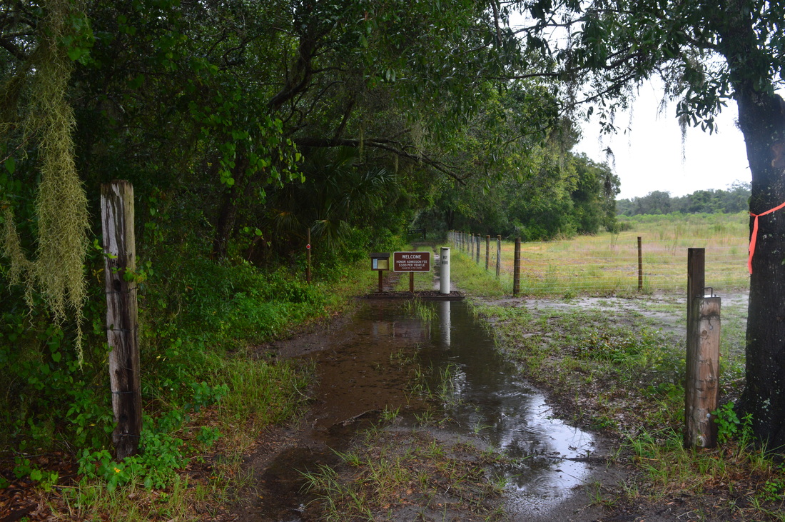
Duration of Hike: 2:35 Type of Hike: Loop Difficulty Rating: 2 out of 10 Total Elevation Gain: Minimal Pros: Well-maintained and equipped trails Cons: None Points of Interest: Cypress Creek views; Little Manatee River views; Swamp on the west side of the loop Trail Blaze Color(s): Main Loop - Orange; Side Trails - Blue Best Season(s) to Hike: Year-round Fees: There is a $3 per vehicle fee. Pay at the pay station at the trailhead. Beginning Point: Little Manatee River Trailhead Directions: From Parrish, FL: Drive on US Route 301 North for 7.8 miles. Then, right after a bridge over the Little Manatee River, a dirt road on the left leads to a roadside parking area. This is the trailhead for the hike. If you pass Dug Creek Road on the right, you have gone too far. MapDetails
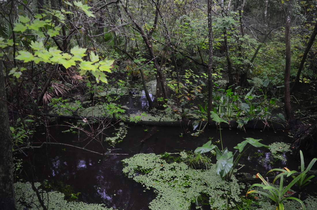
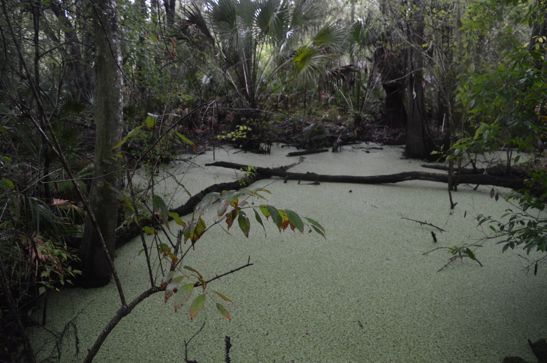
This was the only hike in Florida that I underestimated. I wasn't expecting to find anything interesting, but actually, there were many interesting things on this hike. There were some really nice views of the Little Manatee River and adjacent swamps, there was some great trail around Cypress Creek, and there was great trail through the many miniature palmetto prairies on the north side of the loop. Also, one quick note: the hike does not start and does not go through the main section of Little Manatee River State Park. The trailhead for this hike is at a separate entrance on the north side of the river, while the rest of the park is on the south side of the river.
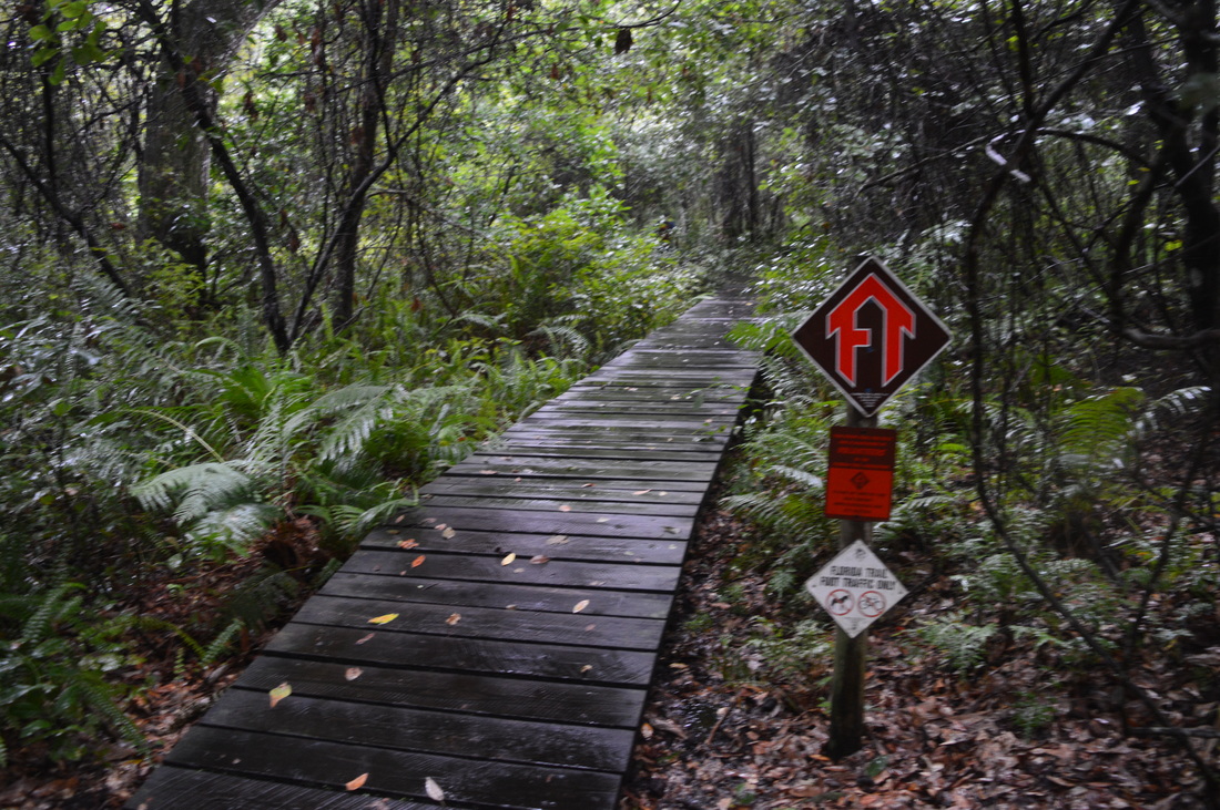
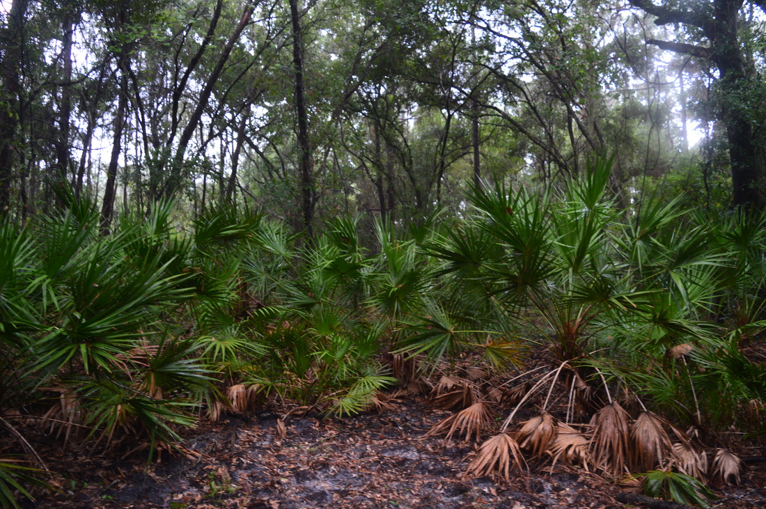
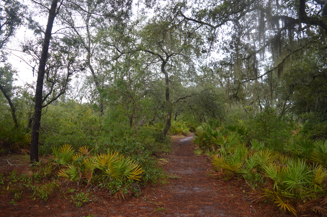
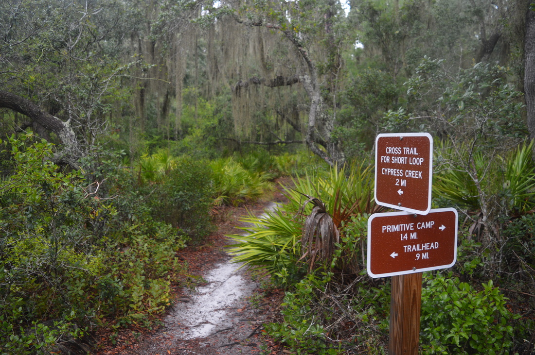
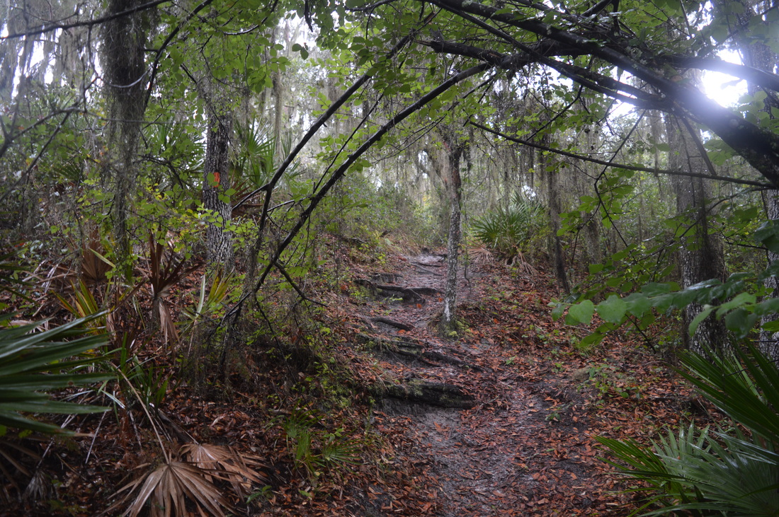
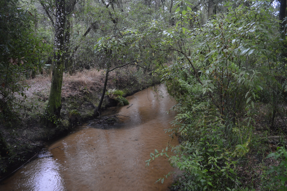
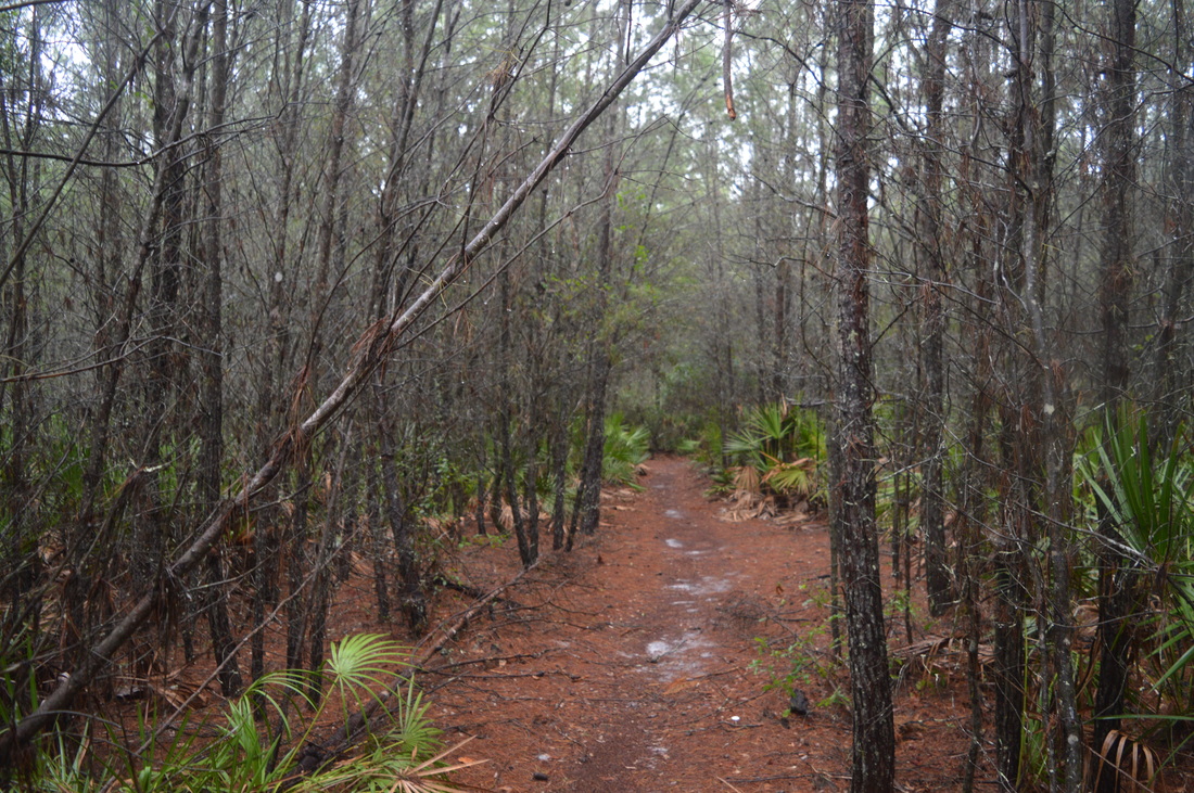
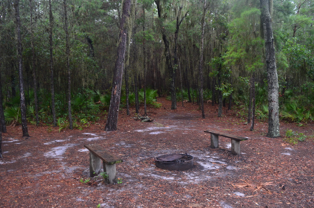
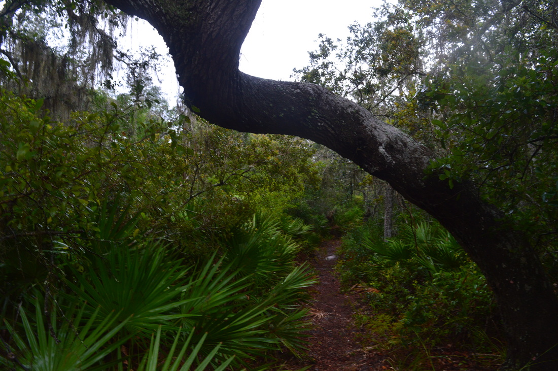
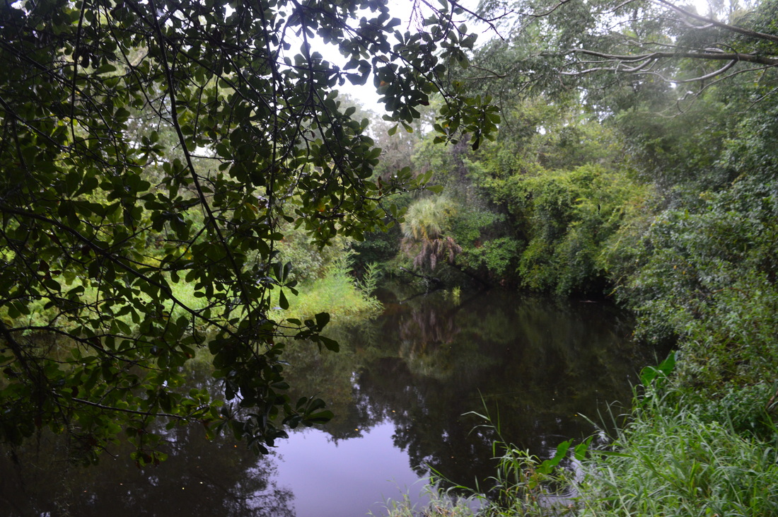
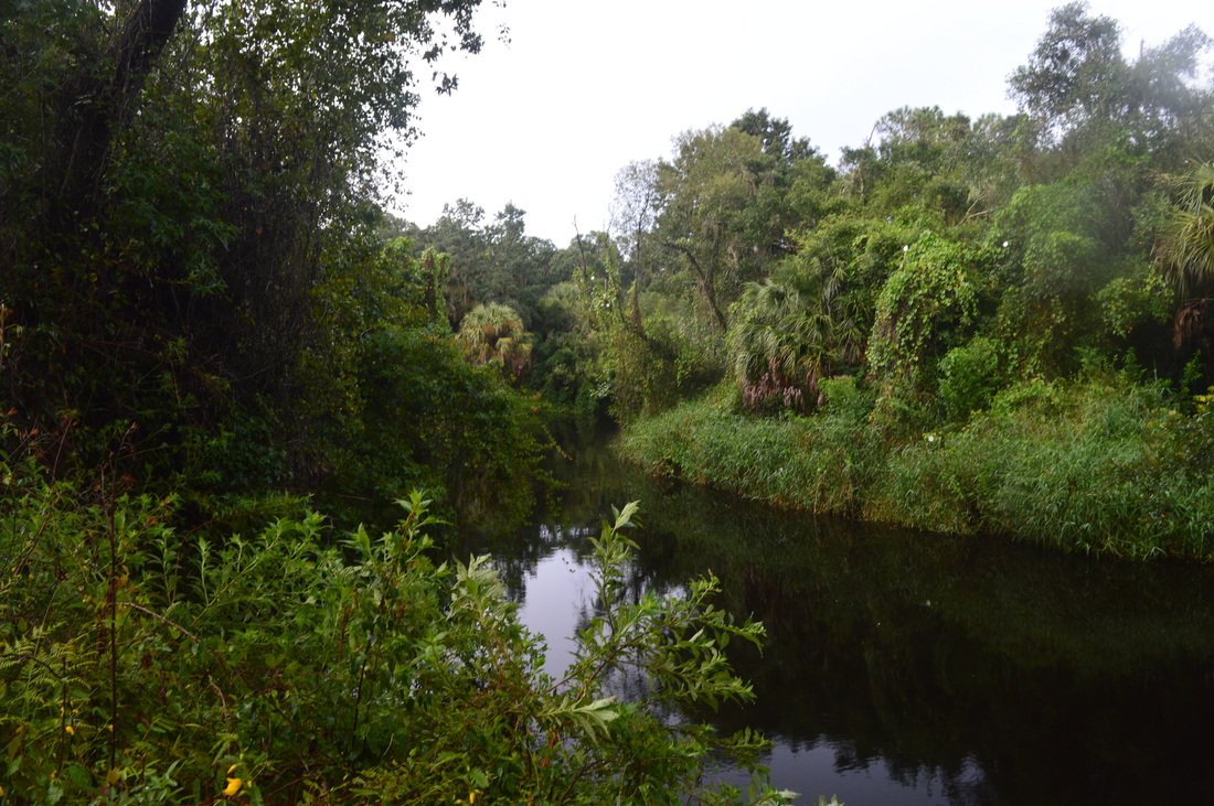
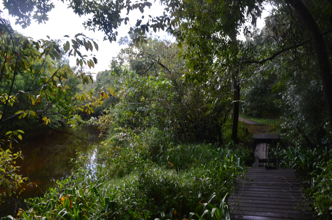
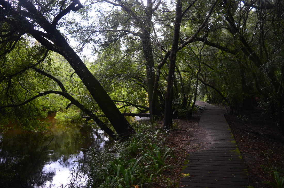
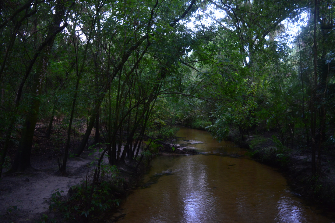
The hike starts on a short access trail that leads to the loop. You take a path from the lower end of the parking area that parallels a fence and a field. Shortly, the trail will curve into the woods and reach an informational kiosk. After this, descend to a boardwalk across a wet-after-rain area. There is a Florida Trail sign here. This hike is not on the actual Florida Trail, but volunteers from the Florida Trail Association are responsible for the maintenance of this trail, thus the sign. At the end of the boardwalk, reach the start of the loop at 0.1 miles. There is little difference no matter which direction you decide to hike this loop, but I did it counter-clockwise to leave the river section for the latter part of the hike. Thus, I turned right here. Originally, the trail stays in the woods, but it soon crosses a couple of forest roads and small prairies. The palmettos along the trail get pretty tall here - taller than most I've seen. At 0.8 miles, enter a slightly larger palmetto prairie. Despite the fact that the area is mostly open, with few trees, the palmettos are high enough and the prairies are small enough to prevent any good views. At 1 mile, at the end of the prairie, you reach a junction. Here, the Cypress Creek Cross-Trail turns left and connects with the south part of the loop. If you use this shortcut, you will shorten your hike to 2.9 miles. You will also enjoy some hiking along Cypress Creek. However, I decided to continue straight ahead and do the full loop. After this junction, the trail reaches the edge of a ravine/mini-gorge. You can't see Cypress Creek from here, but it's down there. This is actually one of the few times I saw this type of terrain in Florida. The trail then curves right and descends briefly but steeply into the ravine. You will cross a small swampy creek on a footbridge, but this is not Cypress Creek yet. At 1.4 miles, reach a large footbridge over Cypress Creek. Note the clear waters of the creek - you can see the creekbed. This is a rare site for Florida. After crossing the creek, you will ascend up a hill and then curve out of the ravine. For the next mile, the trail crosses in and out of small prairies. It is generally uninteresting trail, but I liked the various ecosystems it went through. I did this hike after a very heavy rain all day, and there were a lot of muddy spots and some pretty wet areas. Keep this in mind if you do this hike after rain. At 2.4 miles, in thick woods, reach the spur trail to the primitive campsite. If you want to add some mileage, do this spur trail. I did it. Turn right onto it, and follow it to a dead-end at the large camping area at 2.6 miles. Return to the main trail at 2.8 miles. Continue following the trail through mainly woods now. Near the western extremity of the loop, pass a house visible through the trees on the right. You can hear the sounds of Interstate 75 in the distance. You will soon start gradually descending towards Little Manatee River. This is where the swamps begin. Luckily, all of the swamps have appropriate boardwalks. I'm sure you can find an alligator somewhere here, and if not, then in/near the river you can probably find one too. At 3.8 miles, the trail suddenly reaches the Little Manatee River. The river isn't as big as most major Florida rivers, but it's certainly sizable. Throughout the rest of the hike, you'll be near the river, although the river won't always be visible. The trail near the river stays in a very thick forest the entire time, and even when you can't see the river, you can always see the adjacent swamps. You will also cross some small streams on boardwalks. One particular crossing has some missing planks - hopefully this will be fixed soon. You can still cross using one plank right now. At 5 miles, make a short but steep climb up a hill. This is a sign you're almost at Cypress Creek. Around here, I heard something rather large tumble down the slope and dive into the river with a big splash. I have no idea what it was, but an alligator certainly is an option. I didn't see anyone. Make a couple more short descends and ascents and reach a footbridge over Cypress Creek at 5.1 miles. On the other side of the footbridge is a junction with the Cypress Creek Crosstrail. This is where you would have came out, if you took the crosstrail earlier. The crosstrail turns left. Meanwhile, in order to stay on the main trail, turn right, heading downstream along Cypress Creek. The trail shortcuts a bend in the Little Manatee River and soon reaches the river with more views. After around a mile of following the river, the trail leaves the river at one last view and enters a field at 6.2 miles. After the field, continue into a drier forest before reaching the end of the loop at 6.6 miles. Bear right on the access trail to the trailhead, ending the hike at 6.7 miles. Variations
Shortcut the hike via Cypress Creek Crosstrail - 2.9 Miles
Bonus Stops
Mileage
0.0 - Little Manatee River Trailhead
0.1 - Reach the start of the loop, turn right 0.8 - One of the larger palmetto prairies on this hike 1.0 - Cypress Creek Crosstrail on left, continue straight 1.4 - Footbridge across Cypress Creek 2.4 - Side trail on right to primitive campsite, turn right if you would like to see it 2.6 - Primitive campsite 2.8 - Return to main trail 3.8 - Reach Little Manatee River 5.1 - Another footbridge across Cypress Creek, junction with Cypress Creek Crosstrail on left, continue straight 6.2 - Leave Little Manatee River 6.6 - End of the loop 6.7 - Little Manatee River Trailhead Pictures
4 Comments
bradley scharp
5/12/2016 08:29:50 am
One of my favorite bay area hikes due to diversity of the trail. Not heavily used like the south trails in state park 8/2/2022 03:58:14 pm
This was the only hike in Florida that I underestimated. I wasn't expecting to find anything interesting, but actually, there were many interesting things on this hike. Thank you for making this such an awesome post! 10/19/2023 02:02:32 pm
Love this hike as well. Close to home and my Goldendoodle gets his much needed energy release. great hike! Leave a Reply. |
About MeMark Oleg Ozboyd Dear readers: I have invested a tremendous amount of time and effort in this website and the Georgia Waterfalls Database the past five years. All of the work that has gone in keeping these websites updated with my latest trip reports has almost been like a full-time job. This has not allowed me to pick up a paid job to save up money for college, and therefore, I I've had to take out loans. If you find the information on this website interesting, helpful, or time-saving, you can say "thanks" and help me out by clicking the button above and making a contribution. I will be very grateful for any amount of support you give, as all of it will apply toward my college tuition. Thank you!

Coming in 2022-2023?
Other Hiking WebsitesMiles HikedYear 1: 540.0 Miles
Year 2: 552.3 Miles Year 3: 518.4 Miles Year 4: 482.4 Miles Year 5: 259.9 Miles Archives
March 2021
Categories
All
|


 RSS Feed