HIKING THE APPALACHIANS AND BEYOND
  • Home
  • Trail Reports
    • Best Hikes
    • Hikes with Scenic Views
    • Hikes with Water Features
    • Alabama
    • Georgia
    • Florida
    • North Carolina
    • South Carolina
    • Tennessee
    • Vermont
    • Virginia
  • Map
  • Hike List
  • Testimonials
  • Resources
  • Contact Us
  • Southeast Nature Society
    • Our Team
  • Georgia Waterfalls Database

Triple Creek Preserve and Balm-Boyette Scrub Preserve Hiking Trail, Sun City Center, Florida

10/23/2016

1 Comment

 
Picture
The Florida scrub is an endangered habitat that is found mainly on sand ridges throughout the state. It is relatively common to encounter a scrub in central Florida along the Lake Wales Ridge, as well as in coastal areas of eastern Florida and the state's panhandle. However, Balm-Boyette Scrub is one of a few rare scrubs in west Florida and around the Tampa area, which makes it more special than some of the scrubs on the Lake Wales Ridge. Two preserves adjacent to each other facilitate hiking access into the scrub. The main hiking trail also passes past several creeks, all of which are tributaries of the Alafia River. This hike occurred on Wednesday, July 20th, 2016. My plan was to hike clockwise the loop trail that passes through both Triple Creek Preserve and Balm-Boyette Scrub Preserve.

Summary

R/T Length of Trail: 4.9 Miles
Duration of Hike: 1:50 
Type of Hike: Loop 
Difficulty Rating: 2 out of 10 
Total Elevation Gain: Minimal 
Pros: Remote hiking in a generally densely-populated area 
Cons: A rather boring short section of the trail follows the north boundary of the preserve, along a pine plantation
Points of Interest: Balm-Boyette Scrub 
Trail Blaze Color(s): There are posts with arrows and white diamonds with hiker symbols that mark the trail 
Best Season(s) to Hike: Winter 
Fees: None 
Beginning Point: Triple Creek Preserve Trailhead 
Directions from Sun City Center, FL: From the intersection of FL State Route 674 and US Route 301 near Sun City Center and Wimauma, follow FL State Route 674 East for 3.8 miles. Then, turn left onto Balm-Wimauma Road. Follow it north for 3.9 miles, and then, turn right onto County Road 672. Immediately afterwards, turn left onto Balm-Boyette Road. Continue north for another 2.4 miles until you reach the gravel parking area for Triple Creek Preserve to the left. 

Map

Click ​here for more information and to download this trail map to view in Garmin Basecamp.

Details

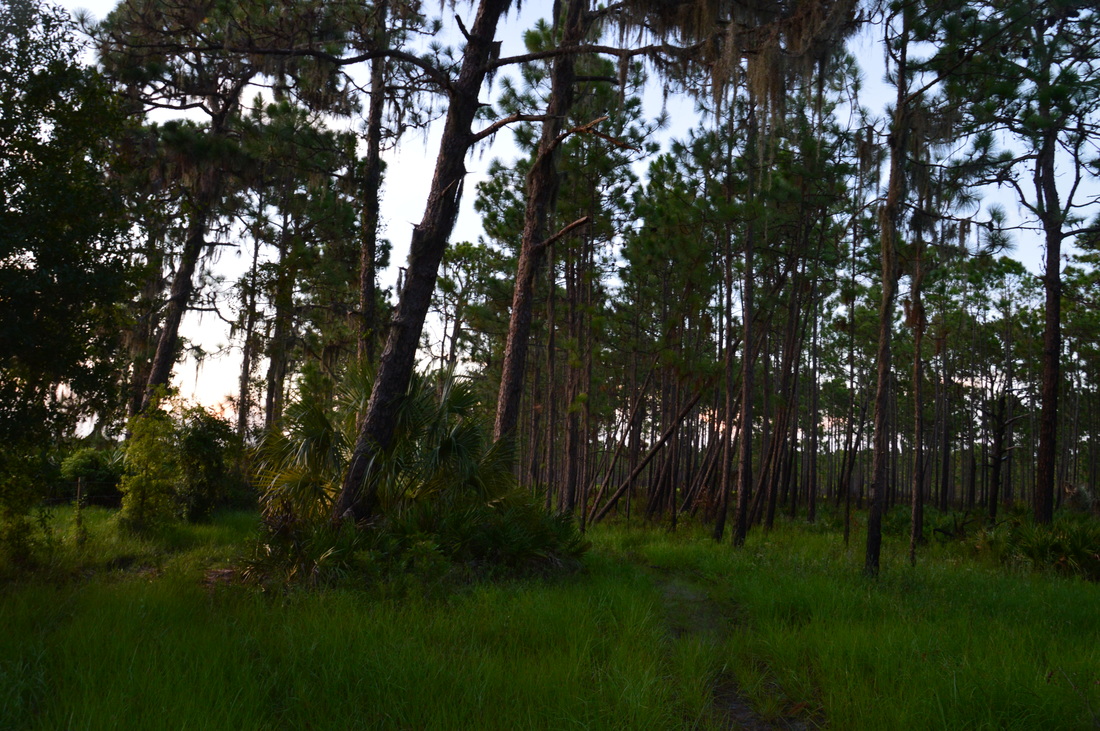
I'm impressed with the excellent job that some Florida counties have done by acquiring various pieces of land and conserving them by turning them into nature preserves that should be open to the public for the future. Lee County and Hillsborough County are two Florida counties that show such excellent work - they are role models for many other Florida counties. Triple Creek Preserve and the adjacent Balm-Boyette Scrub Preserve are just two of many similar preserves throughout the county. The hiking trail that passes through both preserves is very diverse, passing through habitats ranging from lush creekside forest and wetland forest to open scrub. There used to be a separate trailhead for Balm-Boyette Scrub Preserve, but it seems like there were some private property issues at that trailhead, so today, the trail that begins at the Triple Creek Preserve Trailhead is the only route into Balm-Boyette Scrub. 

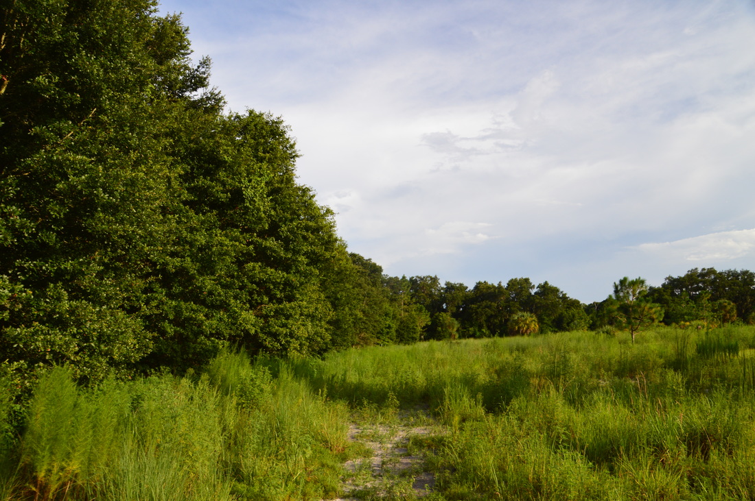
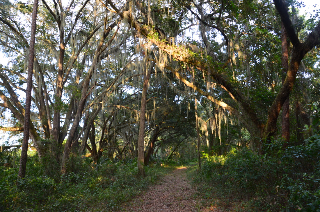
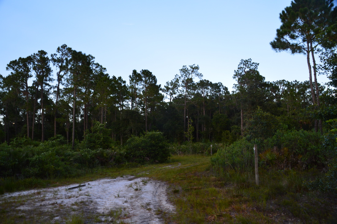
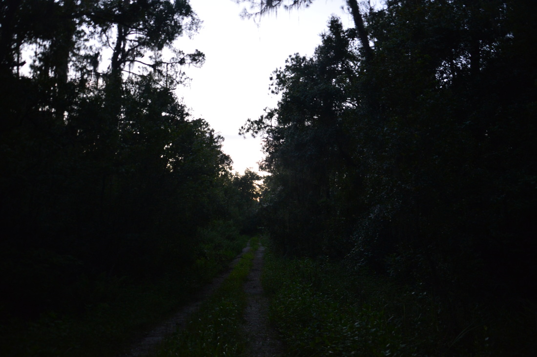
The initial trail is not clearly visible, although the southeast (first if clockwise) section of the loop appears to be the least-used. From the trailhead kiosk, the trail follows a grassy track westward through a clearing. At the end of the clearing, the trail passes through a gap in a line of trees. On the other side is a larger clearing and the beginning of the loop at 0.1 miles. This is where two faint paths leave to the left and right. You wouldn't really know what to do here, unless you know that this is the beginning of the loop. To hike the loop clockwise, turn left. You may notice a trail marker on a post hidden in the grass, confirming that this is indeed the trail. Between 0.1 miles and 0.4 miles, the trail is overgrown with fairly tall grass and passes through several clearings, but in general, the route follows the edge of the forest. Posts with markers mark the trail well. At 0.4 miles, the trail reaches the edge of the largest clearing and passes into a dense hammock guarded by numerous live oaks. Shortly afterwards, there is an intersection with the closed trail from the old Balm-Boyette Scrub Trailhead. The main trail turns right on a broad but little-used double-track path under the shade of a row of live oaks. 
Picture
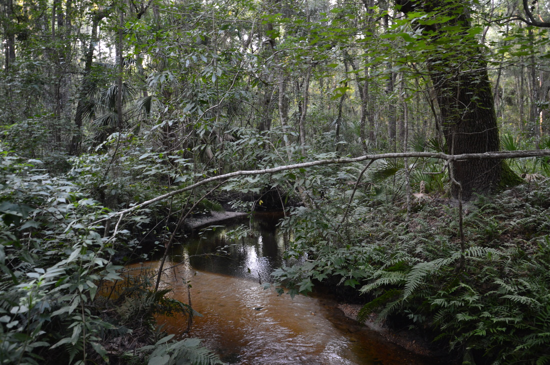
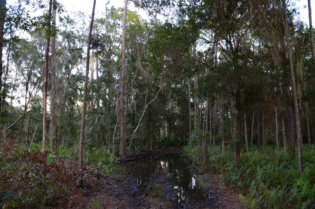
Bell Creek is a blackwater tributary of the Alafia River
The wide path proceeds westward into a dense, remote wetland forest, and the ground on the trail is damp in spots, although it is generally dry. You may notice that the trail is actually slowly losing elevation as it approaches Bell Creek. At 0.65 miles, the trail reaches Bell Creek. There is no footbridge across the creek, but under all but the wettest of conditions, you should be able to hop across. Bell Creek is a picturesque fern-lined stream, with its slow waters winding through the dark forest. 

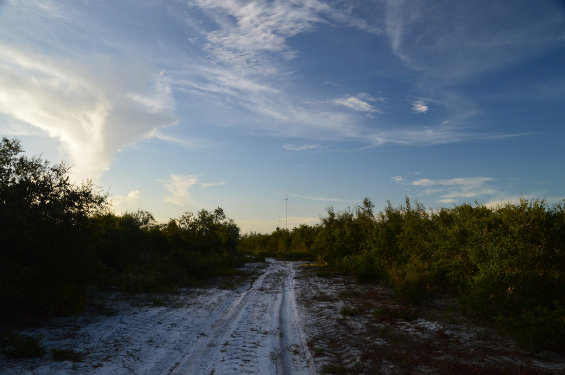
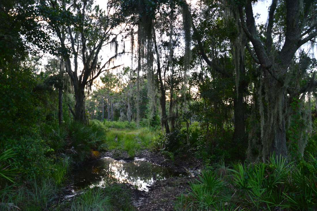
On the other side of the stream, the trail slowly rises out of Bell Creek's depression, entering some uplands at 0.8 miles. At 0.9 miles, the trail reaches a confusing intersection at the boundary of Triple Creek Preserve. Straight ahead lies Balm-Boyette Scrub and the namesake preserve. A sign points out that the trail seemingly turns right and then right again, leaving the scrub and returning into Triple Creek Preserve - this is WRONG. It is unclear to me why the Balm-Boyette Scrub Trail, which is still on public land, is not marked here at all. The trail to the right is a very short connector that cuts across the outer loop through the scrub. You should not take it, unless you would like to make the hike much shorter. Instead, turn left onto the unmarked but wide sandy service road that follows the edge of Balm-Boyette Scrub southward. Continue south until 1.7 miles, where there is another confusing junction. There is actually a sign with arrows here, but the funny thing is that there is an arrow pointing both straight and to the right, despite the fact that the trail ahead no longer exists). Misunderstanding the sign, I had actually continued straight here, before noticing on my GPS that I was no longer headed the direction that I was supposed to be. Thus, don't repeat my mistake and turn right onto this next sandy road. 

This road turns west and follows the southern boundary of the scrub, before turning north and cutting straight into the heart of the scrub. Considering that scrub is nearly unheard of in this region, this hike and this part of the trail in particular is quite unique to the Tampa Bay area. 
Picture
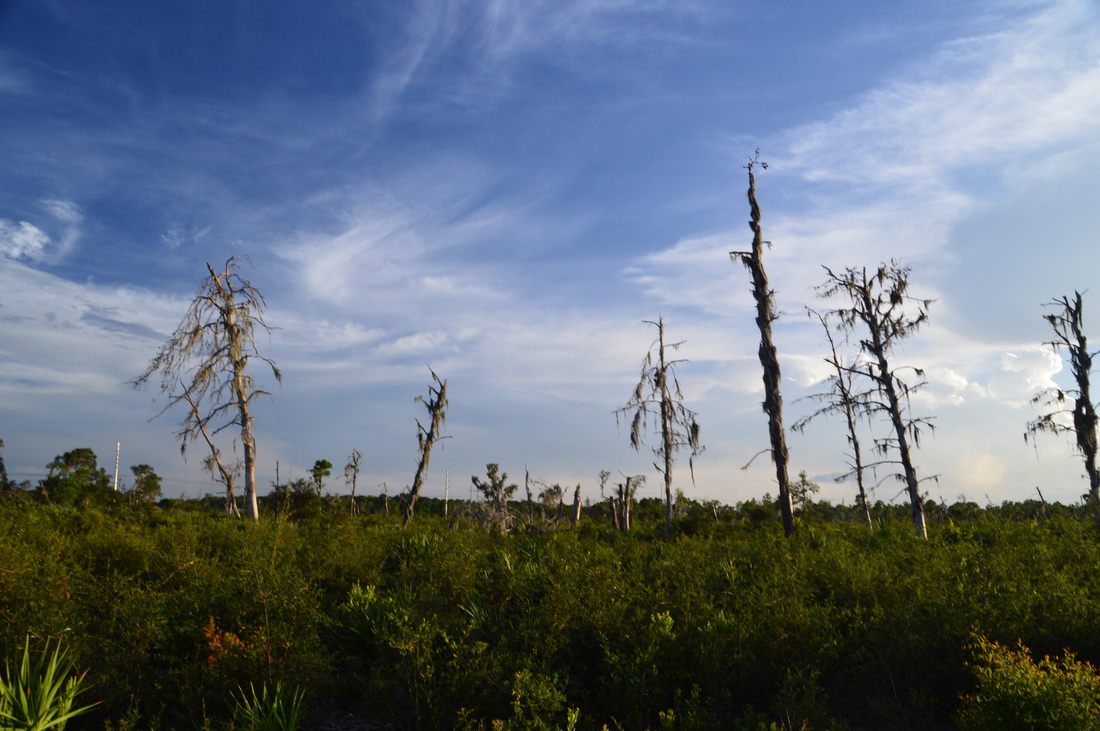
Balm-Boyette Scrub is a one-of-a-kind place in the Tampa Bay area
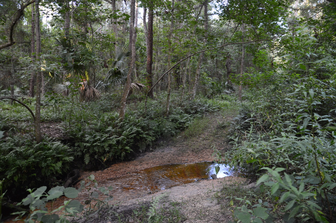
Continue following the arrows along the sandy track, as this section of the trail is well-marked. The trail eventually reconnects with the shortcut at the edge of Balm-Boyette Scrub Preserve at 3.0 miles. Here, turn left and re-enter wooded Triple Creek Preserve. Over the next stretch of trail, there were several seasonally wet areas, but bypasses had been created by hikers around all of them. At 3.35 miles, the trail crosses a small stream that Boggy Creek that begins in a wetland just to the west and later joins Bell Creek. Despite the fact that this stream is smaller than Bell Creek, you may have slightly more trouble crossing this one dry, depending on the season, due to the trail finding the widest point on the stream to cross it. However, I was still able to cross dry. Just after Boggy Creek, the trail reached the western boundary of Triple Creek Preserve at a farm. Here, bear right and begin following the preserve boundary northward through pine flatwoods.

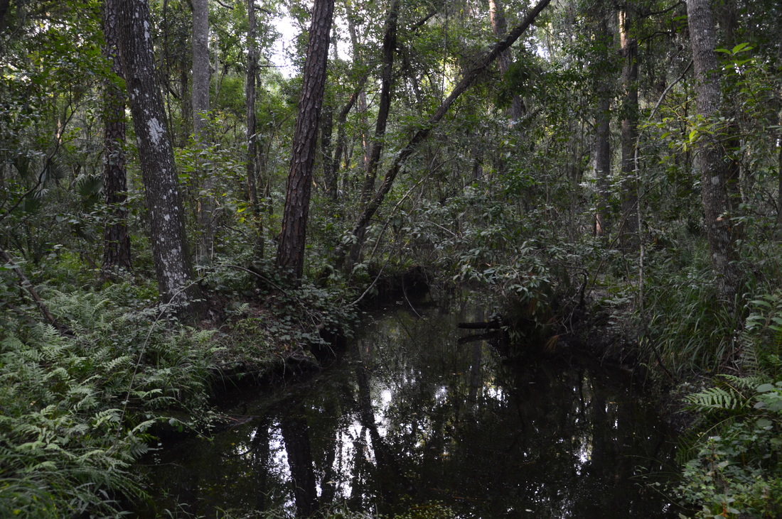
At 3.7 miles, the trail reaches the northwest corner of the preserve, with a farm to the left and a pine plantation straight ahead. Turn right and begin following a service road along the edge of the pine plantation. This is the least scenic part of the hike, due to the somewhat ugly neat rows of planted pines and intermittent clearings that stretch off to the left. The trail follows this road until 4.1 miles, where an arrow marks a turn to the southeast onto a different service road. This service road soon descends into the wetland forest around Bell Creek, but since the the road is elevated, the trail is dry. At 4.35 miles, the trail crosses Bell Creek via a culvert on the road. Bell Creek appears to be larger here than it was further south. The trail continues following the road after Bell Creek. Somewhere, I missed a turn to the right that led to the end of the loop in the grassy clearing, probably due to the fact that the service road was so well-defined in comparison to a faint path in tall grass. However, the service road leads to the trailhead too. Follow the service road all the way to its end at Balm-Boyette Road. Then, turn right onto the road and shortly reach the trailhead parking area at 4.9 miles, concluding the hike. 

Mileage

0.0 - Triple Creek Trailhead
0.65 - Bell Creek
0.9 - Enter Balm-Boyette Scrub
3.0 - Leave Balm-Boyette Scrub
3.35 - Boggy Creek
3.7 - Northwest corner of preserve
4.35 - Bell Creek
​4.9 - Triple Creek Trailhead

Variations

Hike just the Triple Creek Loop - 2.8 Miles

Bonus Stops

Just to the south, the hike at Little Manatee River State Park is another great day hike that follows the Little Manatee River for several miles. 

Pictures

1 Comment
Alexandra Modica
12/30/2020 09:52:44 am

A map of Triple Creek Preserve can be found here: https://www.hillsboroughcounty.org/library/hillsborough/media-center/documents/conservation-and-regional-parks/maps/triple-creek-trail-map.pdf

If you want to hike the more exciting trails across the street (which are shared with Mountain Bike trails, prohibited to hikers), check out this map: https://www.alltrails.com/trail/us/florida/balm-boyette-nature-preserve-trail

Reply


Leave a Reply.

    About Me

    Mark Oleg Ozboyd
    I'm an avid outdoor explorer and a hobbyist landscape photographer. I'm 21 years old and have been hiking since 2011. Originally based out of Atlanta, Georgia, I started out by occasionally hiking short trails throughout well-known Georgia State Parks. During 2012 and 2013, I began to expand my trips into adjacent states, as well as into the wilder National Forest areas rather than just State Parks. Throughout the years that followed, as I slowly ran out of popular hiking trails in my area, I began to search for and hike in more seldom-visited areas. Today, you can find me out in the woods every weekend, whether it's on an official trail or bushwhacking through cross-country terrain without any paths. I now attend Washington & Lee University and am exploring Virginia and West Virginia. My other hobbies include chess, science, old music, and meteorology. I have 3 years of amateur weather forecasting experience, having studied a lot of meteorology basics over the years. I am also a student at European School of Music where I learned that music and nature have a lot in common. Listening to good music inspires me to capture nature's beauty on the camera in different aspects that also make me recall many beautiful music pieces that I've heard.​


    Dear readers: I have invested a tremendous amount of time and effort in this website and the Georgia Waterfalls Database the past five years. All of the work that has gone in keeping these websites updated with my latest trip reports has almost been like a full-time job. This has not allowed me to pick up a paid job to save up money for college, and therefore, I I've had to take out loans. If you find the information on this website interesting, helpful, or time-saving, you can say "thanks" and help me out by clicking the button above and making a contribution. I will be very grateful for any amount of support you give, as all of it will apply toward my college tuition. Thank you! 

    Enter your email address to subscribe for trail reports:

    Delivered by FeedBurner


    Picture
    Coming in 2022-2023?

    Other Hiking Websites

    DWHike's Adventures
    Florida's Natural Wonders
    Florida Trailblazer
    Meanderthals
    Mountain Images
    by Bernie Boyer

    North Carolina Waterfalls with
    ​Kevin Adams
    Take-a-Hike!
    Tennessee Landforms
    Waterfall Page
    Waterfall Adventurer
    Zach's Mild Adventures

    Miles Hiked

    Year 1: 540.0 Miles
    Year 2: 552.3 Miles
    ​Year 3: 518.4 Miles
    Year 4: 482.4 Miles
    Year 5: 259.9 Miles

    Archives

    March 2021
    February 2021
    January 2021
    November 2019
    October 2019
    September 2019
    August 2019
    July 2019
    June 2019
    February 2019
    January 2019
    December 2018
    November 2018
    October 2018
    August 2018
    July 2018
    June 2018
    May 2018
    April 2018
    March 2018
    February 2018
    January 2018
    December 2017
    November 2017
    October 2017
    September 2017
    August 2017
    July 2017
    June 2017
    May 2017
    April 2017
    March 2017
    February 2017
    January 2017
    December 2016
    November 2016
    October 2016
    September 2016
    August 2016
    June 2016
    May 2016
    April 2016
    March 2016
    January 2016
    December 2015
    November 2015
    October 2015
    September 2015
    August 2015
    July 2015
    June 2015
    May 2015
    April 2015
    March 2015
    February 2015
    January 2015
    December 2014
    November 2014
    October 2014
    September 2014
    August 2014
    July 2014
    June 2014
    May 2014
    April 2014
    March 2014
    February 2014

    Categories

    All
    Adel
    Adirondack Park
    Alabama
    Alfred A. Ring Park
    Allegheny Trail
    Amicalola Falls State Park
    Anniston Area
    Apalachicola Bluffs And Ravines Preserve
    Apalachicola National Forest
    Apalachicola/Port St. Joe Area
    Apopka
    Appalachian Trail
    Appling
    Art Loeb Trail
    Aska Trail System
    Bakersville
    Balm-Boyette Scrub Preserve
    Balsam Lake Recreation Area
    Bankhead National Forest
    Bartow County Parks
    Bartram Trail
    Basinger
    Beersheba Springs
    Benton
    Benton Mackaye Trail
    Berry College Trail System
    Best Hike
    Big South Fork National Recreation Area
    Black Bear Wilderness
    Black Rock Mountain State Park
    Blairsville
    Blakely
    Blood Mountain Wilderness
    Blowing Rock
    Blue Ridge
    Blue Ridge Parkway
    Boone
    Bradenton
    Bradenton Beach
    Brasstown Bald
    Brasstown Wilderness
    Brevard
    Bryson City
    Buchanan
    Bucks Pocket State Park
    Bulow Creek State Park
    Bulow Plantation Ruins State Park
    Caesars Head State Park
    Caladesi Island State Park
    Calhoun
    Camel's Hump State Park
    Cashiers
    Caspersen Beach Park
    Catfish Creek State Park
    Caves
    CC Putnam State Forest
    Cedar Point Environmental Park
    Chatsworth
    Chattahoochee National Forest
    Chattanooga
    Chattanooga Valley
    Chattooga National Wild And Scenic River
    Cheaha Wilderness
    Cherohala Skyway
    Cherokee
    Cherokee National Forest
    Chiefland Area
    Chillhowee Recreation Area
    Chipley
    Chunky Gal Trail
    Circle B Bar Reserve
    Citico Creek Wilderness
    Citrus Wildlife Management Area
    Clarkesville
    Clayton
    Cleevland
    Cleveland
    Cloudland Canyon State Park
    Cohutta Wilderness
    Collier-Seminole State Park
    Cordele
    Cornelia
    Covington
    Crestview Area
    Crew-land-and-water-trust
    Cullowhee
    Cumberland Trail
    Dahlonega
    Dalton
    Dawson Forest Wildlife Management Area
    Dawsonville
    Dayton
    De Soto National Memorial
    DeSoto State Park
    Dillard
    Double Springs
    Ducktown
    Duncan Ridge Trail
    Dunlap
    Eagle's Rest Park
    Eastpoint
    Econfina Creek Wildife Management Area
    Eglin Air Force Base
    Elizabethton
    Elkins
    Elk Knob Game Lands
    Elk Park
    Ellicott Rock Wilderness
    Ellijay
    Emerson Point Preserve
    Englewood Area
    Enota Retreat
    Erwin
    Falling Waters State Park
    Fayetteville
    Fires Creek Recreation Area
    Fire Tower
    Flint River
    Florence Area
    Florida
    Florida Caverns State Park
    Florida Trail
    Foothills Trail
    Fort Mountain State Park
    Fort Myers Area
    Fort Payne
    Fort Payne Area
    Fort Yargo State Park
    Franklin
    Franklin Delano Roosevelt State Park
    Franklin-Marion State Forest
    Frozen Head State Park
    Gainesville
    Gainesville Area
    Gatlinburg
    George Washington National Forest
    Georgia
    Georgia Veterans Memorial State Park
    Glasgow
    Gorges State Park
    Grandfather Mountain State Park
    Great Smoky Mountains National Park
    Greeneville
    Green River Game Lands
    Gruetli-Laager
    Grundy Forest State Natural Area
    GTM Reserve
    Guana River Wildlife Management Area
    Hayesville
    Helen
    Hiawassee
    High Falls State Park
    Highlands
    Highlands Scenic Highway
    Hillsborough River State Park
    Hinson Conservation & Recreation Area
    Historic Sites
    Honeymoon Island State Park
    Hot Springs
    Huntington
    Inverness Area
    Jackson
    Jasper
    Jefferson National Forest
    Joan M. Durante Park
    Jonathan Dickinson State Park
    Jones Gap State Park
    Joyce Kilmer Slickrock Wilderness
    Joyce Kilmer - Slickrock Wilderness
    Juniper Prairie Wilderness
    Kelly Park
    Keown Falls Recreation Area
    Kolomoki Mounds State Park
    LaFayette
    Lake City Area
    Lake George Wild Forest
    Lake June-in-Winter State Park
    Lakeland Area
    Lake Placid
    Lake Russell Wildlife Management Area
    Lake Wales Ridge State Forest
    Laurel Fork North Wilderness
    Leffis Key Preserve
    Leon Sinks Geological Area
    Lexington
    Lineville
    Linville
    Linville Gorge Wilderness
    Lithia Springs
    Little Frog Wilderness
    Little Manatee River State Park
    Little River Canyon National Preserve
    Longboat Key
    Long Trail
    Lookout Mountain
    Lookout Mountain Battlefield
    Lovingston
    Lula Lake Land Trust
    Lumpkin
    Maggie Valley
    Manatee Springs State Park
    Marianna Area
    Mark Trail Wilderness
    Marlinton
    Mccaysville
    McMinville
    Mentone
    Middlesex
    Mistletoe State Park
    Monongahela National Forest
    Montreat
    Mountain Bridge Wilderness Area
    Mountain City
    Mountains To Sea Trail
    Mountains-to-Sea Trail
    Mount Rogers National Recreation Area
    Myakka River State Park
    Myron B. Hodge City Park
    Nantahala National Forest
    Naples
    Naples Area
    Natural Bridge State Park
    Neal Preserve
    New Castle
    Newport
    New River Gorge National Park
    New York
    North Carolina
    Ocala Area
    Ocala National Forest
    Ocean-to-Lake Trail
    Oconee State Park
    Oconee Station Historic Site
    Okaloacoochee Slough State Forest
    Oldsmar
    Oneida
    Orlando Area
    Ormond Beach
    Oscar Scherer State Park
    Oxford
    Palatka
    Palmetto Trail
    Panama City Area
    Panthertown Valley
    Parrish
    Paynes Creek Historic State Park
    Peaks Of Otter Recreation Area
    Pigeon Crockford Mountain Wildlife Management Area
    Pigeon-Crockford Mountain Wildlife Management Area
    Pigeon-Crockford Wildlife Management Area
    Pine Mountain
    Pinhoti Trail
    Pinnacle Park
    Pisgah Civitan Park
    Pisgah National Forest
    Pittman Center
    Pond Mountain Wilderness
    Ponds/Lakes
    Prentice Cooper State Forest
    Providence Canyon State Park
    Pumpkintown
    Quick Point Nature Preserve
    Raven Cliffs Wilderness
    Reed Bingham State Park
    Reliance
    Rice Creek Conservation Area
    Riverview Pointe Preserve
    Robbinsville
    Robinson Preserve
    Rock Creek Gorge Scenic Area
    Rock Island State Park
    Rome
    Rosman
    Sale Creek
    Salem
    Salt Springs
    Saluda
    Santa Rosa Beach
    Sarasota
    Sarasota Area
    Savage Gulf State Natural Area
    Scenic Views
    Scottsboro Area
    Sebring Area
    Sewanee
    Sheltowee Trace Trail
    Shining Rock Wilderness
    Signal Mountain
    Sipsey Wilderness
    Sky Valley
    Smithgall Woods State Park
    Snowbird Backcountry Area
    Soddy Daisy
    Soddy-Daisy
    Sopchoppy
    South Carolina
    South Cumberland State Park
    Southeastern Cave Conservancy
    Southern Nantahala Wilderness
    Sparta
    Sprewell Bluff Park
    Spring City
    Spring Hill
    Springs
    Spruce Pine
    Standing Indian Backcountry Area
    St. Augustine
    St. George Island State Park
    St. Joseph Bay State Buffer Preserve
    St. Marks Area
    St. Marks National Wildlife Refuge
    Stone Mountain
    Stone Mountain Park
    Suches
    Sumatra
    Sumter National Forest
    Suwannee River
    Swallow Creek Wildlife Management Area
    Sweetwater Creek State Park
    Sylva
    Talladega National Forest
    Tallahassee Area
    Tallulah Falls
    Tallulah Gorge State Park
    Tampa Bay Area
    Tate City
    Tate's Hell State Forest
    Tea Creek Wildlife Management Area
    Tellico Plains
    Tennessee
    Thomaston
    Toccoa
    Topsail Hill State Park
    Torreya State Park
    Townsend
    Tracy City
    Tray Mountain Wilderness
    Trenton
    Triple Creek Preserve
    Troutdale
    Unaka Mountain Wilderness
    Upper Tampa Bay County Park
    Venice
    Vermont
    Virgin Falls State Natural Area
    Virginia
    Virginia Outdoors Foundation
    Vogel State Park
    Wakulla Springs State Park
    Waleska
    Walhalla
    Wartburg
    Water Features
    Waynesville
    Weedon Island Preserve
    Weeki Wachee Preserve
    Wekiwa Springs State Park
    West Palm Beach Area
    West Virginia
    Whitehall
    White Springs
    Winder
    Withlacoochee State Forest
    Young Harris

    RSS Feed

TRAIL REPORTS

Hikes in Alabama
​Hikes in Florida
Hikes in Georgia
Hikes in North Carolina
Hikes in South Carolina
Hikes in Tennessee
Hikes in Virginia

Hiking Resources

Alabama Resources
​
Florida Resources
Georgia Resources
North Carolina Resources
​South Carolina Resources
​
Tennessee Resources

Other

Contact
Map of Hikes
Alphabetical List of Hikes
Southeast Nature Society
© COPYRIGHT 2014-2018
​ALL RIGHTS RESERVED.
Important: I disclaim any responsibility for any damage or personal injury that may occur as a result of the activities and information found on this website. All outdoor activities, especially off-trail hiking, are done at your own risk. Never hike or head into that area that may be above your fitness or experience level.
  • Home
  • Trail Reports
    • Best Hikes
    • Hikes with Scenic Views
    • Hikes with Water Features
    • Alabama
    • Georgia
    • Florida
    • North Carolina
    • South Carolina
    • Tennessee
    • Vermont
    • Virginia
  • Map
  • Hike List
  • Testimonials
  • Resources
  • Contact Us
  • Southeast Nature Society
    • Our Team
  • Georgia Waterfalls Database