Hillsborough River State Park: Rapids Trail and Florida Trail Loop, Thonotosassa, Florida11/14/2016 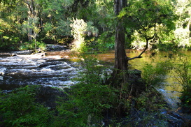
Hillsborough River State Park is one of the most popular outdoor recreation destinations in the Tampa Bay area, and for good reason. This state park, which is home to one of the southernmost sets of rapids in Florida - a set of Class II rapids on the Hillsborough River - as well as a suspension bridge that dates back to the CCC days. For the hiker, the park has several trails. The Rapids Trail provides an easy access to the Hillsborough River Rapids, a unique sight this far south in such a flat landscape. The Baynard Trail provides a quick excursion on the north side of the river, and the more remote Florida Trail Loop, which was built by the Florida Trail Association, is your best for a more remote hike that explores a wild and lush swampy area north of the Hillsborough River. The loop trail then circles back along the river, with numerous superb views of this urban yet wild waterway. This hike occurred on Wednesday, July 27th, 2016. My plan was to hike the north side of the Rapids Trail to the Baynard Trail, then hike the Baynard Trail, before completing the Florida Trail Loop counter-clockwise. I would finish by returning along the south side of the Rapids Trail. An unexpected closure of the suspension bridge forced me to abandon my plan of hiking the Baynard Trail, but I fulfilled the rest of my plan.
Summary
R/T Length of Trail: 5.0 Miles
Duration of Hike: 2:20 Type of Hike: Double Loop Difficulty Rating: 2 out of 10 Total Elevation Gain: Minimal Pros: Many beautiful river views; one of southernmost rapids in Florida Cons: Portions of the Florida Trail Loop may be wet during the wet season; the Rapids Trail may be somewhat crowded depending on the weather and day Points of Interest: Hillsborough River Rapids; Hillsborough River Suspension Bridge; Many views of the Hillsborough River Trail Blaze Color(s): Rapids Trail - None; Florida Trail Loop - Yellowish Orange, Some Orange Best Season(s) to Hike: Fall, Winter, Spring Fees: There is a $6 fee for entry to Hillsborough River State Park, if your car has 2-8 passengers. For cars with just one passenger, the fee is $4. Beginning Point: Rapids Trailhead Directions from Thonotasassa, FL: From the intersection of FL State Route 579 and US Route 301, follow US 301 North for 7.8 miles, until you reach the entrance to Hillsborough River State Park to your left. Enter the park, pay your fee, and upon reaching the one-way loop road, turn right and follow it for 0.4 miles until you reach the parking area for the Rapids Trail to the right of the road. On the park map, this parking area is labeled as Parking Area 2. Map
Click here for more information and to download this trail map to view in Garmin Basecamp.
Details
Hillsborough River State Park is one of Florida's original four state parks from the CCC era, with the other three being Highlands Hammock State Park, O'Leno State Park, and Myakka River State Park. I see good reason for these state parks being chosen first, as they now conserve some of the most beautiful area of Florida. Having completed this hike, I have now visited two of the four original state parks. In my opinion, a visit to Hillsborough River State Park is a must for anyone who is in the Tampa area. It's a true Florida classic.
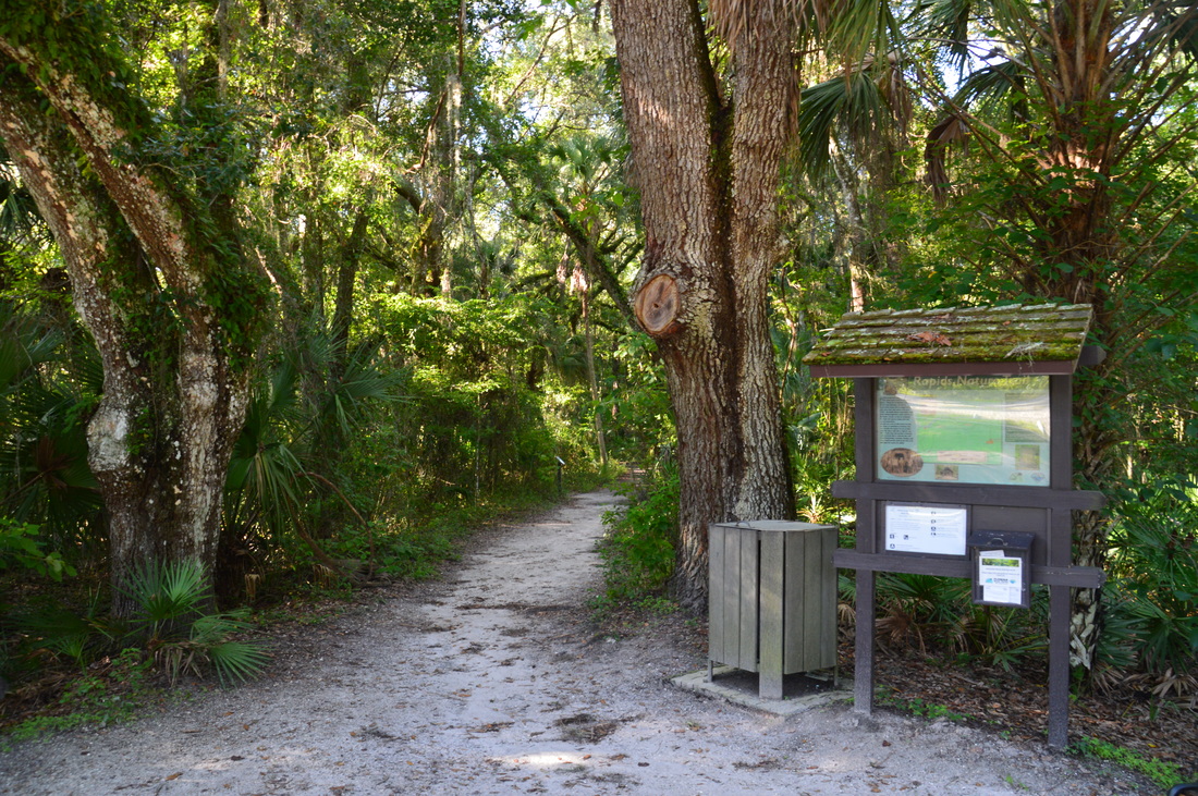
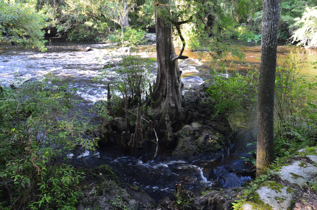
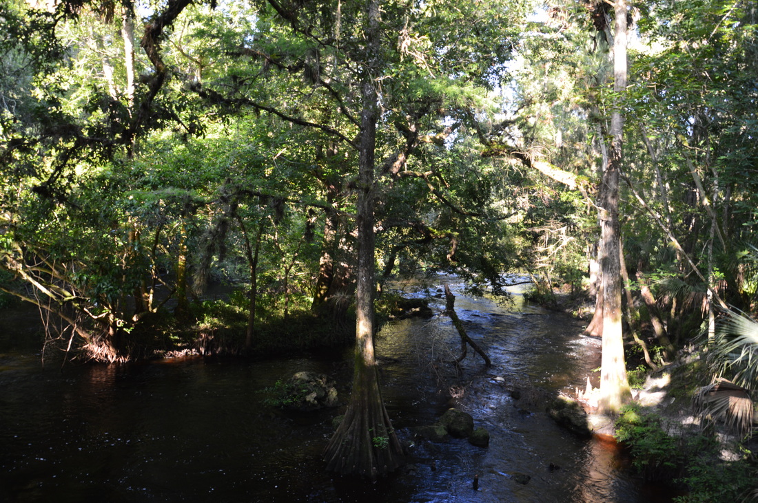
There are a couple of ways to do this hike. I started out from the Rapids Trailhead, which is east of the main stationary bridge trailhead. The Rapids Trail leaves the Rapids Trailhead and heads north into the lush riverside forest. This hike will actually remain in thick shade and near river or swamp the entire time, unlike many of Florida's grand hikes. Passing a kiosk, follow the Rapids Trail towards the Hillsborough River. At 0.1 miles, the loop section of the Rapids Trail begins, with the south side of the loop splitting to the left. Continue straight towards the Hillsborough River, crossing a small tributary (that was dry on this day) via a footbridge. There is a sound of running water in the distance. At 0.2 miles, the trail reaches the Hillsborough River at the Hillsborough River Rapids. These beautiful class II rapids are formed by an area of natural sandstone formations and a slight change in elevation. A cypress tree helps to frame the picturesque scene. I believe that the Hillsborough River Rapids are one of the best-known rapids in Florida, after Big Shoals on the Suwannee River near Lake City. For this reason, depending on the weather and day, there might be a bit of a crowd here, although on the Wednesday evening that I chose for my hike, I saw only three groups of people. 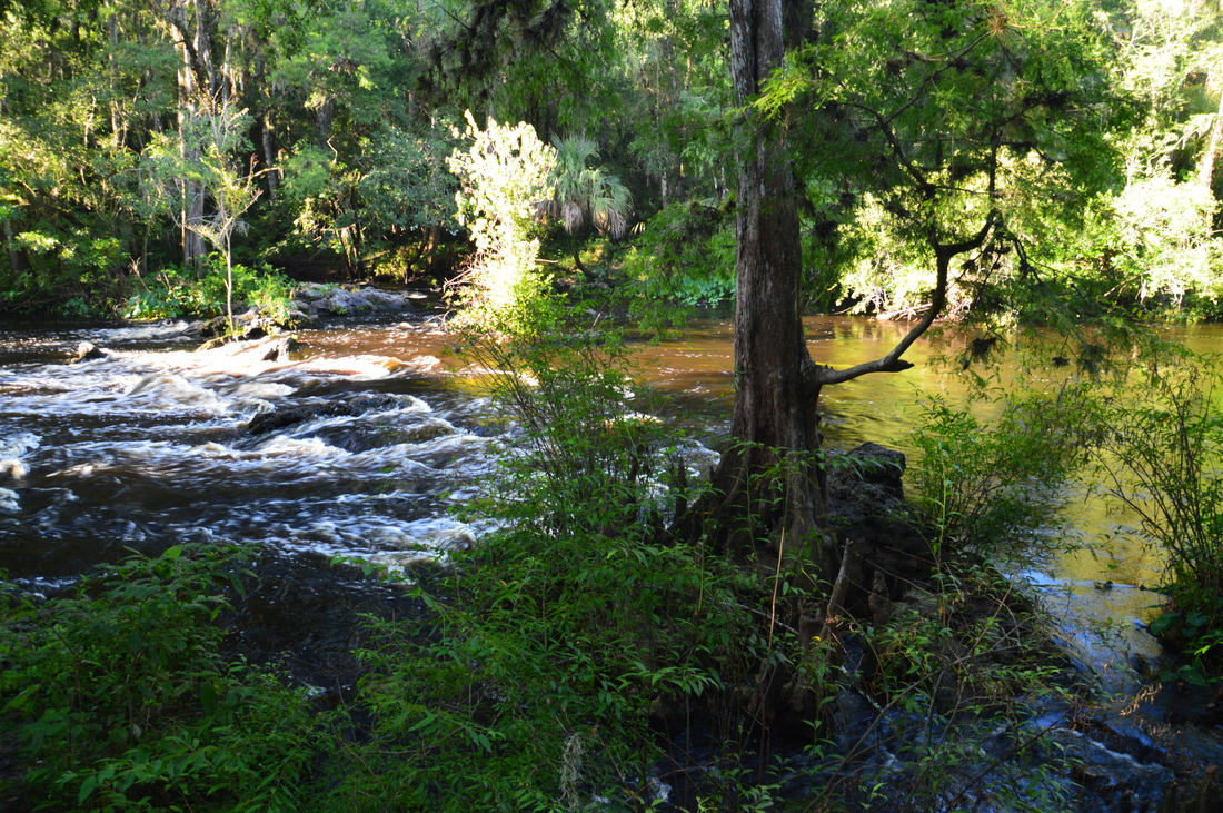
The Hillsborough River Rapids - a set of Class II rapids - is a major point of interest in Hillsborough River State Park
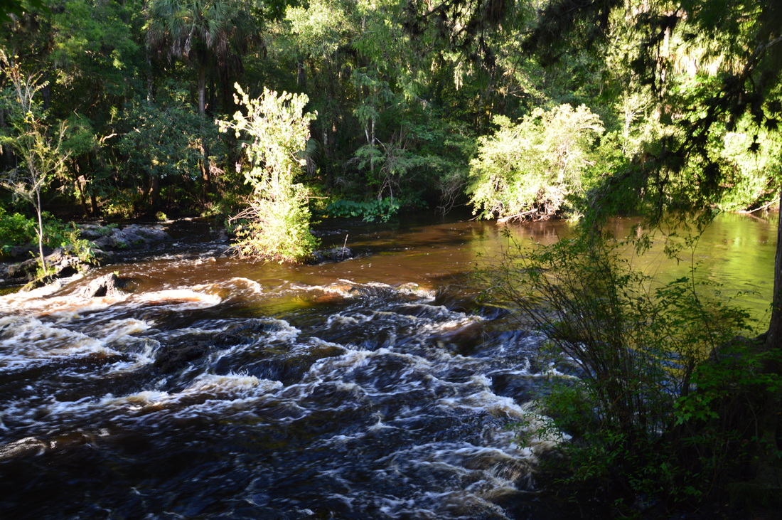
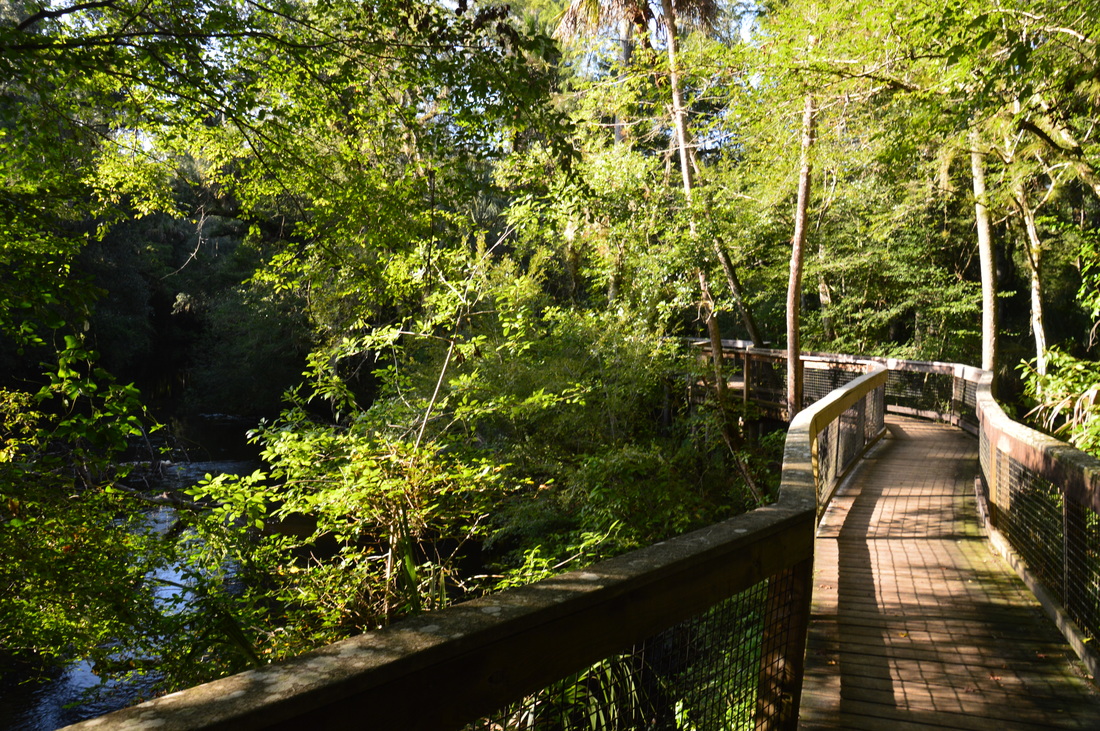
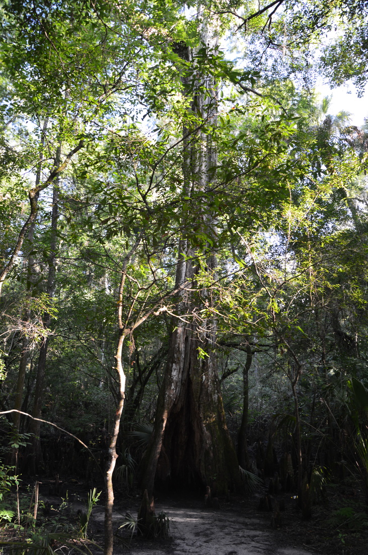
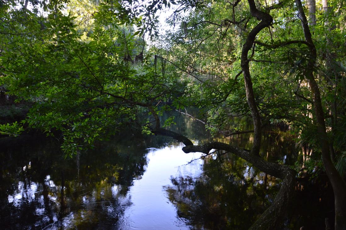
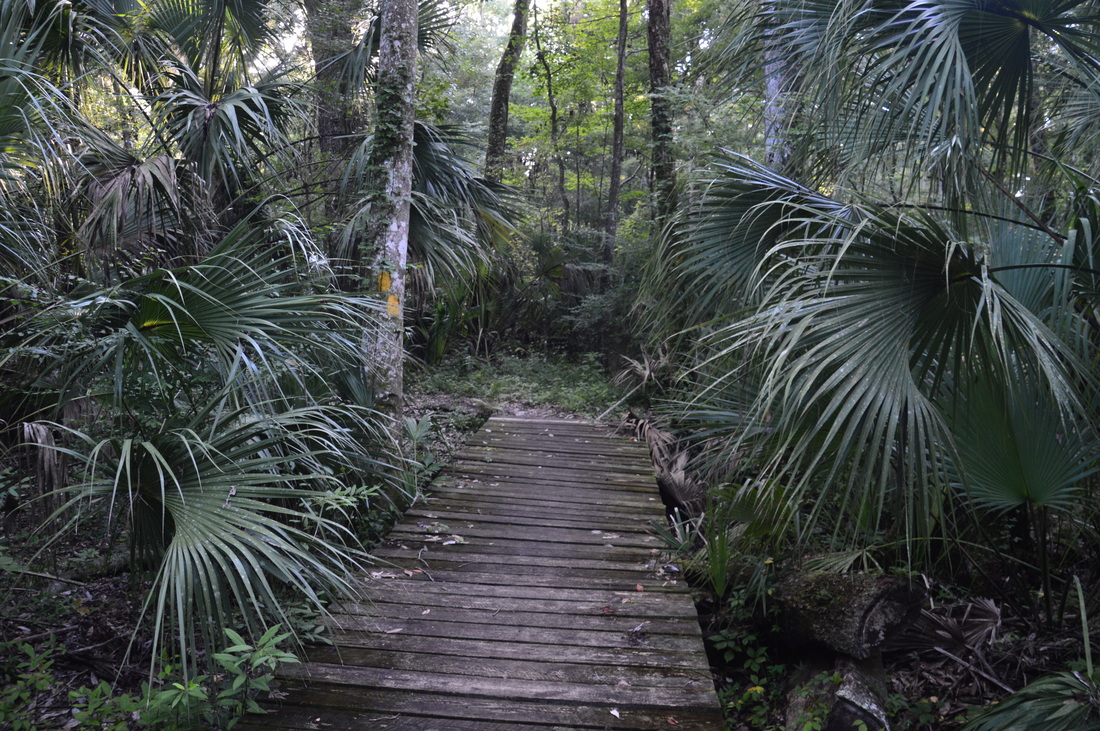
The north side of the Rapids Trail, which follows the Hillsborough River closely, is a very scenic stretch of trail. From the rapids, turn left and begin following a well-defined path along the river. At 0.25 miles, an observation deck to the right provides a great view of the river just downstream from the rapids. Note some additional sandstone formations around the swift-flowing water. If you're here for photography, then I would like to note that the huge limbs that live oaks spread above the river provide a perfect backdrop for a picture of the river. At 0.3 miles, the riverside pathway reaches a well-constructed boardwalk that works its way around a bend of the river, providing the hiker great views of this classic Florida waterway. Just past the boardwalk, a connector trail leads left to the other side of the Rapids Loop. At 0.4 miles, not far past the end of the boardwalk, a short side path leads left and down to the base of a massive cypress tree, surrounded by a score of cypress knees.
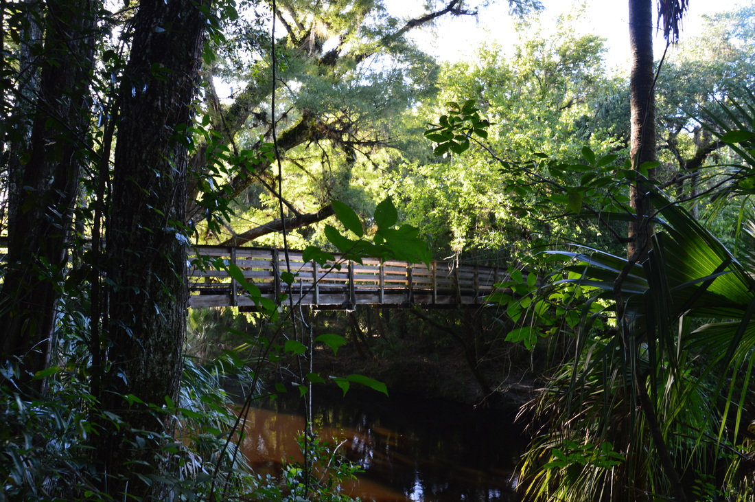
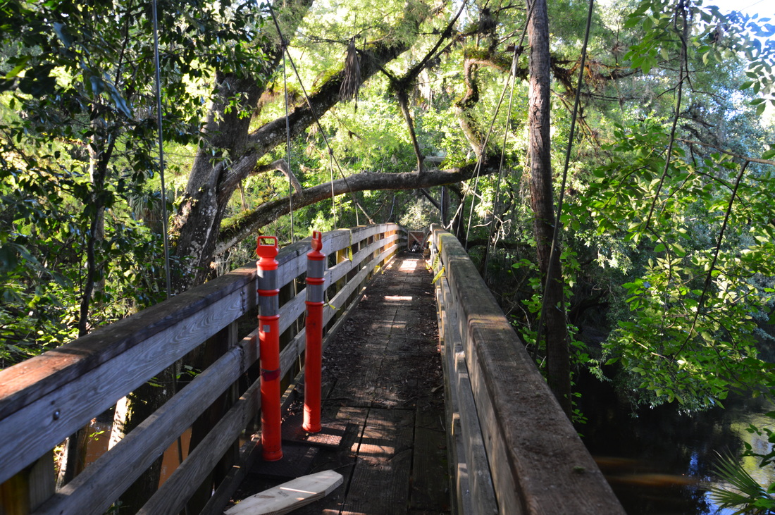
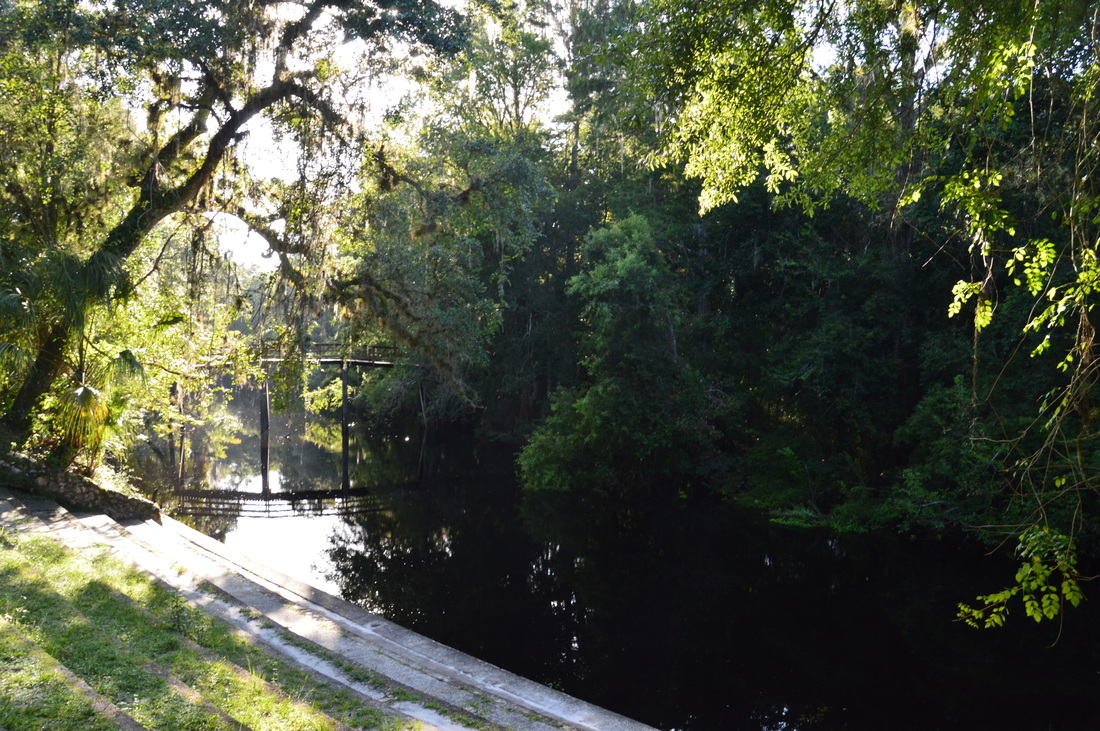
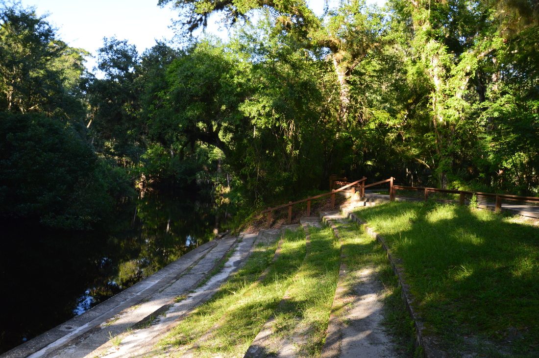
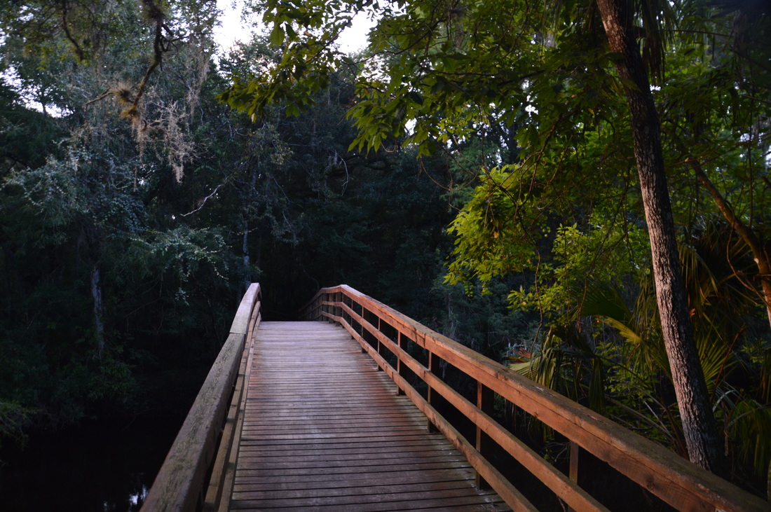
After passing a second connector to the left, reach at 0.6 miles the suspension bridge. Here, my plan was to cross the river via the suspension bridge and hike the Baynard Trail on the opposite side. However, my plan was thwarted by an unexpected closure of the suspension bridge. According to the sign, the bridge was closed to perform "critical preservation", and despite the fact that the closure is marked as "temporary", I do not know when the bridge will be reopened. In fact, I have a feeling that it may not be reopened at all, which would be a shame, as the Baynard Trail would then become inconvenient to hike. A third connector trail that leads to the playground leaves to the left, but the Rapids Trail continues straight along the river. Leaving the suspension bridge, continue to follow this riverside pathway. Rounding a bend, the trail reaches a waterfront area near the playground, as well as the stationary bridge, at 0.8 miles. The Rapids Trail turns left past the recreation hall on its way back to the trailhead, but unless you are satisfied with a very short hike, turn right and cross the stationary bridge. This bridge, while not as unique and iconic as the suspension bridge, still provides a great view of the river in both directions. At the moment, this is the only way to cross the Hillsborough River, in order to access the Florida Trail Loop and Baynard Trail. Continuing across and past the bridge, reach an intersection at 0.9 miles. Here, the Baynard Trail continues straight for a mile back to the suspension bridge, while the Florida Trail Loop begins to the left. A large kiosk with a map of both trails stands at the junction. 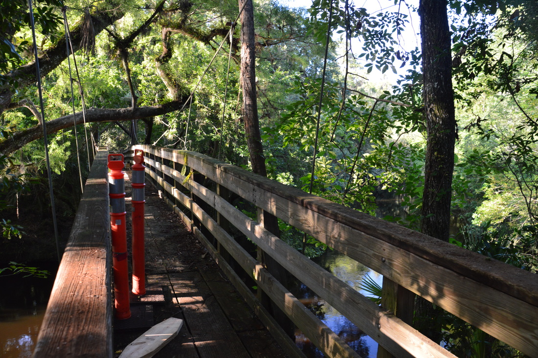
The iconic suspension bridge in Hillsborough River State Park is one of the CCC's numerous works
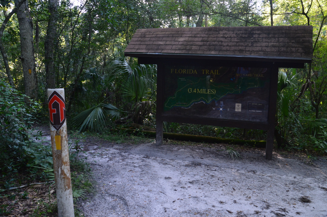
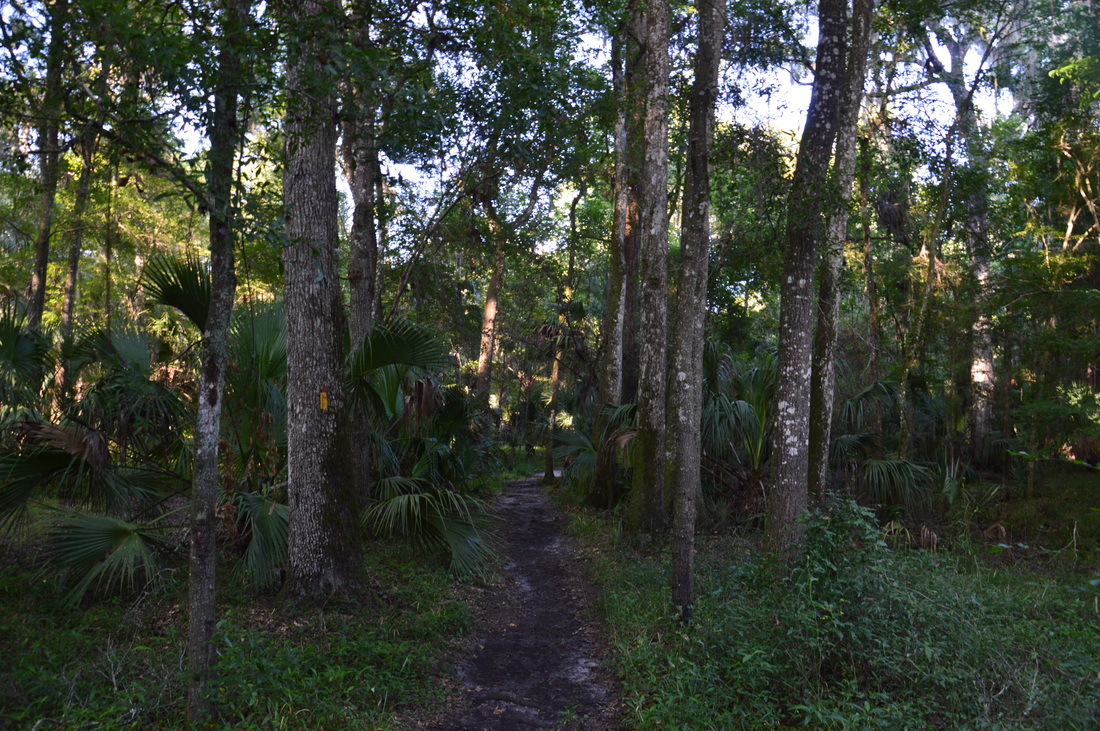
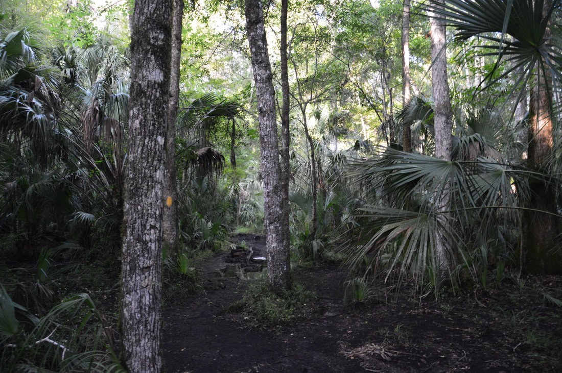
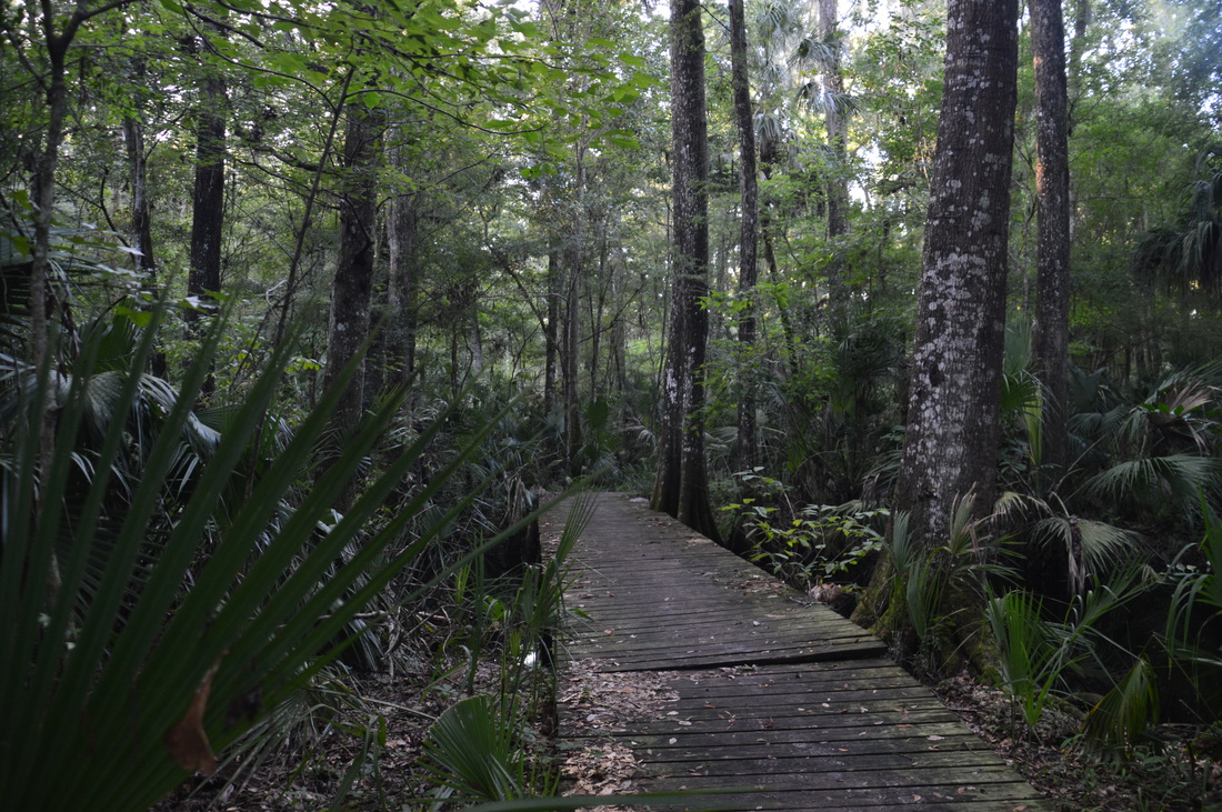
Built and maintained by the Florida Trail Association, the 3.4-mile Florida Trail Loop is the centerpiece of the Hillsborough River State Park trail system, as it leads into the park's wildest corners. Although the trail is advertised as marked by orange blazes, most of the blazes that I saw were yellow or yellowish-orange. On one of the park maps, the trail had apparently been renamed as the Seminole Trail and blazed yellow, but I am not sure if this is official, as the signs still state the former. Regardless, turn left onto the Florida Trail Loop. At 1.0 miles, reach the beginning of the actual loop. I chose to hike the loop clockwise for two reasons. I wanted to leave the main river views for last, and I also wanted to hike through the seasonally wet areas on the north side of the loop first, although on this day, those areas actually turned out to be dry.
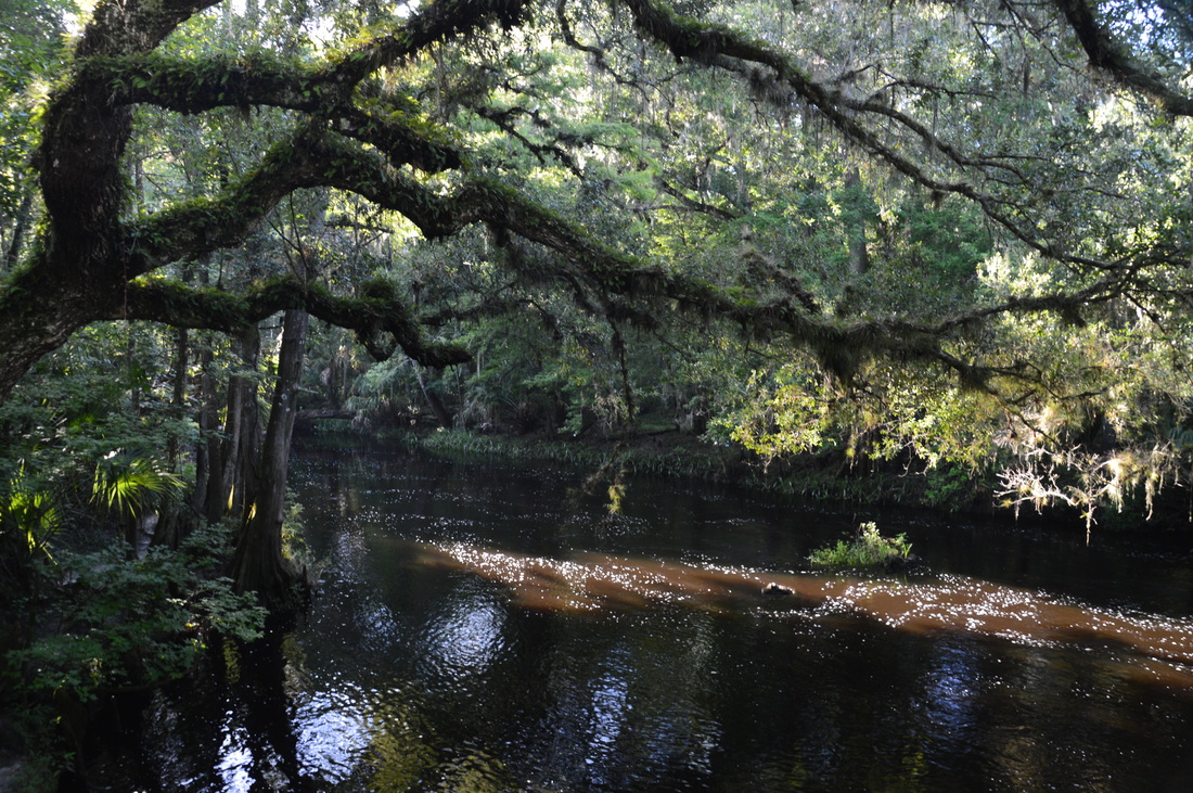
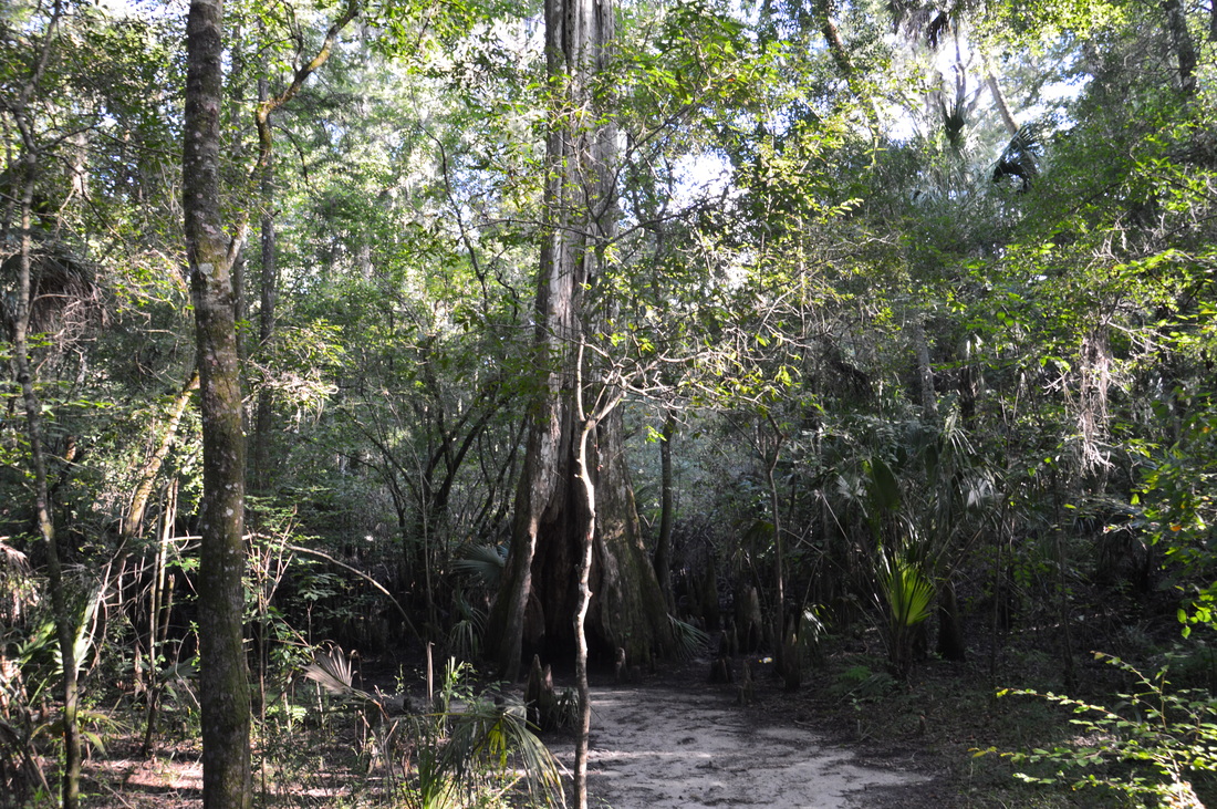
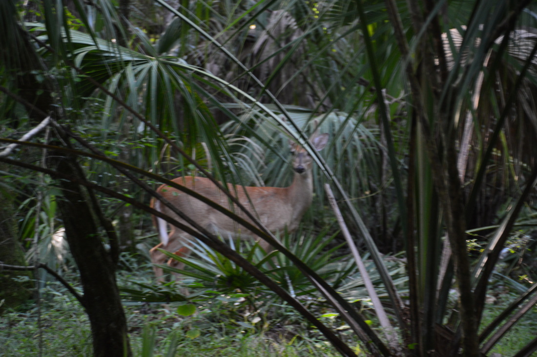
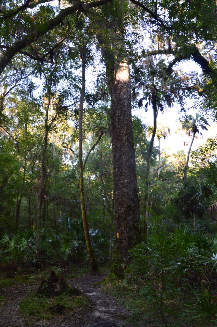
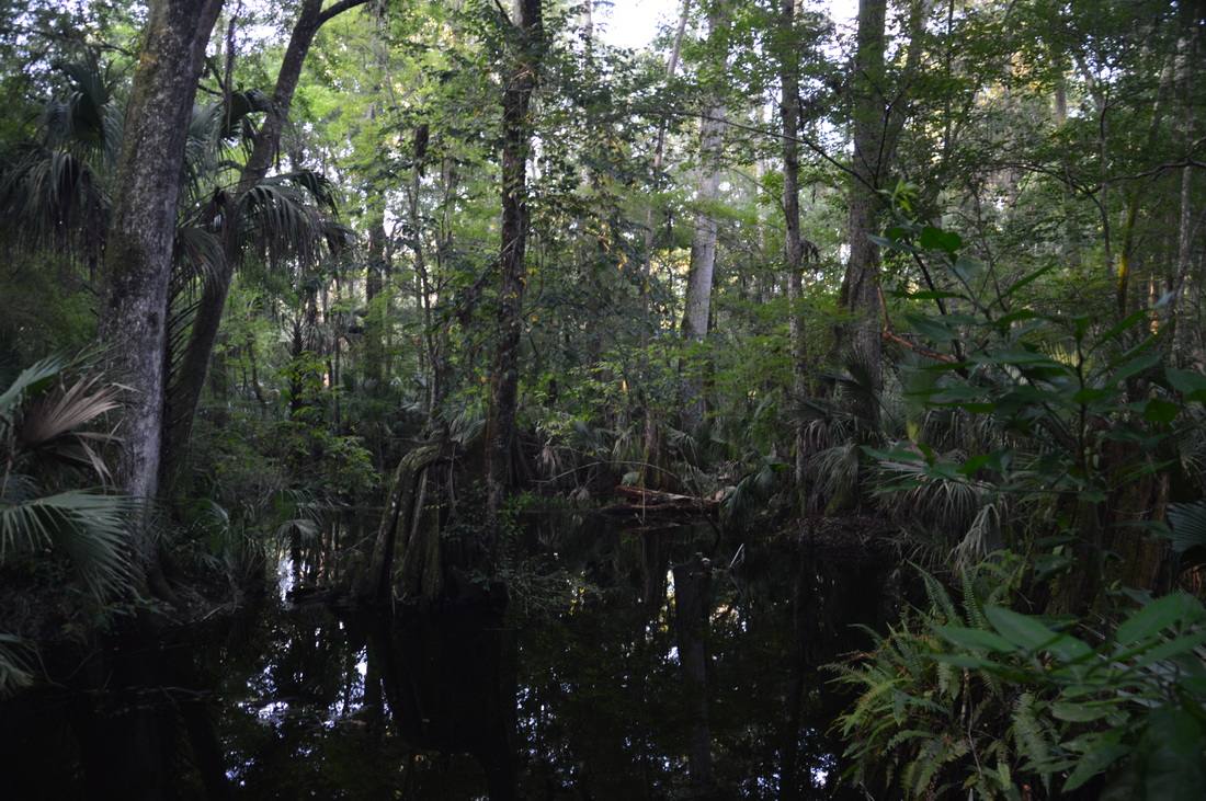
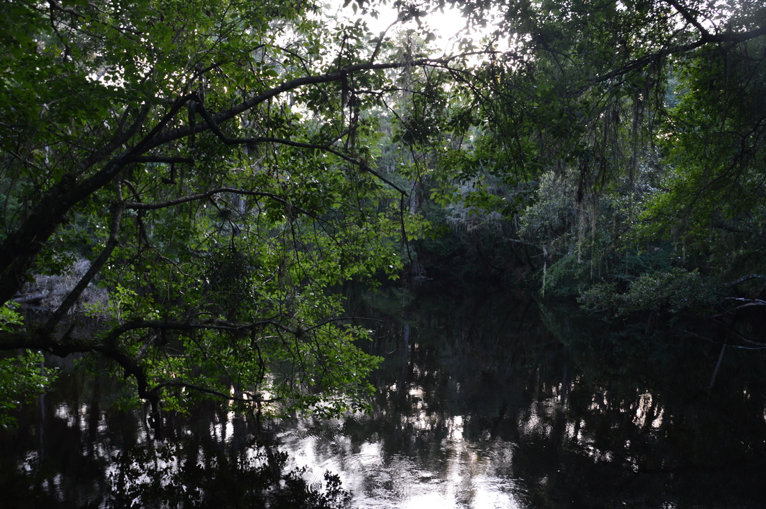
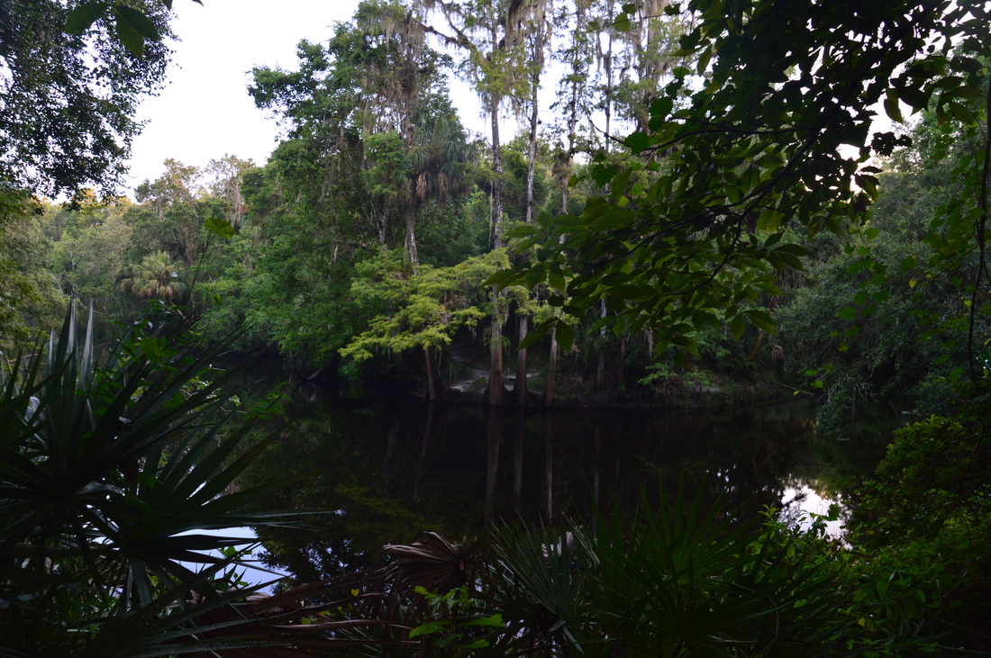
Turn right and begin hiking the loop. Immediately, lose elevation and pass through an area that may be inundated following rainfall. Over the next 1.8 miles, the trail travels generally westward through a hardwood hammock, and there are no particular points of interest along the route, However, this is a very scenic trail. There are many tall oaks in the lush forest that the trail passes through. In the summer, there is an above average amount of mosquitoes on this trail, but as long as you don't stop, you will be fine. The forest steadily gets wetter as the trail progresses westward. At 1.7 miles, the trail crosses a dark, slow-moving slough via a footbridge. A hiker who passed me earlier said that she saw an alligator in this area, but it appears that the alligator had disappeared by the time I got here. Following the footbridge, there is an area where you might get your feet wet depending on the season and recent rainfall. On this day, the ground was soft but not wet. At 1.95 miles, the blue-blazed side trail to the primitive campsite leaves to the right. Continue straight on the main trail. The following area is clearly inundated after rainfall, as I found many signs of flooding here. Keep in mind that this trail stays in the river's floodplain for much of its length. I was honestly very surprised that the area was dry on this day, given it being July and the height of the wet season. The trail soon approaches the slough you saw earlier, which is now to your left. There may be alligators in the slough. Then, the trail crosses the slough via a footbridge. This is a very picturesque area, with numerous cypress trees, live oaks, and palms shading the black waterways. 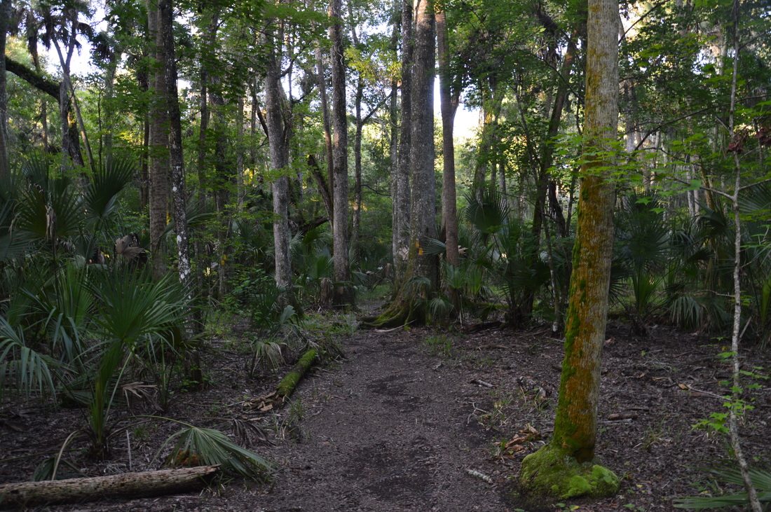
Hiking the Florida Trail Loop in Hillsborough River State Park is a peaceful, relaxing experience.
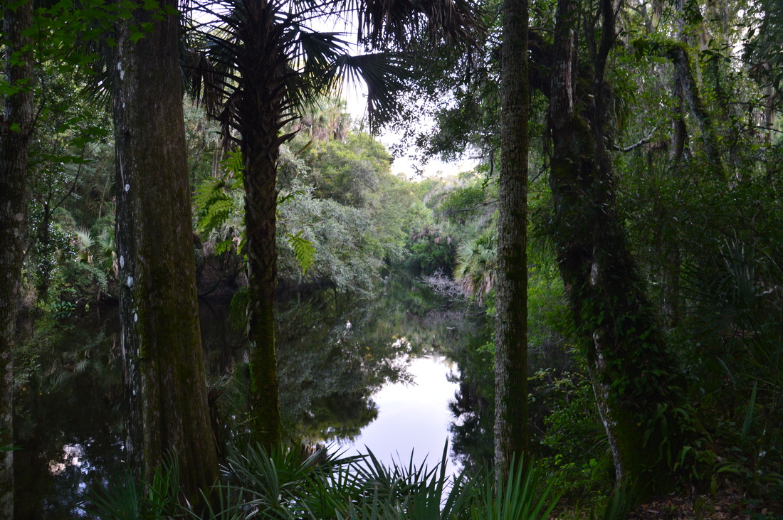
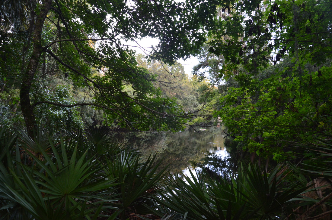
At 2.8 miles, the trail reaches the Hillsborough River. From here to the end of the loop, you will be in sight of the river most of the time. This portion of the river is more remote than around the rapids and bridges, I found it interesting that the land immediately next to the river was slightly elevated, so the riverside portion of the loop is actually likely to be dry year-round. Enjoy the many different views of the river as the trail returns eastward. At 3.2 miles, a boardwalk along a bend in the river provides a great view of the river and of a swamp to the left in the floodplain. At 3.8 miles, you may see a path and a clearing on the opposite side of the river. This is the river access from the campground area of the park. I believe that this location is known as Cedar Landing. At 4.1 miles, the trail leaves the river, and at 4.2 miles, reach the end of the loop segment of the Florida Trail Loop.
Continue straight to the Baynard Trail junction, reaching it at 4.3 miles. Here, turn right and retrace your steps from earlier to and across the stationary bridge. However, this time, don't turn left onto the Rapids Trail right away. Instead, continue straight on the path past the recreational hall and into the playground and picnic area. Just before reaching the parking area, turn left onto a path that heads across the picnic area. At the far end of the picnic area, turn right onto the Rapids Trail (the trail straight continues to the suspension bridge). This portion of the Rapids Trail stays away from the river and approaches several swampy areas, although the trail itself is dry. At 4.9 miles ,reach the end of the loop section of the Rapids Trail. Here, turn right, and follow the last leg of the Rapids Trail south to the Rapids Trailhead, reaching the trailhead and your car and concluding the hike at 5.0 miles. Mileage
0.0 - Rapids Trailhead
0.2 - Hillsborough River Rapids 0.4 - Huge cypress tree on side trail 0.6 - Hillsborough River Suspension Bridge 0.8 - Hillsborough River Stationary Bridge 0.9 - Florida Trail Loop/Baynard Trail Junction 1.95 - Campsite side trail 2.8 - Beginning of long stretch of trail along Hillsborough River 4.4 - Hillsborough River Stationary Bridge 5.0 - Rapids Trailhead Variations
Hike just the Rapids Loop - 1.4 Miles
Add an out-and-back trip along the Baynard Trail to the hike - 7.2 Miles Bonus Stops
Hillsborough River State Park has two other hiking trails:
PicturesVideos
0 Comments
Leave a Reply. |
About MeMark Oleg Ozboyd Dear readers: I have invested a tremendous amount of time and effort in this website and the Georgia Waterfalls Database the past five years. All of the work that has gone in keeping these websites updated with my latest trip reports has almost been like a full-time job. This has not allowed me to pick up a paid job to save up money for college, and therefore, I I've had to take out loans. If you find the information on this website interesting, helpful, or time-saving, you can say "thanks" and help me out by clicking the button above and making a contribution. I will be very grateful for any amount of support you give, as all of it will apply toward my college tuition. Thank you!

Coming in 2022-2023?
Other Hiking WebsitesMiles HikedYear 1: 540.0 Miles
Year 2: 552.3 Miles Year 3: 518.4 Miles Year 4: 482.4 Miles Year 5: 259.9 Miles Archives
March 2021
Categories
All
|


 RSS Feed