
Driving through the vicinity of the town of Lexington, Virginia, one cannot fail to notice two twin summits rising up sharply to the northwest of town. The distant peaks tower out of the valley farmlands as you drive along US Route 11 near Lexington, and when you drive on I-64, the peaks are still there, although their character has changed as you see them from a different angle. The peaks are none other than Big and Little House Mountain, two mountains with outstanding 180-degree to 270-degree views. The House Mountain area was preserved by the Virginia Outdoors Foundation, and there are now established hiking trails to viewpoints on both mountains. In addition to the grand views that you'll see, you'll also get to visit a Big House Mountain boulder field that is home to a unique rock formation known as Tabletop Rock. This hike occurred on Thursday, November 24th, 2016. My plan was to hike to along a gated forest road to the saddle between Big House Mountain and Little House Mountain. Once there, I would hike out and back along the Big House Mountain Trail to Goat Point Overlook and Tabletop Rock on Big House Mountain. Then, I would return to the saddle and hike out and back to the vista on Little House Mountain. I would finish the hike by retracing my steps back down along the gated forest road. This hike was the second of seven hikes that I did during a four-day Thanksgiving trip to the mountains of western Virginia. Unfortunately, I got a late start and reached the Little House Mountain vistas after dark.
*Note: I am hoping to re-hike this trail in 2021 and update this trip report with better information and daylight pictures from Little House Mountain!
Summary
R/T Length of Trail: 8.1 Miles
Duration of Hike: 6:45 Type of Hike: T-Configuration (Out and Back) Difficulty Rating: 5 out of 10 Total Elevation Gain: 2548 Feet Pros: Outstanding views Cons: The trail to Goat Point Overlook follows an old road that is very steep in places Points of Interest: Tabletop Rock; Goat Point Overlook on Big House Mountain - 10 stars; Little House Mountain Overlook - 9 stars Trail Blaze Colors: Saddle Trail - None; Big House Mountain Trail - Blue; Little House Mountain Trail - Blue Best Seasons to Hike: Year-round Fees: None Beginning Point: End of Saddle Ridge Road Directions from Lexington, VA: From the intersection of Main Street and Nelson Street in downtown Lexington, follow W Nelson Street (US 60 West) for 2.8 miles. Then, turn left onto VA 641 (Jacktown Road). Continue for 3.4 miles, and then, turn right onto VA 643 (Saddle Ridge Road). In 0.4 miles, Saddle Ridge Road ends. There is space for parking here, as well as a trailhead kiosk, but it is also possible to bear right onto Trailhead Lane (an unpaved road but in good condition) and continue for another 0.3 miles to a pullout on the right with space for several cars, just before the end of the road at a gate. Map
Click the link below to download a .KML file with a track of this hike.
Details
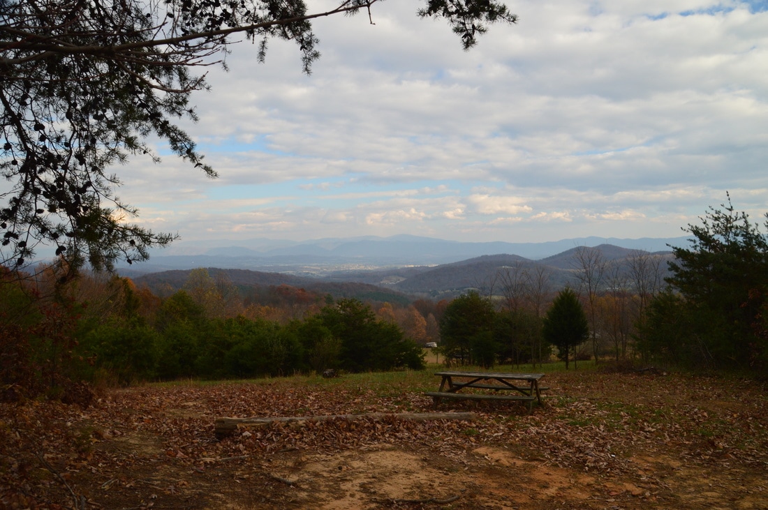
I have seen some confusion regarding the location for the official trailhead for this hike. It is unclear to me if it is allowed to park where I did, 0.1 miles from the end of Trailhead Lane. If you choose to park at the "official" trailhead at the beginning of Trailhead Lane, keep in mind that the total hike will be 0.6 miles longer. All mileage in this post is from the pullout 0.1 miles from the end of Trailhead Lane, where I began my hike. The pullout is located next to a clearing to the right, where there is a picnic table and a great view to the east.
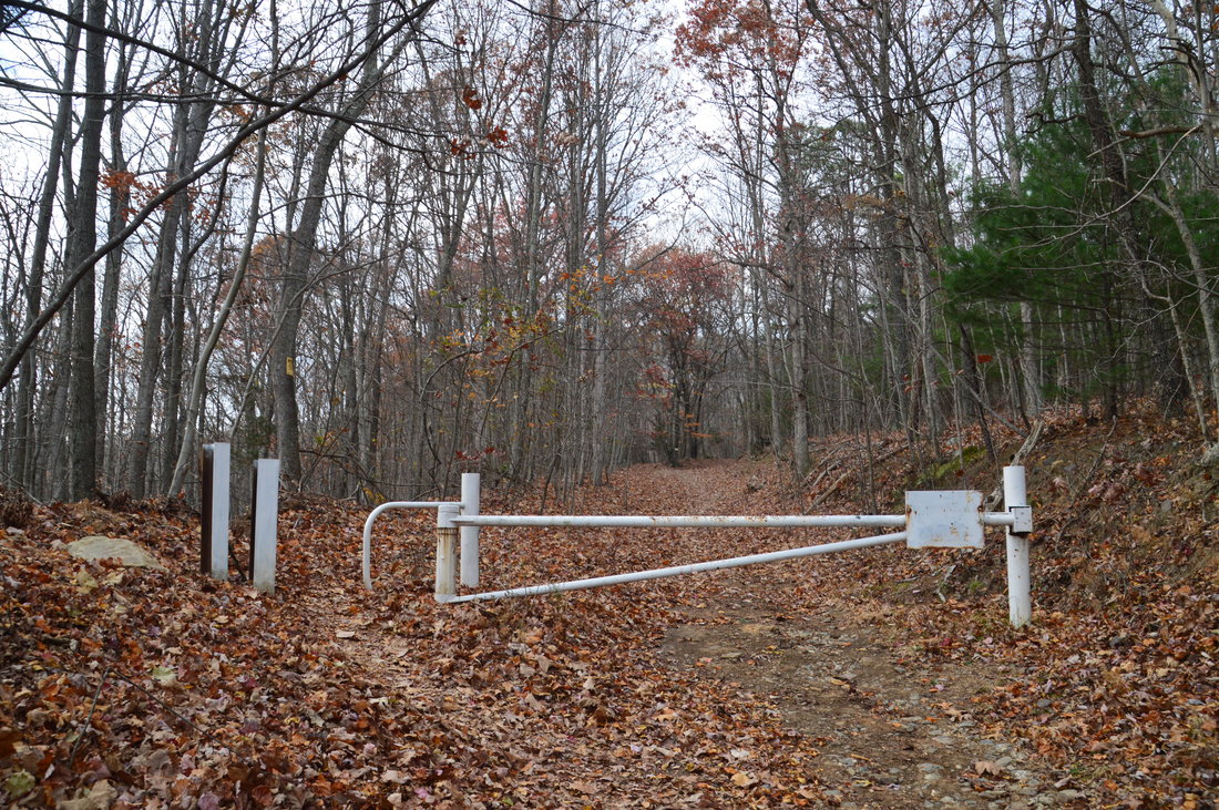
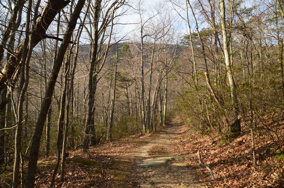
Begin the hike by walking up Trailhead Lane from the car. At 0.1 miles, the road ends near a construction area and a new house. No parking is allowed here. Straight ahead, there is a gate. This is where the Saddle Trail begins. The access trail to both Big and Little House Mountain is the same until the saddle between the two mountains. There, there is a split with one trail heading toward Big House Mountain and the other heading toward Little House Mountain. Walk around the gate and continue following the old roadbed, which is old Saddle Ridge Road. At 0.5 miles, bear left as a gate ahead leads to private property. All of the Saddle Trail involves generally easy to sometimes moderate uphill grades that are never steep. The forest road that the trail follows gradually bends around the south side of Little House Mountain, affording great winter views to the south and later west. Even though the Saddle Trail is unblazed, you should have no problems following it. After a more moderate section of uphill, reach the saddle at 1.8 miles. 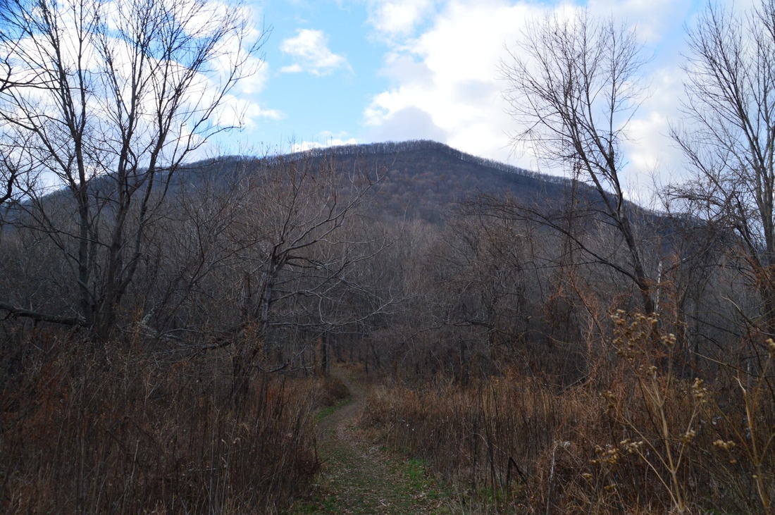
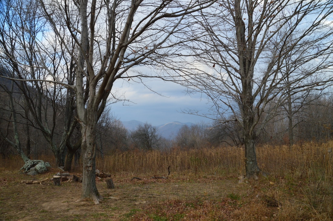
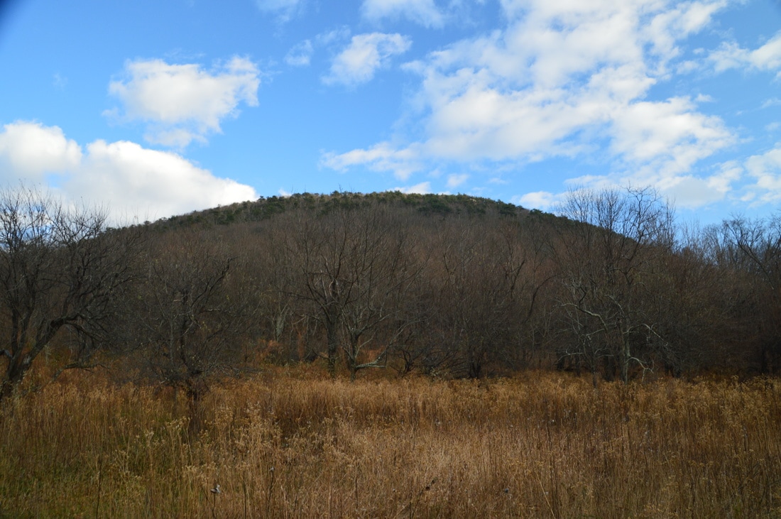
The saddle between Big House Mountain and Little House Mountain is a clearing that is a homestead and used to be a orchard ans pasture. The clearing provides great views of both Big House Mountain (shown above) and Little House Mountain.
The saddle is the site of an ancient mountain homestead. Later, it was an orchard and even a pasture. Today, however, the saddle and both Big House Mountain and Little House Mountain are preserved by Virginia Outdoors Foundation. There are several campsites in the saddle. It is also an important trail junction. Straight ahead, the old road that you have been following continues. I do not know where it leads. To the left, the Big House Mountain Trail leads to Goat Point Overlook and Tabletop Rock. To the right, the Little House Mountain Trail leads to and over the summit to Little House Mountain, terminating at the Little House Mountain Overlook. My plan was to hike first to Big House Mountain and then to Little House Mountain. In my opinion, the view from Goat Point Overlook on Big House Mountain is slightly better, so if you don't have time for both mountains, I would hike just to Big House Mountain, but both views are really great.
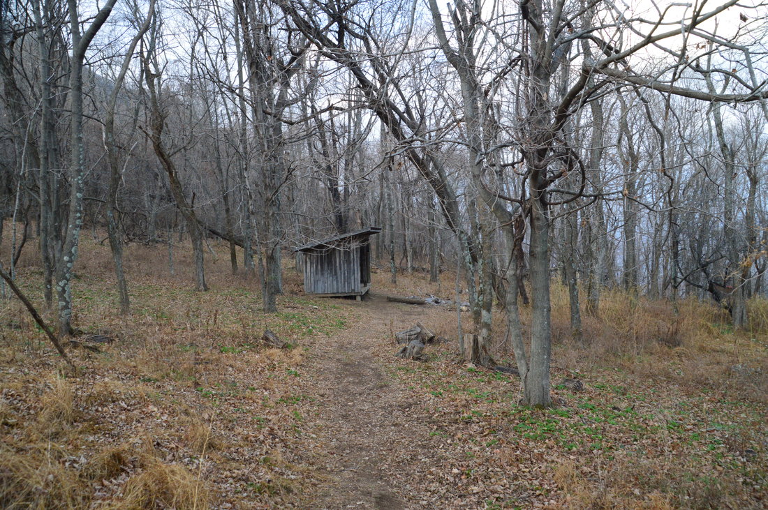
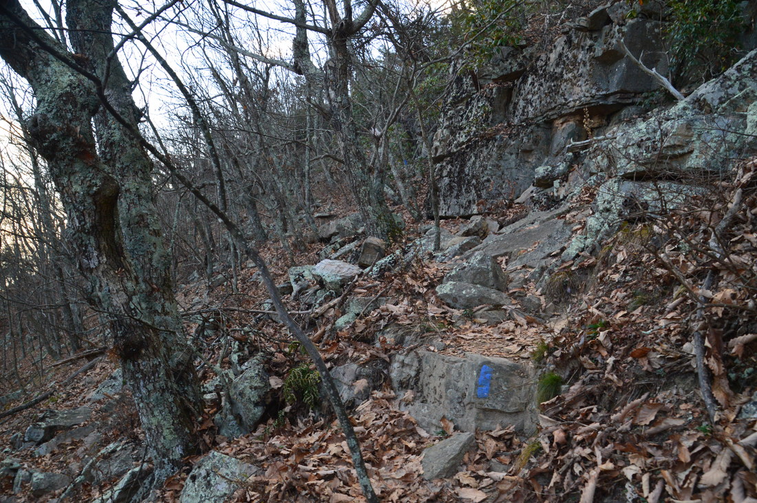
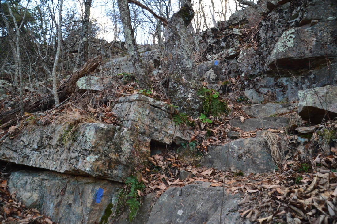
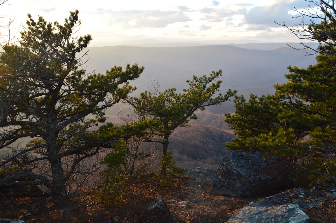
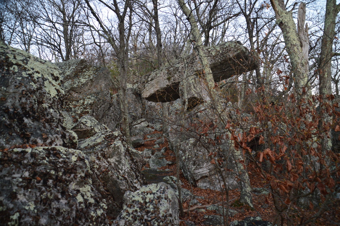
To hike to Big House Mountain, turn left at the saddle clearing and head west on a wide path. Just past the far edge of the clearing, pass a shelter with a spring to the right. After this, the trail - which is actually an old forest road as well - steepens sharply. The trail keeps up an elevation gain rate of 1000 feet per mile for 0.3 miles. At around 2.1 miles, the uphill moderates. At 2.35 miles, the old forest road makes a sharp right turn and eventually reaches the summit of Big House Mountain. A blue blaze marks the trail to Goat Point Overlook and Tabletop Rock as it continues straight, leaving the forest road and turning into a narrow footpath. I do not believe that there is anything to see at the summit of Big House Mountain - all of the points of interest are on the blue-blazed trail. The trail becomes much more rugged as it passes through a boulder field below the top of the ridge. Soon, the well-blazed trail turns right sharply and then makes an extremely steep rock scramble to the top of the ridge. Reach the intersection with the unmarked spur trail to Goat Point Overlook at 2.45 miles. Here, the blue-blazed trail to Tabletop Rock turns right. Interestingly, the path to Goat Point Overlook is much better-defined, even though it's not marked. To visit Goat Point Overlook first, turn left and follow the path along the ridge. The path ends at the edge of several cliffs and at an incredible vista at 2.5 miles. 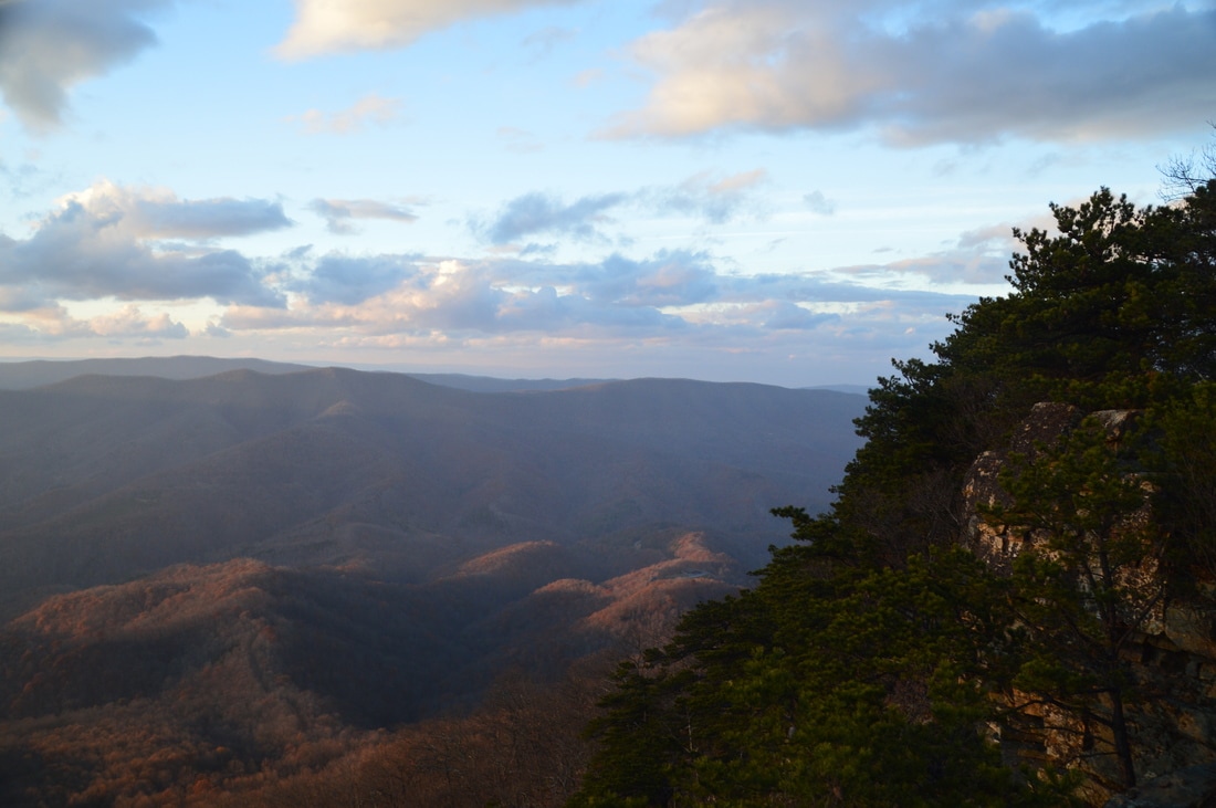
The panoramic views from Goat Point Overlook on Big House Mountain are breathtaking.
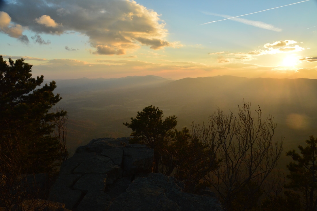
From Goat Point Overlook, there are unobstructed views west into George Washington and Jefferson National Forest and south into the James River valley. There are also partial views to the east, although the view to the east was slightly hazy on this day, due to a wildfire near Mount Pleasant.
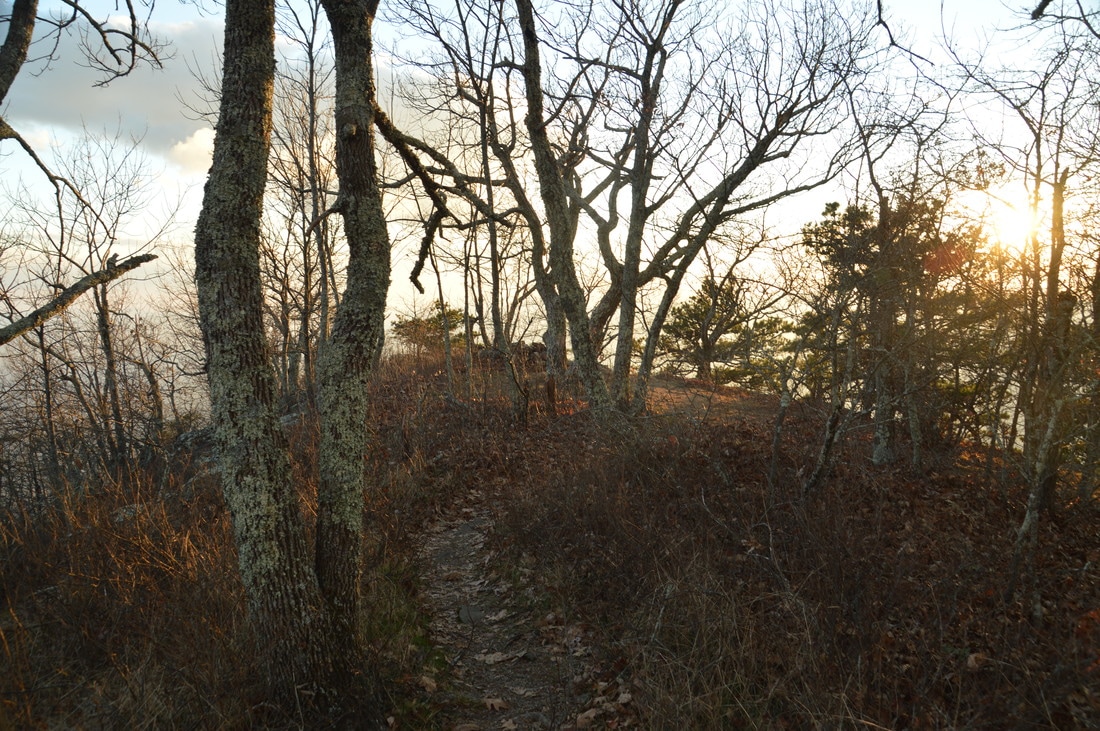
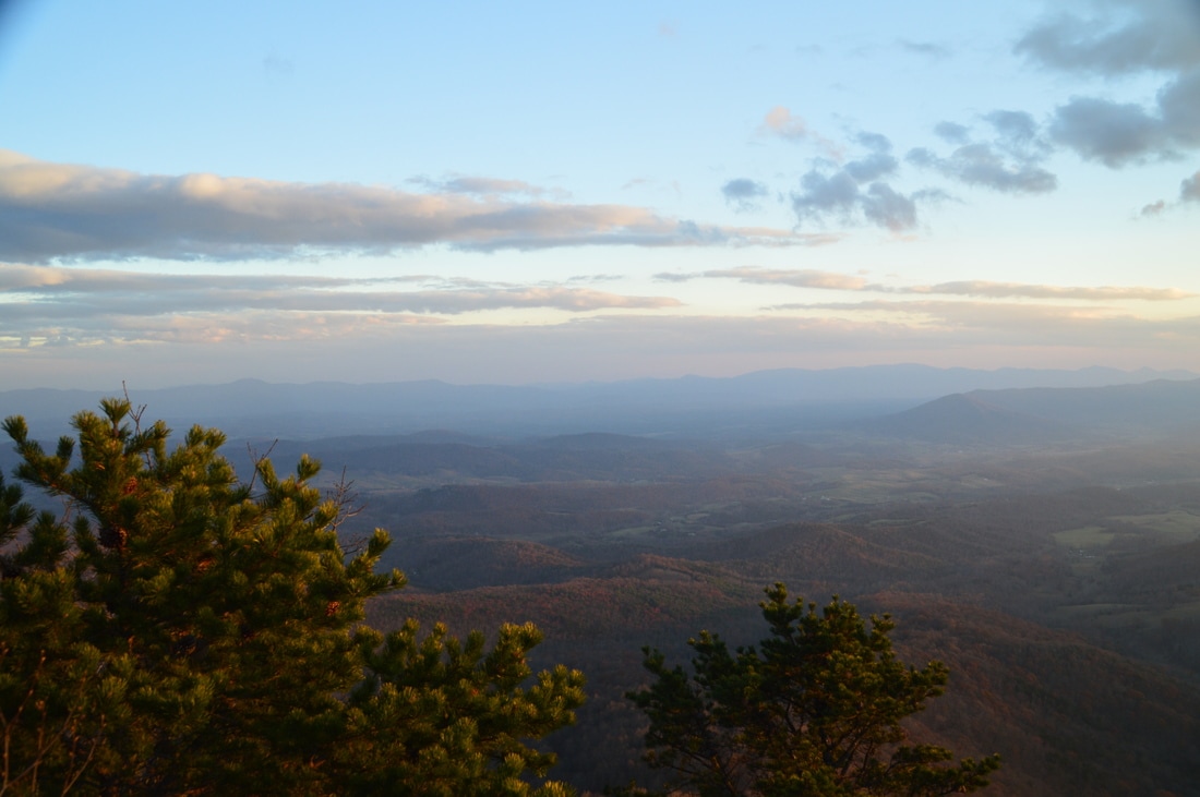
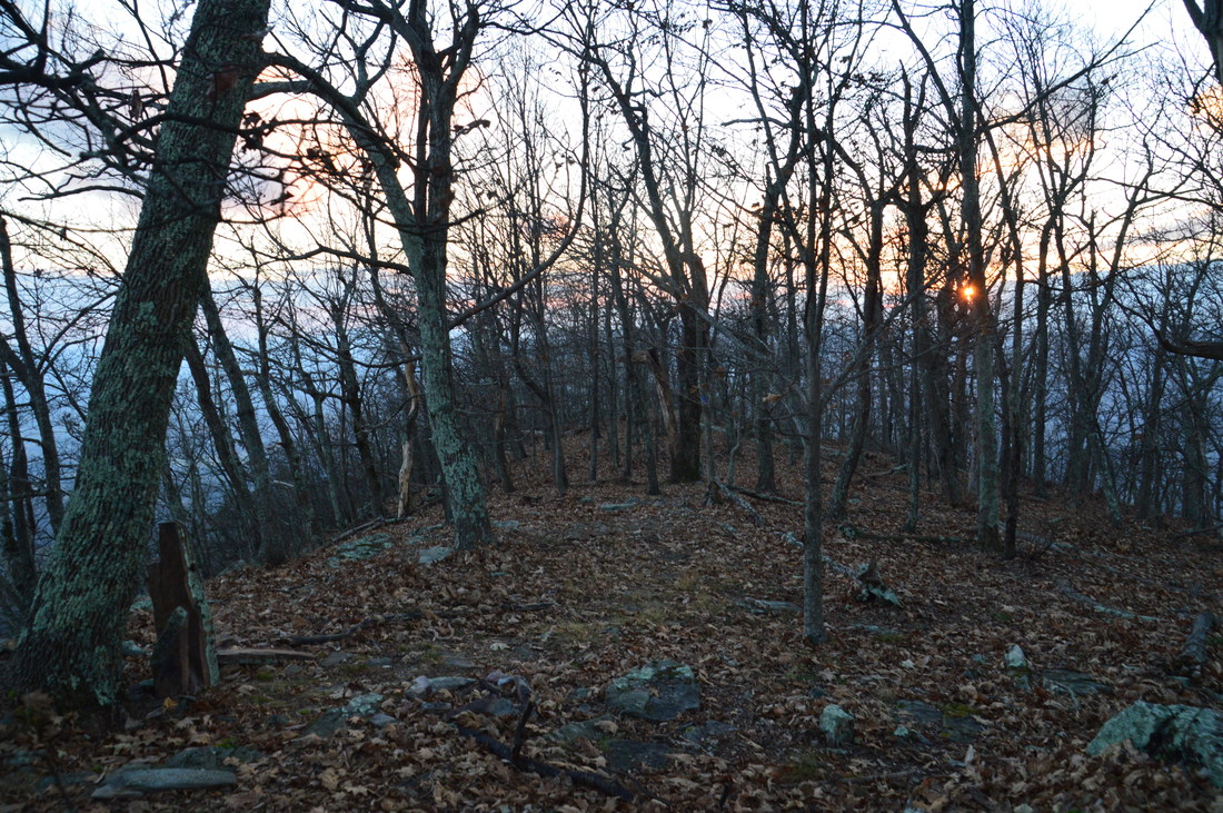
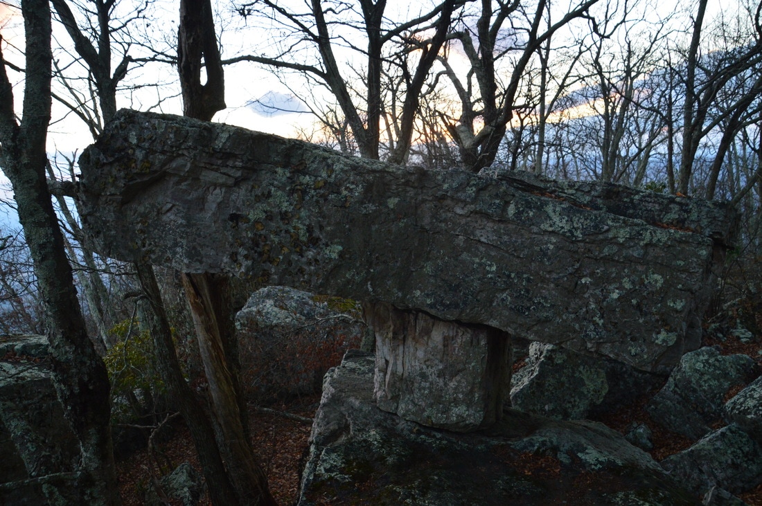
From Goat Point Overlook, retrace your steps to the junction and now follow the faint blue-blazed trail northeast along the ridge towards Tabletop Rock. At 2.65 miles, reach a large boulder field at the end of the official trail. Tabletop Rock stands straight ahead. This unusual sight consists of two medium-sized boulders - with one top of the another - stacked on top of a larger boulder. I noticed that an even fainter goat path continued beyond the rock, and according to maps, the summit of Big House Mountain is only 0.15 miles away as the crow flies. However, I do not know of any good views from the summit. Satellite imagery does indicate the potential for views from rock outcrops on the north side of the mountain, but I simply did not have the time to investigate this potential on this day. From Tabletop Rock, return to the junction and retrace your steps back to the saddle. Unfortunately, by the time I got back to the saddle at 3.4 miles, darkness was fast-approaching, but I still decided to hike up to the views from Little House Mountain just for the record. To reach little House Mountain, hike across the saddle and pick up a blue-blazed footpath headed east-southeast at the kiosk. If you're coming from the Saddle Trail, you would make a sharp right turn to hike the Little House Mountain Trail. This trail follows a generally well-defined and well-constructed footpath that ascends the west side of Little House Mountain via many switchbacks. At 3.7 miles, there is a small opening in the trees with a view to the southwest. This was the last view I saw in daylight on this day. At 3.9 miles, reach an unmarked junction. Here, a side trail to the right leads to a small rock outcrop that appears to provide a limited view to the south. The path seemed to continue on but I am unsure of where it leads, if anywhere. The main trails turns left. The trail gradually levels out, crossing the broad summit of Little House Mountain in a mountain laurel thicket at 4.1 miles. There are no views from the summit of Little House Mountain, but the trail continues for about three-quarters of a mile - along a ridge that extends from Little House Mountain - to a vista that is likely almost as spectacular as on Big House Mountain. 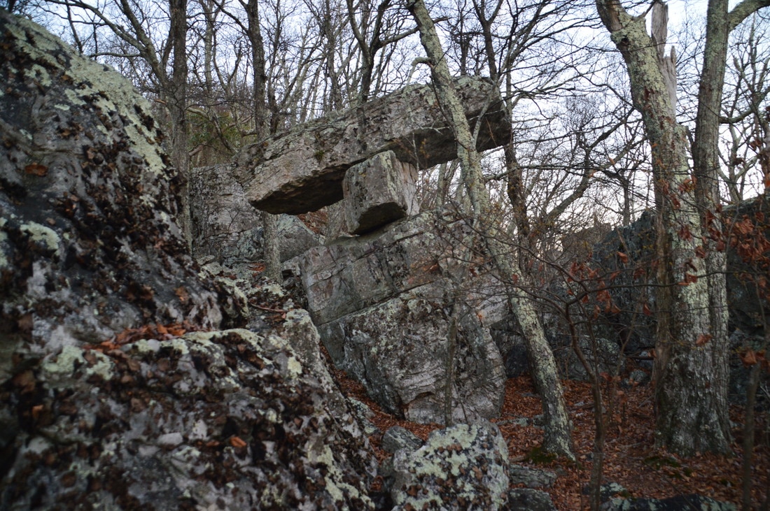
One of the highlights of the hike to Big House Mountain is a unique rock formation known as Tabletop Rock.
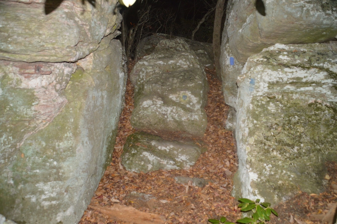
After the summit of Little House Mountain, the trail at first stays nearly level and easy. However, the ridge gradually narrows and becomes increasingly rockier. Being in the dark here, I had not anticipated neither the length of the trail beyond the summit nor the ruggedness of the terrain at the northeast end of Little House Mountain. The first challenge is at 4.45 miles, as the trail passes through a gap between two huge boulders, scrambling over smaller rocks in the meantime. While I was debating my route at this obstacle, a shrill cry pierced the air no farther than perhaps 100 yards from me. Whatever critter it was did not sound pleased with my nocturnal presence here!
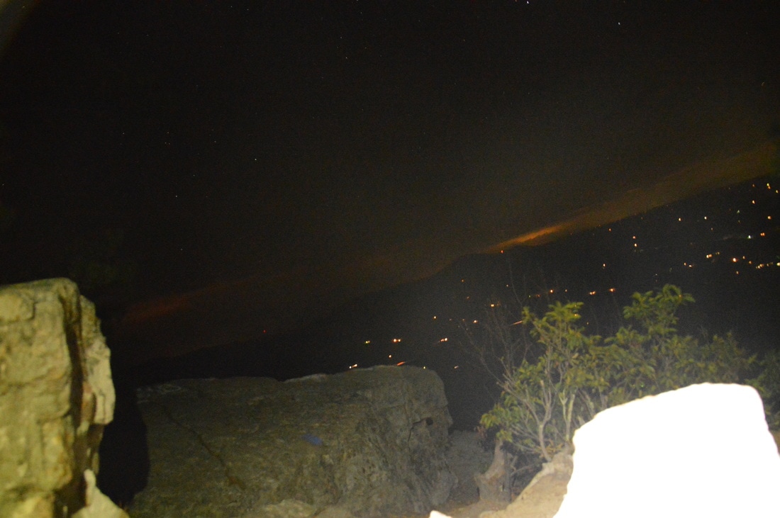
Beyond this area of boulders, the trail continues to stay very rocky, following the east side of the ridge with good winter views. Also, the trail gradually begins to descend more steeply as it approaches the overlook. At 4.85 miles, reach the end of the trail at Little House Mountain Overlook, which is at a large rock outcrop at the north end of the Little House Mountain ridge. From here, there is an excellent view northeast into the Shenandoah Valley and southeast toward Lexington. This view is no less panoramic than the view from Goat Point Overlook, but there is one factor that makes is slightly less scenic: the fact that there are a lot less mountains in the view here than from Goat Point Overlook. From the Little House Mountain Overlook, retrace your steps back to the saddle. From there, conclude the hike by returning along the old Saddle Ridge Road/Saddle Trail, reaching your car and finishing the hike at 8.1 miles. Due to the two spectacular viewpoints, both of which are top-notch, I decided to classify this hike as a "Best Hike". Mileage
0.0 - House Mountain Trailhead
1.8 - House Mountain Saddle 2.5 - Goat Point Overlook (Big House Mountain) 2.65 - Tabletop Rock 3.4 - House Mountain Saddle 4.1 - Little House Mountain 4.85 - Little House Mountain Overlook 8.1 - House Mountain Trailhead Variations
Hike out and back to Goat Point Overlook on Big House Mountain and Tabletop Rock - 5.2 Miles
Hike out and back to Little House Mountain Overlook - 6.5 Miles PicturesVideos
0 Comments
Leave a Reply. |
About MeMark Oleg Ozboyd Dear readers: I have invested a tremendous amount of time and effort in this website and the Georgia Waterfalls Database the past five years. All of the work that has gone in keeping these websites updated with my latest trip reports has almost been like a full-time job. This has not allowed me to pick up a paid job to save up money for college, and therefore, I I've had to take out loans. If you find the information on this website interesting, helpful, or time-saving, you can say "thanks" and help me out by clicking the button above and making a contribution. I will be very grateful for any amount of support you give, as all of it will apply toward my college tuition. Thank you!

Coming in 2022-2023?
Other Hiking WebsitesMiles HikedYear 1: 540.0 Miles
Year 2: 552.3 Miles Year 3: 518.4 Miles Year 4: 482.4 Miles Year 5: 259.9 Miles Archives
March 2021
Categories
All
|
||


 RSS Feed