The Bartram Trail, which is a lesser-used footpath that stretches across portions of Georgia and North Carolina, stays close to the Tennessee Valley Divide for a number of miles in Georgia's Rabun County, passing over Rabun Bald, which is the second highest mountain in Georgia. In the vicinity, several other mountains provide noteworthy views, such as Double Knob, Flat Top Mountain, and Flint Knob. While the views from Rabun Bald are arguably better than some of these views, the other overlooks in the area are certainly worth visit as well. On this hike, you'll follow the Bartram Trail and then a side trail to three or four mountains with views in different directions. If you're feeling up to it, you will have the opportunity to tackle Rabun Bald and experience the 360-degree view from the top as well. This hike occurred on Saturday, November 12th, 2016. My plan was to hike the Bartram Trail out and back from Wilson Gap Road to Rabun Bald. Along the way, I would make the side trip to Flint Knob and possibly Alex Mountain, and I would also bushwhack up to Double Knob, in addition to seeing the view from Flat Top Mountain. Unfortunately, due to the length of the side trips, I was not able to hike the Bartram Trail from Flint Gap to Rabun Bald.
Summary
Note: If you choose to not hike to Alex Mountain from the Flint Knob vista, the length of this hike will be less than shown and the overall difficulty will be significantly easier (and the elevation gain will be lower). I do not recommend hiking to Alex Mountain other than for peakbagging purposes. I explain more farther down in this post.
Note: FS 155, also known as Wilson Gap Road, which is the road that leads to the primary trailhead for this hike, is seasonally gated and closed to all vehicles from January 2nd through March 17th. During this time, you will not be able to access the Wilson Gap Trailhead, but you will still be able to access the Flint Knob Trailhead from Sky Valley and other trailheads for Rabun Bald.
R/T Length of Trail: 11.4 Miles
Duration of Hike: 9:00 Type of Hike: Out and Back Difficulty Rating: 7 out of 10 Total Elevation Gain: 3485 Feet Pros: Numerous vistas Cons: Trail to Alex Mountain no longer exists (and bushwhack is not worth it in my opinion) Points of Interest: Double Knob Vista - 6 stars; Flat Top Mountain Vista - 5 stars; Flint Knob East Vista - 10 stars; Flint Knob Vista - 9 stars; Alex Mountain Vista - 2 stars; Please note that the ratings for the overlooks may be somewhat underrated, as forest fires made the views very hazy on my hike here Trail Blaze Colors: Bartram Trail - Yellow; Flint Knob Trail - Orange Circles Best Seasons to Hike: Winter (Once again, note that you can only access the Wilson Gap Road Trailhead during the first month - December - of winter) Fees: None Beginning Point: Wilson Gap Road Trailhead Directions from Clayton, GA: From the intersection of US 23/441, Rickman Drive, and Savannah Street in Clayton, follow Rickman Drive East for 0.5 miles. Then, bear diagonally right onto Warwoman Road. Continue on Warwoman Road for 8.6 miles, before turning left onto Sarahs Creek Road (Forest Service Road 156). The road starts out paved but soon turns to gravel and dirt. All roads leading to the trailhead for this hike should be passable by most passenger vehicles, taking some bumpiness into account. Follow Sarahs Creek Road for 2.1 miles. Then, turn left onto Wilson Gap Road (Forest Service Road 155). Follow Wilson Gap Road for 6.7 miles until the point where the Bartram Trail crosses the road. Park here - there is space for several cars in the vicinity of the trail crossing. Map
Click here for more information and to download this trail map to view in Garmin Basecamp.
Details
During the weeks prior to this hike, exceptional drought conditions set the stage for the development of a vast amount of wildfires, big and small, across the southern Appalachian Mountains. These wildfires were to continue all the way into late November, with the endless streak of no substantial rain continuing for months. Most of these wildfires were human-caused, and some of them were even intentional (started by arsonists). To be honest, November 2016 was one of the most depressing months in the mountains that I remember, with many creeks completely dried up and smoke and haze from wildfires filling the sky nearly every day. I was looking forward very much to my planned vacation in the mountains of Virginia over Thanksgiving Break, away from all the fires and drought conditions. As the last hiking weekend before my trip arrived, I found it difficult to pick a hike that would be worth it, as I was afraid that smoke from wildfires would prevent good views. Eventually, I settled on a section of the Bartram Trail in the vicinity of Rabun Bald, and while a certain burning odor was hanging in the air throughout the entire hike, and while all of the views did not look their best, I still found it to be a really great hike, and I look forward to doing it again.
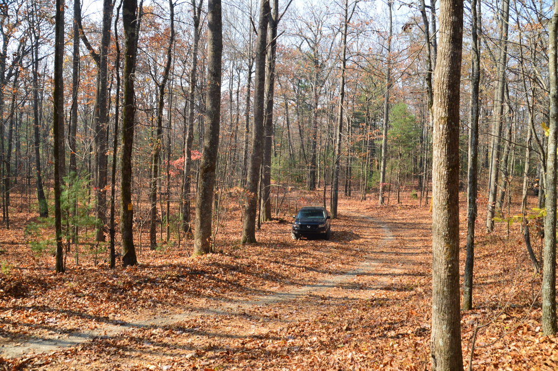
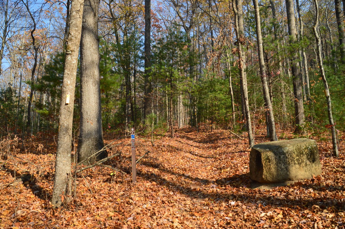
From the parking area at Wilson Gap Road, pick up the northbound Bartram Trail. It is marked by a carsonite trail marker and a yellow blaze. A large stone at the beginning of the hike has an inscription that reads:
BARTRAM TRAIL
RABUN BALD 5 MI. ↑
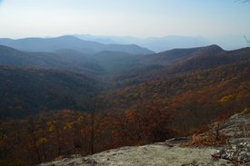
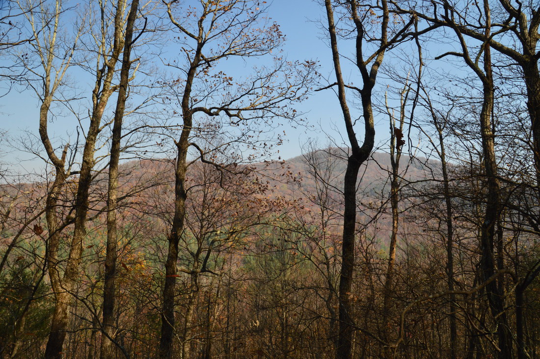
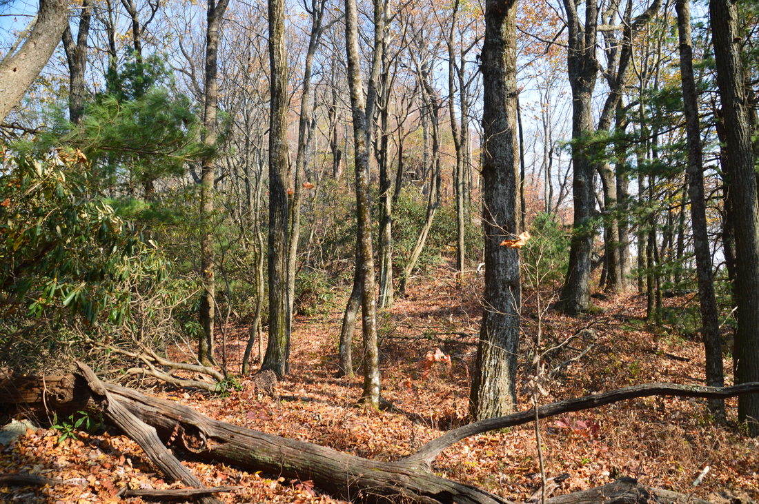
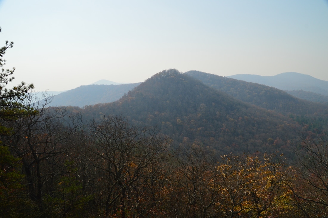
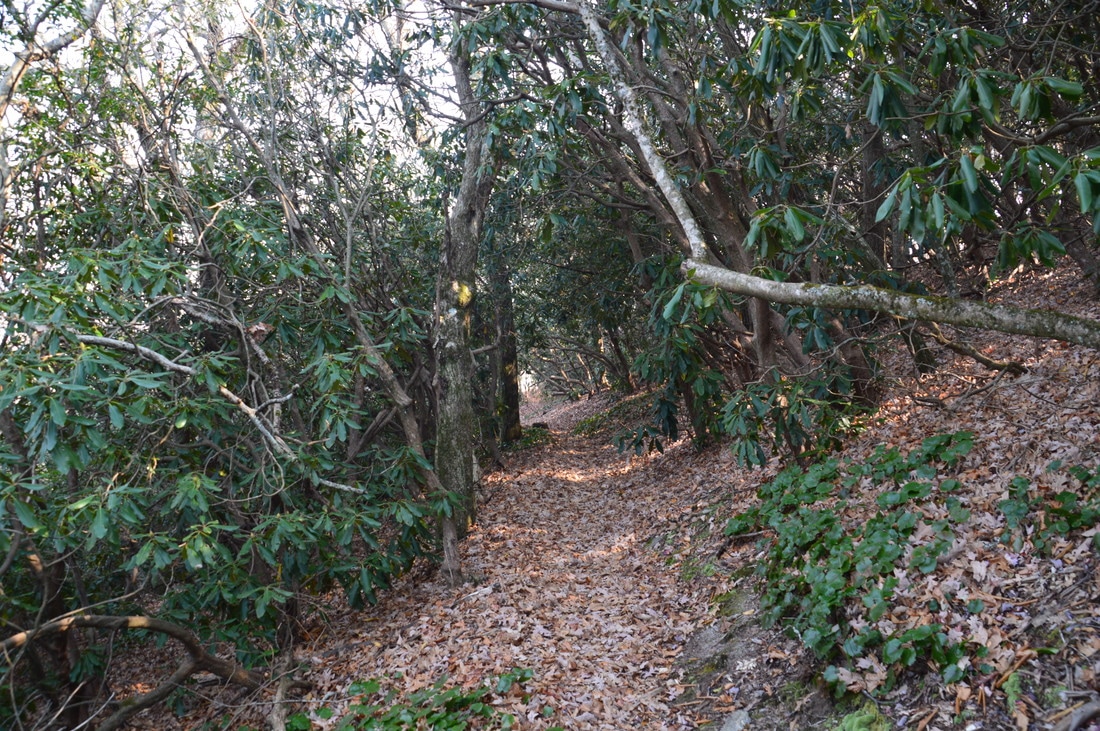
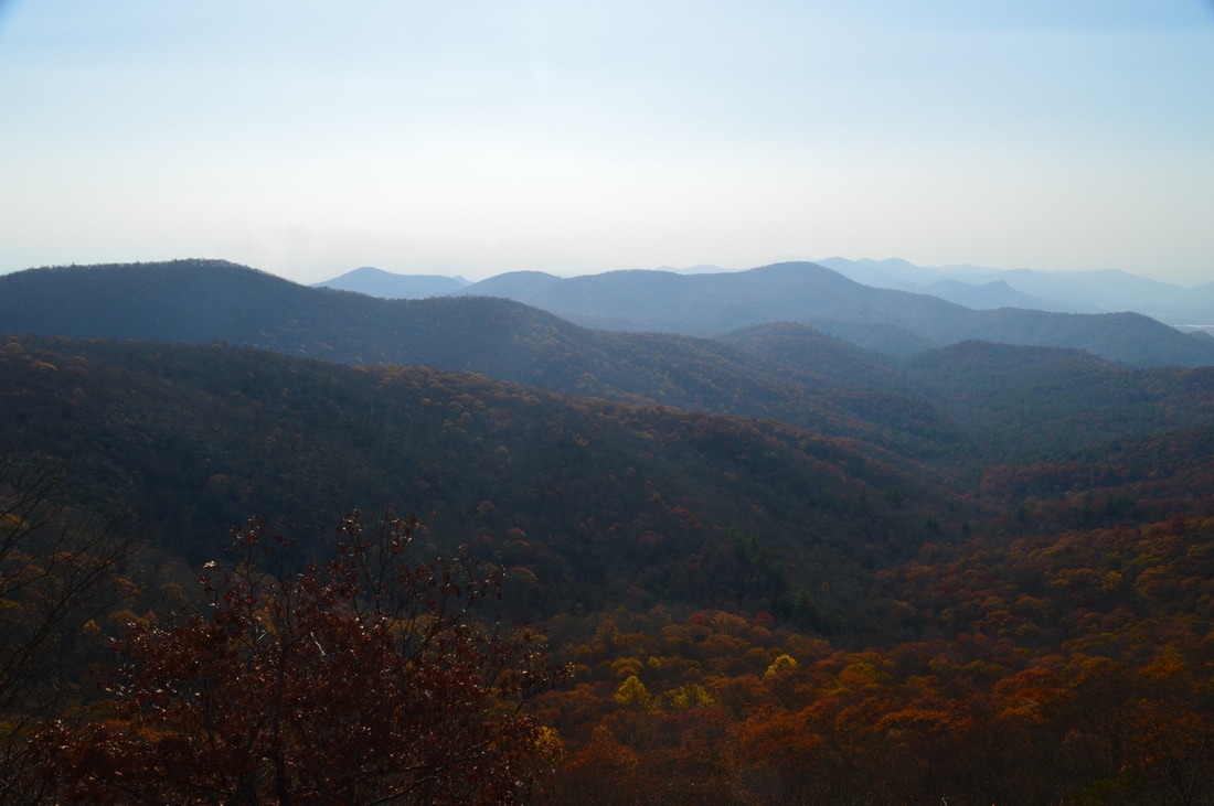
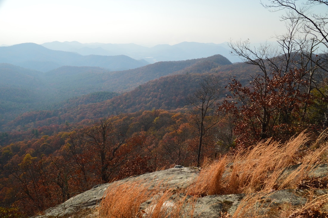
The trail starts out by skirting the west side of an unnamed knob. Soon, good winter views of Flat Top Mountain gradually open up. Now, read closely regarding how to get to the vista on Double Knob. At 0.55 miles, the Bartram Trail passes just north and about 100 vertical feet below a gap between Double Knob and the unnamed knob. At this point, to reach the Double Knob vista, turn right off the trail and work your way south up the slope to the gap on the ridge. There is no obvious path, but the understory is fairly open. Of course, some navigational skills would be good, if you head up to Double Knob. Once you reach the gap on the ridge, turn left (east) and begin climbing up the ridge towards Double Knob. I found more of a path here. After walking through a few briars and up some small rock outcrops, reach a large rock slab with an excellent view to the south and east at 0.7 miles. The view was extremely hazy on this day (more hazy than any of the other views I saw). However, I could tell that it is a magnificent overlook. I could see more cliffs closer to the summit of Double Knob, but I decided that it would not be worth spending more time to see similar hazy views, so I backtracked to the Bartram Trail from this point.
The cliffs of Double Knob, only 15 minutes from the Bartram Trail, provide beautiful views to the south and east.
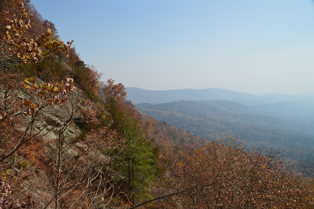
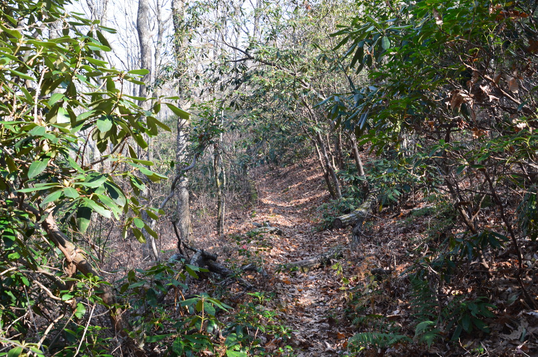
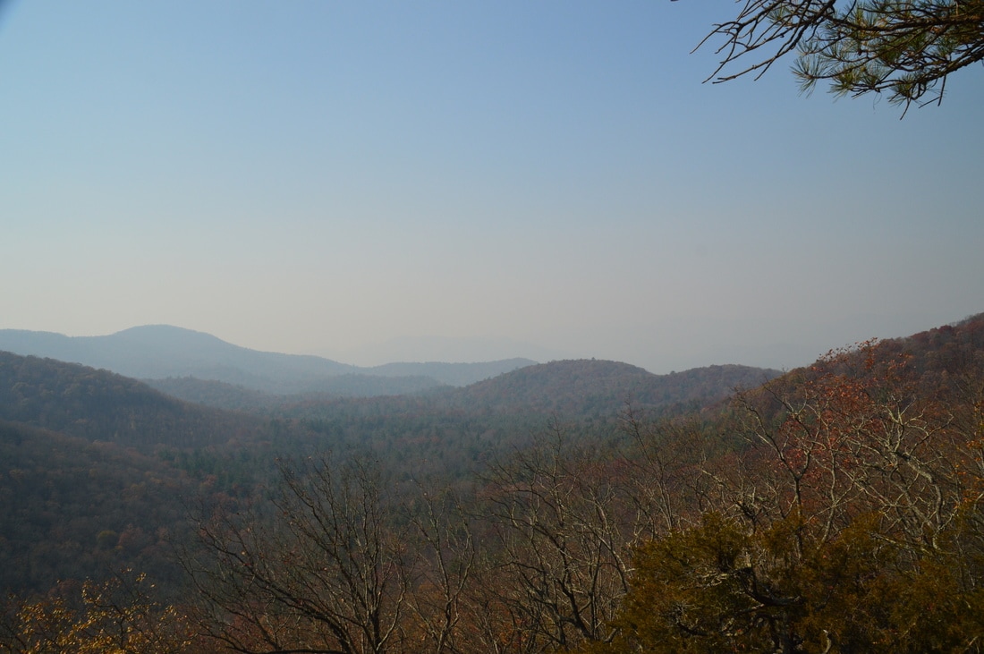
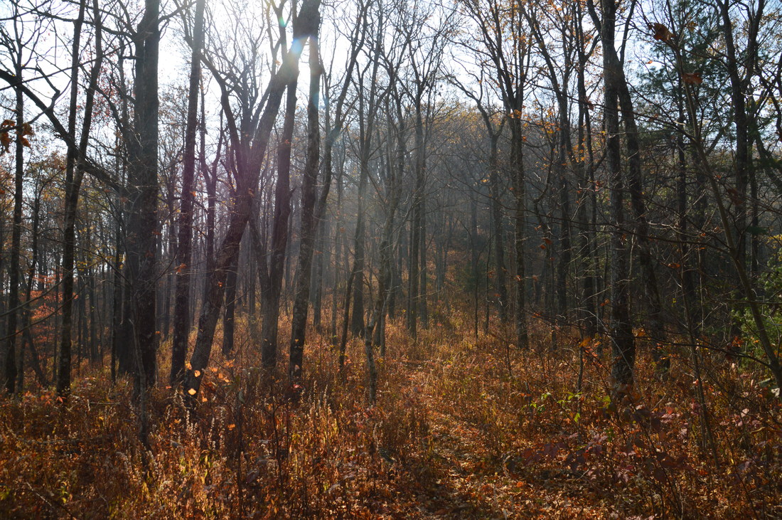
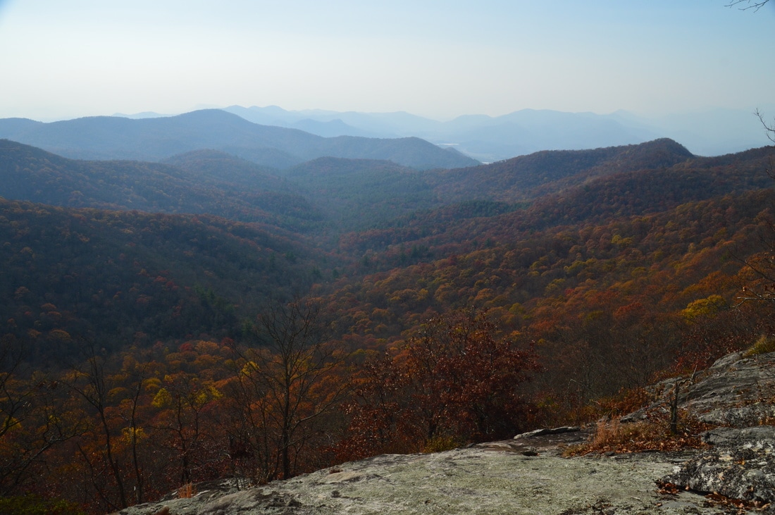
Return to the Bartram Trail, and turn right to continue following it north. The trail remains nearly level as it skirts the north side of Double Knob and then Wilson Knob. At 1.4 miles, reach a gap between Wilson Knob and Flat Top Mountain. This is where the trail begins ascending to Flat Top Mountain. Follow the trail as it makes eight switchbacks. Just after the eight switchback, watch out for the spur trail to the view from a rock slab on Flat Top Mountain, which will be to the left of the main trail at 1.7 miles. At the same time, there will be a boundary sign to the right. Descend along the short path to the great view. The pointed peak of Double Knob occupies the left side of the view. The bowl-shaped Ramey Creek valley is laid out directly below. Sadly, I couldn't see much beyond those features, due to the haze.
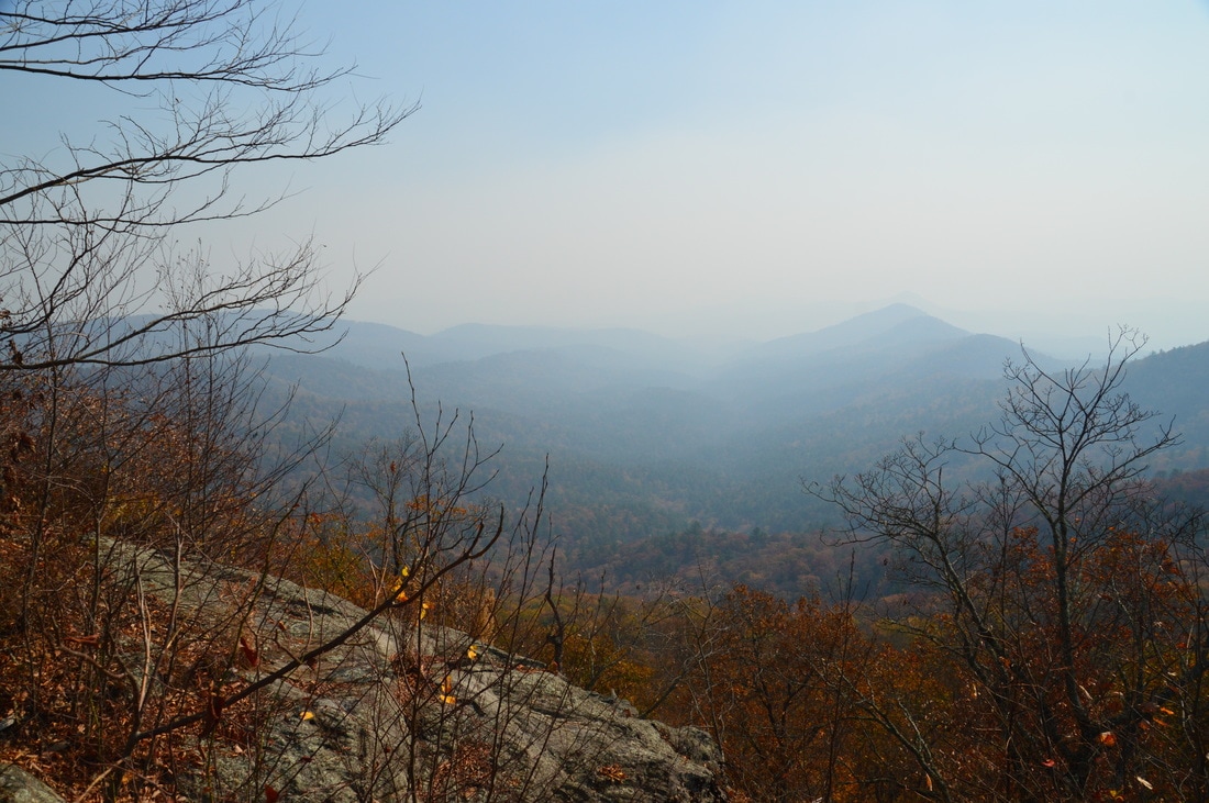
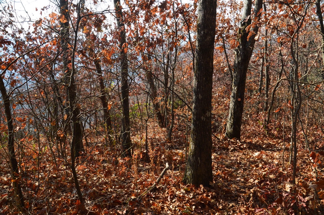
Return to the main trail and at 1.9 miles, pass a campsite at a small creek that provides water for camping. The trail continues to gradually ascend Flat Top Mountain, sometimes via switchbacks, although it never reaches the summit, skirting it to the south and east. Overall, I was very satisfied with the easy to moderate grades of this ascent. At 2.15 miles, Rabun Bald comes into view to the north through the trees. The high point of the ascent occurs at around 2.3 miles, and after this, the trail makes an easy descent via switchbacks and through some rhododendron tunnels to Saltrock Gap, reaching it at 2.8 miles. There is a campsite here. After this, the trail begins ascending Rabun Bald, although the part of the ascent that I did (between Saltrock Gap and Flint Gap) is very easy. At 4.0 miles, reach Flint Gap and an intersection with the Flint Knob Trail. The hike has been a breeze up to this point, in my opinion. This junction is a decision point, however. Looking back, I regret having not hiked up to Rabun Bald before taking the side trail. I had not expected the side trail to be so long and difficult, and I actually got back to this spot after dark, making the extra 0.9 miles to Rabun Bald from Flint Gap not worthwhile. The Flint Knob side trail first leads to two overlooks on Flint Knob East and Flint Knob, before making a long descent to a gap between Alex Mountain and Flint Knob. The mileage sign at Flint Gap indicates a distance to Alex Mountain. However, beyond the gap west of Flint Knob, there is no real trail anymore, and most of my hike up to Alex Mountain was a bushwhack with little reward. Also, both the ascent to Alex Mountain and the ascent back to Flint Knob that follows are simply not worth it. For this reason, I do not suggest continuing beyond Flint Knob, unless you're a peakbagger and trying to complete the GA4000 challenge or something. Also, if you hike to just Flint Knob, you will most likely have time to hike to Rabun Bald as well, where this is a stone observation tower with spectacular 360-degree views. Don't get me wrong though - the spur trail to just Flint Knob is absolutely worth the effort, and in my opinion, both the views from Flint Knob and Flint Knob East are top-notch, with the Flint Knob East vista being perhaps slightly better. 
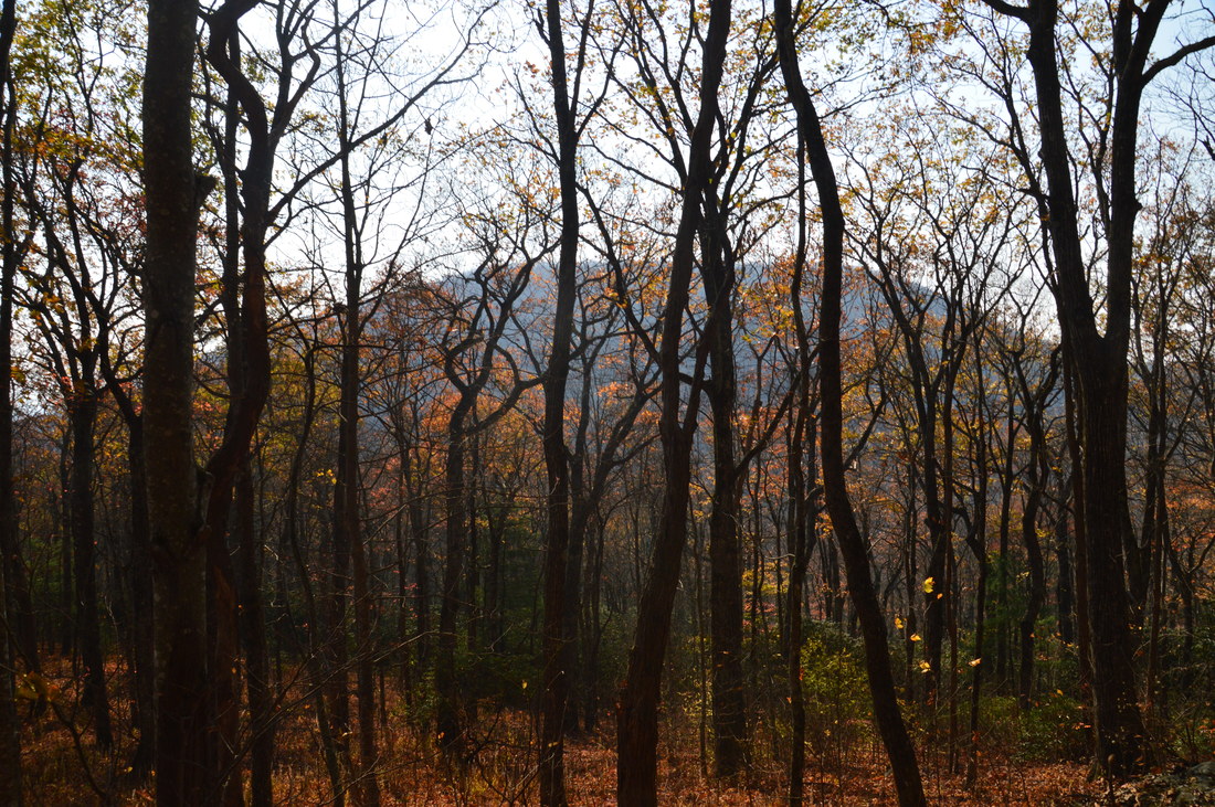
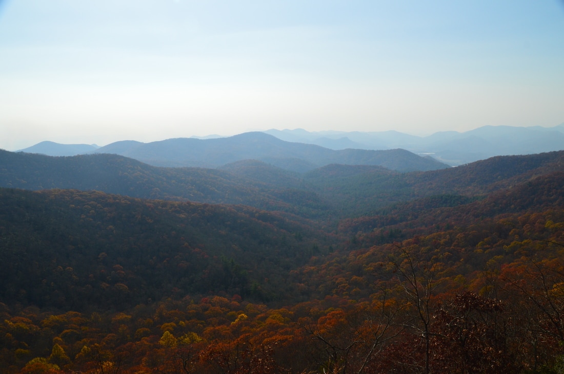
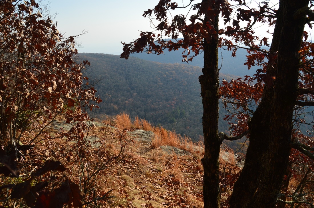
North of Saltrock Gap, you can look back at Flat Top Mountain and see how this mountain got its name.
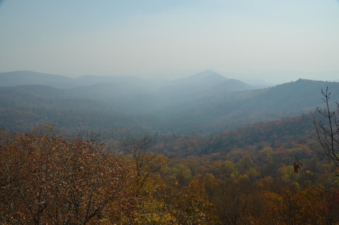
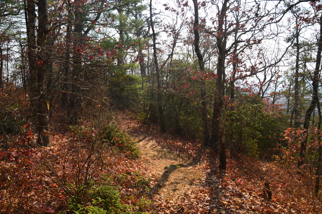
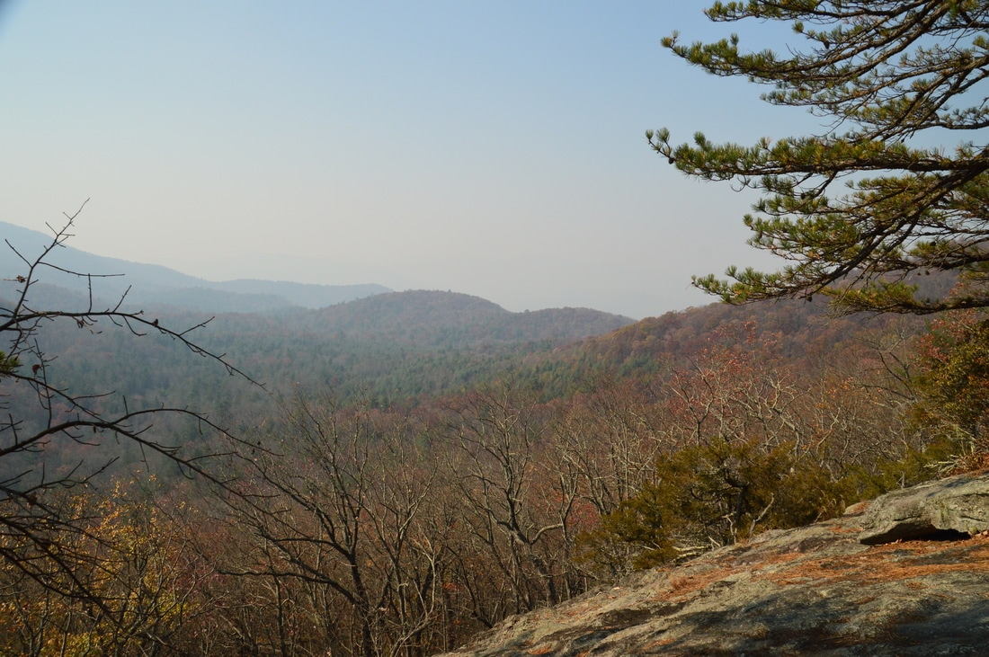
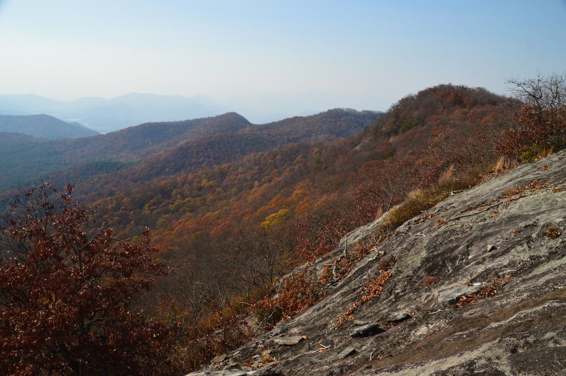
To reach Flint Knob, turn left onto the Flint Knob Trail at Flint Gap. I am not sure who maintains this trail (as it is on no trail maps), but whoever it is does an excellent job. The trail begins with a moderate ascent of a knob that isn't officially named but is commonly referred to as Flint Knob East. Cross the top at 4.15 miles. On the other side, the trail makes a short but rather steep descent of the knob. At 4.4 miles, I noticed an area that looked like a cliff to the left. Then, at around the same spot, I noticed an obvious side trail heading left to the cliff. This trail is not signed or marked, but if you're looking for it, keep in mind that it is about a quarter-mile after the summit of the unnamed knob. The short side trail ends at a wide rock slab with a spectacular view west into the Darnell Creek valley.
I identified Flat Top Mountain to the left and Alex Mountain to the right, with many mountains rising up farther. Despite the haze, I could still see Lake Burton in the distance, sparkling under the afternoon sun. Some fall colors in the valley below added beauty to the view. Wow! I expected a vista or two on the Flint Knob Trail, but I had not imagined anything like this. The side trip must absolutely not be missed. Return to the main trail and make a moderate descent to a gap between Flint Knob East and Flint Knob. Pass through the gap at 4.55 miles and ascend briefly to reach the summit of the true Flint Knob at 4.65 miles. Like the summit of Flint Knob East, the summit of Flint Knob is wooded. However, only about 250 feet past the summit of Flint Knob (at 4.7 miles), a side trail leads left to another rock slab with views. The side trail is marked by a pair of glasses and gloves attached to the remains of a tree, although by the time you do this hike, these objects may no longer be here. Just know that it is just after the summit of Flint Knob. Take the side trail and reach the rock slab. The overlook is very similar to the overlook near Flint Knob East, although it might be slightly worse, because the rock slab is smaller and the view is a little bit tighter. Either way, both vistas are breathtaking and worth the hike. Once again, I suggest turning around here and retracing your steps to the Bartram Trail. After this overlook, the trail makes a long and steep descent to an unnamed gap west of Flint Knob. The official maintained trail ends in the gap at a trailhead (I assume that one can drive up to this point from Sky Valley, but I have not done so myself). From there, there is no real trail to Alex Mountain, and the bushwhack involves a substantial ascent as well as some maneuvering around private property. Plus, on your way back, you'll have to make a steep ascent back up to Flint Knob. Still interested in bagging Alex Mountain? Read on to see what the hike is like beyond Flint Knob. 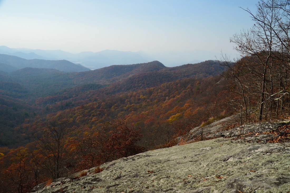
The vast rock faces near Flint Knob East provide spectacular views.
After the Flint Knob Overlook, the trail descends over 500 feet in just 0.6 miles. The descent is steep, and even though there are some switchbacks, they do not aid much. Throughout the descent, there are great winter views of Alex Mountain looming ahead. At 5.3 miles, the orange-blazed trail ends at a trailhead in a gap between Alex Mountain and Flint Knob. The trailhead is at a cul-de-sac at the end of an unpaved road. It seems like it is possible to drive up to this trailhead using a maze of roads in Sky Valley. I was quite puzzled here, because I did not expect the trail to end in this gap. After a lot of "beating around", I found a "path" that followed the ridge northwest towards Alex Mountain. There were occasional old red blazes and very occasional white diamonds that marked this abandoned trail, but I would not call it a trail at all, as most of it is overgrown, often heavily. Additionally, private property occupies portions of the route of the old trail, requiring bypasses with bushwhacking. I found it much simpler to bushwhack in a relatively straight northwest line (as the understory as relatively open for the most part) than wander around looking for the nearly non-existent path. Imagine my surprise, when I found a path mrked by white diamonds on the ridge just south of Alex Mountain's twin summit. However, the path abruptly ends at the south end of the flat ridge, so I was at the beginning of the path. I did not find any signs of a path continuing back in the direction that I came from.
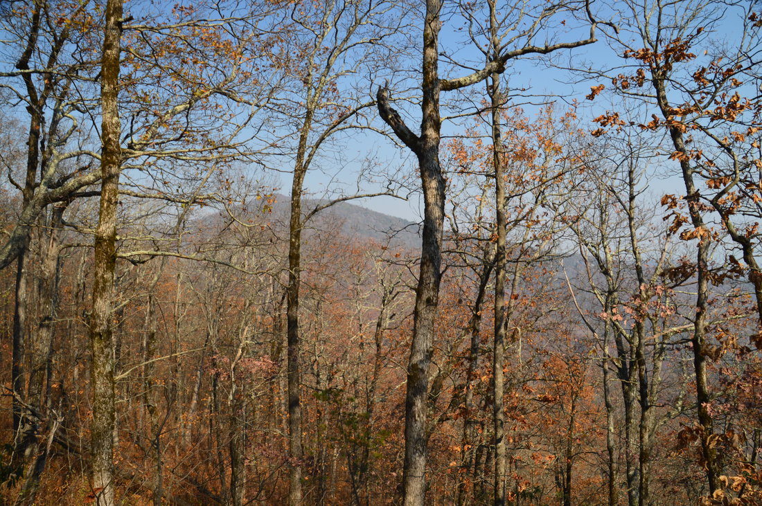
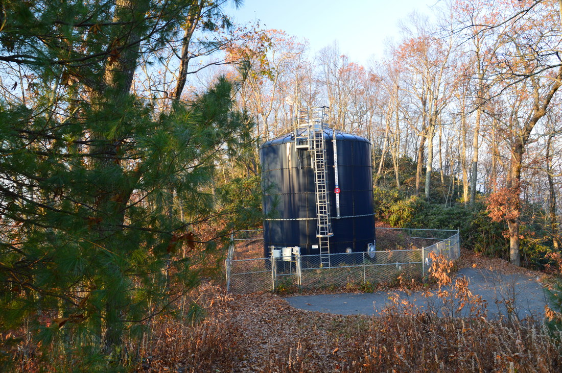
Follow this path to reach a water tower, an old picnic shelter, and the end of a paved road at 5.85 miles. Walk around the water tower and pick up a well-defined path that leads to the south summit of Alex Mountain. The summit is rocky but wooded with no views to speak of. The trail then drops into a saddle before reaching the north summit at 5.95 miles. There is a communications tower on the north summit, as well as the end of a service road that comes in from the north. So what is the reward for all that trouble? The reward is a meager view to the east, with Flint Knob and Rabun Bald taking up most of the picture. In my opinion, the view is not worth the bushwhack and difficulty. There is a summit rock outcrop that faces westward, and there may have been a good view to the west here a long time ago, but it is heavily grown up now. The east view probably did not exist until the summit area was cleared for the communications tower. 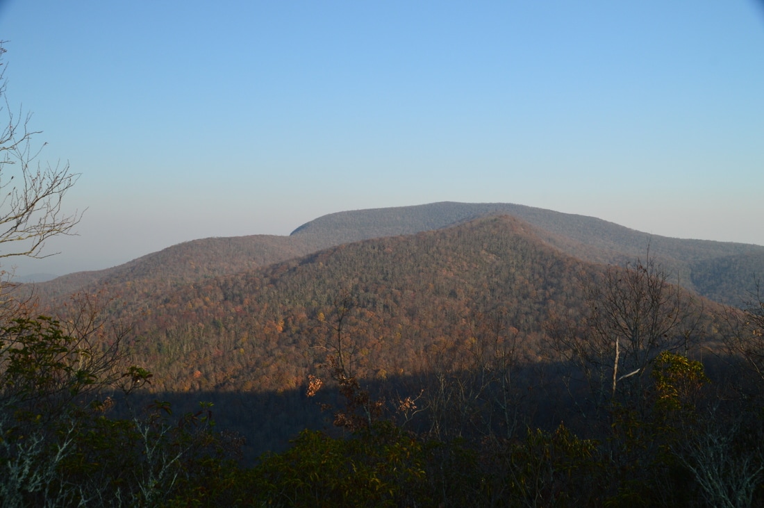
The view to the east from the north summit of Alex Mountain highlights Flint Knob and Rabun Bald.
From Alex Mountain, retrace your steps back to the car. Without the side trips, the hike will be shorter by a half-mile. And remember - the 1.8-mile side trip to Rabun Bald is absolutely worth it, if you have the time and energy. Darkness was the only reason for me not doing it. Return to the trailhead at 11.4 miles, without the Rabun Bald side trip and including the hike to Alex Mountain. See variations below for mileages for other hike options. Due to the beauty of the many vistas on this hike, I rate it a "Best Hike"!
Mileage
0.0 - Wilson Gap Road Trailhead
0.7 - Double Knob Vista 1.7 - Flat Top Mountain Vista 2.8 - Saltrock Gap 4.0 - Flint Gap 4.4 - Flint Knob East Vista 4.7 - Flint Knob Vista 5.3 - Flint Knob Trailhead 5.95 - Alex Mountain 11.4 - Wilson Gap Road Trailhead Variations
Do not hike to Alex Mountain - Removes 2.5 Miles from all variations
Make the side trip to Rabun Bald - Adds 1.8 Miles to all variations Bonus Stops
A lengthy drive along nearby forest service roads will bring you to the trailhead for a short hike to Holcomb Creek Falls, which is one of the more impressive waterfalls in the region.
PicturesVideos
2 Comments
Liz Dyer
1/19/2017 02:04:30 pm
Is there a book on the Bartram Trail? I recently moved to SW North Carolina, just 3 miles from the Georgia line and would like more info on this trail.
Mark Oleg
1/19/2017 02:33:31 pm
Hi Liz, Leave a Reply. |
About MeMark Oleg Ozboyd Dear readers: I have invested a tremendous amount of time and effort in this website and the Georgia Waterfalls Database the past five years. All of the work that has gone in keeping these websites updated with my latest trip reports has almost been like a full-time job. This has not allowed me to pick up a paid job to save up money for college, and therefore, I I've had to take out loans. If you find the information on this website interesting, helpful, or time-saving, you can say "thanks" and help me out by clicking the button above and making a contribution. I will be very grateful for any amount of support you give, as all of it will apply toward my college tuition. Thank you!

Coming in 2022-2023?
Other Hiking WebsitesMiles HikedYear 1: 540.0 Miles
Year 2: 552.3 Miles Year 3: 518.4 Miles Year 4: 482.4 Miles Year 5: 259.9 Miles Archives
March 2021
Categories
All
|


 RSS Feed