Chattooga River Trail: Sandy Ford Road to Dicks Creek Falls to Russell Bridge, Clayton, Georgia1/12/2017 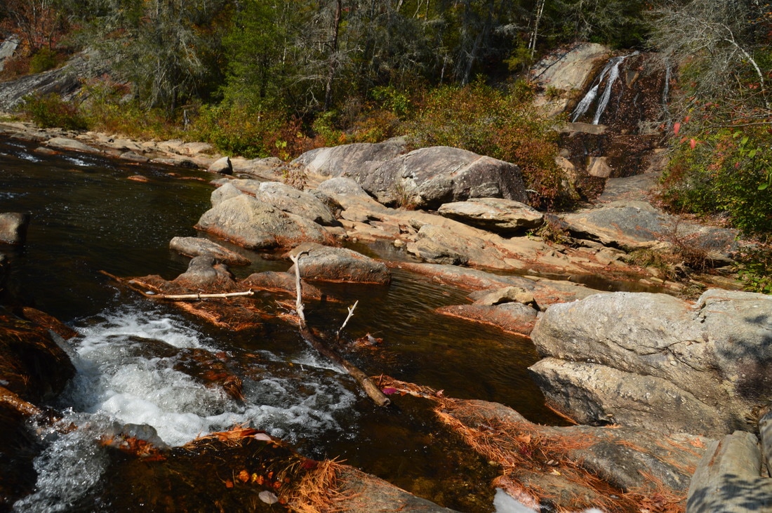
The Chattooga Wild and Scenic River is one of the longest and largest remaining wild waterways in the southeastern US, with no dams and very little human development for all of its length down to Lake Tugaloo. In fact, it is the only wild and scenic river east of the Mississippi River that is actually commercially rafted. For nearly twenty miles, the Chattooga River Trail stays near the river or even follows it along its Georgia side. Unfortunately, the Georgia Chattooga River Trail leaves something to be desired, as there are surprisingly few views of the river throughout the length of the trail. Still, the Chattooga River Trail passes by several points of interest, including Dicks Creek Falls on Section Two. This hike occurred on Saturday, November 5th, 2016. My plan was to hike the Chattooga River Trail from the Sandy Ford Road/Dicks Creek Falls trailhead to the Russell Bridge Trailhead. This is also known as Section Two of the Chattooga River Trail. Along the way, I would take side trips to Dicks Creek Falls and Adline Ford. I arranged to have two cars for this point-to-point hike: one car was placed at the Sandy Ford Road trailhead, and another car was placed at Russell Bridge on Highway 28.
Summary
R/T Length of Trail: 10.1 Miles
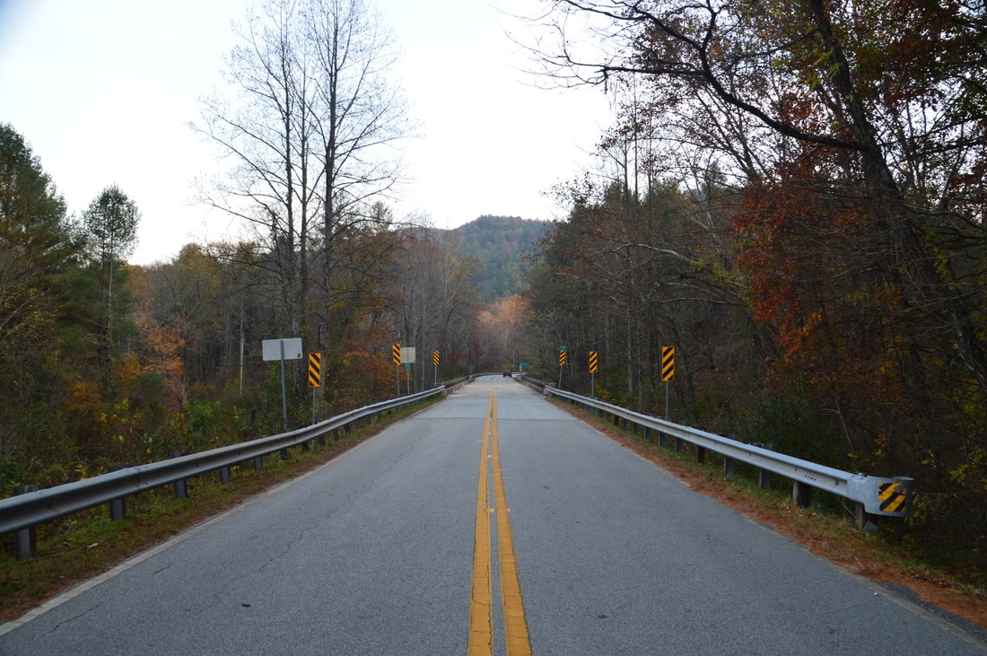
Duration of Hike: 6:00 Type of Hike: Point-to-Point (two cars required) Difficulty Rating: 4 out of 10 Total Elevation Gain: 1525 Feet Pros: None Cons: Surprisingly few river views Points of Interest: Dicks Creek Falls - 8 stars; Adeline Ford; Old homestead and farm site with old chimney and other remains Trail Blaze Colors: Bartram Trail/Chattooga River Trail - Yellow and Lime Green Best Seasons to Hike: Spring, Fall Fees: None Beginning Point: Dicks Creek Falls Trailhead on Sandy Ford Road Directions from Clayton, GA to Russell Bridge Trailhead: From the intersection of Rickman Drive, Savannah Street, and US Route 23/441 in Clayton, follow Rickman Drive East. In 0.5 miles, bear diagonally right onto Warwoman Road. Follow Warwoman Road for 13.4 miles until the road dead-ends at GA Route 28. Bear right onto GA Route 28 South and follow it for another 2.2 miles until you reach Russell Bridge. There is a small parking area to the left just before the bridge, as well as a larger parking area on the other (SC) side of the bridge. Place one car here, as this will be the endpoint of the hike, and drive the second car to the Sandy Ford Road Trailhead. Directions from Russell Bridge Trailhead to Sandy Ford Road Trailhead: Backtrack along GA Route 28 North for 2.2 miles, and then, bear left onto Warwoman Road. Follow Warwoman Road for 8.2 miles. Then, take an acute left turn onto Tom Bleckley Lane, and immediately afterwards, turn right onto John Houck Road. Continue for 0.7 miles, and then, turn left onto Sandy Ford Road. This is a dirt and gravel road, but it is in great shape and should be passable by most passenger vehicles. Continue on Sandy Ford Road for about 3.7 miles. Near the end of the drive along it, there is a shallow car ford of Dicks Creek. About a tenth of a mile after the ford, at the top of a hill, you will reach a small parking area next to the road, with space for several cars on both sides of the road. This is the Dicks Creek Falls trailhead, with the Bartram Trail and Chattooga River Trail just down the road, and this is where you should place the second car and begin the hike. Map
Click here for more information and to download this trail map to view in Garmin Basecamp.
Details
During the preceding summer, I had hiked section one of the Chattooga River Trail, with a car placed at each end. I was not impressed, mainly due to the lack of river views - in addition to temperatures approaching or topping 90 degrees - and I made plans to hike section two during cooler weather. On this day, I decided to give the second section a try, hiking it in a similar fashion. To be honest, it is not much better than the first section, if at all. However, section two does include a large waterfall, as well as historic features, so at the end of the day, it may be a just slightly more attractive hike.
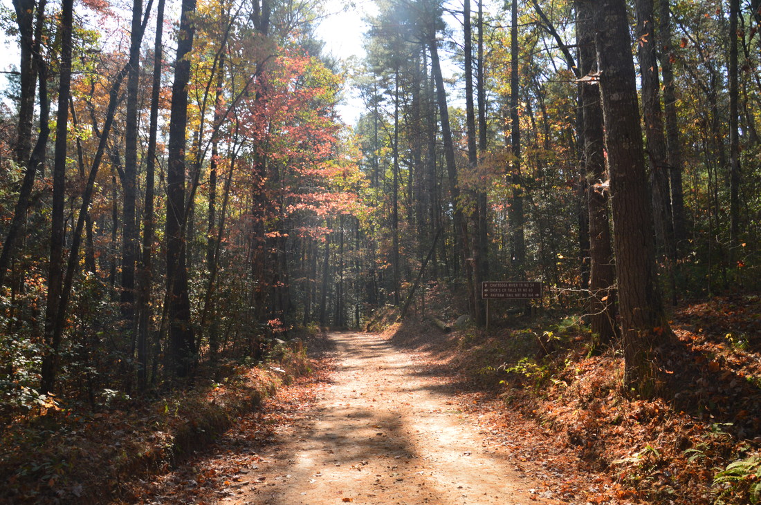
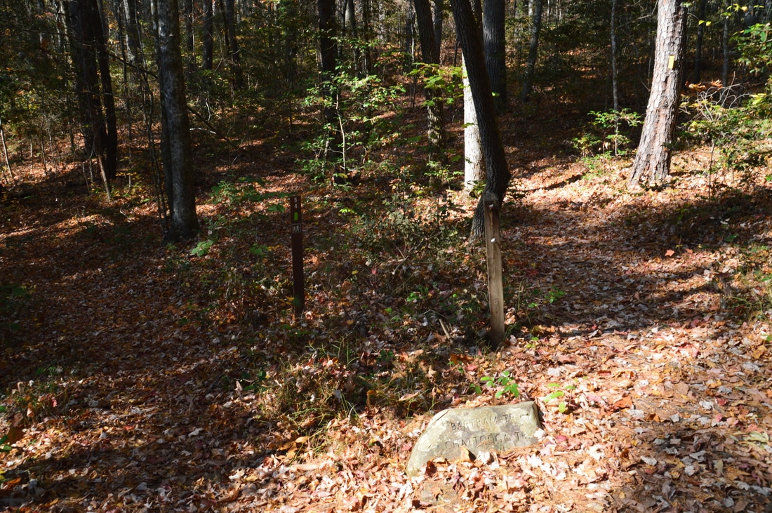
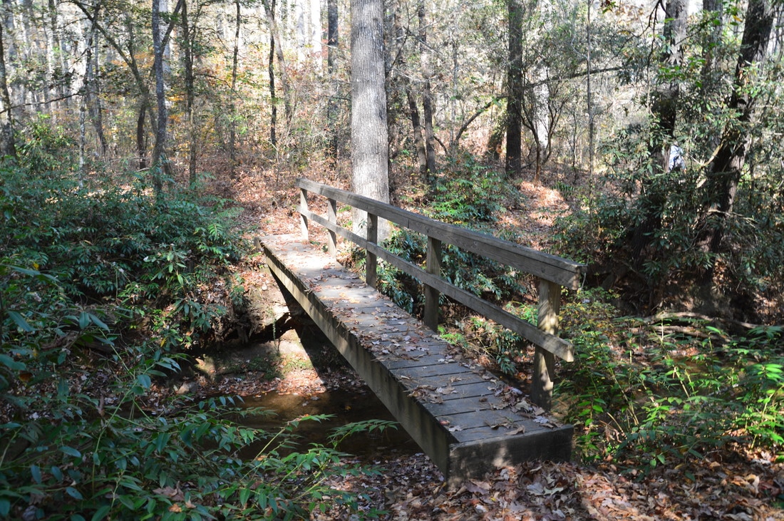
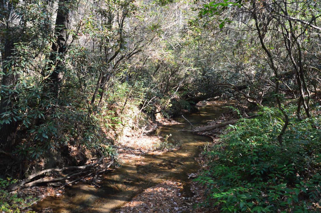
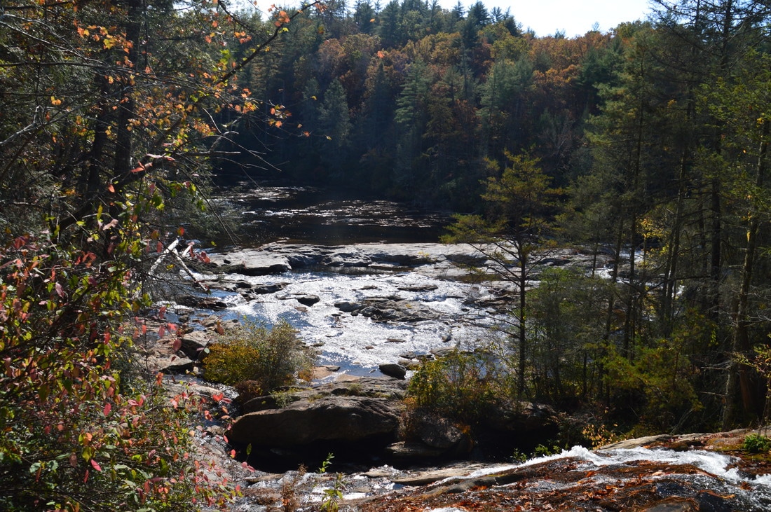
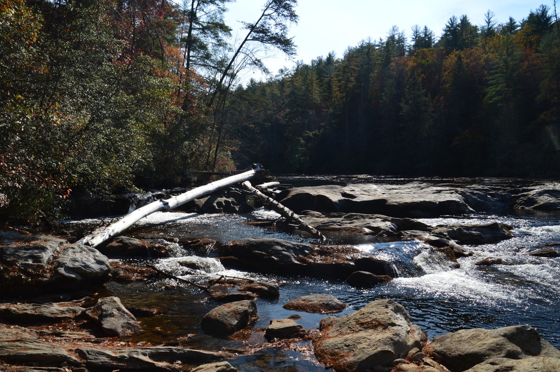
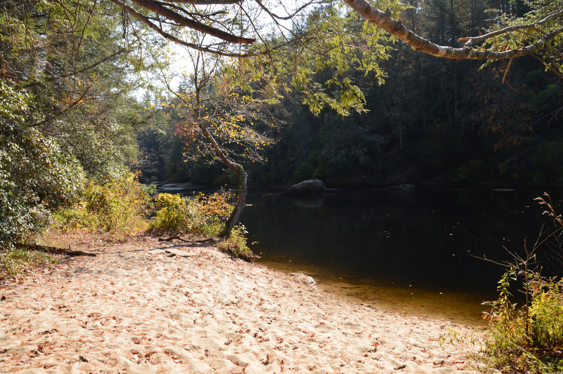
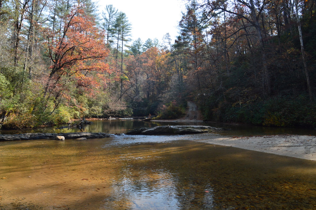
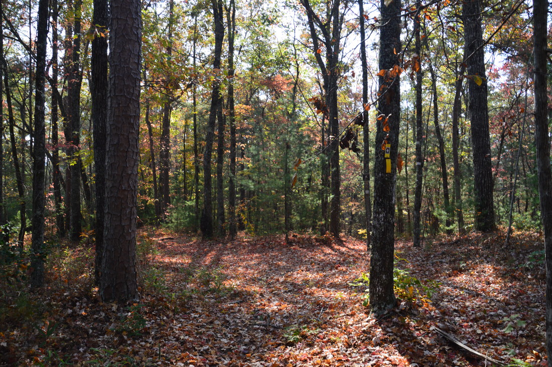
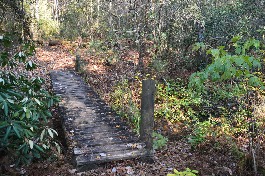
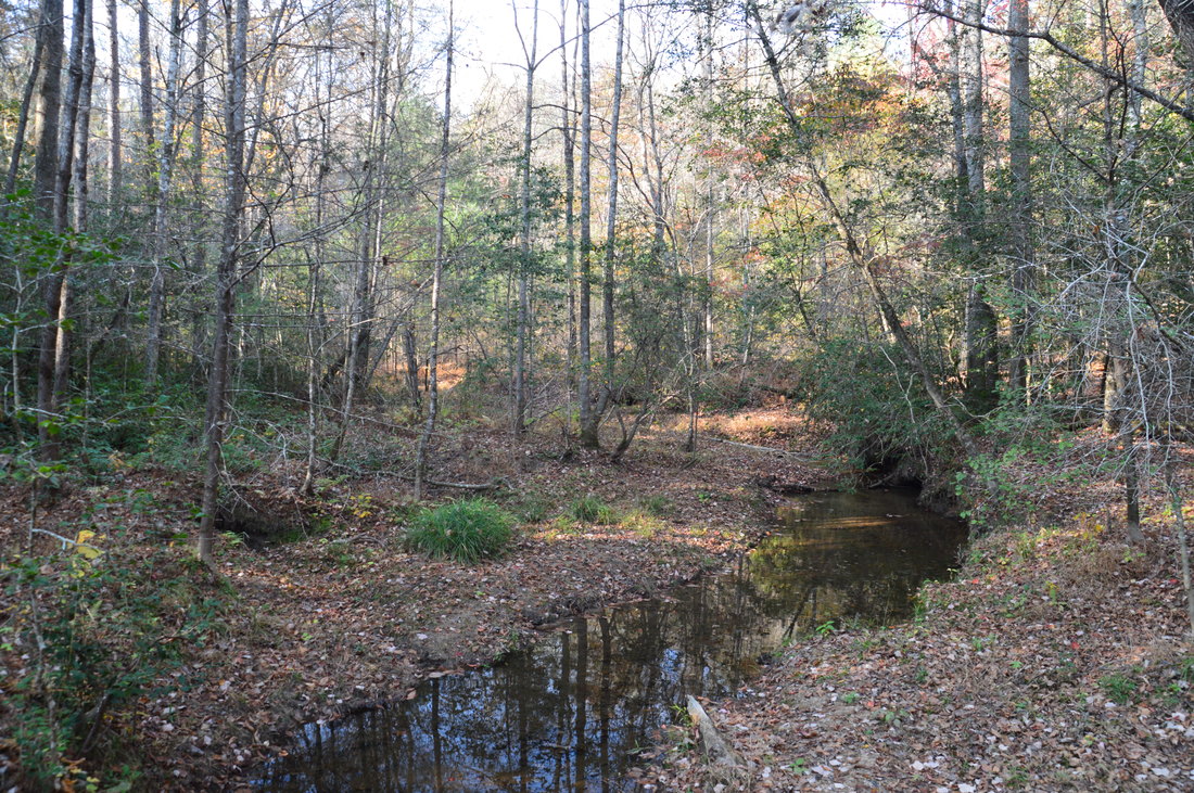
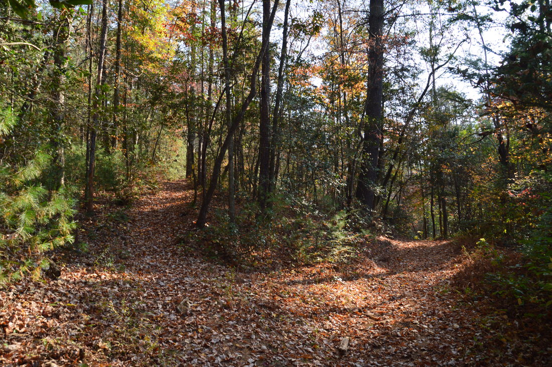
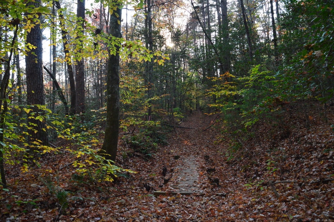
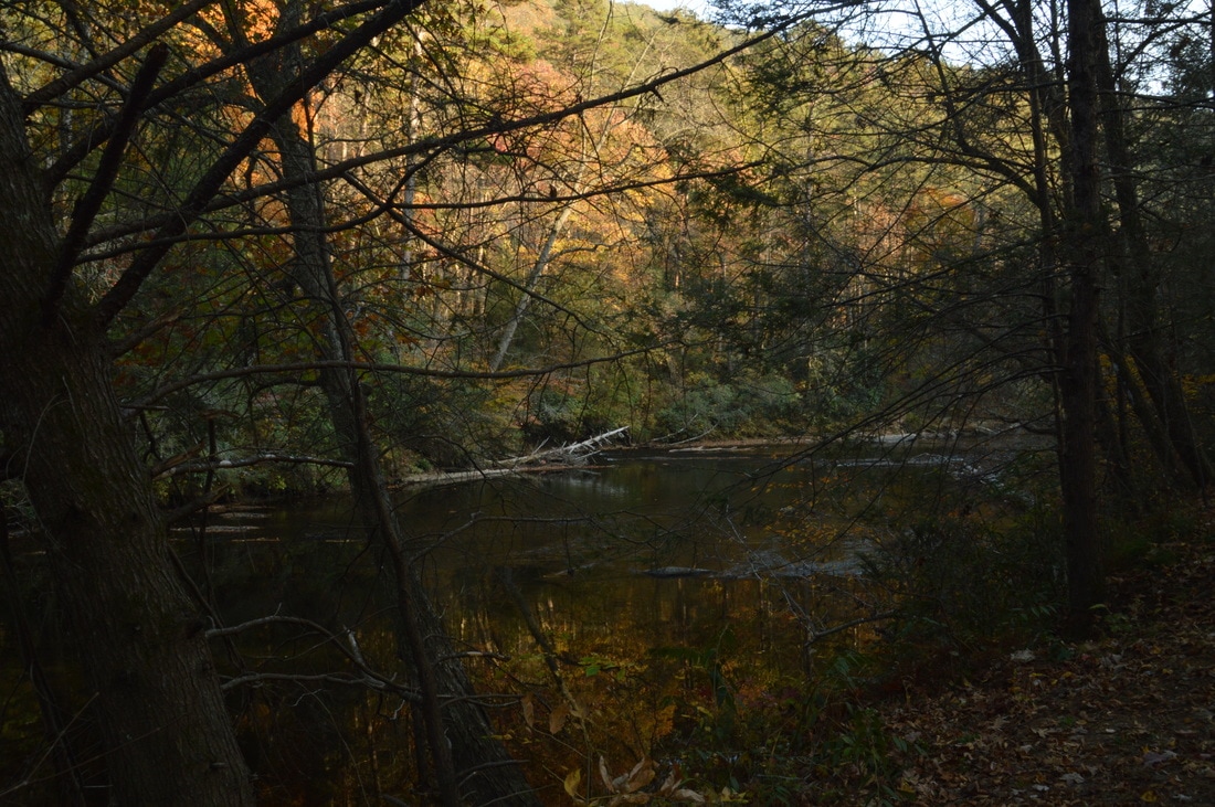
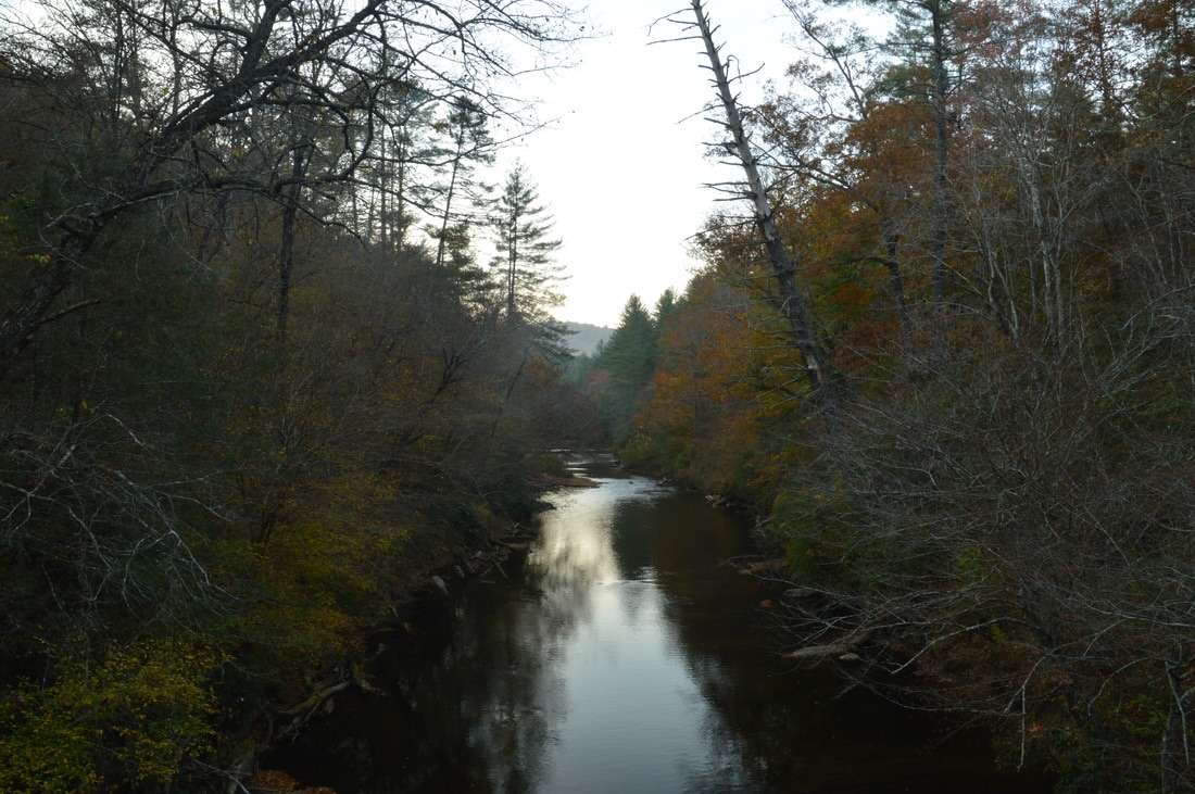
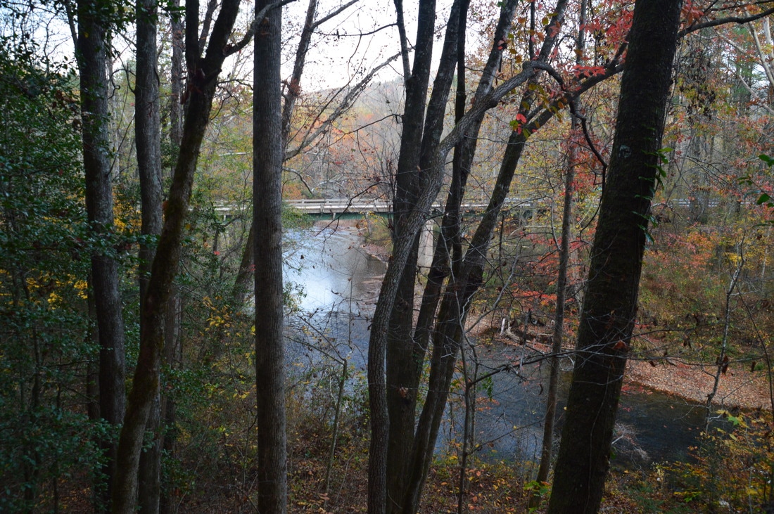
Having left one car at Russell Bridge, begin the hike at the Sandy Ford Road parking area, where you have left your second car. To reach the trail, walk down the road (south) from the parking area for around 200 feet to a large road sign that marks the point where the Bartram Trail crosses the road. Turn left here onto the trail. This is not yet the Chattooga River Trail, but after following the trail for a bit, reach the junction with the Chattooga River Trail at 0.1 miles. If you turn acutely right onto the Chattooga River Trail, you will be on section one of the trail. However, to hike section two, continue straight on the Chattooga River Trail, which runs in conjunction with the Bartram Trail to Russell Bridge. Descend gradually into the Dicks Creek valley and soon reach the placid waters of the creek, crossing it via a footbridge at 0.4 miles. Nothing here indicates that a 60-foot waterfall lies downstream. Just beyond the footbridge, enter a clearing with a four-way intersection. To the left, a slightly overgrown old logging road leads back to Sandy Ford Road and an alternate trailhead for Dicks Creek Falls. To the right is the spur trail to Dicks Creek Falls, marked by a carsonite trail marker with #60 inscribed on it. The trail crosses a branch of Dicks Creek via a small footbridge and reaches the top of Dicks Creek Falls at 0.5 miles. From the top of the waterfall, there is a very good view of the Chattooga River, but please do not get close to the edge, as this is a tall waterfall. Continuing on the trail to the falls, a steep scramble path leaves right to the base of the falls slightly farther. Turn onto this scramble path, as the trail that continues straight dead-ends at a beach area with a nice campsite at the river. The scramble path to the base of the falls has a rope to aid with the descent, although I personally would trust the surrounding trees more than the rope. At 0.55, reach the Chattooga River and the base of Dicks Creek Falls. This is a gorgeous spot and is easily the highlight of the hike, despite being only about a half-mile into the hike. Dicks Creek Falls is a beautiful sliding waterfall, and even though there was an exceptional drought on this day, I found the waterfall to be very photogenic. At the same time, the wide Chattooga River runs over a river-wide rock ledge, forming the Class IV rapid that is known as Dick's Creek Ledge. The river then makes a bend and continues down the gorge and out of sight. The falls alone is a worthy destination, but with the river and its rapids here as well, this is certainly one fine destination. 
Dicks Creek Falls is a 60-foot sliding waterfall that is positioned very close to the Chattooga River on a tributary of the river.
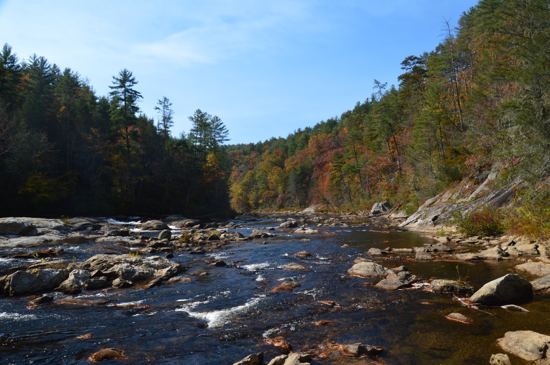
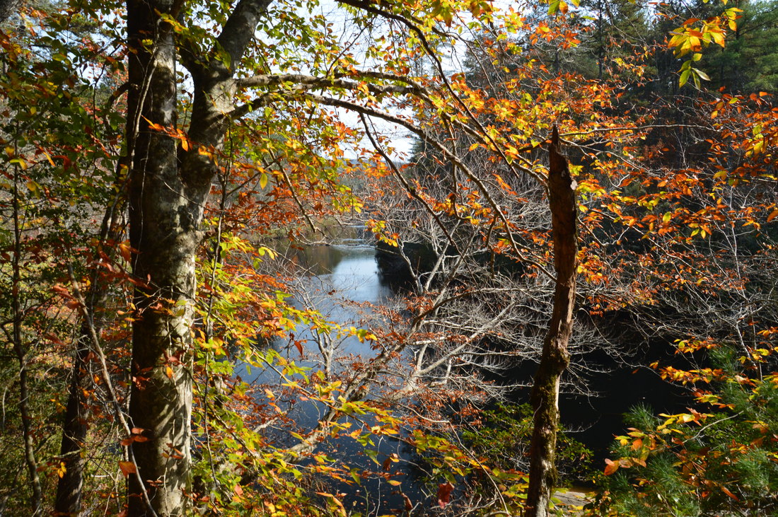
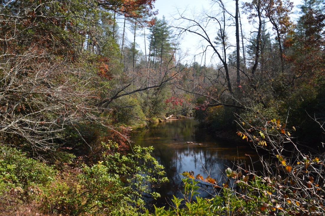
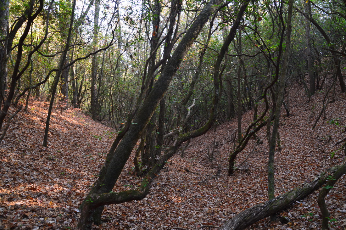
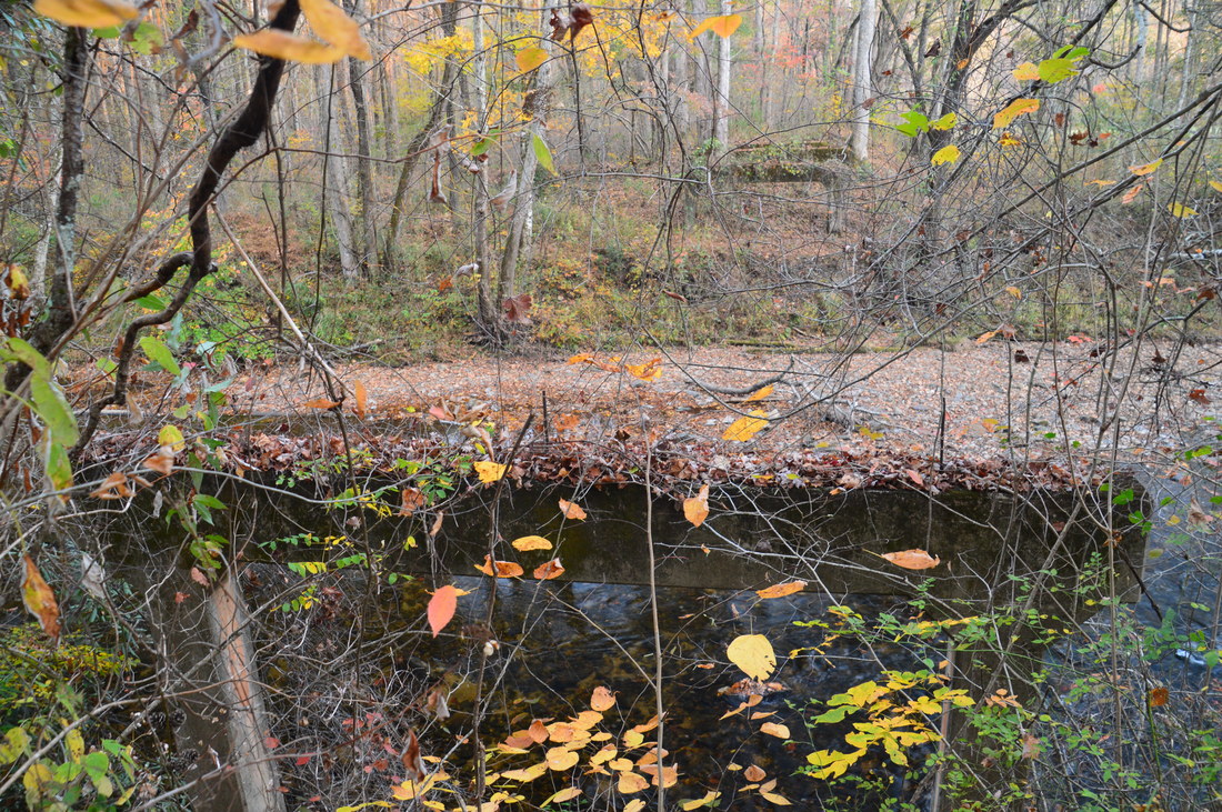
From Dicks Creek Falls, retrace your steps to the Chattooga River Trail and turn right onto it. The trail briefly follows a tributary of Dicks Creek, before crossing it and ascending a lead away from the Chattooga River. Pass through a gap at 1.15 miles and begin descending back to the Chattooga. I found this to be a pattern throughout the hike; more often than not, the trail wandered amidst hills and leads away from the river. Rejoin the river at 1.4 miles. The next half-mile of trail provides the best river views on the hike, in my opinion. Despite the pitiful fall colors this autumn, I still found several spots of beautiful fall color along the river banks. All too soon, the trail leaves the river at 1.9 miles and crosses another lead that juts into the area between the Chattooga River and Warwoman Creek (a major tributary of the river). The trail reaches the top at 2.25 miles. Like the first ascent and all other ascents on this hike, this ascent has easy to moderate grades on it. The trail then descends into the Warwoman Creek valley, reaching this large stream at 2.8 miles. While it is not as large as the Chattooga River, Warwoman Creek is still a large waterway, and when I first reached it, I was slightly confused whether this is the Chattooga River or not! The Chattooga River Trail briefly follows placid Warwoman Creek, passing through a large camping area just before crossing Earls Ford Road at 3.2 miles. To the right of the road crossing, the road makes an interesting wide ford across Wawroman Creek, which requires some tricky maneuvering. This is known as Warwoman Ford. During my break here, I watched a high clearance truck pass across the ford without any trouble whatsoever.
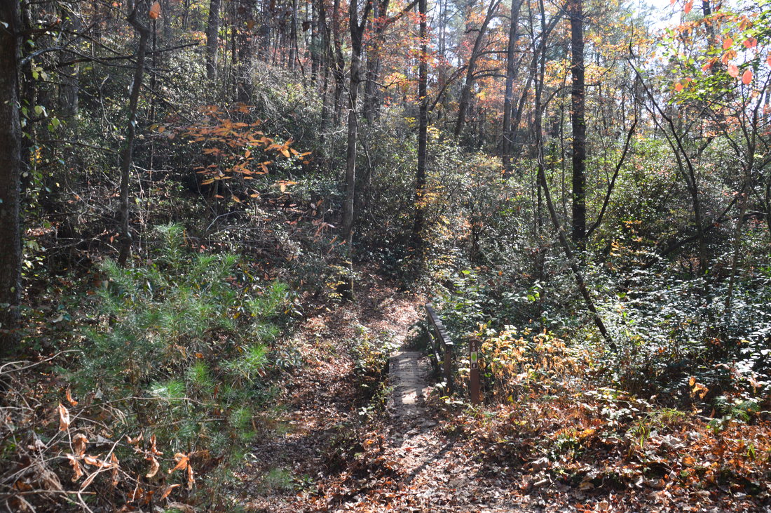
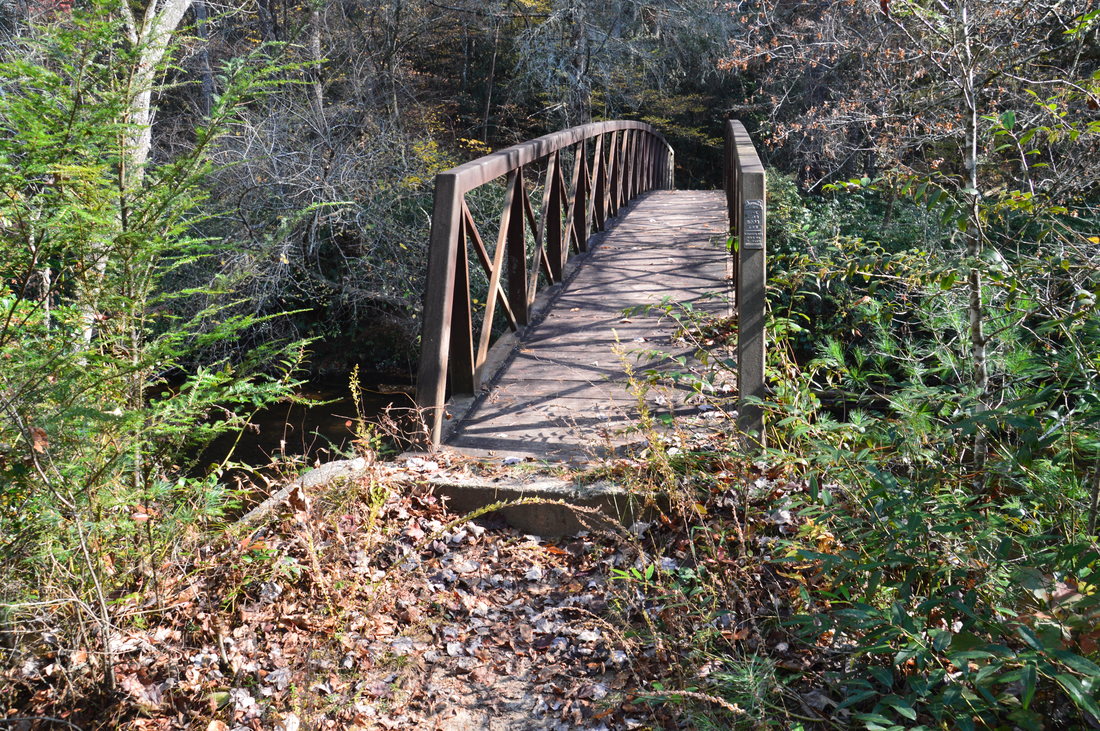
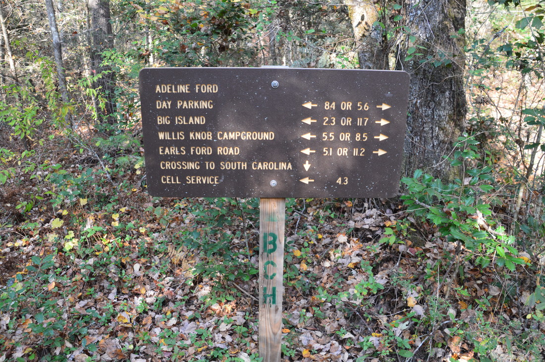
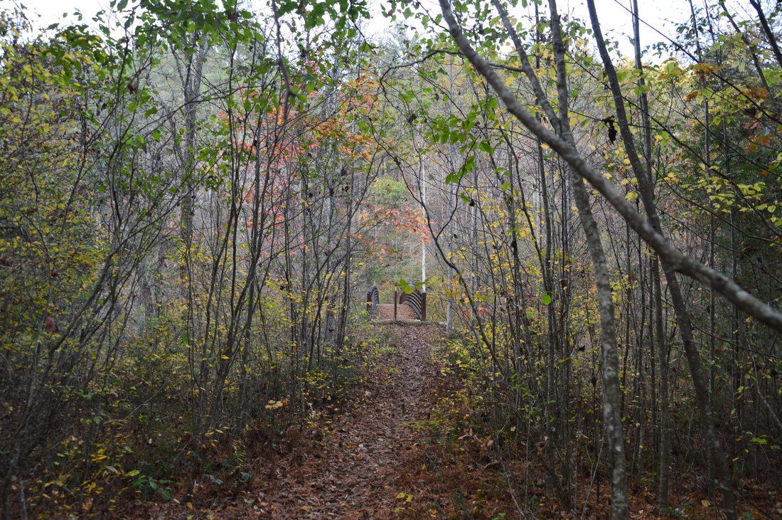
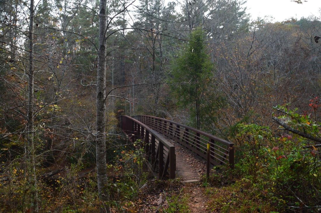
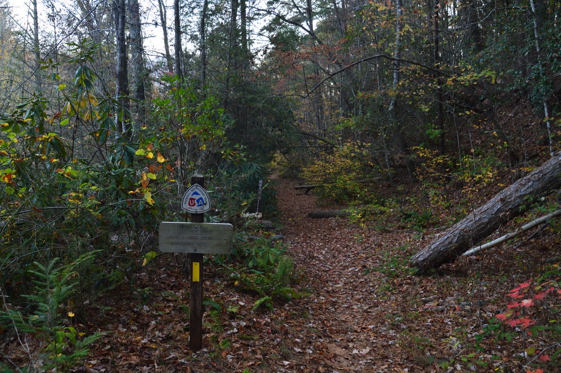
Back on the trail, soon reach an impressive wooden-and-metal footbridge that spans Warwoman Creek. On the other (east) side of the creek, turn left and follow the trail along an old roadbed that soon leaves the creek and begins ascending to a lead from Willis Knob. This the biggest ascent on the hike, but it still involves under 400 feet of elevation gain. At 3.8 miles, the Chattooga River Trail crosses the Willis Knob Horse Trail. I have not yet hiked the horse trail, but from what I've seen on maps, it appears that the horse trail may be more scenic as it spends more time along the Chattooga River on its south side. As the trail approaches the top of the lead, there are some winter views to the west. Cross the top at 4.2 miles. A forest road leaves to the right; continue on the trail. After winding in and out of hollows, sometimes as close as a tenth of a mile to the Chattooga River, and after a couple more short stretches of uphill, cross Laurel Branch at 5.6 miles. The trail ascends to and crosses another Willis Knob lead after Laurel Branch. Then, descend to and cross Bynum Branch - another small tributary of the Chattooga - at 6.45 miles. After Bynum Branch, the trail makes one final uphill run to the top of a hill between Bynum Branch and Adline Branch. The trail crosses Adline Branch at 7.1 miles. Laurel Branch, Bynum Branch, and Adline Branch are all crossed by wooden footbridges. Just past the Adline Branch crossing, at 7.15 miles, the trail again meets the Willis Knob Horse Trail, which bears right towards Adline Ford while the Chattooga River Trail bears left. I recommend taking the side trip to Adline Ford, as it is a scenic spot on the Chattooga River. To reach the ford, bear right on the horse trail. Just before the ford, reach a signed intersection. Here, one part of the Willis Knob Horse Trail turns right, while another part continues straight and fords the river, continuing into South Carolina. The Willis Knob Horse Trail System is quite confusing! Continue straight past a horse hitching post, and reach Adline Ford at 7.35 miles. 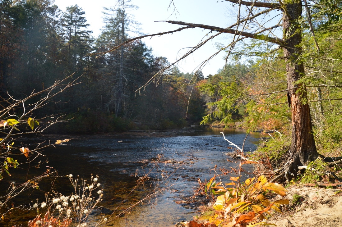
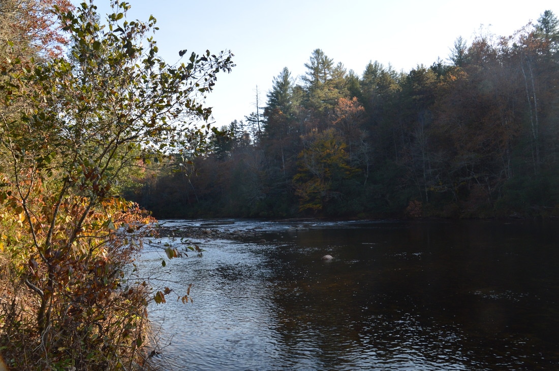
Adline Ford is a scenic location on the Chattooga River, not far from the Chattooga River Trail.
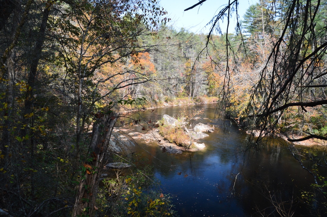
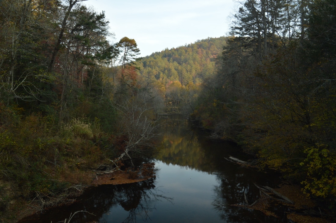
There are great views of the Chattooga River in both directions from Adline Ford, and in my opinion, this is the best view of the Chattooga River on the hike - other than at Dicks Creek Falls. The horse trail makes a wide ford of the river here. In the exceptional drought conditions on this day, it seemed like the ford was around knee-deep at the deepest point, but it might be significantly deeper during normal water levels. I have yet to find out if there are any points of interest on any of the horse trails, but I imagine that they are more scenic with more views of the Chattooga River.
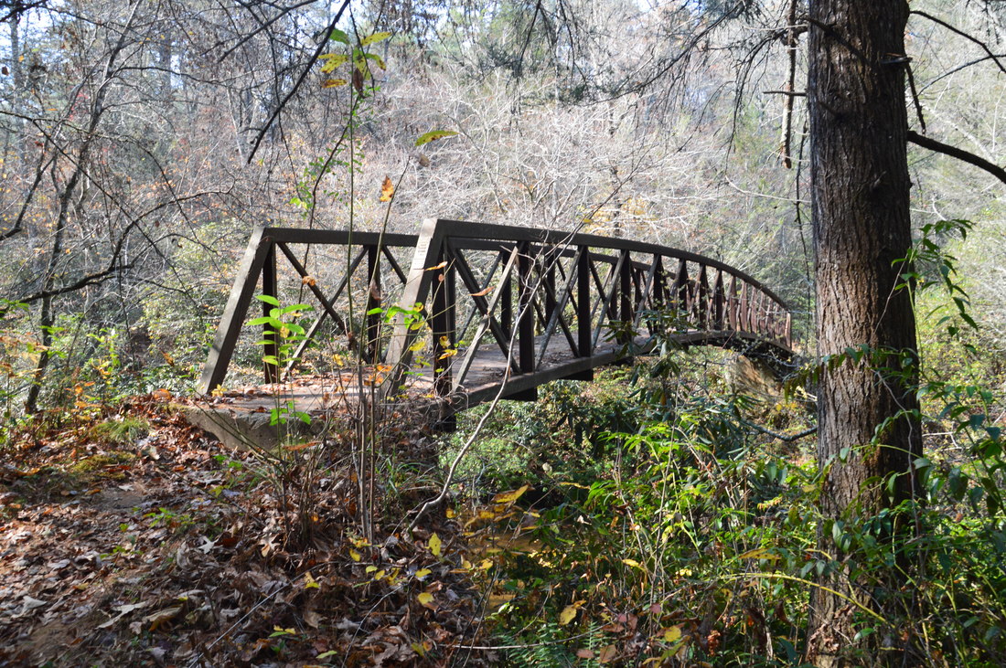
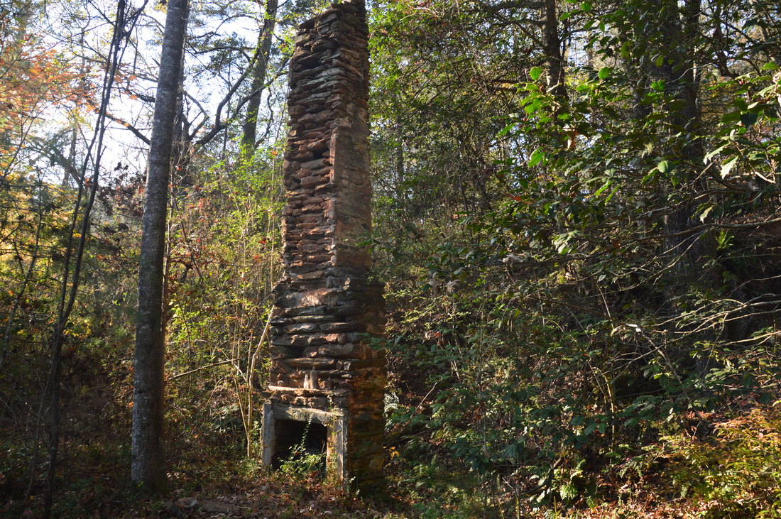
From Adline Ford, retrace your step to the Chattooga River Trail, and turn right onto it. The trail bends around the south side of an unnamed hill. According to my topo map, there is a certain Holden Cemetery on this hill, but I am unsure if it exists and I didn't go looking for it. The trail then descends in the Chattooga River floodplain, staying in or next to it for much of the remainder of the hike. the trail soon enters the site of an old farm, as well as a homestead. At 8.0 miles, there will be an old chimney to the left, where a house once stood. Next to the chimney, I also found some other remains, including what looked like an old refrigerator, as well as what looked like possible gravestones (although it is hard to imagine that there is a grave or cemetery so close to the house). Continuing slightly farther on the trail, you will spot an old hay baler laying down the slope to the right. This is another relic from the farm that once occupied these lowlands along the river. The trail continues to follow the edge of the floodplain, staying mostly flat. There are some views of the Chattooga River between 8.7 miles and 8.8 miles. As you reach the river, you will see that Highway 28 is visible on the South Carolina side of the river, but you're still over a mile from your car! At 8.9 miles, cross Holden Branch via a footbridge. This small stream flows through a miniature ravine. The trail then rises slightly above the floodplain, allowing views of the broad river valley before, as well as hills on the SC side. Angling away from the Chattooga River, the trail reaches and crosses at 9.8 miles an impressive wooden-and-metal footbridge across the West Fork of the Chattooga River. The West Fork is a stream no smaller than the Chattooga itself. The three streams that form the West Fork - Holcomb Creek, Overflow Creek, and Big Creek - all have numerous waterfalls on them that I plan on visiting in the future. After this footbridge, the trail makes one final ascent to Highway 28 at Russell Bridge. You will reach your first car and the Russell Bridge Trailhead at 10.1 miles, concluding the hike. 
Near its north end, Section Two of the Chattooga River Trail passes through old farmlands near the river, with relics such as this hay baler.
After completing the hike, I briefly decided to follow the unofficial and undocumented path that leads north from the Russell Bridge Trailhead along the west (GA) side of the Chattooga River. I followed it for about a half-mile. The trail crosses Mose Branch and then joins an old road that closely parallels the Chattooga River. There are some nice rapids about a half-mile north of the Russell Bridge Trailhead. I did not investigate the path further, but after completing some online research and making some inquiries, I believe this path is a fairly well-traveled fishing path that later morphs into a wider old road that can be followed all the way to Reed Creek. From there, one could make a very difficult hardcore bushwhack to Reed Creek Falls, located a couple of miles upstream from the Chattooga River.
Mileage
0.0 - Sandy Ford Road Trailhead
0.55 - Dicks Creek Falls and Dicks Creek Ledge Rapids 3.2 - Earls Ford Road 7.35 - Adline Ford 8.0 - Old chimney and other farm/homestead relics 9.8 - West Fork of the Chattooga River 10.1 - Russell Bridge Trailhead Variations
Hike out and back to Dicks Creek Falls from Sandy Ford Road - 1.1 Miles
Hike out and back to Dicks Creek Falls from Earls Ford Road - 5.3 Miles Hike out and back to Adline Ford from Russel Bridge - 5.5 Miles Hike out and back to Adline Ford from Earls Ford Road - 8.3 Miles Bonus Stops
Two great waterfalls that are in the area are Goldmine Branch Falls and Talley Mill Creek Falls. Both involve very short hikes, from what I have read, but I have not hiked to them myself.
Pictures
2 Comments
Jupiter9
4/7/2017 12:31:24 pm
Mark, I have read a few of your articles and they are very informative and detailed. Your articles and photos are very helpful. It is great to see a young hiker doing some writing. I am planning a two night backpacking trip with my 12 year old son. We are basically beginners, although I did a couple of short tips a few decades ago. We are fairly experienced hikers, though. What would be your recommendations for great trails/sports in N. GA? Maybe 10-12 miles total, with hiking 3-4 miles per day. I did read your post about the Three Forks/Springer loop. Any places you would suggest that have creeks/rivers to explore, great or neat scenery, that would be up to "moderate" level trails. Thanks.
Ken Taylor
6/18/2020 09:08:18 pm
As an old river runner from the last century, I just wanted to comment that the Chattooga south of Earl's Ford is section 3, including the Dick's Creek Falls area. Leave a Reply. |
About MeMark Oleg Ozboyd Dear readers: I have invested a tremendous amount of time and effort in this website and the Georgia Waterfalls Database the past five years. All of the work that has gone in keeping these websites updated with my latest trip reports has almost been like a full-time job. This has not allowed me to pick up a paid job to save up money for college, and therefore, I I've had to take out loans. If you find the information on this website interesting, helpful, or time-saving, you can say "thanks" and help me out by clicking the button above and making a contribution. I will be very grateful for any amount of support you give, as all of it will apply toward my college tuition. Thank you!

Coming in 2022-2023?
Other Hiking WebsitesMiles HikedYear 1: 540.0 Miles
Year 2: 552.3 Miles Year 3: 518.4 Miles Year 4: 482.4 Miles Year 5: 259.9 Miles Archives
March 2021
Categories
All
|


 RSS Feed