The Southern Nantahala Wilderness is a large wilderness area that stretches across portions of far northeast Georgia and southwest North Carolina. The Georgia side of the wilderness has a distinct lack of trails (other than a short section of the Appalachian Trail), which is unusual for Georgia wilderness areas. However, the lack of official trails does not mean that there are less points of interest. The Georgia side of the Southern Nantahala Wilderness is home to a number of tall peaks, including Hightower Bald and Eagle Mountain. On this hike, you will follow various old logging roads to the summit of Eagle Mountain, a 4000-foot mountain where a fantastic vista awaits. In my opinion, the view from the top of Eagle Mountain is one of the best - if not the best - vista in Georgia. This hike occurred on Saturday, October 22nd, 2016. My plan was to use several old logging roads, which appear to receive horse use and ATV use, to hike out and back to the summit of Eagle Mountain from the gate at the end of the drivable portion of Bell Gap Road.
Summary
R/T Length of Trail: 8.6 Miles
Duration of Hike: 5:40 Type of Hike: Out and Back Difficulty Rating: 5 out of 10 Total Elevation Gain: 2159 Feet Pros: Eagle Mountain has one of the best views in Georgia at a place where you are likely to be all by yourself Cons: The hike to Eagle Mountain is not on maintained or official trails and requires a bit of navigational experience Points of Interest: Eagle Mountain Overlook - 10+ stars Trail Blaze Color(s): None Best Season(s) to Hike: Year-round (portions of the route may get slightly overgrown during summer) Fees: None Beginning Point: The gate at the end of the drivable portion of Bell Gap Road Directions from Hiawassee, GA: From the intersection of Main Street and Bell Street in downtown Hiawassee, follow Main Street North (US 76 West) for 0.5 miles, and then, turn right onto GA Route 75 (Bell Creek Road). In 1.9 miles, turn right onto Upper Bell Creek Road, just before a bridge across the Bell Creek finger of Lake Chatuge. Continue on Upper Bell Creek Road for 1.2 miles. Then, turn right onto Bell Gap Road (County Road 78). In about 0.6 miles, reach the end of County Road 78 amidst houses to the left and right. Bell Gap Road, now known as Forest Service Road 829, continues straight. Contiue following Bell Gap Road. From this point to the end, the road is unpaved, but it is in good condition, and most passenger vehicles should be able to reach the end. There is only one small stretch of the road that has a rather steep grade that may give a few problems, but I think that most vehicles should be able to get to the trailhead. From the end of pavement, continue for another 0.6 miles until you reach the gate. Park here but make sure that you do not block the gate. Map
Click here for more information and to download this trail map to view in Garmin Basecamp.
Details
I used to believe that the collection of tall peaks in the Georgia side of the Southern Nantahala Wilderness were accessible only to experienced off-trail hikers, due to the distinct lack of trails in the area. However, in the week prior to this hike, I discovered several online leads that suggested it may be much easier to access one of the most impressive mountains in the area - Eagle Mountain - then I had been led to think. On this day. my goal was to make an exploratory hike with high hopes that I would be able to get to the top of Eagle Mountain without any bushwhacking whatsoever involved, simply by sticking to old forest roads that I had mapped out on my GPS. I was not mistaken, and neither was I disappointed, for the spectacular view from the summit is now one of my favorite vistas in Georgia. With the detailed description below, I hope that you will be able to follow my footsteps along this relatively moderate hike to the fantastic overlook on Eagle Mountain.
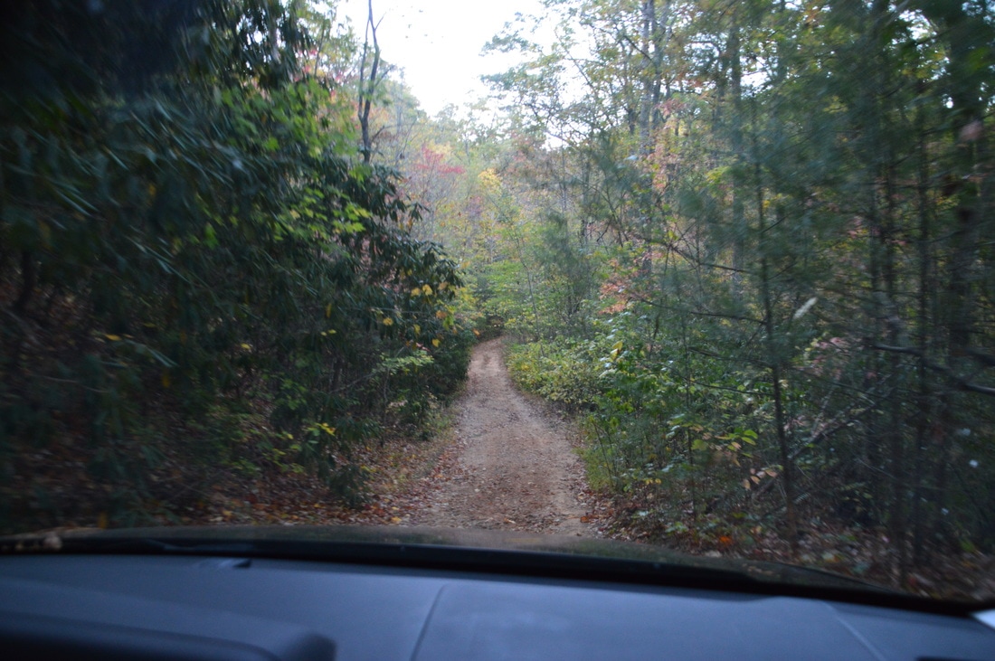
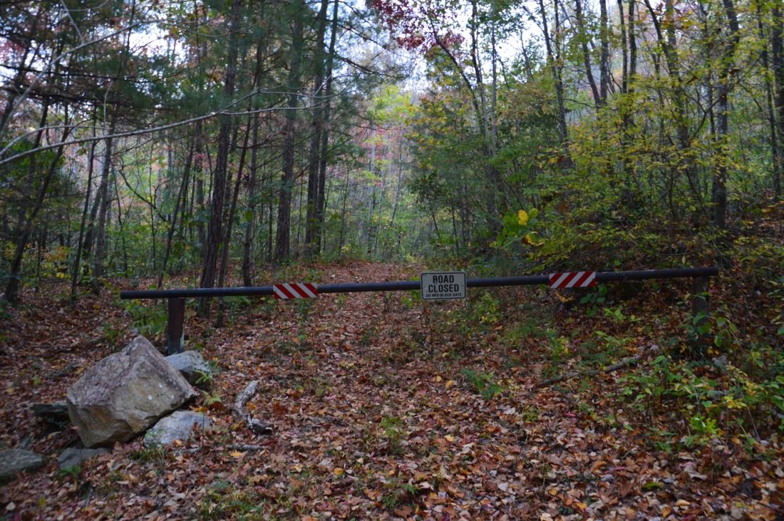
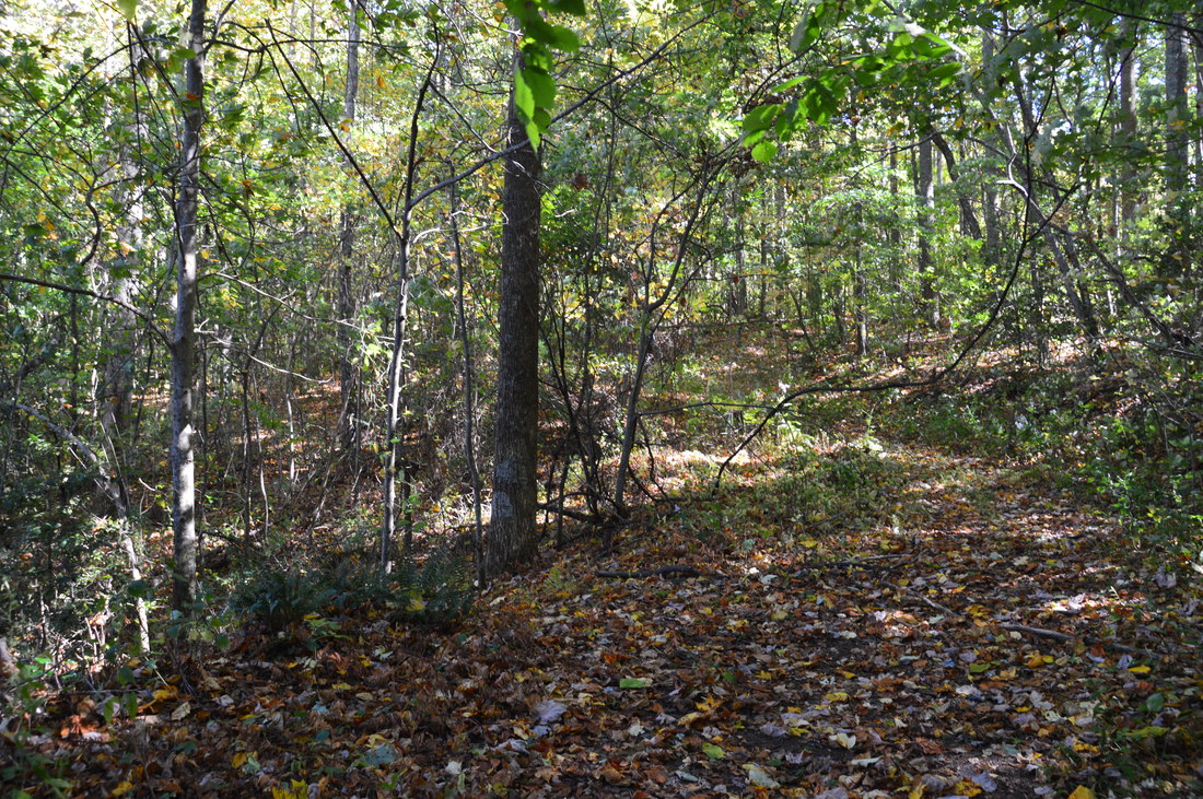
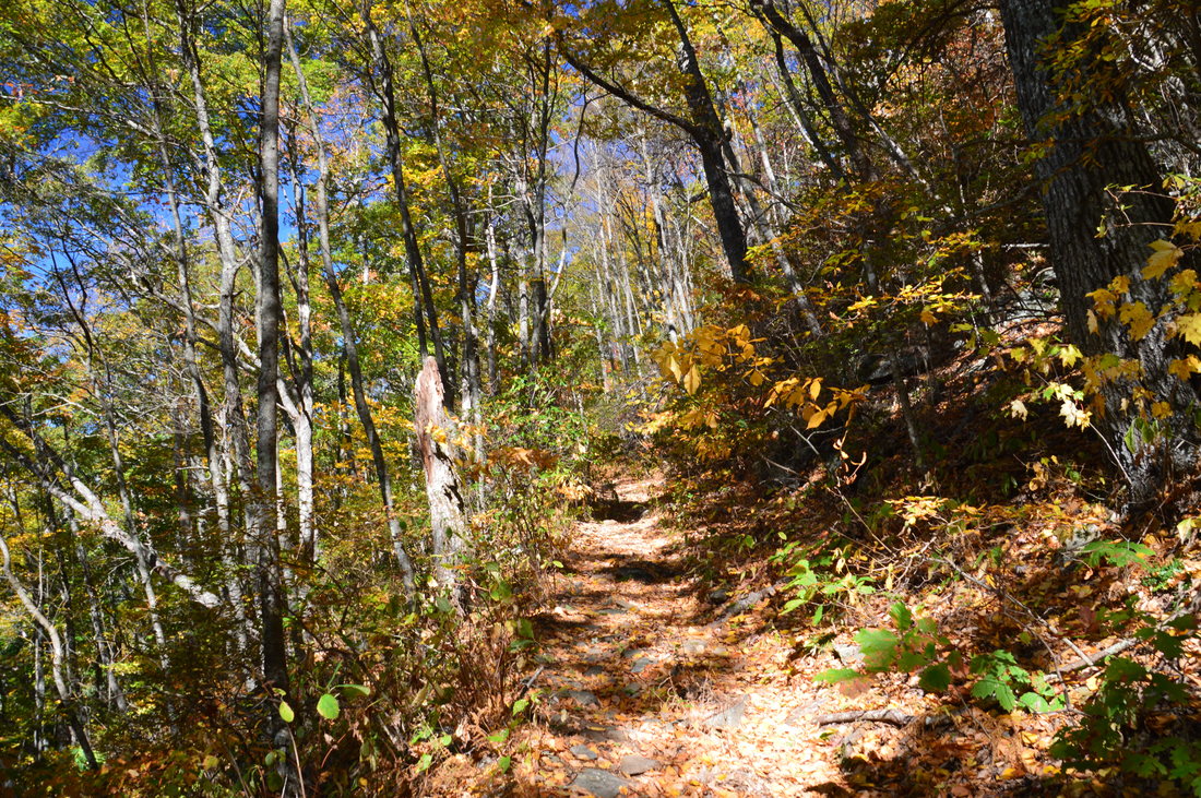
Begin the hike at the gate at the end of the segment of Bell Gap Road that is currently open to vehicles. Make sure to not take the jeep road that leaves steeply uphill to the right of the gate, as I believe this road leads to Bell Mountain. Despite the closure of Bell Gap Road beyond this point, a wide path was cleared to the left of the road and the gate for ATVs to ride up the road past the gate. Throughout the hike, I found frequent signs of ATV usage on the various forest roads that I followed. This is one of the reasons for the good condition that many of these roads are in. At the gate, pass over culverted Sims Branch and begin following old FS Road 829. At 0.1 miles, bear left on the main road as a faint path leaves to the right. This path might lead to Bell Gap. Between the trailhead and the first important turn near Ben Gap, the hike is quite easy as FS 829 gradually ascends at an easy grade. The road will ascend along the lower north slopes of Buck Knob, staying well below the summit. At a couple of places early in the hike, there are great through-the-trees views of Bell Mountain and its bright white quartz outcroppings to the west. At 1.8 miles, the road makes a sudden right turn just west of Ben Gap. When you reach this turn, begin paying close attention to your surroundings. At 1.85 miles, an easy-to-miss path leaves to the left, while FS Road 829 continues straight to shortly reach Ben Gap. Do not continue to Ben Gap; turn left onto this path. If you reach a place that appears to be a gap (Ben Gap), with a small overgrown clearing, where the road begins to gradually descend, you must turn around and look for the path that leaves northward. I have marked the point where the left turn onto this path is as "Important Turn 1" on the hike map at the top of this post. 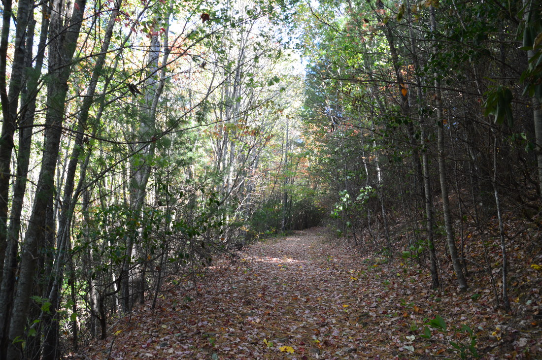
The first part of the hike follows FS 829, which is a gated forest service road.
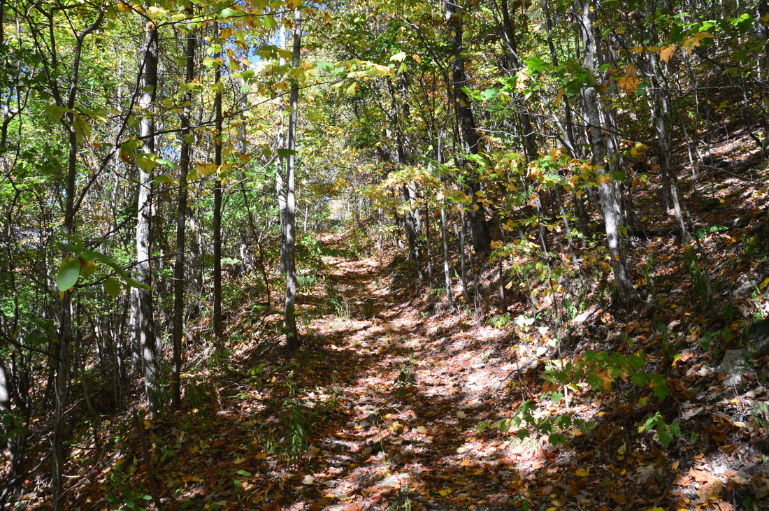
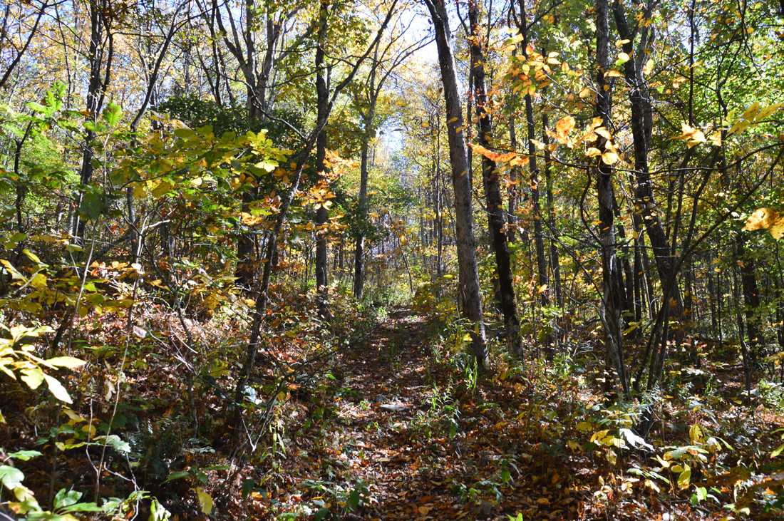
Once you have turned left onto the path, follow it to shortly reach another forest road. This forest road is a lot more overgrown (although still easily-hiked) and does not appear to recieve as much ATV use, if any, as some of the other roads on this hike. An online source stated that this forest road is an old horse trail. In fact, I found signs of horse usage on FS 829 as well. Once you're on this more overgrown logging road, follow it northward, descending slightly. The descent ends at 2.25 miles, and it is followed by a short but steep uphill stretch. At the top, at 2.4 miles, the overgrown road ends at another forest road that appears to recieve at least moderate ATV usage. The road comes in from the left (probably from a community in the vicinity of Upper Bell Creek Road) and continues straight. Walk straight onto it (do not go downhill to the left) and begin following this road now. At 2.65 miles, reach the second important turn on the hike. Here, an overgrown forest road continues straight, while the main forest road and ATV path turns right uphill. Turn right. There was some surveying tape attached to a tree at this turn. I have marked this turn as "Important Turn 2" on the map at the top of this post.
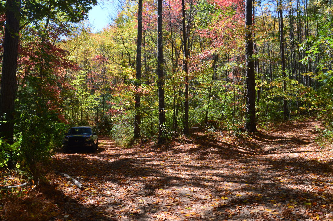
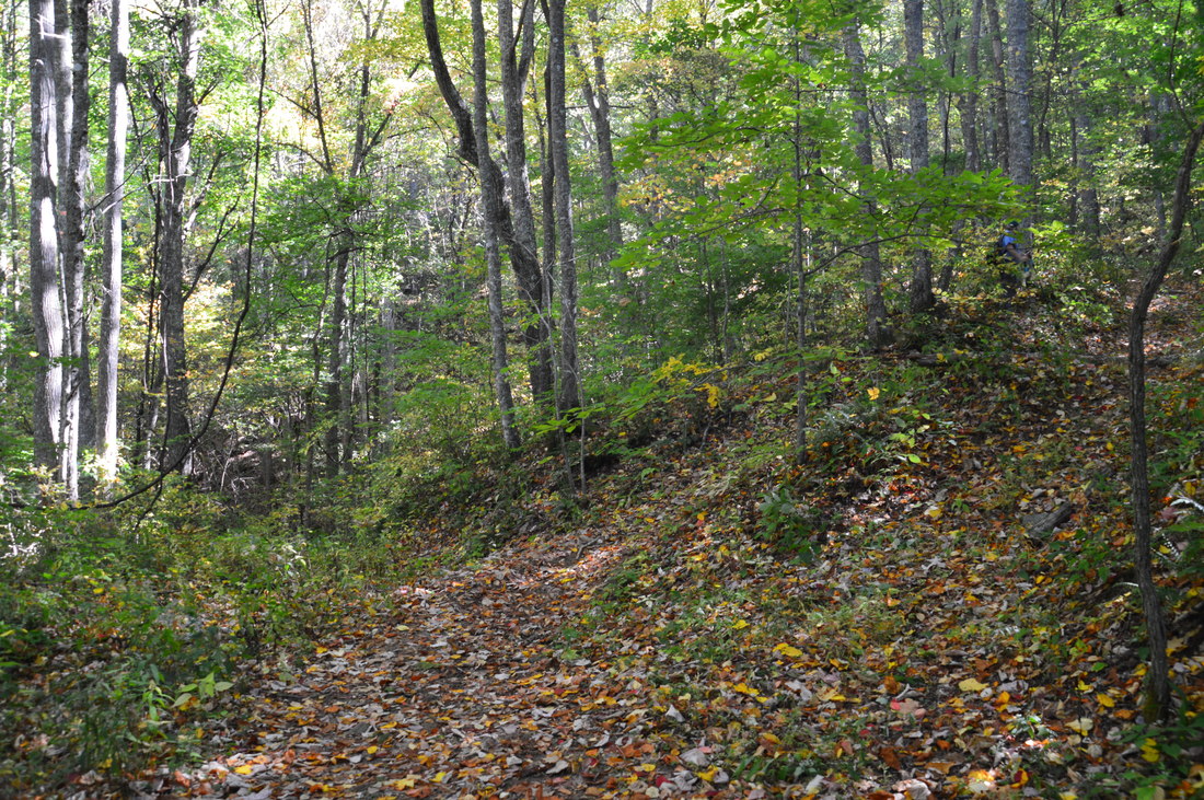
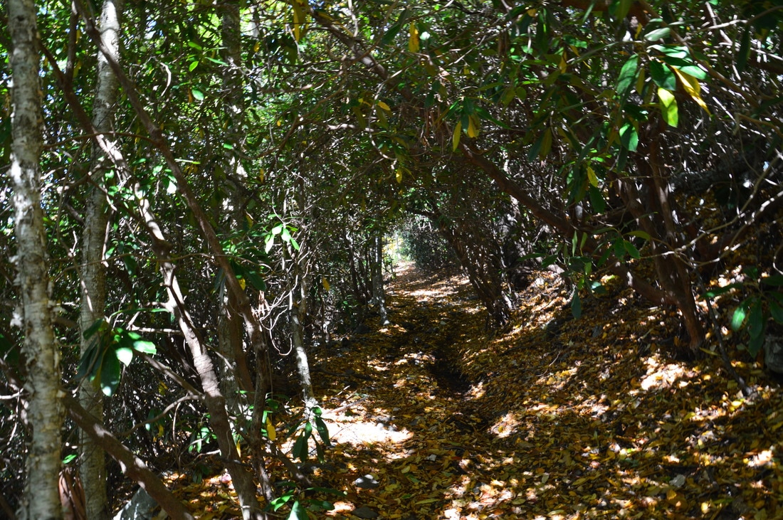
From this point, most of the rest of the hike involves moderate uphill. At 2.8 miles, the forest road crosses Ledford Branch, which was dry on this day. Shortly afterwards, the forest road makes four switchbacks as it ascends Eagle Mountain. As the road gains elevation, great winter views open up to the west. Portions of Lake Chatuge can be seen. At around 3.7 miles, the road narrows and passes through a rhododendron tunnel as well as a slightly muddy area. Then, the road makes a sharp right turn and enters a flat, reaching a hunters' camp spot at 3.85 miles. This appears to be the point that all ATVs drive to, as there appeared to be very little to no ATV usage along the remaining part of the hike. I was very surprised to find three ATVs and a number of people gathered at this campsite. There is another important turn at this point, and it may not be immediately obvious. At the campsite, turn left onto a fainter forest road. Several yards farther, make a sharp right turn and continue onto an old forest road that is slightly overgrown but still easily-hiked. I have marked the turn as "Important Turn 3" on the map at the top of this post. 
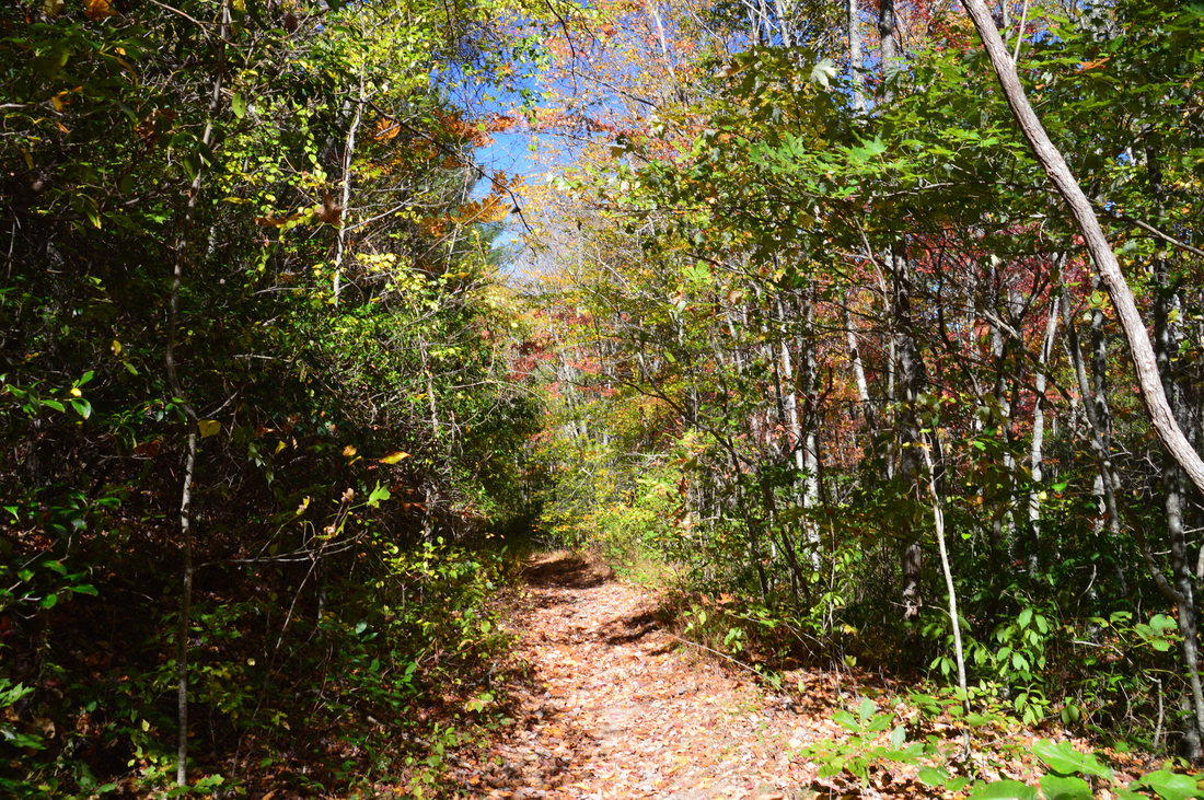
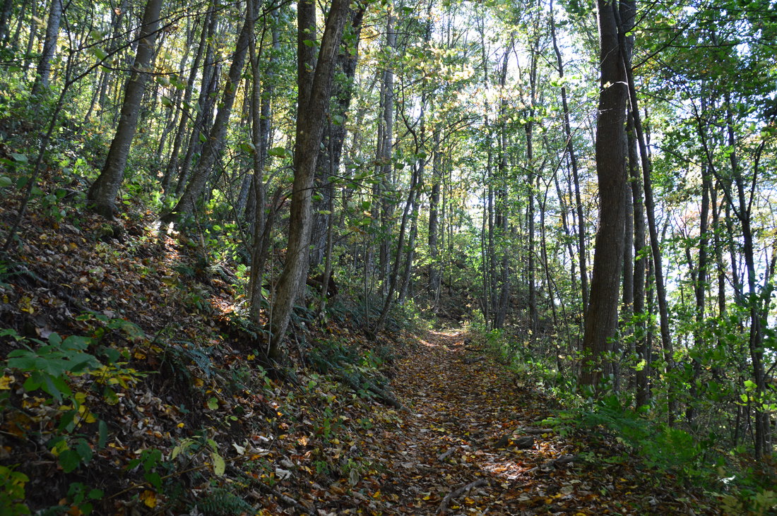
The forest road that leads to Eagle Mountain passes through a rhododendron tunnel near the mountain's summit.
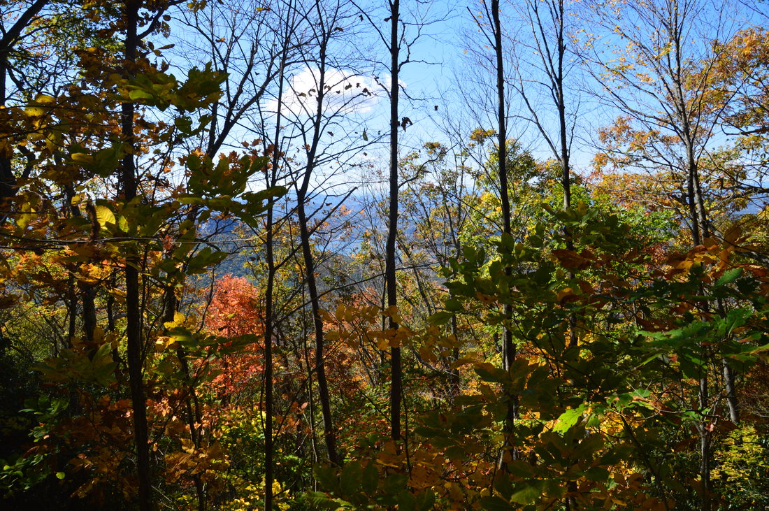
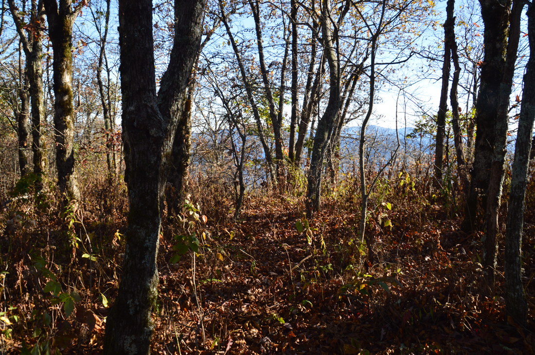
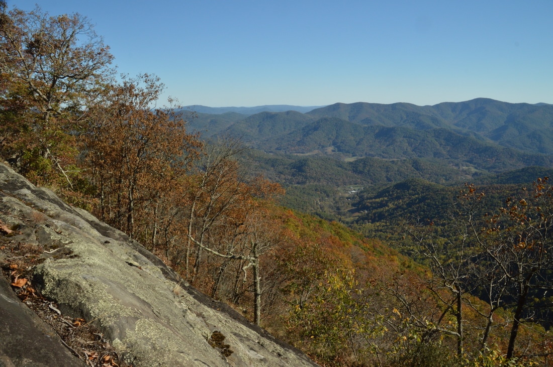
The steepest part of the hike comes after the hunting camp. The trail ascends moderately to steeply until it reaches the ridge and the Southern Nantahala Wilderness boundary at 4.1 miles. Here, there are great winter views eastward into the heart of the wilderness. The old forest road, which now resembles more of a trail than a road, bears right and makes the final push to the summit of Eagle Mountain, reaching it at 4.2 miles. There are two overlooks on Eagle Mountain, one of which is much better than the other. The best way to access the main overlook is just before the summit. However, I suggest leaving the best for last and visiting the worse overlook first. Surprisingly, the access to the smaller overlook is a lot more obvious. Just past the summit of Eagle Mountain, reach a clearing and a turnaround at the end of the old road. To the left, surveying tape marks a faint path that descends southwest. Follow this path downhill, and soon, bear right on the path, reaching at 4.25 miles a small rock outcrop. This place is marked as "Second Overlook on Eagle Mountain" on the map at the top of this page. This rock outcrop provides a good view to the south of the Hiwassee River Valley, Lake Chatuge, and the Eastern Continental Divide. On the right side of the view, the most prominent landmark is the sharp top of Bell Mountain that easily stands out. Bell Mountain looks considerably lower from this vantage point than it looked from the Bell Creek valley and near the beginning of the hike. However, trees greatly impede this view. The reason that I do not describe this view in detail is that the other overlook - the main one - has a very similar view that is from a much larger rock face without any obstacles such as trees that impede the view.
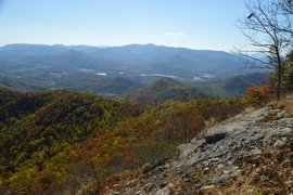
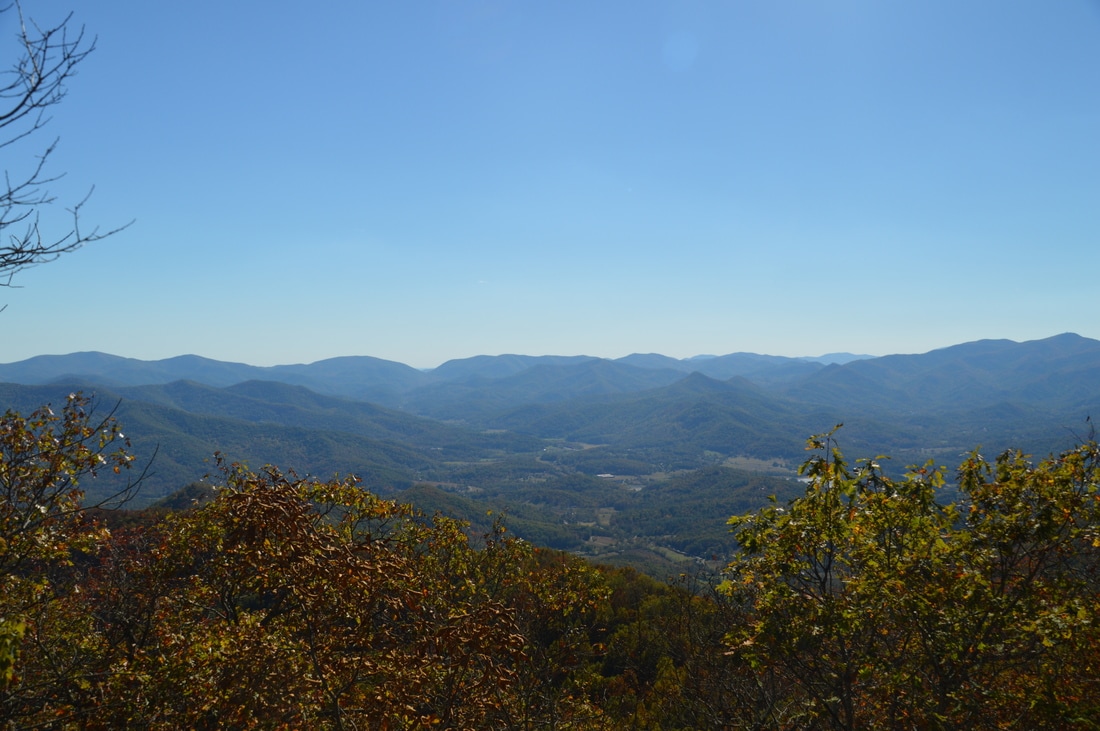
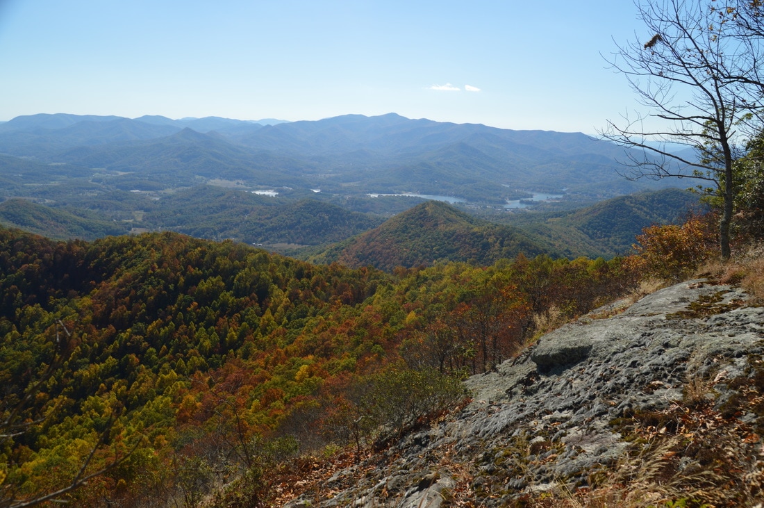
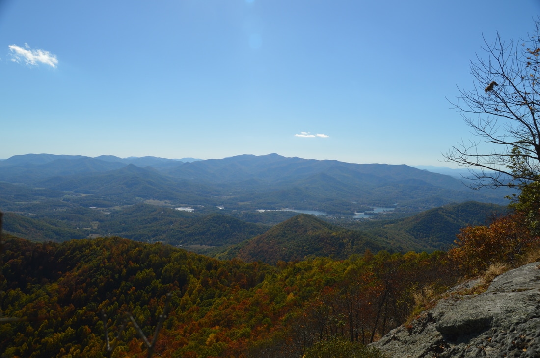
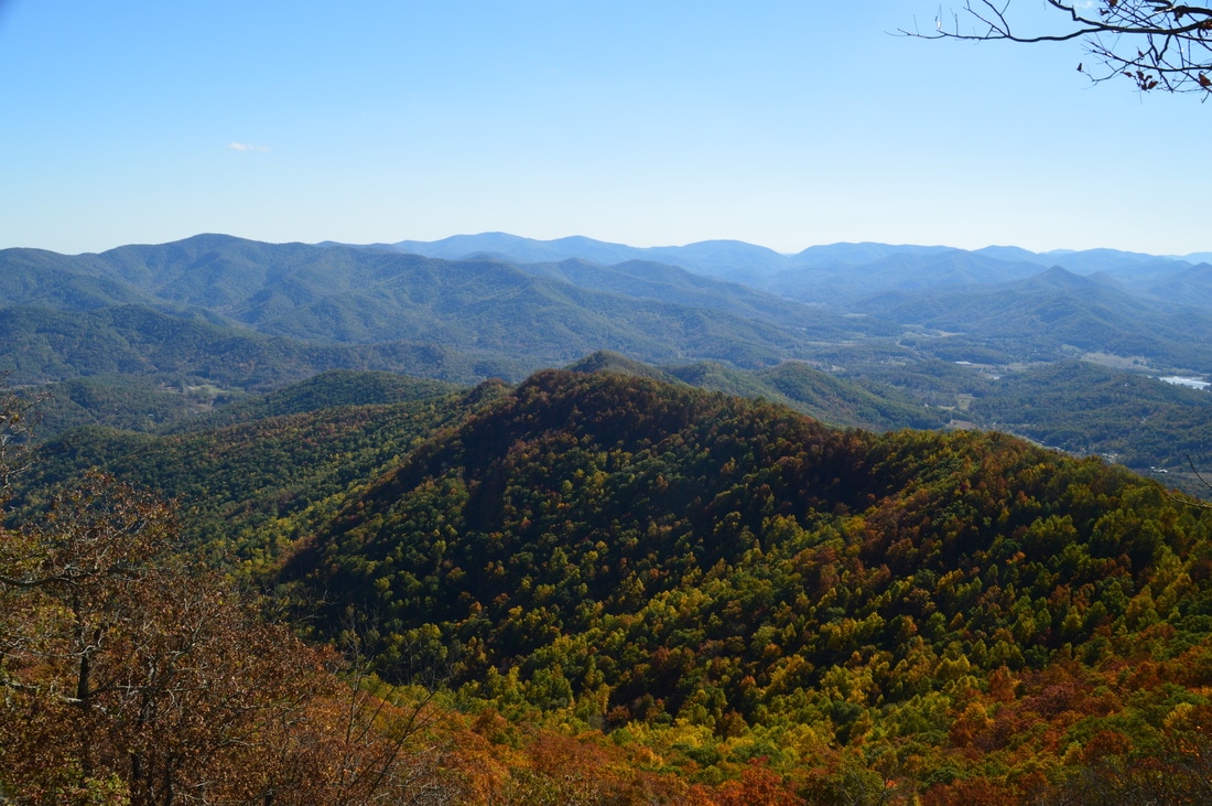
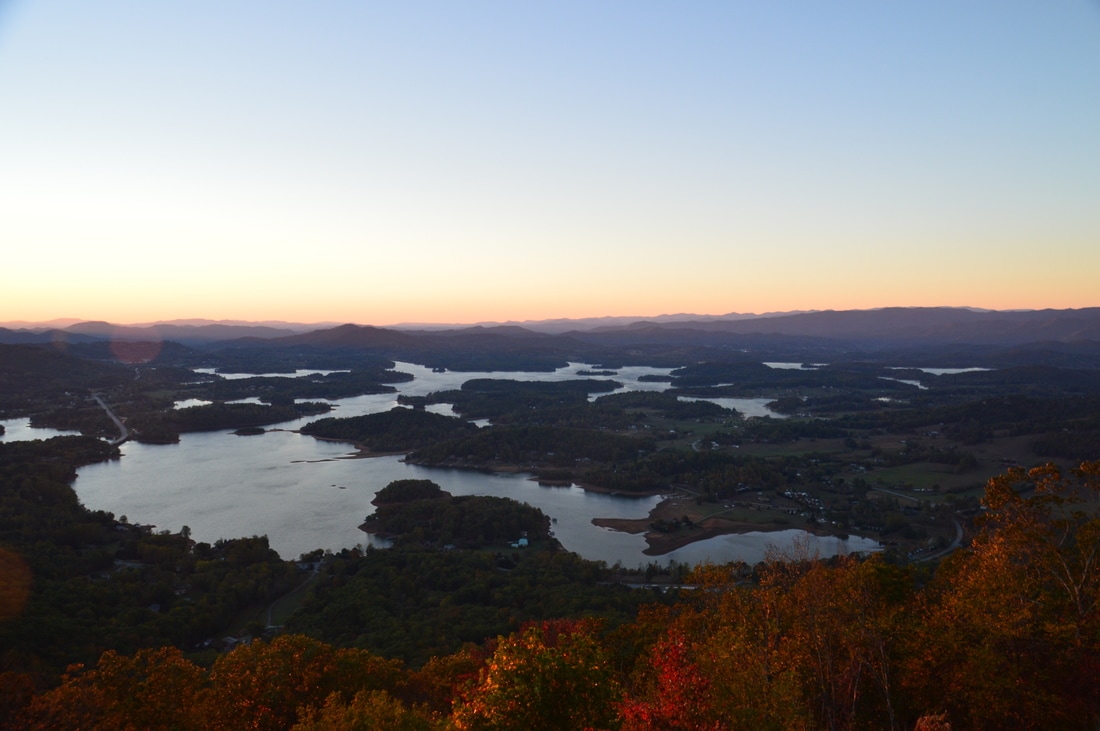
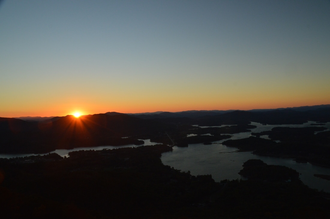
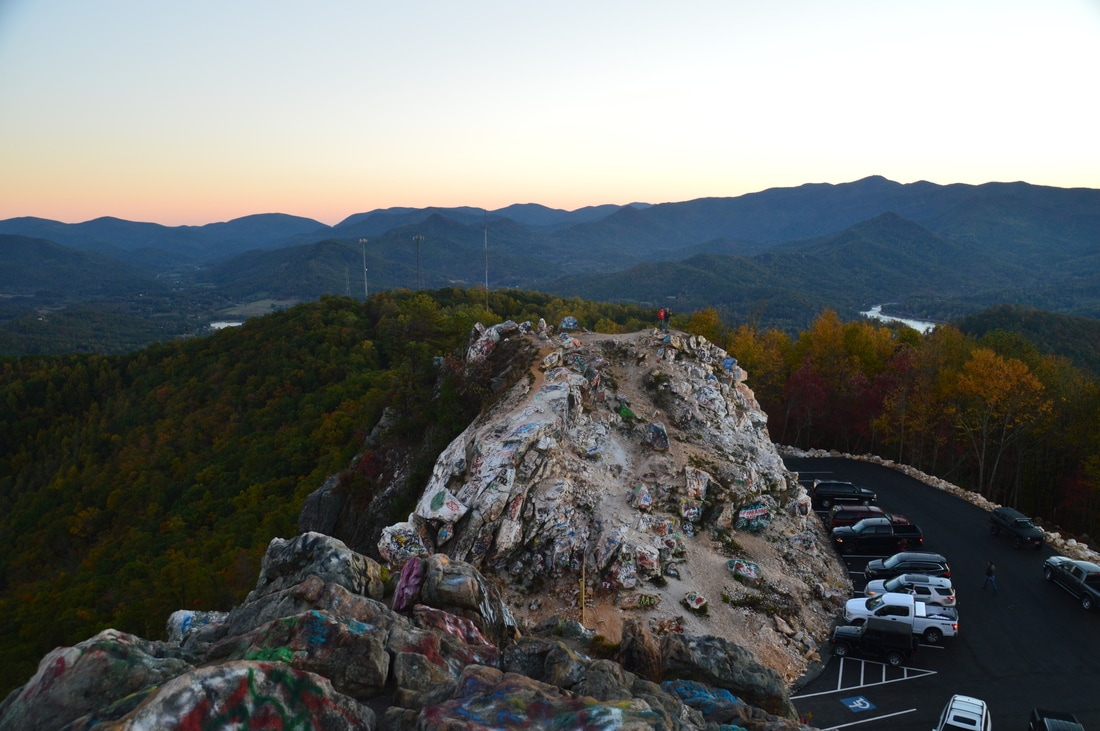
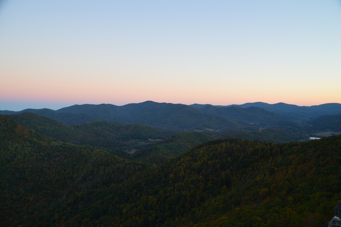
From the first overlook, return to the turnaround near the summit, and walk back across the summit. Just past the summit, at a point where the road bears left (coming from below, it would be a point where the road bears right), look closely for a very faint track to the right. This is not a real path but it is an area of open woods that does not present any obstacles for walking. From the forest road, walk downhill southeastward for about 200 feet. Before long, the rock face becomes visible just below. At 4.35 miles, reach the huge rock face on the southeast side of Eagle Mountain that provides the best view from the peak. What an amazing view!! From the vast rock face, there is a 180-degree southward panorama. In the foreground, Hollifield Ridge (which continues south from Eagle Mountain) gradually lowers into the Hiwassee River Valley. The broad Hiwassee River Valley stretches from left to right, with the sparkling waters of Lake Chatuge nestled in the hills to the southwest. Beyond this, a tall, long line of mountains stretches along the horizon and blocks any further view. This line of mountains is the official "Blue Ridge", as well as the Tennessee Valley Divide, and it includes some of the tallest mountains in Georgia. From this unusual vantage point, I recognized several landmarks, including Brasstown Bald, Tray Mountain, and Unicoi Gap. This vista is very unique in the sense that it provides a view from the north of much of northeast Georgia's highest and best-known terrain, laid out like a carpet in front of you. 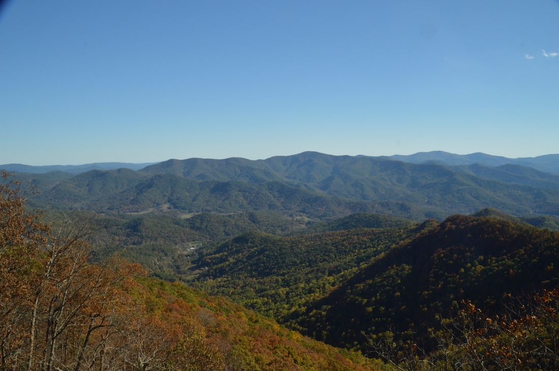
A large rock face on Eagle Mountain affords a grand 180-degree panorama to the south.
Eventually, it was time to leave the fantastic view. To return to your car, simply retrace your steps to the trailhead. For the most part, the return route is easier and mostly downhill. The three important turns are also easier to see on the way back. You will return to the trailhead at 8.6 miles.
Due to the breathtaking nature of the overlook on top of Eagle Mountain, I will rate this hike as a "Best Hike". Even though the hike itself is not particularly special, the view at the end more then makes up for it, in my opinion.
Note: If anyone who reads this post has a tip regarding the beginning point of the ATV trail that comes in from the left (northwest) at mile 2.4, please comment or let me know. Thank you.
Mileage
0.0 - Bell Gap Road Trailhead
1.85 - Important Turn 1 2.65 - Important Turn 2 3.85 - Important Turn 3 at Hunting Camp 4.2 - Eagle Mountain Summit 4.25 - Small Secondary Overlook on Eagle Mountain 4.35 - Main Overlook on Eagle Mountain 8.5 - Bell Gap Road Trailhead Variations
None
Bonus Stops
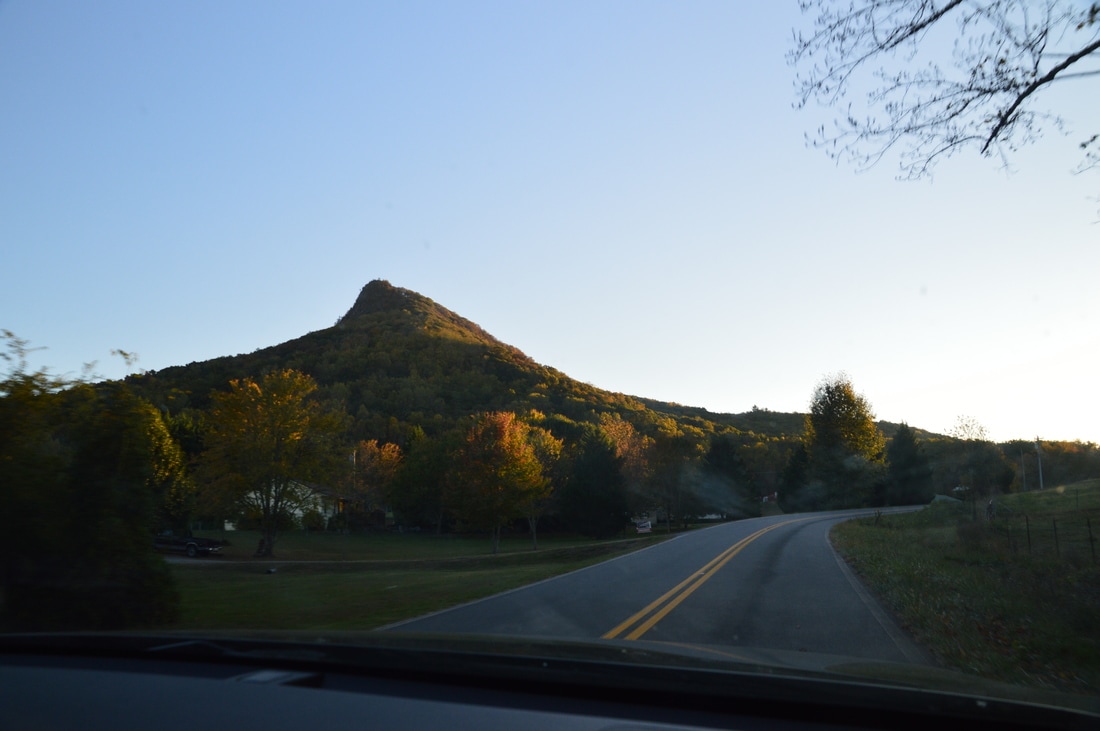
Bell Mountain, which is a roadside destination near Hiawassee, is absolutely worth a bonus stop following this hike. Scroll down for more nformation about Bell Mountain below the video and picture gallery for Eagle Mountain.
PicturesVideosBell Mountain
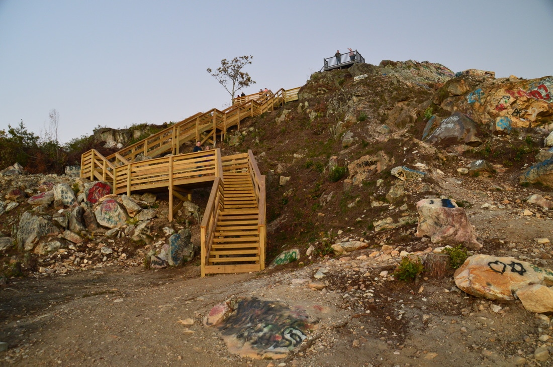
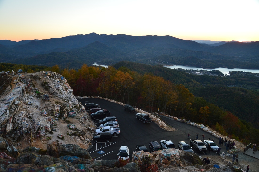
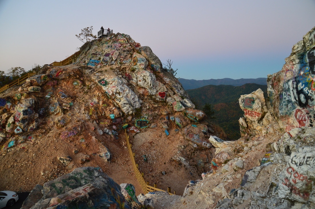
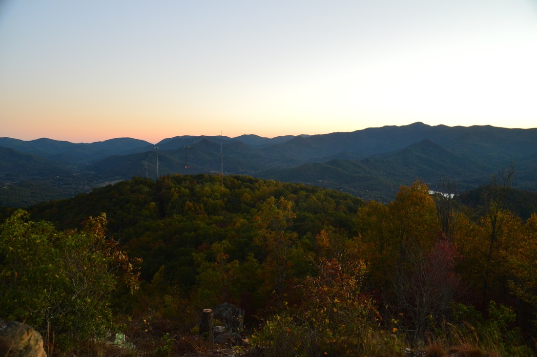
Bell Mountain is a sharp peak that can be accessed from a road leading out of Hiawassee. The summit of the peak was mined for quartz, leaving a very distinct look. Recently, the road to the summit was paved. Prior to that, only high clearance 4WD vehicles could drive this road. Below are the directions to the parking area at the top of Bell Mountain.
From the intersection of Bell Street and Main Street in downtown Hiawassee, follow Main Street South (US 76 East) for 1.3 miles to Shake Rag Road, which will be to the left just after a bridge across a small finger of Lake Chatuge. Turn left onto Shake Rag Road, follow it for 0.7 miles, and then turn left to continue following it. After this, you will reach the summit of Bell Mountain in another 1.5 miles. Be aware that this is the steepest paved road that I have ever encountered. There is already an excellent view westward from the parking area, with the entirety of Lake Chatuge spread out below. However, for the best view, climb up the wooden staircase that leads to the tallest point on Bell Mountain from the parking area. At the top, an observation platform provides a spectacular 360-degree panorama. To the east, you can see Eagle Mountain - standing tall and proud - where you just hiked earlier. To the suth, you can make out a number of mountains such as Brasstown Bald, although in my opinion, the southern view from Eagle Mountain is still better. The only thing that is slightly distracting is the incredible amount of grafitti around the summit of the mountain. I have never seen so much graffiti anywhere else. Despite this, it is stil a very good view though. Below are my pictures. Pictures from Bell MountainVideos from Bell Mountain
9 Comments
Tonya Brant
1/10/2017 12:59:39 pm
Very cool. I'm adding this to my list. Is it dog friendly?
Mark Oleg
1/10/2017 09:29:48 pm
There are no dog restrictions for this hike. I should assume that your dog will not have any trouble on the logging roads that one follows to the summit. 12/10/2020 10:40:26 pm
Bell Gap Road from the end of pavement to the gate is severely washed out and needs to be re-grated/re-graveled, would not attempt without either 4WD or AWD. Barely made it to the gate in my Subaru Outback with AWD, at one particularly bad spot, it took 3 tries. Rough on my car leaving. We came up with a longer mileage but maybe more easily navigable route (around 10 miles). Basically went up FS 829, turned on old logging road just before Ben Gap, described as "important turn no. 1" in the report. After that, we just followed the old logging road to the campsite, maybe we missed important turn no.2, but the route we took seemed to be the most obvious and most traveled. Several springs running down the old logging road, but not bad, just a bit mucky. Went through the rhodo tunnel, followed directions "important turn no.3" just before the campsite, ascended to the summit, checked out the overlooks. The boundary trail on the top of the Eagle Mountain ridge looked very interesting, but we were running out of time, and only managed to do the summit overlooks. Other interesting side trails we will have to do at another time. Also appeared that you might be able to hike to end of FS829 at the base of Hollifield Ridge, and approach the summit coming up that ridge, but probably longer, but looks like a great hike. Saw a young turkey and a young black bear on this hike. Beautiful, secluded area, saw no one else, great hike, but everyone needs to contact the Forest Service to prompt them to repair FS829 aka Bell Gap Road...very rough...
Steven Platek
4/22/2021 05:16:16 pm
Thanks for your comment on this. Been thinking about this hike as a way to access some of the Southern Nantahala Wilderness. I will contact FS service to ask about the road conditions.
Steve Hancock
9/7/2021 08:03:16 am
Thanks for this write-up. Loading your track into my GPS helped a lot and I'm sure I would have missed the important turns without it. I was out there this past Friday, I took a day off work before the holiday, and can attest the FS road to the Bell Gap is still very rough. I have a Toyota with AWS but didn't attempt past the worst of it. There's a parking spot for one vehicle about halfway on the right and I was able to back in. Walking up the road for about half a mile to the iron gate at Bell Gap wasn't much a burden. Never saw another soul the whole time out there, a little slice of heaven and so close to town. Lots of water everywhere from hurricane Ida. Also, this time of year, the trails are a bit overgrown and I got torn up on the final ascent from the ATV camp to the summit. The views were still spectacular on the southern exposure and thinking as I ate my lunch I need to return in the fall when the colors are close to peak.
David Carswell
2/10/2022 09:55:36 pm
My friend Ray and I hiked up to Eagle Mountain today, Thursday , Feb 10th , 2022. It as a beautiful, sunny, breezy day, but comfortable. We had to park 1/4 mile from the gate, which made the walk a half mile farther.
Bob
3/2/2024 09:41:22 am
I did this in January of 2024 and it definitely was a four-wheel drive path to get to the gate. Leave a Reply. |
About MeMark Oleg Ozboyd Dear readers: I have invested a tremendous amount of time and effort in this website and the Georgia Waterfalls Database the past five years. All of the work that has gone in keeping these websites updated with my latest trip reports has almost been like a full-time job. This has not allowed me to pick up a paid job to save up money for college, and therefore, I I've had to take out loans. If you find the information on this website interesting, helpful, or time-saving, you can say "thanks" and help me out by clicking the button above and making a contribution. I will be very grateful for any amount of support you give, as all of it will apply toward my college tuition. Thank you!

Coming in 2022-2023?
Other Hiking WebsitesMiles HikedYear 1: 540.0 Miles
Year 2: 552.3 Miles Year 3: 518.4 Miles Year 4: 482.4 Miles Year 5: 259.9 Miles Archives
March 2021
Categories
All
|


 RSS Feed