Natural Bridge State Park: Cedar Creek Trail to Natural Bridge and Lace Falls, Glasgow, Virginia1/18/2017 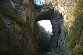
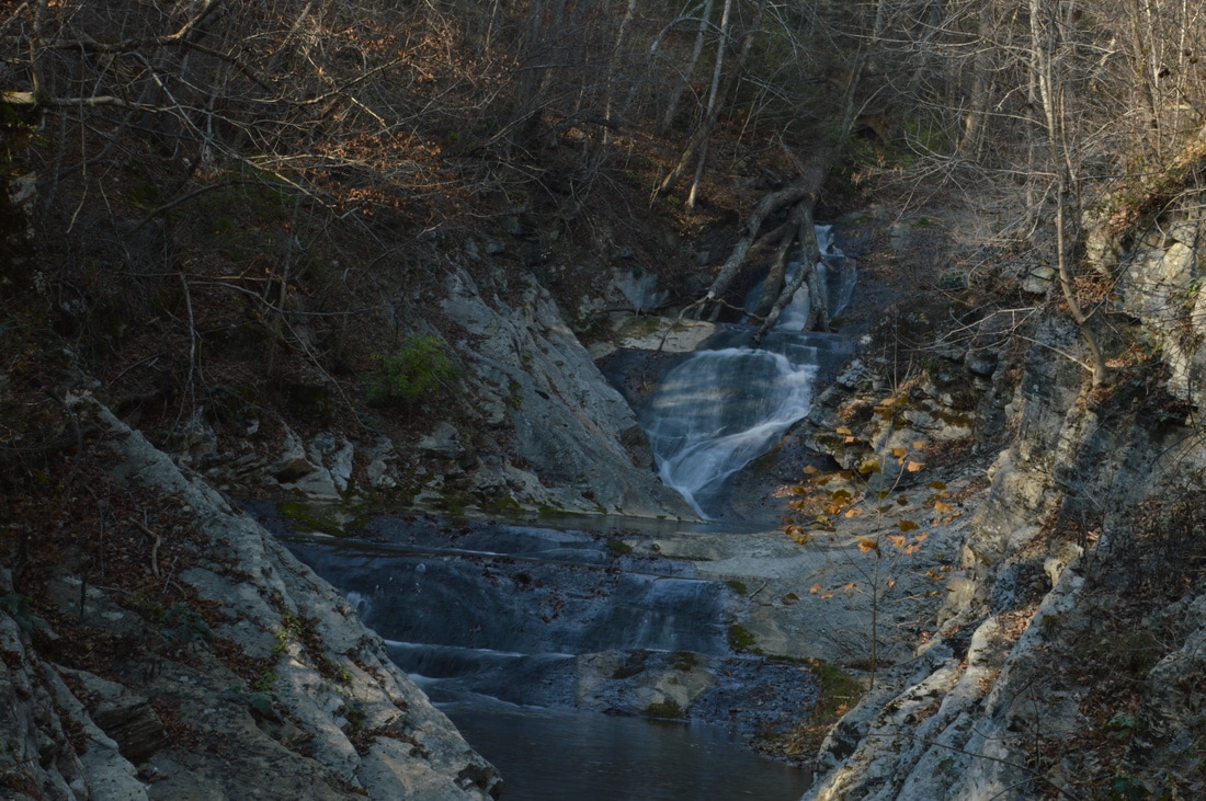
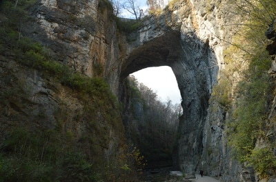
The 215-foot natural bridge that is carved out by Cedar Creek is the centerpiece of Natural Bridge State Park, Virginia's newest state park. The Cedar Creek Trail travels through the Cedar Creek gorge for about a mile, passing a cave along the way, before terminating at Lace Falls, which is a beautiful multi-tiered 50-foot waterfall. Even though the incredible natural bridge is the main attraction on this hike, the trail visits several other features in this little known-area of Virginia. This hike occurred on Thursday, November 24th, 2016. My plan was to hike the Cedar Creek Trail out and back, passing under the Natural Bridge, past Saltpeter Cave, and reaching Lace Falls. This hike was the first of seven hikes that I did during a four-day Thanksgiving trip to the mountains of western Virginia.
Summary
R/T Length of Trail: 2.2 Miles
Duration of Hike: 1:30 (This includes several lengthy photography stops) Type of Hike: Out and Back Difficulty Rating: 1 out of 10 Total Elevation Gain: 300 Feet Pros: This hike features a lot of beautiful and easy-to-access scenery, including the natural bridge, which is a very uncommon and incredible sight Cons: Crowds; hefty fee; portions of the trail are paved Points of Interest: Natural Bridge; Saltpeter Cave; Lost River; Lace Falls - 5 stars Trail Blaze Colors: Cedar Creek Trail - None Best Seasons to Hike: Year-round Fees: There is a fee of $8 per person for this hike. You must pay at the Natural Bridge State Park Visitor Center and then present your tickets to a collector at the end of the steps not far beyond the beginning of the Cedar Creek Trail In my opinion, this fee is upscale and more than it should be, but I guess that it is still worth it, due to the natural bridge. Beginning Point: Natural Bridge State Park Visitor Center (Cedar Creek/Natural Bridge Trailhead) Directions from Glasgow, VA: From the intersection of US Route 501 and VA Route 130 in Glasgow, follow VA 130 West for 6.2 miles. Just before the intersection with US Route 11, turn left into the large parking area in front of the Natural Bridge State Park Visitor Center. The Natural Bridge Hotel is a good landmark. It is located across from the Visitor Center, on the other side of US Route 11. Map
Click here for more information and to download this trail map to view in Garmin Basecamp.
Details
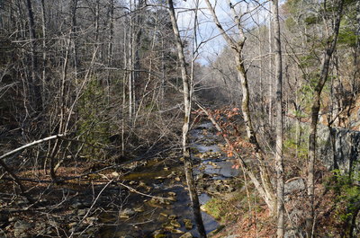
Prior to my trip to Virginia, I had noted down around a half-dozen hikes that I wanted to complete in the vicinity of Roanoke and Lexington. Most of those hikes are fairly well-known throughout the hiking community due to the outstanding features on them. However, Natural Bridge State Park is surprisingly not documented very well online. It is Virginia's newest state park, having been created in September 2016. The centerpiece of the park is the 215-foot natural limestone bridge over Cedar Creek, formed over millions of years by the waters of the creek gradually eroding the cliffs here. Even though hiking the Cedar Creek Trail and seeing the Natural Bridge cost us $16, I still consider this nature trail to be outstanding. Besides the Natural Bridge, which the trail passes directly under, the trail also passes through a beautiful gorge that is reminiscent of the Cumberland Plateau, visits a cave, and provides a view of a multi-tiered 50-foot waterfall at the back of a small canyon.
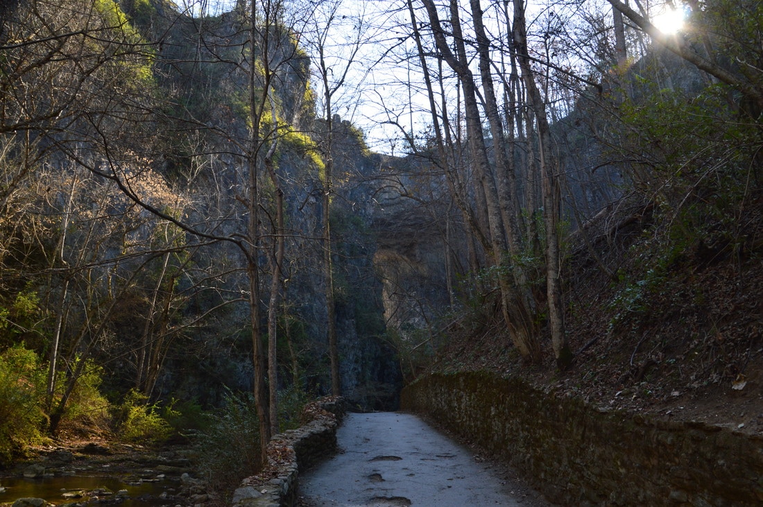
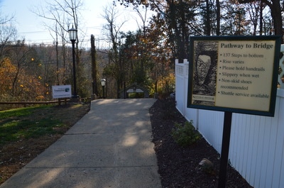
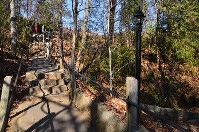
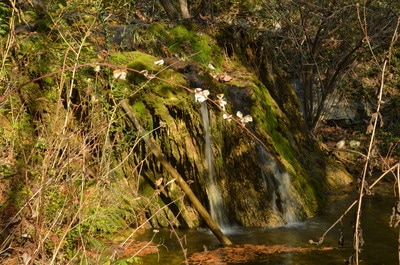
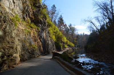
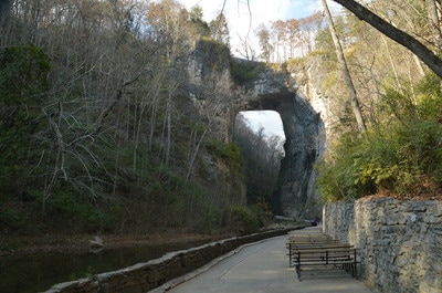
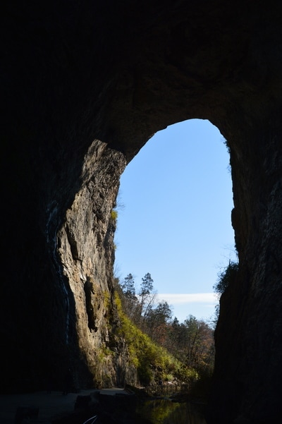
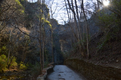
Before beginning the hike, enter the visitor center and pay your fee. Then, walk down a staircase and through the back doors of the visitor center. Ahead is a paved path that leads to the arched entrance for the Cedar Creek Trail. The hike begins with a descent along a paved path and a total of 137 steps. To the left of the staircase, a small stream - a tributary of Cedar Creek - noisily cascades down a series of rock ledges. Due to the low water and small drops, I would hardly consider this to be a waterfall, but the park calls it Cascade Falls. The main draw to Cascade Falls is the beautiful moss-covered rock ledges that the water flows over. At 0.15 miles, you will reach the end of the steps and the bottom of the gorge. There is a park building here and a shuttle loading area. Yes, there is a shuttle for those who would prefer to ride back rather than hike back up. More importantly, this is the place where you must show your tickets to an on-site attendant before continuing on the trail. After thus, the paved trail bears right and reaches Cedar Creek. Just ahead, the massive Natural Bridge towers across the creek and the trail. What a sight! The Cedar Creek Trail passes directly under the massive bridge at 0.25 miles. From the trail, you can observe up close the impressive walls of the gorge around the bridge. The Natural Bridge is 40 feet thick, 100 feet wide, 215 feet high, and has a span of 90 feet between its walls. Additionally, this unique arch contains rock that weights a whopping total of 36,000 tons! Being approximately 500 million years old, the Natural Bridge is strong enough to easily carry the weight of US Route 11 (Lee Highway) and all of the road's traffic on top of the bridge.
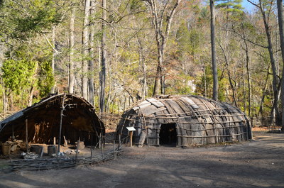
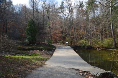
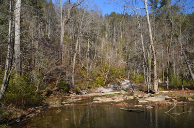
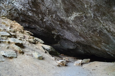
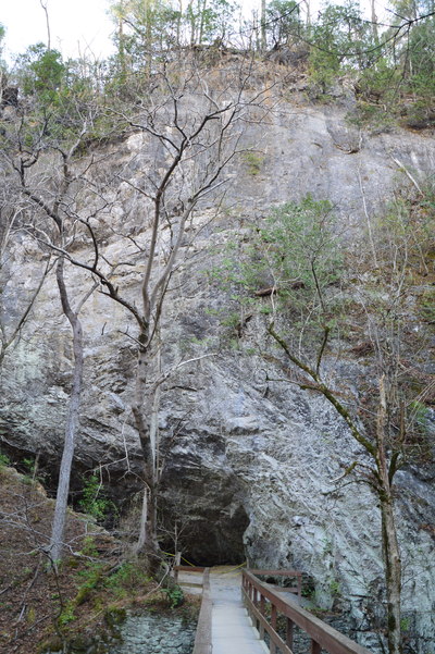
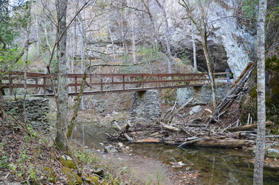
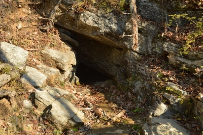
Past the Natural Bridge, the trail crosses Cedar Creek via a footbridge and then turns unpaved as it follows the west side of the creek. At 0.5 miles, where there is an amphitheater to the left, the trail reaches the Monacan Native American Village exhibit, which is a miniature replica of a typical ancient Native American settlement from the pre-colonization days. After the exhibit, the trail crosses Cedar Creek on a concrete footbridge and resumes following the east side of the creek. At 0.6 miles, check our the short 150-foot spur trail to the left that crosses Cedar Creek on a wooden footbridge and ends at Saltpeter Cave. While you can't walk up right up to the entrance of the cave, as the area is chained off, it is still interesting to see. The name of the cave originates from the fact that nitrate was mined in this cave for the production of gunpowder. In fact, during the War of 1812 and the Civil War, this cave was an important storage place for ammunition.
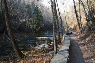
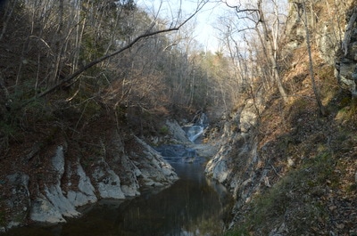
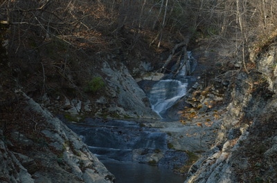
Return to the main trail, which continues to stay wide and nearly level along the creek. The next point of interest is the "Lost River" at 0.8 miles. There is a footbridge here and to the right there is what looks like a cave, with the sound of rushing water coming from it. The opening that looks like a cave is actually an artificial opening that was created during 1812, when workmen from Saltpeter Cave heard the sound of water coming from the ground. A water main was attached to the opening to transport water to machinery that extracted nitrate from Saltpeter Cave. Interestingly, the source and destination of the the underground river known as the Lost River is still not known. The creekside trail ends in another 0.3 miles at 1.1 miles, where there is an observation area with a miniature canyon just ahead. Lace Falls is located at the far end of the canyon. Despite the fact that Lace Falls is a bit farther away than desired, this is still a really great view. Lace Falls is a multi-tiered sliding waterfall that is 50 feet high. A large fallen tree partially masks the uppermost drop.
From Lace Falls, retrace your steps back to the trailhead, concluding the hike at 2.2 miles. To summarize, this is a really beautiful nature trail that is definitely worth doing if you're in the area, as the Natural Bridge is a sight as unique as it can get in Virginia or anywhere in the Southeast for that matter. The main reason that I avoided rating this hike as a "Best Hike" is that the trail is too crowded and touristy for my liking, and it does not offer a true wilderness experience at all.
Mileage
0.0 - Natural Bridge Trailhead
0.25 - Natural Bridge 0.5 - Monacan Native American Village Exhibit 0.6 - Saltpeter Cave 0.8 - Lost River 1.1 - Lace Falls 2.2 - Natural Bridge Trailhead Variations
Hike out and back to the Natural Bridge - 0.5 Miles
Bonus Stops
After the hike, consider visiting the Natural Bridge Caverns. The hour-long guided tour of the caverns passes through several chambers with interesting cave formations. It also descends 35 stories below ground level.
PicturesVideos
5 Comments
Anne
7/14/2017 04:55:08 pm
One of the most informative posts on the Natural Bridge. The details were clear and beautifully thorough. The pictures and videos were great as well. All the questions I had were answered and then some.
Reply
4/30/2021 04:16:43 am
I've been wanting to know about th Natural Bridge park in Lexington for a long time. Thank you to the author, for the excellent and detailed information
Reply
4/14/2023 09:25:23 am
Natural Bridge State Park in Virginia is home to a stunning 215-foot natural bridge carved out by Cedar Creek. The Cedar Creek Trail takes hikers through the Cedar Creek gorge, past Saltpeter Cave and Lace Falls, a beautiful multi-tiered 50-foot waterfall. The trail is easy and accessible, making it a great hike for all skill levels. However, the trail can be crowded and there is a hefty fee of $8 per person. Despite the cost, the natural bridge is a unique and incredible sight that makes the hike well worth it.
Reply
4/17/2023 10:16:56 am
Virginia, but based on what I've learned, the Cedar Creek Trail seems like a wonderful hiking opportunity. The trail offers scenic views of the natural bridge and Lace Falls, which are both breathtaking sights to see. For those who love nature and hiking, this state park is definitely worth exploring.
Reply
4/19/2023 04:34:05 am
The Cedar Creek Trail at Natural Bridge State Park seems like a hidden gem that's worth exploring. The centerpiece of the park, the 215-foot natural bridge, is an awe-inspiring sight to see up close. The trail also passes through a beautiful gorge, a cave, and leads to a multi-tiered waterfall. While there is a fee to enter and hike the trail, the experience is worth it.
Reply
Leave a Reply. |
About MeMark Oleg Ozboyd Dear readers: I have invested a tremendous amount of time and effort in this website and the Georgia Waterfalls Database the past five years. All of the work that has gone in keeping these websites updated with my latest trip reports has almost been like a full-time job. This has not allowed me to pick up a paid job to save up money for college, and therefore, I I've had to take out loans. If you find the information on this website interesting, helpful, or time-saving, you can say "thanks" and help me out by clicking the button above and making a contribution. I will be very grateful for any amount of support you give, as all of it will apply toward my college tuition. Thank you!
Coming in 2022-2023?
Other Hiking WebsitesMiles HikedYear 1: 540.0 Miles
Year 2: 552.3 Miles Year 3: 518.4 Miles Year 4: 482.4 Miles Year 5: 259.9 Miles Archives
March 2021
Categories
All
|


 RSS Feed