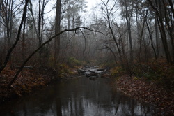
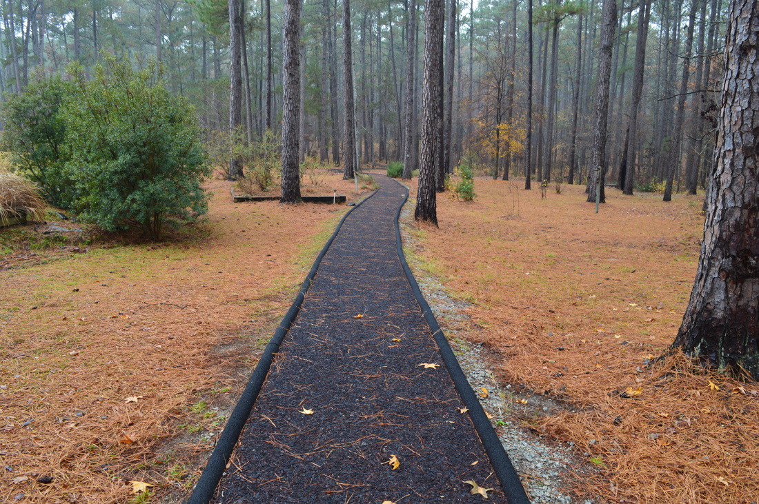
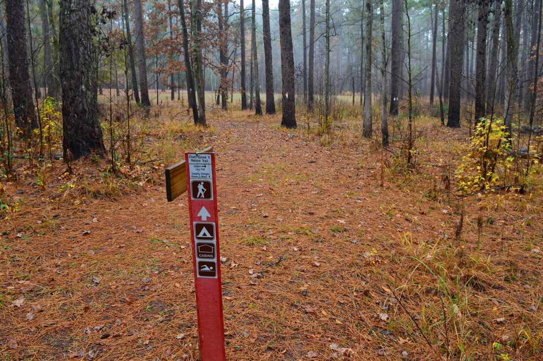
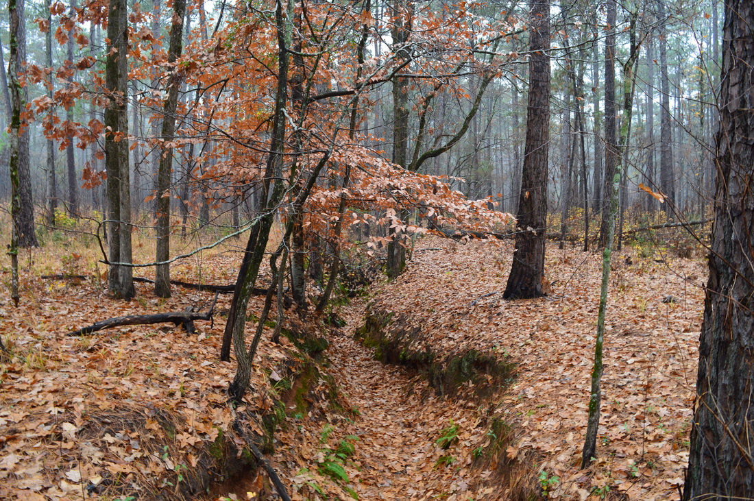
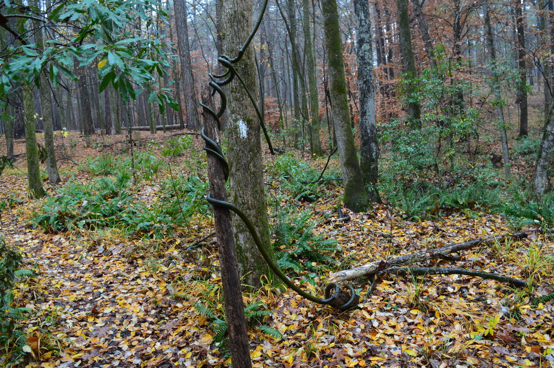
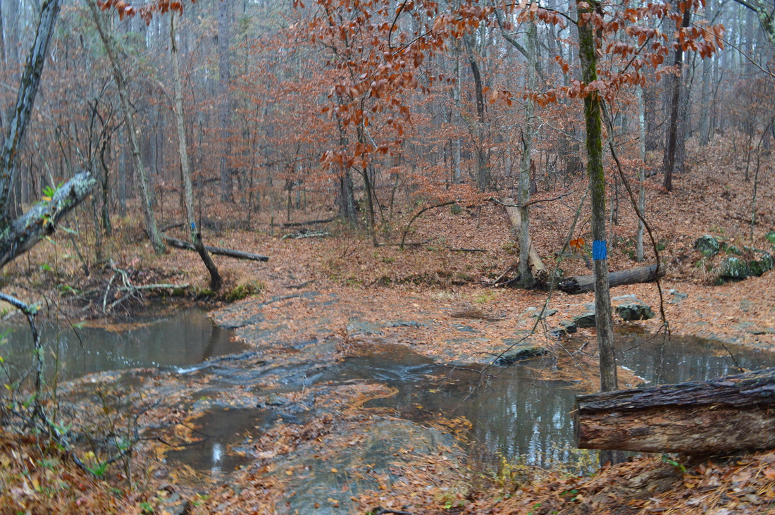
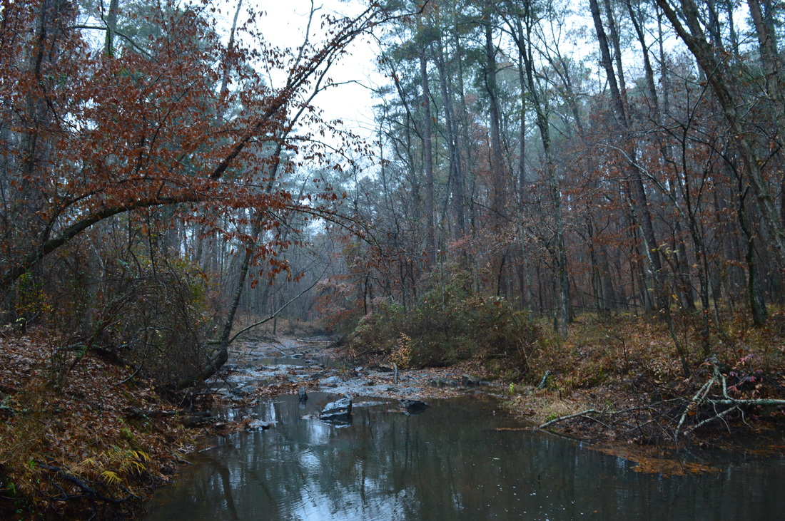
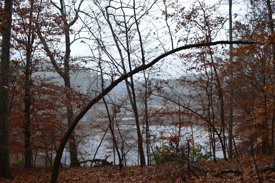
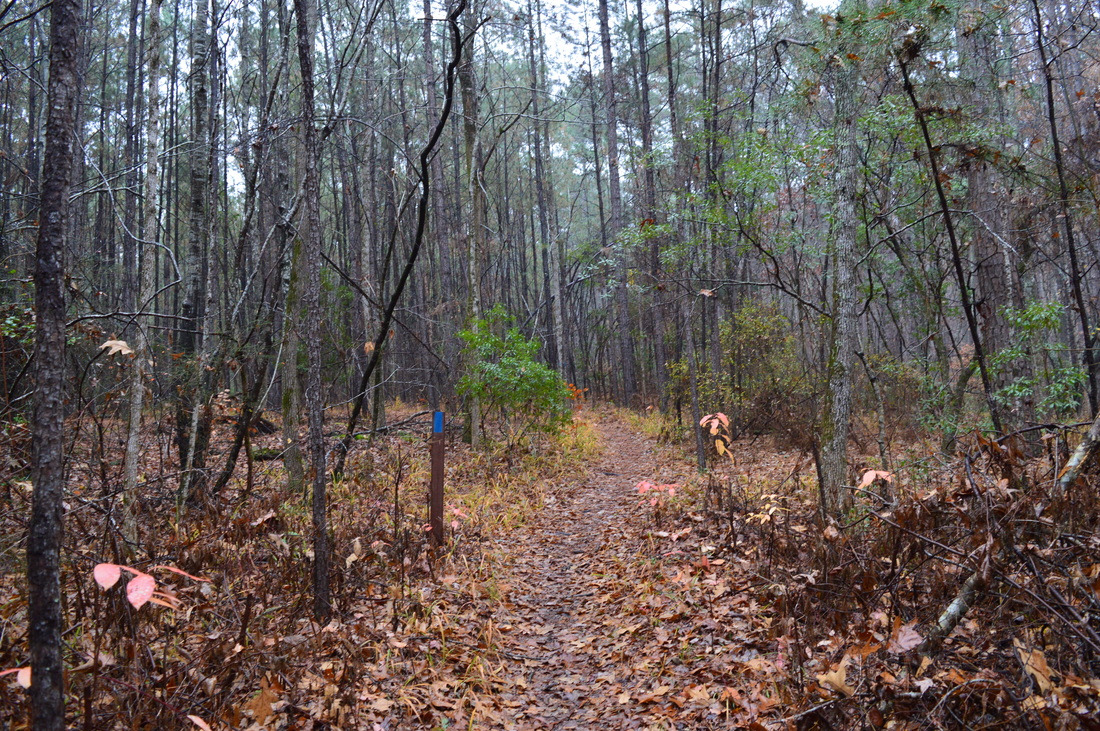
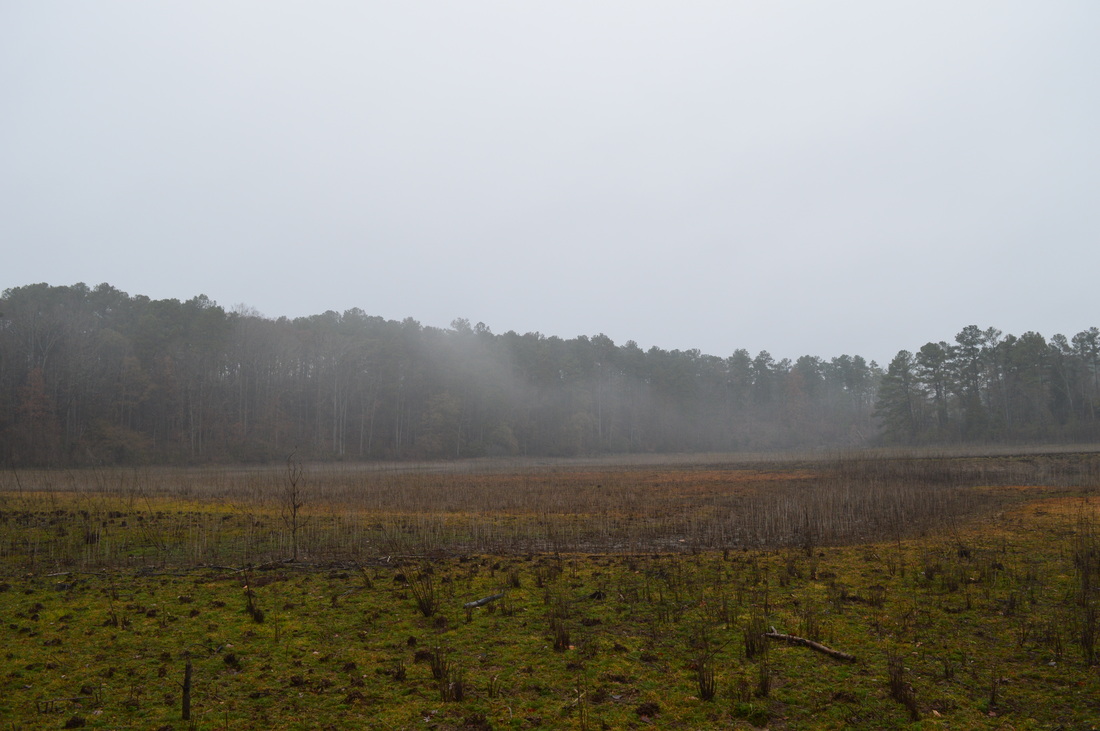
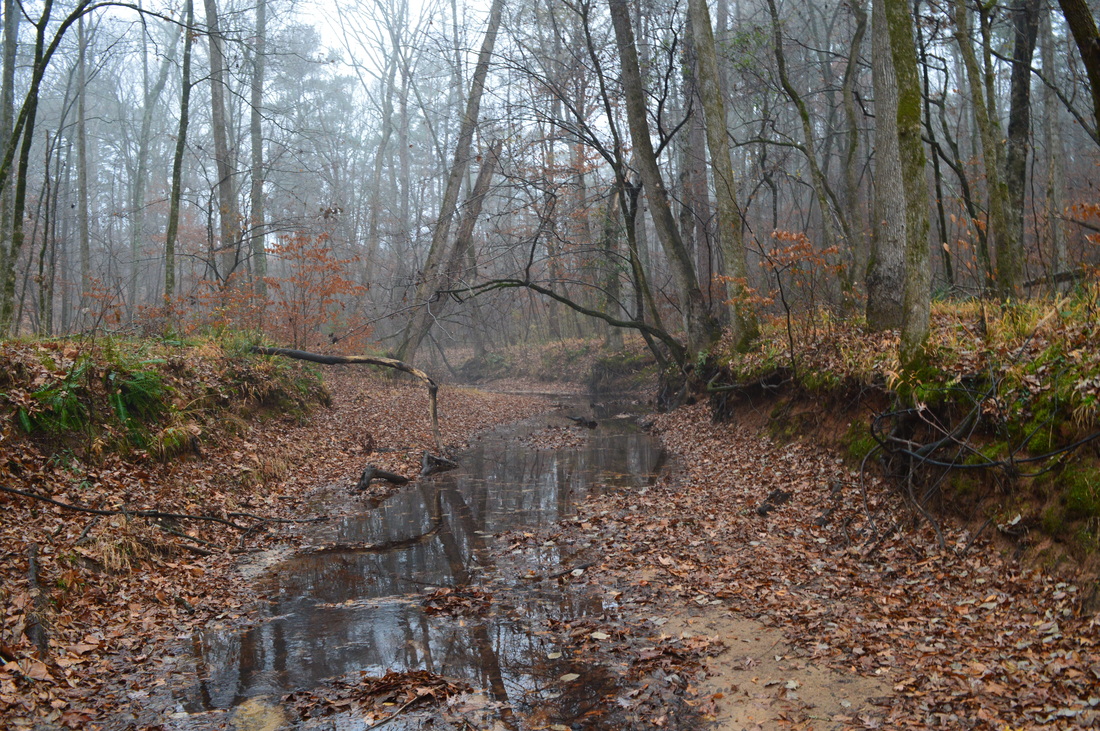
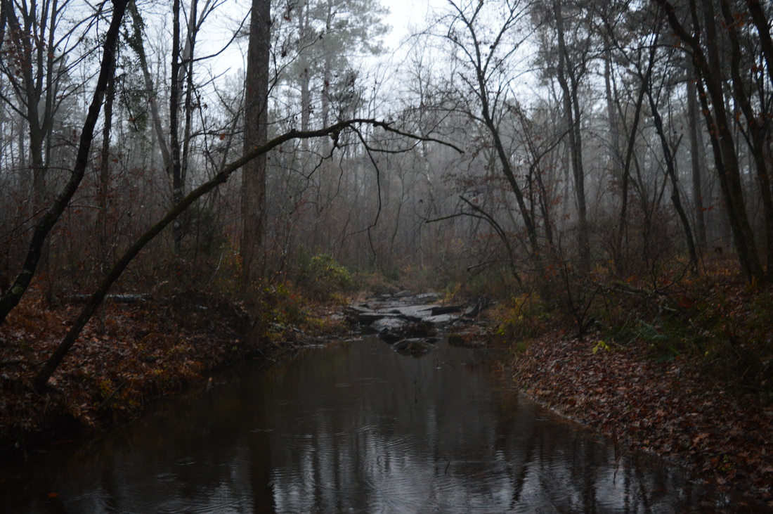
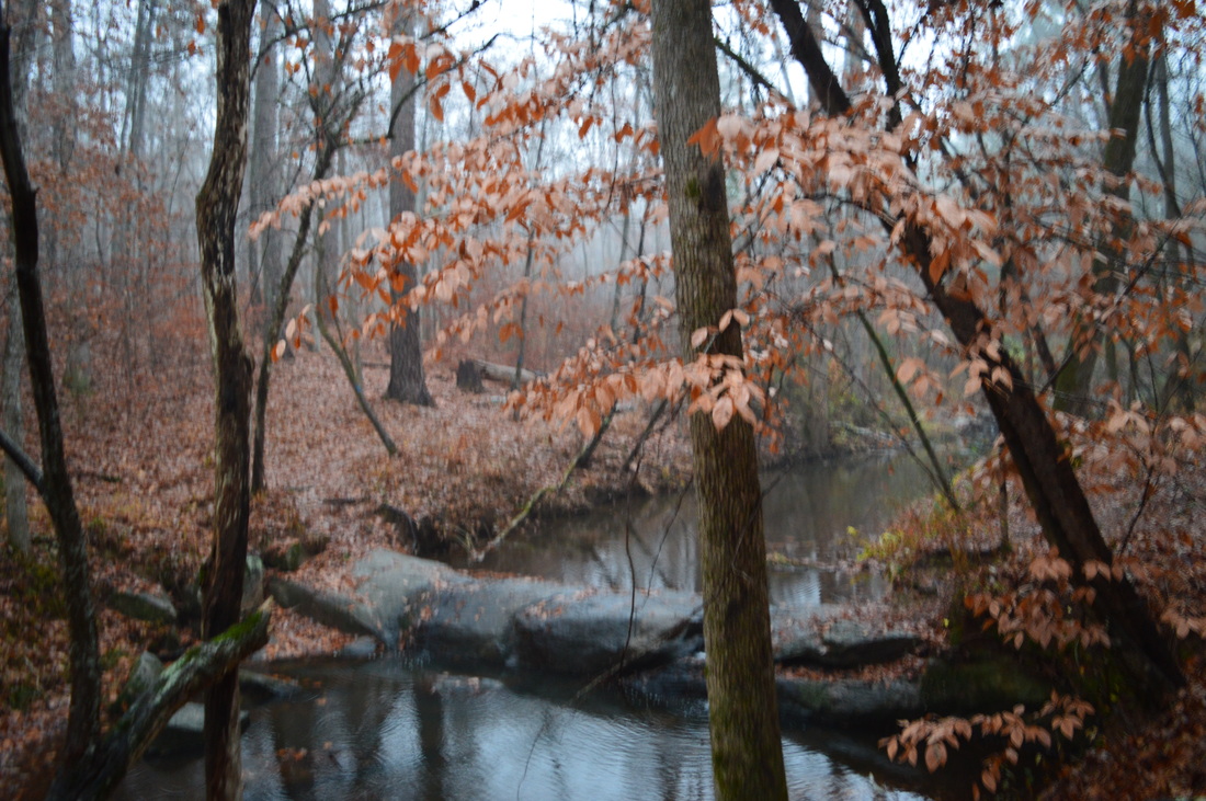
 Ever hiked in Georgia's Piedmont? You'll be treated to lakes, rolling hills, and scattered woodlands. It's different from the mountains, and many hikers may fInd it boring. This hike close to Augusta's metro area is a primer for the area though. You'll be treated to views of Clarks Hill Lake, a canyon caused by soil erosion from poor farming activities, and a small natural rock dam on Boehler Creek. This hike is one of the easiest ones on this website. It is suitable for most ages and levels of experience, and the lay of the land is easy to traverse. This hike occurred on Saturday, December 6th, 2014. My plan was starting from Misteltoe State Park's Trailhead, to hike the Cliatt Creek Nature Trail to Rock Dam Trail, and then hike the Rock Dam Trail back to the trailhead. Along the way, there would be 4 fords - two of Cliatt Creek and two of Boehler Creek. R/T Length of Trail: 8 Miles Duration of Hike: 3:30 Type of Hike: Loop Difficulty Rating: 4 out of 10 Pros: Great hike for beginners; views of Clarks Hill Lake; natural rock dam; small canyon caused by soil erosion Cons: Fords of Boehler Creek and Cliatt Creek (wading may be required during wetter months) Scenic Views: None Water Features: None Trail Blaze Color(s): Cliatt Creek Nature Trail - White; Rock Dam Trail - Blue Best Season(s) to Hike: Year-round; maybe Fall when water levels are lower Beginning Point: Main trailhead at Visitor Center in Mistletoe State Park Directions: From Appling, GA: Follow Ray Owens Road north for 4.6 miles. Then turn left onto GA State Route 150 (Cobbham Road). In 4.2 miles, turn right onto Mistletoe Road. Enter Mistletoe State Park in about 3 miles, and turn left on Campground Road. The trailhead kiosk and parking area will be on the left across from the visitor center. it barely matters which direction to hike this trail. I took the clockwise route, so that I could see some of the small canyons on the north side first. From the trailhead, the nature trail goes straight into the woods, but if you want to do it the direction I did it, it is a little less obvious. Walk across the road to the visitor center, and take the rubber path. This is the start of Cliatt Creek Nature Trail and Canyon Loop Trail. In 0.1 miles, the two trails split up. The Canyon Trail continues forward on the rubber path, while the Cliatt Creek Trail turns left. I heard that the bigger canyon is straight ahead, along with an observation deck viewing a wet-weather waterfall. I didn't see anything too interesting over there though, so I skipped the side trip and turned left. You can do it though - it's optional. The Cliatt Creek Trail stays flat on its northern section for most of the time. However, in the first few tenths of a mile, you will cross a few small erosion gullies that look like war trenches. In 0.5 miles, reach a junction with the Office Trail. This trail serves as a connector to the Beach Trail, the primary path that leads through and around the park's busier areas (cottages, campground, and beach areas). Meanwhile, Cliatt Creek Nature Trail turns right here. It's hard to miss the junction - there is a trail marker and plenty of white blazes. The trail crosses several more small erosion gullies, with views of the main, bigger one on the right. These gullies are just extremely small versions of Providence Canyon near Lumpkin,Georgia (you can find a listing about it on this website). Maybe if these poor faring practices had been much longer-lasting, a similar canyon would have formed in Mistletoe State Park. Anyway, the Cliatt Creek Trail continues near the gully, finally crossing it in a few tenths of a mile. Shortly after the bridged crossing, you will see a very noticeable tree on the right. But why is it noticeable? Because it has the largest vine twisted around it I have ever seen. A vine this big could strangle it quite soon! After a gentle climb through sparse forest, reach a junction with the other end of the Canyon Loop Trail. The shortcut is pretty big, and cuts out some of the less interesting sections along Cliatt Creek Trail - I just wanted to add some mileage. At the junction, bear left, and cross the main park road at 1.5 miles. The descent into the Cliatt Creek corridor is marked by a tree that fell over the trail in such a way as to form an arc. The descent is not steep but steady. The erosion gully is back on the left (also acting as a water drainage now). This gully empties into Cliatt Creek right where the Cliatt Creek Nature Trail reaches Cliatt Creek. At this point, you can see Cliatt Creek emptying into Clarks Hill Lake to the left. At 2 miles, you reach the lower junction with Rock Dam Trail. It is not very well marked, but you can see a trail heading off to the left across Cliatt Creek. Cliatt Creek is the more robust of the two waterways on this hike, hence the harder crossings/fords. During normal water levels, this crossing should not require wading, or just barely so, as the rocks are just above water. However, should the water be a bit higher or after significant rainfall, prepare for a wet crossing. A bit downstream, there is also a fallen tree across Cliatt Creek that can be used to cross the creek, if you do not want to wade - do it at your own risk. On the other side of the stream, you are now on the Rock Dam Trail, which is blue-blazed. The very first section of the trail might be the most scenic one - the trail first follows Cliatt Creek downstream and then curves on the north side of the park's highest point - a hill topping out at 465 feet. However, in between the hill's steep slopes and Clarks Hill Lake just below, the trail follows uneven terrain with good lake views. After the first half mile or so, the lake views come to a close and the trail resumes a rather monotonous nature that will be the case for most of the rest of the hike. At 3 miles from the start of the hike, intersect an old road with no signs except marking the trail crossing the road. Turning right would short cut the hike in a good amount - and also let you miss thee namesake feature of the trail, the Rock Dam. Turning left takes you to the lake. I am not sure of the exact mileage of the spur, but I think it gets close to half a mile. There might be some nice lake views over there though. For the purposes of this description, just cross the road and keep following the blue blazes. The trail will be constantly crossing gullies/ravines. There will be a particularly large one on the left, larger than all the ones before. After a few of them, I kept thinking that the next one would be Boehler Creek, but not so fast... before that was Campsite #3. This is a nice site situated in a dry spot on a small hill, away fro the lake. There will be a picnic table on the left - a small path behind the table leads through a grove of pines out onto the "beach" of Clarks Hill Lake, which at this point, is little more than a marshy finger. Shortly after the campsite, the trail rounds another small hill and descends into "Devil's Gorge", the valley that houses Boehler Creek at 4 miles. Boehler Creek has less water than Cliatt Creek, especially at this lower crossing. It is easily done during normal water levels, as there is only a narrow channel of water. However, there did not appear to be any rocks in the area of the crossing, so if water levels are up and the creek is wider, you may have to wade here as well. If you went off-trail up the stream, you'll come to the Rock Dam very shortly, but there's no need in doing so. Just keep following the blue-blazed path as it follows Boehler Creek downstream, and then curves away from the lake. There may be some more winter lake glimpses around here, but these were your last. The rest of the hike will be in the slightly more elevated terrain of Mistletoe State Park's southern sector, Just before leaving the lake for good, the trail passes Campsite #2. This is my favorite site. It is situated on a rocky, dry hill. After this, the trail follows the park boundary and a small stream, although soon climbing away from it. You'll pass Split Rock on the way, situated on the highest hill in sight. After this, a steady descent brings you back into the Boehler Creek area. The trail follows the creek downstream for a bit, and then reaches the "Rock Dam" at 5 miles. This crossing is easy too, if you cross on the dam. In the wettest of times, maybe these rocks will be underwater, but generally, they shouldn't be. Upstream is a scenic spot, and in the fog, the picture that turned out was pretty interesting. On the other side of Boehler Creek was Campsite #1, "Rock Dam Campsite". This site is located right along the stream. The trail leaves the campsite and climbs up a little, before reaching another gully. Until now, the pattern was that the trail crossed the gullies. This time, the trail followed the gully almost to its end, before ascending a bit. Around here, a dog appeared out of nowhere. He was probably lost - he was running around in circles and followed me for a bit. About a mile later, he disappeared. The trail resumes to its familiar monotonous manner. It descended through gullies and climbed small hills, heading in one general direction. At 6 miles, reach a junction with the old road that you saw much earlier, 1 mile into the Rock Dam Trail. This is where the shortcut comes out. Turn right to follow the trail - turning left leads out of the park. After the right turn, don't miss a left turn that comes very soon. If you continue straight all the way, you'll end up back where you were. The left turn is marked though. Once you turn left, the descent towards Cliatt Creek begins. By now, you've probably noticed the descents to and ascents from the Cliatt Creek valley are more significant than the ones around Boehler Creek. On the way down towards the creek, you will cross some rock outcrops. Keep following the trail, as it bears left over the rocks. The descent soon bottoms out near Cliatt Creek. The trail follows Cliatt Creek a little bit downstream, and then comes out onto the creek at the fourth, final, and trickiest crossing/ford. You are most likely going to have to wade here. If you have hiking poles, it may be possible to balance across some small rotten logs in the water. These logs are going to be in the water during high water, and even in normal water, it is tricky, so I recommend wading here. The water should not be deep anyway. Right across the creek, the trail gets a bit confusing. Once you climb out, take the path that goes right (there are no blazes). The left path appears to be a fisherman path that continues pretty far along the creek. The right path shortly comes out onto Cliatt Creek Trail with blazes at 7 miles. Turning right here will lead you out to the lower junction with Rock Dam Trail; turn left to go back towards the trailhead. The ascent out of the Cliatt Creek valley is about three quarters of a mile long. It is not steep and the grades are easy. At 7 3/4 miles, the ascent ends at a crossing of Mistletoe Road at the park boundary. The gate is on the right - keep going straight into the woods. Keep following the white blazes to descend back to the trailhead at 8 miles. In summary, this is a nice woodland hike, and the locals from east Gerogia should like it. If you're looking for a break from the tougher trails in the mountains, this trail is for you. Below are some of my pictures.
2 Comments
Emily Thomas
6/23/2017 11:01:34 pm
Thank you for the thorough account of your hiking experience at Mistletoe State Park. This is exactly the information I was interested in seeing prior to making a decision to drive out there tomorrow morning for a hike. 8/3/2022 05:39:26 pm
Edirne ECA servisi hizmetlerimiz memnuniyet odaklıdır. Detayları incelemek için hemen web adresimize göz at! https://www.edirneklimaservisi.com/edirne-eca-servisi/ Leave a Reply. |
About MeMark Oleg Ozboyd Dear readers: I have invested a tremendous amount of time and effort in this website and the Georgia Waterfalls Database the past five years. All of the work that has gone in keeping these websites updated with my latest trip reports has almost been like a full-time job. This has not allowed me to pick up a paid job to save up money for college, and therefore, I I've had to take out loans. If you find the information on this website interesting, helpful, or time-saving, you can say "thanks" and help me out by clicking the button above and making a contribution. I will be very grateful for any amount of support you give, as all of it will apply toward my college tuition. Thank you!

Coming in 2022-2023?
Other Hiking WebsitesMiles HikedYear 1: 540.0 Miles
Year 2: 552.3 Miles Year 3: 518.4 Miles Year 4: 482.4 Miles Year 5: 259.9 Miles Archives
March 2021
Categories
All
|


 RSS Feed