HIKING THE APPALACHIANS AND BEYOND
  • Home
  • Trail Reports
    • Best Hikes
    • Hikes with Scenic Views
    • Hikes with Water Features
    • Alabama
    • Georgia
    • Florida
    • North Carolina
    • South Carolina
    • Tennessee
    • Vermont
    • Virginia
  • Map
  • Hike List
  • Testimonials
  • Resources
  • Contact Us
  • Southeast Nature Society
    • Our Team
  • Georgia Waterfalls Database

Great Smoky Mountains National Park: Purchase Road to Purchase Knob & Cataloochee Divide Trail - Purchase Knob to Hemphill Bald, Maggie Valley, North Carolina

1/21/2015

2 Comments

 
Picture
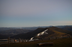
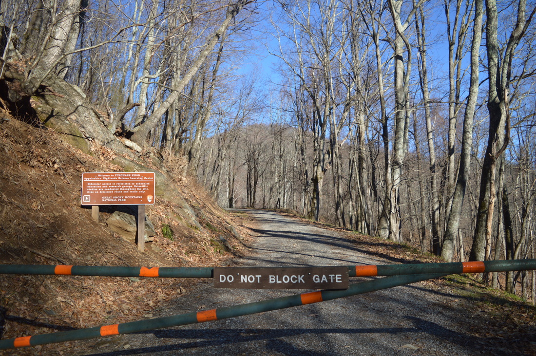
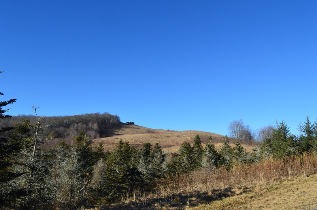
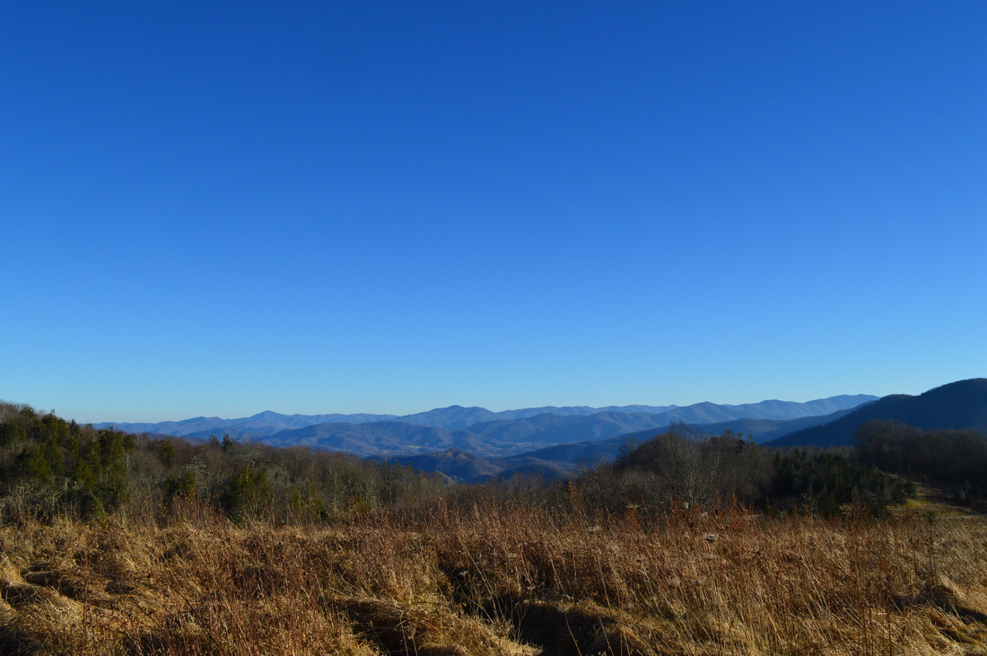
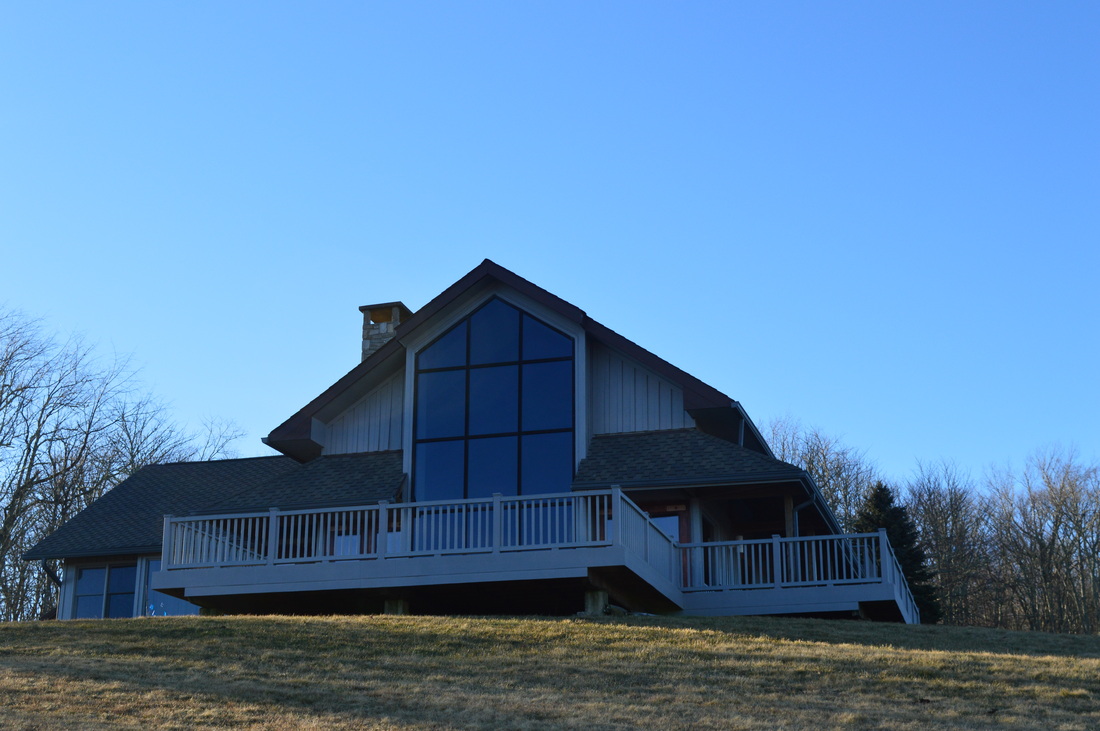
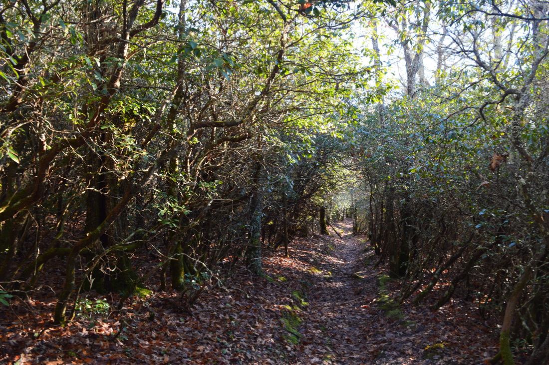
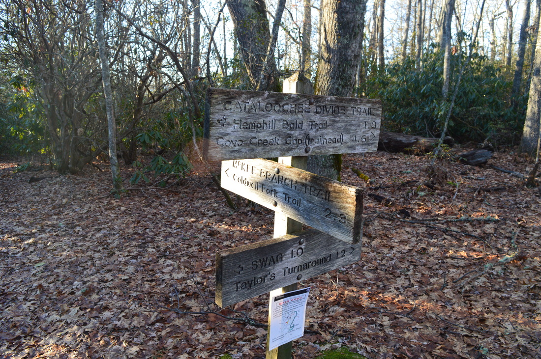
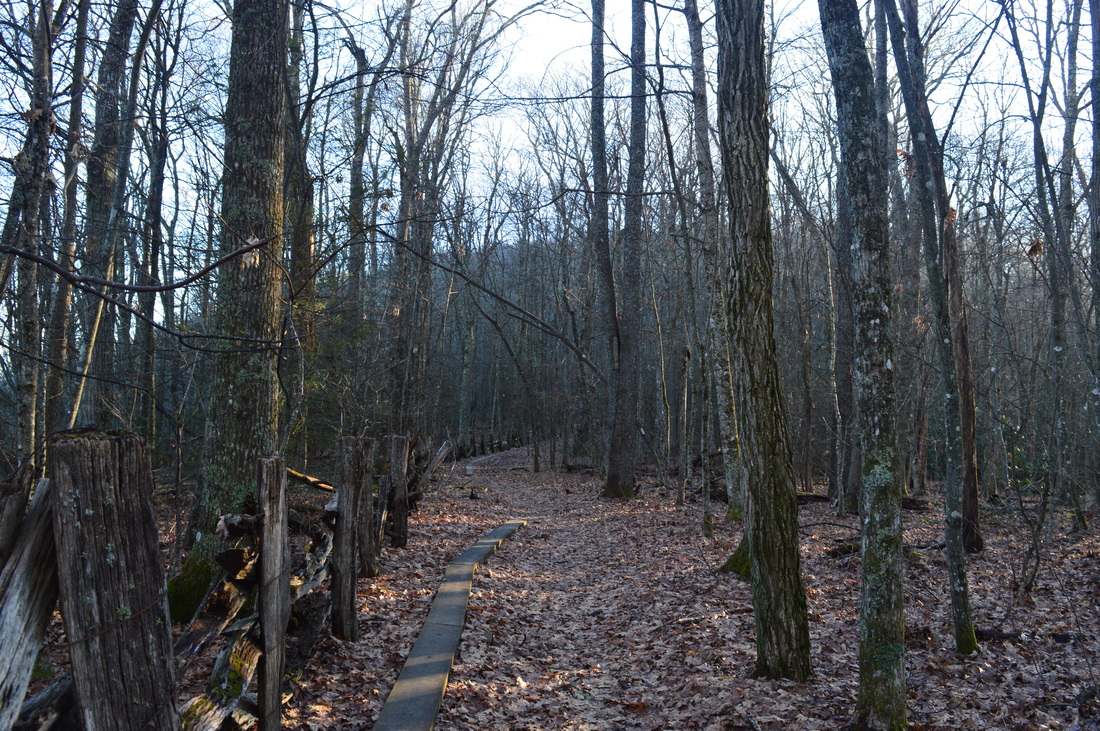
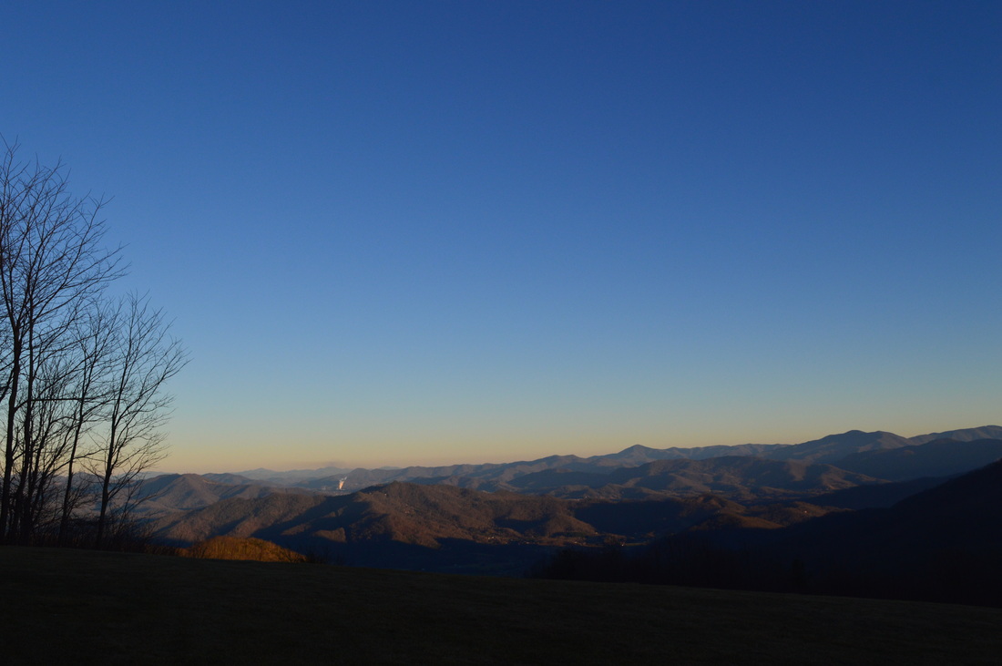
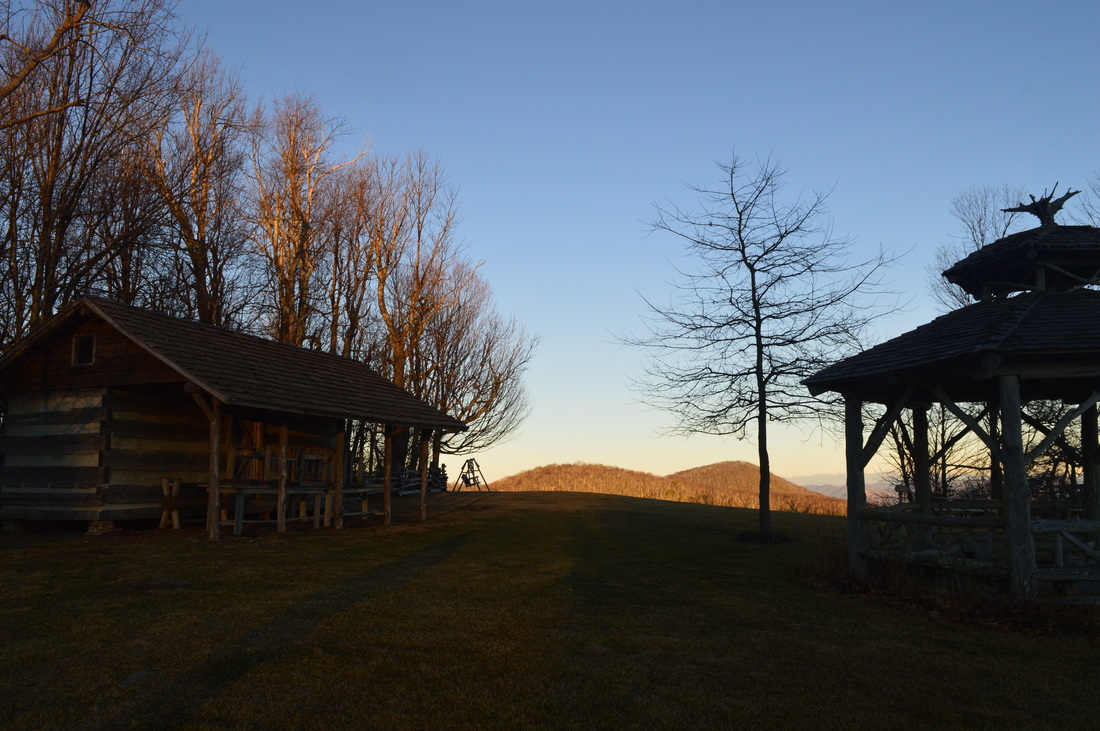
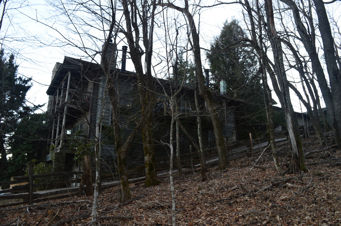
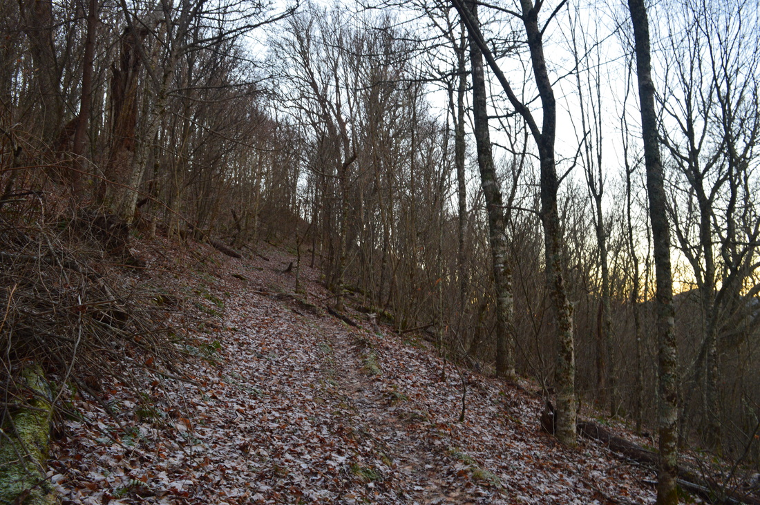
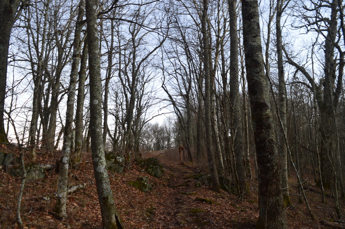
The Cataloochee area of the Great Smoky Mountains National Park is an overlooked and very scenic region. Cataloochee Divide marks the eastern boundary of GSMNP in this area, separating Cataloochee Valley and Maggie Valley. Cataloochee Divide Trail might be one of the most spectacular trail in the entire park, if hiked during winter. Views sprout in all directions. However, the section described here is a good hike even  during summer, with amazing views from Hemphill Bald and Purchase Knob. Along the way back, take a minute to stop at and explore the Ferguson Cabin located just below Purchase Knob. This hike occurred on Thursday, December 25th, 2014. My plan was to park at the gate on Purchase Road, and then hike up Purchase Road to Purchase Knob. From there, I would pick up the Cataloochee Divide Trail and follow it past the The SWAG to Hemphill Bald. I would retrace my steps back, but instead of climbing back up Purchase Knob, I would shortcut it using the Ferguson Cabin Trail. 

R/T Length of Trail: 9.4 Miles
Duration of Hike: 5:05
Type of Hike: Out and back
Difficulty Rating: 6 out of 10
Pros: Many views; historical features
Cons: Confusing sections of trail on Ferguson Cabin Trail
Scenic Views: Purchase Knob - 8 stars; Gooseberry Knob - 7 stars; Hemphill Bald - 8 stars
Water Features: None
Best Season(s) to Hike: Winter
Trail Blaze Color(s): None 
Beginning Point: Pullout at Great Smoky Mountains National Park gate on Purchase Road 
Directions: From Maggie Valley, NC: Follow US Route 276 north for 2.9 miles until Grindstone Road. Turn left onto Grindstone Road and follow it for about 5 miles to the gate and a small pullout on the left right before it. Road name will change to Hemphill Road and eventually Purchase Road.
The Appalachian Highlands Science Learning Center is located in a pretty spot, up on Purchase Knob. The true summit of Purchase Knob i actually a bit farther and higher, and technically where AHSLC is is Purchase Gap, but most people refer it to as Purchase Knob anyway. The first part of this hike is along a gravel road, but you're unlikely to see anyone driving, except sometimes on weekdays. Also, if by some chance the gate on Purchase Road is open, DO NOT drive in. You may get locked in. 


From the gate, Purchase Road climbs slightly, following a small creek. In 0.2 miles, the gravel road crosses the creek and a powerline cut, and then continues to climb the slopes of Purchase Knob. Winter views are abundant. Most of the first mile is not very steep, but still a steady climb. At around 1.3 miles, the gravel road continues forward, while a grassy road goes left, with the AHSLC visible on the top of the Purchase Knob. Take the grassy road, and immediately, keep right, while the Ferguson Cabin Trail continues forward. The grassy path steeply climbs up the bald, with increasing views behind you. The steep climbs ends at 1.7 miles at the Appalachian Highlands Learning Center. Great views abound in all directions, and the next summit just to the the north is the true summit of Purchase Knob. Take a minute and enjoy the panorama. From here, there are several ways to reach the Cataloochee Divide Trail. I went behind the building and saw a sign "To Cataloochee Divide Trail", but the way that path twisted around (and it is seen on the map too), I doubt it was the quickest route. The description will follow the route I took though. The path starts at the upper left corner and starts to descend. What I don't like about this is that you descend 70 feet, and then climb back up to just a bit higher than you were before. This trail descends until it reaches another, wider trail at 1.8 miles. Turn right here, and begin climbing back up. Reach yet another trail at 2 miles. I suspect turning right is a shorter way back to AHSLC, but for the Cataloochee Divide Trail, turn left. This trail shortly brings you out onto the Cataloochee Divide Trail. 


If you turn right, it will eventually bring you to Cove Creek Gap in 4.5 miles. However, Hemphill Bald is the left way. Once you turn left, it is a delightful downhill through a rhododendron tunnel. At 2.3 miles, the trail reaches a gap. Here, McKee Branch Trail turns right and heads down toward Caldwell Fork and Cataloochee Valley. Ferguson Cabin Trail turns left. Remember this spot - you will turn onto Ferguson Cabin Trail here on the way back. After this, boardwalks help you get through a short muddy section, and then the trail rounds a small knob. The next gap is reached at 2.8 miles. From here, the trail starts the climb up to Gooseberry Knob and The SWAG. The climb is not very steep for the most part. At 3.1 miles, an opening in the fence on the left provides access to a nature trail. I assume this nature trail goes to Cataloochee Ranch. The Cataloochee Divide Trail reaches Goosberry Knob at 3.3 miles. There are great views here, similar to those from Purchase Knob, but a little more blocked by trees on the right. Cataloochee Ski Resort is now in the view on the upper right - on the way back, it made for a great night photo. After Gooseberry Knob, the trail steeply descends into an unnamed gap, only to steeply ascend onto an unnamed knob at 3.7 miles, home of The SWAG. Judging by the solitude around the inn, it seemed like it wasn't their season and no one stays there in winter. After The SWAG, some more climbing will lead to another unnamed knob at 4.1 miles. Winter views abound into the heart of the Smokies. A short descent leads to Double Gap at 4.2 miles. 


Double Gap kindof lives up to its name - the gap is long, and one could say it is double. The gap marks the end of Cataloochee Divide Trail Here, Hemphill Bald Trail comes out from the right and goes forward. If turning right, the Hemphill Bald Trail eventually reaches the upper reaches of Caldwell Fork. From Polls Gap on Heintooga Ridge Road, an excellent loop option ( a longer hike than the one described here) would be Rough Fork Trail - Caldwell Fork Trail - Hemphill Bald Trail Loop, equal to 13.7 miles. I haven't hiked it yet,but it is in my plans for one day. Anyways, back to the trail description, the second main climb of the day starts after Double Gap. Over the next 0.7 miles, the trail climbs 500 feet o the summit of Hemphill Bald. From Double Gap, you can see much of the bald portion of Hemphill Bald, but the summit observation area cannot be seen from here. The trail first follows the Cataloochee Ranch barbed wire fence, but then veers into the woods. As I rose above 5000 feet, a trace of snow appeared on the ground from last night's light snow event. As the trail climbs, it provides good views to the ridges to the north and west. As you near the summit of Hemphill Bald, the closest ridge on the right is Heintooga Ridge/Balsam Mountain. While there are several views before the summit, you will know when you reach the main one. A small passage through the fence on the left lets you into a fenced area of land, with outstanding 180-degree views. While there are similar to Purchase Knob, they might be even better. The reason is that since Purchase Knob is at a lower elevation, the ridge that houses Cataloochee Ski resort would block the view beyond it. Now, that ridge is directly below you, and you can see the numerous ridges to the right that fade away into Nantahala National Forest. Straight ahead on the horizon, the farthest ridge is the Black Mountains. The observation area also has some information about Cataloochee Ranch and a stone table. This is a place not to rush from. I waited for nightfall and got an excellent picture of Cataloochee Ski Resort and Maggie Valley shining in the dark.


It may be tempting to stay for a while at Hemphill Bald, but eventually, you'll have to go back. Retrace your steps all the way back to where I earlier talked about the Ferguson Cabin Trail junction. This trail is now on your right. Turn onto it, and start descending steeply along the slopes of Purchase Knob. Soon, the trail splits - the hiking trail goes right and the horse trail keeps forward. Turn right, and continue descending steeply. Then, reach a confusing spot. The trail briefly follows a small stream's bed (usually you should be able to stay dry here). After leaving the stream, reach Ferguson Cabin. take a minute to look around it and inside it, then go to the back of the house and take the wide path that heads right. There will shortly be a small spring. Even though there are few sign,s you should be able to tell what is the main path, as it is the widest. Climb slightly, with Purchase Knob and Appalachian Highlands Science Learning Center coming into view, and then reach Purchase Road. Turn right, and follow the road back to your car. 


To summarize, this might be one of the best hikes I've done in the Smokies yet. Mt. LeConte was supposed to b really good, but if you have been reading my blog for a while, you'll know that I didn't manage to see any views that day. I rate this hike a Best Hike. Below are my pictures and videos. 
Best Hike
2 Comments
Jerri-Anne
6/20/2016 12:19:06 pm

Thank you for the wonderful descriptions and photos!

Reply
Edirne baymak servisi link
8/4/2022 06:12:09 am

Edirne baymak servisi en uygun fiyat ve en hızlı servis garantisi ile sizlerle. https://www.edirneklimaservisi.com/edirne-baymak-servisi/

Reply


Leave a Reply.

    About Me

    Mark Oleg Ozboyd
    I'm an avid outdoor explorer and a hobbyist landscape photographer. I'm 21 years old and have been hiking since 2011. Originally based out of Atlanta, Georgia, I started out by occasionally hiking short trails throughout well-known Georgia State Parks. During 2012 and 2013, I began to expand my trips into adjacent states, as well as into the wilder National Forest areas rather than just State Parks. Throughout the years that followed, as I slowly ran out of popular hiking trails in my area, I began to search for and hike in more seldom-visited areas. Today, you can find me out in the woods every weekend, whether it's on an official trail or bushwhacking through cross-country terrain without any paths. I now attend Washington & Lee University and am exploring Virginia and West Virginia. My other hobbies include chess, science, old music, and meteorology. I have 3 years of amateur weather forecasting experience, having studied a lot of meteorology basics over the years. I am also a student at European School of Music where I learned that music and nature have a lot in common. Listening to good music inspires me to capture nature's beauty on the camera in different aspects that also make me recall many beautiful music pieces that I've heard.​


    Dear readers: I have invested a tremendous amount of time and effort in this website and the Georgia Waterfalls Database the past five years. All of the work that has gone in keeping these websites updated with my latest trip reports has almost been like a full-time job. This has not allowed me to pick up a paid job to save up money for college, and therefore, I I've had to take out loans. If you find the information on this website interesting, helpful, or time-saving, you can say "thanks" and help me out by clicking the button above and making a contribution. I will be very grateful for any amount of support you give, as all of it will apply toward my college tuition. Thank you! 

    Enter your email address to subscribe for trail reports:

    Delivered by FeedBurner


    Picture
    Coming in 2022-2023?

    Other Hiking Websites

    DWHike's Adventures
    Florida's Natural Wonders
    Florida Trailblazer
    Meanderthals
    Mountain Images
    by Bernie Boyer

    North Carolina Waterfalls with
    ​Kevin Adams
    Take-a-Hike!
    Tennessee Landforms
    Waterfall Page
    Waterfall Adventurer
    Zach's Mild Adventures

    Miles Hiked

    Year 1: 540.0 Miles
    Year 2: 552.3 Miles
    ​Year 3: 518.4 Miles
    Year 4: 482.4 Miles
    Year 5: 259.9 Miles

    Archives

    March 2021
    February 2021
    January 2021
    November 2019
    October 2019
    September 2019
    August 2019
    July 2019
    June 2019
    February 2019
    January 2019
    December 2018
    November 2018
    October 2018
    August 2018
    July 2018
    June 2018
    May 2018
    April 2018
    March 2018
    February 2018
    January 2018
    December 2017
    November 2017
    October 2017
    September 2017
    August 2017
    July 2017
    June 2017
    May 2017
    April 2017
    March 2017
    February 2017
    January 2017
    December 2016
    November 2016
    October 2016
    September 2016
    August 2016
    June 2016
    May 2016
    April 2016
    March 2016
    January 2016
    December 2015
    November 2015
    October 2015
    September 2015
    August 2015
    July 2015
    June 2015
    May 2015
    April 2015
    March 2015
    February 2015
    January 2015
    December 2014
    November 2014
    October 2014
    September 2014
    August 2014
    July 2014
    June 2014
    May 2014
    April 2014
    March 2014
    February 2014

    Categories

    All
    Adel
    Adirondack Park
    Alabama
    Alfred A. Ring Park
    Allegheny Trail
    Amicalola Falls State Park
    Anniston Area
    Apalachicola Bluffs And Ravines Preserve
    Apalachicola National Forest
    Apalachicola/Port St. Joe Area
    Apopka
    Appalachian Trail
    Appling
    Art Loeb Trail
    Aska Trail System
    Bakersville
    Balm-Boyette Scrub Preserve
    Balsam Lake Recreation Area
    Bankhead National Forest
    Bartow County Parks
    Bartram Trail
    Basinger
    Beersheba Springs
    Benton
    Benton Mackaye Trail
    Berry College Trail System
    Best Hike
    Big South Fork National Recreation Area
    Black Bear Wilderness
    Black Rock Mountain State Park
    Blairsville
    Blakely
    Blood Mountain Wilderness
    Blowing Rock
    Blue Ridge
    Blue Ridge Parkway
    Boone
    Bradenton
    Bradenton Beach
    Brasstown Bald
    Brasstown Wilderness
    Brevard
    Bryson City
    Buchanan
    Bucks Pocket State Park
    Bulow Creek State Park
    Bulow Plantation Ruins State Park
    Caesars Head State Park
    Caladesi Island State Park
    Calhoun
    Camel's Hump State Park
    Cashiers
    Caspersen Beach Park
    Catfish Creek State Park
    Caves
    CC Putnam State Forest
    Cedar Point Environmental Park
    Chatsworth
    Chattahoochee National Forest
    Chattanooga
    Chattanooga Valley
    Chattooga National Wild And Scenic River
    Cheaha Wilderness
    Cherohala Skyway
    Cherokee
    Cherokee National Forest
    Chiefland Area
    Chillhowee Recreation Area
    Chipley
    Chunky Gal Trail
    Circle B Bar Reserve
    Citico Creek Wilderness
    Citrus Wildlife Management Area
    Clarkesville
    Clayton
    Cleevland
    Cleveland
    Cloudland Canyon State Park
    Cohutta Wilderness
    Collier-Seminole State Park
    Cordele
    Cornelia
    Covington
    Crestview Area
    Crew-land-and-water-trust
    Cullowhee
    Cumberland Trail
    Dahlonega
    Dalton
    Dawson Forest Wildlife Management Area
    Dawsonville
    Dayton
    De Soto National Memorial
    DeSoto State Park
    Dillard
    Double Springs
    Ducktown
    Duncan Ridge Trail
    Dunlap
    Eagle's Rest Park
    Eastpoint
    Econfina Creek Wildife Management Area
    Eglin Air Force Base
    Elizabethton
    Elkins
    Elk Knob Game Lands
    Elk Park
    Ellicott Rock Wilderness
    Ellijay
    Emerson Point Preserve
    Englewood Area
    Enota Retreat
    Erwin
    Falling Waters State Park
    Fayetteville
    Fires Creek Recreation Area
    Fire Tower
    Flint River
    Florence Area
    Florida
    Florida Caverns State Park
    Florida Trail
    Foothills Trail
    Fort Mountain State Park
    Fort Myers Area
    Fort Payne
    Fort Payne Area
    Fort Yargo State Park
    Franklin
    Franklin Delano Roosevelt State Park
    Franklin-Marion State Forest
    Frozen Head State Park
    Gainesville
    Gainesville Area
    Gatlinburg
    George Washington National Forest
    Georgia
    Georgia Veterans Memorial State Park
    Glasgow
    Gorges State Park
    Grandfather Mountain State Park
    Great Smoky Mountains National Park
    Greeneville
    Green River Game Lands
    Gruetli-Laager
    Grundy Forest State Natural Area
    GTM Reserve
    Guana River Wildlife Management Area
    Hayesville
    Helen
    Hiawassee
    High Falls State Park
    Highlands
    Highlands Scenic Highway
    Hillsborough River State Park
    Hinson Conservation & Recreation Area
    Historic Sites
    Honeymoon Island State Park
    Hot Springs
    Huntington
    Inverness Area
    Jackson
    Jasper
    Jefferson National Forest
    Joan M. Durante Park
    Jonathan Dickinson State Park
    Jones Gap State Park
    Joyce Kilmer Slickrock Wilderness
    Joyce Kilmer - Slickrock Wilderness
    Juniper Prairie Wilderness
    Kelly Park
    Keown Falls Recreation Area
    Kolomoki Mounds State Park
    LaFayette
    Lake City Area
    Lake George Wild Forest
    Lake June-in-Winter State Park
    Lakeland Area
    Lake Placid
    Lake Russell Wildlife Management Area
    Lake Wales Ridge State Forest
    Laurel Fork North Wilderness
    Leffis Key Preserve
    Leon Sinks Geological Area
    Lexington
    Lineville
    Linville
    Linville Gorge Wilderness
    Lithia Springs
    Little Frog Wilderness
    Little Manatee River State Park
    Little River Canyon National Preserve
    Longboat Key
    Long Trail
    Lookout Mountain
    Lookout Mountain Battlefield
    Lovingston
    Lula Lake Land Trust
    Lumpkin
    Maggie Valley
    Manatee Springs State Park
    Marianna Area
    Mark Trail Wilderness
    Marlinton
    Mccaysville
    McMinville
    Mentone
    Middlesex
    Mistletoe State Park
    Monongahela National Forest
    Montreat
    Mountain Bridge Wilderness Area
    Mountain City
    Mountains To Sea Trail
    Mountains-to-Sea Trail
    Mount Rogers National Recreation Area
    Myakka River State Park
    Myron B. Hodge City Park
    Nantahala National Forest
    Naples
    Naples Area
    Natural Bridge State Park
    Neal Preserve
    New Castle
    Newport
    New River Gorge National Park
    New York
    North Carolina
    Ocala Area
    Ocala National Forest
    Ocean-to-Lake Trail
    Oconee State Park
    Oconee Station Historic Site
    Okaloacoochee Slough State Forest
    Oldsmar
    Oneida
    Orlando Area
    Ormond Beach
    Oscar Scherer State Park
    Oxford
    Palatka
    Palmetto Trail
    Panama City Area
    Panthertown Valley
    Parrish
    Paynes Creek Historic State Park
    Peaks Of Otter Recreation Area
    Pigeon Crockford Mountain Wildlife Management Area
    Pigeon-Crockford Mountain Wildlife Management Area
    Pigeon-Crockford Wildlife Management Area
    Pine Mountain
    Pinhoti Trail
    Pinnacle Park
    Pisgah Civitan Park
    Pisgah National Forest
    Pittman Center
    Pond Mountain Wilderness
    Ponds/Lakes
    Prentice Cooper State Forest
    Providence Canyon State Park
    Pumpkintown
    Quick Point Nature Preserve
    Raven Cliffs Wilderness
    Reed Bingham State Park
    Reliance
    Rice Creek Conservation Area
    Riverview Pointe Preserve
    Robbinsville
    Robinson Preserve
    Rock Creek Gorge Scenic Area
    Rock Island State Park
    Rome
    Rosman
    Sale Creek
    Salem
    Salt Springs
    Saluda
    Santa Rosa Beach
    Sarasota
    Sarasota Area
    Savage Gulf State Natural Area
    Scenic Views
    Scottsboro Area
    Sebring Area
    Sewanee
    Sheltowee Trace Trail
    Shining Rock Wilderness
    Signal Mountain
    Sipsey Wilderness
    Sky Valley
    Smithgall Woods State Park
    Snowbird Backcountry Area
    Soddy Daisy
    Soddy-Daisy
    Sopchoppy
    South Carolina
    South Cumberland State Park
    Southeastern Cave Conservancy
    Southern Nantahala Wilderness
    Sparta
    Sprewell Bluff Park
    Spring City
    Spring Hill
    Springs
    Spruce Pine
    Standing Indian Backcountry Area
    St. Augustine
    St. George Island State Park
    St. Joseph Bay State Buffer Preserve
    St. Marks Area
    St. Marks National Wildlife Refuge
    Stone Mountain
    Stone Mountain Park
    Suches
    Sumatra
    Sumter National Forest
    Suwannee River
    Swallow Creek Wildlife Management Area
    Sweetwater Creek State Park
    Sylva
    Talladega National Forest
    Tallahassee Area
    Tallulah Falls
    Tallulah Gorge State Park
    Tampa Bay Area
    Tate City
    Tate's Hell State Forest
    Tea Creek Wildlife Management Area
    Tellico Plains
    Tennessee
    Thomaston
    Toccoa
    Topsail Hill State Park
    Torreya State Park
    Townsend
    Tracy City
    Tray Mountain Wilderness
    Trenton
    Triple Creek Preserve
    Troutdale
    Unaka Mountain Wilderness
    Upper Tampa Bay County Park
    Venice
    Vermont
    Virgin Falls State Natural Area
    Virginia
    Virginia Outdoors Foundation
    Vogel State Park
    Wakulla Springs State Park
    Waleska
    Walhalla
    Wartburg
    Water Features
    Waynesville
    Weedon Island Preserve
    Weeki Wachee Preserve
    Wekiwa Springs State Park
    West Palm Beach Area
    West Virginia
    Whitehall
    White Springs
    Winder
    Withlacoochee State Forest
    Young Harris

    RSS Feed

TRAIL REPORTS

Hikes in Alabama
​Hikes in Florida
Hikes in Georgia
Hikes in North Carolina
Hikes in South Carolina
Hikes in Tennessee
Hikes in Virginia

Hiking Resources

Alabama Resources
​
Florida Resources
Georgia Resources
North Carolina Resources
​South Carolina Resources
​
Tennessee Resources

Other

Contact
Map of Hikes
Alphabetical List of Hikes
Southeast Nature Society
© COPYRIGHT 2014-2024
​ALL RIGHTS RESERVED.
Important: I disclaim any responsibility for any damage or personal injury that may occur as a result of the activities and information found on this website. All outdoor activities, especially off-trail hiking, are done at your own risk. Never hike or head into that area that may be above your fitness or experience level.
  • Home
  • Trail Reports
    • Best Hikes
    • Hikes with Scenic Views
    • Hikes with Water Features
    • Alabama
    • Georgia
    • Florida
    • North Carolina
    • South Carolina
    • Tennessee
    • Vermont
    • Virginia
  • Map
  • Hike List
  • Testimonials
  • Resources
  • Contact Us
  • Southeast Nature Society
    • Our Team
  • Georgia Waterfalls Database