HIKING THE APPALACHIANS AND BEYOND
  • Home
  • Trail Reports
    • Best Hikes
    • Hikes with Scenic Views
    • Hikes with Water Features
    • Alabama
    • Georgia
    • Florida
    • North Carolina
    • South Carolina
    • Tennessee
    • Vermont
    • Virginia
  • Map
  • Hike List
  • Testimonials
  • Resources
  • Contact Us
  • Southeast Nature Society
    • Our Team
  • Georgia Waterfalls Database

Appalachian Trail: Wildcat Creek Road to Addis Gap to Tray Mountain, Hiawassee, Georgia

1/22/2015

4 Comments

 
Picture
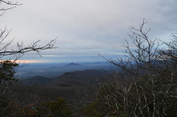
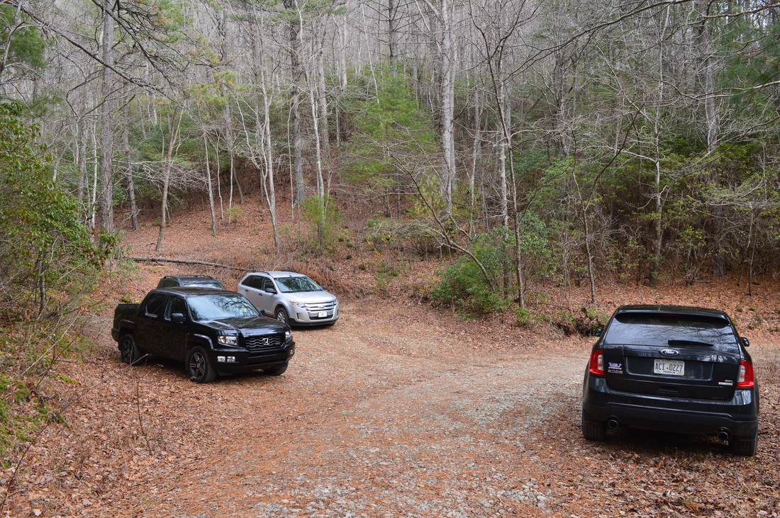
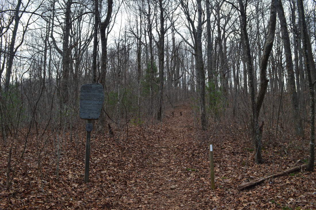
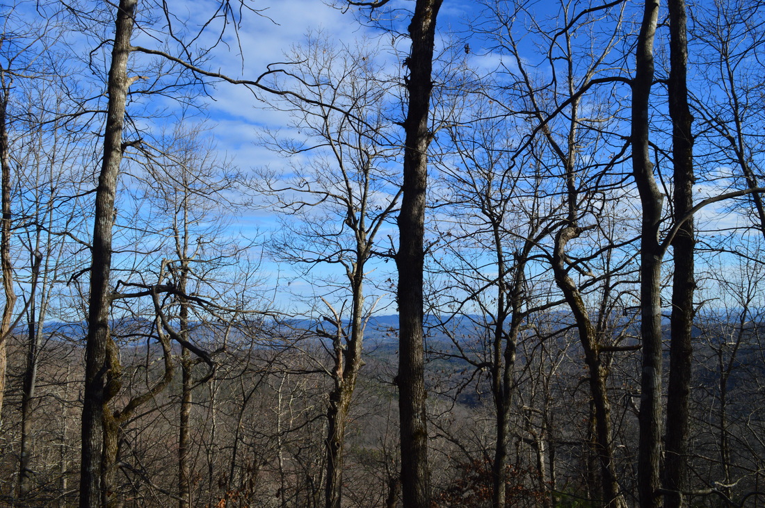
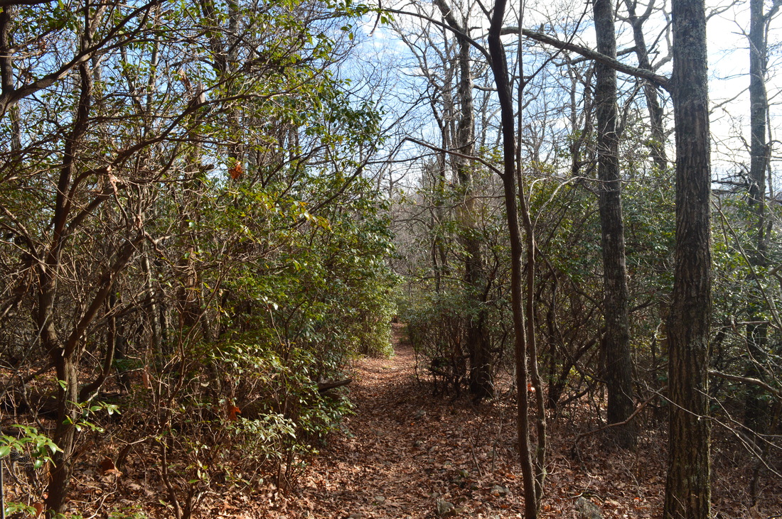
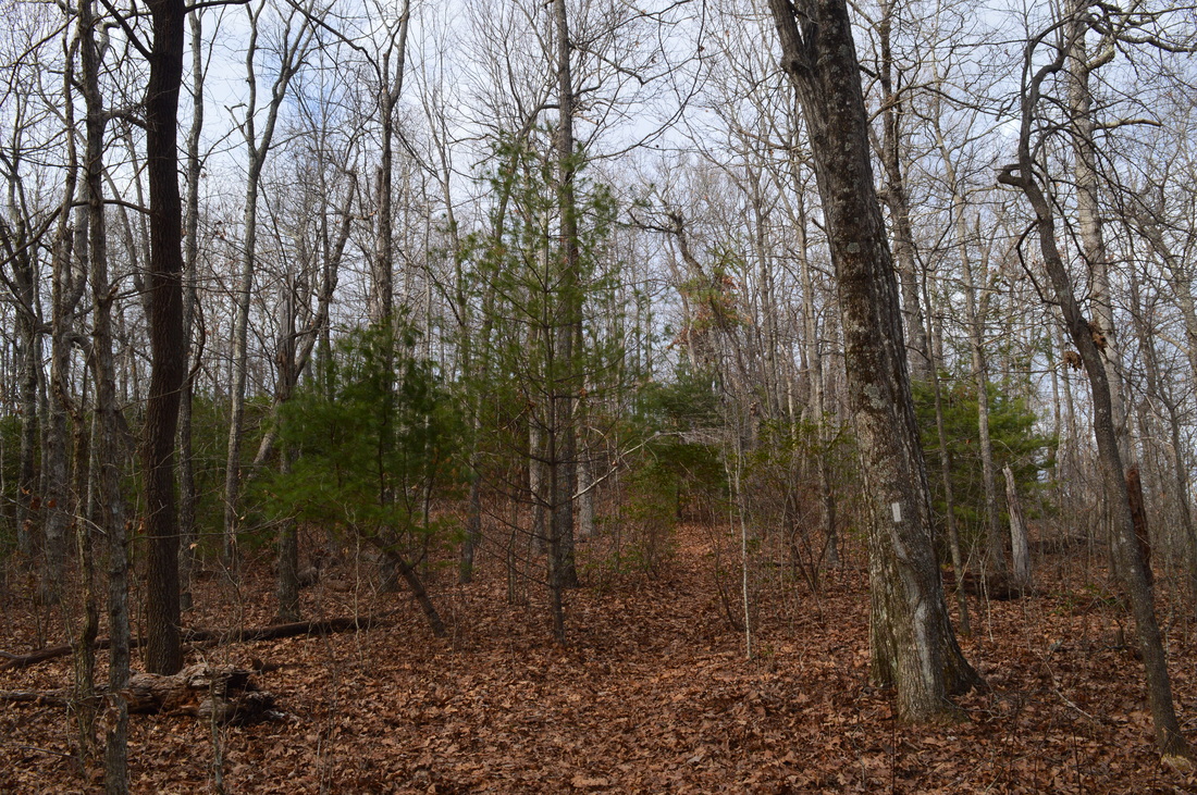
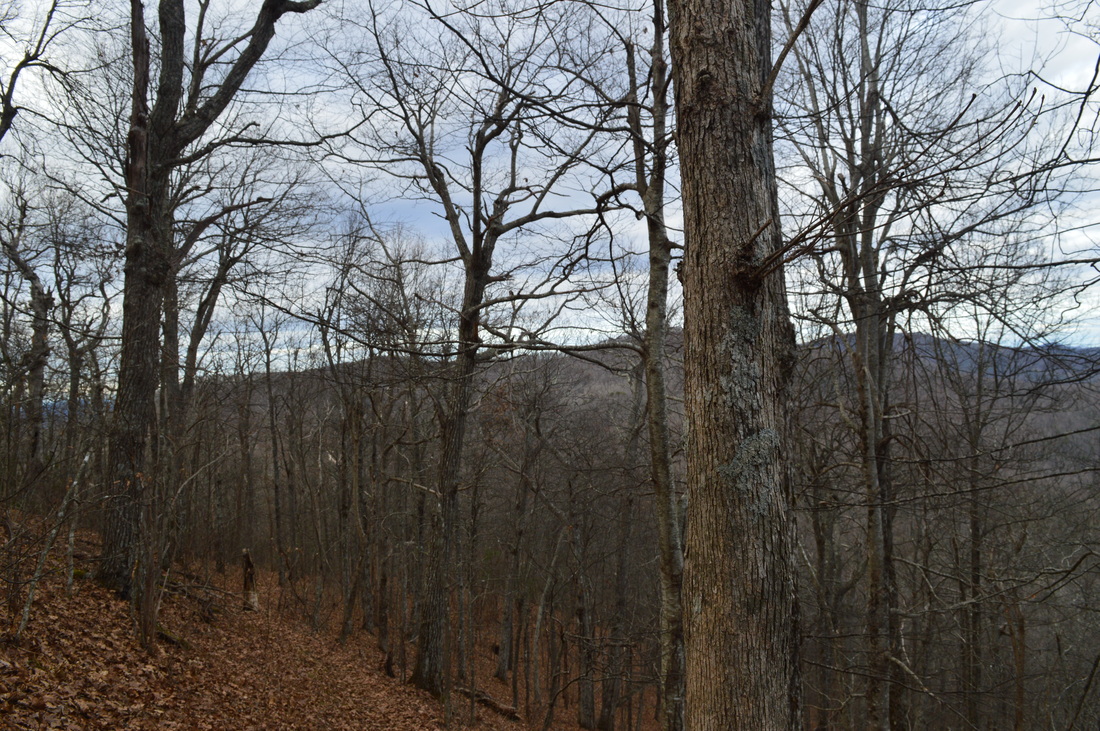
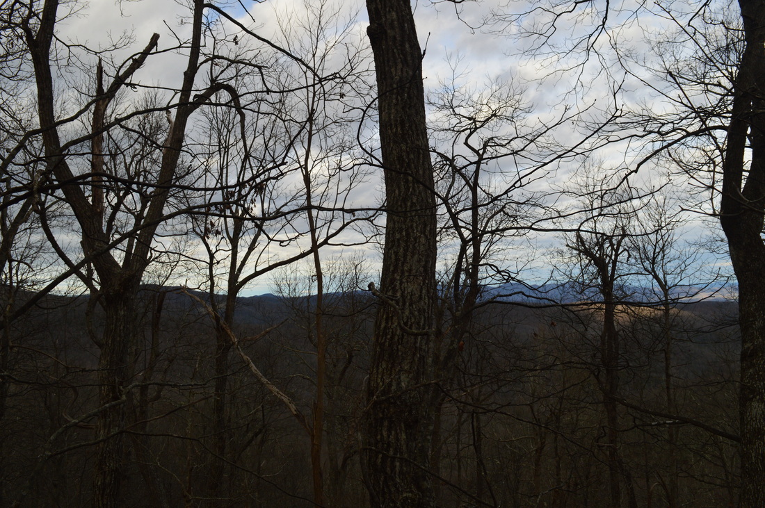
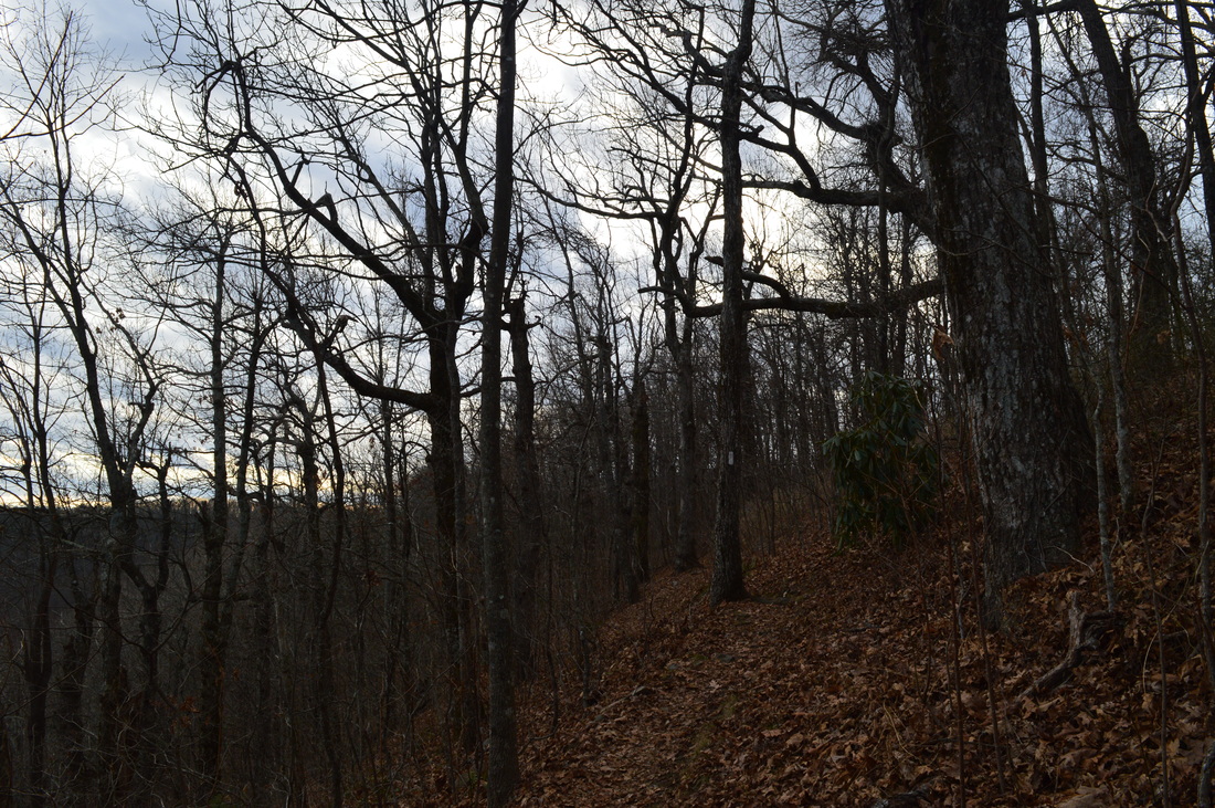
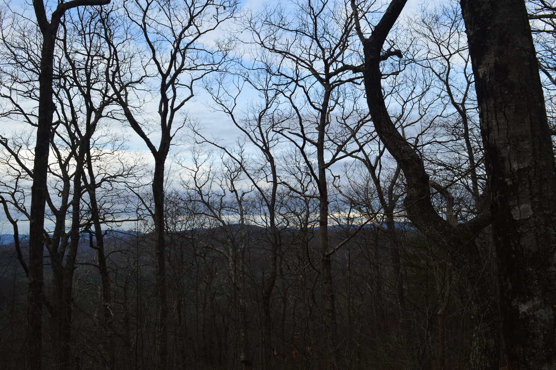
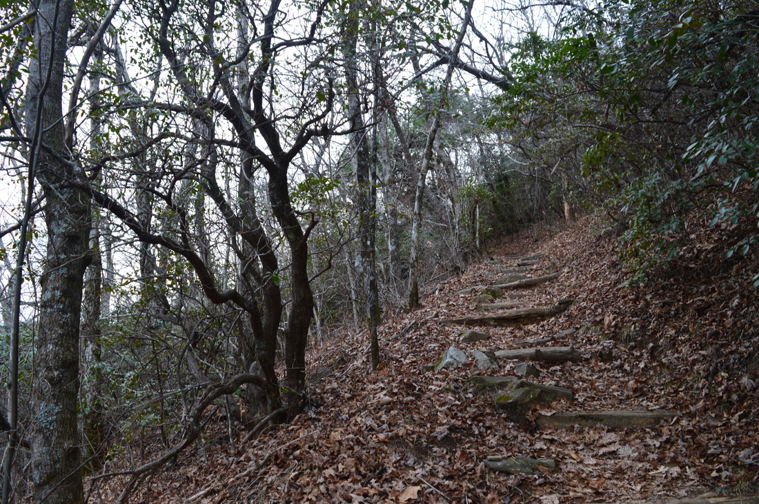
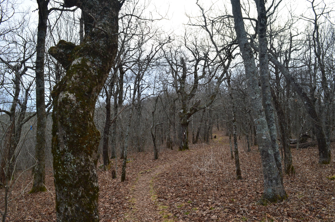
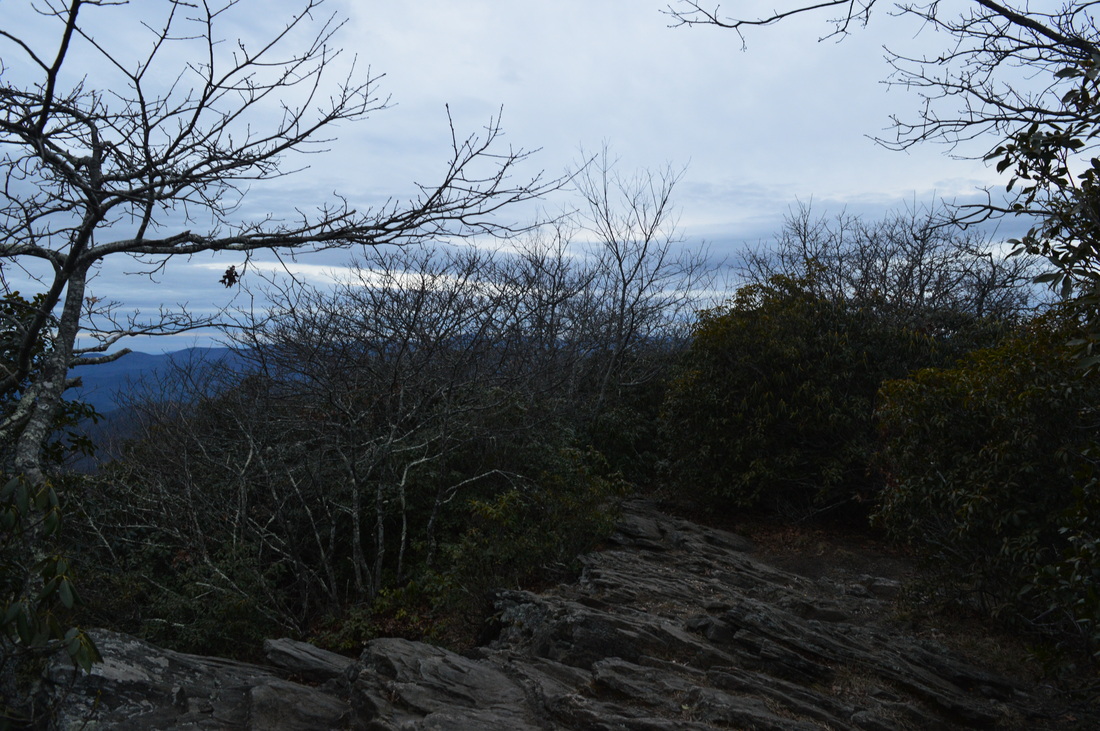
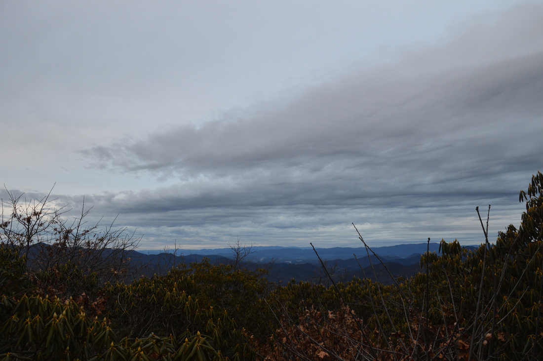
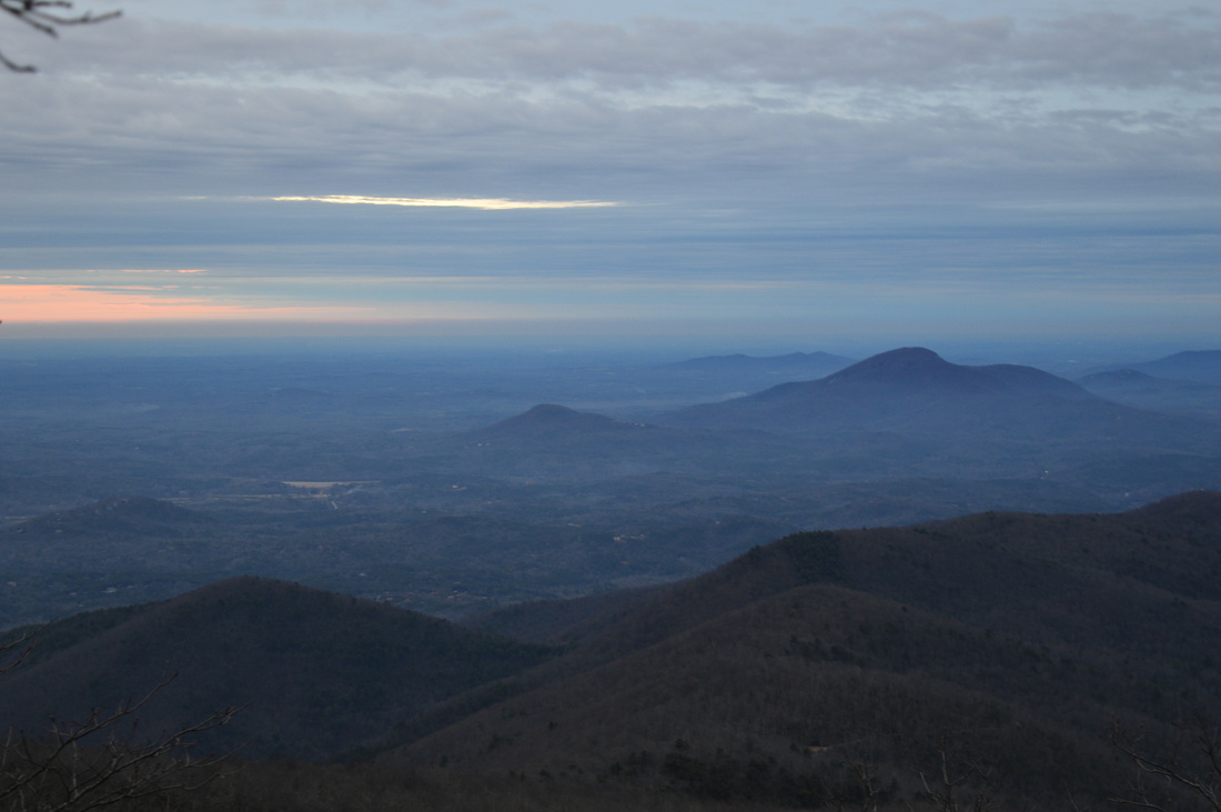
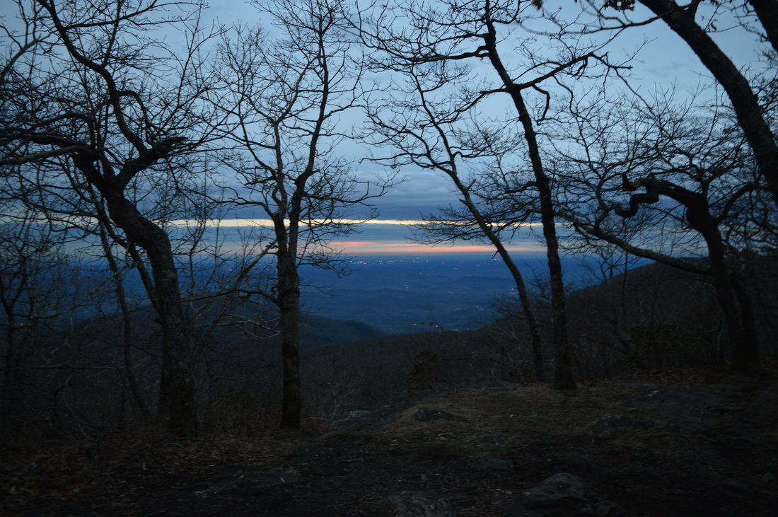
One of the most remote sections of Georgia's Appalachian Trail lies in Tray Mountain Wilderness. Are you ready for a rollercoaster ride? You better be if you're planning to do this hike. From the Moccasin Creek watershed, you will traverse eight, yes eight, mountains before finally reaching Tray Mountain and its excellent viewpoint. During most of this hike, you're going to feel like you're really out there in the wilderness - even the road leading to the trailhead looks like it. This hike occurred on Saturday, December 27th, 2014. My plan was to start this hike at the small trailhead at the end of Wildcat Creek Road. I would follow the old, gated section of Wildcat Creek Road to Addis Gap on the Appalachian Trail. From there, I would turn left onto the AT and follow it to Tray Mountain. I would return the same way. 

R/T Length of Trail: 14 Miles
Duration of Hike: 6:55
Type of Hike: Out and Back
Difficulty Rating: 9 out of 10
Pros: Very well-maintained trail; numerous campsites
Cons: Tough rollercoaster ride hike 
Scenic Views: View near Tray Mountain Shelter - 4 stars; Tray Mountain Overlook - 5 stars
Water Features: None
Best Season(s) to Hike: Winter
Trail Blaze Color(s): Appalachian Trail Access - Blue; Appalachian Trail - White
Beginning Point: Small parking area at the gate at the end of the drivable section of Wildcat Creek Road
Directions: From Hiawassee, GA: Follow US Route 76 East for about 15 miles until GA State Route 197. Turn right onto Rt. 197, and follow it south for 5 miles. Then, turn right onto Wildcat Creek Road. Wildcat Creek Road is a sometimes rough forest road - high clearance vehicles are recommended, although if driving with care, a regular passenger vehicle can make it. Follow Wildcat Creek Road to the gate and parking area for 7.7 miles. 
First off, if you're interested in car camping, this hike might be your cup of tea. Hammer out the 14 miles than go back to Wildcat Creek and its campgrounds and spend the night there, and on Day 2, pick another hike nearby. It's a pretty good idea for some... the campsites and campgrounds along Wildcat Creek and Moccasin Creek are some of the best car camping spots I have seen. If you want to be adventurous though, do the whole thing in just a day, like I did.


Most of this hike is on a very high level maintenance trail. The exception is the access to the trail - those who know little about the area may get confused. From the paring area, take the old road behind the gate. There is a sign that points towards Appalachian Trail and Addis Gap. The old road follows the upper reaches of South Fork Moccasin Creek for the first half mile. Then, at 0.5 miles, there is a fork in the roads. While there is no sign to point the way, take the road that goes left. It appears to climb away from the creek. The other road keeps straight, steeper up the Moccasin Creek watershed. This junction is the site of a nice campsite by the creek. You should lose sight of the creek shortly and also pass through a half torn-down gate, if you took the correct road at the fork. The ascent here is gradual, and in winter, great views abound towards Lake Burton and beyond. Soon, there will be one or two blue blazes, which will be additional proof you're on your way to the AT. At 1 mile, the old road reaches Addis Gap and a junction with the Appalachian Trail. Addis Gap is where the Addis family lived until 1942. A small grassy clearing is all that remains at the homestead. If you continue on the old road past Addis Gap, you'll eventually get down to Mill Creek and Rt. 75. It is another possible access point for this hike, but I don't know much about it, and Wildcat Creek Trailhead still seems like the better one. 


At the junction with the AT, a left turn is the right direction for this hike. A right turn would take you to Kelly Knob and eventually Dicks Creek Gap (US Route 76). Meanwhile, turning left immediately brings you to the Tray Mountain Wilderness boundary. You're going to stay in the wilderness for the rest of the hike. What's more - you're going to be very happy to see this sign on your way back. When you reach this spot on your way back, you'll know all that is left to the end is downhill. The Appalachian Trail immediately starts climbing up log steps. The first climb is to an unnamed mountain. The trail skirts the top at 1.5 miles,and beings descending into Sassafras Gap. Reach Sassafras Gap at 1.9 miles. a Side trail left is marked as "Water" - it leads to a branch of Moccasin Creek. After this, the trail begins a relatively steeper ascent to the Dismal Mountain ridge. There are several mountains along the ridge, and from the gap, you can see them all stretching west, but the one that the trail skirt is Round Top. The trail doesn't directly reach the summit, but curves right below it. The highest point is reached at 2.3 miles. The descent that follows is one of the longest - thus, this ascent will be one of the most annoying on the way back. On this descent, the winter views are amazing to the east. You can see Lake Burton, the mountains in Rabun County, and perhaps into North Carolina - I am not the best at telling what you can see from an overlook. At 2.6 miles, the trail rounds another small knob without any major ascent, and then continues descending to Swag of the Blue Ridge.


At 2.7 miles, reach Swag of the Blue Ridge. This is a large gap, marked by a sign. From what I've heard, this used to be a farming area in the mid 1900's. The first thru-hiker who hiked the Appalachian Trail saw various livestock grazing here. After this, the trail meanders around several small knobs on the ridge without any major climbing, before reaching a gap at 3.2 miles. The next mountain (#3 so far) is a longer climb. The summit is reached at 3.7 miles. Here, several short but steep descents and ascents bring you over two more small mountains, and the last one, Young Lick, is reached at 4.4 miles.After this, a rather steep descent (and more winter views) brings you to Steeltrap Gap at 4.9 miles. This is the other main ascent to be remembered on the way back. In Steltrap Gap, a trail goes left marked for "Water" - it shortly leads to Goshen Creek. After Steeltrap Gap, the grades, in general, become steeper, and the lay of the land changes to more rocky. Wolfpen Ridge (mountain #6) is crossed at 5.2 miles after a  steep climb. Reach Wolfpen Gap at 5.5 miles. From here, the rest of the climbing is basically up Tray Mountain's main mass... or so it seems. As you descend into Wolfpen Gap, what I thought was Tray Mountain looms directly in front of you, like a whole separate hike. The ascent isn't as long as it looks like, but the constant feeling of seeing another mountain after the one you just summited is steadily weighing in. The summit of the next unnamed mountain is reached after another steep climb at 6 miles. The last gap comes at 6.1 miles, and after this, all that's left is the final ascent to the eighth mountain,Tray Mountain. The climb lasts about 0.9 miles. At 6.3 miles, the trail crosses some stream drainages and ascends via log steps to a small ridge  at 6.4 miles. Turning right leads to Tray Mountain Shelter shortly. Don't skip the spur trail - there is a rock ledge with a nice view, almost as nice as on Tray Mountain itself. Meanwhile, the Appalachian Trail turns left. The ascent is now fully equipped with log steps,  and you reach a high point at 6.8 miles. There is a nice campsite here, and winter views, but no year-round views. However, this isn't the summit of Tray Mountain yet - the summit was the next "mountain" you can see ahead. I was afraid this would mean descending a while and ascending a while again, but luckily, the summit is much closer than it seems. The trail twists between rock formations and  scrambles up some roots on this narrow ridge, and then pops out onto the summit of Tray Mountain at 7 miles. 


The summit of Tray Mountain is a rock outcrop with some nice views. They are not exactly like some views in North Carolina, but still pretty good and worth the efforts. The views are to the south and to the north. To the north, there is a somewhat limited view (especially in the summer) towards North Carolina and Southern Nantahala Wilderness. Hiawassee and Lake Chatuge are in the valley up-front. To the south, the better view, you can see Mount Yonah, as it's a very prominent peak, and the various hills and small mountains fading away into the Piedmont. There was some fog in place, which made for a rather interesting photo opportunity. That is what I put as the header for this description. If you continue on the Appalachian Trail beyond the summit of Tray Mountain, you will reach Tray Gap and FS Roads 79/698. They provide a much shorter access to Tray Mountain for those who don't want to walk a while. Another option is to start at Indian Grave Gap FS Road 283 or Unicoi Gap on GA State Route 75. Both options provide a short hike than the one described here, but I might eventually still check out the one from Uncoi Gap.  From Tray Mountain, retrace your steps to the car the same way, and make sure to check out the spur trail to Tray Mountain Shelter. Also, on the way back, if you see the sign "Swag of the Blue Ridge", you have only two mountains left to climb, and after that, when you see the next sign for water, you have only one mountain left to climb. 


To summarize, this is a hard hike, not very suitable for beginner hikers. Just by looking at the elevation profile doesn't exactly tell the tale. You're going to have to ascend 16 mountains, smaller or bigger, and descend the same amount by the time you're done. Even though it's spread out over 14 miles, it's STILL a tough rollercoaster ride. I would suggest that for an easier hike but with still some decent mileage, start from Unicoi Gap or Andrews Cove. Both routes are about 10 miles roundtrip with less climbing. Below are my pictures and videos.
4 Comments
Wade T. Wiggins Sr.
10/13/2017 01:29:25 am

Cool article. Very helpful. We will definitely use it. Headed up there tonight. Probably won't hike as far as you but we want to see the AT. Thanks.

Reply
David Anderson
11/20/2018 10:13:16 pm

Incredibly helpful article. We were trying to plan for hiking Tray to Dicks Creek and camping at Wildcat and had no idea about the access trail. Thanks a bunch.

Reply
Molly Douglas
1/8/2021 05:09:43 pm

Okay so what if you go right after you leave Wildcat Creek instead of left heading towards Tray Mountain? What's the hiking on the other side like?

Reply
Edirne ECA servisi link
8/3/2022 05:23:44 pm

Edirne ECA servisi en uygun fiyat ve en hızlı servis garantisi ile sizlerle. https://www.edirneklimaservisi.com/edirne-eca-servisi/

Reply


Leave a Reply.

    About Me

    Mark Oleg Ozboyd
    I'm an avid outdoor explorer and a hobbyist landscape photographer. I'm 21 years old and have been hiking since 2011. Originally based out of Atlanta, Georgia, I started out by occasionally hiking short trails throughout well-known Georgia State Parks. During 2012 and 2013, I began to expand my trips into adjacent states, as well as into the wilder National Forest areas rather than just State Parks. Throughout the years that followed, as I slowly ran out of popular hiking trails in my area, I began to search for and hike in more seldom-visited areas. Today, you can find me out in the woods every weekend, whether it's on an official trail or bushwhacking through cross-country terrain without any paths. I now attend Washington & Lee University and am exploring Virginia and West Virginia. My other hobbies include chess, science, old music, and meteorology. I have 3 years of amateur weather forecasting experience, having studied a lot of meteorology basics over the years. I am also a student at European School of Music where I learned that music and nature have a lot in common. Listening to good music inspires me to capture nature's beauty on the camera in different aspects that also make me recall many beautiful music pieces that I've heard.​


    Dear readers: I have invested a tremendous amount of time and effort in this website and the Georgia Waterfalls Database the past five years. All of the work that has gone in keeping these websites updated with my latest trip reports has almost been like a full-time job. This has not allowed me to pick up a paid job to save up money for college, and therefore, I I've had to take out loans. If you find the information on this website interesting, helpful, or time-saving, you can say "thanks" and help me out by clicking the button above and making a contribution. I will be very grateful for any amount of support you give, as all of it will apply toward my college tuition. Thank you! 

    Enter your email address to subscribe for trail reports:

    Delivered by FeedBurner


    Picture
    Coming in 2022-2023?

    Other Hiking Websites

    DWHike's Adventures
    Florida's Natural Wonders
    Florida Trailblazer
    Meanderthals
    Mountain Images
    by Bernie Boyer

    North Carolina Waterfalls with
    ​Kevin Adams
    Take-a-Hike!
    Tennessee Landforms
    Waterfall Page
    Waterfall Adventurer
    Zach's Mild Adventures

    Miles Hiked

    Year 1: 540.0 Miles
    Year 2: 552.3 Miles
    ​Year 3: 518.4 Miles
    Year 4: 482.4 Miles
    Year 5: 259.9 Miles

    Archives

    March 2021
    February 2021
    January 2021
    November 2019
    October 2019
    September 2019
    August 2019
    July 2019
    June 2019
    February 2019
    January 2019
    December 2018
    November 2018
    October 2018
    August 2018
    July 2018
    June 2018
    May 2018
    April 2018
    March 2018
    February 2018
    January 2018
    December 2017
    November 2017
    October 2017
    September 2017
    August 2017
    July 2017
    June 2017
    May 2017
    April 2017
    March 2017
    February 2017
    January 2017
    December 2016
    November 2016
    October 2016
    September 2016
    August 2016
    June 2016
    May 2016
    April 2016
    March 2016
    January 2016
    December 2015
    November 2015
    October 2015
    September 2015
    August 2015
    July 2015
    June 2015
    May 2015
    April 2015
    March 2015
    February 2015
    January 2015
    December 2014
    November 2014
    October 2014
    September 2014
    August 2014
    July 2014
    June 2014
    May 2014
    April 2014
    March 2014
    February 2014

    Categories

    All
    Adel
    Adirondack Park
    Alabama
    Alfred A. Ring Park
    Allegheny Trail
    Amicalola Falls State Park
    Anniston Area
    Apalachicola Bluffs And Ravines Preserve
    Apalachicola National Forest
    Apalachicola/Port St. Joe Area
    Apopka
    Appalachian Trail
    Appling
    Art Loeb Trail
    Aska Trail System
    Bakersville
    Balm-Boyette Scrub Preserve
    Balsam Lake Recreation Area
    Bankhead National Forest
    Bartow County Parks
    Bartram Trail
    Basinger
    Beersheba Springs
    Benton
    Benton Mackaye Trail
    Berry College Trail System
    Best Hike
    Big South Fork National Recreation Area
    Black Bear Wilderness
    Black Rock Mountain State Park
    Blairsville
    Blakely
    Blood Mountain Wilderness
    Blowing Rock
    Blue Ridge
    Blue Ridge Parkway
    Boone
    Bradenton
    Bradenton Beach
    Brasstown Bald
    Brasstown Wilderness
    Brevard
    Bryson City
    Buchanan
    Bucks Pocket State Park
    Bulow Creek State Park
    Bulow Plantation Ruins State Park
    Caesars Head State Park
    Caladesi Island State Park
    Calhoun
    Camel's Hump State Park
    Cashiers
    Caspersen Beach Park
    Catfish Creek State Park
    Caves
    CC Putnam State Forest
    Cedar Point Environmental Park
    Chatsworth
    Chattahoochee National Forest
    Chattanooga
    Chattanooga Valley
    Chattooga National Wild And Scenic River
    Cheaha Wilderness
    Cherohala Skyway
    Cherokee
    Cherokee National Forest
    Chiefland Area
    Chillhowee Recreation Area
    Chipley
    Chunky Gal Trail
    Circle B Bar Reserve
    Citico Creek Wilderness
    Citrus Wildlife Management Area
    Clarkesville
    Clayton
    Cleevland
    Cleveland
    Cloudland Canyon State Park
    Cohutta Wilderness
    Collier-Seminole State Park
    Cordele
    Cornelia
    Covington
    Crestview Area
    Crew-land-and-water-trust
    Cullowhee
    Cumberland Trail
    Dahlonega
    Dalton
    Dawson Forest Wildlife Management Area
    Dawsonville
    Dayton
    De Soto National Memorial
    DeSoto State Park
    Dillard
    Double Springs
    Ducktown
    Duncan Ridge Trail
    Dunlap
    Eagle's Rest Park
    Eastpoint
    Econfina Creek Wildife Management Area
    Eglin Air Force Base
    Elizabethton
    Elkins
    Elk Knob Game Lands
    Elk Park
    Ellicott Rock Wilderness
    Ellijay
    Emerson Point Preserve
    Englewood Area
    Enota Retreat
    Erwin
    Falling Waters State Park
    Fayetteville
    Fires Creek Recreation Area
    Fire Tower
    Flint River
    Florence Area
    Florida
    Florida Caverns State Park
    Florida Trail
    Foothills Trail
    Fort Mountain State Park
    Fort Myers Area
    Fort Payne
    Fort Payne Area
    Fort Yargo State Park
    Franklin
    Franklin Delano Roosevelt State Park
    Franklin-Marion State Forest
    Frozen Head State Park
    Gainesville
    Gainesville Area
    Gatlinburg
    George Washington National Forest
    Georgia
    Georgia Veterans Memorial State Park
    Glasgow
    Gorges State Park
    Grandfather Mountain State Park
    Great Smoky Mountains National Park
    Greeneville
    Green River Game Lands
    Gruetli-Laager
    Grundy Forest State Natural Area
    GTM Reserve
    Guana River Wildlife Management Area
    Hayesville
    Helen
    Hiawassee
    High Falls State Park
    Highlands
    Highlands Scenic Highway
    Hillsborough River State Park
    Hinson Conservation & Recreation Area
    Historic Sites
    Honeymoon Island State Park
    Hot Springs
    Huntington
    Inverness Area
    Jackson
    Jasper
    Jefferson National Forest
    Joan M. Durante Park
    Jonathan Dickinson State Park
    Jones Gap State Park
    Joyce Kilmer Slickrock Wilderness
    Joyce Kilmer - Slickrock Wilderness
    Juniper Prairie Wilderness
    Kelly Park
    Keown Falls Recreation Area
    Kolomoki Mounds State Park
    LaFayette
    Lake City Area
    Lake George Wild Forest
    Lake June-in-Winter State Park
    Lakeland Area
    Lake Placid
    Lake Russell Wildlife Management Area
    Lake Wales Ridge State Forest
    Laurel Fork North Wilderness
    Leffis Key Preserve
    Leon Sinks Geological Area
    Lexington
    Lineville
    Linville
    Linville Gorge Wilderness
    Lithia Springs
    Little Frog Wilderness
    Little Manatee River State Park
    Little River Canyon National Preserve
    Longboat Key
    Long Trail
    Lookout Mountain
    Lookout Mountain Battlefield
    Lovingston
    Lula Lake Land Trust
    Lumpkin
    Maggie Valley
    Manatee Springs State Park
    Marianna Area
    Mark Trail Wilderness
    Marlinton
    Mccaysville
    McMinville
    Mentone
    Middlesex
    Mistletoe State Park
    Monongahela National Forest
    Montreat
    Mountain Bridge Wilderness Area
    Mountain City
    Mountains To Sea Trail
    Mountains-to-Sea Trail
    Mount Rogers National Recreation Area
    Myakka River State Park
    Myron B. Hodge City Park
    Nantahala National Forest
    Naples
    Naples Area
    Natural Bridge State Park
    Neal Preserve
    New Castle
    Newport
    New River Gorge National Park
    New York
    North Carolina
    Ocala Area
    Ocala National Forest
    Ocean-to-Lake Trail
    Oconee State Park
    Oconee Station Historic Site
    Okaloacoochee Slough State Forest
    Oldsmar
    Oneida
    Orlando Area
    Ormond Beach
    Oscar Scherer State Park
    Oxford
    Palatka
    Palmetto Trail
    Panama City Area
    Panthertown Valley
    Parrish
    Paynes Creek Historic State Park
    Peaks Of Otter Recreation Area
    Pigeon Crockford Mountain Wildlife Management Area
    Pigeon-Crockford Mountain Wildlife Management Area
    Pigeon-Crockford Wildlife Management Area
    Pine Mountain
    Pinhoti Trail
    Pinnacle Park
    Pisgah Civitan Park
    Pisgah National Forest
    Pittman Center
    Pond Mountain Wilderness
    Ponds/Lakes
    Prentice Cooper State Forest
    Providence Canyon State Park
    Pumpkintown
    Quick Point Nature Preserve
    Raven Cliffs Wilderness
    Reed Bingham State Park
    Reliance
    Rice Creek Conservation Area
    Riverview Pointe Preserve
    Robbinsville
    Robinson Preserve
    Rock Creek Gorge Scenic Area
    Rock Island State Park
    Rome
    Rosman
    Sale Creek
    Salem
    Salt Springs
    Saluda
    Santa Rosa Beach
    Sarasota
    Sarasota Area
    Savage Gulf State Natural Area
    Scenic Views
    Scottsboro Area
    Sebring Area
    Sewanee
    Sheltowee Trace Trail
    Shining Rock Wilderness
    Signal Mountain
    Sipsey Wilderness
    Sky Valley
    Smithgall Woods State Park
    Snowbird Backcountry Area
    Soddy Daisy
    Soddy-Daisy
    Sopchoppy
    South Carolina
    South Cumberland State Park
    Southeastern Cave Conservancy
    Southern Nantahala Wilderness
    Sparta
    Sprewell Bluff Park
    Spring City
    Spring Hill
    Springs
    Spruce Pine
    Standing Indian Backcountry Area
    St. Augustine
    St. George Island State Park
    St. Joseph Bay State Buffer Preserve
    St. Marks Area
    St. Marks National Wildlife Refuge
    Stone Mountain
    Stone Mountain Park
    Suches
    Sumatra
    Sumter National Forest
    Suwannee River
    Swallow Creek Wildlife Management Area
    Sweetwater Creek State Park
    Sylva
    Talladega National Forest
    Tallahassee Area
    Tallulah Falls
    Tallulah Gorge State Park
    Tampa Bay Area
    Tate City
    Tate's Hell State Forest
    Tea Creek Wildlife Management Area
    Tellico Plains
    Tennessee
    Thomaston
    Toccoa
    Topsail Hill State Park
    Torreya State Park
    Townsend
    Tracy City
    Tray Mountain Wilderness
    Trenton
    Triple Creek Preserve
    Troutdale
    Unaka Mountain Wilderness
    Upper Tampa Bay County Park
    Venice
    Vermont
    Virgin Falls State Natural Area
    Virginia
    Virginia Outdoors Foundation
    Vogel State Park
    Wakulla Springs State Park
    Waleska
    Walhalla
    Wartburg
    Water Features
    Waynesville
    Weedon Island Preserve
    Weeki Wachee Preserve
    Wekiwa Springs State Park
    West Palm Beach Area
    West Virginia
    Whitehall
    White Springs
    Winder
    Withlacoochee State Forest
    Young Harris

    RSS Feed

TRAIL REPORTS

Hikes in Alabama
​Hikes in Florida
Hikes in Georgia
Hikes in North Carolina
Hikes in South Carolina
Hikes in Tennessee
Hikes in Virginia

Hiking Resources

Alabama Resources
​
Florida Resources
Georgia Resources
North Carolina Resources
​South Carolina Resources
​
Tennessee Resources

Other

Contact
Map of Hikes
Alphabetical List of Hikes
Southeast Nature Society
© COPYRIGHT 2014-2018
​ALL RIGHTS RESERVED.
Important: I disclaim any responsibility for any damage or personal injury that may occur as a result of the activities and information found on this website. All outdoor activities, especially off-trail hiking, are done at your own risk. Never hike or head into that area that may be above your fitness or experience level.
  • Home
  • Trail Reports
    • Best Hikes
    • Hikes with Scenic Views
    • Hikes with Water Features
    • Alabama
    • Georgia
    • Florida
    • North Carolina
    • South Carolina
    • Tennessee
    • Vermont
    • Virginia
  • Map
  • Hike List
  • Testimonials
  • Resources
  • Contact Us
  • Southeast Nature Society
    • Our Team
  • Georgia Waterfalls Database