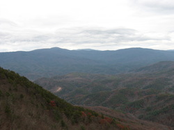
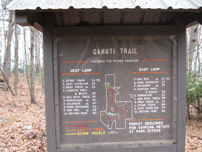
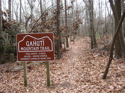
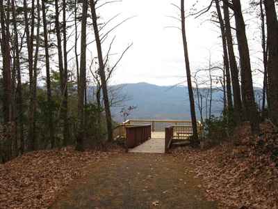
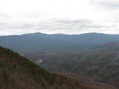
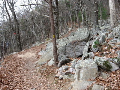
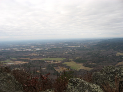
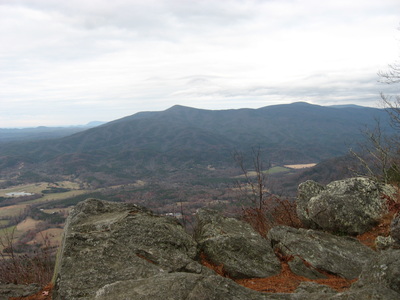
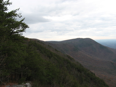
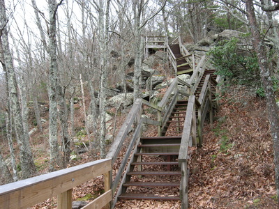
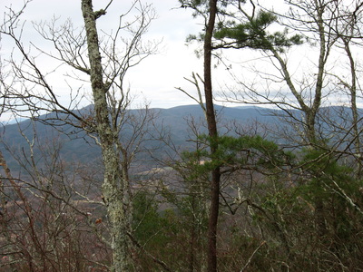
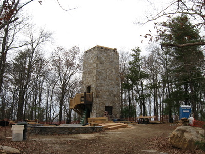
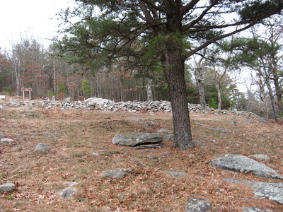
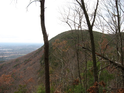
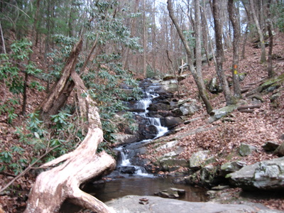
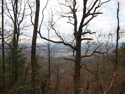
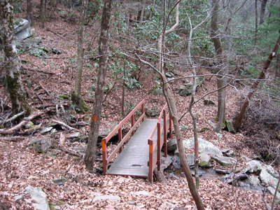
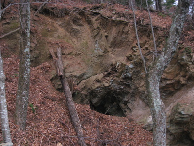
 Fort Mountain is one of the most prominent features in northwestern Georgia. While its elevation is low relative to the Cohutta Mountains just to the north, the steep drop-off of the mountain can be recognized from dozens of miles away. The mountain is pretty significant historically. The very summit of Fort Mountain is marked by a CCC Stone Tower, which is currently closed to the public. Just below the summit, an 800-foot wall of mysterious origin follows the south slope of the mountain. The Gahuti Trail takes you farther from the summit of the mountain into more remote regions, where you can find waterfalls on Goldmine Creek. This hike occurred on Saturday, November 29th, 2014. My plan was to start at the Cool Springs Trailhead, and after checking out the Cool Springs Overlook, to follow the Gahuti to the Stone Tower Loop. After hiking the Stone Tower Loop, I would leave the crowded sections of the park and hike the Gahuti Loop counter-clockwise. If time would remain, I would take the #301 Bike Trail down the mountain to see some of the lower waterfalls on Goldmine Creek. R/T Length of Hike: 11 Miles Duration of Hike: 7:00 Type of Hike: Figure-eight loop Difficulty Rating: 6 out of 10 Pros: Historical features; great views; water features Cons: Confusing trail in cabin area; very steep descent to Lower Goldmine Creek Falls (if you wish to do it - not part of this description) Scenic Views: Cool Springs Overlook - 7 stars; West Face Overlook - 6 stars Water Features: Upper Goldmine Creek Falls - 3 stars Trail Blaze Color(s): Gahuti Trail - Orange; West Overlook Trail - Yellow; North Stone Tower Trail - Yellow; CCC Stone Tower Trail - Red; Big Rock Trail - Yellow Best Season(s) to Hike: Winter Beginning Point: Cool Springs Trailhead in Fort Mountain State Park Directions: From Chatsworth, GA: Follow GA State Route 52 East for 7.2 miles, until you see the Fort Mountain State Park entrance on the left. Turn left onto Fort Mountain Park Road. Drive 0.6 miles, then keep right onto Old Fort Road. Drive another 1.3 miles until you reach the Cool Springs Trailhead and parking area on the right. Fort Mountain State Park is one of the bigger state parks in Georgia, and has a wealthy trail system. I've yet to do more exploring around the park, but the hike described in this post is a good one to acquaint you with the park. The #301 Bike Trail (you can hike it, because literally no one bikes it) appears to be a much more challenging route that completely explores the park's remote areas. I will do it eventually. But for now, I can't tell you that this route is easy. It's EASIER than some of the other trails in the park, but there's a lot of rollercoaster rides on this hike, thus makingit harder. If you hike it the way I did, you get the worst rollercoaster rides in the last few miles. Not a good idea - but I'll describe it the way I hiked it to prevent confusion. There are many trailheads for this hike, and depending which one you start on, it could be harder or easier. I prefer the Cold Springs Trailhead. Either way you go, you're going to have some sort of challenge in the last few miles (if you go clockwise, you will have a mile-long ascent up Fort Mountain, or if you go counter-clockwise, you will have a lot of smaller ascents and descents in the last couple miles), but still, it is probably the best option. I hiked the trail counter-clockwise. From the trailhead, take the paved pathway that goes from the corner of the parking lot. This pathway brings you to the Cool Springs Overlook in 0.1 miles. A new observation deck provided a grand view of the Cohutta Mountains, standing grand all across the view. From the overlook, take the trail that goes left off the deck. It descends a little bit, then reaches a junction with the #302 Bike Trail at 0.2 miles. Going sharply left will take you to the Bike Trailhead; going forward/slightly to the right will take you down a long descent to the #301 Bike Trail, so if you want to hike or bike it, this is the way to do it. Meanwhile, the Gahuti Trail goes slightly to the left, and then starts to gradually climb Fort Mountain's main peak. At 0.5 miles, the Gahuti Trail reaches an unsigned connector that leads to the Stone Tower area trails. You'll return to this spot later, so for now keep going forward on the connector (The Gahuti Trail and its orange blazes turned left). The connector ends at the North Stone Tower Trail at 0.6 miles. It doesn't matter much whether you turn left or right, but I turned left. At around 0.9 miles, you reach the junction with the West Overlook Trail. To the left is the Stone Tower parking - turn right. This trail gradually climbs up to almost the summit of Fort Mountain, At 1.4 miles, keep left on a red-blazed connector to the overlook, and at 1.5 miles, reach the steps leading to West Overlook. Turn left here, and descend to the observation deck. The view from here is amazing! To the left, you can see the rest of Fort Mountain and where the Gahuti Trail goes. To the right, you can see the Cohuttas, and in front of you are endless fields leading to the Cumberland Plateau on the horizon. Unfortunately, on this day, I couldn't spend much time here, as the wind was a bit crazy! After you've had your share of the overlook, return up the steps all the way to the end of them back to the junction with West Overlook Trail at 1.6 miles. Straight is the Stone Tower, but don't worry about it - you'll still come up to it. Turn left onto the North Stone Tower Trail. This trail is the northernmost trail in the park, as it follows the northern slopes of Fort Mountain, grabbing views of the Cohuttas. These views are enhanced in winter. At 2 miles, the trail reaches a junction with the CCC Stone Tower Trail. Turn right here, and start ascending to the very summit with the tower. At 2.1 miles, the Stone Wall Trail takes off to the left - keep going straight. Reach the summit at 2.4 miles. The Stone Tower was under construction when I went, so it looked a bit ugly around it. I wonder if they are going to make a public observation deck on the top? That would be wonderful! The tower was built in the 1930s by CCC, and it was not given public access because it was old and needed rehabilitation. From the tower, take the trail that goes south (to the left). This is a continuation of the CCC Stone Tower Trail. At 2.7 miles, reach another junction with the Stone Wall Trail. It's worth going a bit along the Stone Wall Trail - it follows a long stone wall of mysterious origin. There is a little information written about it wt the junction I just mentioned. After this, keep descending down, and reach the lower part of North Stone Tower Trail at 3 miles. Turn left, and keep going until you reach the connector to the Gahuti at 3.3 miles. Turn right, and descend to the Gahuti the way you came, reaching it at 3.4 miles. From here, the route of the hike turns right, following the Gahuti counter-clockwise. Here, the Gahuti Trail ascends for a little bit. At 3.5 miles, the ascent ends at a crossing of the main park road. This is also one the highest points on the entire trail. Following the road crossing, a descent follows down the slopes of Fort Mountain. Even though there are some switchbacks, there were some steep spots. The steep part was over by the time the Gahuti crosses a small rivulet and at 4 miles, reaches Rock Creek Campsite (Campsite #4). From here the descent ends mainly, and the trail follows the contours of the mountain southward. At 4.2 miles, a spur trail on the right and descends a short distance to a nice view of the valley below. The trail stays along the rim for the next mile, before reaching the Campers Loop at 5.2 miles. Keep right, and right away keep left - don't take the white-blazed Campers Loop. Follow the orange blazes. At 5.3 miles, cross the other end of the Campers Loop, and descend down to cross a small branch on a footbridge. After this, the trail climbs over the rim one more time, the trail descends into the Goldmine Creek depression, with winter views to the right. Cross Goldmine Creek on a footbridge and reach a junction with the Big Rock Trail. The Big Rock Trail goes both left and right, as it's a loop. Left leads to Fort Mountain Lake; right is the Gahuti Trail's route. Turn right, and descend slightly, reaching Upper Goldmine Creek Falls. These falls are not significant and are best viewed during periods of wet weather. I suspect they can dry up completely during fall. After this, the trail bears left away from the creek. Shortly afterwards, the other end of the Big Rock Trail takes off to the left to the lake. Keep following Gahuti Trail's orange blazes. Soon, cross two small streams. The first one is crossed via footbridge; the second one is rock-hopped easily. At 6.1 miles, reach Campsite #3 (Moonshine Campsite). This campsite is located on the end of a ridge, with great winter views. This is by far the best campsite on the entire hike. Right after the campsite, at 6.2 miles, an unsigned but obvious very short path continues forward, while the Gahuti veers left. This path leads to a powerline cut, which is also the route of Bike Trail #301. While this is not officially part of this description, I did go down the bike trail in hopes of finding the lLower Goldmine Creek Falls. It's a long way down there though, I was confused, so I decided to return before finding them. The Bike Trail descends extremely steeply down the powerline cut, so you're going to have one good workout if you choose to go down and then back up! I did pass one of four talc mines on the way. I have included a picture at the end of the post. I plan to do the Bike Trail #310 some day and see the waterfalls that I was trying to find. Anyway,back to the main trail description: the Gahuti Trail continues following a relatively flat section of land that slopes down to the lake (although the Gahuti Trail stays on the upper reaches, never passing by the lake). It is quite rocky sometimes though. At around 6.9 miles, the trail crosses Bike Trail #303. Bike Trail #303 here is an old park road that is asphalted. Keep following the Gahuti Trail. After crossing the road, the trail winds along the southern slopes of Fort Mountain, and climbs up to the park's cottage area. As the ascent to the cottages eases off, the most confusing place on the entire trail comes up. I spent 30-40 minutes trying to figure out what to do, and I had to ask someone for help from the cottages. There is a T-type intersection, where a red-blazed trail goes left. This shortly leads to the cottages. An old roadbed also goes right, but there is nothing to mark it as a trail. There is a post at the intersection, which indicates a sign once stood here, but it was not there on the day I went. You need to turn right down the old roadbed, even though there are no blazes. Near the bottom of the descent, the blazes appear. At the bottom, you reach the first junction with Goldmine Creek Trail, which heads off to the left and traverses Goldmine Creek's uppermost reaches. The Gahuti Trail follows the old roadbed. There is an extended ascent, but it is not steep. As the ascent ends, you will find the second junction with the Goldmine Creek Trail in a small gap. Around here, you will also see the short spur trail to Goldmine Creek Campsite (Campsite #2). After this, there will be a nice vista with views to the south towards Carters Lake and the mountains around it. After the vista, there will be a junction with Bike Trail #301 again. When I first hiked the Gahuti several years ago, I remember confusing the Bike Trail and the Gahuti more than once. Just keep following the orange blazes. After this, the trail will follow undulating slopes, sharing its route with the old roadbed that leads to Highway 52 and Fort Mountain State Park's entrance. At 8.3 miles, reach the Fort Mountain State Park entrance. You will pass a gate that blocks the old road from vehicular traffic, and then cross the entrance road. There is no sign here, but DO NOT cross Highway 52. Across Highway 52 goes the Pinhoti Connector Trail, but that is a completely different trail that goes outside of Fort Mountain State Park's boundaries. The Gahuti Trail goes across the Fort Mountain State Park road, but it doesn't go across right at the entrance. It goes across just up the road. You should be able to easily see the steps going to the right. After this, the lay of the land changes dramatically. Even though there are only a mere 2.7 miles left from here to the Cool Springs Trailhead, they are quite annoying with over 9 miles on your legs. The trail constantly descends and ascends through steep hollows and stream valleys. It seems like an endless rollercoaster ride. The first descent is the biggest, where the trail descends to Mill Creek. Bike Trail #301 will come in from the left over a footbridge and share the path with Gahuti Trail for some time. Then, Gahuti Trail veers left over Mill Creek on a footbridge. Even though I think that Bike Trail #301 goes right here, there was a sign that restricted BOTH foot and bike travel. Not sure what stands behind this... Right after the footbridge, you pass the last campsite, Hogpen Campsite (Campsite #1). There will be no more major streams after this, but the constant steep, short elevation changes will make you think "How much more is there left to the end???". Well, I've got good news: only 1.5 miles from Campsite 1. The trail will become more developed with additional signs and steps towards the end. When you see the trailhead kiosk with mileage information, you know you're there! To summarize, this combination of trails at Fort Mountain State Park are great to introduce you to the most visited features in the park - Stone Tower area and Goldmine Creek. Of course, you can just do short hikes to them, but if you've got the time and the energy, why not add some mileage? This is not my last visit to Fort Mountain State Park. I plan to do the Bike Trail #301 sometime in February. It's supposed to be much more challenging..... so let's go! Below are my pictures and videos from the hike.
1 Comment
anonymous
1/10/2015 12:27:48 am
Yes there will be an observation tower. I understand it will be open to the public. I am involved in this project.
Reply
Leave a Reply. |
About MeMark Oleg Ozboyd Dear readers: I have invested a tremendous amount of time and effort in this website and the Georgia Waterfalls Database the past five years. All of the work that has gone in keeping these websites updated with my latest trip reports has almost been like a full-time job. This has not allowed me to pick up a paid job to save up money for college, and therefore, I I've had to take out loans. If you find the information on this website interesting, helpful, or time-saving, you can say "thanks" and help me out by clicking the button above and making a contribution. I will be very grateful for any amount of support you give, as all of it will apply toward my college tuition. Thank you!
Coming in 2022-2023?
Other Hiking WebsitesMiles HikedYear 1: 540.0 Miles
Year 2: 552.3 Miles Year 3: 518.4 Miles Year 4: 482.4 Miles Year 5: 259.9 Miles Archives
March 2021
Categories
All
|


 RSS Feed