HIKING THE APPALACHIANS AND BEYOND
  • Home
  • Trail Reports
    • Best Hikes
    • Hikes with Scenic Views
    • Hikes with Water Features
    • Alabama
    • Georgia
    • Florida
    • North Carolina
    • South Carolina
    • Tennessee
    • Vermont
    • Virginia
  • Map
  • Hike List
  • Testimonials
  • Resources
  • Contact Us
  • Southeast Nature Society
    • Our Team
  • Georgia Waterfalls Database

Nantahala National Forest: Chunky Gal Trail - Tusquitee Gap to Tuni Creek, Hayesville, North Carolina

3/4/2015

10 Comments

 
Picture
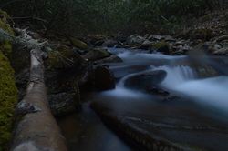
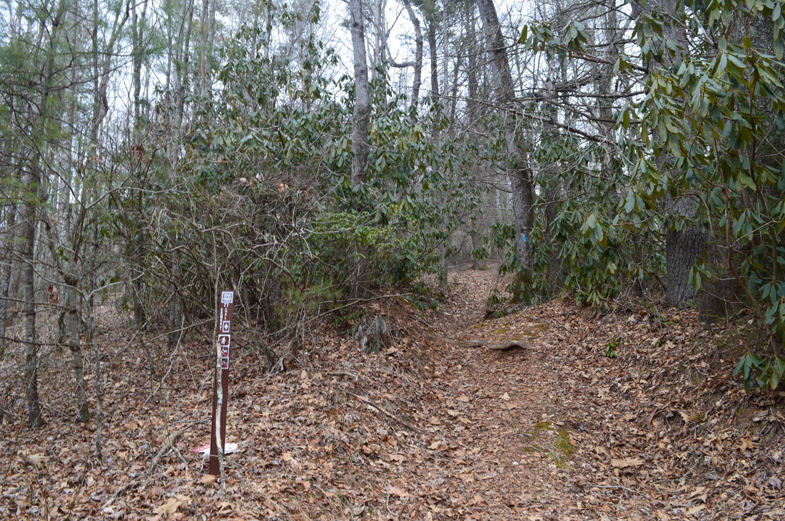
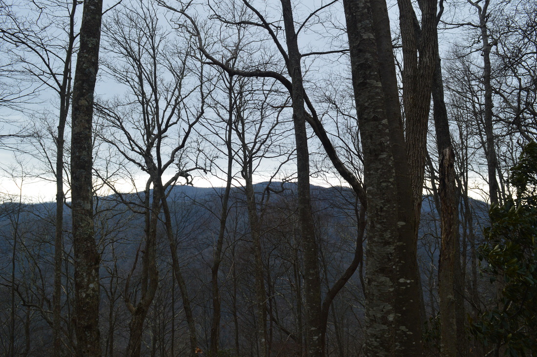
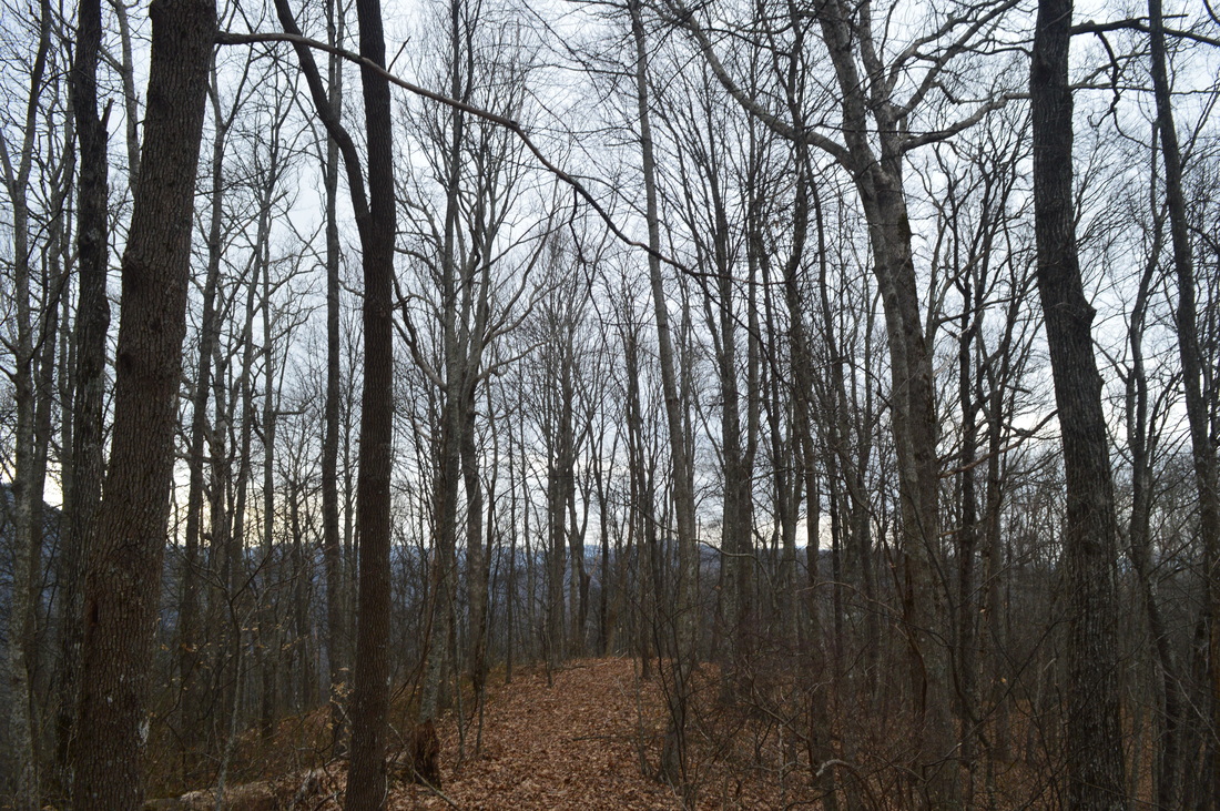
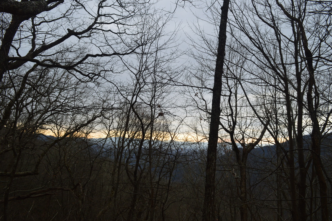
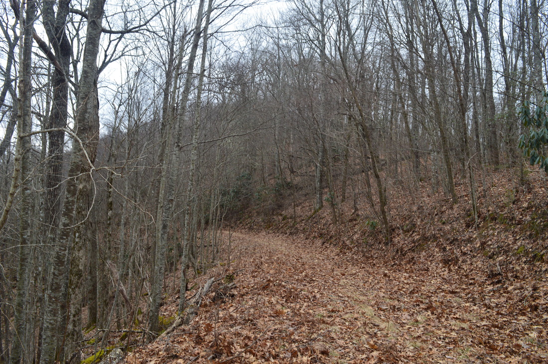
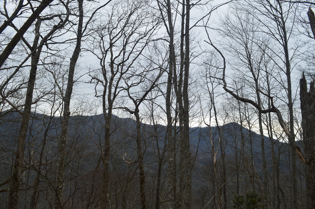
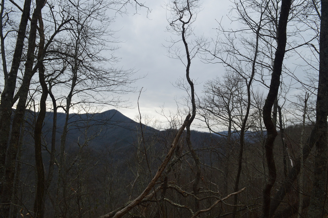
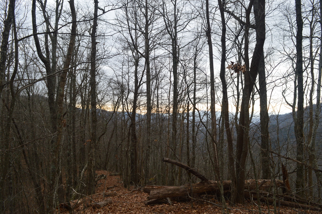
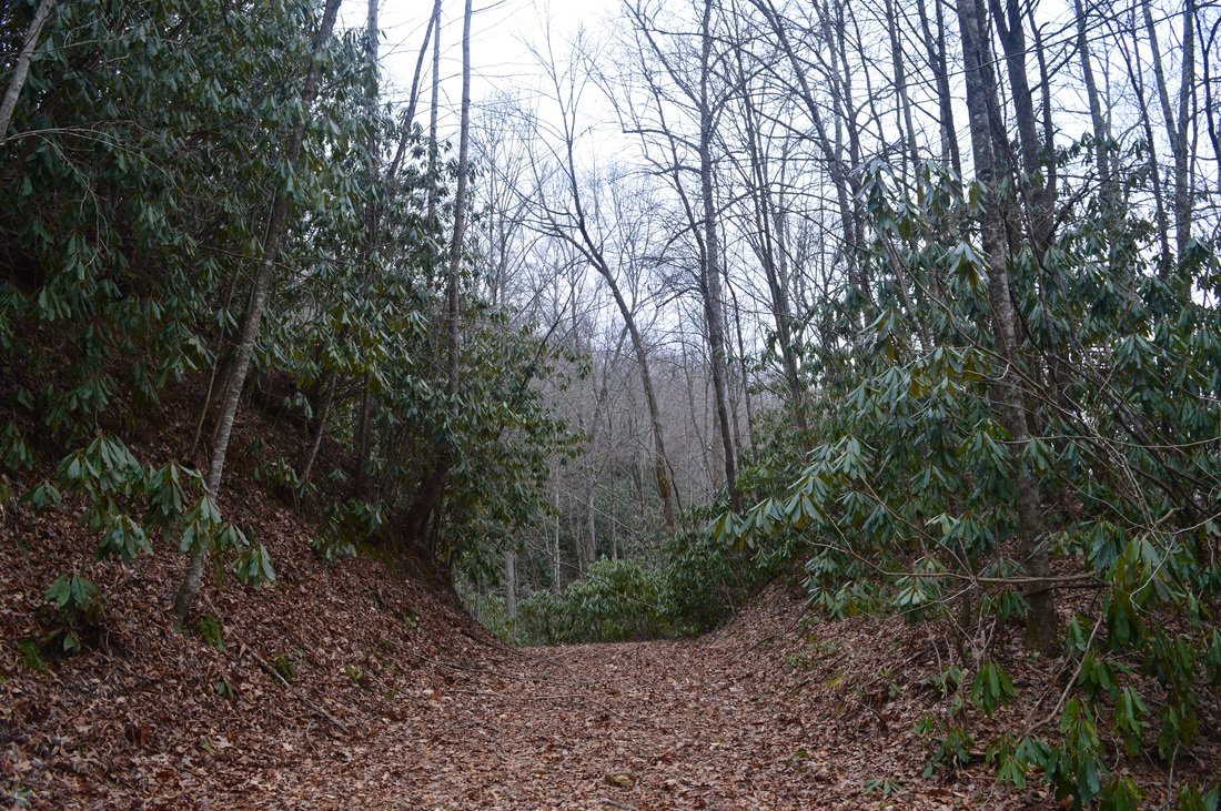
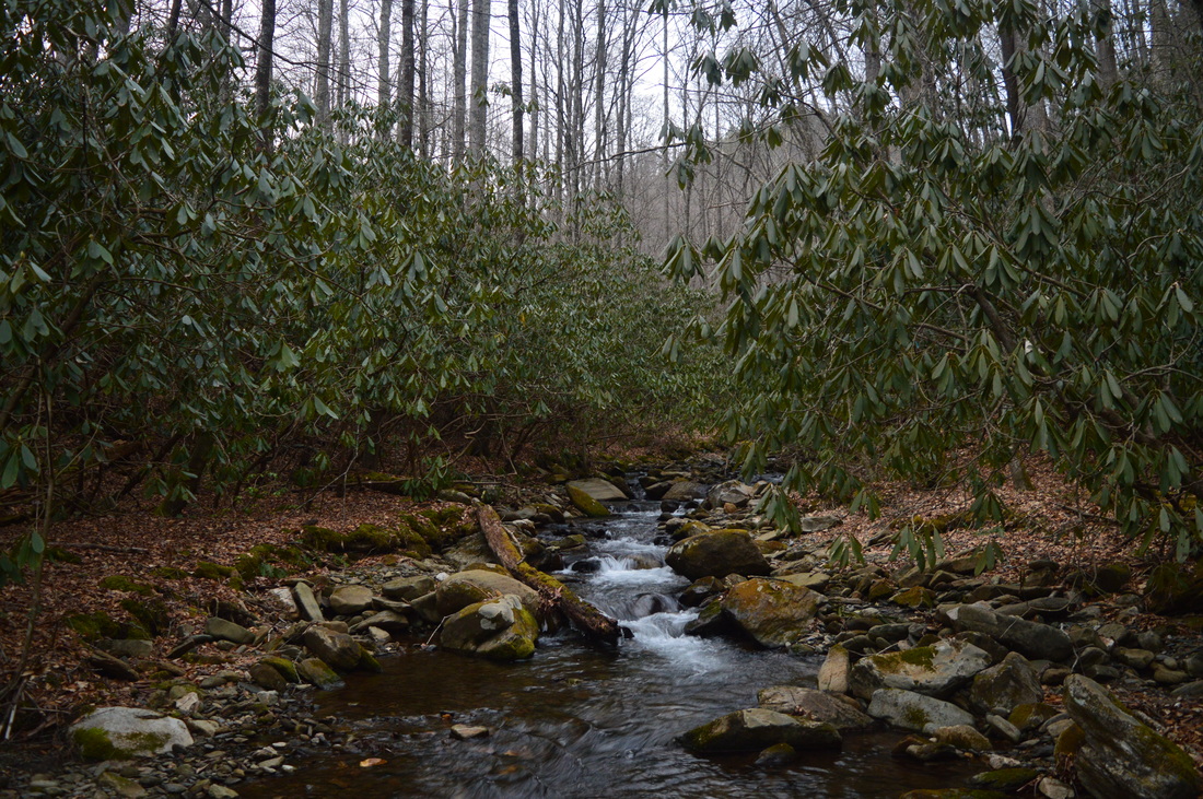
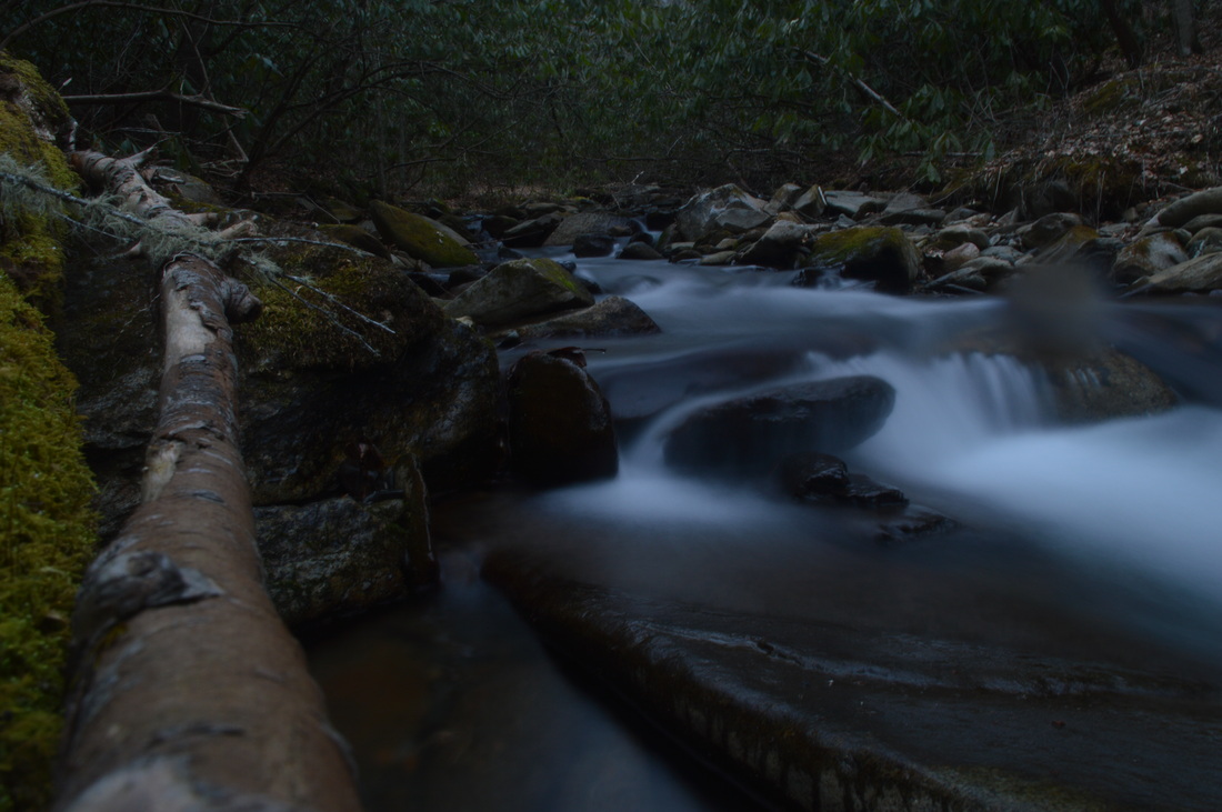
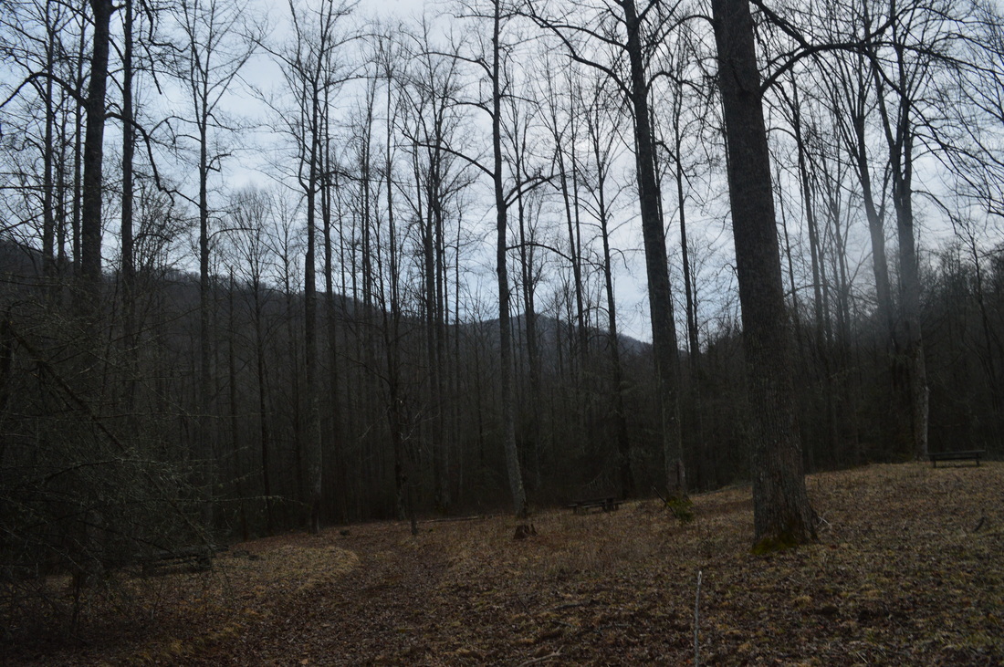
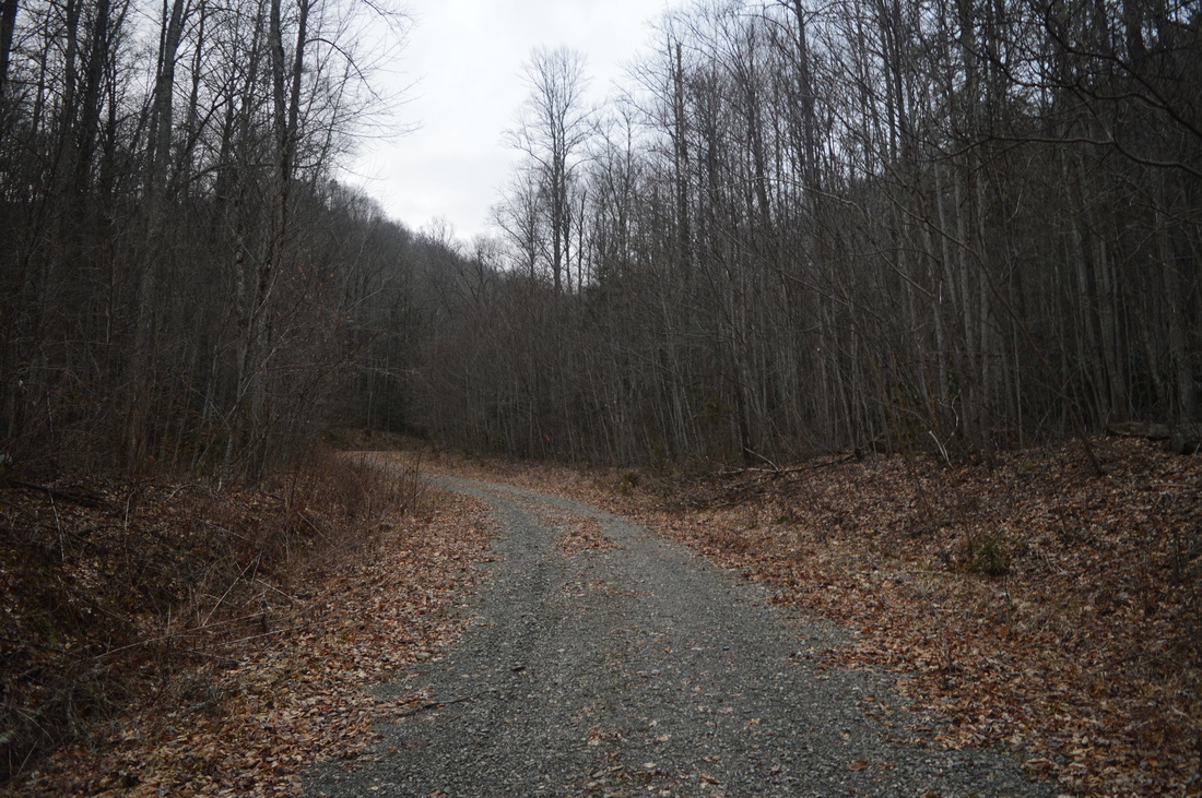
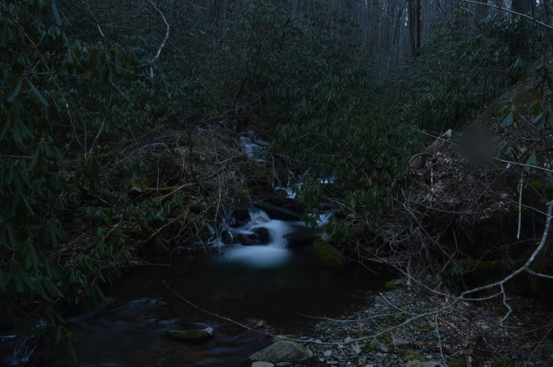
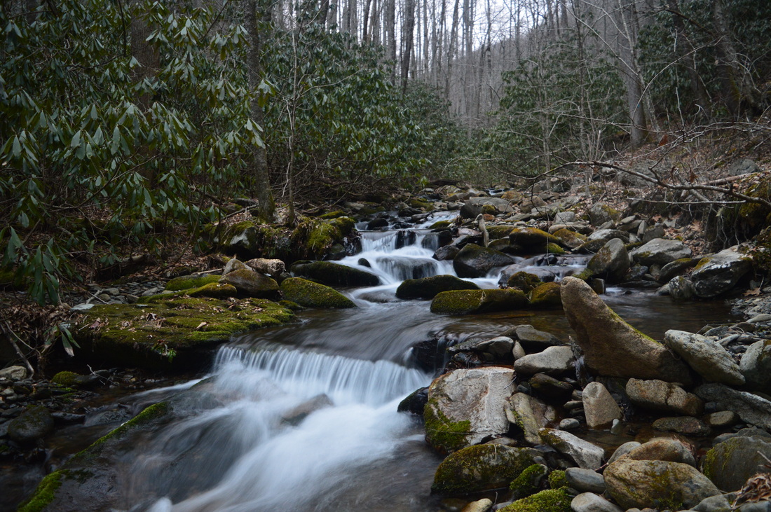
The Chunky Gal Trail is a 21-mile long hiking trail that connects the Nantahala Mountains with the Tusquitee Mountains. Despite its unfortunate name, it has many great vistas and is a good trail. This is the first time I visited it, but I was pretty happy with it - and I will return. The trail visits key peaks of the area such as Tusquitee Bald and Boetler Peak, as well as Muskrat Creek Shelter on the Appalachian Trail, which is where it ends. This hike occurred on February 14th, 2015. Originally, my plan was to hike the Chunky Gal Trail westward from Tusquitee Gap all the way to Tusquitee Bald, but it turned out to be a much longer hike than information had suggested, so I decided to turn around at some cascades on Tuni Creek. 

R/T Length of Trail: 11 Miles
Duration of Hike: 7:25
Type of Hike: Out and Back
Difficulty Rating: 6 out of 10
Pros: Good winter views; scenic sections on Tuni Creek
Cons: Much of return route is ascent
Scenic Views: None
Water Features: None
Best Season(s) to Hike: Winter
Trail Blaze Color(s): Chunky Gal Trail - Blue
Beginning Point: Tusquitee Gap on Tusquitee Road
Directions: From Hayesville, NC: Follow US Route 64 for 5 miles, and then, turn left onto Cold Branch Road. Follow Cold Branch Road for 4.1 miles until a T-intersection with Tusquitee Road. Turn right onto Tusquitee Road and follow it for 5.4 miles until the small parking area at Tusquitee Gap. The last 2.5 miles will be a narrow gravel road. 
When I did this hike, I was planning to hike approximately 16 miles roundtrip to Tusquitee Bald, but by the time I was approaching Tuni Creek, my GPS program ALREADY had recorded nearly 5 miles, and I knew that after Tuni Creek, there is still around halfway of the hike, judging by the map. Thus, I decided to make Tuni Creek to Tusquitee Bald a separate hike for whenever Tuni Gap Road reopens, and meanwhile, turn around at Tuni Creek, still making for a pleasant winter hike. 


I started my hike at Tusquitee Gap, and took the trail westward. It immediately started with a steep ascent up... well... Little Negrohead Mountain? That's what all official maps call it, believe it or not. While the ascent is steep, it's not long. At 0.6 miles, the trail rounds Little Negrohead Mountain's summit, without ever reaching it, and begins a descent that will be the story for much of the hike (in one direction). As soon as the trail hits the ridge, there are excellent winter views of Fires Creek Rim to the west. I could point out some of the key summits, such as Johnson Bald, Potlock Bald, and Tusquitee Bald, with Tusquitee Bald being the highest one and the one to the furthest on the right. Right away, what made me wonder was the incredibly deep valley between the ridge I was on right now and Fires Creek Rim. Knowing I had to descend somewhere down there, the distance already looked like twice longer than it was supposed to be. The descent along the ridge is steep, with few switchbacks, but the steep part comes to a close soon as a gap is reached at 1.1 miles. The next couple miles featured both uphill and downhill sections, but each downhill would be longer than uphill, although no steep grades here. At some point, the trail intersects an old roadbed, and turns left onto it. However, there is a very old turnaround here, now overgrown - watch for the trail exiting the turnaround on the upper right end. 


Like I mentioned, there is a small rollercoaster pattern for a couple miles along the trail, but then, a more steady descent starts after the 2.5 mile mark. At first it's along the slopes with winter views abundant, but then, at 3.5 miles, it becomes steeper and comes off the mountain. Around the 3.5 mile mark, there is a sharp switchback in the trail, where the trail turns left, while a clear path goes right (uphill). This path wasn't marked, but on my way back, I somehow missed the switchback and went straight up the path and ended up at Tuni Gap, adding a half-mile to my hike. I didn't know about this approach from Tuni Gap. It has many severe blowdowns, but it is still a possible approach point. But after the switchback, even the main trail suddenly has tons of downed trees. Not sure what happened here, but there were so many that it started to get annoying. Luckily, it was not a very long section. The trail kept progressively getting steeper, and then, several short, steep switchbacks led down to a small stream and onto an old forest road at about 4 miles. It looks like this is Forest Road 6271 according to maps. It is gated and not open to vehicles. The trail turns left onto it and briefly follows it but soon turns right. This turn is very well-marked, so you will probably not miss it. After this, the trail crosses a couple small unnamed streams, and then, after several more blowdowns and several more steep switchbacks, the sounds of Tuni Creek suddenly appear. The trail reaches a ford of Tuni Creek at 4.3 miles, although I can see this can be crossed dry-shod if the water is slightly below normal or even normal. There are lots of scenic cascades on this section of Tuni Creek. After the ford of Tuni Creek, reach Bob Allison Campground (as of this writing closed, but I know Tuni Gap Road, along with the campground, are supposed to reopen very soon. 


The trail skirts the edge of the campground, and exits onto Tuni Gap Road at 4.5 miles. Turn right onto the road. At 4.7 miles, cross Tuni Creek on a road bridge, and then turn left to keep following Chunky Gal Trail. The road continues up to Tuni Gap. The trail follows Tuni Creek for some time. There are several large cascades on the creek here. Then, the trail fords Tuni Creek at 5.5 miles and this was my turnaround point. I m estimating it's at least another 4 to 5 miles to Tusquitee Bald from here. But to get back to Tusquitee Gap, retrace your steps, and make sure to not go accidentally onto the Tuni Gap spur trail. 


I can't wait until Tuni Gap Road is open so I could do the Tusquitee Bald hike. Below are a few pictures from this hike.
10 Comments
Kathy Prosser
11/18/2015 12:00:08 pm

Is there any place to park at Tate Gap?

Reply
Mark Oleg
11/20/2015 06:20:34 pm

Tate Gap? I don't believe there is such a location. But in case you mispelled something, I'll give you some information - there's a small parking space at Tusquitee Gap, I'd say for several cars. There is plenty of parking at Tuni Creek in Bob Allison Campground, but I believe the road is still closed. There may be enough space for 1 car at Tuni Gap, but that's not much.

Reply
Kathy Hildreth
6/12/2017 04:48:23 pm

Hi, Mark! I'm desperate to know how to access Chunky Gal hiking trail from 64 West. It is supposedly .3 miles from the Macon County Line and is an unmarked state road. Can you help me?

Jared S
6/12/2017 05:04:55 pm

The road is no longer closed according to someone on peakbagger.

Jared S
1/5/2016 12:55:17 pm

I attempted the same route in Sept 2015. I was able to venture further up Tuni Creek. According to maps, I got to the point of heavy switch backs but I couldn't find the switch backs. The trail sorta vanishes at the base of the switch backs. Not only are there blowdowns but the foliage in late summer was overgrowing on the trails. I started to bushwhack up the hill but rain came in and I turned around. This winter I plan on starting from Tuni Gap (it was available by Tusquitee Road) and either improving the switchbacks as I find them or bushwhack up the hill. I contacted the trail maintainers and they say they will eventually work their way into that area to fix the trail. I recently completed a ~14 miler up to Tusquitee Bald that was fantastic. Walking next to creeks, descent view at the top. There is a hidden waterfall too.

Reply
Mark Oleg
1/6/2016 11:16:09 am

Thank you for the information. I wasn't aware of the condition of the trail, because the only book that I have is from 2005, and it describes the condition as good. I will keep in this mind the next time I attempt to reach Tusquitee Bald.

Reply
jiulie williams
3/10/2018 11:02:26 am

where do people even get maps for these hikes... I bought a national geo one and it had nothing..

Reply
John Rambo
6/13/2021 08:17:41 pm

Chunky Gal Trail is named appropriately and proudly. An old mining prospector had a donkey that helped him carry gold out of the mountains. The donkey was faithful and never gave the miner any trouble...the miner was married to a chunky gal and if you don't like the name Chunky Gal your probably a beta male douche bag who got beat up alot as kid by real girls.

Reply
Edirne baymak servisi link
8/4/2022 06:15:03 am

Edirne baymak servisi hizmetlerimiz memnuniyet odaklıdır. Detayları incelemek için hemen web adresimize göz at! https://www.edirneklimaservisi.com/edirne-baymak-servisi/

Reply
Kathy Prosser link
8/4/2022 09:27:43 am

Some think "Chunky Gal" comes from a game the local native Americans played called "Chunque".

Reply


Leave a Reply.

    About Me

    Mark Oleg Ozboyd
    I'm an avid outdoor explorer and a hobbyist landscape photographer. I'm 21 years old and have been hiking since 2011. Originally based out of Atlanta, Georgia, I started out by occasionally hiking short trails throughout well-known Georgia State Parks. During 2012 and 2013, I began to expand my trips into adjacent states, as well as into the wilder National Forest areas rather than just State Parks. Throughout the years that followed, as I slowly ran out of popular hiking trails in my area, I began to search for and hike in more seldom-visited areas. Today, you can find me out in the woods every weekend, whether it's on an official trail or bushwhacking through cross-country terrain without any paths. I now attend Washington & Lee University and am exploring Virginia and West Virginia. My other hobbies include chess, science, old music, and meteorology. I have 3 years of amateur weather forecasting experience, having studied a lot of meteorology basics over the years. I am also a student at European School of Music where I learned that music and nature have a lot in common. Listening to good music inspires me to capture nature's beauty on the camera in different aspects that also make me recall many beautiful music pieces that I've heard.​


    Dear readers: I have invested a tremendous amount of time and effort in this website and the Georgia Waterfalls Database the past five years. All of the work that has gone in keeping these websites updated with my latest trip reports has almost been like a full-time job. This has not allowed me to pick up a paid job to save up money for college, and therefore, I I've had to take out loans. If you find the information on this website interesting, helpful, or time-saving, you can say "thanks" and help me out by clicking the button above and making a contribution. I will be very grateful for any amount of support you give, as all of it will apply toward my college tuition. Thank you! 

    Enter your email address to subscribe for trail reports:

    Delivered by FeedBurner


    Picture
    Coming in 2022-2023?

    Other Hiking Websites

    DWHike's Adventures
    Florida's Natural Wonders
    Florida Trailblazer
    Meanderthals
    Mountain Images
    by Bernie Boyer

    North Carolina Waterfalls with
    ​Kevin Adams
    Take-a-Hike!
    Tennessee Landforms
    Waterfall Page
    Waterfall Adventurer
    Zach's Mild Adventures

    Miles Hiked

    Year 1: 540.0 Miles
    Year 2: 552.3 Miles
    ​Year 3: 518.4 Miles
    Year 4: 482.4 Miles
    Year 5: 259.9 Miles

    Archives

    March 2021
    February 2021
    January 2021
    November 2019
    October 2019
    September 2019
    August 2019
    July 2019
    June 2019
    February 2019
    January 2019
    December 2018
    November 2018
    October 2018
    August 2018
    July 2018
    June 2018
    May 2018
    April 2018
    March 2018
    February 2018
    January 2018
    December 2017
    November 2017
    October 2017
    September 2017
    August 2017
    July 2017
    June 2017
    May 2017
    April 2017
    March 2017
    February 2017
    January 2017
    December 2016
    November 2016
    October 2016
    September 2016
    August 2016
    June 2016
    May 2016
    April 2016
    March 2016
    January 2016
    December 2015
    November 2015
    October 2015
    September 2015
    August 2015
    July 2015
    June 2015
    May 2015
    April 2015
    March 2015
    February 2015
    January 2015
    December 2014
    November 2014
    October 2014
    September 2014
    August 2014
    July 2014
    June 2014
    May 2014
    April 2014
    March 2014
    February 2014

    Categories

    All
    Adel
    Adirondack Park
    Alabama
    Alfred A. Ring Park
    Allegheny Trail
    Amicalola Falls State Park
    Anniston Area
    Apalachicola Bluffs And Ravines Preserve
    Apalachicola National Forest
    Apalachicola/Port St. Joe Area
    Apopka
    Appalachian Trail
    Appling
    Art Loeb Trail
    Aska Trail System
    Bakersville
    Balm-Boyette Scrub Preserve
    Balsam Lake Recreation Area
    Bankhead National Forest
    Bartow County Parks
    Bartram Trail
    Basinger
    Beersheba Springs
    Benton
    Benton Mackaye Trail
    Berry College Trail System
    Best Hike
    Big South Fork National Recreation Area
    Black Bear Wilderness
    Black Rock Mountain State Park
    Blairsville
    Blakely
    Blood Mountain Wilderness
    Blowing Rock
    Blue Ridge
    Blue Ridge Parkway
    Boone
    Bradenton
    Bradenton Beach
    Brasstown Bald
    Brasstown Wilderness
    Brevard
    Bryson City
    Buchanan
    Bucks Pocket State Park
    Bulow Creek State Park
    Bulow Plantation Ruins State Park
    Caesars Head State Park
    Caladesi Island State Park
    Calhoun
    Camel's Hump State Park
    Cashiers
    Caspersen Beach Park
    Catfish Creek State Park
    Caves
    CC Putnam State Forest
    Cedar Point Environmental Park
    Chatsworth
    Chattahoochee National Forest
    Chattanooga
    Chattanooga Valley
    Chattooga National Wild And Scenic River
    Cheaha Wilderness
    Cherohala Skyway
    Cherokee
    Cherokee National Forest
    Chiefland Area
    Chillhowee Recreation Area
    Chipley
    Chunky Gal Trail
    Circle B Bar Reserve
    Citico Creek Wilderness
    Citrus Wildlife Management Area
    Clarkesville
    Clayton
    Cleevland
    Cleveland
    Cloudland Canyon State Park
    Cohutta Wilderness
    Collier-Seminole State Park
    Cordele
    Cornelia
    Covington
    Crestview Area
    Crew-land-and-water-trust
    Cullowhee
    Cumberland Trail
    Dahlonega
    Dalton
    Dawson Forest Wildlife Management Area
    Dawsonville
    Dayton
    De Soto National Memorial
    DeSoto State Park
    Dillard
    Double Springs
    Ducktown
    Duncan Ridge Trail
    Dunlap
    Eagle's Rest Park
    Eastpoint
    Econfina Creek Wildife Management Area
    Eglin Air Force Base
    Elizabethton
    Elkins
    Elk Knob Game Lands
    Elk Park
    Ellicott Rock Wilderness
    Ellijay
    Emerson Point Preserve
    Englewood Area
    Enota Retreat
    Erwin
    Falling Waters State Park
    Fayetteville
    Fires Creek Recreation Area
    Fire Tower
    Flint River
    Florence Area
    Florida
    Florida Caverns State Park
    Florida Trail
    Foothills Trail
    Fort Mountain State Park
    Fort Myers Area
    Fort Payne
    Fort Payne Area
    Fort Yargo State Park
    Franklin
    Franklin Delano Roosevelt State Park
    Franklin-Marion State Forest
    Frozen Head State Park
    Gainesville
    Gainesville Area
    Gatlinburg
    George Washington National Forest
    Georgia
    Georgia Veterans Memorial State Park
    Glasgow
    Gorges State Park
    Grandfather Mountain State Park
    Great Smoky Mountains National Park
    Greeneville
    Green River Game Lands
    Gruetli-Laager
    Grundy Forest State Natural Area
    GTM Reserve
    Guana River Wildlife Management Area
    Hayesville
    Helen
    Hiawassee
    High Falls State Park
    Highlands
    Highlands Scenic Highway
    Hillsborough River State Park
    Hinson Conservation & Recreation Area
    Historic Sites
    Honeymoon Island State Park
    Hot Springs
    Huntington
    Inverness Area
    Jackson
    Jasper
    Jefferson National Forest
    Joan M. Durante Park
    Jonathan Dickinson State Park
    Jones Gap State Park
    Joyce Kilmer Slickrock Wilderness
    Joyce Kilmer - Slickrock Wilderness
    Juniper Prairie Wilderness
    Kelly Park
    Keown Falls Recreation Area
    Kolomoki Mounds State Park
    LaFayette
    Lake City Area
    Lake George Wild Forest
    Lake June-in-Winter State Park
    Lakeland Area
    Lake Placid
    Lake Russell Wildlife Management Area
    Lake Wales Ridge State Forest
    Laurel Fork North Wilderness
    Leffis Key Preserve
    Leon Sinks Geological Area
    Lexington
    Lineville
    Linville
    Linville Gorge Wilderness
    Lithia Springs
    Little Frog Wilderness
    Little Manatee River State Park
    Little River Canyon National Preserve
    Longboat Key
    Long Trail
    Lookout Mountain
    Lookout Mountain Battlefield
    Lovingston
    Lula Lake Land Trust
    Lumpkin
    Maggie Valley
    Manatee Springs State Park
    Marianna Area
    Mark Trail Wilderness
    Marlinton
    Mccaysville
    McMinville
    Mentone
    Middlesex
    Mistletoe State Park
    Monongahela National Forest
    Montreat
    Mountain Bridge Wilderness Area
    Mountain City
    Mountains To Sea Trail
    Mountains-to-Sea Trail
    Mount Rogers National Recreation Area
    Myakka River State Park
    Myron B. Hodge City Park
    Nantahala National Forest
    Naples
    Naples Area
    Natural Bridge State Park
    Neal Preserve
    New Castle
    Newport
    New River Gorge National Park
    New York
    North Carolina
    Ocala Area
    Ocala National Forest
    Ocean-to-Lake Trail
    Oconee State Park
    Oconee Station Historic Site
    Okaloacoochee Slough State Forest
    Oldsmar
    Oneida
    Orlando Area
    Ormond Beach
    Oscar Scherer State Park
    Oxford
    Palatka
    Palmetto Trail
    Panama City Area
    Panthertown Valley
    Parrish
    Paynes Creek Historic State Park
    Peaks Of Otter Recreation Area
    Pigeon Crockford Mountain Wildlife Management Area
    Pigeon-Crockford Mountain Wildlife Management Area
    Pigeon-Crockford Wildlife Management Area
    Pine Mountain
    Pinhoti Trail
    Pinnacle Park
    Pisgah Civitan Park
    Pisgah National Forest
    Pittman Center
    Pond Mountain Wilderness
    Ponds/Lakes
    Prentice Cooper State Forest
    Providence Canyon State Park
    Pumpkintown
    Quick Point Nature Preserve
    Raven Cliffs Wilderness
    Reed Bingham State Park
    Reliance
    Rice Creek Conservation Area
    Riverview Pointe Preserve
    Robbinsville
    Robinson Preserve
    Rock Creek Gorge Scenic Area
    Rock Island State Park
    Rome
    Rosman
    Sale Creek
    Salem
    Salt Springs
    Saluda
    Santa Rosa Beach
    Sarasota
    Sarasota Area
    Savage Gulf State Natural Area
    Scenic Views
    Scottsboro Area
    Sebring Area
    Sewanee
    Sheltowee Trace Trail
    Shining Rock Wilderness
    Signal Mountain
    Sipsey Wilderness
    Sky Valley
    Smithgall Woods State Park
    Snowbird Backcountry Area
    Soddy Daisy
    Soddy-Daisy
    Sopchoppy
    South Carolina
    South Cumberland State Park
    Southeastern Cave Conservancy
    Southern Nantahala Wilderness
    Sparta
    Sprewell Bluff Park
    Spring City
    Spring Hill
    Springs
    Spruce Pine
    Standing Indian Backcountry Area
    St. Augustine
    St. George Island State Park
    St. Joseph Bay State Buffer Preserve
    St. Marks Area
    St. Marks National Wildlife Refuge
    Stone Mountain
    Stone Mountain Park
    Suches
    Sumatra
    Sumter National Forest
    Suwannee River
    Swallow Creek Wildlife Management Area
    Sweetwater Creek State Park
    Sylva
    Talladega National Forest
    Tallahassee Area
    Tallulah Falls
    Tallulah Gorge State Park
    Tampa Bay Area
    Tate City
    Tate's Hell State Forest
    Tea Creek Wildlife Management Area
    Tellico Plains
    Tennessee
    Thomaston
    Toccoa
    Topsail Hill State Park
    Torreya State Park
    Townsend
    Tracy City
    Tray Mountain Wilderness
    Trenton
    Triple Creek Preserve
    Troutdale
    Unaka Mountain Wilderness
    Upper Tampa Bay County Park
    Venice
    Vermont
    Virgin Falls State Natural Area
    Virginia
    Virginia Outdoors Foundation
    Vogel State Park
    Wakulla Springs State Park
    Waleska
    Walhalla
    Wartburg
    Water Features
    Waynesville
    Weedon Island Preserve
    Weeki Wachee Preserve
    Wekiwa Springs State Park
    West Palm Beach Area
    West Virginia
    Whitehall
    White Springs
    Winder
    Withlacoochee State Forest
    Young Harris

    RSS Feed

TRAIL REPORTS

Hikes in Alabama
​Hikes in Florida
Hikes in Georgia
Hikes in North Carolina
Hikes in South Carolina
Hikes in Tennessee
Hikes in Virginia

Hiking Resources

Alabama Resources
​
Florida Resources
Georgia Resources
North Carolina Resources
​South Carolina Resources
​
Tennessee Resources

Other

Contact
Map of Hikes
Alphabetical List of Hikes
Southeast Nature Society
© COPYRIGHT 2014-2018
​ALL RIGHTS RESERVED.
Important: I disclaim any responsibility for any damage or personal injury that may occur as a result of the activities and information found on this website. All outdoor activities, especially off-trail hiking, are done at your own risk. Never hike or head into that area that may be above your fitness or experience level.
  • Home
  • Trail Reports
    • Best Hikes
    • Hikes with Scenic Views
    • Hikes with Water Features
    • Alabama
    • Georgia
    • Florida
    • North Carolina
    • South Carolina
    • Tennessee
    • Vermont
    • Virginia
  • Map
  • Hike List
  • Testimonials
  • Resources
  • Contact Us
  • Southeast Nature Society
    • Our Team
  • Georgia Waterfalls Database