Southern Nantahala Wilderness is one of only two wilderness areas in Nantahala National Forest. However, it covers some very rugged and beautiful terrain across extreme southern North Carolina and a small section of north Georgia. The Tallulah River is one of the main rivers that eventually forms the Savannah River. Its headwaters are here. On this hike, you'll have a chance to see several of the headwater streams, at least two waterfalls, and an outstanding view. One thing though - be prepared for everything except an easy hike. This hike occurred on Saturday, March 7th, 2015. My plan was to hike the Deep Gap Branch Trail from the Dreamcatcher Cove Trailhead to its end on the Appalachian Trail at Deep Gap. From there, I would follow the Appalachian Trail to check out the vista on Standing Indian Mountain, this time in it's winter state, and then continue to Beech Gap. From Beech Gap, I would take an overgrown connector trail to Beech Creek Trail, and then continue down Beech Creek Trail to its end near the North Carolina/Georgia state line. I would finish the hike with a little roadwalk.
R/T Length of Trail: 13.8 Miles
Duration of Hike: 9:00 Type of Hike: Loop Difficulty Rating: 10 out of 10 Pros: Panoramic views; easy Appalachian Trail section; lots of small water features Cons: Deep Gap Branch Trail is very steep and has blowdowns; Beech Gap Connector is extremely steep, even steeper than Deep Gap Branch, and is almost like off-trail; numerous fords of Beech Creek and other tributaries of Tallulah River; numerous blowdowns on lower sections of Beech Creek Trail Scenic Views: Standing Indian Mountain Vistas - 8 stars Water Features: Cascades on Deep Gap Branch - 4 stars; High Falls - N/A; Bull Cove Falls - N/A Best Season(s) to Hike: Year-round - vista is best in winter and fords are best in summer Trail Blaze Color(s): Deep Gap Branch Trail - Blue; Appalachian Trail - White; Beech Gap Connector - Faded Blue; Beech Creek Trail - None Beginning Point: Dreamcatcher Cove Trailhead (possibly referred to as Upper Tallulah River Trailhead or Deep Gap Branch Trailhead) Directions: From Tate City, GA: From Tate City, follow Tate City Road north for about 2 miles until the dead end. While the road is unpaved, it is in perfect condition and can be driven by any vehicle. Since Tate City may not be a well-known location, please contact me for additional directions, if needed.
Before I get into the description of this hike, I would like to give a fair warning: this hike is not for a novice, and not even for a constant hiker. If you plan to hike the entire route described here, you MUST have significant hiking experience, be sure to have enough energy for a whole-day, very strenuous hike, and most importantly, navigational skills are absolutely required. The 0.5-mile Beech Gap Connector Trail can barely be called a trail, and you are likely to be scrambling down steep slopes through growth while doing that trail, especially in summer. Please have a compass and map or a GPS device with you, if you plan on hiking down Beech Gap Connector - it's nearly impossible to get through there without knowing where you are going for sure.
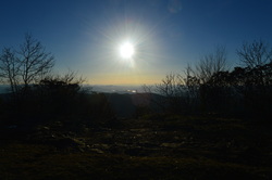
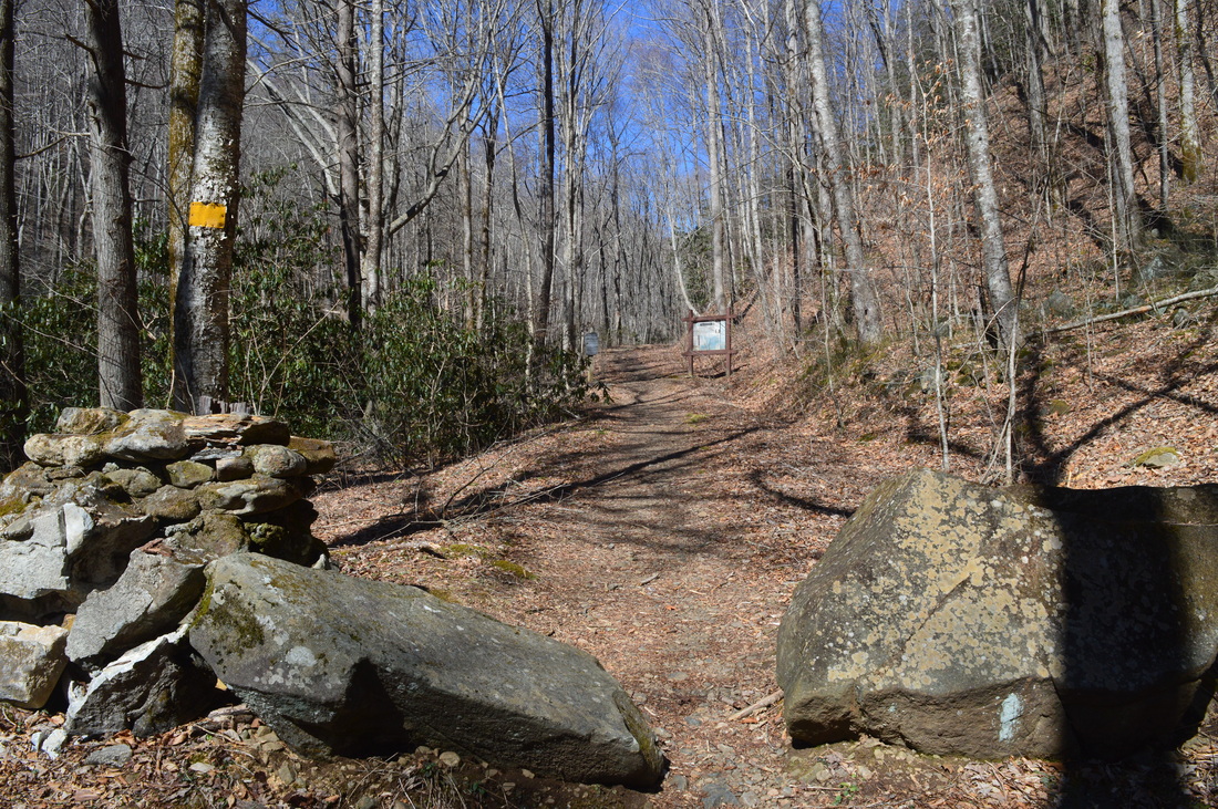
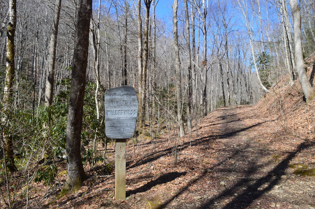
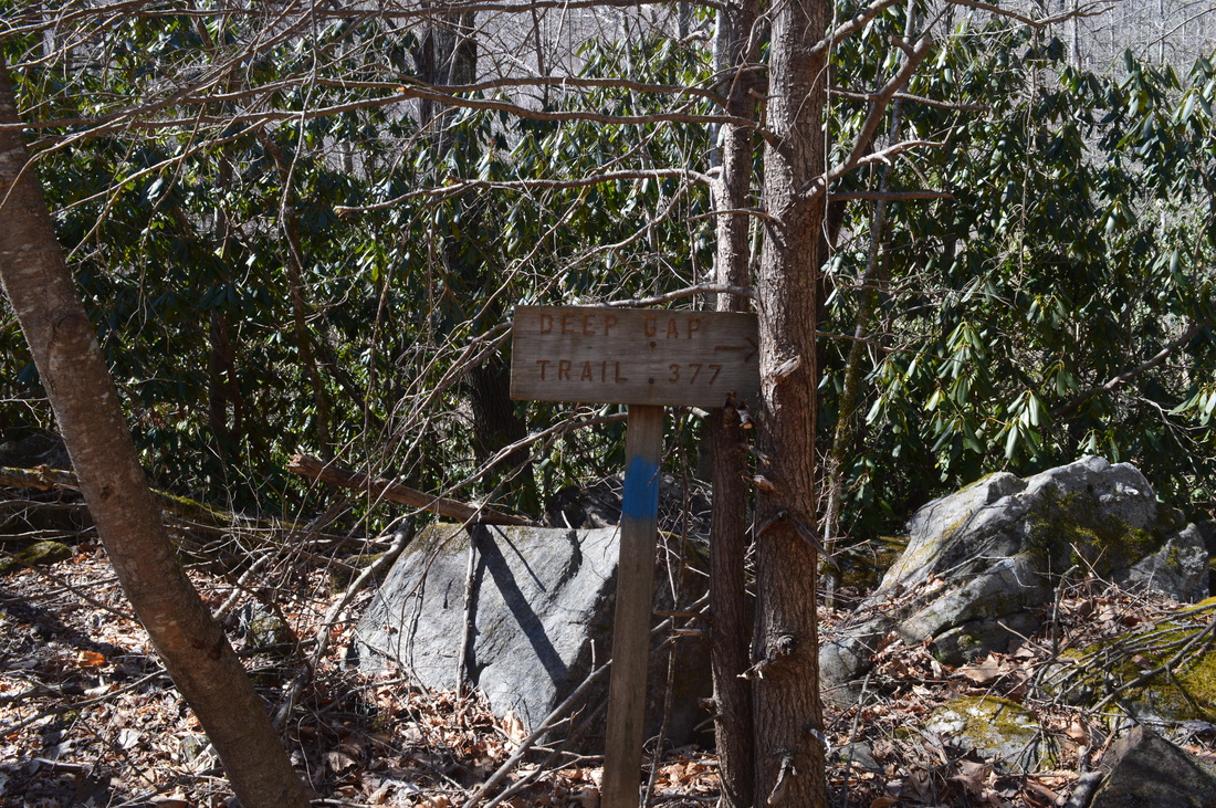
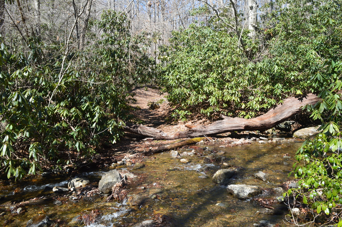
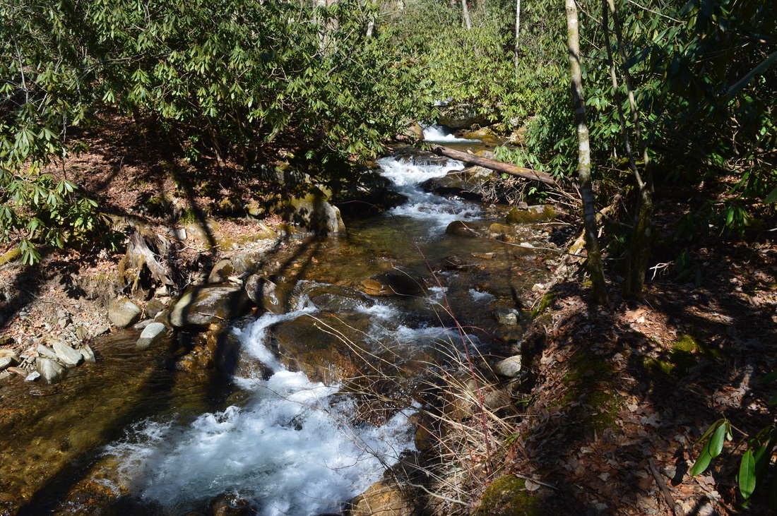
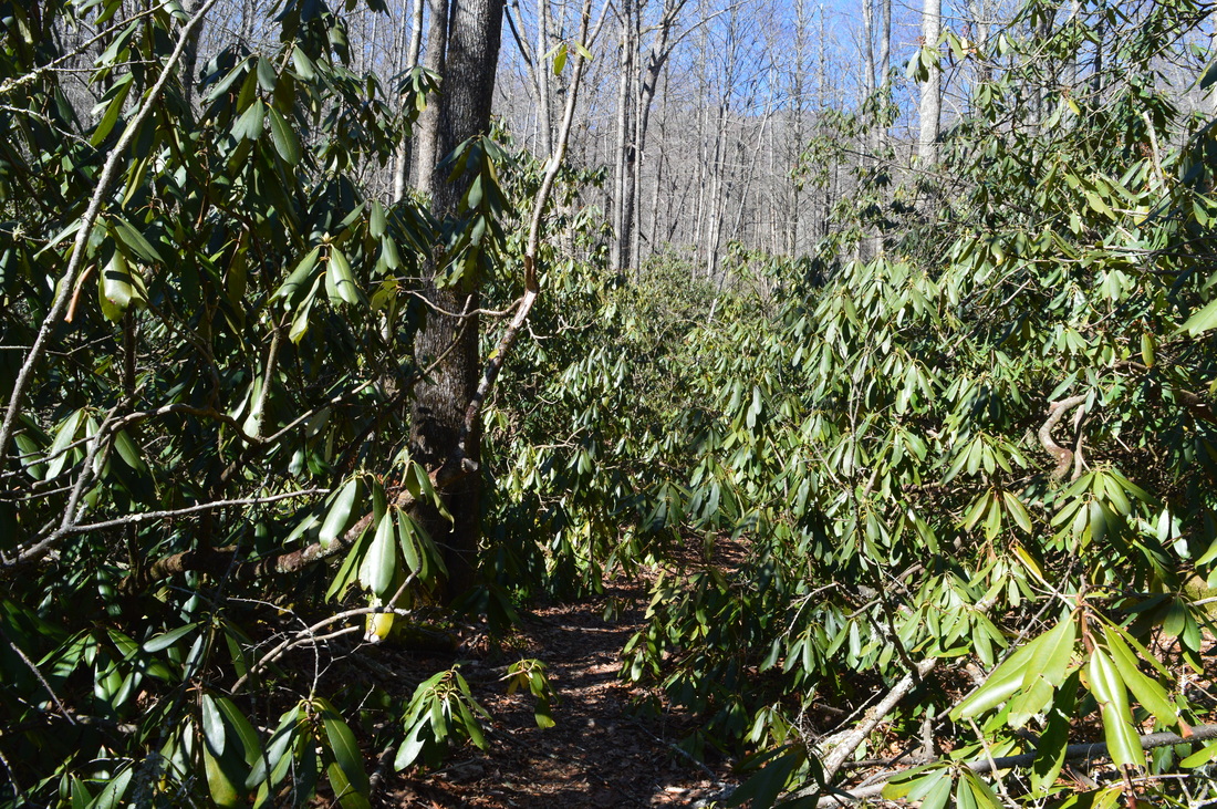
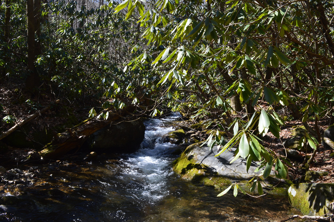
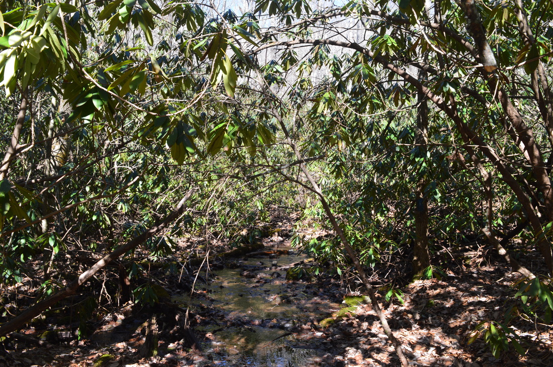
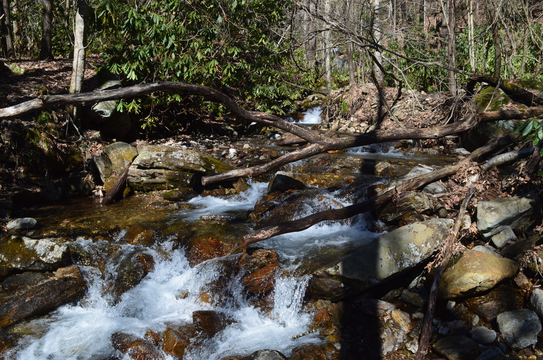
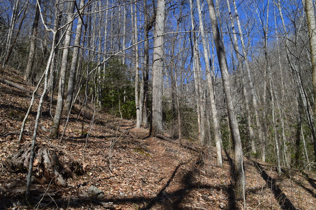
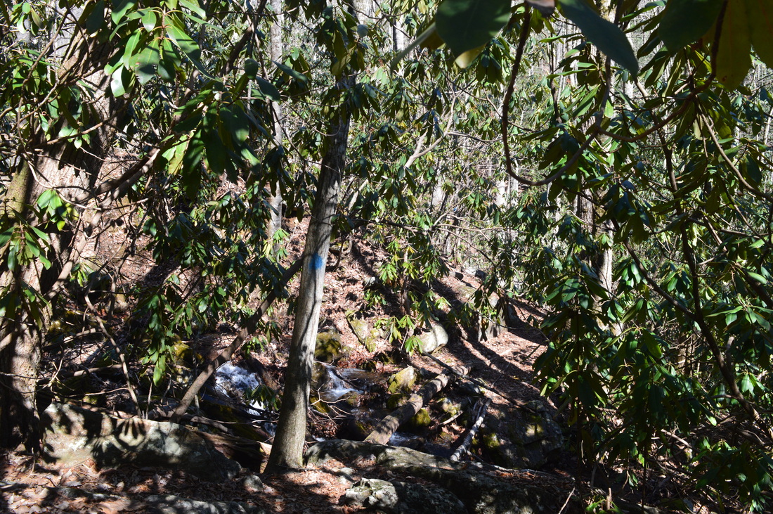
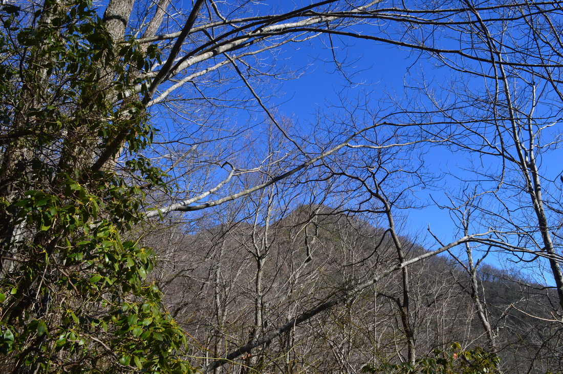
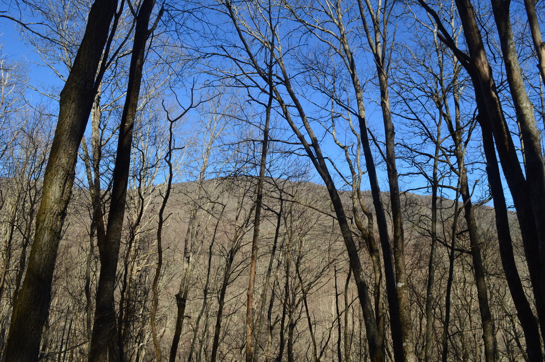
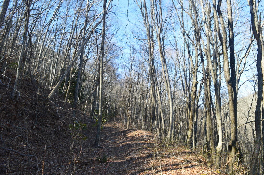
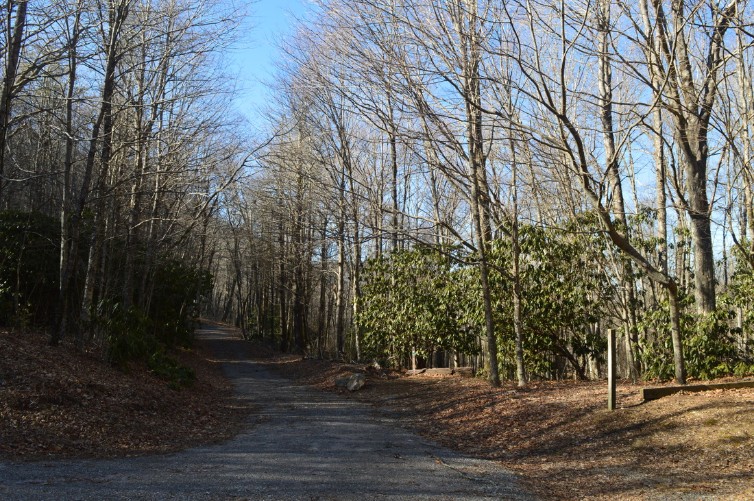
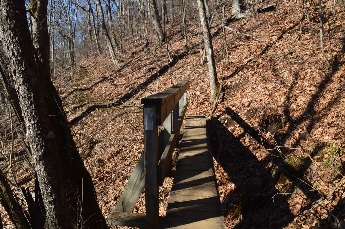
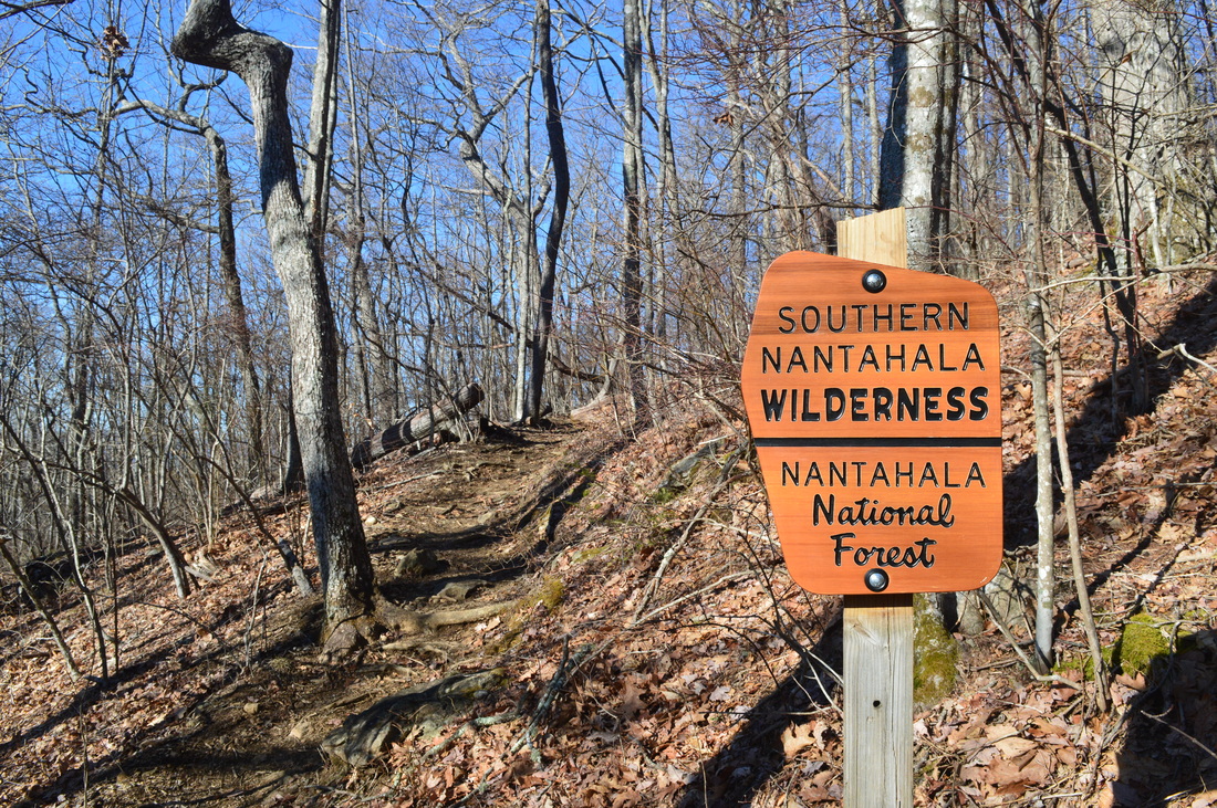
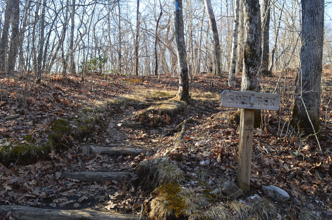
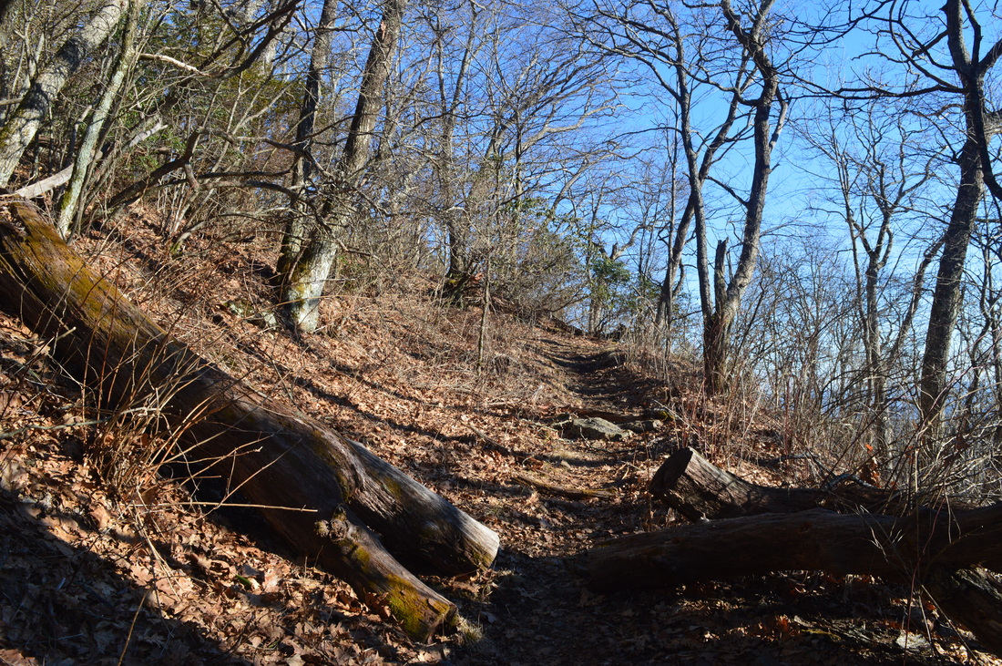
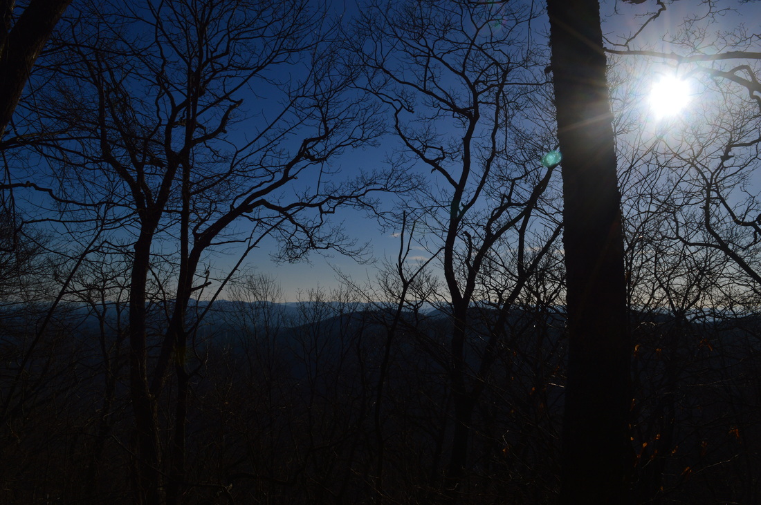
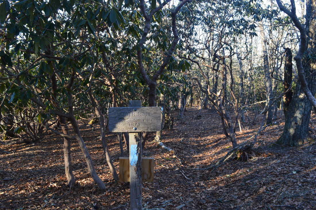
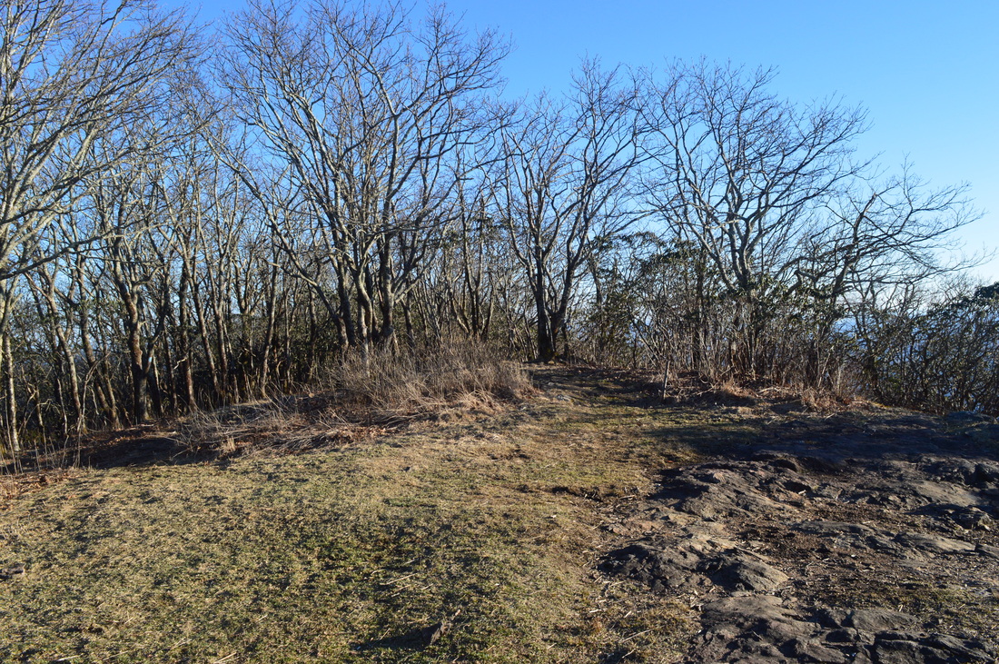
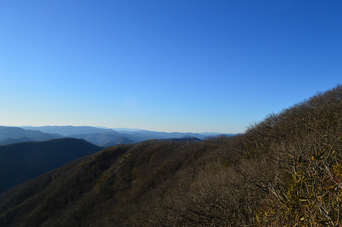
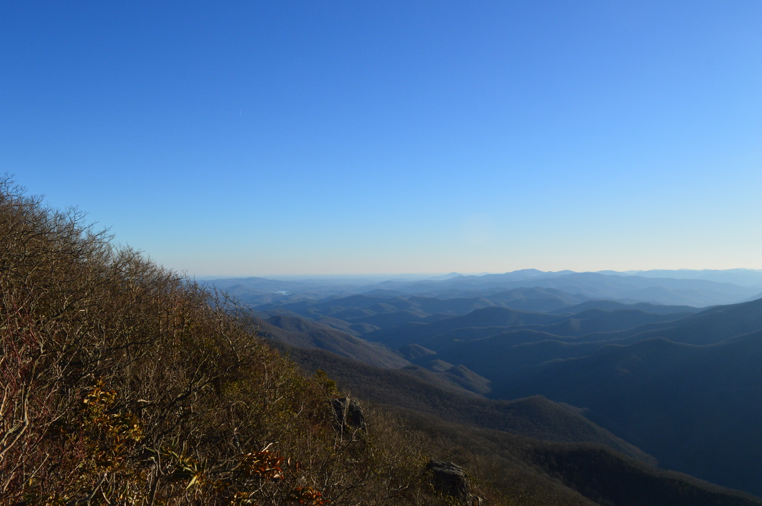
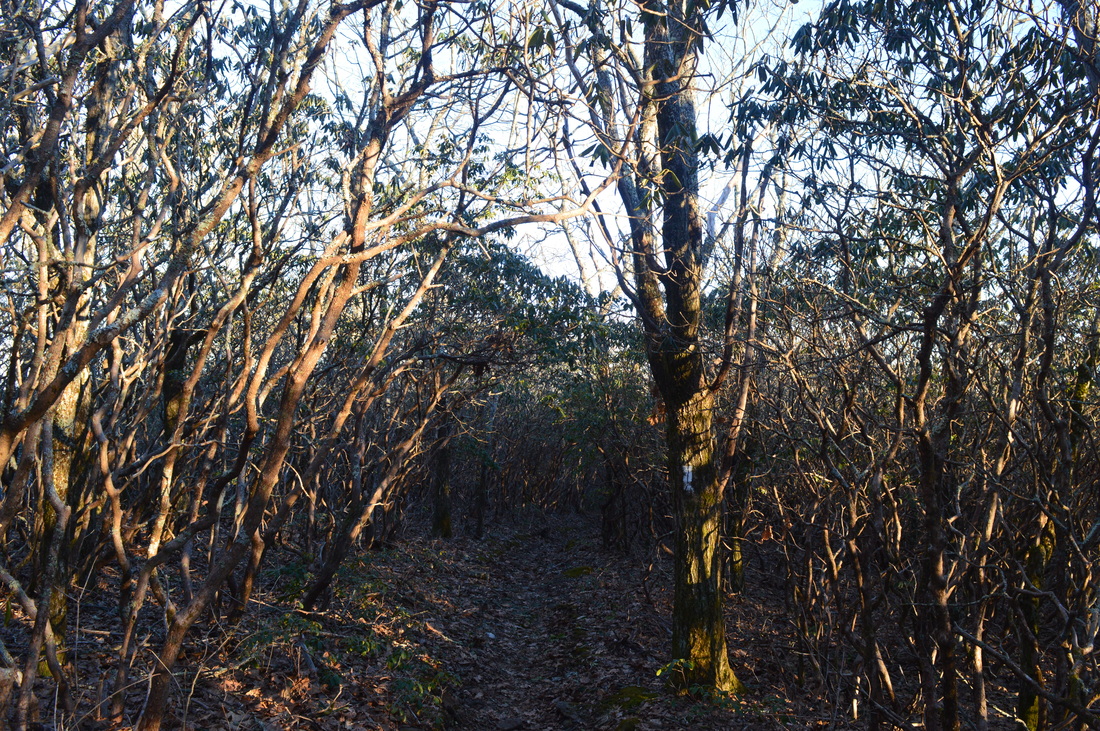
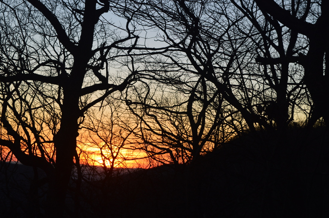
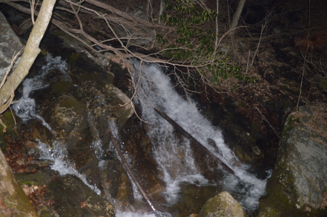
This hike starts at the end of Tate City Road. Start following the old road uphill along the Tallulah River, which is pretty small here and only the size of an average stream. Immediately enter Southern Nantahala Wilderness. The trail you are currently on Beech Creek Trail. After undulating above the banks of Tallulah River, the trail passes through an overgrown field at 0.3 miles. This is the site of a former Girl Scout Camp. At 0.4 miles, reach a junction with the Deep Gap Branch Trail. Here, the Beech Creek Trail angles right and continues following the old road on its way to Case Knife Gap and the Beech Creek watershed. You'll eventually return to the Beech Creek Trail much further down in the Beech Creek watershed, but for now, continue straight on the Deep Gap Branch Trail. Make a crossing of Chimney Rock Branch and continue through dense rhododendron that is choking the trail. At 0.5 miles, Thomas Creek flows into what is now Deep Gap Branch on the left. Crossing the stream and going off-trail up Thomas Creek will take you to Thomas Creek Falls. After this, the trail continues to follow closely Deep Gap Branch. There are blue blazes here and there, but the condition of the trail is still not very good. There are a lot of blowdowns and some overgrowth. Pay attention to the trail for the next half-mile, as there are several places where it seems to disappear. At 0.7 miles, the trail steeply climbs around a small cliff at the creek. A small creek drops off another cliff on the right, creating a wet-weather waterfall. At 0.8 miles, Wateroak Creek drops into Deep Gap Branch on the left. An overgrown trail crosses the stream and climbs up Wateroak Creek to a waterfall. If you have extra time, both this waterfall and Thomas Creek Falls might be worth a try. Around here, there are also some scenic cascades on Deep Gap Branch. At 1 mile, the trail enters a flat area. By now, I was thinking "where the heck is the over 1000-foot climb when I was already nearly halfway to Deep Gap?". I would find out shortly. After the flat area, at 1.1 miles the trail crosses Deep Gap Branch (a normally dry crossing), and after briefly following it, begins an arduous climb. All of a sudden, a nearly flat trail turned into a climb with grades being some of the steepest I've encountered while hiking anywhere. These grades were similar to a 0.6-mile section that was the last leg of a climb to Blackrock, but the trail there was better constructed and easier to climb up. Here, it's just a dirt path that wet up straight up the mountainside without any switchbacks. After this steep pitch, the trail briefly moderated and crossed Deep Gap Branch again at 1.4 miles. This is also a dry crossing, but it is a little tricky, because you have the option of crossing by a fallen log or by rocks and then scrambling up a very steep slope. After this crossing, the extra-steep climb resumed in earnest. While there were some short, steep switchbacks here, they were not helping at all - or maybe helping to not fall off the trail, but that's it. The steep climb continued for 0.4 miles until 1.8 miles, and there are few places to even catch your breath in this section. As you approach the top of the steep section, look back - there is a good winter panorama, with views of Big Scaly Mountain and the Tallulah River Valley. After this, the climb finally moderated. A waterfall can be heard on the left on the now small Deep Gap Branch. However, there is no visible way to reach the waterfall - I couldn't even tell where exactly it was. At 1.9 miles, the trail reached an old roadbed, which was a welcome change from the type of trail that I had just hiked. While there is no sign or blaze detailing the turn,turn left onto the old roadbed. According to maps, turning right on the overgrown roadbed will eventually take you to case Knife Gap, although I'm not sure if it's possible to get there from here without serious off-trail hiking. After turning left, cross the now tiny Deep Gap Branch and follow the old roadbed as it gradually ascended along the slopes. At 2.2 miles, at a rock cairn and a trail marker, turn sharply right onto another old roadbed. Follow this nearly flat old roadbed to the terminus of the Deep Gap Branch Trail at Deep Gap. Deep Gap is a major trail junction and also a trailhead with a parking area. The Deep Gap Branch Trail ends here. The Appalachian Trail crosses from left to right. The Kimsey Creek Trail drops off into the Kimsey Creek watershed on the opposite end of the parking area. If turning left onto the Appalachian Trail, you will be hiking southbound and will cross over Chunky Gal Mountain and then enter Whiteoak Stamp. However, this hike turns right onto the Appalachian Trail in the direction of Standing Indian Mountain. Even though the rest of the climb is easy, your energy is probably drained from the first part of the hike. The trail ascends along the flank of a Standing Indian Mountain spur ridge, crossing a muddy drainage on a footbridge and then re-entering the Southern Nantahala Wilderness. After crossing the ridge, the trail follows it and hen reaches Standing Indian Shelter and surrounding campsites at 3.5 miles. A spur trail leads right to the shelter - a spur trail leads left to the campsites and water from the headwaters of Little Lymon Prong. This is a branch of Kimsey Creek. After this, the trail followed the spur ridge to its end and rounded the upper end of the Little Lymon Prong drainage. Then, the trail started ascending via switchbacks onto the upper part of Standing Indian Mountain. There are great winter views into both the Nantahala River basin and the Tallulah River basin. After countless switchbacks, the trail finally topped out onto the upper ridge of Standing Indian Mountain at 4.5 miles. The trail followed the ridge and made the final push to the summit of Standing Indian Mountain. At 4.9 miles, the Appalachian Trail passed a side trail on the left leading to water from the Devils Prong of Kimsey Creek, and then reached a junction. Here, a spur trail went right to the summit of Standing Indian Mountain and its two vistas. Meanwhile,the Lower Ridge Trail went left to reach Standing Indian Campground in 4 miles. That was the trail which I used to get here on my first hike to Standing Indian Mountain. I took a right turn to see the vistas on Standing Indian Mountain. The spur trail does one final push to the summit of Standing Indian Mountain, reaching it at 5 miles. Elevation here is 5499 feet. There is a large campsite at the summit in a clearing. There's a nice vista on the right, although the best one is if you continue on the blue-blazed spur trail beyond the summit. Reach the vista after passing through a narrow crevice in the rocks. The view is amazing! Directly ahead, the evening sun was illuminating Lake Chatuge which was tucked in behind Chunky Gal Mountain. On the left, you could see the Tallulah River Valley and more into Georgia, including into Rabun County, and a view of Lake Burton. Directly below, you can see where you came from - the upper Tallulah River area. And on the right, the views stretch for miles into the Nantahala Mountains, and on a clear day, you can see the Great Smoky Mountains.Once you have acquired the views from the vista, retrace your steps to the Appalachian Trail, reaching it at 5.1 miles. Turn right and begin aiming for Beech Gap. The next nearly 3 miles are some of the easiest on the hike, so enjoy them while you can - bigger challenges lay ahead. The trail follows a ridge with some occasional winter views, although for the most part, it is hidden in thick growth. At 6.5 miles, the trail heads off to the left of the ridge and begins switchbacking down to Beech Gap. The descent is gradual and easy. The trail reaches Beech Gap at 8 miles with another trail junction. The Timber Ridge Trail heads off left into the Nantahala River Valley, while the AT continues straight to Little Bald Knob and eventually Albert Mountain. In addition, an unmarked side trail slips through the campsites on the right. This is the roue of this hike. Turn right onto the side trail, and go amid campsites before reaching a small stream. I'm going to try to describe this next section, the best I can, but it's hard to give a good description - the next half-mile is a combination of pretty much off-trail and very steep slopes with few ways to tell where you're going, besides your own. If you keep following the path (with a few encouraging faded blue blazes), you will run into a dead-end beside the small stream. This is what happened to me. The trail crossed the stream a little earlier, but I couldn't find where, so I just bushwhacked across the stream and got back on the trail. The path here is more or less visible, but it's hard to tell it apart from the rest of the land around. Occasional faded blue blazes and a rock cairn will help to guide you to the start of the steep descent. And when I'm saying steep, that means nothing - steep is an extreme UNDERSTATEMENT! If you want to try going up this section, you're probably not going to make it. Believe it or not, this is probably twice steeper than Deep Gap Branch Trail, and I had to butt slide down this trail of sorts almost the entire way. One thing you need to keep in mind is that you must stay to the north (or to the right) of the small stream the entire time, and be going in a direction that has Big Scaly Mountain directly in front of you. The rough direction you must be going the entire time is northwest. The trail will descend past many fallen trees and some rock slabs. Luckily, there are no cliffs here, so at least the terrain is passable. Much of the trail will be sliding straight down, but while you're at it, try to keep your eyes peeled for the occasional faded blue blaze. They are here and there, although most are very hard to tell, as they could just be thin slivers of blue paint or a few dots. When you start hearing the waters of a bigger waterway, it means you're almost there, with about 0.1 miles to go, although the steepness and the sliding doesn't abate until the very end. At 8.5 miles, ford Beech Creek below a large cascade. This is generally an easy ford, although it might not be during high water. After the ford, climb up the bank and turn left onto an old roadbed, shortly reaching the terminus of this so-called connector trail at the Beech Creek Trail. If you've made it this far, congratulations. I mean seriously, by far not everyone can make it down that connector trail. If you're unsure of where you're going, it's best to turn around. Turning around is always a better choice than getting lost, although I suppose if you bushwhack down the little stream to Beech Creek, you could make it on the Beech Creek Trail anyway. But anyway, if you've made it out onto the Beech Creek Trail, you're good to go. You've done the hardest section of the hike, and all that remains is several fords and a ton of blowdowns. At the Beech Creek Trail junction, you have two choices: to turn right and ascend to Case Knife Gap, before descending back down to Deep Gap Branch and the trailhead or you could continue down the Beech Creek Trail past Bull Cove to the lower trailhead, and then roadwalk Tate City Road to the trailhead. That is what I did. Since I was here in the dark, I didn't do the spur trail to High Falls, but if you're here, you might want to do the extra 0.8 miles roundtrip - I've read that it's worth it, especially after heavy rainfall. So from the connector trail, turn right for High Falls, or to continue my route, turn left and follow the old road downstream along Beech Creek. Shortly afterwards, pass a rock ruin on the right - this was a place where corundum was crushed a long time ago. After this, for the next 1.1 miles, the trail stays downhill and closely follows Beech Creek, crossing several of its tributaries. At 9.1 miles, pass a wet-weather cascade on the right on a tributary. Then, at 9.6 miles, descend down a drainage and reach the second ford of Beech Creek. A blowdown has obscured where the trail goes next after the ford, but just cross the creek, go around the blowdown, and you'll see the old road continuing. At 9.7 miles, cross (or ford if during wet weather) a large tributary of Beech Creek, flowing out of Bull Cove. Right before this crossing, a faint side trail takes off along the tributary to Bull Cove Falls, a waterfall that would be best seen after heavy rainfall, just like High Falls. I didn't take this spur trail, just like I didn't to High Falls. I didn't see a reason to in the dark, especially since I was quite tired by now. After this, the blowdowns come one after another, one after another, never stopping. Somewhere in these blowdowns I missed the turnoff for the trail to the right. The trail was rerouted from the old road to avoid private property. If you find the turnoff, you should expect another ford of Beech Creek, a 0.3-mile long easy to moderate climb, and a short but steep downhill section near the trailhead. but I continued straight on the road, thinking I would see some sort of private property sign if I missed the turn. Well, I never did, and I was getting increasingly suspicious when the road was almost completely blocked by blowdowns, and then when I saw on my GPS device that I was further south then I was thinking I was. However, I didn't feel like turning back, so I decided to just continue on, since I knew this route leads out too in a slightly longer way. I forded Beech Creek the 3rd time,and then passed an old sign nailed to a tree. The sign said "North Carolina State Line". My suspicions proved right - I had missed the turn for the trail. After a ton of more blowdowns, I forded Beech Creek for the 4th and final time, and reached a house and its driveway. the house appeared to be vacant, but I wasn't sure. I quietly slipped past the house and continued on the driveway, reaching Tate City Road at around 12 miles. I turned right, and hiked the remaining 1.8 miles to the trailhead following the road. To summarize, this is an extremely strenuous hike, although it does have its rewards with both vistas and water features. I'd say that if you want a challenge, do the whole loop, but otherwise, see the Beech Creek watershed waterfalls and maybe the Deep Gap Branch watershed waterfalls in one hike, and Standing Indian Mountain in another hike. Below are my pictures and a video.
19 Comments
Steve Kilinski
11/10/2015 11:04:04 am
Great description. We just moved near the area and have been looking for good trails to hike. Best account of an experience we have found yet. Thanks. Hope to make the hike soon.
Mark Oleg
11/13/2015 01:44:28 pm
Glad you liked it. It's a good hike, but it's pretty strenuous. Good luck if you do it. Keep in mind it's best done in winter, even with the fords.
Elizabeth Fox
11/21/2016 06:21:15 pm
Hi Mark. I have a home in Tate City (part-time resident) and stumbled onto your fabulous description of your trek from 3/31/2015. My friend and I are actually the last ones to re-blaze the lower part of the Deep Gap Branch Trail. I have done all of the same area you hiked (Standing Indian from Deep Gap numerous times) but have never taken that connector trail down to Beech Creek. (I have seen it on the topo map and knew that it was impossible ;-). There is another connector trail down from the Standing Indian ridge and marked with a rock cairn that goes down to meet the Beech Creek Trail at the base of Big Scaly. It is a bit easier but I am not sure it is blazed unless the ATC has done that in the past year or two. In any event, I am writing to let you know that I have been following the fires closely and saw that the fire overcame Big Scaly yesterday. Firefighters are attempting to protect the AT below Deep Gap and east of Big Scaly. What a difficult task they have had. Loved your blog and just signed up. Will go back and read your other treks. 11/21/16.
Sam Johnson
12/21/2015 02:34:00 pm
About to take 2 teens on this hike. Did it myself over 20 years ago and remember that climb up deep gap. We will be doing it at an easy pace and camping 2 nights so we can take everything in and enjoy the magnificence.
Mark Oleg
12/21/2015 03:43:52 pm
3 days and 2 nights are a good amount for this hike. You can camp near the summit of Standing Indian Mountain for the first night, and near Beech Creek for the second night. Keep in mind that the descent from Beech Gap to Beech Creek is difficult and not for a novice hiker.
Sam Johnson
12/21/2018 12:52:07 pm
I just saw your reply, we camped at the top of Standing Indian, awesome! then camped along Beech creek in a bottom area just before the short ridge over to the road. It was a fun trip. We had no difficulty negotiating the steep descent down the gap between the AT and Beech creek loop but its definitely not for beginners.
Bill Solomon
2/23/2016 08:45:39 pm
I've been hiking this area for about 12 years and really love the mix of landscape. I hate to hear that lower Beech Cr Trial has a lot of blowdowns. Not been down that way in years. I typically go the way you did but the other direction. Fav is is to go up Chimney Cr Trail, see Chimney Cr rocks, a climbing area, then proceed to Case Knife Gap, where the old AT shelter was long ago. The roofing tin is still around. Somewhere in there is the old trail (likely disappeared by growth) up to the AT. Proceed down the trail. The side trail to High Falls is worth it. It rains a lot at Standing Indian, about 85 in. a year, so waterfalls are good except late summer/early fall. Just downstream I take the Beech Gap connector, sometimes there is a locally made sign, sometimes not. I'd rather go up that than down! Coming down Deep Gap trail is easier for sure. The whole area has so much to offer, so many different hikes, many loop hikes. Don't go end of October though, start of bear hunting season and Deep Cr./Beech Cr. have a lot of bear dens drawing a lot of dogs and hunters!
Bill Solomon
5/6/2016 02:22:41 pm
I've been studying historical topo maps of the Tallulah/Nantahala area from the era long before autos or electricity were in this area, 1890s+.
Steve Song
10/29/2019 03:22:18 pm
When I was hiking Beech creek trail on Oct.21 2019, I met 4 bear hunters at the stacked -rock ruin corundum. no problem
Bill Solomon
2/6/2020 07:42:42 pm
Steve, just happened to refer back to this page by chance. The wildfire of 2017 changed everything in this area. The once lush vegetation will come back over time, though. You were there on the first weekend of bear hunting, the only time you'll see many people in this area. You can tell by the number of pickups with dog cages at the end of Tallulah River Rd. Just below Chimney Rocks is a steep cove with overhang caves where the bears have dens for birthing. The bear hunters tend to focus that area. I'm not against hunting as I grew up in rural Alabama, but hunters don't use all the bear and I don't trust them to not shoot cubs or mothers. The one advantage the bears have that you discovered is that they hunters spend more time looking for their dogs than they do bears. I go to that area every fall to camp and see more tagged hunting dogs running around than any wildlife! They are usually hungry by then so I give each a hand full of nuts. The owners do find the dogs with their GPS location trackers eventually. Out of curiosity I wrote the NC Wildlife manager. In 2016 there were 1200 bears killed in NC though they have nothing to do with deer or other animal populations. There is no bear season in GA. Ironically, NC even has a wildcat hunting season, which does affect the deer population. About 850 wildcat were killed in NC in 2016.
Larry Walls
2/6/2017 08:05:58 pm
Hi Mark,excellent description of your hike and the upper Tallulah River Basin. We explored this area often during the 1990's and never completed the loop as you did, but we did make it up to the Appalachian Trail at Deep Gap once. I wanted to better locate the Girl Scout camp for those who may be interested in visiting it. The overgrown field at 0.3 miles is actually the location of an old corundum mine. (This is an abrasive used in the making of grinding wheels etc.) The Girl Scout camp is at 0.4 miles just after you cross Deep Gap Branch. After crossing the stream, Deep Gap Trail turns right but if you continue straight and slightly left a short way, you will see the remains of the camp on the right. The tent sites are leveled and outlined with rocks and there are several fire rings still visible. The camp and all the surrounding acreage was donated to the National Forest Service by the Dorothy Thomas Foundation in the late 60's or 70's. Continuing on the unmarked trail to the left will take you to a very small double waterfall at about 100 yards.
Mark Oleg
2/6/2017 08:18:40 pm
Larry,
Bill Solomon
2/6/2020 07:49:28 pm
Larry, I don't know if you'll ever see this comment, but here it is just the same. The wildfires swept through most of the upper Tallulah area in Oct. 2017. I camped each fall at the old Girl Scout camp, absolutely one of my fav places with so many hike options and waterfalls. However, most of the old giant hemlocks had died or were dying. The wildfires burned up the trashy limbs but the fallen trunks remain. The wooly adelgid ruined the scenic beauty of this area as it had so many others. However, hemlock seedlings are already growing so in another 100 years this area will again be pristine!
Larry Walls
2/6/2020 09:17:18 pm
Thanks for the comment Bill. I am sorry for the loss of so many hemlocks in this area. They kept the forest floor shaded and their absence is allowing the undergrowth to come in. I haven't seen the girl scout camp in years but we will be camping at Tate Branch with the grandchildren this summer. I plan to take them up there during our visit. I'm glad to hear there are seedlings of hemlock coming back. At least it is not as bad as the blight that killed off the chestnuts so long ago.
John W
1/25/2021 07:37:12 pm
Very nice trail report. I have done various parts of the trail sections you described many many times over 35 years. I used to lease the log cabin on Beech Creek with some friends in the 90's and used it as a base for exploring the valley and it's trails. If you really want to check out a challenging trail look at Little Bald Knob to the log cabin on Beech Creek via Bear Pen Ridge. We opened a trail along that route many years ago and it was viable before the fire. Haven't been back there since but will check it out in the early spring. Ang the actual "bald" on Little Bald is a very interesting place to visit.
Donald Browning
10/16/2022 04:15:04 pm
I have been hiking and camping for many years in this area. For some reason, Little Bald has had my fascination and I’ve camped many times up on the bald, last night for instance. I had a terrible time finding water this time, usually can find some at Kilby Creek spring near the bald. I usually come up from the south, Steeltrap, Dicks, Bear Gap and on up. This route is all bushwhack and terribly hard with all the downed trees. Yesterday I walked in from the south, Beech Gap trail and the AT, bushwhacking to the top (really hard). I had a fire an stars were nice. I always have the place to myself
Bill Solomon
6/23/2022 12:15:37 am
John W, 8/3/2022 05:58:38 pm
Edirne ECA servisi hizmetlerimiz memnuniyet odaklıdır. Detayları incelemek için hemen web adresimize göz at! https://www.edirneklimaservisi.com/edirne-eca-servisi/ 8/4/2022 06:26:26 am
Edirne baymak servisi en uygun fiyat ve en hızlı servis garantisi ile sizlerle. https://www.edirneklimaservisi.com/edirne-baymak-servisi/ Leave a Reply. |
About MeMark Oleg Ozboyd Dear readers: I have invested a tremendous amount of time and effort in this website and the Georgia Waterfalls Database the past five years. All of the work that has gone in keeping these websites updated with my latest trip reports has almost been like a full-time job. This has not allowed me to pick up a paid job to save up money for college, and therefore, I I've had to take out loans. If you find the information on this website interesting, helpful, or time-saving, you can say "thanks" and help me out by clicking the button above and making a contribution. I will be very grateful for any amount of support you give, as all of it will apply toward my college tuition. Thank you!

Coming in 2022-2023?
Other Hiking WebsitesMiles HikedYear 1: 540.0 Miles
Year 2: 552.3 Miles Year 3: 518.4 Miles Year 4: 482.4 Miles Year 5: 259.9 Miles Archives
March 2021
Categories
All
|


 RSS Feed