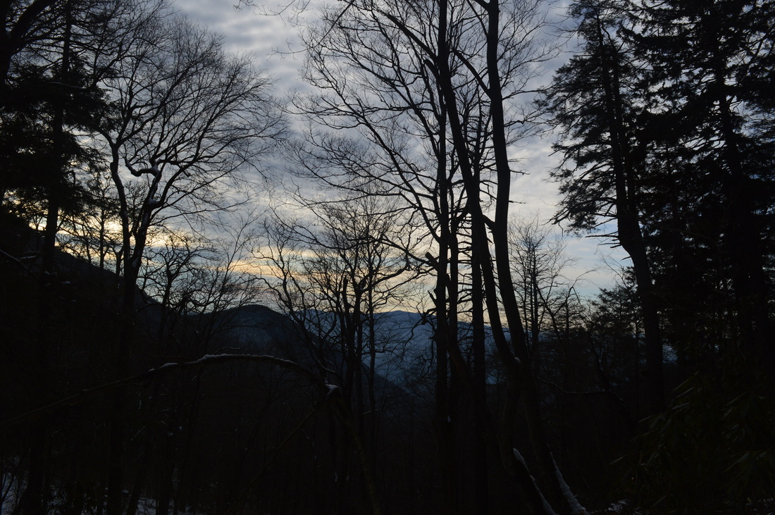
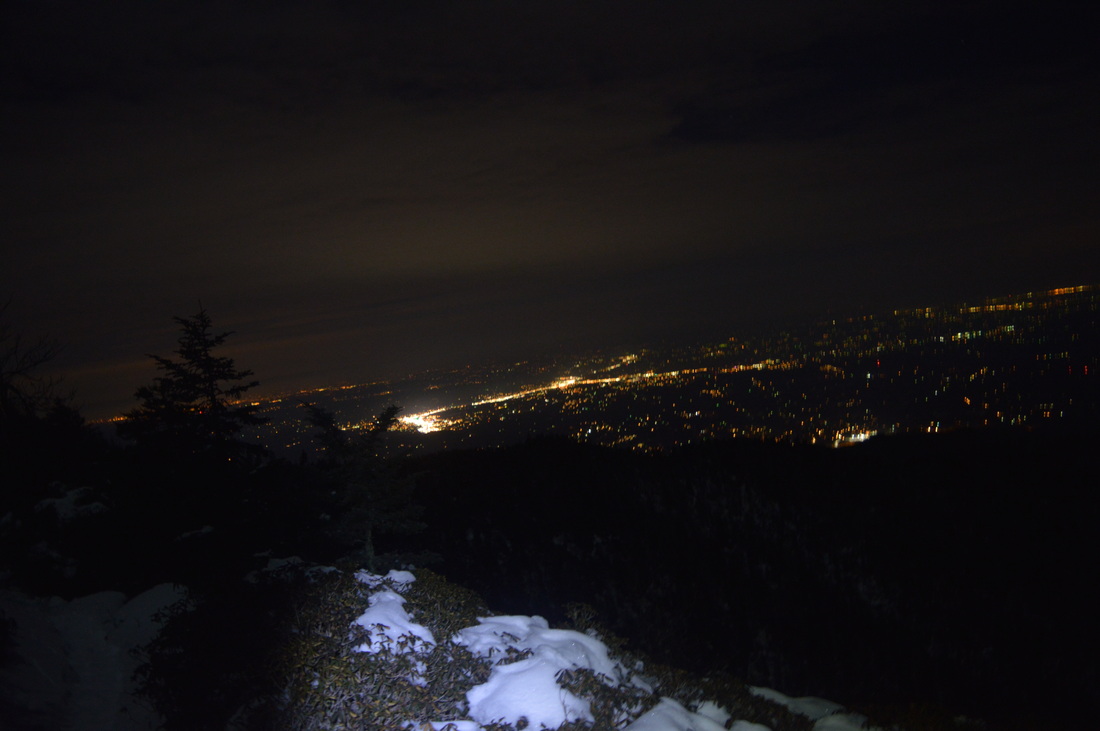
Mount LeConte is the most famous mountain in Great Smoky Mountains National Park. Being in the list of the top 25 highest peaks in the eastern US, it is also the tallest peak in the eastern US measured directly from its base near Gatlinburg. The mountain is home to a hikers lodge, accessed only by foot. The lodge provides amenities in all times of the year except winter. Due to the popularity of LeConte, five trails lead to the summit. If you have followed this blog for a little bit, you might have seen that I have already hiked to Mount LeConte via Alum Cave Trail. Unfortunately, I came to a fogged in overlook. This was my second attempt of seeing the views on Mount LeConte, with an even more challenging hike. And this time, due to my hiking partner not being in shape, the 4000-foot climb took considerably more time than expected. I arrived at the summit in the dark, but at least I was able to capture a good night picture of Pigeon Forge - even that wasn't possible last time. One day I'll set out on my third attempt to hike up to LeConte to see the views, and I know I won't fail that time. This hike occurred on February 28, 2015. My plan was to hike up to Mount LeConte via Rainbow Falls Trail, see the views from Cliff Tops, Myrtle Point, and Rocky Spur, and then return by Bullhead Trail.
R/T Length of Hike: 16 Miles
Duration of Hike: 10:00 Type of Hike: Loop Difficulty Rating: 8 out of 10 Pros: Evenly spaced out ascent with mainly no steep grades; many views; ice buildup at Rainbow Falls in winter Cons: Narrow footbridges; seemingly endless descent with some steep grades; steep, rocky trail to Cliff Tops Scenic Views: Myrtle Point Overlook - 10 stars; Rocky Spur Overlook - 7 stars; Cliff Tops - N/A (See text) Water Features: Rainbow Falls - 5 stars Best Season(s) to Hike: Year-round (possibly winter if you're up to brutal conditions) Trail Blaze Color(s): None Beginning Point: Rainbow Falls Trailhead in Cherokee Orchard Directions: From Gatlinburg, TN: Take Cherokee Orchard Road and drive for 3.5 miles to a parking area on the right. If you have reached Roaring Fork Motor Nature Trail, you have gone too far.
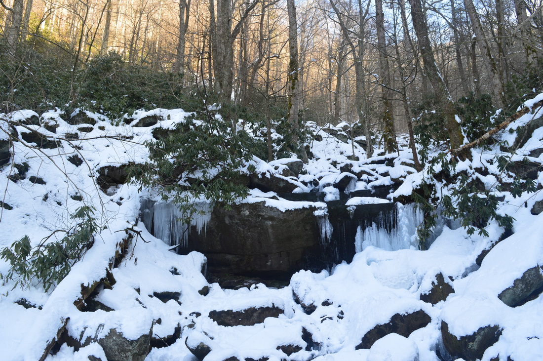
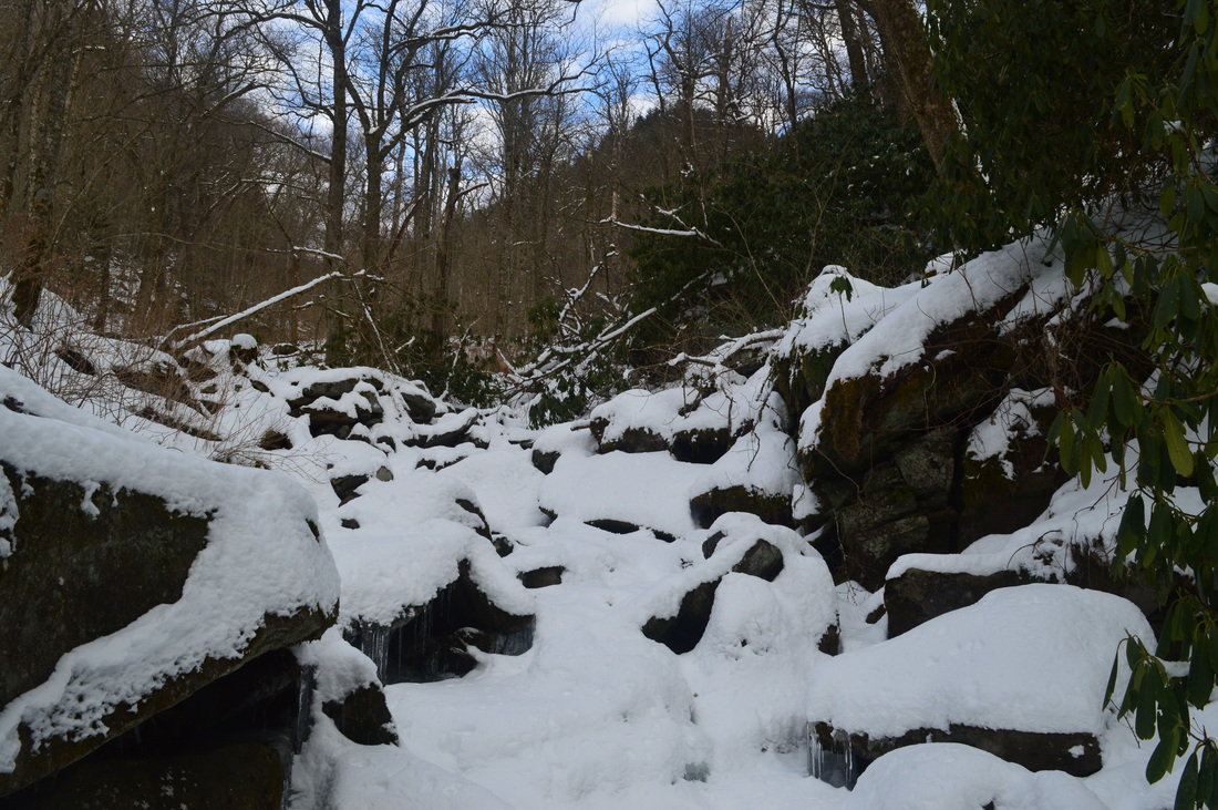
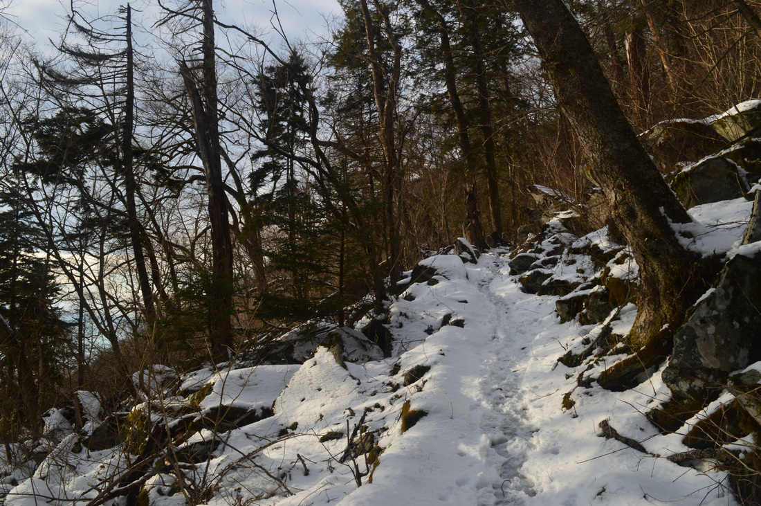
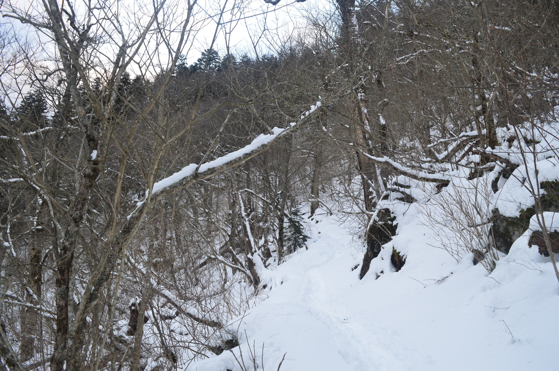
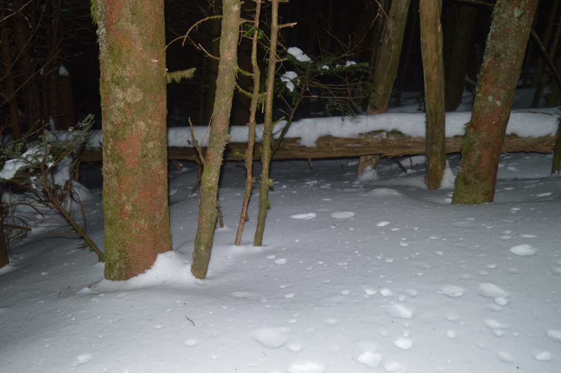
All winter long, I've been itching for a good snow hike, with 6"+ of snow - a rather easy-to-find event in the mountains most winters. Much of this winter was unusual though. Even with cold temperatures, all the storms would fall right into warm periods and even the mountains wouldn't get much. Besides the first storm in October (which turned out to be the biggest of the winter for the mountains), there was no good opportunity for snow hikes. While there were a couple good storms throughout the time period until this hike, the timeframes for all those storms were such that by the weekends, a decent snow hike would still have been impossible. My last two hikes did have winter weather, but I wanted something better, and I finally reached my goal this weekend in Great Smoky Mountains National Park. The entire hike had snow depth of at least 4 inches, and approached two feet on the Bullhead Trail's uppermost section. I'm pretty sure some drifts there were over 2 feet.
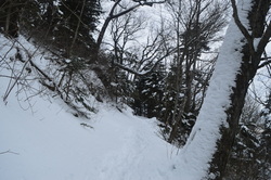
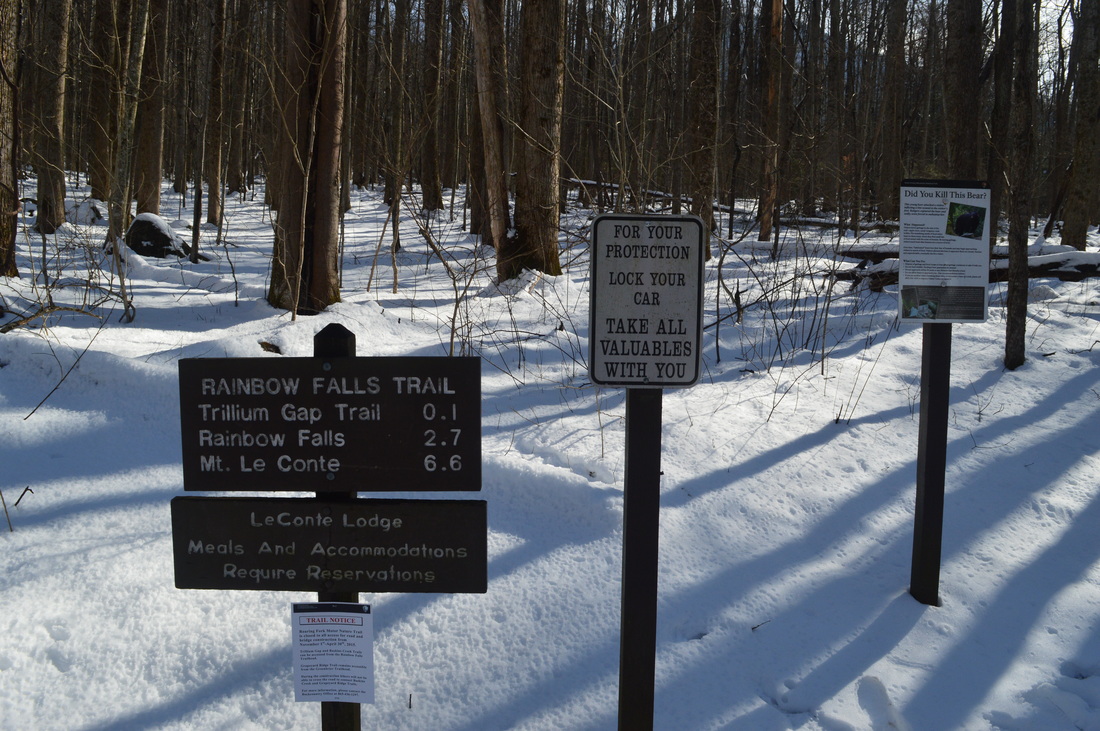
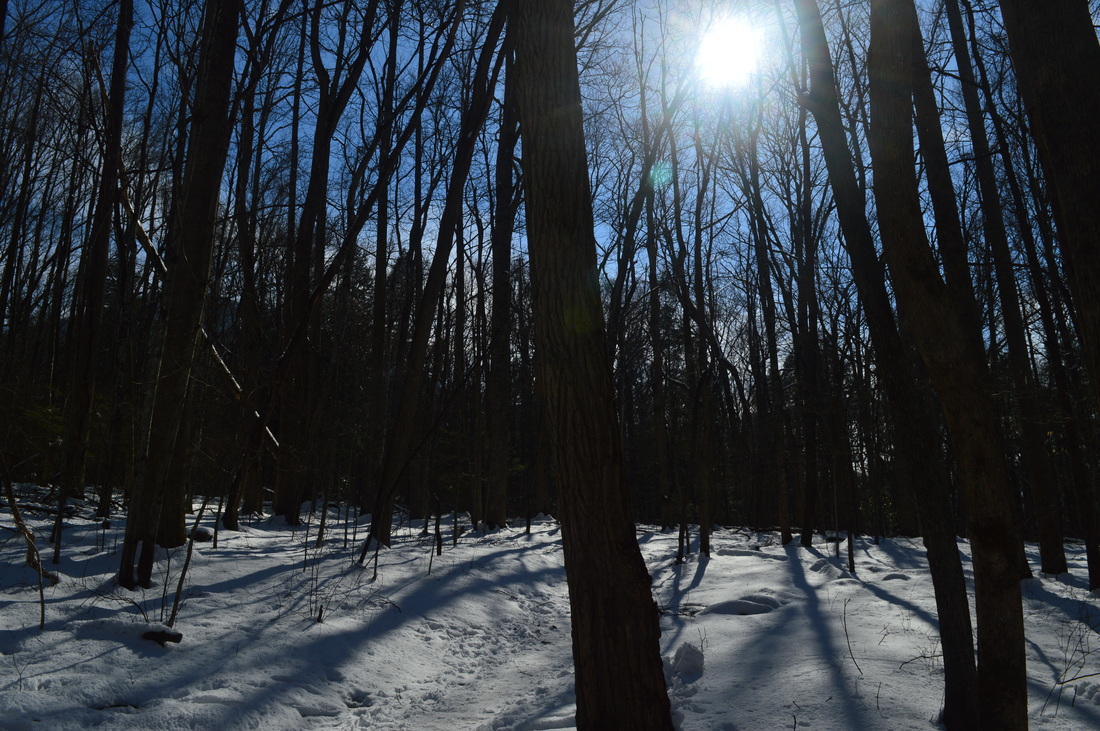
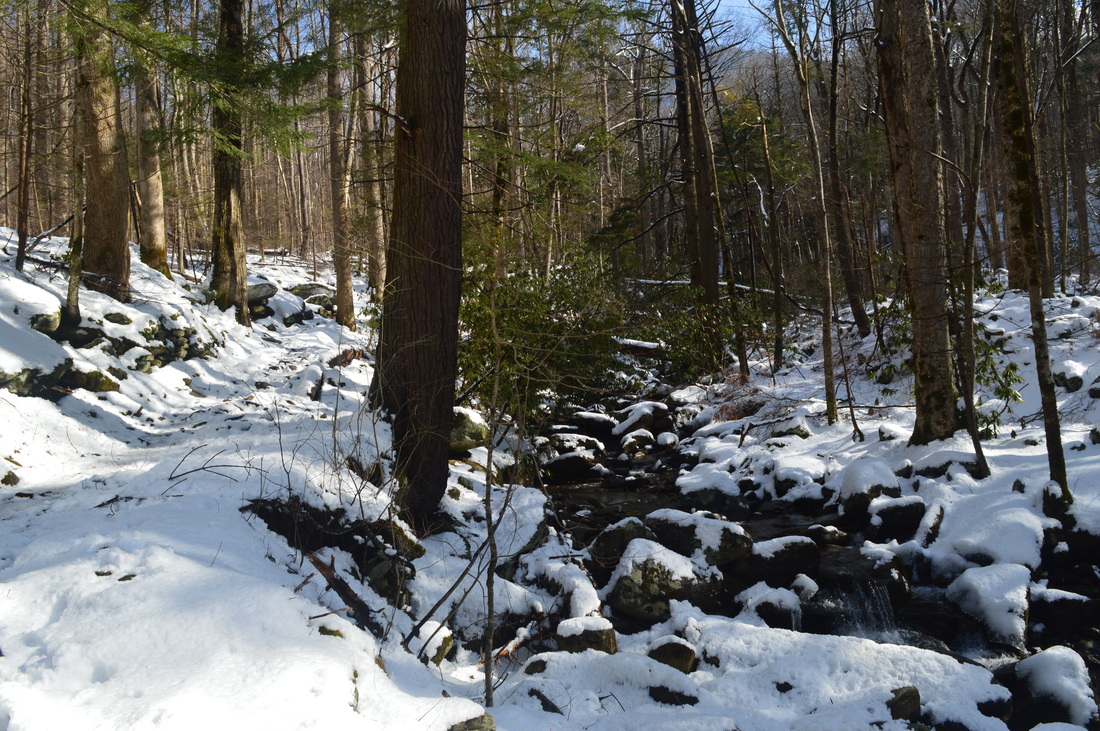
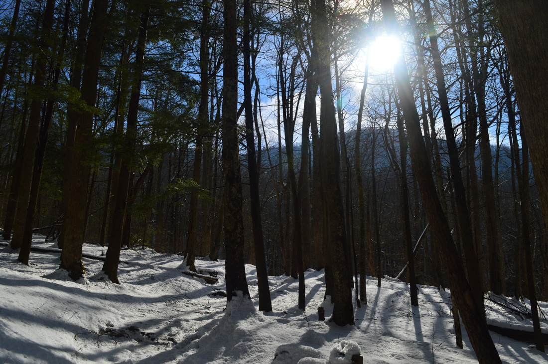
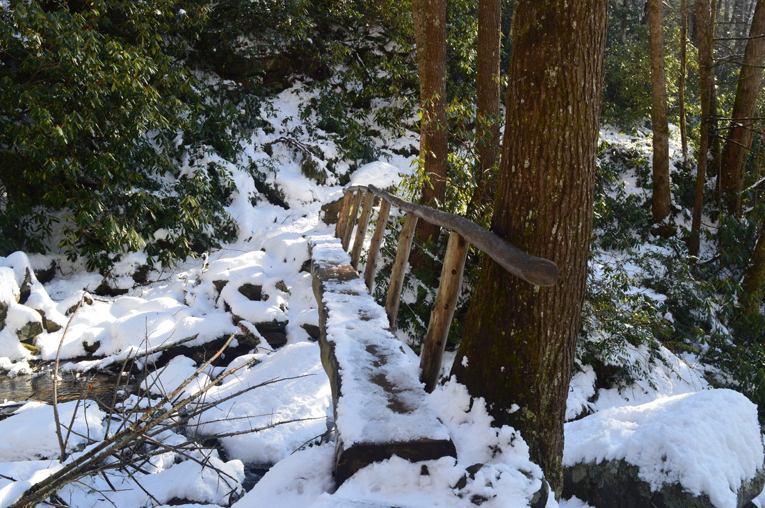
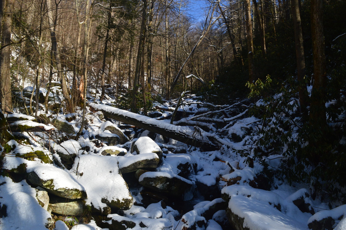
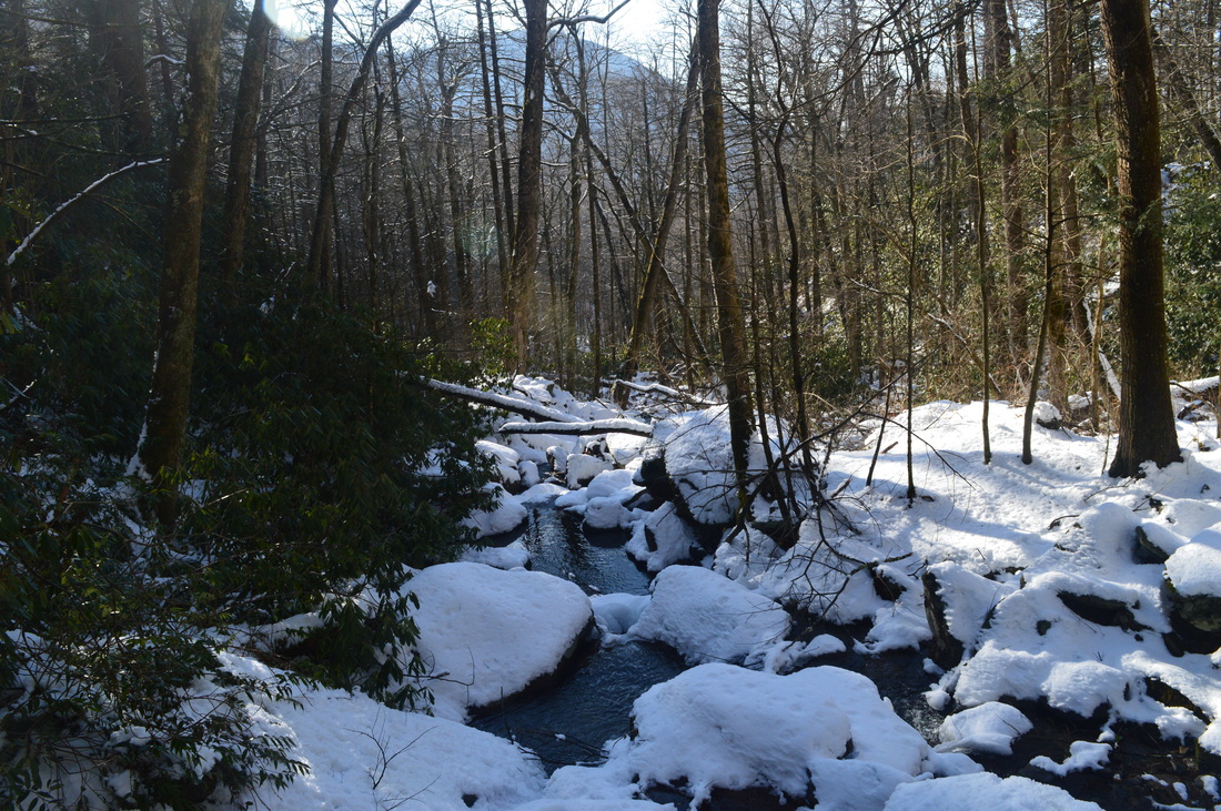
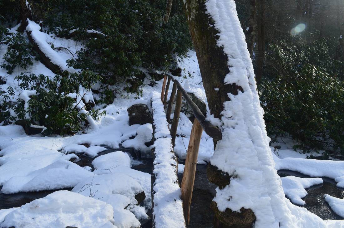
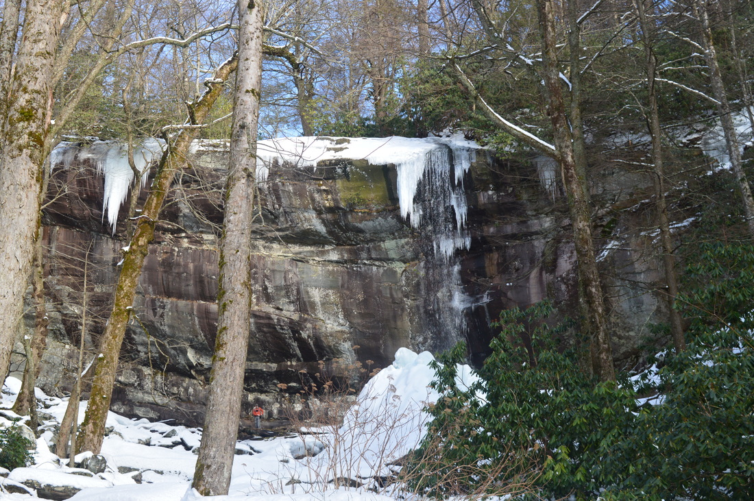
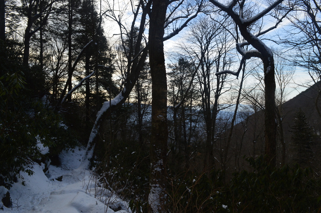
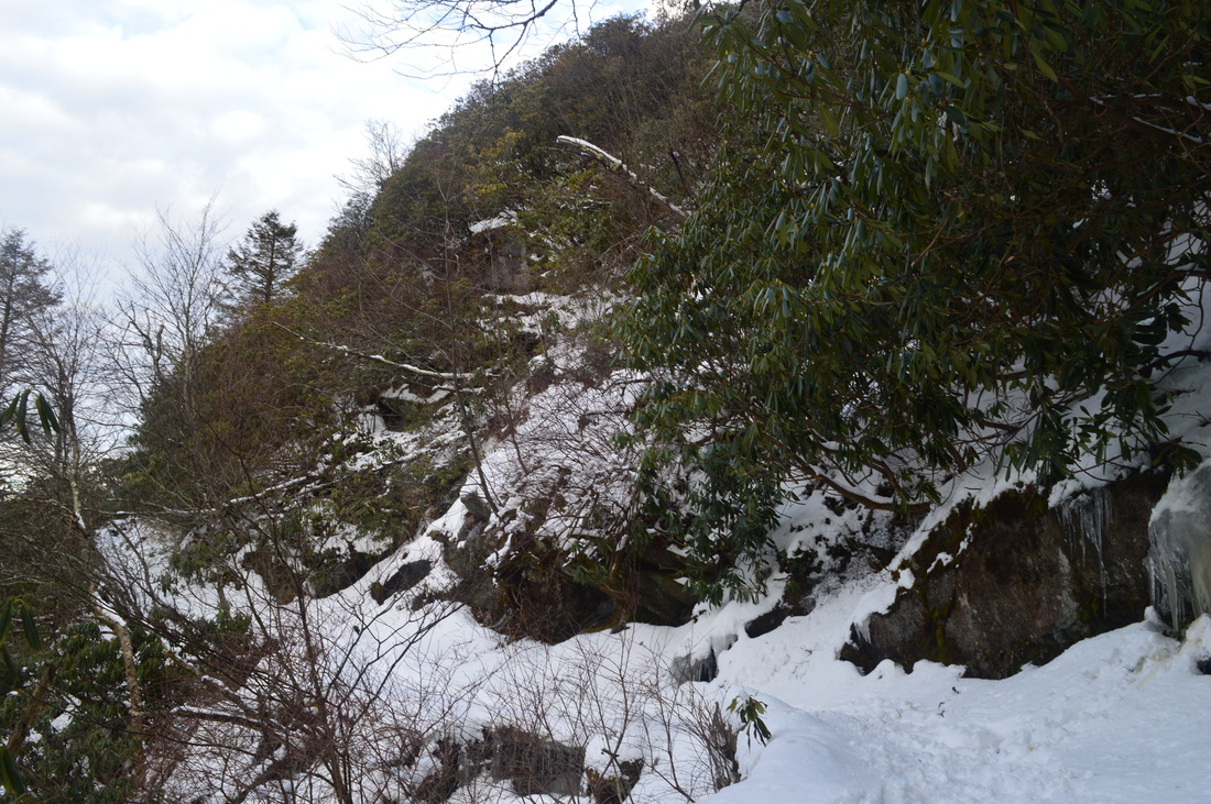
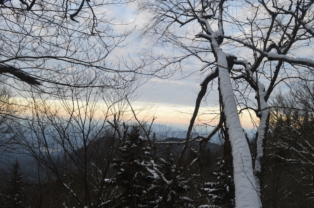
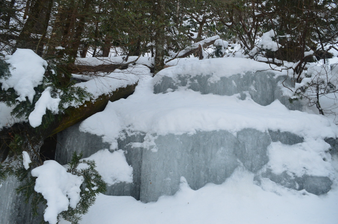
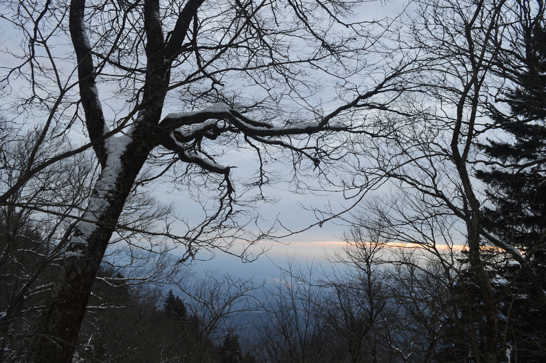
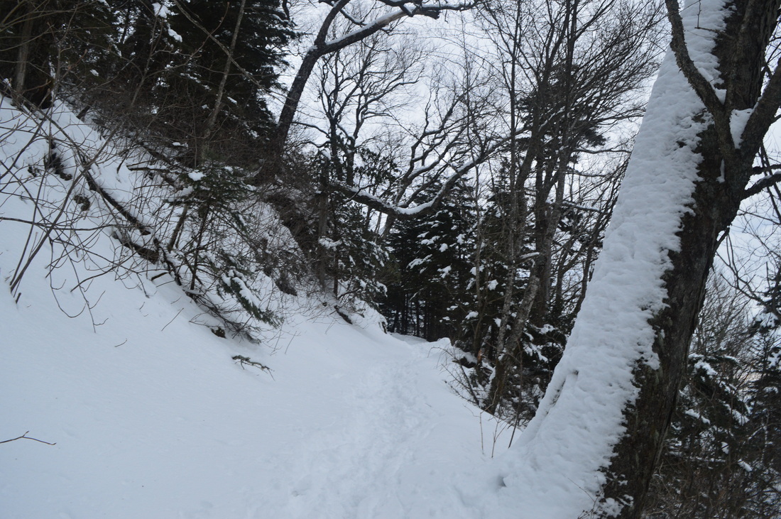
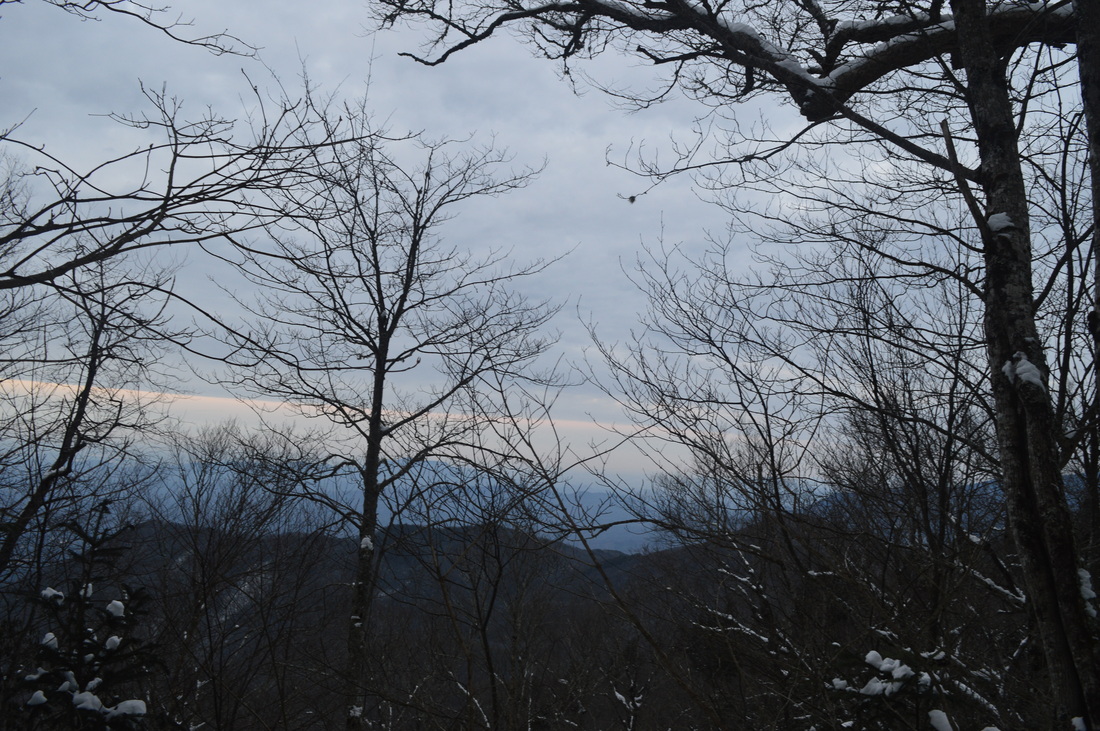
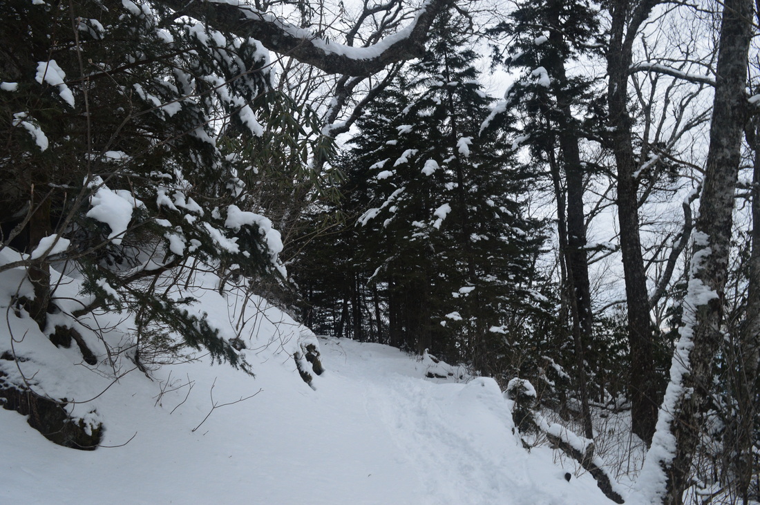
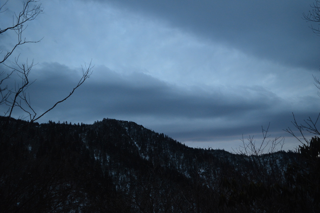
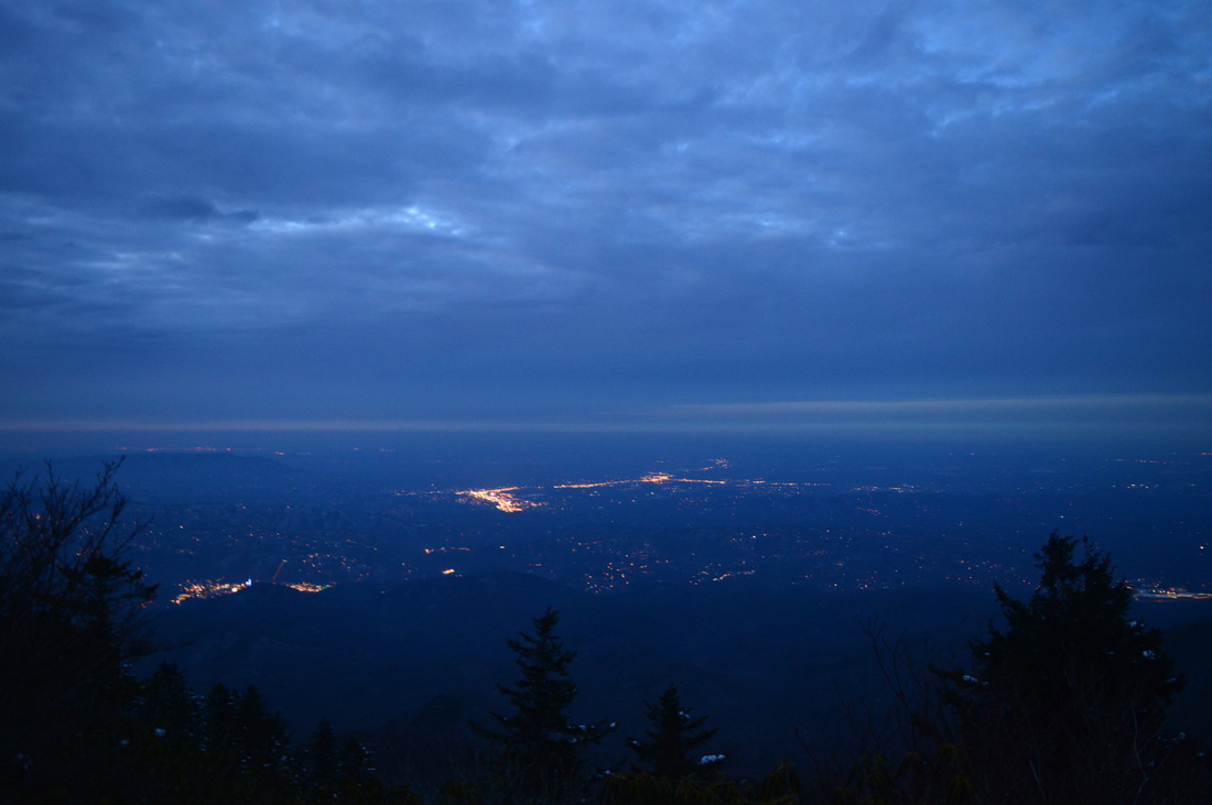
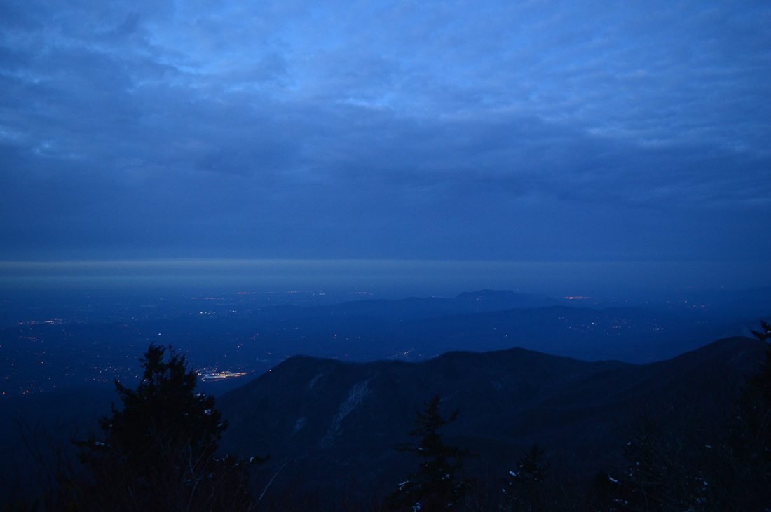
A quick note - I would say that for first time LeConte hikers, Alum Cave Bluffs Trail to the summit of the mountain would be a considerably more interesting hike. Not only is the hike more scenic, it is also generally easier, being shorter with less elevation change. Don't get me wrong - Rainbow Falls is also a good hike, but not as good. It would be a good trail, if you want to summit LeConte a second time. It is also usually open in winter except during the strongest winter storms. If you look at my GPS track above, you may notice it says I hiked more miles than I listed in this post. This is because me and my hiking partner separated, as I wanted to get to at least Rocky Spur before dark, and we couldn't find each other for some time after that. I subtracted roughly 1.2 miles from my recorded distance, which seems to be about right. Now to the description of the hike. Both Bullhead Trail and Rainbow Falls Trail share one trailhead. The Rainbow Falls Trail starts right where the parking is, while Bullhead Trail (as well as Old Sugarlands Trail) starts just down the road. With the two trails being so close together, it's easy to make it a loop. A lot of people have different opinions about which one is better for up and which one is better for down. I'd say Rainbow Falls is slightly better for down, but it might be different when there's no snow - the snow was really decreasing my speed on much of the Bullhead Trail. There was snow on Rainbow Falls Trail too, but the way it was setup it was much easier to go downhill, as it is a better built trail. The difference is not crucial, though, and either way would be fine. The Rainbow Falls Trail starts as a gentle uphill, approaching LeConte Creek. The wet snow was glistening under the warm sun, and there were "snowballs" falling from the trees. At 0.1 miles, the Trillium Gap Trail heads off to the left. The trail reaches the Trillium Gap Trailhead on Roaring Fork Motor Nature Trail in 1.7 miles, and from there continues to Grotto Falls, Brushy Mountain, and eventually Mount LeConte. Currently, Roaring Fork Motor Nature Trail is closed to all kinds of traffic, due to bridge construction, so this is the only easy way to reach Grotto Falls. Beyond the junction, the trail quickly reaches LeConte Creek and begins tracing it upstream. The ascent here does not look steep, but it does feel steep at times. It is somewhat rocky as well (like most streamside trails). Over the next mile, there are several trailside cascades on the stream to the right. After about a mile, the trail switchbacks away from the creek and rises to slightly higher ground with views of the creek valley below. Up ahead, several ominous mountains stand - Mount LeConte is the middle one. As the trail does a second switchback, there will be a couple small stream crossings. Then, the trail stays flat, with some slight uphill, as it follows the contours of the hillside. LeConte Creek continues to slowly get closer and closer, as the creek itself drops steeply here (thus, the creek approaches the trail rather than vice versa). Just as it looks like the trail is about to reach the creek, the trail zigzags uphill some more, just before crossing LeConte Creek on a footbridge at 1.7 miles. With the boulders in the creek covered by deep snow, it was a pretty winter scene. After the footbridge, there will be many switchbacks, as the trail tries its best to navigate up the steep slopes here. This might be one of the steeper uphill sections of the hike. Then, at 2.1 miles, the trail crosses a small branch with a small waterfall, that was iced up today. After this, I have read that the trail is supposed to cross LeConte Creek on a second footbridge, but I didn't see any signs of it. The trail actually rock hops the creek at 2.3 miles, just below Rainbow Falls, and then reaches Rainbow Falls at 2.4 miles at a second, narrower footbridge. Rainbow Falls had a big ice cone underneath it and it was flowing rather poorly. I've seen picture of it flowing better, but the way it was flowing on this day, it's not a very impressive waterfall. The waterfall has an 80-foot single drop, and is known as the highest single-drop waterfall in Great Smoky Mountains National Park. After Rainbow Falls, cross the footbridge and continue switchbacking along Rainbow Falls Trail to slowly ascend above the drop of Rainbow Falls. At 2.9 miles, the trail crosses LeConte Creek again, without the advantage of a footbridge, although the crossing is easy. After this, the trail steadily ascends towards Rocky Spur, reaching the ridge at 4.4 miles after breaking the 5000-foot mark. As the trail reaches this ridge, there are good winter views to the south of the LeConte ridge. You can see Balsam Point, West Point, Cliff Tops, and possibly High Top. I was thinking the trail would now follow the main ridge of Rocky Spur, but I was wrong - the trail actually rounded the ridge and started following its north side. There are good winter views here into the Roaring Fork Valley and Gatlinburg. Brushy Mountain can be seen. As the trail was slowly ascending up Rocky Spur, the snow was getting steadily deeper, with at least 6-7 inches here. After many switchbacks, the trail recrosses to the south side of the ridge and views of Mount LeConte reappear. At 5.7 miles, reach a spur trail heading off to the left, marked as Rocky Spur Overlook. The Rocky Spur Overlook Spur Trail is a short trail that leads to Rocky Spur Overlook in 0.1 miles, reaching it at 5.8 miles, and loops back to the main trail shortly. Rocky Spur Overlook provides an amazing view of the Roaring Fork Valley, Gatlinburg/Pigeon Forge/Sevierville, and perhaps on a good day, you can see as far as the Cumberland Mountains. The other side of the overlook provides a great view towards all of Mt. LeConte, and all of its peaks - Balsam Point, West Point, Cliff Tops, High Top, and Myrtle Point - are clearly visible. I was here during twilight, a few minutes after sunset, and the mountains were bathed in a breathtaking blue, characteristic to the Blue Ridge Mountains. This blue haze usually lasts for a short time just after sunset and a short time just before sunrise. The trail continues beyond the overlook and loops back out onto the the main trail in another 0.2 miles. From here, continue following the Rainbow Falls Trail as it gently ascends towards its end at the Bullhead Trail. Along the way, there are several good overlooks of Gatlinburg/Pigeon Forge on the right. At 6.3 miles, reach a junction with the Bullhead Trail. This is the end of the Rainbow Falls Trail. You'll return to this point later, but for now, turn left towards LeConte Lodge and the summit of the mountain. You are now on the Bullhead Trail. The trail shortly breaks the 6000-foot line, and continues to ascend steeply for a half-mile. At 6.8 miles, the Alum Cave Bluffs Trail ties in from the right. At 6.9 miles, reach the LeConte Lodge. A staircase leads left to the lodge, while a spur trail leads right to Cliff Tops. I didn't hike to Cliff Tops on this visit, knowing there was no night view to expect, but under ordinary circumstances, you should. It's 0.2 miles to the vista and another 0.3 miles back to the main trail near High Top. Meanwhile, I kept following the Bullhead Trail. At 7 miles, the Trillium Gap Trail comes in from the left. Does this sound familiar? It's the same trail went left, 0.1 miles from the start of the hike. It's on my to-do list. After this, the trail gradually continues climbing to the summit of Mount LeConte, known as High Top. Along the way, pass the other end of Cliff Tops spur trail and also the LeConte Shelter, which has been recently reopened after being closed for nearly a year due to bear activity. Near High Top, you'll also find a few good views into the heart of the Smokies. At 7.4 miles, reach High Top, elevation 6594 feet. There are no views from the summit, but there is a large pile of rocks just to the right of the trail. Make sure to add your own! There was also about 9-10 inches of snow here. This was the turnaround point on my first hike to Mount LeConte. On this day, I decided to continue, seeking the night view from Myrtle Point. The trail steeply descends from the summit through a dead hemlock forest. You are now on the Boulevard Trail. At 7.6 miles, reach a junction with the Myrtle Point spur trail. The Boulevard Trail angles left, while the Myrtle Point spur trail keeps going straight. I was surprised that while all other trails were packed, Boulevard Trail didn't have a single footprint in the deep snow! The Boulevard Trail, while starting higher than any other trail to the summit, is known to be the longest and possibly hardest hike to the summit, so maybe that's why no one hike it recently. Meanwhile, I took the Myrtle Point spur trail. It ascended up to a narrow, rocky ridge, and after a short period of scrambling, reached Myrtle Point at 7.8 miles. Myrtle Point has an absolutely amazing view! Even in the nighttime, I could make out ridges upon ridges of mountains, as the mainland of the Smokies stretched as far as the eye could see. In the opposite direction, the bright lights of Pigeon Forge and Sevierville were lighting up the dark, night sky. It sure is a place to linger at, and I can guarantee that it's one of the best views around in daylight. Judging by the way this overlook is set up, it's probably better than Cliff Tops, but I can't confirm that right now. I will be back. From Myrtle Point, retrace your steps back to the Rainbow Falls Trail junction, reaching it at 9.5 miles. From here, continue following the Bullhead Trail instead of taking Rainbow Falls Trail. The snow depth dramatically increased and reached about 2 feet, lasting like that for a mile! It was extremely slow travel, because the trail was following a slope, and with the deep snow, i was hard to walk. There were several views towards the valley again to the right. There isn't anything much to describe about this trail, besides that it's down, down, down. After the trail left the slope, the snow depth decreased back to the average depth the entire hike. The trail passed below West Point, and then briefly followed a ridge that leads up to Balsam Point (also known as Bullhead). Following this, the trail left the ridge and began the descent for goo. And it's one LONG descent, seemingly endless! The descent is somewhat steep at times and switchbacks several times over a few miles. At some point, it crosses a side ridge with some views, and then continues the descent. The last half-mile of the Bullhead Trail is pretty steep as the trail plunges down into the Sugarlands, ending at the Old Sugarlands Trail at 15.6 miles. Take a right here. Begin a gentle uphill along an old roadbed. Cross LeConte Creek on a footbridge at 15.8 miles, and reach Cherokee Orchard at 16 miles. The parking area is just ahead. To summarize, this is a good Smokies hike. There are both water features and scenic views, and it's a good hike if you wish to resummit Mount LeConte. Like I mentioned earlier, though, Alum Cave Bluffs would be a better first LeConte hike. I'll do the Trillium Gap Trail soon to finally see the overlooks in their true colors. Below are my pictures and videos.
0 Comments
Leave a Reply. |
About MeMark Oleg Ozboyd Dear readers: I have invested a tremendous amount of time and effort in this website and the Georgia Waterfalls Database the past five years. All of the work that has gone in keeping these websites updated with my latest trip reports has almost been like a full-time job. This has not allowed me to pick up a paid job to save up money for college, and therefore, I I've had to take out loans. If you find the information on this website interesting, helpful, or time-saving, you can say "thanks" and help me out by clicking the button above and making a contribution. I will be very grateful for any amount of support you give, as all of it will apply toward my college tuition. Thank you!

Coming in 2022-2023?
Other Hiking WebsitesMiles HikedYear 1: 540.0 Miles
Year 2: 552.3 Miles Year 3: 518.4 Miles Year 4: 482.4 Miles Year 5: 259.9 Miles Archives
March 2021
Categories
All
|


 RSS Feed