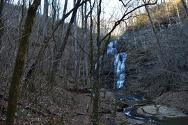
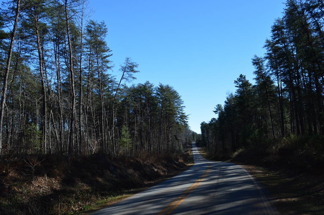
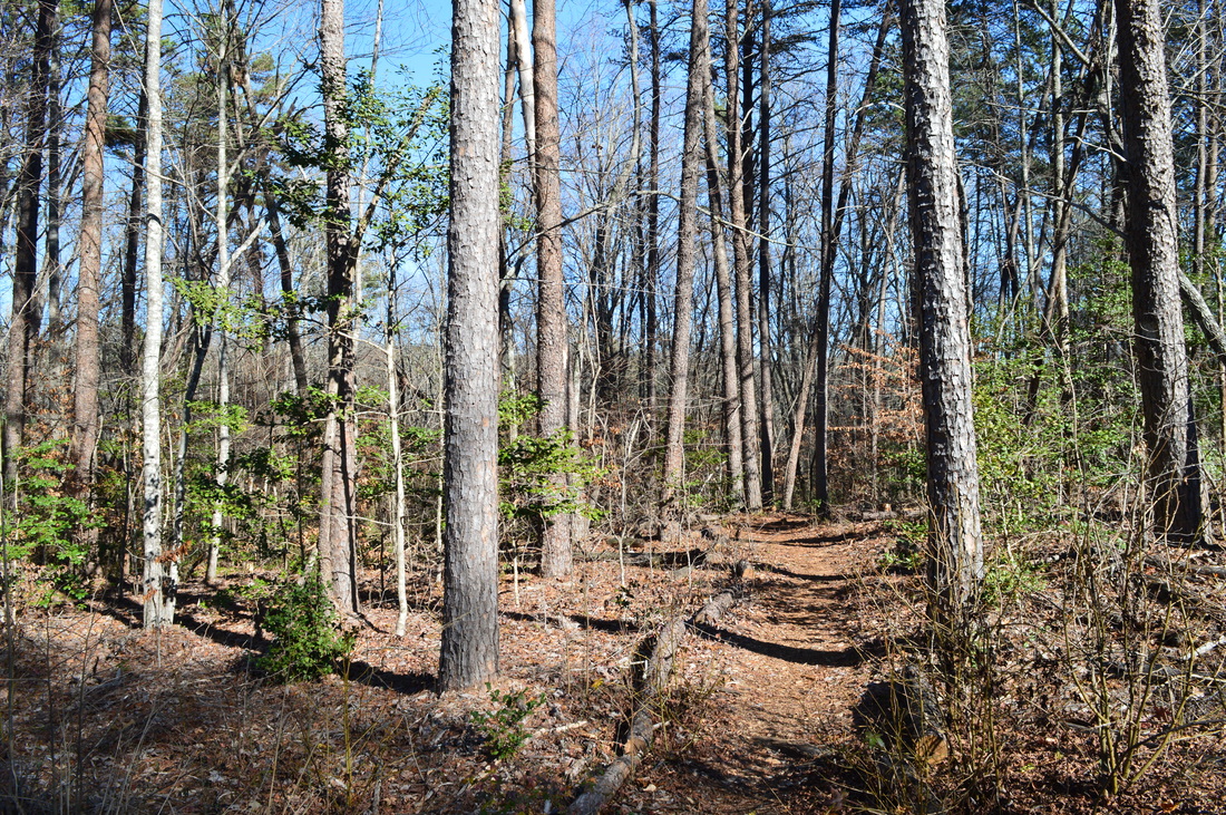
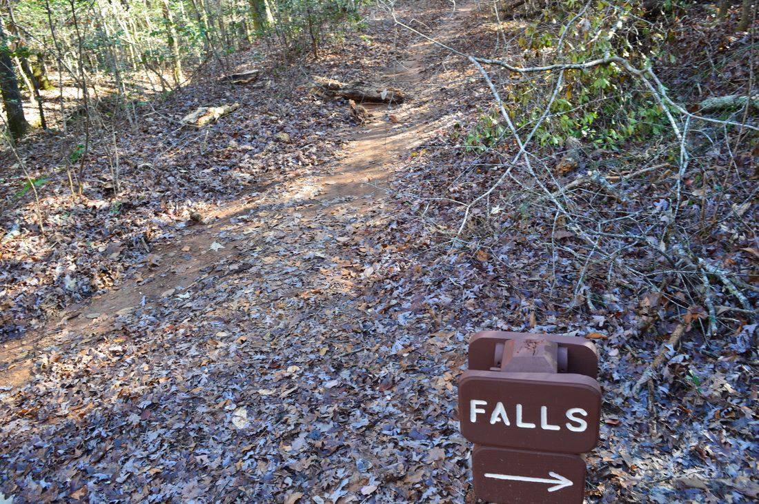
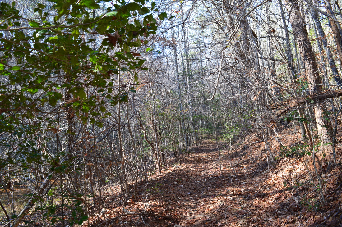
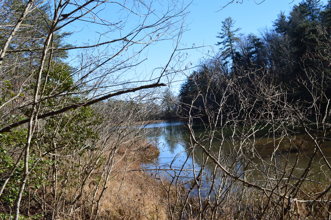
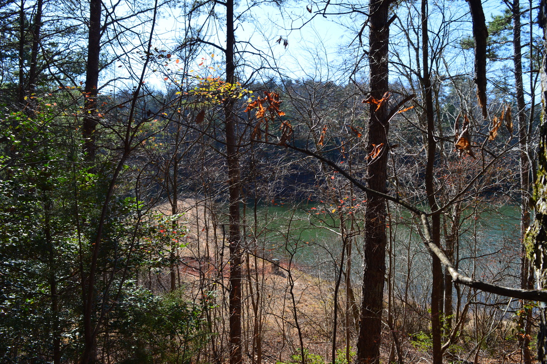
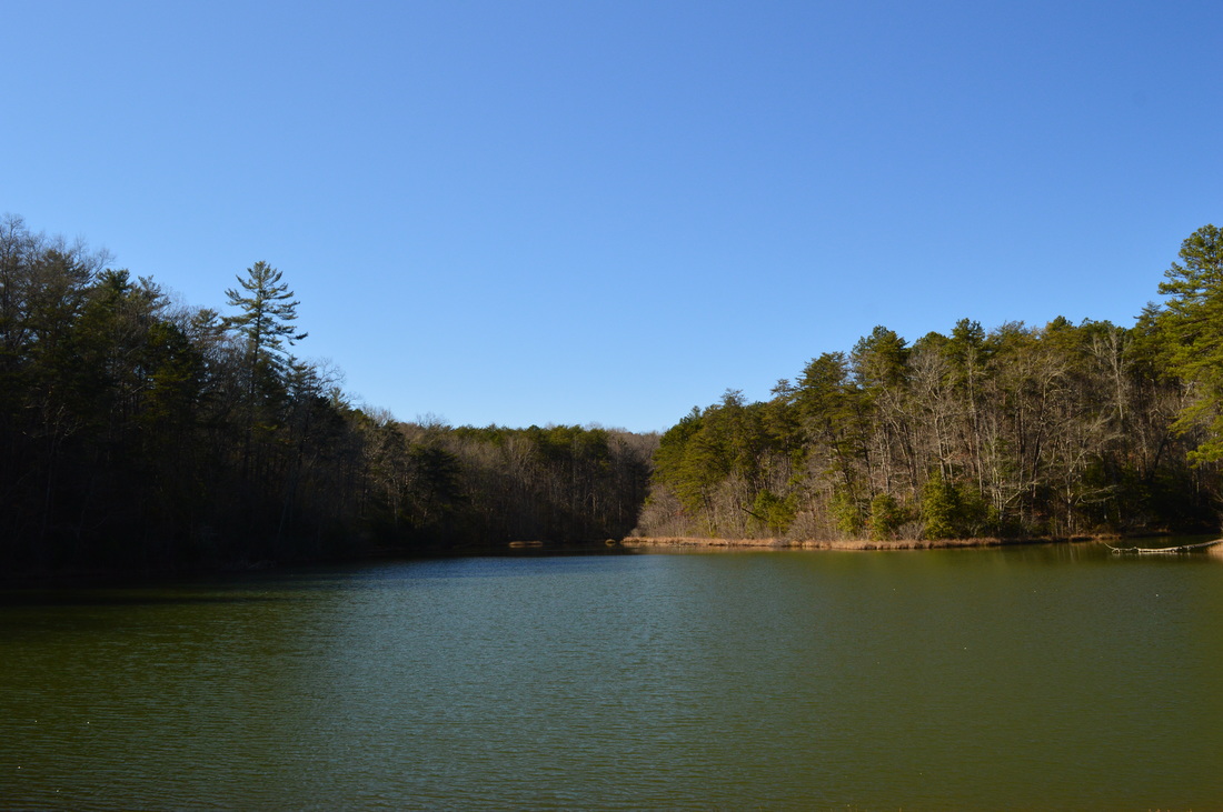
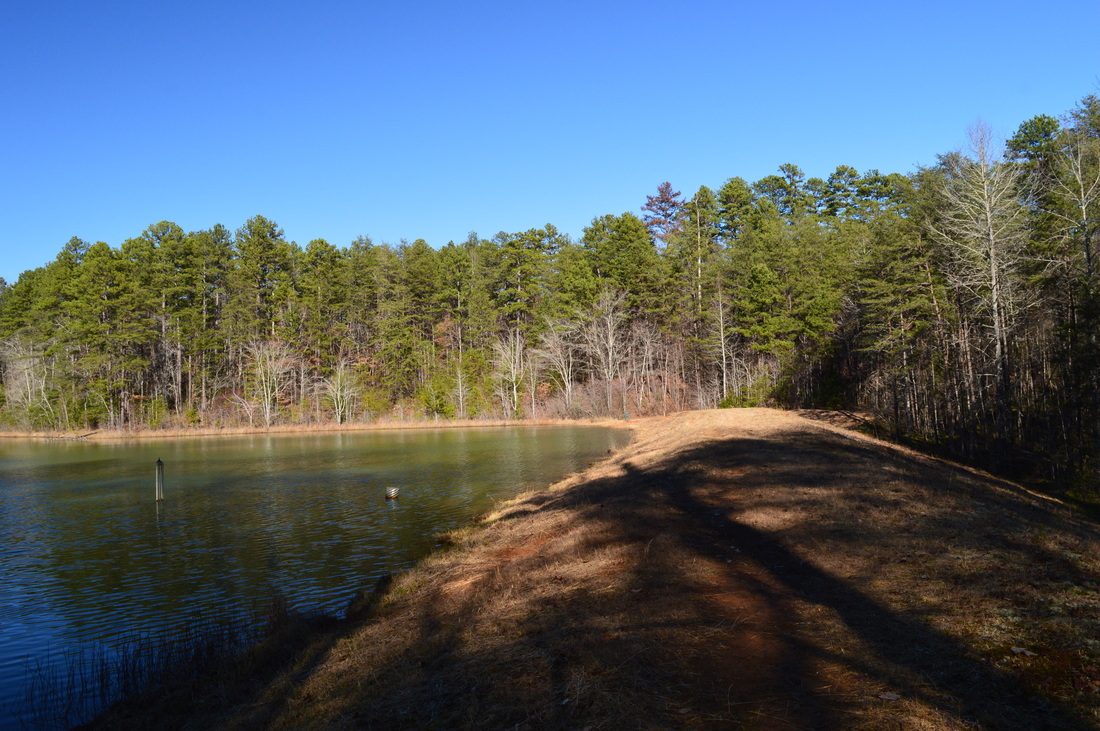
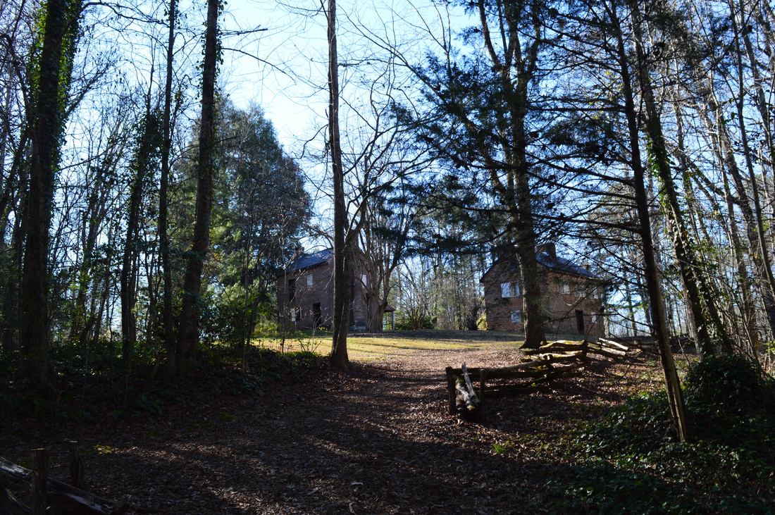
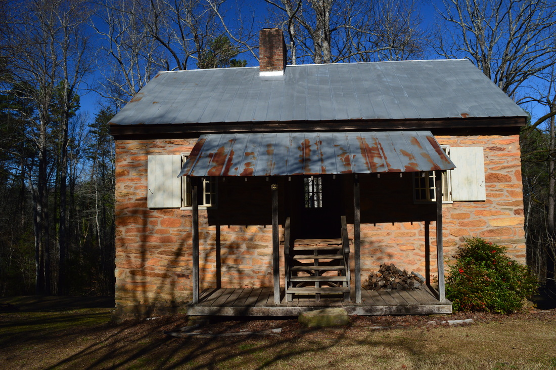
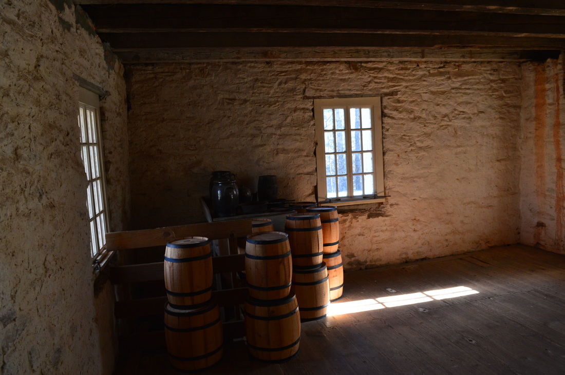
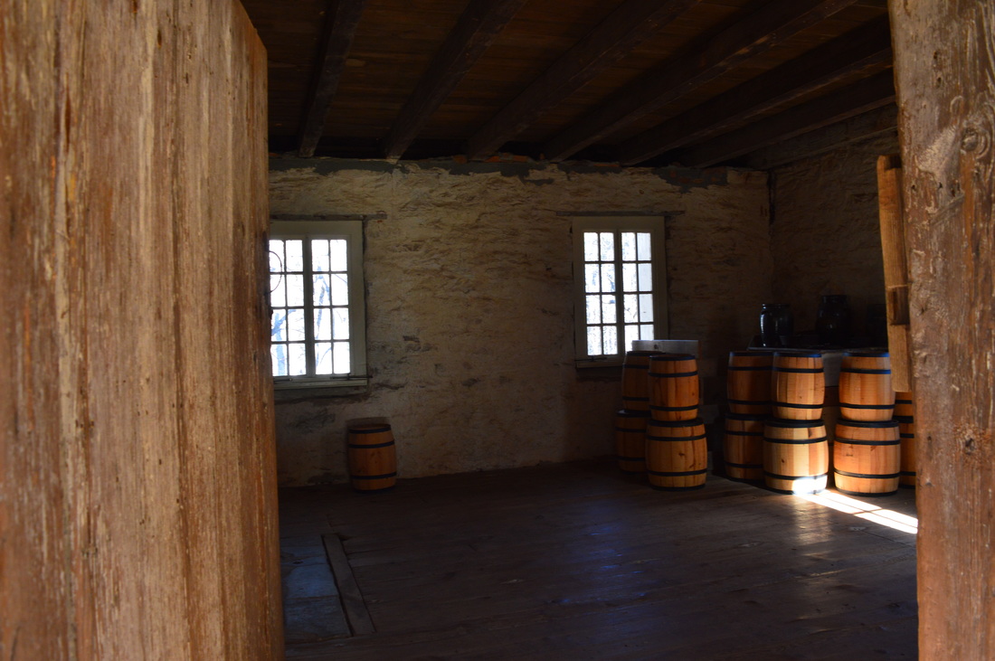
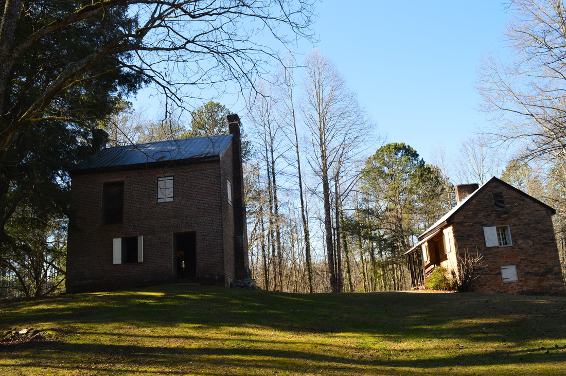
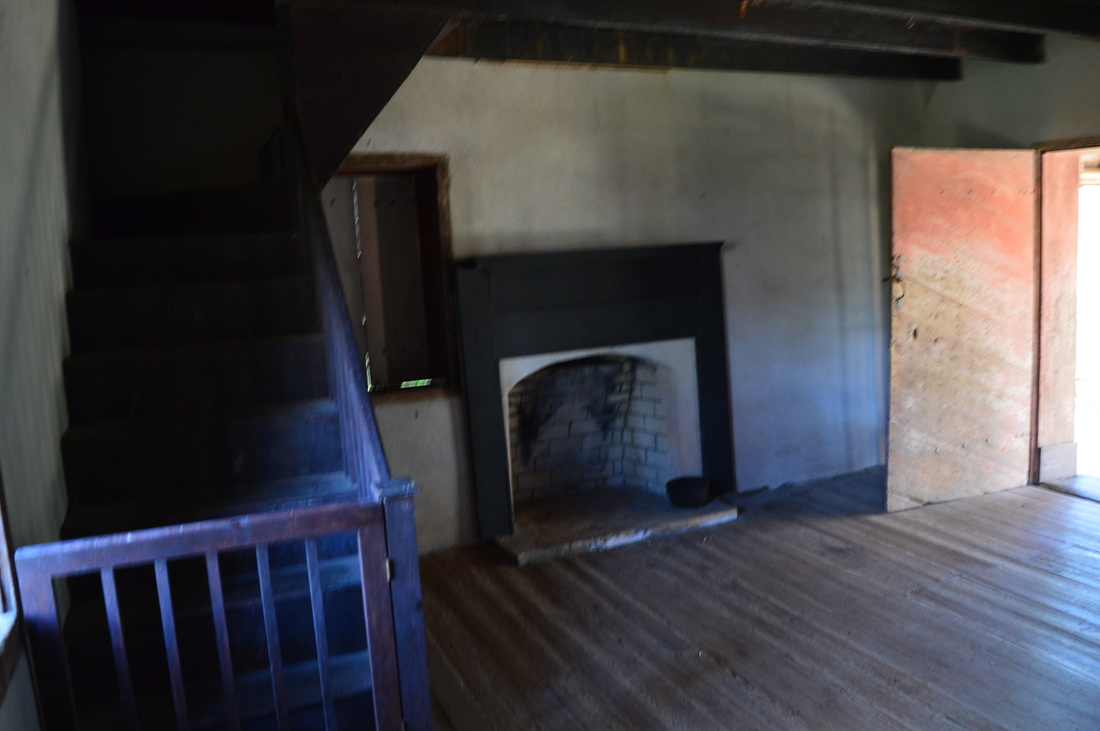
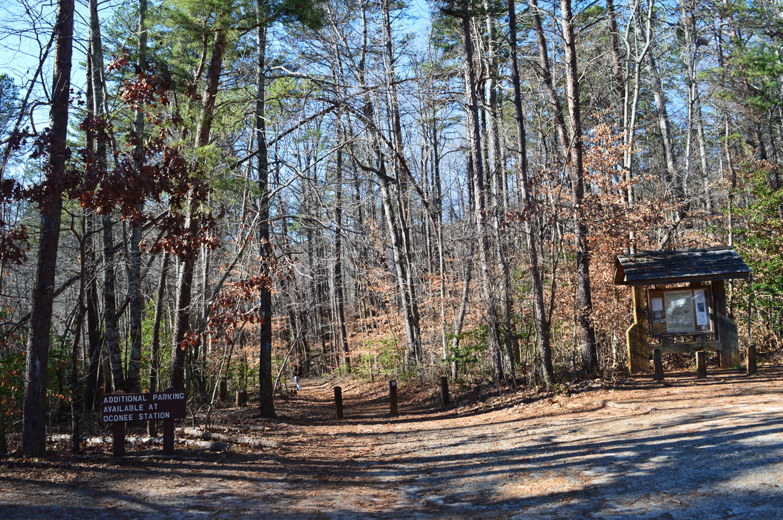
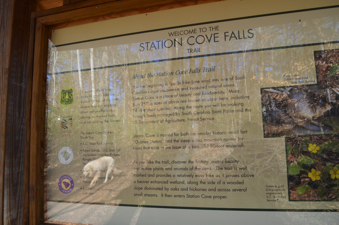
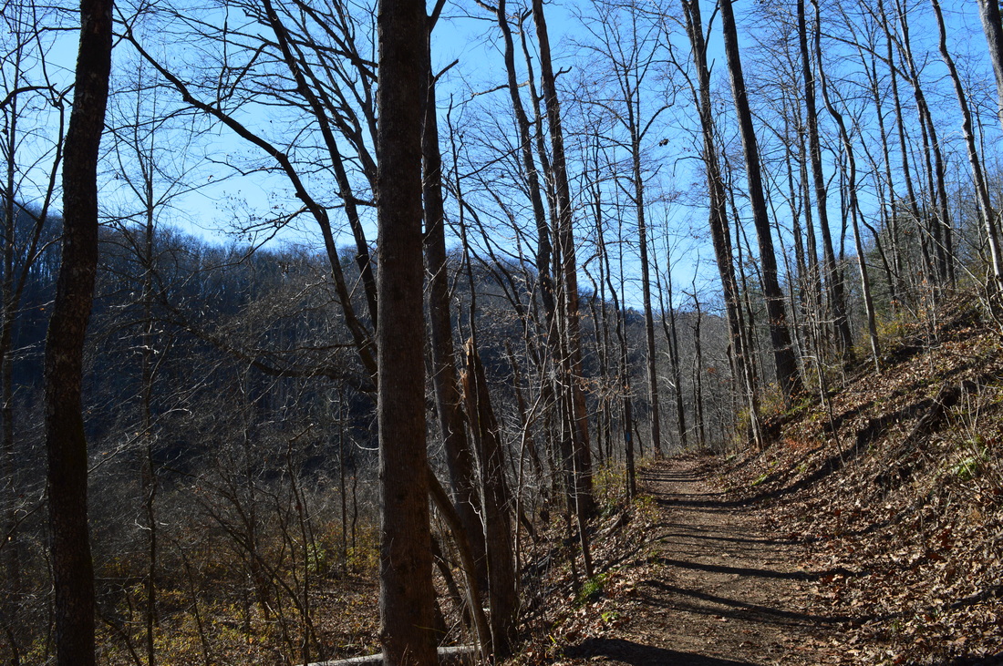
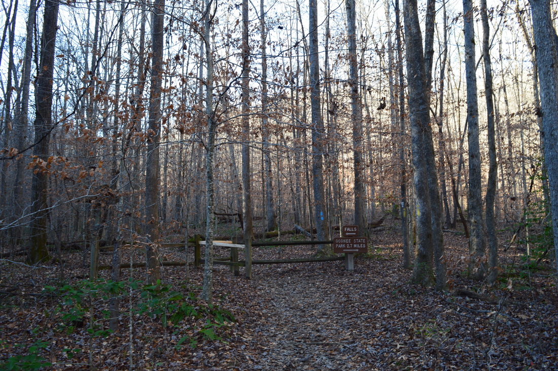
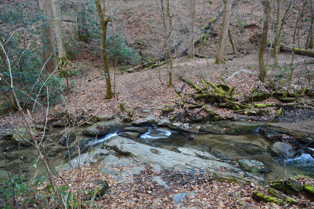
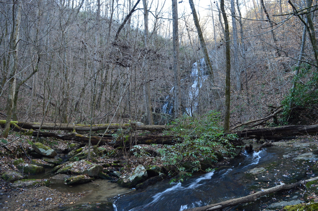
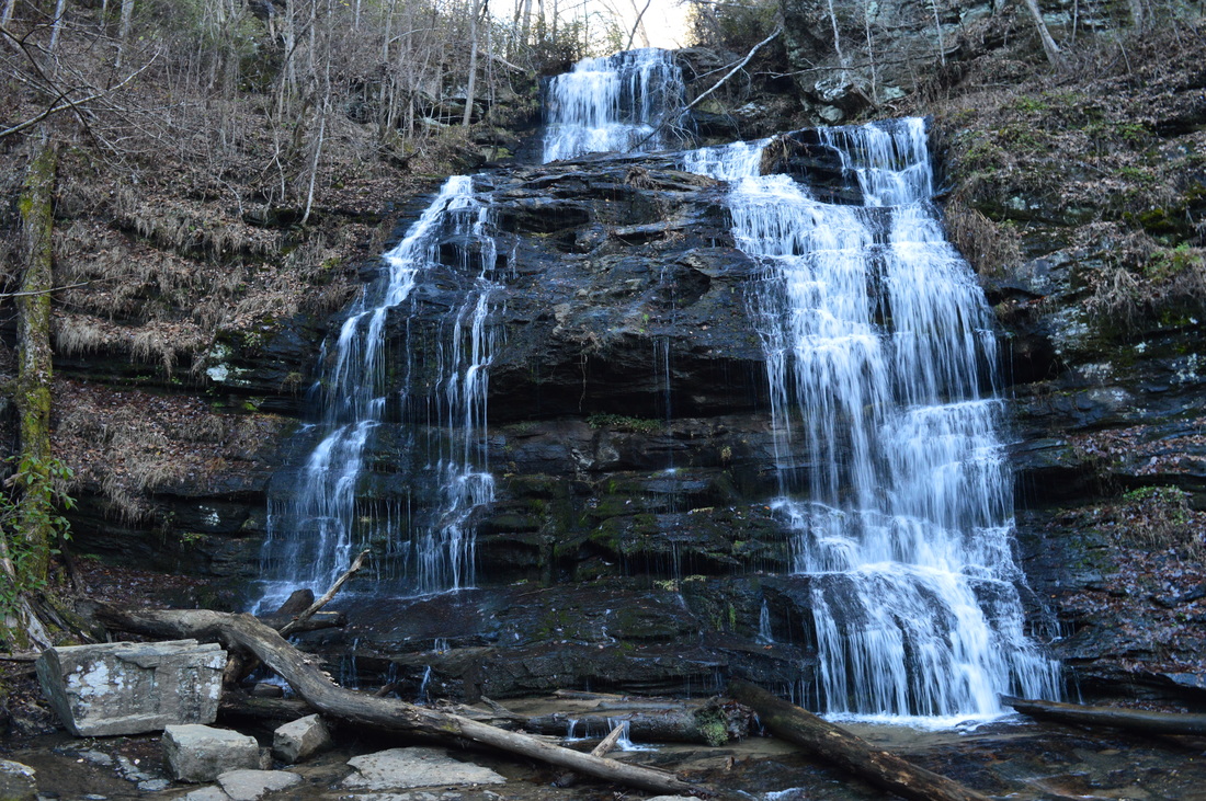
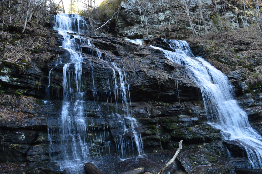
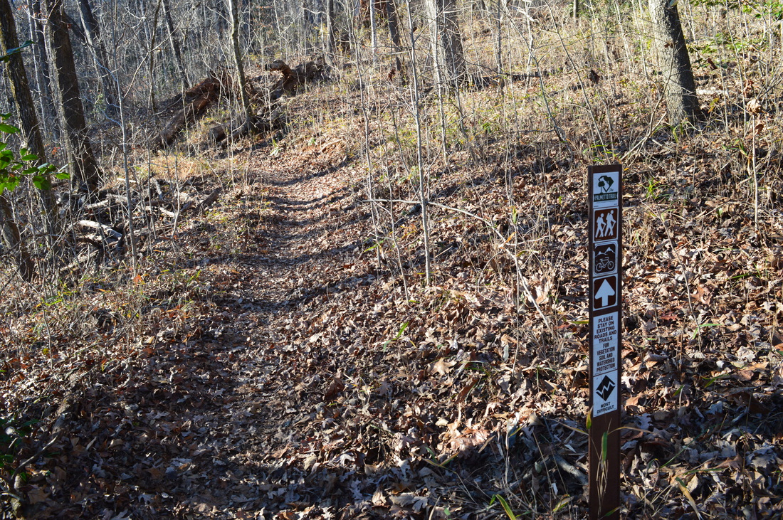
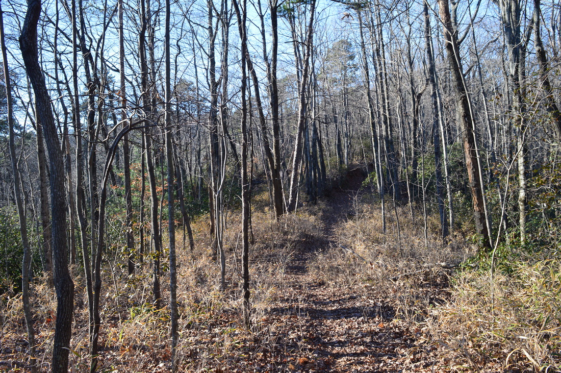
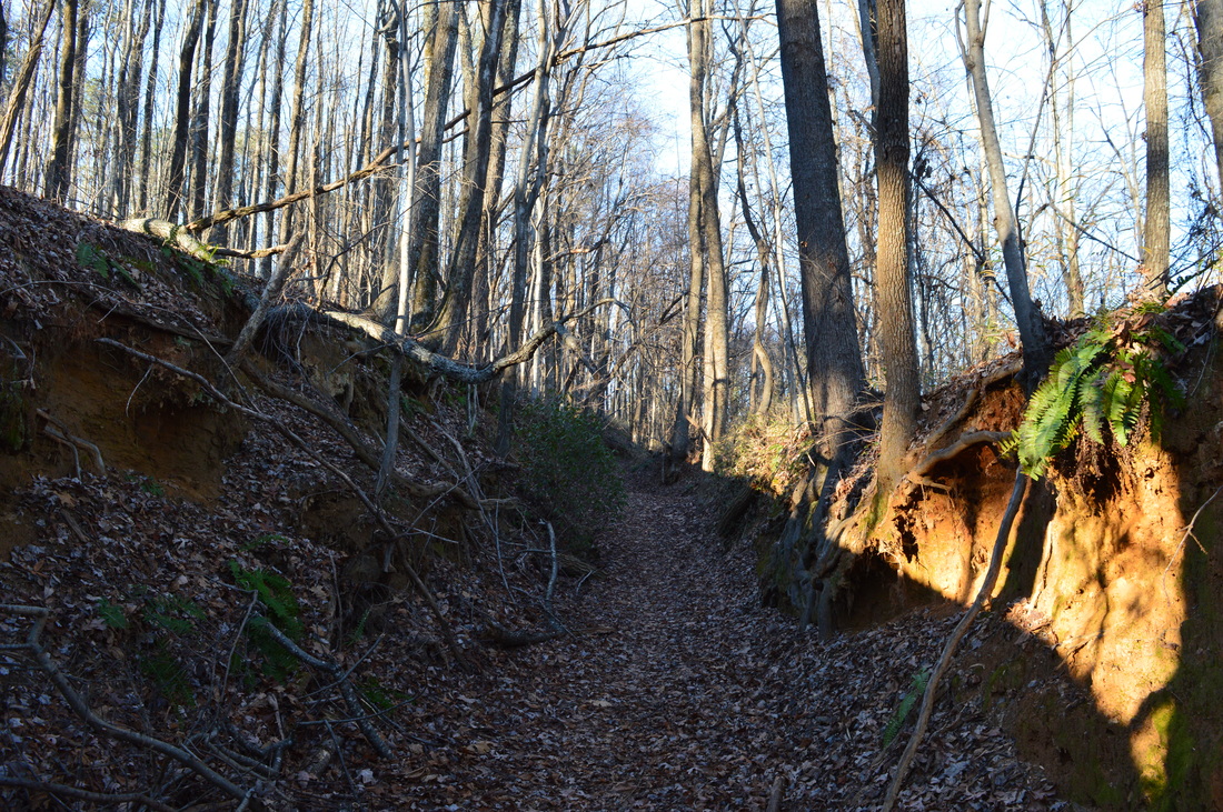
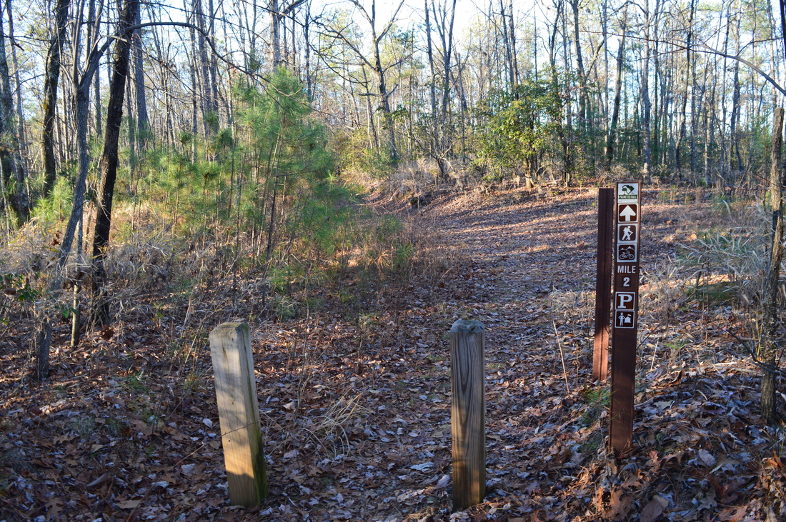
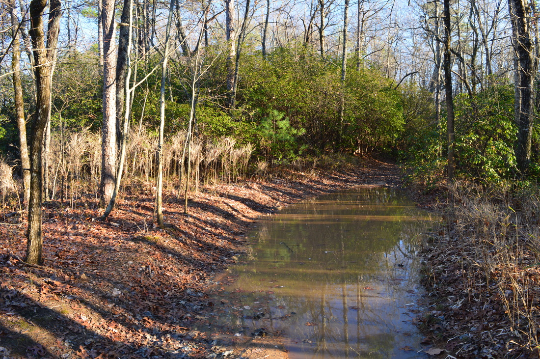
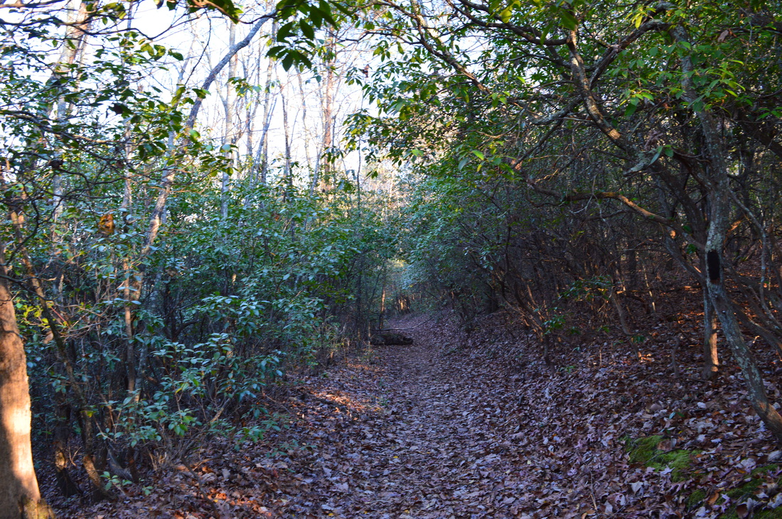
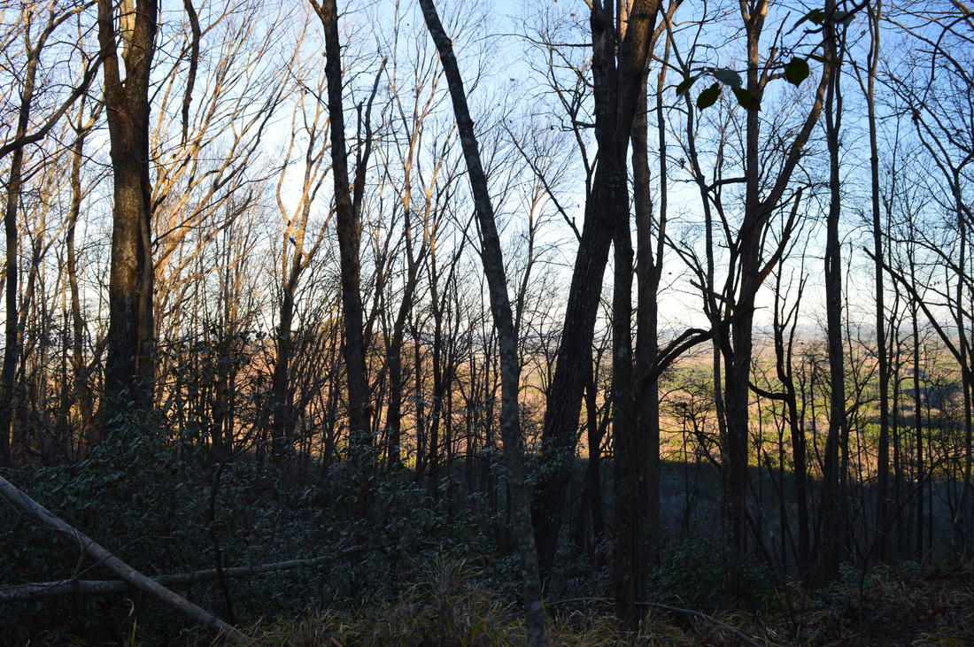
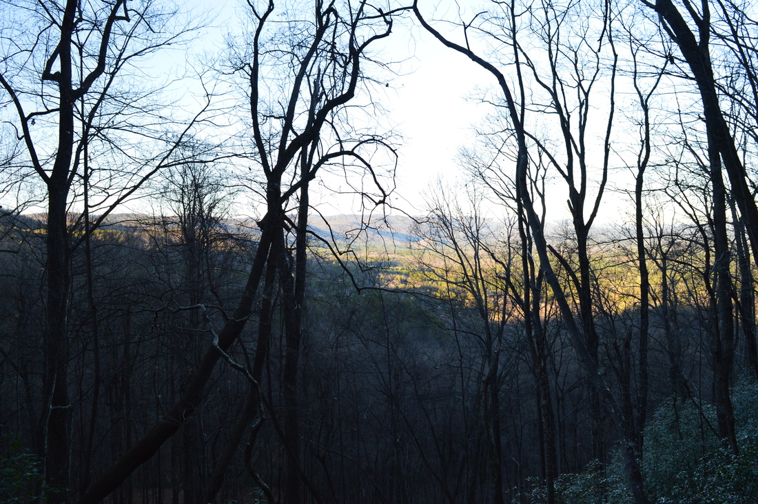
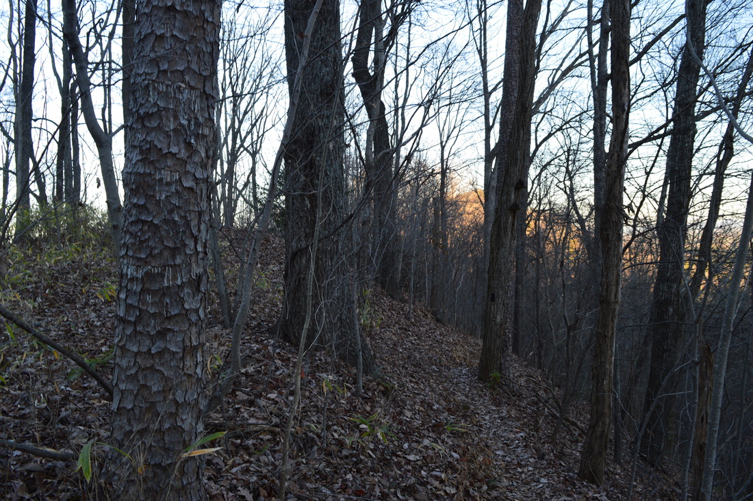
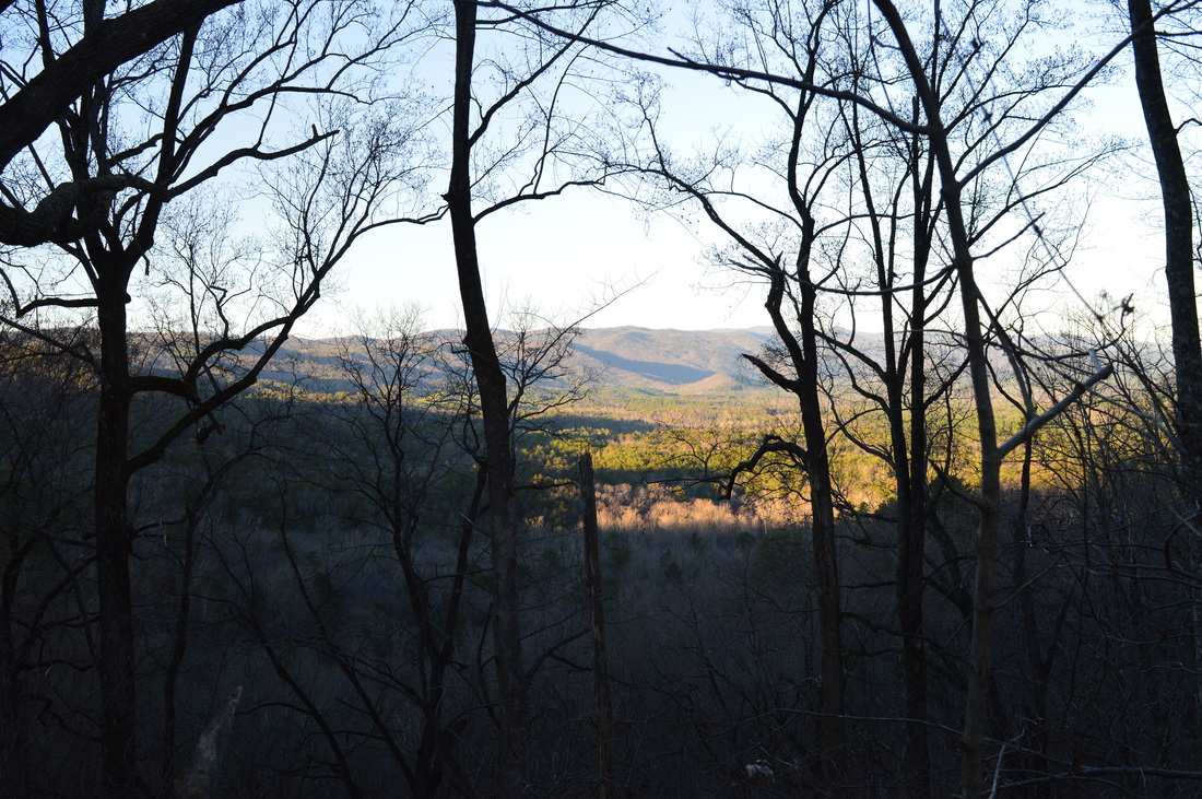
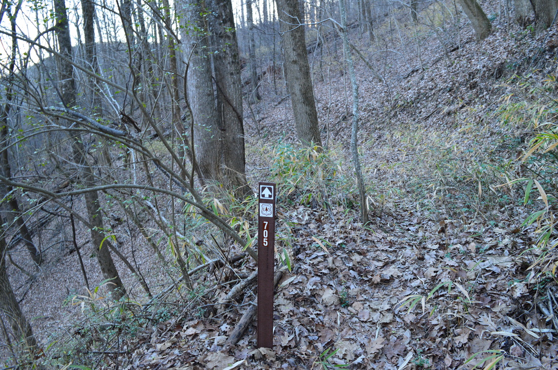
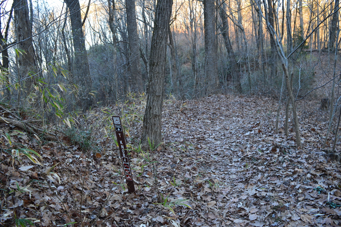
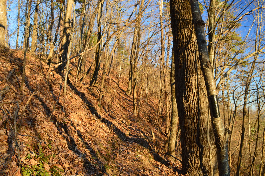
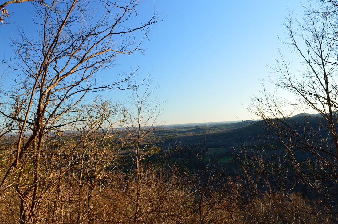
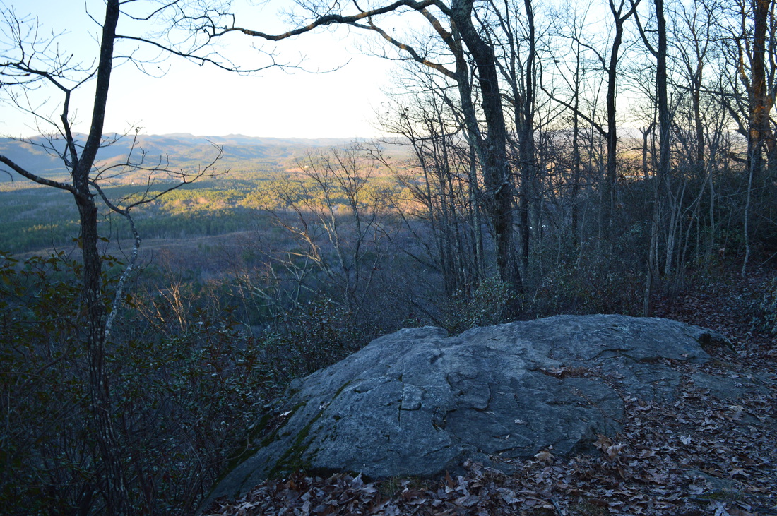
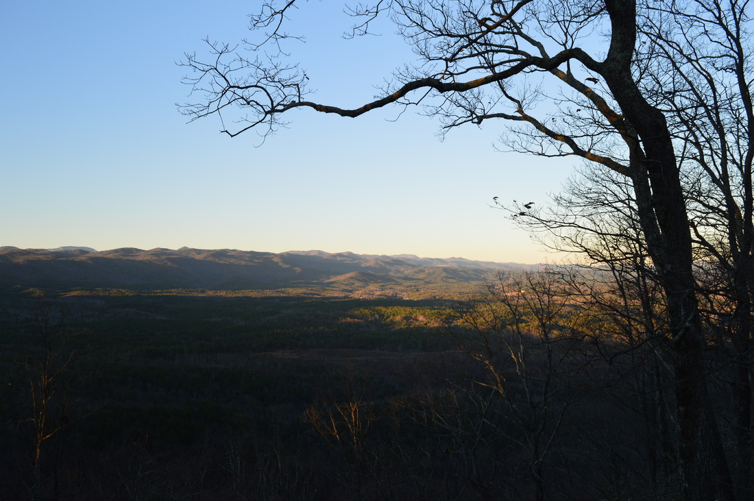
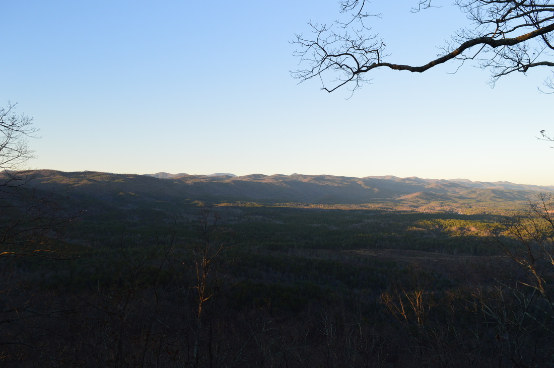
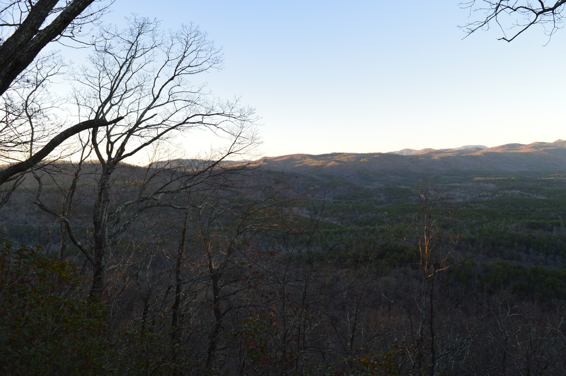
 The Palmetto Trail is South Carolina's master trail, and when finished, it will extend across the entire state from the mountains to the coast. The trail starts off with a bang, and it's very first section is packed with interesting features, from a 60-foot waterfall to a historic site at Oconee Station to a breathtaking view from Tamassee Knob. Go in the winter, and you'll be treated to great views throughout the entire hike. This hike occurred on Saturday, December 19th, 2015. My plan was to first hike the Oconee Station Nature Trail, and then hike the Palmetto Trail's "Oconee Passage" from Oconee Station to Oconee State Park. Along the way, I would stop at Station Cove Falls. After reaching Oconee State Park, I would hike the Tamassee Knob Trail along a narrow ridge extending to a small summit with a fantastic vista. SummaryR/T Length of Trail: 10.9 Miles Duration of Hike: 6:05 Type of Hike: Out and Back Difficulty Rating: 5 out of 10 Total Elevation Gain: 2221 Feet Pros: All of the ascent on this hike is very well-graded and makes the hike easier than most with this much elevation gain Cons: None Points of Interest: Oconee Station Historic Site; Oconee Station Lake; Station Cove Falls - 8 stars; Tamassee Knob Vista - 8 stars Trail Blaze Color(s): Oconee Station Nature Trail - None; Palmetto Trail - Yellow; Station Cove Falls Trail - Blue; Tamassee Knob Trail - Black Best Season(s) to Hike: Winter; Spring Fees: There are no fees if parking at Station Cove Falls Trailhead or Oconee Station State Historic Site (Oconee Station will appreciate donations). If you choose to start the hike at the trailhead in Oconee State Park, then as of 1/8/16, the fees from Memorial Day Saturday through Labor Day are $5 for adults, $3.25 for SC Seniors (at least 65 years old), $3 for children 6-15, and free for children under 6. During the rest of the year, the fees are $2 for adults, $1.25 for SC Seniors, and free for children under 16. Pay at the entrance booth, or if there is no attendant, at a pay box. Beginning Point: Station Cove Falls Trailhead Directions: From Walhalla, SC: Follow SC State Route 183 North for 3.5 miles. Then, turn left onto Cristophers Road, the ramp to SC State Route 11. In 0.1 miles, turn right onto SC State Route 11. Follow SC State Route 11 for 2 miles, and then, turn left onto Oconee Station Road. Follow Oconee Station Road for 2.5 miles. The trailhead will be to the left at a dirt parking area. MapA map and some other information regarding this hike can be viewed here. DetailsUpstate South Carolina is a region with some of the Southeast US' best hiking trails, and I have only just recently started to get into the endless hiking opportunities presented in South Carolina's northwestern tier. In fact, over the next 6-12 months, be sure that you'll see many more trail reports from South Carolina. This particular hike is one of the easier hikes in the area - using gentle trails, you will get to see a waterfall, a fantastic vista, and some history. While the elevation gain on the hike is rather impressive for the low elevations of the area, the trail cleverly makes the entire ascent with grades only moderate at best. There are several locations where you can start this hike. You can start at Oconee Station Historic Site, at Station Cove Falls Trailhead, or at Oconee State Park. I decided to start at Station Cove Falls Trailhead and do the Oconee Station Nature Trail first for a warm-up. The Nature Trail is across the road from the parking area. The path is unmarked at this end, but it is a very clear one. You will quickly descend via some switchbacks into a small valley. At 0.1 miles, reach the start of the nature trail's loop. Bear left here to hike the loop clockwise. The trail stays in the valley and then reaches the northern end of the tiny Oconee Station Lake at 0.2 miles. The trail rises above the lake and curves over several hollows with wet-weather streams draining into the lake. At 0.5 miles, after a switchback, the trail reaches the dam of the small lake. Follow the dam - this is the best view of the lake you'll have. On the other side of the dam, ascend some before reaching a junction at 0.6 miles. Here, the loop turns right. However, continue straight first to Oconee Station. After some easy uphill, reach the Oconee Station Trailhead at 0.7 miles. Continue on a wide pathway across the paved road. The Oconee Station Historic Site is at the top of the hill. There are two historic houses here - the Oconee Station and the Richards House. Guided tours are available. The Oconee Station building was an important military outpost for northwestern South Carolina during the late 1700s. It then became a trading post. Later, a trader called William Richards came to the area and built a house next to the Oconee Station building. The house is now known as the Richards House. After you've fully explored the historic site, return back to the Oconee Station Trailhead. I was just about to set off around the southern side of the lake, when a wandering dog approached with no obvious intention. At first, I thought the dog was lost, but it wasn't - it probably was from the community just up the road from Oconee Station. Regardless, this unexpected companion had no intention of leaving us and continued to stay with us until we ran into other people near Station Cove Falls. From the Oconee Station Trailhead, return to the loop junction near the dam, and turn left to continue the nature trail loop. The trail traces the south side of the lake, and there are some good views of the lake. You will cross couple of hollows before joining an old roadbed. At 1.25 miles, reach the end of the loop. Turn left, and ascend the several switchbacks to the Station Cove Falls Trailhead, reaching it at 1.35 miles. The warm-up is over - continue across the road and onto the main hike. The beginning is well-marked. This is the northern terminus of the Palmetto Trail. This particular section of the Palmetto Trail is called the Oconee Passage. You will notice both a blue and a yellow blaze - the blue blazes mark the shorter Station Cove Falls Trail. The trail descends moderately into the valley of Station Cove Creek. At 1.55 miles, reach a seasonal view of Station Cove. While this view isn't much, you'll be able to make out some wetlands formed by beavers as the cove considerably widens in front of you. The view is best seen in winter. From here, the trail continues descending, bridging a hollow, before bottoming out near Station Cove Creek at 1.8 miles. The creek is rather quiet here and it would be hard to imagine that an impressive waterfall lies upstream. In this area, the rare Oconee Bell wildflower can be found during spring, making it a worthwhile hike in spring. At 2 miles, reach an intersection. Here, the Palmetto Trail bears right, while the Station Cove Falls Trail bears left. Do not skip the short spur trail to Station Cove Falls - it is worth it. From here to the falls, no bikes are allowed - the trail is for hikers only, hence the stile. Bear left onto the Station Cove Falls Trail - it continues into a now-narrow valley where the surrounding slopes are steep and the small creek forms some rapids. Despite that the creek's volume seems to be low, the waterfall, at normal flow, is good, and even at times of lower flow, it shouldn't be the worst. At 2.2 miles, cross Station Cove Creek on stepping stones. This should be a dry crossing most of the time. You're now approaching the head of the cove with the waterfall visible. At 2.3 miles, reach Station Cove Falls and the end of the trail to the falls. This is an impressive two-tier waterfall that forms the head of Station Cove. Various paths lead up the slope near the falls for different vantage points. Once you've finished enjoying the waterfall, retrace your steps to the Palmetto Trail, reaching it at 2.5 miles. Turn left onto the Palmetto Trail and begin a 700-foot ascent onto a plateau/divide that is sometimes called the Chattooga Ridge, separating the Cheohee Valley from the Chattooga River Valley. The ascent is very gradual and never difficult. Switchbacks are well-placed where they are needed. At 3.4 miles, drop into a gap and join an old road. Winter views eastward are increasing as you ascend higher. You reach the top of the plateau at 4 miles at an old turnaround. Keep left and join a wide forest road. At 4.35 miles, reach a connector to the Tamassee Knob Trail. You can join the trail later on, unless you want to reduce some mileage, but I wasn't sure how well-marked the junction up ahead would be, so I used the connector. If you're doing this hike, do not miss the Tamassee Knob Trail, especially in winter. This trail is the highlight of the hike, a mile-long walk along a knife-edge ridge with breathtaking winter views both southward and northward. However, to get to Tamassee Knob, you will first have to descend. You reach the Tamassee Knob Trail shorty after turning on the connector - bear right, as the trail goes into a rhododendron tunnel. Right away, you may notice something bizarre. The blazes for this trail are colored black, certainly one of the worst colors for trail blazes! The trail loses no time in starting to descend nearly right away. As you exit the rhododendron tunnel, you can see the ridge ahead, the ridge the trail follows. At the far end, a sharp peak is visible - this is Tamassee Knob. It seems farther away than it really is. The trail curves left around a knob, continuing to descend - winter views soon open up northward. This is the grand view that you'll be seeing all the way until Tamassee Knob. Cheohee Valley looks very wide from this angle, with the different peaks of Chattooga Ridge standing up behind the valley. The trail soon opens up onto the ridge with views into both directions, and the descent continues, interrupted by a couple of small knobs. At 5.2 miles, reach a trail intersection. Tamassee Knob Trail bears left, while "Trail #705" turns sharply right. To be honest, I have no idea what is this Trail #705 or where it goes, although looking at the map, it may be leading to another trailhead near Oconee Station Road, a mile or two north of the trailhead for Station Cove Falls. The trail is not listed on any trail maps. The sign for this trail was not here the first time I hiked this trail over two years ago, although I do remember seeing the old road that seems to be the trail now. In any case, bear left and continue on the Tamassee Knob Trail, shortly reaching the low point of this trail. The final ascent to Tamassee Knob begins. The trail first rises over a small knob and then heads just to the right of the ridge, ascending moderately. This is the best area for southward winter views - there are even a few year-round openings. At 5.7 miles, reach the sharp, small summit of Tamassee Knob. There is no year-round view here - however, continue straight and descend just a little bit to reach the Tamassee Knob vista at 5.75 miles. This is also the terminus of the Tamassee Knob Trail. The view is excellent, especially in winter, as the entire Cheohee Valley and Chattooga Ridge open up. A pair of lakes shimmer on the far right end. From the vista at Tamassee Knob, retrace your steps along the Tamassee Knob Trail - you'll be in for some more climbing on your way back, although it is not difficult. Do not take the connector this time (maybe you never did) - instead, keep following the black blazes to a junction at 7.4 miles. This junction is quite important. The Tamassee Knob Trail turns left. The Foothills Trail and Hidden Falls Trail come in from the left and continue straight. the Foothills Trail is another long-distance trail that travels through upstate South Carolina. The Hidden Falls Trail leads to Hidden Falls, a destination that you can add to this hike. Turn left to continue following the Tamassee Knob Trail to Oconee State Park. Immediately, you cross the wide forest road that the Palmetto Trail follows - if you didn't use the connector, you would have turned here. To the left, the Palmetto Trail returns to Oconee Station. To the right, the Palmetto Trail continues to a different trailhead at Oconee State Park. Continue straight on the path with Tamassee Knob Trail, Hidden Falls Trail, and Foothills Trail all combined. The trail stays flat and eventually descends slightly, before reaching the western terminus of all three trails at Oconee State Park at 7.85 miles. Oconee State Park is the western terminus of the Foothills Trail, a wilderness route that straddles the South Carolina/North Carolina border. I plan on exploring a lot more of both the Foothills Trail and Palmetto Trail over the next year. While there are multiple ways to extend this hike with different trails in the Oconee State Park area, I would suggest that this is a good place to turn around for a moderate hike. Oconee State Park is a great starting point for other good hikes, and I plan to utilize this trailhead for a future hike or two. However, combining those hikes into this one would be a foolish idea, and if I were to add on to this hike, I would only add on Hidden Falls, although I would suggest doing that separately as well. From the Oconee State Park Trailhead, retrace your steps to the Palmetto Trail at 8.3 miles. From here, turn right onto the Palmetto Trail. The trail stays mostly flat atop the plateau, and soon, you'll reach the connector you used earlier. Continue straight on the Palmetto Trail and retrace your steps along the trail back to the Station Cove Falls Trailhead. You will reach the Station Cove Falls Trailhead at 10.9 miles, concluding the hike. At one point, I debated whether I should rate this hike as a "Best Hike". In the end, I decided against it - this hike does have a lot of interesting features, but they are mainly concentrated over certain areas, and as a whole, this hike doesn't fully warrant a Best Hike rating. However, be assured that this is still a good hike and worth doing. VariationsOconee Station Nature Trail - 1.35 Miles Oconee Station Nature Trail plus Station Cove Falls - 3.25 Miles Do most of the hike but skip the extra trail to the Oconee State Park Trailhead - 10.15 Miles Bonus StopsYellow Branch Falls is a nearby short 1-mile hike to a unique waterfall that can be seen, if you're not too tired after doing this hike. PicturesVideos
14 Comments
Robert Underwood
3/2/2020 10:05:40 pm
Your link to a map is messed up and takes me to an add for garmin products instead of a map from Oconee Staion falls to Oconee state park 8/4/2022 09:02:58 am
Edirne baymak servisi için hemen websitemize göz at! https://www.edirneklimaservisi.com/edirne-baymak-servisi/ 8/20/2022 06:59:10 pm
Sizde NestaCloud ile aradığınız sunuculara ışık hızında erişebilirsiniz. en güzel en kaliteli sunucu hizmetlerine erişmek artık çok kolay. Sunucu hizmetlerimize güveniyoruz. Haydi hemen indirimli paketlerimizden deneyin. Pişman olmayacaksınız. bize güvenebilirsiniz. 8/21/2022 09:18:55 am
Mp3Video.org'u tercih etmelisiniz çünkü Youtube Mp3 ve Youtube Video İndir alanında lider teknoloji sağlayıcılarındandır. Hızlı altyapısı güvenilir sistemi. reklamsız ara yüzü ile kalite odaklı bir hizmet sunmaktadır. pişman olmama garantili bir servistir. 8/22/2022 02:53:02 am
DonghuaTR Türkçe Anime ve Donghua izleme adresi. Bir çok çeşit Animeyi sitemizde HD kalitede izleyebilirsiniz. Anime bölümleri her zaman güncel olarak sitemizde yayınlanır. Aradığınız tüm animeleri DonghuaTR'de bulabilir ve izleyebilirsiniz. 9/3/2022 12:47:59 pm
Hacklink satın almak isteyenler için muhteşem bir site hacklink.gen.tr güçlü hacklink panel satışı ile sizde sıralamalarda yükseleceksiniz. Hemen sizde hacklink satın alın 9/25/2022 02:25:58 pm
En güncel urfa haber için sitemizi ziyaret et! Site adresi https://haberurfadan.com/ 10/5/2022 12:05:24 pm
Güvenilir bir konum hizmeti arıyorsunuz ama bulamıyor musunuz? Tam güvenlik standartlarını karşılayan adresimiz ile hemen takipçi kazanın. Kaliteli ve hızlı hizmetlerimiz için sizleri adresimize bekliyoruz. 10/6/2022 05:30:08 pm
istanbul kepenk tamiri sitesidir! Kepenk tamiri hizmetleri için ziyaret et! https://kepenktamiriistanbul.net/ 10/19/2022 09:29:20 am
Where is ZAFUL 's headquarters? ZAFUL is located in Hong Kong Hong Kong Island Hong Kong. 10/22/2022 02:08:56 pm
Find all of the best SHEIN coupons live NOW on Insider Coupons. Free shipping gift cards and more. 29 live offers hand-tested today! Leave a Reply. |
About MeMark Oleg Ozboyd Dear readers: I have invested a tremendous amount of time and effort in this website and the Georgia Waterfalls Database the past five years. All of the work that has gone in keeping these websites updated with my latest trip reports has almost been like a full-time job. This has not allowed me to pick up a paid job to save up money for college, and therefore, I I've had to take out loans. If you find the information on this website interesting, helpful, or time-saving, you can say "thanks" and help me out by clicking the button above and making a contribution. I will be very grateful for any amount of support you give, as all of it will apply toward my college tuition. Thank you!

Coming in 2022-2023?
Other Hiking WebsitesMiles HikedYear 1: 540.0 Miles
Year 2: 552.3 Miles Year 3: 518.4 Miles Year 4: 482.4 Miles Year 5: 259.9 Miles Archives
March 2021
Categories
All
|


 RSS Feed