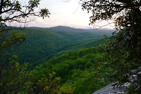
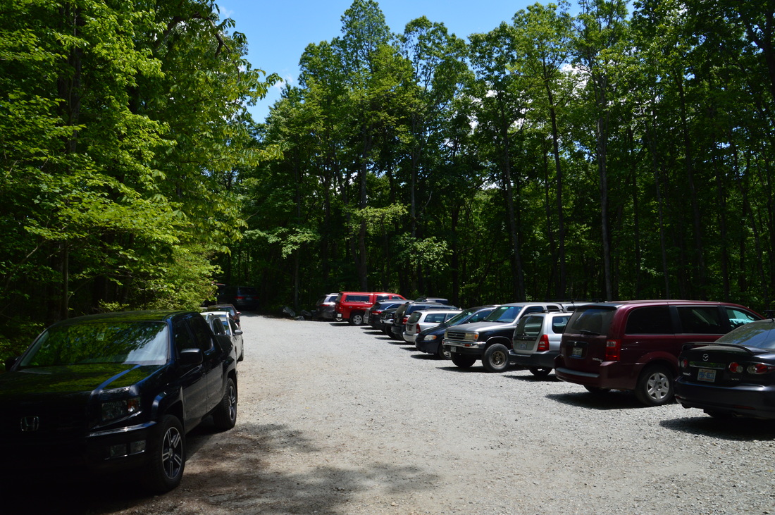
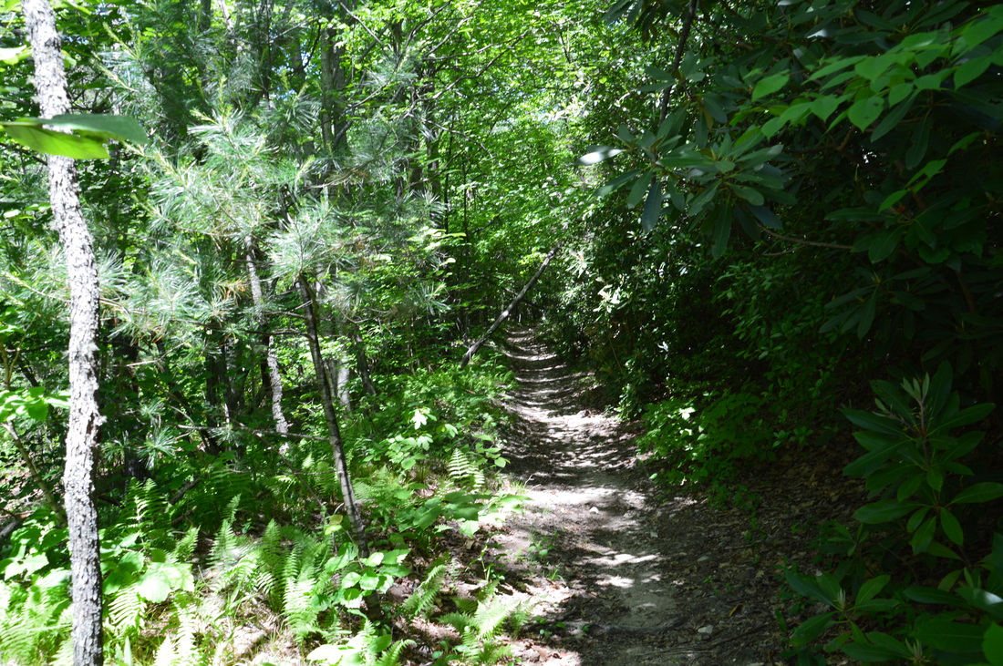
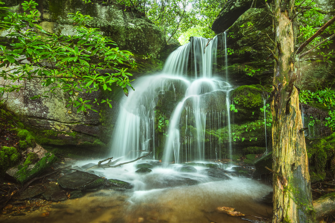
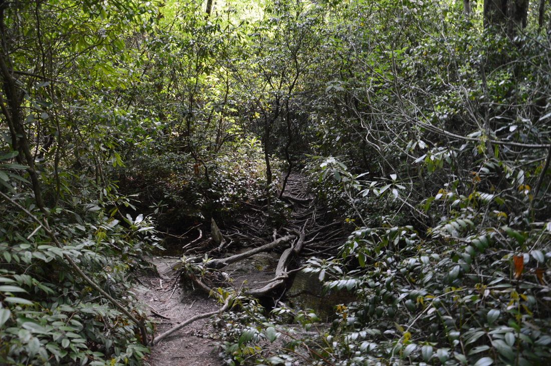
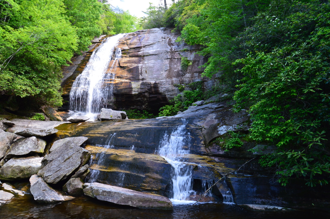
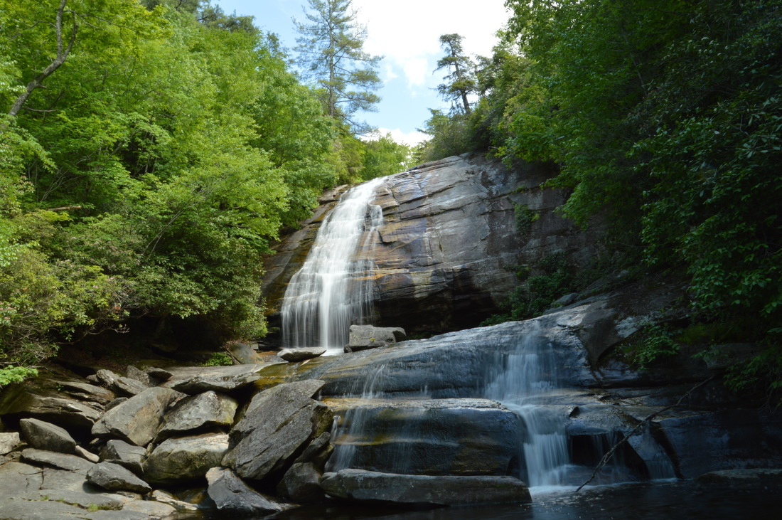
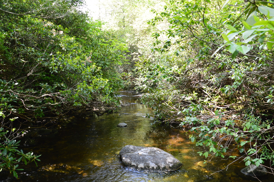
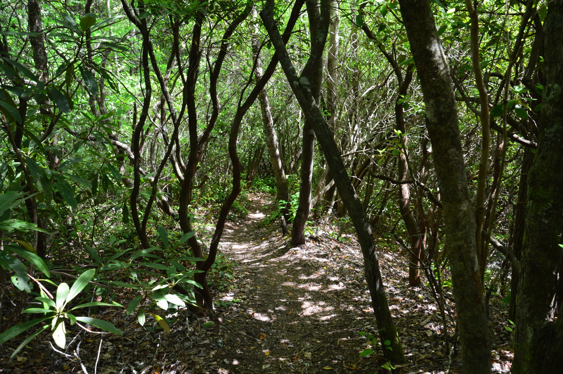
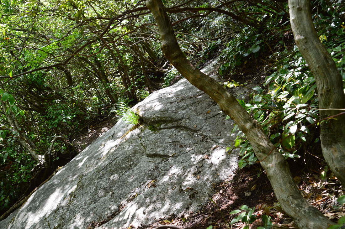
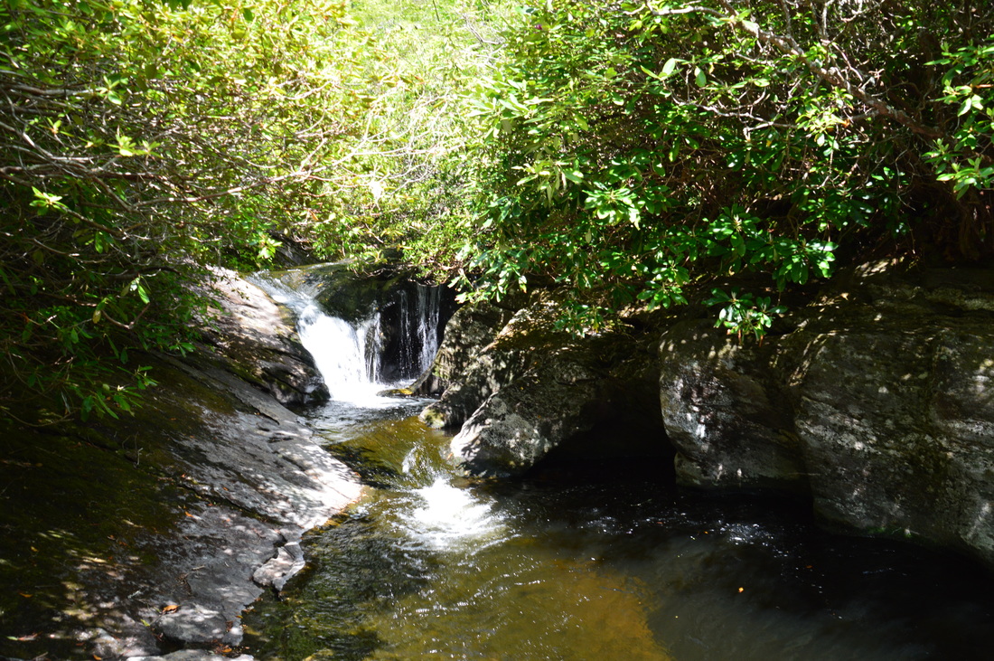
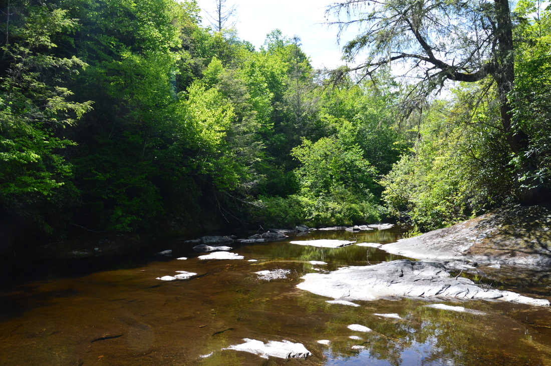
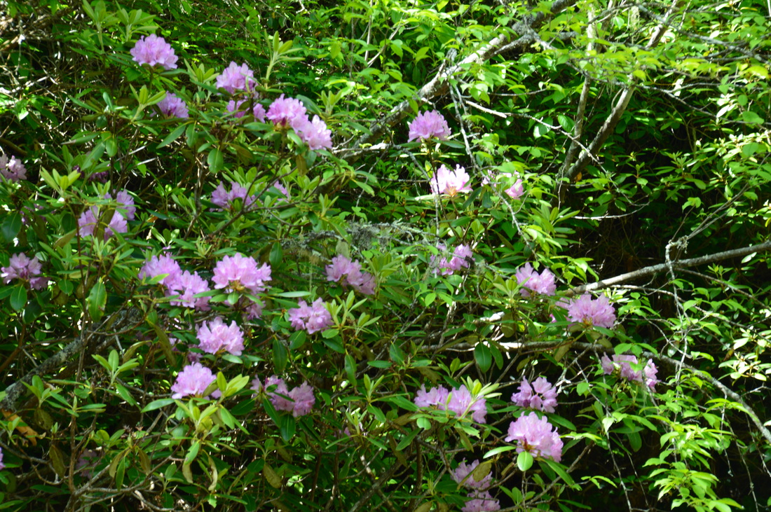
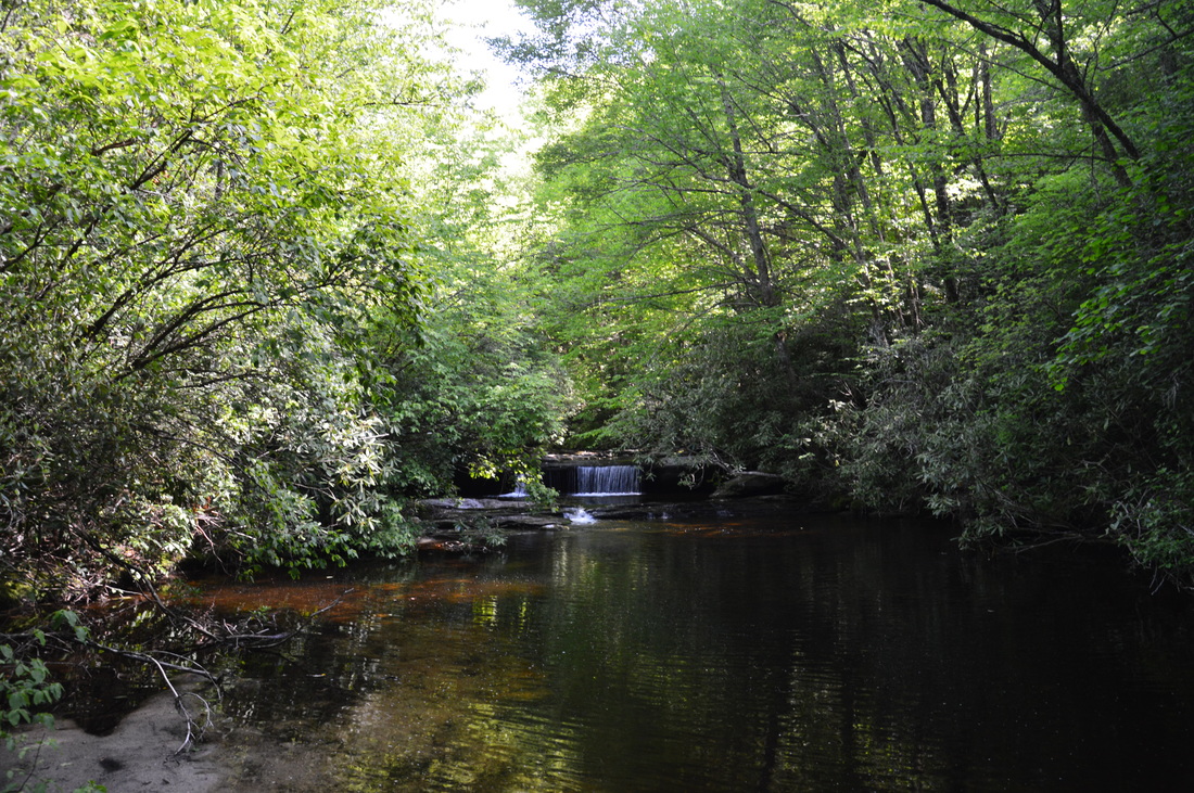
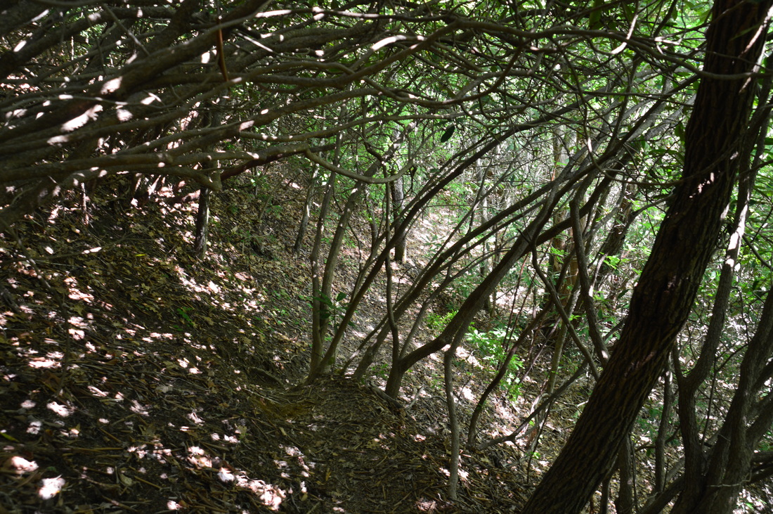
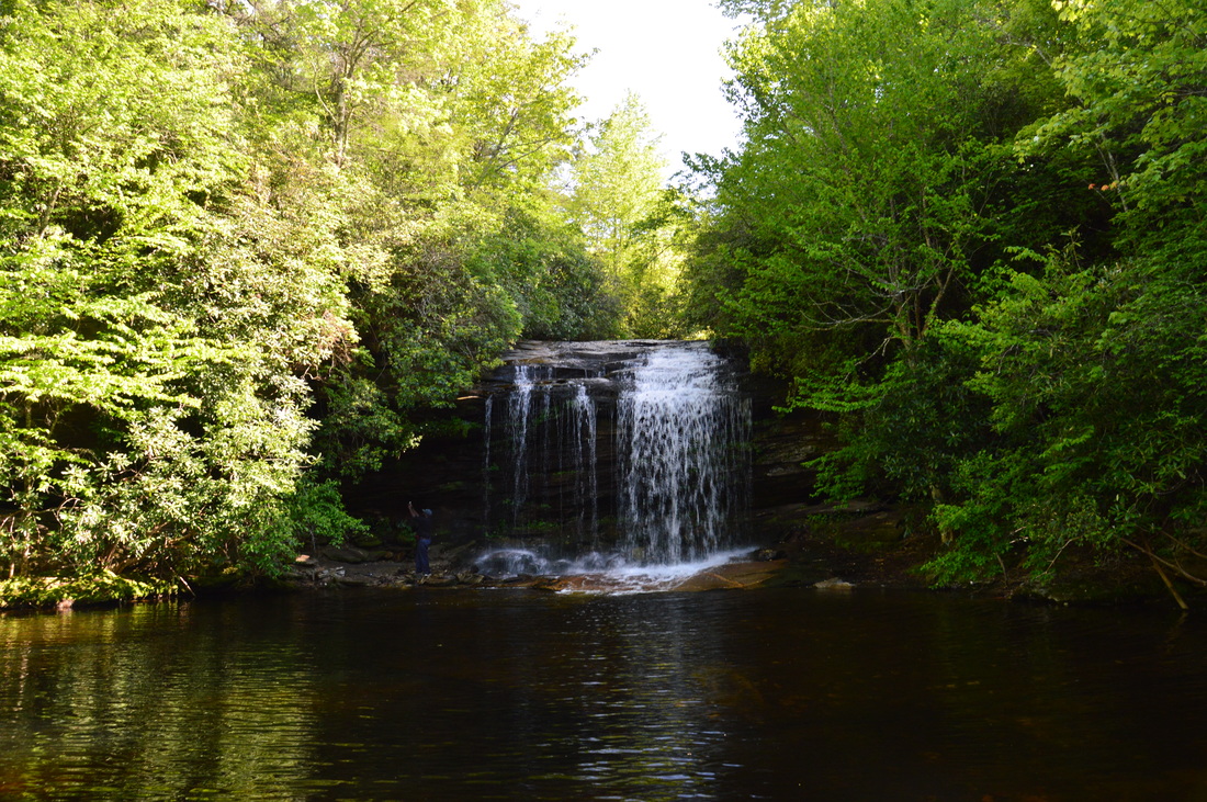
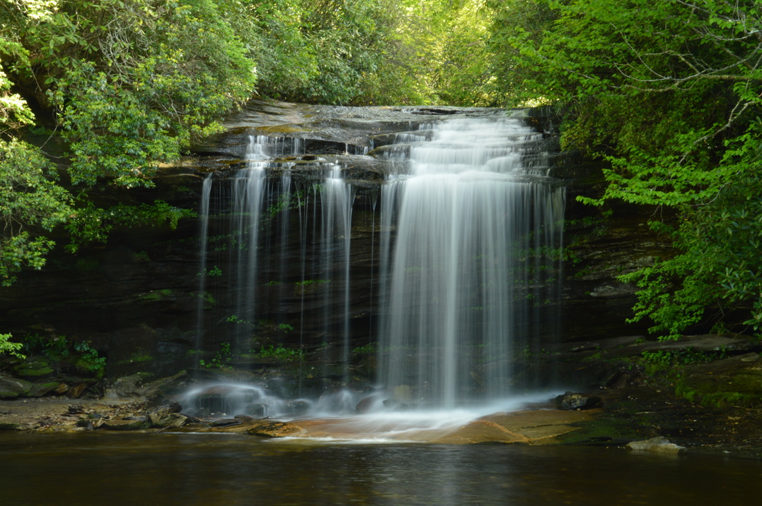
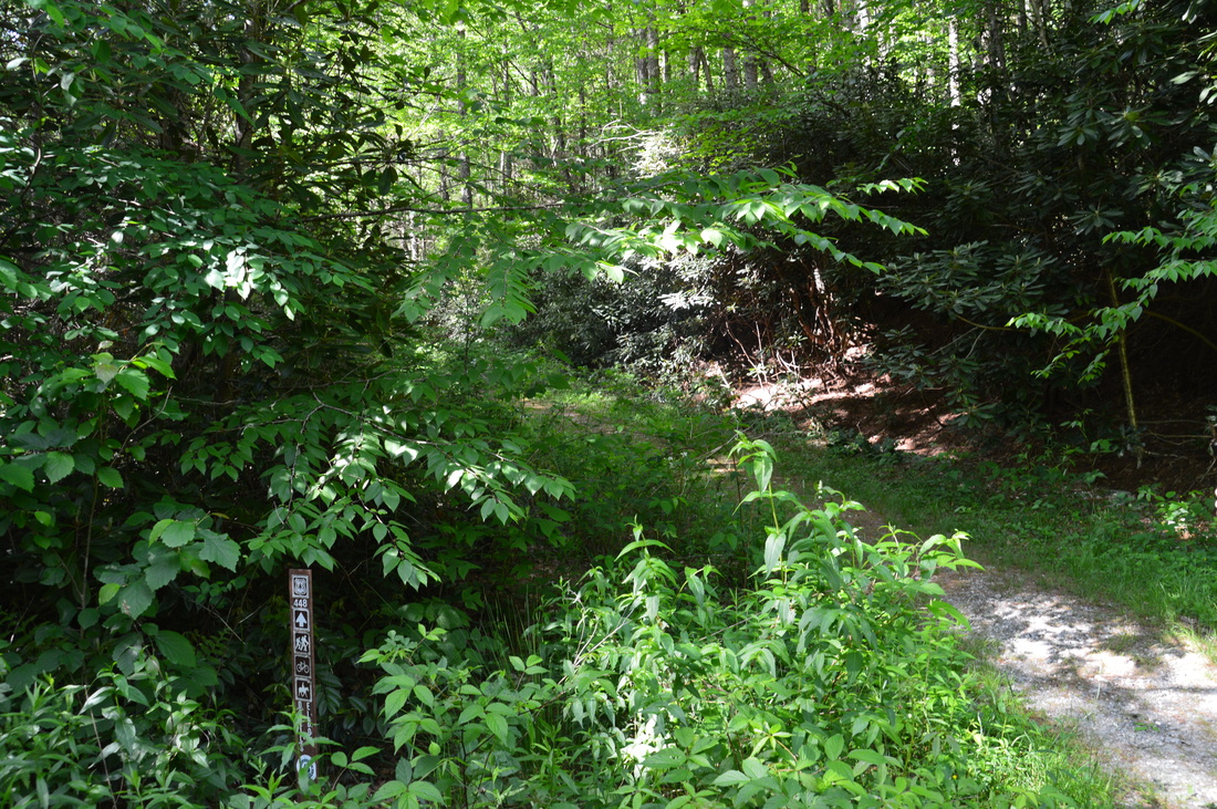
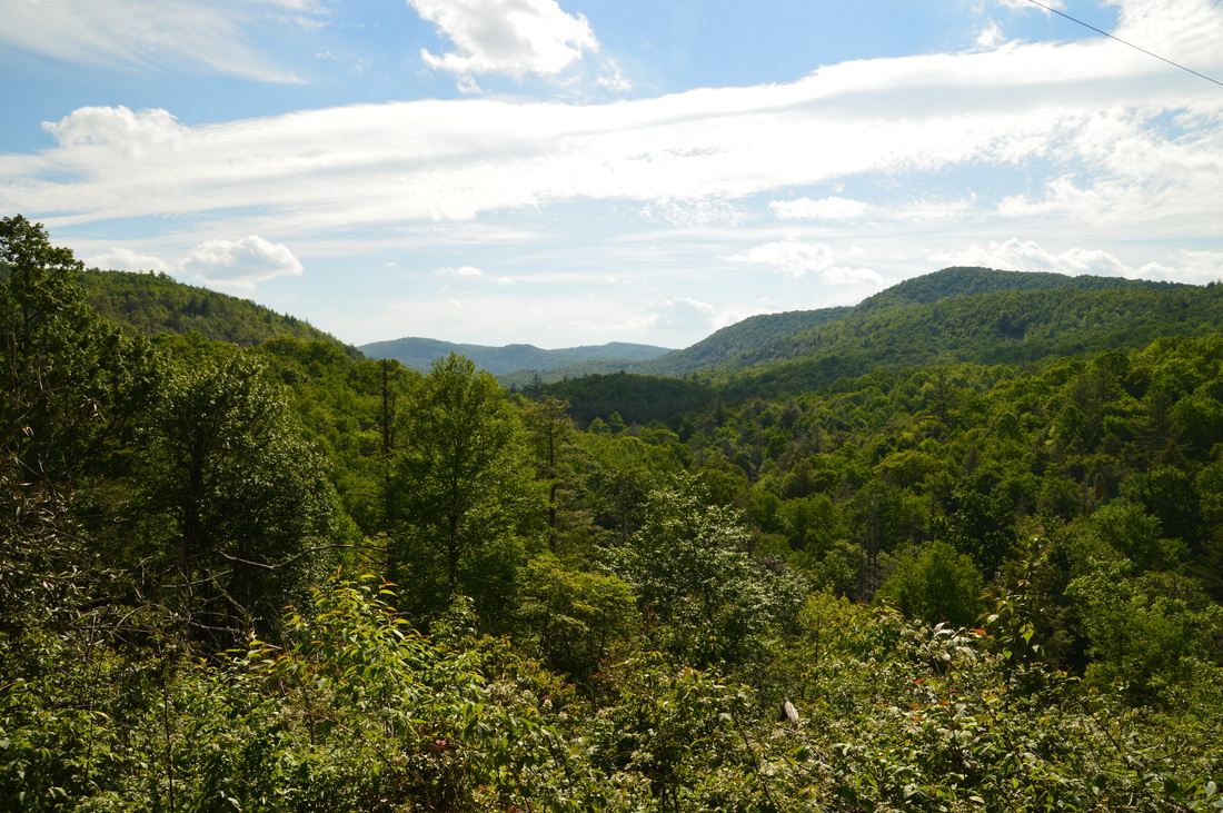
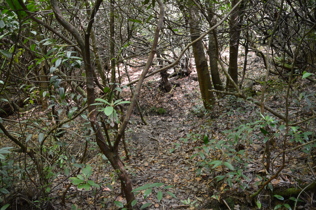
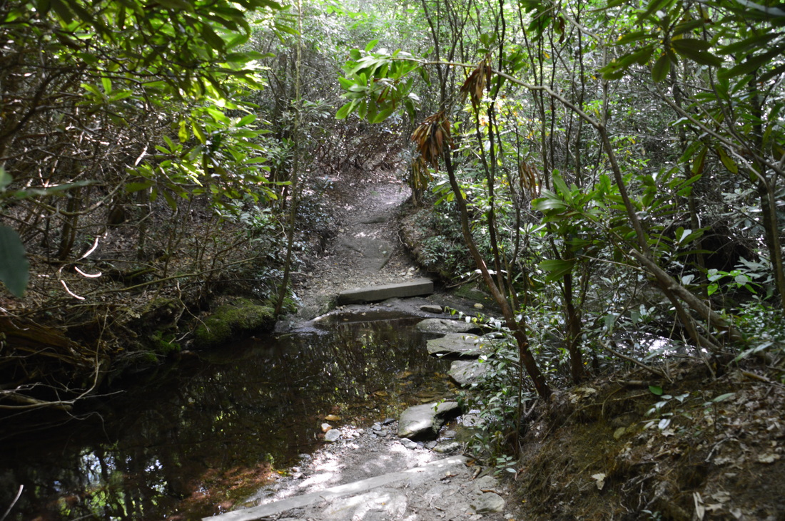
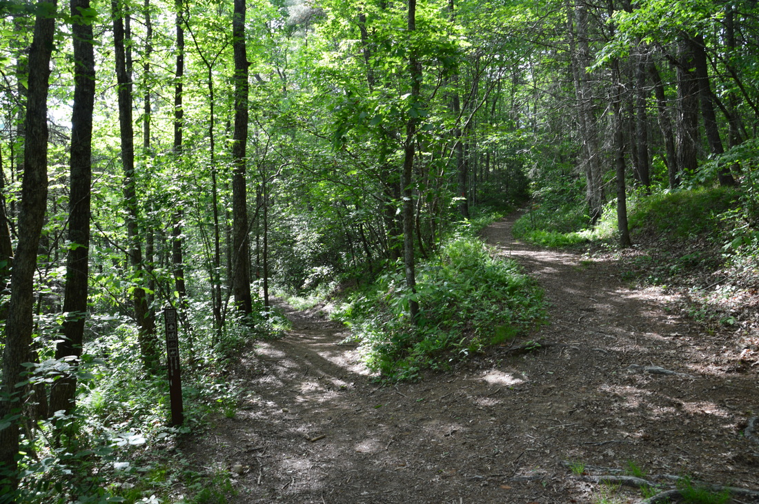
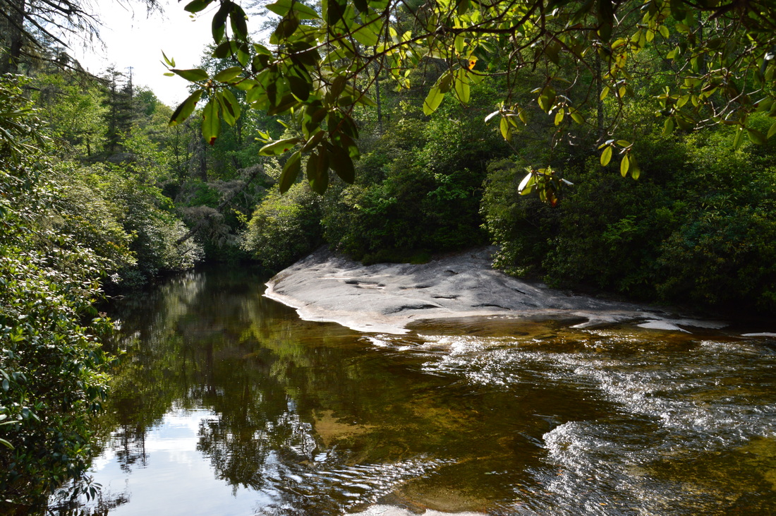
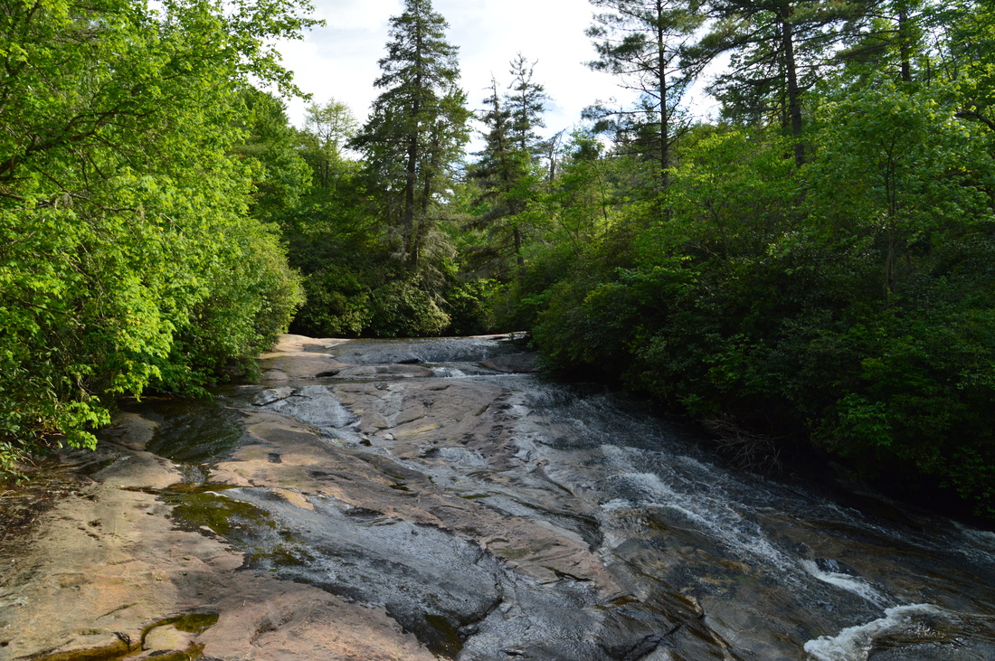
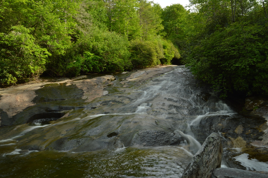
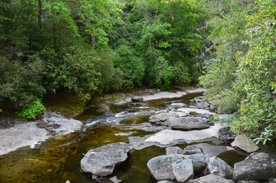
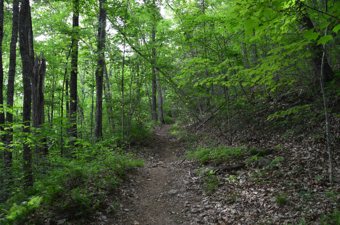
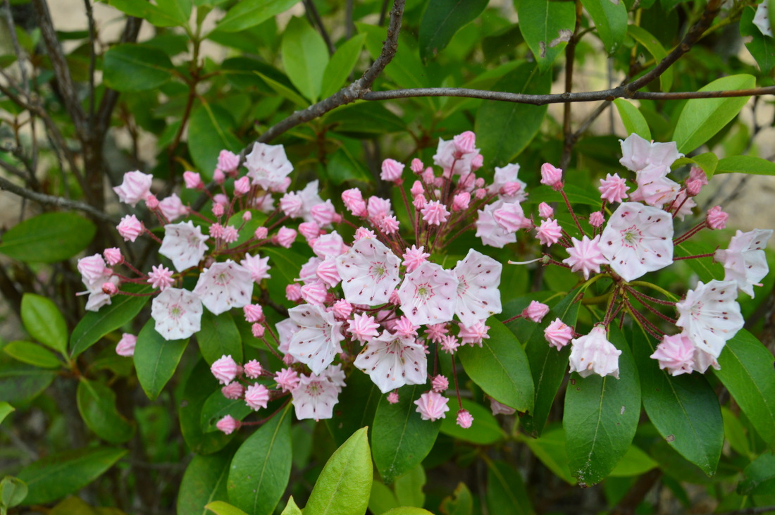
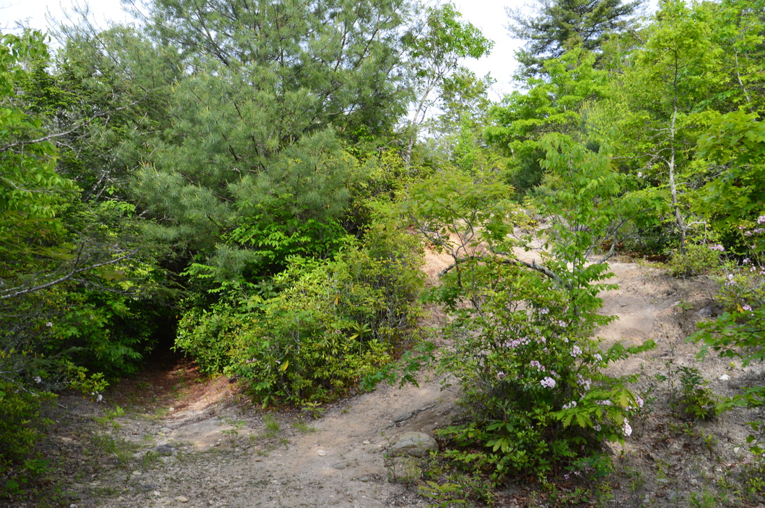
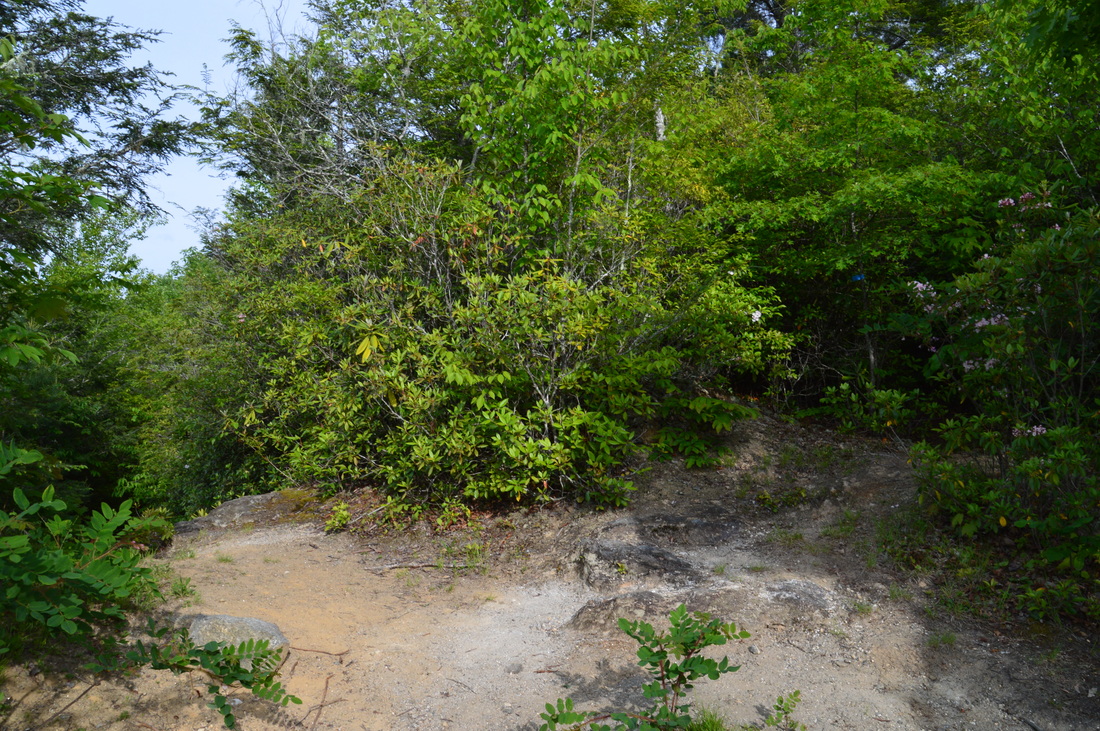
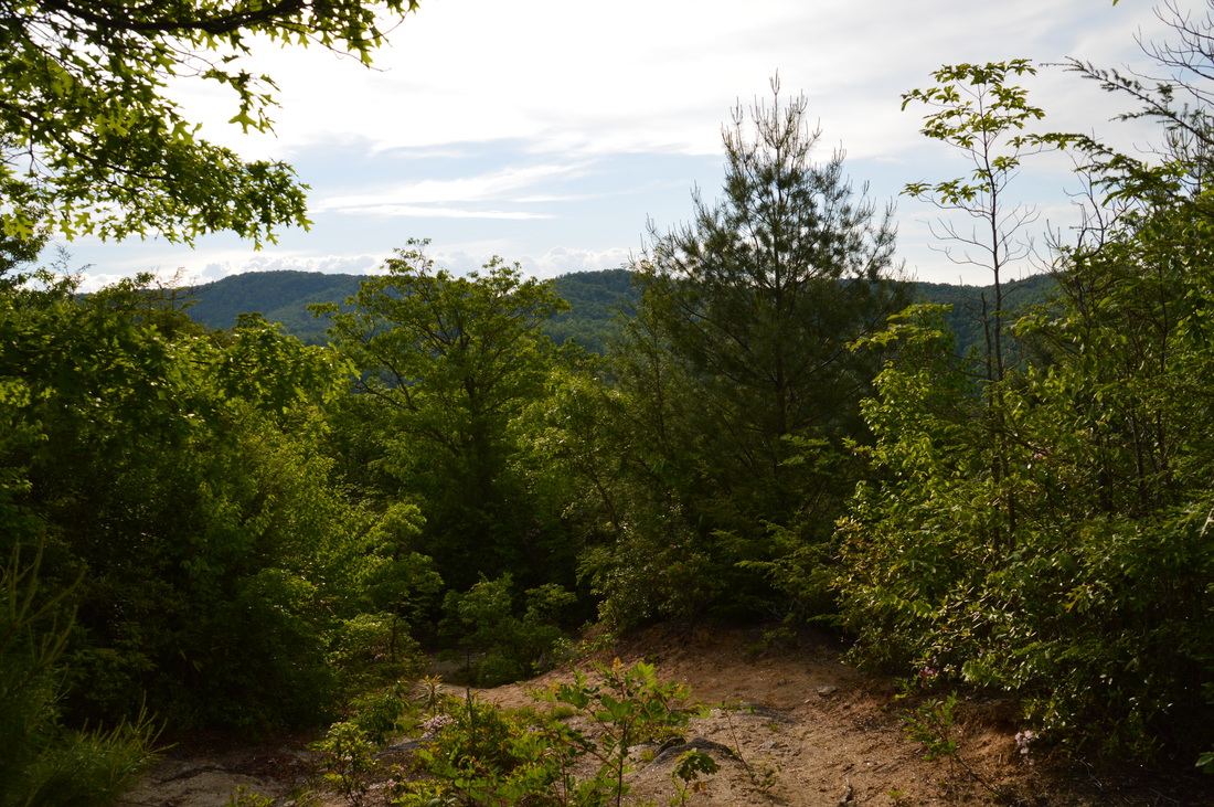
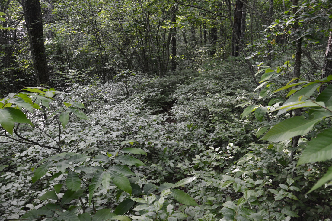
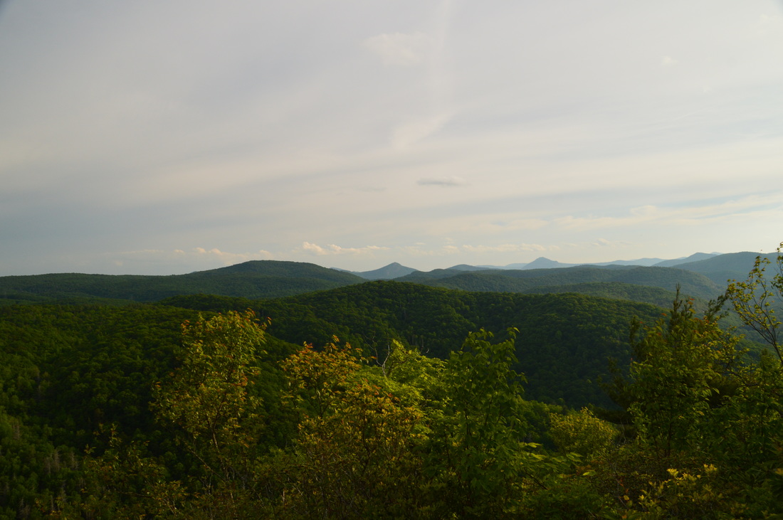
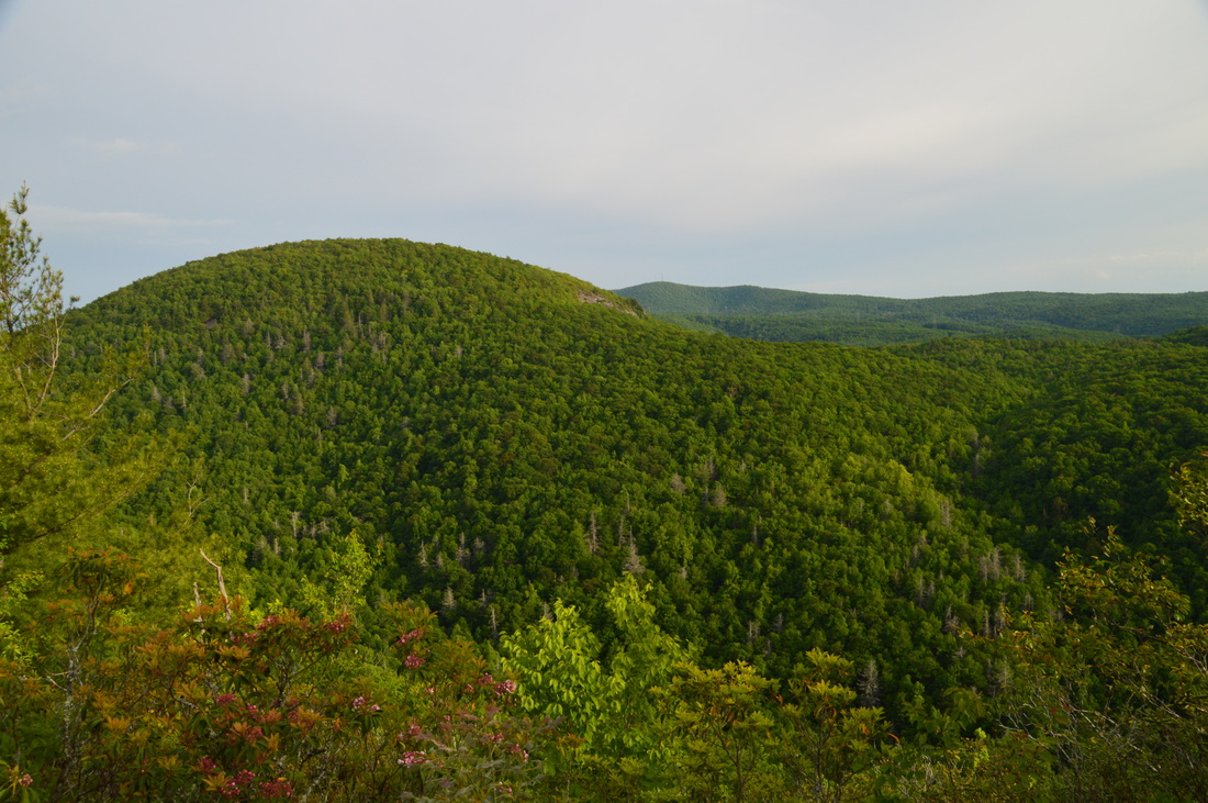
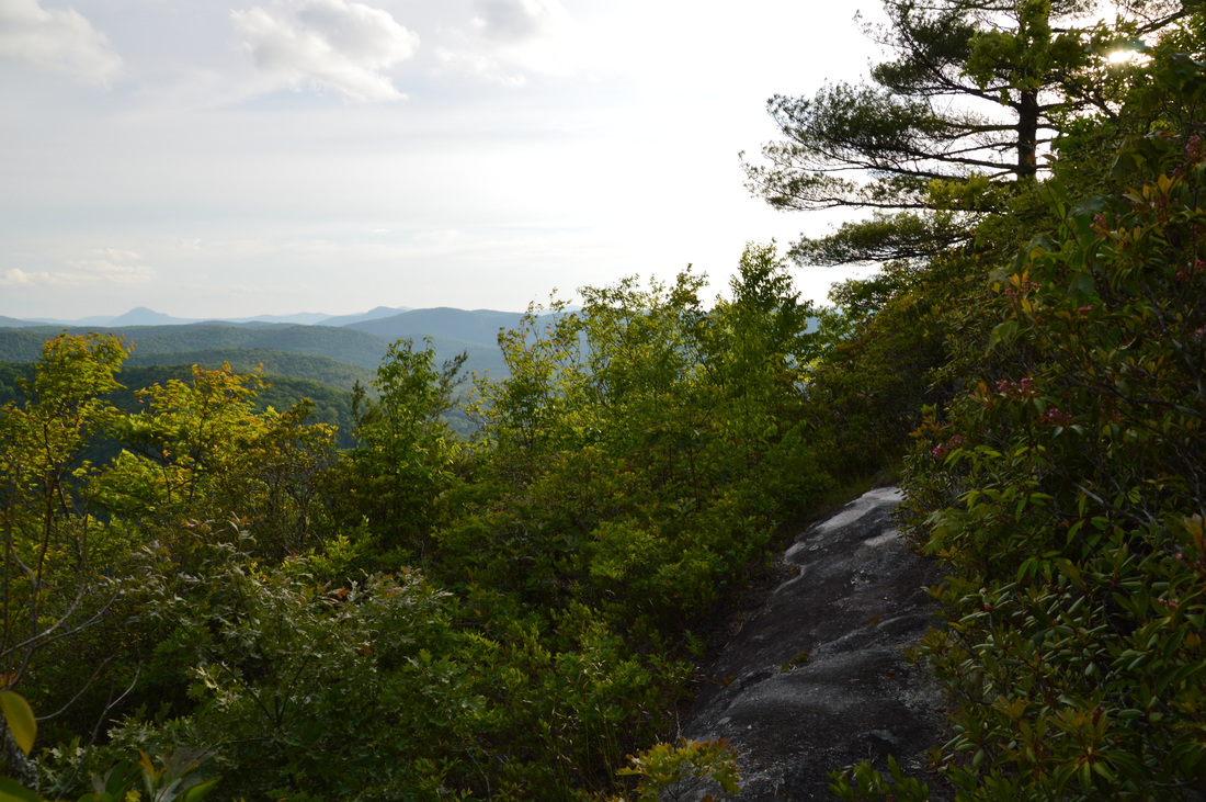
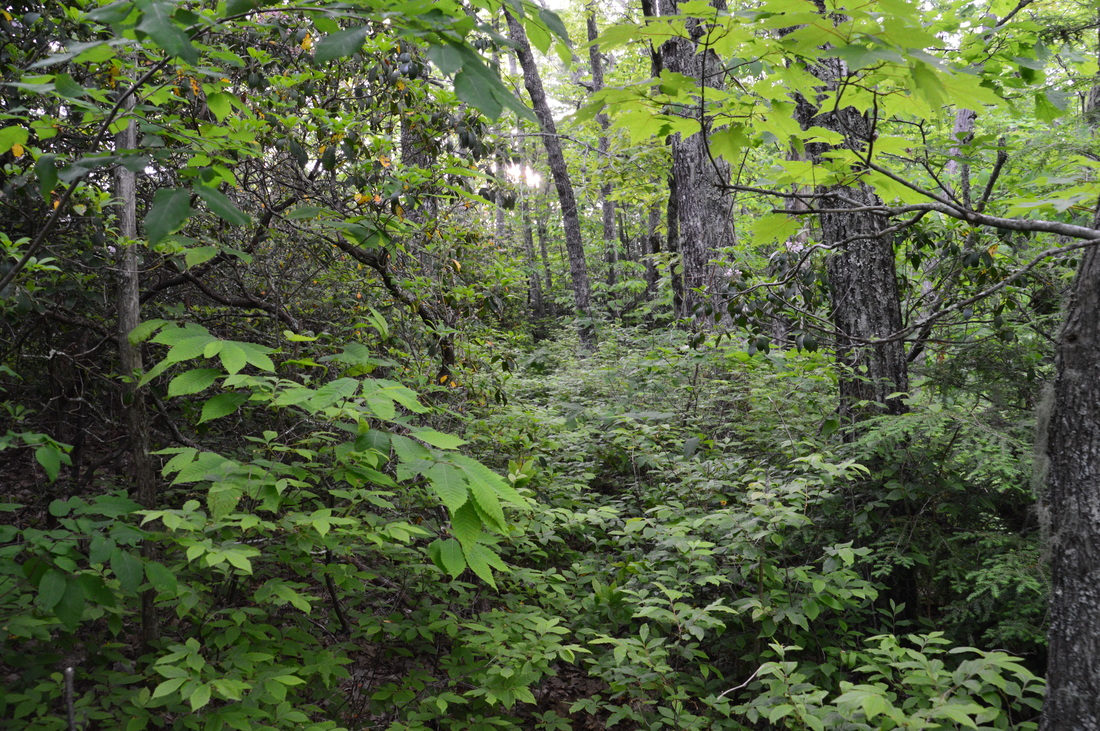
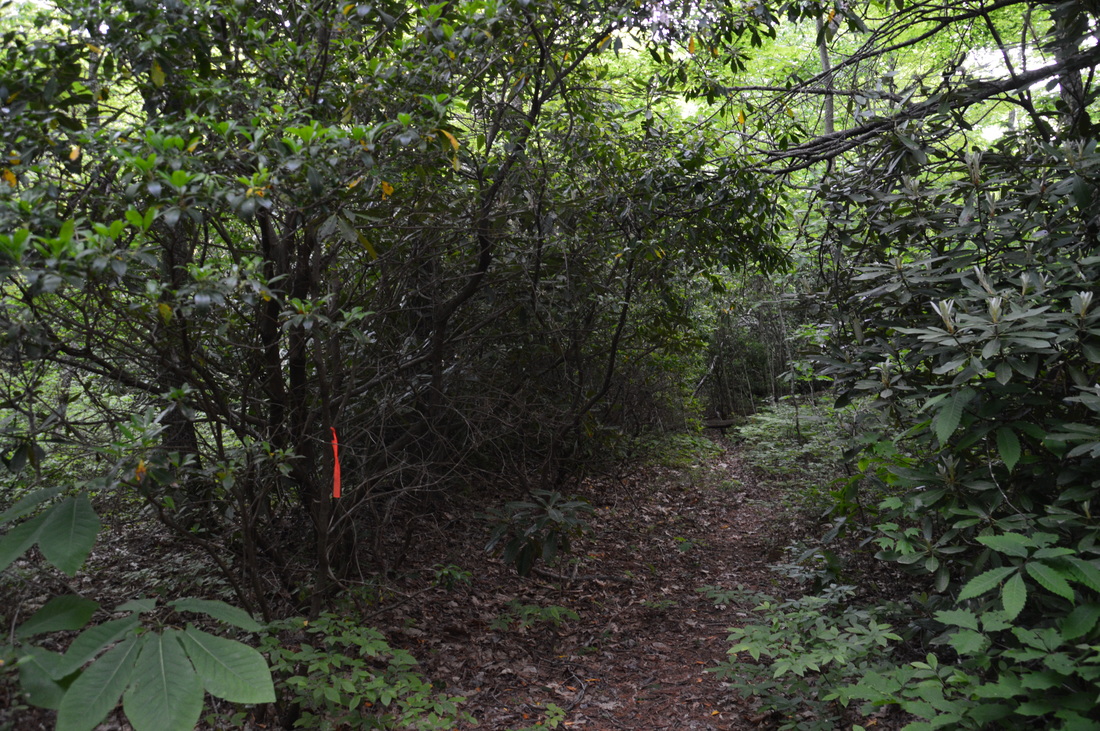
 Panthertown Valley is a mecca for outdoor recreation, with over a dozen waterfalls and many mountains that provide spectacular views. Some locations, such as Schoolhouse Falls and Little Green Mountain, are very popular. Other locations, such as Riding Ford Falls and Panthertail Mountain, are seldom visited or even heard of. On this hike, you will get to see as many as five waterfalls, with several others just a short ways off. Also, you'll visit two mountaintop vistas, with a third one nearby. Just make sure not to stray off too far on the unclear trail system on Panthertail Mountain, because you might have a long way back. This hike occurred on Saturday, May 28th, 2016. My plan was to begin this hike at Cold Mountain Gap, where I would take the Mac's Gap Trail to Greenland Creek. After hiking te short spur trail to Greenland Creek Falls, I would take the Greenland Creek Trail downstream along Greenland Creek, before turning onto an unofficial trail that led past Mac's Falls and Pothole Falls to Schoolhouse Falls. From Schoolhouse Falls, I would follow the Devil's Elbow Trail to its terminus at Shelton-Pisgah Trail, (with a short side trip to Riding Ford Falls along the way). Then, I would take the Shelton-Pisgah Trail across Shelton-Pisgah Mountain, before venturing onto a set of unofficial trails to Panthertail Mountain. From here, my plan was to return to Panthertown Valley by way of Little Green Creek, but things turned out otherwise, and I ended up following an unknown-to-me trail to Cold Mountain Gap Road. SummaryLength of Trail: 6.0 Miles One Way to Shelton-Pisgah Overlook Type of Hike: Loop or Out and Back Difficulty Rating: 6 out of 10 Pros: Abundance of points of interest on this hike (minimum of five waterfalls and five vistas) Cons: Confusing, poorly-marked trail system around Panthertail Mountain Points of Interest: Greenland Creek Falls - 6 stars;, Mac's Falls - 1 star;, Pothole Falls - 2 stars; Schoolhouse Falls - 5 stars; Riding Ford Falls - 4 stars; View from Shelton-Pisgah Mountain - 7 stars Trail Blaze Color(s): I did not see blazes on any of the trails, official or unofficial. Occasional surveyor's tape marked the Shelton-Pisgah Trail. Best Season(s) to Hike: Spring for the water features; Fall for the fall colors that can be seen Fees: None Beginning Point: Cold Mountain Gap Trailhead Directions: From Cashiers, NC: Follow US Route 64 East for 12.8 miles. Then, turn left onto NC Route 281 and follow it northward for 0.9 miles. Then, turn left onto Cold Mountain Road. Follow Cold Mountain Road for 5.7 miles until you reach the entrance to the Canaan Land Christian Retreat straight ahead. To reach the Cold Mountain Gap Trailhead, turn left here and drive on a narrow paved road for a short distance. Shortly after the turn, you will see a private road that continues straight - turn right here onto a gravel road that leads to the Cold Mountain Gap Trailhead. You will reach the official parking area in 0.15 miles at the end of the road, but depending on the type of weather outside and what day it is, you might find the whole entrance road lined with cars - such was the case on this day, and it was not easy to find a spot anywhere! Luckily, there are many trails that folks can take, so the crowds dissipate, and this hike follows a lot of the lesser-used trails. DetailsHaving hiked in Panthertown Valley a couple of times before, I knew of the fantastic waterfalls and vistas in this popular hiking area. On my more recent hike here, I visited Blackrock Mountain and Little Green Mountain, both having excellent views, and I also hiked to a number of waterfalls, including Wardens Falls at the head of the Tuckasegee River. At the time I did the hike, I didn't know about the numerous waterfalls downstream of Wardens Falls, and while on this day I didn't see all of them, there are four more waterfalls below Wardens Falls. One day, I plan on returning to this area to see the remaining waterfalls, as well as Cold Mountain (that I planned to see on this day but didn't due to trail complications). The two main trailheads in Panthertown Valley are Salt Rock Gap and Cold Mountain Gap, although there is a couple of secondary trailheads. The two major trailheads are connected to each other by the Panthertown Valley Trail, which is the sort of central trail for the Panthertown Valley Trail System. However, a myriad of other trails branches off from the vicinity of both trailheads, such as the Blackrock Trail and Wilderness Falls Trail at Salt Rock Gap, and the Mac's Gap Trail and Greenland Creek Trail at Cold Mountain Gap. On this day, my plan was to begin with the Mac's Gap Trail. The Mac's Gap Trail doesn't start at the official parking area at the end of the short gravel road stretch. To get to the Mac's Gap Trail, walk back along the gravel road, and just before its beginning at the private driveway, turn right onto the Mac's Gap Trail, which is a wide footpath. The trail immediately starts descending into the Greenland Creek valley. The trail is wide and easy as, on its way down, it crosses a powerline cut. At 0.75 miles, the Mac's Gap Trail concludes descending near Greenland Creek at a junction with the Greenland Creek Trail. You will soon take the Greenland Creek Trail to the right, but for now, bear left on a path which both trails follow together. This is part of your side trip to Greenland Creek Falls (the tallest waterfall on this hike). At 0.85 miles, reach a clearing. The Mac's Gap Trail turns right and crosses Greenland Creek. To reach Greenland Creek Falls, continue straight on the marked Greenland Creek Trail. The trail takes on a completely different aspect. Until now, you have been following a wide, easy path. Now, the trail became a narrow, twisting path through rhododendron thickets along Greenland Creek. At 1.05 miles, the trail crosses a tributary of Greenland Creek, and at 1.2 miles, the official trail ends at Greenland Creek Falls. This is a fairly tall, single-drop waterfall that slides down a steep rock face. A long time ago, the Greenland Creek Trail continued past Greenland Creek Falls to Halfway Falls and Carlton's Falls, two smaller waterfalls on the uppermost section of Greenland Creek. This trail is no longer maintained, but I have heard that a goat path can still be followed to those two waterfalls. However, it was not part of my plan to see them on this day. Instead, I started retracing my steps from Greenland Creek Falls back to the Mac's Gap Trail. I returned to the clearing, and briefly followed the Mac's Gap Trail before reaching the junction where the Greenland Creek Trail continues northwest at 1.65 miles. Turn left here onto the Greenland Creek Trail. The trail stays above the creek, but within earshot of it. At 1.8 miles, reach an interesting junction. The official Greenland Creek Trail continues straight to Cold Mountain Gap. A "new" unofficial trail, marked by flagging tape, turns left here and passes two smaller waterfalls on Greenland Creek before reaching Schoolhouse Falls. This is a slow route requiring some scrambling along the steep slopes near the creek, but I found it worth the effort. Thus, turn left onto the unofficial trail. At 1.9 miles, there are some views through the trees of Mac's Falls to the left. It is a small single-drop waterfall. I didn't find a clear view of it. Just beyond Mac's Falls, the trail crosses a sort of large slanted rock, which may present some difficulty to navigate. At 2.1 miles, the trail reaches Pothole Falls. It is not visible from the trail, but there is a tricky side trail to it, which involves descending steeply onto a very slick, mud-covered rock slab stretching down to Greenland Creek. Once you reach the rock slab, you can see Pothole Falls just upstream. This small falls cascades down a small ledge and through a cleft in the rocks, before the creek fans out and becomes much wider. From Pothole Falls, return to the trail and continue on the pathway of sorts paralleling Greenland Creek. The trail soon flattens out in an area where the creek valley is broader, and at 2.3 miles, the trail reaches the creek. Walk out to the left onto some rock slabs in the creek, where you can view a small but photogenic cascade upstream with a pool in front of it. After this, the trail becomes rougher again, and there are a couple places where it can take a minute or two to find where the trail goes next. At 2.8 miles, you may notice a path heading down steeply to the left back to Greenland Creek. This is the continuation of the trail to Schoolhouse Falls, while if you walk just a bit farther, you will reach the wide, road-like Panthertown Valley Trail. I wanted to see Schoolhouse Falls again, so I took the steep trail to the left. This trail shortly flattened out and beared right near the top of the Schoolhouse Falls. After descending alongside Schoolhouse Falls, the trail reaches a junction. Here, a spur trail heads left, rock hops across Greenland Creek, and reaches Schoolhouse Falls at 3 miles. Schoolhouse Falls is perhaps the most popular destination in Panthertown Valley, although in my opinion, the waterfall isn't that spectacular. The waterfall consists of one middle-sized drop across a large ledge. It is possible to walk behind the falls. The main thing that makes this waterfall so popular is the pool in front of it, which is good for swimming. I did not wish to stay here for long, so after snapping a few pictures, I returned to the trail along the east side of Greenland Creek. I continued on the path and reached the Panthertown Valley Trail at 3.1 miles. You have many options here, such as hiking to Little Green Mountain, Wardens Falls, Riding Ford Falls, or back to the trailhead. My plan was to continue to some lesser-used trails, so I continued straight across the Panthertown Valley Trail and onto the Devils Elbow Trail. This trail quickly left Greenland Creek and began ascending along the lower slopes of Boardcamp Ridge. At 3.4 miles, the trail passes through a large powerline clearing. Usually, powerline clearings do not belong in mountain views, but from this particular powerline cut, there is a spectacular view of Panthertown Valley - closed in by mountains on all sides. Soon after the powerline cut, the Devils Elbow Trail begins to descend into the Little Green Creek valley. At 4 miles, the trail crosses a tributary of Little Green Creek. Immediately afterwards, the trail crosses Little Green Creek itself on well-placed stones. Just before the crossing of Little Green Creek, there is an unofficial trail/goat path that leaves to the right and travels along Little Green Creek upstream. From what information I have read, it appears that the slim pathway is possible to follow the entire time to its terminus near Cold Mountain in the gap to the southeast of Shelton-Pisgah Mountain, where the Shelton-Pisgah Trail meets the Panthertail Mountain Trail. I had planned to use this route to return from Panthertail Mountain, until my plans changed (more on that later). However, I do plan on trying this route some day. Regardless, for now, I continued on the official trail, so I could see Riding Ford Falls. After crossing the creek, the Devils Elbow Trail bends to the west and reaches a junction at 4.1 miles. Here, the Riding Ford Trail continues straight to and across the Tuckasegee River, providing access to Wardens Falls, Jawbone Falls, and Riding Ford Falls. Another goat path off the Devils Elbow Trail a bit farther on provides access to Elbow Falls, Red Butt Falls, and Lichen Falls (altogether there's six waterfalls in and near this short stretch of the Tuckasegee River!). I took the Riding Ford Trail, although I only had time to see Riding Ford Falls, as the other waterfalls required more time-consuming hikes and scrambles. I have future plans of returning to this area and seeing all of the waterfalls on and near the Tuckasegee River, as well as the Dismal Creek area waterfalls. The Riding Ford Trail descends to and reaches the Tuckasegee River at 4.2 miles. A path to the left leads to Wardens Falls and Jawbone Falls, along with some campsites. The Riding Ford Trail fords the Tuckasegee RIver here, at a picturesque location where the river makes a 90-degree turn and changes from a slow river with standing water to a rushing mountain stream. This ford is the "Riding Ford" - the name of a car ford that once used to be here. To see Riding Ford Falls, I didn't have to ford the river. In fact, Riding Ford Falls is right here - the ford is at the top of this long, sliding falls. To reach the base, you should be able to advance down the large rock slabs in the creek to the right. Do not attempt this if the water is up or if the rocks are wet. At the bottom of the series of rock slabs, find a way to scramble up to the large boulders that are located at the base of the falls. The best view of Riding Ford Falls and the river below it is from one of these boulders. Elbow Falls and Red Butt Falls are not far downstream from Riding Ford Falls, and Lichen Falls is a half-mile below Red Butt Falls on a tributary of the Tuckasegee River. However, there is no easy way to get to any of them from this point. You'll have to retrace your steps to the Devils Elbow Trail to see them. I did retrace my steps to the Devils Elbow Trail, but not to see the waterfalls (I didn't have enough time for that). My plan was to ascend to Devils Elbow and then Shelton-Pisgah Mountain. This is where the real ascent of this hike begins. Return to and turn left onto the Devils Elbow Trail at 4.4 miles. After this, the trail passes several campsites. According to Kevin Adams' guidebook, the spur trail to Elbow Falls, Red Butt Falls, and Lichen Falls is to the left at 4.7 miles (0.3 miles from the Riding Ford Trail junction). I must have walked straight past it, for I never saw it. Right after this, the trail begins a steep ascent to Devils Elbow. This is a sharp contrast to what the hike has been so far! The initial grade soon lessens a bit, but a steady ascent out of the Tuckasegee River Gorge continues until 5 miles, At 5 miles is a gap just below the summit of Devils Elbow. The trail doesn't ascend to Devils Elbow itself - instead, it makes what is nearly a U-turn and continues an easier ascent southeastward towards Shelton-Pisgah Mountain. At 5.15 miles, the Devils Elbow Trail ascends some steps and reaches a clearing. This is a very important point, and I marked it with a waypoint on my GPS track. Here, the official Devils Elbow Trail ends. A lot of people simply retrace their steps from here, but there are a couple of other choices. The more obvious one lies directly ahead. The West Fork Way, an unofficial trail that is not maintained by the Forest Service, continues straight along an overgrown pathway. The West Fork Way eventually descends into the Dismal Creek watershed, reaches the West Fork of the Broad River valley, and ends at NC Route 281. The West Fork Way provides access to Dismal Falls and several other waterfalls around Dismal Creek. Also, the West Fork Way is a link between Nantahala National Forest and Pisgah National Forest. For this hike, though, I opted to take the second trail that leaves this clearing: the Shelton-Pisgah Trail. It is also unofficial and not maintained by the Forest Service, but it was possible to follow the entire time, in part thanks to frequent flagging tape. The Shelton-Pisgah Trail leads to Shelton-Pisgah Mountain, where there is a great overlook. Afterwards, the trail descends to a gap where you have the choice to see Panthertail Mountain or Cold Mountain (both have great views). It is a bit trickier to locate the beginning of this trail. At the clearing, turn right and scramble up what looks like a landslide area. At the top of it, there is a limited view back to the west. Once you reach the top of the landslide area, look for a very slim path that exits to the right into the mountain laurel bushes. It is marked by blue flagging tape. I will add a picture of the entrance to the Shelton-Pisgah Trail in the photo gallery below to further help you to understand how to reach this trail. Once you're actually on the Shelton-Pisgah Trail, you should not have problems following it. The path itself is a bit overgrown due to a thick understory. But even with the plants on the trail, you should still be able to make out a path, and there is frequent blue flagging tape that marks the way. The trail moderately ascends for a while along the ridge leading up to Shelton-Pisgah Mountain. At 6 miles, the trail ascends to the top of an unnamed knob directly to the west of Shelton-Pisgah Mountain. Right away after the knob, the trail descends to a long rock slab that offers a breathtaking view of the upper reaches of Panthertown Valley and the mountains to the south and west of it. Cold Mountain looms high to the southeast, and Cold Mountain Gap (where your car is) is to the south-southwest. Little Green Creek flows through a deep valley directly below you. From the overlook below Shelton-Pisgah Mountain, the Shelton-Pisgah Trail descends to a high gap and then makes the final ascent to the summit of Shelton-Pisgah Mountain. There is flagging tape at the summit. Although the summit is wooded, you will know that you have passed over it when the trail begins descending.The descent is slow, as the trail seems to become even more overgrown after the overlook. Thus, it is hard to descend faster than you ascended. The descent ends at 6.8 miles in a gap between Shelton-Pisgah Mountain and Cold Mountain. There are many different choices here, and there are two junctions. The first junction is just after a sharp right turn, where the Shelton-Pisgah Trail continues straight onto an old roadbed towards Cold Mountain and Canaan Land, while another trail turns left towards Panthertail Mountain. But first, I would like to add that there is another junction a tad farther down the Shelton-Pisgah Trail. There, the Little Green Creek Trail turns right and descends along its namesake stream to the Devils Elbow Trail. Sounds familiar? I mentioned this trail earlier, and its beginning was visible on the Devils Elbow Trail. My plan at this point was to first visit Panthertail Mountain, then Cold Mountain, and then return via Little Green Creek. However, I now know that Panthertail Mountain is on private property, so I cannot disclose access details - public use of the trails to and on Panthertail Mountain is prohibited. Thus, the best thing to do is to loop the hike via Little Green Creek Trail or come back the same way from Shelton-Pisgah Mountain Overlook. I have not personally hiked the Little Green Creek Trail yet, but I do know that it exists and actually provides a shorter route back to the trailhead. Unfortunately, I do not know the exact mileage. If you are feeling confident enough to hike the Little Green Creek Trail, then keep in mind that the trail will come straight out at the Devils Elbow Trail crossing of Little Green Creek. From there, you would simply follow the shortest route back to the trailhead via Devils Elbow Trail and Panthertown Valley Trail. To summarize, I liked this hike a lot. There were a lot of waterfalls and scenic overlooks that made this hike a really great one with plenty to see. I highly recommend for hikers to explore the lesser-known gems of Pannthertown Valley, such as the lower waterfalls of the Tuckasegee River and the mountains at the east rim of the valley. Mileage0.0 - Cold Mountain Gap Trailhead 1.2 - Greenland Creek Falls 1.9 - Mac's Falls 2.1 - Pothole Falls 3.0 - Schoolhouse Falls 3.4 - Powerline vista 4.25 - Riding Ford Falls 5.15 - Devils Elbow Trail end, beginning of Shelton-Pisgah Trail 6.0 - Overlook on Shelton-Pisgah Mountain 6.8 - Junctions in gap between Shelton-Pisgah Mountain and Cold Mountain VariationsDo a short loop hike to Greenland Creek Falls and Schoolhouse Falls - 4.3 Miles Do a short loop hike to Greenland Creek Falls and Schoolhouse Falls, plus the side trip to Riding Ford Trails - 6.7 Miles Return to Cold Mountain Gap via Little Green Creek - Unknown Distance (I have not hiked the Little Green Creek Trail); however, it will be shorter than returning via Shelton-Pisgah Trail Bonus StopsIt is possible to add on the hike at Gorges State Park to the waterfalls on the Horsepasture River. PicturesVideos
0 Comments
Leave a Reply. |
About MeMark Oleg Ozboyd Dear readers: I have invested a tremendous amount of time and effort in this website and the Georgia Waterfalls Database the past five years. All of the work that has gone in keeping these websites updated with my latest trip reports has almost been like a full-time job. This has not allowed me to pick up a paid job to save up money for college, and therefore, I I've had to take out loans. If you find the information on this website interesting, helpful, or time-saving, you can say "thanks" and help me out by clicking the button above and making a contribution. I will be very grateful for any amount of support you give, as all of it will apply toward my college tuition. Thank you!

Coming in 2022-2023?
Other Hiking WebsitesMiles HikedYear 1: 540.0 Miles
Year 2: 552.3 Miles Year 3: 518.4 Miles Year 4: 482.4 Miles Year 5: 259.9 Miles Archives
March 2021
Categories
All
|


 RSS Feed