The Thompson River is one of several great rivers in the Jocassee Gorges region on the south side of Lake Toxaway. Although the Thompson River isn't as well-known as the nearby Whitewater River (due to Whitewater Falls) or Horsepasture River (due to Rainbow Falls), the Thompson features a collection of gorgeous waterfalls, including a 200-foot monster called Big Falls. Big Falls on Thompson River is an awesome, massive waterfall that crashes down through an enormous open area full of cliffs and borders. This spectacular waterfall should be on every experienced waterfaller's must-see list. Much of the hike to Big Falls follow an unofficial moderate trail along an old logging road that meanders near the Thompson River. However, the final section of the Big Falls hike is an extreme descent into the gorge, including several short rock scrambles. Along the Big Falls hike, you'll pass side trails to three other beautiful waterfalls that are all unique in their own ways and are worth seeing. This hike occurred on Saturday, May 26th, 2018. My plan was to hike out and back to Big Falls from Brewer Road. On my way in, I would make a side trip to Simon Falls. On my return trip, I would make side trips to Rich Falls and High Falls. Unfortunately, a series of heavy thunderstorms messed up my plans slightly, but it was still a great day.
Summary
R/T Length of Trail: 8.5 Miles
Duration of Hike: 5:30 plus 3 hours of stopping and photography Type of Hike: Out and Back Difficulty Rating: 8 out of 10 Total Elevation Gain: 2266 Feet Pros: Stunning waterfalls and remote area Cons: Tricky and strenuous scrambles down to Big Falls and Rich Falls Points of Interest: Big Falls - 10+ stars; Rich Falls - 7 stars; Simon Falls - 5 stars; High Falls - 7 stars; Reid Branch Falls - 2 stars; Standing Stone Falls - N/A Trail Blaze Colors: None, not an official trail Best Seasons to Hike: Summer; Fall Fees: None Beginning Point: Brewer Road/NC 281 intersection Directions from Cashiers, NC: From the intersection of NC 107 and US 64 in downtown Cashiers, follow US 64 East for 10.1 miles. Then, turn right onto NC 281. Continue for 3.7 miles along NC 281 to Brewer Road on the left. Park in the wide space surrounding the intersection of Brewer Road with NC 281. The Thompson River hike begins behind the gate at the end of a small paved strip right between the two roads. Map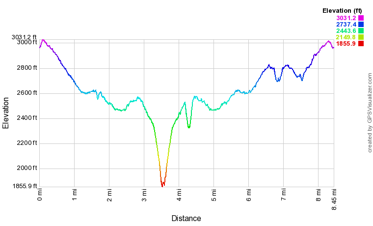
Click the link below to download a .GPX file with a track of this hike.
Details
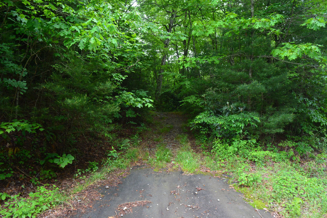
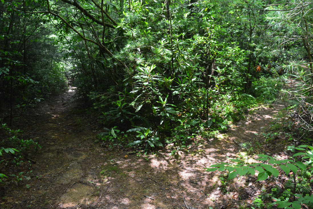
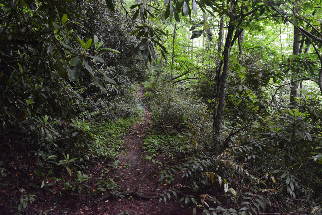
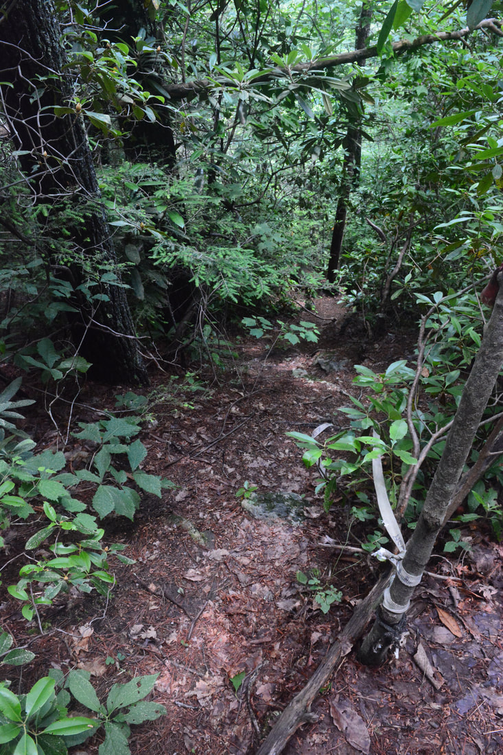
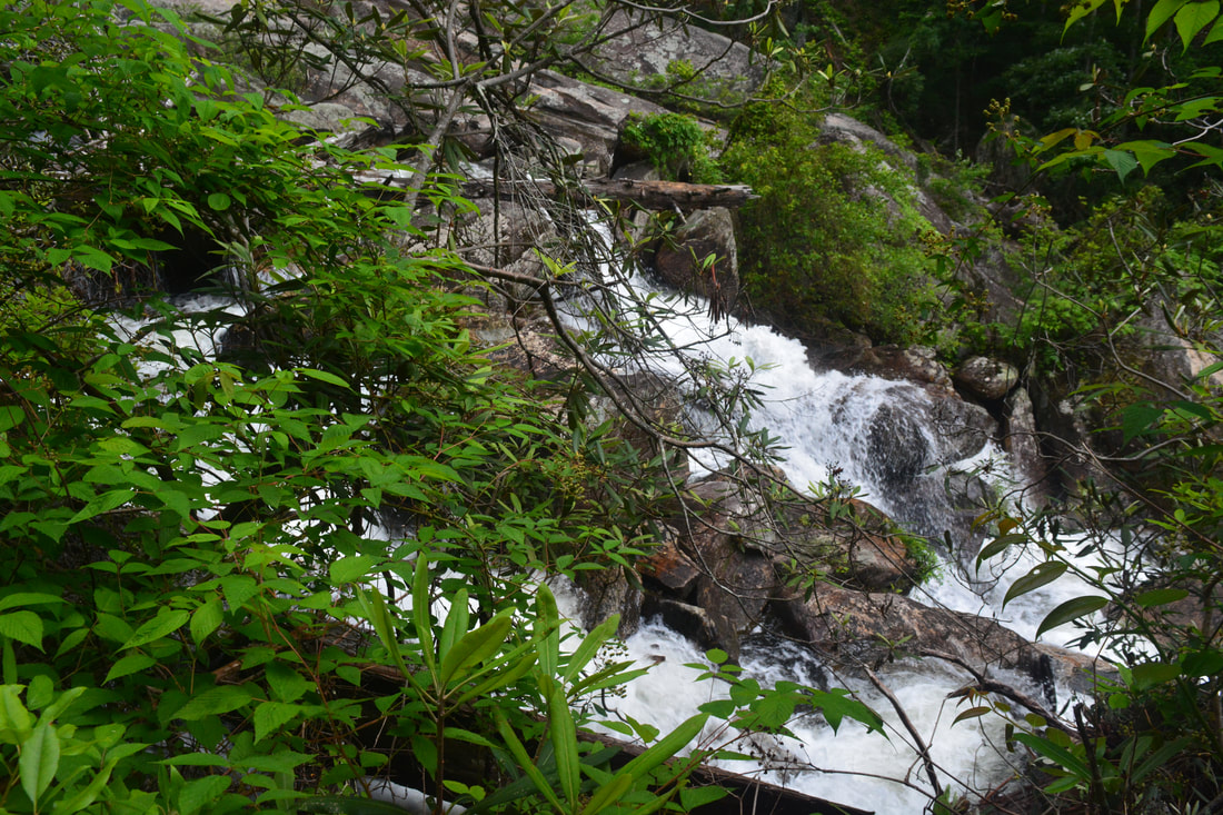
For months, people kept telling me all about the grandeur of the Thompson River waterfalls - especially Big Falls - and how they are a must-see for all waterfallers. I finally made plans to see them in late May. Unfortunately, the water levels were a bit too high for maximum enjoyment. I wasn't able to see High Falls well at all, and many of the intricate details of Rich Falls were washed out. The main waterfall - Big Falls - was absolutely spectacular and roaring though! Begin the hike along the distinct double-track trail heading south between Brewer Road and NC 281. The initial gentle climb lasts 0.2 miles, after which the trail starts descending moderately into the Thompson River valley. At 0.9 miles, a 250-foot side path leaves left and descends to Reid Branch Falls. About 20 feet high, Reid Branch Falls isn't really a spectacular drop, but it's pretty nice and probably worth seeing on your way back, if you've got extra energy. For now, save your energy for Big Falls and the others. 250 feet farther along the main trail, at 0.95 miles, reach a Y-split, where the main trail to Big Falls, Rich Falls, and Simon Falls bears left, while the trail to High Falls bears right. Compared to the other Thompson River waterfalls, the side trip to High Falls is pretty easy, so I suggest doing it along your return trip. Thus, for now, stay left on the main trail, but be sure to not miss High Falls on the way back!
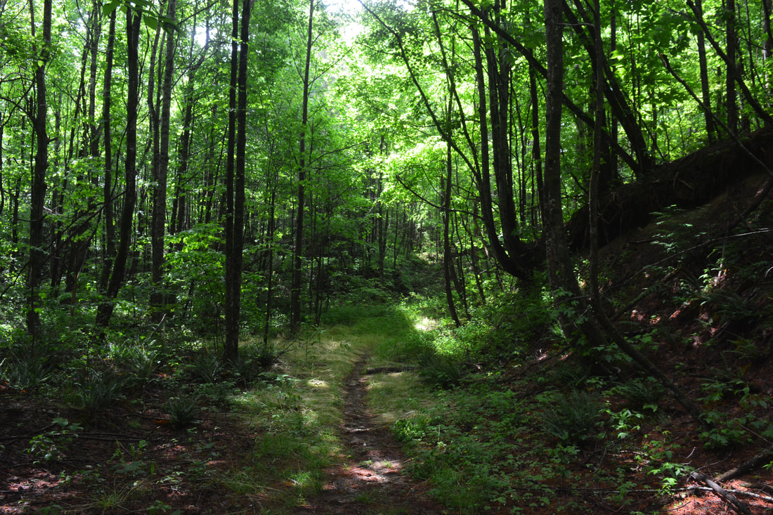
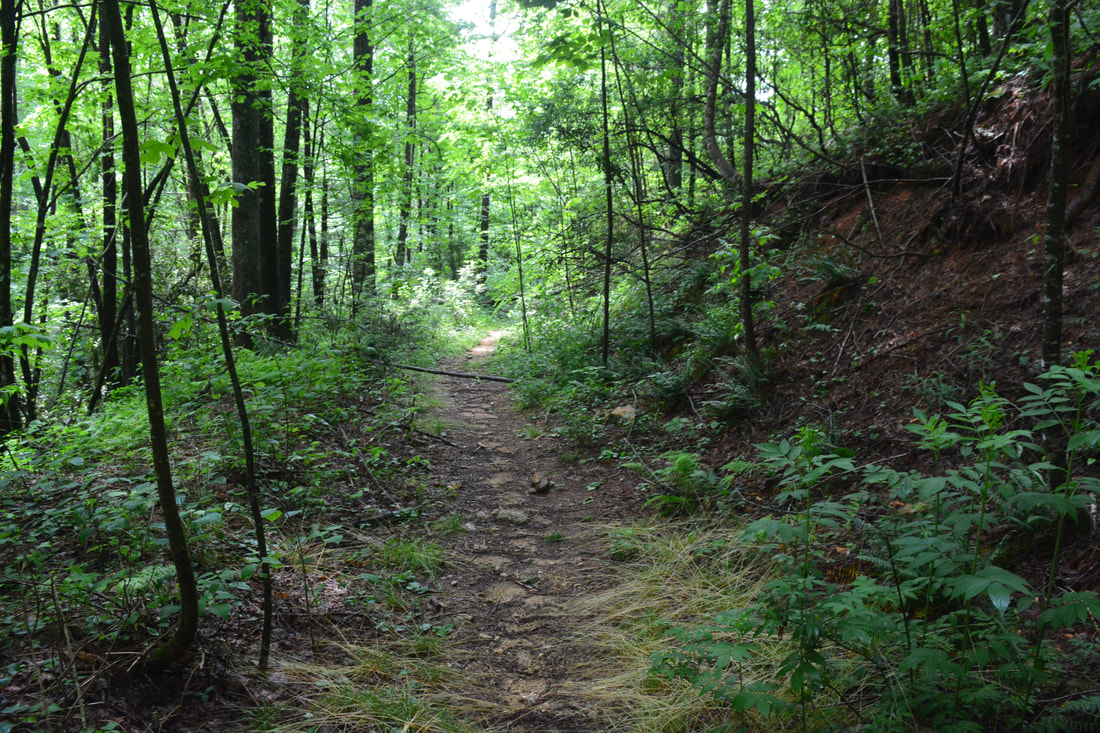
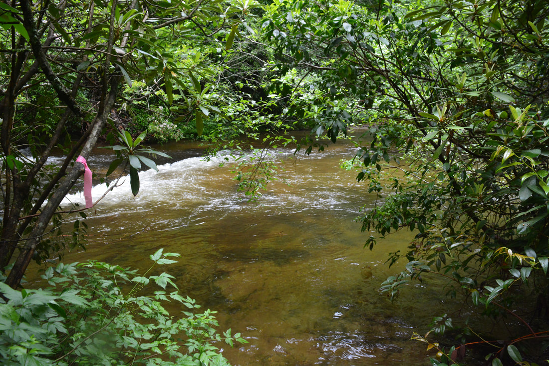
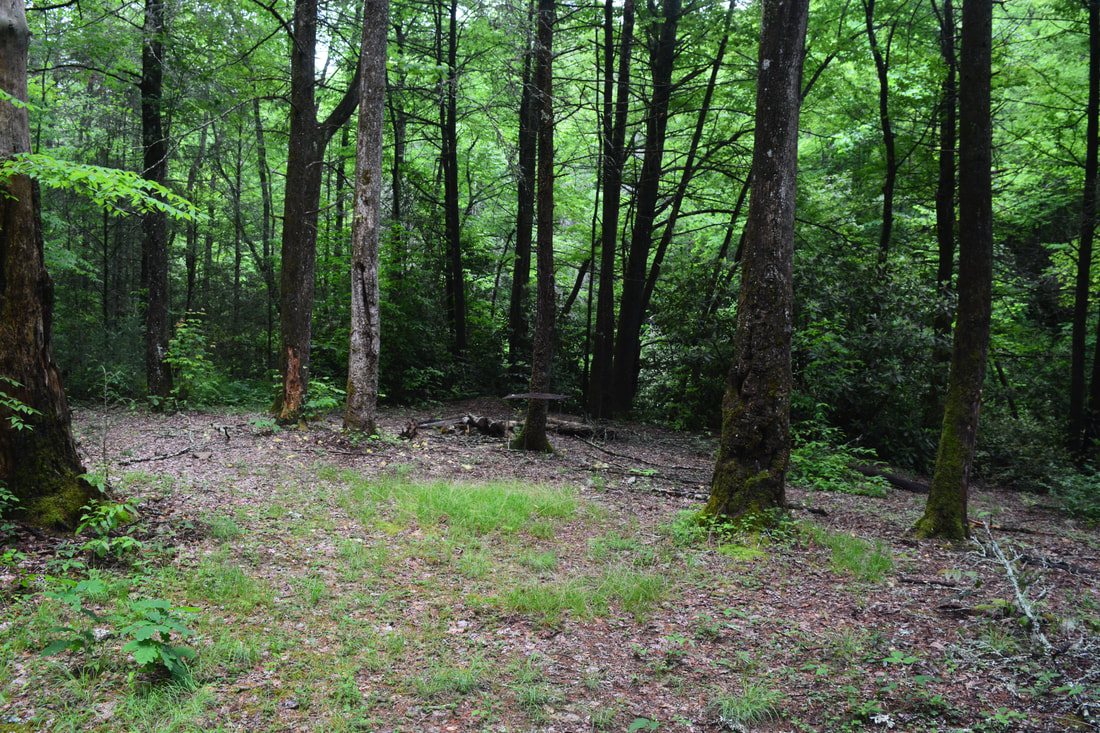
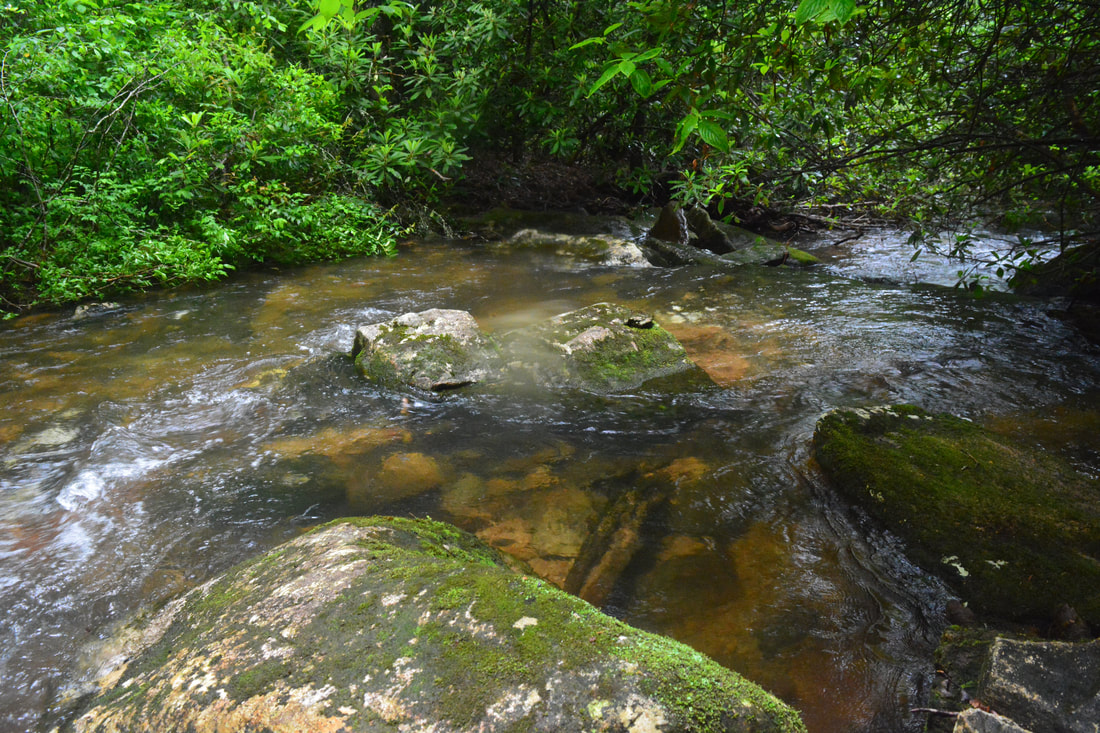
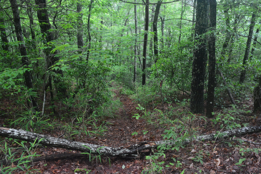
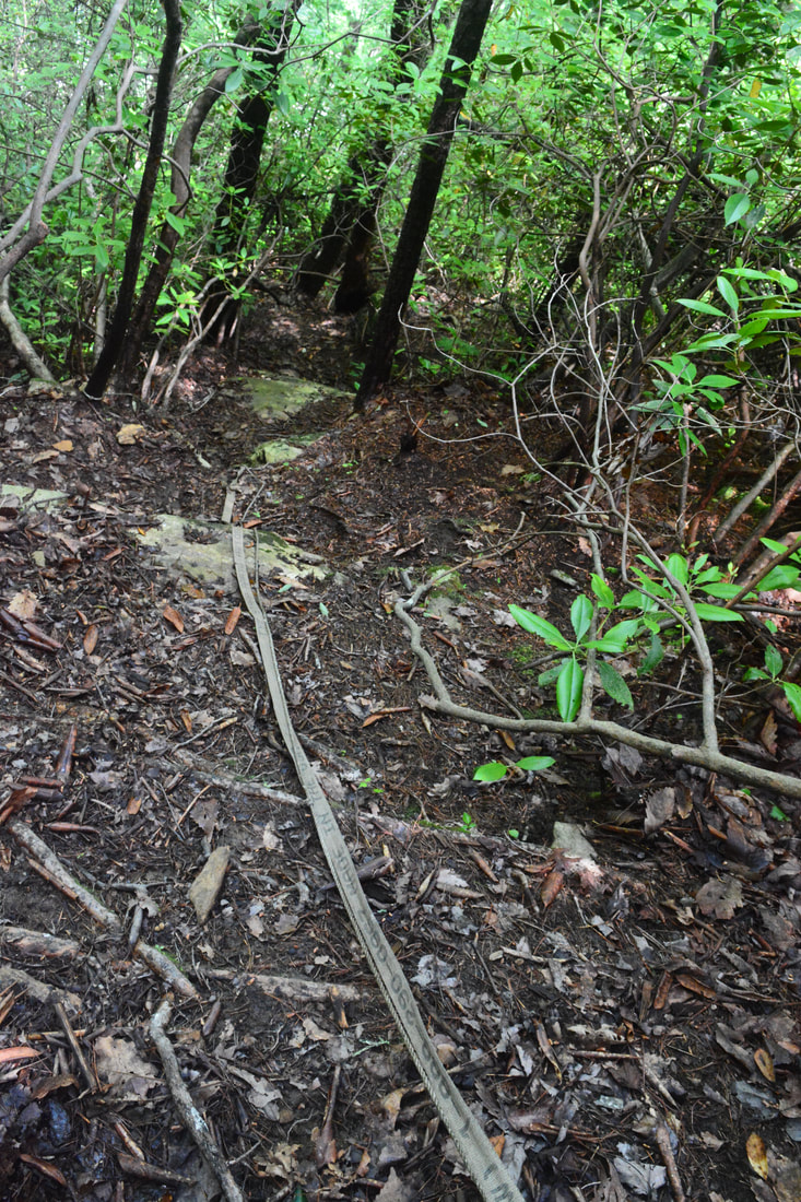
A couple switchbacks bring you to a ford of the Thompson River at 1.2 miles. In typical flow, the crossing is only ankle-deep and quite easy. If the flow is as high as it had been this day, you'll find the crossing to be waist-deep with a moderately swift current. There's a sizable cascade several dozen yards downstream, so if you decide to cross with it being deeper than knee-deep, please be extremely careful. Trekking poles and experience in river fording are a must here in high flow - if you happen to be swept off your feet downstream, you could be seriously injured. The trail closely follows Thompson River past the ford, passing a large campsite. At 1.65 miles, reach another Y-split. The main trail to Simon Falls, Rich Falls, and Big Falls bears left. The old logging road that bears right uphill is the best access to Hidden Dome Falls, a tall, wet-weather waterfall spilling over a massive dome-shaped cliff on an unnamed tributary of the Thompson River. Like with Reid Branch Falls, I would only suggest seeing this waterfall if you have extra energy on the way back - and if the flow is good. Just so you have them, the coordinates for Hidden Dome Falls are N35° 03.354' W82° 59.644'. 100 feet along the main trail past the split, the 150-foot side path to Simon Falls leaves left. You can do this easy scramble on the way in, reaching Simon Falls at 1.7 miles at the coordinates N35° 03.805' W82° 59.254'. Simon Falls is a sliding cascade about 20 feet high. It's scenic and definitely worth the short side trip. Nice flat rocks line the river below the falls. Simon Falls was initially known as Waterfall #1 on the lower section of the Thompson River. Back on the main trail, keep following the twisting pathway along the old logging road near the river, often within sight of it. The trail is always distinct and easy to follow. The only annoyance comes in the form of occasional stretches of low-hanging rhododendron. At 2.5 miles, reach a crossing of the unnamed stream with Hidden Dome Falls. In typical flow, this will be an easy rock hop, but in this day's high flow, it was an ankle-deep wade. The trail then climbs higher above the Thompson River and continues twisting along the contours of the steep gorge slopes. 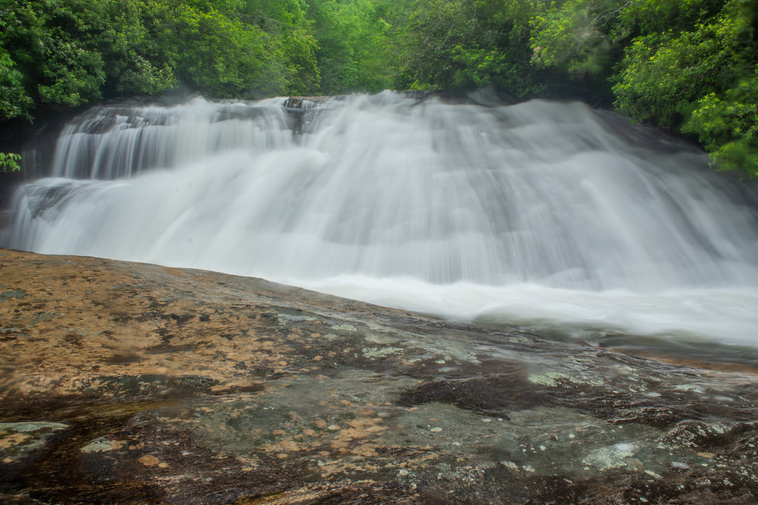
Simon Falls is a small but scenic sliding waterfall on the Thompson River.
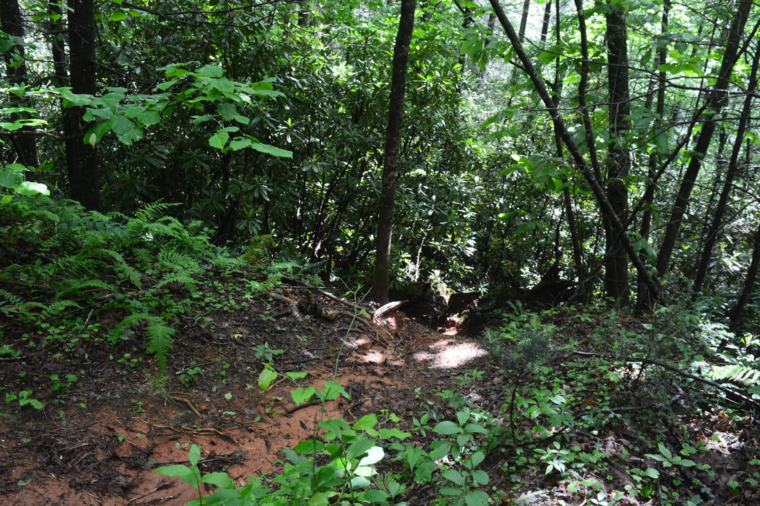
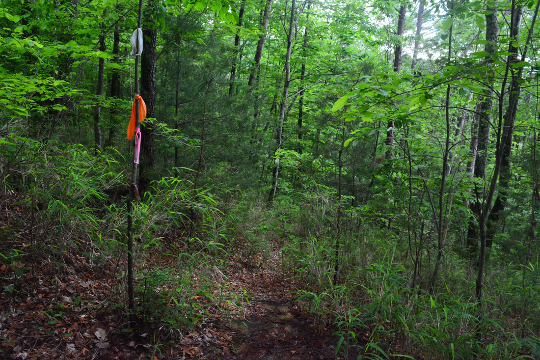
At 2.95 miles, the steep 0.1-mile side path to Rich Falls leaves left. The start is usually marked by flagging tape. I went to Big Falls first and stopped by Rich Falls on the way back. The order is your choice, but this trail report describes Rich Falls on the return trip. Thus, stay on the main trail as it curves around a ridge and distances it so far from the river that you can't even hear it. At 3.3 miles - 0.35 miles past the Rich Falls side path - you'll reach the Big Falls side path on the left. It can be hard to identify this path as there's no good landmarks around. At the time of my visit, multiple pieces of flagging tape marked the turn though. The coordinates for the junction are N35° 02.706' W82° 59.091'. If you do happen to miss it, you'll end up on the Foothills Trail in less than a mile, but the path here is the only reasonable route to Big Falls.
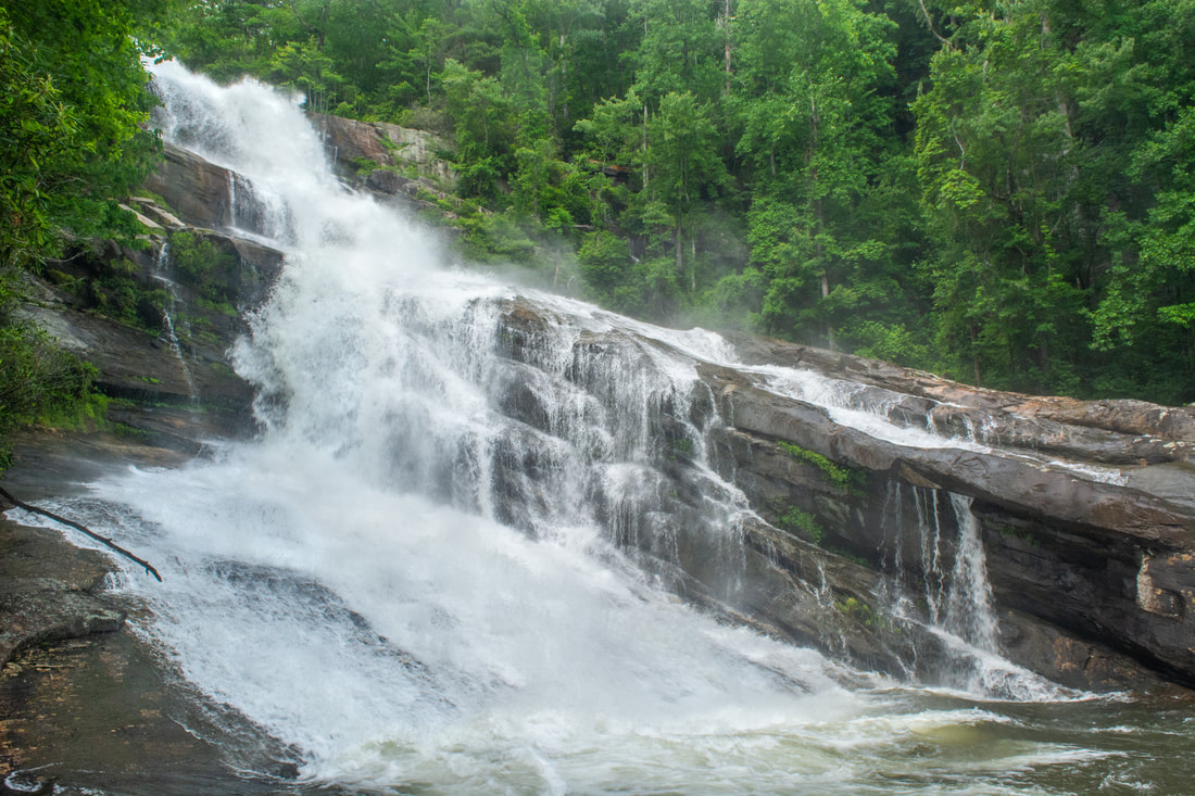
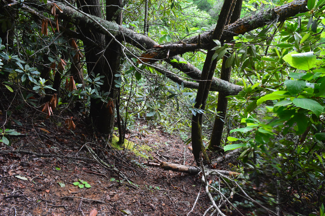
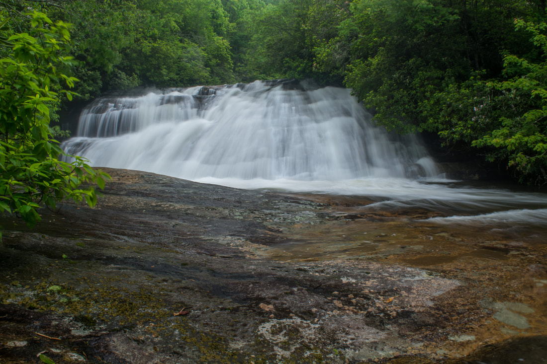
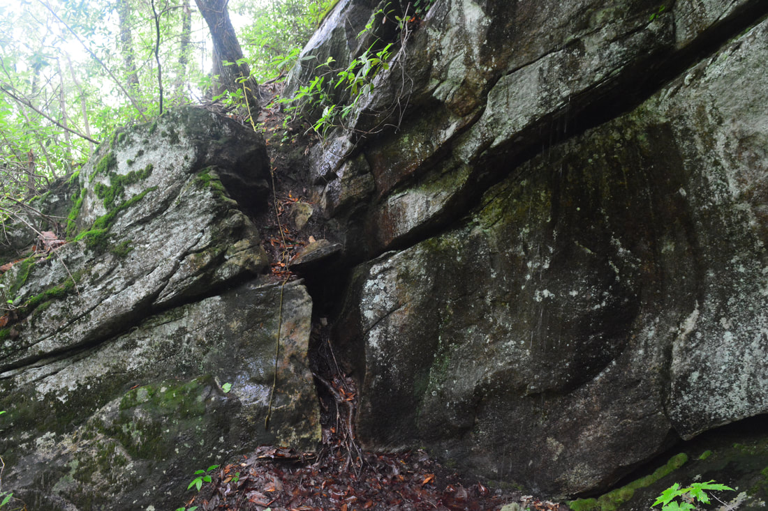
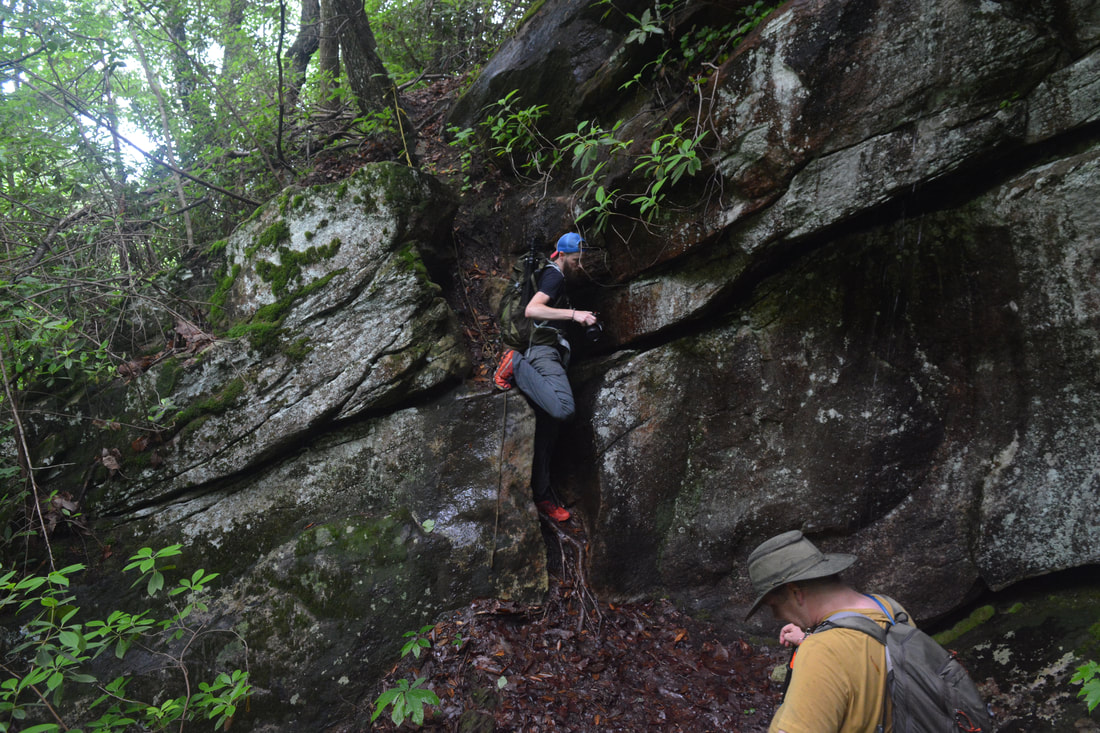
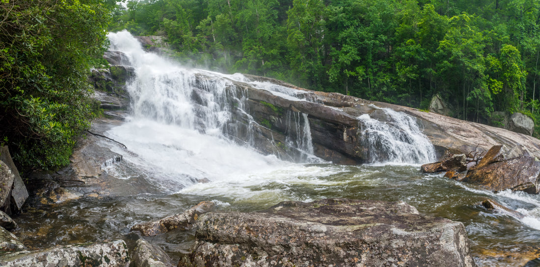
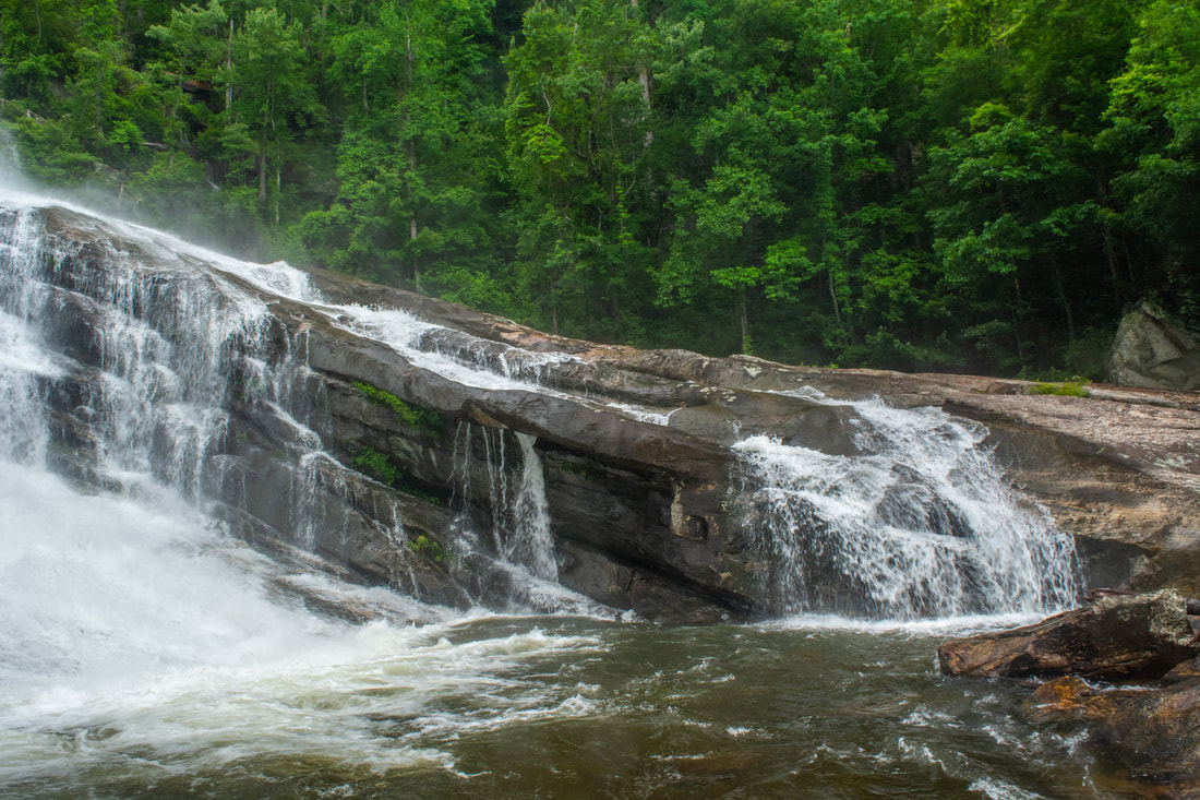
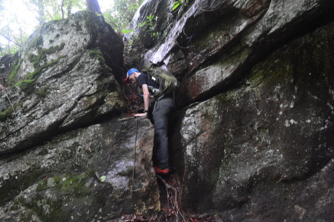
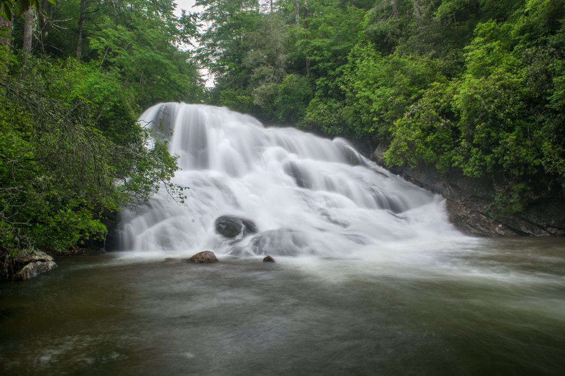
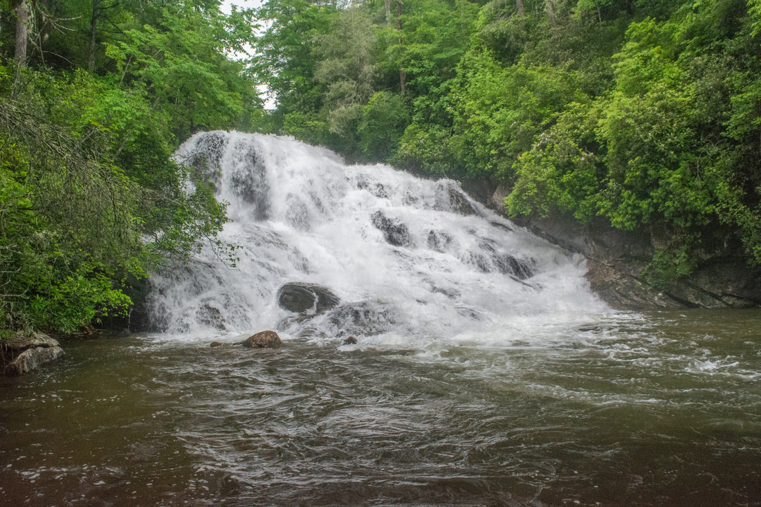
Once you're on the Big Falls path, you'll begin an incredibly steep 450-foot descent. The first part is just a regular steep, dirt path. Around 3.4 miles, the makeshift path reaches the edge of the gorge and becomes an even steeper drop down numerous small rock outcrops. Both the descent and returning ascent are not for the faint-hearted! You'll soon reach the toughest spot on the scramble: a 15-foot drop through a rock notch. You'll probably find a rope here. I didn't have to use it, but most people would probably feel more comfortable using it. The path then turns right and finally reaches the floor of the Thompson River gorge at 3.5 miles. Turn left and follow a rough scramble path 250 feet upstream to the base of Big Falls at 3.55 miles. The coordinates for Big Falls are N35° 02.671' W82° 58.923'. No words can adequately describe the amazing beauty and power of Big Falls. This incredible waterfall is at least 200 feet high! The water crashes down the enormous cliffs through several free-falling and cascading sections in a huge torrent. A unique aspect of Big Falls is how open the entire setting is. Massive cliffs and boulders like this, more common to Western waterfalls, aren't usually seen around waterfalls in the Southeast. In particular, the huge sloping rock on the other side of the river alongside Big Falls is an amazing element of the falls and adds a lot of beauty to it. In normal flow, you can cross the river at the base of the Big Falls pool and explore the sloping rock. The rock provides other unique perspectives of Big Falls. Overall, there's little doubt that the remote setting, sheer power and size, and great beauty of Big Falls make it among the top waterfalls in North Carolina. 
The amazing Big Falls on Thompson River is among North Carolina's top waterfalls.
0.1 mile above Big Falls and 0.2 miles below Rich Falls, at the coordinates N35° 02.815' W82° 58.948', is another very scenic waterfall called Standing Stone Falls. Unfortunately, it's even harder to reach than Big Falls or Rich Falls. To start with, it's not even safe to access Standing Stone Falls in high flow. That's why I didn't attempt it today. I plan to try it again on a future date, and when I do, I'll update this trail report with more detailed access information, but here's what I know so far. You can reach Standing Stone Falls by river-walking downstream from Rich Falls and then scrambling down rocks on the River Right (west) side, or you can reach it by climbing the huge sloping rock on the River Left (east) side of Big Falls, climbing through a couple cliffy areas, and crossing the river just above Big Falls. Both options are very difficult and must not be attempted by anyone but a very experienced waterfaller. Standing Stone Falls, a free-fall and long slide surrounded by huge boulders, should be worth seeing for those who can reach it though. Standing Stone Falls was initially known as Waterfall #3 on the lower section of the Thompson River.
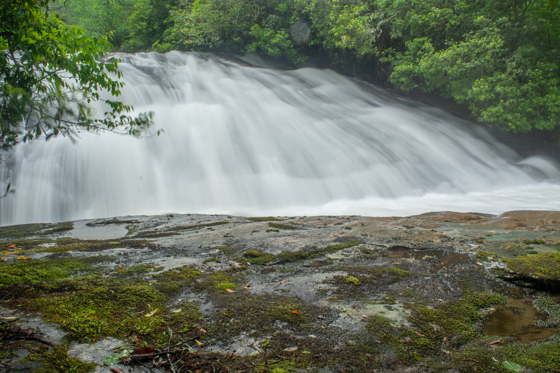
From Big Falls, begin retracing your steps to and along the main trail. Once you finish the hellacious climb out of the gorge, the rest of the return trip is easy to moderate with periods of gentle uphill. The only exception is the Rich Falls side trip, which is also very steep. You'll return to the Rich Falls side trail at 4.2 miles. Although this side path is only half as long as the Big Falls side path and descends only 200 feet, it's still fairly tough. A couple sections are really muddy and slippery. Reach Rich Falls at 4.3 miles. The coordinates for Rich Falls are N35° 02.978' W82° 59.028'. Even though Rich Falls is only 35 feet, it's an outstanding waterfall in normal flow. The river splits perfectly into numerous trickles that cascade and slide down the rock face into a tranquil pool. Rich Falls is considerably less scenic in high flow, because all of the fine details in the water trickles get washed out. Rich Falls was initially known as Waterfall #2 on the lower section of the Thompson River. It was named after Rich Stevenson, a renowned North Carolina waterfall explorer, as well as the creator of one of the state's most comprehensive waterfall websites. Return to the main trail and continue retracing your steps back to Brewer Road. You'll return to the ford at 6.05 miles and the High Falls junction at 6.3 miles. Assuming you've still got a little extra energy, be sure to turn left on the High Falls trail. This nearly-level path follows an old logging road that contours along the slope about 100 feet above the river. 0.45 miles from the main trail, at 6.75 miles, the well-defined trail to High Falls turns abruptly left (an overgrown logging road continues straight; do not follow it!). The path descends moderately down to the river. At the river, turn right and make the short final scramble to High Falls, reaching the falls at 6.9 miles. The coordinates for High Falls are N35° 04.208' W82° 59.654'. High Falls is an impressive 50-foot near-vertical sliding drop that ends with an enormous pool. Both the falls and the setting is kindof a miniature Big Falls, as this is another open waterfall with big cliffs around. Unfortunately, the only way to see High Falls well is to scramble down a small rock and stand in the river. After two hours of heavy storms, the water was murky and high. I couldn't tell how deep it was, so I decided not to risk scrambling down. Thus, I don't have any good photos from High Falls. I plan to return soon, and when I do, I'll add new photos to this report. 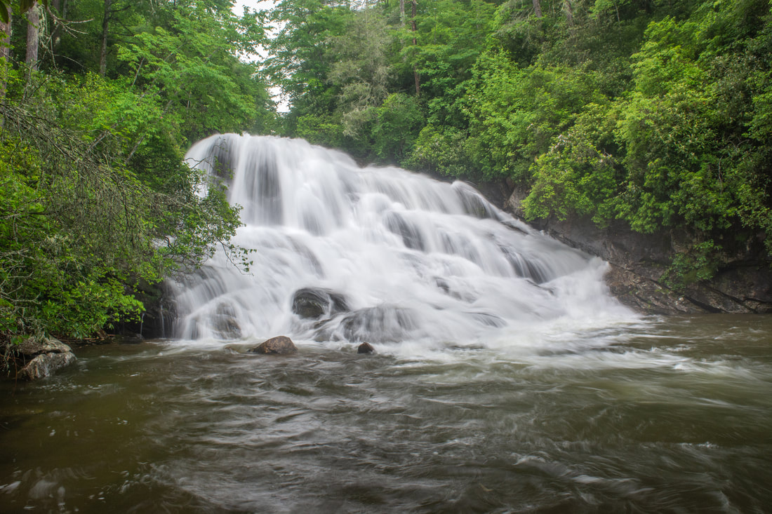
Rich Falls is a very scenic 35-foot waterfall on the Thompson River not far above Big Falls.
Retrace your steps to the main trail from Big Falls. Then, keep retracing your steps along the trail back to Brewer Road. If you've still got more energy, make sure to make the quick side trip to Reid Branch Falls. You'll return to the Brewer Road trailhead at 8.5 miles, concluding the hike. The Thompson River hike easily meets my criteria for a "Best Hike". The beauty of the waterfalls on the river is truly hard to beat anywhere in the Southeast. Plus, not only are these waterfalls gorgeous, but their remote nearly guarantees that you'll have them to yourself (except possibly High Falls). I highly recommend that all experienced hikers do the Thompson River hike at least once. You won't regret it!
Mileage
0.0 - Brewer Road Trailhead
1.2 - Thompson River Ford 1.7 - Simon Falls 3.55 - Big Falls 4.3 - Rich Falls 6.9 - High Falls 8.5 - Brewer Road Trailhead Variations
Hike out and back to High Falls - 3.0 Miles
Hike out and back to High Falls and Simon Falls - 4.5 Miles Hike out and back to Simon Falls and Rich Falls - 6.1 Miles Hike out and back to High Falls, Simon Falls, and Rich Falls - 7.2 Miles Hike out and back to Simon Falls, Rich Falls, and Big Falls - 7.3 Miles Bonus Stops
There's one more scenic, publicly-accessible waterfall on the Thompson River: a 15-foot cascade called Whiteowl Falls. Once you find the obscure path, it's quite easy to reach Whiteowl Falls. It's accessed only a couple hundred feet down NC 281 from Brewer Road - so close that you don't even have to move your car! The coordinates for Whiteowl Falls are N35° 04.590' W82° 59.827'.
Pictures & Videos
0 Comments
Leave a Reply. |
About MeMark Oleg Ozboyd Dear readers: I have invested a tremendous amount of time and effort in this website and the Georgia Waterfalls Database the past five years. All of the work that has gone in keeping these websites updated with my latest trip reports has almost been like a full-time job. This has not allowed me to pick up a paid job to save up money for college, and therefore, I I've had to take out loans. If you find the information on this website interesting, helpful, or time-saving, you can say "thanks" and help me out by clicking the button above and making a contribution. I will be very grateful for any amount of support you give, as all of it will apply toward my college tuition. Thank you!

Coming in 2022-2023?
Other Hiking WebsitesMiles HikedYear 1: 540.0 Miles
Year 2: 552.3 Miles Year 3: 518.4 Miles Year 4: 482.4 Miles Year 5: 259.9 Miles Archives
March 2021
Categories
All
|
||


 RSS Feed