
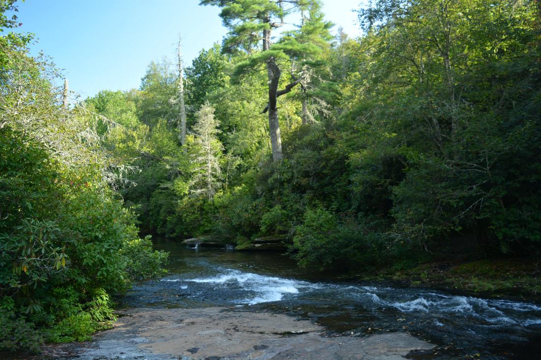
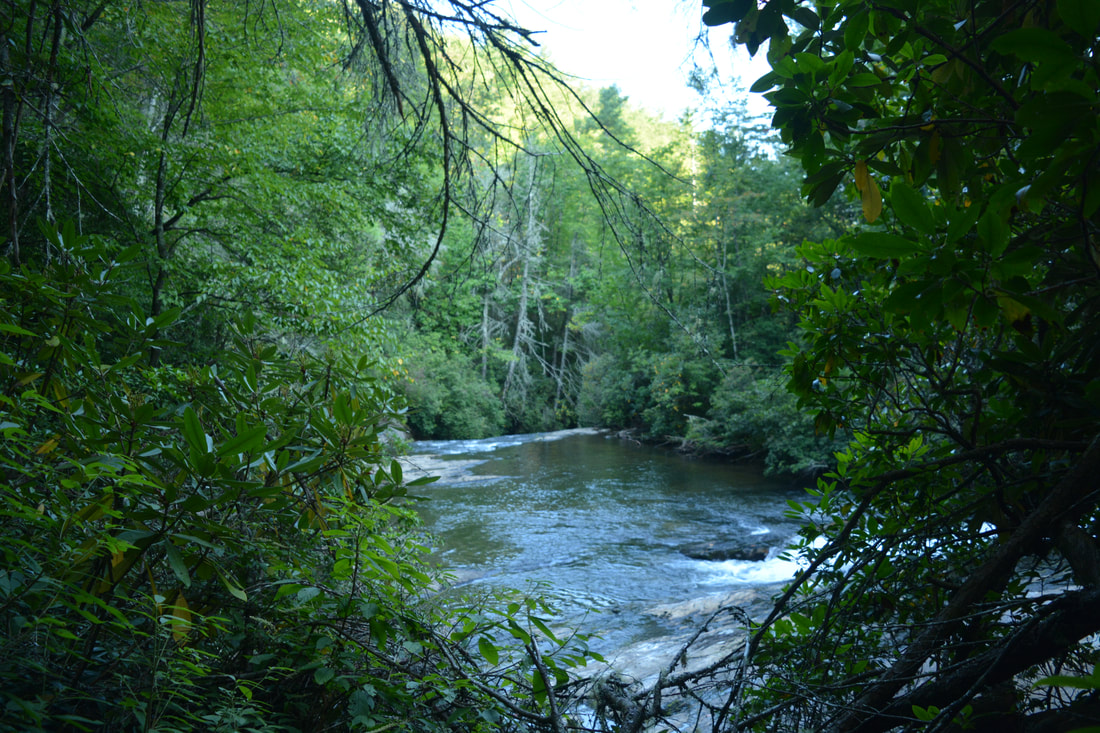
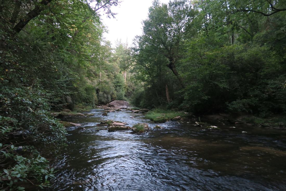
The Whitewater River is one of the most spectacular rivers in the Southeastern US. In its 15-mile length, the river plummets over two of the region's tallest and most breathtaking waterfalls, through a rare narrow slot canyon, and over nearly a dozen smaller waterfalls. Most folks familiar with the Whitewater River only know about Upper & Lower Whitewater Falls. This report focuses on the area immediately upstream, known as the Upper Whitewater River area, which is one of the most rugged, pristine, and gorgeous stretches of river that I've hiked. The Upper Whitewater Slot Canyon is a particularly unique location, where the mighty Whitewater River squeezes into a narrow canyon about 300 feet long and only a feet wide, lined by sheer cliffs rising dozens of feet. The river even crashes over two significant waterfalls - Sculpted Falls & Little Canyon Falls - in the canyon, as well as two others - Entrance Falls and Exit Falls - at both ends of it. While the waterfalls around the canyon are this hike's biggest highlight, many other photogenic waterfalls such as 55 MPH Falls lie between the canyon and Route 281, and the scenic Hornet Falls on Democrat Creek, a Whitewater River tributary, is a great bonus too. Seeing all of the waterfalls along the Upper Whitewater River requires a cross-country trek about as challenging as any in the North Carolina mountains, although access to a few selected waterfalls by themselves is easier. This hike occurred on Saturday, September 9th, 2017. Placing one car at NC 281 and another on Heady Mountain Road, my plan was to follow the easiest route downstream along the Whitewater River between the two parking areas, making sure to visit all waterfalls on the river as well as Hornet Falls on Democrat Creek.
Summary
R/T Length of Trail: 5.1 Miles (much of which is off-trail)
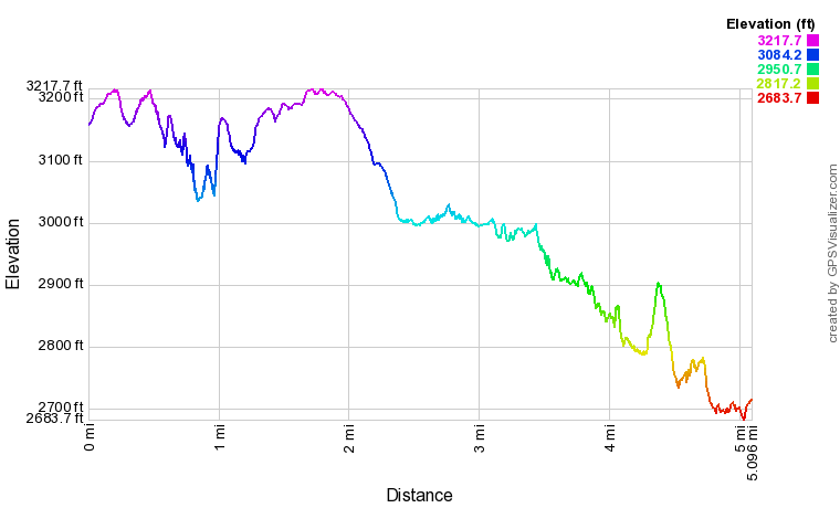
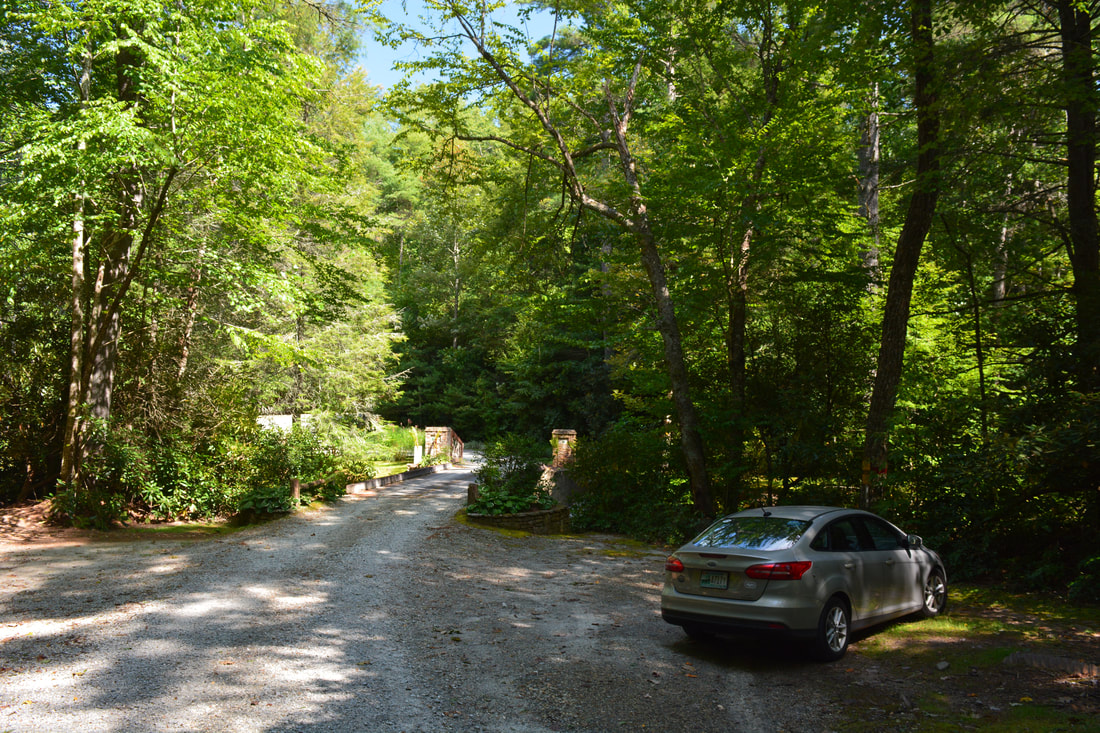
Duration of Hike: 9:00 Type of Hike: Point-to-Point Difficulty Rating: 10 out of 10 (due to rugged terrain) Total Elevation Gain: 904 Feet Pros: Incredibly beautiful remote scenery all throughout the hike Cons: The hike includes fairly challenging creek-walk sections and parts without paths, and even the sections of the hike with paths are often quite rugged, confusing, and slow Points of Interest: Exit Falls - 9 stars; Entrance Falls - 7 stars; Sculpted Falls - 10 stars; Bedrock Falls - 4 stars; Hornet Falls - 6 stars; Merge Lane Falls - 4 stars; 55 MPH Falls - 8 stars; Big Ledge Falls - 3 stars; Wheelchair Accessible Falls - 2 stars; Portage Left Falls - 6 stars; Exit Falls Cave; Upper Whitewater Slot Canyon at the Top of Exit Falls: Old School Bus along Exit Falls Bypass Trail Trail Blaze Colors: Most of this hike is unblazed due to the primitive nature of the unofficial trails, but the trail between Entrance Falls and Bedrock Falls (the bypass around Exit Falls) is blazed by orange circles Best Seasons to Hike: Summer Fees: None Beginning Point: Whitewater River Bridge on Heady Mountain Road Directions from Cashiers, NC to Highway 281 Parking: Follow NC 107 South for 9.4 miles, entering South Carolina along the way. Then, turn left onto Wigington Road and continue for 2.2 miles, before turning left onto SC 130. Follow SC 130 for exactly 2.0 miles, re-entering North Carolina as the road changes to NC 281. Once you reach the bridge across the Whitewater River, cross it and then park in the pullout on the left side of the highway (north side of the river). Directions from Highway 281 Parking to Heady Mountain Road Parking: Return the same way along NC 281/SC 130 and Wigington Road. At NC 107, turn right and continue for 3.5 miles. Then, turn sharply right on Heady Mountain Road. Follow the road for about 1 mile to a bridge across the Whitewater River. The road turns private across the river - park in either one of the large pullout areas just before the bridge. Map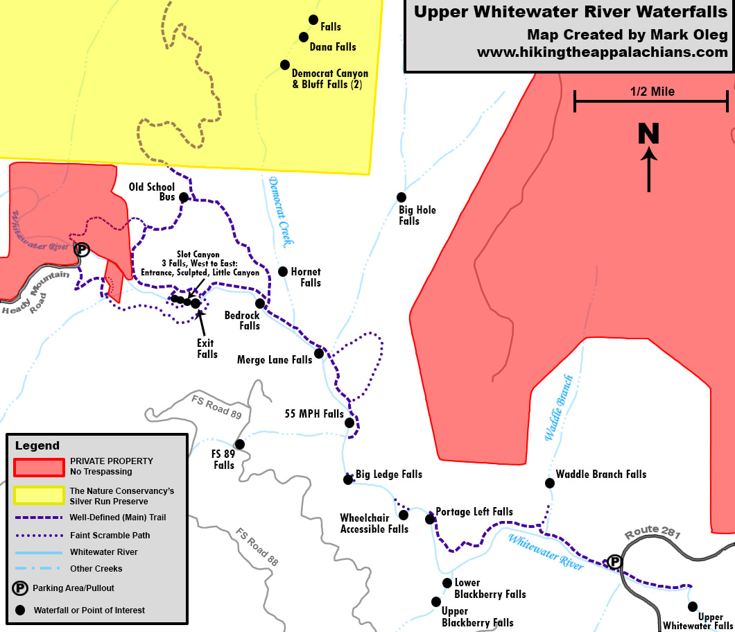
Click the link below to download a .GPX file with a track of this hike.
Details
The waterfalls of the Upper Whitewater River had been on my list for a long time, ever since I first read about them in Kevin Adams's new third edition of North Carolina Waterfalls. The whole stretch of river sounded absolutely fantastic! For some time, the hike had been on the back burner due to a long list of waterfalls in Georgia that I was working through, and in addition, I wanted to hike the Upper Whitewater River in the form of a shuttle hike - as that would guarantee that I would have to see all waterfalls - and it took some time to finalize the shuttling plan. Finally, the hike was all set for a beautiful mid-September Saturday, and I sure wasn't disappointed! Some parts of the cross-country trek were quite challenging, but they mostly just added to the fun, and seeing ten waterfalls in only about five miles of hiking was a big treat. Remember to save this hike for a time when there are low water levels, as many parts of the hike will be very difficult and unsafe during high water.
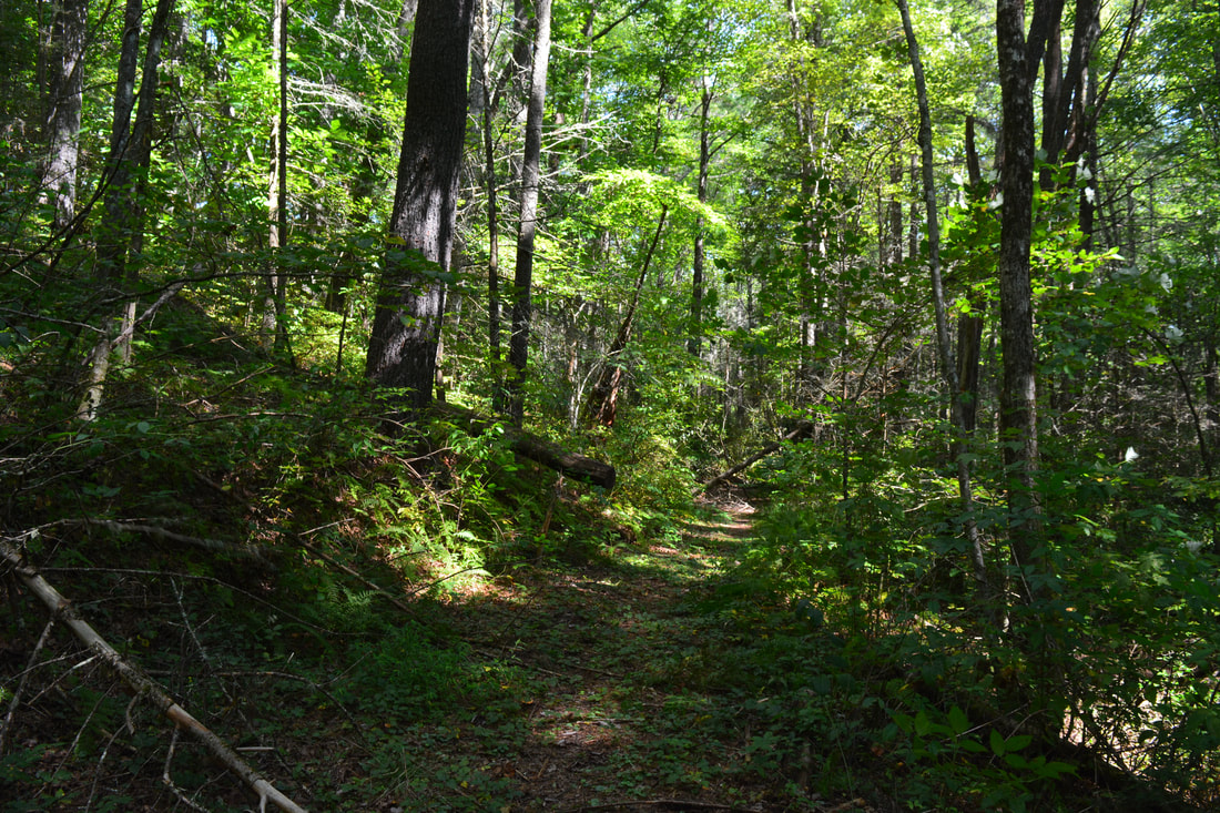
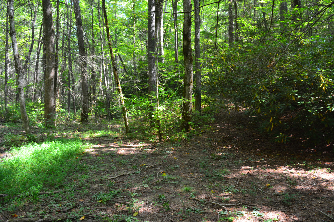
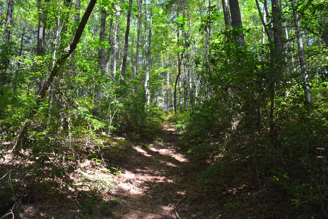
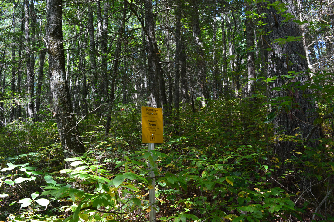
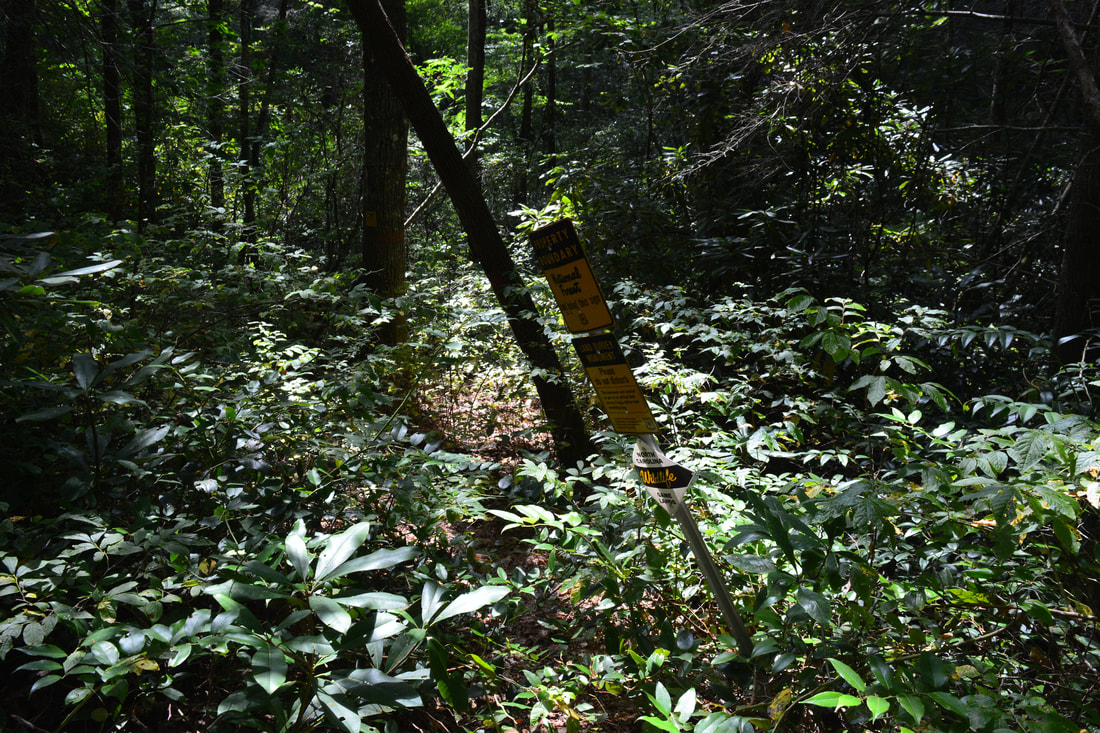
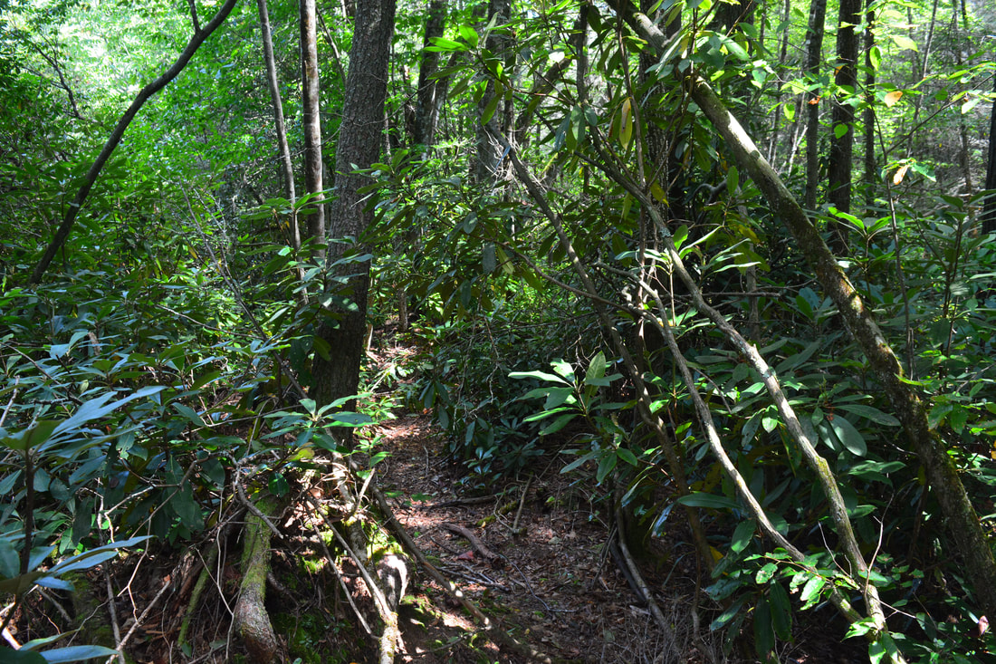
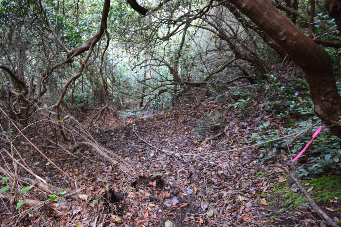
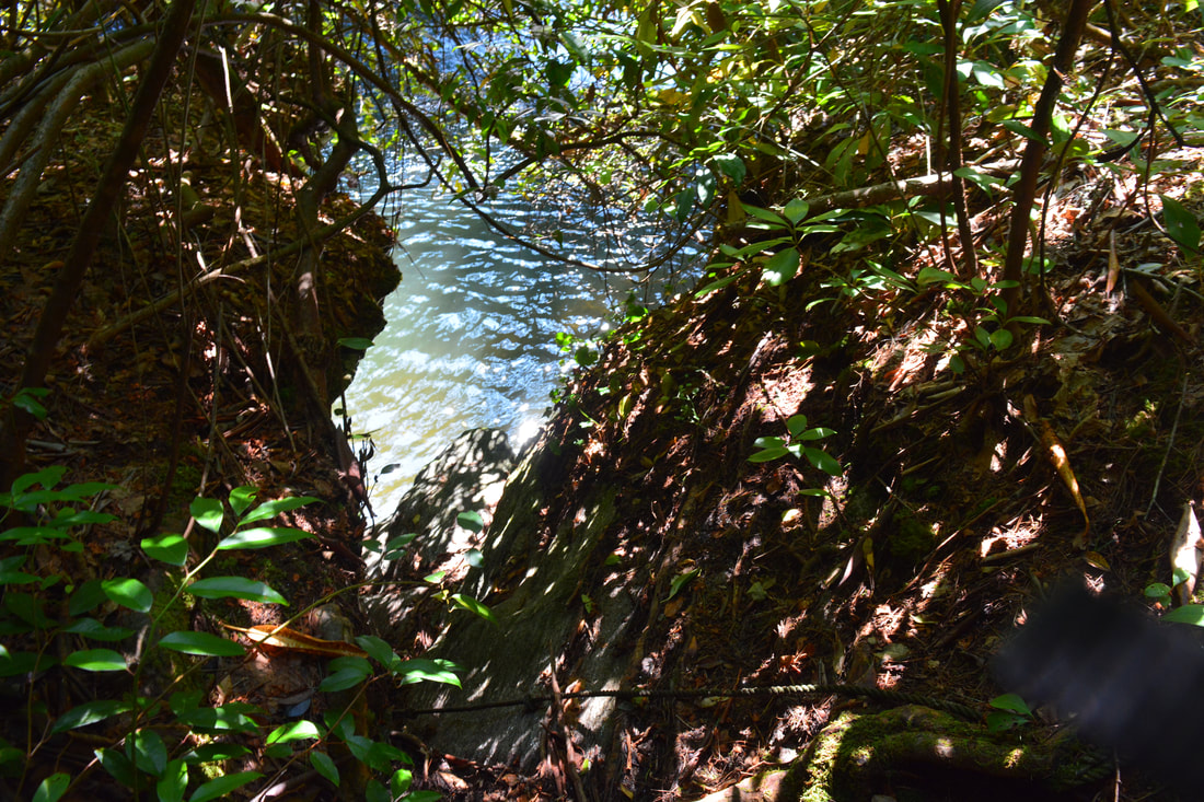
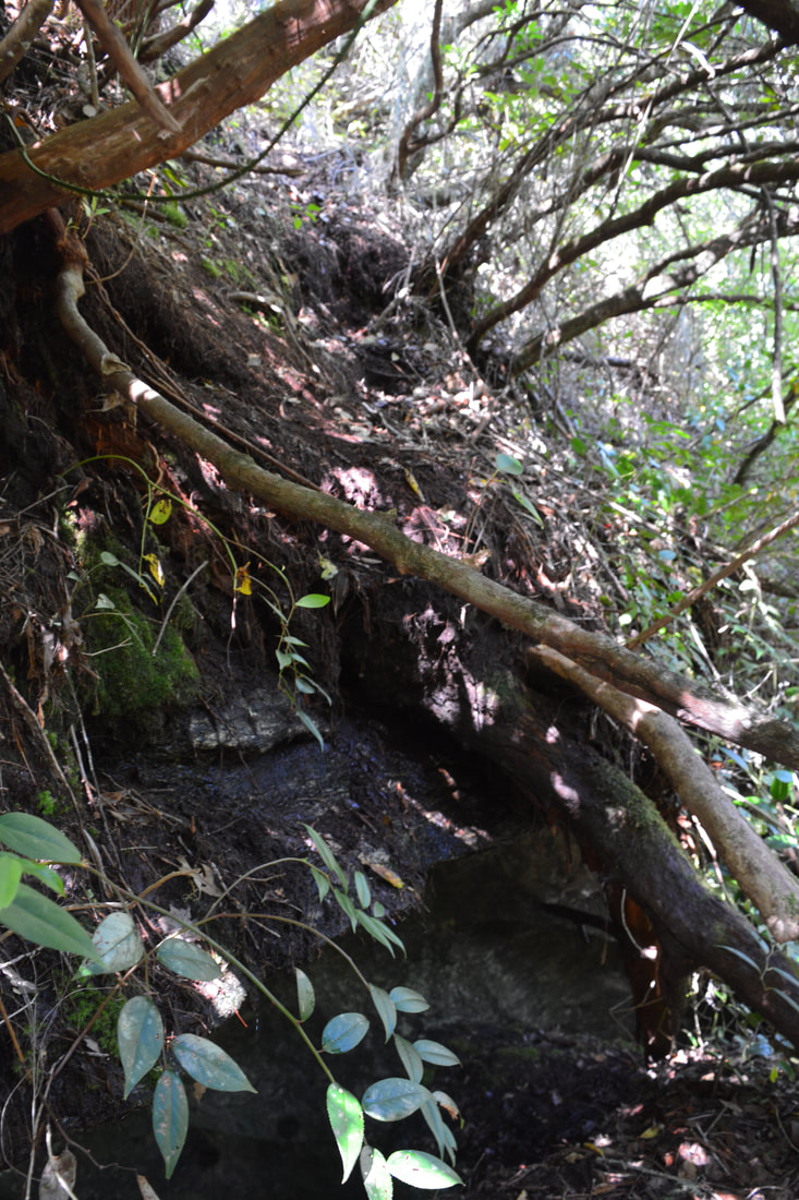
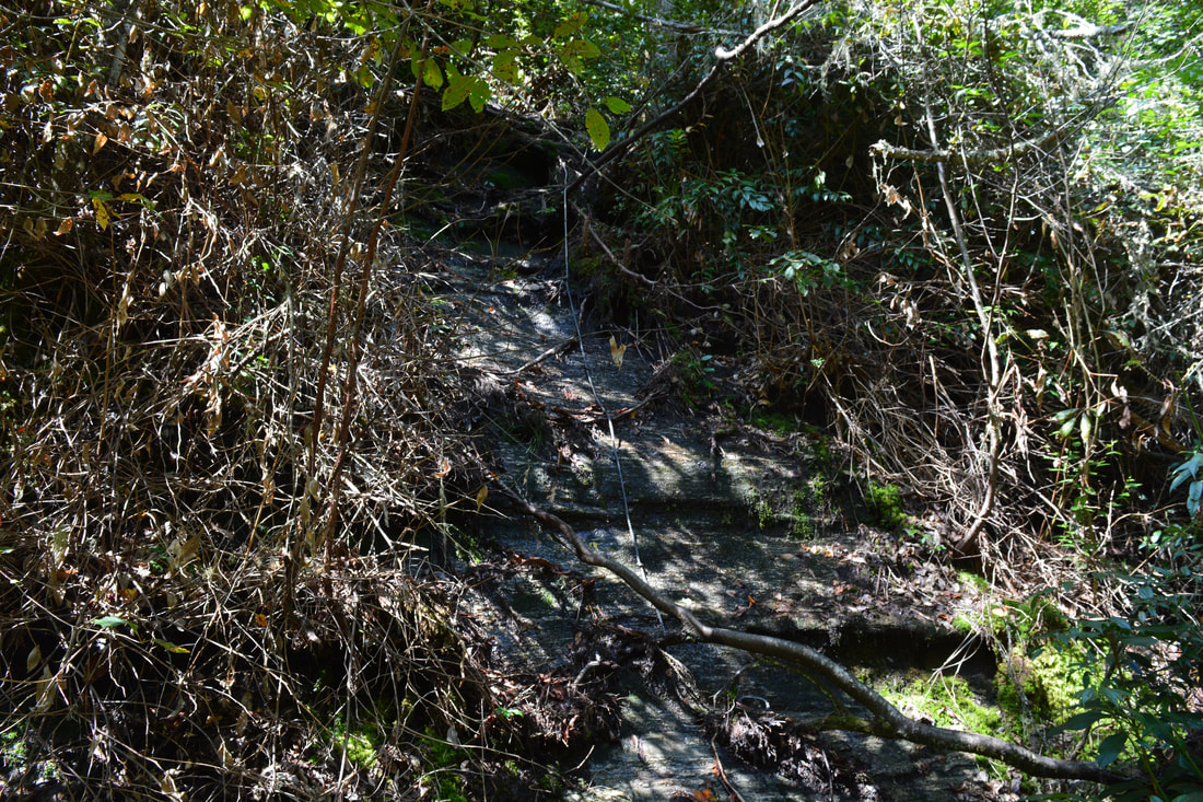
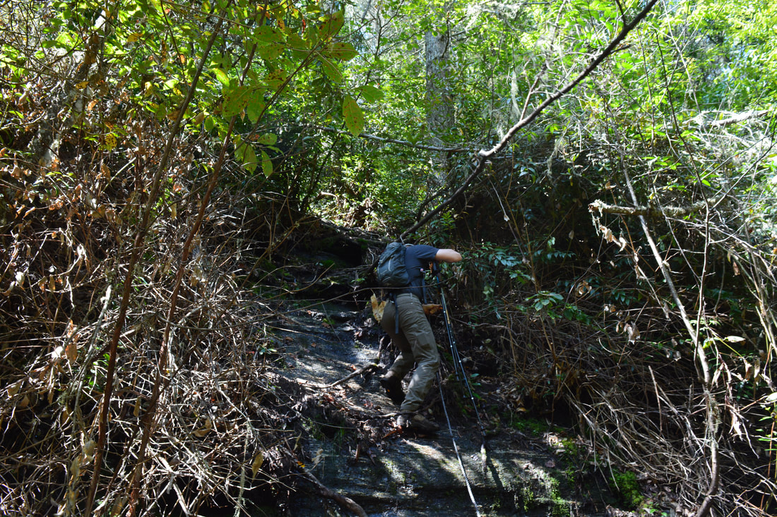
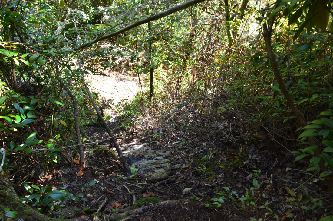
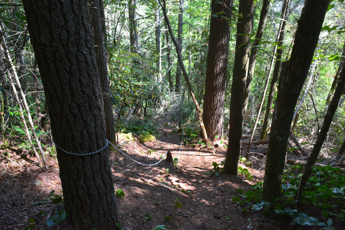
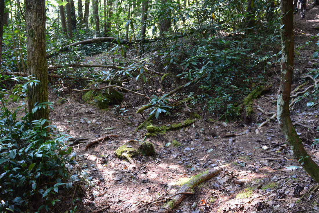
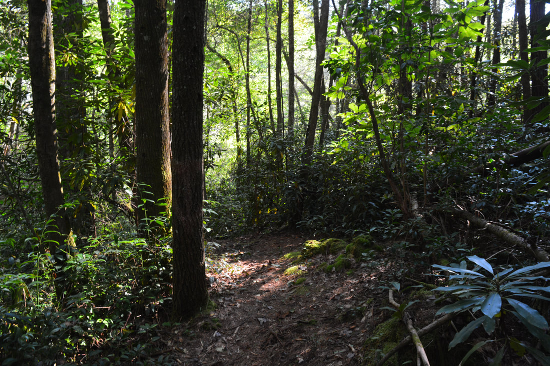
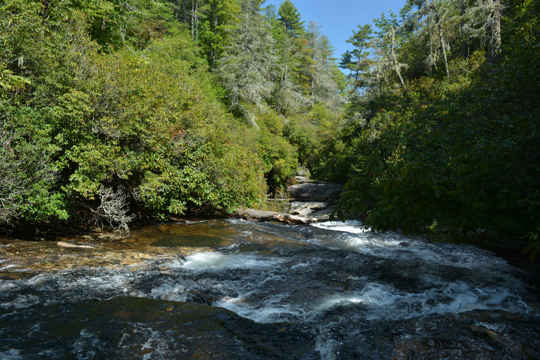
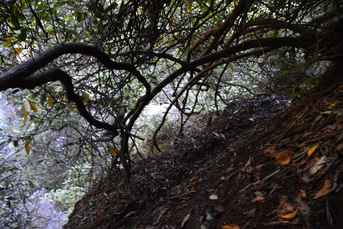
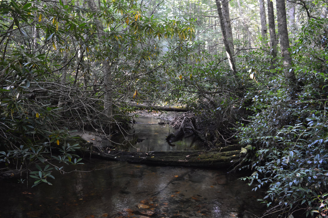
There are two ways to get to the Upper Whitewater Slot Canyon from Heady Mountain Road. The easier way passes through private property in the Heady Mountain community on the north side of the Whitewater River above the canyon, and while this approach is commonly-used, I cannot describe it out of courtesy to the property owners and thus will not describe it here. The following is a description of the second approach, which is entirely on USFS land on the south side of the river, but it is traveled infrequently and can therefore be pretty confusing. Begin the hike by walking back southward along Heady Mountain Road (in the direction you drove in from). In about 400 feet, the road curve to the right while a broad forest road leaves left from the curve. This is the trail you need to take; for confirmation, look for an electrical box on the right side of the road across from the trail. Another 400 feet from Heady Mountain Road (at approximately 0.15 miles from the parking), the forest road passes through a small open area. At the end of the open area, turn sharply left onto another broad forest road (the start of which is slightly obscured by rhododendron). Follow this new forest road for 400 feet again. Then, at a yellow property boundary marker, there is a split where the road bears left. Stay right on a narrower path that crests a low ridge and then descends along the property boundary. The path reaches a T-intersection with yet another forest road in 100 yards. Turn left, and in about a couple dozen feet, reach another property boundary sign on the right. A faint overgrown path turns right at the sign and heads into thick woods - this is the path that you must take to Exit Falls (do not continue straight on the road as it enters private property). The path shortly appears to end just before a small creek - push straight through the undergrowth, wade the unnamed stream, and you should see a continuation of the path. You have hiked 0.3 miles up to this point. For the next 0.15 miles, the path is very confusing as it crosses several other rivulets and passes numerous blowdowns. Sometimes it's obvious, but more often it's not. Generally, the path travels in a southeast and then east direction. At about 0.45 miles, I completely lost the trail in a small clearing with blowdowns. While I thought the path turned right, it appears that it had actually turned left and then headed downhill. I ended up bushwhacking just above the path before running into it again just southwest of Entrance Falls, with the river and falls clearly audible below. The rest of the path is a little more distinct. It crosses a small hollow, contours directly above the Upper Whitewater Slot Canyon, and reaches a distinct old road at 0.6 miles. Turn left, continue for several dozen feet, and then turn right down a path where the road is blocked by vegetation. The path drops in and out of a couple more hollows and then reaches a turn where the path suddenly begins dropping very steeply down to the river at 0.8 miles. At the time of my hike, flagging tape marked the turn and a rope assisted with the descent. Along the descent, there are views of Exit Falls through the trees. The path bears left at a mossy log near the bottom and arrives at Exit Falls at 0.85 miles. 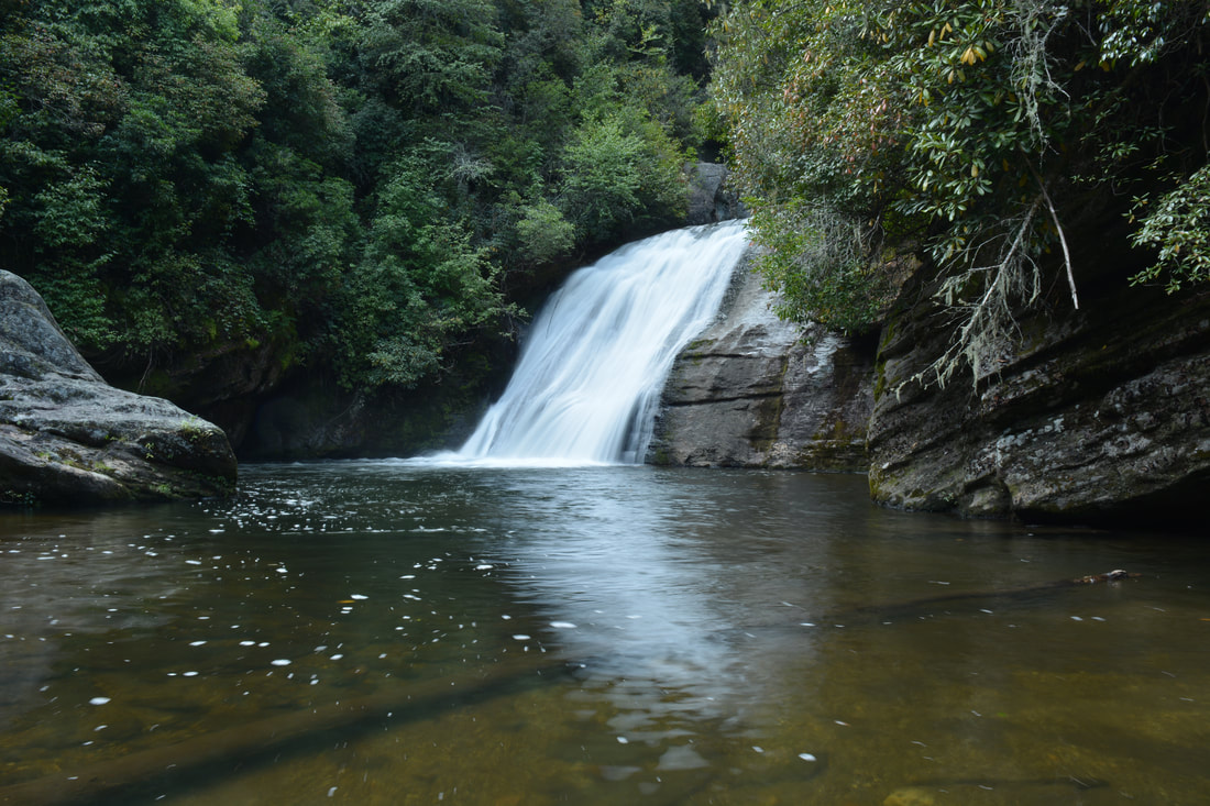
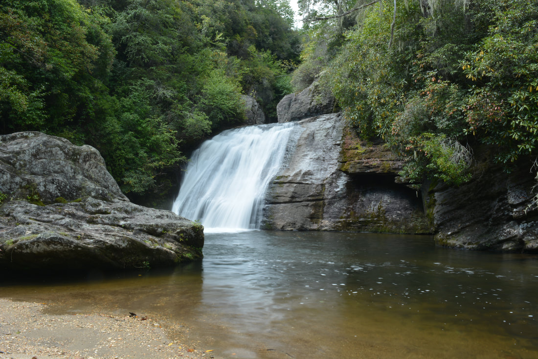
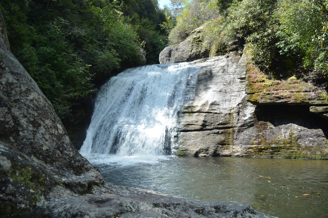
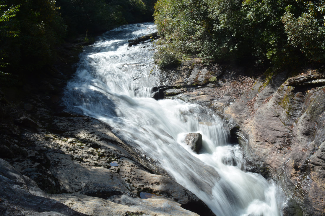
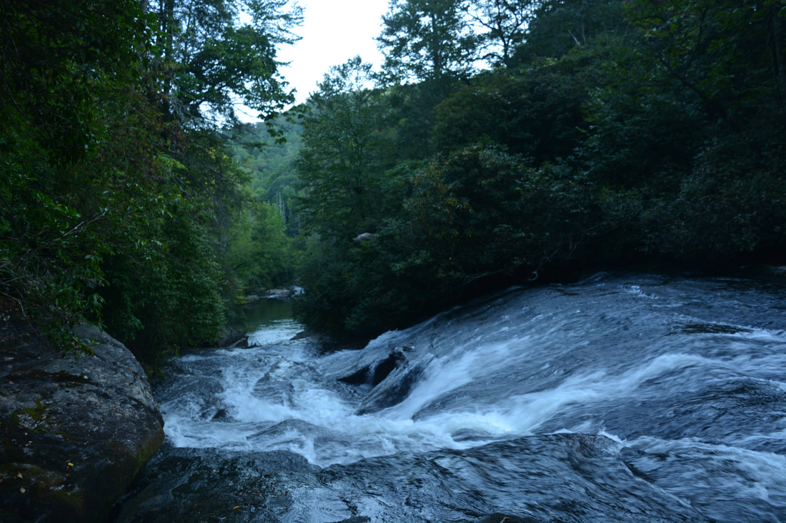
Exit Falls is a nearly vertical sliding waterfall about 25 feet high. Its picturesque setting with the cliff-framed pool and broad sandy beach makes it one of the scenic small-size waterfalls I've been to in Southwest North Carolina.
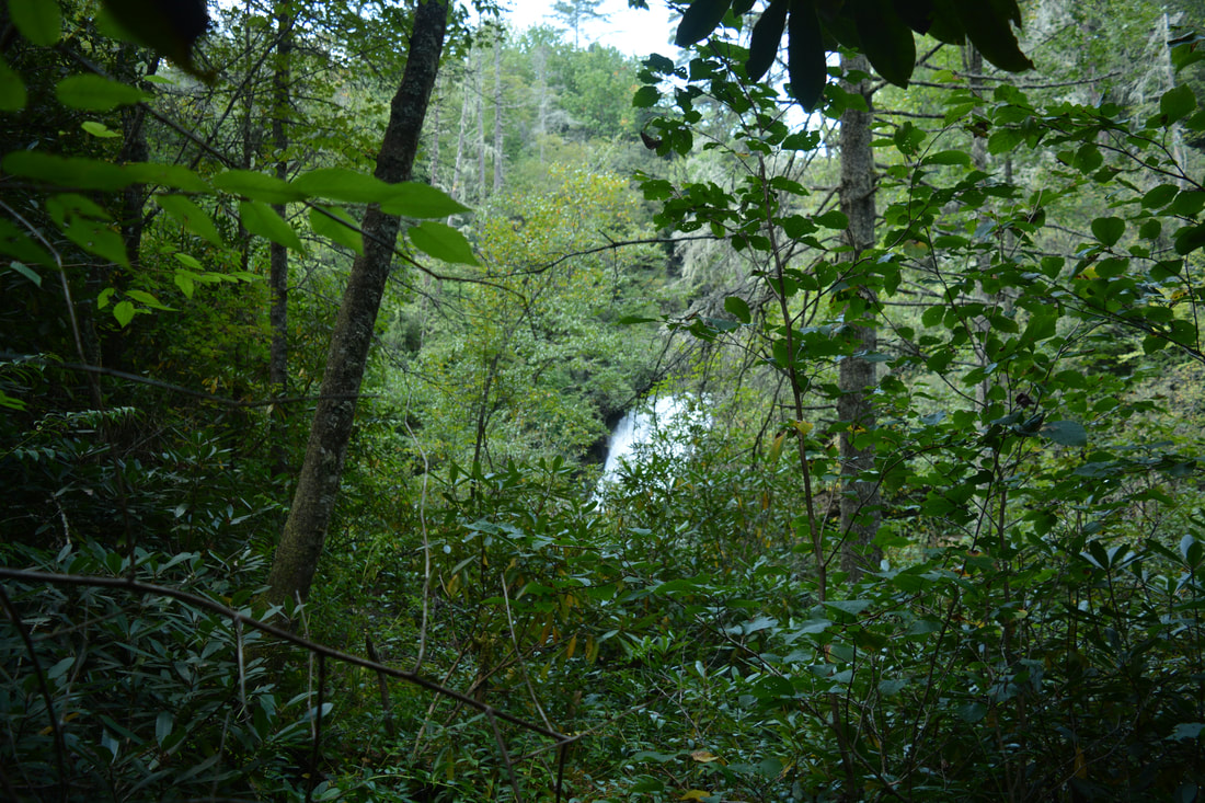
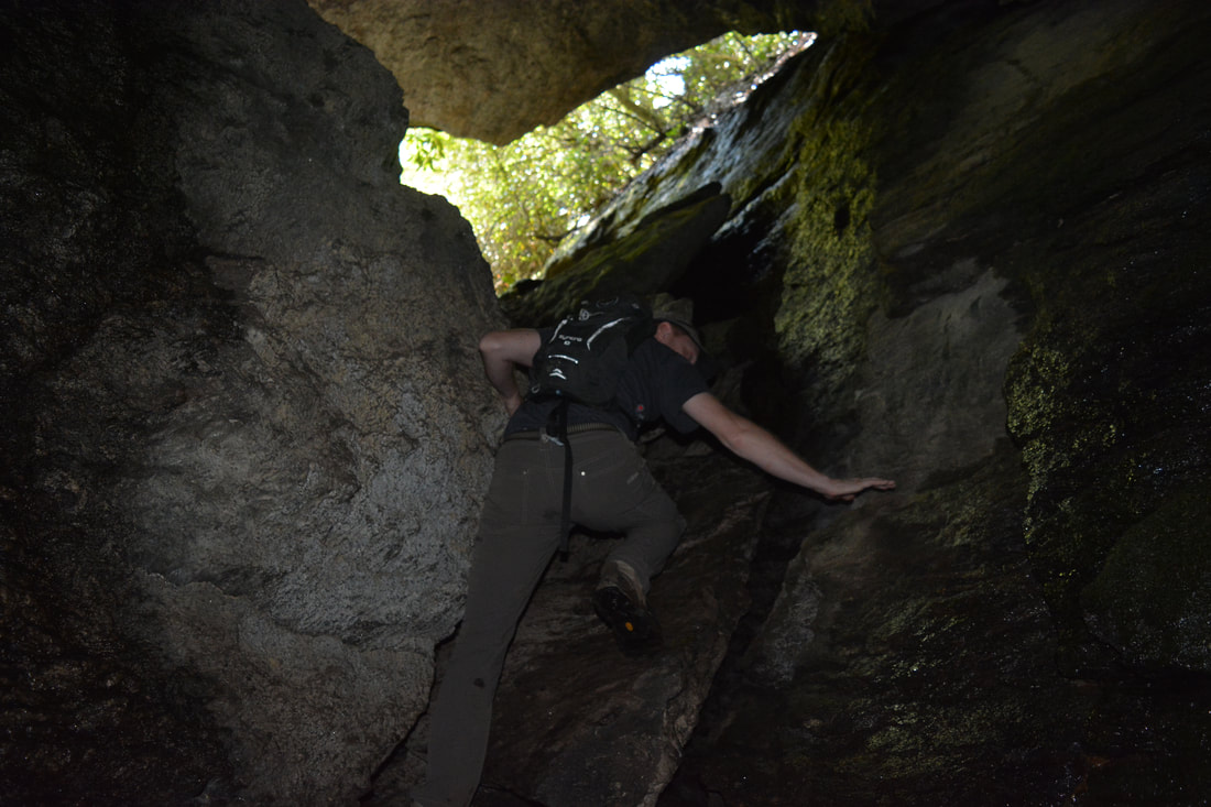
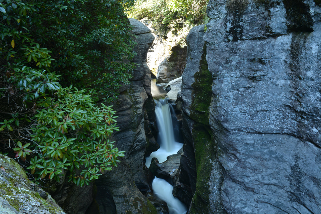
Exit Falls is such a gorgeous waterfall! The name comes from the fact that the Whitewater River comes over the falls upon exiting the slot canyon. At Exit Falls, the river slides 25 feet steeply down a sheer cliff and into a picturesque pool lined by cliffs and rock outcrops. A broad sandy beach lies just below the pool and provides great views of the falls. For photographers, Exit Falls is about as good as it gets in terms of variety of vantage points, as there are many different angles you can photograph the falls from. In my opinion, Exit Falls is the second-best waterfall on the Upper Whitewater River (after Sculpted Falls). Before you head on to Sculpted Falls, I highly recommend making the side trip through Exit Falls Cave to the top of Exit Falls, where there is a spectacular view of the Upper Whitewater Slot Canyon, although you have to be comfortable with the scrambling involved.
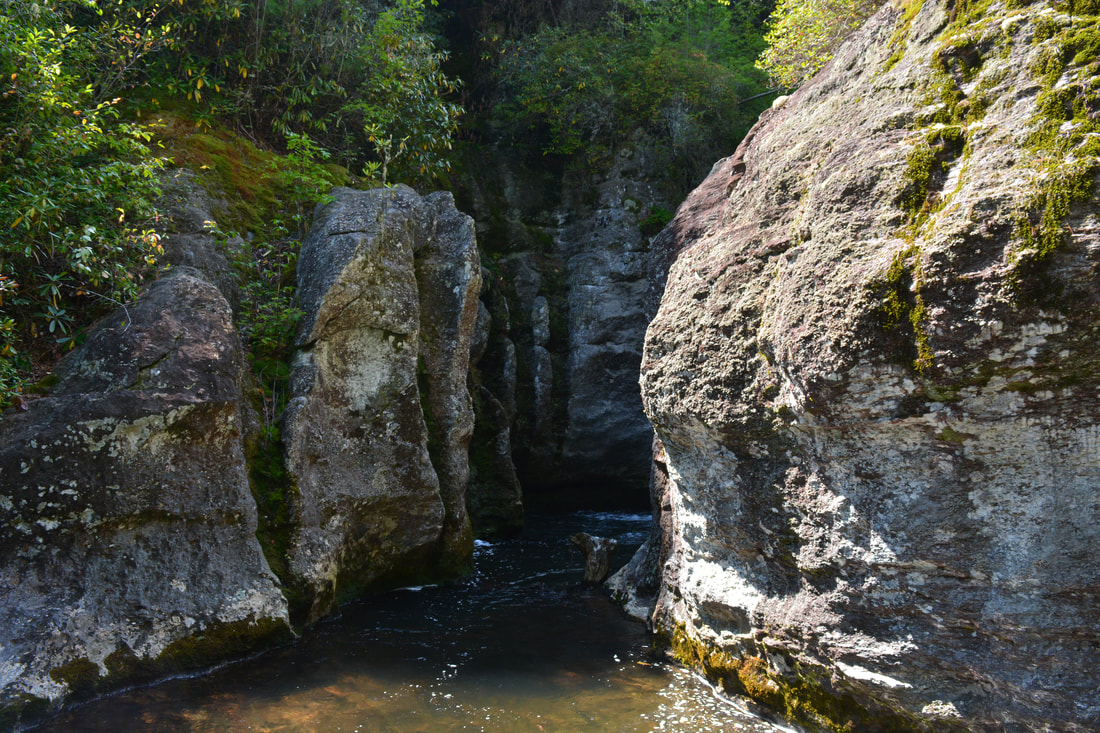
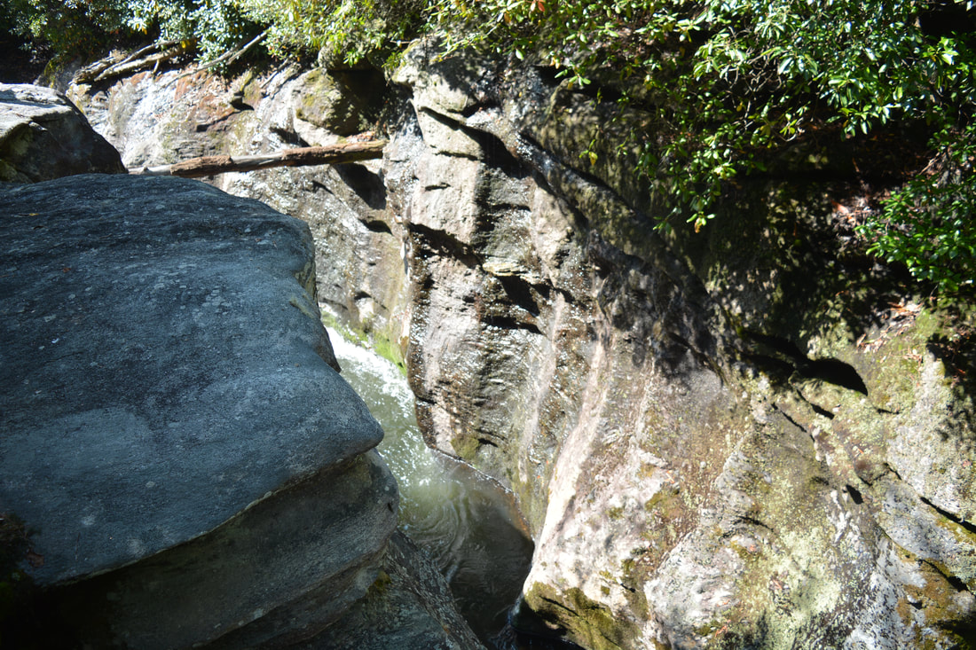
To reach the top of Exit Falls, wade across the Whitewater River just below the pool and falls (about knee-deep). On the north side of the river, a path heads downstream - that's the way to Sculpted Falls and Bedrock Falls. For now, look straight: there is a narrow crack in the cliffs. Walk into the cave through the crack, and then turn left and scramble up the cliff. While the cliff looks shear at first, there are enough handholds and footholds to make the scramble moderate and fairly safe. Once you reach the top of the cave, things get a bit confusing. The path straight ahead is a dead-end - do not go there. A route bears diagonally left into a crevice where there is an interesting side view of Exit Falls, but I do not suggest going down there as the scramble is risky and not worth it (although a rope was there at the time of my hike). To reach the top of Exit Falls, turn sharply left and follow the path to a spot where you have to scramble up to the top of the rock that forms the ceiling of the cave. For folks who are accustomed to scrambling in steep terrain, this won't be hard. At the top of the steep stretch, stay left as another faint path leaves to the right. The path then contours along the extremely steep slope above Exit Falls before coming to the final rock scramble down to the top of Exit Falls. As far as scrambles go, this one isn't too difficult, but it's rather dangerous as one misstep will send you 25+ feet down Exit Falls. It is best to descend through the small crack in the rocks on the right. Reach the top of Exit Falls at 0.9 miles at the bottom of the final rock scramble. This is a very neat spot - just upstream, the Whitewater River is only a few feet wide and very deep as it exits the slot canyon, lined by tall sheer cliffs on both sides. Little Canyon Falls - the only waterfall on the Upper Whitewater River that I do not suggest seeing due to the risk involved - is just upstream around the bend, but you can only see the very end of its run-out in the pool. From the cliff-top perch across the river, there is a frontal view of Little Canyon Falls, but getting to that spot would require fording the river at the very brink of Exit Falls and then scrambling up the steep rocks on the other side. In high water, this is simply impossible, but even in low water levels, the crossing can be disastrous - because you're a couple feet at most from the brink of Exit Falls - so I suggest that you content yourself with the view of the canyon and return to the bottom of the falls. The view down the falls from the top is cool as well, as you can see the pool and beach where you were moments before. 
The view of the Upper Whitewater Slot Canyon from the top of Exit Falls is spectacular.
Return back down through the cave and to the riverside path. Turn left and follow the path downstream. In just a few yards, you will come to a steep stairstep rock face on the left. Believe it or not, the shortest way to Sculpted Falls is up this rock face! At the time of my hike, a sturdy new rope was equipped to help with the scramble up the rock. In my opinion, this is the most difficult spot on the hike, and you're most likely to make it up if you have a lot of experience in scrambling. Note that if you are not comfortable with the rock scramble, there is a longer bypass trail that still accesses Sculpted Falls. To reach the bypass trail, continue straight for 0.4 miles to a T-intersection with the bypass just above Bedrock Falls. Once at the intersection, you would turn left to hike toward Sculpted Falls. I actually used the bypass trail on my way back from Sculpted Falls, so it is shown in the map above and it will be described "backwards" in more detail farther below. If you're not using the bypass, turn left and scramble up the insanely steep rock face. The rope is very useful here! The steep scramble out of the gorge continues past the rock, but it is a little easier, and even though ropes are in place all the way to the top, they are no longer necessary. At 1.0 miles, reach the top of the extremely steep climb about 200 feet after leaving the river trail. The broad trail turns left and mercifully becomes level as it contours along the slope above the slot canyon.
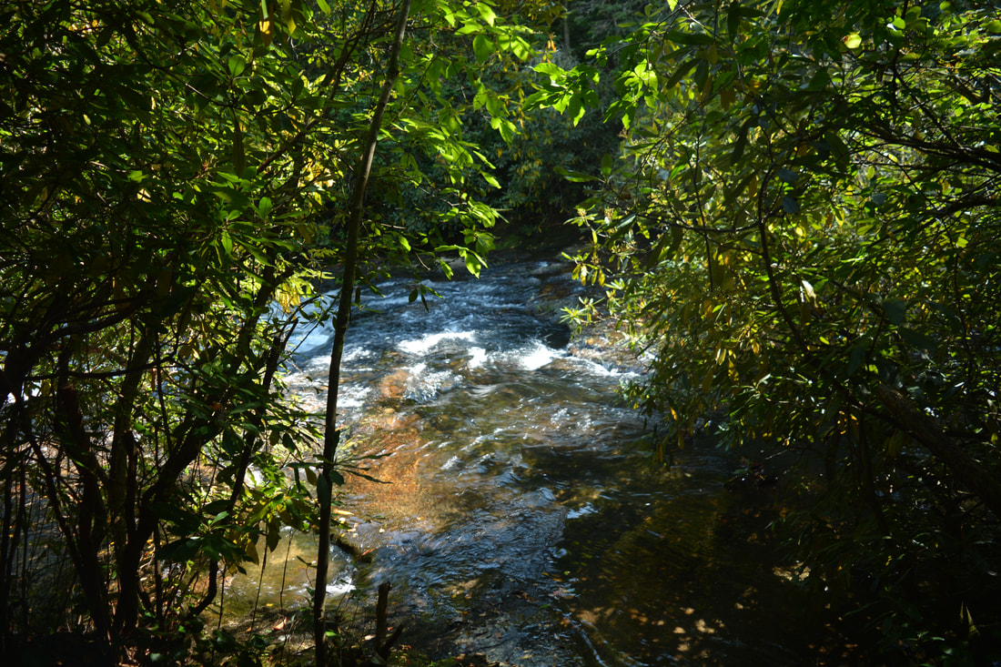
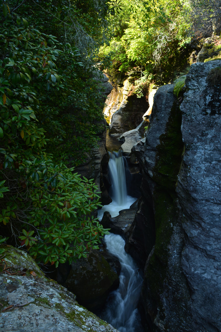
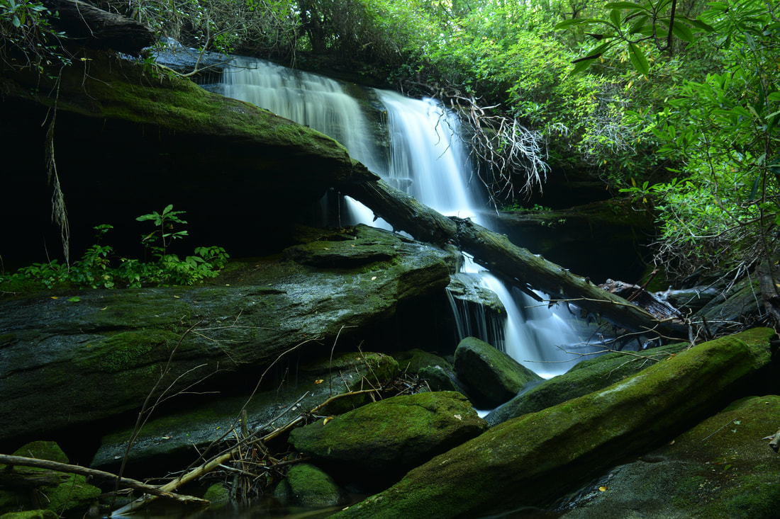
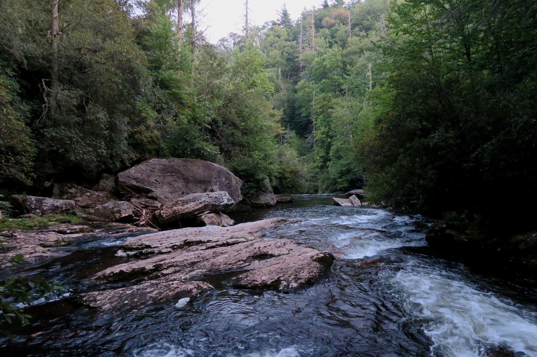
Reach an obvious split in the trail at 1.05 miles. The trail to the old school bus and Bedrock Falls bears right, while the spur trail to Entrance Falls and Sculpted Falls turns left. If you've made it this far, Sculpted Falls is must-see! Thus, turn left onto the spur trail and follow it down to the Whitewater River. At 1.1 miles, the trail comes to a ford of the river just above Entrance Falls. Getting to the Sculpted Falls view is dangerous during high water thanks to this crossing, which easily becomes unsafe at high flow. During normal flow, cross the river just to the right of the point where the trail reaches it. The crossing is a shallow wade, but there are some slippery rock slabs underfoot. Just upstream from the crossing is a 15-foot cascade squeezed into a notch. It would be very scenic if not all of the deadfall. The cascade has sometimes been referred to as "Garbage Falls" by kayakers and "Nasty Falls" by hikers but neither name is official. On the other (south) side of the river, walk downstream on a series of rock slabs along the bank, crossing a pair of fallen trees in the beginning. The rock slabs are slippery in places, so be very slow and careful. About 100 feet from the crossing, reach the entrance to the Upper Whitewater Slot Canyon. Stay away from the edge of the rocks! To the right is an overgrown rock outcrop. Up the rock outcrop is the way to Sculpted Falls. For now, stay straight and scramble to the top of the open cliff at the edge of the canyon. From here, there is a great view of the long cascading drop into the canyon on the river - this is Entrance Falls. Entrance Falls isn't a sheer drop like Exit Falls, as it loses only about 30 vertical feet in a fairly long horizontal distance, but this doesn't make the gradual sliding cascade any less scenic. Under the right conditions, Entrance Falls is very photogenic. You can also continue along the cliff for a few yards farther to its end, where there is a spectacular and surreal view of the Upper Whitewater Slot Canyon's narrowest and wildest part downstream. Always remain vigilant and absolutely never approach the edge of the cliff. If you fall into the canyon, you're likely to die. The route to Sculpted Falls is quite obscure at the beginning. To reach the Sculpted Falls view, scramble up the overgrown rock outcrop mentioned earlier. There are some rhododendron branches in the way. At the top, stay left. In a few feet, you'll see what looks like a fork. Straight is a dead-end; stay left (downhill) again, following a crude path. Next, there is a spot where the path comes dangerously close to the edge of the canyon. At the same spot, you have to carefully get across several branches - make sure to stay as far as possible from the edge! In a few more feet, the path ends at the clifftop view of Sculpted Falls at about 1.2 miles. The sloping rock outcrop is very small, and there is room for only two to maybe three people at one time on it. As usual, exercise extreme caution. But what a view it is! To the left, just upstream, is Sculpted Falls: a 15-foot free-fall on the Whitewater River smack in the middle of the canyon. At Sculpted Falls, the mighty river gets squeezed into a very narrow and extremely powerful waterfall that ends with a wildly-churning small pool. Cliffs dozens of feet high hem in the waterfall on both sides and continue along the river as part of the canyon. Words and pictures cannot accurately describe the unique beauty of this location - no other similar spot is known in North Carolina or elsewhere in the Southeast. 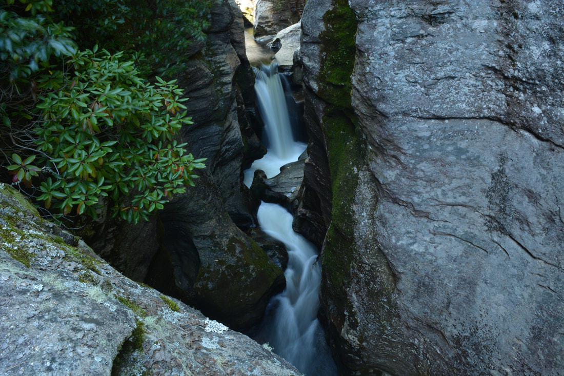
Sculpted Falls is arguably the most scenic waterfall on the Upper Whitewater River, located in the middle of the Upper Whitewater Slot Canyon.
The view of Sculpted Falls described here is known as the River Right Perch, because it is on the south side of the river - the right side looking downstream. River Right and River Left are terms used by kayakers, who also travel rivers downstream. There is another way to view Sculpted Falls from the River Left Perch. Do you see the small flat spot atop the cliffs on the other side almost directly across the canyon? That's where the other view of Sculpted Falls is. However, in my opinion, that view isn't as good - and it is also harder to reach, because there is no distinct path to it and the scramble down from the trail is steep and fairly treacherous. Thus, I am not going to provide detailed directions to it, but once you see where it is by looking across from River Right, you should be able to figure it out on your own.
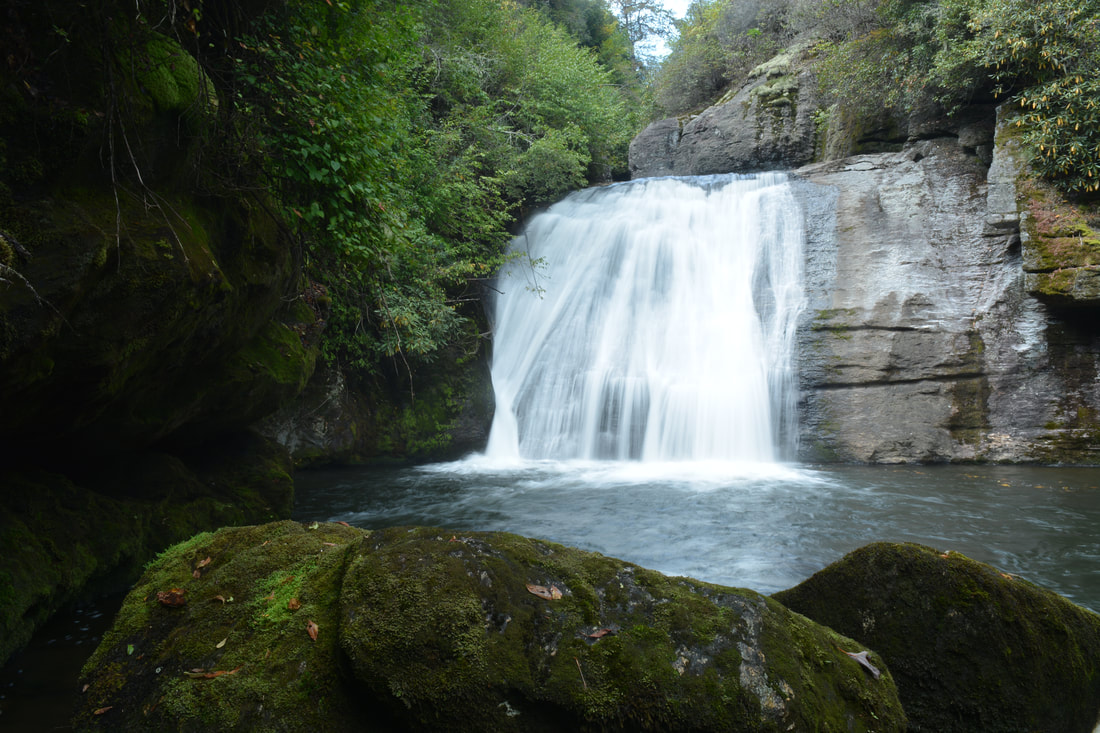
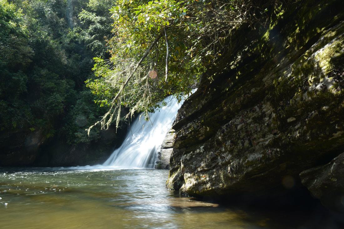
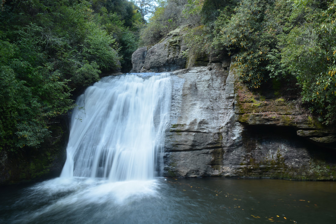
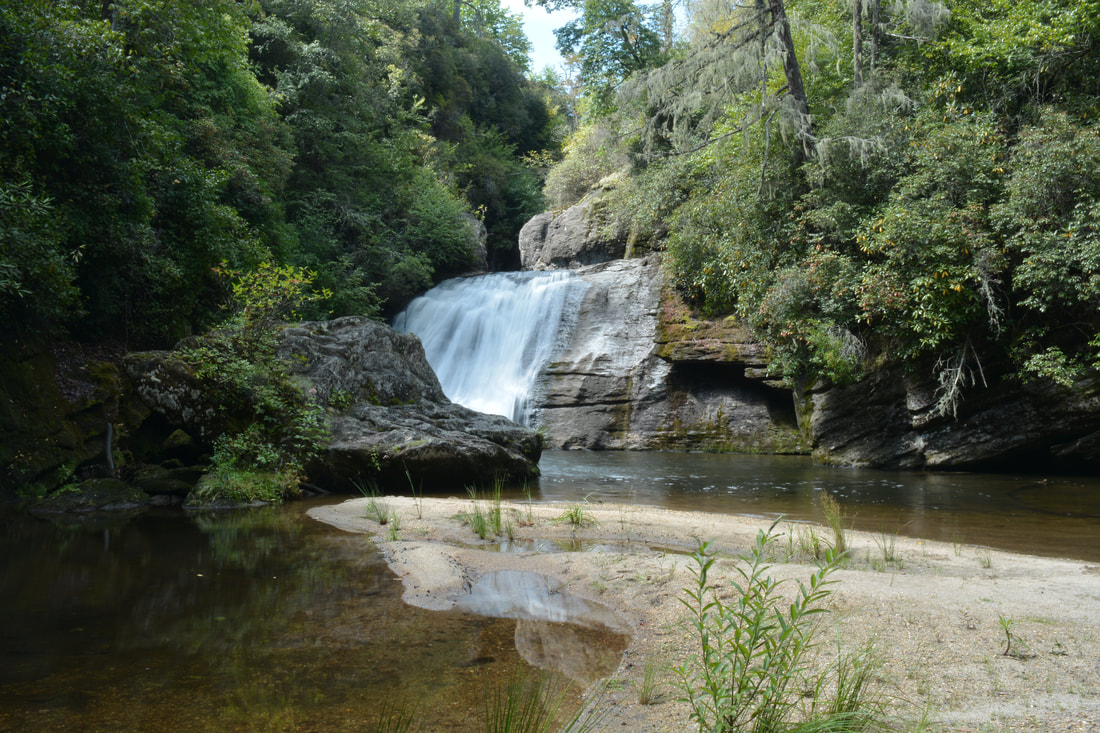
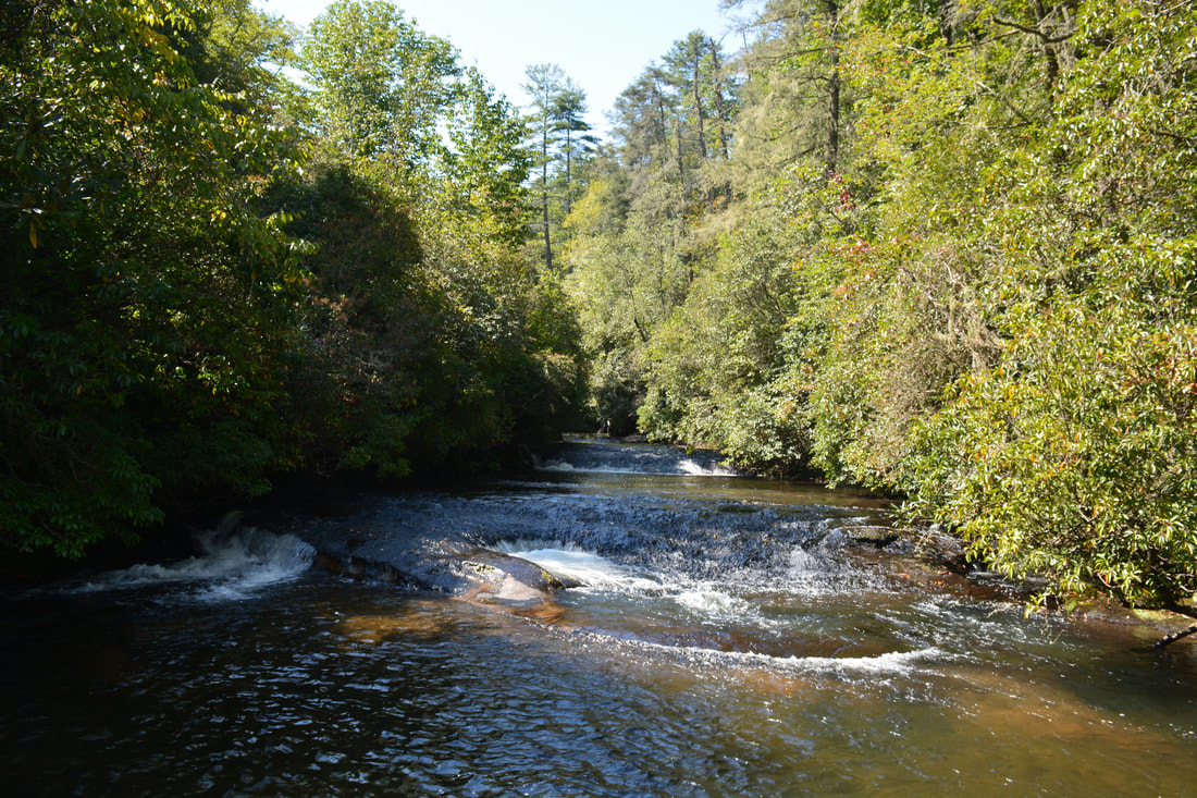
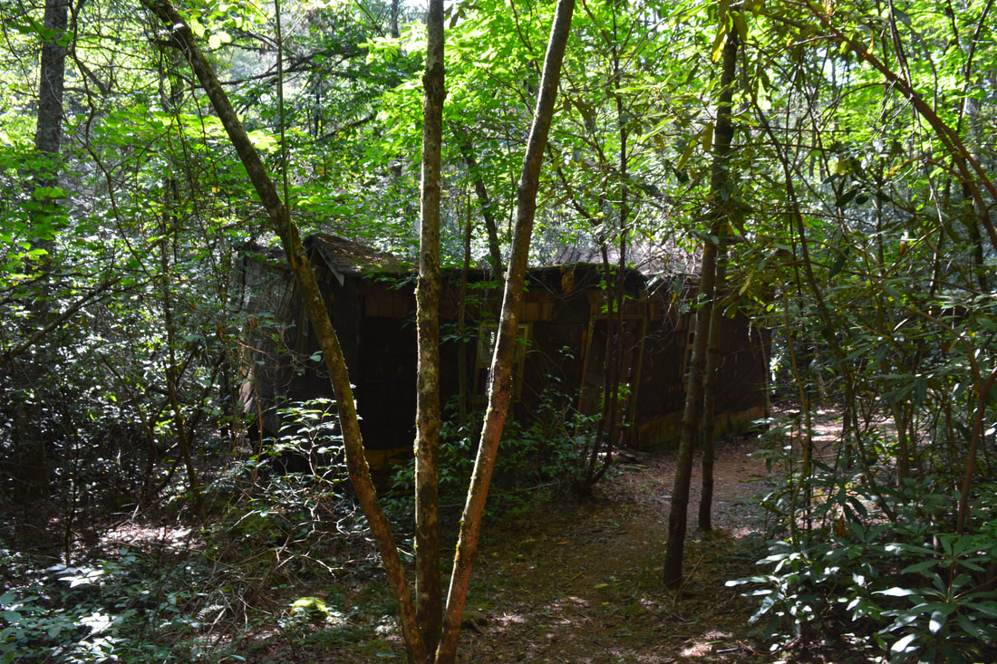
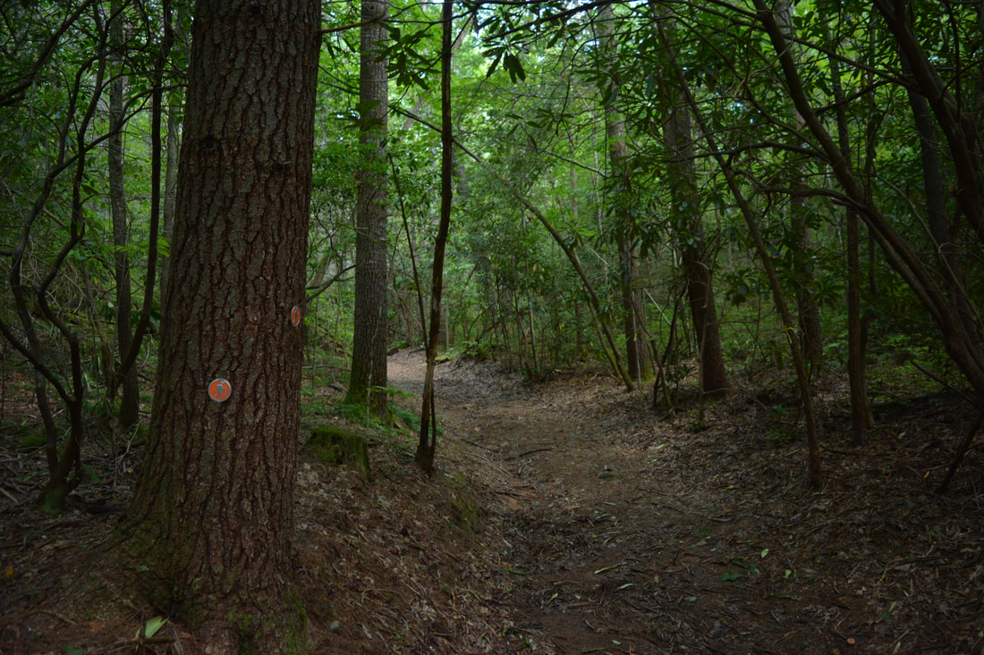
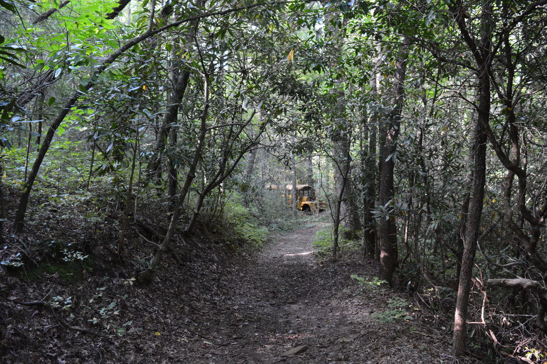
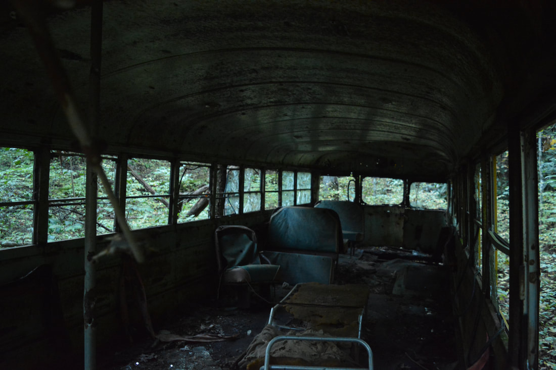
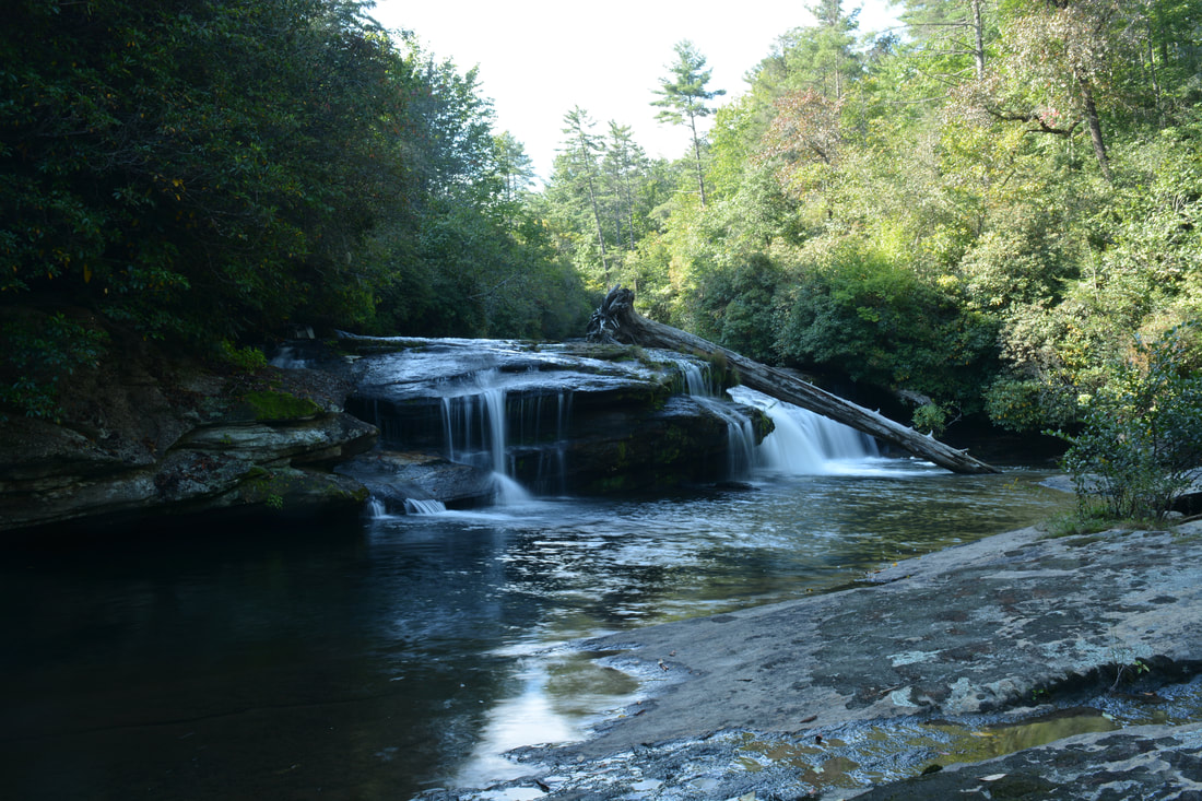
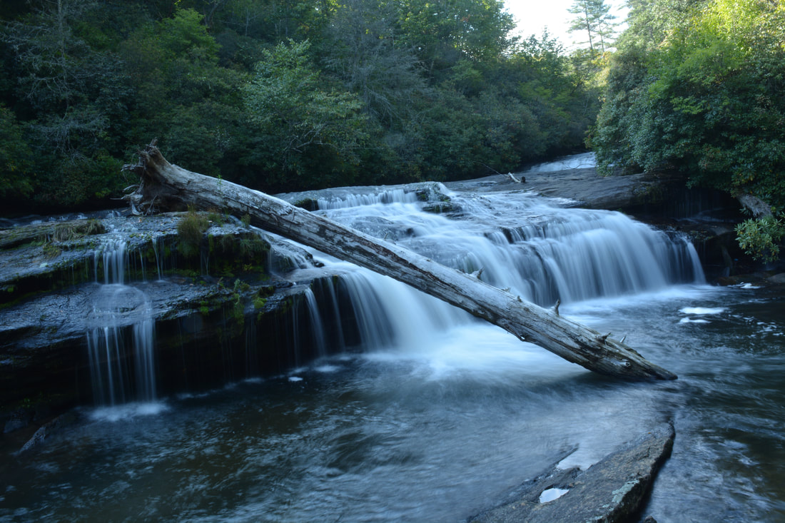
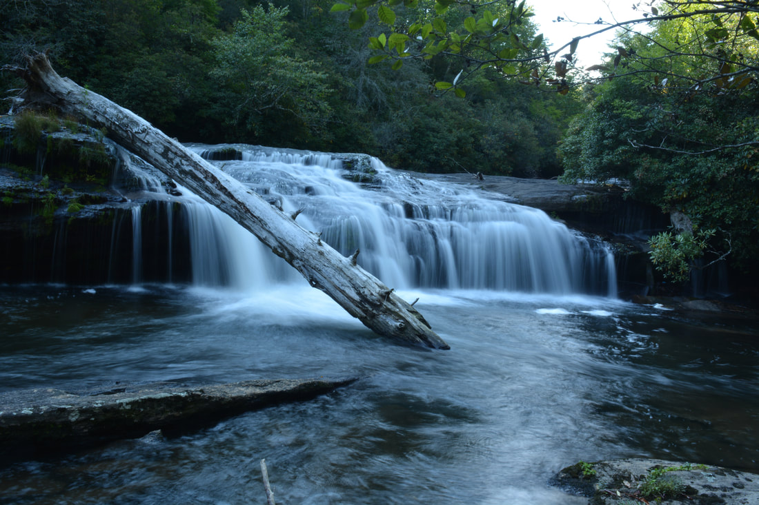
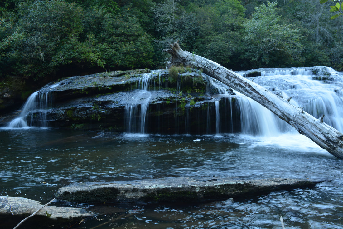
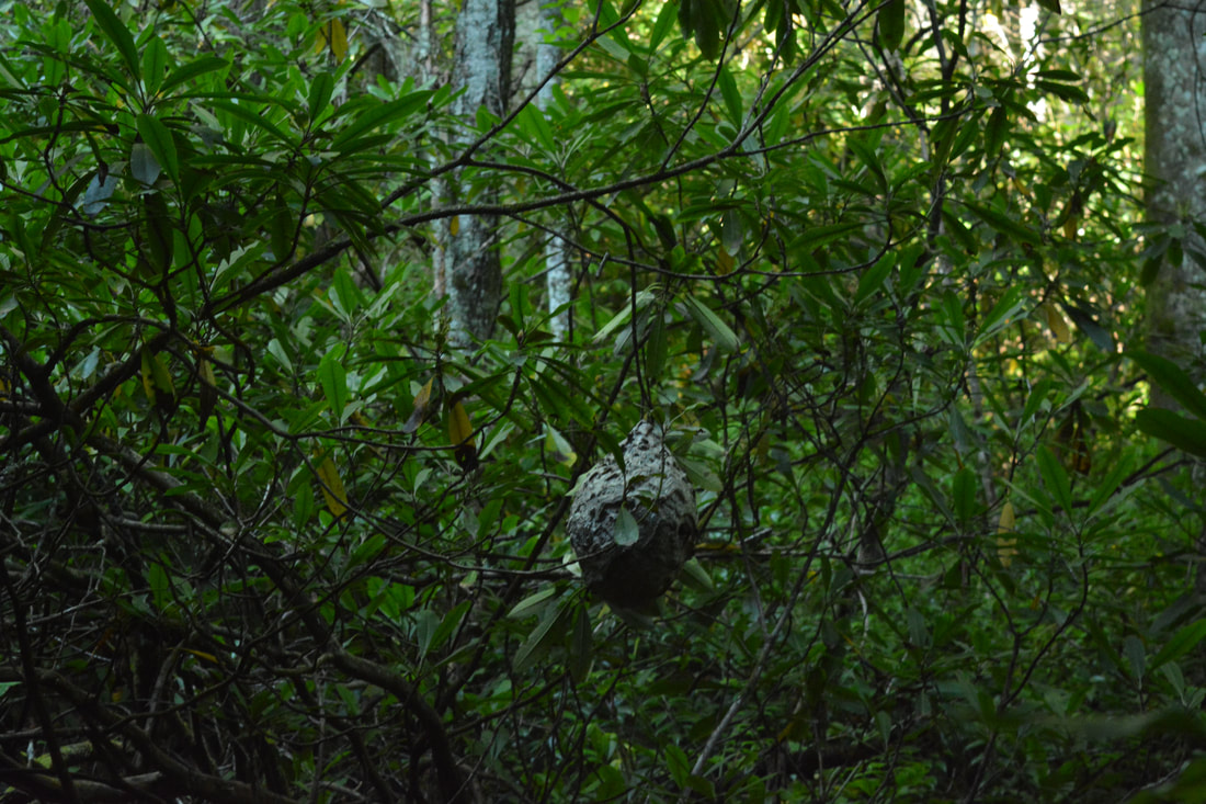
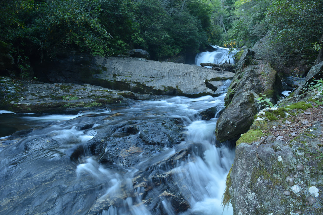
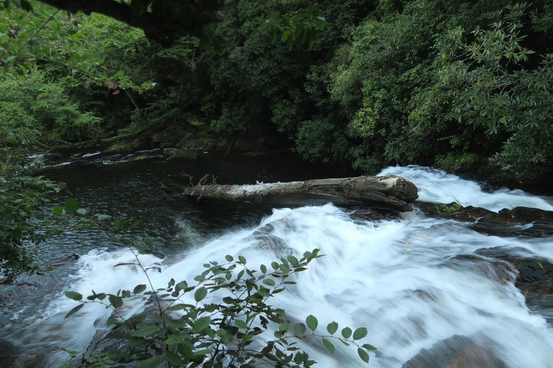
Retrace your steps from Sculpted Falls to Entrance Falls and back across the river to the trail above the canyon. Return to the main trail at 1.3 miles and turn left. The broad trail ascends briefly and then levels out, slowly curving away from the river. The trail passes the ruins of an old cabin to the left at 1.45 miles. At 1.65 miles, there is an important junction. The main trail bears left and shortly enters private property. The trail back to the Whitewater River and Bedrock Falls turns right. This equally broad trail is actually marked by orange circle blazes with hiker symbols. After you turn right, you'll pass through a shallow gap and briefly curve north again, reaching a curious sight at 1.85 miles: an old school bus to the left of the trail. How did this school bus end up in a fairly remote area far from any roads? While I cannot confirm the validity of this story, locals say that the bus was placed here from elsewhere and used as a camp with cots inside. The bus's outside appearance is warlike thanks to the countless bullet holes. At the bus, the trail turns east and then southeast, making a gradual relaxing descent back toward the Whitewater River. Just before the river, the trail narrows and a path comes in from the right. That path is the same path that heads downstream from Exit Falls, which is about 0.4 miles away. Thus, that is the bypass route for the steep rope scramble. About 100 feet past the junction, the path comes out onto the broad rock slabs at the base of Bedrock Falls at 2.4 miles. Bedrock Falls is only about 15 feet high, but it's a scenic waterfall. The Whitewater River splits into many different channels of flow as it drops over the ledge. Unfortunately, a large tree lays right across the right side of Bedrock Falls. The trail continues along the rock slabs for a few feet and then dives back into the woods along the same side of the river below Bedrock Falls. The narrower path reaches a crossing of Democrat Creek in another 0.1 miles at 2.5 miles. This is where you have to leave the trail to access Hornet Falls on Democrat Creek. The best way to reach Hornet Falls is to simply walk in Democrat Creek upstream for a quarter-mile. The creek-walk is pretty easy as far as creek-walks go, but there are still a few blowdowns and rhododendron tangles. The creek is essentially flat and calm during this stretch. There is a bypass route to the right of the biggest blowdown. You'll reach Hornet Falls at 2.75 miles, 0.25 miles after leaving the trail. This 30-foot waterfall was previously undocumented and unknown in the hiking community until I found it on my hike here. I named it Hornet Falls after spotting a bald-faced hornet nest near the base of the waterfall that unfortunately prevented me from getting into an optimal photography position. While locals likely know about Hornet Falls and may even have various names of their own for it, there was no previously-publicized name for it anywhere, so Hornet Falls appears to be a fitting official name. At Hornet Falls, Democrat Creek crashes down a sheer bluff and then makes a sharp turn amidst a mossy boulder jumble near the base before emptying into a shallow pool. The bluff actually extends a good ways in either direction from the falls. Sadly, a fallen tree makes the falls a bit less photogenic. The setting is extremely remote and pristine, and there was no sign of human traffic or interference at the time of my hike. 
Hornet Falls is a newly-discovered 30-foot waterfall on Democrat Creek.
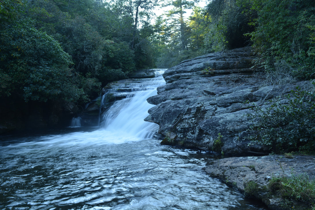
Return along Democrat Creek from Hornet Falls to the trail. Once on the trail at 3.0 miles, continue following it downstream along the Whitewater River. As the river gets quite noisy, the trail reaches a split at 3.15 miles. While the main trail bears left toward 55 MPH Falls, a spur path bears right to Merge Lane Falls. Take the side path and reach the base of Merge Lane Falls in 100 feet. Merge Lane is a pretty 20-foot sliding waterfall. Its most interesting feature is the scenic sloping rock slab on the River Left (north) side. It is also neat how the main channel of the river converges with several separate water trickles at the falls. From Merge Lane Falls, return to the split and continue on the main trail, which shortly crosses an unnamed stream. About 250 feet past the previous split, at 3.25 miles, there is a slightly confusing junction. The most obvious trail bears left and continues rather steeply uphill away from the river. That is the wrong way - stay straight on a fainter path that roughly parallels the river. Another steep path comes in from the left at 3.45 miles. Stay right, descending steeply to river level. At the river, the path disappears near the top of 55 MPH Falls. Follow the rock slabs along the same side of the river past the top of 55 MPH Falls to a point where you can't walk any farther; the path turns left into the woods here. The top of 55 MPH Falls at 3.5 miles is a very scenic spot, as you can see the river cascading steeply down through the bend.
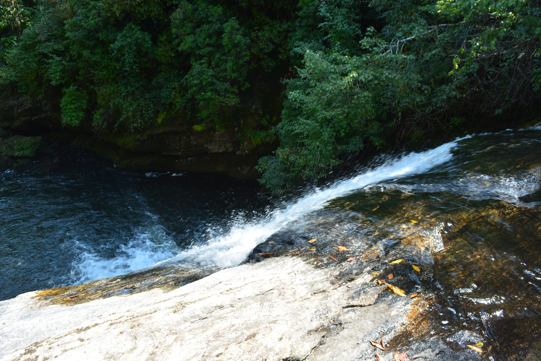
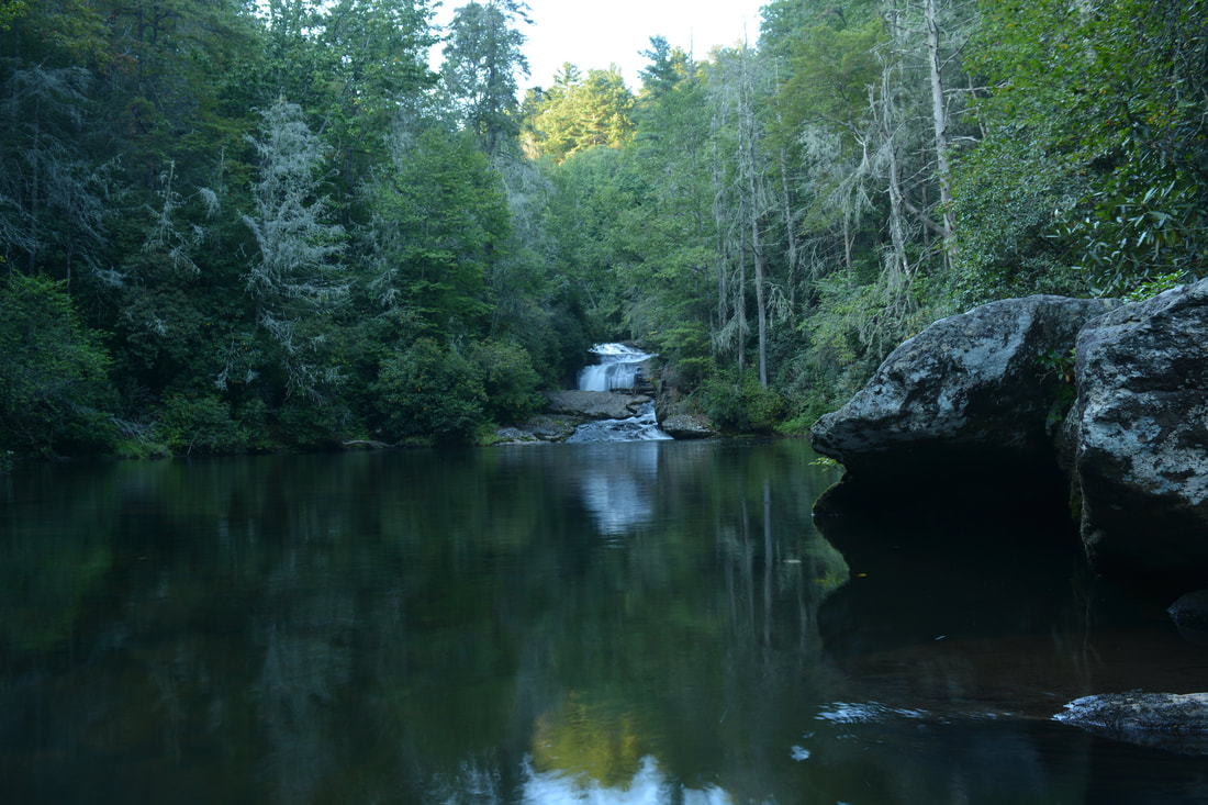
The path swings around the steep area near the falls before coming to another split at 3.55 miles. The path that goes straight is the way to Big Ledge Falls and NC 281. For now, stay right on a steep side path that ends at a long and narrow ledge near the base of 55 MPH Falls. From here, there is a good view of the long cascading 40-foot waterfall. It's hard to consider 55 MPH Falls as a waterfall in the true sense, but the whole multi-tier run is beautiful. Below 55 MPH Falls is a gigantic pool that also serves as a good swimming hole. The main path is headed to the far end of the pool next. Return to the trail and follow it as it becomes increasingly fainter, contouring along the slope above the pool. At 3.65 miles, the path once again reaches the Whitewater River at the far end of the pool and ends here. There is a gorgeous view of the pool here with 55 MPH Falls forming a spectacular distant backdrop. This also marks the beginning of the hike's most difficult extended segment: a 0.55-mile walk in and along the Whitewater River without the benefit of any paths (the exception is the scramble route to the base of Big Ledge Falls). From the end of the pool below 55 MPH Falls, simply get in the Whitewater River and begin walking through it downstream. The river-walk is pretty difficult overall, with many rocks and cascades. In high water, do not attempt it as it will be dangerous. I do not recommend trying this river-walk without trekking poles no matter the water levels. The first part is the 0.2 miles between the 55 MPH Falls pool and Big Ledge Falls. Initially, stay on the River Left side of the river, but when it flattens out briefly, cross over to the River Right (west) side, as there is a small cliff and deep area on the River Left side. As you approach the top of Big Ledge Falls, cross back over to the River Left side. At the time of my hike, pink flagging tape marked the entrance of a scramble path that bypassed the dangerous top of Big Ledge Falls and provided a route to the base. Be very careful and don't get close to the edge, as it's a straight 20 feet down. The scramble bypass is distinct but steep at the end. At the base of the falls is a deep pool. It is necessary to get across a corner of the pool to continue the river-walk. You must tiptoe along the underwater ledge at the very edge of the pool, because otherwise, you might get into some very deep water. Once past this obstacle, you will reach a good spot for viewing Big Ledge Falls at 3.85 miles - yet another scenic waterfall along this spectacular stretch of the Whitewater River. Big Ledge Falls is a sheer drop of about 20 feet. Naturally, a downed tree hurts the view a bit - This seems to be a recurring theme along the Upper Whitewater River. 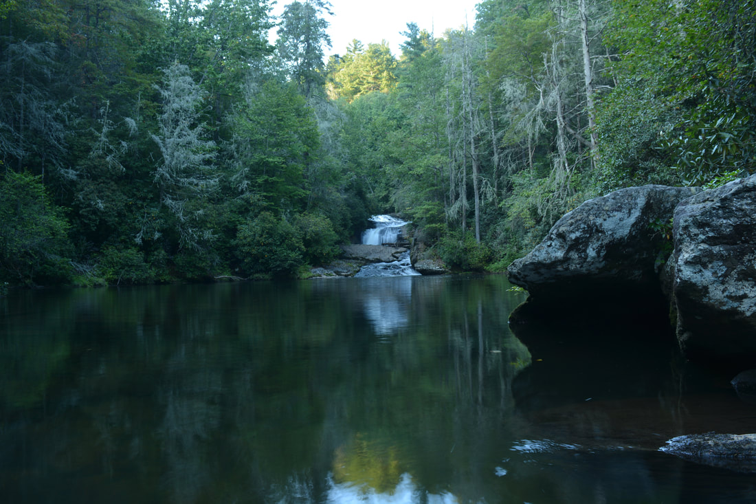
At the bottom of 55 MPH Falls is an enormous calm pool on the Upper Whitewater River.
The second part of the river-walk begins at Big Ledge Falls: the 0.25-mile segment between Big Ledge Falls and Wheelchair Accessible Falls. In my opinion, this is the most difficult part of the river-walk. In addition to this being one of the Upper Whitewater River's most remote stretches, there are many rushing cascades, pools, and slippery rocks. I found it easiest to stay on the River Left side the entire time, often scrambling through the rocks along the bank. 0.2 miles past Big Ledge Falls, at 4.05 miles, the Whitewater River makes a slight bend to the right just before the big left-hand bend at Wheelchair Accessible Falls. At this slight right-hand bend, it is best to leave the river and bushwhack up and across a low ridge on the River Left side. During times of very low water, proceeding along the river and directly down the gradually sliding Wheelchair Accessible Falls is possible, but on this day, the water was high enough that it didn't appear safe. There is no real path across the small ridge, but the route is fairly obvious and open, with the exception of a few green briars. The ascent is extremely steep and involves scrambling on all fours. The descent back down to the river is a little easier. Altogether, the Wheelchair Accessible Falls bypass is about 250 feet long. You will come out back at the Whitewater River at 4.1 miles just below Wheelchair Accessible Falls. Wheelchair Accessible Falls is a sliding drop only about 10 feet high. It may be the least scenic waterfall on the hike.
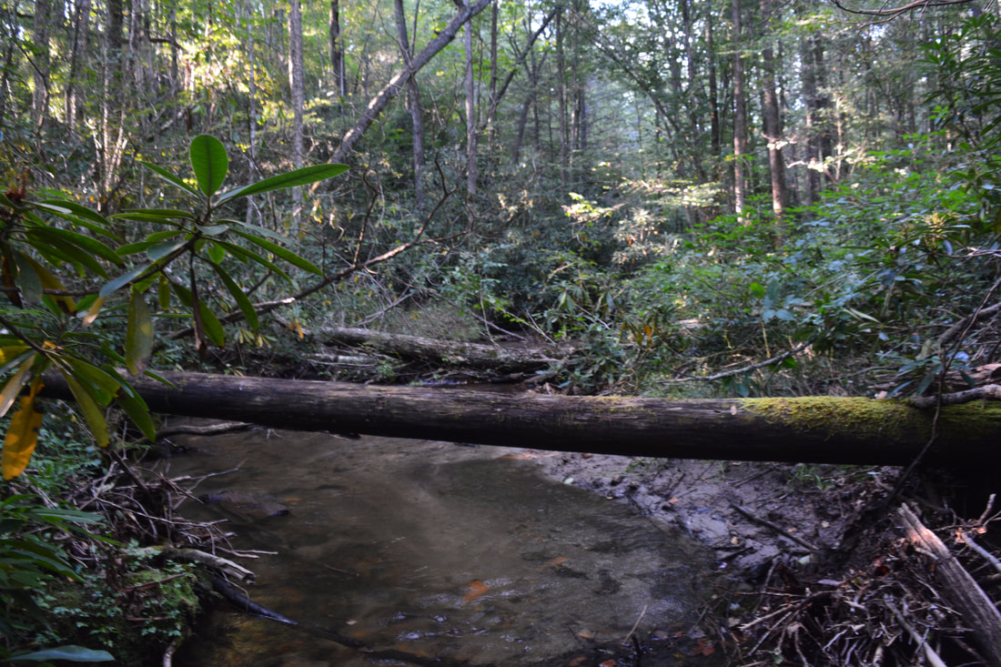
The third and final part of the river-walk is the 0.1 miles between Wheelchair Accessible Falls and Portage Left Falls. This part is a little easier. Continue following the River Left side of the river, occasionally scrambling across dry rocks at the bank. You will approach the top of Portage Left Falls, the lowermost waterfall on the Upper Whitewater River, at 4.2 miles. Once again, stay away from the edge and look for a path on the River Left (northeast) side of the river. Once you find the fairly distinct path, the river-walk is over. The path passes above Portage Left Falls, and shortly, a steep side path on the right leads to the base. I skipped this final side path due to time constraints, but I do know that Portage Left Falls is a pretty scenic 20-foot waterfall. I have also heard that there is yet another fallen tree that mars the view of the falls a bit. Meanwhile, the main path is now headed straight for NC Route 281 where your second car is. There are still some things to watch out for along the path. Generally, the trail between Portage Left Falls and NC 281 follows pieces of various old logging roads. Soon after Portage Left Falls, the trail rises over a small ridge, descends steeply, and then contours along the slopes above the Whitewater River. The path isn't always obvious, but most of it is fairly distinct. The trickiest spot comes at 4.75 miles (0.55 miles from Portage Left Falls). Here, you have to turn right onto a very steep path that just "does not seem right" when it really is the correct route (another path continues straight on a nearly level track and eventually provides access to waterfalls on Waddle Branch, although I've heard the path dissipates before the waterfalls). The steep path descends into a gully and thus reaches a crossing of Waddle Branch at 4.8 miles. After the crossing, the path broadens and becomes more distinct, staying close to the Whitewater River. At 5.05 miles, just before the NC 281 Whitewater River bridge, a very obvious path turns left steeply uphill. Take this path, which curves right and shortly reaches NC 281 at the pullout with your second car. You'll thus conclude this spectacular hike at 5.1 miles. 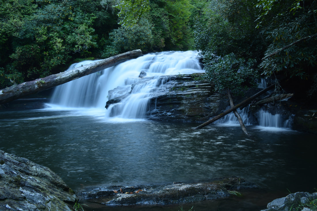
Big Ledge Falls is a scenic 20-foot waterfall on the Upper Whitewater River.
I have decided to rate the trek through the Upper Whitewater River Gorge a "Best Hike" just because the number of breathtaking waterfalls on this hike (10 total) is simply outstanding. In addition, you'll be treated to remote and pristine scenery all throughout, and in fact, you'll be pretty lucky if you see any people at all! Of course, seeing all of the waterfalls requires some serious effort, but it's undoubtedly worth it. Just keep in mind that a map, compass (and/or GPS), and good navigational skills are mandatory for this hike. In all honesty, the Upper Whitewater River hike may be one of the best waterfall hikes I've ever done.
Mileage
0.0 - Heady Mountain Road
0.85 - Exit Falls 0.9 - Top of Exit Falls and Mouth of Upper Whitewater Slot Canyon 1.15 - Entrance Falls 1.2 - Sculpted Falls 1.85 - Old School Bus 2.4 - Bedrock Falls 2.75 - Hornet Falls 3.15 - Merge Lane Falls 3.5 - Top of 55 MPH Falls 3.55 - Side View of 55 MPH Falls 3.65 - Pool View of 55 MPH Falls 3.85 - Big Ledge Falls 4.1 - Wheelchair Accessible Falls 4.2 - Portage Left Falls 4.8 - Waddle Branch 5.1 - NC 281 Variations
Bonus Stops
Pictures and Videos
6 Comments
Taylor Bruce
10/2/2017 10:07:44 am
Great work on this section of Waterwater Falls. I actually live on the private home section across the bridge over the River below Heady Mountain Rd. The road down there is named Lost Cove Rd. I look after the roads and property down there. Thanks for recommending visitors to stay off of private property.
Hello Taylor,
Bill
1/11/2018 06:53:51 pm
Quite the spectacular hike, Mark!
shelly herbert
7/17/2019 12:21:09 pm
We just stayed on the property and my daughter is very curious about the history of the bus we came across. Do you have any idea how it got down there? Leave a Reply. |
About MeMark Oleg Ozboyd Dear readers: I have invested a tremendous amount of time and effort in this website and the Georgia Waterfalls Database the past five years. All of the work that has gone in keeping these websites updated with my latest trip reports has almost been like a full-time job. This has not allowed me to pick up a paid job to save up money for college, and therefore, I I've had to take out loans. If you find the information on this website interesting, helpful, or time-saving, you can say "thanks" and help me out by clicking the button above and making a contribution. I will be very grateful for any amount of support you give, as all of it will apply toward my college tuition. Thank you!

Coming in 2022-2023?
Other Hiking WebsitesMiles HikedYear 1: 540.0 Miles
Year 2: 552.3 Miles Year 3: 518.4 Miles Year 4: 482.4 Miles Year 5: 259.9 Miles Archives
March 2021
Categories
All
|
||


 RSS Feed