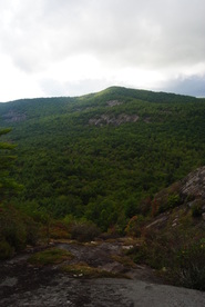
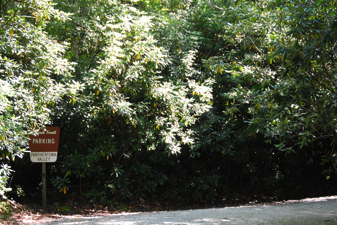
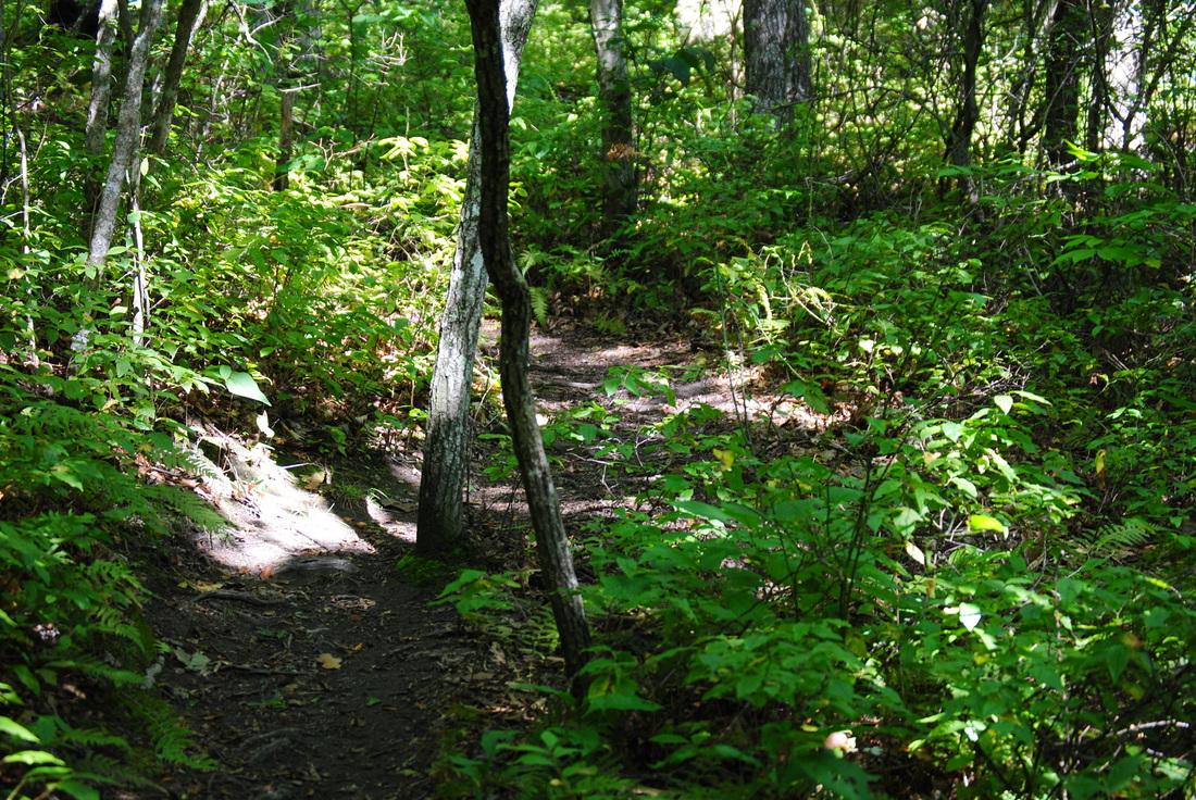
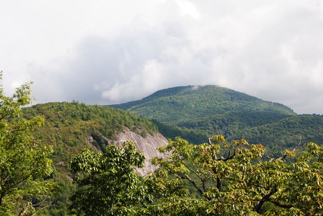
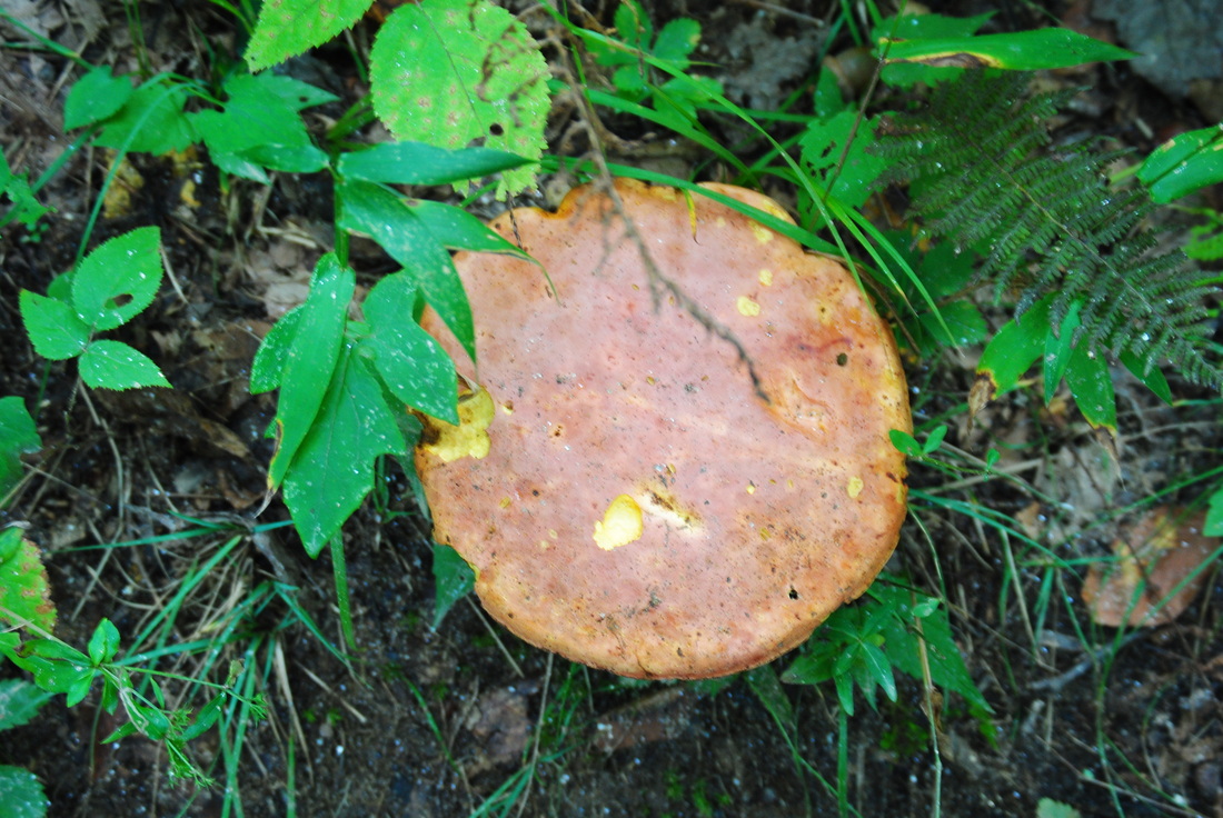
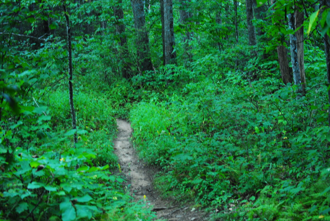
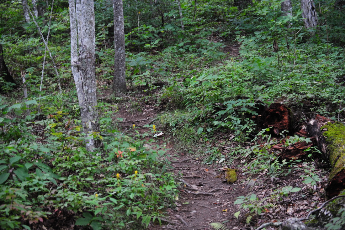
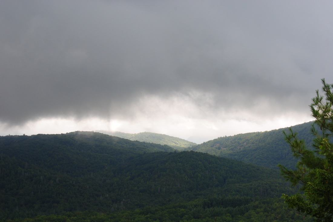
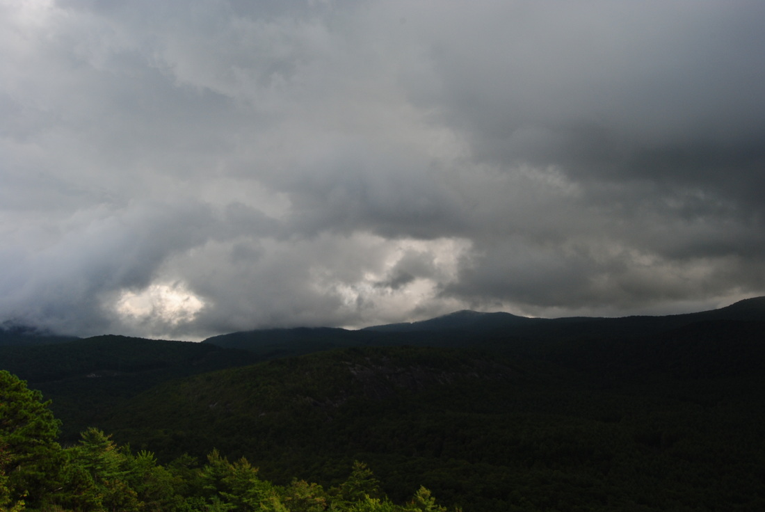
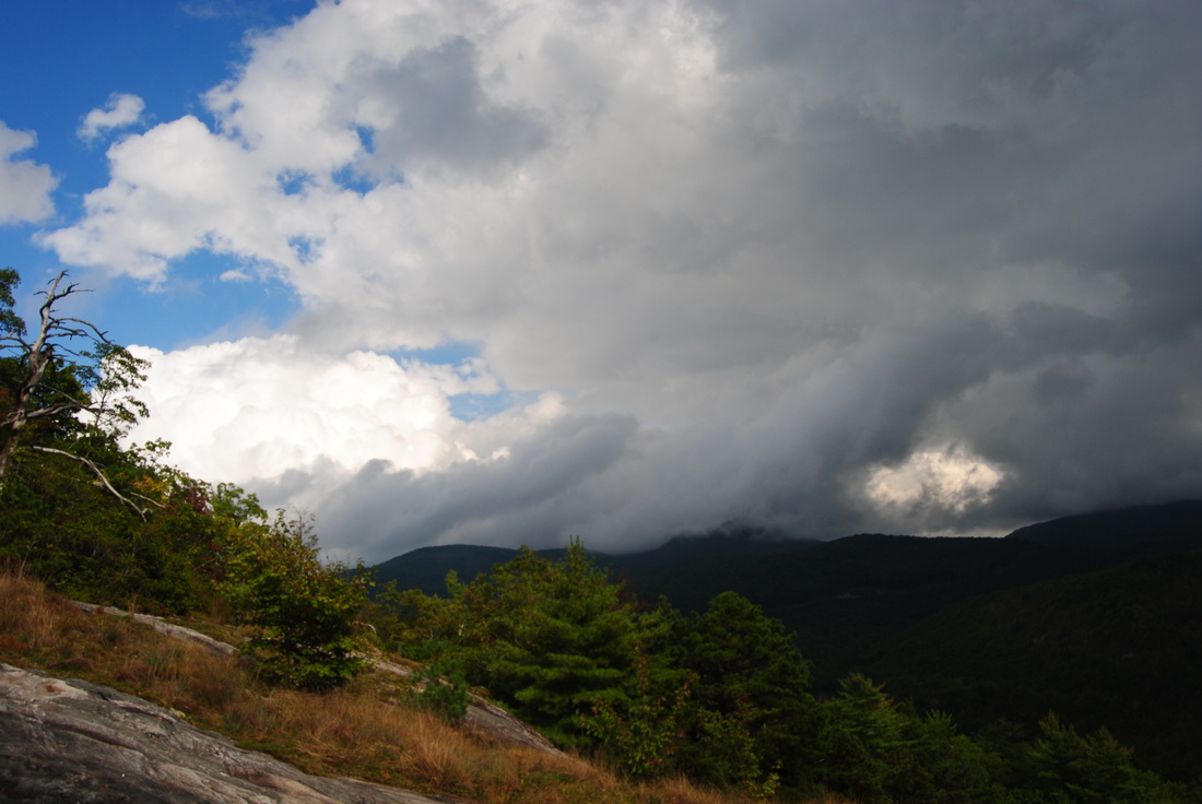
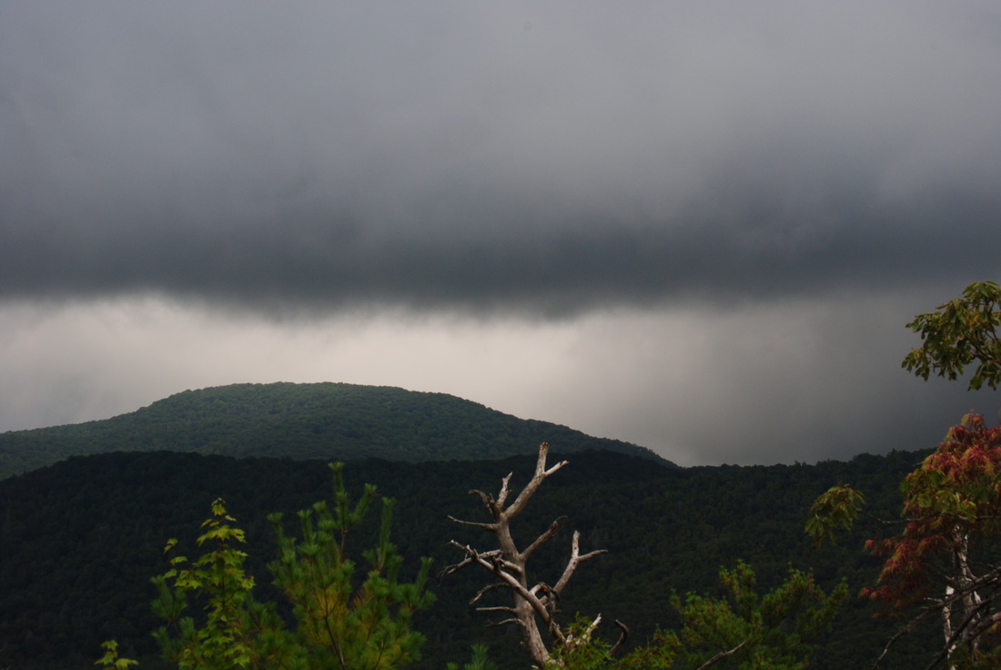
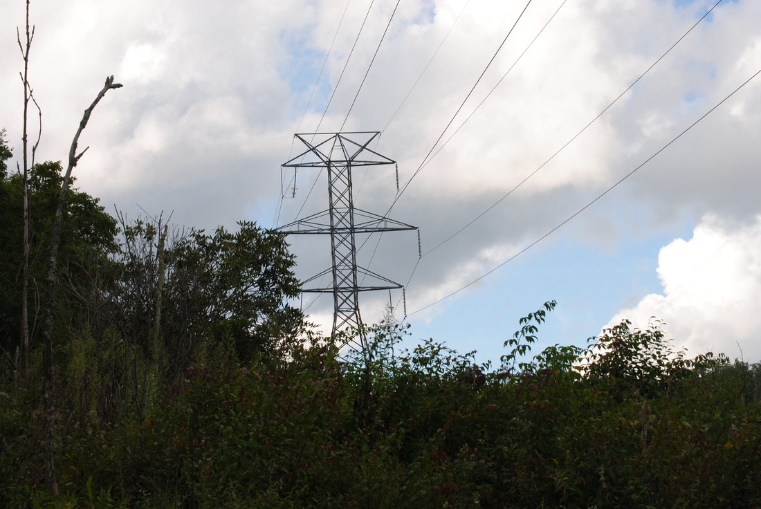
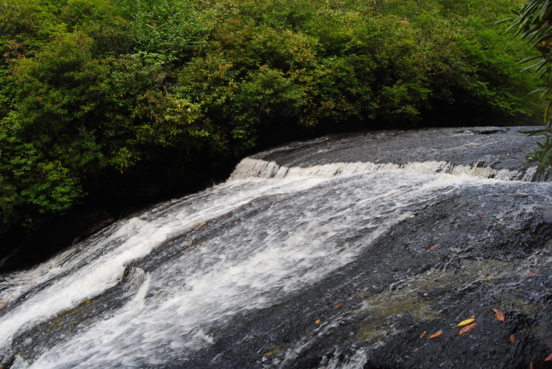
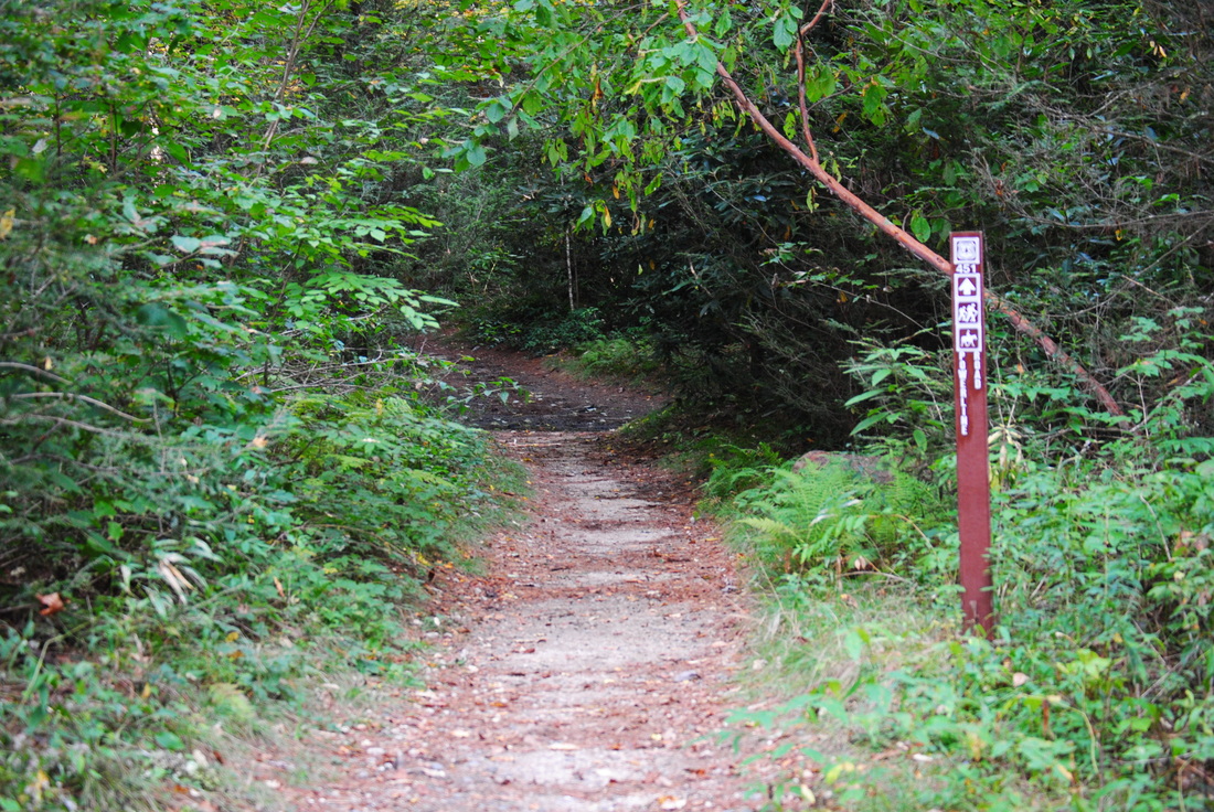
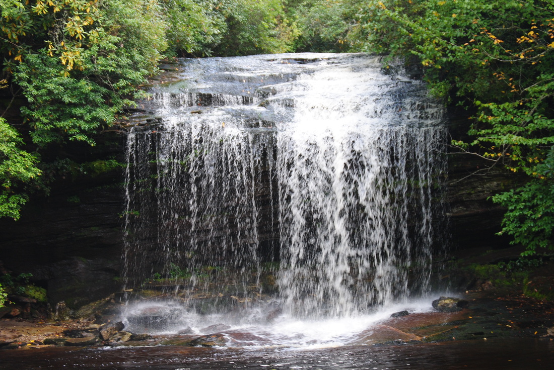
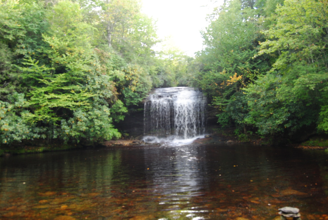
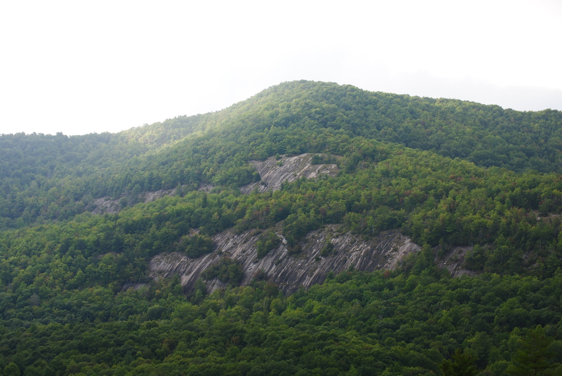
 Highlands and Cashiers are two small, wealthy towns in the mountains of Southwest North Carolina surrounded by mountains with great views and great hiking trails. The Panthertown Valley Recreation Area is one of the best hiking destinations in the area, with several mountains with great views, and at least a dozen accessible waterfalls. Panthertown Valley, nicknamed "The Yosemite of the East". Mountains like Little Green Mountain alone are worth doing this hike - traversing it's open rocky faces with incredible views is quite a feeling. This hike occurred on Saturday, September 13th, 2014. My plan was as follows (and it's a long one): From the Packs Gap Trailhead, take the Blackrock Spur Trail to Blackrock Trail. From there, I'd follow the Blackrock Trail to Overlook Trail. I would take the Overlook Trail to Blackrock Mountain Overlook and to the Powerline Trail. I would turn right on the Powerline Trail and go all the way to Panthertown Valley Trail. Along the way, I would do the short out-and-back to Wardens Falls. Then, I would turn left on Panthertown Valley Trail, followed by turning right onto Little Green Trail. After visiting Schoolhouse Falls, I would summit Little Green Mountain and on the other side of the mountain, turn left on Mac's Gap Trail. Then, I would turn right onto Big Green Trail and follow it to Great Wall Trail. I would turn left onto the Great Wall Trail and follow it to Granny Burrel Falls Trail. After doing the short out-and-back to Granny Burrell Falls, I would continue on the Great Wall Trail to Deep Gap Trail. I would turn left onto Deep Gap Trail, and immediately right onto Wilderness Falls Trail. Finally, I would finish by turning left onto the Panthertown Valley Trail and ascend to Packs Gap. R/T Length of Trail: 10.2 Miles Duration of Hike: 6 Hours Type of Hike: Loop with a couple of spurs Difficulty Rating: 5 out of 10 Pros: Lots of waterfalls, several scenic overlooks, lots of easy trail Cons: Some steep grades, long rock hop over Frolictown Falls, crowds at Schoolhouse Falls and Little Green Mountain Water Features: Wardens Falls - 8 stars; Wilderness Falls - 6 stars; Schoolhouse Falls - 5 stars; Frolictown Falls - 4 stars; Granny Burrell Falls - 2 stars Scenic Views: Views from Little Green Mountain - 9 stars; Blackrock Mountain Overlook - 8 stars Best Season(s) to Hike: Winter; Spring Trail Blaze Color(s): Either green or red, although primarily green Beginning Point: Packs Gap trailhead Directions: From Cashiers, NC: Follow US Route 64 East from Cashiers. Right after the sign "Horsepasture River", turn left onto Cedar Creek Road. In 2.3 miles, reach Zacharys Gap, where there is a sign for Panthertown Valley Recreation Area. Turn right onto Breedlove Road. Follow it for 3 miles. The last 0.2 miles are paved. The parking area is at the end of the road - just park on the shoulder. First of all, I need to give you a heads up: DO NOT do this hike without a map. It's going to be really hard to do this hike without a map due to the countess trail intersections. The National Geographic maps are pretty good and not expensive. The parking area for this hike is weird. It's really long, but no clear parking spaces, although there's a long pullout along the road. Even though there's plenty of people here always, there's usually a few parking spaces that are free. There's several trails that leave from the trailhead. The first one is the Panthertown Valley Trail. This will be from where you will return. The second trail is the Blackrock Trail. The third trail, the Blackrock Spur Trail, is a steep shortcut for some of the Blackrock Trail, and is the start of this hike. the Blackrock Spur Trail is only 0.2 miles, but it ascends steeply up Blackrock Mountain, as opposed to the gentle ascent on the Blackrock Trail. You start off steeply ascending through a thick forest, before reaching a small overlook at 0.1 miles. Here, you have a nice view of a part of Panthertown Valley. There's no blaze where to go until you actually find the trail, so scramble up the rocks to the upper left, and there's a green blaze there that leads you onto the trail. The trail keeps ascending before reaching Blackrock Trail at 0.2 miles. Turn right here. The Blackrock Trail is an old road that continues to gradually climb Blackrock Mountain. Once you reach the ridge, though, the climbing subsides and the trail becomes single-track (still more likely an overgrown road). At 0.9 miles, reach a junction with Overlook Trail just below Blackrock Mountain's summit. The "official" trail goes only right, although an unofficial equally wide goes left. For 0.1 mile, the Overlook Trail ascends to the forested summit of Blackrock Mountain at 1 mile, and after this, descends steeply for 0.3 miles. Coming up this slope would be pretty hard, and it's rough for the knees when going down too. There's almost no switchbacks and lots of roots. At 1.3 miles, reach Blackrock Mountain Overlook, a great clifftop panorama. You can see pretty much the whole range of Panthertown Valley spread out in front of you. The headwaters of the Tuckasagee RIver are directly below. In front of you, Big Green Mountain rises, while further to the left, its more attractive brother, Little Green Mountain, can be seen.The southern boundary of Panthertown Valley overshadows the horizon, preventing long-rage views, with the highest peak being Toxaway Mountain.Dark clouds were covering many of the mountains, a sign of incoming storms. After this overlook, continue along the cliff, past a nice campsite, and into the forest. The Overlook trail continues to descend steeply for another 0.2 miles, before reaching the Powerline Trail at 1.5 miles. Just before the Powerline Trail, "Carlton's Path" went to the right. I don't know where it goes - no maps have it. Turn right onto the Powerline Trail. This is actually an old road, and an easy trail. The road will make some turns and gradually going downhill. The road is eroded, but there are no steep grades, so it still is not hard. At 2.3 miles, you reach the Duke Energy powerlines. I wish these powerlines were never placed here, but oh well, they give a feature to the land in a way. Here, keep right on the Powerline Trail for another 0.2 miles. At 2.5 miles, watch carefully - here, the powerline Trail curves right, while a small, unsigned path goes left, a drainage at first glance. This is the spur to Wardens Falls. Take the path and follow it for 0.1 mile. Then, the path pretty much disappears, so the best thing to do is just scramble toward the sounds of the falls. You can still see the path time to time. It gets a bit steep near the falls, but at 2.7 miles, you get there. The "viewing area" for this waterfall is really small, but it's still a beautiful slide waterfall. When there's plenty of water in the creek, like on this day, it's an amazing sight. I especially liked watching the whirlpools at the bottom of the falls. There are two more waterfalls downstream, but those are really tough to get to, and I still had most of the hike ahead of me, so I had no intention of wasting time down here. Return the way you came to the Powerline Trail, and keep following it down. At 3 miles, reach the North Road Trail, which is another route to the Panthertown Valley Trail. The Powerline Trail continues as an old road, winding through the forest. There was a brief shower here, although not heavy. At 3.3 miles, the forest opens up to a large campsite on the left and right. There were some people here. It's a pretty nice campsite as it's not very moist. After the campsite, rock hop a small stream and then the Powerline Trail ends at the Panthertown Valley Trail at 3.4 miles. Forward takes you back to the parking area in a couple miles, so turn left to keep following this description. Right away, cross Frolictown Creek on a footbridge. The Panthertown Valley Trail, also an old road, follows Frolictown Creek for 0.4 miles with little elevation change. At 3.8 miles, reach a junction with Little Green Trail just before another footbridge. Take a right here. The Little Green Trail winds near the creek and crosses a boardwalk. At 4 miles, there is a small campsite on the left and Schoolhouse Falls. The waterfall is not very impressive (although still nice when there's a good amount of water), but the huge swimming hole is what attracts most people here. There's a little overgrown path along the the stream that leads to the falls, where you can actually get behind the falls. I didn't go there though. So far, Wardens Falls was the best waterfall. After Schoolhouse Falls, the Little Green Trail starts an ascent up Little Green Mountain. This ascent is not very long-lasting, but it is steep most of the time. It starts off up a long set of steps, and then just a rooty climb without any switchbacks. The summit of Little Green Mountain is at 4.5 miles. It gets confusing here, because there are very few blazes. There's a campsite here, but go in the direction of the distant views. Take the path that leads right. You can tell there's an overlook that way. And sure they are! The views start at 4.6 miles, with a very impressive view of Blackrock Mountain where you were earlier. This is a nearly top notch overlook, with all the mountains standing grand in front of you. Follow the trail along the open rock faces, occasionally entering the woods. Watch carefully for the green blazes that are few and far in between. There are also a few faded white arrows on the rocks. As you progress along the slopes of Little Green Mountain, Packs Gap and the trailhead come into view on the horizon, and then the mountains west of that extending towards Cashiers. At 4.8 miles, the trail starts a little precariously descending the south slope of Little Green Mountain, first down roots and rocks and then a long set of steps into a small gap. A bit more descent led past a campsite and to Mac's Gap Trail at 5.2 miles. Turning right is another way to shorten the hike, as it leads to Panthertown Valley Trail. To follow this route, turn left. The Mac's Gap Trail ascended for half a mile, with a couple switchbacks, where I could see the grades of an old road. Then, it started descending to reach Big Green Trail at 5.8 miles. Turn right onto Big Green Trail. Forward takes you to another trailhead. The Big Green Trail starts off nice and flat, following the slopes of the ridgeline, but there is some ascending to a gap, and then a descent. Along the way, there are some nice winter views. Reach the Great Wall Trail at 6.6 miles. This is another gap, where the Big Green Trail continues forward to Big Green Mountain. As far as I have been told, Big Green Mountain does not have any views, so not worth visiting it. For this route, turn left onto the Big Gen Trail. The Big Green Trail starts off gently descending, but soon starts descending steeply through tangles of rhododendron on staircases, both wooden and stone. There has been quite a bit of work put into this trail, cutting it through the steep slopes. After the main descent ends around 7 miles, there will be a couple footbridges over a creek. It's a beautiful trail, winding down the slopes into the valley. At 7.6 miles, you have your best shot at seeing the Great Wall. The Great Wall is a huge rock face on the south side of Big Green Mountain that is a popular spot for rock climbers. The campsites here are frequented mainly by rock climbers. Water comes from the small creek. At 7.9 miles, you reach a huge campsite and a shelter, that is basically a campsite with a steel roof. The shelter houses 20-30 people. Right wafer the shelter, watch for the easy-to-miss Granny Burrell Falls Trail leading right. Turn right onto it. For the next 0.3 miles, this is some of the ugliest stretch of trail on the entire hike. You are constantly scrambling through tangles of rhododendron and roots along Frolictown Creek. There's some very muddy areas too. At 8.2 miles, reach Granny Burrell Falls. This small slide waterfall isn't worth much - even during "high water" it seems like it's still low. There's a small swimming hole at the bottom of the falls. Retrace your steps to the Great Wall Trail, and reach it again at 8.6 miles. Turn right onto the Great Wall Trail and make a tricky rock hop over Frolictown Creek. It can be slippery when wet. After this, a slow but steady ascent continues for 0.4 miles until the Deep Gap Trail junction at 4 miles. Turning right is an alternative option to reach the trailhead. Turn left, and follow it for 0.1 miles down to Wilderness Falls Trail at 9.1 miles. First, go down to the creek and check out Frolictown Falls. This falls is small but relatively strong. During high water, it can look pretty good. After this, go back to the Wilderness Falls Trail junction and turn onto Wilderness Falls Trail. The trail will wind through the forest, again through tangles of rhododendron, to reach Wilderness Falls at 9.5 miles. This is a high but often low flow waterfall. During high flow, it can be quite pretty. Keep following Wilderness Falls Trail up the mountain, ascending towards Packs Gap. The ascent is never steep, although a little rugged and rooty. It's still easy - the ascent up Little Green Mountain was harder. This part of the hike was in a torrential downpour (closing off the summer, as this was the last day with a chance of rain in a long time). The downpour made the trail a mess, with mud and water everywhere. Reach Panthertown Valley Trail at 10 miles. This is the final leg to the finish. Turn left onto it. It's a steep 0.2 miles to Packs Gap and the trailhead at 10.2 miles. Time to summarize. This hike is a very good one, with so many different features. One thing I didn't like about it is that much of it was on old roads Other than this, it's a great hike. All of the waterfalls went't too bad, although Wardens Falls still took the first place. The views from Little Green Mountain were nearly fantastic. The only con about the views from Little Green Mountain and even the views from Blackrock Mountain is that the ridgelines on the horizon limited long-range views. All you could see was what was in front of you. Still, these were great views. Below are my pictures and videos.
1 Comment
8/4/2022 06:08:19 am
Edirne baymak servisi en uygun fiyat ve en hızlı servis garantisi ile sizlerle. https://www.edirneklimaservisi.com/edirne-baymak-servisi/ Leave a Reply. |
About MeMark Oleg Ozboyd Dear readers: I have invested a tremendous amount of time and effort in this website and the Georgia Waterfalls Database the past five years. All of the work that has gone in keeping these websites updated with my latest trip reports has almost been like a full-time job. This has not allowed me to pick up a paid job to save up money for college, and therefore, I I've had to take out loans. If you find the information on this website interesting, helpful, or time-saving, you can say "thanks" and help me out by clicking the button above and making a contribution. I will be very grateful for any amount of support you give, as all of it will apply toward my college tuition. Thank you!

Coming in 2022-2023?
Other Hiking WebsitesMiles HikedYear 1: 540.0 Miles
Year 2: 552.3 Miles Year 3: 518.4 Miles Year 4: 482.4 Miles Year 5: 259.9 Miles Archives
March 2021
Categories
All
|


 RSS Feed