HIKING THE APPALACHIANS AND BEYOND
  • Home
  • Trail Reports
    • Best Hikes
    • Hikes with Scenic Views
    • Hikes with Water Features
    • Alabama
    • Georgia
    • Florida
    • North Carolina
    • South Carolina
    • Tennessee
    • Vermont
    • Virginia
  • Map
  • Hike List
  • Testimonials
  • Resources
  • Contact Us
  • Southeast Nature Society
    • Our Team
  • Georgia Waterfalls Database

Tate's Hell State Forest: High Bluff Coastal Hiking Trail, Carrabelle, Florida

2/15/2017

0 Comments

 
Picture
With a size of over 200,000 acres, Tate's Hell State Forest is one of Florida's largest state forests. Its only official hiking trail is the High Bluff Coastal Trail, which traverses pine flatwoods and ancient sand dunes near the Forgotten Coast. In fact, one of the sand dunes is tall enough to provide an elevated view toward the southern end of the forest, where the Gulf of Mexico is just a thin blue sliver. In addition, black bears are common in Tate's Hell State Forest and neighboring Apalachicola National Forest, and on this hike, it is possible to spot this elusive creature or find evidence of its activity. This hike occurred on Monday, December 26th, 2016. My plan was to hike the High Bluff Coastal Loop in a clockwise direction. Along the way, I would take a short side trail to an elevated  view of the surrounding terrain and the Gulf of Mexico in the distance. 

Summary

R/T Length of Trail: 9.0 Miles 
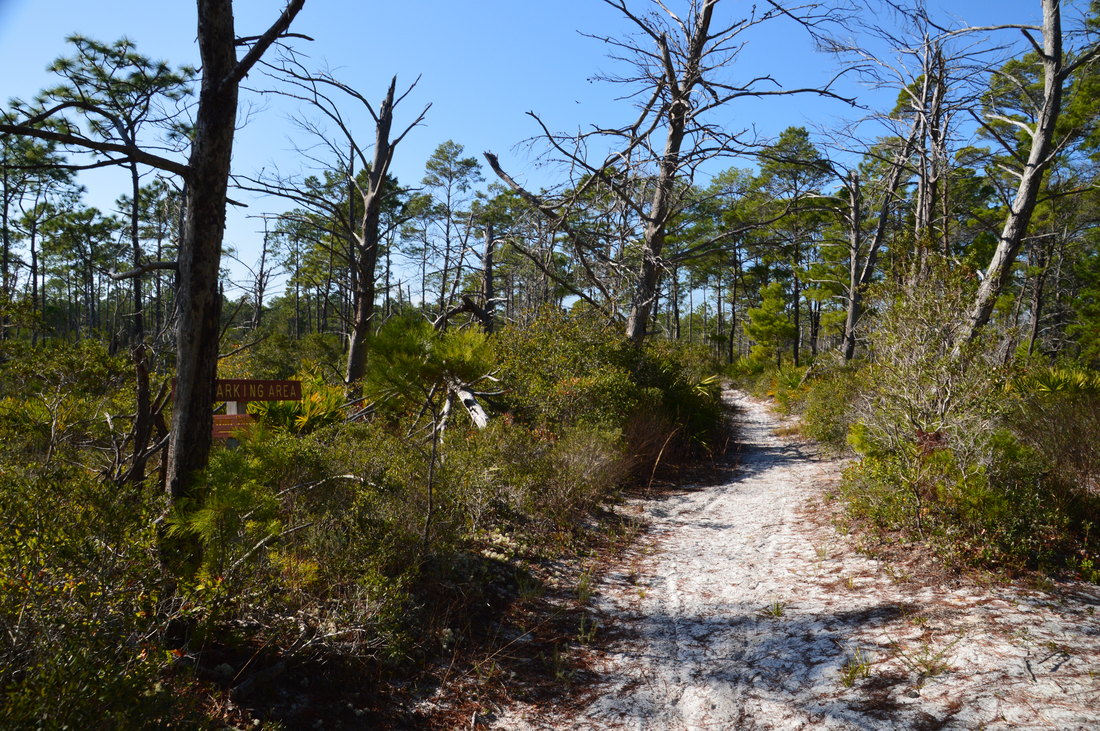
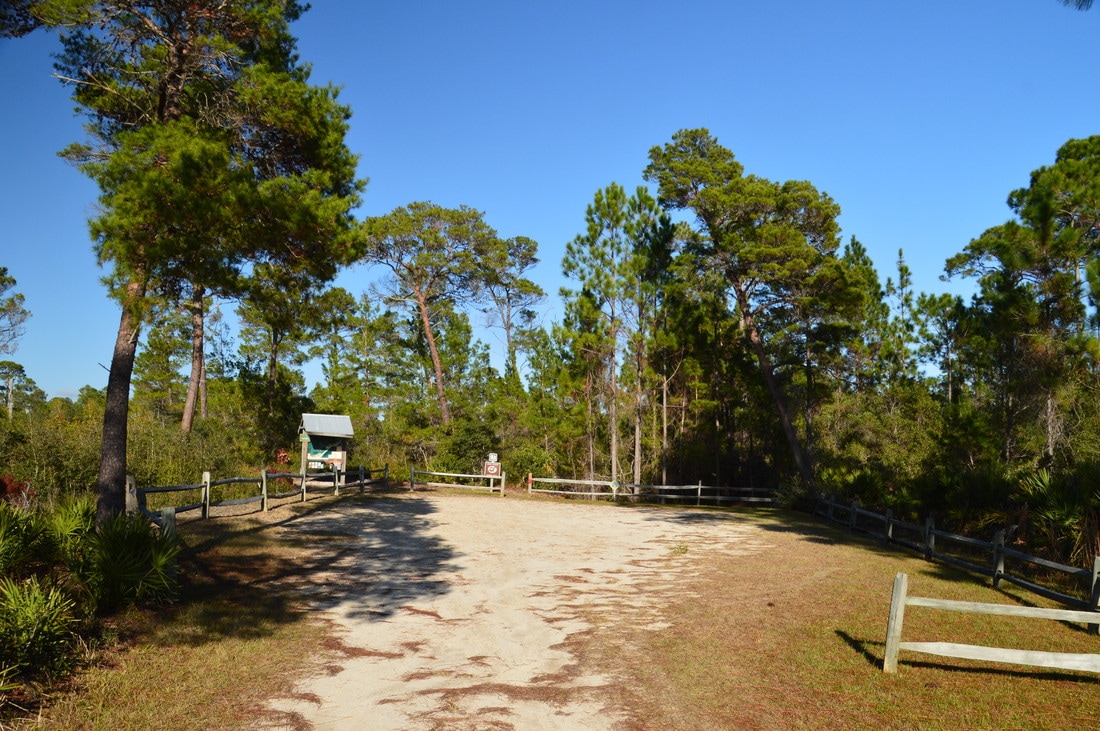
Duration of Hike: 3:50 
Type of Hike: Loop 
Difficulty Rating: 3 out of 10 
Total Elevation Gain: Minimal 
Pros: Elevated views that are uncommon for Florida 
Cons: Northern side of the High Bluff Loop is entirely on forest roads, some of which are accessible to cars
Points of Interest: Scenic sand dune view; Slough near West Trailhead
Trail Blaze Colors: High Bluff Outer Loop - Orange; High Bluff East Inner Loop - Blue; High Bluff West Inner Loop - Red
Best Seasons to Hike: Year-round (it can be hot during summer as much of the trail is out in the open) 
Fees: None 
Beginning Point: High Bluff East Trailhead
Directions from Carrabelle, FL: From the intersection of Tallahassee Street (County Road 67) and St. James Avenue (US Route 98/319) in downtown Carrabelle, follow US 98 West/US 319 South for 5.3 miles. After 5.3 miles, the entrance road to the East Trailhead parking area for High Bluff Coastal Hiking Trail will be to the right. It is marked by a sign. 

Map

Click ​here for more information and to download this trail map to view in Garmin Basecamp.

Details

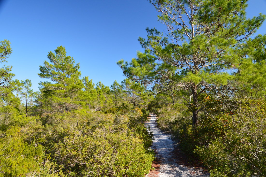
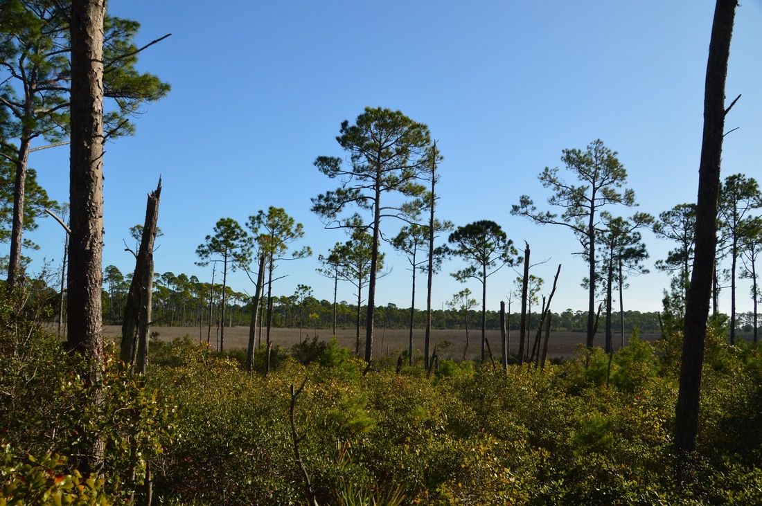
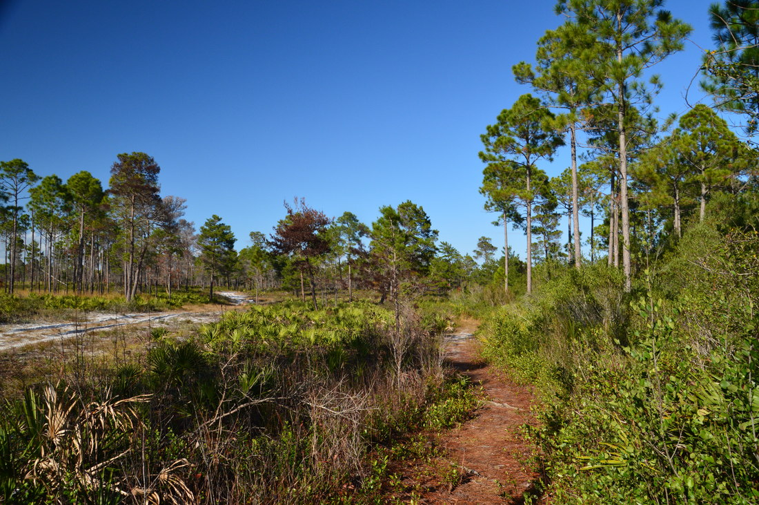
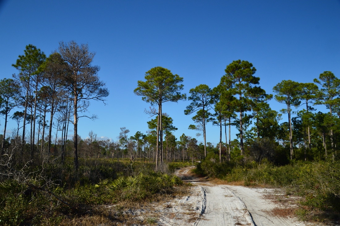
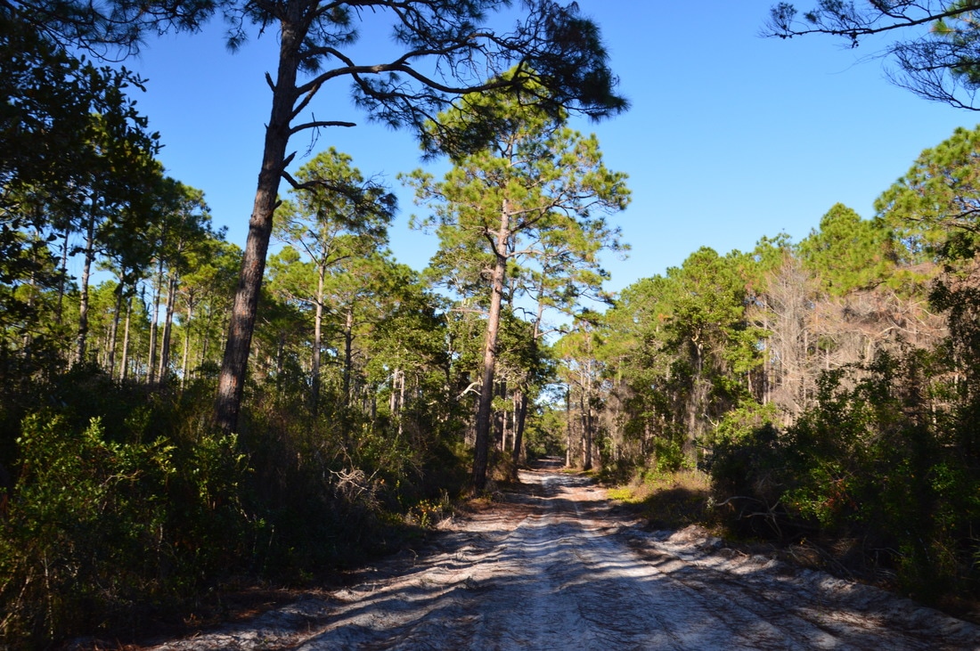
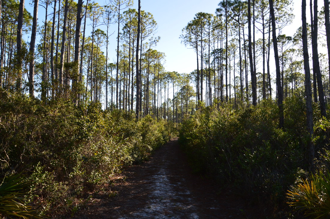
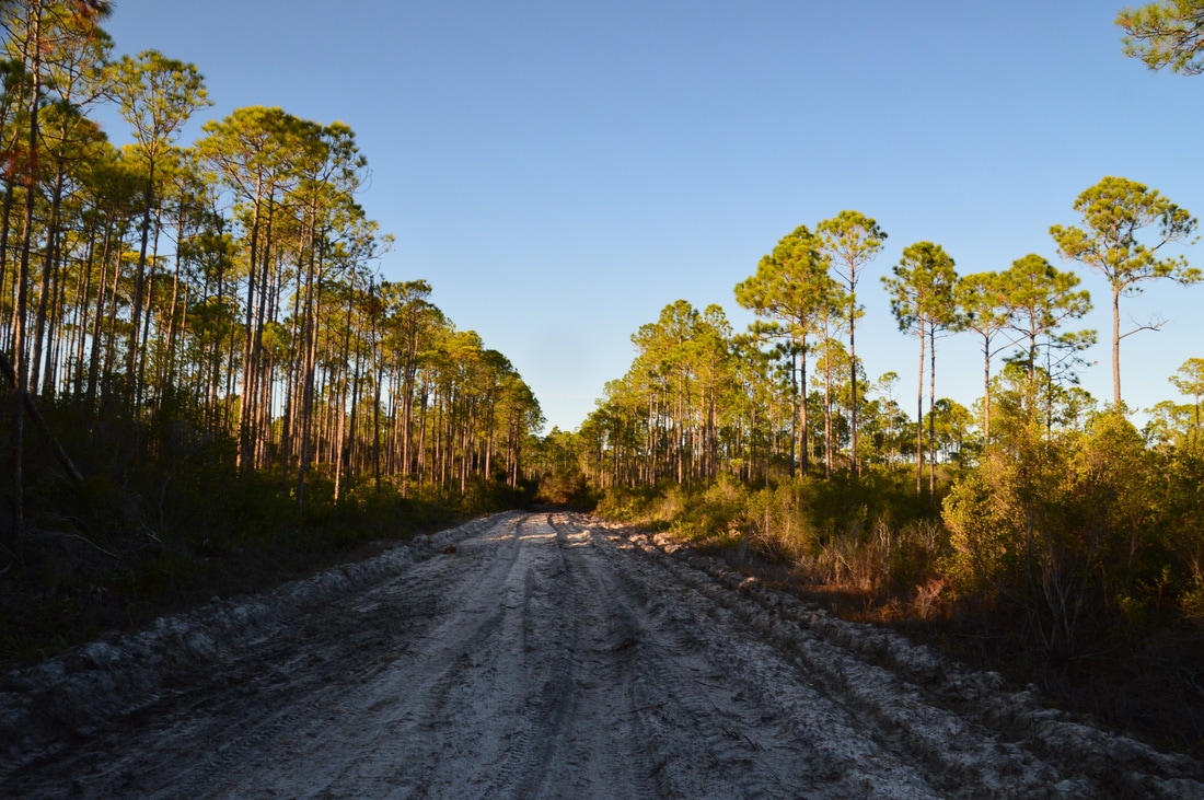
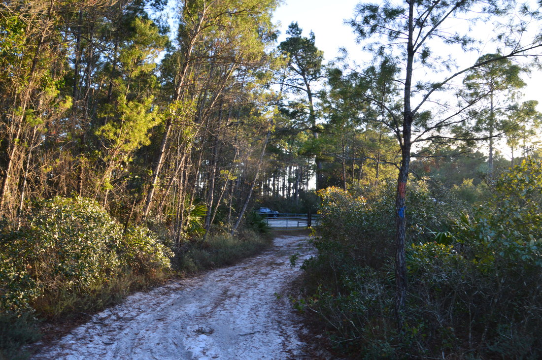
Most of Florida's coastline is either developed or is preserved but inaccessible due to marshes. The portion of the Forgotten Coast around Tate's Hell State Forest falls into neither category, and while US 98 - lined by occasional houses - follows the immediate coastline, there is a vast land of state land north of US 98 that is the Tate's Hell State Forest. The forest's only hiking trail is the High Bluff Coastal Hiking Trail, which is a loop that leads to several tall sand dunes near the coast. This trail is unique, because there are very few locations in Florida where you can be hiking on relatively pristine and remote trails near the ocean. Originally, the High Bluff Trail was only about a mile long roundtrip, but with time, the trail was extended to a second trailhead, and then later, several different forest roads north of the original trail were blazed and became part of a loop. In my opinion, the north side of the loop, which follows forest roads (some of which are actually accessible to cars), is not very scenic, but the south side of the loop - that follows single-track trail the entire time - is an excellent hike. 

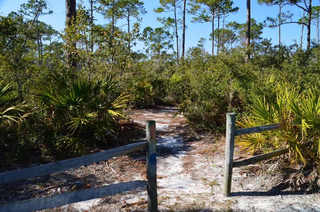
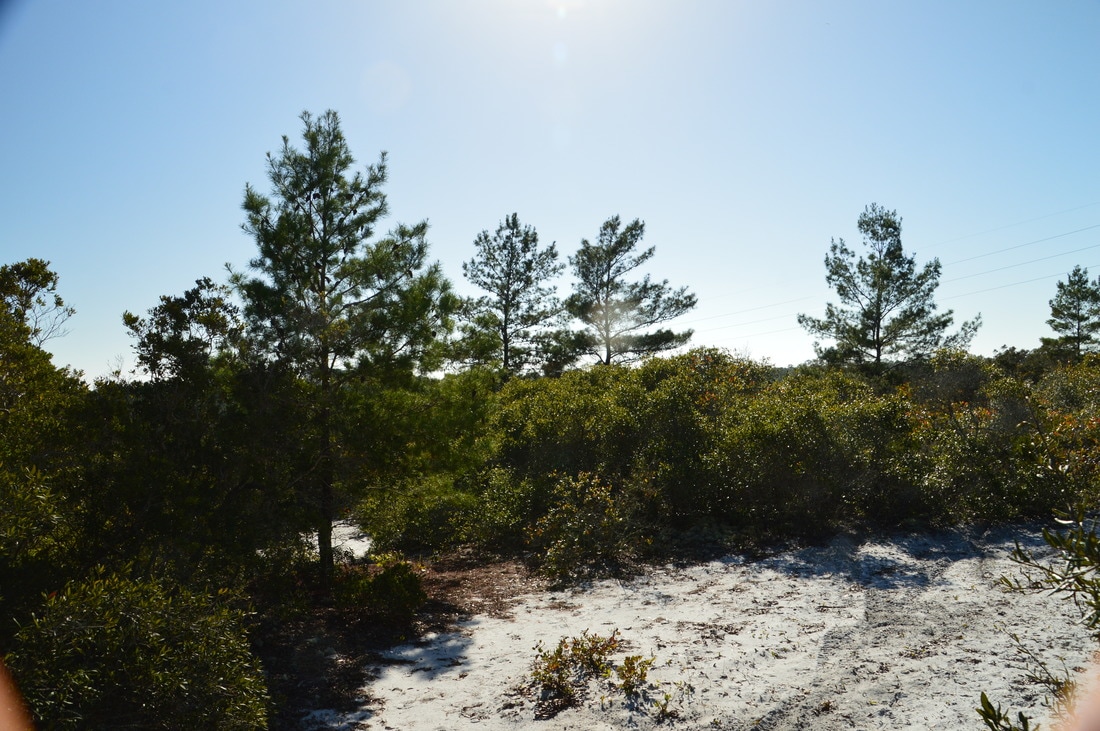
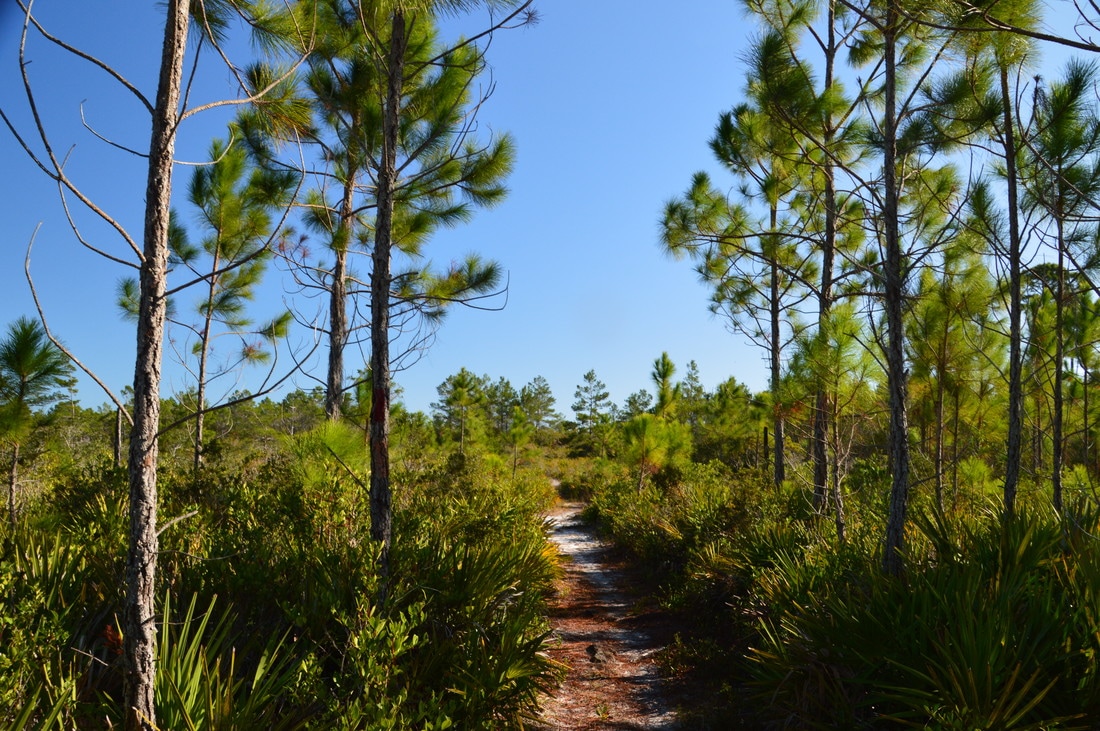
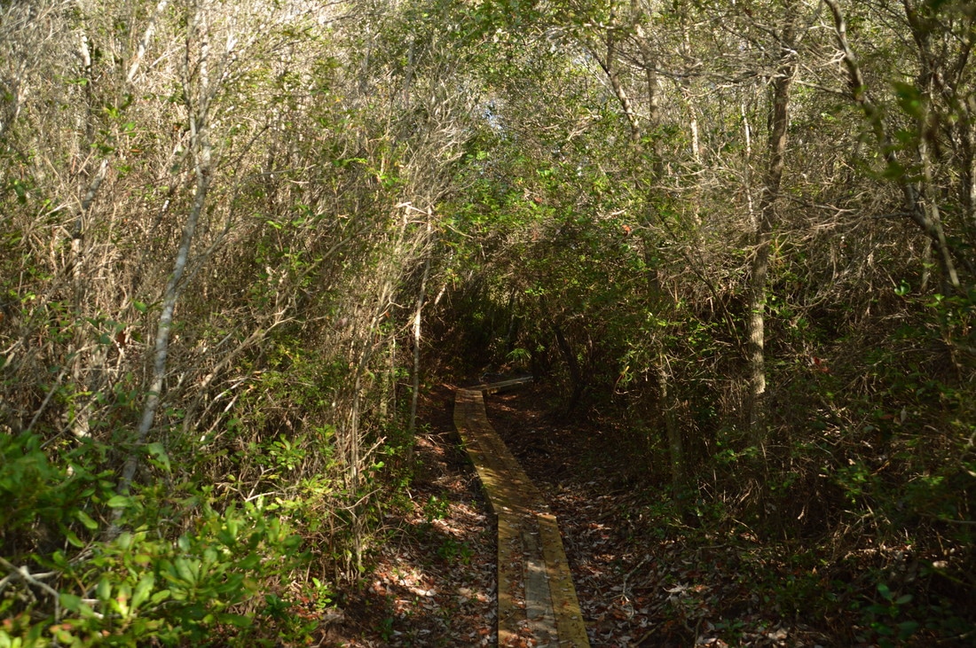
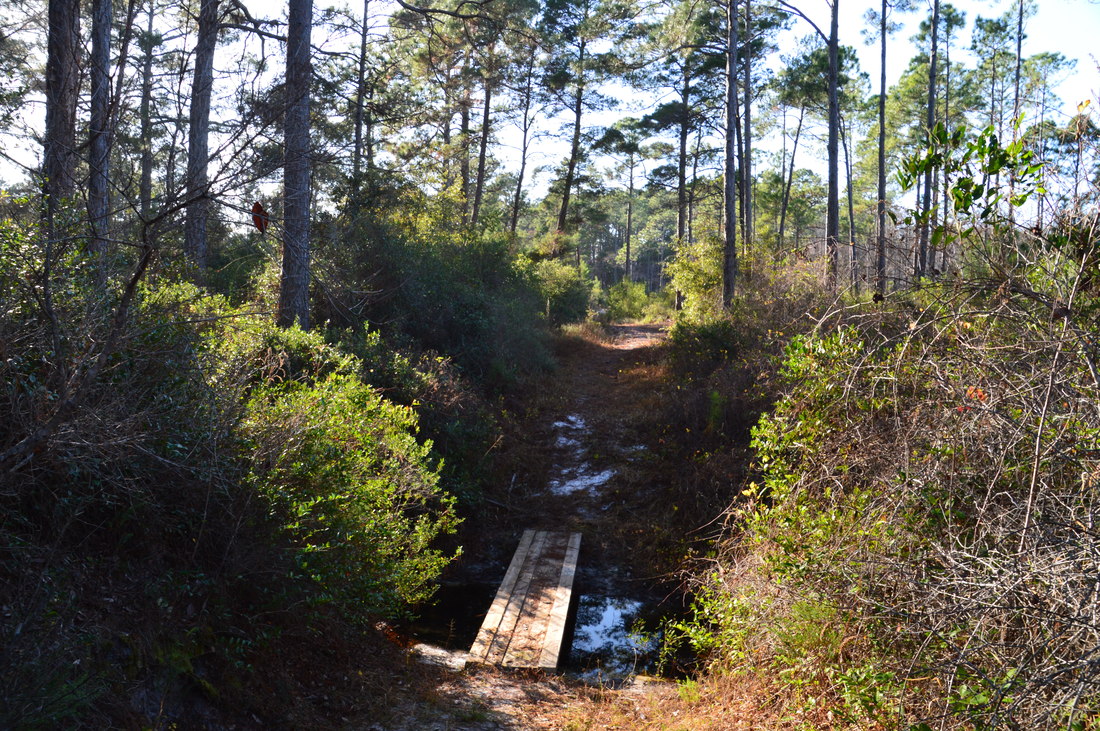
I chose to begin the hike at the East Trailhead and hike the single-track portion of the trail first (thus hiking the loop in a clockwise direction). To hike the loop clockwise, pass to the left of the trailhead kiosk, through a gap in the fence, and onto a blue-and-orange-blazed pathway. You'll see three different types of blazes on this hike, but to hike the outer loop, you must follow the orange blazes. Blue blazes mark the east loop and red blazes mark the west loop; there is quite a bit of overlap between red and orange blazes and blue and orange blazes. Pines and palmetto dominate the landscape in which the sandy trail starts out. At 0.4 miles, there is an intersection in the trail. Here, the main trail continues straight, while a slightly longer offshoot of the trail (which later returns to the main trail) turns right. I decided to hike the offshoot to see where it leads. Turn right and enter denser forest to reach a shaded picnic table at 0.55 miles, which is actually the primary attraction of the longer trail. After the picnic table, the path returns to the main trail at 0.6 miles; turn right to continue on the main trail. At 0.8 miles, the trail reaches Forest Road 83 - turn right onto this road, passing some houses to the left past the forest boundary. At 0.9 miles, an arrow points out the trail as it bears right off the road and back into the forest. At 1.05 miles, the trail passes through a titi thicket, where a small footbridge takes the trail across a seasonally wet area. 
Picture
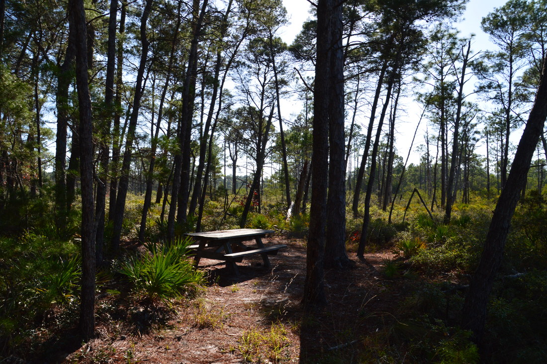
A shaded picnic table stands near the trail just over a half-mile from the East Trailhead.
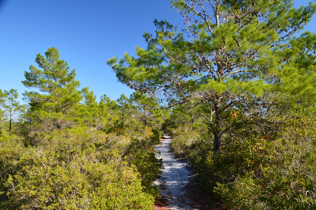
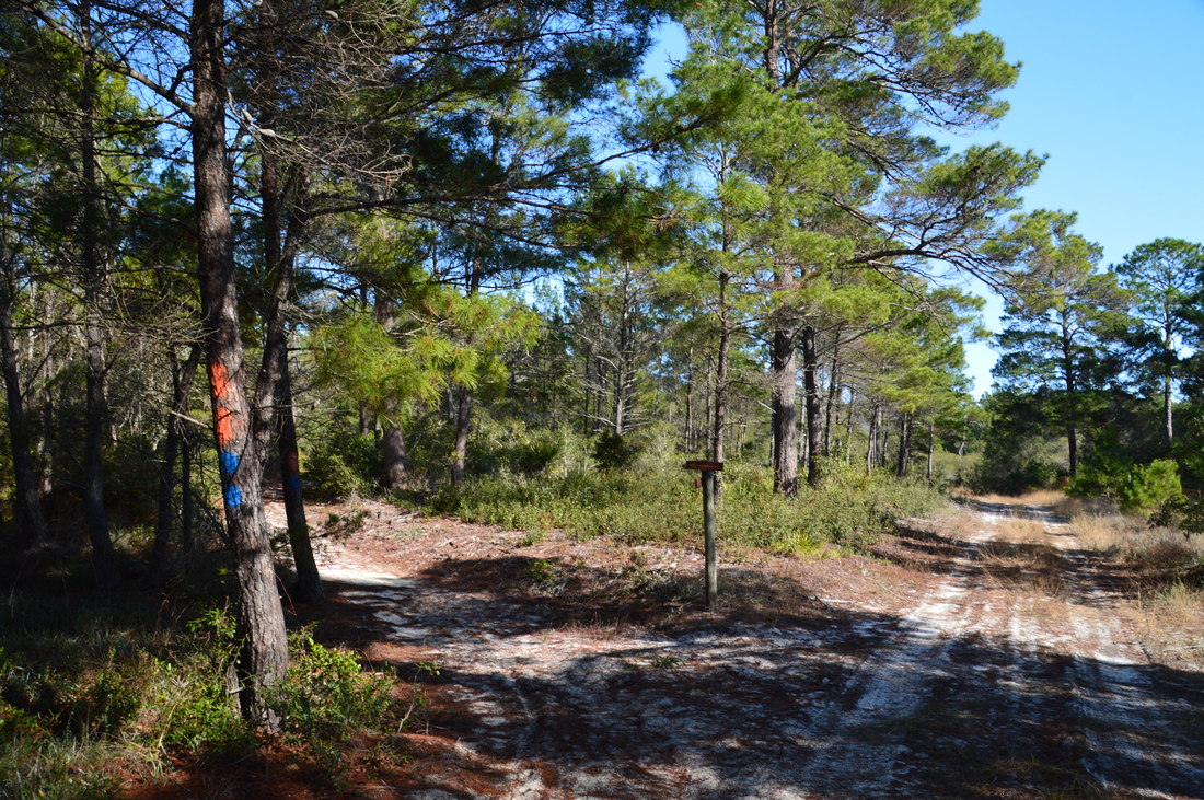
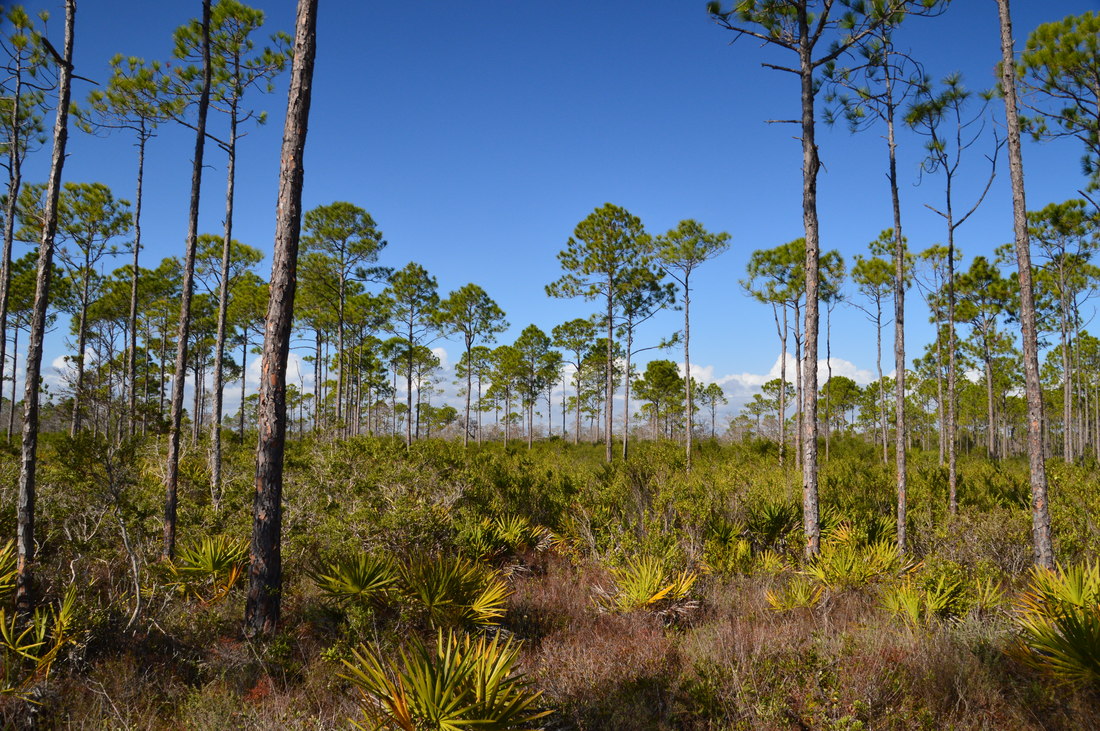
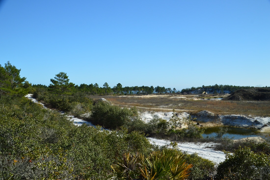
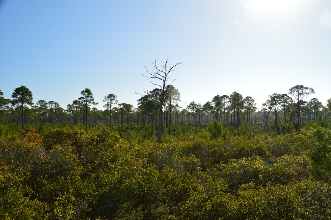
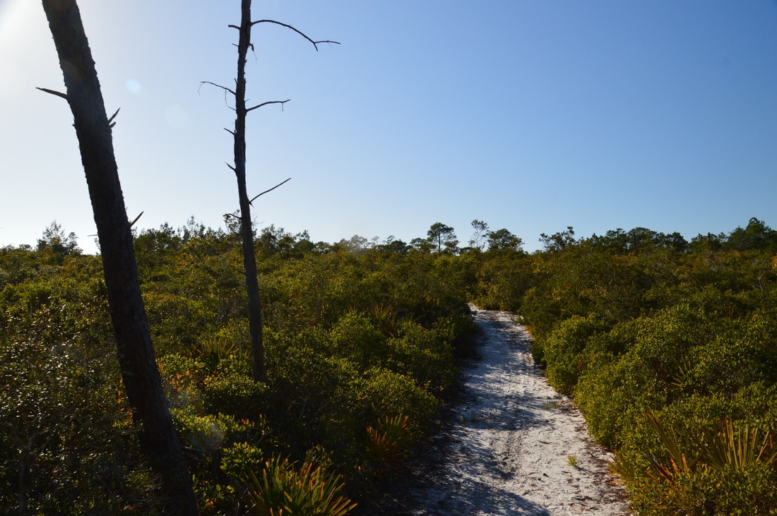
After the titi thicket, the trail passes through a more open area with great views of surrounding pine flatwoods and then reaches Forest Road 38 again at 1.25 miles. Turn right on the road and reach an intersection at 1.3 miles. here, the blue-and-red-blazed shortcut trail continues straight along the forest road, so if you want to hike just the blue east loop, that is where you must continue, but to hike the orange outer loop, turn left off the road and onto a path at the sign with arrows. At 1.55 miles, the trail turns noticeably sandier and makes a quick ascent to the top of an line of ancient sand dunes that is about 20 feet taller than the surrounding land. At 1.7 miles, do not miss an unmarked spur trail that leads left (south) for 100 feet to Forest Road 83A at the forest boundary and a notable elevated vista looking southward. The area in the foreground is not forest property and appears as if it is undergoing some sort of development. However, shifting your gaze outward into the distance, you can see the sparkling blue waters of St. George Sound past a line of pine-topped sand dunes. Elevated views are uncommon in Florida, so this short side trip is definitely worth it. 

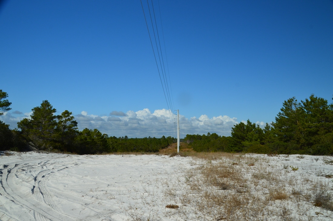
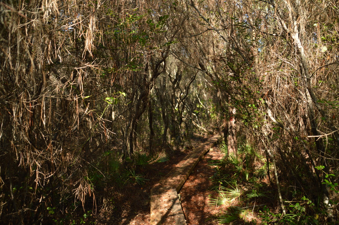
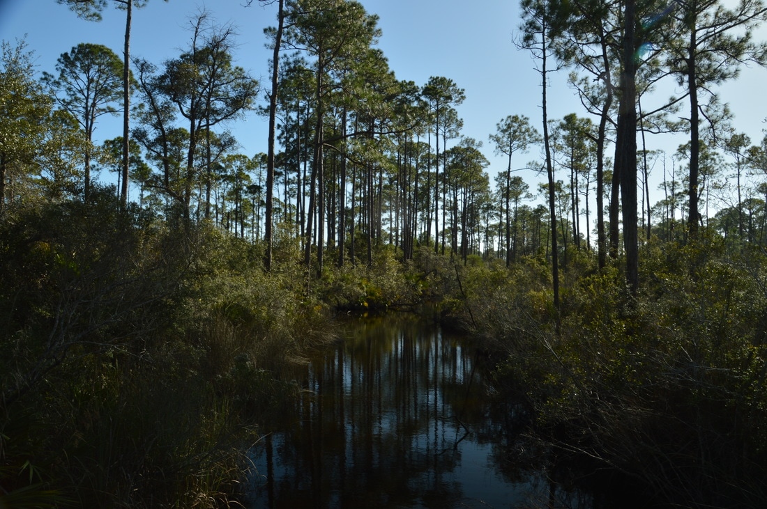
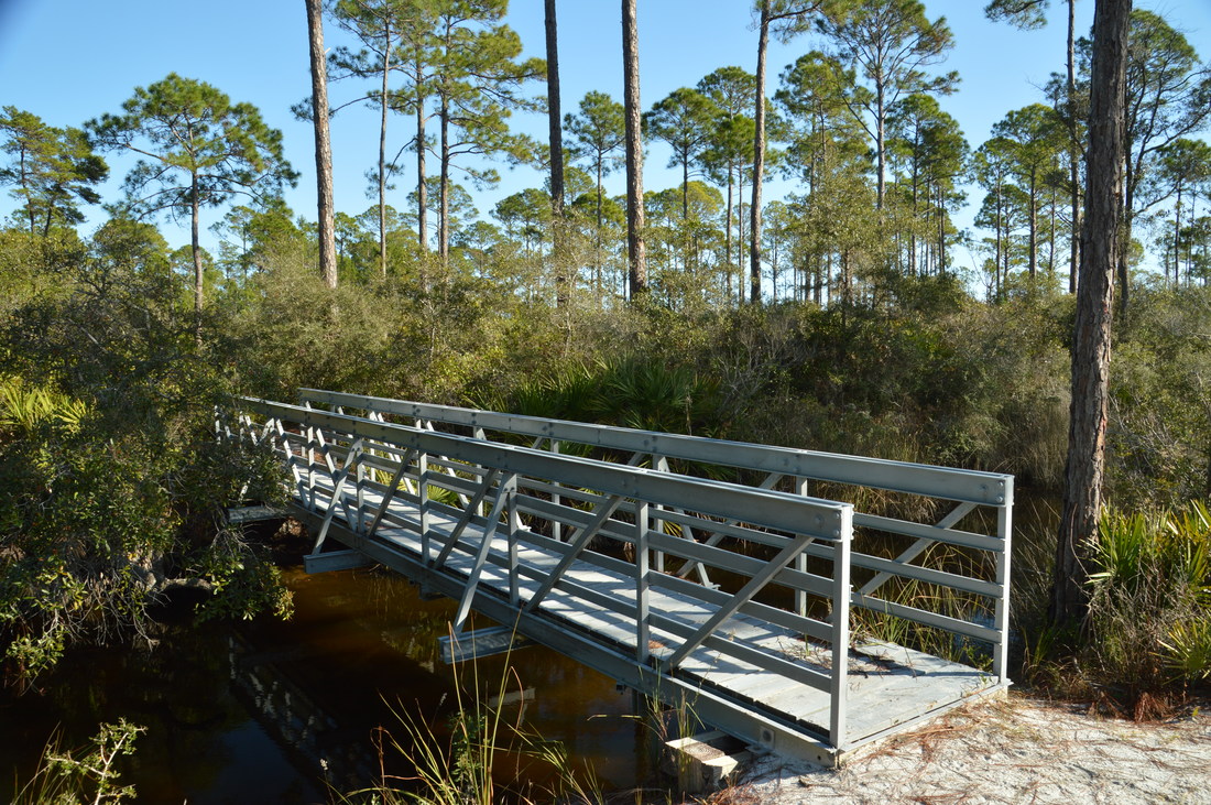
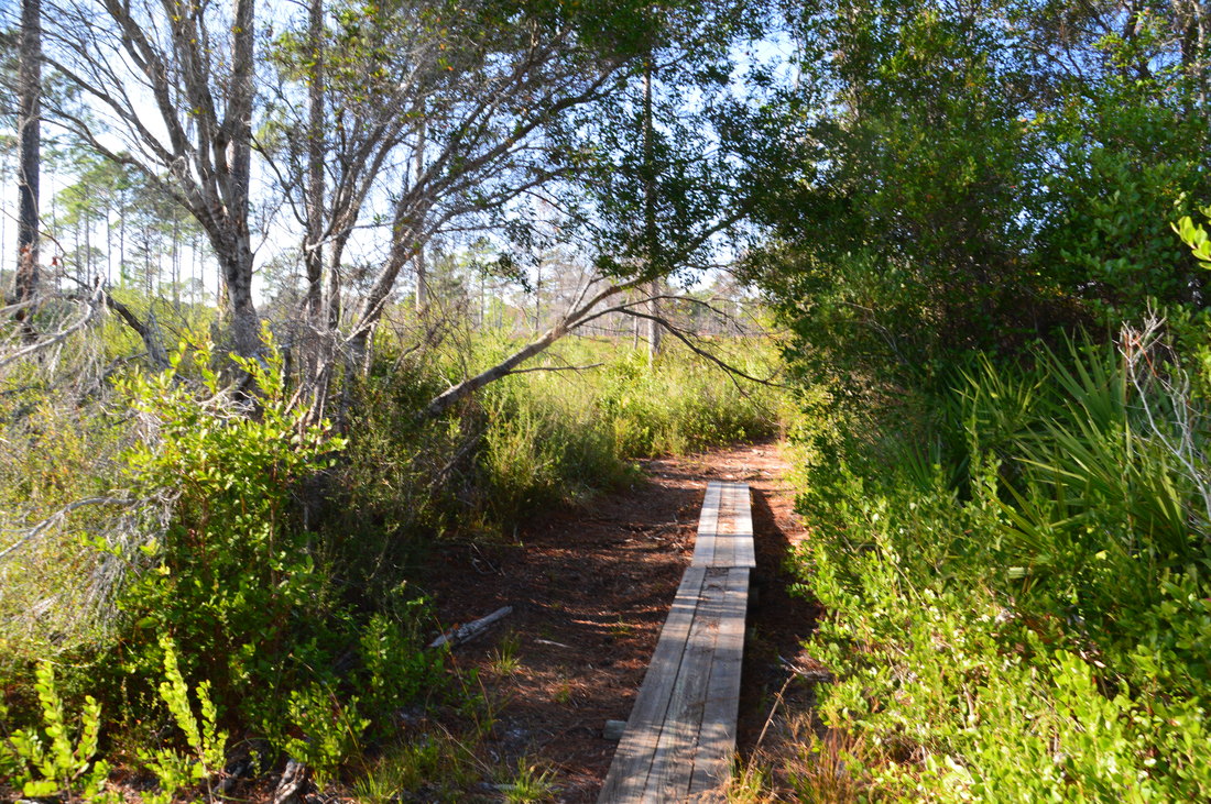
Back on the main trail, cross a sandy powerline clearing at 1.75 miles with another view to the south. The trail continues along the top of the sandy dune past low pine trees before descending back into the flatwoods at 2.0 miles. At 2.2 miles, the trail passes through a titi thicket along a plank boardwalk. After crossing Forest Road 83B, the High Bluff Trail passes through another dark titi thicket - that could also be a swamp, depending on recent rainfall - using a long boardwalk at 2.45 miles. After this, the trail ascends to another sand dune with views of a marsh lined by pines to the left (south) at 2.9 miles. I found numerous signs of bear activity (bear scat) in this area. The trail then descends the sand dune and nears the marsh (although never quite reaches it), before crossing a slough via a large footbridge at 3.25 miles. A picnic table is positioned next to the footbridge. As a forest road leaves to the right and connects to Forest Road 77, bear left to continue on the trail, which soon passes through an area that has recently been burned. At 3.85 miles, the trail approaches Forest Road 77, parallels it for a short distance, and then bears southeast away from the road, crossing a footbridge across a potentially muddy area at 3.95 miles. Then, the footpath reaches the West Trailhead parking area at 4.1 miles. 
Picture
Along the High Bluff Trail, there is an elevated view southward towards St. George Sound.
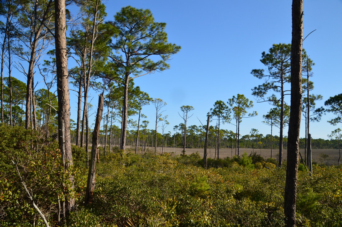
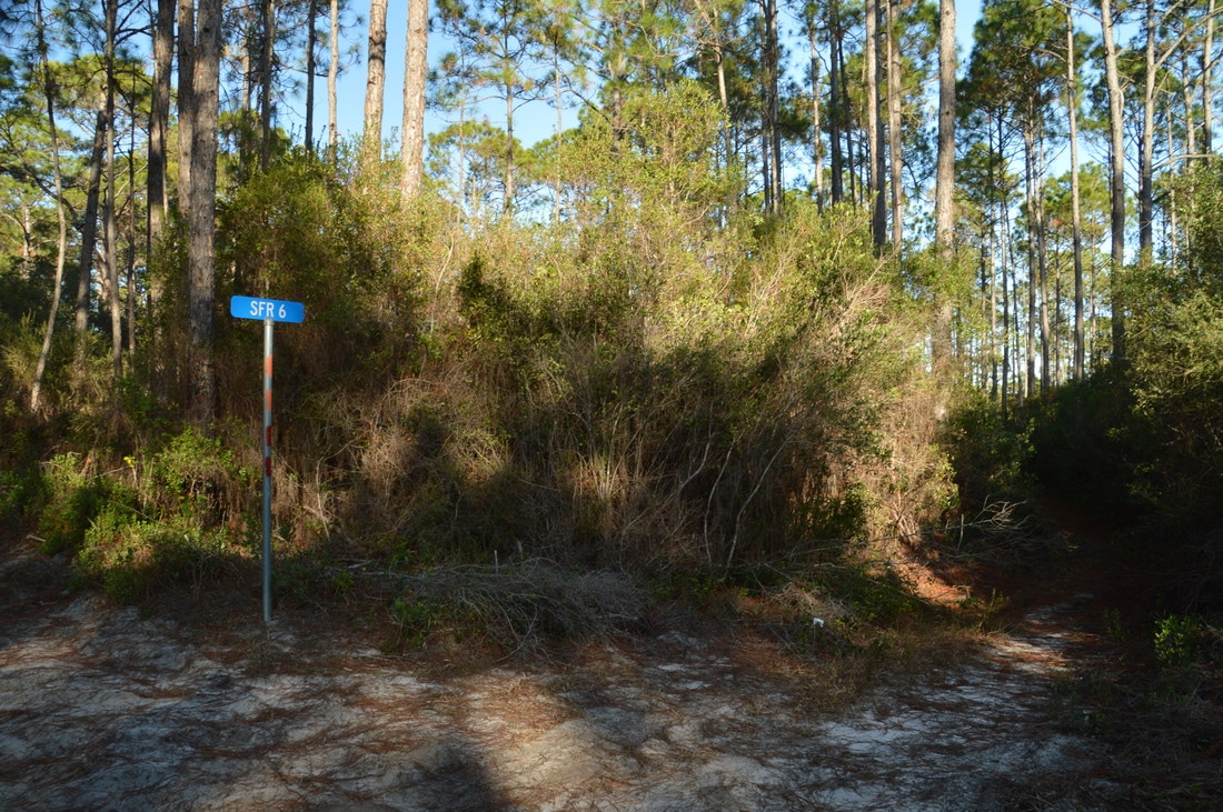
From the West Trailhead, you can either retrace your steps along the same trail or continue to hike the loop. To be honest, if you retrace your steps, you won't miss much, because the rest of the loop is entirely on forest roads of varying quality, and the scenery is less picturesque than on the south side of the loop. However, I still hiked the loop as I prefer to not retrace my steps on hikes, if it is possible. To hike the loop, pass through the parking area and turn right onto Forest Road 77, which is open to vehicles, as are most of the forest roads that the rest of the loop follows. That said, I did not run into a single car or ATV on my hike. After a long walk through pine flatwoods, there is a sort of turnaround at 5.0 miles. Forest Road 77 continues on the map but is impassable by vehicles. The trail crosses a pair of footbridges across sloughs and then scrambles up to another forest road at 5.15 miles, which seems to be the continuation of Forest Road 77. Turn left to continue on the trail (the road to the right leads to the slough footbridge with the picnic table that you passed earlier). Continue following this road northward through denser woods for another half-mile until the intersection with Forest Road 6 at 5.65 miles. The trail turns right on Forest Road 6, which is the most "trail-like" road on the north side of the loop and does not appear to get much if any vehicle usage. A sign labeled "SFR 6" and two pairs of double blazes (orange and red) mark the turn. 

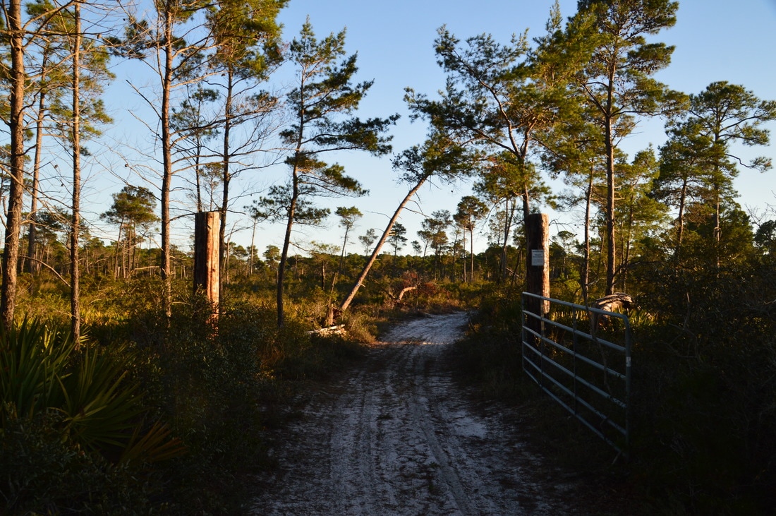
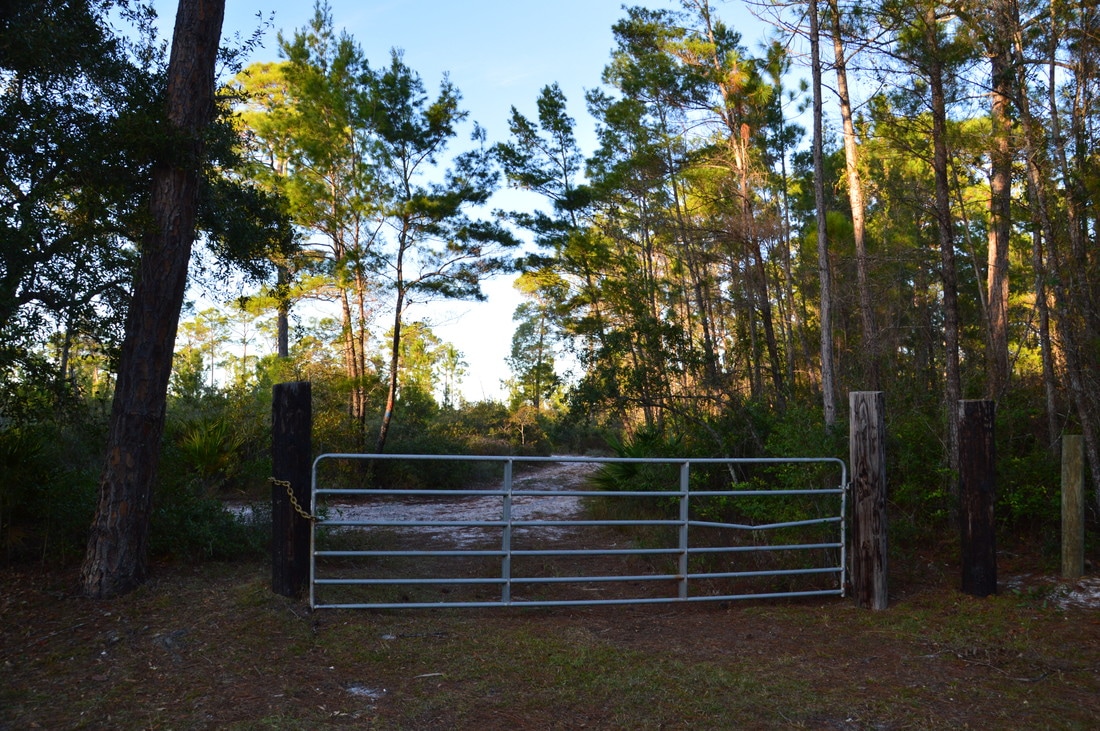
After a lengthy walk through more pine flatwoods with a mostly dense understory, Forest Road 6 ends at 6.7 miles at Forest Road 38. This is where the shortcut that you saw much earlier ends. The shortcut trail heads right, while the outer loop turns left onto Forest Road 38. At 6.8 miles, turn right onto Forest Road 81 to continue following the loop. This road is very sandy and does not allow a fast walking pace. The road crosses a powerline cut at 6.9 miles with a wetland to the right. At 7.7 miles, turn right onto Forest Road 40, which does not differ much from Forest Road 81 in both quality and scenery. The forest is still predominantly pines. The final turn is at 8.5 miles, where the trail turns right onto Forest Road 40C. This road is supposed to be gated, but on this day, I found the gate to be open. Follow this road south back to the East Trailhead, reaching it at 9.0 miles and concluding the hike. 
Picture
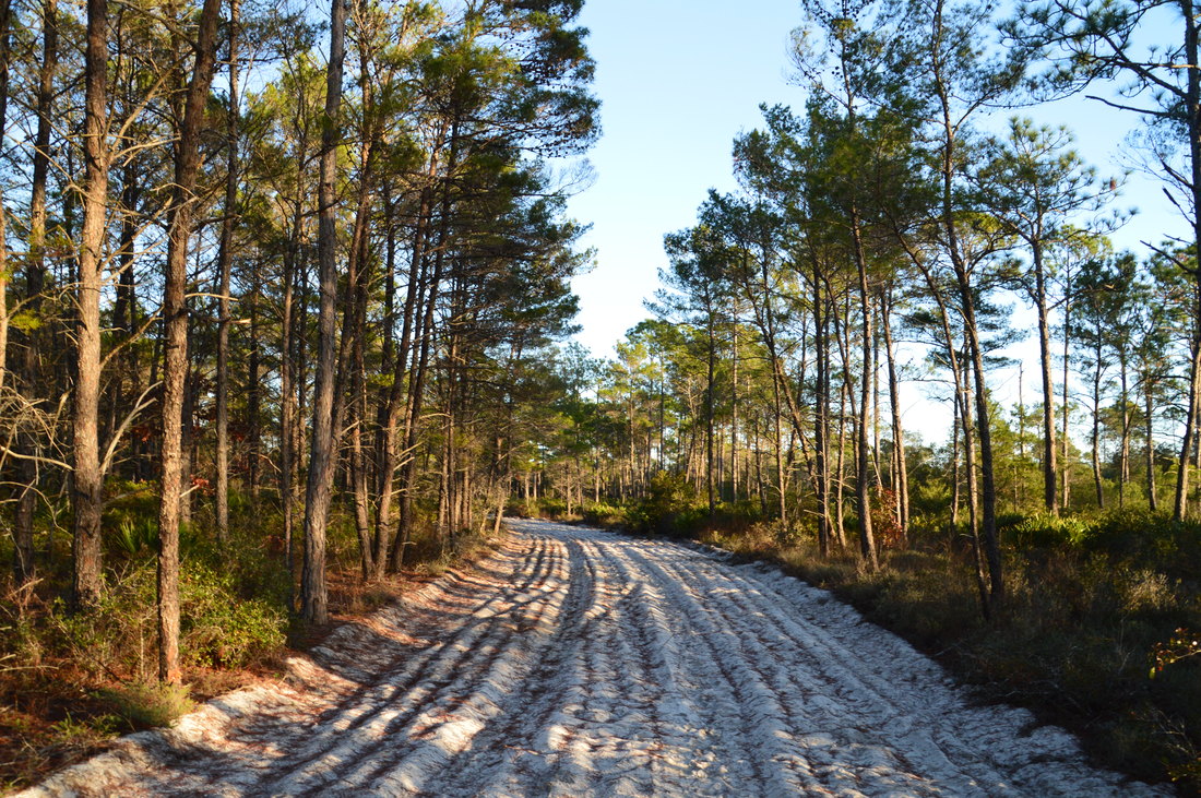
The north side of the High Bluff Trail follows forest roads of varying size and quality.

Mileage

0.0 - High Bluff East Trailhead 
0.55 - Picnic Table 
1.7 - Scenic View
3.25 - Slough Footbridge and Picnic Table 
4.1 - High Bluff West Trailhead 
9.0 - High Bluff East Trailhead

Variations

​Hike just the East Loop - 3.5 Miles 
Hike just the West Loop - 5.6 Miles 
Hike the south side of the High Bluff Trail out and back - 8.2 Miles 

Bonus Stops

Also in Tate's Hell State Forest, the Ralph G. Kendrick Cypress Boardwalk is a quick walk to a view of one of north Florida's most unique botanical sights. It is well worth the visit before or after the High Bluff Trail hike. 

Pictures

0 Comments


Leave a Reply.

    About Me

    Mark Oleg Ozboyd
    I'm an avid outdoor explorer and a hobbyist landscape photographer. I'm 21 years old and have been hiking since 2011. Originally based out of Atlanta, Georgia, I started out by occasionally hiking short trails throughout well-known Georgia State Parks. During 2012 and 2013, I began to expand my trips into adjacent states, as well as into the wilder National Forest areas rather than just State Parks. Throughout the years that followed, as I slowly ran out of popular hiking trails in my area, I began to search for and hike in more seldom-visited areas. Today, you can find me out in the woods every weekend, whether it's on an official trail or bushwhacking through cross-country terrain without any paths. I now attend Washington & Lee University and am exploring Virginia and West Virginia. My other hobbies include chess, science, old music, and meteorology. I have 3 years of amateur weather forecasting experience, having studied a lot of meteorology basics over the years. I am also a student at European School of Music where I learned that music and nature have a lot in common. Listening to good music inspires me to capture nature's beauty on the camera in different aspects that also make me recall many beautiful music pieces that I've heard.​


    Dear readers: I have invested a tremendous amount of time and effort in this website and the Georgia Waterfalls Database the past five years. All of the work that has gone in keeping these websites updated with my latest trip reports has almost been like a full-time job. This has not allowed me to pick up a paid job to save up money for college, and therefore, I I've had to take out loans. If you find the information on this website interesting, helpful, or time-saving, you can say "thanks" and help me out by clicking the button above and making a contribution. I will be very grateful for any amount of support you give, as all of it will apply toward my college tuition. Thank you! 

    Enter your email address to subscribe for trail reports:

    Delivered by FeedBurner


    Picture
    Coming in 2022-2023?

    Other Hiking Websites

    DWHike's Adventures
    Florida's Natural Wonders
    Florida Trailblazer
    Meanderthals
    Mountain Images
    by Bernie Boyer

    North Carolina Waterfalls with
    ​Kevin Adams
    Take-a-Hike!
    Tennessee Landforms
    Waterfall Page
    Waterfall Adventurer
    Zach's Mild Adventures

    Miles Hiked

    Year 1: 540.0 Miles
    Year 2: 552.3 Miles
    ​Year 3: 518.4 Miles
    Year 4: 482.4 Miles
    Year 5: 259.9 Miles

    Archives

    March 2021
    February 2021
    January 2021
    November 2019
    October 2019
    September 2019
    August 2019
    July 2019
    June 2019
    February 2019
    January 2019
    December 2018
    November 2018
    October 2018
    August 2018
    July 2018
    June 2018
    May 2018
    April 2018
    March 2018
    February 2018
    January 2018
    December 2017
    November 2017
    October 2017
    September 2017
    August 2017
    July 2017
    June 2017
    May 2017
    April 2017
    March 2017
    February 2017
    January 2017
    December 2016
    November 2016
    October 2016
    September 2016
    August 2016
    June 2016
    May 2016
    April 2016
    March 2016
    January 2016
    December 2015
    November 2015
    October 2015
    September 2015
    August 2015
    July 2015
    June 2015
    May 2015
    April 2015
    March 2015
    February 2015
    January 2015
    December 2014
    November 2014
    October 2014
    September 2014
    August 2014
    July 2014
    June 2014
    May 2014
    April 2014
    March 2014
    February 2014

    Categories

    All
    Adel
    Adirondack Park
    Alabama
    Alfred A. Ring Park
    Allegheny Trail
    Amicalola Falls State Park
    Anniston Area
    Apalachicola Bluffs And Ravines Preserve
    Apalachicola National Forest
    Apalachicola/Port St. Joe Area
    Apopka
    Appalachian Trail
    Appling
    Art Loeb Trail
    Aska Trail System
    Bakersville
    Balm-Boyette Scrub Preserve
    Balsam Lake Recreation Area
    Bankhead National Forest
    Bartow County Parks
    Bartram Trail
    Basinger
    Beersheba Springs
    Benton
    Benton Mackaye Trail
    Berry College Trail System
    Best Hike
    Big South Fork National Recreation Area
    Black Bear Wilderness
    Black Rock Mountain State Park
    Blairsville
    Blakely
    Blood Mountain Wilderness
    Blowing Rock
    Blue Ridge
    Blue Ridge Parkway
    Boone
    Bradenton
    Bradenton Beach
    Brasstown Bald
    Brasstown Wilderness
    Brevard
    Bryson City
    Buchanan
    Bucks Pocket State Park
    Bulow Creek State Park
    Bulow Plantation Ruins State Park
    Caesars Head State Park
    Caladesi Island State Park
    Calhoun
    Camel's Hump State Park
    Cashiers
    Caspersen Beach Park
    Catfish Creek State Park
    Caves
    CC Putnam State Forest
    Cedar Point Environmental Park
    Chatsworth
    Chattahoochee National Forest
    Chattanooga
    Chattanooga Valley
    Chattooga National Wild And Scenic River
    Cheaha Wilderness
    Cherohala Skyway
    Cherokee
    Cherokee National Forest
    Chiefland Area
    Chillhowee Recreation Area
    Chipley
    Chunky Gal Trail
    Circle B Bar Reserve
    Citico Creek Wilderness
    Citrus Wildlife Management Area
    Clarkesville
    Clayton
    Cleevland
    Cleveland
    Cloudland Canyon State Park
    Cohutta Wilderness
    Collier-Seminole State Park
    Cordele
    Cornelia
    Covington
    Crestview Area
    Crew-land-and-water-trust
    Cullowhee
    Cumberland Trail
    Dahlonega
    Dalton
    Dawson Forest Wildlife Management Area
    Dawsonville
    Dayton
    De Soto National Memorial
    DeSoto State Park
    Dillard
    Double Springs
    Ducktown
    Duncan Ridge Trail
    Dunlap
    Eagle's Rest Park
    Eastpoint
    Econfina Creek Wildife Management Area
    Eglin Air Force Base
    Elizabethton
    Elkins
    Elk Knob Game Lands
    Elk Park
    Ellicott Rock Wilderness
    Ellijay
    Emerson Point Preserve
    Englewood Area
    Enota Retreat
    Erwin
    Falling Waters State Park
    Fayetteville
    Fires Creek Recreation Area
    Fire Tower
    Flint River
    Florence Area
    Florida
    Florida Caverns State Park
    Florida Trail
    Foothills Trail
    Fort Mountain State Park
    Fort Myers Area
    Fort Payne
    Fort Payne Area
    Fort Yargo State Park
    Franklin
    Franklin Delano Roosevelt State Park
    Franklin-Marion State Forest
    Frozen Head State Park
    Gainesville
    Gainesville Area
    Gatlinburg
    George Washington National Forest
    Georgia
    Georgia Veterans Memorial State Park
    Glasgow
    Gorges State Park
    Grandfather Mountain State Park
    Great Smoky Mountains National Park
    Greeneville
    Green River Game Lands
    Gruetli-Laager
    Grundy Forest State Natural Area
    GTM Reserve
    Guana River Wildlife Management Area
    Hayesville
    Helen
    Hiawassee
    High Falls State Park
    Highlands
    Highlands Scenic Highway
    Hillsborough River State Park
    Hinson Conservation & Recreation Area
    Historic Sites
    Honeymoon Island State Park
    Hot Springs
    Huntington
    Inverness Area
    Jackson
    Jasper
    Jefferson National Forest
    Joan M. Durante Park
    Jonathan Dickinson State Park
    Jones Gap State Park
    Joyce Kilmer Slickrock Wilderness
    Joyce Kilmer - Slickrock Wilderness
    Juniper Prairie Wilderness
    Kelly Park
    Keown Falls Recreation Area
    Kolomoki Mounds State Park
    LaFayette
    Lake City Area
    Lake George Wild Forest
    Lake June-in-Winter State Park
    Lakeland Area
    Lake Placid
    Lake Russell Wildlife Management Area
    Lake Wales Ridge State Forest
    Laurel Fork North Wilderness
    Leffis Key Preserve
    Leon Sinks Geological Area
    Lexington
    Lineville
    Linville
    Linville Gorge Wilderness
    Lithia Springs
    Little Frog Wilderness
    Little Manatee River State Park
    Little River Canyon National Preserve
    Longboat Key
    Long Trail
    Lookout Mountain
    Lookout Mountain Battlefield
    Lovingston
    Lula Lake Land Trust
    Lumpkin
    Maggie Valley
    Manatee Springs State Park
    Marianna Area
    Mark Trail Wilderness
    Marlinton
    Mccaysville
    McMinville
    Mentone
    Middlesex
    Mistletoe State Park
    Monongahela National Forest
    Montreat
    Mountain Bridge Wilderness Area
    Mountain City
    Mountains To Sea Trail
    Mountains-to-Sea Trail
    Mount Rogers National Recreation Area
    Myakka River State Park
    Myron B. Hodge City Park
    Nantahala National Forest
    Naples
    Naples Area
    Natural Bridge State Park
    Neal Preserve
    New Castle
    Newport
    New River Gorge National Park
    New York
    North Carolina
    Ocala Area
    Ocala National Forest
    Ocean-to-Lake Trail
    Oconee State Park
    Oconee Station Historic Site
    Okaloacoochee Slough State Forest
    Oldsmar
    Oneida
    Orlando Area
    Ormond Beach
    Oscar Scherer State Park
    Oxford
    Palatka
    Palmetto Trail
    Panama City Area
    Panthertown Valley
    Parrish
    Paynes Creek Historic State Park
    Peaks Of Otter Recreation Area
    Pigeon Crockford Mountain Wildlife Management Area
    Pigeon-Crockford Mountain Wildlife Management Area
    Pigeon-Crockford Wildlife Management Area
    Pine Mountain
    Pinhoti Trail
    Pinnacle Park
    Pisgah Civitan Park
    Pisgah National Forest
    Pittman Center
    Pond Mountain Wilderness
    Ponds/Lakes
    Prentice Cooper State Forest
    Providence Canyon State Park
    Pumpkintown
    Quick Point Nature Preserve
    Raven Cliffs Wilderness
    Reed Bingham State Park
    Reliance
    Rice Creek Conservation Area
    Riverview Pointe Preserve
    Robbinsville
    Robinson Preserve
    Rock Creek Gorge Scenic Area
    Rock Island State Park
    Rome
    Rosman
    Sale Creek
    Salem
    Salt Springs
    Saluda
    Santa Rosa Beach
    Sarasota
    Sarasota Area
    Savage Gulf State Natural Area
    Scenic Views
    Scottsboro Area
    Sebring Area
    Sewanee
    Sheltowee Trace Trail
    Shining Rock Wilderness
    Signal Mountain
    Sipsey Wilderness
    Sky Valley
    Smithgall Woods State Park
    Snowbird Backcountry Area
    Soddy Daisy
    Soddy-Daisy
    Sopchoppy
    South Carolina
    South Cumberland State Park
    Southeastern Cave Conservancy
    Southern Nantahala Wilderness
    Sparta
    Sprewell Bluff Park
    Spring City
    Spring Hill
    Springs
    Spruce Pine
    Standing Indian Backcountry Area
    St. Augustine
    St. George Island State Park
    St. Joseph Bay State Buffer Preserve
    St. Marks Area
    St. Marks National Wildlife Refuge
    Stone Mountain
    Stone Mountain Park
    Suches
    Sumatra
    Sumter National Forest
    Suwannee River
    Swallow Creek Wildlife Management Area
    Sweetwater Creek State Park
    Sylva
    Talladega National Forest
    Tallahassee Area
    Tallulah Falls
    Tallulah Gorge State Park
    Tampa Bay Area
    Tate City
    Tate's Hell State Forest
    Tea Creek Wildlife Management Area
    Tellico Plains
    Tennessee
    Thomaston
    Toccoa
    Topsail Hill State Park
    Torreya State Park
    Townsend
    Tracy City
    Tray Mountain Wilderness
    Trenton
    Triple Creek Preserve
    Troutdale
    Unaka Mountain Wilderness
    Upper Tampa Bay County Park
    Venice
    Vermont
    Virgin Falls State Natural Area
    Virginia
    Virginia Outdoors Foundation
    Vogel State Park
    Wakulla Springs State Park
    Waleska
    Walhalla
    Wartburg
    Water Features
    Waynesville
    Weedon Island Preserve
    Weeki Wachee Preserve
    Wekiwa Springs State Park
    West Palm Beach Area
    West Virginia
    Whitehall
    White Springs
    Winder
    Withlacoochee State Forest
    Young Harris

    RSS Feed

TRAIL REPORTS

Hikes in Alabama
​Hikes in Florida
Hikes in Georgia
Hikes in North Carolina
Hikes in South Carolina
Hikes in Tennessee
Hikes in Virginia

Hiking Resources

Alabama Resources
​
Florida Resources
Georgia Resources
North Carolina Resources
​South Carolina Resources
​
Tennessee Resources

Other

Contact
Map of Hikes
Alphabetical List of Hikes
Southeast Nature Society
© COPYRIGHT 2014-2018
​ALL RIGHTS RESERVED.
Important: I disclaim any responsibility for any damage or personal injury that may occur as a result of the activities and information found on this website. All outdoor activities, especially off-trail hiking, are done at your own risk. Never hike or head into that area that may be above your fitness or experience level.
  • Home
  • Trail Reports
    • Best Hikes
    • Hikes with Scenic Views
    • Hikes with Water Features
    • Alabama
    • Georgia
    • Florida
    • North Carolina
    • South Carolina
    • Tennessee
    • Vermont
    • Virginia
  • Map
  • Hike List
  • Testimonials
  • Resources
  • Contact Us
  • Southeast Nature Society
    • Our Team
  • Georgia Waterfalls Database