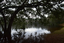
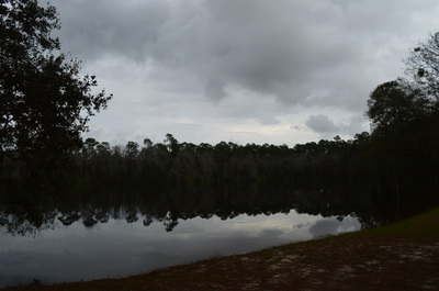
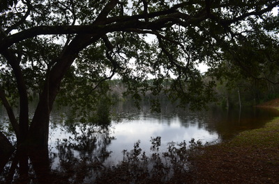
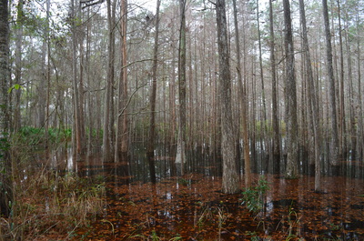
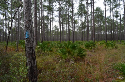
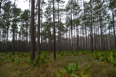
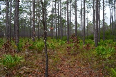
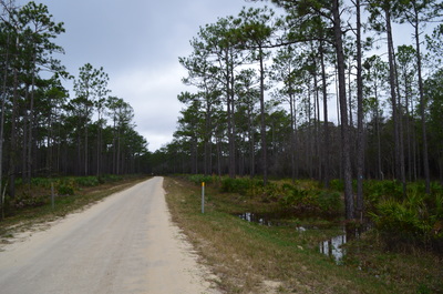
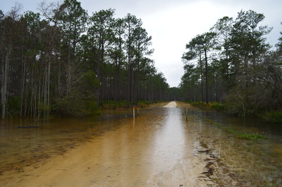
 Coming in at over 600,000 acres, Apalachicola National Forest is Florida's largest national forest - it is the home to the famed Bradwell Bay Wilderness, one of the wildest swamps in Florida. While the forest may be best-known for the large swamp expanse of Bradwell Bay, it is also home to an uncommon sight - numerous pitcher plant bogs scattered throughout the area. One particular hiking trail, the Wright Lake Loop, visits several of these pitcher plant bogs in the western section of the forest that are easy to get to. However, after a month of historical rains, they may not be quite so easy to get to. This hike occurred on Thursday, December 31, 2015. My plan was to hike the entire Wright Lake Loop, but due to impassable sections of trail with pretty severe flooding ongoing in all of the nearby creeks, I was forced to abandon my plan and hike merely a small segment of the Wright Lake Loop. SummaryPlease note that this trail report is not regarding the full extent of the Wright Lake Loop that I was unable to hike on this day due to impassable stretches of trail. The trail report reflects a small portion of the Wright Lake Loop, 1 mile long one way, from FS Road 181 to FS Road 181-B. This section does reportedly have some of the pitcher plant bogs on the hike. This page will be updated or removed and replaced, if I get the chance to rehike this trail and complete the full loop. R/T Length of Trail: 2 Miles Duration of Hike: 0:50 Type of Hike: Out and Back (dirt roads can be used for a loop option) Difficulty Rating: 1 out of 10 Total Elevation Gain: Minimal Pros: This section of the Wright Lake Loop Trail is guaranteed to be dry no matter what Cons: None Points of Interest: Pitcher plant bogs that have pitcher plants in spring Trail Blaze Color(s): Wright Lake Loop Trail - Blue Best Season(s) to Hike: Spring Fees: There are no fees if you do the hike from FS 101 or FS 101-B, but as of 12/31/15, the fee is $3 if you start from the Wright Lake Recreation Area and hike the full loop. Beginning Point: FS 101 where the Wright Lake Loop Trail crosses the road Directions: From Sumatra, FL: Continue South on FL State Route 65 for 1.9 miles. Then, turn right onto Wright Lake Road. This is also known as Forest Service Road 101. It is a dirt road in good condition. Follow FS 101 for 1 mile to where the blue-blazed Wright Lake Loop Trail crosses the road. Park on the shoulder. If you would like to continue to Wright Lake Recreation Area, continue straight for another 0.6 miles. Then, bear right at the fork and enter the recreation area. MapA map and some other information regarding this hike can be viewed here. DetailsThis hike was one at the top of my list to complete upon my visit to the Florida Panhandle. Unfortunately, the weather did not cooperate. All of the Southeast US experienced one of the wettest and warmest Decembers on record, with intense flooding ongoing all across the Southeast, save the Florida peninsula. While the Florida peninsula avoided most of the rain, the Florida peninsula wasn't so lucky, and many forest roads, trails, and recreation areas had to be closed due to flooding of all of the different streams and marshes that feed into the Apalachicola River in Apalachicola National Forest. To my surprise, neither the Wright Lake Trail nor the Wright Lake Recreation Area were closed on this day. However, it didn't take long for it to become apparent that this trail wasn't going to be easy to hike. The start to the normally dry trail in Wright Lake Recreation Area was flooded by a marsh, and Wright Lake was out of its banks, flooding the beginning of the trail too. Unsure what to do, I was about to start from a different trailhead (having uselessly paid my $3 fee), when I talked to a hiker who had just finished the trail. He told us that there were several sections of the trail, where the water was waist-deep, and Coffee Branch had risen so high that the footbridge over it was underwater and the creek looked like it had to be swum across! With these news, I totally abandoned any idea of hiking the full trail. Also, I learned that my alternative, a 1-mile hike at Fort Gadsden, was closed as well... leaving me with but one option: to hike the only section if Wright Lake Trail that I knew would be dry no matter what, as it travels through piney uplands. That said, I drove back down FS 101 and started where the Wright Lake Loop Trail crossed the road, with the intention to hike as far as I could in a southwesterly direction. The trail first headed south from FS 101. This is the heart of the Apalachicola National Forest's pine flatwoods. As you look at the surrounding pine forest that seems to stretch on endlessly for miles, a sense of isolation may be felt. At 0.2 miles, bear right as the trail joins an ATV track. You will curve around the headwaters area of one of the streams that join Coffee Branch and into a corridor of saw palmetto. Saw palmetto thrives in the understory of pine flatwoods. At 0.75 miles, the trail exits the pines, and suddenly, there are signs of civilization. You have reached a road - FS 101-B - that was closed on this day due to flooding. I was soon to find out why. The trail turns left and follows the road for a while. At 0.85 miles, the trail turned right off the road, and continued parallel to it. However, this section was rather wet on this day after all of the rain. I decided to continue following the road and watch where the trail would go. At 1 mile, the trail reached Coffee Branch. The normally narrow creek was quite wide on this day, and its tannic waters quietly flowed over the road here. The dirt road vanished beneath the creek's dark surface. Apparently, the creek is culverted here and the water should normally not flow over the road. For this reason, the road was closed. Also, it was unclear as to where the trail goes from here. Looking at the blazes, it seemed like the trail crossed Coffee Branch via the road's culvert. It would then bear right into the woods along Coffee Branch. I decided that this was a good point to backtrack, as there was no telling how deep the waters of Coffee Branch were. On my way back, I decided to use the little-traveled FS roads to make a loop out of the hike and see some new scenery. The endless pine flatwoods continued to look fairly impressive. Whether you use the roads or the trail, the roundtrip distance is about the same, ending at about 2 miles. VariationsHike the full Wright Lake Loop Trail - 4.5 Miles Bonus StopsFort Gadsden Nature Trail is nearby, also in Apalachicola National Forest, and can be a nice historical walk to add to the Wright Lake Loop. Pictures
2 Comments
Norma Lee Rhines
4/25/2016 07:56:32 pm
Would like to reserve site 15 at Wright Lake near Sumatra, GL for thee nights - night of June 13, 14 and 15. I am a Golden Age card holder so cost should be $5. per night. Am having problem with web site to reserve site. Please reserve site 15 for me. Thanks
Reply
Crispin Middleton
2/4/2024 12:58:56 am
Great info. The link in the 'Map' section just goes to the Garmin website. Is that correct? Or is there more info somewhere? Thanks Crispin
Reply
Leave a Reply. |
About MeMark Oleg Ozboyd Dear readers: I have invested a tremendous amount of time and effort in this website and the Georgia Waterfalls Database the past five years. All of the work that has gone in keeping these websites updated with my latest trip reports has almost been like a full-time job. This has not allowed me to pick up a paid job to save up money for college, and therefore, I I've had to take out loans. If you find the information on this website interesting, helpful, or time-saving, you can say "thanks" and help me out by clicking the button above and making a contribution. I will be very grateful for any amount of support you give, as all of it will apply toward my college tuition. Thank you!
Coming in 2022-2023?
Other Hiking WebsitesMiles HikedYear 1: 540.0 Miles
Year 2: 552.3 Miles Year 3: 518.4 Miles Year 4: 482.4 Miles Year 5: 259.9 Miles Archives
March 2021
Categories
All
|

 RSS Feed