HIKING THE APPALACHIANS AND BEYOND
  • Home
  • Trail Reports
    • Best Hikes
    • Hikes with Scenic Views
    • Hikes with Water Features
    • Alabama
    • Georgia
    • Florida
    • North Carolina
    • South Carolina
    • Tennessee
    • Vermont
    • Virginia
  • Map
  • Hike List
  • Testimonials
  • Resources
  • Contact Us
  • Southeast Nature Society
    • Our Team
  • Georgia Waterfalls Database

St. George Island State Park: East Slough Trail and Gap Point Trail, Eastpoint, Florida

1/26/2016

0 Comments

 
Picture
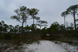
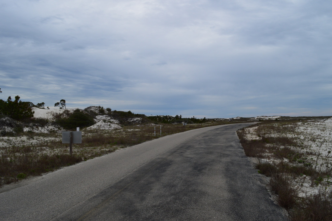
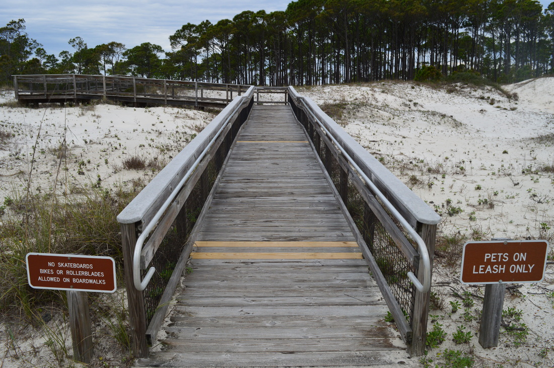
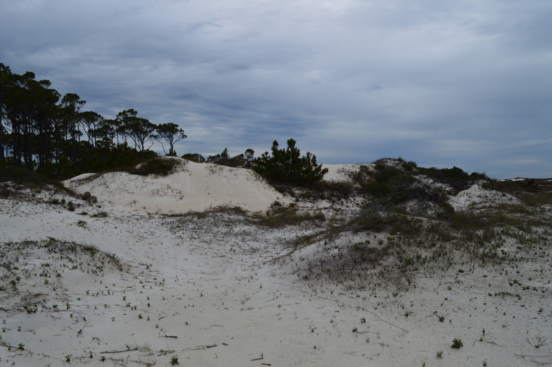
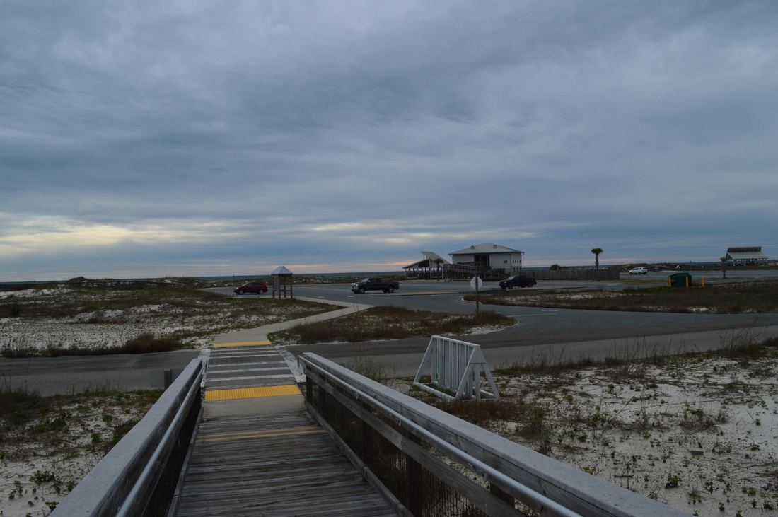
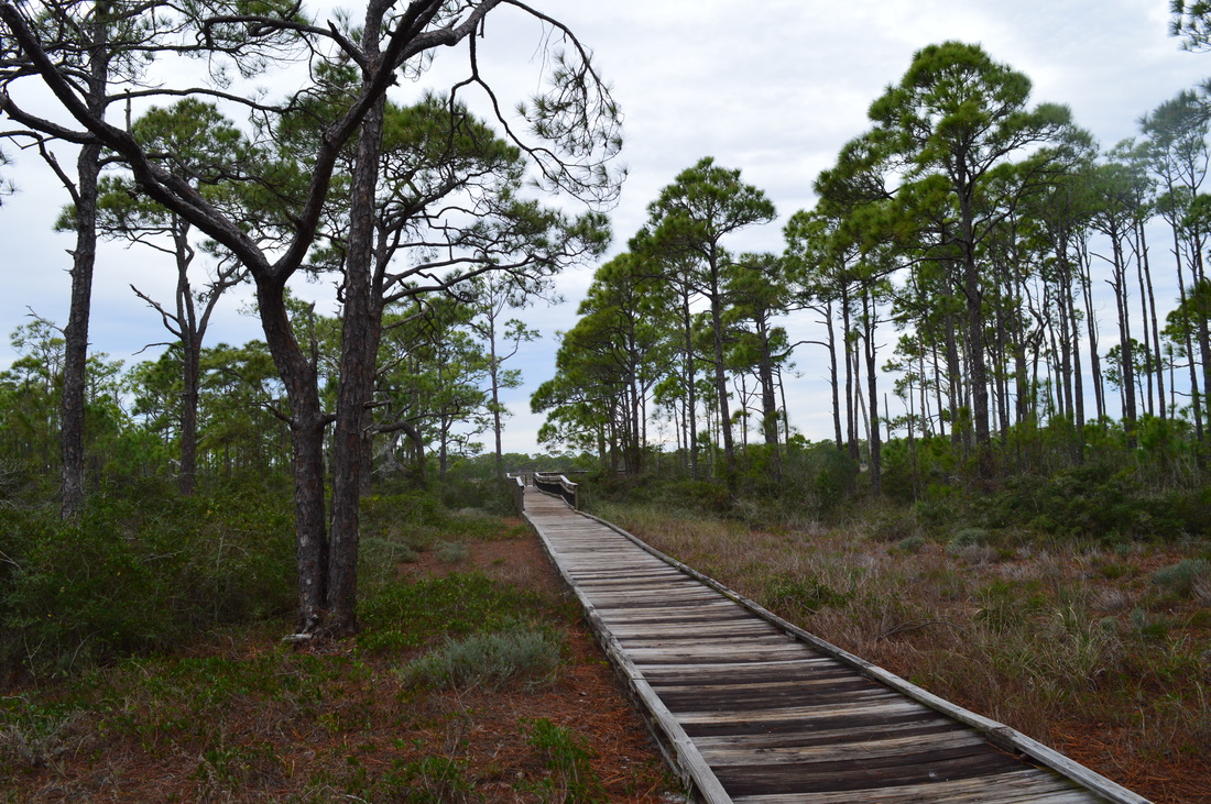
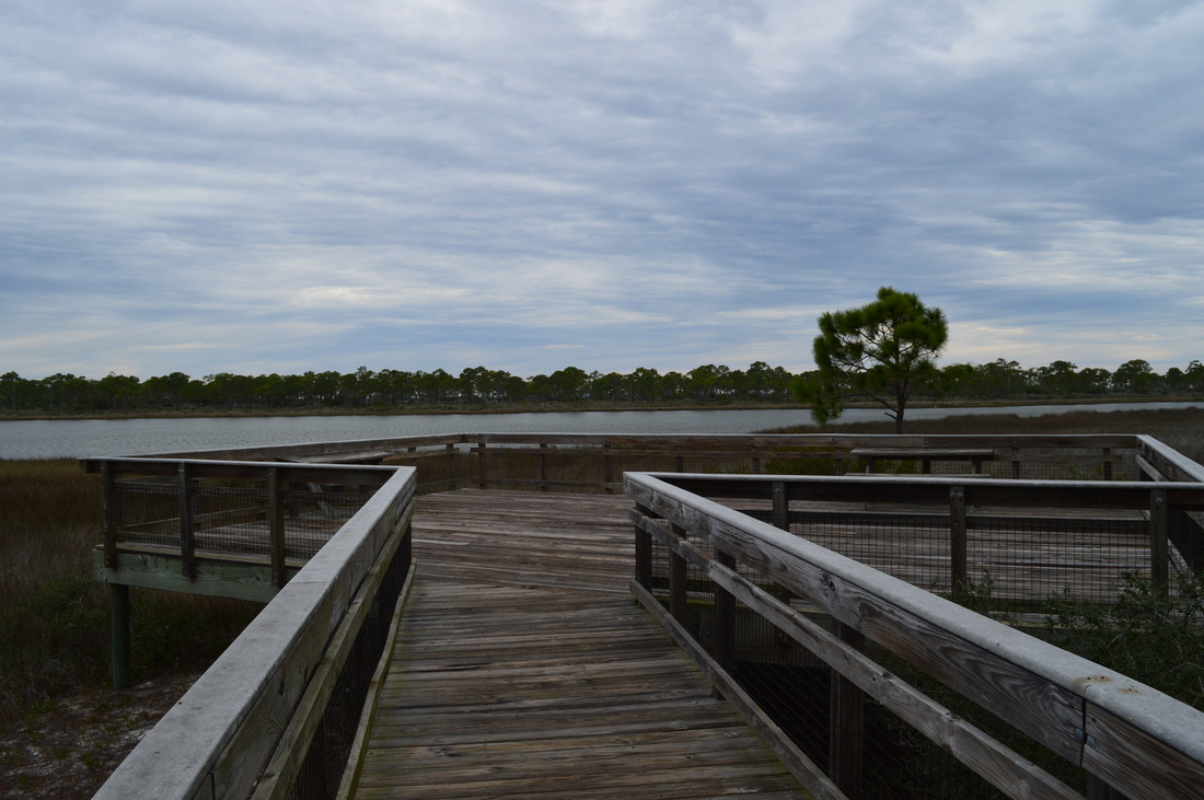
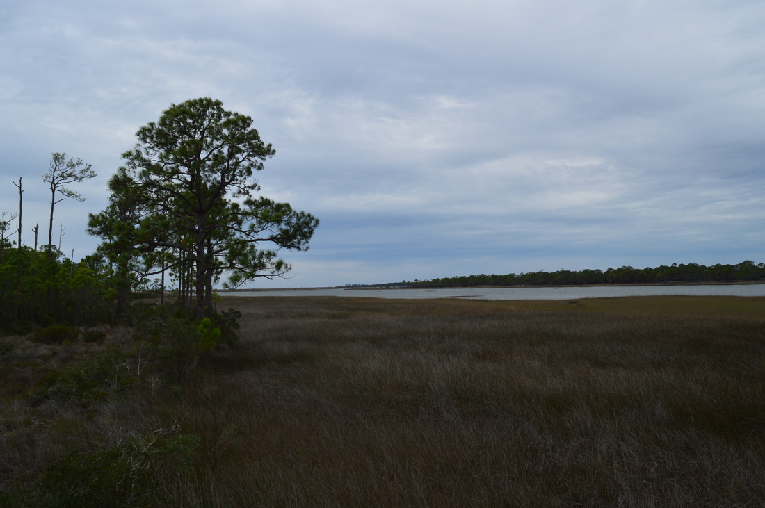
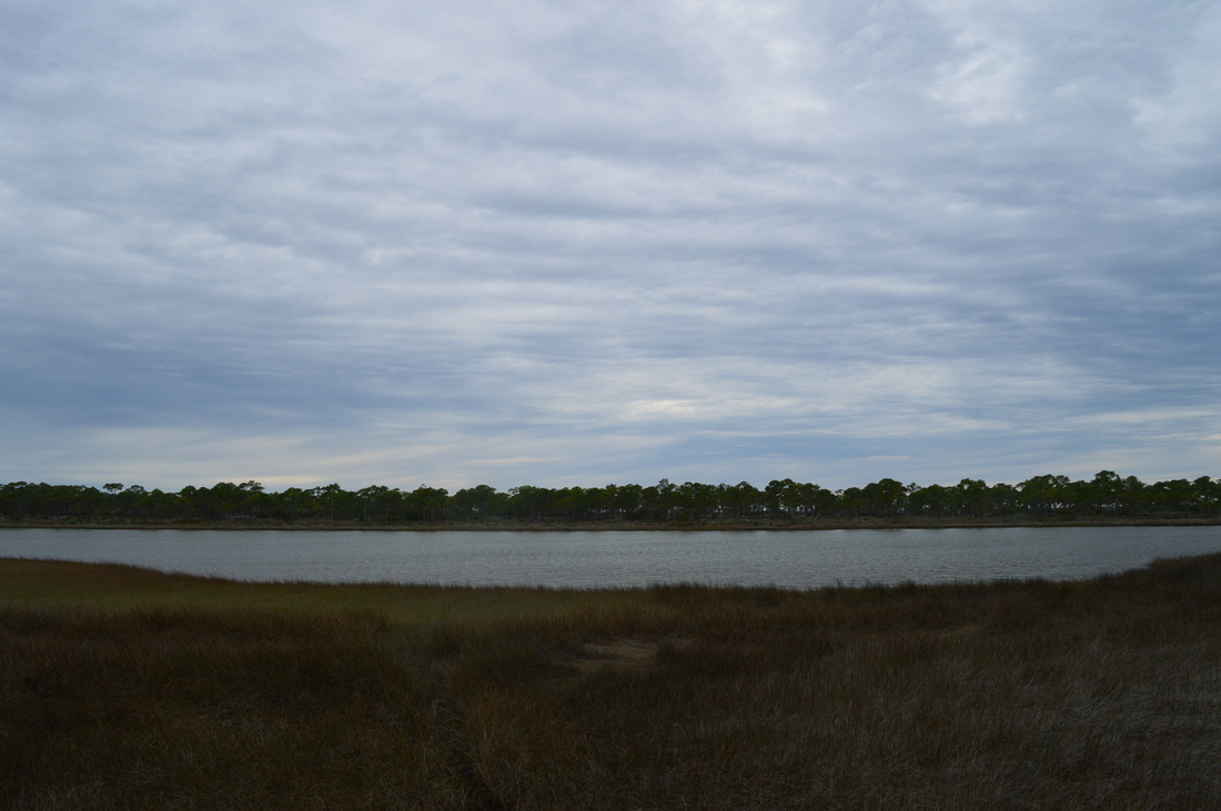
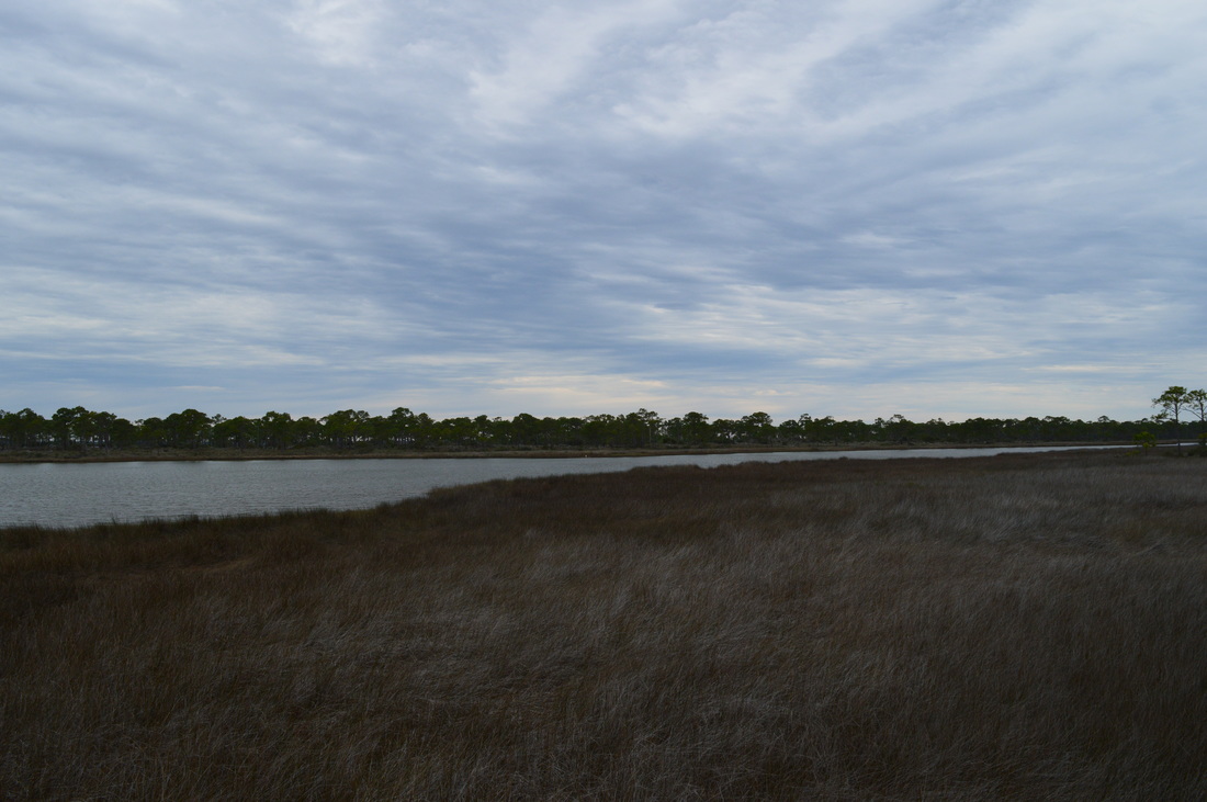
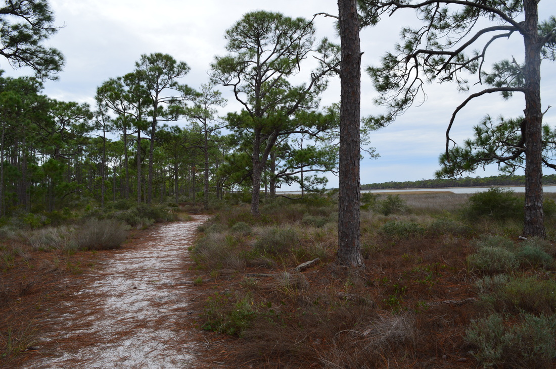
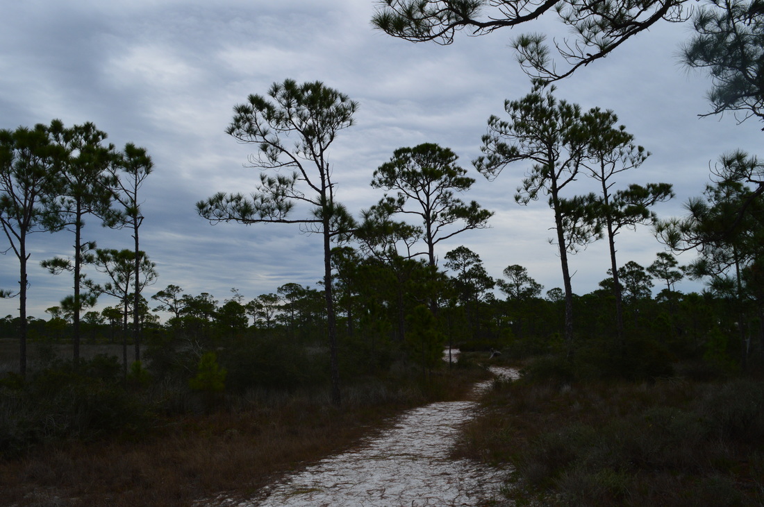
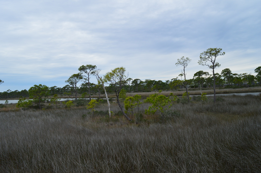
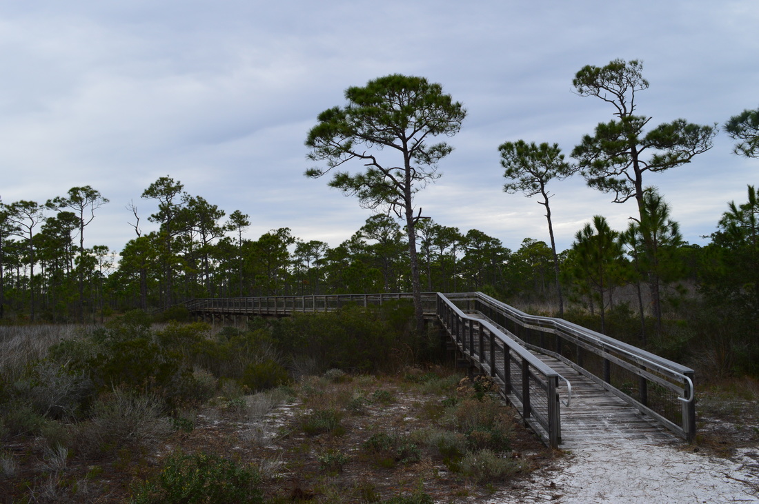
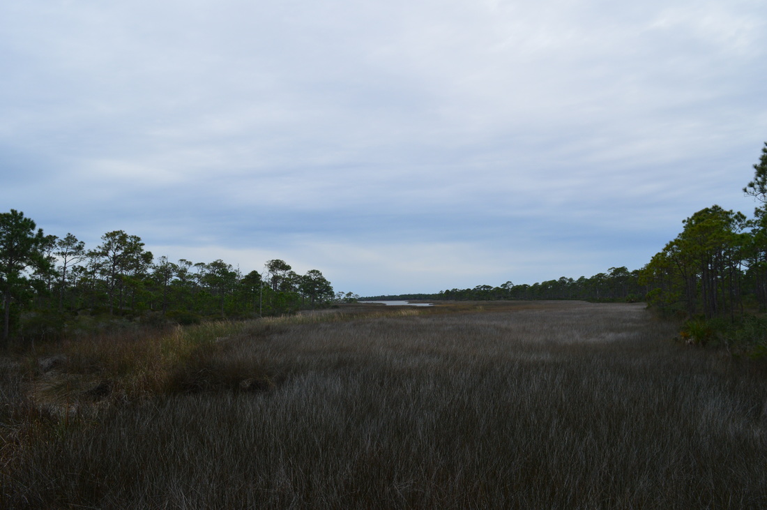
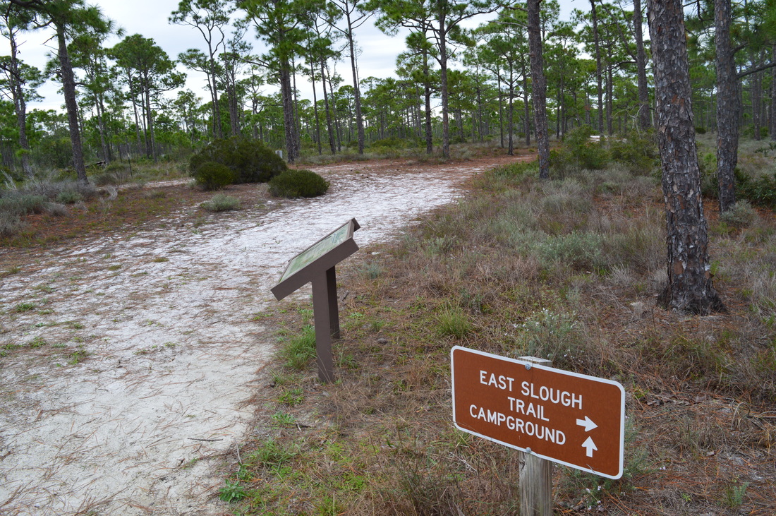
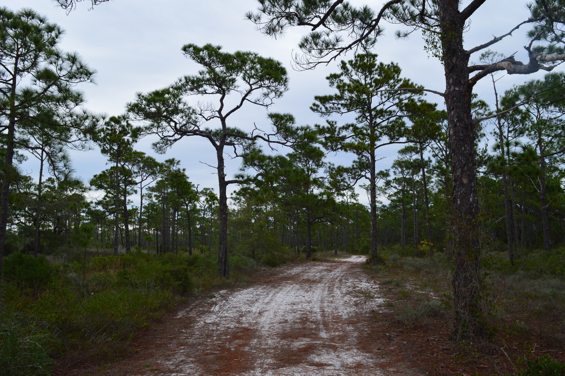
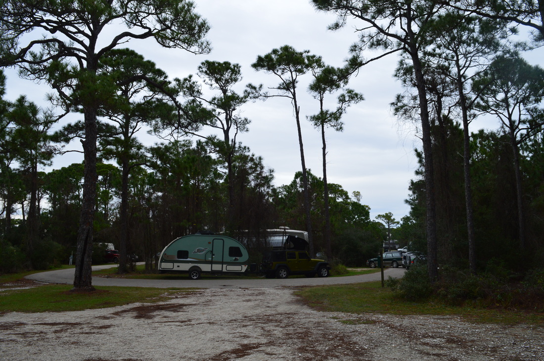
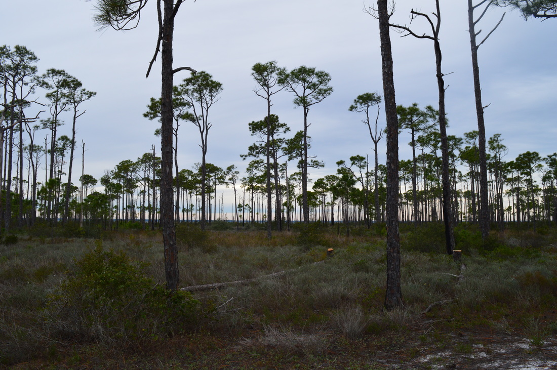
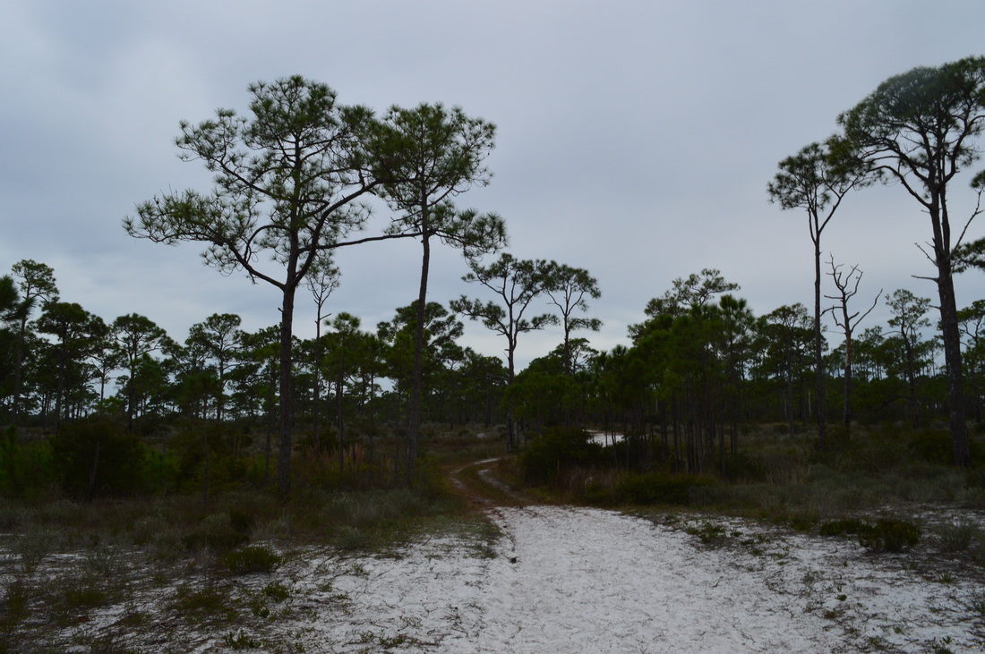
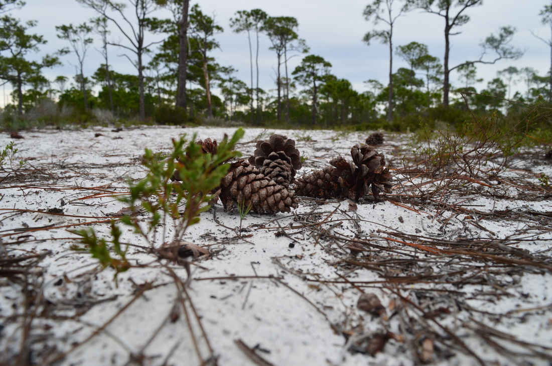
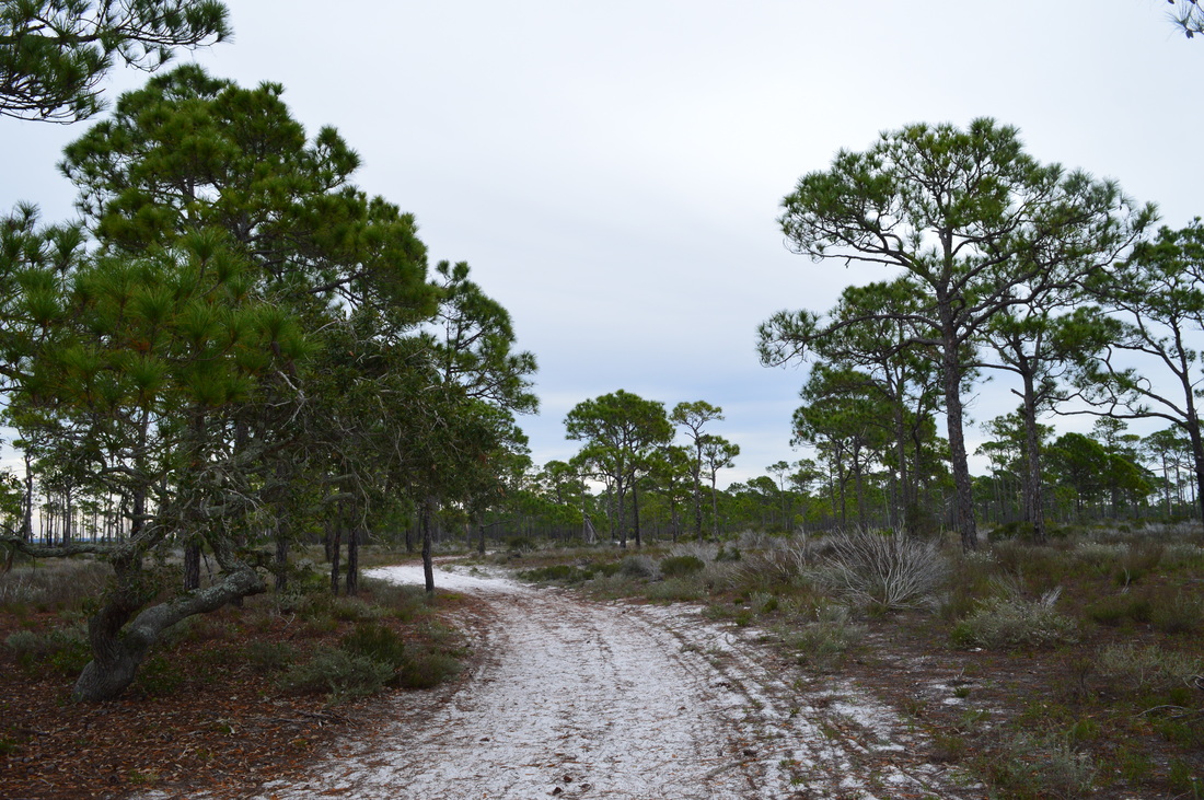
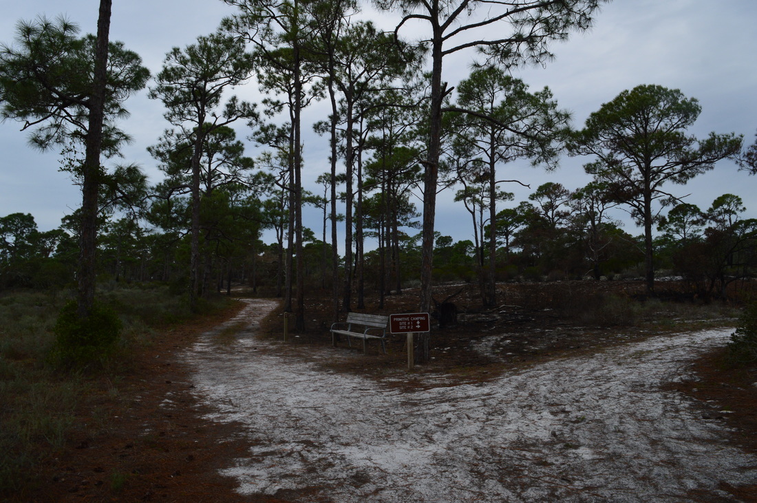
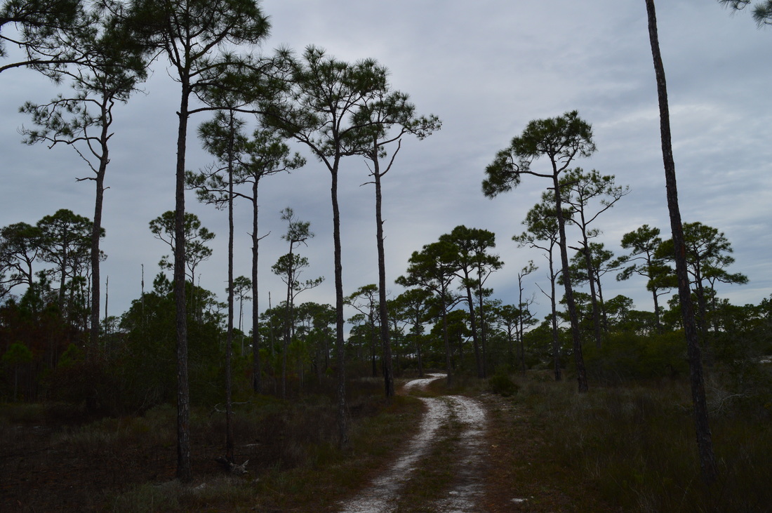
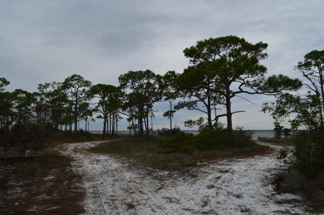
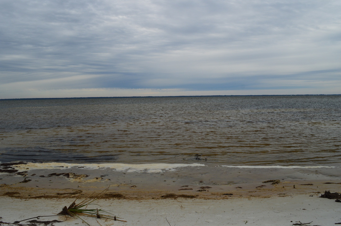
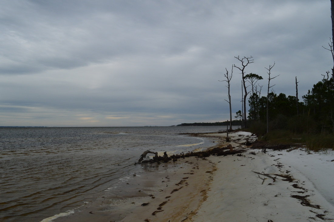
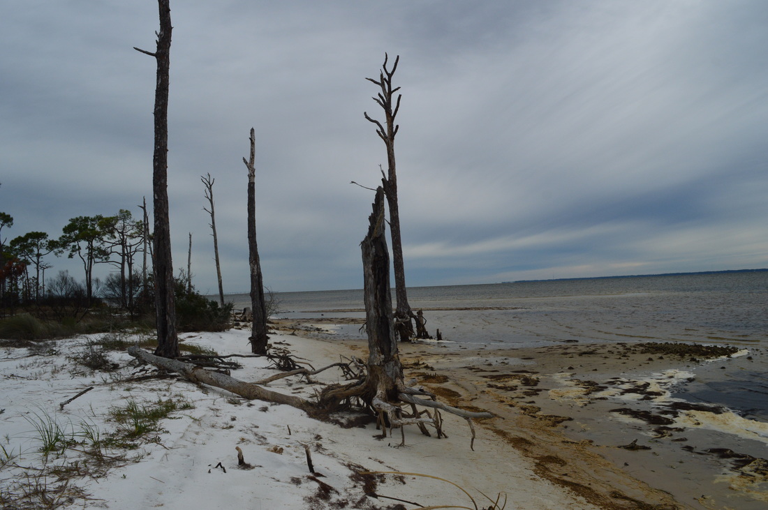
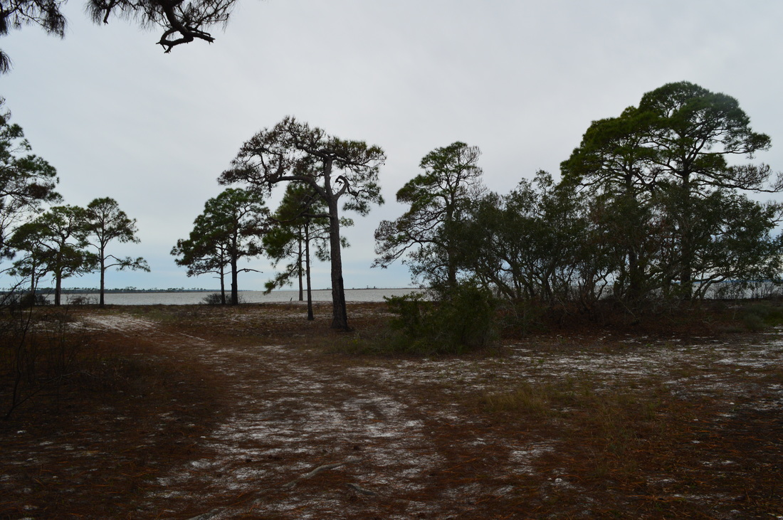
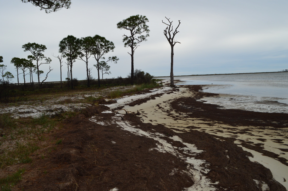
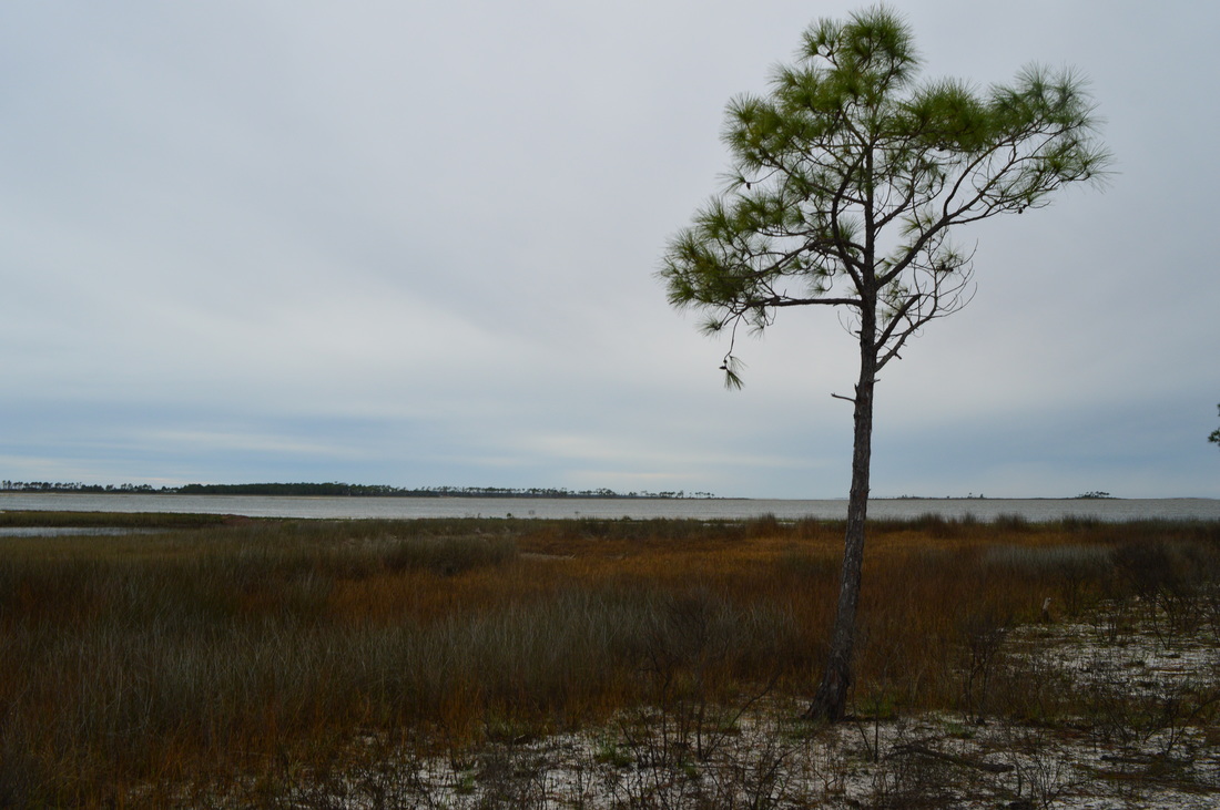
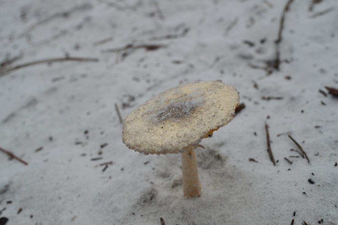
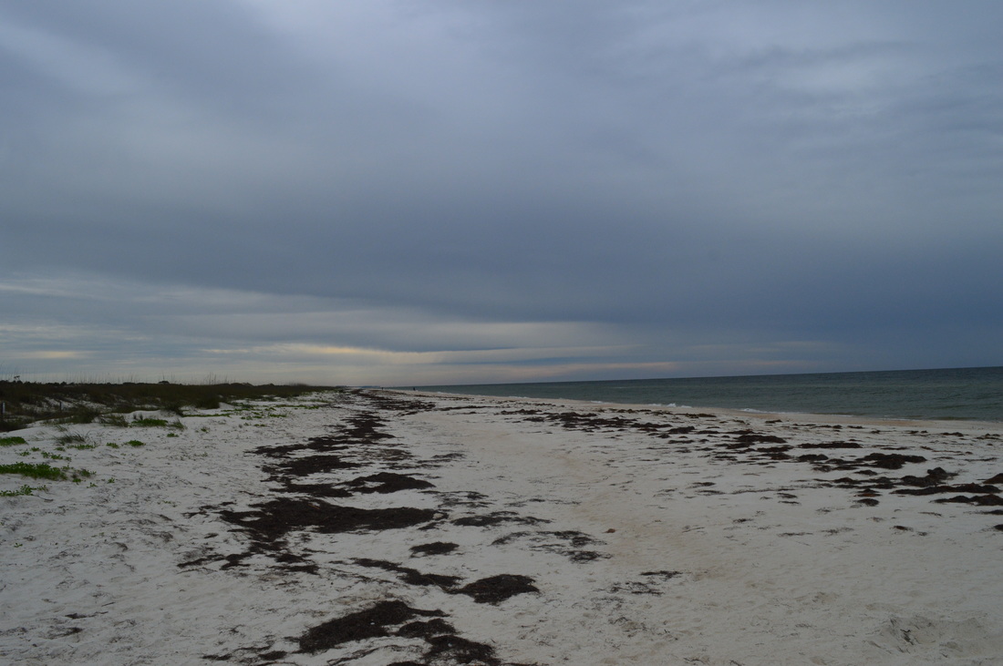
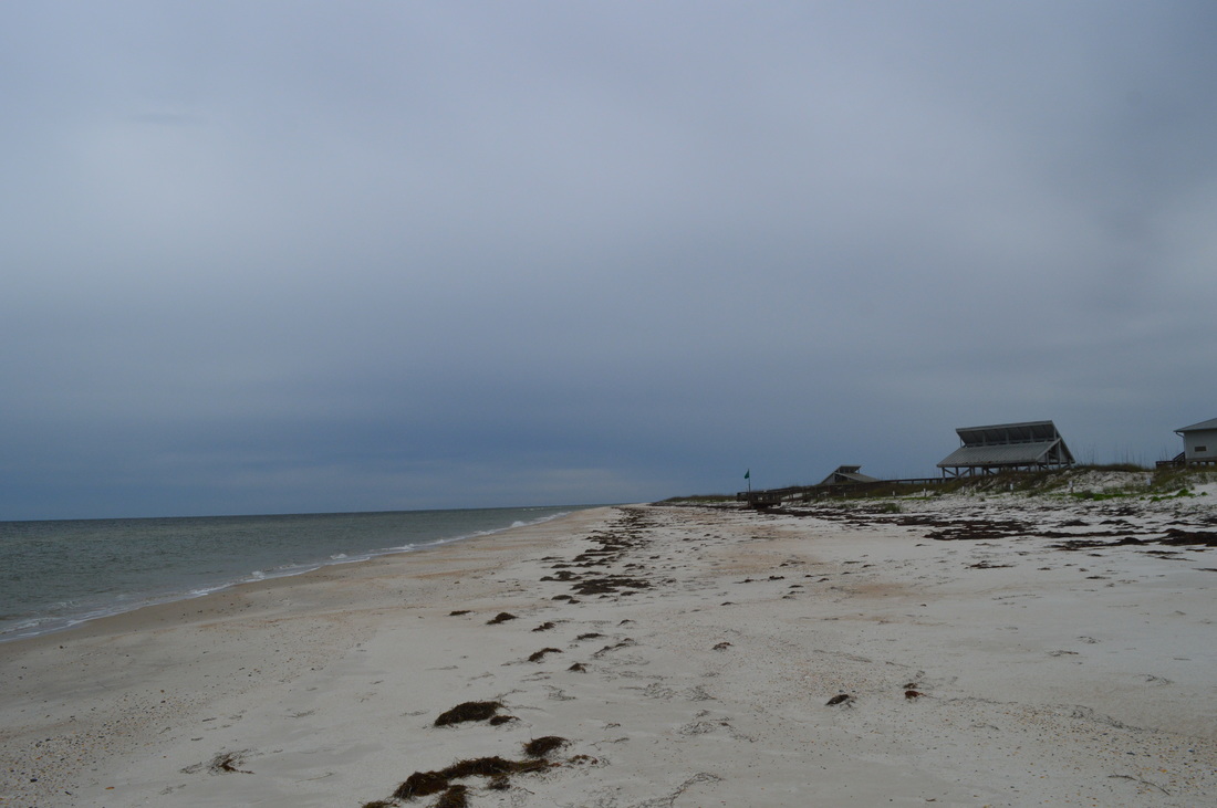
St. George Island is a barrier island near the Florida Panhandle, located at the mouth of the Apalachicola River. The island stretches for 20 miles along the coast, and most of the island is developed. However, St. George Island State Park protects the eastern tier of the island. In this park, a scenic drive and several hiking trails provide views of dunes twice the height of a human, as well as a coastal scrub habitat. This hike occurred on Saturday, January 2nd, 2016. My plan was to hike the East Slough Trail to the Gap Point Trail, and then hike the Gap Point Trail to Gap Point. Along the way, I would hike the spur trails to the campground and to Primitive Campsite #2. I would return the same way. 

Summary

R/T Length of Trail: 7.9 Miles
Duration of Hike: 3:15
Type of Hike: Y-configuration 
Difficulty Rating: 3 out of 10
Total Elevation Gain: Minimal
Pros: None
Cons: There is some ugly, burned forest as you approach Gap Point; some portions of the trail have deep sand, and this may add some difficult to this hike (the main reason I rated it as a low-end moderate hike and not a beginner hike)
Points of Interest: East Slough Overlook; Ocean Access at Primitive Campsite #2; Gap Point
Trail Blaze Color(s): None 
Best Season(s) to Hike: Year-round
Fees: There is a $6 entrance fee per vehicle (2-8 people) for St. George Island State Park. The fee is $4 if a vehicle has only 1 person, while there is a $2 fee for pedestrians, bicyclists, and extra passengers in vehicles. Pay at the ranger station at the entrance to the park. 
Beginning Point: East Slough Beach Use Area/East Slough Trailhead
Directions: From Eastpoint, FL: Follow FL State Route 300 for 5.6 miles across the St. George Island Causeway (Bryant Patton Bridge). At the T-intersection on St. George Island, directly in front of the St. George Island Lighthouse, turn left onto Gulf Beach Drive. Follow Gulf Beach Drive through the developed section of St. George Island for 4.2 miles to the entrance to Dr. Julian G. Bruce St. George Island State Park. Pay your fee at the entrance station, and continue on the park road/scenic drive for another 2.6 miles. Then, turn right into the huge parking area for East Slough Beach Use area (I bet this fills up fast in summer!). The trail starts to the left of the road as a boardwalk across the tall dunes, across from the parking area. 

Map

​A map and some other information regarding this hike can be viewed here.

Details

Most of the islands and beaches in Florida have been totally developed. Fortunately, a few islands and their beaches have been preserved. The eastern tier of St. George Island, protected by St. George Island State Park, is one such example, and it indeed is a great thing that this still-being-developed island has a wild side remaining to it. The hike detailed here showcases the wild side of St. George Island very well. Take a look at the developed section of the island, and imagine what it may have looked like before all the houses were built. 

The hike begins on the East Slough Trail, across from the East Slough Beach Use Area. The trail begins as a boardwalk that ascends over an area of dunes near the park road. Do not walk off the boardwalk onto the dunes - this is sensitive, endangered habitat. The boardwalk continues into pine forest on the approach to East Slough. At 0.2 miles, reach East Slough Overlook. Before turning right to continue the trail, continue straight to the observation deck.Here, you can see East Slough. East Slough originates as a wetland farther east into the island, and then turns into a bay, which you can see here. Return to the main trail, and continue on the sandy path paralleling East Slough eastward. At times, you may catch glimpses of the tall dunes to your right. At 0.5 miles, cross a footbridge over a wetland adjacent to East Slough. At 1.05 miles, cross the head of East Slough on a long footbridge. To your left, take a look at how the wetlands turn into open water. At 1.1 miles, reach the end of East Slough Trail. The Gap Point Trail goes left and right here. For now, turn right - you're headed to the campground for extra mileage (you can skip this part of course). The trail is sandy, flat, and very wide. At 1.7 miles, reach the campground. This is also the Gap Point Trailhead, and a lot of people start here and simply do the Gap Point Trail out and back. Retrace your steps to the East Slough junction, reaching it at 2.3 miles, band continue straight. The trail is slightly narrower. This is a perfect example of a slash pine/coastal scrub habitat. As the trail follows a peninsula leading out to Gap Point, you can watch East Slough to your left. Also, take a moment, and stop to analyze the little things found in this landscape dotted by sand.

At 3.15 miles, reach a junction. Here, a spur trail goes right to Primitive Campsite #2. Turn onto this spur trail, and follow a sandy path toward the north coastline of St. George Island. St. George Island is one of those places where both shores of the island have a beach, although the south shoreline (the oceanfront) has undoubtedly the better beach. At 3.6 miles, reach Primitive Campsite #2 and the end of the spur trail. Here, the ocean is straight ahead. Walk to the edge of the water and observe the narrow strip of beach dotted by dead trees standing like dark statues. From here, you can see the mainland and the community of Eastpoint in the distance. To the far left, you may spot the Bryant Patton Bridge. From this viewpoint, retrace your steps to the main Gap Point Trail, and continue on it. You will shortly enter an ugly area, where it seemed like a prescribed burn had gone a bit over the limit, with some dead or severely damaged pines and rosemary bushes. At 4.75 miles, bear left. The ocean comes into view - you are approaching Gap Point. At 5 miles, reach Gap Point. There are excellent views here into the ocean between the mainland and St. George Island, towards the Bryant Patton Bridge and beyond. A small island, Goose Island, lies straight ahead off the shore of St. George Island. To the left, you may be able to see the mouth of East Slough. From this vista, retrace your steps along the Gap Point Trail and then East Slough Trail back to the trailhead for a total hike of 7.9 miles. 

Variations

Hike the East Slough Trail out and back - 2.2 Miles
Hike the Gap Point Trail out and back plus spur trail to Campsite #2  from the campground - 6.15 Miles

Bonus Stops

After the hike, check out the St. George Island Lighthouse. Also, drive the scenic park road to the east end of the road at the Sugar Hill Beach Area. You will see some very tall dunes along the way.

Pictures

Videos

0 Comments


Leave a Reply.

    About Me

    Mark Oleg Ozboyd
    I'm an avid outdoor explorer and a hobbyist landscape photographer. I'm 21 years old and have been hiking since 2011. Originally based out of Atlanta, Georgia, I started out by occasionally hiking short trails throughout well-known Georgia State Parks. During 2012 and 2013, I began to expand my trips into adjacent states, as well as into the wilder National Forest areas rather than just State Parks. Throughout the years that followed, as I slowly ran out of popular hiking trails in my area, I began to search for and hike in more seldom-visited areas. Today, you can find me out in the woods every weekend, whether it's on an official trail or bushwhacking through cross-country terrain without any paths. I now attend Washington & Lee University and am exploring Virginia and West Virginia. My other hobbies include chess, science, old music, and meteorology. I have 3 years of amateur weather forecasting experience, having studied a lot of meteorology basics over the years. I am also a student at European School of Music where I learned that music and nature have a lot in common. Listening to good music inspires me to capture nature's beauty on the camera in different aspects that also make me recall many beautiful music pieces that I've heard.​


    Dear readers: I have invested a tremendous amount of time and effort in this website and the Georgia Waterfalls Database the past five years. All of the work that has gone in keeping these websites updated with my latest trip reports has almost been like a full-time job. This has not allowed me to pick up a paid job to save up money for college, and therefore, I I've had to take out loans. If you find the information on this website interesting, helpful, or time-saving, you can say "thanks" and help me out by clicking the button above and making a contribution. I will be very grateful for any amount of support you give, as all of it will apply toward my college tuition. Thank you! 

    Enter your email address to subscribe for trail reports:

    Delivered by FeedBurner


    Picture
    Coming in 2022-2023?

    Other Hiking Websites

    DWHike's Adventures
    Florida's Natural Wonders
    Florida Trailblazer
    Meanderthals
    Mountain Images
    by Bernie Boyer

    North Carolina Waterfalls with
    ​Kevin Adams
    Take-a-Hike!
    Tennessee Landforms
    Waterfall Page
    Waterfall Adventurer
    Zach's Mild Adventures

    Miles Hiked

    Year 1: 540.0 Miles
    Year 2: 552.3 Miles
    ​Year 3: 518.4 Miles
    Year 4: 482.4 Miles
    Year 5: 259.9 Miles

    Archives

    March 2021
    February 2021
    January 2021
    November 2019
    October 2019
    September 2019
    August 2019
    July 2019
    June 2019
    February 2019
    January 2019
    December 2018
    November 2018
    October 2018
    August 2018
    July 2018
    June 2018
    May 2018
    April 2018
    March 2018
    February 2018
    January 2018
    December 2017
    November 2017
    October 2017
    September 2017
    August 2017
    July 2017
    June 2017
    May 2017
    April 2017
    March 2017
    February 2017
    January 2017
    December 2016
    November 2016
    October 2016
    September 2016
    August 2016
    June 2016
    May 2016
    April 2016
    March 2016
    January 2016
    December 2015
    November 2015
    October 2015
    September 2015
    August 2015
    July 2015
    June 2015
    May 2015
    April 2015
    March 2015
    February 2015
    January 2015
    December 2014
    November 2014
    October 2014
    September 2014
    August 2014
    July 2014
    June 2014
    May 2014
    April 2014
    March 2014
    February 2014

    Categories

    All
    Adel
    Adirondack Park
    Alabama
    Alfred A. Ring Park
    Allegheny Trail
    Amicalola Falls State Park
    Anniston Area
    Apalachicola Bluffs And Ravines Preserve
    Apalachicola National Forest
    Apalachicola/Port St. Joe Area
    Apopka
    Appalachian Trail
    Appling
    Art Loeb Trail
    Aska Trail System
    Bakersville
    Balm-Boyette Scrub Preserve
    Balsam Lake Recreation Area
    Bankhead National Forest
    Bartow County Parks
    Bartram Trail
    Basinger
    Beersheba Springs
    Benton
    Benton Mackaye Trail
    Berry College Trail System
    Best Hike
    Big South Fork National Recreation Area
    Black Bear Wilderness
    Black Rock Mountain State Park
    Blairsville
    Blakely
    Blood Mountain Wilderness
    Blowing Rock
    Blue Ridge
    Blue Ridge Parkway
    Boone
    Bradenton
    Bradenton Beach
    Brasstown Bald
    Brasstown Wilderness
    Brevard
    Bryson City
    Buchanan
    Bucks Pocket State Park
    Bulow Creek State Park
    Bulow Plantation Ruins State Park
    Caesars Head State Park
    Caladesi Island State Park
    Calhoun
    Camel's Hump State Park
    Cashiers
    Caspersen Beach Park
    Catfish Creek State Park
    Caves
    CC Putnam State Forest
    Cedar Point Environmental Park
    Chatsworth
    Chattahoochee National Forest
    Chattanooga
    Chattanooga Valley
    Chattooga National Wild And Scenic River
    Cheaha Wilderness
    Cherohala Skyway
    Cherokee
    Cherokee National Forest
    Chiefland Area
    Chillhowee Recreation Area
    Chipley
    Chunky Gal Trail
    Circle B Bar Reserve
    Citico Creek Wilderness
    Citrus Wildlife Management Area
    Clarkesville
    Clayton
    Cleevland
    Cleveland
    Cloudland Canyon State Park
    Cohutta Wilderness
    Collier-Seminole State Park
    Cordele
    Cornelia
    Covington
    Crestview Area
    Crew-land-and-water-trust
    Cullowhee
    Cumberland Trail
    Dahlonega
    Dalton
    Dawson Forest Wildlife Management Area
    Dawsonville
    Dayton
    De Soto National Memorial
    DeSoto State Park
    Dillard
    Double Springs
    Ducktown
    Duncan Ridge Trail
    Dunlap
    Eagle's Rest Park
    Eastpoint
    Econfina Creek Wildife Management Area
    Eglin Air Force Base
    Elizabethton
    Elkins
    Elk Knob Game Lands
    Elk Park
    Ellicott Rock Wilderness
    Ellijay
    Emerson Point Preserve
    Englewood Area
    Enota Retreat
    Erwin
    Falling Waters State Park
    Fayetteville
    Fires Creek Recreation Area
    Fire Tower
    Flint River
    Florence Area
    Florida
    Florida Caverns State Park
    Florida Trail
    Foothills Trail
    Fort Mountain State Park
    Fort Myers Area
    Fort Payne
    Fort Payne Area
    Fort Yargo State Park
    Franklin
    Franklin Delano Roosevelt State Park
    Franklin-Marion State Forest
    Frozen Head State Park
    Gainesville
    Gainesville Area
    Gatlinburg
    George Washington National Forest
    Georgia
    Georgia Veterans Memorial State Park
    Glasgow
    Gorges State Park
    Grandfather Mountain State Park
    Great Smoky Mountains National Park
    Greeneville
    Green River Game Lands
    Gruetli-Laager
    Grundy Forest State Natural Area
    GTM Reserve
    Guana River Wildlife Management Area
    Hayesville
    Helen
    Hiawassee
    High Falls State Park
    Highlands
    Highlands Scenic Highway
    Hillsborough River State Park
    Hinson Conservation & Recreation Area
    Historic Sites
    Honeymoon Island State Park
    Hot Springs
    Huntington
    Inverness Area
    Jackson
    Jasper
    Jefferson National Forest
    Joan M. Durante Park
    Jonathan Dickinson State Park
    Jones Gap State Park
    Joyce Kilmer Slickrock Wilderness
    Joyce Kilmer - Slickrock Wilderness
    Juniper Prairie Wilderness
    Kelly Park
    Keown Falls Recreation Area
    Kolomoki Mounds State Park
    LaFayette
    Lake City Area
    Lake George Wild Forest
    Lake June-in-Winter State Park
    Lakeland Area
    Lake Placid
    Lake Russell Wildlife Management Area
    Lake Wales Ridge State Forest
    Laurel Fork North Wilderness
    Leffis Key Preserve
    Leon Sinks Geological Area
    Lexington
    Lineville
    Linville
    Linville Gorge Wilderness
    Lithia Springs
    Little Frog Wilderness
    Little Manatee River State Park
    Little River Canyon National Preserve
    Longboat Key
    Long Trail
    Lookout Mountain
    Lookout Mountain Battlefield
    Lovingston
    Lula Lake Land Trust
    Lumpkin
    Maggie Valley
    Manatee Springs State Park
    Marianna Area
    Mark Trail Wilderness
    Marlinton
    Mccaysville
    McMinville
    Mentone
    Middlesex
    Mistletoe State Park
    Monongahela National Forest
    Montreat
    Mountain Bridge Wilderness Area
    Mountain City
    Mountains To Sea Trail
    Mountains-to-Sea Trail
    Mount Rogers National Recreation Area
    Myakka River State Park
    Myron B. Hodge City Park
    Nantahala National Forest
    Naples
    Naples Area
    Natural Bridge State Park
    Neal Preserve
    New Castle
    Newport
    New River Gorge National Park
    New York
    North Carolina
    Ocala Area
    Ocala National Forest
    Ocean-to-Lake Trail
    Oconee State Park
    Oconee Station Historic Site
    Okaloacoochee Slough State Forest
    Oldsmar
    Oneida
    Orlando Area
    Ormond Beach
    Oscar Scherer State Park
    Oxford
    Palatka
    Palmetto Trail
    Panama City Area
    Panthertown Valley
    Parrish
    Paynes Creek Historic State Park
    Peaks Of Otter Recreation Area
    Pigeon Crockford Mountain Wildlife Management Area
    Pigeon-Crockford Mountain Wildlife Management Area
    Pigeon-Crockford Wildlife Management Area
    Pine Mountain
    Pinhoti Trail
    Pinnacle Park
    Pisgah Civitan Park
    Pisgah National Forest
    Pittman Center
    Pond Mountain Wilderness
    Ponds/Lakes
    Prentice Cooper State Forest
    Providence Canyon State Park
    Pumpkintown
    Quick Point Nature Preserve
    Raven Cliffs Wilderness
    Reed Bingham State Park
    Reliance
    Rice Creek Conservation Area
    Riverview Pointe Preserve
    Robbinsville
    Robinson Preserve
    Rock Creek Gorge Scenic Area
    Rock Island State Park
    Rome
    Rosman
    Sale Creek
    Salem
    Salt Springs
    Saluda
    Santa Rosa Beach
    Sarasota
    Sarasota Area
    Savage Gulf State Natural Area
    Scenic Views
    Scottsboro Area
    Sebring Area
    Sewanee
    Sheltowee Trace Trail
    Shining Rock Wilderness
    Signal Mountain
    Sipsey Wilderness
    Sky Valley
    Smithgall Woods State Park
    Snowbird Backcountry Area
    Soddy Daisy
    Soddy-Daisy
    Sopchoppy
    South Carolina
    South Cumberland State Park
    Southeastern Cave Conservancy
    Southern Nantahala Wilderness
    Sparta
    Sprewell Bluff Park
    Spring City
    Spring Hill
    Springs
    Spruce Pine
    Standing Indian Backcountry Area
    St. Augustine
    St. George Island State Park
    St. Joseph Bay State Buffer Preserve
    St. Marks Area
    St. Marks National Wildlife Refuge
    Stone Mountain
    Stone Mountain Park
    Suches
    Sumatra
    Sumter National Forest
    Suwannee River
    Swallow Creek Wildlife Management Area
    Sweetwater Creek State Park
    Sylva
    Talladega National Forest
    Tallahassee Area
    Tallulah Falls
    Tallulah Gorge State Park
    Tampa Bay Area
    Tate City
    Tate's Hell State Forest
    Tea Creek Wildlife Management Area
    Tellico Plains
    Tennessee
    Thomaston
    Toccoa
    Topsail Hill State Park
    Torreya State Park
    Townsend
    Tracy City
    Tray Mountain Wilderness
    Trenton
    Triple Creek Preserve
    Troutdale
    Unaka Mountain Wilderness
    Upper Tampa Bay County Park
    Venice
    Vermont
    Virgin Falls State Natural Area
    Virginia
    Virginia Outdoors Foundation
    Vogel State Park
    Wakulla Springs State Park
    Waleska
    Walhalla
    Wartburg
    Water Features
    Waynesville
    Weedon Island Preserve
    Weeki Wachee Preserve
    Wekiwa Springs State Park
    West Palm Beach Area
    West Virginia
    Whitehall
    White Springs
    Winder
    Withlacoochee State Forest
    Young Harris

    RSS Feed

TRAIL REPORTS

Hikes in Alabama
​Hikes in Florida
Hikes in Georgia
Hikes in North Carolina
Hikes in South Carolina
Hikes in Tennessee
Hikes in Virginia

Hiking Resources

Alabama Resources
​
Florida Resources
Georgia Resources
North Carolina Resources
​South Carolina Resources
​
Tennessee Resources

Other

Contact
Map of Hikes
Alphabetical List of Hikes
Southeast Nature Society
© COPYRIGHT 2014-2024
​ALL RIGHTS RESERVED.
Important: I disclaim any responsibility for any damage or personal injury that may occur as a result of the activities and information found on this website. All outdoor activities, especially off-trail hiking, are done at your own risk. Never hike or head into that area that may be above your fitness or experience level.
  • Home
  • Trail Reports
    • Best Hikes
    • Hikes with Scenic Views
    • Hikes with Water Features
    • Alabama
    • Georgia
    • Florida
    • North Carolina
    • South Carolina
    • Tennessee
    • Vermont
    • Virginia
  • Map
  • Hike List
  • Testimonials
  • Resources
  • Contact Us
  • Southeast Nature Society
    • Our Team
  • Georgia Waterfalls Database