Rocky Mountain and Tray Mountain are two rocky peaks with impessive views on the Appalachian Trail in north Georgia near Helen. Tray Mountain is also the seventh-highest mountain in Georgia. Other than the Appalachian Trail, a couple of additional trails are used to access the area. The Rocky Mountain Trail bends around the northern side of Rocky Mountain, which serves as a bypass for the rocky summit area of Rocky Mountain as well creates a popular loop hike. The Andrews Cove Trail begins nearly two thousand feet below the summit of Rocky Mountain and ascends through a lush mountain cove past several small tumbling streams before joining the Appalachian Trail. On this hike, you will first ascend along the Andrews Cove Trail to the Appalachian Trail, before hiking the Rocky Mountain Loop past the great views from the namesake peak, and finishing with an outing along the AT to the summit of Tray Mountain, where more views await. This hike occurred on Saturday, September 10th, 2016. My plan was to hike the Andrews Cove Trail to the Appalachian Trail at Indian Grave Gap. From there, I would hike the Rocky Mountain Loop clockwise, and then, I would hike the Appalachian Trail out and back to the summit of Tray Mountain as well as locate a little-known vista on the mountain's east side. I would finish by retracing my steps along the Andrews Cove Trail.
Summary
R/T Length of Trail: 13.6 Miles
Duration of Hike: 8:30 Type of Hike: Out and Back and Loop Difficulty Rating: 8 out of 10 Total Elevation Gain: 3714 Feet Pros: Several great vistas are rewards for this difficult hike Cons: Crowds on Rocky Mountain; Portions of Andrews Cove Trail are steep; There are few good views of Andrews Creek from the Andrews Cove Trail Points of Interest: Views from Rocky Mountain - 4 stars collectively; Tray Mountain Summit Overlook - 5 stars; Overlook on east side of Tray Mountain - 8 stars Trail Blaze Color(s): Andrews Cove Trail - Blue; Rocky Mountain Trail - Blue; Appalachian Trail - White Best Season(s) to Hike: Year-round (The trailhead at Andrews Cove Campground is not accessible starting December 1st through March 17th, because the campground is closed during that time; however, in winter, you can still drive up to the trailheads at Indian Grave Gap and Tray Gap) Fees: None Beginning Point: Andrews Cove Campground Directions from Helen, GA: From the Chattahoochee River Bridge in downtown Helen on GA Route 75 (Main Street), follow GA Route 75 North for 6.4 miles. Then, at a hairpin turn in the road, turn right onto the entrance road to Andrews Cove Campground. When you reach the short loop road in the campground, turn right, cross Andrews Creek on a bridge, and then, bear right onto a paved spur road that heads uphill and shortly dead-ends at the small trailhead parking area (it is signed as such). This is the only designated area in the campground to park for the trail. Map
Click here for more information and to download this trail map to view in Garmin Basecamp.
Details
The section of the Appalachian Trail between Unicoi Gap and Tray Mountain, including Rocky Mountain, is one of the most popular segments of the AT in Georgia. For this reason, I have avoided hiking it for several years, and for the same reason, I even hiked to Tray Mountain using the lightly-traveled section of the AT from the north from Addis Gap, instead of the typical route from Indian Grave Gap or Unicoi Gap. However, I decided that a visit to Rocky Mountain was long overdue, and I finally decided to compleet this hike. Additionally, I had learned about a possible another vista on Tray Mountain, so I had a secondary goal to investigate the vista, and I was not disappointed... the overlook on the east side of Tray Mountain has better views those from the summit!
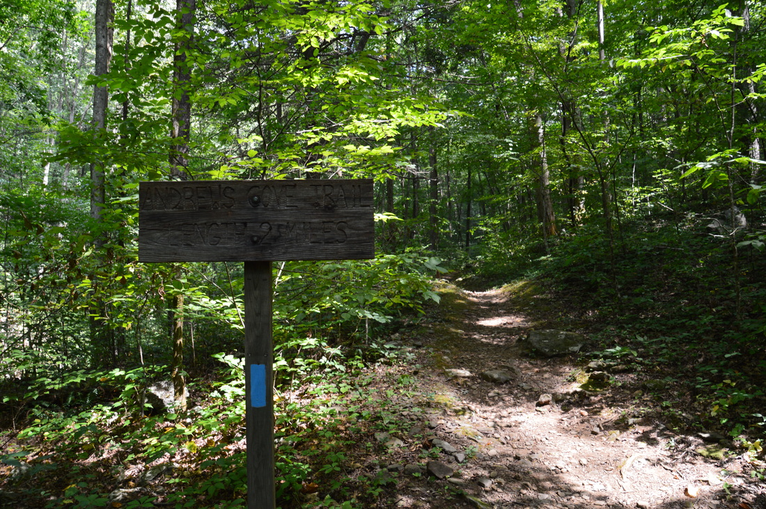
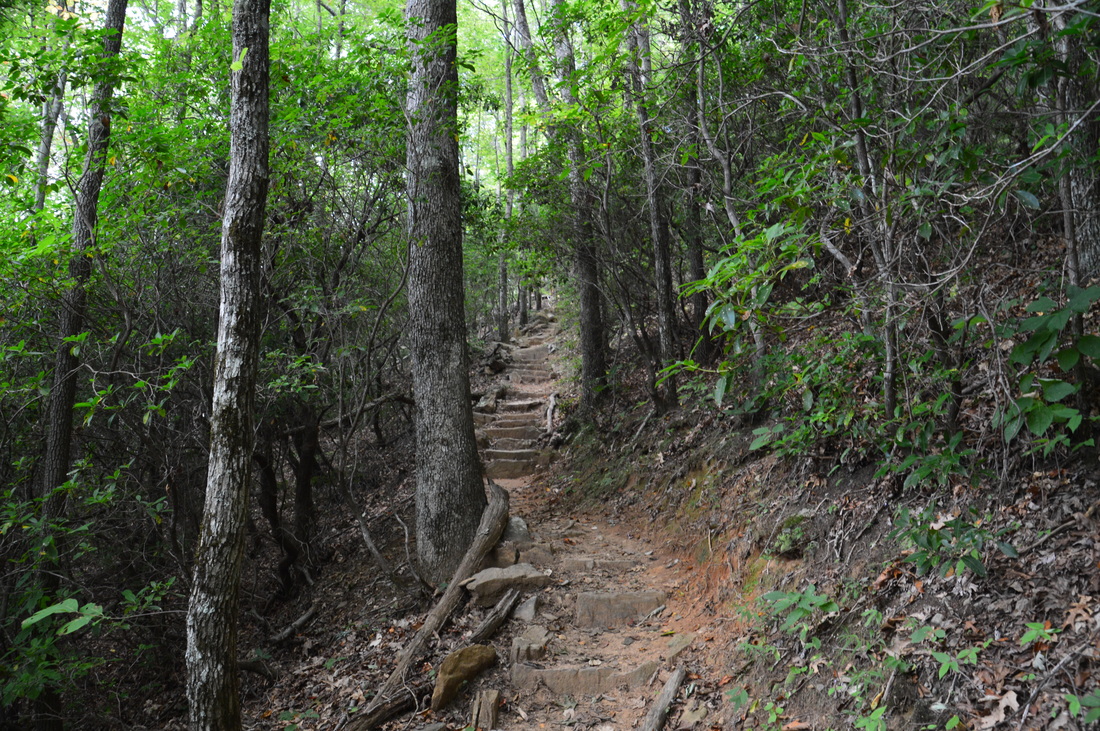
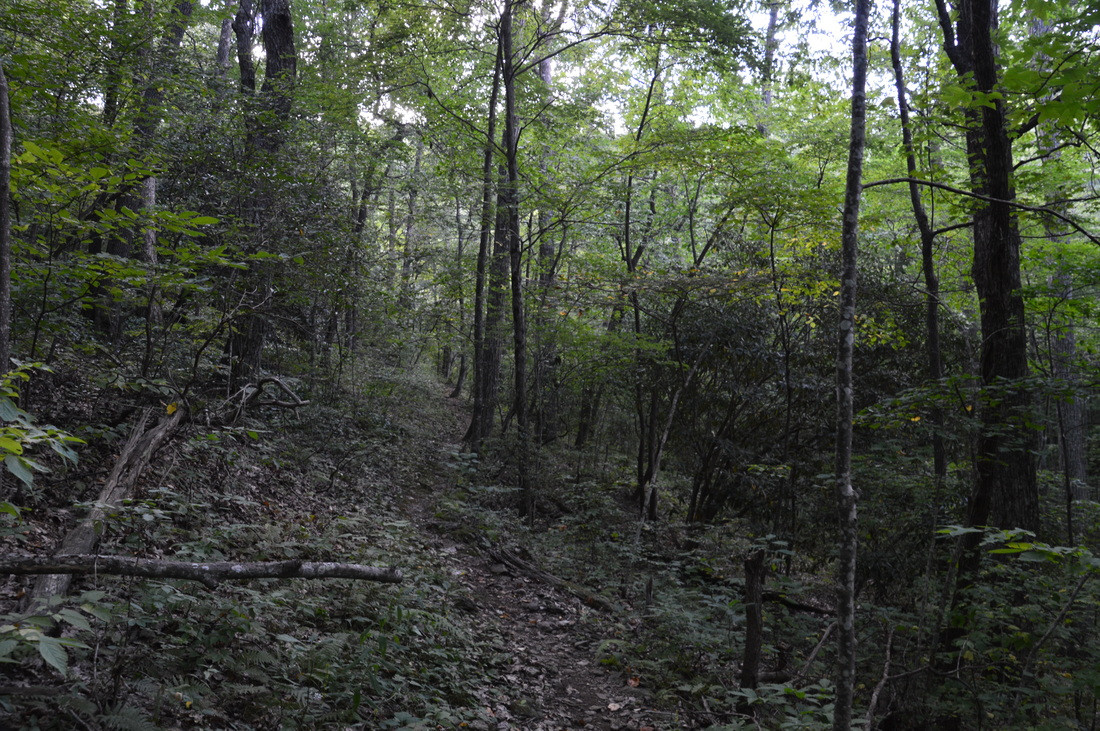
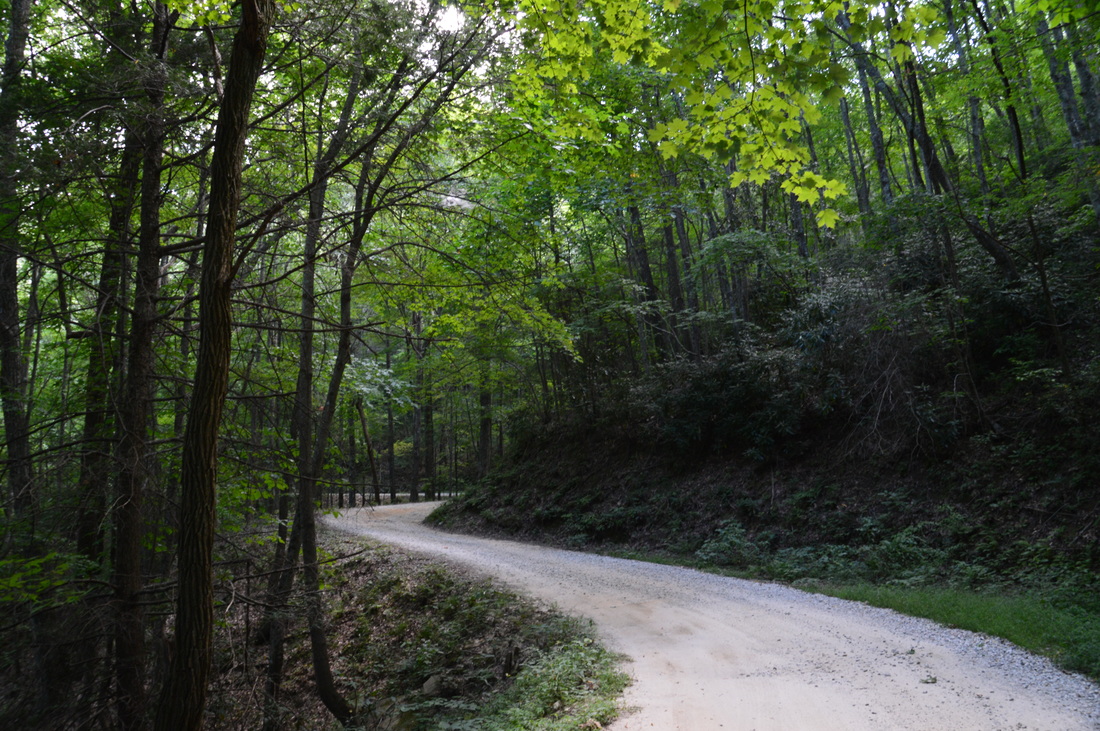
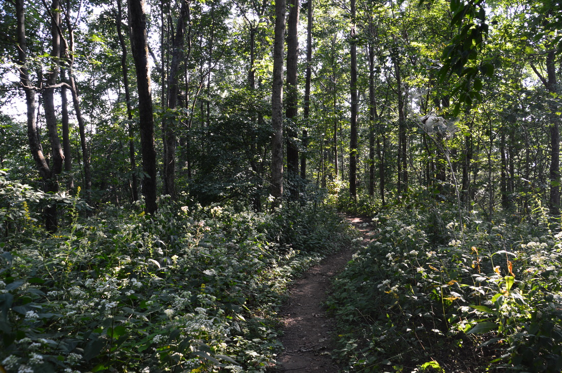
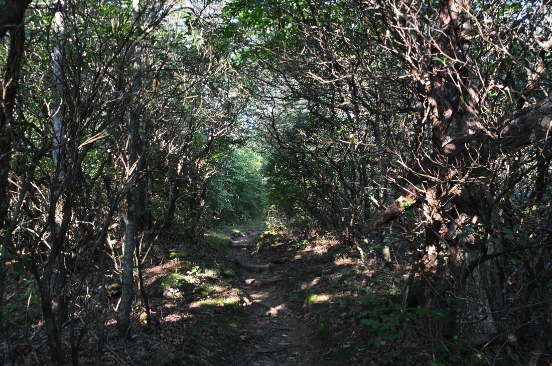
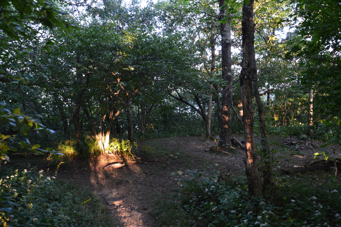
There are several ways to get to Rocky Mountain, but the most difficult is the one from Andrews Cove Campground, and it was the route that I chose. This route involves the most elevation gain, so if you're looking for an easier hike, I suggest starting at Indian Grave Gap or Unicoi Gap. All precuations aside, begin the hike at the trailhead in Andrews Cove Campground. The trail starts at a trailhead parking sign and an "Andrews Cove Trail" sign. The one slightly disappointing thing about the Anrdrews Cove Trail (#35) is that it spends less time near Andrews Creek and other creeks than I had anticipated it to, but it is still a good approach to the AT. From the trailhead, the Andrews Cove Trail begins ascending at an easy grade. There are some initial views of Andrews Creek to the left but the trail soon leaves the creek and traverses higher slopes. At 0.45 miles, the trail briefly comes back to the creek, before the ascent steepens. At 1.25 miles, as the valley tightens, the trail began to follow Andrews Creek. It was barely a trickle this far up in the drainge, due to severe drought conditions at the time. The trail crosses two tributaries of Andrews Creek and then, at 1.65 miles, begins to ascend very steeply towards Indian Grave Gap. In the next 0.2 miles, the trail ascends 200 feet, Some steps help with the ascent. As the Andrews Cove Trail reaches the head of the cove, it levels out, and at 2.0 miles, the trail ends at Indian Grave Gap. 
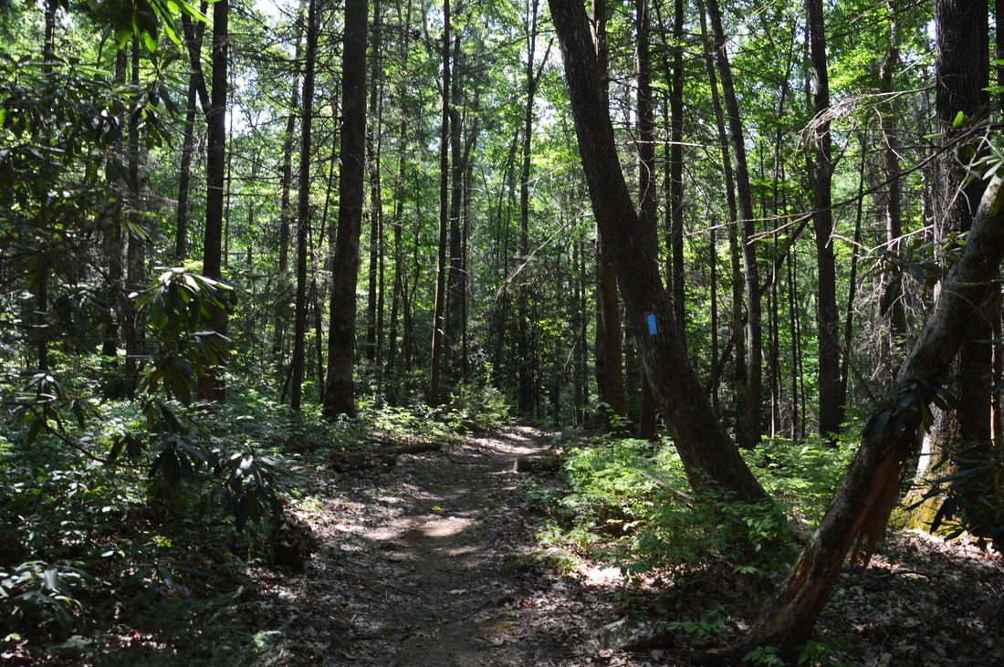
The Andrews Cove Trail, an access trail for the Appalachian Trail
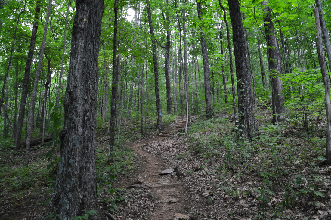
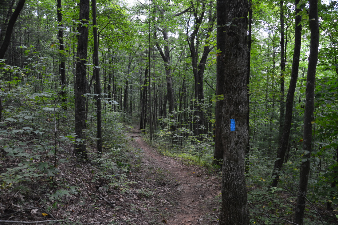
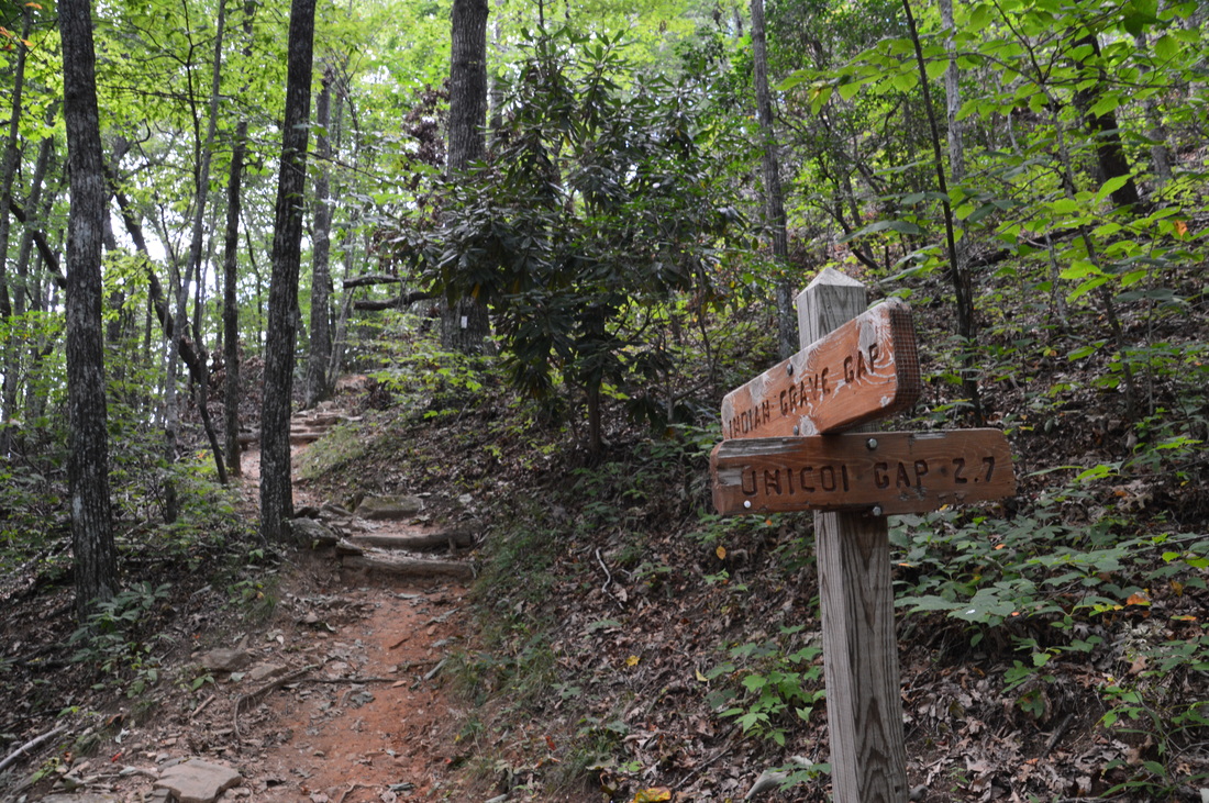
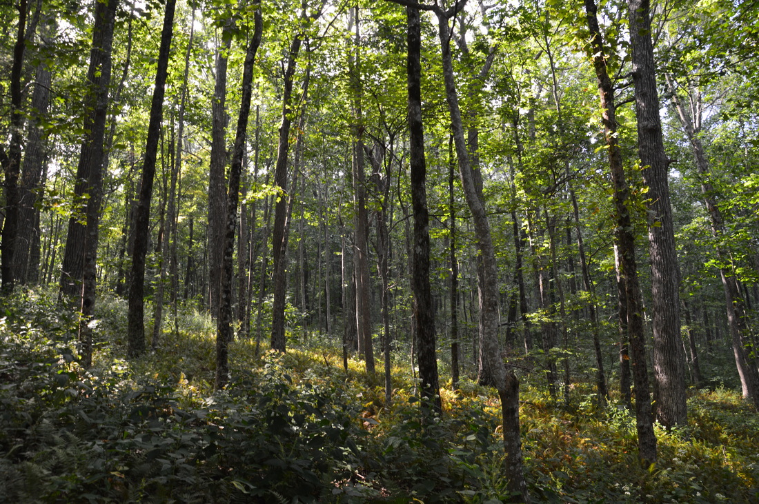
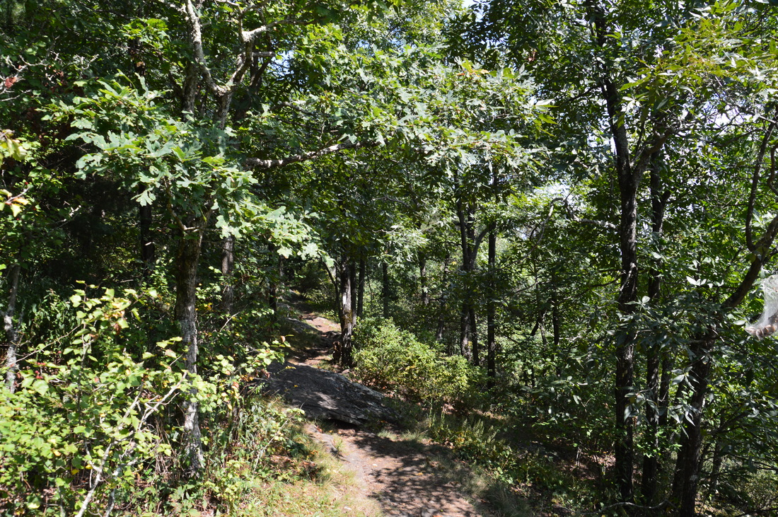
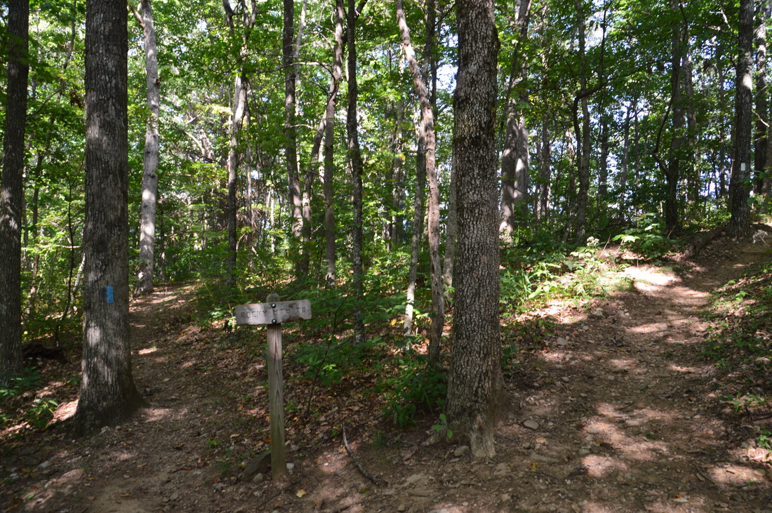
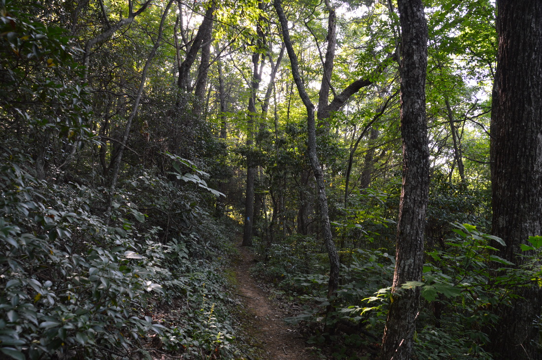
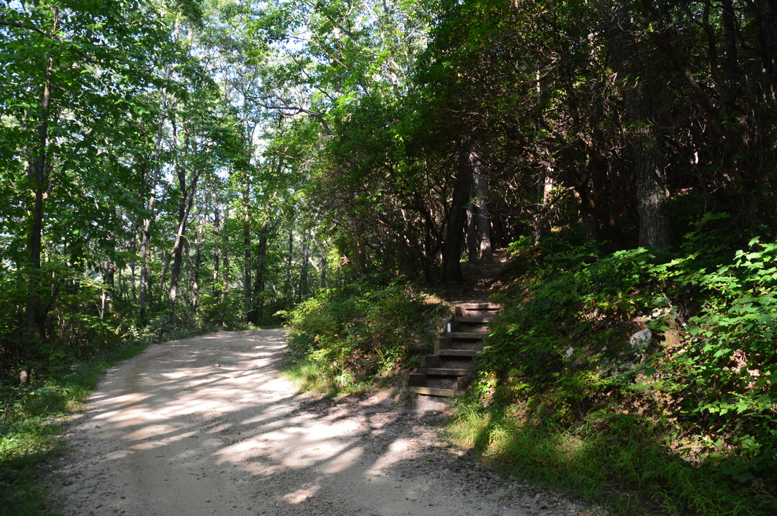
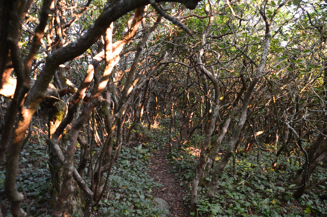
At Indian Grave Gap, the Andrews Cove Trail terminates at the Appalachian Trail. Also, FS Road 283 (Indian Grave Gap Road) passes through Indian Grave Gap. There is a parking area here with shorter and easier ways to get to Rocky Mountain and Tray Mountain than by coming up the Andrews Cove Trail. You can skip Rocky Mountain and head straight to Tray Mountain by turning right onto the Appalachian Trail, but to reach Rocky Mountain, turn left ont othe Appalachian Trail, which quickly begins ascending westward. This is a pretty difficult ascent, especially after the 2 miles of uphill on Andrews Cove Trail. The AT utilizes numerous stone staircases that aid in the ascent.At 2.65 miles, the Appalachian Trail passes through a gap in the ridge between Rocky Mountain and a lower unnamed knob and then resumes ascending Rocky Mountain itself. The next section of trail is in a more picturesque forest.
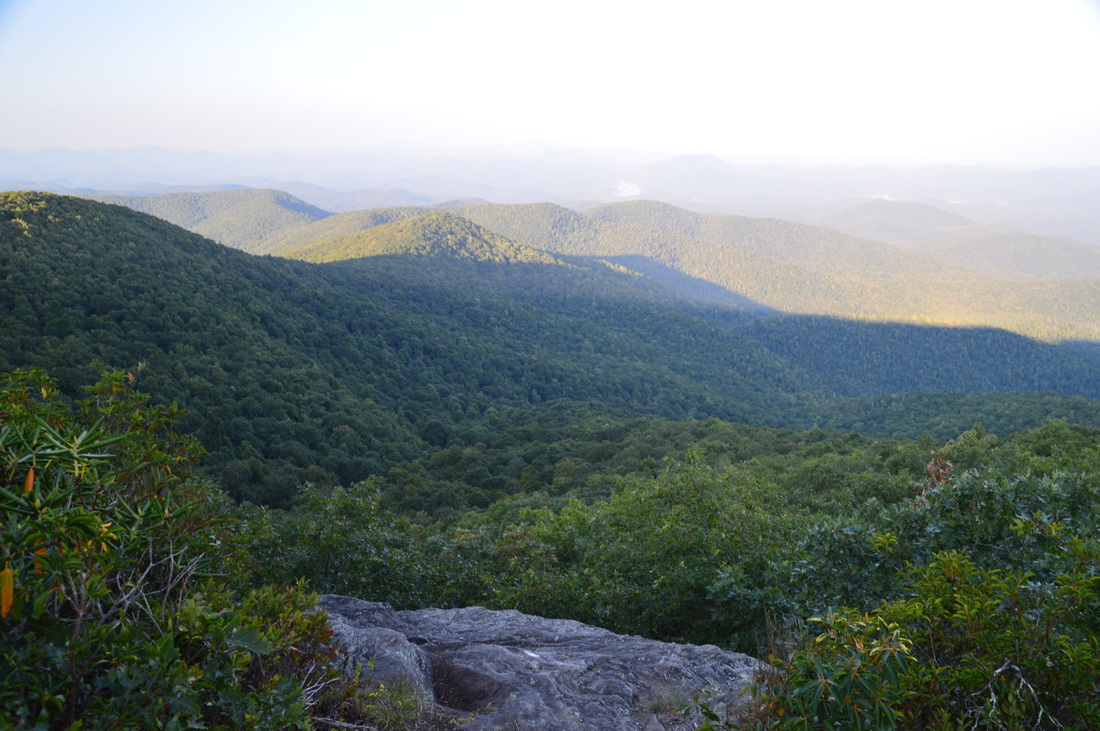
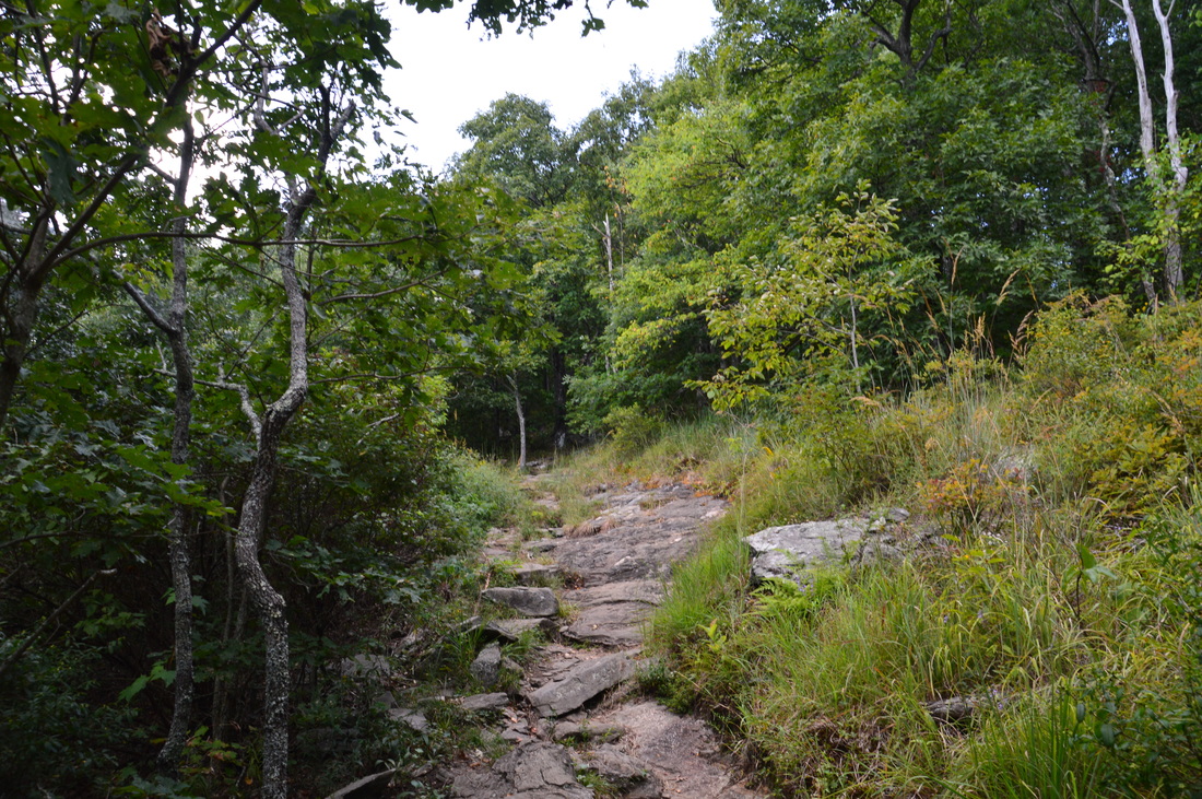
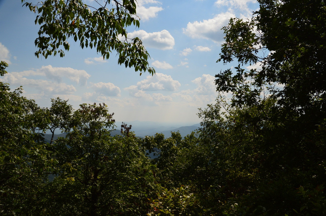
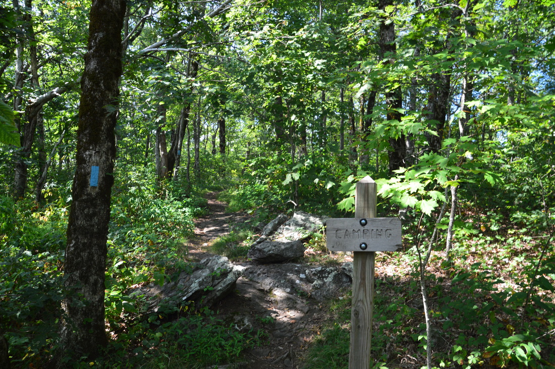
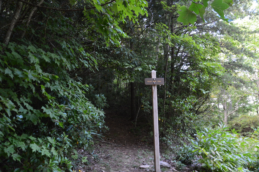
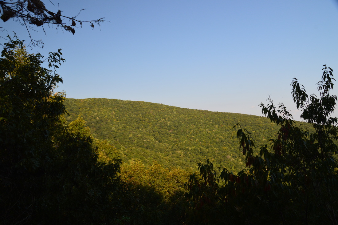
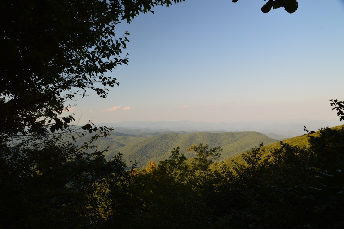
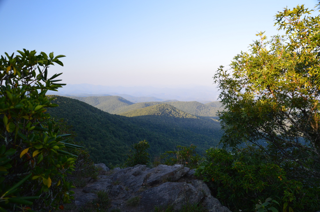
Just below the summit of Rocky Mountain, between 3.1 miles and 3.2 miles, the trail passes several rock faces and outcrops that provide good views to the south, with Mount Yonah being a prominent landmark in the distance. I must admit that I was slightly disappointed by the views from Rocky Mountain. I had expected wide, open rock slabs that provided 180-degree panoramic views, but the actual views were pretty narrow. For this reason, I gave the views a collective rating of only 4 stars out of 10. I believe the views from Tray Mountain are better, especially the view from the eastern overlook, but this doesn't mean that you should not hike to Rocky Mountain - it's still a great trail with payoff. After the several views, the trail passes right next to the summit of Rocky Mountain at 3.3 miles. A short side trail to the right eads to a camping area on the very summit. After this, the trail briefly follows the ridge from the summit, but at 3.5 miles, just past a campsit on the trail's left, the trail turns north and begins a steep descent. At 3.8 miles, the Appalachian Trail reaches a junction with the Rocky Mountain Trail. To continue this hike along the Rocky Mountain Loop, turn right onto the blue-blazed Rocky Mountain Trail, which provides an easy way to get back to Indian Grave Gap. If you would liek to continue to Unicoi Gap, you should know that the AT continues for nearly another mile to Unicoi Gap on GA Route 75. Unicoi Gap is the traditional trailhead for the hike to Rocky Mountain. 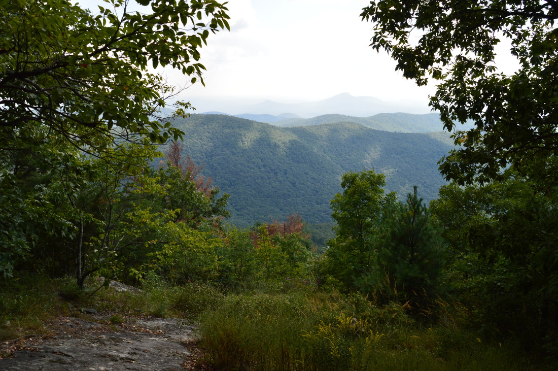
One of the views from Rocky Mountain
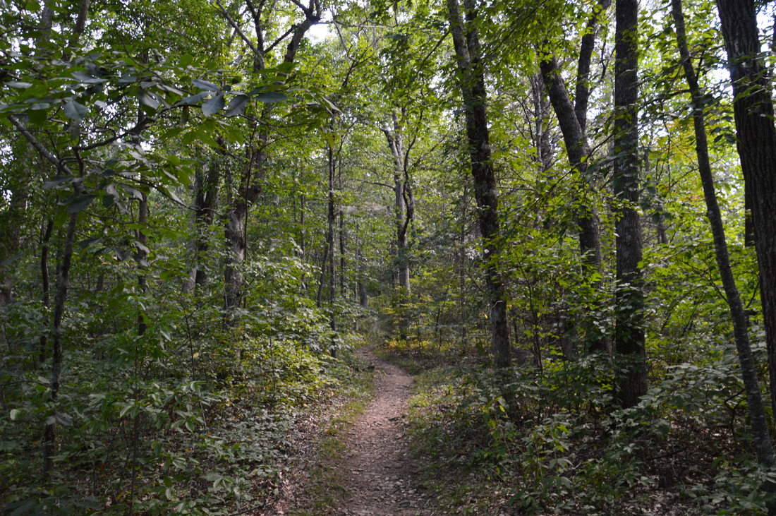
From the intersection, begin following the Rocky Mountain Trail to the east along the northern slopes of Rocky Mountain. This trail is mostly downhill, and there isn't anything notable on it, other than the trail is definitely traveled less than the overused section of the AT across Rocky Mountain. The trail crosses the Rogers Branch drainage at 4.1 miles and a tributary of High Shoals Creek at 4.55 miles, both of which were virtually dry on this day. At 4.7 miles, the Rocky Mountain Trail joins an old roadbed, and at 5.0 miles, the Rocky Mountain Trail ends at Indian Grave Gap Road. Turn right onto this forest road here and follow it for 0.6 miles of gentle uphill, before reaching Indian Grave Gap at 5.6 miles.
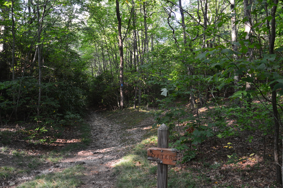
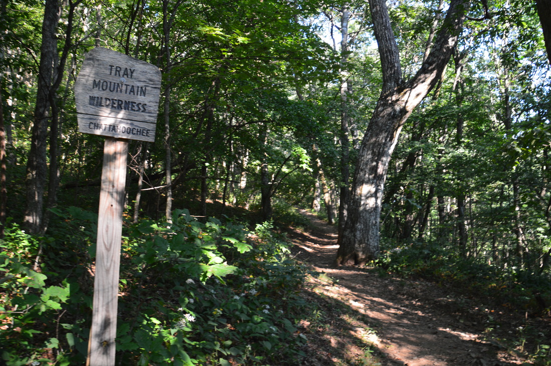
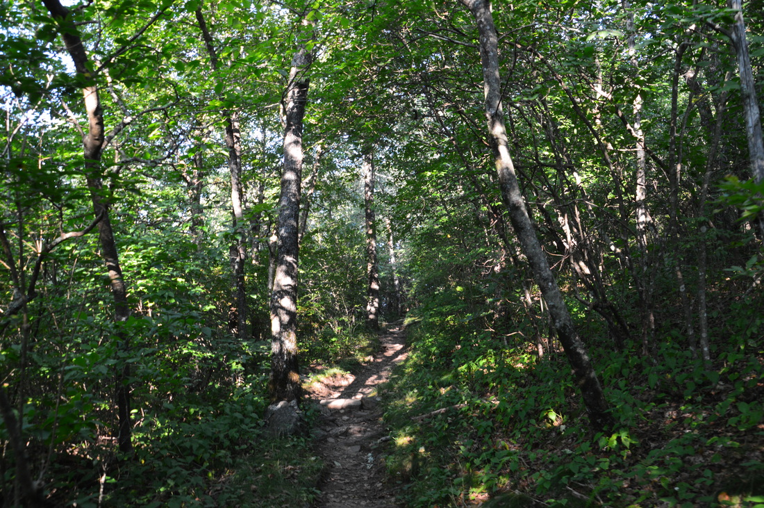
At Indian Grave Gap, pick up the northbound Appalachian Trail to the left, if you wish to continue to Tray Mountain. The first part of the trail as it leaves Indian Grave Gap is very pretty: it passes through a rhododendron tunnel, and the trail is lined by galax. After a period of gradual ascent, the trail passes a small creek and crosses FS Road 79 (Tray Mountain Road. Follow the white blazes across the road. At 6.6 miles, at a campsite, the trail reaches the top of the ridge that connects Rocky Mountain and Tray Mountain. From here, the trail follows the ridge to Tray Gap. At first, there is a brief descent, and at 6.7 miles, the AT passes through a gap with a good campsite. A signed spur trail to the left leads to water. A short ascent follows, after which, the AT stays on the level ridgeline for a bit. At 7.25 miles, another good camspite lies to the left and a rock outcrop to the right provides a view of Tray Mountain that looms ahead. After this, the trail descends to Tray Gap, reaching it at 7.5 miles. Tray Mountain Road passes through the gap from left to right, and to the left, Corbin Creek Road (FS Road 698) branches off. Continue straight on the Appalachian Trail. After crossing through Tray Gap, the Appalachian Trail enters the Tray Mountain Wilderness, marked by a sign. From here, the trail remains all uphill to the summit of Tray Mountain. The uphill grade is very manageable, but you might be a bit worn out by this point after all the climbing up to this point. The trail makes several switchbacks as it ascends Tray Mountain, At 8.1 miles, at one of the switchbacks, a small rock outcrop provides a view of the continuation of the ridge that the Appalachian Trail follows north from Tray Mountain. After one last switchback, the Appalachian Trail reaches the summit of Tray Mountain at 8.3 miles. 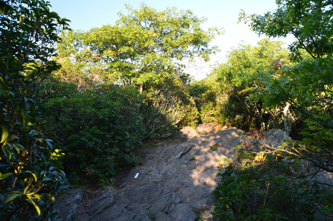
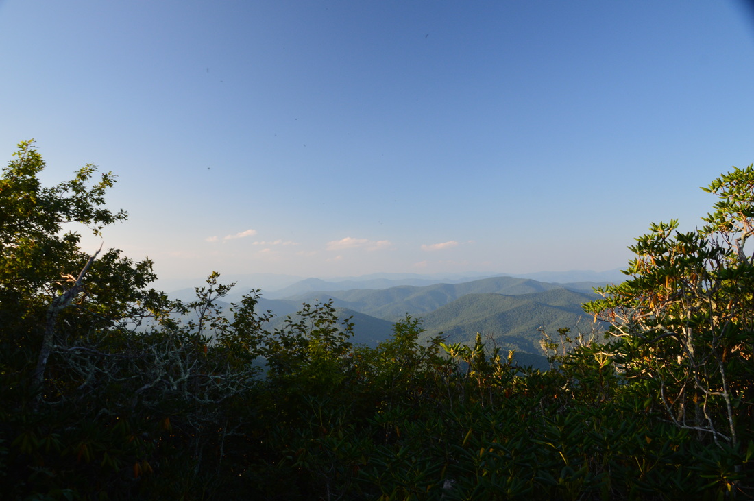
The summit of Tray Mountain
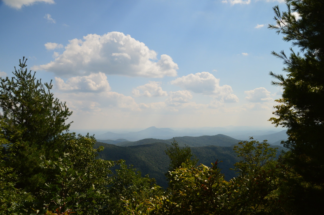
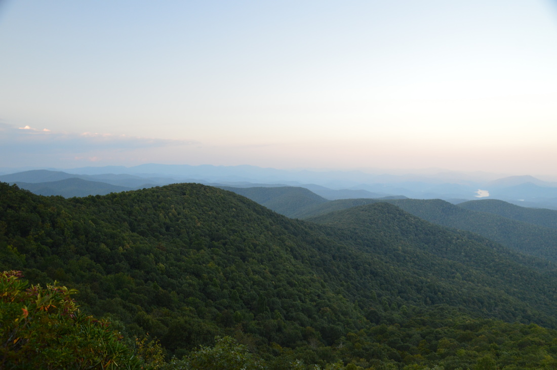
The summit of Tray Mountain provides good views both toe north and south. Once again, you can see Mount Yonah to the south. I believe that this overlook looks better when the leaves are off the trees. On my previous visit to Tray Mountain, I had been led to believe that the summit overlook on Tray Mountain provides the best views from the mountain. On this day, I learned that I couldn't be mistaken more. There is a spectactular overlook from a rock slab on a lead that leaves southeast from Tray Mountain. I am very surprised that this vista is not signed, marked, or talked about in any way, as it is very easily-reached and has a much better view than at the summit.
To get to this view, continue on the Appalachian Trail beyond the summit for abiut a tenth of a mile along a nearly level ridge. At 8.4 miles, you will reach a campsite. The AT leaves the ridge here as it bears left. Do not follow the AT from here. Instead, walk across the campsite, and pick up a narrow but well-defined path at the campsite's far edge that continues to follow the ridge. This is apparently an unofficial side trail, but for what it's worth, it really should become a mantained, signed, and blazed side trail. The trail is galax-lined for much of its way as it passes through a very dense rhododendron tunnel. Make sure to stay along the primary path along the ridgetop. When you reach another campsite in a saddle, you are almost at the overlook. Continue straight on the main path, now slightly uphill. Be sure to not take a second path to the right (I do not know where it leads, but it goes somewhere downhill). Soon, a rock outcrop comes into view ahead. Scramble up to the top of the rock outcrop, reaching the breathtaking overlook at 8.6 miles. 
The panoramic view eastward from the overlook near the summit of Tray Mountain
The grand east-looking vista from the rock outcrop puts many different ridges and mountains into view. You can see Lake Burton and Lake Rabun directly to the east. To the right of Lake Rabun, Oakey Mountain rises seemingly slightly higher than the other visible peaks. If you're hiking to Tray Mountain, I highly recommend visiting this overlook, as it provides one of the best views in the area.
From this overlook, simply retrace your steps back to the Andrews Cove trailhead. Return to the AT, follow the AT back to Indian Grave Gap, and return along the Andrews Cove Trail to the Andrews Cove Trailhead. You will return to the Andrews Cove Trailhead at 13.6 miles. Mileage
0.0 - Andrews Cove Trailhead
2.0 - Indian Grave Gap 3.1-3.2 - Views from Rocky Mountain 3.3 - Summit of Rocky Mountain 5.6 - Indian Grave Gap 7.5 - Tray Gap 8.3 - Summit of and views from Tray Mountain 8.6 - Overlook on east side of Tray Mountain 13.6 - Andrews Cove Trailhead Variations
Hike the Andrews Cove Trail and Appalachian Trail out and back to Rocky Mountain - 6.6 Miles
Hike the Andrews Cove Trail and Rocky Mountain Loop without Tray Mountain - 7.6 Miles Hike the Andrews Cove Trail and Appalachian Trail out and back to the Tray Mountain eastern overlook without Rocky Mountain - 10.0 Miles Bonus Stops
The High Shoals Falls Trail is a great bonus stop. The trail is accessed from Indian Grave Gap Road north of Indian Grave Gap. This 2.4-mile trail passes two beautiful waterfalls - High Shoals Falls and Blue Hole Falls.
PicturesVideos
0 Comments
Leave a Reply. |
About MeMark Oleg Ozboyd Dear readers: I have invested a tremendous amount of time and effort in this website and the Georgia Waterfalls Database the past five years. All of the work that has gone in keeping these websites updated with my latest trip reports has almost been like a full-time job. This has not allowed me to pick up a paid job to save up money for college, and therefore, I I've had to take out loans. If you find the information on this website interesting, helpful, or time-saving, you can say "thanks" and help me out by clicking the button above and making a contribution. I will be very grateful for any amount of support you give, as all of it will apply toward my college tuition. Thank you!

Coming in 2022-2023?
Other Hiking WebsitesMiles HikedYear 1: 540.0 Miles
Year 2: 552.3 Miles Year 3: 518.4 Miles Year 4: 482.4 Miles Year 5: 259.9 Miles Archives
March 2021
Categories
All
|


 RSS Feed