The Appalachian Trail in Georgia passes through some of the state's highest terrain, passing many different views. Some are very popular, such as Springer Mountain, Blood Mountain, and Tray Mountain. But the best and perhaps underrated view lies on Cowrock Mountain: a 3800-foot peak that lies in the Raven Cliffs Wilderness on the Blue Ridge Valley Divide. The Appalachian Trail passes right over the summit of the mountain, and just to the south of the AT, a pair of magnificent vistas await. To the east of Cowrock Mountain, the Appalachian Trail passes over a second mountain - Wildcat Mountain - where another rock slab gives additional views. Furthermore, a lesser-used access trail, known as the Logan Turnpike Trail, joins the AT between the two mountains via the picturesque Town Creek valley along the route of an old toll road. On this hike, you will use the Logan Turnpike Trail to reach the Appalachian Trail and visit both Cowrock Mountain and Wildcat Mountain. This hike occurred on Saturday, September 17th, 2016. My plan was to hike the Logan Turnpike Trail up to Tesnatee Gap, where it joins the Appalachian Trail. From there, I would first hike the AT northbound over Wildcat Mountain and to Hogpen Gap. Then, I would return to Tesnatee Gap, and I would hike the AT southbound to Cowrock Mountain. I would finish the hike by retracing my steps to Tesnatee Gap and down the Logan Turnpike Trail.
Update 2/14/17: I have received confirmation that the southern trailhead to the Logan Turnpike Trail is no longer accessible by car, because the property owner of the land at the trailhead has placed a gate 1/4 mile south of the trailhead, and the USFS has concluded that they do not have access rights into the private property area. In the future, the trail may potentially be extended east or looped with Whitley Gap Trail, but if this ever materializes, then it will not be anytime soon. The Logan Turnpike Trail can still be hiked out and back from its northern trailhead at Tesnatee Gap on GA Route 348, and keep in mind that the trail is still entirely on USFS land.
Summary
R/T Length of Trail: 7.9 Miles
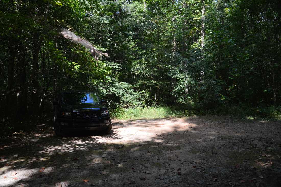
Duration of Hike: 7:50 (this includes a nearly hour-long break on Cowrock Mountain) Type of Hike: T-Configuration Difficulty Rating: 8 out of 10 Total Elevation Gain: 2680 Feet Pros: One of the best vistas in Georgia; Solitude on the Logan Turnpike Trail Cons: A lot of steep ascent Points of Interest: Small waterfall on Town Creek - 1 star; Wildcat Mountain Overlook - 3 stars; Three Overlooks on Cowrock Mountain - 10 stars collectively Trail Blaze Color(s): Logan Turnpike Trail - Blue; Appalachian Trail - White Best Season(s) to Hike: Winter; Spring Fees: None Beginning Point: Logan Turnpike Trailhead Directions from Cleveland, GA: From the traffic circle in downtown Cleveland, Follow US Route 129 North for 7.5 miles. Then, turn right onto Kellom Valley Road and immediately bear right to stay on the road. Follow Kellom Valley Road for 2.6 miles. The road will turn unpaved but it is in good condition. 2.6 miles from US 129, reach a turnaround area where the road ends as a driveway to the left. A much poorer road continues straight. Take this road to reach the Logan Turnpiek Trailhead. Four-wheel drive is advised for this road and high clearance is recommended, but in my opinion, a vehicle with average clearance can make it to the end if the driver is careful. The good thing is that this road is very short. From the turnaround at the end of Kellom Valley Road, continue for a quarter-mile on the unnamed poorer road to another turnaround. This is the parking area for the Logan Turnpike Trail. The obscure trail begins at the far end of the turnaround. Map
Click here for more information and to download this trail map to view in Garmin Basecamp.
Details
As you were reading the summary for this hike, you may have noticed that it took me seven hours and fifty minutes to hike 7.9 miles. Yes, I did take a break of around fifty minutes at the summit of Cowrock Mountain. But that's stil seven hours to hike only 7.9 miles. If you've been wondering why, then the truth is, this hike is quite a workout and perhaps one of the hardest hikes that I have done under eight miles. This hike involves nearly 3000 feet of elevation gain. Such an amount of elevation gain makes for a fairly difficult hike at any distance, but when it's only eight miles, it is obvious that there is a lot of steep climbing involved. The upper end of the Logan Turnpike Trail is very steep, and the ascents to Wildcat Mountain and Cowrock Mountain are at least somewhat steep, but luckily, at least they have switchbacks, unlike the ascent on the Logan Turnpike Trail. I faced quite a dilemma when I was trying to rate the difficulty of this hike, but I decided to rate it at an "8 out of 10", because even though I still did this hike without any problems (in part due to its distance), many casual hikers might find it rather difficult and at the upper end of their limitations. Thus, for those who do not want to hike the Logan Turnpike Trail, there is a trailhead at Tesnatee Gap that provides a much easier hike to both Cowrock Mountain and Wildcat Mountain. With that said, read on to learn more about this hike.
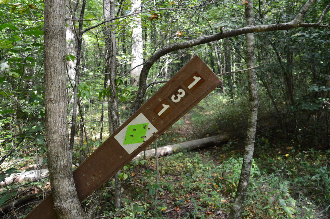
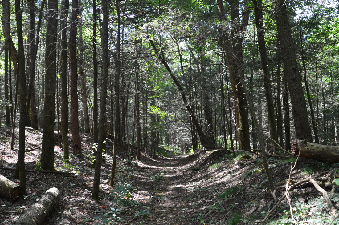
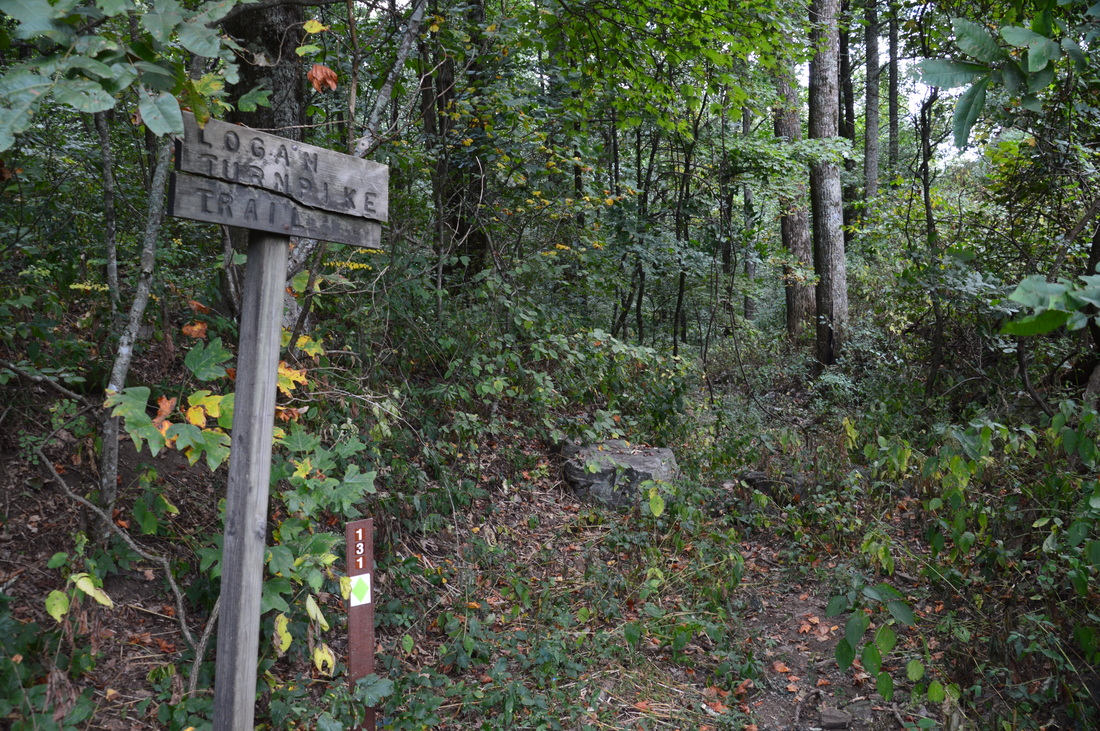
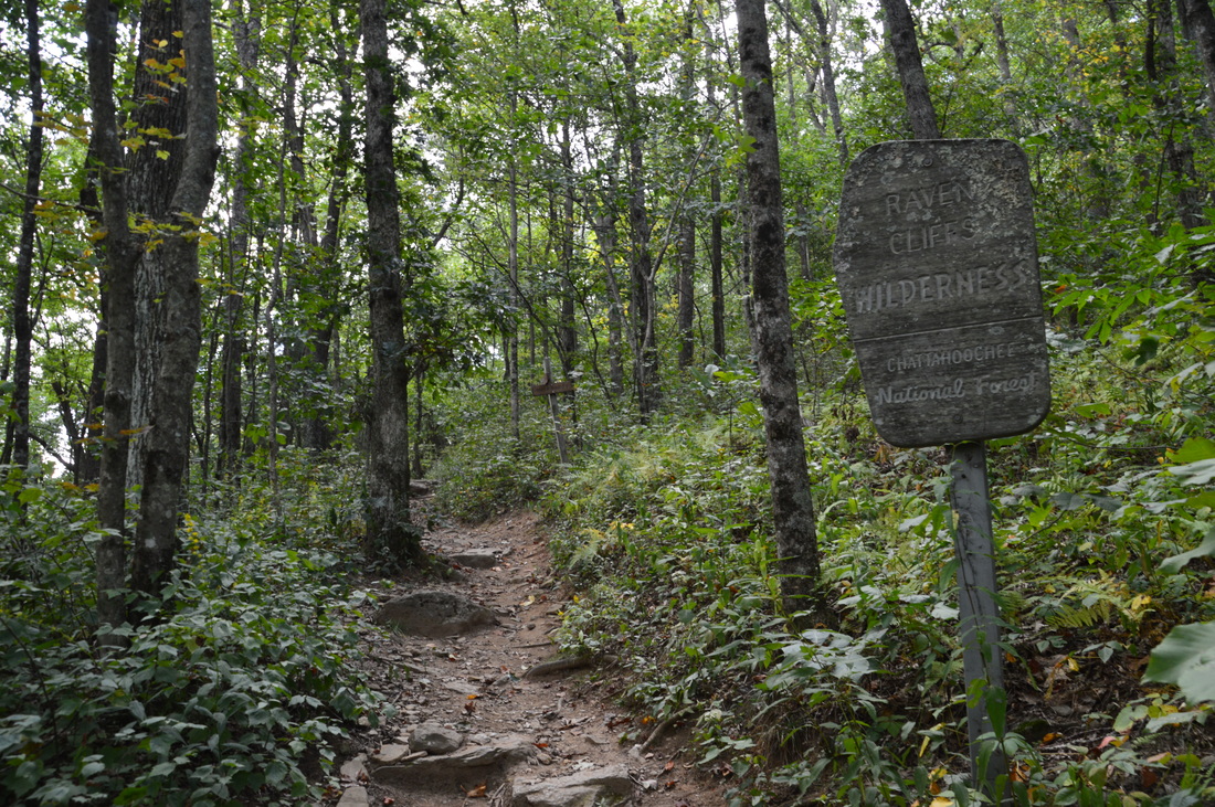
Finding the beginning of the Logan Turnpike Trail can be a bit tricky. At first, I thought that the trail begins along the ATV path that leaves the parking area up the mountainside to the east. However, the trail actually heads northward from the parking area. Once you spot the beginning of the trail, you will also spot a carsonite stake that is attached to a tree. The carsonite stake has the numbers 131 imprinted on it (which stands for Logan Turnpike Trail #131). Begin following the initially flat trail and nearly immediately enter the Raven Cliffs Wilderness (the boundary is unsigned). Most of the trail follows an old toll road, which was originally called the Union Turnpike and later renamed as the Logan Turnpike. The now-abandoned road, which was built in 1821, was mainly used as a way to transport food to areas south of Tesnatee Gap. Once automobiles were invented, the road continued to stay in use, although many automobiles did not make it all the way to Tesnatee Gap due to the steepness of the road. 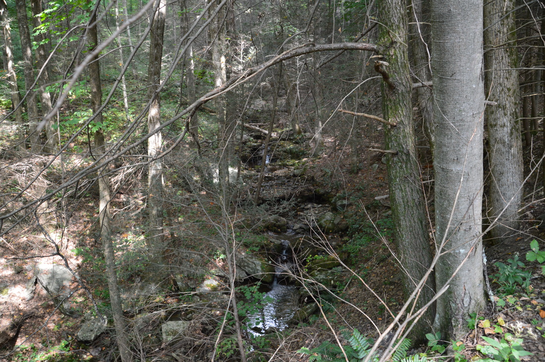
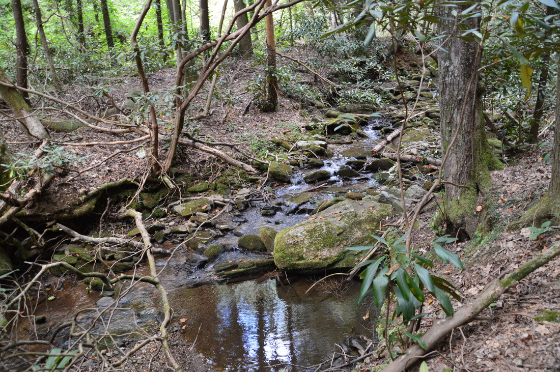
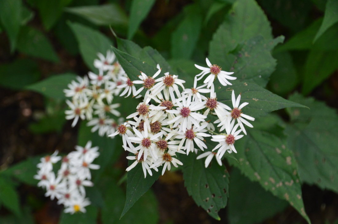
There are many views of Town Creek throughout the Logan Turnpike Trail. Town Creek is a beautiful stream, even during drought conditions
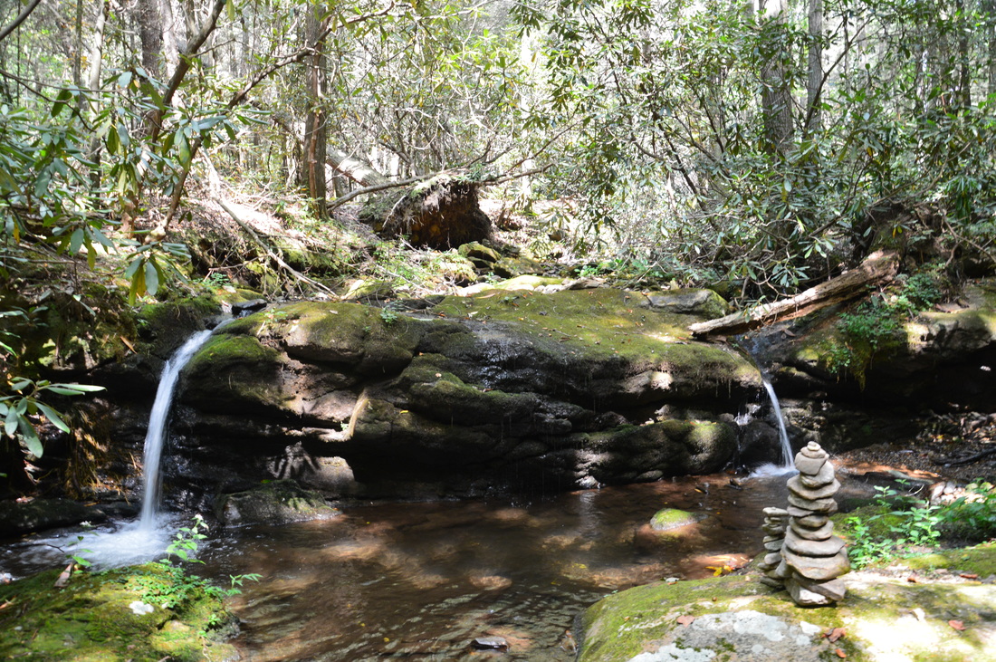
Pay attention to the occasional blue blazes as the trail joins the old turnpike and crosses a tributary of Town Creek at 0.35 miles. The trail is very easy in this section, as there is virtually no uphill and a nearly double-track route. At 0.45 miles, the trail approaches Town Creek and begins to follow it upstream. There are some cascades along the creek here. Town Creek is a very beautiful stream, and I am sure that the Logan Turnpike Trail becomes quite beautiful after a prolonged period of heavy rain, when the creek's levels go up. On this day, the level of Town Creek was well below average due to an extreme drought, but there were still many scenic cascades. At 0.6 miles, there is a somewhat confusing spot, but fortunately, it is well-blazed. The trail veers off the old roadbed to the left, passes a side trail to the left, and then bears right next to the old roadbed. The side trail to the left descends just a couple dozen yards to a several-foot waterfall across a rock wall on Town Creek. On this day, the water level was so low that the waterfall consisted of only two small channels of water at the edges of the wall.
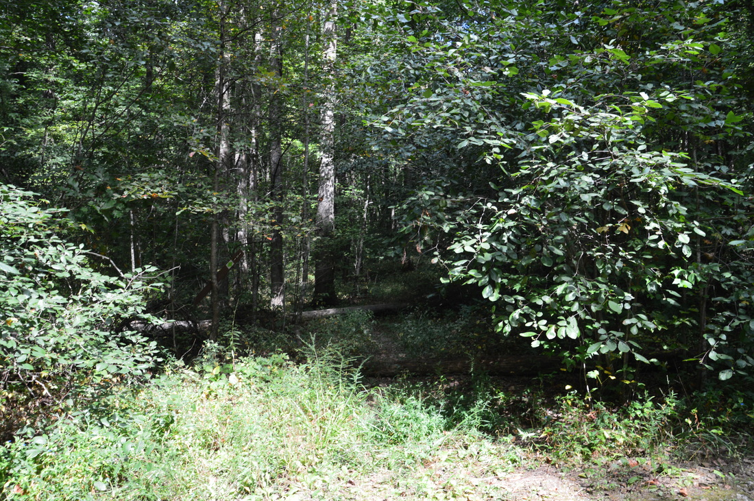
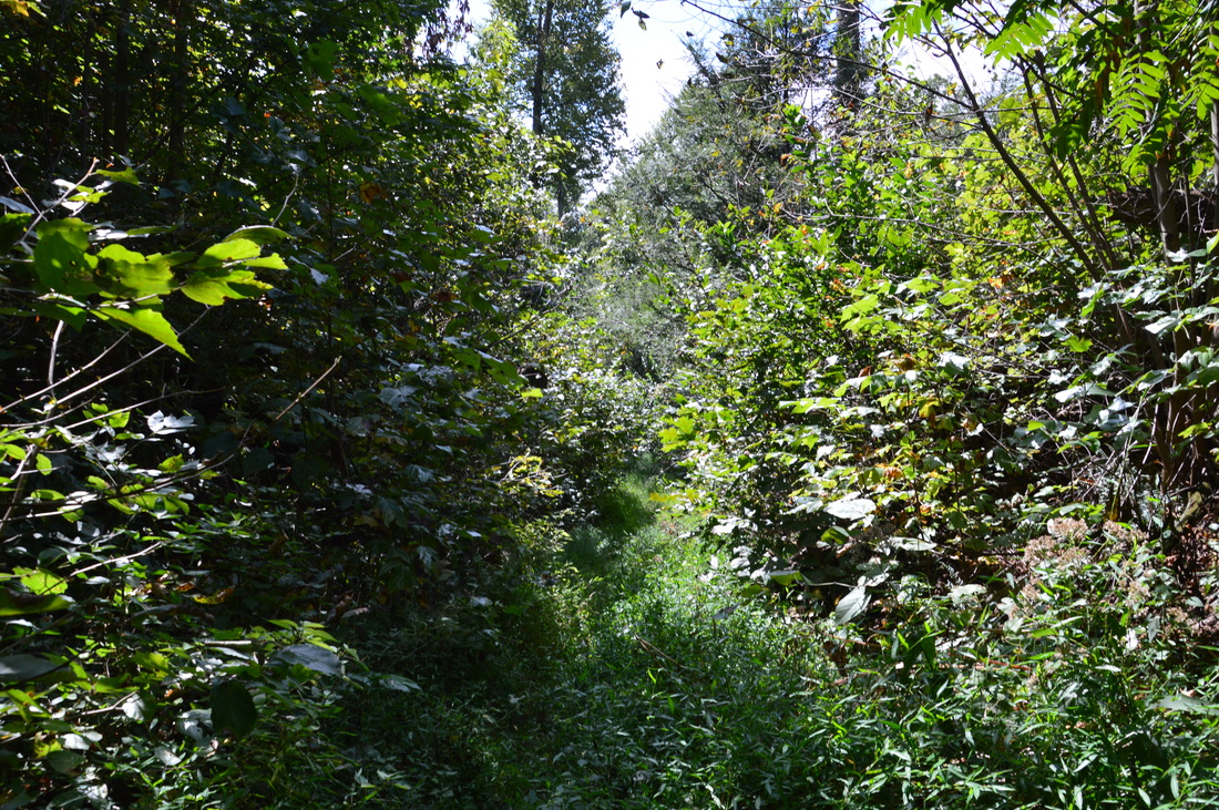
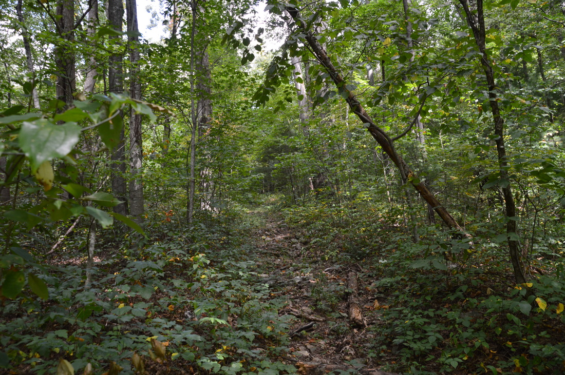
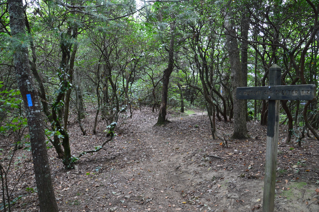
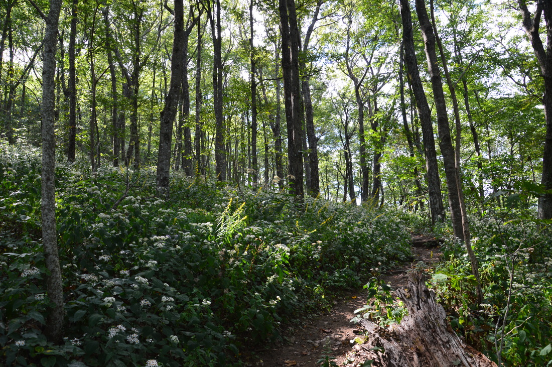
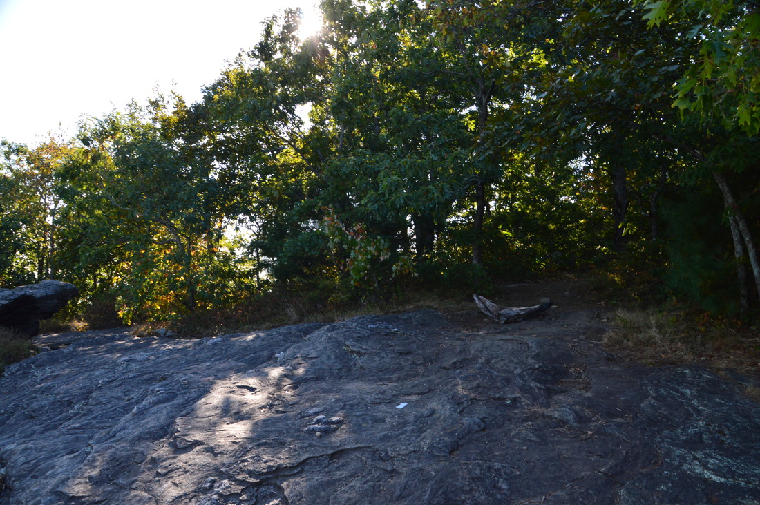
After this waterfall, the trail soon rejoins the old roadbed. Around this point, the blue blazes suddenly disappeared, and I never saw a single blaze until the Appalachian Trail. At 0.8 miles, reach an extended very overgrown segment of the Logan Turnpike Trail. This area was hit by a tornado during April 2011, and as a result, a lot of trees were knocked down. I believe that the trail became so overgrown with grass and other brush because the route of the trail recieved much more sunlight following the tornado, and this caused a rapid growth competition amidst such plants. Also, I believe that this section of trail may be ticky during late spring and early summer, so keep that in mind. Continue following the "trail" through the periods of grass and brush. You will cross a mucky area where some views of Cowrock Mountain towering to the left will open up, due to the treeless hillside. 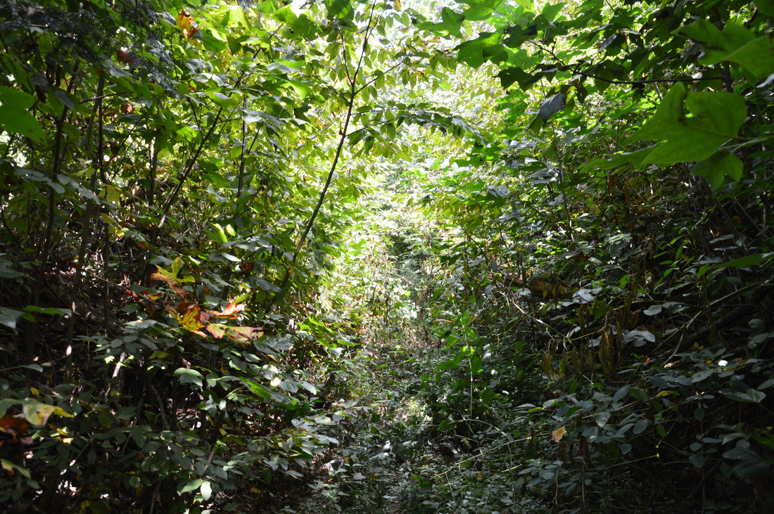
Portions of the Logan Turnpike Trail are very overgrown and look like this
At 1.1 miles, leave the overgrown area and the tornado's path. The trail becomes easier to follow again. Some views of the small creek and its scenic tumbling cascades open up to the left. Shortly after this, the trail begins to steepen as the valley grows smaller and the slopes get steeper. In under a quarter-mile, the ascent becomes somewhat steep, and there are no switchbacks as the trail simply follows the route of the old turnpike. At 1.45 miles, bear left and cross Town Creek, which is now barely a trickle. After this, the ascent becomes very steep without any switchbacks, and according to my GPS, some of the ascent is at a grade of 24%. This portion of the trail is not blazed. However, you should be able to stay on the trail by following the widest and least overgrown track, which is the route of the old turnpike. At 1.9 miles, the Logan Turnpike Trail ends at Tesnatee Gap, where there is a signed intersection with the Appalachian Trail as well as a parking area off of GA Route 348 (Richard B. Russell Scenic Highway).
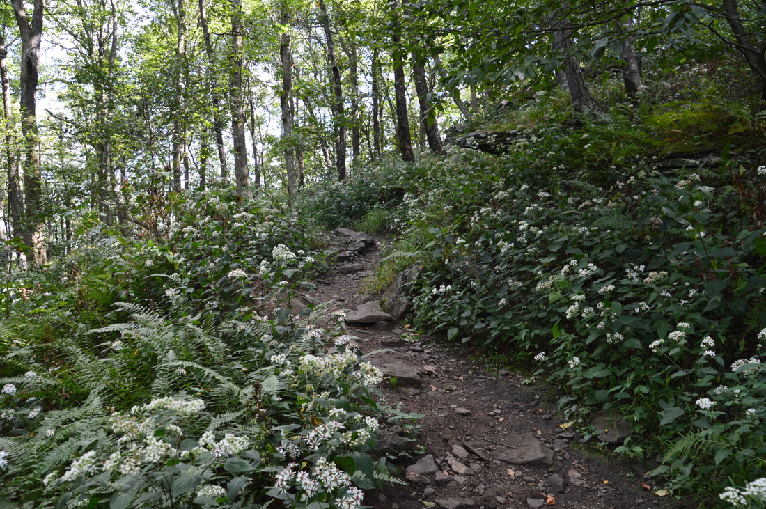
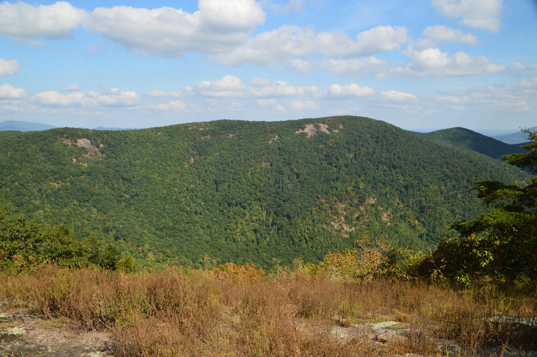
From Tesnatee Gap, you can turn left to follow the AT to Cowrock Mountain, or you can turn right to follow the AT to Wildcat Mountain. My plan was to see both, but if you have time for just one, I would definitely pick Cowrock Mountain over Wildcat Mountain. However, since I had time for both, I planned to first hike to Wildcat Mountain. To hike to Wildcat Mountain, turn right and immediately begin ascending along the white-blazed Appalachian Trail. Re-enter the Raven Cliffss Wilderness shortly (after having left it briefly at the Tesnatee Gap parking area). The ascent is still pretty steep, but at least there are good switchbacks on the Appalachian Trail, so the ascent is easier than along the Logan Turnpike Trail. Passing some large boulders to the left, the trail briefly levels out at 2.4 miles. Then, at 2.45 miles, the Appalachian Trail reaches the Wildcat Mountain Overlook. This overlook provides a decent view of Cowrock Mountain, the Town Creek valley, and the Piedmont in the distance. A pretty big problem about the vista is that there are numerous trees that decrease the size of the view, as the rock outcrop is quite small. 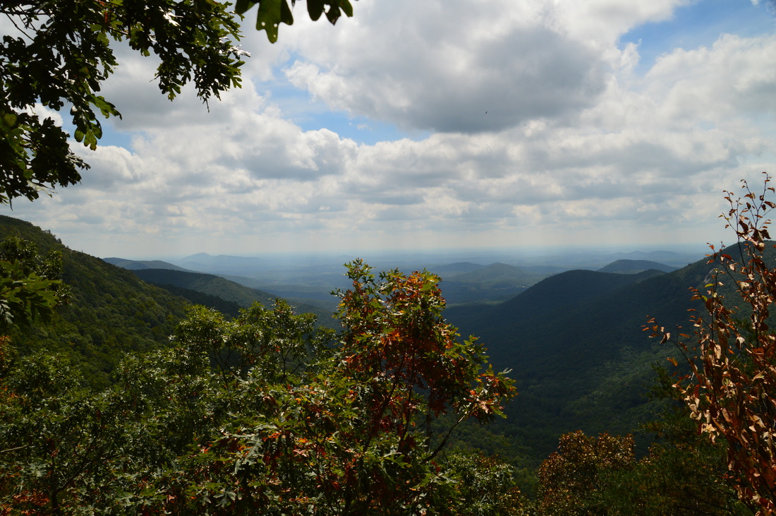
The view from Wildcat Mountain
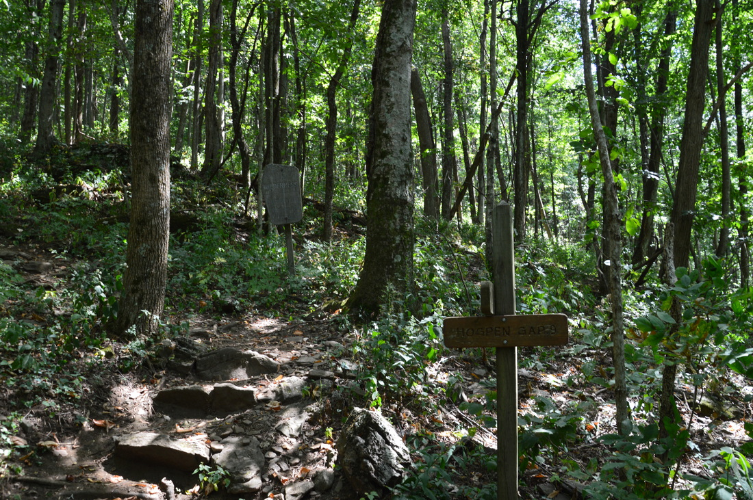
From the Wildcat Mountain Overlook, I decided to continue on the Appalachian Trail to Hogpen Gap. However, there is nothing much to see on this part of the trail (unless you also do the Whitley Gap Spur Trail), and I did it simply for the sake of completion. The mileage below includes my hike to Hogpen Gap. From the overlook, continue on the AT, which briefly ascends to the summit of Wildcat Mountain, arriving at it at 2.5 miles. Actually, WIldcat Mountain is a ridge with several summits, and this is one of them. A nice campsite lies at the summit. After this, the AT gradually descends to a gap at 2.6 miles. In the gap, the Appalachian Trail turns left, while the blue-blazed Whitley Gap Trail (Whitley Gap Shelter Trail) continues straight. The trail is 1.2 miles one way to the Whitley Gap Shelter. After completing this hike, I learned about a vista on Wildcat Ridge that can be accessed from the Whitley Gap Trail. I do not yet have the details regarding this vista, but I plan on doing a future hike here and I will attempt to locate the vista.
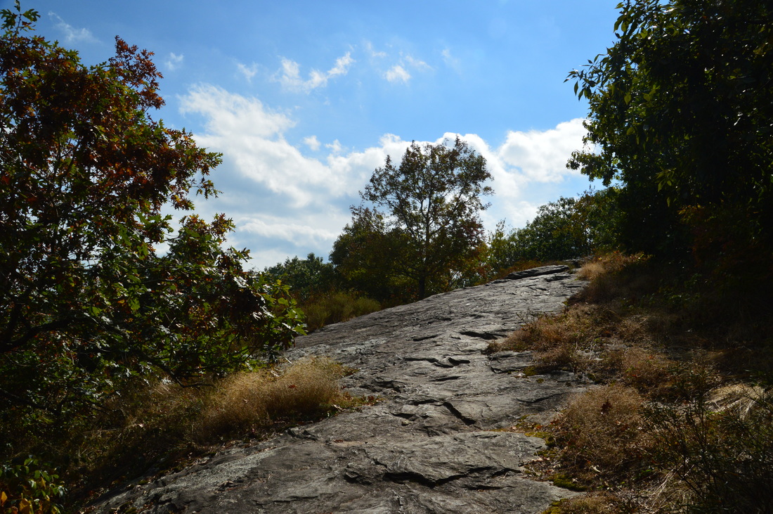
To reach Hogpen Gap, turn left on the Appalachian Trail and descend at an easy grade using numerous switchbacks through a forest with a fern-filled understory. At 2.8 miles, reach GA 348. A blue-blazed spur trail to water heads to the right. The trail crosses the road and reaches the Hogpen Gap parking area at 2.85 miles. From here, the Appalachian Trail continues into the Mark Trail Wilderness to Horsetrough Mountain, Chattahoochee Gap, and eventually Unicoi Gap. To hike to Cowrock Mountain, retrace your steps from Hogpen Gap to Tesnatee Gap. You will reach Tesnatee Gap at 3.8 miles. Walk across the parking area, pick up the Appalachian Trail, and re-enter the Raven Cliffss Wilderness. The trail begins ascending moderately to steeply to a knob below Cowrock Mountain. At 4.1 miles, the trail passes through a gap between the knob and Cowrock Mountain The main ascent to Cowrock Mountain now begins. The trail utilizes numerous switchbacks to ease the grade on the ascent. At 4.3 miles, a rock outcrop to the left provides a limited view of Wildcat Mountain. At 4.7 miles, the Appalachian Trail reaches a large rock slab at the summit of Cowrock Mountain. 
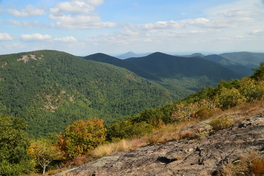
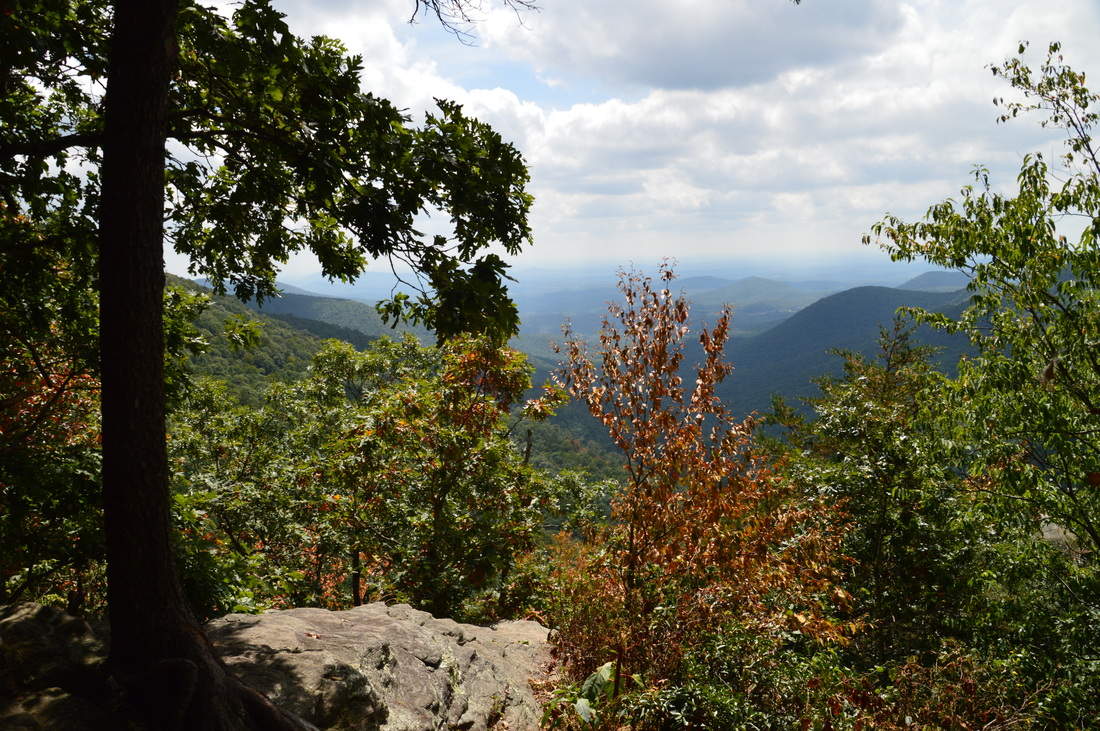
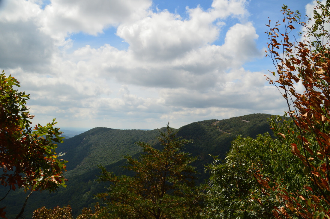
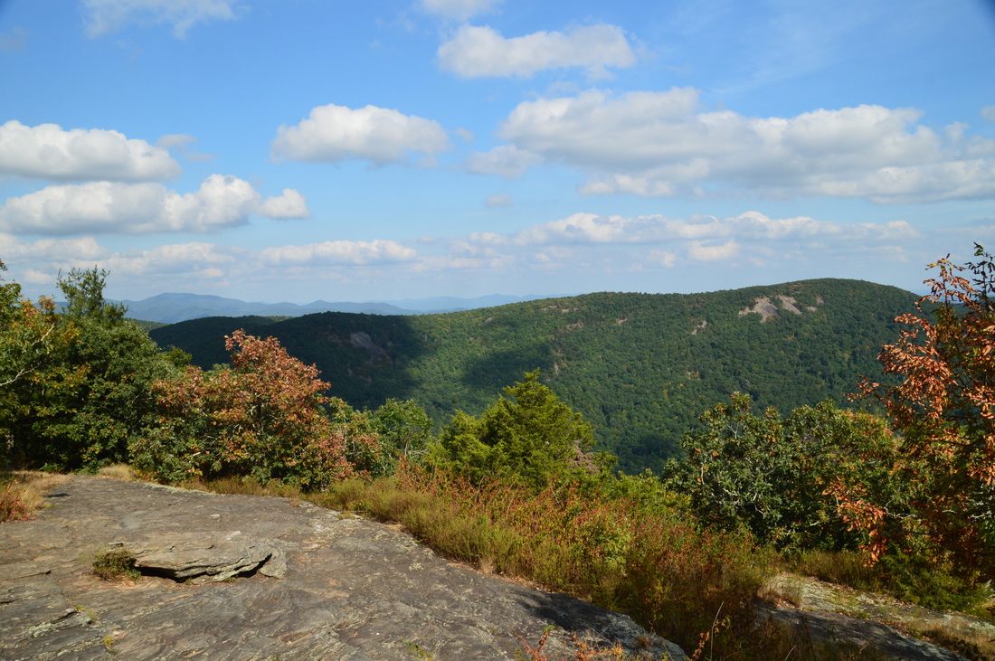
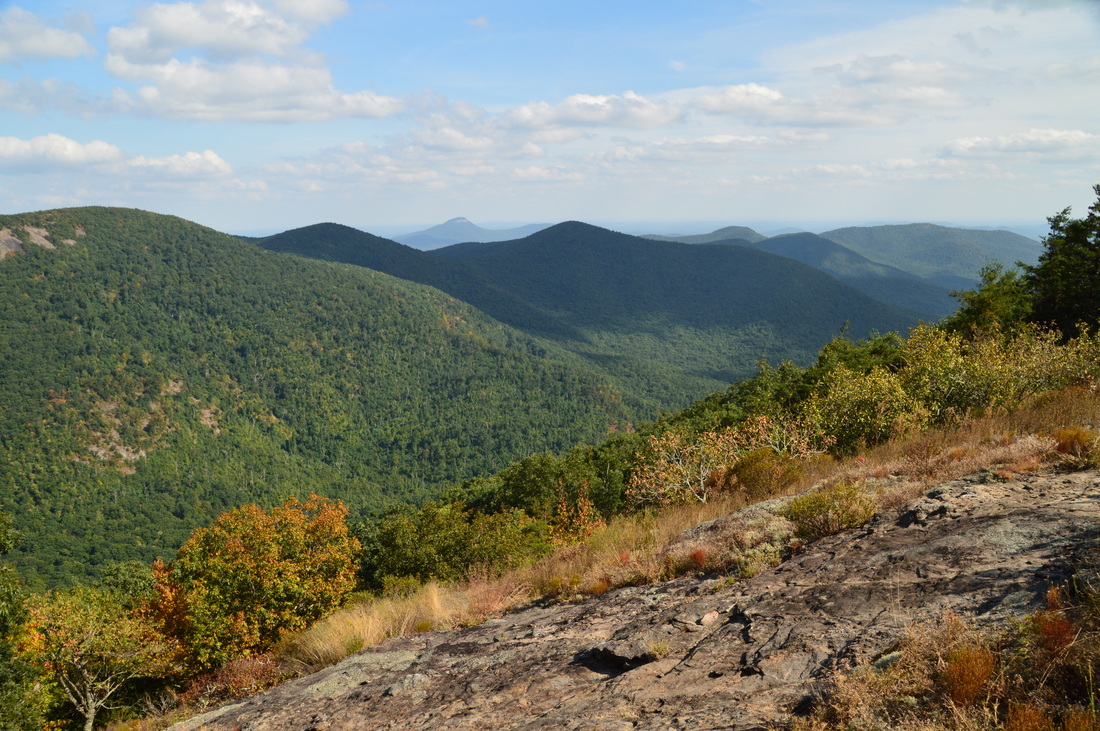
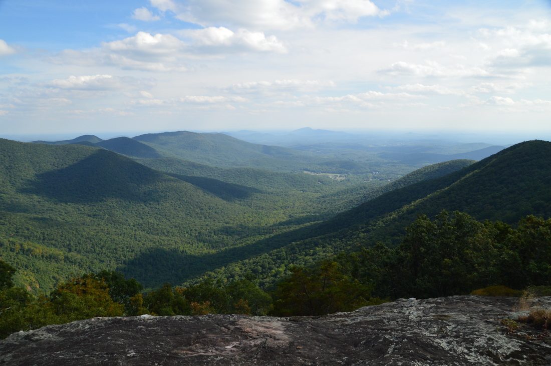
The breathtaking views from Cowrock Mountain are nothing short of outstanding
This rock slab provides a really great view of Wildcat Mountain, Adams Bald, Mount Yonah, and portions of the Town Creek valley. This is the "classic" view from Cowrock Mountain, and it is the view that most people get to see, as it is right on the trail. It is a good view, although there are some trees and bushes that slightly block the lowermost end of the view. On my first hike to Cowrock Mountain from Neels Gap several years ago, I had thought that this is the only view, and man was I mistaken. What most people do not know is that an unofficial and unmarked side trail leaves the AT and travels south for a quarter-mile past two outstanding overlooks that provide much better views than the official overlook on the AT. Here are the directions to these overlooks. When you're at the large summit rock slab on the AT, note that the AT bears right back into the woods. To access the overlooks, bear left and walk across the rock slab past a large boulder that rests on the rock slab. At the end of the rock slab, you should see a "goat path" that heads south and begins descending moderately. This is the path that you must take. Descend about 100 feet and follow the path for a tenth of a mile.
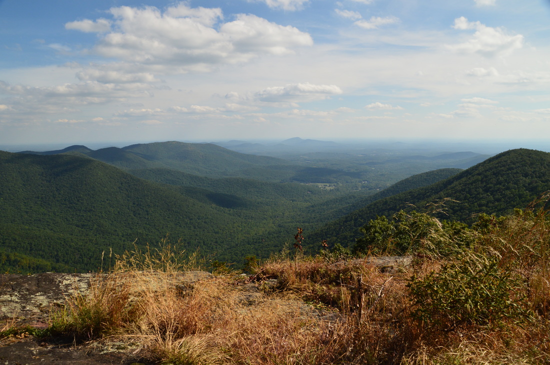
At 4.8 miles, reach a large clearing with a campsite. To the left, a large rock face provides the first of the two outstanding vistas on Cowrock Mountain. The views here are to the northeast, east, and southeast. In the foreground, Wildcat Mountain occupies the view. There are some cliffs visible on the mountain that might provide good views back to this point. To the left (northeast), you can see Horsetrough Mountain and Brasstown Bald in the distance. To the right, Adams Bald occupies the foreground, and the pointy peak of Mount Yonah - ringed with a line of cliffs - rises in the distance. What a view! To reach the next vista, which is arguably even better than this one, pass through the clearing and past the campsite and pick up the well-defined path that continues south along the ridge. Follow it for a bit past a campsite and through a small grassy clearing. You will then see a cliff just ahead. Descend to the top of the cliff, reaching it at 4.9 miles. The Town Creek watershed is laid out straight in front of you. The valley is bordered by two ridges. To the right is Cowrock Flat Moutnain and to the left is a number of peaks including Adams Bald, Rocky Mountain, and Pinnacle Mountain. Beyond the mouth of the Town Creek valley, the rolling hills of Piedmont fade away into the distance. This stunning view is definitely one of the best that I have seen in Georgia and is well worth the hike. There may be more views on Cowrock Mountain that I have not yet seen. I am going to investigate this possibility on my next hike to it. From the last vista, simply retrace your steps along the AT to Tesnatee Gap and then down the Logan Turnpike Trail back to your car. You will conclude the hike at 7.9 miles at the Logan Turnpike Trailhead. I classify this hike as a "Best Hike" due to the outstanding views from Cowrock Mountain. Mileage
0.0 - Logan Turnpike Trailhead
0.6 - Cascade on Town Creek 1.9 - Tesnatee Gap 2.45 - Wildcat Mountain Overlook 2.85 - Hogpen Gap 3.8 - Tesnatee Gap 4.7 - Summit of Cowrock Mountain; Overlook 1 4.8 - Cowrock Mountain Overlook 2 4.9 - Cowrock Mountain Overlook 3 7.9 - Logan Turnpike Trailhead Variations
Hike out and back to Wildcat Mountain Overlook from Tesnatee Gap - 1.1 Miles
Hike out and back to three overlooks on Cowrock Mountain from Tesnatee Gap - 2.2 Miles Hike out and back to Wildcat Mountain Overlook via Logan Turnpike Trail - 4.9 Miles Hike out and back to three overlooks on Cowrock Mountain via Logan Turnpike Trail - 6.0 Miles Add the Whitley Gap Trail to the full hike - 10.3 Miles Bonus Stops
The short popular hike to Desoto Falls is worth a try after this hike, as it's in the same area.
PicturesVideos
4 Comments
Gerald W. Flinchum
2/18/2017 09:52:58 pm
I would like to use several of your photos of Logan's Turnpike Trail for a lecture project at Kennesaw State University Continuing Education program on the Civil War in Georgia. Maybe three of your trail photos.
Mark Oleg
2/18/2017 10:02:09 pm
Hi Gerald, 2/19/2017 06:55:02 pm
Thanks Mark, The proposed course at KSU Continuing Ed. will be based on a book project that will completed this year on the "Guerrilla War in Georgia" 1864-1865 period.
JEFF SHOTWELL
10/15/2019 03:06:33 pm
Beautiful pics and video from that third overlook at Cowrock. I have been told it is called Storytime Rock. One of the best overlooks in all of N Georgial for sure. Leave a Reply. |
About MeMark Oleg Ozboyd Dear readers: I have invested a tremendous amount of time and effort in this website and the Georgia Waterfalls Database the past five years. All of the work that has gone in keeping these websites updated with my latest trip reports has almost been like a full-time job. This has not allowed me to pick up a paid job to save up money for college, and therefore, I I've had to take out loans. If you find the information on this website interesting, helpful, or time-saving, you can say "thanks" and help me out by clicking the button above and making a contribution. I will be very grateful for any amount of support you give, as all of it will apply toward my college tuition. Thank you!

Coming in 2022-2023?
Other Hiking WebsitesMiles HikedYear 1: 540.0 Miles
Year 2: 552.3 Miles Year 3: 518.4 Miles Year 4: 482.4 Miles Year 5: 259.9 Miles Archives
March 2021
Categories
All
|


 RSS Feed