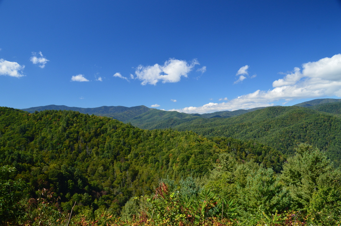
The Cataloochee Valley in Great Smoky Mountains National Park is a place where beauty and history mingle together. By the mid 1800s, there were several settlements in the valley, the remains of which we can still see today. The mountains around the Cataloochee Valley are home to areas of gorgeous old-growth forest, where tall trees tower proudly into the sky in areas that have never been logged. On this hike, you will first hike along the Caldwell Fork - a picturesque mountain stream - before taking the Boogerman Trail past some of the area's most remarkable trees, as well as a couple of significant historic points, including an old cemetery and an old stone wall. You will then follow the Big Fork Ridge Trail across a low ridge that separates the Caldwell Fork valley from the Cataloochee Valley, before concluding the hike along Cataloochee Road and seeing several more historical points of interest. If you're lucky, you might also spot the renowned Cataloochee elk. This hike occurred on Saturday, October 1st, 2016. My plan was to hike the Caldwell Fork Trail to the lower Boogerman Trail junction, from where I would follow the Boogerman Trail to its end farther up on the Caldwell Fork Trail. I would then take the Caldwell Fork Trail to the Big Fork Ridge Trail, which I would follow to Cataloochee Road. I would finish the hike by walking Cataloochee Road back to the trailhead.
Summary
R/T Length of Trail: 11.8 Miles
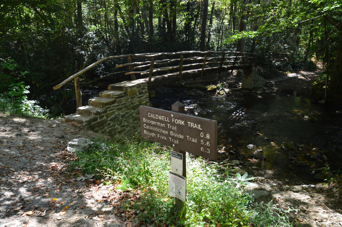
Duration of Hike: 7:45 Type of Hike: Loop Difficulty Rating: 5 out of 10 Total Elevation Gain: 2088 Feet Pros: Numerous historic points of interest; mostly well-graded ascents Cons: Horse usage on Caldwell Fork Trail and Big Fork Ridge Trail; two-mile roadwalk at the end Points of Interest: Old-growth trees on Boogerman Trail; remains of Palmer Homestead including old stone walls; Palmer Cemetery; two graves of settlers who were killed during the Civil War; Caldwell House; Hiram Caldwell Cemetery; Beech Grove School; Palmer Chapel Trail Blaze Color(s): None Best Season(s) to Hike: Spring; Fall (especially late September into early October for the elk rut) Fees: None Beginning Point: Caldwell Fork and Boogerman Trailhead in Cataloochee Valley Directions from Maggie Valley, NC: From the intersection of US Route 19 and Campbell Creek Road in Maggie Valley, follow US Route 19 North for 4.1 miles. Then, turn left onto US Route 276 North. Follow 276 for 5.6 miles, and then, just before I-40, turn left onto Cove Creek Road. The road will turn unpaved in 5.7 miles, but it is easily passable by all passenger vehicles. 8.6 miles from US 276, turn left onto paved Cataloochee Road. Follow Cataloochee Road for 3.2 miles to the Caldwell Fork Trailhead to the left. There is a small parking area on the left with space for under a dozen cars right after the trailhead. Map
Click here for more information and to download this trail map to view in Garmin Basecamp.
Details
For years, I had been trying to see the Cataloochee Valley elk rut, which occurs in the Great Smoky Mountains National Park every year during late September and early October. Each year, I either had other plans or missed the elk rut, but this year, I was finally able to make a trip to Cataloochee around the peak of the rut on October 1st, and it paid off. I got to see elk for the first time. Of course, I first had to do a hike, and Ipicked a hike that would end on Cataloochee Road in the evening right around when the elk come out into the fields. Despite the lack of water features and scenic views on this hike, it has quite a bit of historical significance, as well as some very pretty old-growth forest.
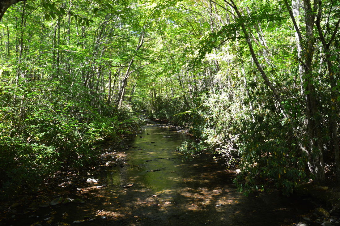
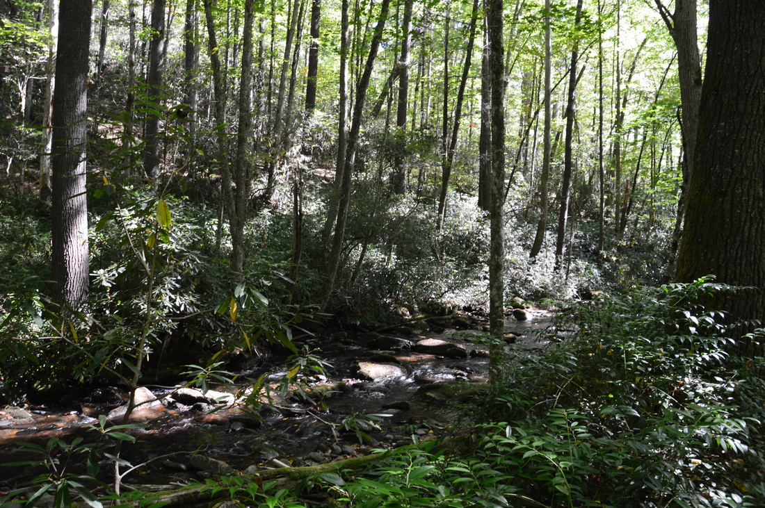
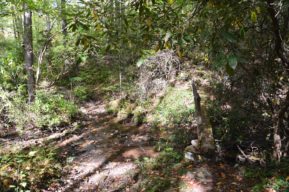
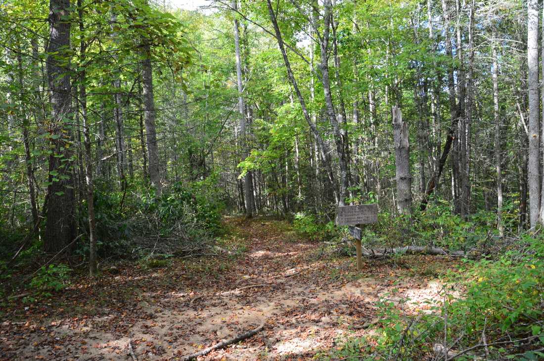
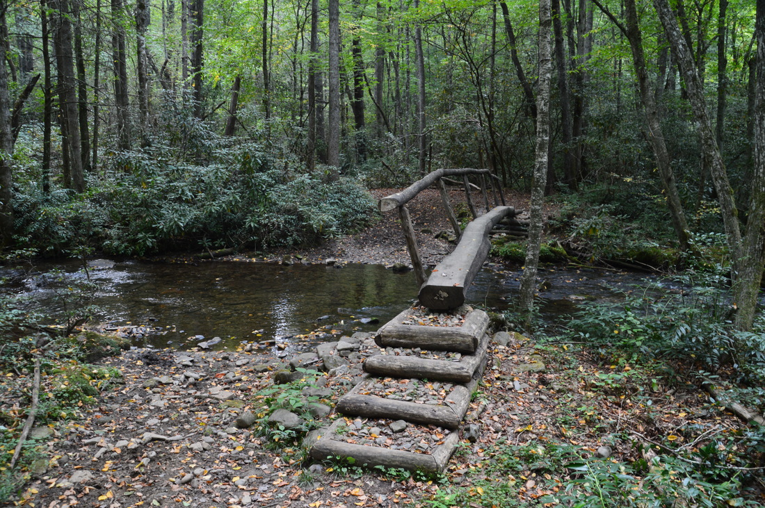
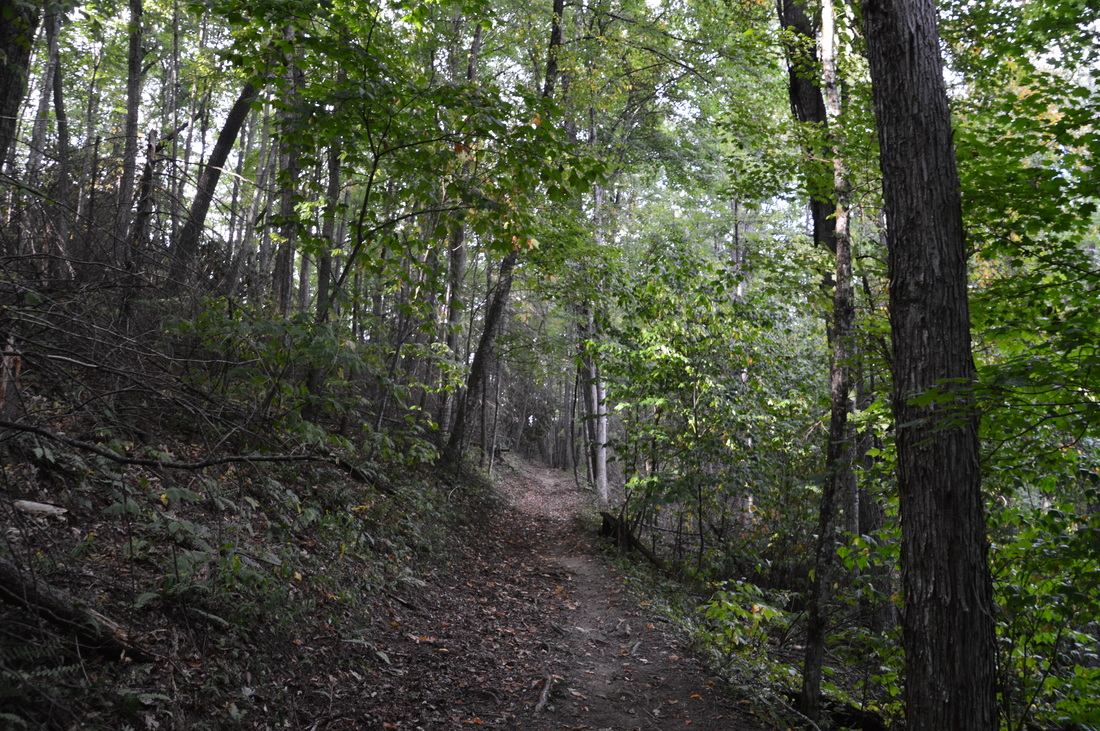
From the parking area, walk down the road to the trailhead. A trailhead sign states key mileage information. The Caldwell Fork Trail begins with a new wooden footbridge with V-shaped railing across Cataloochee Creek. This trail is open to both hikers and equestrians, and I have heard that portions of the Caldwell Fork Trail can become a real mess during wet periods, due to the horses that tear up the trail. Beyond the footbridge, the trail courses through flat lowlands, where several small footbridges take the trail across seasonally muddy areas. At 0.4 miles, the Caldwell Fork Trail arrives at Caldwell Fork and begins tracing it upstream. At 0.65 miles, the trail rises above the creek briefly at a bend in the creek, offering great views of the watercourse. At 0.9 miles, the Caldwell Fork Trail crosses Caldwell Fork on a beautifully-crafted log footbridge and arrives at the lower junction with the Boogerman Trail. 
This footbridge across Caldwell Fork is a work of art
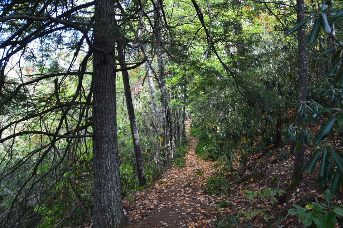
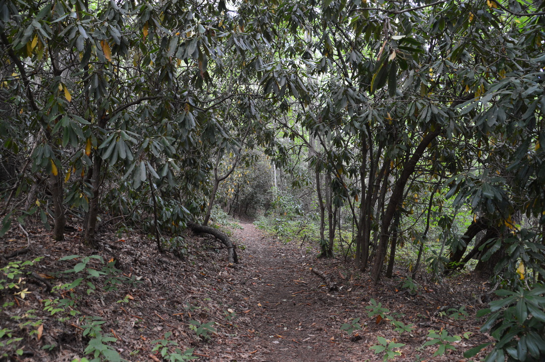
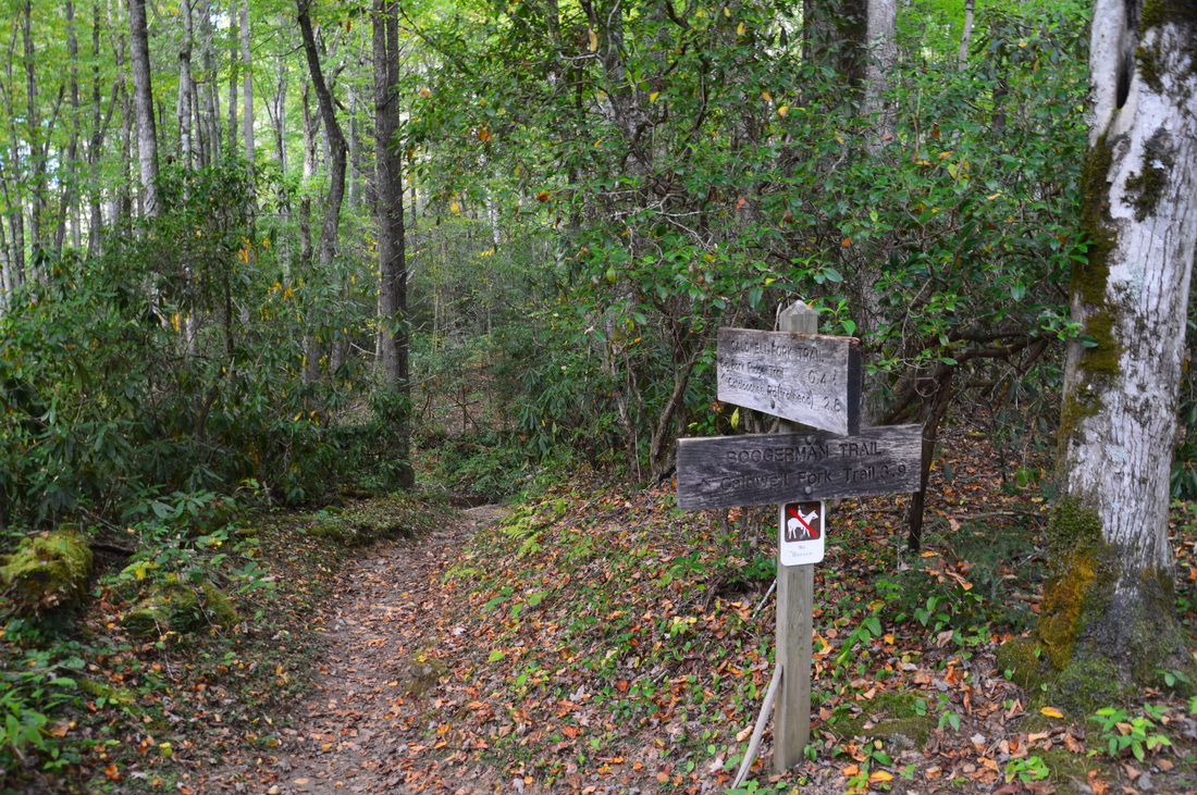
The Boogerman Trail is an "interior trail" that begins and ends at the Caldwell Fork Trail. It is considerably longer than the section of the Caldwell Fork Trail between the two intersections, but my plan was to hike it rather than the Caldwell Fork Trail, as I had heard that there are lots of old-growth trees on the Boogerman Trail, in addition to historical sights. Additionally, I always prefer hiking trails over horse trails, and the Boogerman Trail is a trail that is used exclusively by hikers. A popular loop, known as the Boogerman Loop, combines the Caldwell Fork Trail and Boogerman Trail, but it was not my plan to hike the actual loop today.
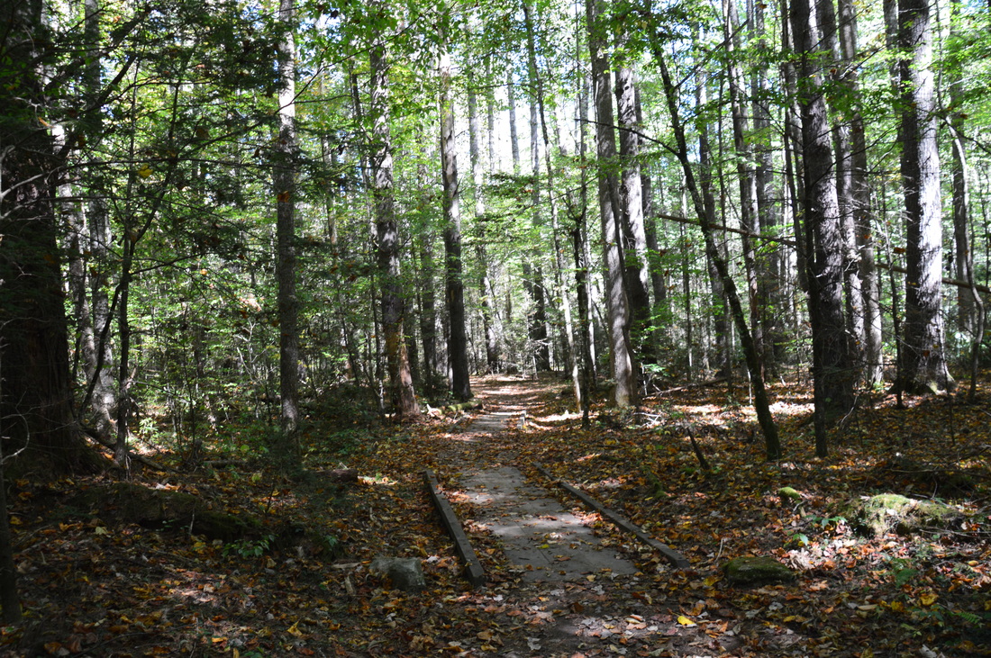
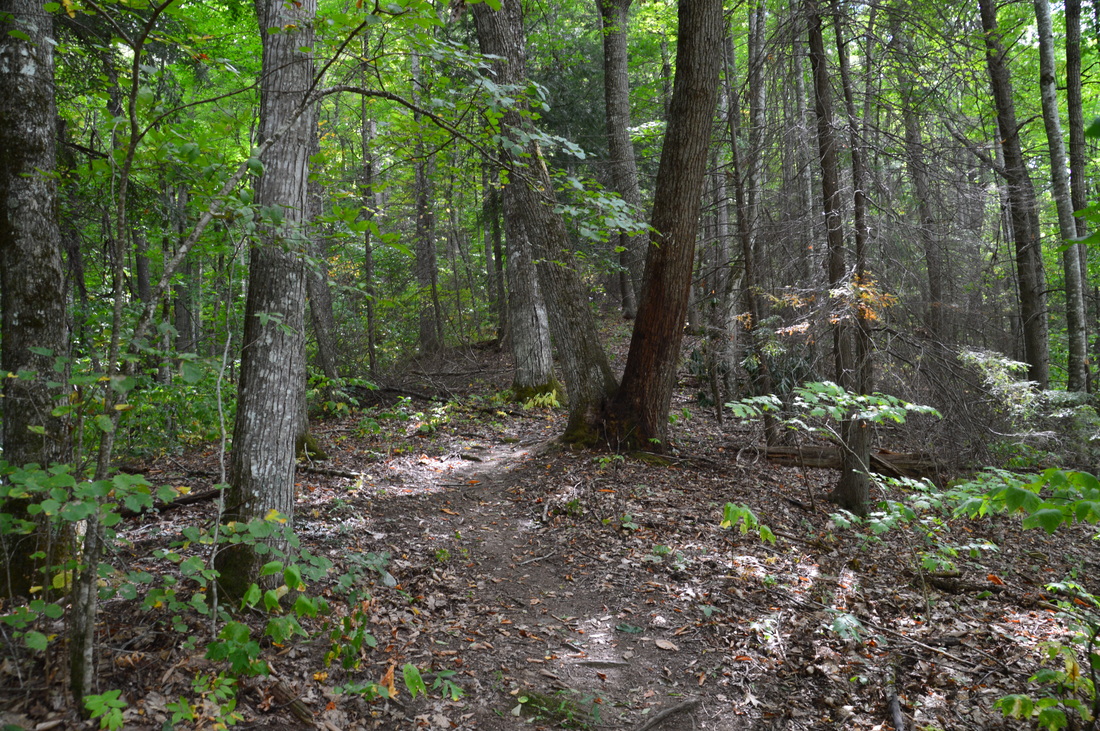
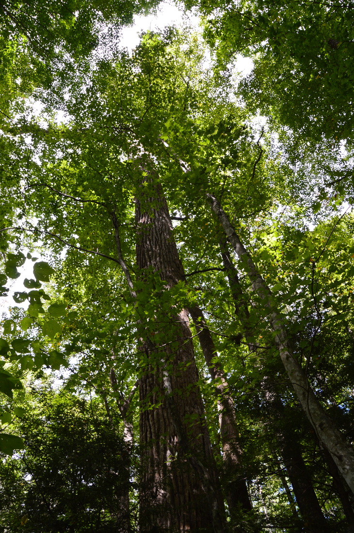
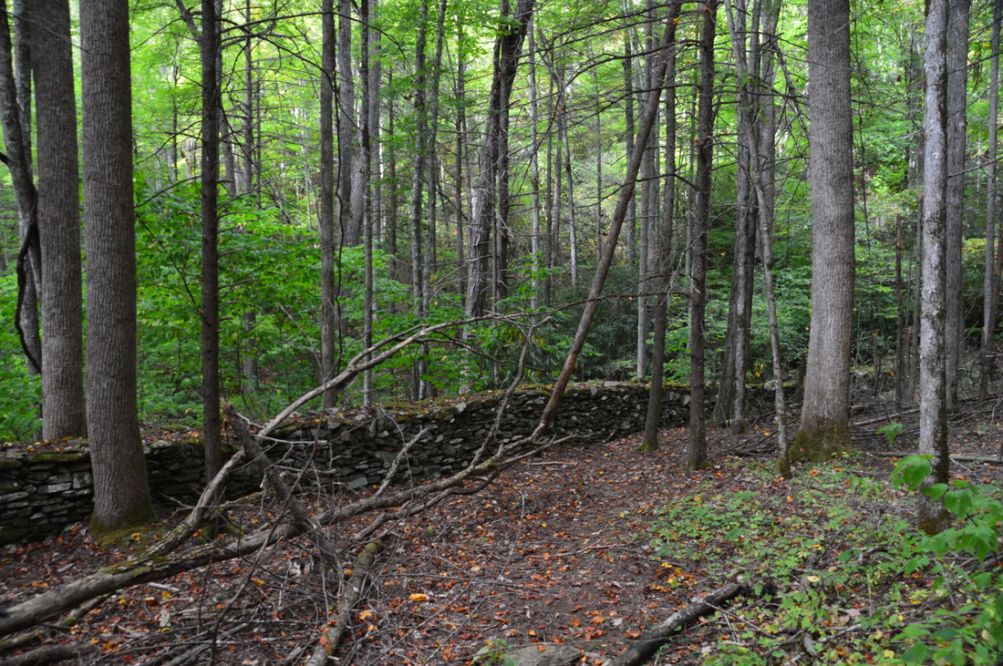
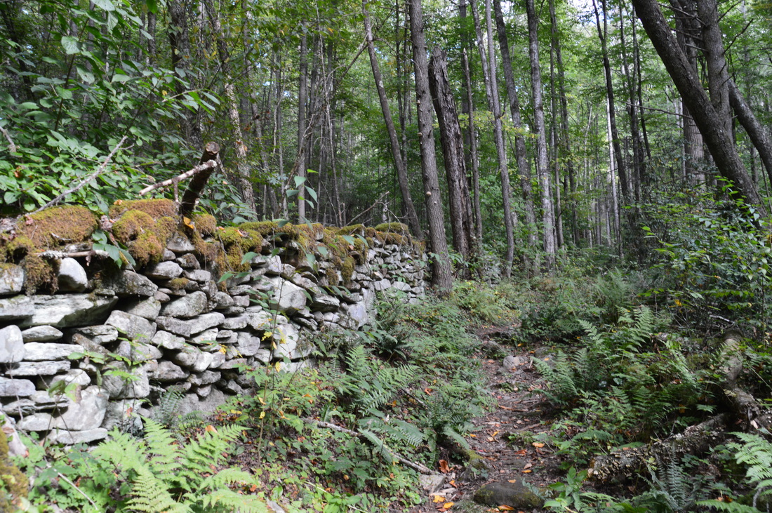
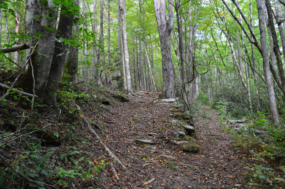
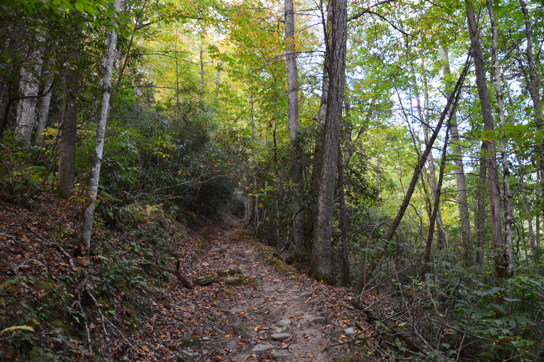
Turn left on Boogerman Trail and immediately leave Caldwell Fork. Begin ascending up the lower slopes of the Cataloochee Divide. While you will never get close to the top of the ridge, there is still a fairly substantial amount of climbing on this trail. The first ascent ends at 2.2 miles in a gap on Den Ridge (a lead from Cataloochee Divide). There are some large trees on the way up, and there'll be many more to come, including the two most notable trees on the trail. Following the gap, descend towards Palmer Branch. Near Palmer Branch, a short, steep side trail to the right leads to a small grassy clearing on a hill. This clearing is obviously maintained, but there is no explanation as to why. Please comment if you have information. At 2.4 miles, the trail crosses Palmer Branch via a unique small footbridge, which looks somewhat like a raft. After this, the moderate ascent resumes. One of the largest trees on the hike is just to the left of the trail at 2.7 miles, near the head of a small cove. At 3.3 miles, rock hop across another small stream: Sag Branch. The steepest part of the ascent follows before the trail finally levels out on the lower slopes of Snake Ridge (another lead from Cataloochee Divide) at 3.6 miles. After this, the Boogerman Trail begins descending back into the Caldwell Fork valley, passing numerous large trees. It was very interesting to see such an extensive old-growth forest, as most of my hikes pass through forest that has been mostly logged at some point. Curving around a lead, the trail begins a moderate descent into the valley of Snake Branch, a tributary of Caldwell Fork. At 4.3 miles, the trail arrives at an impressive stone wall, which is one of the few remnants from the Robert Palmer homestead. 
This rock wall, which is 3 feet high and 2 feet thick, is one of the remains from the Robert Palmer homestead, visible on the Boogerman Trail
Have you been wondering where the Boogerman Trail got its bizarre name? It can be traced back to Robert Palmer, who lived here in the mid to late 1800s and whose home was very close to the Boogerman Trail. Robert Palmer's nickname was "The Booger Man". It originated when on his first day of school as a kid, when he was asked what his name is, he responded "The Booger Man", being the shy boy that he was, and since then, his nickname passed into his adult years. Robert "Boogerman" Palmer was the chief reason that the forest along the Boogerman Trail was not logged, as Palmer loved the forest and restricted logging on his property.
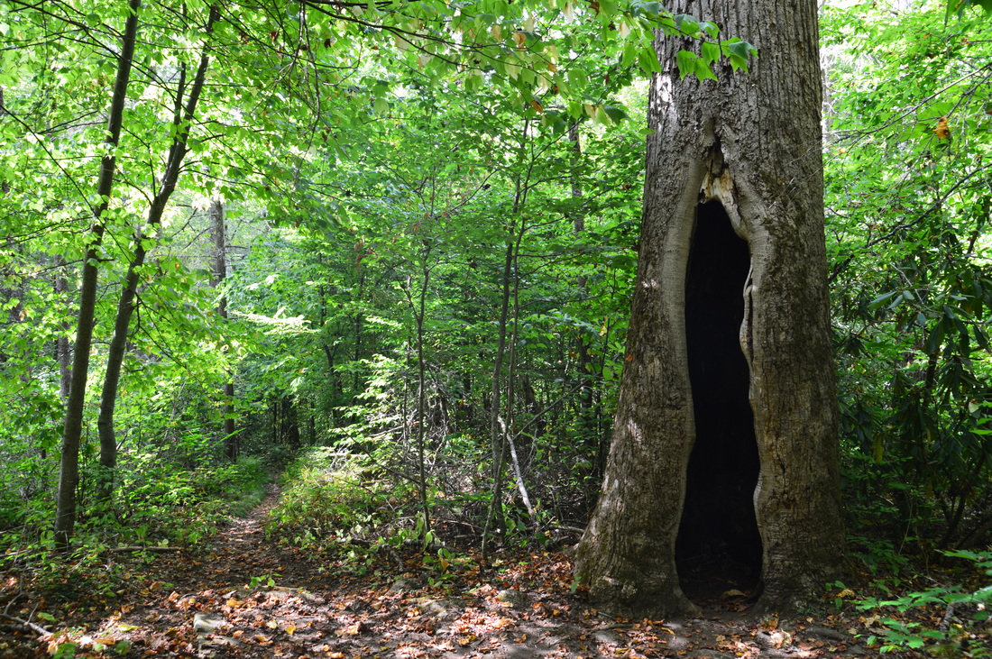
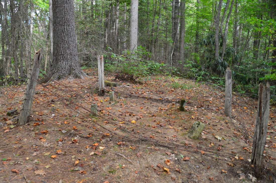
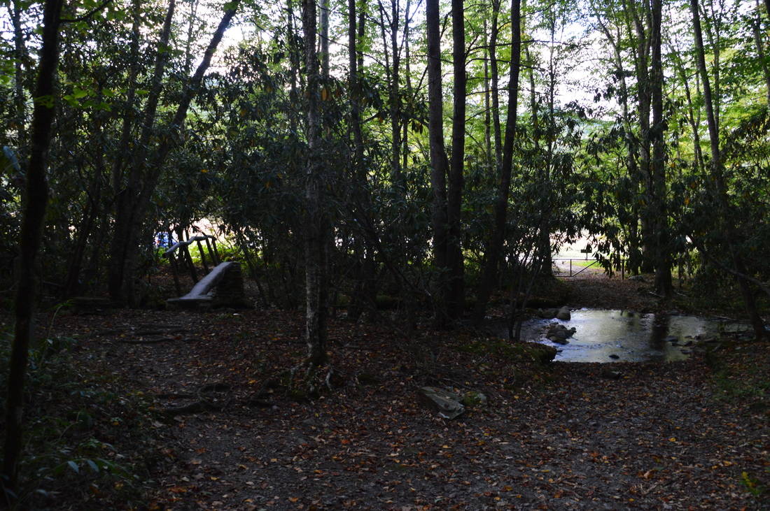
Following the stone wall, the trail passes the other most notable tree on the trail, with a tall hollow at the front. Step in and take a selfie. Beyond the tree, the trail makes two quick rockhop crossings across Snake Branch and passes another rock wall to the right. At 4.65 miles, an unsigned spur trail leaves acutely right to the Palmer Cemetery on an old road. Take this spur trail and pass another rock wall. Then, ascend a small but steep hill and reach the Palmer Cemetery at 4.8 miles. The cemetery is very small, as it looks like there are only two graves. Return to the main trail and continue following it downhill, crossing Snake Branch a third time at 5.0 miles. At 5.1 miles, the Boogerman Trail ends at the Caldwell Fork Trail. For a quick return to the trailhead, you can turn right and follow the Boogerman Loop back, but to do the full hike, turn left on the Caldwell Fork Trail. The trail here actually stays relatively far from Caldwell Fork, crossing McKee Branch via a rickety footbridge at 5.5 miles. Then, at 5.55 miles, reach an intersection with the Big Fork Ridge Trail. The Big Fork Ridge Trail leaves to the right and is the shortest way to Cataloochee Road. You will take this trail shortly, but first, turn left onto the Caldwell Fork Trail to make the side trip to the grave site of valley settlers who were killed during the Civil War. At 5.6 miles, the McKee Branch Trail splits off to the left and reaches Purchase Gap on Cataloochee Divide in 2.3 miles and then the Appalachian Highlands Science Learning Center on Purchase Knob a short distance farther. Continue straight on the Caldwell Fork Trail. At 5.65 miles, the side trail to the graves leaves to the left. The side trail is simply marked by a "no horses" sign. Follow the side trail for about 150 feet up an extremely steep hill. At the end of the side trail, you will see the two graves. These are graves of two men, residents of Cataloochee Valley, who were killed here by marauders during the Civil War. 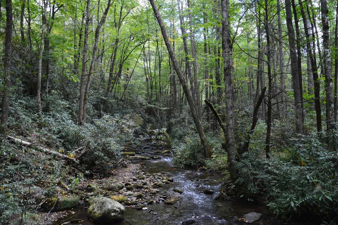
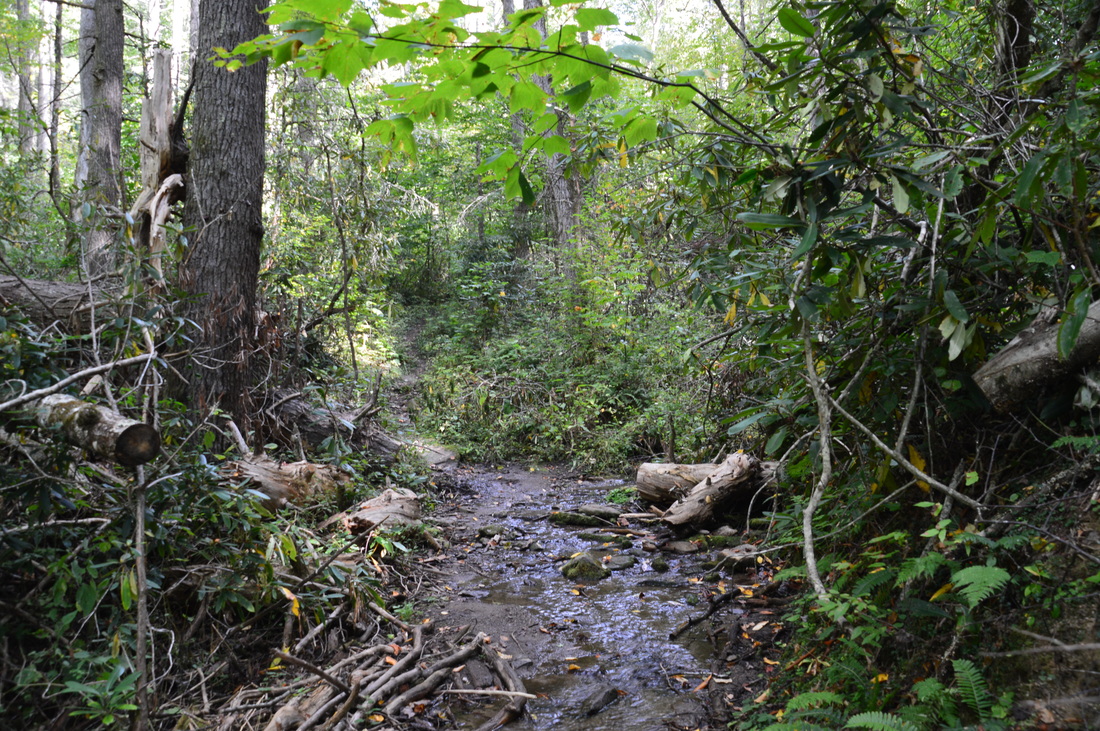
Caldwell Fork is seen several times throughout this hike
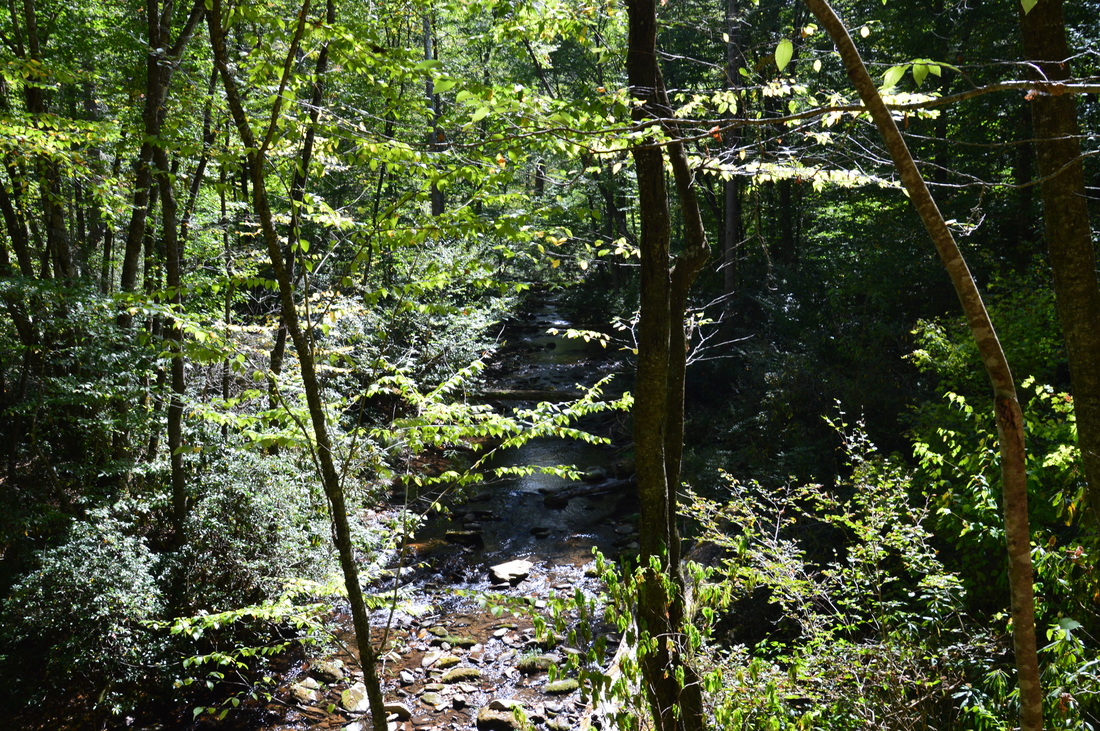
Retrace your steps to the Big Fork Ridge Trail junction and begin following the Big Fork Ridge Trail downhill towards Caldwell Fork. Horse traffic is allowed on this trail too. At 5.9 miles, cross a log footbridge across Caldwell Fork. There are great views of this waterway from the footbridge. The upstream view is pictured above. After the footbridge, the trail begins ascending Big Fork Ridge. This ascent is very gradual and the grade is easy to moderate. There are some good winter views of the Caldwell Fork valley and the Cataloochee Divide during the initial segment of the ascent. Between the Caldwell Fork footbridge and the high point of the Big Fork Ridge Trail, you will ascend only about 550 feet in 1.35 miles. At 7.25 miles, reach a gap in Big Fork Ridge and the end of the ascent. There are no views here, but it is a nice, peaceful spot to take a break.
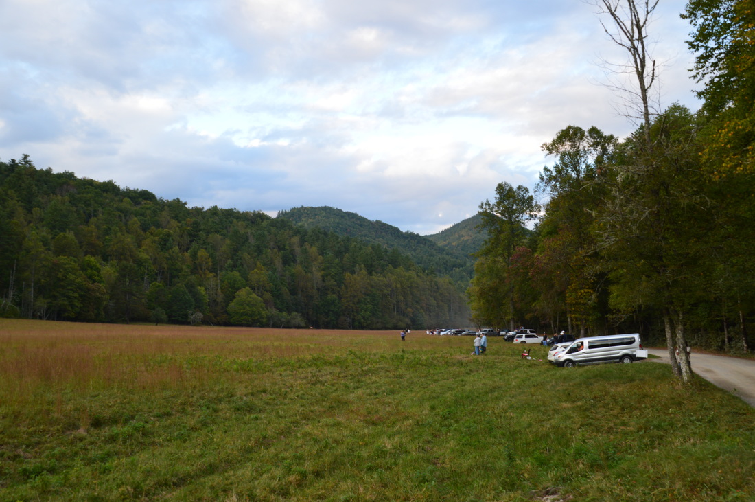
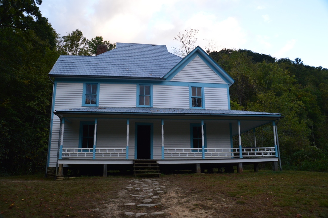
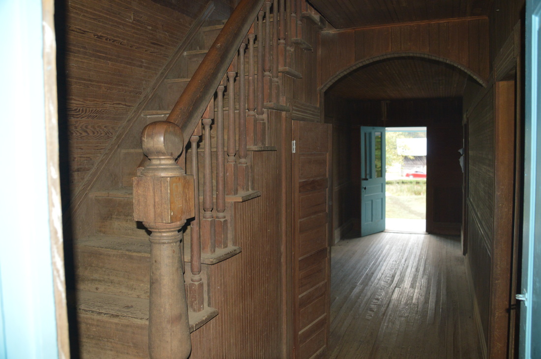
After the high point, the trail begins to descend into Cataloochee Valley just as gradually. besides one moderate-to-steep stretch at 8.3 miles. At 9.0 miles, the Big Fork Ridge Trail crosses Rough Fork via a footbridge and ends at Cataloochee Road. Most of the rest of the hiek is roadwalk, but there are several more points of interest. As I reached the road here, I was treated to the sight that I had long been waiting for: over a dozen elk in the field, including a bugling bull. It was quite the sight. Turn right onto unpaved Cataloochee Road and begin walking it in the direction of the Caldwell Fork Trailhead. The first point of interest along the road is at 9.35 miles: the Caldwell House, which is to the right at the end of a short trail. Built in 1903, the house has two stories with four rooms each. 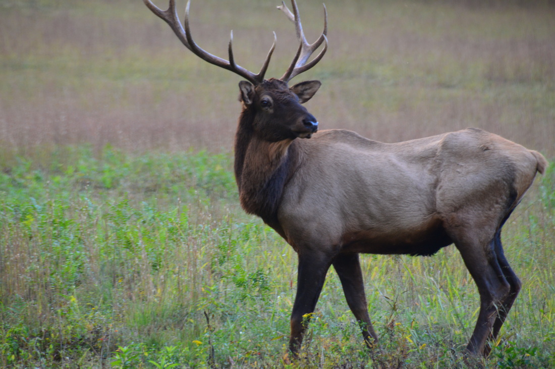
A big attraction in Cataloochee is the elk that are often seen in the valley
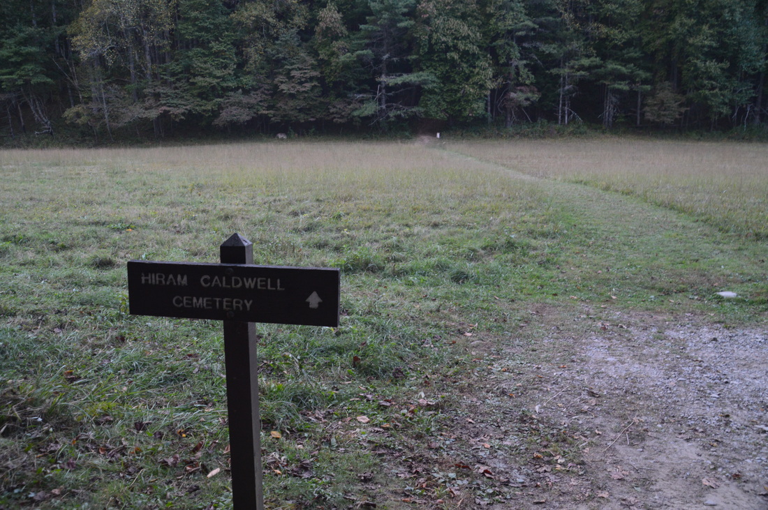
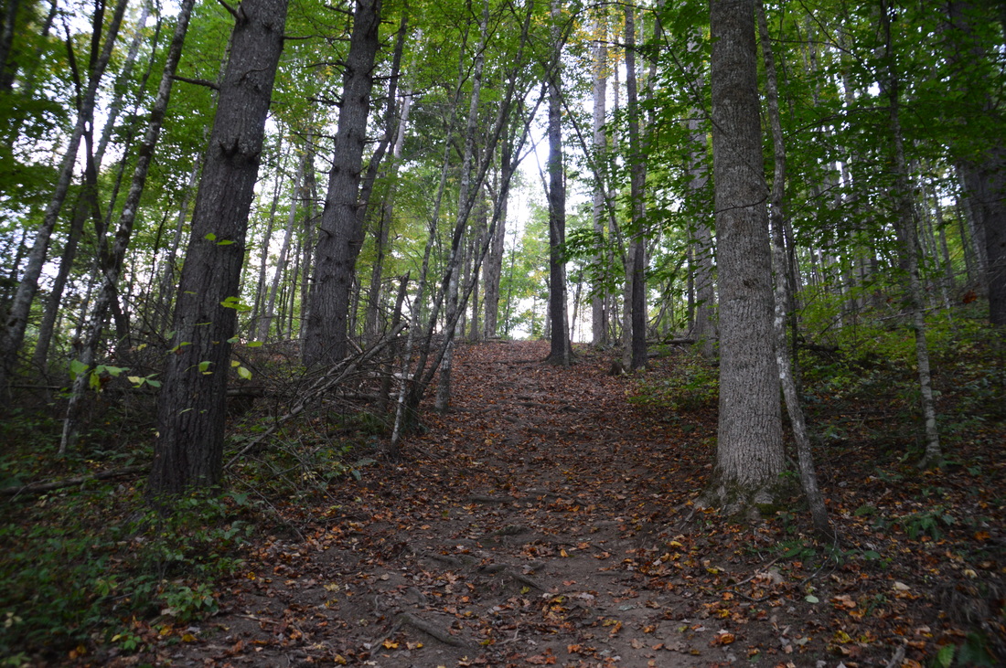
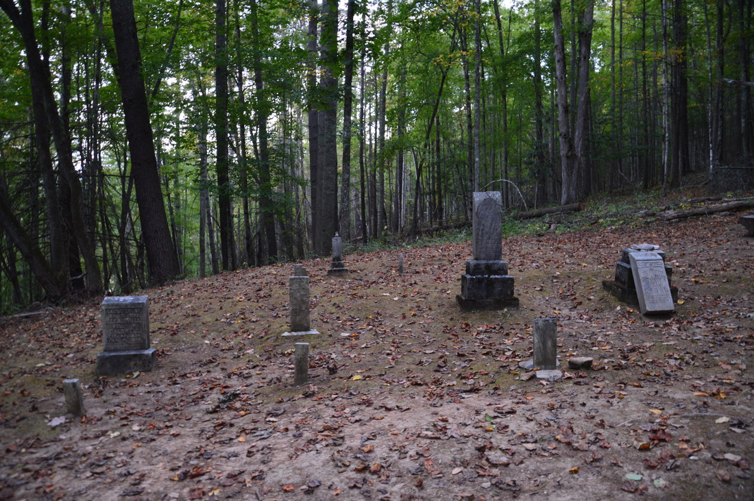
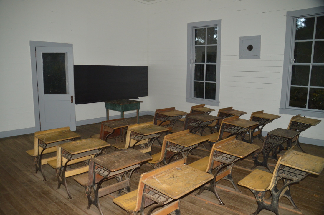
Return to Cataloochee Road and continue following it east. At 9.6 miles, a trail to the left leads to the Hiram Caldwell Cemetery. Take this trail across the field and then up an extremely steep hill that will get you "huffing and puffing". At 9.75 miles, reach the cemetery at a flat area. Several members of the Caldwell family were buried here, as I could tell by the inscriptions on some of the gravestones. Retrace your steps back to the road and follow it down to a short path to the left at 10.2 miles that arrives at the Beech Grove School at 10.25 miles. It was also built in 1903. There are two rooms inside the schoolhouse, and the desks and the blackboard can still be seen.
Once again, return to the road. The road turns paved following a bridge across Palmer Creek. At 10.45 miles, the Palmer Chapel will be to the right. Beyond this, I was made a bit nervous by the sound of bugling coming from the gathering gloom that lay ahead. Elk are known to be dumb sometimes, and in the deep twilight, this elk was too close to the road fo rcomfort. Fortunately, all he did was fix his gaze upon me, carefully watching me until I walked out of sight. With no more stopping points, I was able to pick up my pace along the road. You will reach the end of the hike at the Caldwell Fork Trailhead at 11.8 miles. Mileage
0.0 - Caldwell Fork Trailhead
4.3 - Stone wall 4.8 - Palmer Cemetery 5.65 - Graves of settlers killed in Civil War 7.25 - Big Fork Ridge 9.0 - Big Fork Ridge Trailhead 9.35 - Caldwell House 9.75 - Hiram Caldwell Cemetery 10.25 - Beech Grove School 10.45 - Palmer Chapel 11.8 - Caldwell Fork Trailhead Variations
Hike just the Boogerman Loop - 7.9 Miles
Extend the hike by hiking the Caldwell Fork Trail upstream and Rough Fork Trail instead of Big Fork Ridge Trail - 14.5 Miles Bonus Stops
Pictures
1 Comment
12/18/2016 05:24:53 pm
I am an administrator of the group https://www.facebook.com/groups/Mtgatennnc/ . I always enjoy Mark Olge's work. When I first read his work he was only 13 years old and I was totally amazed. I am very proud to have this young rising start writer as a member of our group. I encourage him to keep up the great work. Leave a Reply. |
About MeMark Oleg Ozboyd Dear readers: I have invested a tremendous amount of time and effort in this website and the Georgia Waterfalls Database the past five years. All of the work that has gone in keeping these websites updated with my latest trip reports has almost been like a full-time job. This has not allowed me to pick up a paid job to save up money for college, and therefore, I I've had to take out loans. If you find the information on this website interesting, helpful, or time-saving, you can say "thanks" and help me out by clicking the button above and making a contribution. I will be very grateful for any amount of support you give, as all of it will apply toward my college tuition. Thank you!

Coming in 2022-2023?
Other Hiking WebsitesMiles HikedYear 1: 540.0 Miles
Year 2: 552.3 Miles Year 3: 518.4 Miles Year 4: 482.4 Miles Year 5: 259.9 Miles Archives
March 2021
Categories
All
|


 RSS Feed