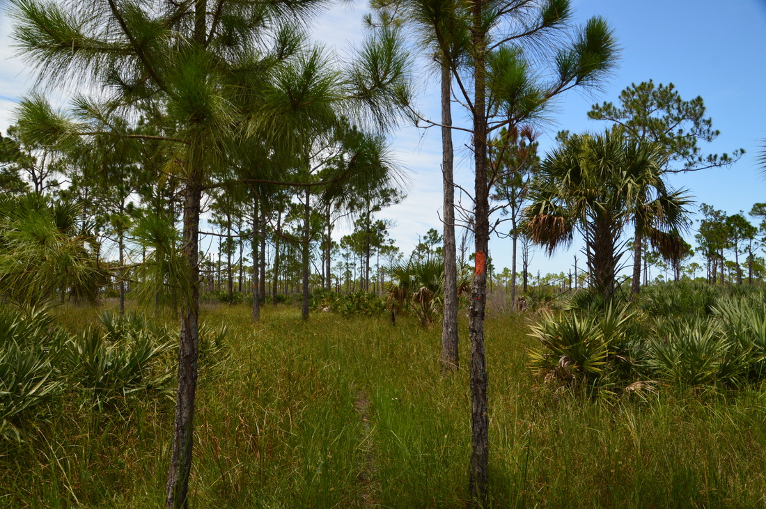
Coming in at 11,500 acres, Jonathan Dickinson State Park is one of the largest state parks in Florida, and it is complete with an extensive trail system of over twenty miles. The park has a variety of habitats, ranging from scrubby sand dunes on the east end, with Hobe Mountain being the highest, to pine flatwoods dotted by cypress domes that occupy much of the park, to wetter hammocks along Kitching Creek and the Loxahatchee River in the park's western and southern regions. This hike occurred on Saturday, July 23rd, 2016. My plan was to hike the Kitching Creek Loop and the the Ocean-to-Lake Trail to the White Loop, completing the White Loop as well. Unfortunately, major changes in the trail system brought me into ultimate confusion and forced me to greatly alter my plans. I ended up hiking only part of the Kitching Creek Loop and White Loop, and I also accidentally hiked a portion of the Ocean-to-Lake Trail westward. Additionally, I ended the hike with a several-mile roadwalk due to exhaustion and time shortage.
Summary
R/T Length of Trail: 19.1 Miles
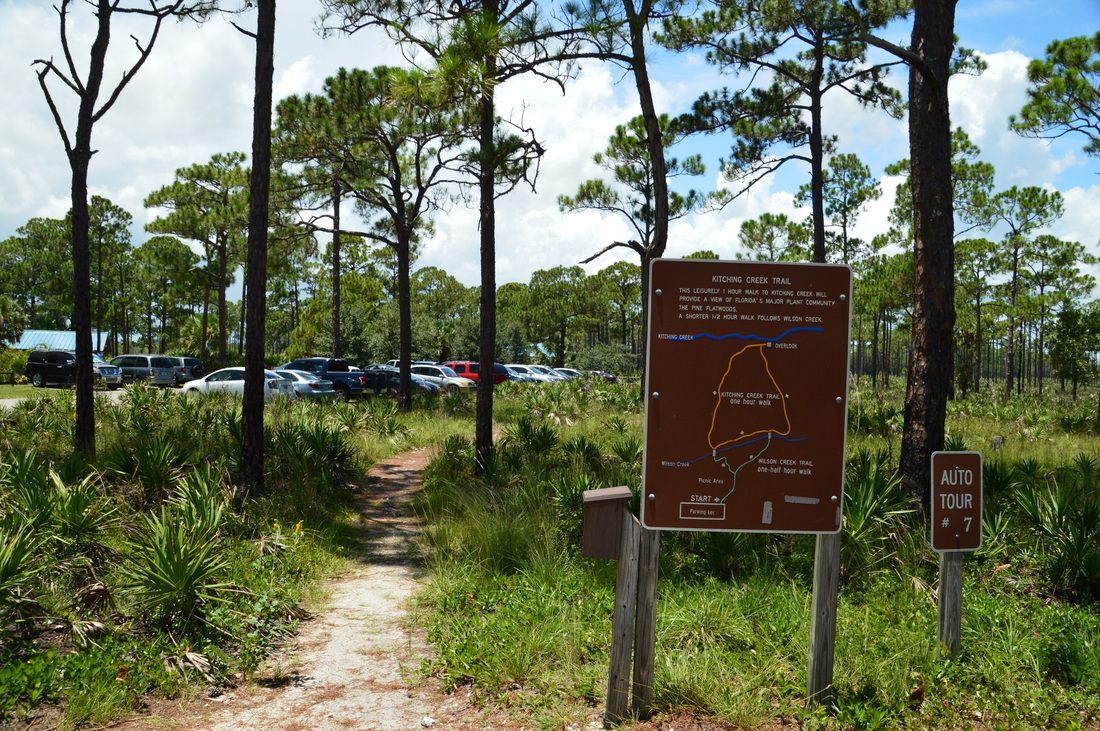
Duration of Hike: 8:40 Type of Hike: Loop with Extensions Difficulty Rating: 5 out of 10 Total Elevation Gain: Minimal Pros: Generally easy-to-follow, dry, and maintained trails Cons: Extremely confusing trail system with many recent reroutes/additions Points of Interest: Views of Kitching Creek; Scrub habitat with vast views on the east side of the loop; Camp Murphy Ruins Trail Blaze Color(s): Kitching Creek Trail - None; Ocean-to-Lake Trail - Orange; Ocean-to-Lake Greenway - Rainbow (Mixed Green, Red, Yellow, & Blue); White Trail - White; Green Trail - Green Best Season(s) to Hike: Winter Fees: There is a $6 fee for entry to Jonathan Dickinson State Park, if your car has 2-8 passengers. For cars with just one passenger, the fee is $4. Beginning Point: Kitching Creek Trailhead at the River Area Directions from Jupiter, FL: From the intersection of US Route 1 and South Beach Road in Jupiter, simply follow US Route 1 North for 3.7 miles, at which point the park entrance will be to the left. Turn left, enter the park, pay your fee, and then just afterwards, turn right onto the main park road. Continue for 3.9 miles to a dead end in the river area. The large trailhead parking area will be to your right at the end of the road. Map
Click here for more information and to download this trail map to view in Garmin Basecamp.
Details
If there is such a thing as a confusing trail system, then the Jonathan Dickinson State Park trail system undoubtedly is one. I had arrived at the Kitching Creek Trailhead equipped with Sandra Friend's 2004 guidebook "50 Hikes in South Florida", and my plan was to combine the Kitching Creek Loop and East Loop from her book into one large hike. However, as I had learned the hard way by the time I finished the hike, the trail system had changed in many ways, and I have an endless list of reroutes or other changes to the trails. New trails have appeared, and some old trails have disappeared. As a result, unfortunately, the description from Friend's book is no longer relevant to this hike. I will try my best to outline all of the changes to the trail system that I encountered. Of course, I didn't hike the entire trail system as I had planned to, due to the significant increase in length of the hike, so I may not know of other changes. If Friend releases a new edition of the book, I expect that these changes will be implemented, but right now, it does not appear to be in her plans.
Here are several key changes that the trail system has undergone as a whole (please note that whenever I mention the "book" it is the 50 Hikes in South Florida book):
Before beginning the hike, I suggest that you download and examine or bring with you the trail map below for the Jonathan Dickinson State Park Trail System. 
There are several different trailheads throughout the park: near the ranger station, at the railroad crossing, and in the river area. I chose to begin at the river area. There are many things that you can do in the river area, including taking a tour down the Loxahatachee River and visiting Trapper Nelson Interpretive Site, or viewing the exhibits and displays at the Elsa Kimbell Environmental Education and Research Center. On my list, however, the hike was foremost, and I knew that with such a long hike, I did not have time set apart for any other recreational activities.
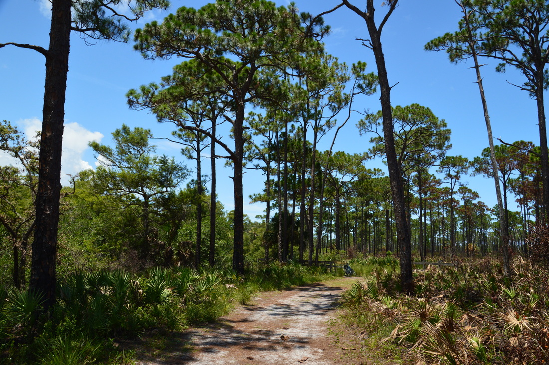
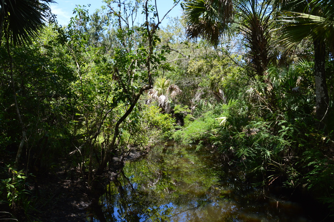
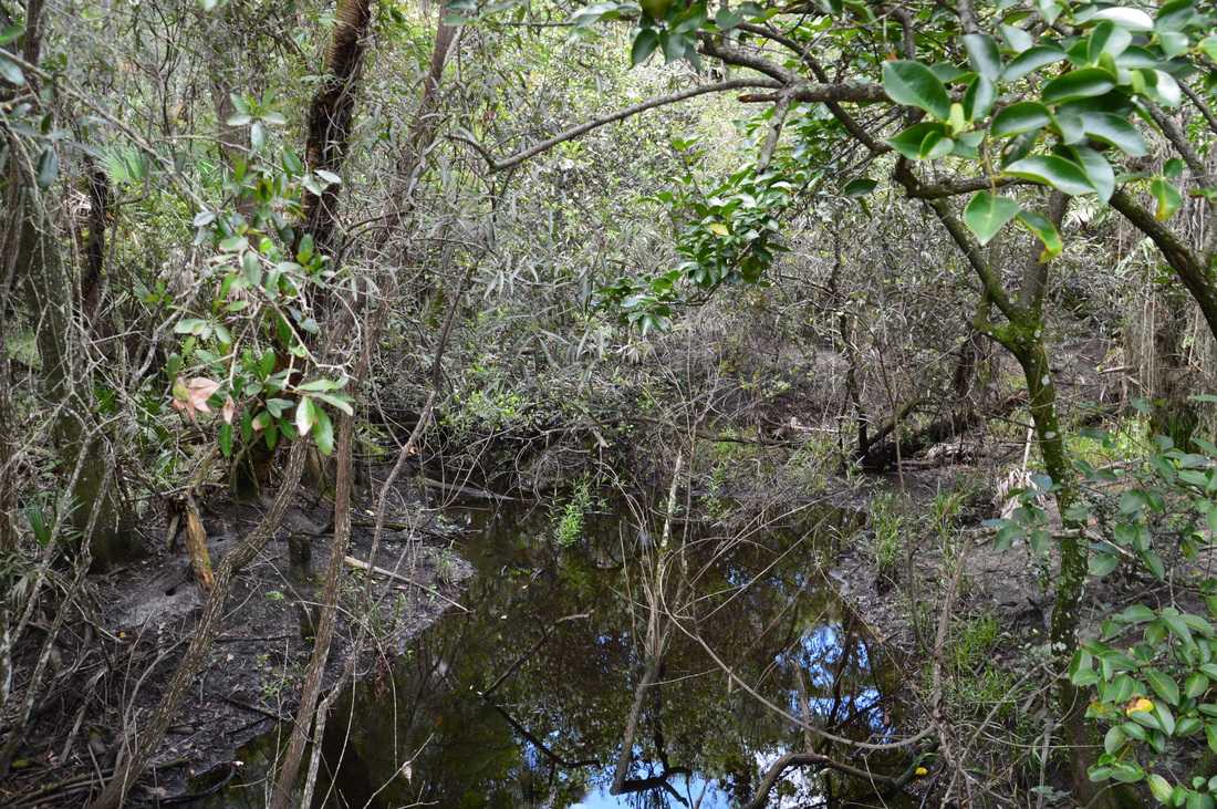
The hike begins on the Kitching Creek Nature Trail, which runs in conjunction with the Wilson Creek Nature Trail. The signed trailhead is at the northwest corner of the parking area. The trail begins follow a narrow path through a seemingly endless, symmetrical palmetto-pine plain. Keep right on the main path at the Nature Trails sign. The trail passes a seasonal wetland hidden in the palmettos to the right, before crossing small Wilson Creek on a footbridge at 0.25 miles. The creek was mostly dry on this day. Just past the footbridge, the Wilson Creek Nature Trail leaves off to the left to finish its short 0.6-mile loop. The longer Kitching Creek Nature Trail bears right back into the pine flatwoods. At 0.4 miles, the Kitching Creek Nature Trail arrives at a T-type intersection with a wide forest road. A sign shows that the trail turns left here. Turn left, now headed towards Kitching Creek itself. At 0.7 miles, near Kitching Creek, there is another intersection, and this might be a potential source of confusion. The signed nature trail, which forms a one-mile loop, turns left and returns to the river area. To the right, an unmarked connector trail is the route to the Florida Trail. This is the turn you want to make, unless you're out for just a short walk. Just past the turn, there is an observation deck to the left that provides a great view of cypress-lined Kitching Creek. In recent years, saltwater intrusions from Jupiter Inlet up the Loxahatchee River and its tributaries have caused the appearance of mangroves along Kitching Creek, but at least for now, the cypresses still stay strong. 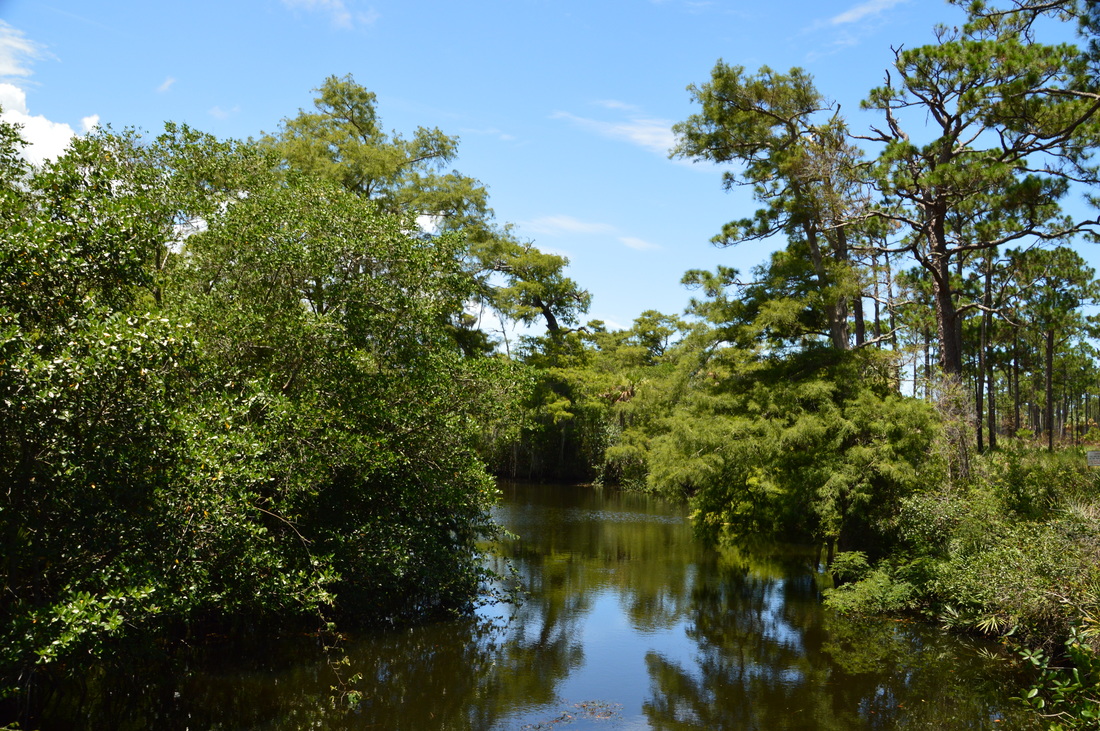
Kitching Creek is a picturesque tributary of the Loxahatchee River.
From the observation area, the connector trail travels north-northwestward toward the Ocean-to-Lake Trail. At 1.45 miles, the connector trail ends at the red horse trail, which ties in from the right. Bear slightly left on the same forest road (now red-blazed), still heading northward through pine flatwoods, with a wall of sand oaks and cypresses off to the left near the shores of Kitching Creek. At 1.8 miles, the yellow horse trail leaves off to the right; continue straight. The red horse trail finally reaches a junction with the orange-blazed Ocean-to-Lake Trail (part of the Florida Trail system) at 2.05 miles. Here, the red horse trail bears right, while the Ocean-to-Lake Trail crosses from left to right. A bench stands to the left. According to the book, this was the beginning of the Kitching Creek Loop. While this is still true, only the southern part of the "loop" still follows a hiking trail - thus, I personally recommend checking out Kitching Creek and then hiking the Ocean-to-Lake Trail eastward towards the White Loop. However, I will describe my route below.
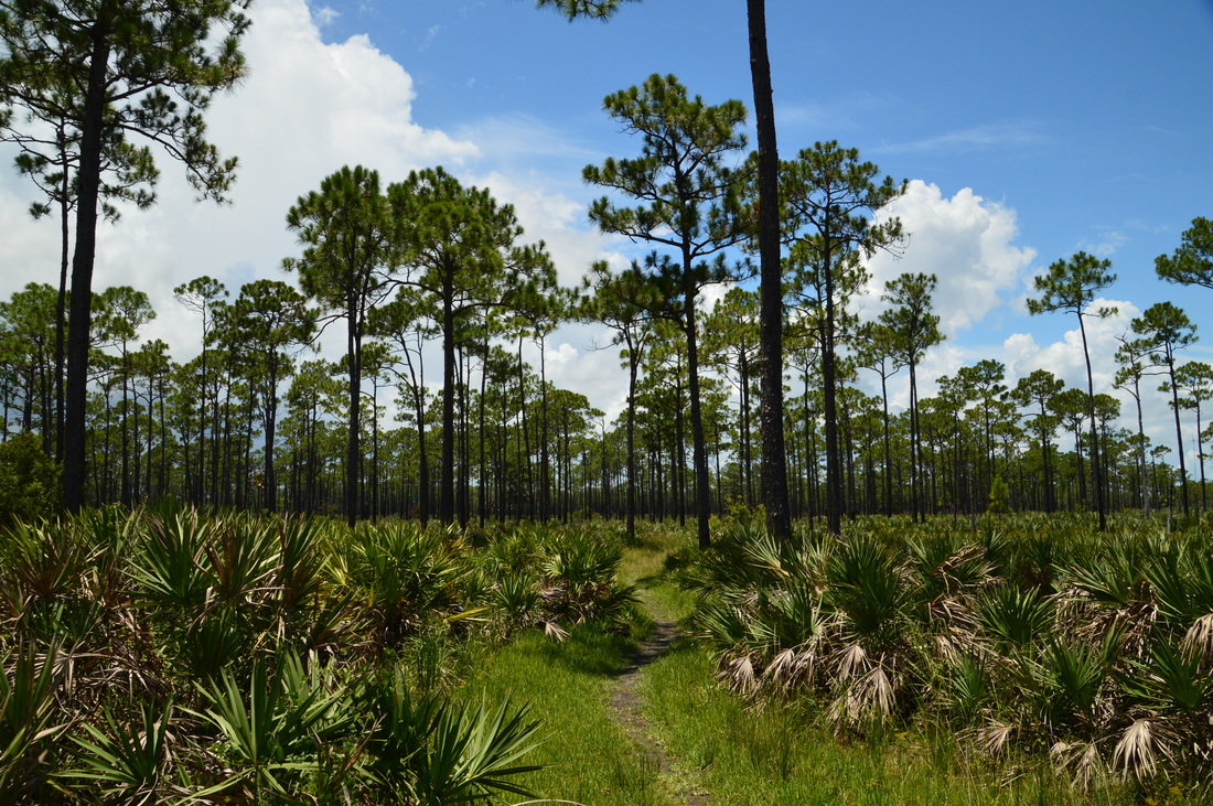
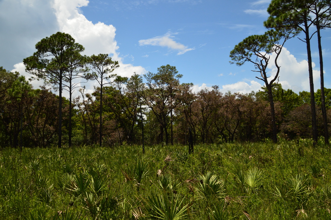
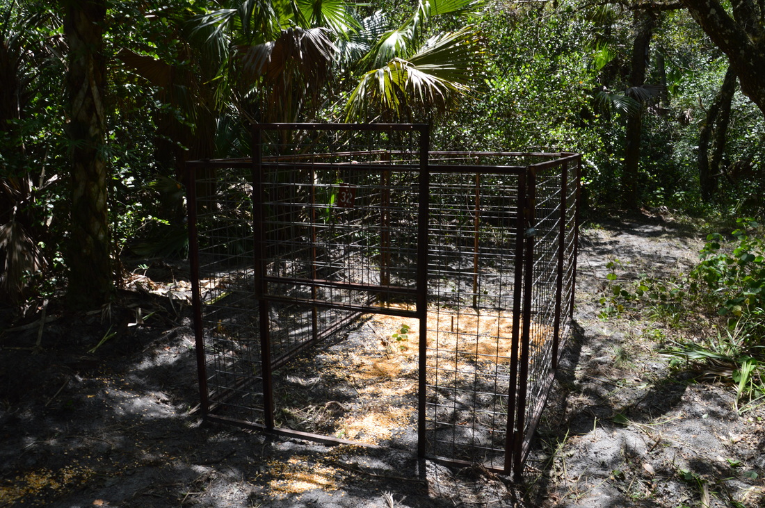
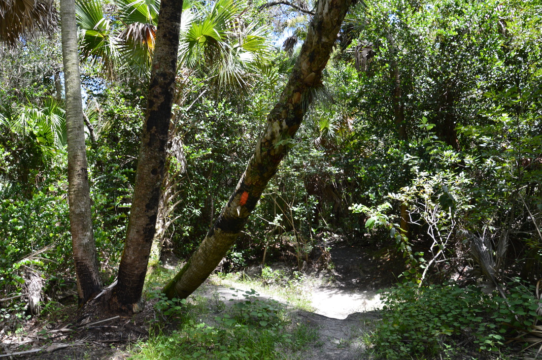
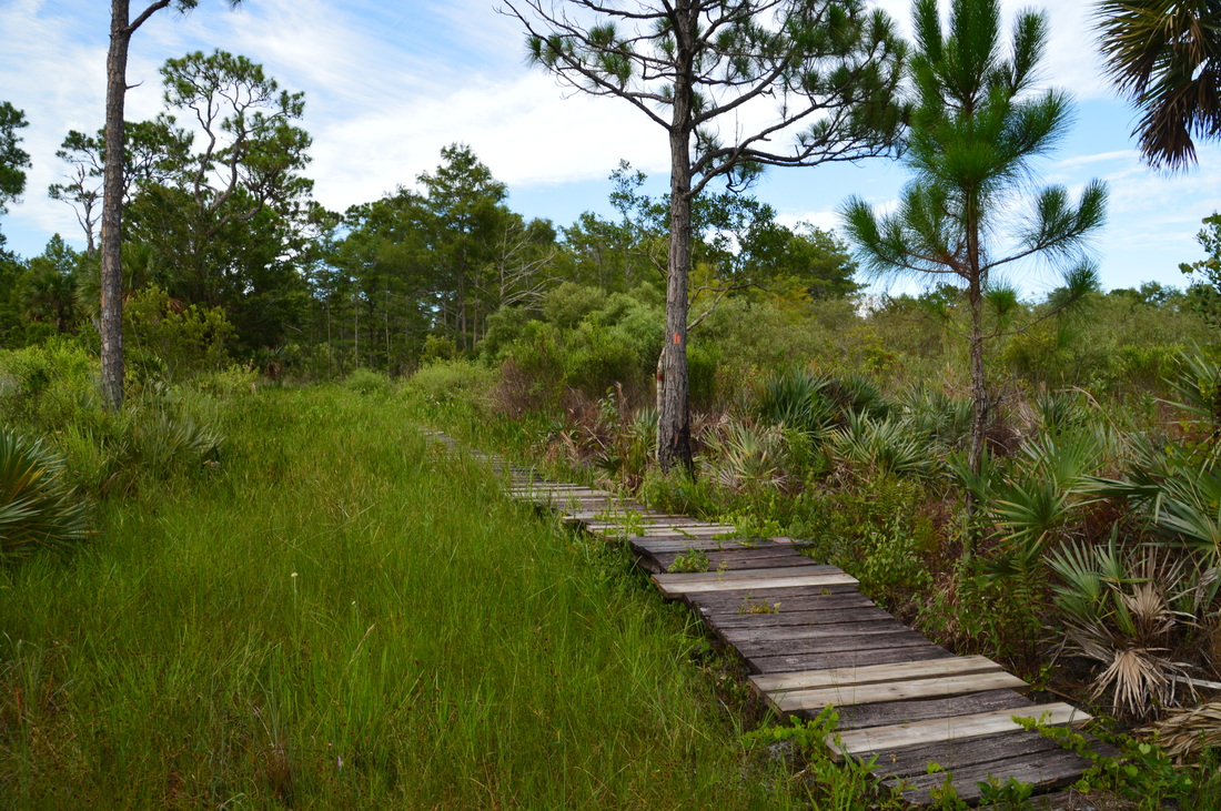
To hike the main portion of the Kitching Creek Loop (even though it is no longer the same), turn left onto the Ocean-to-Lake Trail. The single-track footpath quickly enters a hammock and reaches Kitching Creek at 2.1 miles. A hog trap stands to the left, and ahead, a footbridge signed "Kitching Creek South" crosses the creek. It is hard to see far along the creek, but personally, I enjoyed this view more than the one earlier, as the creek here reminds me more of a typical Florida stream, shaded by a dense canopy of live oaks, palms, and cypresses. After the footbridge, the trail zigzags through the lush hammock on the creek's west side. This area appears to be part of the creek's floodplain, and I suspect that during wet periods, the trail may be inundated in places. However, in another tenth of a mile, the trail breaks out of the hammock and into more pine flatwoods. At 2.35 miles, the trail passes through an area that appears to have been logged. At the end of the logged area there is a service road, which the trail seemingly crosses. This is a very confusing place. If you would like to hike the Kitching Creek Loop, turn right onto the forest road, even though it is not blazed. Contrary to what the book says, do not follow the orange blazes at this point, as they will lead you westward along the Ocean-to-Lake Trail and eventually out of the state park. On the other hand, the forest road is the Ocean-to-Lake Greenway that forms the north side of the Kitching Creek Loop. I didn't realize this when I first got to this point, and I had simply continued to follow the orange blazes, until over a mile later, I happened to look at my GPS and saw that I had went in the wrong direction. If you have the extra time and energy, however, I still suggest hiking the Ocean-to-Lake Trail westward for some time, as it is a pretty, little-used trail that passes through picturesque prairie and pine flatwoods, with seasonal wetlands here and there. I found this trail to be more overgrown than the other trails encountered on this hike. I followed the Ocean-to-Lake Trail westward and southward for 1.35 miles before reaching an old service road, where I turned around and retraced my steps to the loop. 0.5 miles south of the logged area is a junction with the white-blazed 0.3-mile side trail that leads east to Kitching Creek Campsite. Mileage below will include the extension to the southwest unless otherwise noted. 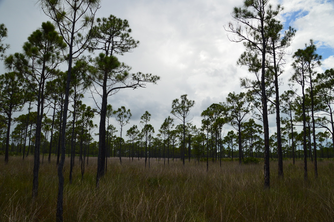
West of Kitching Creek, the Ocean-to-Lake Trail passes through picturesque prairies dotted by pines.
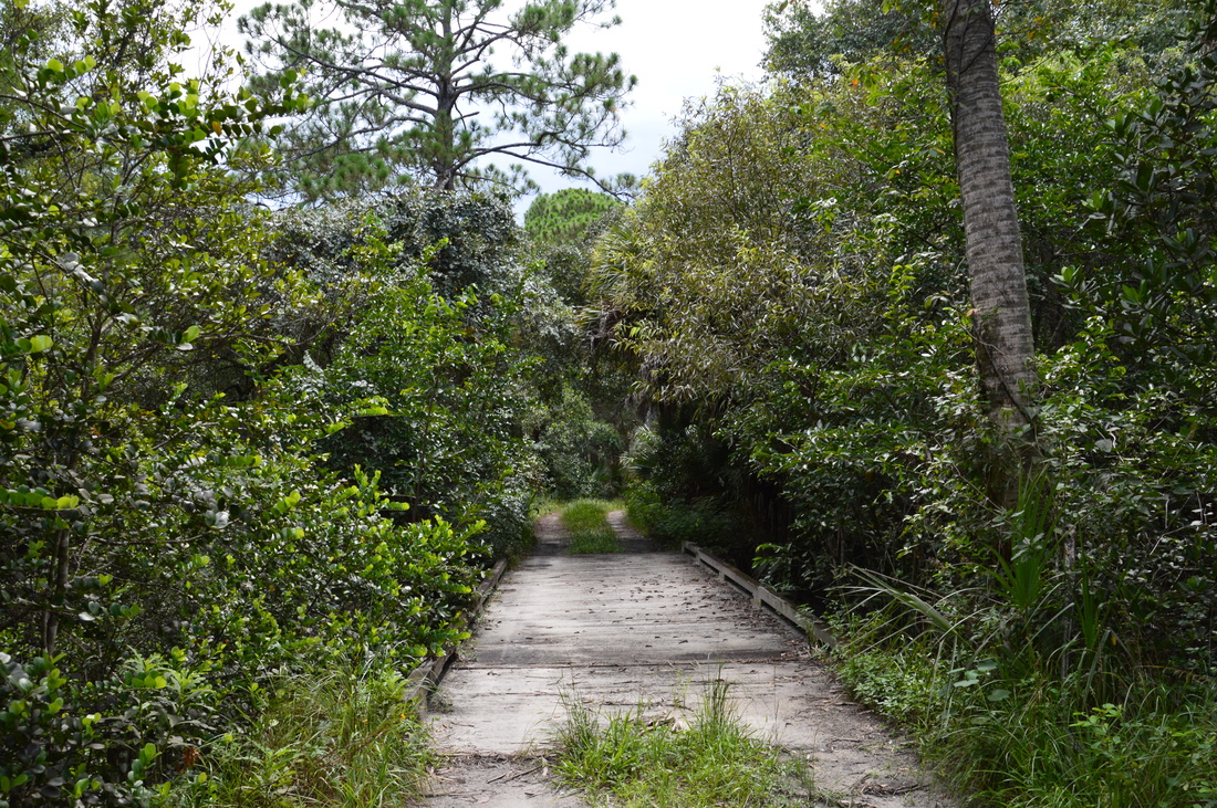
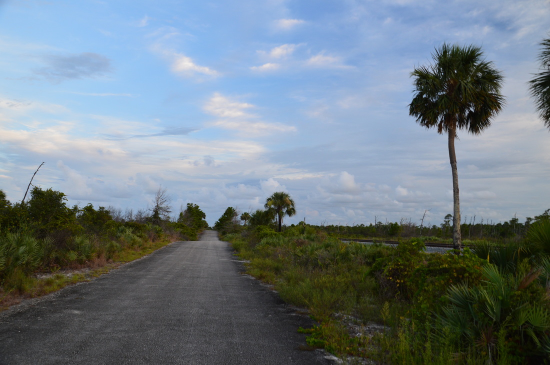
Back at the logged area and the Ocean-to-Lake Greenway at 5.05 miles (or 2.35 miles without southwest extension), turn onto and follow the multi-use greenway northward. In my opinion, this part of the hike is not as scenic as along the hiking trail, as the hike follows a forest road rather than a single-track path. As you follow the road northward, you may notice a four-color blaze from time to time (green, red, yellow, and blue) - I will refer to this blaze as a "rainbow blaze". At 5.9 miles, the forest road ends at a T-type intersection with another forest road. Turn right here to continue following the greenway. This forest road loses no item in re-entering the lush hammock that stretches along Kitching Creek. At 6.0 miles, the greenway crosses Kitching Creek via a wide bridge, which is designed to accommodate vehicles, labeled as "Kitching Creek North". The forest road quickly exits the hammock. The blue horse trail then comes in from the right and joins the forest road/greenway. At 6.15 miles, the forest road dead-ends at a wider forest road which follows a levee that is bordered by a canal on one side.
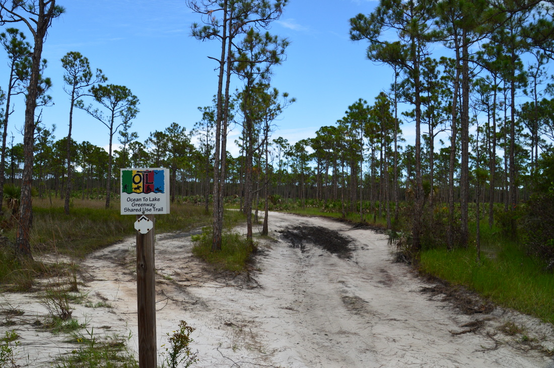
According to the book, a trail continues straight across the levee. This is not true. This trail no longer exists; the new Ocean-to-Lake Greenway instead follows the levee to the right (southward), so you must turn there to continue on the trail. I briefly continued straight on a faint path to see if there is anything there. An old pipe has been laid across this path, and it appears that this may have been done in order to disqualify the route. The path eventually disappeared in an area of tall grass shaded by palms, less then a tenth of a mile southeast of a levee. Meanwhile, the main trail continues south on the levee. Follow the rainbow blazes. At 6.95 miles, the red horse trail comes in from the right at a post marked with the number 4. You can use this trail as a connector to return back to the beginning of the Kitching Creek Loop. I believe that that this horse trail was also part of the official Kitching Creek Loop, before the Ocean-to-Lake Hiking Trail got its own path just to the south and east. Otherwise, bear left to reach a 5-way intersection at 7.4 miles in the midst of the pine flatwoods. In the book, this intersection was referred to as "Confusion Corners", although I believe that it is less confusing now than it used to be. At the intersection, a forest road comes in sharply from the left - this was the old route of the Kitching Creek Loop. The Ocean-to-Lake Greenway turns diagonally to the left. The red horse trail turns diagonally to the right. Lastly, an unmarked path turns sharply right. I suspect that this path leads to the Ocean-to-Lake Hiking Trail, but I cannot confirm it. It does not matter whether you take the Ocean-to-Lake Greenway or Red Horse Trail from here from a directional point of view, but even though I took the greenway due to my ultimate confusion regarding the location of the orange-blazed trail, I recommend taking the red horse trail, as it would allow you to cut over faster to the Ocean-to-Lake Hiking Trail. As a result, you would spend less time along forest roads. 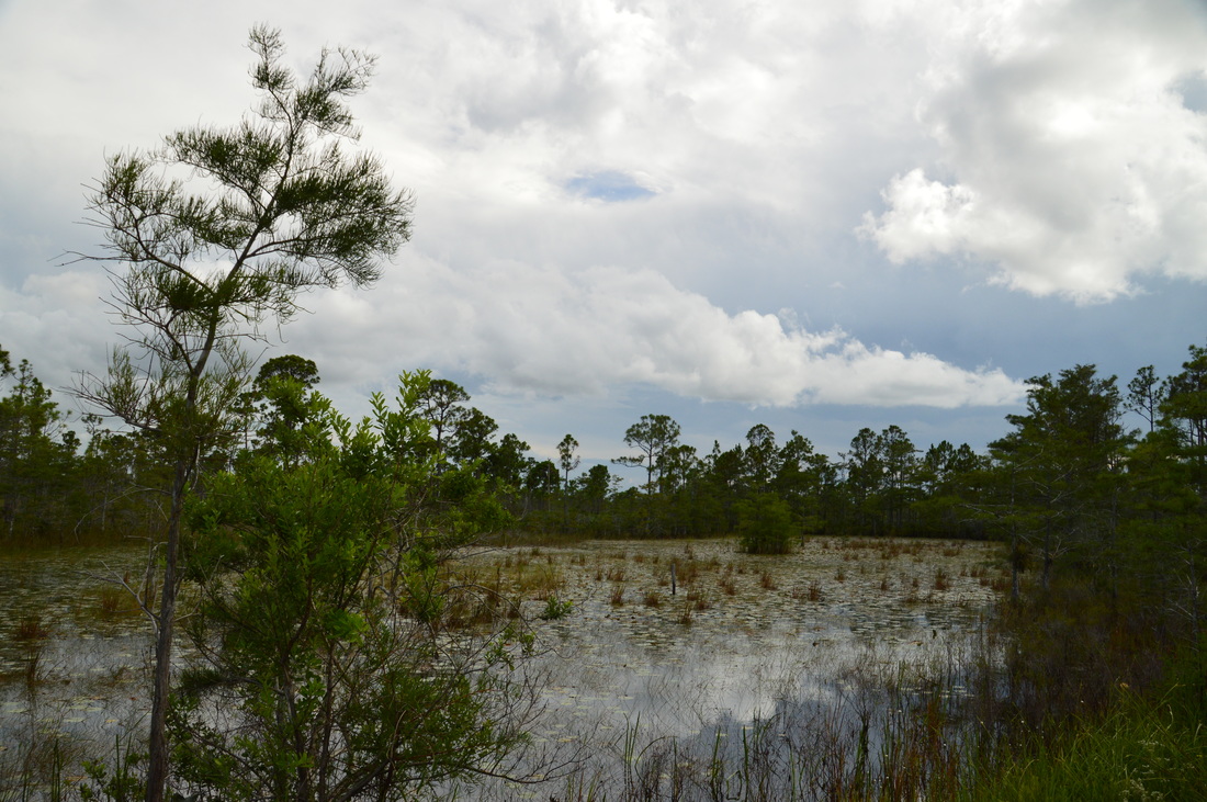
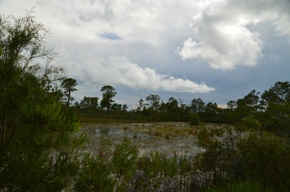
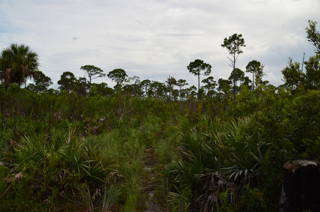
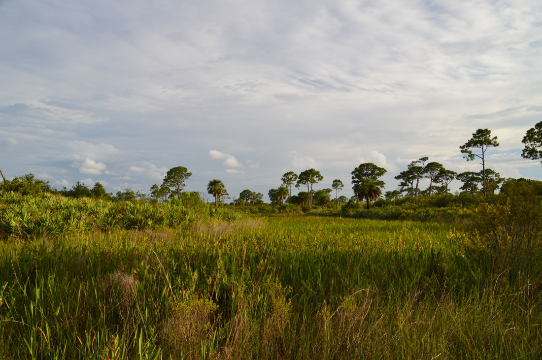
A marsh along the Ocean-to-Lake Greenway
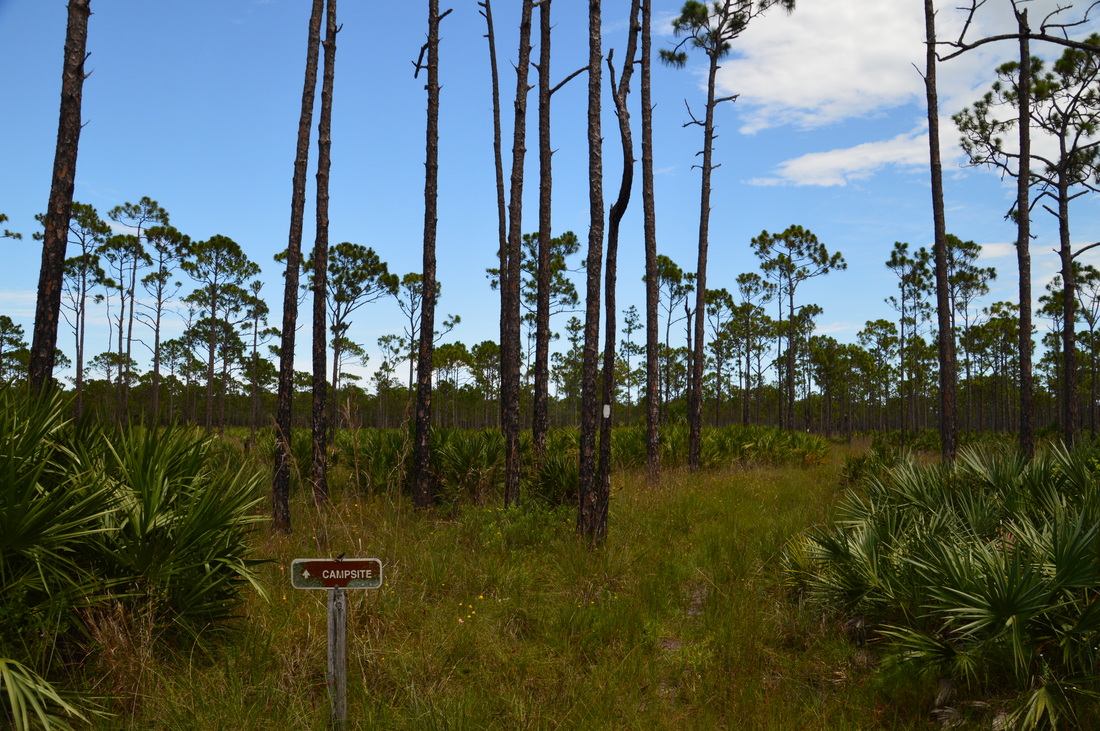
Since I am describing my route, the hike continues as follows. Bear left onto the Ocean-to-Lake Greenway, which continues to follow a wide forest road. At 8.15 miles, this forest road reaches a powerline cut. The greenway turns right here and begins following the powerline cut directly to the east. I was delighted to know that at this point, with a clear east turn finally occurring, I would reach the hiking trail sooner or later, as I can't say that I had been enjoying hiking the wide forest roads. As the trail traveled east, the surrounding landscape changed slightly and turned wetter, with intermittent wetlands - such as the one pictured above - showing up on both sides of the powerline cut. At 8.7 miles, the Ocean-to-Lake Greenway finally reached the Ocean-to-Lake Hiking Trail. Near the intersection, there is a group of benches to the right and a water pump to the left for the nearby Scrub Jay Campsite. Please remember to treat all water before using it.
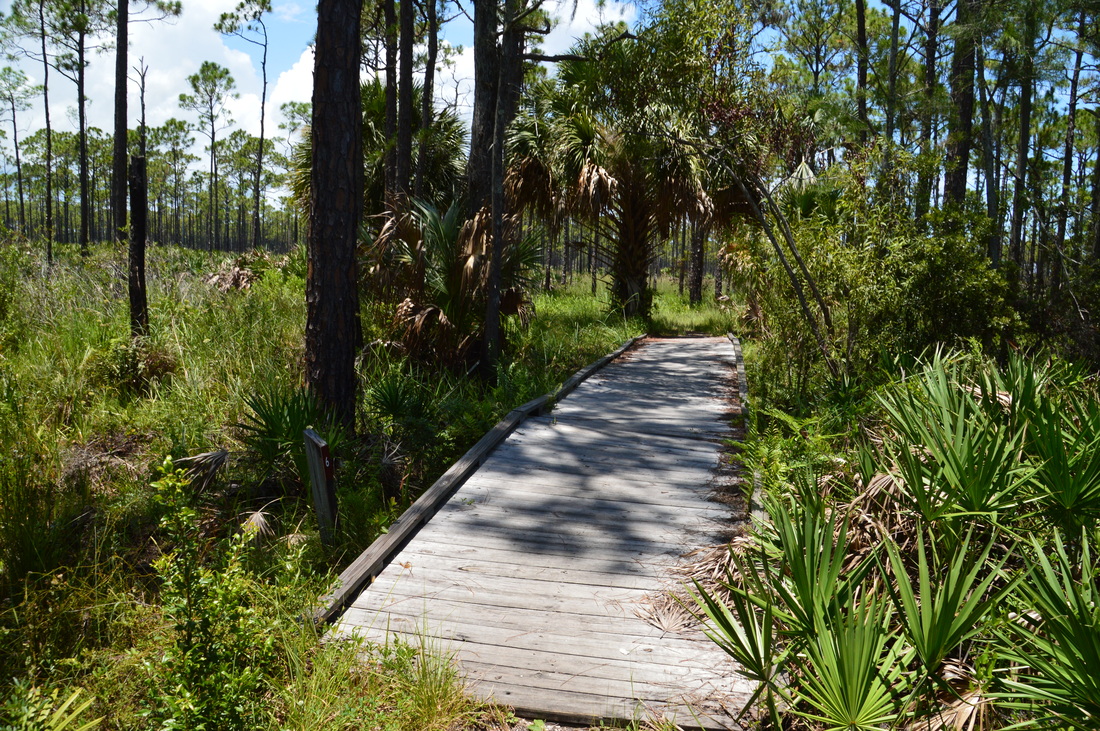
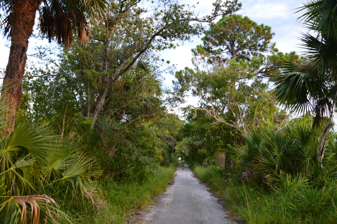
If you turn right on the orange-blazed hiking trail, you have the option of returning to the trailhead by closing the Kitching Creek Loop. This is a much shorter route than the one I took. To follow my long route, turn left onto the Ocean-to-Lake Hiking Trail. Shortly afterwards, the side trail to Scrub Jay Campsite leaves to the right. This is the last campsite that you will encounter on this hike, and with it being strategically placed near halfway through the hike, it is a good spot to spend the night, if doing this long hike as an overnighter. The trail, even though it is no longer the greenway, continues to follow what looks like a jeep road for some time. You will catch some views of a wetland just to the east (to the right). At 9.0 miles, the trail bears right onto a single-track path, leaving the road. At 9.1 miles, the trail navigates across a long seasonally wet area using a boardwalk that is simply known as "Bridge 4". The end of the boardwalk is somewhat overgrown, although during the winter, this likely shouldn't be a problem. Then, at 9.2 miles, the trail reaches a cypress dome. Hedrick Bridge takes the trail across this small swampy area. As you walk the footbridge, note the large cypresses standing off to the left. 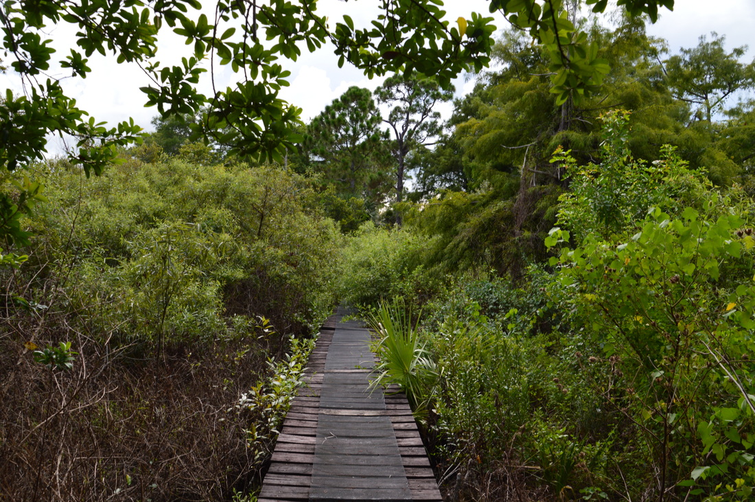
Crossing through a cypress dome on the Ocean-to-Lake Trail
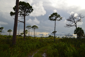
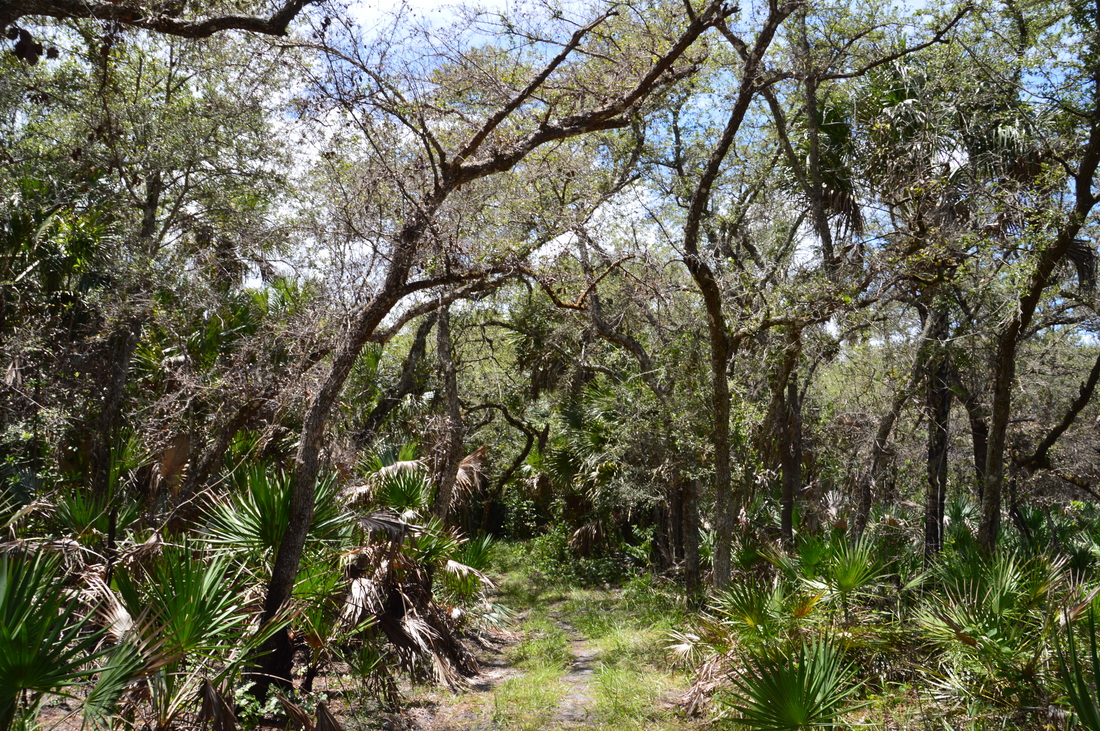
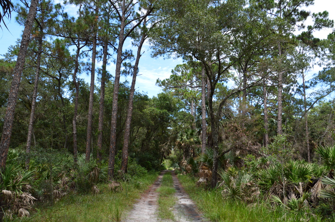
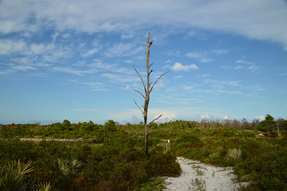
After the bridge, the trail re-enters pine flatwoods on a single-track path, although it seems like the ecosystem begins to change to scrub around here. As you hike the trail, note the large exposed palmetto trunks that were uncovered by the trail. Hopping on and off various jeep roads, the Ocean-to-Lake Hiking Trail meets the White Trail at 10.0 miles. This junction is now much further northeast than it used to be, once again showing that my hike was becoming much longer than I had expected. If you follow my route, or if you would like to hike the entire White Loop clockwise, turn left onto a forest road that is shared by both trails. After passing through a hammock with a large oak spreading its limbs above the trail, the trail enters the scrub of Jonathan Dickinson State Park. I found the transition from pine flatwoods to scrub very interesting. By now, there were few trees. The main growth was shrubs and brush, allowing long-range views.
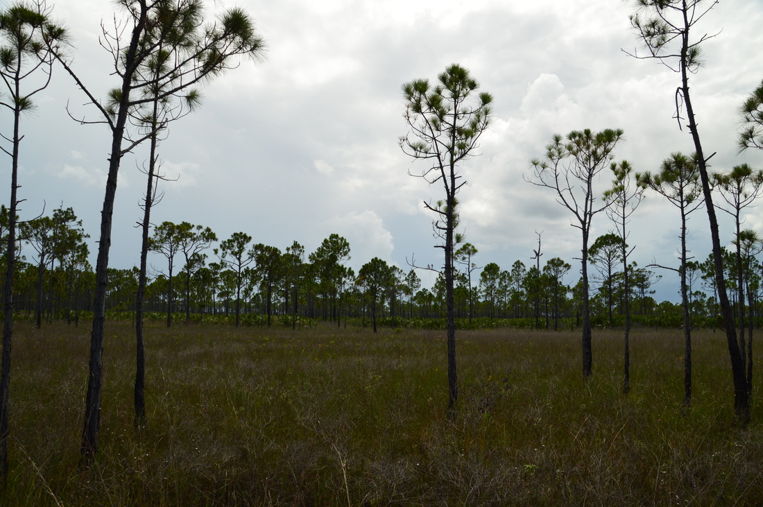
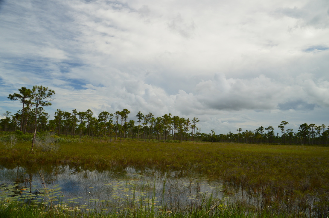
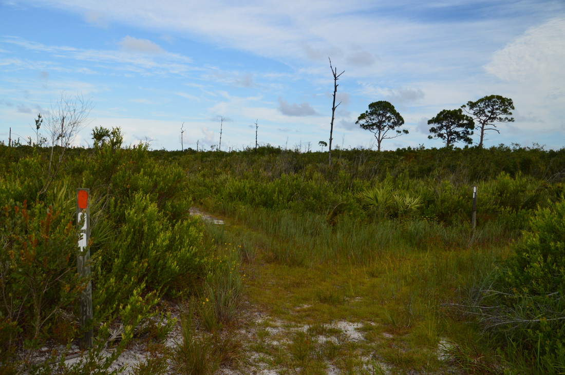
At 10.3 miles, there is another junction. Here, the White Trail leaves to the right, while the Ocean-to-Lake Hiking Trail continues east-northeast. I am not very familiar with this last bit of the Ocean-to-Lake Hiking Trail, but according to maps, the trail reaches the railroad tracks to the east and then stays on their west side, heading north to the terminus of the trail at the northern boundary of the park at US Route 1. The one thing that baffles me is that I could not find any sign of a parking area around what looks like the trail's eastern terminus. This leads me to believe that there is no trailhead at the terminus, and that people who are hiking the entire Ocean-to-Lake Trail must finish their hike by heading down the White Loop to a trailhead. Regardless, to follow my route, turn right onto the White Trail and begin hiking in a general southward direction. Despite the flat terrain, the trail is very winding here, probably because the trail builders tried to pick the path of least resistance through the scrub. One interesting thing that I noted was that the terrain got progressively hillier as the trail traveled southeast. Otherwise, there are really no points of interest along this section other than the beautiful scrub. 
The eastern half of the White Loop often travels through the scrub ecosystem of Jonathan Dickinson State Park
At 12.2 miles, the White Trail arrives at the railroad tracks that passes straight through the park, from north to south. Before the White Trail and Green Trail had been designated, there was simply one trail - the East Loop - that followed the western and northern portions of the white trail and the eastern portions of the green trail. At the time, you were allowed to cross the railroad tracks at this point. Since then, the two separate loops have been designated, and the White Loop now stays on the west side of the railroad tracks, while the Green Loop stays on the east side of the railroad tracks. This was a big disappointment to me, as you're no longer officially allowed to cross the railroad tracks, and I had planned to hike the east side of the green trail around Hobe Mountain. I am sure that the Green Loop is a hike worth doing by itself, as it passes through some scenic terrain in the Hobe Mountain vicinity, but on this day, I was forced to follow the White Trail southward. There was a clear path that still crossed the railroad tracks, and there were obvious signs of people crossing the railroad tracks here despite not being allowed to do so, but I didn't wish to break the rules.
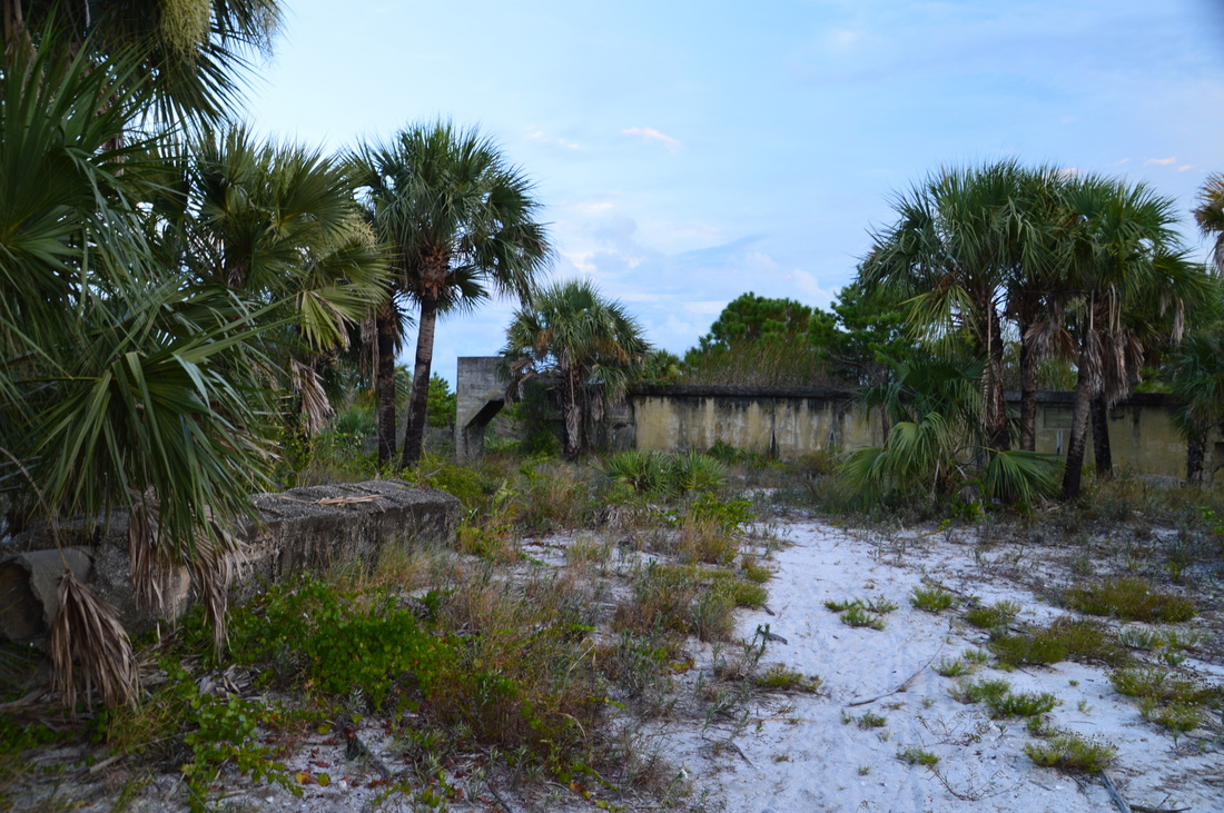
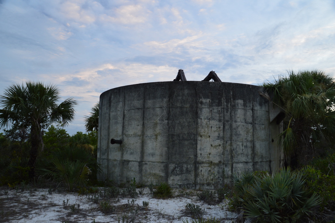
After the sharp south turn at the railroad tracks, the trail became a lot hillier, and the vegetation was a lot denser here, no longer the type that is typical in a scrub. I cannot say that I was exactly delighted by the cross-country terrain, with over twelve miles on my legs through sand, much of it done in near 100-degree heat. At 13.4 miles, the trail arrived at a large marsh with no way through it. This caused the trail to make a large detour around the west end of the marsh. As I was leaving the marsh, a white-tailed deer bounced away. At 14.0 miles, the White Trail reached the main park road at the point where the railroad crosses it. I still had one more goal for the day. I wanted to see the ruins of Camp Murphy. However, I wasn't exactly sure where the ruins were, and it was hard to locate them from the book due to the changes in the trail system. I was initially led to believe that they were east of the railroad somewhere off the Green Trail, and as a result, I crossed the tracks and started following the Green Trail southward. This trail followed a closed but paved road southward. This is in fact an old road, and the pavement was crumbling in many places. I believe that this is the route of Old US 1, which originally passed very close to the Camp Murphy Ruins. At 15.0 miles, the Green Trail reached a place where it turned left, while a service road seemed to go right and cross the tracks. I had been studying the map for a while, and I now thought that the ruins were actually right here, but just to the west of the tracks. Reluctantly, not being sure if it is allowed at this point, I crossed the tracks, reaching a service road that followed the west side. This forest road heads south from the White Trail, and I suggest that you use it to reach the ruins, rather than following the Green Trail on the east side of the tracks. From this point, bear left and ascend a path up a hill to the Camp Murphy Ruins at 15.1 miles. There are several concrete structures still standing, as well as other visible foundations. 
There are several concrete structures still standing as the ruins of Camp Murphy
Named in the honor of Colonel William H. Murphy, Camp Murphy was a top-secret military camp that had nearly 1000 structures and a territory of over 11,000 acres. The camp was complete with a post office, hospital, church, bank, and even a movie theater. The camp was opened when during World War II, the US Army Signal Corps School located in New Jersey decided to expand to Florida. The camp had a radar and served the role of being a radar instruction base during the early part of the war. However, towards the end of the war, radar maintenance personnel was no longer needed, as the need for the radar was no longer as big. As a result, the camp was closed, and the property became Jonathan Dickinson State Park in 1950.
There are several different structures at the site that I visited. There are probably some other structures further west, as I saw a path heading that way, but I did not have time to explore the area very thoroughly. I am not sure of the use of the two main buildings that I saw, but one of them (pictured above) looked like it might have been the foundation for a radar. If you have the time to explore this area more thoroughly than I did, please let me know what else you find, if anything. To return to the white trail, return to the service road that was on the west side of the railroad tracks. Start following this unmaintained service road northward. it makes for relatively slow walking, due to uneven footing and terrain that is not traveled very often, At 15.75 miles, reach a post marked with double white blaze. This is where the White Trail comes in from the north (from the main park road) and turns west. You could have come in to the ruins this way. Turn left to continue following the White Trail, which passes back into the scrub. At 15.95 miles, the trail enters a hammock and then uses the Rainy Slough Bridge to cross the namesake slough. This slough and surrounding wetlands actually form the headwaters of the North Fork of the Loxahatchee River, which eventually flows into the Loxahatchee River near Jupiter Inlet. Passing out of the hammock, the trail returns to the scrub before crossing a marsh via an overgrown footbridge called Bridge 8. This marsh is also part of the headwaters of the North Fork of the Loxahatchee. After this, the trail joins a sandy jeep road. Don't miss a sharp right turn onto an indistinct path at 16.4 miles, which crosses over to another jeep road. From here, the trail follows the extremely sandy jeep road that makes for very slow hiking, due to the rather deep sugar sand. I found this especially tiring, having hiked already over 16 miles. At 16.8 miles, the trail reaches the main park road again. This was my decision point. By now, I was extremely tired, and it was getting dark. I absolutely did not wish to do the full white loop anymore, despite my initial ambitious plans. If I continued to do the full loop, I would likely to have to hike anywhere from another five to seven miles, while if I took the road directly westward, my hike would be over in under two and a half miles. As you probably have guessed, I chose the road. To reach the trailhead as fast as possible, simply turn left onto the main park road and follow it all the way to its end in the river area. I concluded my hike at 19.1 miles, upon reaching the river area trailhead and parking. Mileage
0.0 - Kitching Creek Trailhead
0.7 - Kitching Creek observation area 2.1 - Kitching Creek South Bridge 2.35 - Very confusing junction in logged area 2.85 - Kitching Creek Campsite Side Trail 3.7 - Turnaround point on Ocean-to-Lake Trail 6.0 - Kitching Creek North Bridge 8.7 - Scrub Jay Campsite Side Trail 9.2 - Hedrick Bridge 10.0 - White Trail junction 10.3 - Leave Ocean-to-Lake Trail 12.2 - Railroad tracks 14.0 - Main park road 15.1 - Camp Murphy Ruins 15.95 - Rainy Slough Bridge 16.8 - Main park road 19.1 - Kitching Creek Trailhead Variations
Do just the Kitching Creek Nature Trail - 1.0 Miles
Do just the Kitching Creek Loop (not the nature trail) - 7.0 Miles Do the hike without the extension west of Kitching Creek - 16.4 Miles Do the hike including the full White Loop - Estimated two to four miles extra Bonus Stops
Pictures
1 Comment
Chris
1/3/2018 10:42:46 am
Is this entire Trail System Mountain Biking accessible? Or are Mountain Bikes allowed in said Trail System? Thanks Leave a Reply. |
About MeMark Oleg Ozboyd Dear readers: I have invested a tremendous amount of time and effort in this website and the Georgia Waterfalls Database the past five years. All of the work that has gone in keeping these websites updated with my latest trip reports has almost been like a full-time job. This has not allowed me to pick up a paid job to save up money for college, and therefore, I I've had to take out loans. If you find the information on this website interesting, helpful, or time-saving, you can say "thanks" and help me out by clicking the button above and making a contribution. I will be very grateful for any amount of support you give, as all of it will apply toward my college tuition. Thank you!

Coming in 2022-2023?
Other Hiking WebsitesMiles HikedYear 1: 540.0 Miles
Year 2: 552.3 Miles Year 3: 518.4 Miles Year 4: 482.4 Miles Year 5: 259.9 Miles Archives
March 2021
Categories
All
|


 RSS Feed