Lookout Mountain Battlefield, which is part of the Chickamauga & Chattanooga National Military Park, covers an impressive portion of Lookout Mountain, where the "Battle Above the Clouds" occurred during the Civil War. The battlefield's extensive trail system provides easy access to some of the mountain's signature features, such as Sunset Rock and Point Park, both of which have panoramic vistas. The park's most scenic trail, Bluff Trail, follows the bluff line along the west side of Lookout Mountain for several miles, connecting to other trails with more views and other points of interest such as mountain springs. This hike occurred on Saturday, January 28th, 2017. My plan was to hike the Bluff Trail from Ochs Gateway to Point Park. Along the way, I would take a side trip along the Jackson Gap Trail and also to Sunset Rock. From Point Park, I would follow the Mountain Beautiful Trail and Hardy Trail to Cravens House, from where I would take the Rifle Pits Trail to the Upper Truck Trail. Then, I would hike along the Upper Truck Trail past the ruins of Camp Demaray to the Gum Spring Trail. Lastly, I would follow the Gum Spring Trail up to the Bluff Trail, concluding the hike by retracing my steps on a portion of my earlier route along the Bluff Trail.
Summary
R/T Length of Trail: 14.8 Miles
Duration of Hike: 8:30 Type of Hike: Lasso with Side Trails Difficulty Rating: 7 out of 10 Total Elevation Gain: 2694 Feet Pros: Well-maintained trail system Cons: None Points of Interest: Vista on Jackson Gap Trail - 6 stars; Sunset Rock Vista - 8 stars; Point Park Vistas - 9 stars; Jackson Spring; Rock Spring; Leonora Spring; Gum Spring; Cravens House; Ruins of Camp Demaray Trail Blaze Colors: None of the trails are blazed Best Seasons to Hike: Winter Fees: None Beginning Point: Ochs Gateway Trailhead Directions from Lookout Mountain, GA: From the intersection of Mc Farland Road (GA 157 North) and Scenic Highway (GA 189) in the town of Lookout Mountain, follow GA 189/GA 157 (Scenic Highway) South for 0.7 miles. Just before the entrance to Covenant College, turn right onto Frontier Bluff Road. Continue for 0.3 miles to the trailhead parking area, which will be on the right. Map
Click here for more information and to download this trail map to view in Garmin Basecamp.
Details
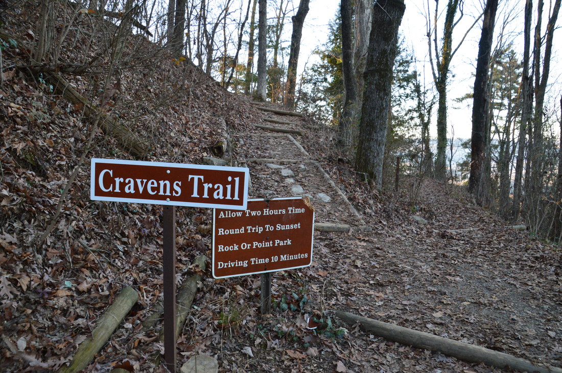
Lookout Mountain Battlefield is best known for its signature vista of the picturesque Tennessee River and downtown Chattanooga from Point Park. However, the battlefield also has an extensive trail system that leads to other points of interest, such as more vistas and a variety of springs. This trail system is definitely undervalued, in my opinion. While there are many different trailheads on Lookout Mountain, I decided to begin my hike at the Ochs Gateway Trailhead. The gateway is a tribute to Adolph and Milton Ochs, who over many years, assembled a collection of tracts of land that totaled about 2800 acres on Lookout Mountain, before donating all of the land to the United States, leading to the formation of Lookout Mountain Battlefield and Military Park, which is managed today by the National Park Service. It is also of importance that John A. Chambliss donated a small corridor of land to the park and blazed the trail through it, connecting the main trail system to Frontier Bluff Road. If not his contribution, then the only Lookout Mountain Battlefield trailhead in Georgia would not exist today.
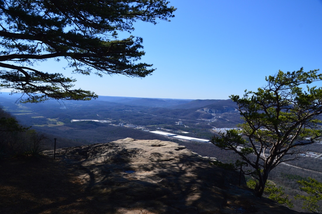
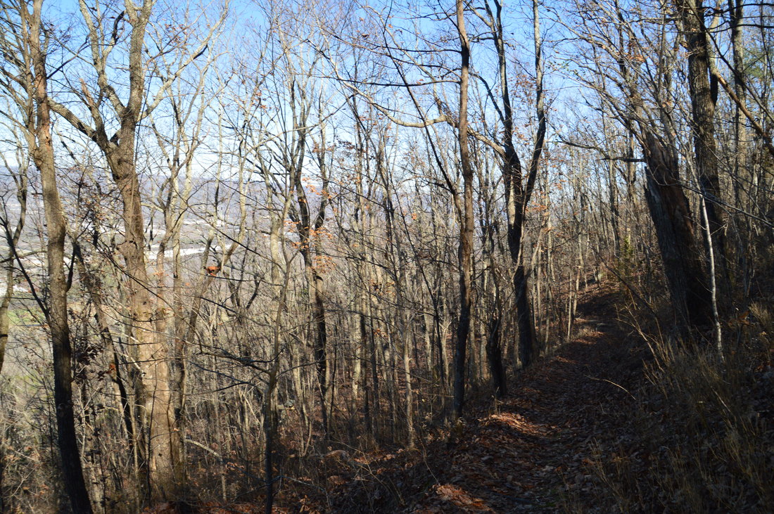
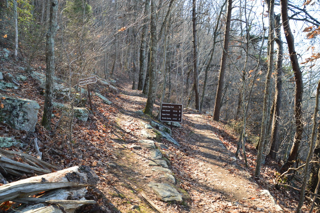
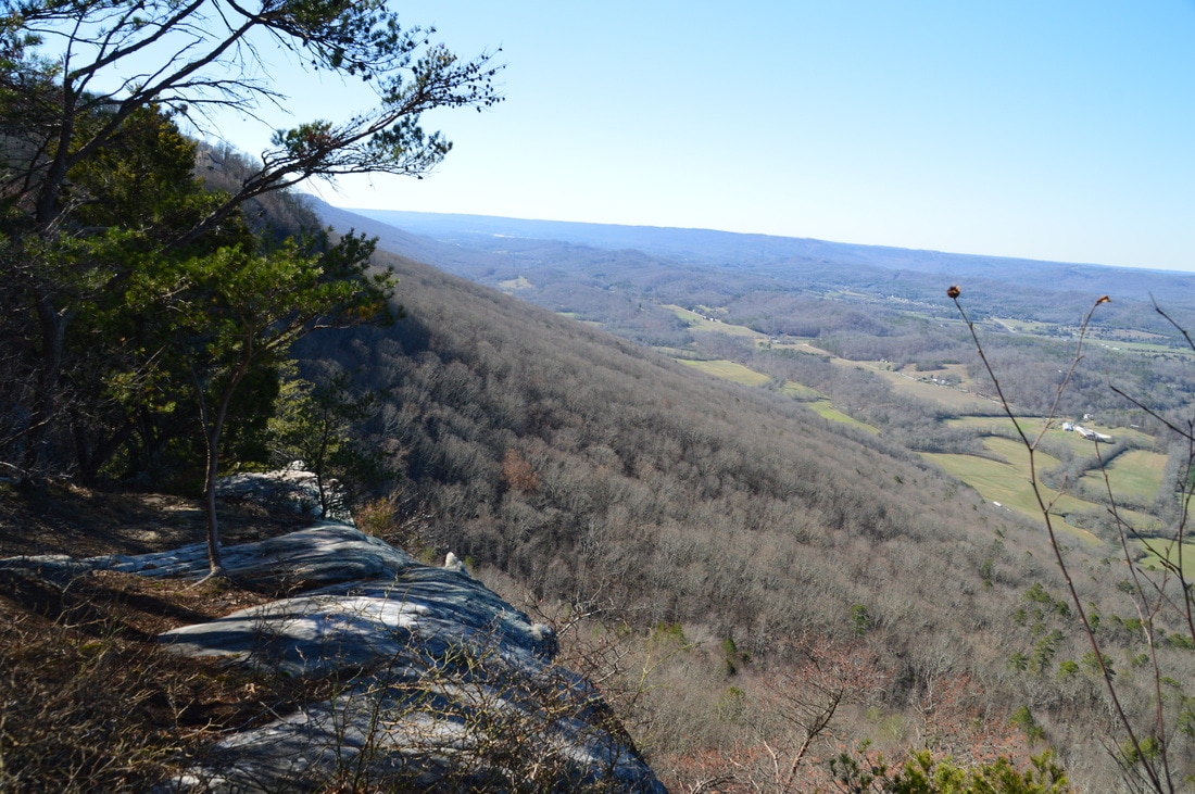
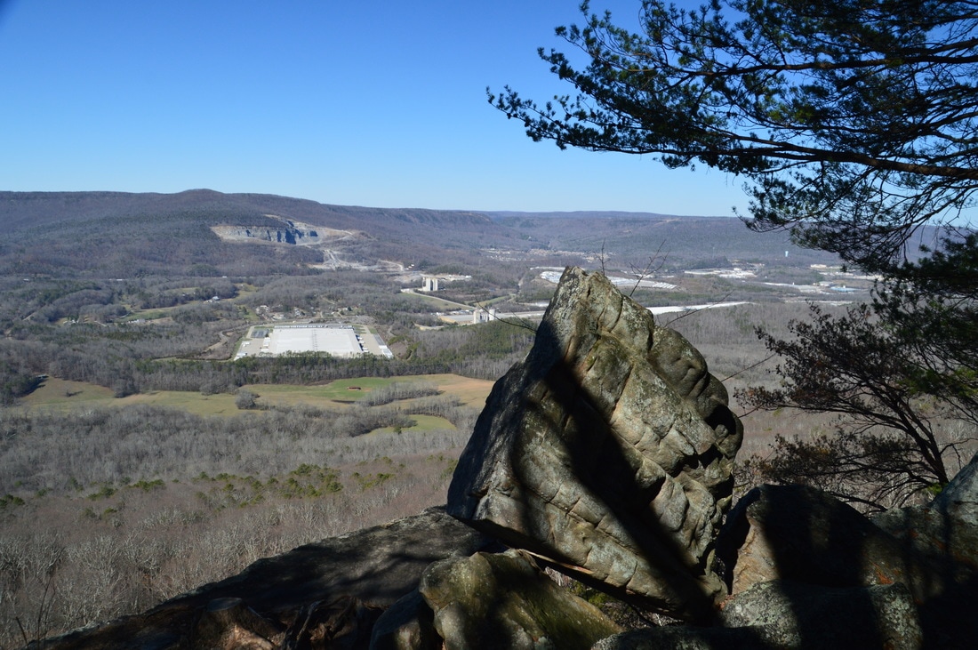
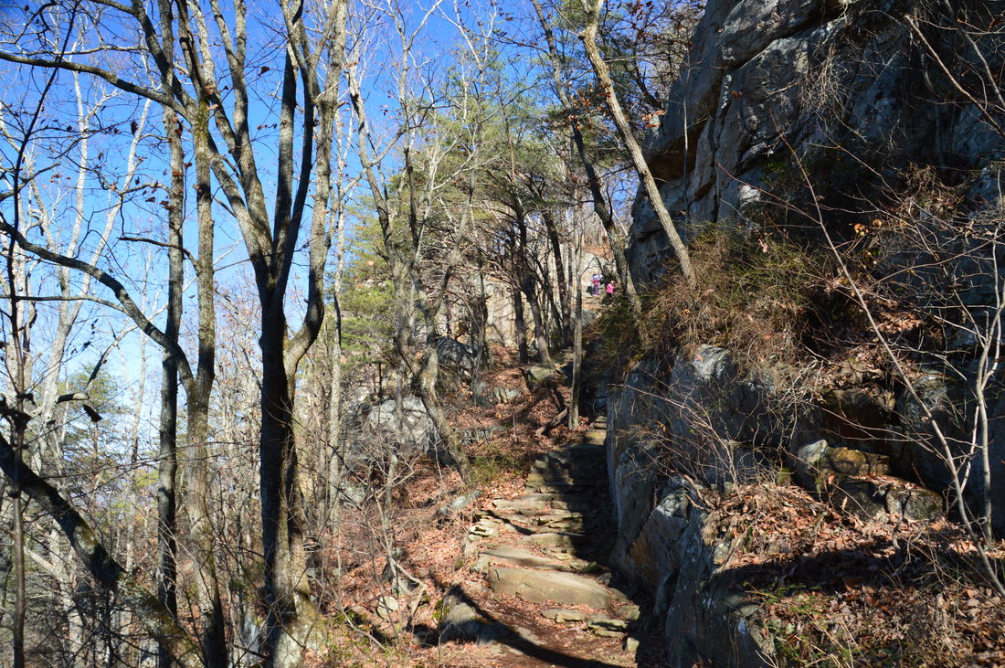
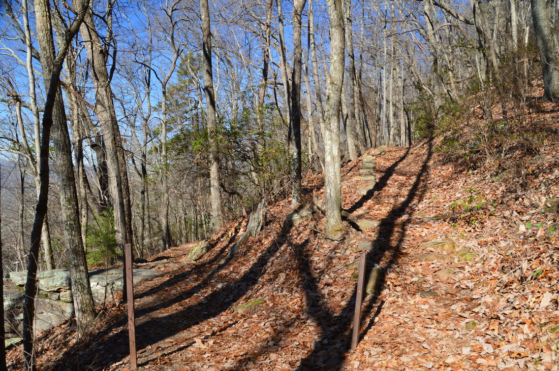
An obvious trail begins at the Ochs Gateway parking area. This is the Bluff Trail, which is the most scenic trail on Lookout Mountain. A carsonite stake marks the beginning of the trail, which immediately begins an easy to moderate descent westward. You'll shortly pass a trailhead kiosk and then a plaque that commemorates Adolph and Milton Ochs. A pair of switchbacks bring the trail below the west brow of Lookout Mountain. At 0.15 miles, the descent becomes much more gradual as the trail stays parallel to the rim of the mountain. After crossing some wet-weather seeps, the Bluff Trail reaches a junction with the John Smartt Trail at 0.55 miles, where the Bluff Trail turns right while the John Smartt Trail heads off acutely left. My plan was to first explore the Jackson Gap Trail, so if you wish to access this trail like I did, turn left onto the John Smartt Trail (and if you want to skip the side trip, then follow the Bluff Trail). After the left turn, you will reach a fork in another tenth of a mile. Here, the Jackson Gap Trail bears left and slightly uphill, while the John Smartt Trail bears right and downhill toward Skyuka Spring. I have hiked the John Smartt Trail and to Skyuka Spring before, so today, my goal was to hike the Jackson Gap Trail. The Jackson Gap Trail is also known as the Jackson Spring Trail. Bear left onto the Jackson Gap Trail, which stays level for some time, providing good winter views into Lookout Valley. At 0.85 miles, a pair of switchbacks brings the trail slightly higher up. The purpose of this short ascent is to bring the trail above a bluff line that begins just ahead (meanwhile, the John Smartt Trail follows the base of the bluff line). There is a great viewpoint from the top of the bluffs, and the Jackson Gap Trail also provides access to it. At 1.35 miles, about a half-mile after the double switchback, an unmarked but well-used side trail leaves to the right. This side trail leads for 250 feet to a great vista on top of the bluffs. From here, you can see far into Lookout Valley both north and south, as well as across to Raccoon Mountain to the west. 
The Jackson Gap Trail passes near this great vista of Lookout Valley.
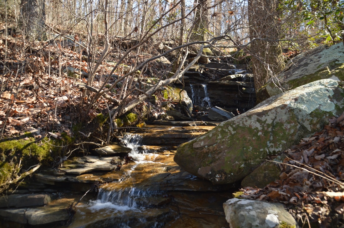
Return to the main trail and continue following it south. Passing some rock outcrops, the Jackson Gap Trail reaches Jackson Spring at 1.65 miles. As best as I could tell, this is not a true spring. It appears that a bit of water comes out from the ground here, but the main stream that you see is actually the outflow of Jackson Lake which is further up the mountain in a residential area near the end of Frontier Bluff Road. However, even though Jackson Spring is not a true spring, it is still a pretty place, where a small creek forms a stairstep cascade over a rock ledge. Jackson Spring is at the boundary of Lookout Mountain Battlefield. The Jackson Gap Trail continues outside of the park through an area of private property that is under a conservation easement. It leads to Route 189/157, but I did not continue past the park boundary. From Jackson Spring, retrace your steps along the Jackson Gap Trail back to the Bluff Trail. You'll return to the Bluff Trail at 2.65 miles.
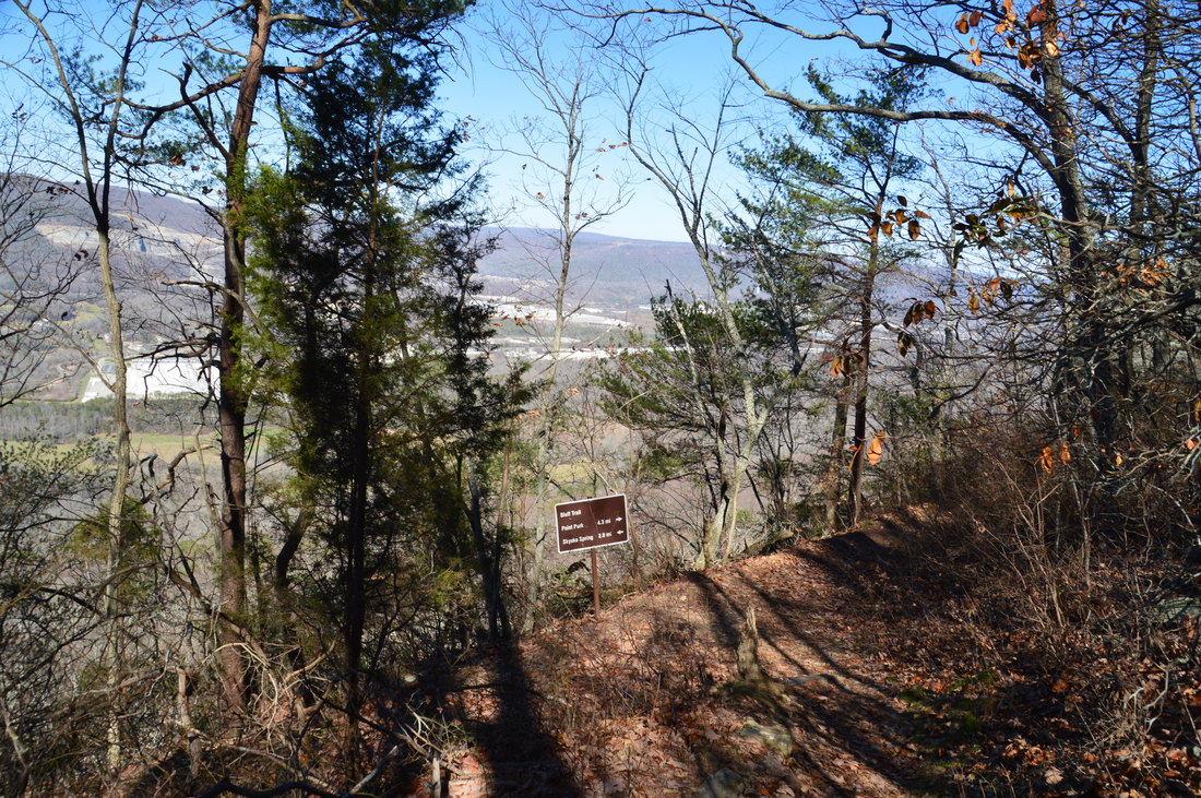
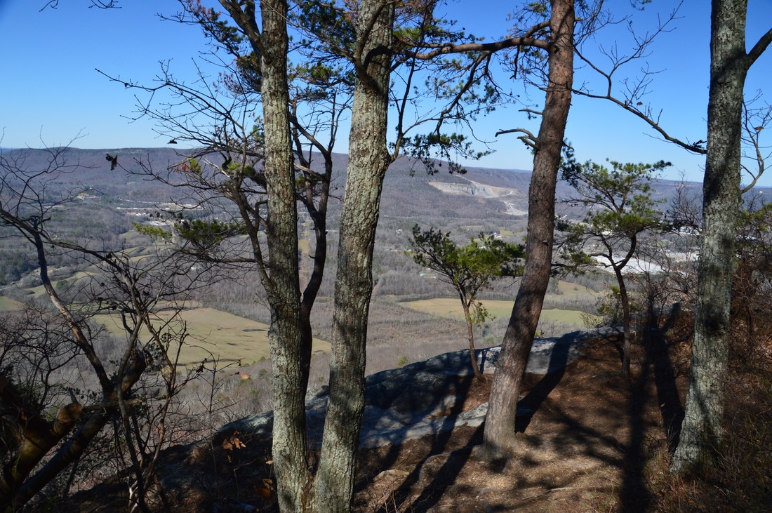
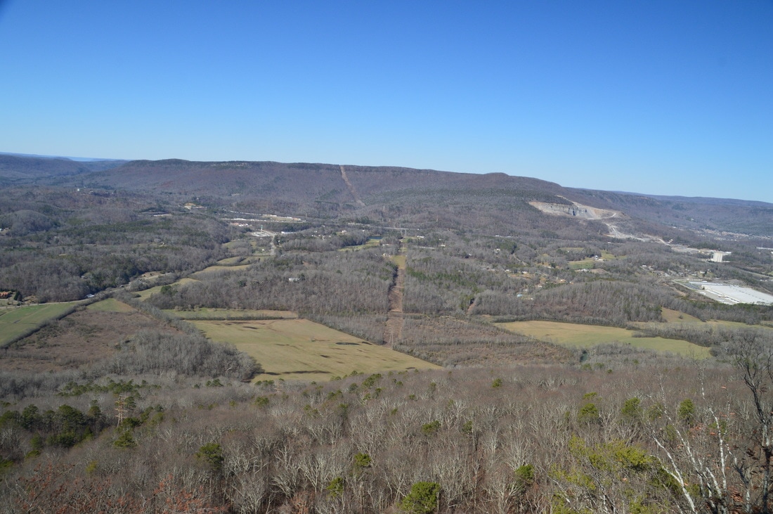
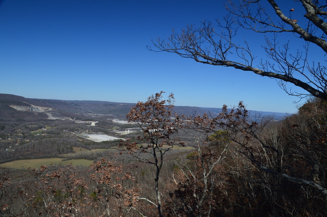
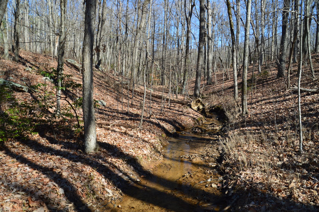
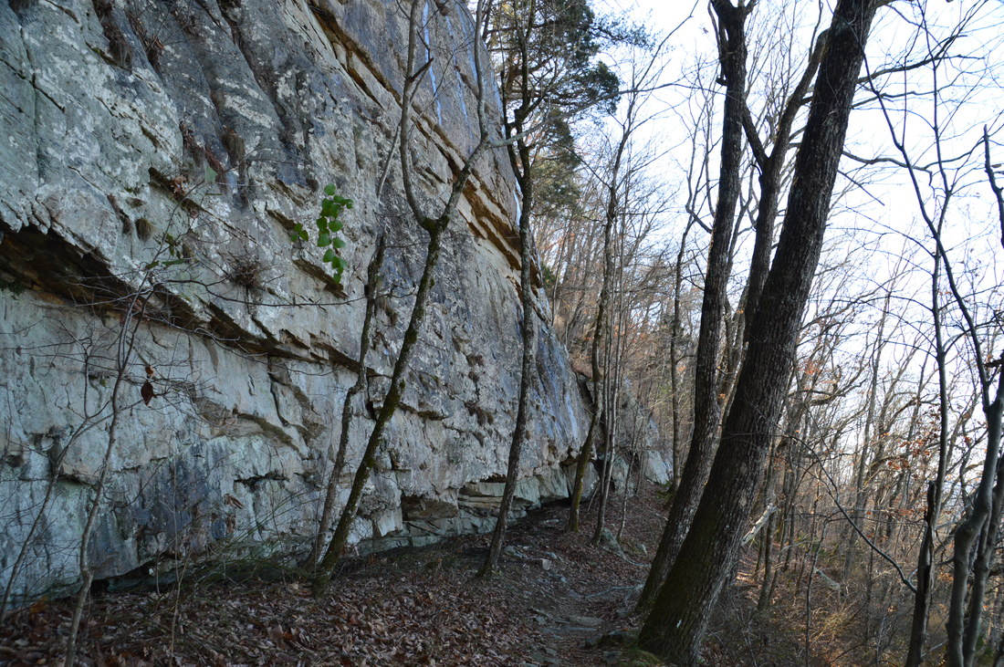
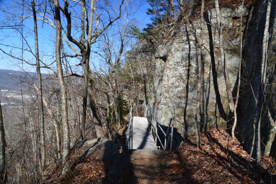
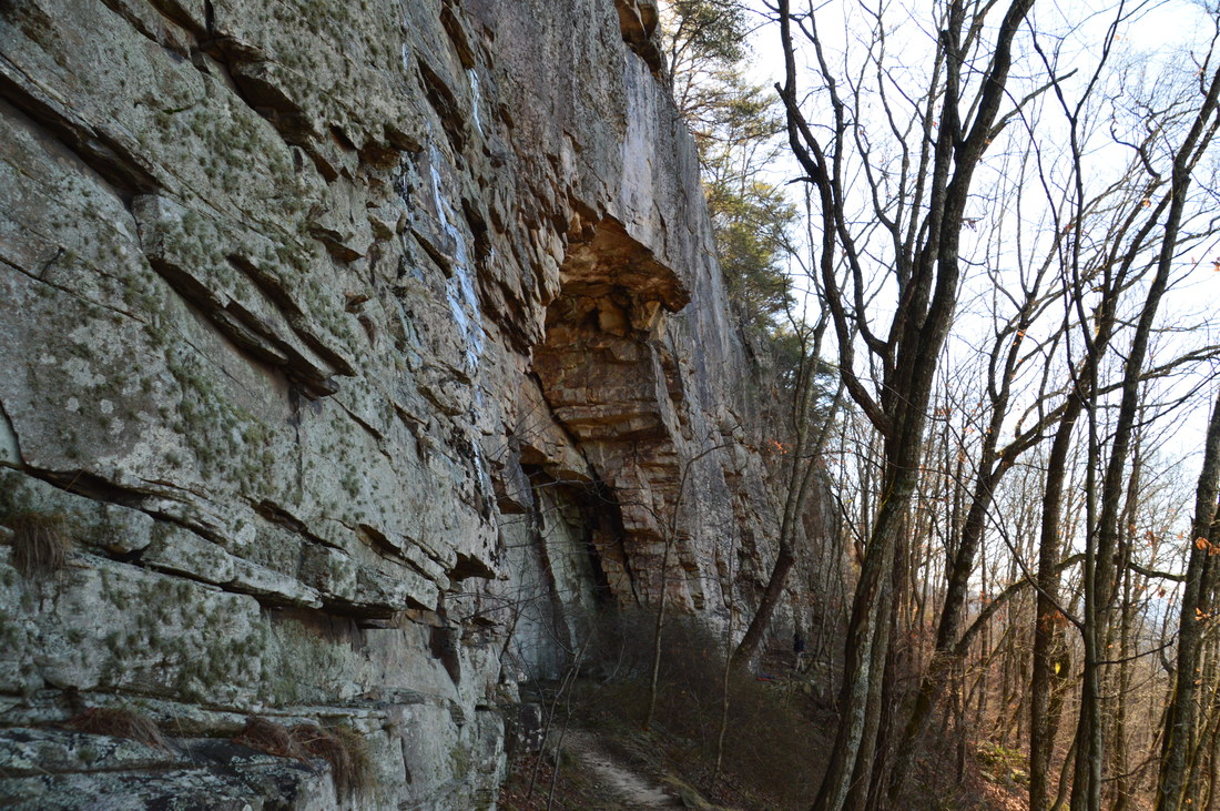
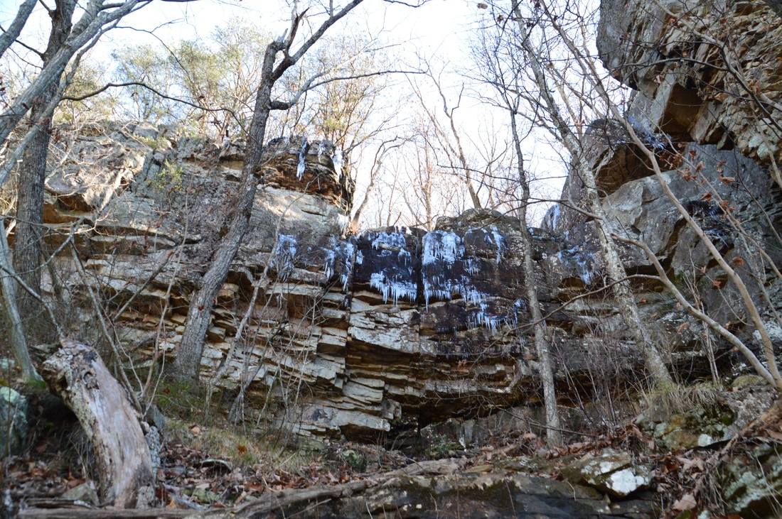
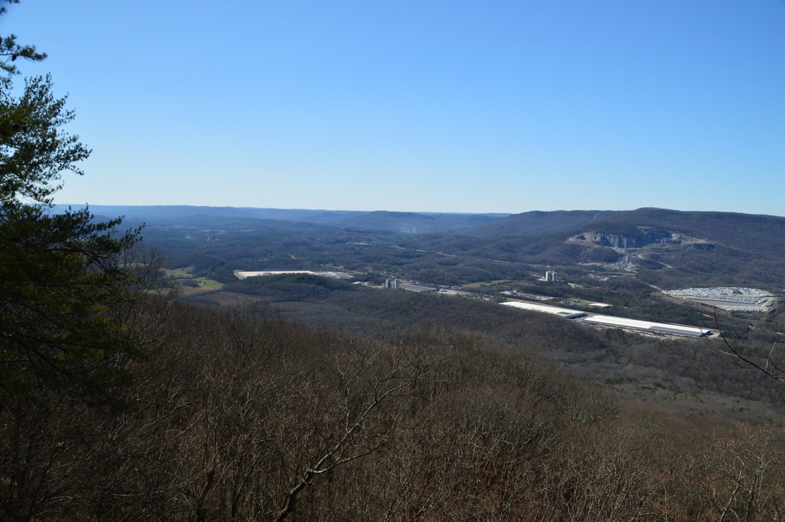
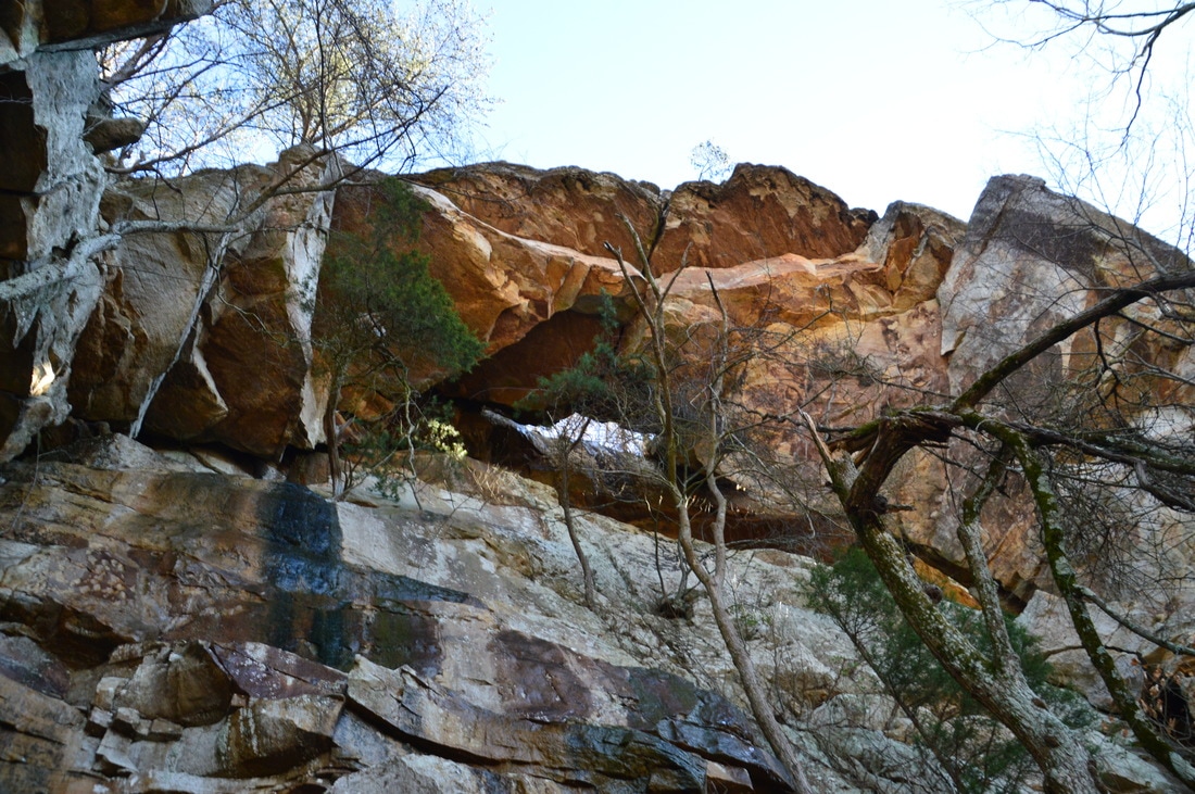
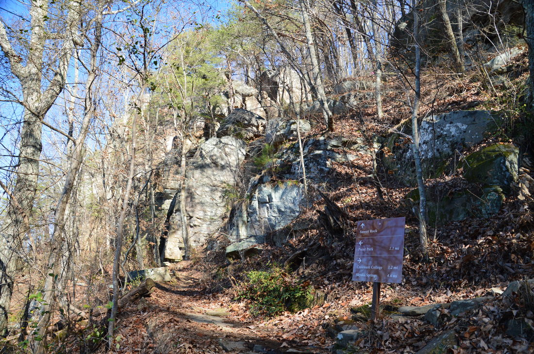
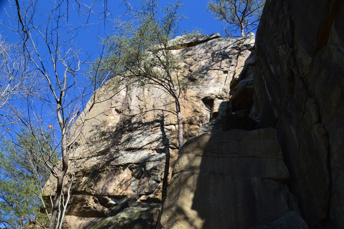
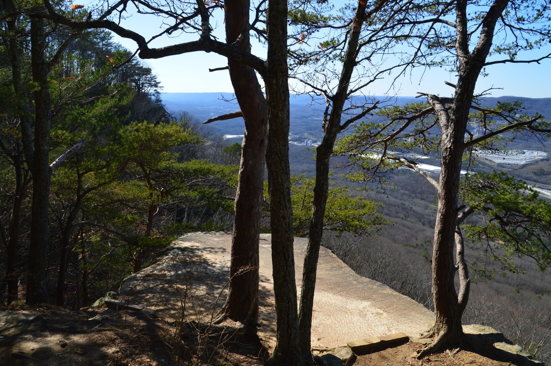
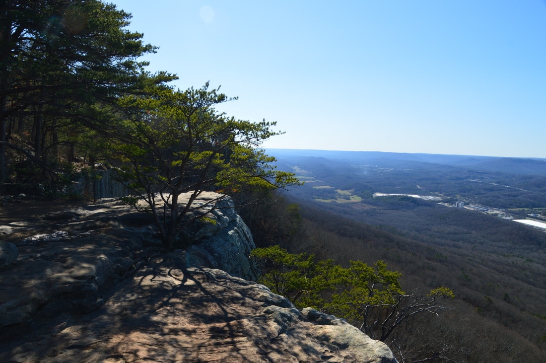
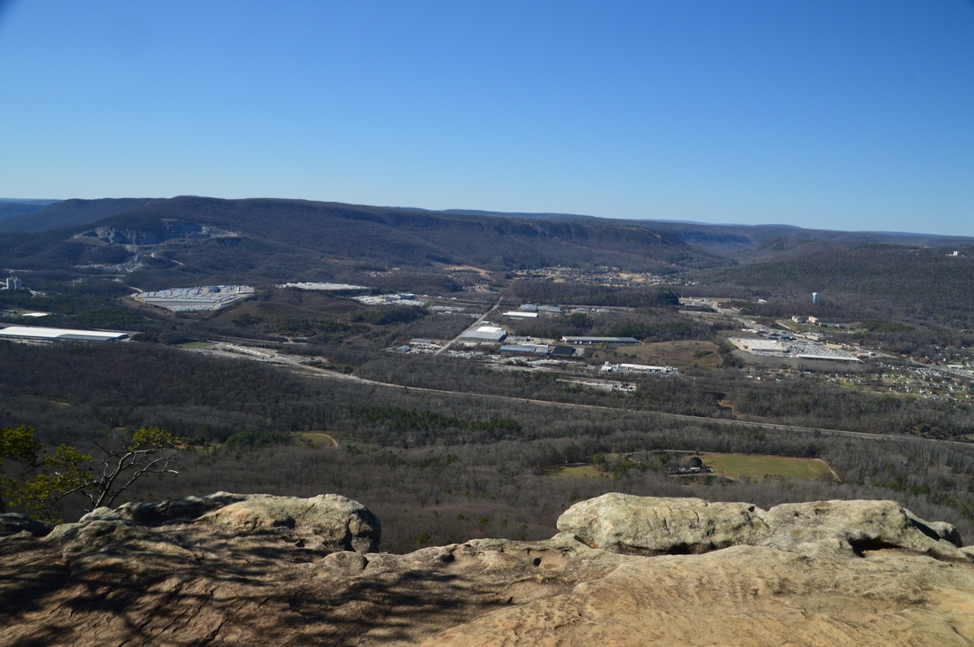
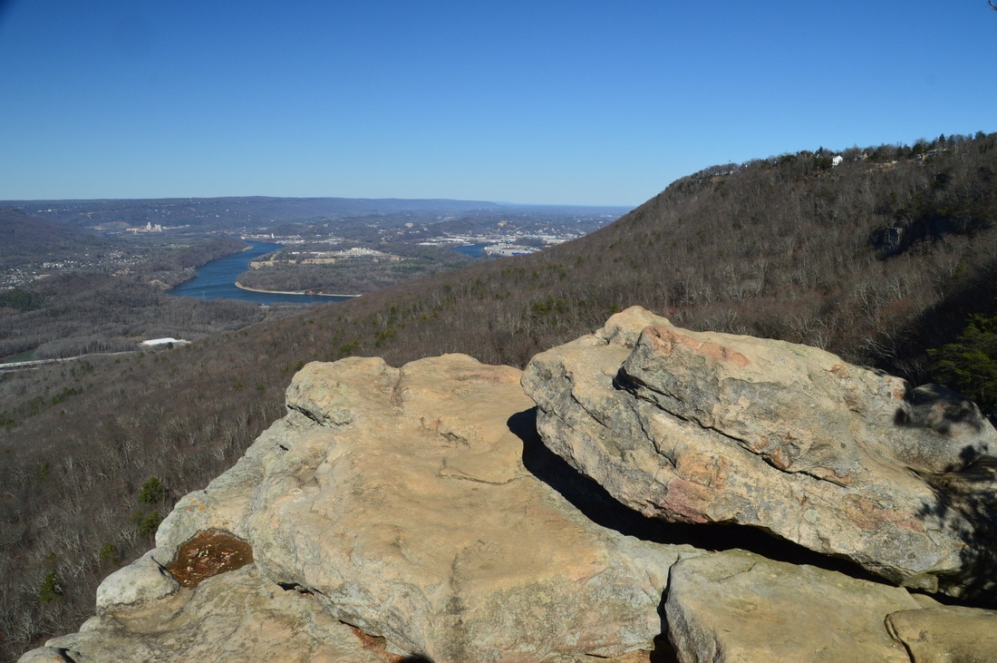
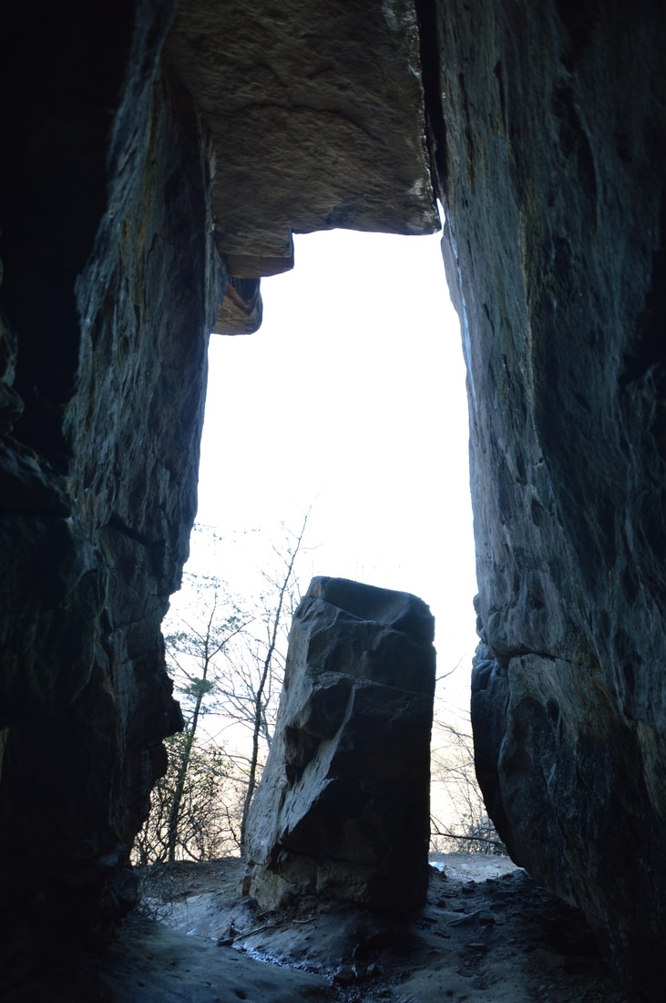
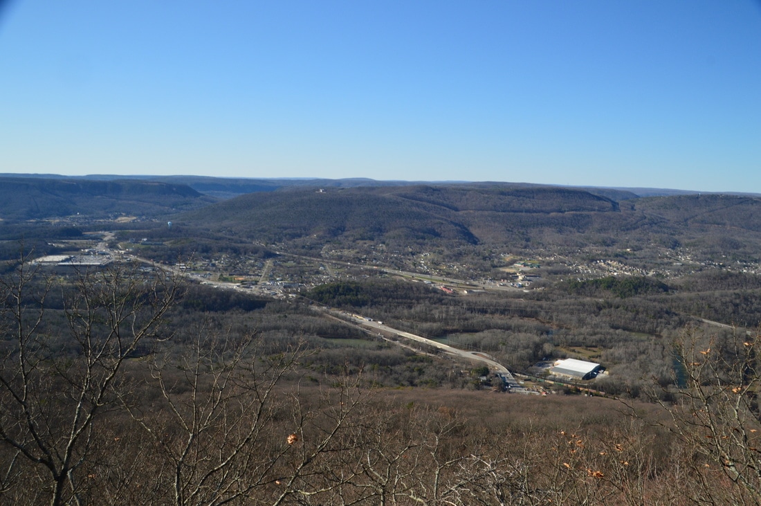
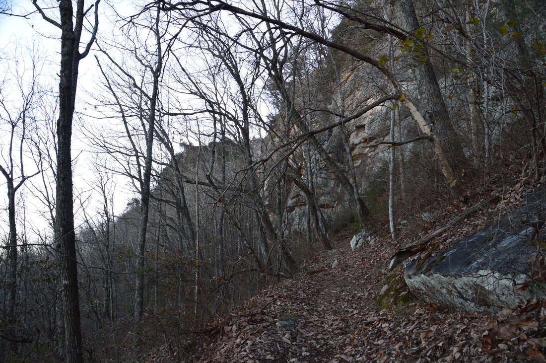
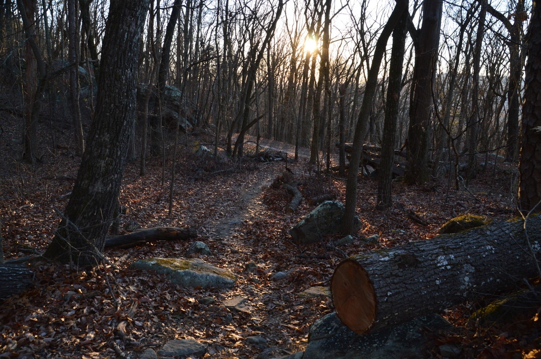
Continue straight (north) on the Bluff Trail in the direction of Sunset Rock and Point Park, both of which are must-see destinations. Just after you return to the Bluff Trail, there will be a rock outcrop to the left that provides some views into Lookout Valley. A quarry is visible across the valley on Raccoon Mountain. The Bluff Trail has several such open vistas, in addition to continuous winter views of the valley. Over the next several miles, the Bluff Trail follows the base of the bluff line that stretches along the west brow of Lookout Mountain. Thus, the trail is very scenic, as most of the time, tall bluffs are in sight. At one point, the trail crosses a small ravine at the base of the bluffs via a metallic footbridge. At approximately 3.75 miles, the trail crosses the state line and enters Tennessee. This is one of those hikes where you can walk in two states on the same hike! At 4.8 miles, there is a particularly scenic spot, where the trail passes by the base of a long line of particularly tall bluffs, with a steep drop-off to the left. A fence guards the drop-off. There is an open view into the valley from here. Shortly afterwards, an obscure side trail leads to a notable geological feature: a natural bridge visible high above at the top of the bluffs. At 5.2 miles, the Bluff Trail reaches an intersection with the Gum Spring Trail, which marks the beginning of the loop portion of the hike. There is no big difference in the direction that you chose to the hike the loop in, but if you choose to hike it counter-clockwise like I did, then continue straight on the Bluff Trail for about 100 feet farther to an intersection with the signed Sunset Rock Trail, which leaves to the right. Do not miss this side trail, as it leads to spectacular views from Sunset Rock. The trail makes a short but steep ascent to the top of the bluff line, utilizing a long rock staircase along the way. At the top, an unmarked path leaves to the right, but to reach Sunset Rock, turn left. The trail passes some teaser rock outcrops with views before reaching Sunset Rock at 5.3 miles. Sunset Rock has the best views of Lookout Valley on the hike. Furthermore, the views stretches northward to the end of Lookout Valley, where a portion of the Tennessee River at Moccasin Bend is visible. From the large rock outcrops at Sunset Rock, large houses are visible on the brow of Lookout Mountain near Point Park. As the name implies, Sunset Rock is a great spot for sunset-watching. 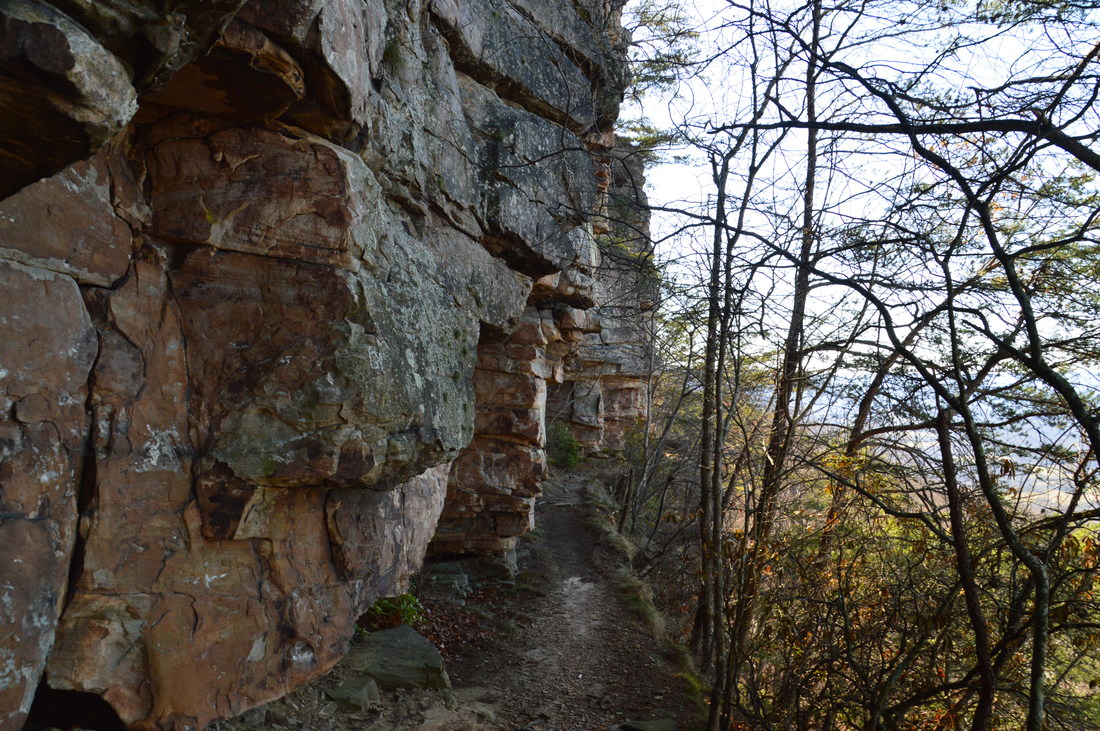
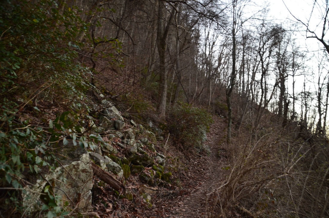
The Bluff Trail is a very scenic trail that often follows the bluff line along the west brow of Lookout Mountain.
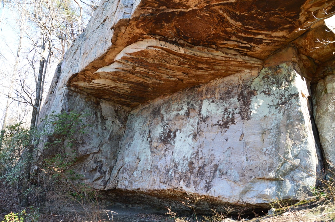
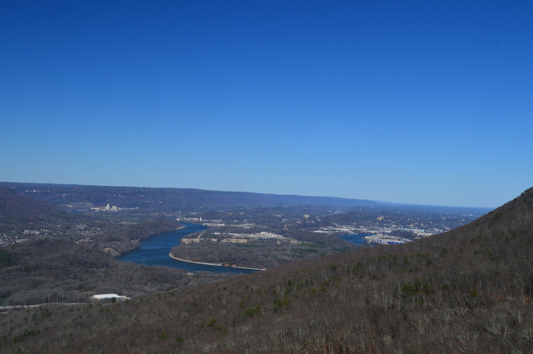
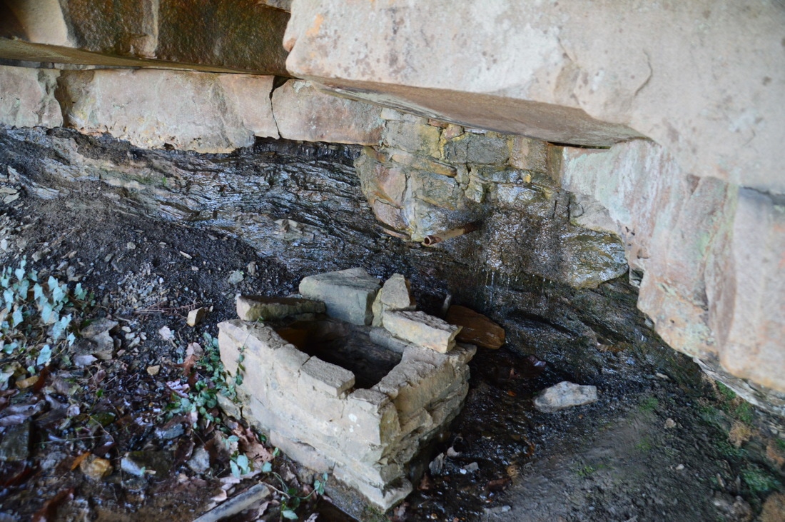
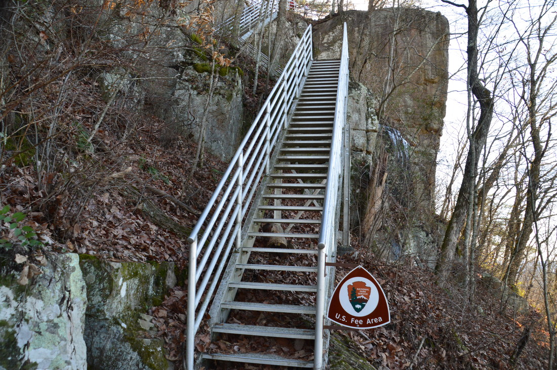
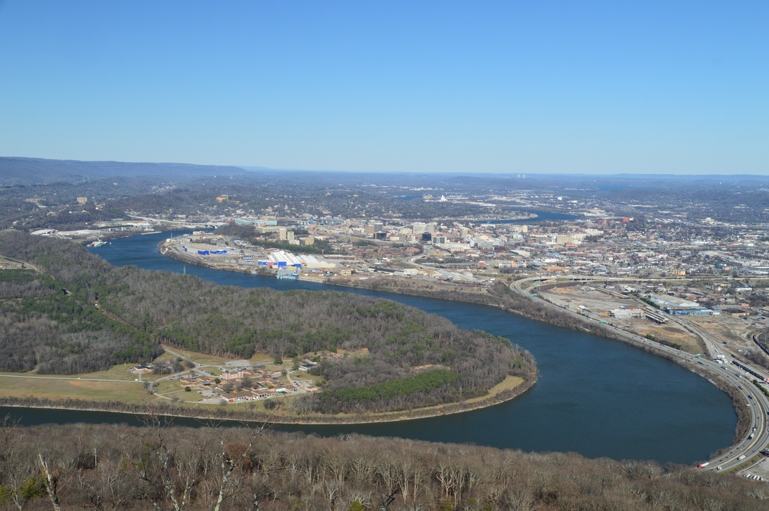
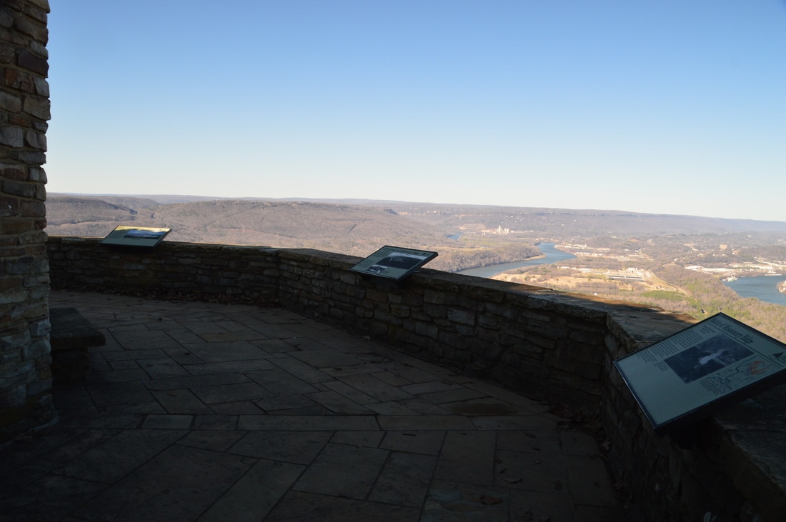
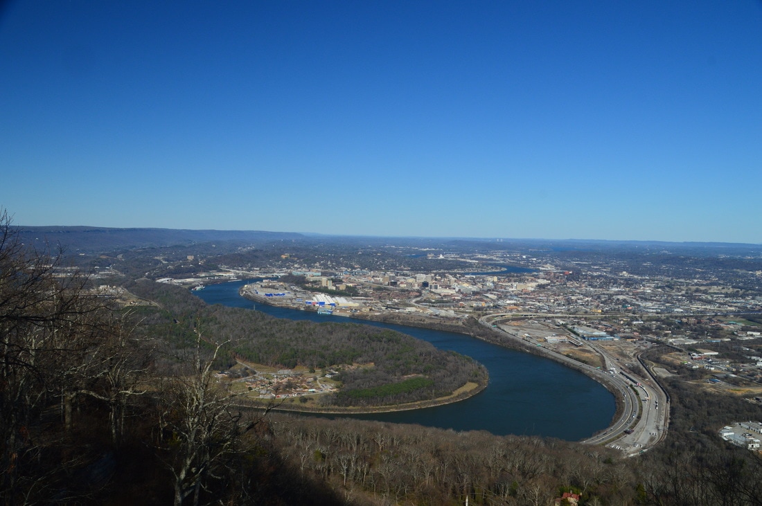
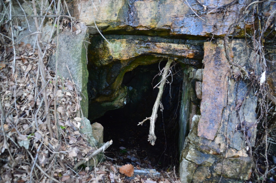
The Sunset Rock Trail continues to a residential area on Lookout Mountain, but to continue the hike, return to the Bluff Trail and turn right to follow it to Point Park. The Bluff Trail passes the base of the impressive cliffs that are home to the Sunset Rock vista up at the top. This is a popular climbing area. At 6.05 miles, there is a junction where the sign was missing when I did this hike. The Cravens House Trail bears left, while the Bluff Trail bears right; keep right to continue on the hike. At 6.4 miles, the trail reaches Rock Spring. This tiny spring comes out of a pipe from a rockhouse under a bluff. At 6.6 miles, the Bluff Trail reaches a junction with the Point Park Spur Trail. Once again, this spur trail must not be missed, as it leads to what I consider to be a top-notch vista and the best one on the hike. At the signed junction, there are some commemorating plaques. Turn right onto the side trail and ascend up a series of metal staircases. About 150 feet from the junction, you'll reach the top of the stairs, where there is a mediocre view west into Lookout Valley. To reach the main vistas at Point Park, turn left onto a paved path, which leads right by the Ochs Museum and to a large stone viewing area at 6.65 miles. This is the lower vista at Point Park,. This location is also known as Point Lookout. From this vantage point, there are spectacular views of downtown Chattanooga, the Tennessee River's picturesque Moccasin Bend, and much of the flat Tennessee River Valley northward. On a clear day, the Appalachian Mountains are visible far to the east. A major downside to the view is how crowded it is (due to easy access from the Point Park Trailhead), but nevertheless, there are few views in the area as picturesque as this one. The spot that you're standing on now is the site of the former Point Hotel, which was destroyed in 1910 just over a decade after Point Park became part of Lookout Mountain Battlefield.
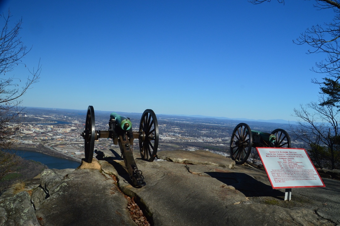
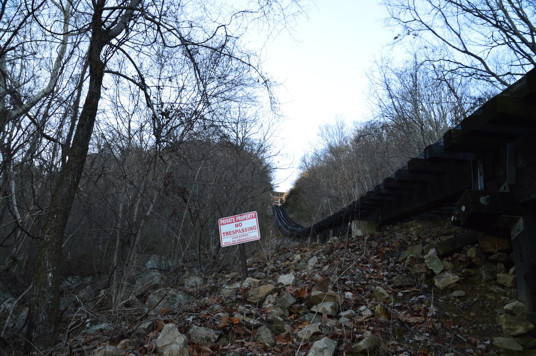
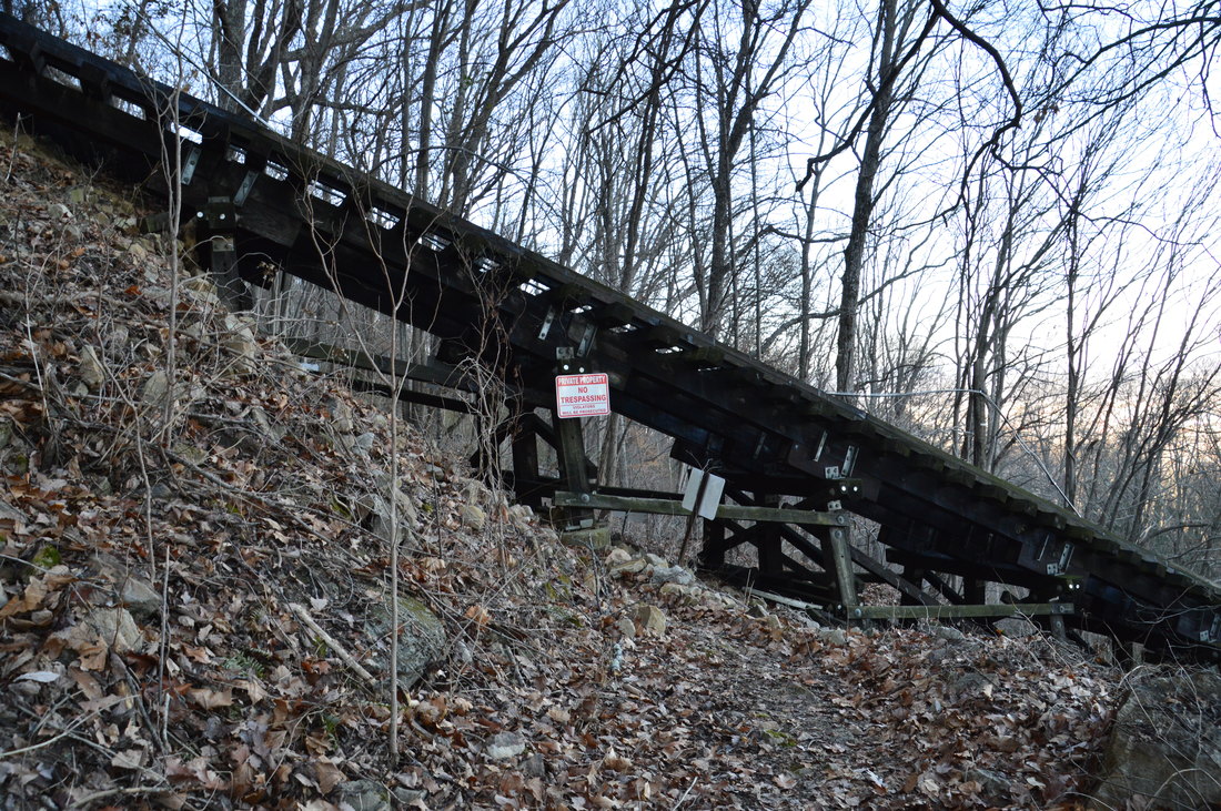
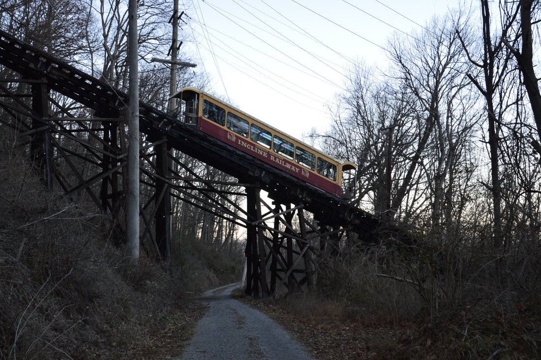
The paved path continues past the lower vista up to a second vista. To reach it, follow the paved path up some short flights of steps to a junction with a paved loop walkway at the core section of Point Park. A monument stands ahead in the middle of a large field. Turn left onto the paved loop walkway, and at 6.75 miles, reach a rock outcrop with a pair of historic cannons and a view. The view is similar to the one from lower vista, although it is actually slightly less expansive. The paved path continues to the Point Park Trailhead, which is at the north end of East Brow Road and West Brow Road. However, you do not have to go there. From this point, simply retrace your steps back to the Bluff Trail, and turn right onto it to continue following the loop. You have now seen the best views on the hike, but there are still many more points of interest ahead. Since Point Park and its viewpoints are the very north end of Lookout Mountain, the Bluff Trail now rounds the point and begins following the bluff line along the east brow of Lookout Mountain. After a switchback, the Bluff Trail ends at a junction with the Mountain Beautiful Trail at 7.35 miles. The Mountain Beautiful Trail goes both straight and acutely right. The straight route is a shortcut to Cravens House, but I highly recommend hiking the full loop, which can be done by turning acutely right. After the right turn, the Mountain Beautiful Trail descends gradually for some time before passing under the Incline Railway at 7.6 miles. There are numerous "Private Property" signs posted here, but what they mean is that you must not step off the trail and onto the railway; the trail itself is open for public use. The Incline Railway is a popular tourist destination on Lookout Mountain. After passing under the railway, the trail climbs back up to the base of the bluff line, using switchbacks. The next trail segment is very scenic, as the trail follows a bluff line that is even more impressive than the one on the west side. From time to time, houses are visible high above. 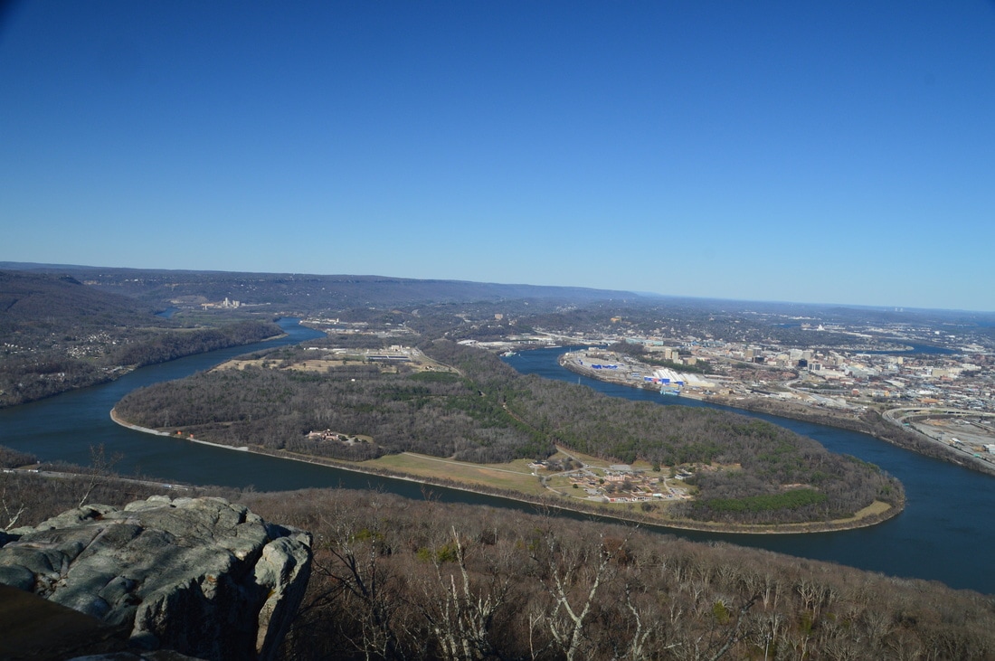
At Point Park, Moccasin Bend, vast segments of the Tennessee River, the surrounding valley, and downtown Chattanooga are all in the view.
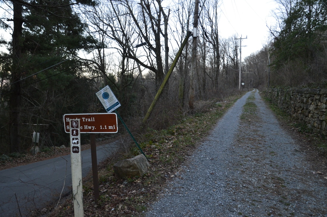
At 8.35 miles, the Mountain Beautiful Trail reaches Leonora Spring. This is a small but neat spring. A small stone springhouse was built around the spring, which trickles out from under the bluffs in a fashion similar to that of Rock Spring. Just past this point, I spotted a pair of vultures silently staring out from their vantage point on a nearby tree. After this, the trail begins descending, and after a pair of switchbacks, the Mountain Beautiful Trail ends at the Hardy Trail and at TN 148 at 8.5 miles. This is the far end of the loop. To continue following the loop, turn left onto the Hardy Trail, which is a gravel service road that is open to bikers as well. The Hardy Trail stays nearly level or slightly downhill the entire time. At 8.8 miles, there is an artificial clearing to the right with a view eastward across the Great Valley and toward the Appalachian Mountains that are over 35 miles away in Polk County. The Hardy Trail passes under the Incline Railway again at 9.15 miles. Then, after passing a few houses on private land just below and to the right of the trail, the Hardy Trail ends at the Cravens House Trailhead at 9.6 miles.
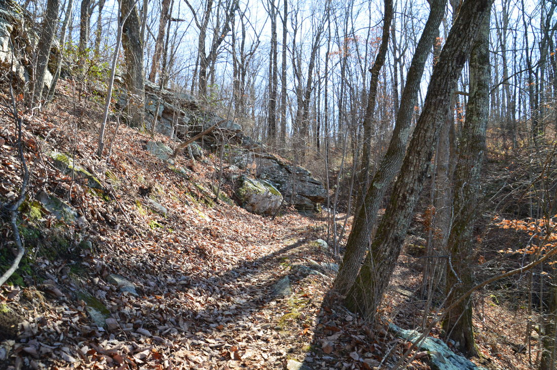
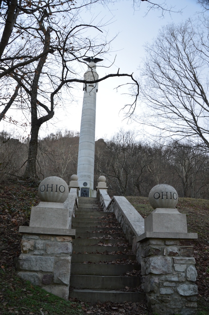
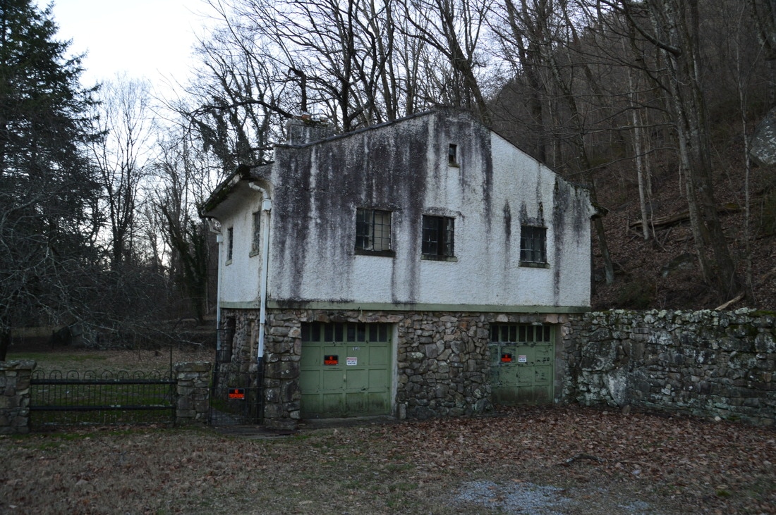
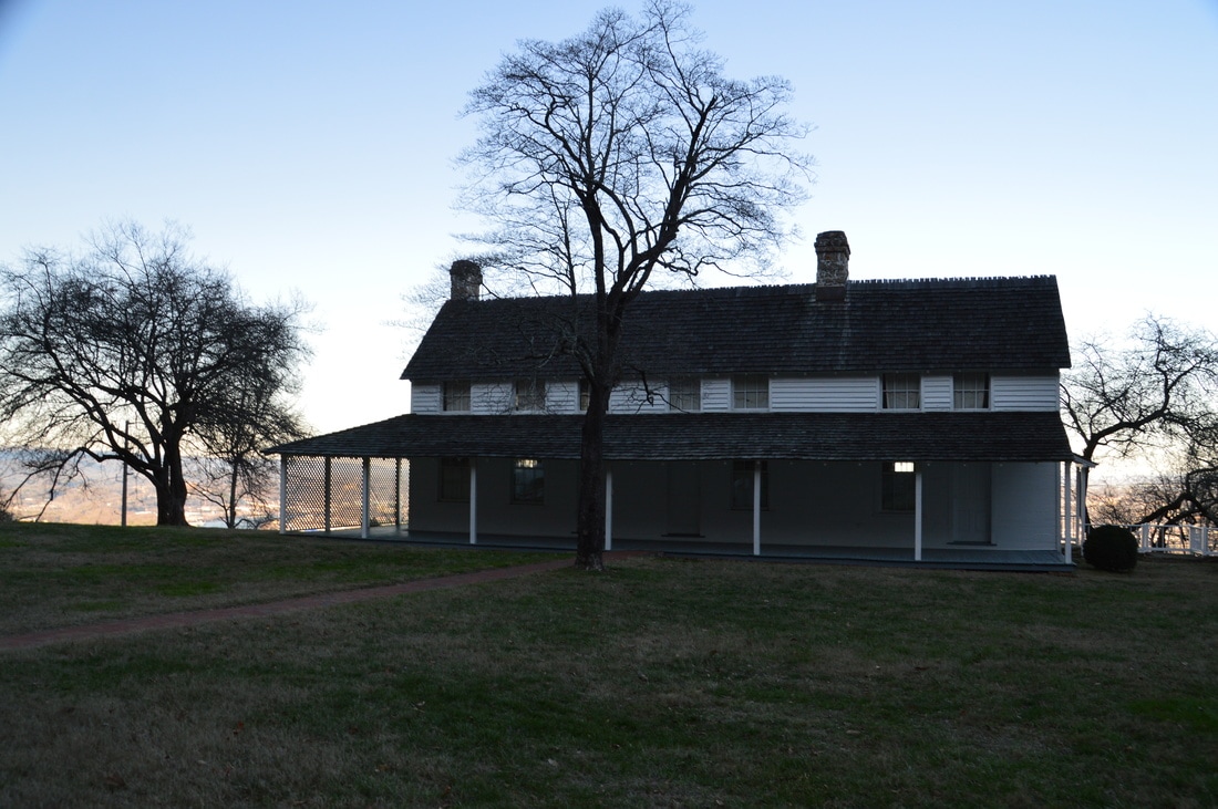
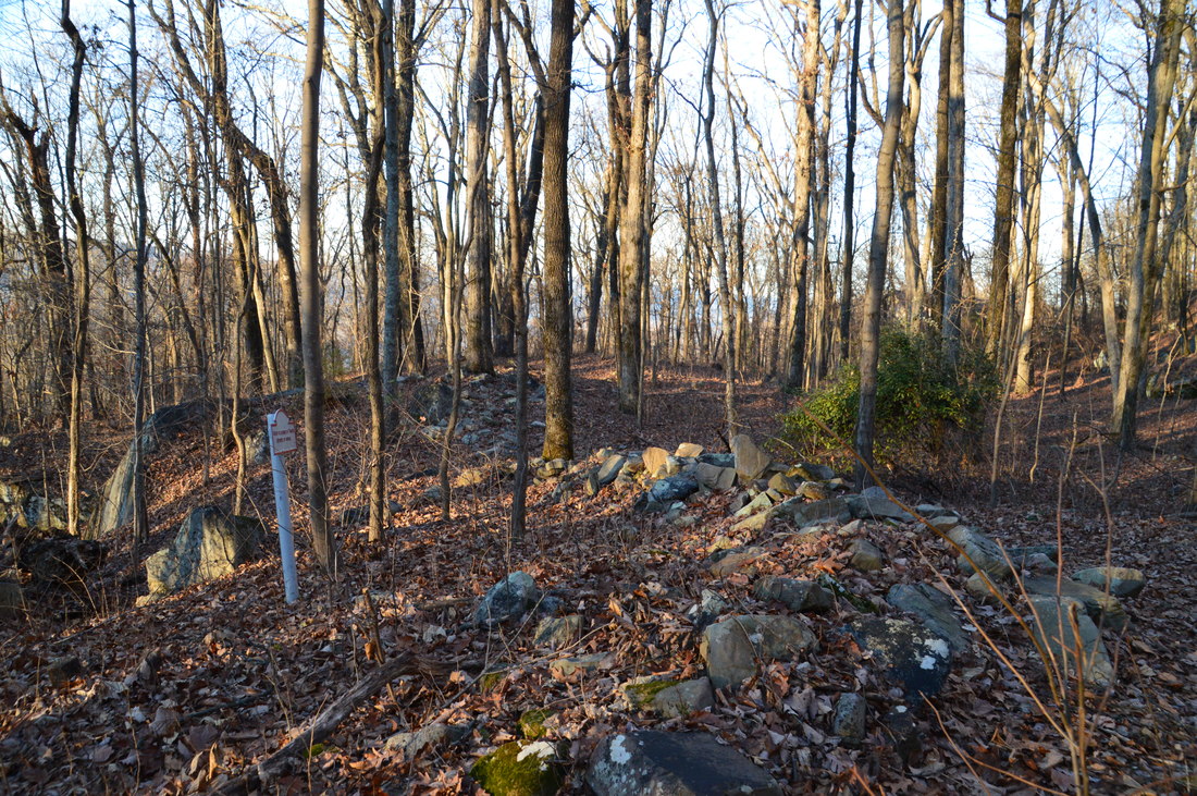
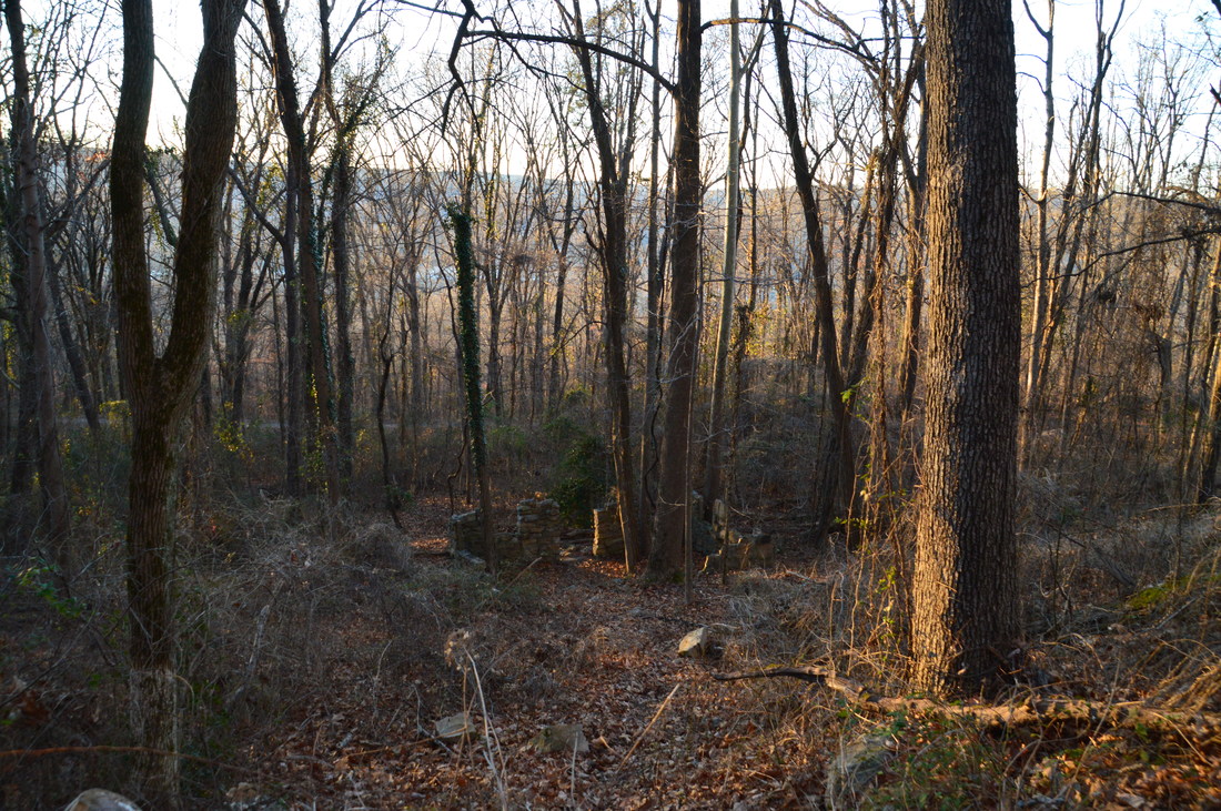
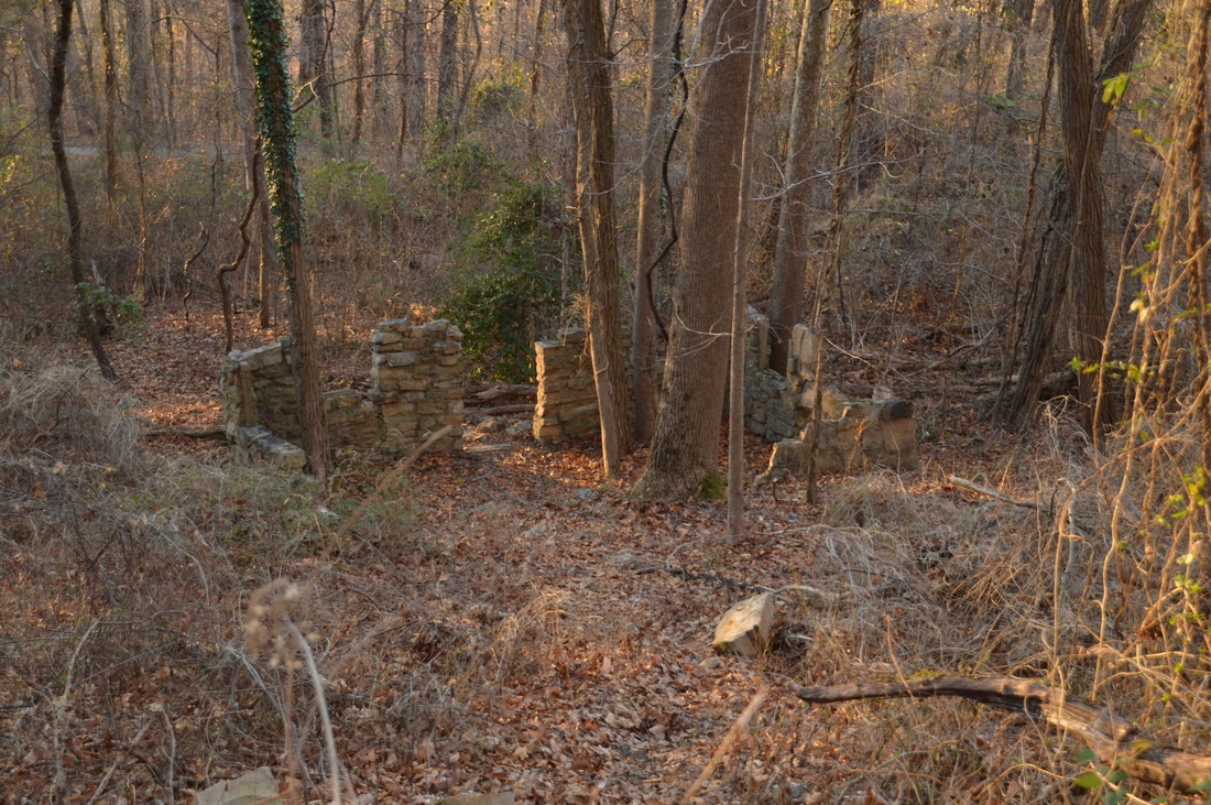
The Cravens House area is worth spending a few minutes at. There is a number of monuments in the vicinity, and the Cravens House itself is viewable. The first house at this site was built by Robert Cravens - an ironmaster - in 1856. However, the house became the headquarters of Confederate Brigadier General Edward C. Walthall when Confederate troops occupied Lookout Mountain in the fall of 1863. After the outnumbered Confederates lost the "Battle Above the Clouds" on Lookout Mountain, the house fell into the hands of Union troops, and the house was destroyed. The house was eventually rebuilt at the same location by Cravens after the Civil War. From the large cleared area at the house, there is another open view east toward Chattanooga. There is also a historic springhouse for Cravens House nearby; to see it, walk past the New York Monument and to the left of a small old building that is signed as a "Private Ranger Residence" (it does not appear to be occupied anymore). You should see a faint path that leads for a few feet to the arched entrance of the springhouse. After viewing the springhouse, walk back past the New York Monument and to the north end of the parking area, where the Cravens House Trail begins. Shortly past the beginning, a spur trail to the left leaves to the Pennsylvania and Illinois Monuments. About 0.1 miles from the beginning of the trail, there is a split at 9.95 miles. The Cravens House Trail bears left and uphill, but to hike the full loop, bear right on the unsigned Rifle Pits Trail. This trail descends by some earthworks (the "Rifle Pits") from the Civil War at 10.2 miles, before ending at 10.55 miles at the Upper Truck Trail. Turn left onto this trail to continue following the loop. The Upper Truck Trail is open to bikers as well as hikers, as it follows a wide and nearly level forest road that is great for biking. At 10.8 miles, a sign marks the ruins of Camp Demaray that are visible below and to the right of the trail. Camp Demaray was a CCC complex that was active through 1939, five years after the land became part of Chickamauga and Chattanooga National Military Park. In fact, most of the hiking trails at Lookout Mountain Battlefield were constructed by the CCC. Today, the walls of the camp still stand and can be seen from the trail. 
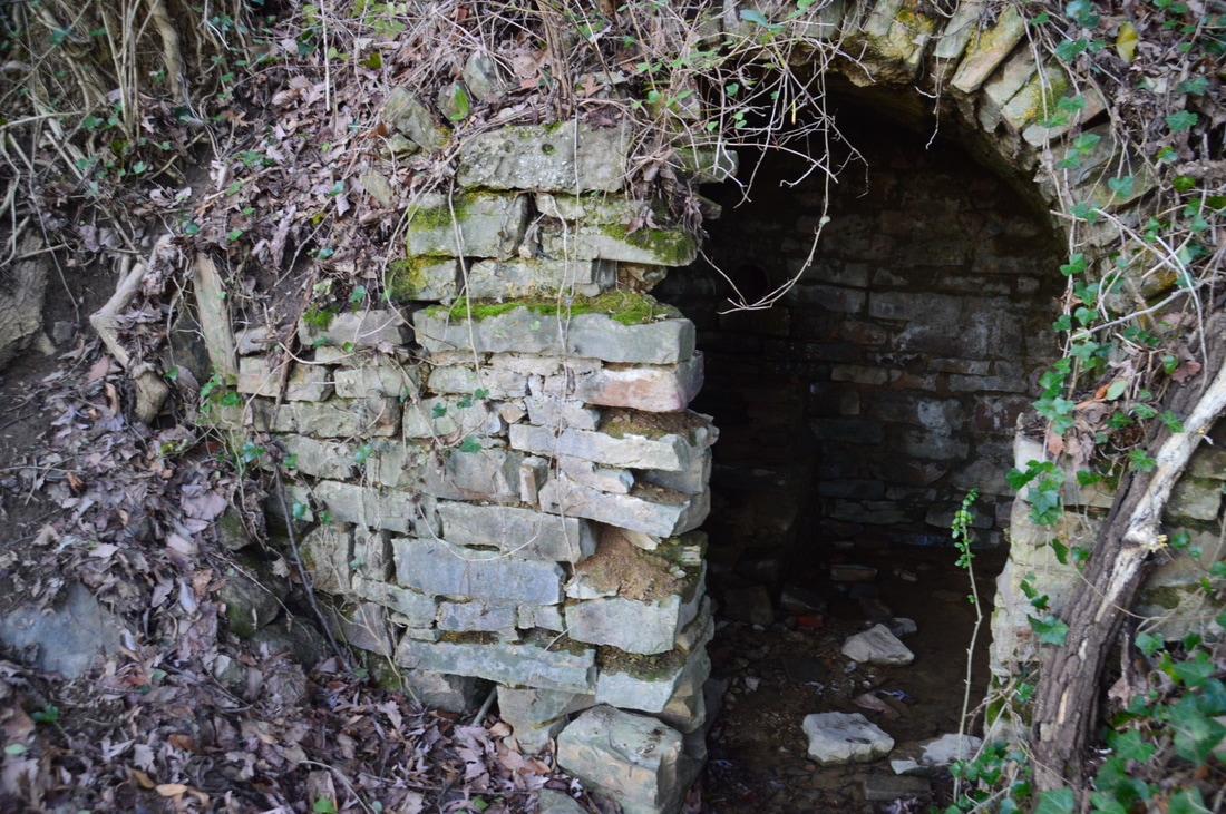
These walls are ruins of Camp Demaray, a CCC Camp that used to operate near the Upper Truck Trail on Lookout Mountain.
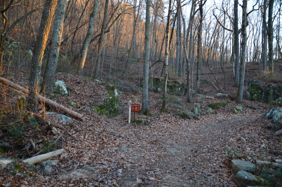
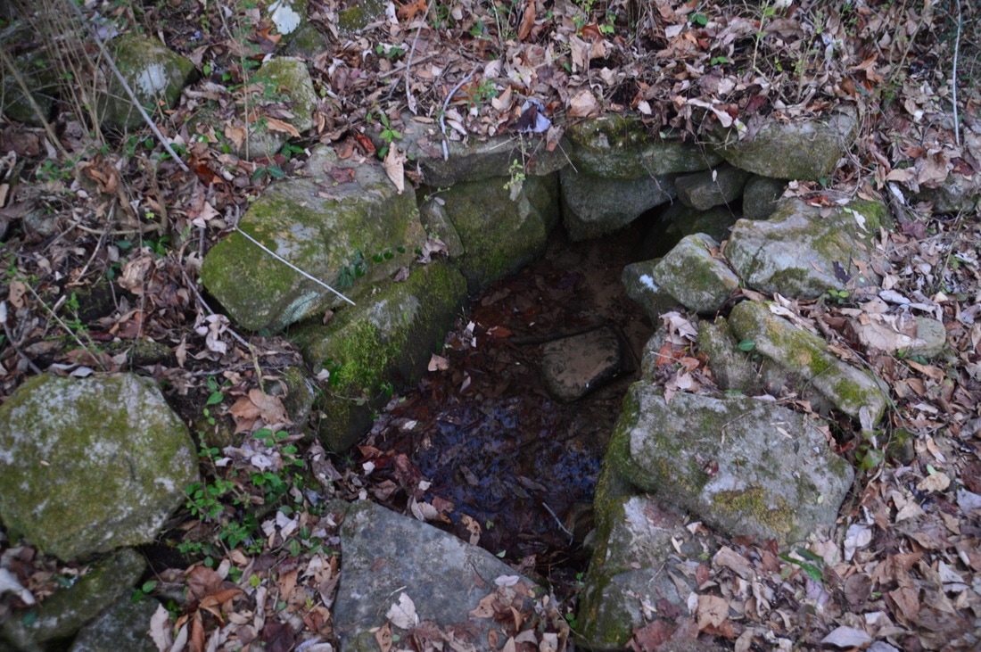
At 11.0 miles, bear left to continue on the Upper Truck Trail, as the Guild Trail leaves to the right in the direction of TN 148. At 11.1 miles, the Lower Gum Springs Trail leaves to the right. Just afterwards, the Gum Springs Trail leaves to the left; turn onto it to begin the ascent back to the Bluff Trail. Over the next 0.6 miles, you will ascend over 500 feet at a fairly steep grade. At 11.3 miles, pass Gum Spring to the left, which is highly water-dependent. The Gum Spring Trail reaches the Bluff Trail at 11.7 miles. This is where you should turn right onto the Bluff Trail and simply retrace your steps from earlier in the day back the Ochs Gateway Trailhead. Remember to bear left onto the Bluff Trail at the John Smartt Trail junction. You should return to the trailhead, at 14.8 miles, concluding the hike.
Mileage
0.0 - Ochs Gateway
1.35 - Jackson Gap Trail Vista 1.65 - Jackson Spring 5.3 - Sunset Rock 6.4 - Rock Spring 6.65 - Point Park (Lower Vista) 6.75 - Point Park (Upper Vista) 8.35 - Leonora Spring 9.6-9.85 - Cravens House Area 10.2 - The Rifle Pits 10.8 - Camp Demaray Ruins 11.3 - Gum Spring 14.8 - Ochs Gateway Variations
Hike out and back to Jackson Spring from Ochs Gateway - 3.3 Miles
Hike out and back to Sunset Rock from Ochs Gateway (without Jackson Gap Trail) - 6.4 Miles Hike out and back to Point Park Vistas from Ochs Gateway (without Jackson Gap Trail) - 9.3 Miles There are many other hiking variations and possibilities on Lookout Mountain. The Lookout Mountain Battlefield Trail Map is very useful in planning a hike at Lookout Mountain Battlefield. Bonus Stops
After the hike, consider making a quick stop at Natural Bridge Park - a Lookout Mountain City Park off TN 148 - where the Good Shepherd Natural Arch can be viewed.
PicturesVideos
0 Comments
Leave a Reply. |
About MeMark Oleg Ozboyd Dear readers: I have invested a tremendous amount of time and effort in this website and the Georgia Waterfalls Database the past five years. All of the work that has gone in keeping these websites updated with my latest trip reports has almost been like a full-time job. This has not allowed me to pick up a paid job to save up money for college, and therefore, I I've had to take out loans. If you find the information on this website interesting, helpful, or time-saving, you can say "thanks" and help me out by clicking the button above and making a contribution. I will be very grateful for any amount of support you give, as all of it will apply toward my college tuition. Thank you!

Coming in 2022-2023?
Other Hiking WebsitesMiles HikedYear 1: 540.0 Miles
Year 2: 552.3 Miles Year 3: 518.4 Miles Year 4: 482.4 Miles Year 5: 259.9 Miles Archives
March 2021
Categories
All
|


 RSS Feed