Imagine a large mountain waterway winding its way through a wilderness for nearly a dozen miles with zero road access. Picture a rugged, little-traveled pathway following this waterway, crisscrossing the creek many times through deep, slick fords, circumnavigating countless blowdowns and rock scrambles. There, you've discovered the Slickrock Creek Trail! This is the best creek trail I've ever walked in the Southern Appalachian Mountains, and I'm not even exaggerating. Nowhere else have I found a combination of such remote beauty and rugged wilderness trail, which never follows any of the logging roads customary to most North Carolina waterways. As if you needed more incentive to tackle this hike, the Slickrock Creek Trail features two secluded waterfalls - Wildcat Falls and Lower Falls - with swimming holes that couldn't be any more refreshing after a long summer day in the backcountry. This hike occurred on Saturday, September 15th, 2018. My plan was to day hike a lengthy loop through the heart of the Joyce Kilmer-Slickrock Creek Wilderness backcountry. I would start off along the Slickrock Creek Trail at Cheoah Dam along US 129, but before long, I would take the Ike Branch Trail. At Yellowhammer Gap, I would pick up the Yellowhammer Gap Trail, followed by the Nichols Cove Trail and Windy Gap Trail. The Windy Gap Trail would finally bring me to Slickrock Creek, from where I'd spend the rest of the day tracing the Slickrock Creek Trail back to US 129.
Summary
R/T Length of Trail: 14.2 Miles
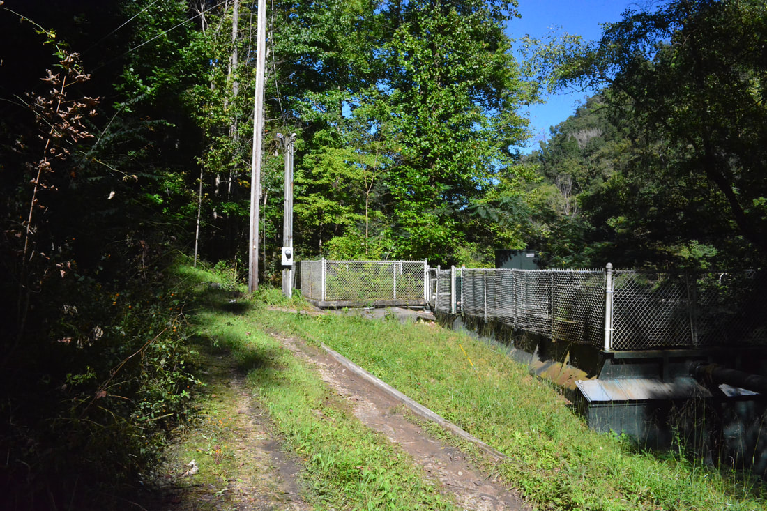
Duration of Hike: 8:30 plus 2.5 hours of stopping Type of Hike: Lasso Difficulty Rating: 8 out of 10 Total Elevation Gain: 3,429 Feet Pros: Remote, scenic trail along Slickrock Creek with many backcountry campsites Cons: Some portions of the Slickrock Creek Trail can be pretty technical; the first half of the hike might feel like a bit of a drag at times Points of Interest: Wildcat Falls - 8 stars; Lower Slickrock Creek Falls - 6 stars; Trail Blaze Colors: None, as trails within the Joyce Kilmer-Slickrock Wilderness are unblazed. Most trail junctions and crossings of Slickrock Creek are signed. Best Seasons to Hike: Summer Fees: None Beginning Point: Cheoah Dam Trailhead Directions from Robbinsville, NC: From the intersection of NC 143 West (Cherohala Skyway) and US 129 north of downtown Robbinsville, follow US 129 North for 14.2 miles to the Little Tennessee River bridge immediately below Cheoah Dam. Just before the bridge, look for an obscure gravel road leading into the woods to the left. Drive down the road for about one-tenth of a mile to what appears as some kindof minor water quality/treatment station. Do not attempt to drive further; park in the wide space just before the station. There's space for a few cars without blocking the road and trail. Map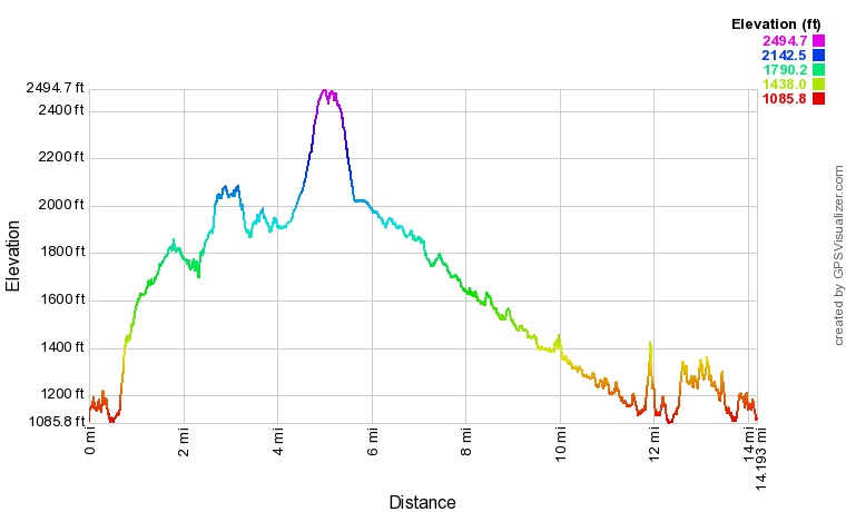
Click the link below to download a .GPX file with a track of this hike.
Details
On this mid-September weekend, the remnants of Hurricane Florence were barrelling inland into the Carolinas and Georgia, and the threat for high winds had entirely closed down the Great Smoky Mountains National Park and many popular recreation areas throughout the national forests. While these circumstances made it quite difficult for me to find an accessible hike that I hadn't done yet, it also worked in my benefit, because the threat of rough weather had apparently scared everyone away from the trails, yet in fact, the entire day was perfect as it stayed partly cloudy with no rain and light winds.
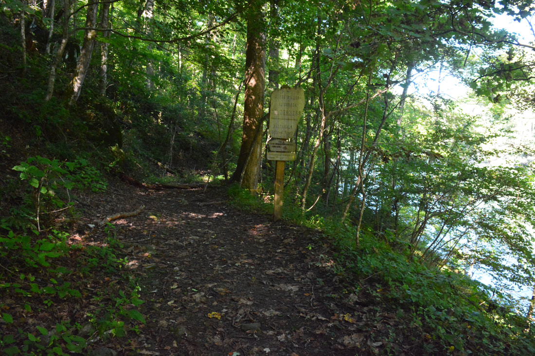
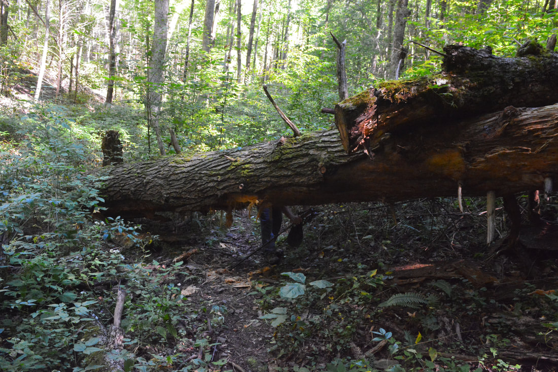
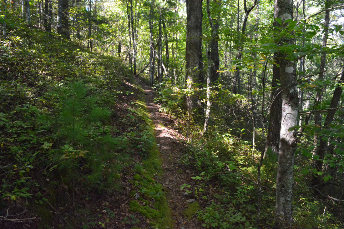
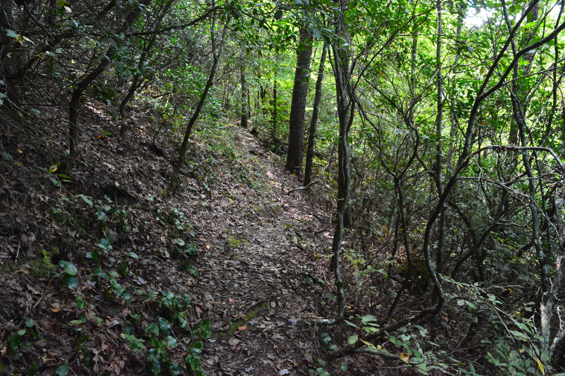
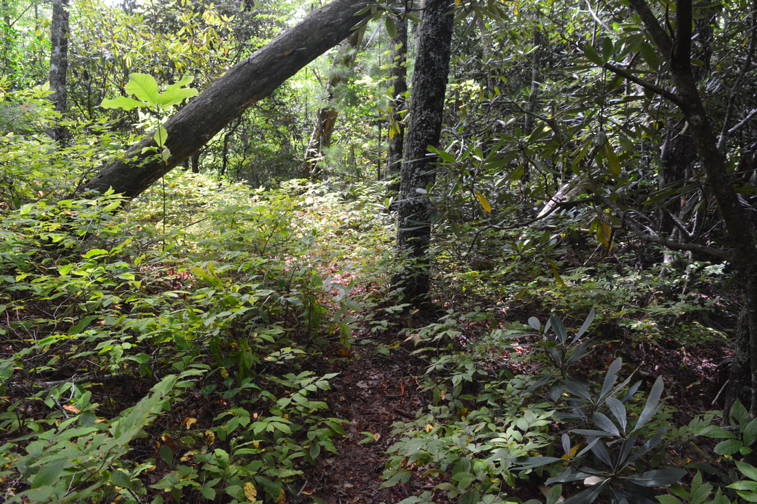
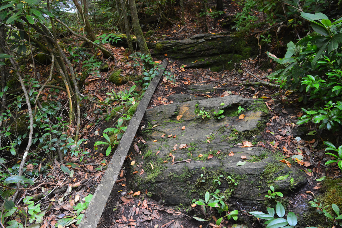
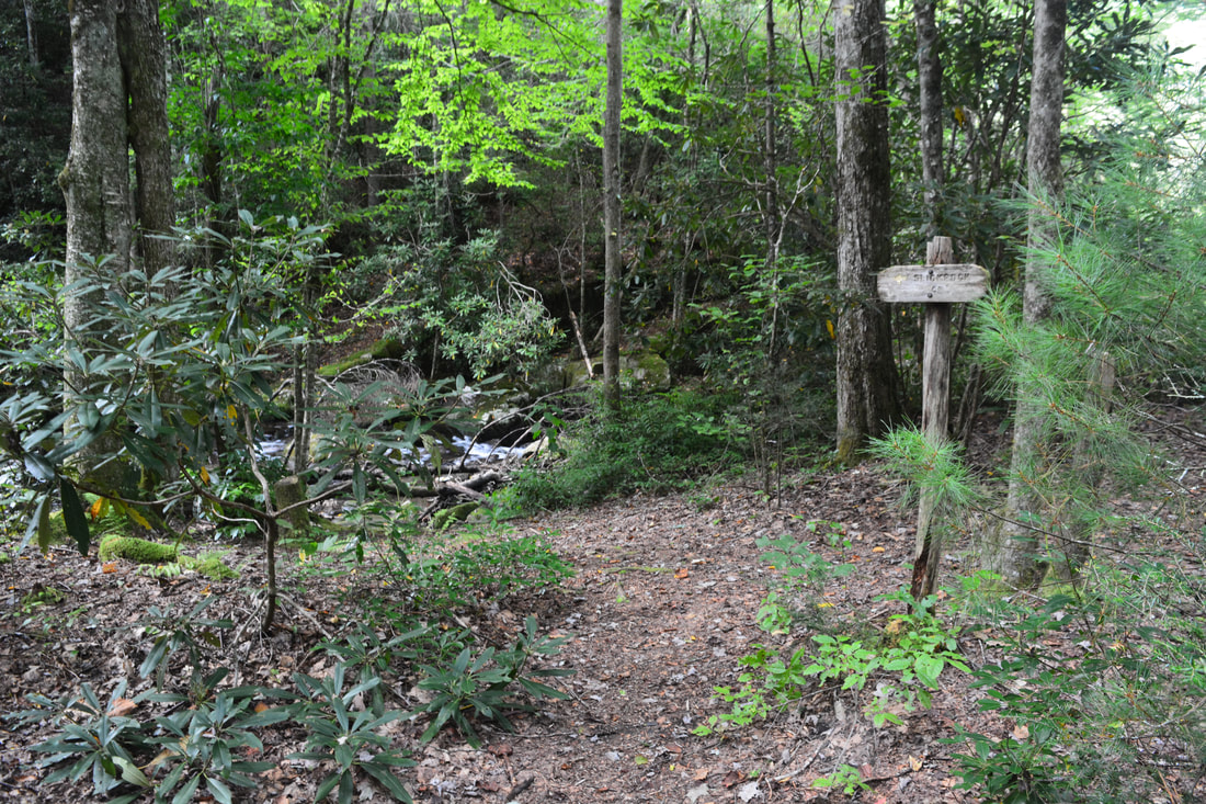
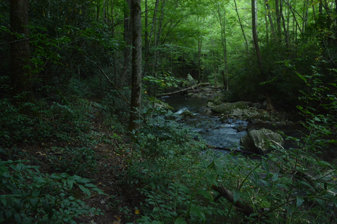
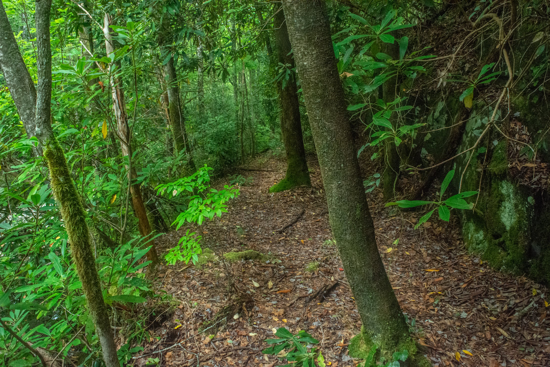
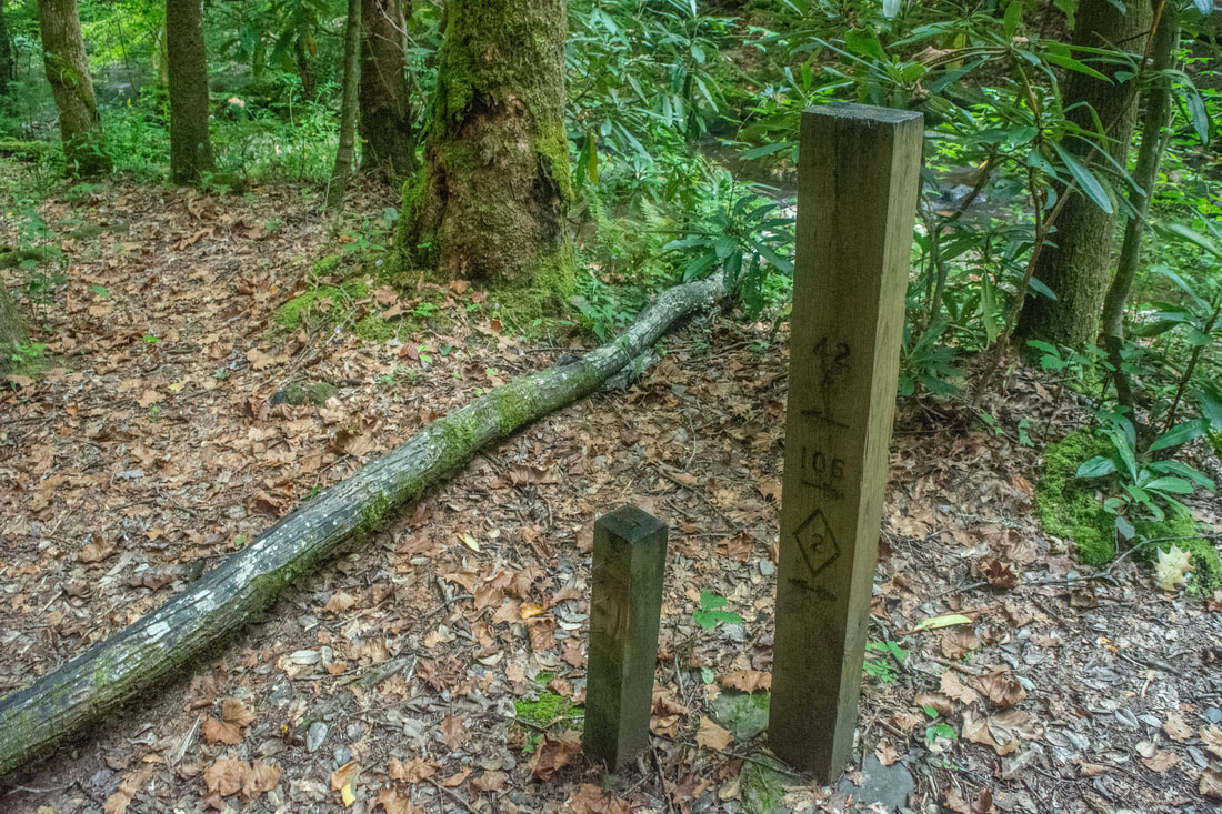
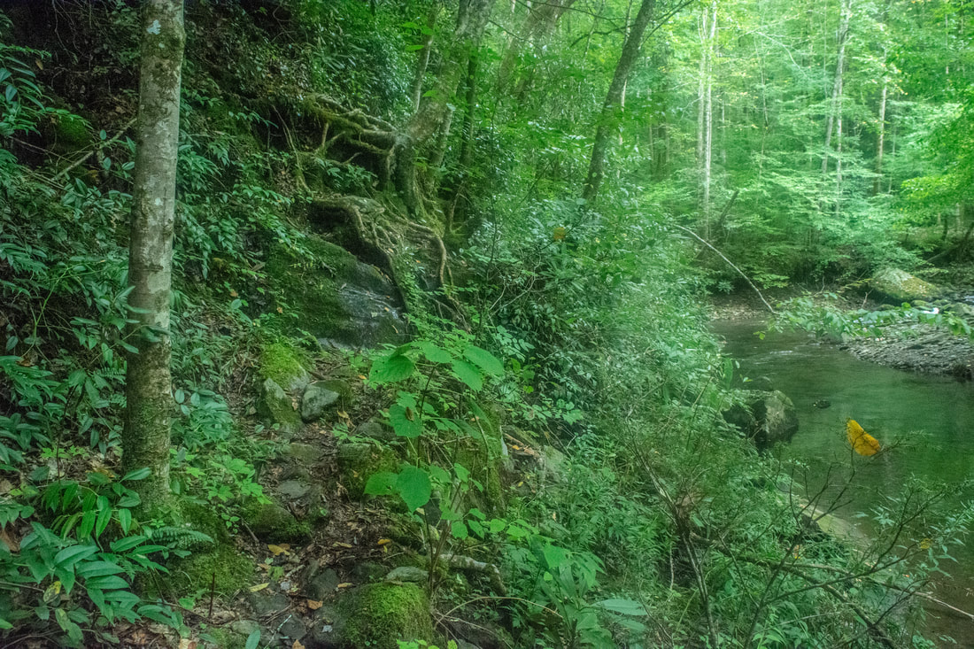
Start off the hike by walking past the Joyce Kilmer-Slickrock Wilderness sign onto a level old logging road grade. You are now walking along the Slickrock Creek Trail (#42) within the 17,394-acre Joyce Kilmer-Slickrock Wilderness, not only a vital area of protection for the vast remote land on the north side of the Cherohala Skyway west of Robbinsville, but also an important link to the adjacent Citico Creek Wilderness in Tennessee. Combined together, these two wilderness area feature one of the largest remaining wild areas in the Southeastern US, crisscrossed by miles of little-traveled pathways. It is no wonder that Slickrock Creek is one of the most scenic and remote streams I've had the pleasure of hiking miles along in years of Southern Appalachian exploring. The trail initially stays nearly level as it narrows to a single-track footpath and passes through a few muddy spots. The upper reaches of Lake Calderwood along the Little Tennessee River are visible about 100 feet below the trail. At 0.7 miles, reach a junction with the Ike Branch Trail (#45), usually marked by a wooden sign. I prefer hiking this loop clockwise, as the east side of the loop features a lot more of rollercoaster-type elevation gain, and gently hiking downhill along the refreshing waters of Slickrock Creek is a much more pleasant second half of the hike. Therefore, turn left on the Ike Branch Trail to begin the loop section of the hike. From the stinging nettle and blowdowns, it immediately becomes apparent that this slim pathway receives much less traffic and maintenance. The trail climbs very steeply up the ravine formed by Ike Branch and reaches a crossing of this small stream when the ascent moderates at 0.9 miles. After crossing the stream once more, the Ike Branch Trail continues a moderate ascent up this remote valley. The trail passes a little-used campsite on the left at 1.6 miles and shortly tops out in a gap along a low ridge. After this, the trail follows an elongated U-shaped curve along a level grade around a knob, providing seasonal views into the Slickrock Creek gorge on the right, before reaching a junction with the Hangover Lead Trail at 2.3 miles. 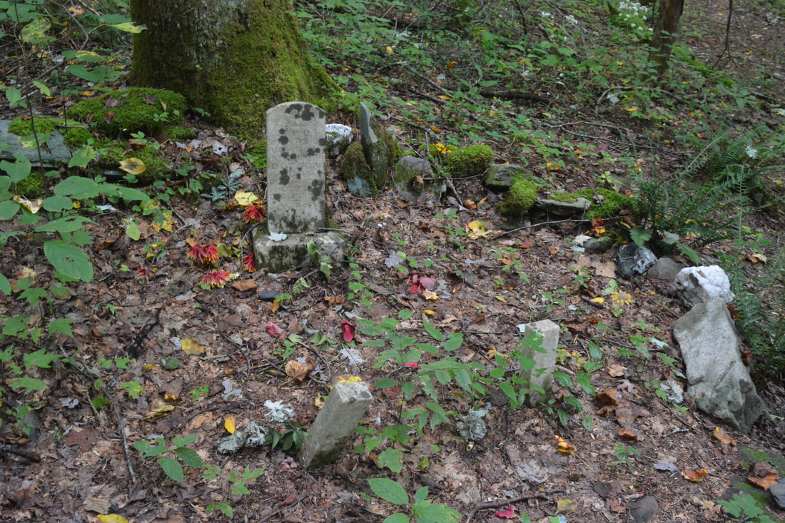
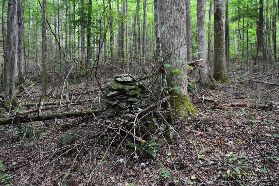
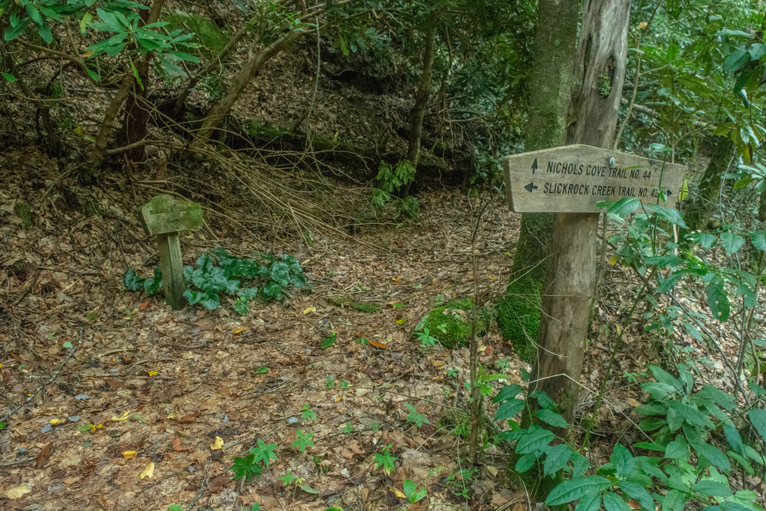
This ancient and tiny cemetery is a curious sight found at the Yellow Hammer Gap/Nichols Cove Trail junction.
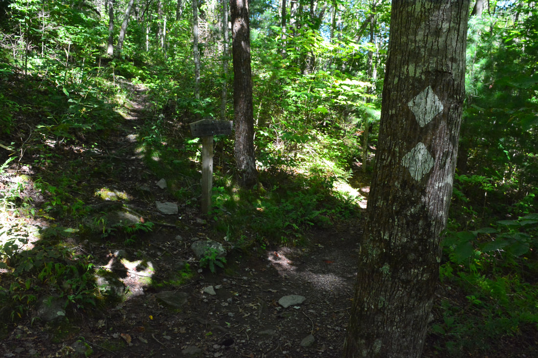
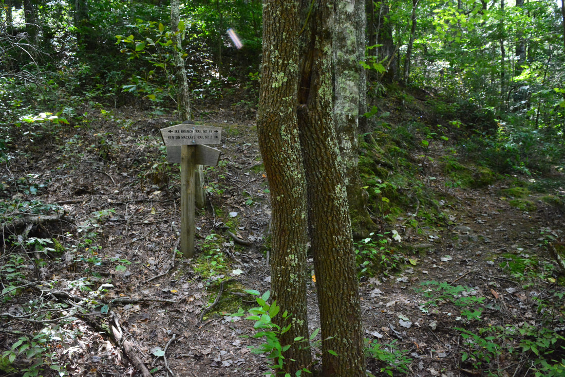
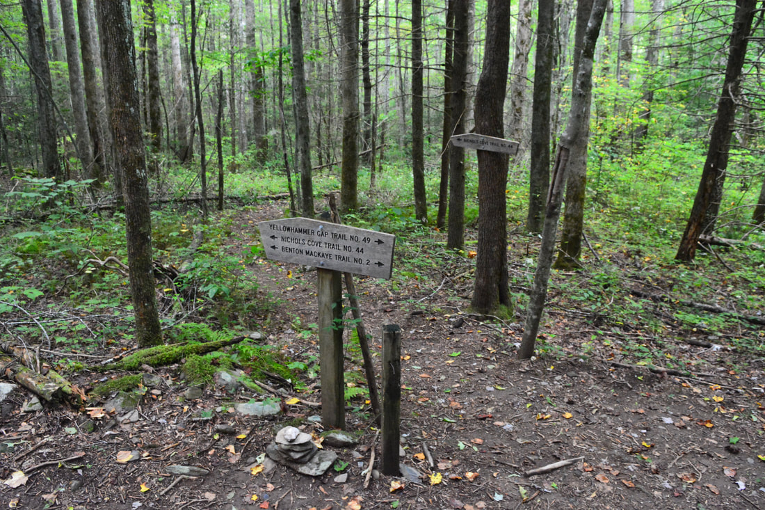
At the junction, the Hangover Lead Trail (#56) and reaches Yellow Hammer Gap in 100 feet. There, the Hangover Lead Trail turns right and begins an extremely steep ascent along the Hangover Lead ridge, eventually leading to a parking area at Big Fat Gap. Another trail that leaves Yellow Hammer Gap is a newly-constructed section of the Benton MacKaye Trail (#2), which leads to Tapoco Lodge at US 129, eliminating the former very dangerous roadwalk that BMT thru-hikers had to do along US 129. This hike continues straight on the Yellow Hammer Gap Trail (#49) in conjunction with the Ike Branch Trail at the initial junction (100 feet west of Yellow Hammer Gap). You are also briefly joining the Benton MacKaye Trail, which you may see marked by white diamond blazes. I also noticed some faded white diamonds along the Ike Branch Trail, indicative of that being the BMT's former route. At 2.4 miles, the Ike Branch Trail (#45) splits right, reaching Slickrock Creek in 0.6 mile. This connector can be useful if you would just like to do a short half-day loop hike without delving into the heart of the Slickrock Creek backcountry. Meanwhile, this hike bears left and uphill on the Yellow Hammer Gap Trail.
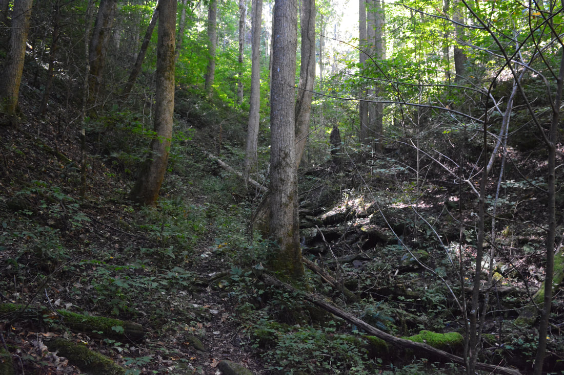
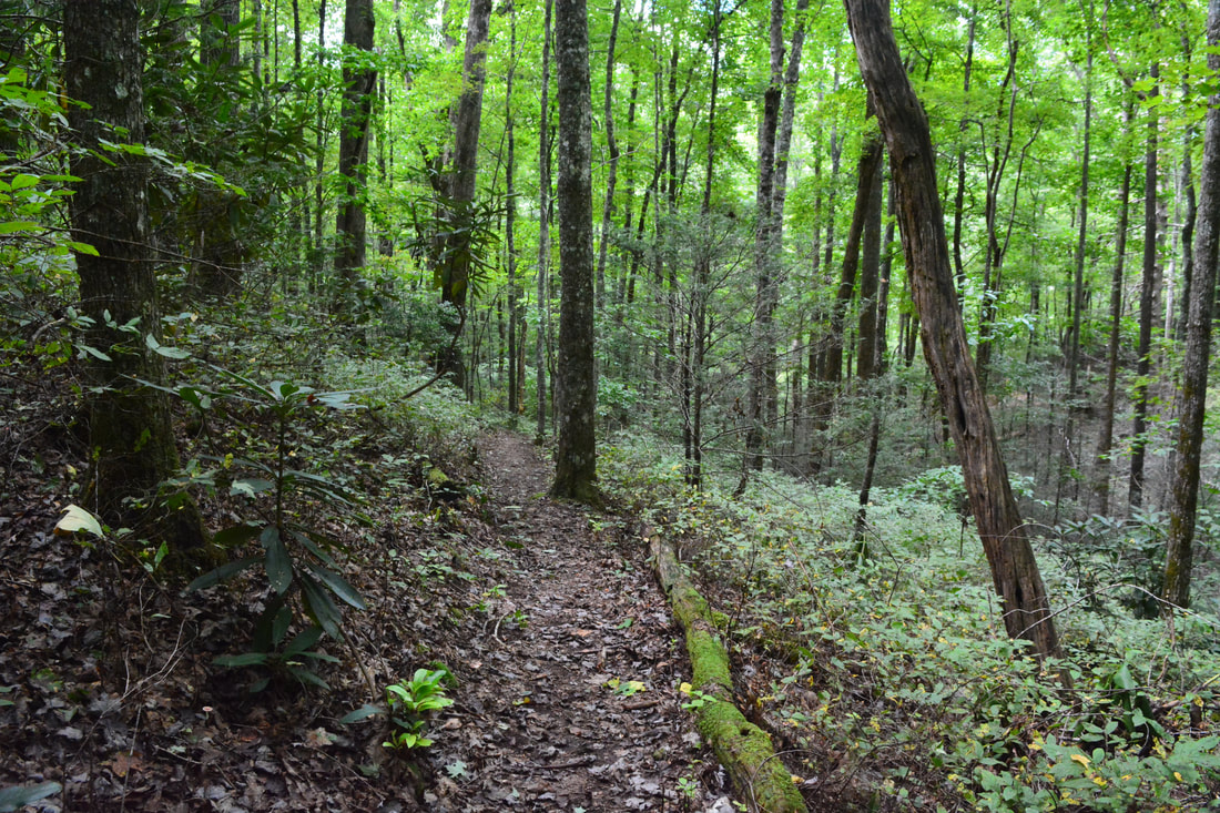
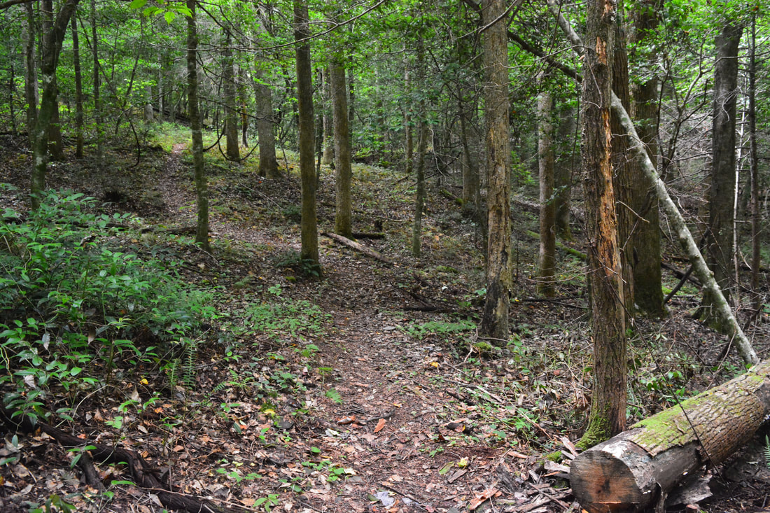
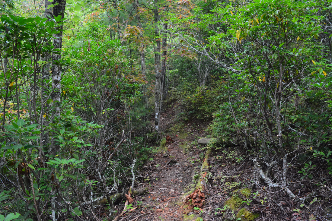
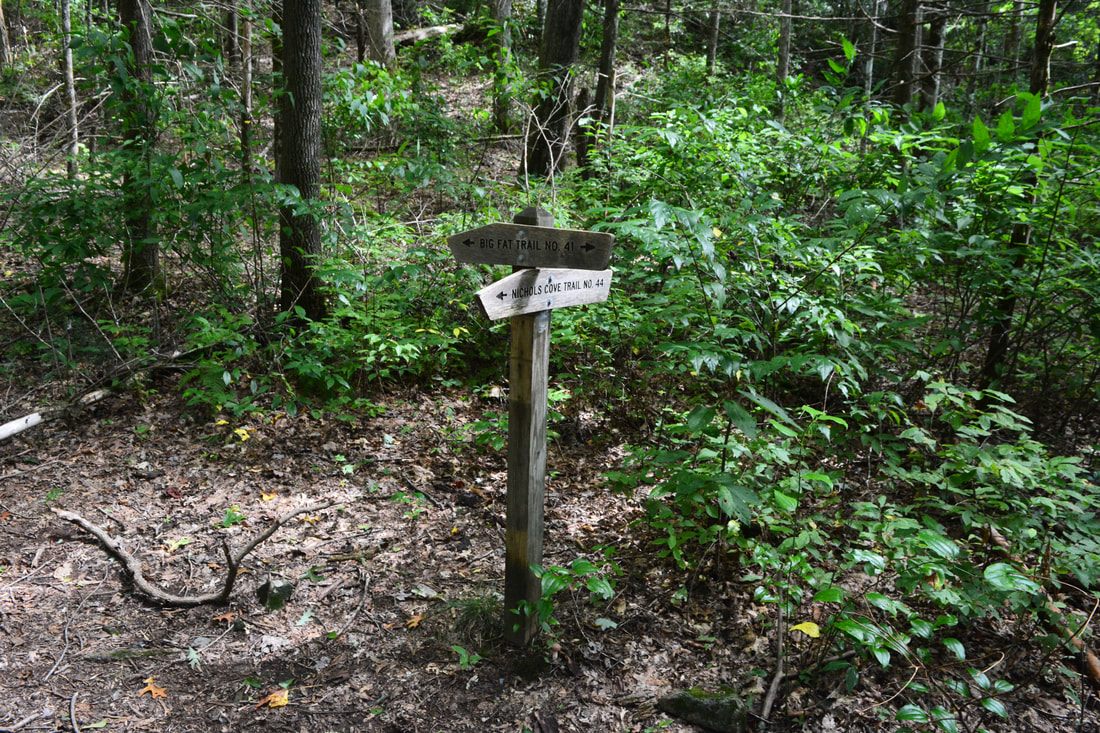
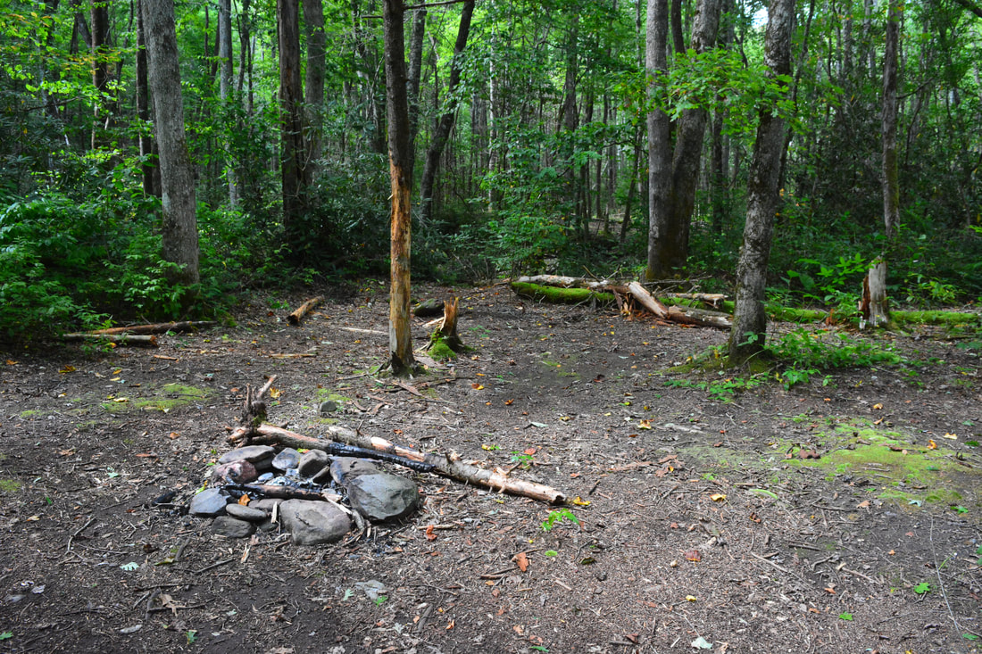
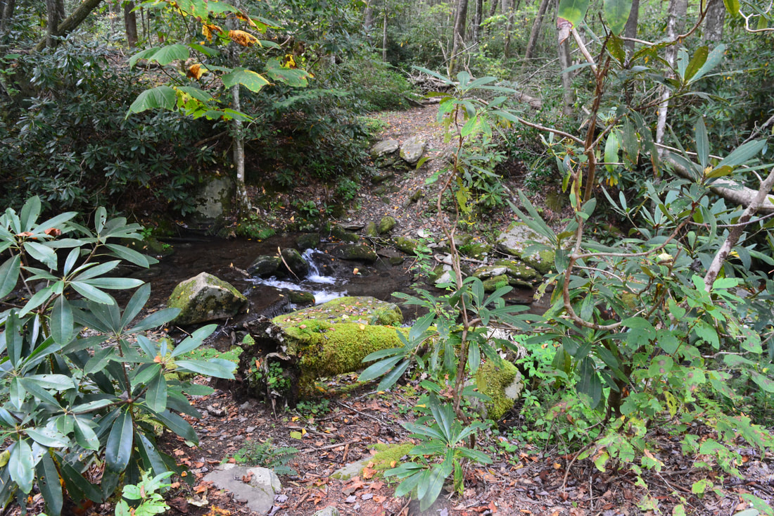
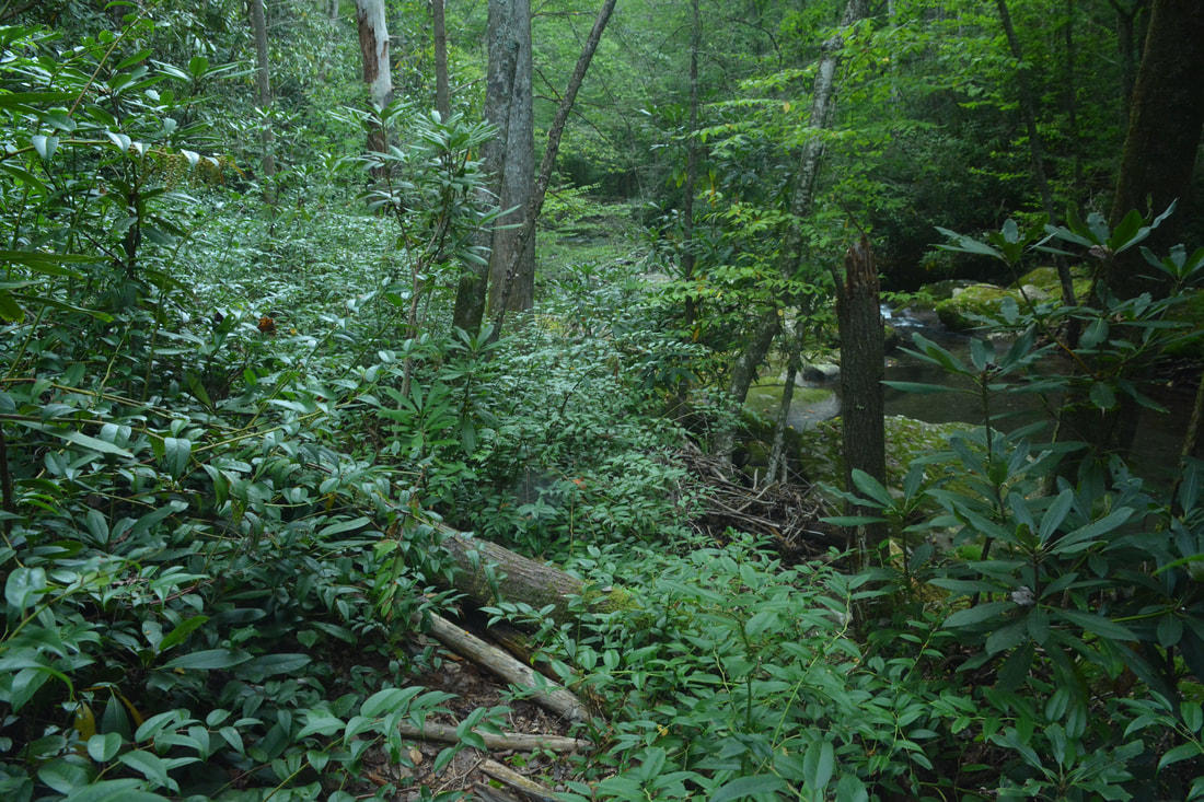
The hike follows the Yellow Hammer Gap Trail for the next 1.7 miles. The trail feels surprisingly long, thanks to the constant up-and-down formed by numerous spurs of Hangover Lead that the trail constantly crosses. There is essentially no flat ground on this trail, and some of the ascents are quite steep, so I'd definitely hike the loop in this direction to get this section done first. On the flip side, this is one of the best-manicured trails on the hike, having undergone a recent revamp that significantly improved the trail's grade. At 4.1 miles, the Yellow Hammer Gap Trail ends at a junction with the Nichols Cove Trail (#44). The Nichols Cove Trail turns right and follows Nichols Cove Branch for about 1.5 miles to Slickrock Creek. The Nichols Cove Trail also continues straight, where this hike is headed. Before continuing on, however, take a moment to gaze at the interesting little cemetery fenced in on the junction's left. The cemetery contains just a single headstone; if you wander through the woods above it, you may run into the remains of a chimney. The Nichols Cove Trail begins an easy climb through shady flats into the upper reaches of the Nichols Cove Branch valley. The ascent becomes steeper at 4.6 miles, and the trail soon leaves the valley and enters a tight mountain laurel tunnel as it gains elevation. The trail tops at a junction with the Windy Gap Trail (#400) at 5.0 miles, the hike's highest point at elevation 2,500 feet. You have climbed roughly 600 feet since the cemetery. The Windy Gap Trail leads left 1.4 miles to a parking area at Big Fat Gap. Meanwhile, this hike continues straight on the Nichols Cove Trail, beginning the plunge to Slickrock Creek. What you'll instantly notice is that the trail becomes much lesser-traveled and overgrown beyond this point. In fact, this was probably the most remote trail of the hike, the faint path constantly weaving across deadfall and often being hard to discern. At 5.7 miles, the trail enters a disorienting flat area with campsites near Slickrock Creek. Just try to walk across and look for a semi-obvious spot where you cross a small stream (Big Fat Branch). On the other side, the Nichols Cove Trail ends at a junction with the Big Fat Trail (#41). The Big Fat Trail is a newer trail leading from the Big Fat Gap parking area, and serves as the quickest and most popular access point for folks wishing to see Slickrock Creek. 
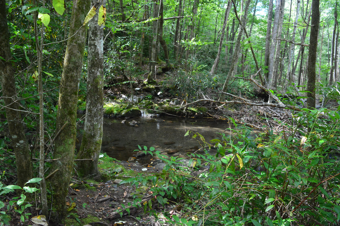
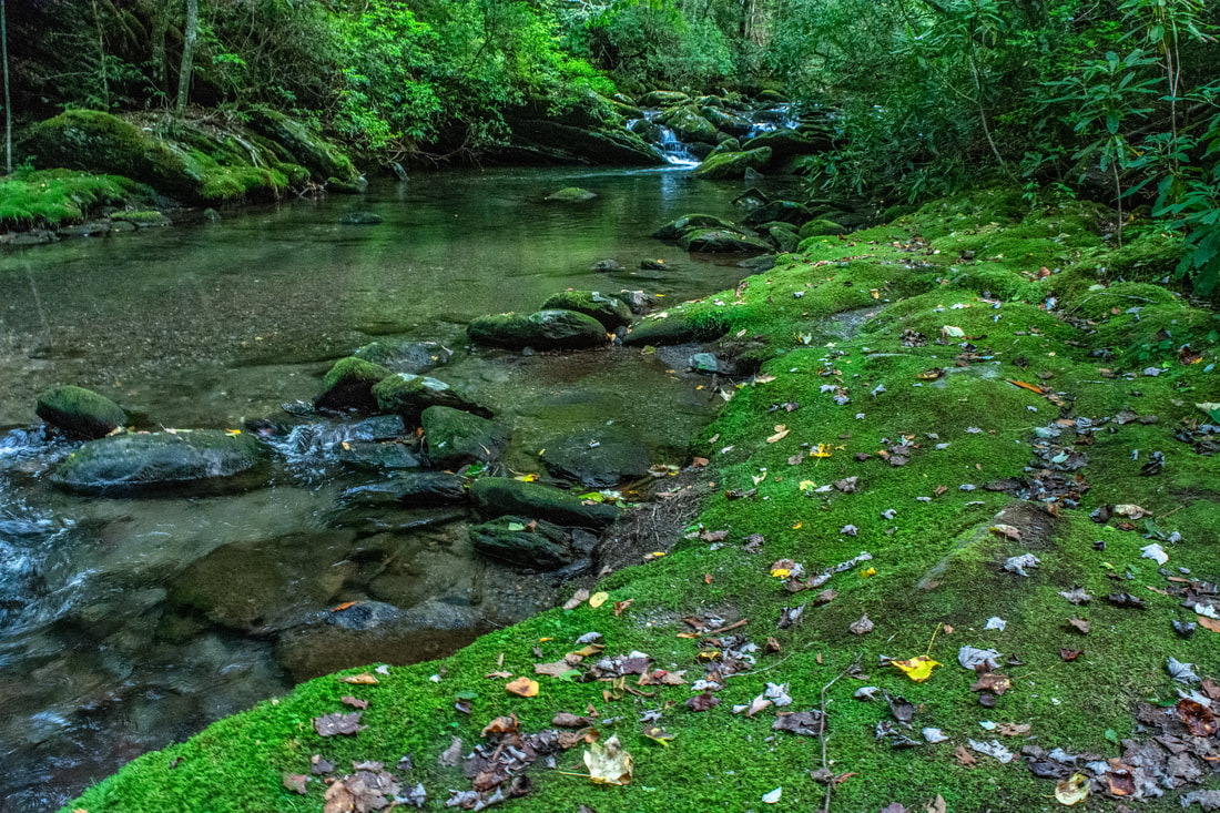
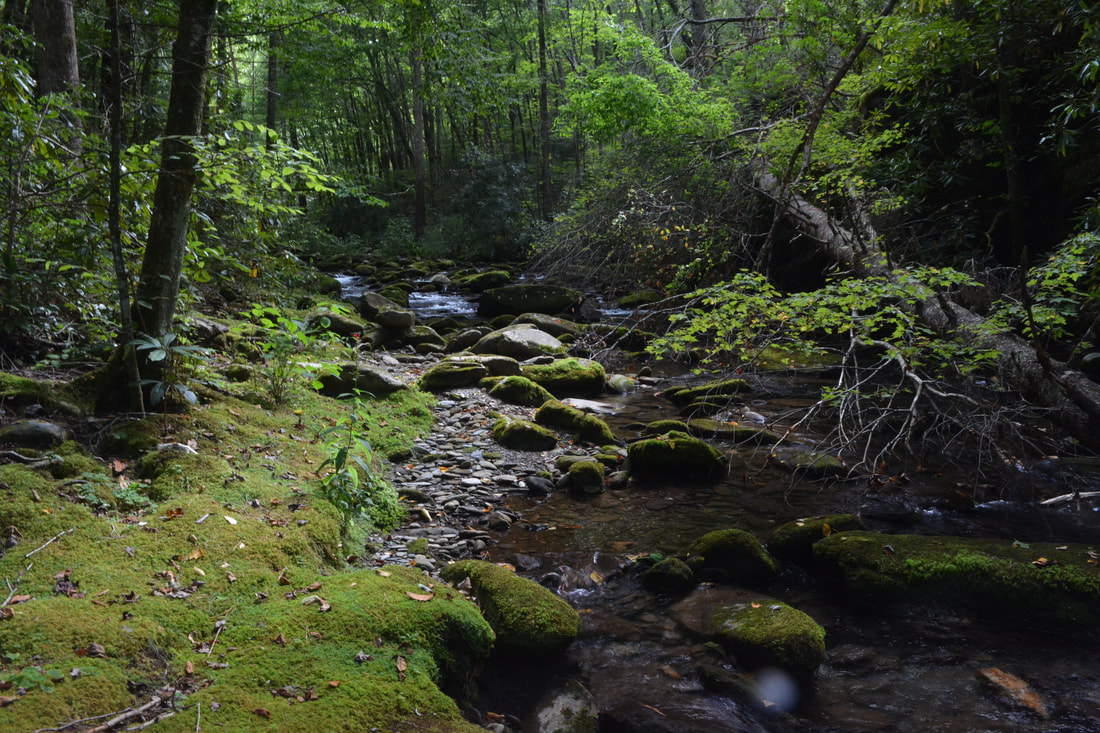
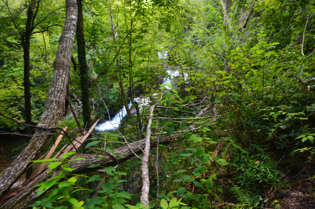
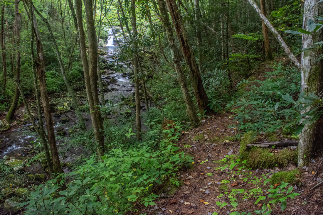
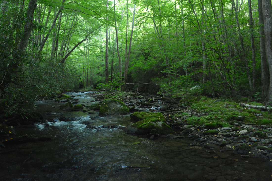
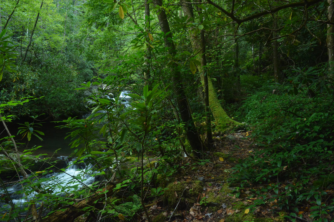
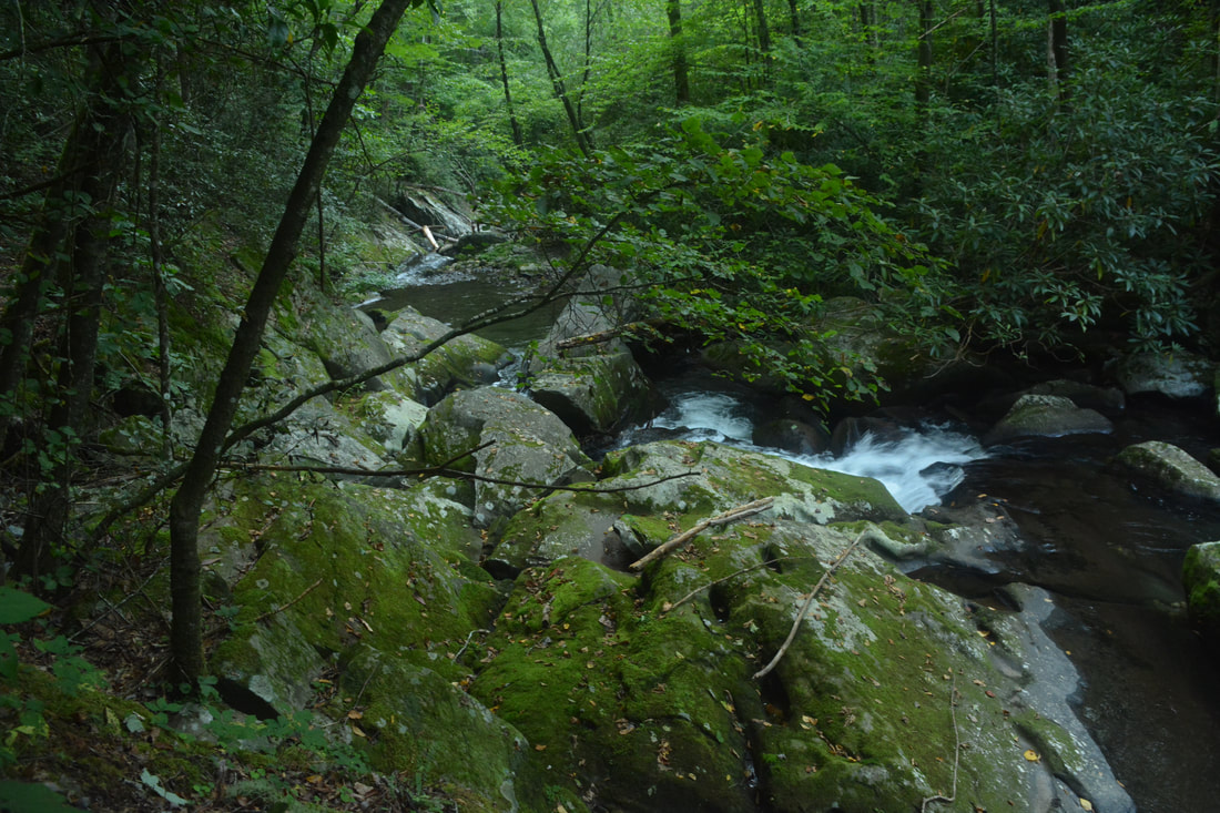
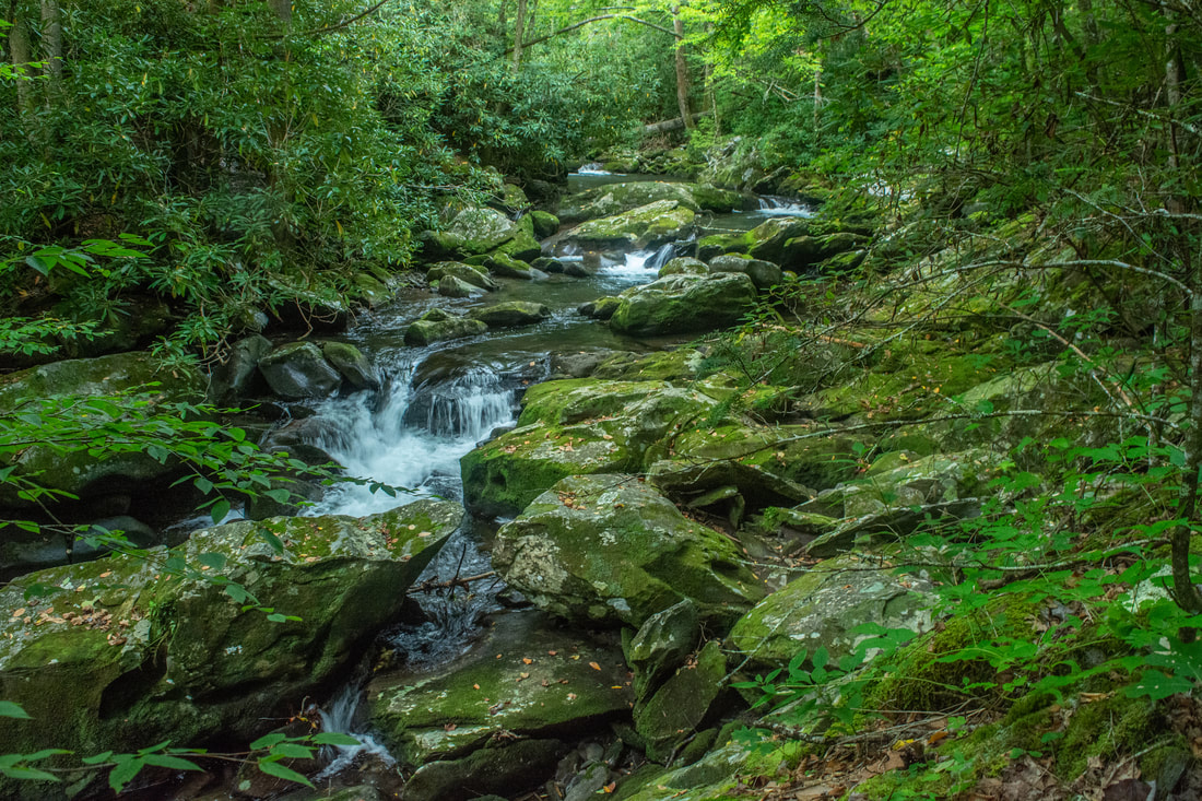
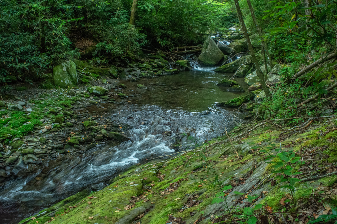
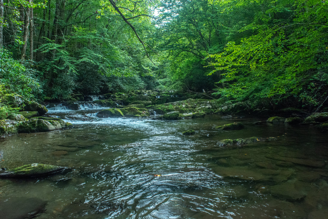
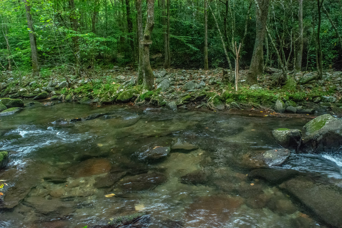
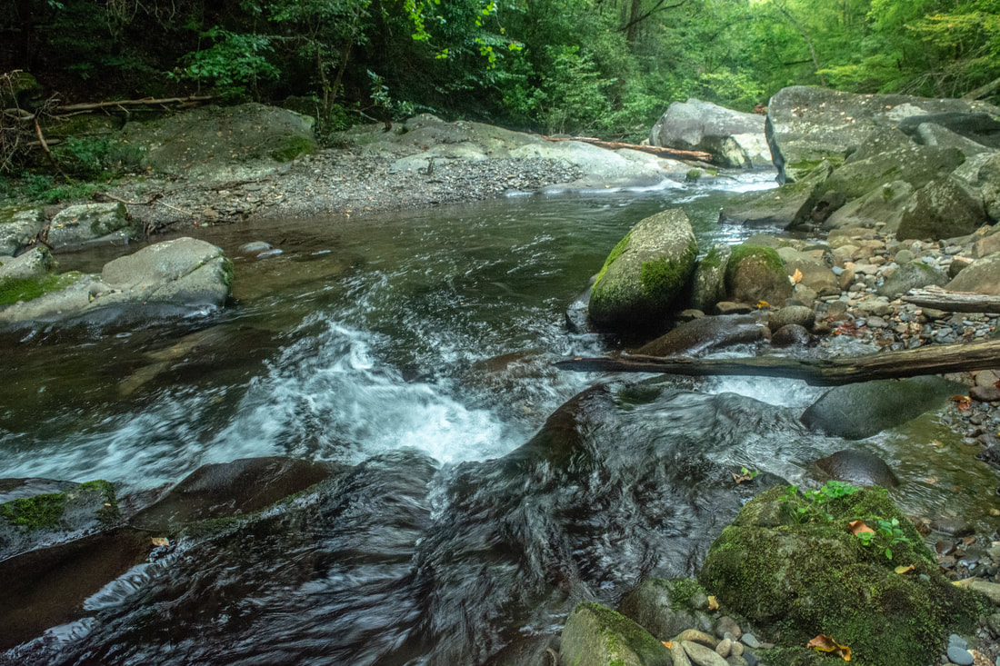
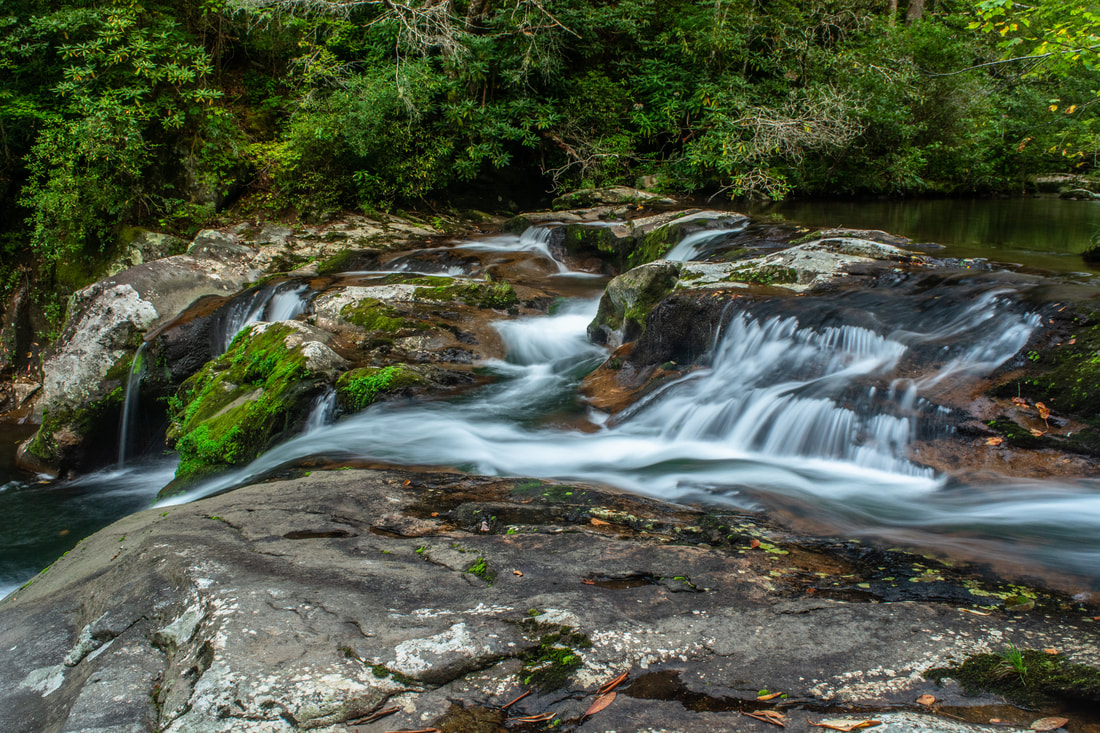
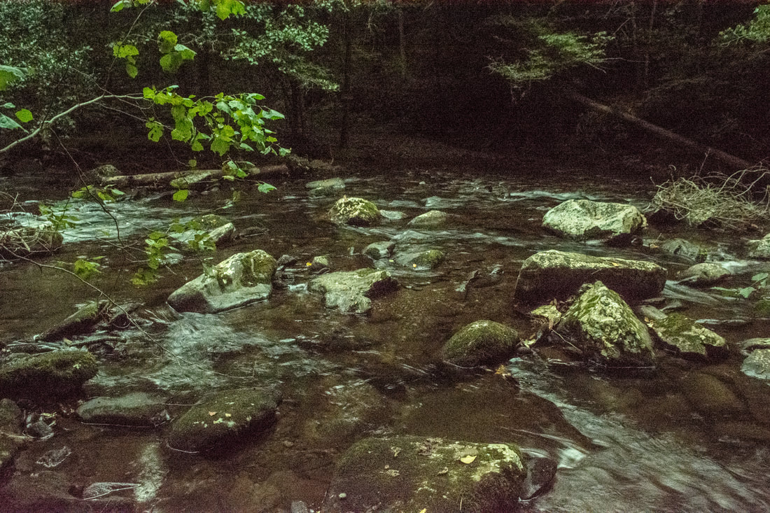
True to its name, the Slickrock Creek Trail features countless views of the scenic Slickrock Creek.
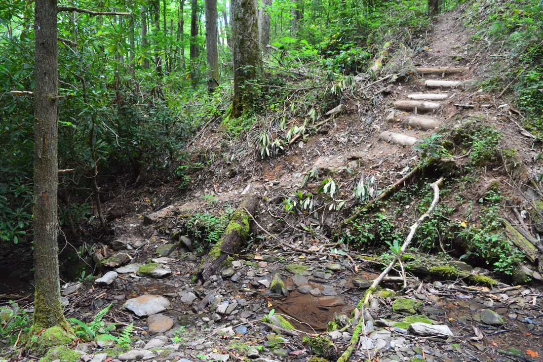
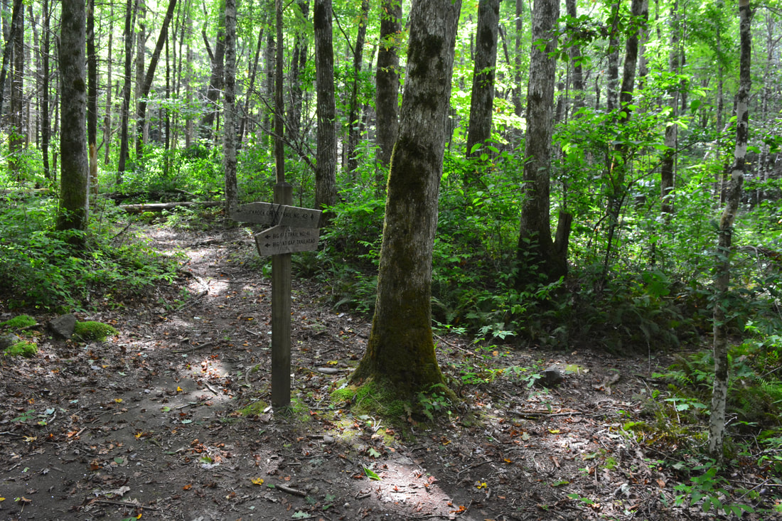
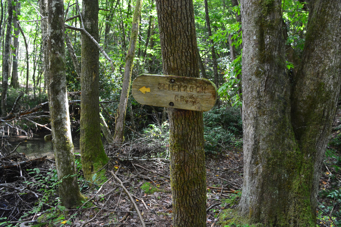
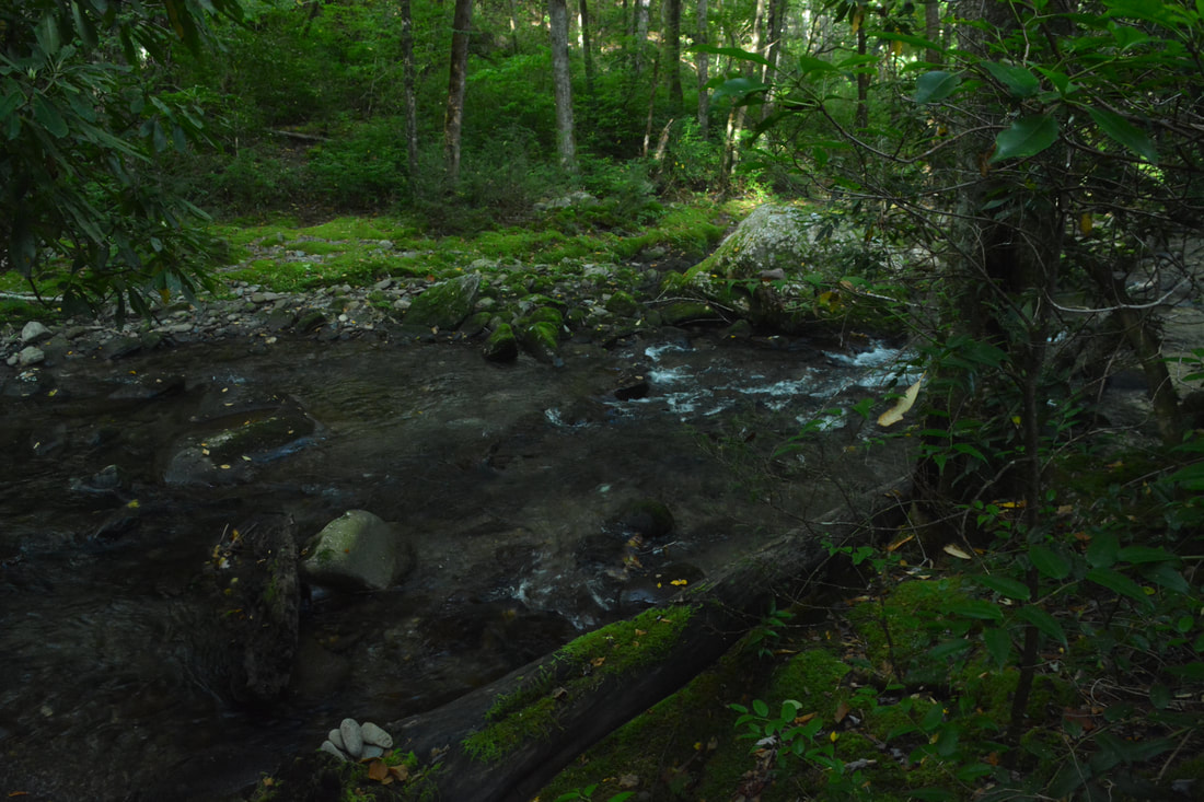
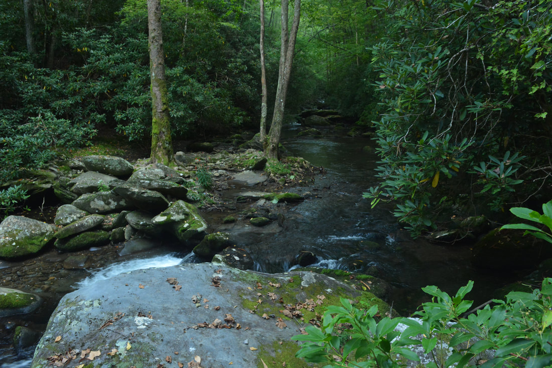
To continue this loop hike, turn right on the Big Fat Trail, and in just 350 feet, reach a T-intersection with Slickrock Creek Trail (#42) at 5.85 miles. The rest of this hike follows the Slickrock Creek Trail back to US 129 for over 8 miles. Turn right on the trail, and after walking through more campsites, reach your first of twelve Slickrock Creek fords at 5.9 miles. This is the easiest and shallowest ford, crossing a small tranquil pool - the fords get consistently broader and trickier as the creek grows larger, particularly below Wildcat Falls. Most crossings have an ancient, wooden "Slickrock Creek" sign with an arrow on each side, but they are often hard to find and can go missing, so it's best to not solely rely on these signs.
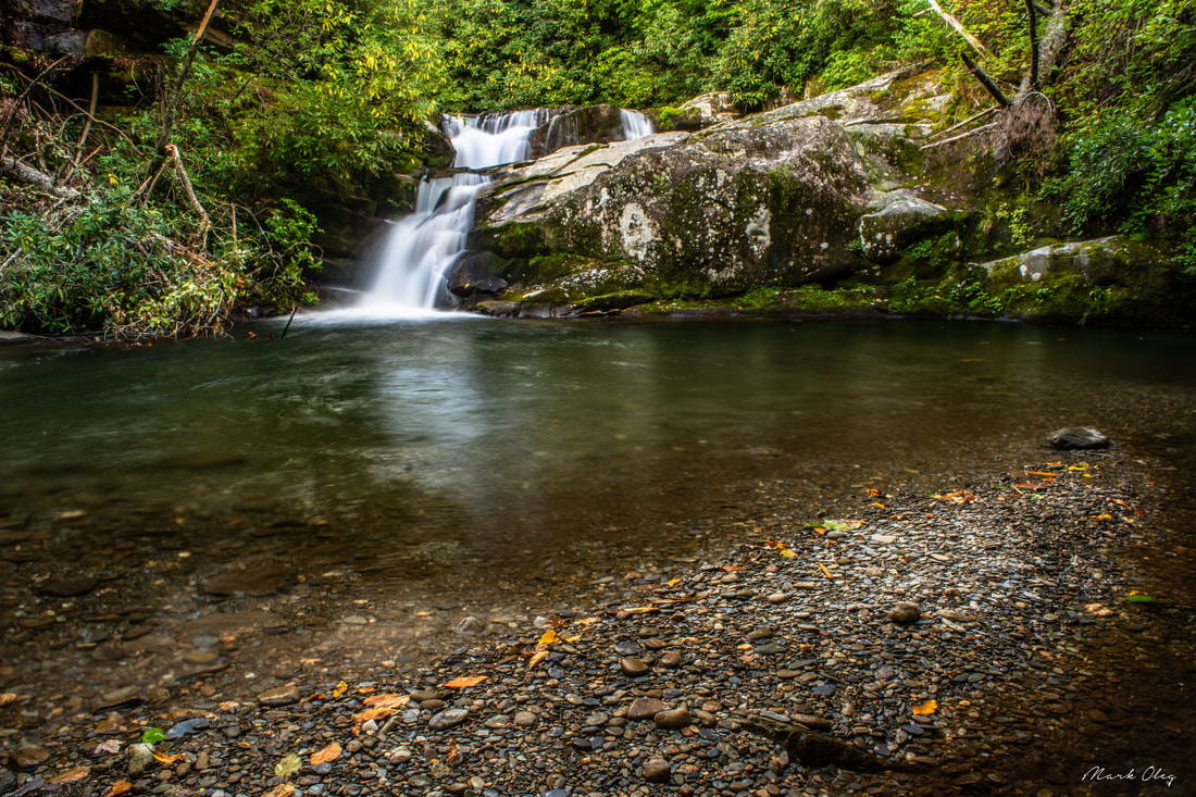
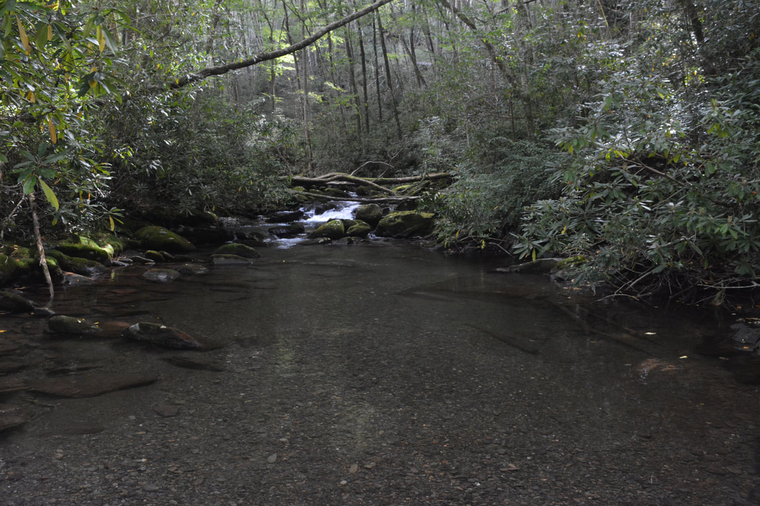
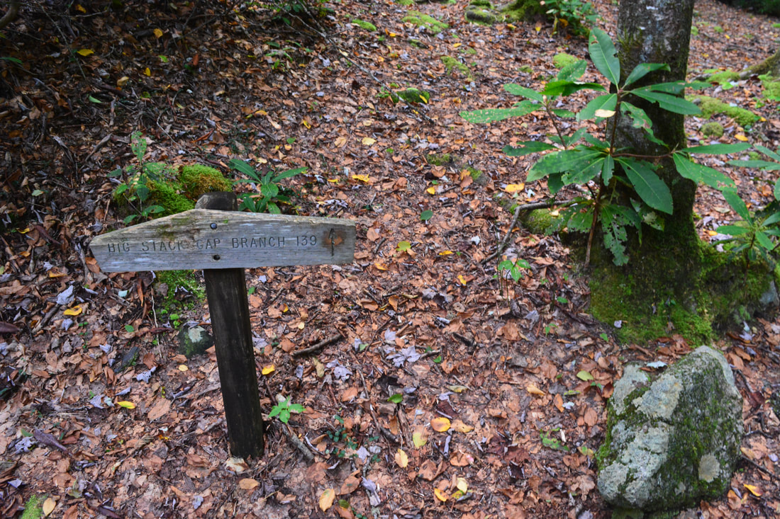
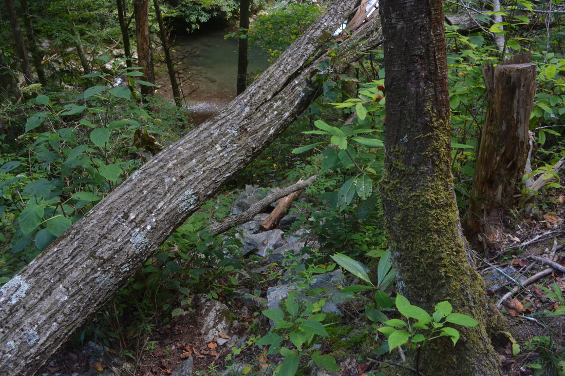
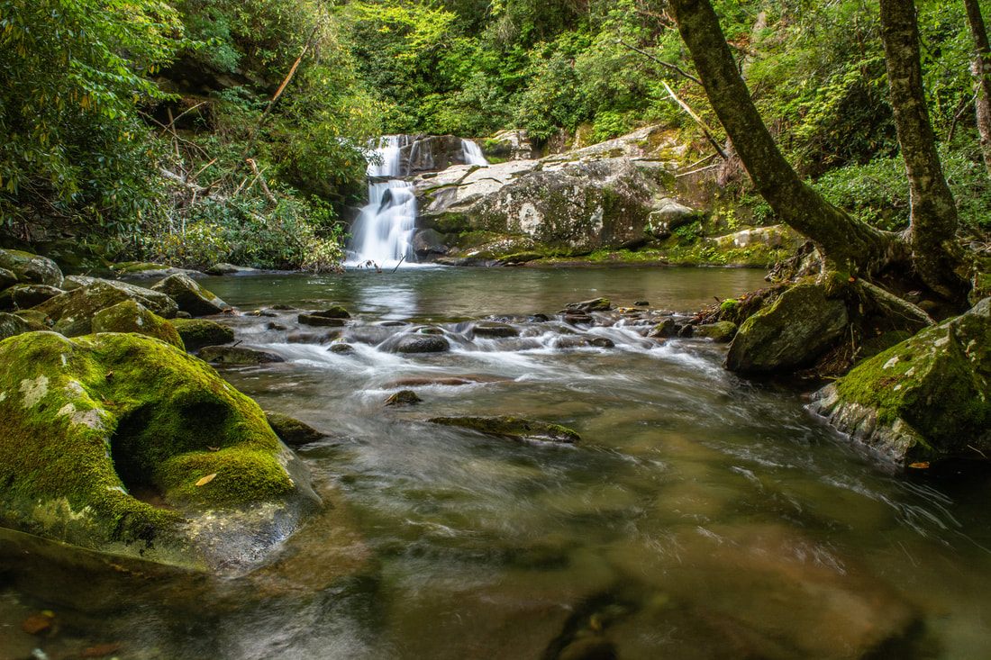
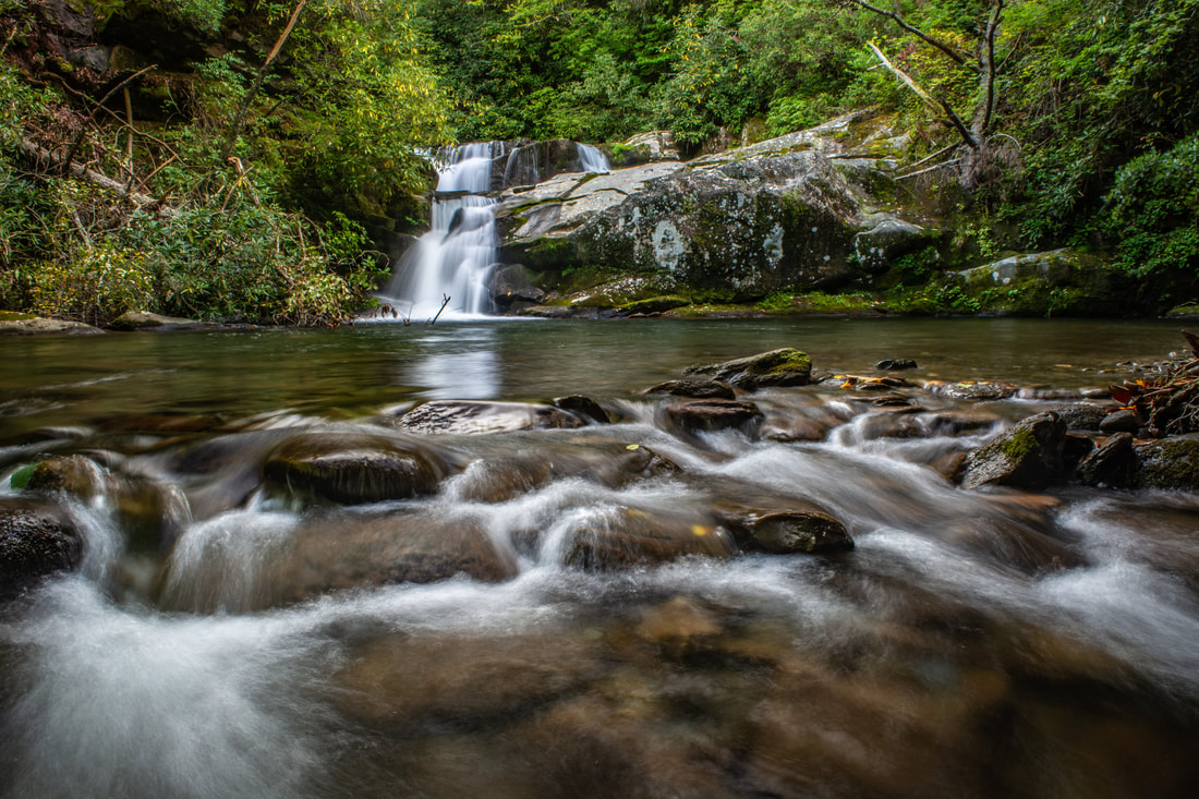
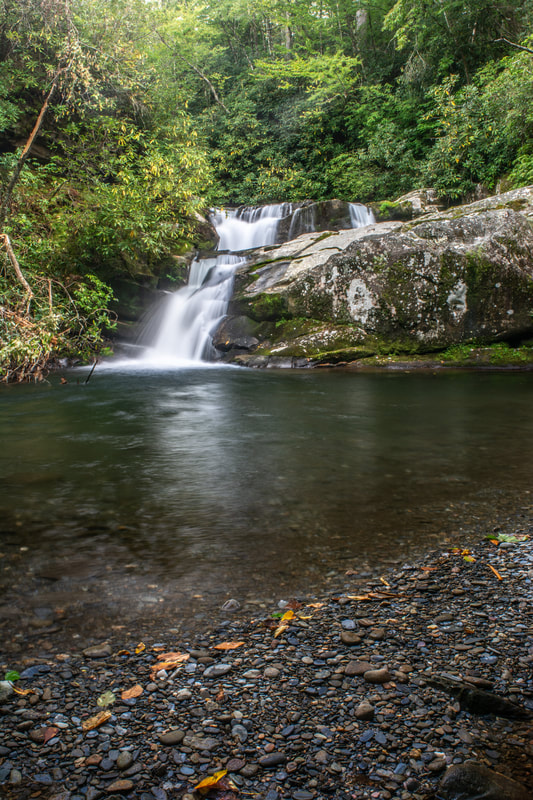
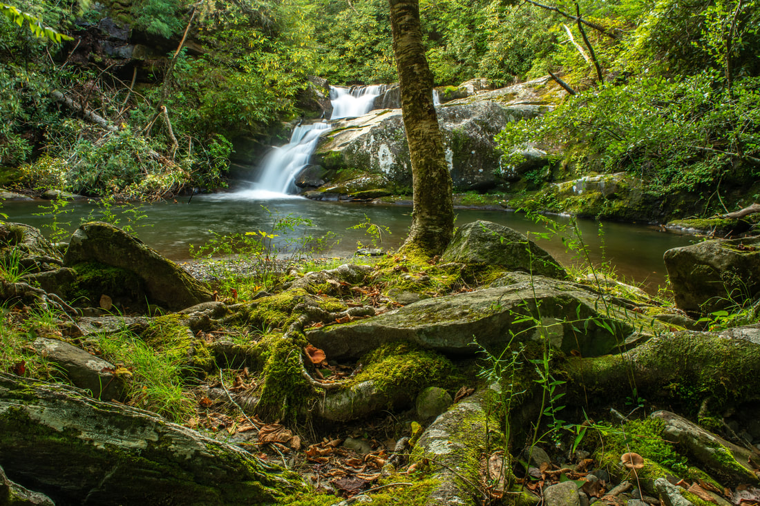
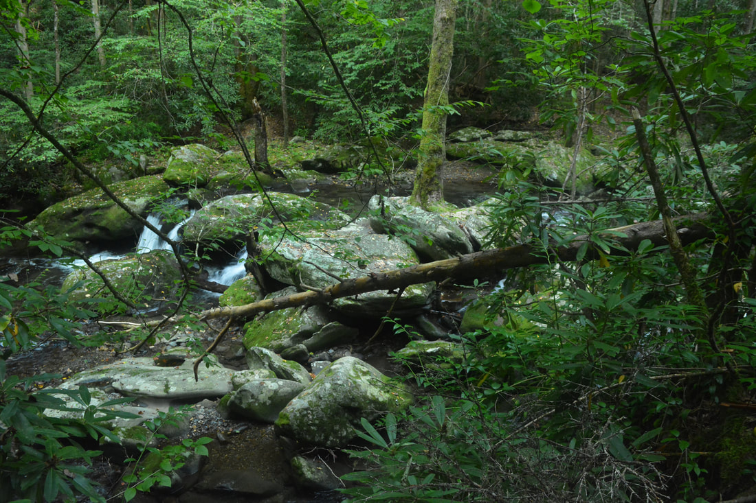
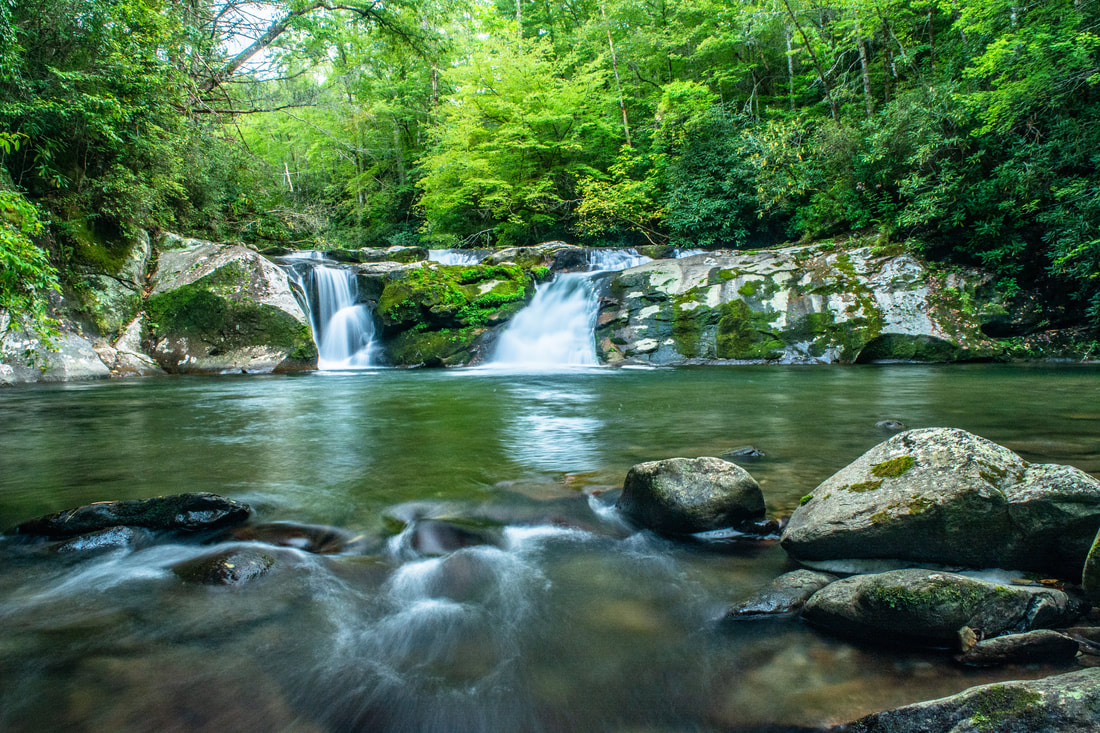
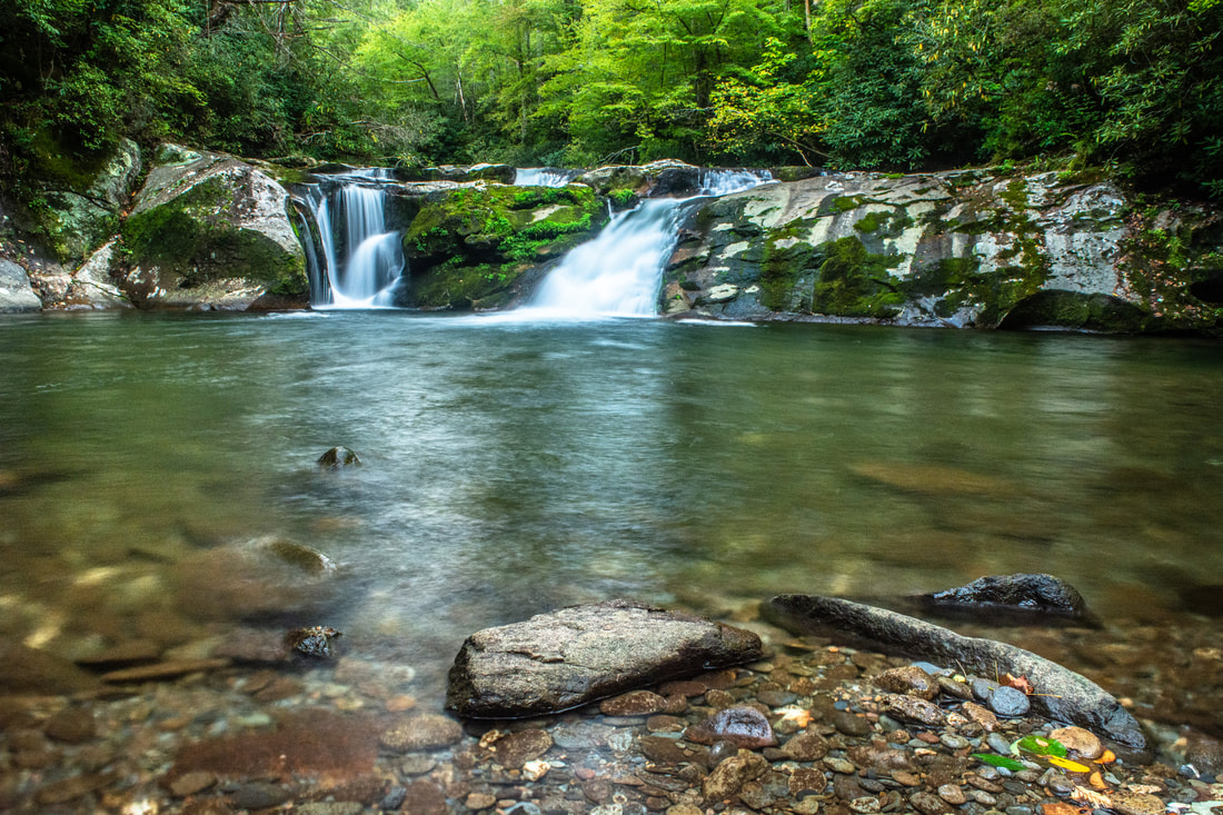
After initially passing through more flats, the trail begins tracing Slickrock Creek. The creek views aren't that great at first, but don't worry, as they gradually become more and more wild and dramatic, especially past Wildcat Falls. After navigating across a small rock outcrop with an old rail lying around - a relic from the logging days, back when this trail used to be a railroad - the trail reaches a junction with the Big Stack Gap Trail (#139), a little-used connector that crosses into the Citico Creek Wilderness of Tennessee. As an aside, this is the point where the Tennessee/North Carolina border begins tracing Slickrock Creek the rest of the way to Calderwood Lake, so you'll be crossing between the two states from now on. Make the broader Ford #2 at the junction and continue hiking downstream, now along the River Right side. Ford #3 occurs at 6.8 miles, right at the top of Wildcat Falls. Given the proximity of this waterfall, care must be taken at this crossing if water levels are above average. On the other side, the trail ascends up a rock shelf, rounds a small outcrop, and follows a level grade above the creek with shrouded views of the upper tiers of Wildcat Falls. Although the full drop of Wildcat Falls is close to 60 feet, only the lowermost 20-foot drop is accessed by trail. At 6.9 miles, the scramble trail to the base of Wildcat Falls turns right. Although the rough trail follows a steep slope chock-full with loose boulders, it's only 150 feet long, and the waterfall is one of this hike's major highlights. The scene that presents itself at the base is a gorgeous one. The remote lower tier of Wildcat Falls makes a double drop 20 feet down a cliff into a peaceful pool, great for swimming and cooling off. A small gravel bar at the pool's edge was a perfect addition to the scene on this day's low water levels. Downstream, the creek forms swift, intricate cascades as it flows into the forest, surrounded by mossy boulders of various shapes and sizes. 
Wildcat Falls is a serene spot hidden in the heart of the Joyce Kilmer-Slickrock Wilderness.
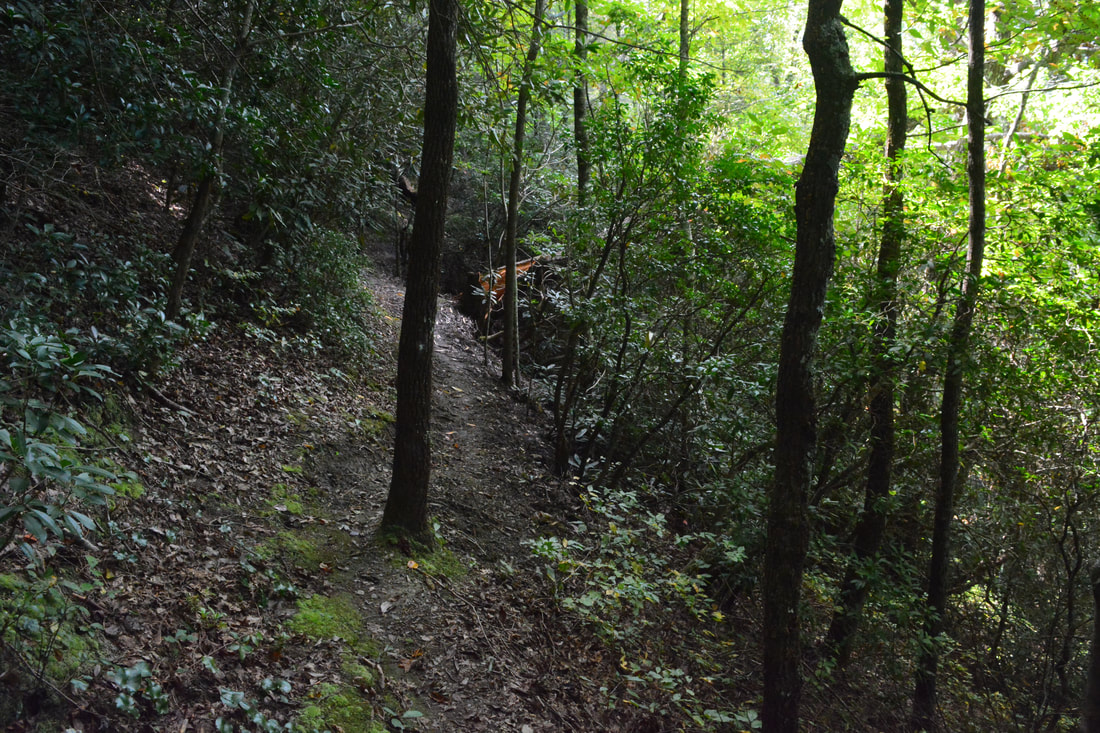
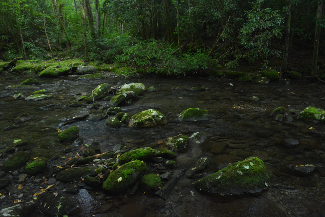
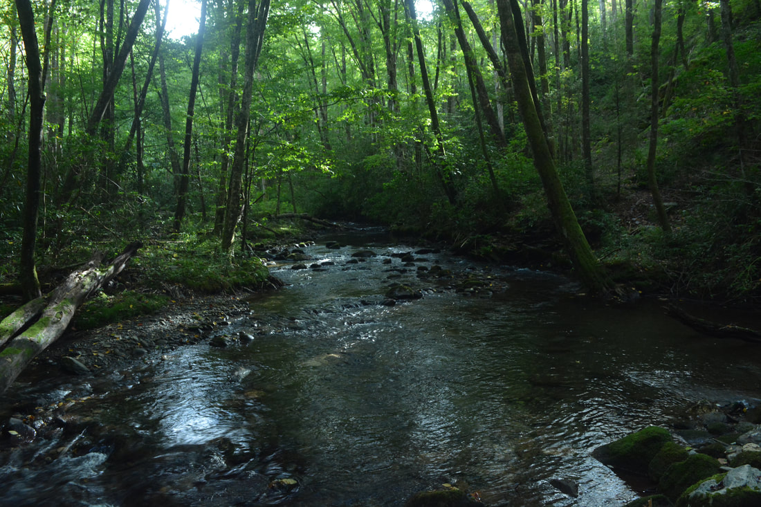
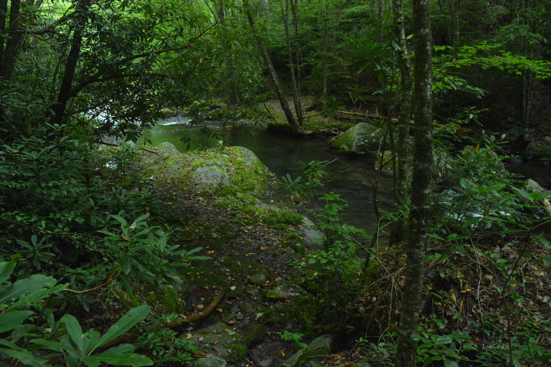
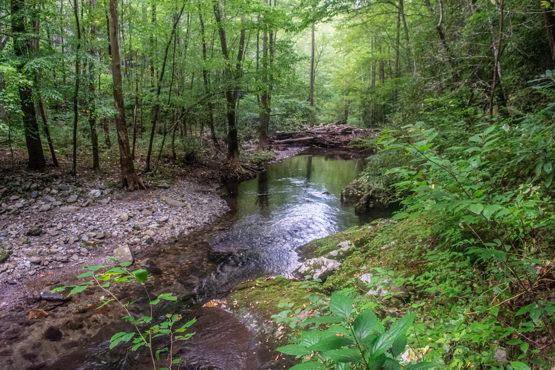
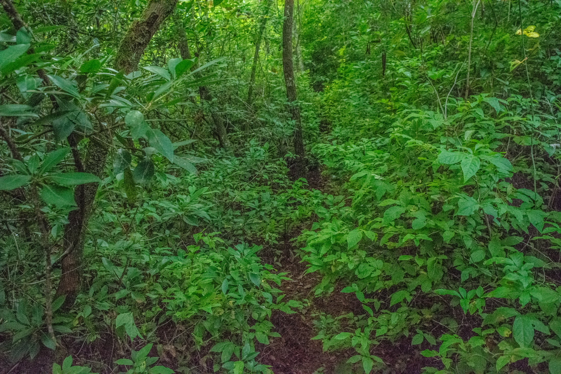
Return to the main trail and continue hiking downstream along Slickrock Creek. You will soon come to Fords #4, #5, and #6 in quick succession - at 7.2, 7.25, and 7.35 miles, respectively. These crossings are still pretty easy, but you will notice that the creek has definitely become wider by now. Ford #7 occurs at 7.6 miles, after which the trail stays on the River Left (west) side of Slickrock Creek for quite a while. This is where my favorite part of the hike begins, and it's simply impossible to describe in words how amazing the trail is here. The trail stays remote and rugged the whole way, always a single-track pathway with occasional blowdowns, tricky rock scrambles, and overgrown sections. And at the same time, the trail shadows Slickrock Creek's every turn, providing countless views of the creek's constant wild cascades and the boulder fields surrounding it. Most Southern Appalachian creek trails either follow broad old road grades, stay far enough above creeks that the views aren't great, or both. This trail is remarkable as it never has either problem!
At 9.25 miles, the trail makes the eight crossing of Slickrock Creek. This is the first ford where I learned why the creek is called "Slickrock" - some of the rounded, polished underwater stones in this creek are insanely slippery! You'll want to use caution, as I encountered similarly slick rocks at every one of the remaining crossings from here on, especially the last two, which were the toughest. After crossing small Nichols Cove Branch, reach the other end of the Nichols Cove Trail (#44) at 9.5 miles. This is where that trail arrives at the creek after leaving the cemetery. Immediately afterwards, at 9.55 miles, the trail makes Ford #9. Then, at 9.7 miles, the trail rock hops Little Slickrock Creek and arrives at a junction with Stiffknee Trail (#106) by a campsite. Turning left into Tennessee, the Stiffknee Trail leads 1.8 miles to a parking area at Farr Gap, making this another one of the easier and more popular access points for Slickrock Creek. Given how large the creek's size is, it is truly unique that Slickrock Creek never once crosses or parallels a roadway on its winding course to Calderwood Lake - such is the power of wilderness protection! At 10.0 miles, make Ford #10 of Slickrock Creek, where the water is now at least knee-deep. At 10.25 miles, reach the other end of the Ike Branch Trail at another campsite. The trail crosses an unnamed stream after this and then makes a particularly tricky scramble along an eroded slope about 15 feet above the creek - it appears that a landslide almost washed the trail into the creek here. A log jam just downstream makes for an interesting sight. Ford #11 comes up at 10.4 miles - the fords keep getting more difficult, the water swifter and deeper, but there's only one more left after this one! The trail then rises away from the creek for the first time in a while, becoming notably overgrown. Finally, at 10.9 miles, after returning to creek-level, the trail passes above Lower Falls, the other of two waterfalls on this hike. 
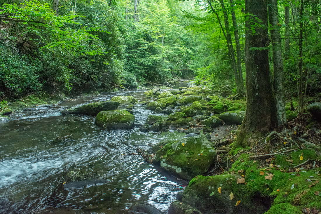
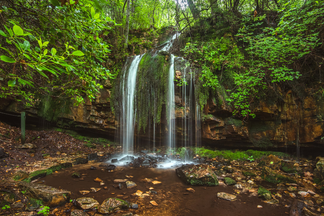
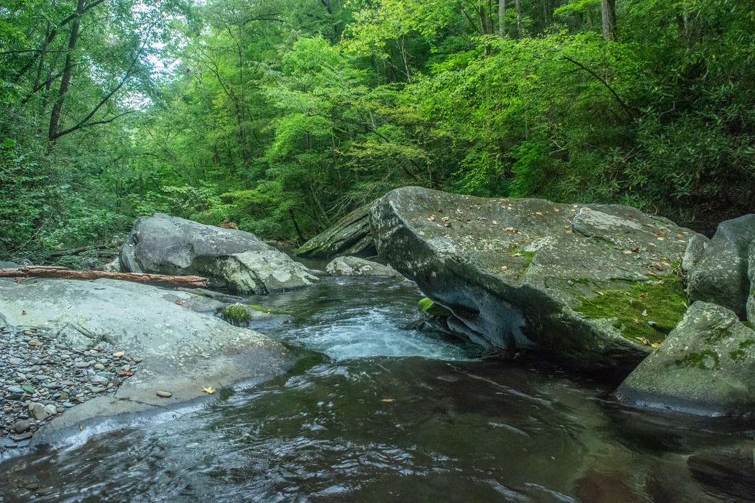
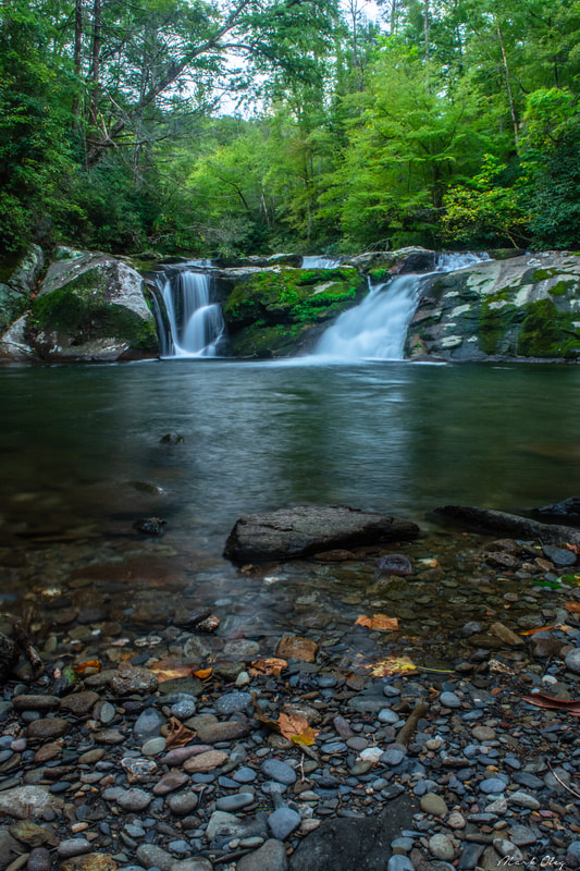
The twin drop of 15-foot Lower Falls is quite showy and comes with an outstanding pool.
Two paths lead to Lower Falls - one to the flat bedrock at the top, and one to the true base. Both are obvious and neither is difficult. Even though Lower Falls is only 15 feet high, I really love this waterfall - almost as much as Wildcat Falls. The twin drop is very picturesque, and the large pool is simply outstanding for a rest stop and even a quick swim before continuing the hike. I also liked a lot the mossy cliff that the falls spills over. Lower Falls would make a great destination for the shorter Ike Branch Loop that one has the option of completing, if the hike described here is too long or strenuous.
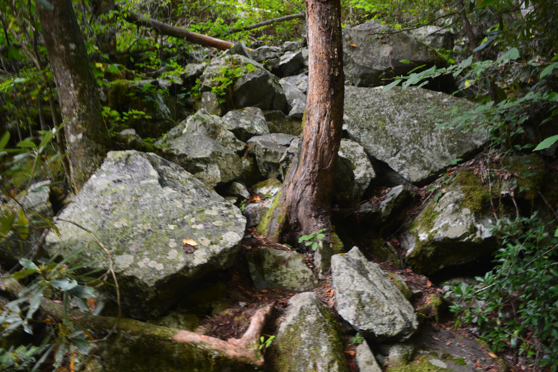
Back on the main trail, reach the twelfth and final ford of Slickrock Creek at 11.3 miles. The trail stays on the creek's River Right side the rest of the way, but what follows is actually one of the hike's more difficult sections, as the trail makes constant rock scrambles that are required to maneuver across the gorge's extremely rugged and wild terrain. Of special note is a spot around 11.8 miles, where the Slickrock Creek Trail inches across a slim ledge hardly a couple feet wide, with a sheer drop-off to the creek. The views of the creek in this area are also some of the best on the hike; the creek is much bigger and the gorge is much deeper than six miles earlier. Finally, around 12.4 miles, you will want to stay right as the trail begins rising above and away from Slickrock Creek (a path bears left and leads to the creek's confluence at Calderwood Lake). This is another sketchy section, as the narrow trail hugs a cliff while following the edge of another sheer drop-off. Of course, everything becomes exponentially trickier if you're hiking this part of the trail in the dark like me (blame poor time management skills)! At 12.6 miles, the trail turns decidedly east and starts taking a fairly straight course toward US 129, constantly hovering 150-200 feet above Calderwood Lake. Of course, even though the trail looks straight on the map, it's nothing but in reality. The trail stays very narrow and rugged as it circumnavigates numerous cliffs and steep slopes. A set of three wooden footbridges assist the trail in crossing a few steep-sided ravines. It is only around 13.3 miles that the trail starts to broaden and level out, resembling more the trail you saw when you left it at the Ike Branch junction. At 13.5 miles, return to the intersection with the Ike Branch Trail and continue straight; from here, it's simply a matter of retracing your earlier steps to the US 129 parking area. You will return to your vehicle at 14.2 miles, concluding this stunning but strenuous hike. 
Hiking the Slickrock Creek Trail means making numerous tricky creek crossings, often through swift, deep water.
It is a no-brainer that I decide to rate this hike a "Best Hike". This is seriously one of the best hikes I've ever done in over six years of exploring the Southern Appalachians. The Slickrock Creek Trail is quite possibly the best creek trail I've ever hiked, and one I'm looking forward very much to experiencing over and over again. I cannot recommend this hike enough to anyone wishing to have a true wilderness experience and see some scenic views/waterfalls as well. The only thing that could make this hike better is if it followed Slickrock Creek all 14 miles!
Mileage
0.0 - US 129 Parking
0.7 - Ike Branch Trail (Begin Loop) 2.3 - Yellow Hammer Gap 4.1 - Nichols Cove Cemetery 5.85 - Slickrock Creek 6.9 - Wildcat Falls 10.9 - Lower Falls 13.5 - End Loop 14.2 - US 129 Parking Pictures & Videos
0 Comments
Leave a Reply. |
About MeMark Oleg Ozboyd Dear readers: I have invested a tremendous amount of time and effort in this website and the Georgia Waterfalls Database the past five years. All of the work that has gone in keeping these websites updated with my latest trip reports has almost been like a full-time job. This has not allowed me to pick up a paid job to save up money for college, and therefore, I I've had to take out loans. If you find the information on this website interesting, helpful, or time-saving, you can say "thanks" and help me out by clicking the button above and making a contribution. I will be very grateful for any amount of support you give, as all of it will apply toward my college tuition. Thank you!

Coming in 2022-2023?
Other Hiking WebsitesMiles HikedYear 1: 540.0 Miles
Year 2: 552.3 Miles Year 3: 518.4 Miles Year 4: 482.4 Miles Year 5: 259.9 Miles Archives
March 2021
Categories
All
|
||


 RSS Feed