HIKING THE APPALACHIANS AND BEYOND
  • Home
  • Trail Reports
    • Best Hikes
    • Hikes with Scenic Views
    • Hikes with Water Features
    • Alabama
    • Georgia
    • Florida
    • North Carolina
    • South Carolina
    • Tennessee
    • Vermont
    • Virginia
  • Map
  • Hike List
  • Testimonials
  • Resources
  • Contact Us
  • Southeast Nature Society
    • Our Team
  • Georgia Waterfalls Database

Nantahala National Forest: Snowbird Creek Trail, Sassafras Creek Trail, and Burntrock Ridge Trail Loop, Robbinsville, North Carolina

11/2/2015

9 Comments

 
Picture
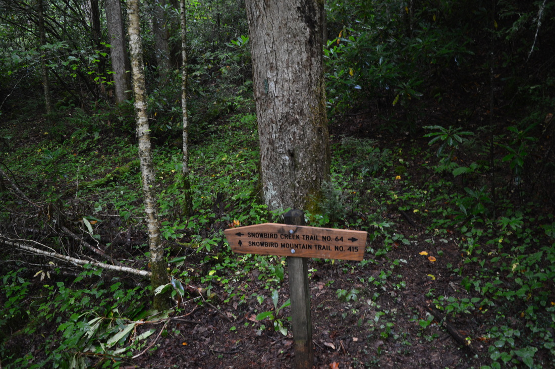
​​Deep in the Cheoah Ranger District of Nantahala National Forest flows a pristine wilderness waterway, Snowbird Creek. Snowbird Creek, encompassed by the large Snowbird Backcountry Area, is one of the more remote regions in western North Carolina, where trails can be overgrown streamside paths and where the junctions often go unsigned. Snowbird Creek and its tributaries sport numerous waterfalls, even some large ones - on this hike you'll get to see as many as four sizable waterfalls. It's no walk in the park to get as far as Upper Falls though - be prepared to traverse faint, steep paths on Burntrock Ridge and along Snowbird Creek. This hike occurred on Saturday, August 15th, 2015. My plan was to hike the Snowbird Creek Trail to the Sassafras Creek Trail, and then take Sassafras Creek Trail upstream along Sassafras Creek past Sassafras Creek Trail. Next, I would take the Burntrock Ridge Trail over Burntrock Ridge, ending up again on the Snowbird Creek Trail. I would take the Snowbird Creek Trail upstream to Upper Falls and then downstream to Middle Falls, Big Falls, and back to the trailhead.

​Summary

​​R/T Length of Trail: 13.2 Miles
Duration of Hike: 7:45
Type of Hike: Lasso
Difficulty Rating: 6 out of 10
Pros: Some flagging tape helps to hike through the most confusing sections of trail
Cons: Burntrock Ridge Trail can be very overgrown and steep; upper parts of Snowbird Creek Trail are rugged and often hard-to-locate; confusing trail throughout the "8 fords of Snowbird Creek" section; a couple of poorly-marked intersections
Points of Interest: Sassafras Creek Falls - 7 stars; Upper Falls - 4 stars; Middle Falls - 8 stars; Big Falls - N/A
Trail Blaze Color(s): None
Best Season(s) to Hike: Spring
Beginning Point: Junction Trailhead
Directions: From Robbinsville, NC: Follow US Route 129 North for 0.8 miles. Then, turn left onto NC State Route ​143, also known as Cherohala Skyway. Follow NC State Route 413 for 5.6 miles, and then, turn left onto Snowbird Road. Follow Snowbird Road for 2.1 miles, and then, turn left onto Big Snowbird Road. Follow the road for 6 miles to its end. The road will turn to gravel. The end of the road is a small parking area and a cul-de-sac where Snowbird Creek Trail and King Meadows Trail start. The road turns to gravel for the last 4 miles, but it is in great condition and can be traveled by most passenger vehicles. 

​Map

Please note: this map is incomplete as my GPS failed to record a section of this hike roughly from Middle Falls to Big Falls. Please consult National Geographic Maps to verify the route of this hike. 

Details

This is a beautiful hike for people who are looking for plenty of water features. However, you'll have to be ready for lots of navigation problems - I wouldn't suggest for hikers lacking good navigation skills to do this hike. 

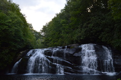
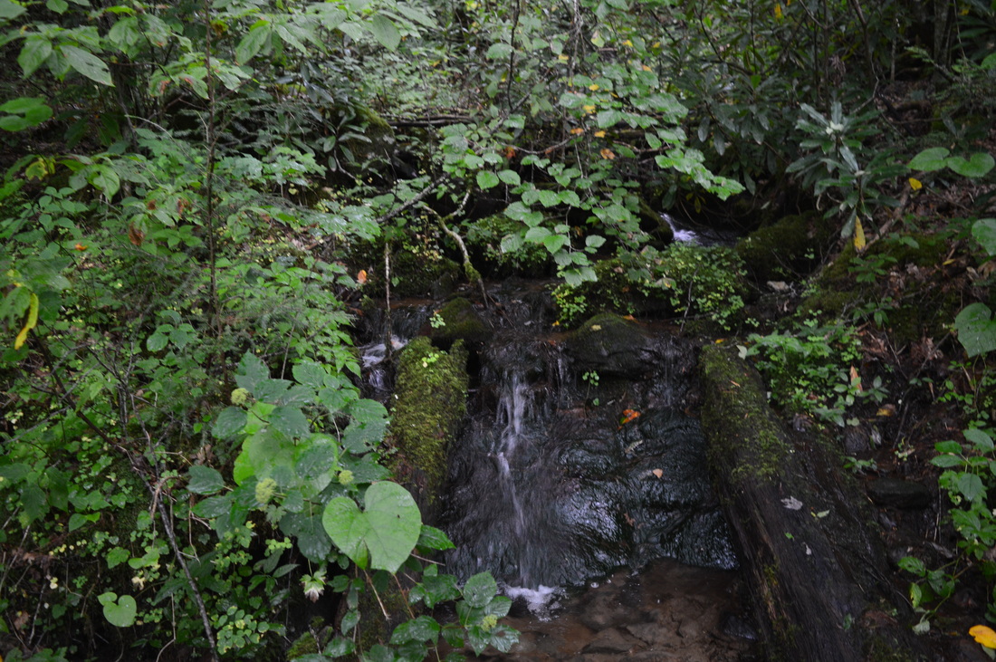
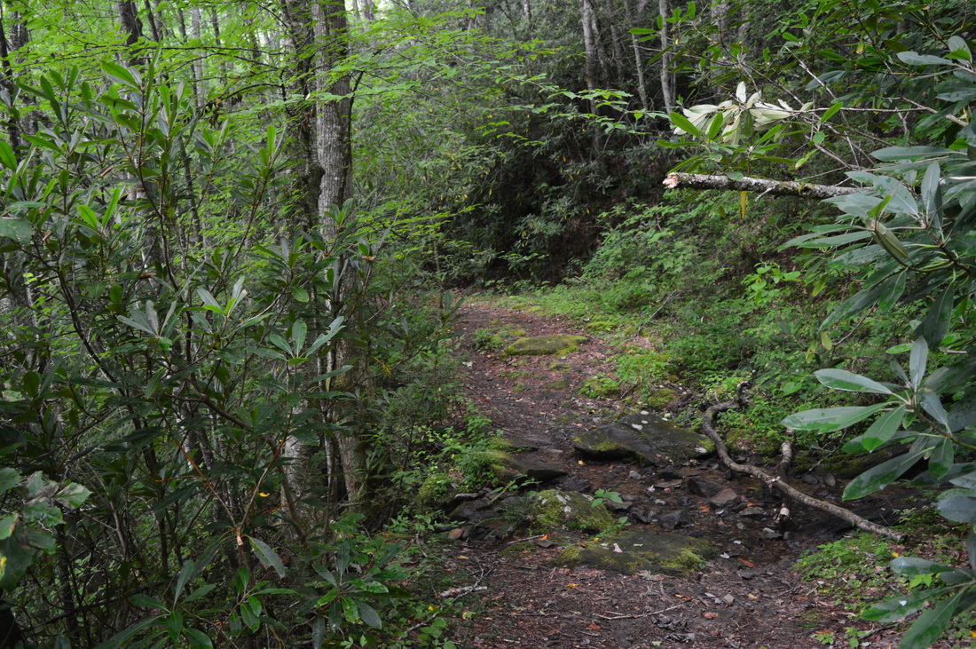
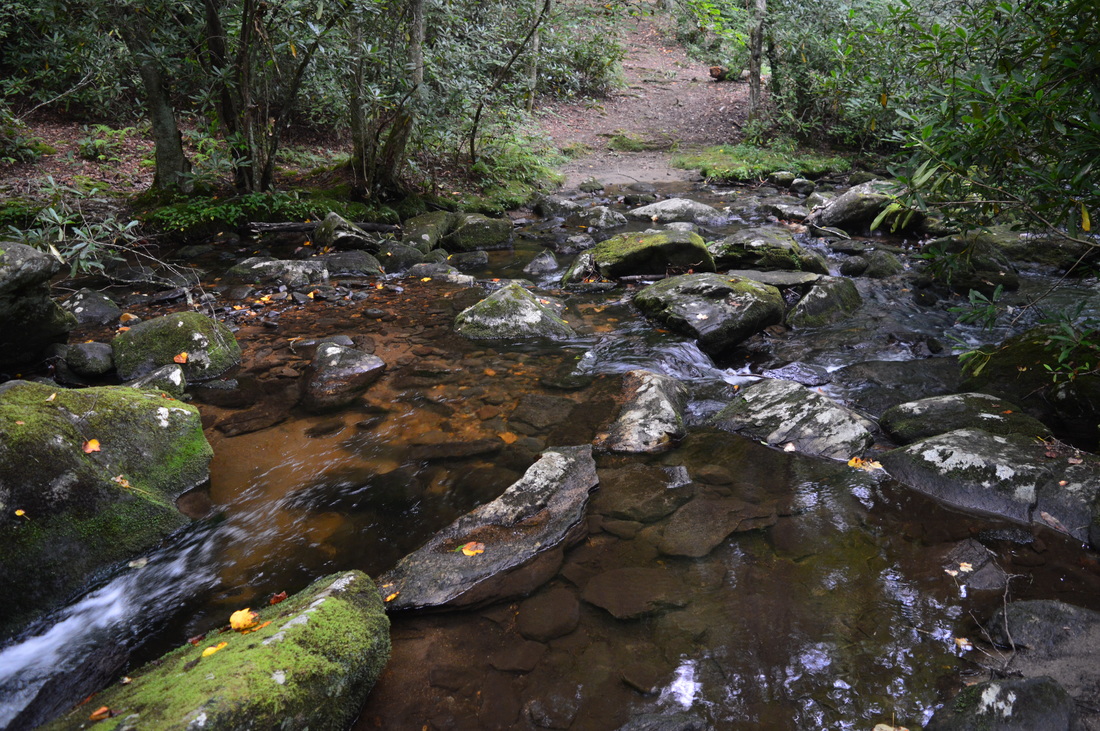
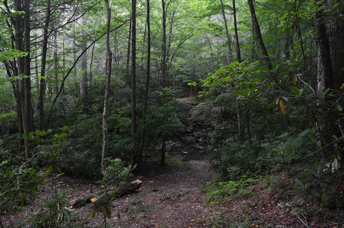
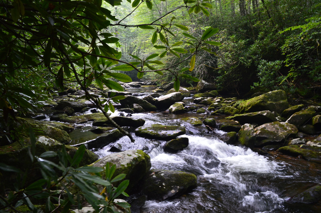
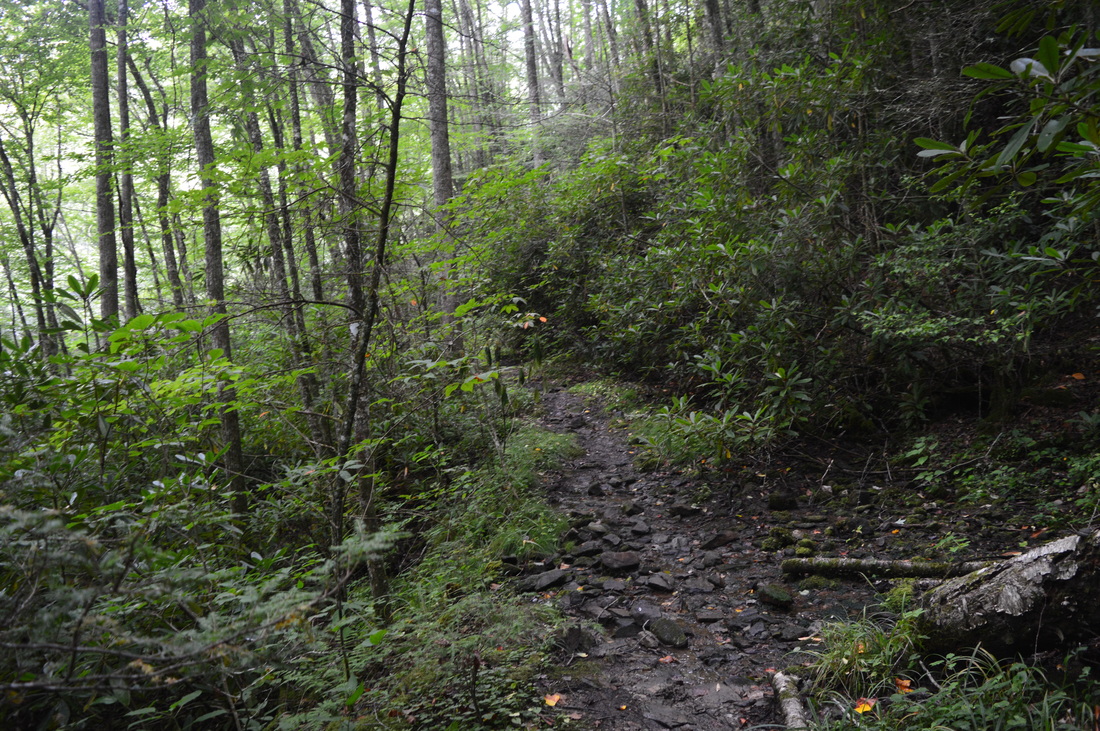
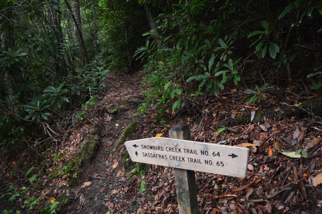
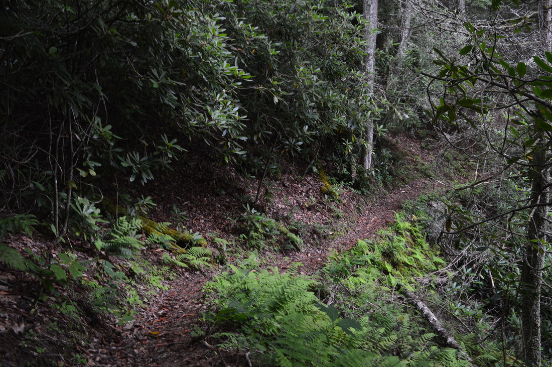
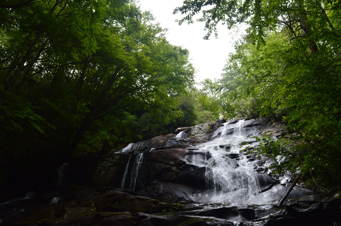
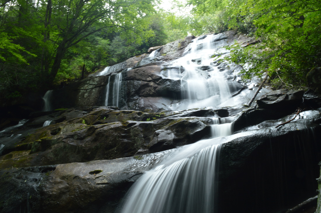
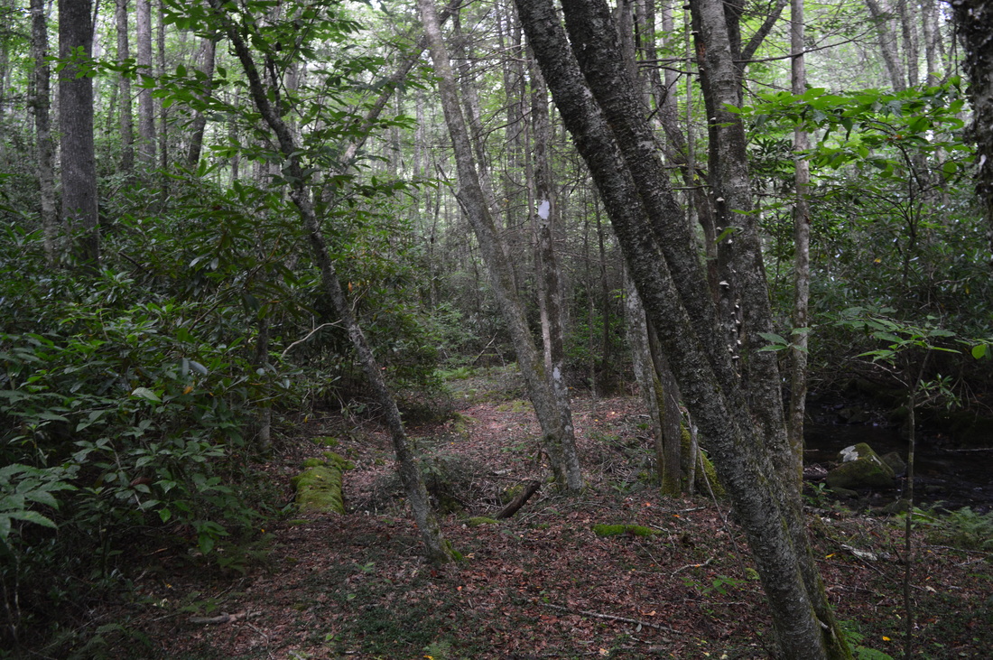
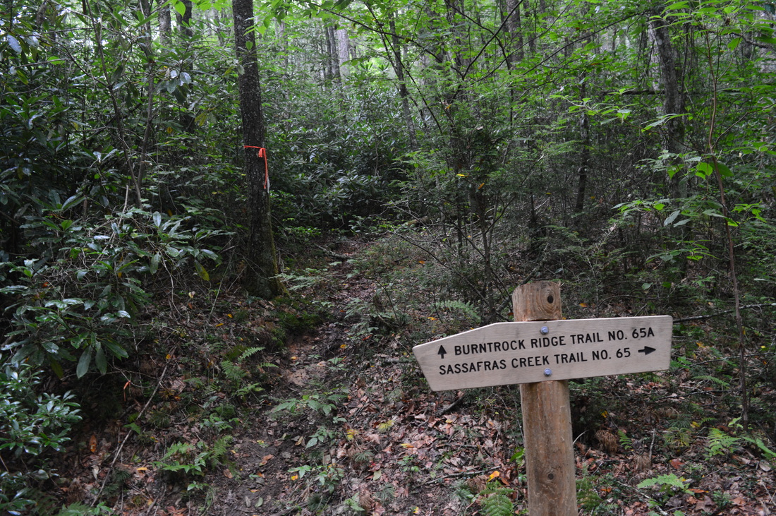
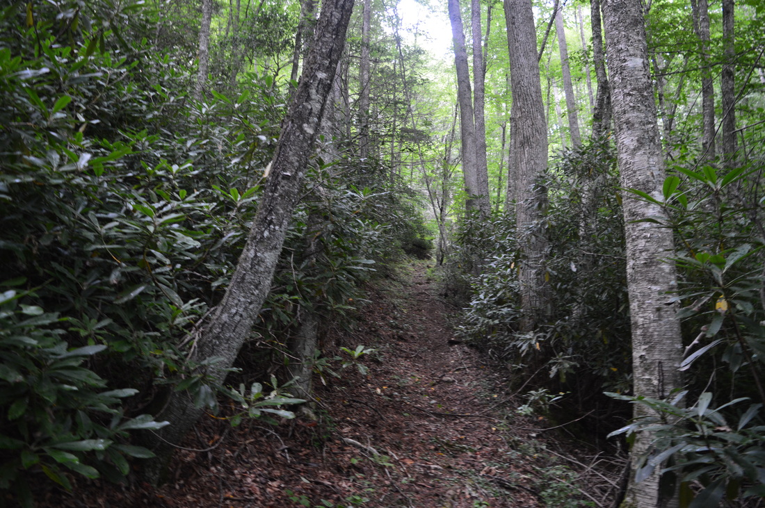
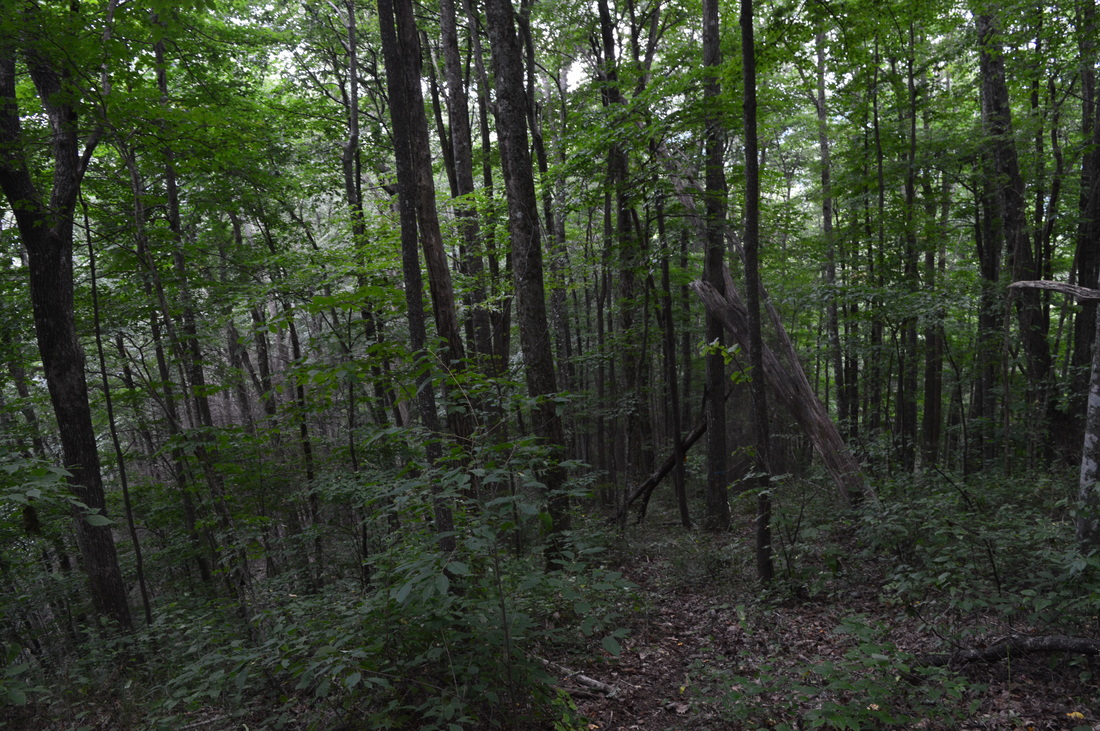
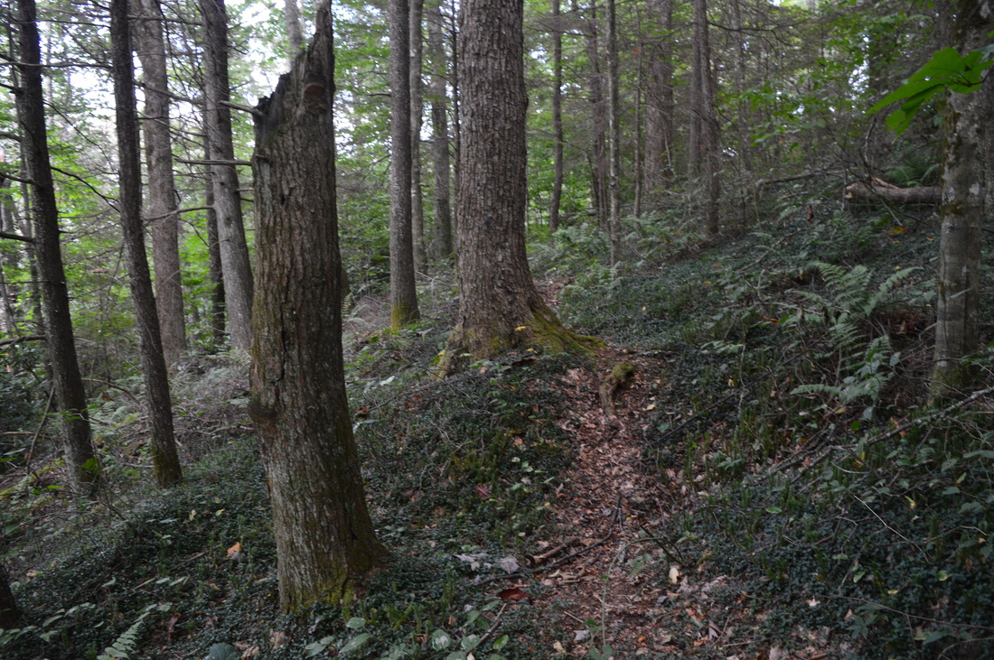
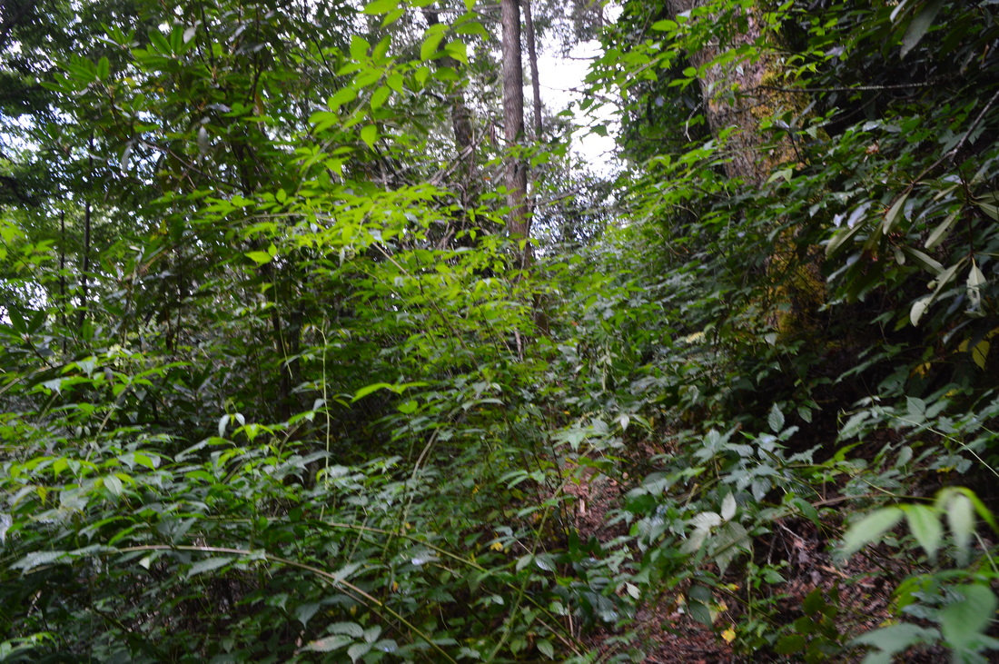
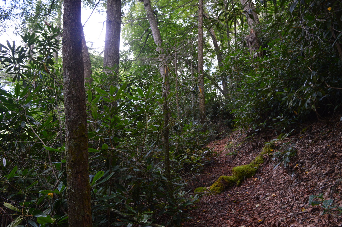
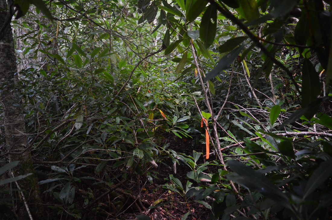
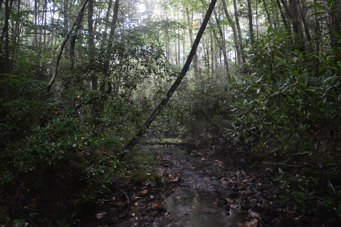
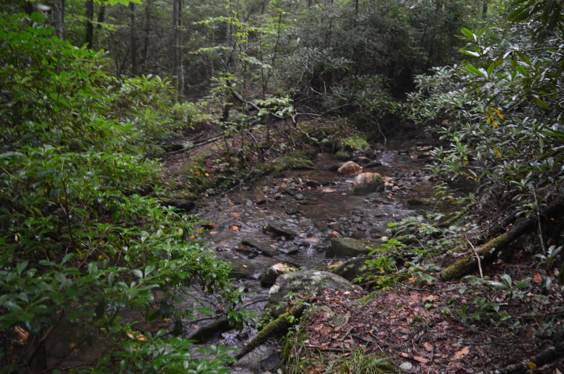
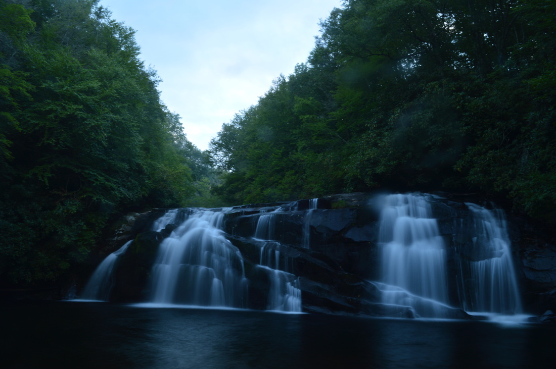
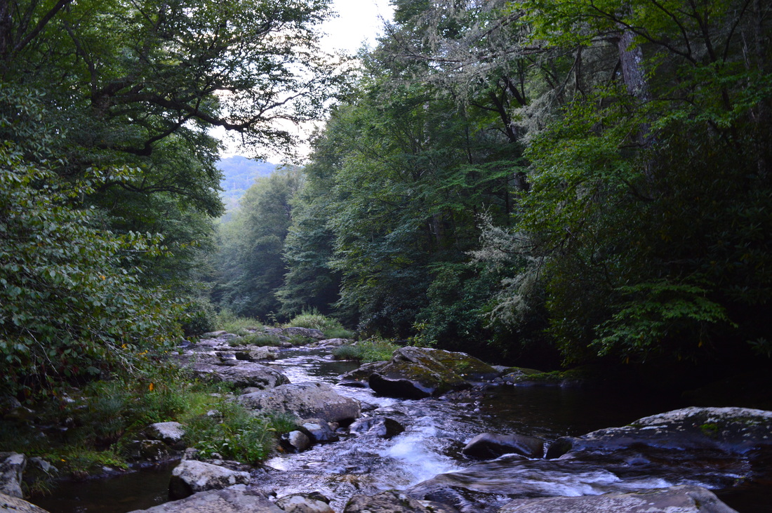
The hike starts at the "Junction" trailhead, the local name for the end of Snowbird Road where King Meadows Trail and Snowbird Creek Trail, two of the main trails in the area, start. This hike goes on the Snowbird Creek Trail, the trail that is on the left side and heads uphill - the King Meadows Trail starts on the right side and heads downhill to ford Snowbird Creek. The Snowbird Creek Trail starts out uphill but quickly becomes mostly flat, with a gentle uphill trend. This portion of the Snowbird Creek Trail is easy - it follows an old roadbed that makes for easy walking. This first part of the hike generally parallels Snowbird Creek, although most of the time, Snowbird Creek is out of view. There are spur trails that steeply drop down to pretty cascades on the creek. At 0.2 miles, the Snowbird Mountain Trail, marked by a sign, leaves the Snowbird Creek Trail to the left. The Snowbird Mountain Trail is a long trail that follows the ridge of Snowbird Mountain to the Cherohala Skyway. At 2.6 miles from the start, you will cross Sassafras Creek, the first major creek crossing of the hike. This may or may not be a wet crossing, depending on the amount of recent rainfall. When I did this hike, the creek was possible to cross without getting wet but just barely. In any case, wet ford(s) (depending on your choice of trail later) lie ahead. Also, the water level at this crossing indicates if Sassafras Creek Falls upstream will have good flow. If there is no way to cross without getting wet, Sassafras Creek Falls will likely be spectacular. There are also some campsites around the crossing - Snowbird Creek is nearby. At 2.9 miles, reach a junction with Sassafras Creek Trail. This is the start of the loop. Make a hard left onto Sassafras Creek Trail. The trail begins a slightly more noticeable uphill, but it's still easy. Soon, the trail nears Sassafras Creek, although it stays well above creek level. At 3.6 miles, reach the spur trail to Sassafras Creek Trail which leaves the trail and heads downhill left to the creek. When I did this hike, this spur trail was marked by a sign. The spur trail isn't long and is moderately steep. Shortly reach Sassafras Creek and Sassafras Creek Falls. 

This waterfall is very photogenic in the right conditions and especially after rainfall. The waterfall is approximately 80 feet high and slightly resembles Ramsey Cascades in Great Smoky Mountains National Park, although that one is more beautiful in my opinion. If you hike in this area, this waterfall is a must-see. Retrace your steps back to the main trail and continue upstream along Sassafras Creek. At 3.7 miles, another spur trail, marked by a sign, leads left to a view of the top and upper part of Sassafras Creek Falls. The view is somewhat obscured. After this, the trail reaches the level of Sassafras Creek and stays close to it until the junction with Burntrock Ridge Trail at 4 miles. There is a small creekside campsite here. This hike turns right onto Burntrock Ridge Trail. The Sassafras Creek Trail used to continue upstream along Sassafras Creek to its terminus at Snowbird Mountain Trail. This trail is no longer maintained, but I have read that it can still be followed. A side trail, crossing Sassafras Creek just past the junction with Burntrock Ridge Trail, also leads to Snowbird Mountain Trail, reaching it at Bee Gap. It is no longer maintained as well.

The right turn onto Burntrock Ridge Trail expresses a sudden change in the types of trails on this hike. Until now, the hike was on easy, well-maintained trails. This suddenly changes. The Burntrock Ridge Trail quickly becomes steep and strenuous as it climbs without any switchbacks up the steep slope of Burntrock Ridge. As you approach the ridge, you will notice that there has been significant work done in improving the condition of this trail. A lot of dead branches and other deadfall had been brushed aside. All of the brush surrounding the trail had been trimmed. This wasn't quite the case later on, though. After the trail reaches a gap in Burntrock Ridge, the trail turns left and continues to climb steeply along the ridge. Luckily, this is the only hard part of this hike, because if there were several miles of this steep climbing, the hike would be much harder! After you reach a sort of high point, the trail levels out and follows the ridge. The at-first-glance obvious pathway was gradually and steadily becoming more obscure. At 5 miles, the trail leaves the ridge on an obscure, overgrown path to the right. It starts out steeply and then continues to descend more gradually. Some sections are easy to hike, but most of this descent is overgrown, sometimes badly. There is one particular section where the trail is nearly non-existent in a tangle of rhododendron. Watch out for surveying tape that marks the way in the tricky spots. At 5.6 miles, reach Little Flat Creek. Turn right and follow Little Flat Creek downstream along a confusing pathway. Then, cross Little Flat Creek (a normally dry crossing) and continue downstream on the other side. The trail is wider here. At 5.8 miles, things get confusing. There's no signs in this part of the hike, and it's hard to tell apart the real trail and the goat paths. When I got to the confluence of Little Flat Creek and Snowbird Creek at 5.8 miles, I didn't realize that this is the junction with the Snowbird Creek Trail - I understood that later. There's a campsite here, and to the right, a path seems to lead to Snowbird Creek. This is actually the Snowbird Creek Trail heading downstream - there is a wide but easy ford here. I 

For now, turn left onto Snowbird Creek Trail, unless you want to skip Upper Falls and head straight to Middle Falls. The Snowbird Creek Trail fords Snowbird Creek at 6 miles. This is your first wet ford. It is easy, however. On the other side of the creek, the Snowbird Creek Trail turns left. When I got here, I thought this was the actual junction with the Snowbird Creek Trail. It wasn't. Even though there wasn't any sign, I'm pretty sure that this was the junction with the Middle Falls Trail, which headed right. This is a bypass trail for the fords of Snowbird Creek below Middle Falls. At the time, I didn't want to take it, but later, I found out I had to. Beyond this junction, the Snowbird Creek Trail heads upstream along Snowbird Creek. Generally, the trail is more obvious here, but it is rugged with a lot of scrambling along the creek's edge. There are a lot of pretty cascades in Snowbird Creek along this section. By the time you may cursing the trailbuilders for all of the scrambling and slow hiking the past 0.8 miles, you reach Upper Falls at 6.8 miles. You will have to scramble to the creekside for any view of Upper Falls - there is no view from the trail. However, there is no good view from the creekside either - you cannot see the full falls. You will have to wade out into the middle of Snowbird Creek to see the best view of Upper Falls. The water is waist deep or deeper here. Upper Falls is a 20-foot high slide waterfall. There is a pool below the falls. This waterfall is not particularly scenic, but I suggest that you should still see it if you're hiking in the area, unless the additional 2 miles will make your hike too long. 

From Upper Falls, retrace your steps along Snowbird Creek Trail to the junction with Burntrock Ridge Trail. Here, ford Snowbird Creek at a particularly wide crossing, although not harder than the first one. After the ford, the trail continues downstream towards Middle Falls. At 8 miles, watch out for an obscure pathway that heads to the left - it is marked by surveyor's tape. This is a connector trail that leads to the Middle Falls Trail, the bypass trail for the rest of the fords on Snowbird Creek Trail. You might find this connector handy if you'll end up losing the trail below Middle Falls - something that happened to me. At 8.1 miles, an unmarked side trail to the right leads to Middle Falls. You can hear Middle Falls to the right and you can possibly see it through the trees. Middle Falls is a beautiful "block type" waterfall about 20 feet high. Its width is more than twice larger than its height. In my opinion, this is the most photogenic waterfall on this hike. Middle Falls can be crowded as in summer it is a popular destination. From Middle Falls, the Snowbird Creek Trail continues along Snowbird Creek, crisscrossing the creek many times. My plan was to continue to follow the Snowbird Creek Trail, but this became close to impossible, and I knew if I wanted to not be hiking all night, I had to use the bypass trail. I did follow the trail for about a quarter mile below Middle Falls. I forded the creek one more time where there was some surveyor's tape, but on the other side of the creek, the trail gradually disappeared with several potential fording points. At each fording point, I didn't see any signs of a trail on the other side of the creek. On a future hike, I may try this again, but on this day, I returned to Middle Falls and took the connector to the bypass trail. 

The connector ends at Middle Falls Trail at 8.3 miles. There is a sign here, the first in a while. Turn right onto the Middle Falls Trail. A moderate uphill begins. The Middle Falls Trail stays far from Snowbird Creek. You will descend to a tributary of Snowbird Creek and then ascend again at a moderate grade. After the second uphill, a long descent back to Snowbird Creek begins. At 9.3 miles, following a long downhill, reach a very confusing area of campsites at the end of the bypass trail. There is a confusing sign here that shows the Snowbird Creek Trail continuing in only one direction, back upstream along Snowbird Creek. I knew this wasn't right. At the sign, turn right, reach a campsite, then turn left and pass through more camping areas until you see a footbridge over Snowbird Creek on the right. This is the Snowbird Creek Trail - the direction you need to take, downstream. I really have no idea where the Snowbird Creek Trail came in from upstream - it must have been somewhere in the middle of the camping areas. Anyways, after you cross Snowbird Creek on the footbridge, the hard part is over. Everything else is on a wide mostly downhill trail. At 9.6 miles, a spur trail on the left leads to Big Falls. Unfortunately, it was dark by the time I got here, so I didn't get to see Big Falls. It could be clearly audible from the main trail, however. At 10.5 miles, reach the junction with the Sassafras Creek Trail and finish the loop. Continue down the Snowbird Creek Trail and reach the trailhead at 13.2 miles. 

​Variations

Skip Upper Falls - 11.2 Miles
Just to Sassafras Creek Falls - 7.2 Miles
Just Big Falls and Middle Falls - 10.2 Miles

​Bonus Stops

Snowbird Loop Nature Trail off the Cherohala Skyway 

​Pictures

​Videos

9 Comments
Tabitha M. Myler link
12/29/2015 10:50:11 am

Would you mind sharing you video footage with me? We could really use it for marketing the area and for use on our social media posts and website!! Thanks!! TM Myler, Director, Graham County Travel & Tourism

Reply
Mark Oleg
12/30/2015 02:27:16 pm

Hi Tabitha,
You can share the information, pictures,or videos in this post as long as you give proper credit. Thank you.
Mark

Reply
Tipi Walter link
2/1/2017 03:17:23 pm

I laughed hard at the Snowbird Mountain #415 trailsign because that trail certainly doesn't exist going into Mitchell Lick on the upper end.

On my next trip I hope to follow it up from this sign and from the bottom to see how quickly it peters out into nothing.

This phenom also happens on the Sassafras Creek trail because it deadends right past the Burntrock Ridge trailsign even though both Sassafras and 415 are still on the maps.

But thanks for the excellent pics anyway!! Tipi

Reply
Mark Oleg
2/1/2017 09:15:29 pm

Tipi,
I have not hiked much in this area and I would love to explore some of it. I didn't know that Snowbird Mountain's upper end doesn't exist anymore. I did know about the Sassafras Creek dead-end. Despite the fact that it's still on maps, it appears that the Sassafras Creek Trail is no longer maintained past Burntrock Ridge (although I've heard that you can follow a goat path further to Snowbird Mountain). I have been thinking of doing some hiking around Mitchell Lick Trail and down but I have heard that those trails are very confusing and faint in many places.
Mark

Reply
Ashlynn Super
6/1/2017 07:15:04 pm

Mark,
I am the family friend of a 14 girl and an adult woman that are missing in this very spot. Now they have been missing for over 24 hours. Do you have any advice on any places that you recognized as hazardous that someone could fall or get hurt? Or do you know of anything we should alert the authorities of that would help us find them?
Also, do you know of any experts of the park we should reach out to for help searching?
This is time sensitive and we really need to find them.
Ashlynn Super

Reply
Mark Oleg
6/1/2017 07:22:05 pm

Hello Ashlynn,
I don't know how much of help I could be here. All of the areas around waterfalls are dangerous, and anyone who visits waterfalls should take great care not to fall off from the waterfalls or something. Perhaps your friends could have made some navigation errors in that area and gotten lost. All of the trails in the Snowbird Creek area are very remote and many are faint or nearly non-existent. Do you know what route they were hiking? I would have the authorities check the little-used trails first, such as Burntrock Ridge or the upper reaches of Snowbird Creek and Mitchell Lick.
Mark

Reply
Ashlynn Super
6/1/2017 08:16:02 pm

This is all of the info we have, this is from the mother's Facebook. Please share this if you live in the area or anywhere near. Her name is Terra Anderson, you can find her on Facebook and share the original post with the pictures as well.

To all my friends and family- I need your prayers please. I am heartbroken. The sheriff is encouraging I send this message out in hopes that someone somewhere sees this and saw them or can help.

Yesterday morning, Wednesday May 31, Maddie and her grandmother, Chris Plonski, set out for a hike into the forest near Robbinsville, NC. As of today, neither Maddie nor her grandmother have returned. Their car is still at the Snowbird Creek trailhead. A search is underway, being coordinated by the Graham County Sheriff's office.

Their car was left at the Snowbird Creek Trailhead (GPS: Latitude: 35.273442 | Longitude: -83.912333) and they made a call to family from the summit of Mouse Knob. It is expected that they are somewhere between these two points.

Please share and spread the word so we can get Maddie and Chris home safely! Any leads should be forwarded to Graham County Dispatch at (828) 479-7985Yesterday Maddie and my step mom Chris went hiking in Robbinsville NC - tI was not going to post this on social media but I was encouraged to do so by the Sheriff.

Cameron de Vries
7/18/2018 03:07:41 pm

I just saw this and was concerned so I did some research. Happily the pair were found safe. I would recommend anyone posting this kind of thing here ought to place the resolution. It just seems like the polite thing to do.

http://www.foxcarolina.com/story/35571572/deputies-two-females-missing-after-hiking-trip

Reply
Ashlynn K. Super
7/18/2018 03:22:12 pm

Thanks for your concern! Yes I should have posted the happy ending - but we have been busy rejoicing the safety of our loved ones!

We are very thankful for the positive turnout of this matter.

Reply


Leave a Reply.

    About Me

    Mark Oleg Ozboyd
    I'm an avid outdoor explorer and a hobbyist landscape photographer. I'm 21 years old and have been hiking since 2011. Originally based out of Atlanta, Georgia, I started out by occasionally hiking short trails throughout well-known Georgia State Parks. During 2012 and 2013, I began to expand my trips into adjacent states, as well as into the wilder National Forest areas rather than just State Parks. Throughout the years that followed, as I slowly ran out of popular hiking trails in my area, I began to search for and hike in more seldom-visited areas. Today, you can find me out in the woods every weekend, whether it's on an official trail or bushwhacking through cross-country terrain without any paths. I now attend Washington & Lee University and am exploring Virginia and West Virginia. My other hobbies include chess, science, old music, and meteorology. I have 3 years of amateur weather forecasting experience, having studied a lot of meteorology basics over the years. I am also a student at European School of Music where I learned that music and nature have a lot in common. Listening to good music inspires me to capture nature's beauty on the camera in different aspects that also make me recall many beautiful music pieces that I've heard.​


    Dear readers: I have invested a tremendous amount of time and effort in this website and the Georgia Waterfalls Database the past five years. All of the work that has gone in keeping these websites updated with my latest trip reports has almost been like a full-time job. This has not allowed me to pick up a paid job to save up money for college, and therefore, I I've had to take out loans. If you find the information on this website interesting, helpful, or time-saving, you can say "thanks" and help me out by clicking the button above and making a contribution. I will be very grateful for any amount of support you give, as all of it will apply toward my college tuition. Thank you! 

    Enter your email address to subscribe for trail reports:

    Delivered by FeedBurner


    Picture
    Coming in 2022-2023?

    Other Hiking Websites

    DWHike's Adventures
    Florida's Natural Wonders
    Florida Trailblazer
    Meanderthals
    Mountain Images
    by Bernie Boyer

    North Carolina Waterfalls with
    ​Kevin Adams
    Take-a-Hike!
    Tennessee Landforms
    Waterfall Page
    Waterfall Adventurer
    Zach's Mild Adventures

    Miles Hiked

    Year 1: 540.0 Miles
    Year 2: 552.3 Miles
    ​Year 3: 518.4 Miles
    Year 4: 482.4 Miles
    Year 5: 259.9 Miles

    Archives

    March 2021
    February 2021
    January 2021
    November 2019
    October 2019
    September 2019
    August 2019
    July 2019
    June 2019
    February 2019
    January 2019
    December 2018
    November 2018
    October 2018
    August 2018
    July 2018
    June 2018
    May 2018
    April 2018
    March 2018
    February 2018
    January 2018
    December 2017
    November 2017
    October 2017
    September 2017
    August 2017
    July 2017
    June 2017
    May 2017
    April 2017
    March 2017
    February 2017
    January 2017
    December 2016
    November 2016
    October 2016
    September 2016
    August 2016
    June 2016
    May 2016
    April 2016
    March 2016
    January 2016
    December 2015
    November 2015
    October 2015
    September 2015
    August 2015
    July 2015
    June 2015
    May 2015
    April 2015
    March 2015
    February 2015
    January 2015
    December 2014
    November 2014
    October 2014
    September 2014
    August 2014
    July 2014
    June 2014
    May 2014
    April 2014
    March 2014
    February 2014

    Categories

    All
    Adel
    Adirondack Park
    Alabama
    Alfred A. Ring Park
    Allegheny Trail
    Amicalola Falls State Park
    Anniston Area
    Apalachicola Bluffs And Ravines Preserve
    Apalachicola National Forest
    Apalachicola/Port St. Joe Area
    Apopka
    Appalachian Trail
    Appling
    Art Loeb Trail
    Aska Trail System
    Bakersville
    Balm-Boyette Scrub Preserve
    Balsam Lake Recreation Area
    Bankhead National Forest
    Bartow County Parks
    Bartram Trail
    Basinger
    Beersheba Springs
    Benton
    Benton Mackaye Trail
    Berry College Trail System
    Best Hike
    Big South Fork National Recreation Area
    Black Bear Wilderness
    Black Rock Mountain State Park
    Blairsville
    Blakely
    Blood Mountain Wilderness
    Blowing Rock
    Blue Ridge
    Blue Ridge Parkway
    Boone
    Bradenton
    Bradenton Beach
    Brasstown Bald
    Brasstown Wilderness
    Brevard
    Bryson City
    Buchanan
    Bucks Pocket State Park
    Bulow Creek State Park
    Bulow Plantation Ruins State Park
    Caesars Head State Park
    Caladesi Island State Park
    Calhoun
    Camel's Hump State Park
    Cashiers
    Caspersen Beach Park
    Catfish Creek State Park
    Caves
    CC Putnam State Forest
    Cedar Point Environmental Park
    Chatsworth
    Chattahoochee National Forest
    Chattanooga
    Chattanooga Valley
    Chattooga National Wild And Scenic River
    Cheaha Wilderness
    Cherohala Skyway
    Cherokee
    Cherokee National Forest
    Chiefland Area
    Chillhowee Recreation Area
    Chipley
    Chunky Gal Trail
    Circle B Bar Reserve
    Citico Creek Wilderness
    Citrus Wildlife Management Area
    Clarkesville
    Clayton
    Cleevland
    Cleveland
    Cloudland Canyon State Park
    Cohutta Wilderness
    Collier-Seminole State Park
    Cordele
    Cornelia
    Covington
    Crestview Area
    Crew-land-and-water-trust
    Cullowhee
    Cumberland Trail
    Dahlonega
    Dalton
    Dawson Forest Wildlife Management Area
    Dawsonville
    Dayton
    De Soto National Memorial
    DeSoto State Park
    Dillard
    Double Springs
    Ducktown
    Duncan Ridge Trail
    Dunlap
    Eagle's Rest Park
    Eastpoint
    Econfina Creek Wildife Management Area
    Eglin Air Force Base
    Elizabethton
    Elkins
    Elk Knob Game Lands
    Elk Park
    Ellicott Rock Wilderness
    Ellijay
    Emerson Point Preserve
    Englewood Area
    Enota Retreat
    Erwin
    Falling Waters State Park
    Fayetteville
    Fires Creek Recreation Area
    Fire Tower
    Flint River
    Florence Area
    Florida
    Florida Caverns State Park
    Florida Trail
    Foothills Trail
    Fort Mountain State Park
    Fort Myers Area
    Fort Payne
    Fort Payne Area
    Fort Yargo State Park
    Franklin
    Franklin Delano Roosevelt State Park
    Franklin-Marion State Forest
    Frozen Head State Park
    Gainesville
    Gainesville Area
    Gatlinburg
    George Washington National Forest
    Georgia
    Georgia Veterans Memorial State Park
    Glasgow
    Gorges State Park
    Grandfather Mountain State Park
    Great Smoky Mountains National Park
    Greeneville
    Green River Game Lands
    Gruetli-Laager
    Grundy Forest State Natural Area
    GTM Reserve
    Guana River Wildlife Management Area
    Hayesville
    Helen
    Hiawassee
    High Falls State Park
    Highlands
    Highlands Scenic Highway
    Hillsborough River State Park
    Hinson Conservation & Recreation Area
    Historic Sites
    Honeymoon Island State Park
    Hot Springs
    Huntington
    Inverness Area
    Jackson
    Jasper
    Jefferson National Forest
    Joan M. Durante Park
    Jonathan Dickinson State Park
    Jones Gap State Park
    Joyce Kilmer Slickrock Wilderness
    Joyce Kilmer - Slickrock Wilderness
    Juniper Prairie Wilderness
    Kelly Park
    Keown Falls Recreation Area
    Kolomoki Mounds State Park
    LaFayette
    Lake City Area
    Lake George Wild Forest
    Lake June-in-Winter State Park
    Lakeland Area
    Lake Placid
    Lake Russell Wildlife Management Area
    Lake Wales Ridge State Forest
    Laurel Fork North Wilderness
    Leffis Key Preserve
    Leon Sinks Geological Area
    Lexington
    Lineville
    Linville
    Linville Gorge Wilderness
    Lithia Springs
    Little Frog Wilderness
    Little Manatee River State Park
    Little River Canyon National Preserve
    Longboat Key
    Long Trail
    Lookout Mountain
    Lookout Mountain Battlefield
    Lovingston
    Lula Lake Land Trust
    Lumpkin
    Maggie Valley
    Manatee Springs State Park
    Marianna Area
    Mark Trail Wilderness
    Marlinton
    Mccaysville
    McMinville
    Mentone
    Middlesex
    Mistletoe State Park
    Monongahela National Forest
    Montreat
    Mountain Bridge Wilderness Area
    Mountain City
    Mountains To Sea Trail
    Mountains-to-Sea Trail
    Mount Rogers National Recreation Area
    Myakka River State Park
    Myron B. Hodge City Park
    Nantahala National Forest
    Naples
    Naples Area
    Natural Bridge State Park
    Neal Preserve
    New Castle
    Newport
    New River Gorge National Park
    New York
    North Carolina
    Ocala Area
    Ocala National Forest
    Ocean-to-Lake Trail
    Oconee State Park
    Oconee Station Historic Site
    Okaloacoochee Slough State Forest
    Oldsmar
    Oneida
    Orlando Area
    Ormond Beach
    Oscar Scherer State Park
    Oxford
    Palatka
    Palmetto Trail
    Panama City Area
    Panthertown Valley
    Parrish
    Paynes Creek Historic State Park
    Peaks Of Otter Recreation Area
    Pigeon Crockford Mountain Wildlife Management Area
    Pigeon-Crockford Mountain Wildlife Management Area
    Pigeon-Crockford Wildlife Management Area
    Pine Mountain
    Pinhoti Trail
    Pinnacle Park
    Pisgah Civitan Park
    Pisgah National Forest
    Pittman Center
    Pond Mountain Wilderness
    Ponds/Lakes
    Prentice Cooper State Forest
    Providence Canyon State Park
    Pumpkintown
    Quick Point Nature Preserve
    Raven Cliffs Wilderness
    Reed Bingham State Park
    Reliance
    Rice Creek Conservation Area
    Riverview Pointe Preserve
    Robbinsville
    Robinson Preserve
    Rock Creek Gorge Scenic Area
    Rock Island State Park
    Rome
    Rosman
    Sale Creek
    Salem
    Salt Springs
    Saluda
    Santa Rosa Beach
    Sarasota
    Sarasota Area
    Savage Gulf State Natural Area
    Scenic Views
    Scottsboro Area
    Sebring Area
    Sewanee
    Sheltowee Trace Trail
    Shining Rock Wilderness
    Signal Mountain
    Sipsey Wilderness
    Sky Valley
    Smithgall Woods State Park
    Snowbird Backcountry Area
    Soddy Daisy
    Soddy-Daisy
    Sopchoppy
    South Carolina
    South Cumberland State Park
    Southeastern Cave Conservancy
    Southern Nantahala Wilderness
    Sparta
    Sprewell Bluff Park
    Spring City
    Spring Hill
    Springs
    Spruce Pine
    Standing Indian Backcountry Area
    St. Augustine
    St. George Island State Park
    St. Joseph Bay State Buffer Preserve
    St. Marks Area
    St. Marks National Wildlife Refuge
    Stone Mountain
    Stone Mountain Park
    Suches
    Sumatra
    Sumter National Forest
    Suwannee River
    Swallow Creek Wildlife Management Area
    Sweetwater Creek State Park
    Sylva
    Talladega National Forest
    Tallahassee Area
    Tallulah Falls
    Tallulah Gorge State Park
    Tampa Bay Area
    Tate City
    Tate's Hell State Forest
    Tea Creek Wildlife Management Area
    Tellico Plains
    Tennessee
    Thomaston
    Toccoa
    Topsail Hill State Park
    Torreya State Park
    Townsend
    Tracy City
    Tray Mountain Wilderness
    Trenton
    Triple Creek Preserve
    Troutdale
    Unaka Mountain Wilderness
    Upper Tampa Bay County Park
    Venice
    Vermont
    Virgin Falls State Natural Area
    Virginia
    Virginia Outdoors Foundation
    Vogel State Park
    Wakulla Springs State Park
    Waleska
    Walhalla
    Wartburg
    Water Features
    Waynesville
    Weedon Island Preserve
    Weeki Wachee Preserve
    Wekiwa Springs State Park
    West Palm Beach Area
    West Virginia
    Whitehall
    White Springs
    Winder
    Withlacoochee State Forest
    Young Harris

    RSS Feed

TRAIL REPORTS

Hikes in Alabama
​Hikes in Florida
Hikes in Georgia
Hikes in North Carolina
Hikes in South Carolina
Hikes in Tennessee
Hikes in Virginia

Hiking Resources

Alabama Resources
​
Florida Resources
Georgia Resources
North Carolina Resources
​South Carolina Resources
​
Tennessee Resources

Other

Contact
Map of Hikes
Alphabetical List of Hikes
Southeast Nature Society
© COPYRIGHT 2014-2024
​ALL RIGHTS RESERVED.
Important: I disclaim any responsibility for any damage or personal injury that may occur as a result of the activities and information found on this website. All outdoor activities, especially off-trail hiking, are done at your own risk. Never hike or head into that area that may be above your fitness or experience level.
  • Home
  • Trail Reports
    • Best Hikes
    • Hikes with Scenic Views
    • Hikes with Water Features
    • Alabama
    • Georgia
    • Florida
    • North Carolina
    • South Carolina
    • Tennessee
    • Vermont
    • Virginia
  • Map
  • Hike List
  • Testimonials
  • Resources
  • Contact Us
  • Southeast Nature Society
    • Our Team
  • Georgia Waterfalls Database