
The northeast sector of Lake Russell Wildlife Management Area is home to the Toccoa's area best-known peak: Currahee Mountain. Even though this prominent mountain has a relatively low elevation of 1740 feet above sea level, it still is situated well above the surrounding valleys and provides commanding long-range views to the north, east, and south. A steep trail used mostly by rock climbers leads from Highway 184 to the cliffs and views atop Currahee Mountain, from where one can reach the Frady Branch Trail System with some roadwalk. Even though much of the Upper Frady Branch Trail System follows broad forest roads, it has a surprising amount of points of interest, including three historic homesites, a small quarry, an ancient cemetery, and perhaps most importantly: a 50-foot waterfall in the headwaters of Big Leatherwood Creek. Even though Big Leatherwood Falls is less than a quarter-mile from an official trail, it is a very little-known waterfall in a gorgeous pristine setting, and getting to it can be tricky due to the lack of a good path. This hike occurred on Saturday, August 12th, 2017. My plan was to hike the Currahee Mountain Trail to the summit of Currahee Mountain. There, I would follow Currahee Mountain Road to the Latham Cemetery Trailhead. I would then make a loop along the upper portions of the Frady Branch Trail System, making side trips to four historic sites and BIg Leatherwood Falls. I would retrace my earlier steps once I re-emerged on Currahee Mountain Road.
Summary
R/T Length of Trail: 9.8 Miles
Duration of Hike: 7:50 Type of Hike: Lasso Difficulty Rating: 7 out of 10 Total Elevation Gain: 2413 Feet Pros: Most trails on this hike afford plenty of solitude Cons: A lot of the hike follows open and closed forest roads Points of Interest: Currahee Mountain Vistas - 7 stars collectively; Big Leatherwood Falls - 6 stars (with adequate water flow); William Marion Edmonds Historic Housesite; Lathan-Edmonds Cemetery; John Lathan Sr Historic Housesite; Old Quarry Site; Joanna Gibson Historic Housesite Trail Blaze Colors: Currahee Mountain Trail - None; Lathan Cemetery Trail - Blue; Pear Orchard Trail - Red; Frady Branch Trail - Yellow (Note: the Frady Branch Trail System is poorly blazed although there are mostly good signs at intersections) Best Seasons to Hike: Winter Fees: None Beginning Point: Currahee Mountain Trailhead off Highway 184 Directions from Toccoa, GA: From the intersection of US 123/GA 365 (Currahee Street) and GA 106 (Broad Street) near downtown Toccoa, follow US 123/GA 365/184 South (Currahee Street West) for 3.5 miles. Then, turn left onto Highway 184 and continue for 0.9 miles to the unmarked entrance to the Currahee Mountain Trail parking area on the right. The parking area is located on a small unpaved semicircle that shortly returns to the Highway 184. Thus, if you miss the entrance, you'll have the chance to turn right at the exit about 200 feet farther. Map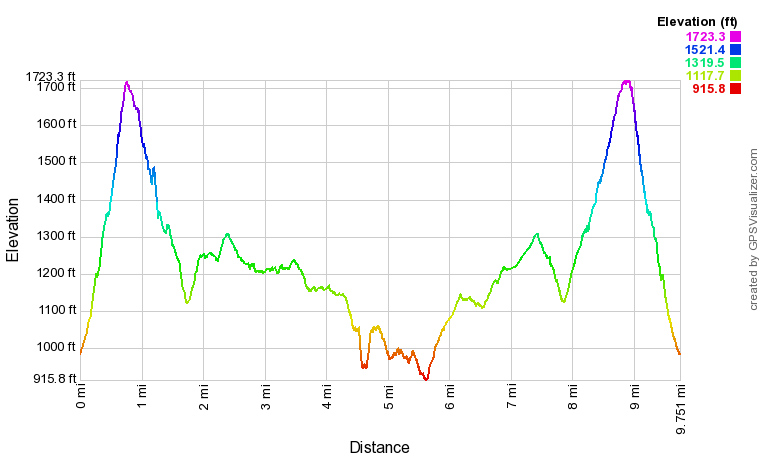
Click the link below to download a .GPX file with a track of this hike.
Details
Most folks have known about Currahee Mountain as a place with cliffs that offer great drive-up views thanks to the gravel service road that leads to the summit. But many people are not aware of the existence of a trail that provides a much more exciting approach to the Currahee vistas from Highway 184. Even though the trail is mostly used by climbers who wish to scale the mountain's tall cliffs, hikers are more than welcome to use it. Folks who hike to the top of Currahee Mountain will then have a chance to extend the hike by joining the Frady Branch Trail System, although most hikers may not find this a desirable option due to the roadwalk involved.
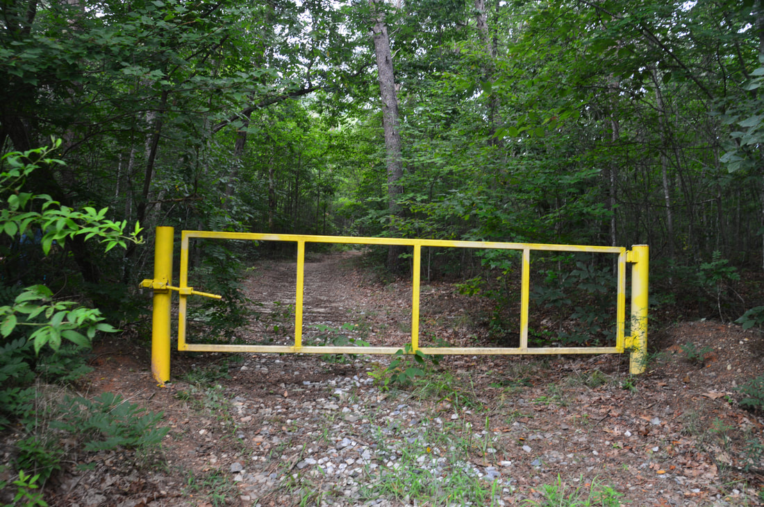
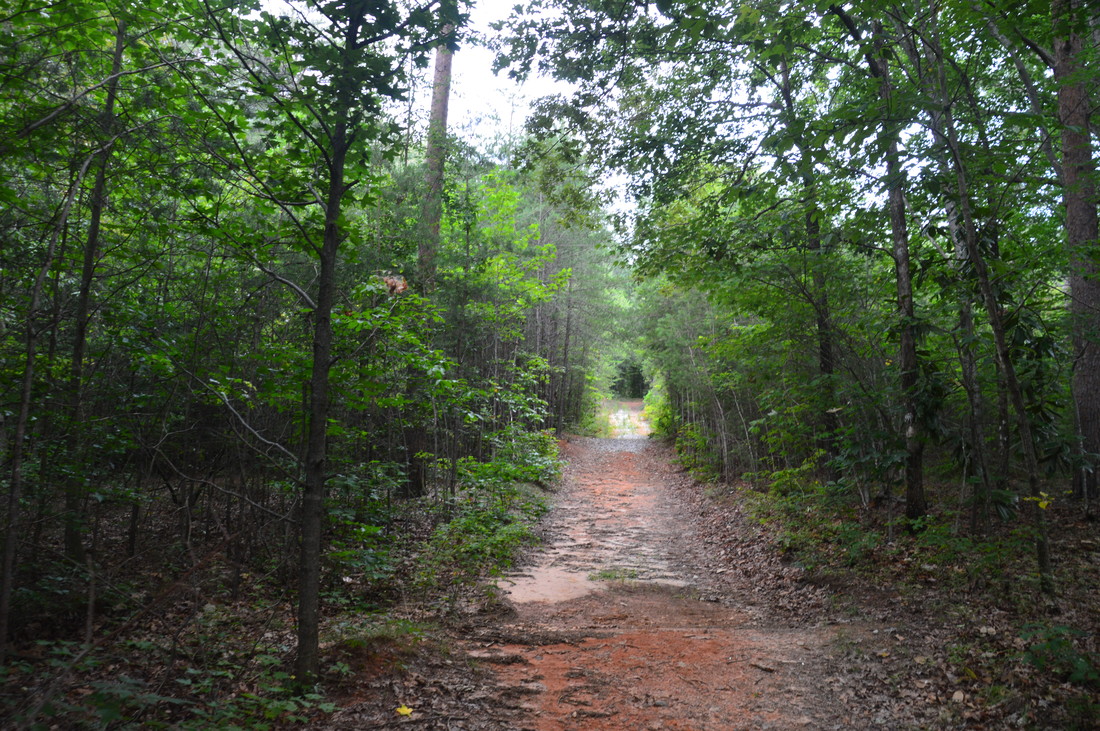
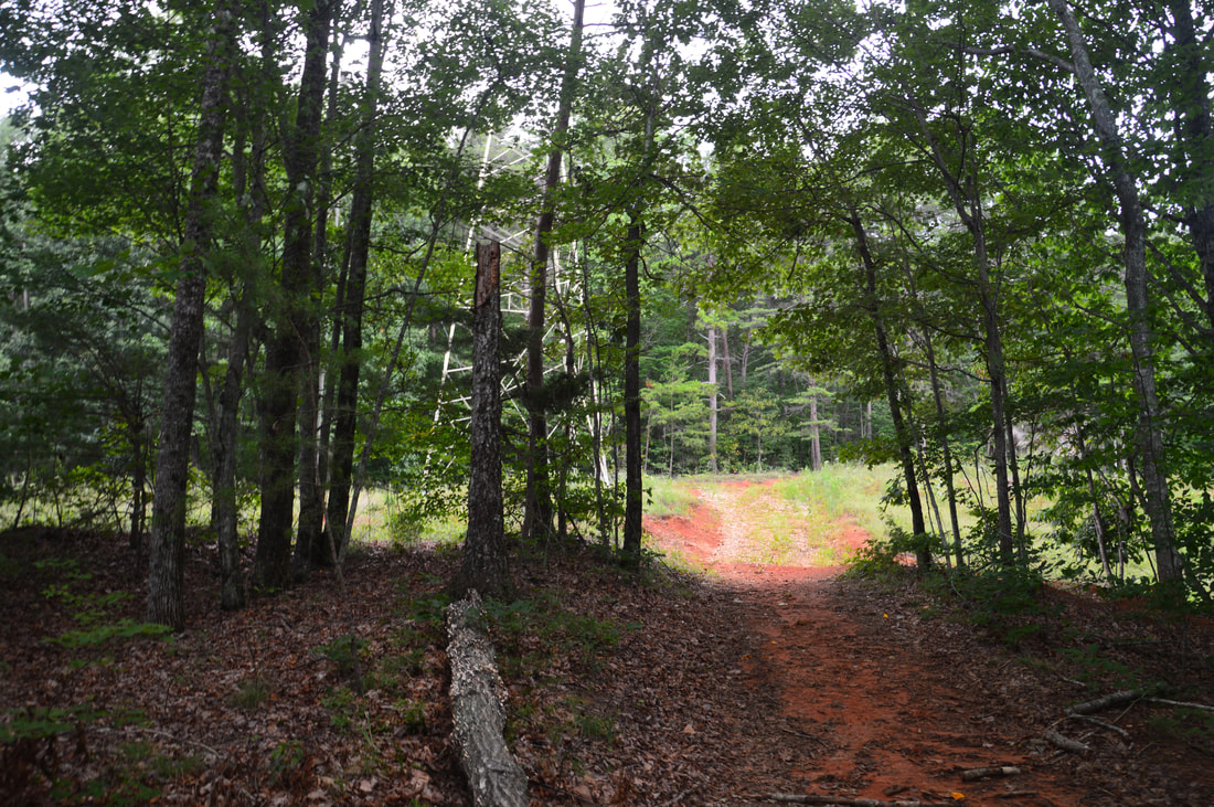
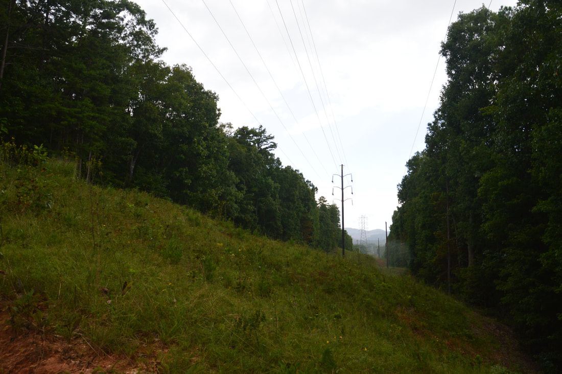
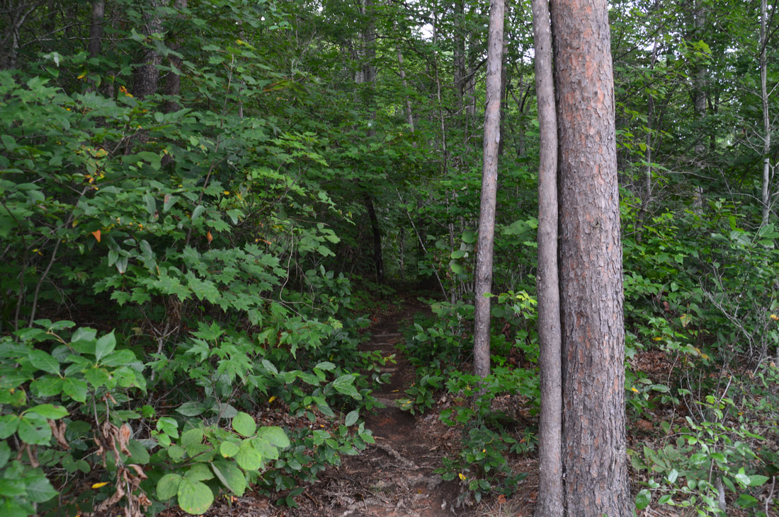
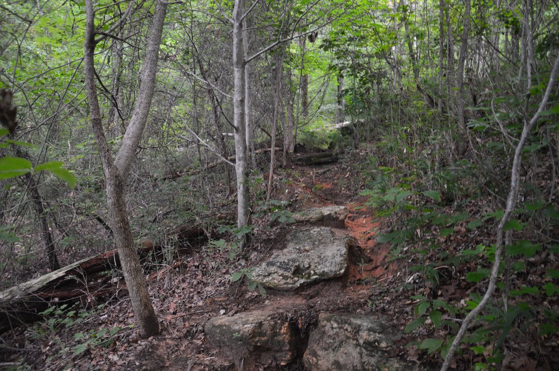
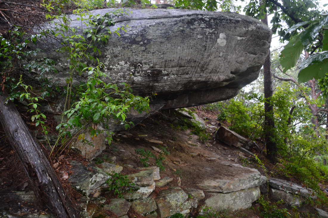
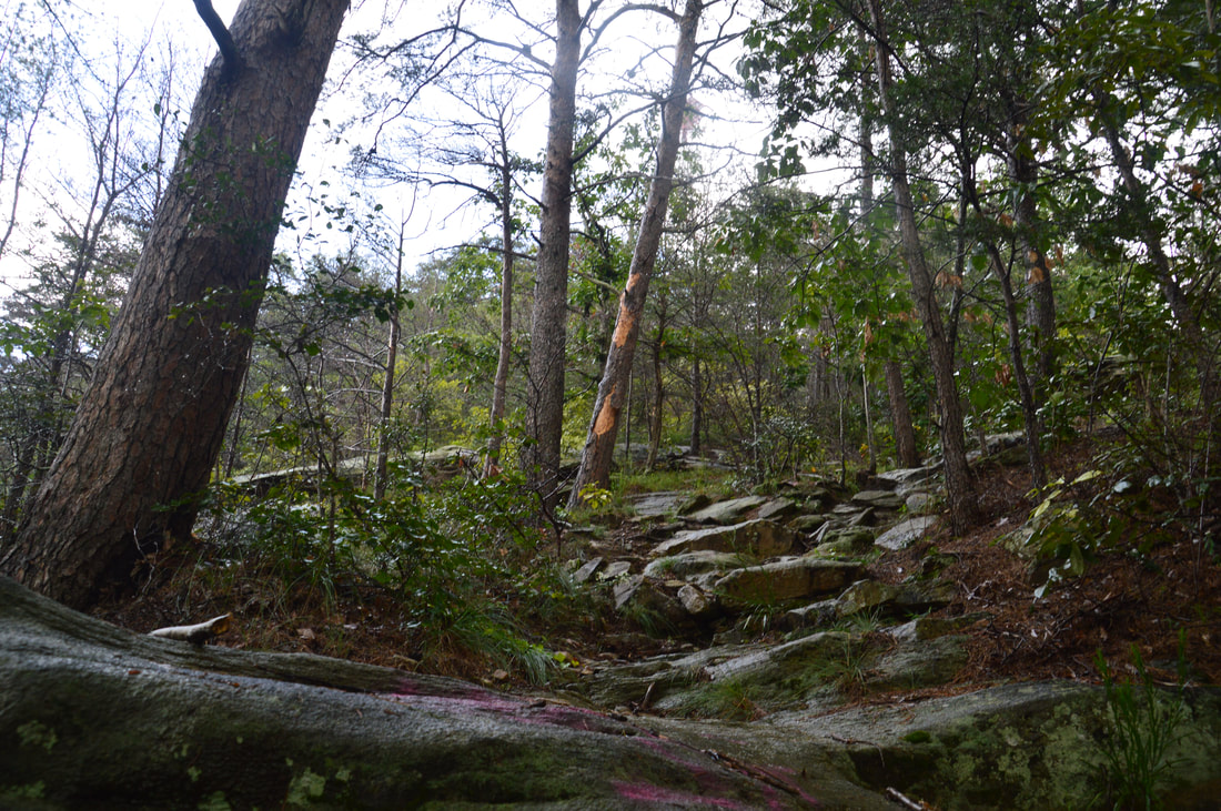
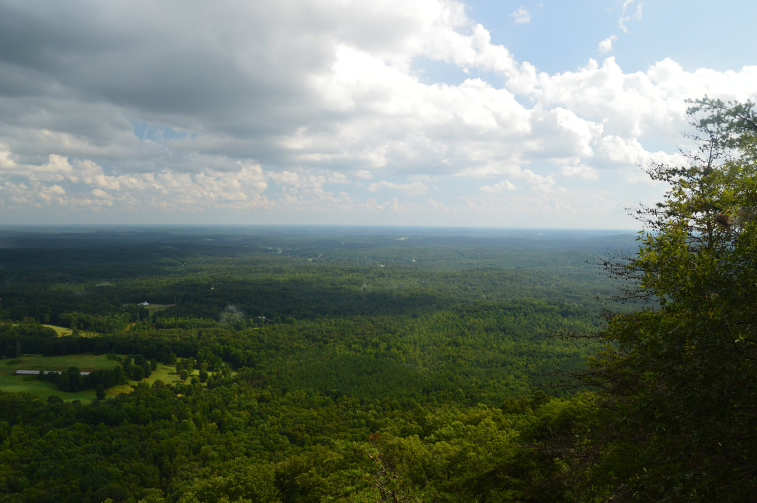
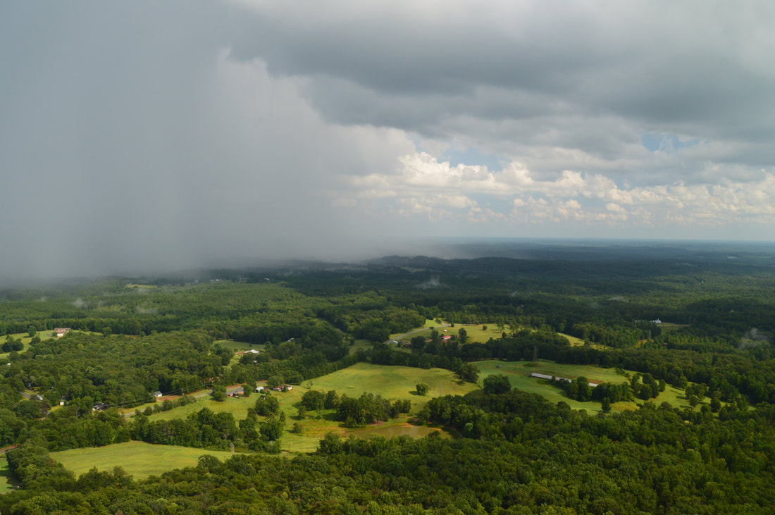
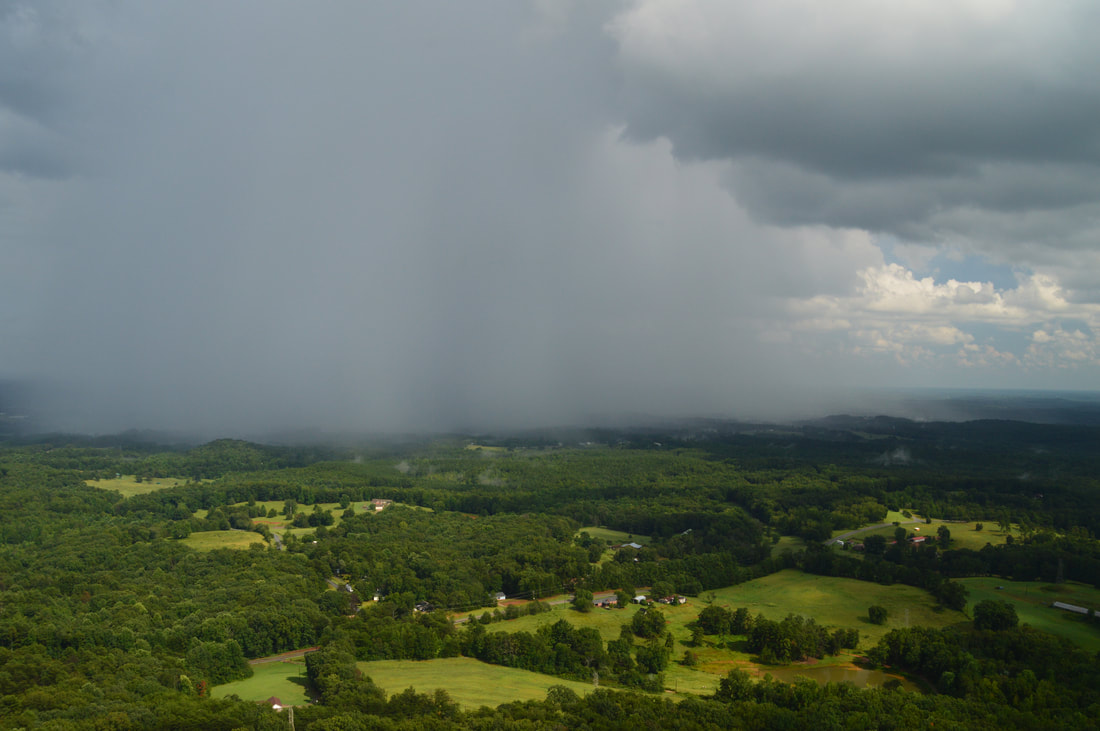
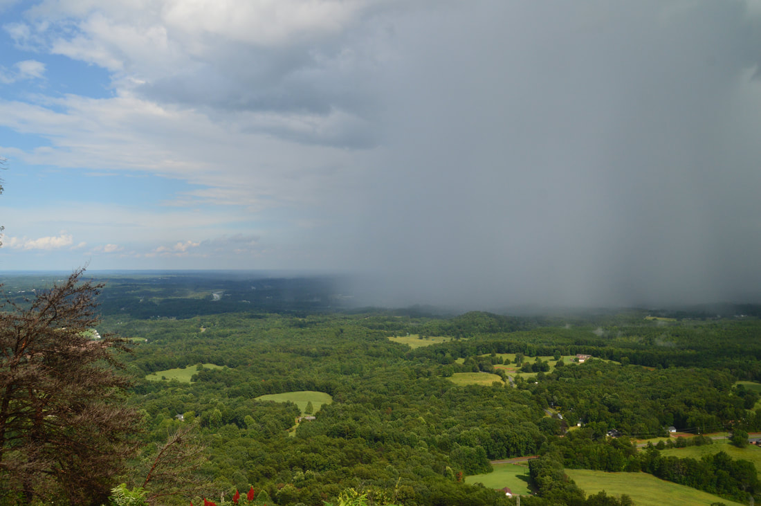
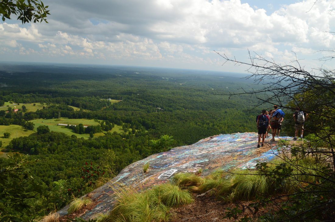
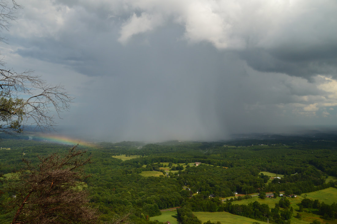
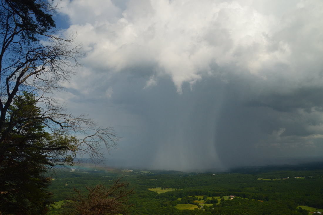
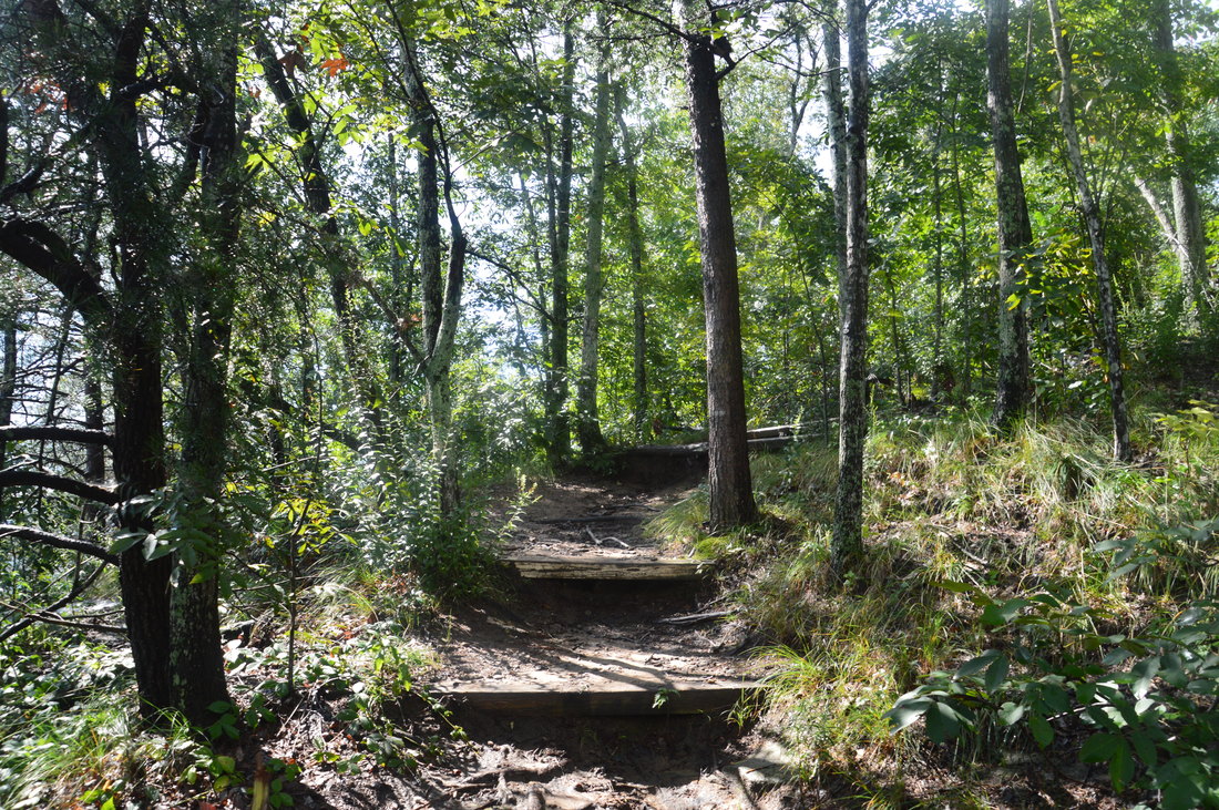
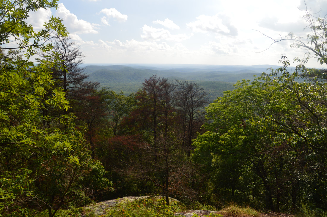
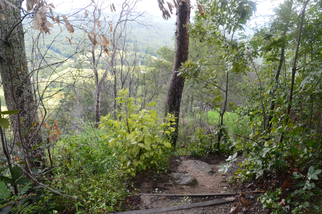
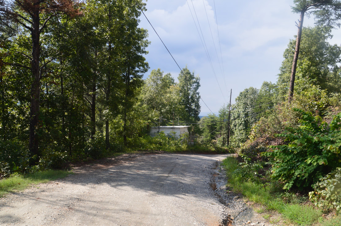
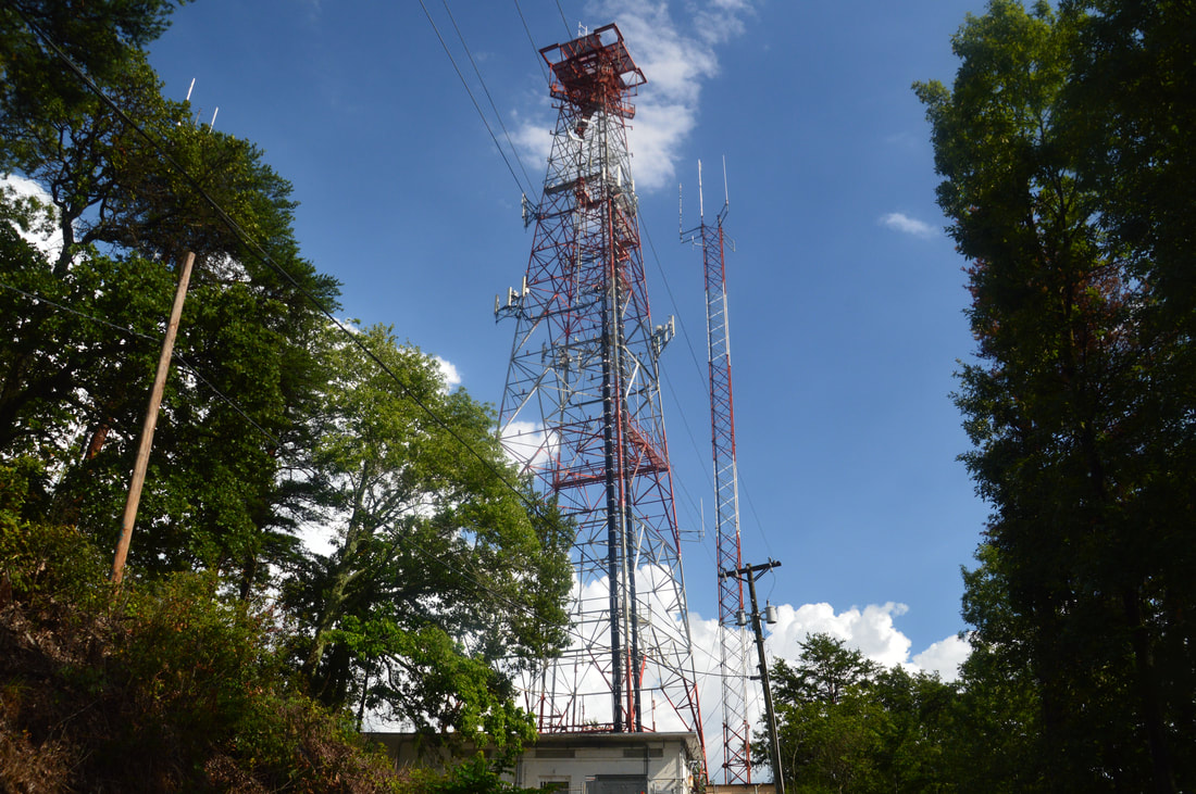
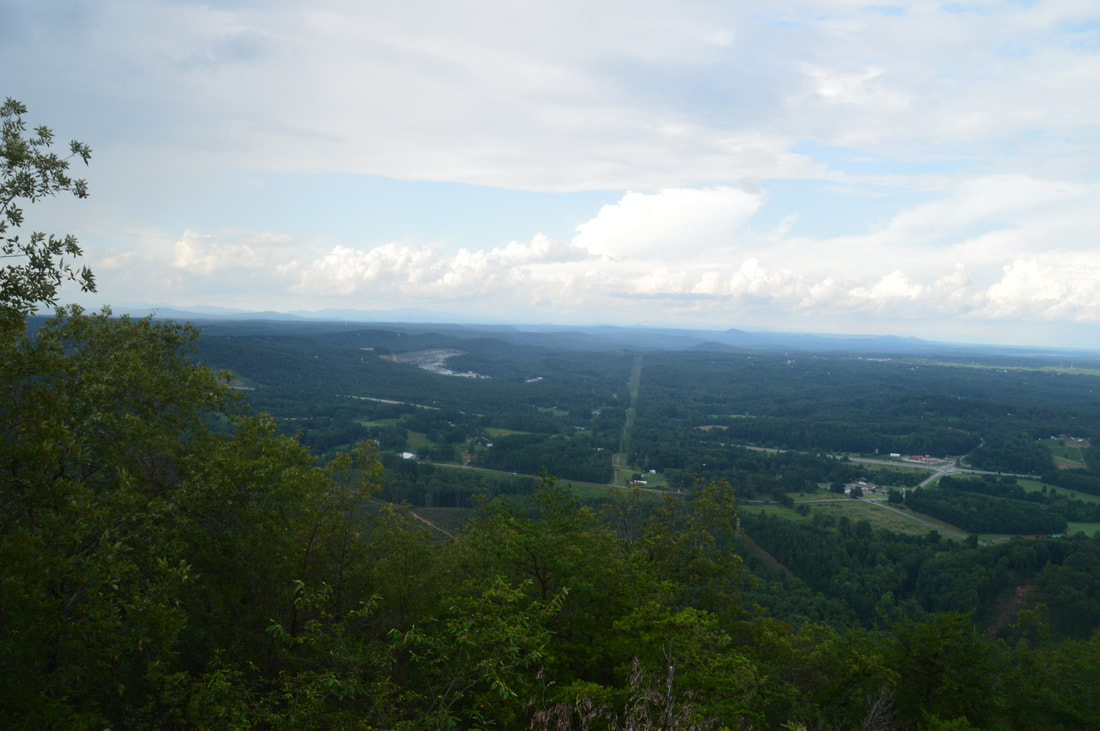
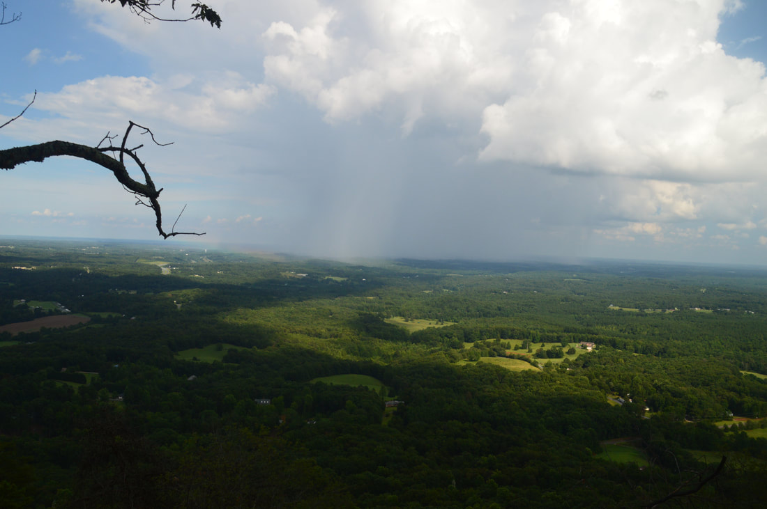
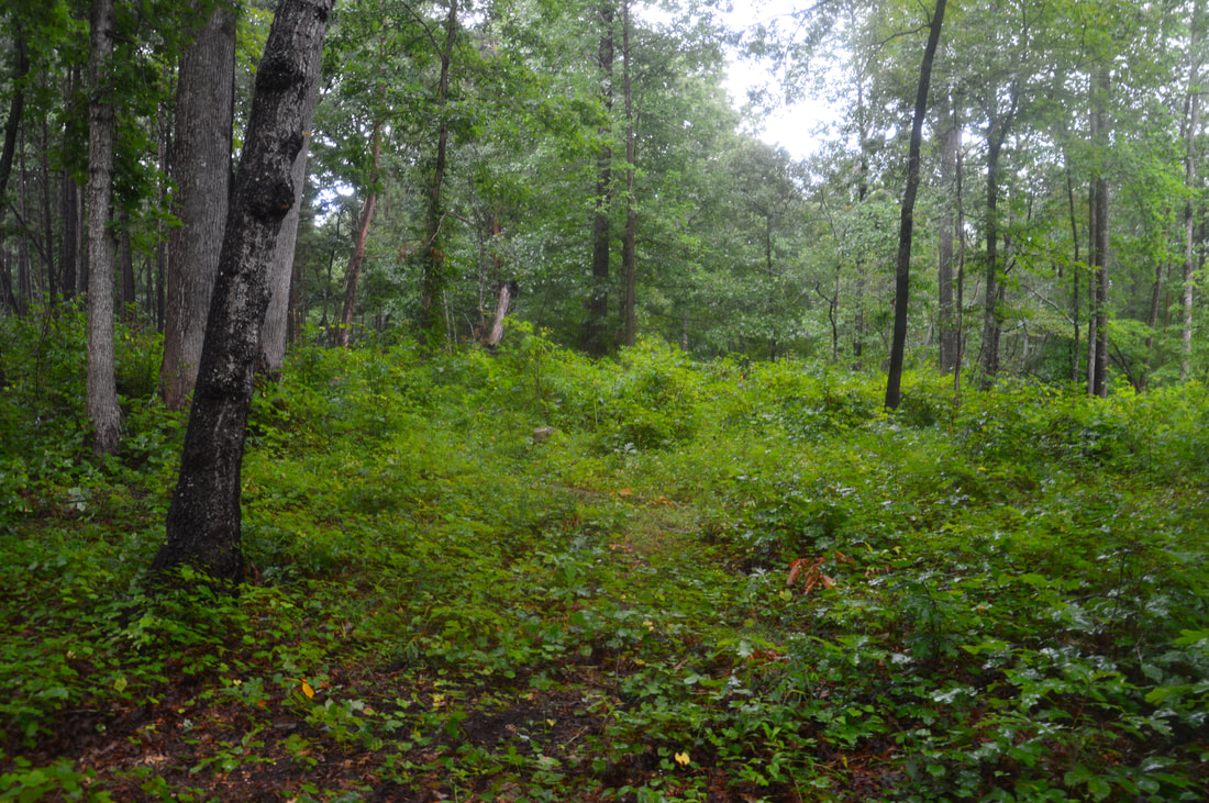
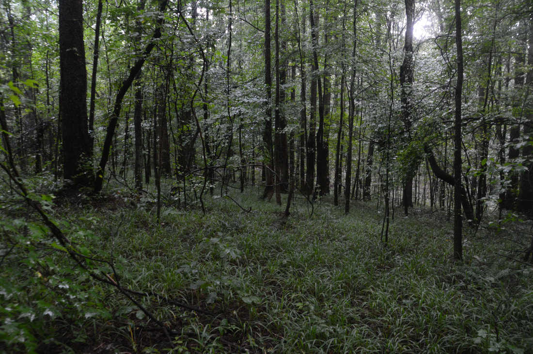
The hike begins at the small semi-circular parking area off Highway 184. The Currahee Mountain Trail begins on a broad forest road behind the heavy yellow gate. The Currahee Mountain Trail is only 0.75 miles long, but in this distance, it ascends about 750 feet! The ascent starts out gentle and easy along the forest road, which acts as a service road for the nearby powerline cut and is even graveled in places. At 0.15 miles, the forest road ends at the powerline cut. A narrow but well-used path continues in the woods on the other side and begins a moderate ascent. The trail lacks any switchbacks and is quite rooty in places, so on your way back down, it may feel unpleasant. Between 0.5 and 0.55 miles, the Currahee Mountain Trail passes a huge boulder and then a small rockhouse on the right. There are several faint side trails leaving to the right in this area, and they likely lead to the base of the Currahee cliffs, but I didn't check them out as I was hiking this part of the trail in a blinding downpour and thunderstorm. At the same time, the trail also becomes very steep - the most difficult part of the ascent begins here. In addition, this part of the trail is very rocky, so the descent will not be much easier! As the trail approaches a small rock outcrop with views, stay left on the main trail. The trail climbs to a much bigger rock slab, the top of which it reaches at 0.7 miles. This is the first and arguably the best vista on Currahee Mountain. You can't miss it, because the broad sloping rock is entirely covered by graffiti. This rock slab provides a breathtaking 180-degree view from northeast to southwest, facing the Piedmont and the Tugaloo River area. Most of the land in the view is flat with only small hills, but that enhances the long-range aspect of the view. When I reached the vista, I was treated to an amazing spectacle: the rain had just ended, and as the sun came out, a super bright rainbow appeared in front of the rain shaft that was steadily moving down the view. From the vista, stay left on the main trail, which continues the steep ascent. About 100 feet farther, a rock outcrop on the left provides a more limited view to the west. A few dozen feet farther, there is a split in the trail. Turn right here and ascend up a series of tall wooden steps. At the top, the trail reaches a fence next to one of several transmission towers that pepper the summit of Currahee Mountain. Follow the fence, reaching Currahee Mountain Road at 0.75 miles. To the right is the end of the road, where there is another vista facing northeast. If you wish to hike just to Currahee Mountain, this second view is a good place to turn around. Otherwise, turn left onto the gravel Currahee Mountain Road and begin descending. At 0.9 miles, there is a roadside vista to the right with more views to the north and east. After a lengthy moderate descent, the road passes through a gap with a powerline cut at 1.8 miles. There is an abandoned structure to the left. The road then makes a short ascent to a ridge, where there is a junction with gated Pear Orchard Road on the left at 2.0 miles. The loop portion of the hike begins here. For now, continue straight along Currahee Mountain Road. The road from now on follows a rollercoaster ridge with small ups and downs. 
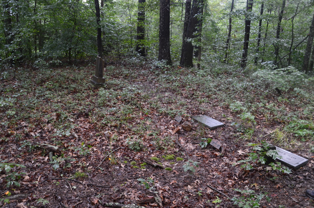
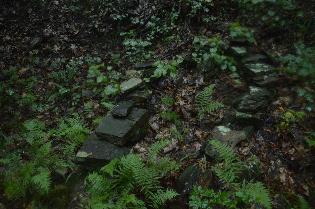
The historic Lathan-Edmonds Cemetery, located near the Frady Branch Trail System, has approximately 45 graves, although only 4 of them are named.
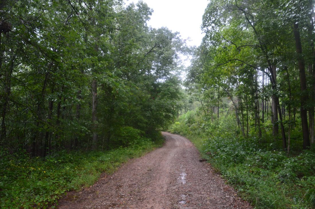
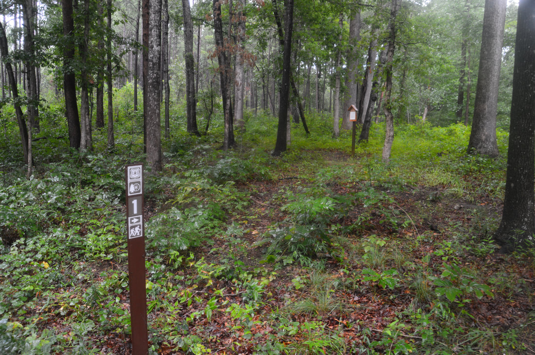
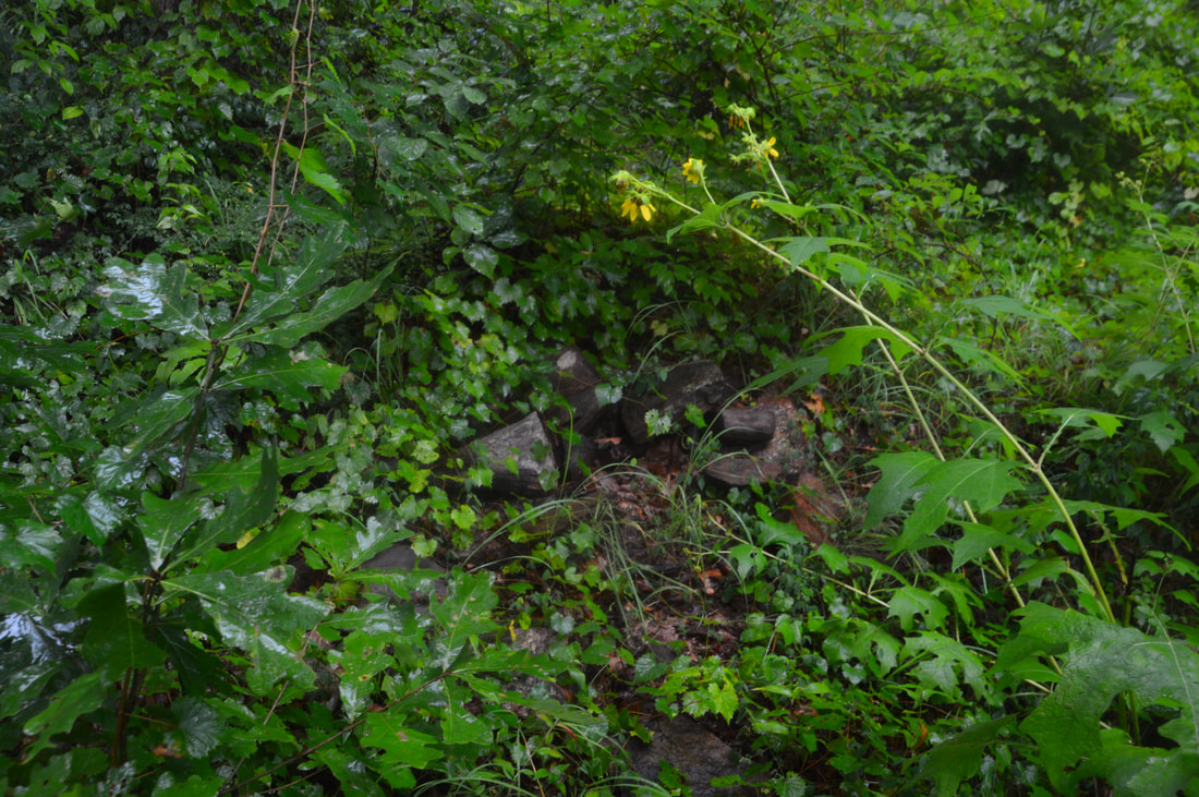
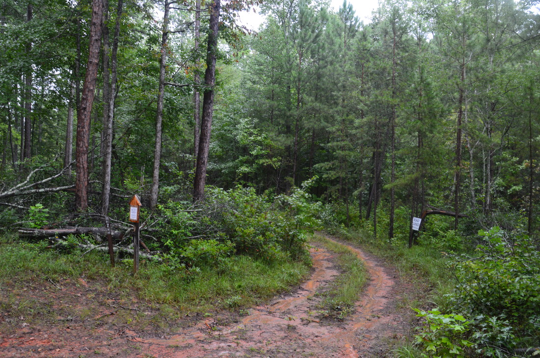
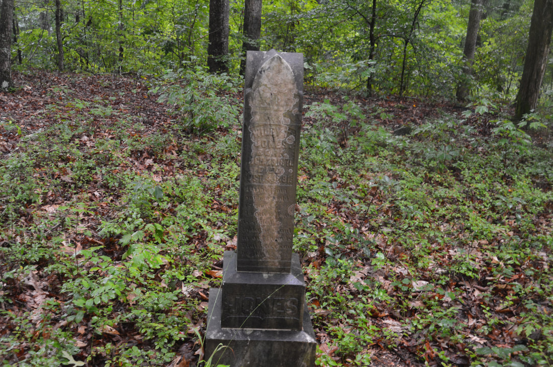
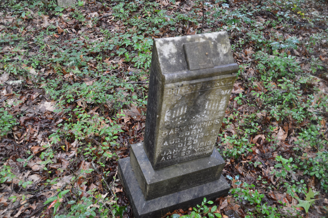
At 2.75 miles, Currahee Mountain Road meets another gated road. Turn left onto the gated road, which is the beginning of the Lathan Cemetery Trail. Note that the gates may be open during hunting season, as this is part of Lake Russell Wildlife Management Area. In about 300 feet, a sign marks the Lathan Cemetery Loop that comes in along a path from the left. Continue straight along the forest road, which is actually graveled in places. Generally, the forest road is nearly flat or descending slightly. At 3.35 miles, the William Marion Edmonds Housesite will be on the left. This is Historic Site #1 on the Frady Branch Trail System. All historic sites along the hike are marked by multiple signs. The Civil War Veteran Marion Edmonds lived at this site. The housesite is just an overgrown clearing now, but there are a few small piles of stones on the ground left from the house's chimney. After checking out the housesite, continue on the forest road southward. You'll reach a sign for Historic Site #2 on the left at 3.7 miles. Here, a spur trail begins along another forest road to Lathan-Edmonds Cemetery. Turn onto the broad road and follow it for about 250 feet. At another sign, turn right onto a faint path that leads to the cemetery. The path soon crosses diagonally a woods road, ascends a small hill, and ends at the cemetery at 3.8 miles. This historic cemetery has approximately 45 graves, but only 4 of them have inscriptions.
From the cemetery, return to the main road and shortly reach a signed junction at 3.95 miles. Here, the Lathan Cemetery Trail bears left on the main forest road joining the Pear Orchard Trail in one direction, while the other direction of the Pear Orchard Trail bears right southward off the gravel road and onto a much narrower forest road with jeep mounds at the beginning. To hike toward Big Leatherwood Falls and the other historic sites, stay right on the Pear Orchard Trail. At 4.05 miles, a short side trail on the right leads to Historic Site #3: the John Lathan Sr Housesite. The Lathan family once lived at this site, which is now even more overgrown than the previous site. There is some interesting historic information about this site on the sign at it. Continuing on the main trail, you'll find that the path becomes a lot more pleasant as it follows a much narrower and more overgrown forest road along a low ridge. The ridge separates the two main headwaters branches of Big Leatherwood Creek. After one curve to the left, the trail shortly makes another curve to the right at a small clearing and a shallow gap in the ridge at 4.45 miles. At this point, a faint path turns left and serves as the access point to Big Leatherwood Falls. The path is only a little better than nothing, as it follows what looks like an overgrown old logging road with several blowdowns. The path also follows the slope on the south side of the ridge. In about 400 feet, there will be a small grassy clearing with miniature rock outcrops down to the right. You may be able to hear what sounds like a small cascade - that's actually Big Leatherwood Falls far below! It is best to leave the path and turn right here, hiking off-trail down toward the creek. Note that if you follow the path to a point where you can see the creek well, you have gone too far and you would have to follow the creek downstream to the falls (taking care to swing around the dangerous cliffs at the top of the falls and avoiding the precipice). Regardless, you should reach the creek at a point about 200 feet below Big Leatherwood Falls. To reach the falls, it is best to cross the creek because the other side is a lot flatter. You may get your feet wet if the water is up. Once on the other side, pick your way through the open woods upstream, reaching the base of Big Leatherwood Falls at 4.65 miles. 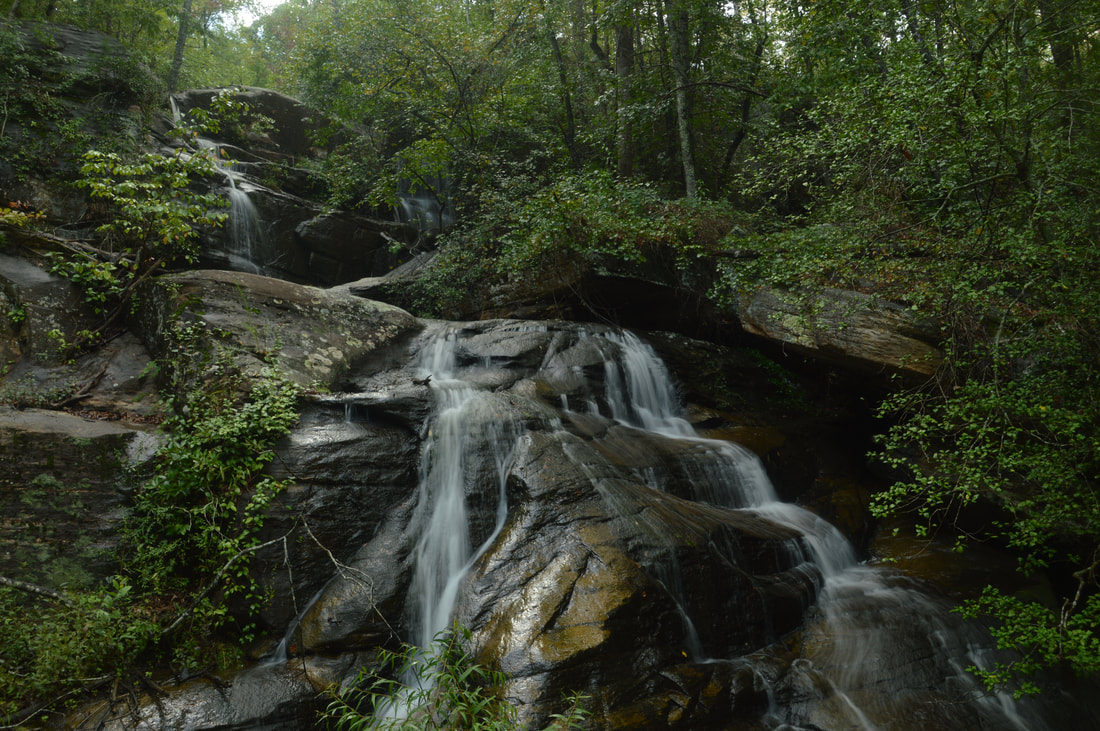
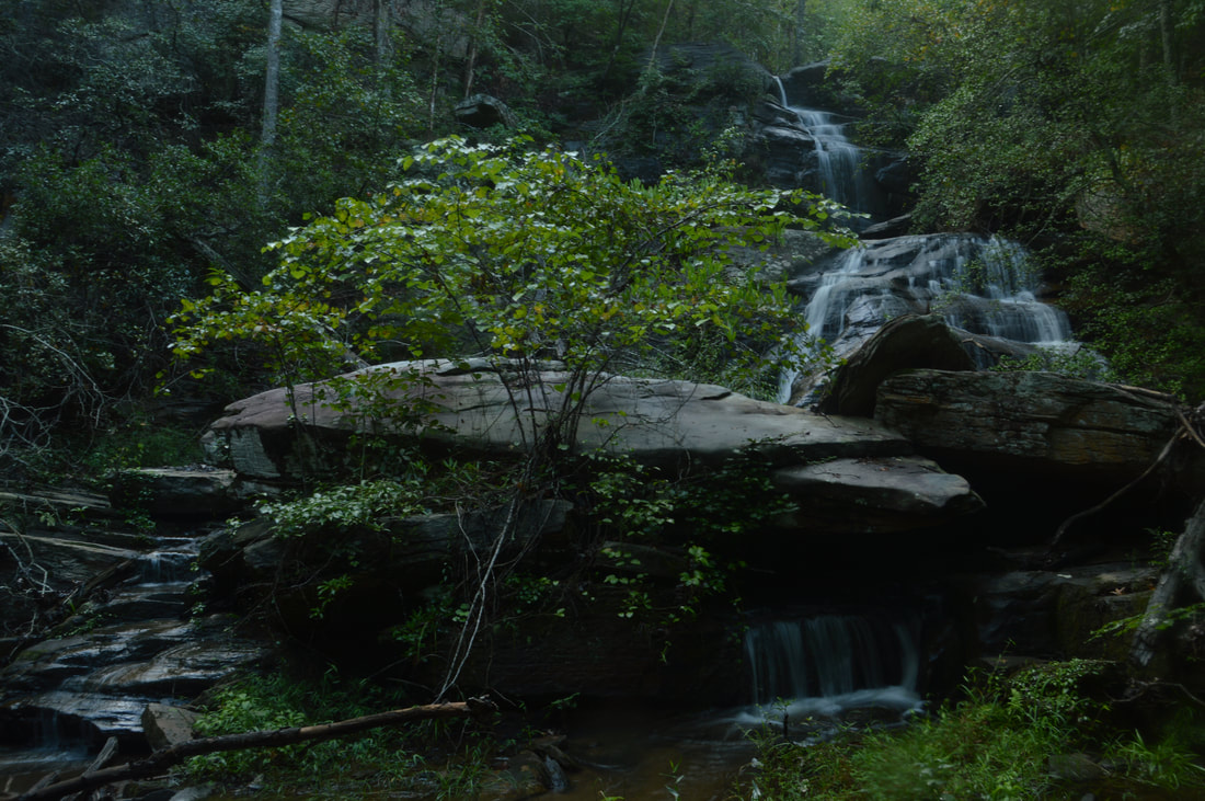
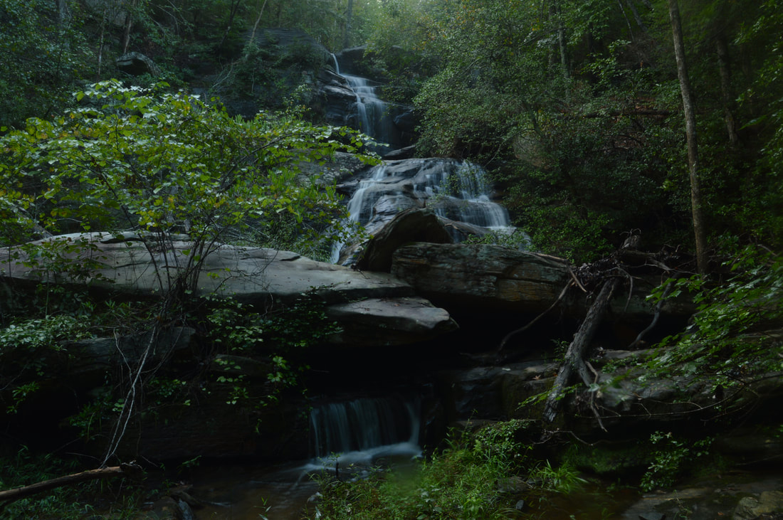
This picture shows the upper 2/3 of 50-foot Big Leatherwood Falls, a triple-tier waterfall located in a small grotto with huge boulders that help to shape a scenic setting.
This waterfall is located on the east branch of Big Leatherwood Creek. The falls did not have any name that I knew of prior to my discovery of it, and I could not find any documentation of it, so I decided to christen it Big Leatherwood Falls, since it's in the headwaters area of Big Leatherwood Creek. It is incredible that this beautiful waterfall is so close to an official trail and yet is so little-known. There were very few signs of foot traffic around the falls. Big Leatherwood Falls consists of three tiers. The upper tier is a double cascade and free-fall down a 30-foot vertical ledge. The middle tier is the most photogenic part of the waterfall, where the water slides 15 feet in many trickles down a colorful rock slab. The lower tier is the smallest, but it is interesting. The flow once again splits - to the left, there is a small stairstep cascade about five feet high, while to the right, the water actually flows through a tiny boulder cave and drops into a shallow channel. Big Leatherwood Falls is tucked back into a small grotto with many huge boulders that shape a gorgeous setting. A serious drawback of Big Leatherwood Falls is that it is in a very small watershed, so in dry periods, the falls will probably not be worth it. With less water, the split channels of flow at the uppermost tier of the falls will be thin. I'm not entirely sure what the regular water level is here, because I got to the falls only about an hour after two consecutive heavy thunderstorms hit the Currahee Mountain area (but actually, I doubt that the bulk of the rainwater had made it to the falls yet). It is safe to say though that the flow at Big Leatherwood Falls will normally be highest in winter and spring.
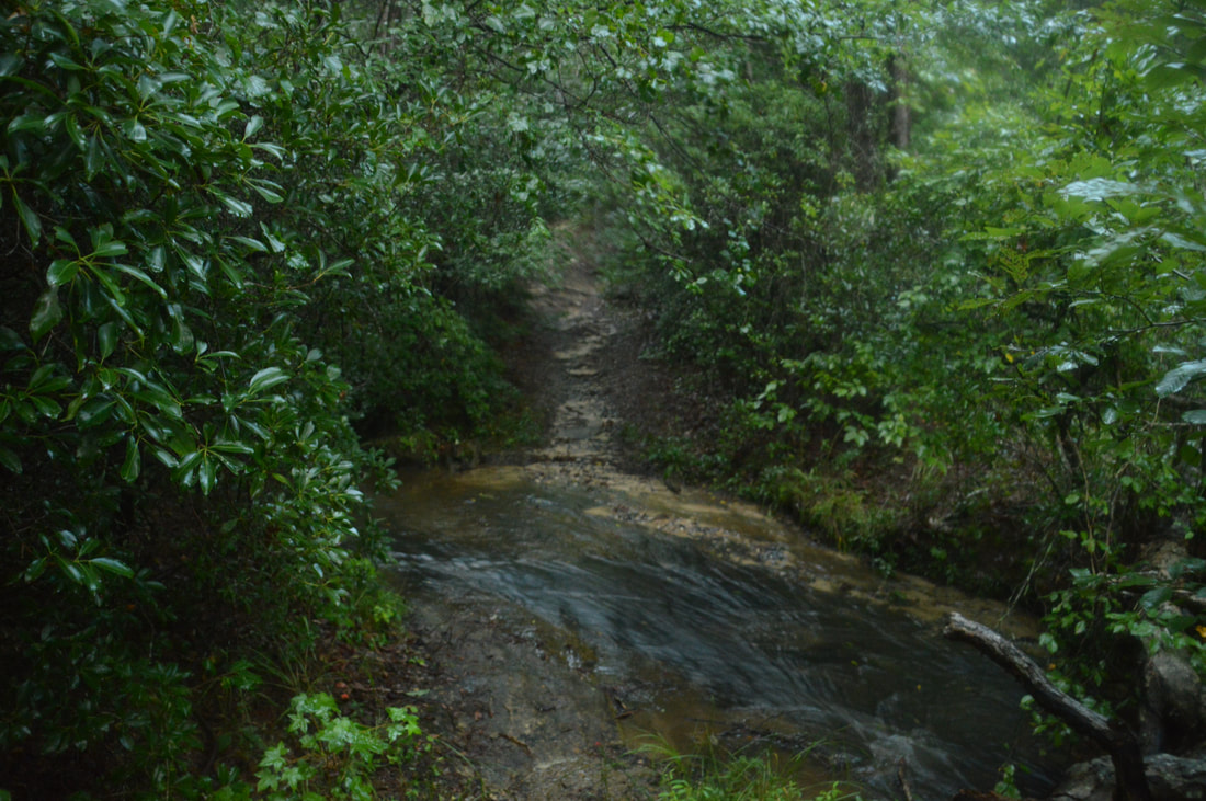
From Big Leatherwood Falls, return to the Pear Orchard Trail and keep following it. At 5.05 miles, the trail descends to the west branch of Big Leatherwood Creek. Just before the crossing, there is a side trail to Historic Site #4 on the right. This side trail is a bit longer than the others. It leads to old sites of a moonshine still and a quarry. The side trail begins with its own crossing of the west branch of Big Leatherwood Creek, which can normally be rock hopped at this point. The trail then reaches a tree with two wooden arrows, one pointing left and one pointing straight, at 5.1 miles. The ring of rocks to the left is all that remains of the moonshine still. The path to the quarry continues straight but becomes a lot fainter, at one point bypassing a group of blowdowns. At 5.2 miles, the path ended in a grassy flat at the creek. There are some small excavations on this side of the creek here, and you can see the main part of the old quarry on the other side. It was getting late and it looked like crossing the creek would be tricky, so I didn't explore the site fully. Return to the main trail and cross the west branch of Big Leatherwood Creek. This could be a shallow wade if the water is up. On the other side of the creek is Historic Site #5 to the right: the Joanna Gibson Housesite. Joanna Gibson was accidentally shot at her house here in 1917 on Christmas Day. The site is a very small grassy clearing that is getting overgrown, but it is a pretty spot above a series of flat rock slabs along the creek. A sign to the left discusses the Mary Steele Waterfalls, which is actually a long sliding cascade. Even though it's not a waterfall in the true sense, it's a pretty spot. The name of the cascade is a tribute to Mary Steele, who was raised in the area that is now Lake Russell WMA and showed many of the area's historic sites to the Forest Service. The sign states that without Mary's help, we would know only a small part of Lake Russell WMA's history. 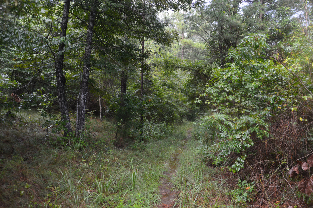
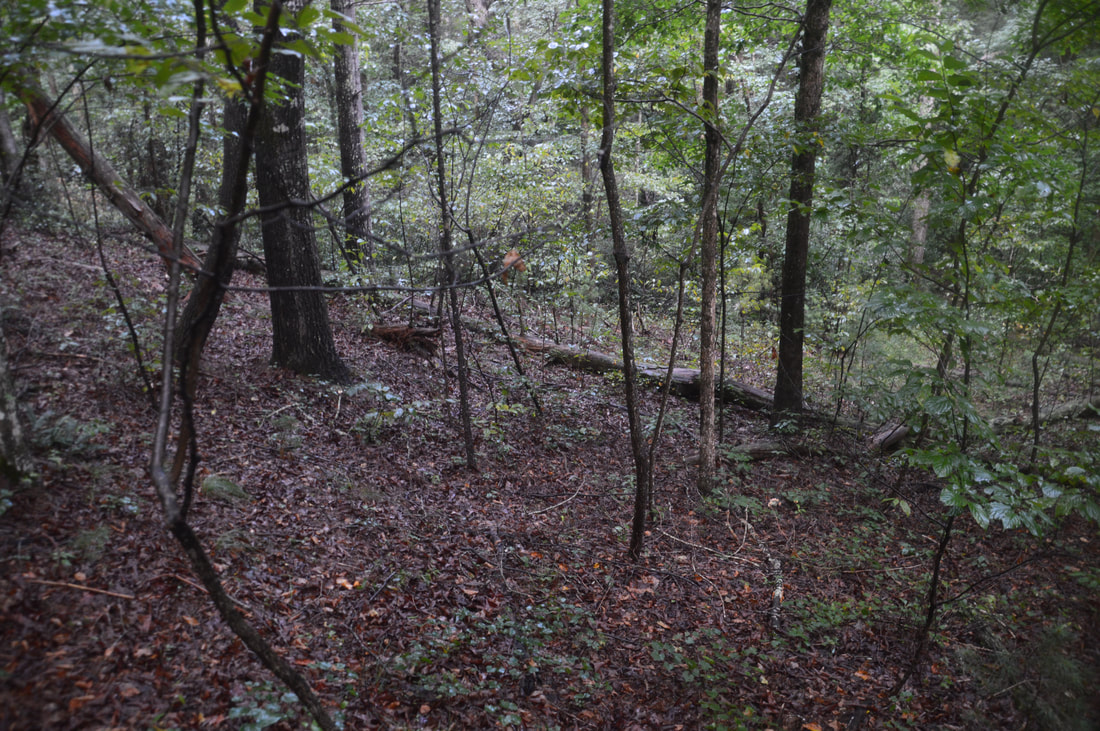
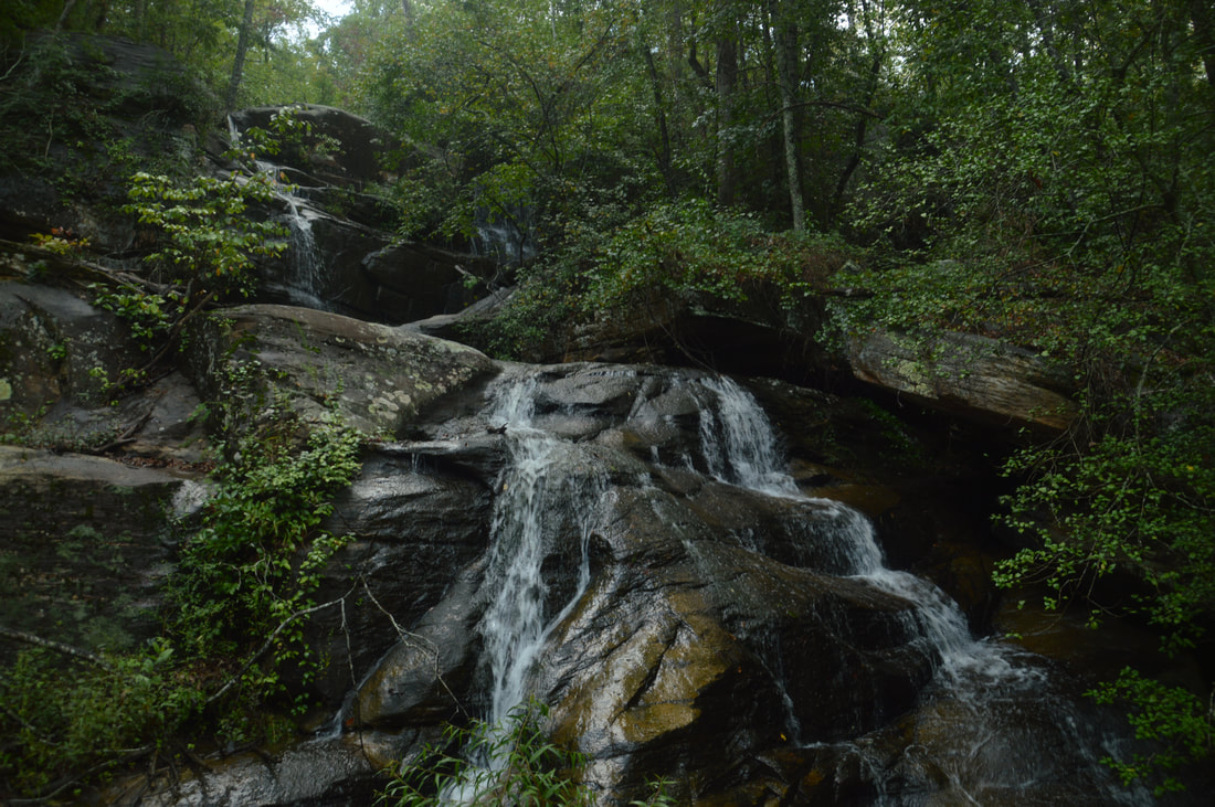
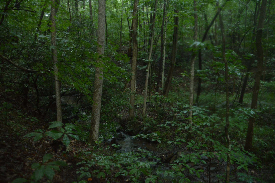
The west side of the Pear Orchard Loop Trail follows old forest roads along the ridge that divides the west and east branches of Big Leatherwood Creek.
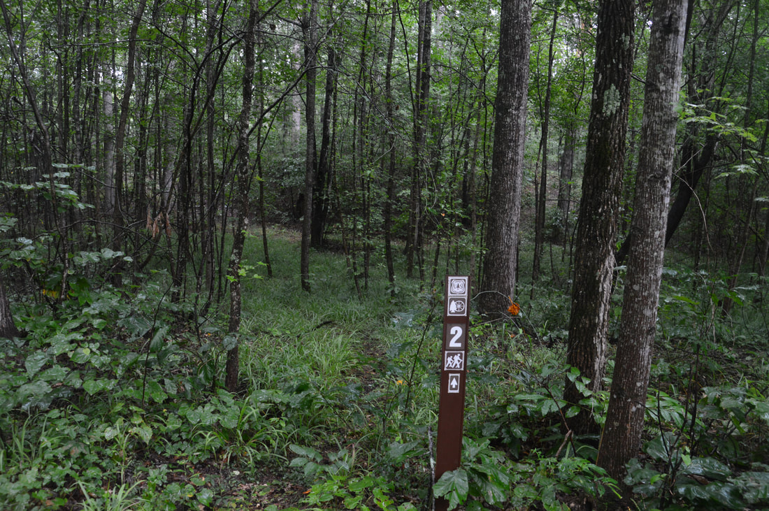
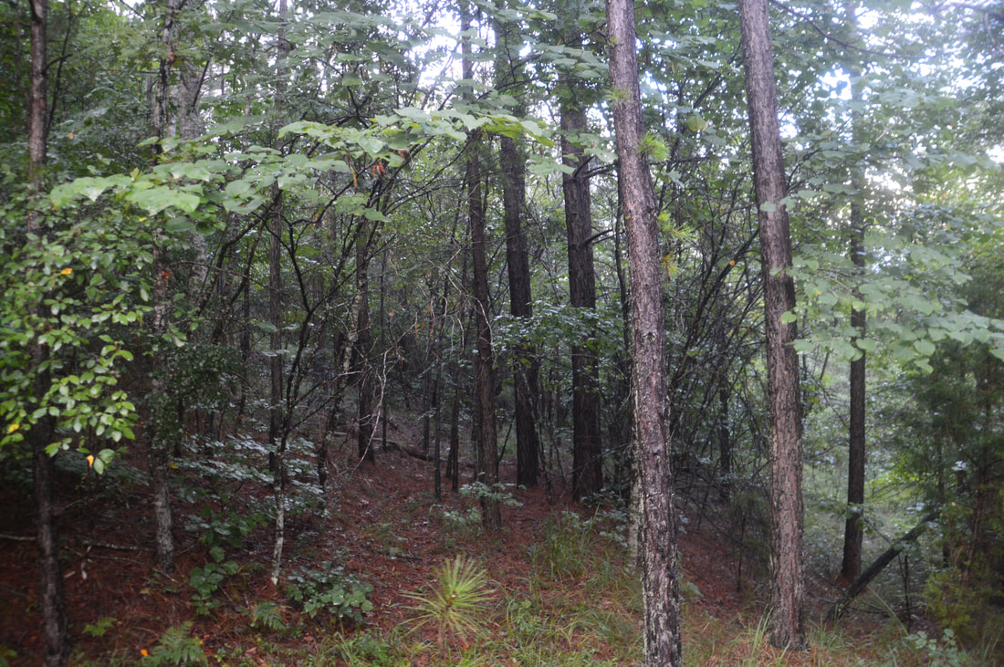
The Pear Orchard Trail briefly leaves the creek, crossing a low ridge and descending to a junction at 5.6 miles. Some of the signs at the junction are confusing and outdated. The Pear Orchard Trail turns left here, in the direction of Big Leatherwood Creek Trail and Frady Branch Trail. The old route of the Big Leatherwood Creek Trail used to turn right onto the broad forest road, as the sign indicates, but the trail was rerouted due to severe erosion and no longer goes that way. Instead, the trail along the forest road to the right now serves as a connector trail to Forest Road 87C, where there is an alternative trailhead north of Farmer Mountain. My initial plan was to hike the Big Leatherwood Creek Loop as well, but I got utterly confused when I followed the signs and had to backtrack, adding nearly 2 miles to my hike (although this is not reflected in the track above). I will have to save the Big Leatherwood Creek Trail for another day. Thus, to continue hiking the upper loop, turn left at the junction. In around a hundred feet is a crossing of Big Leatherwood Creek. This could be a shallow wade despite the small volume of the creek. The trail then makes a moderate climb up a low ridge. Somewhere in this area the Big Leatherwood Creek Trail's new route is supposed to leave to the right, but I must have missed it. Meanwhile, the Pear Orchard Trail climbs up to a T-intersection with the gated Pear Orchard Road at 6.0 miles. The rest of the trail is along this road. Turn left onto it and continue a slow ascent, passing one end of the Frady Branch Trail on the right at 6.2 miles. The Frady Branch Trail eventually reaches another parking area of Highway 184.
The Pear Orchard Trail reaches a junction with another gravel forest road at 6.65 miles. Here, the Pear Orchard Trail turns left onto the other forest road - the same one that you left when you left the Lathan Cemetery Trail earlier in the day. At this junction, the Lathan Cemetery Trail comes in from the left and continues straight. Stay straight on the Lathan Cemetery Trail. You are also following the west side of the Frady Branch Trail. About 250 feet farther, the Lathan Cemetery Trail bears left onto a single-track path. Stay right on the ascending forest road toward Currahee Mountain. At 7.1 miles, the Frady Branch Trail leaves diagonally to the right and descends down to the Frady Branch Trailhead off Highway 184. Stay straight on the forest road (this is still Pear Orchard Road but not the trail with the same name), which finally reaches a high point on the ridge before reaching Currahee Mountain Road at 7.6 miles. Here, turn right onto the road and retrace your earlier steps to the summit of Currahee Mountain. The ascent along the road is quite steep and will feel difficult after a long day. Near the summit of Currahee Mountain, make sure to pick up the trail along the transmission tower fence at the final switchback on the road. Continue retracing your earlier steps past the vista and down the very steep and rocky trail to Highway 184. You will return to the Currahee Mountain Trailhead at 9.8 miles, concluding the hike. Mileage
0.0 - Currahee Mountain Trailhead
0.7 - Currahee Mountain Vista 1 0.75 - Currahee Mountain Summit and Vista 2 2.75 - Leave Currahee Mountain Road 3.35 - William Marion Edmonds Housesite 3.8 - Lathan-Edmonds Cemetery 4.05 - John Lathan Sr Housesite 4.65 - Big Leatherwood Falls 5.2 - Old Quarry Site 5.35 - Joanna Gibson Housesite 7.6 - Join Currahee Mountain Road 9.8 - Currahee Mountain Trailhead Variations
Hike out and back to Currahee Mountain from Highway 184 - 1.5 Miles
Hike out and back to Big Leatherwood Falls from Lathan Cemetery Trailhead (includes all historic side trips) - 3.6 Miles Hike the Upper Frady Branch Loop from Currahee Mountain Road - 4.85 Miles Bonus Stops
If you've never seen Toccoa Falls - one of Georgia's most incredible waterfalls - in Toccoa Falls College, it could be a good option to add on to this hike. A lesser-known waterfall in the area called Tabor Falls will also serve as a great bonus stop.
PicturesVideos
0 Comments
Leave a Reply. |
About MeMark Oleg Ozboyd Dear readers: I have invested a tremendous amount of time and effort in this website and the Georgia Waterfalls Database the past five years. All of the work that has gone in keeping these websites updated with my latest trip reports has almost been like a full-time job. This has not allowed me to pick up a paid job to save up money for college, and therefore, I I've had to take out loans. If you find the information on this website interesting, helpful, or time-saving, you can say "thanks" and help me out by clicking the button above and making a contribution. I will be very grateful for any amount of support you give, as all of it will apply toward my college tuition. Thank you!

Coming in 2022-2023?
Other Hiking WebsitesMiles HikedYear 1: 540.0 Miles
Year 2: 552.3 Miles Year 3: 518.4 Miles Year 4: 482.4 Miles Year 5: 259.9 Miles Archives
March 2021
Categories
All
|
||


 RSS Feed