HIKING THE APPALACHIANS AND BEYOND
  • Home
  • Trail Reports
    • Best Hikes
    • Hikes with Scenic Views
    • Hikes with Water Features
    • Alabama
    • Georgia
    • Florida
    • North Carolina
    • South Carolina
    • Tennessee
    • Vermont
    • Virginia
  • Map
  • Hike List
  • Testimonials
  • Resources
  • Contact Us
  • Southeast Nature Society
    • Our Team
  • Georgia Waterfalls Database

Chattahoochee National Forest: Tabor Falls (Waterfall on Unnamed Tributary of Middle Fork Broad River), Cornelia, Georgia

8/24/2017

10 Comments

 
Picture
The Lake Russell Wildlife Management Area covers the southeastern extremity of Chattahoochee National Forest. This low-elevation sector of the forest is not known for pleasant hiking trails and spectacular waterfalls/overlooks to the extent that other parts of the forest are. But despite its low elevation, the Lake Russell area is home to a number of waterfalls, most of which have slipped under the radar of hikers and waterfall enthusiasts for years. One of the most spectacular waterfalls is a 50-foot sheer drop - historically referenced to as Tabor Falls - that is located well up an unnamed tributary of the Middle Fork Broad River. Even though a distinct path leads almost to the base of Tabor Falls, the waterfall is largely unknown to the outdoors community, and you're unlikely to see other people in this remote corner of Lake Russell WMA - although there may be exceptions during hunting season. This hike occurred on Saturday, August 12th, 2017. My plan was to find the easiest route from Sellers Road to a waterfall that I discovered on terrain and satellite imagery on an unnamed tributary of the Middle Fork Broad River, learning after my hike that the waterfall's historical name is Tabor Falls. I was surprised to find an unofficial trail in great condition leading almost to the base of the waterfall with only a short off-trail scramble at the end. 

Summary

R/T Length of Trail: 2.0 Miles 
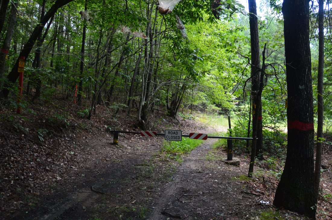
Duration of Hike: 2:00 (includes lengthy stop at Tabor Falls) 
Type of Hike: Out and Back 
Difficulty Rating: 3 out of 10 
Total Elevation Gain: 342 Feet 
Pros: Good trail almost to the end 
Cons: Tabor Falls is on a low-volume stream; the final scramble to the base of the falls lacks a distinct path 
Points of Interest: Tabor Falls - 8 stars (with adequate water flow) 
Trail Blaze Colors: None, not an official trail 
Best Seasons to Hike: Winter 
Fees: None 
Beginning Point :Sellers Road Gate 
Directions from Cornelia, GA: From the intersection of Main Street and Wyly Street near downtown Cornelia, follow Wyly Street/Highway 13 East (which turns into Dicks Hill Parkway) for 4.9 miles. Then, turn right onto Sellers Road. In 0.4 miles, Sellers Road crosses a bridge across railroad tracks. 0.1 miles farther, Sellers Road turns unpaved. Continue straight on the dirt road - which should be suitable for most passenger vehicles - for 0.2 miles to a small turnaround and gate. This is the parking area where the hike begins. Note that the gate may be open during hunting season, allowing one to drive right to the beginning of the trail about 0.25 miles farther, although at the time of my hike, there were some mud holes along the gated stretch. 

Map

Picture
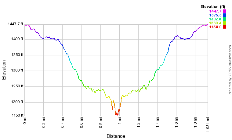
Click the link below to download a .GPX file with a track of this hike. 
tabor_falls_in_lake_russell_wma.gpx
File Size: 75 kb
File Type: gpx
Download File

Details

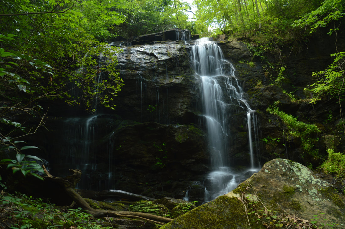
Everyone knows about Toccoa Falls, one of Georgia's tallest and most spectacular waterfalls, near Toccoa and not far from Lake Russell WMA. In May 2016, I hiked a loop trail in Lake Russell WMA that visited a small waterfall known as Nancytown Falls. Since then, I've always wondered if the area has other waterfalls besides these two that people are mostly unaware of, and a recent look at the area via Google Earth's satellite imagery, as well as terrain and topographic maps, revealed the possibility of nearly a dozen other waterfalls of varying size. One of the most promising locations was a particularly tall drop on a small tributary of the Middle Fork Broad River. With there not being any documentation on the web of a waterfall at that location, and with it being fairly close to a road, my curiosity was piqued and I decided to check it out. I was surprised to find an unofficial but clearly well-used trail leading almost to the base of the falls - which in turned exceeded my expectations in term of beauty. When I got home, I did extensive research about the falls and even contacted local rangers. It appears that the waterfall has the historic name "Tabor Falls". A Tabor Falls is referenced as "one of the most beautiful waterfalls in the WMA" in the book "Life Along the Middle Broad River". Per the book reference, Tabor Falls is located northwest of the Toccoa Pumping Station (the site of which is near the confluence of the unnamed tributary and the river) and west along Guard Camp Road (today, it is Sellers Road but old topo maps show the former name) near the old George Sellars homesite (I have not been able to identify the exact location of the site, unfortunately, thus lending a slight degree of uncertainty to the reference). 

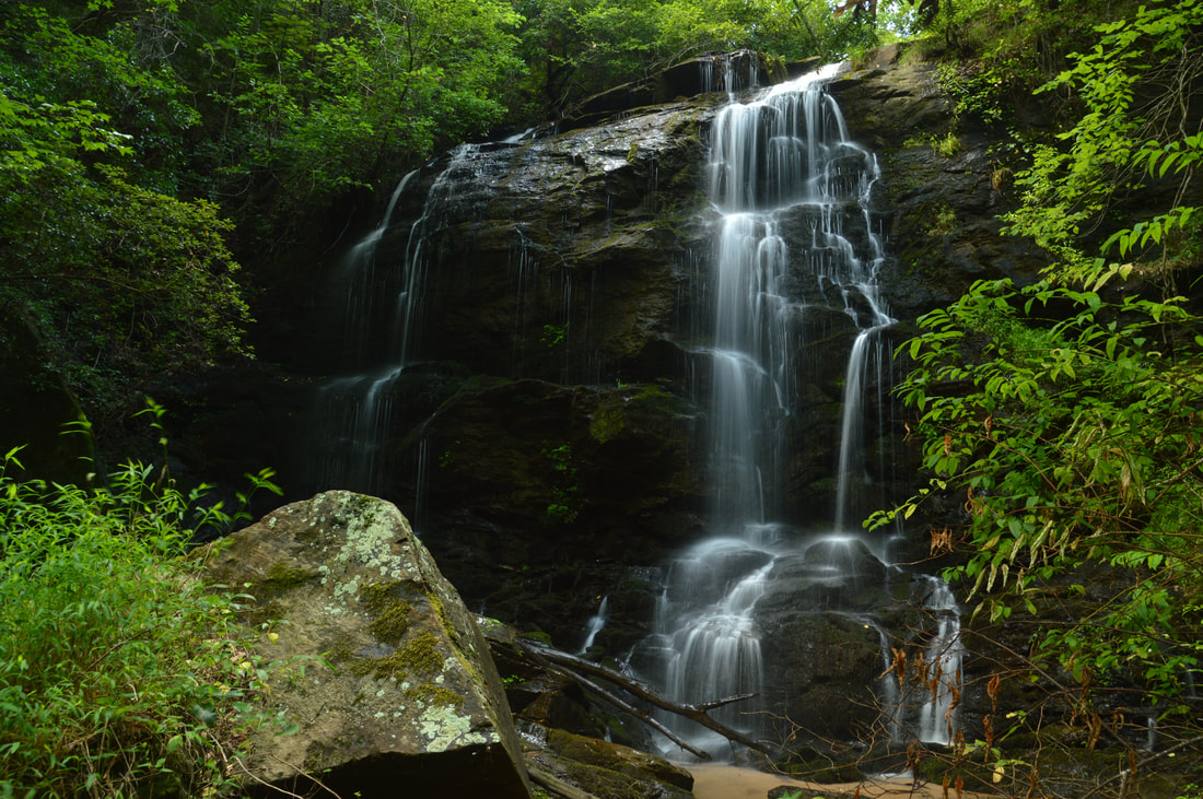
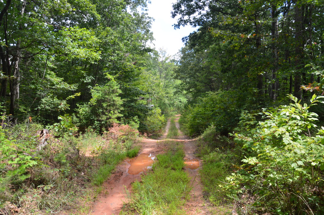
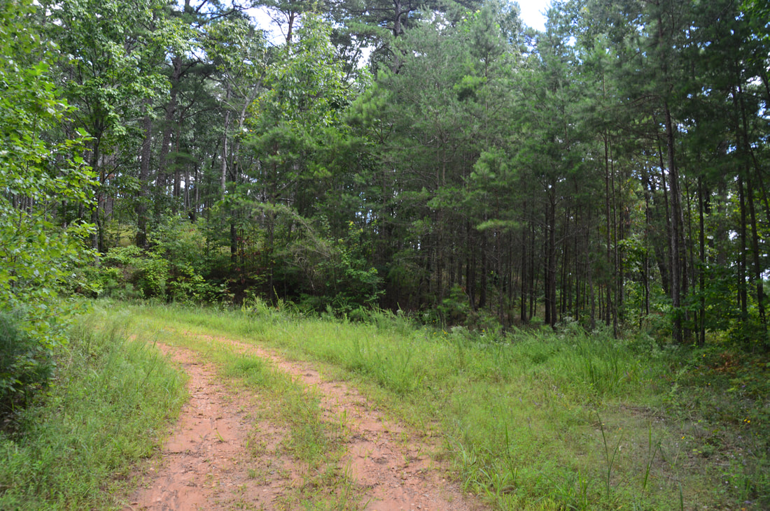
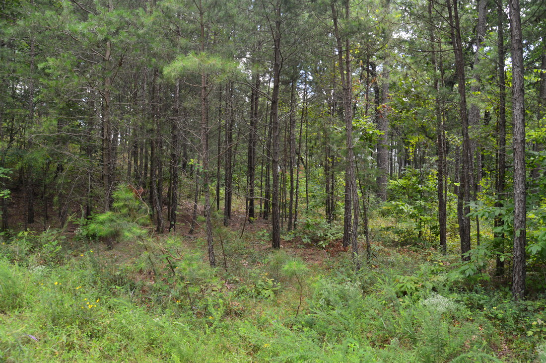
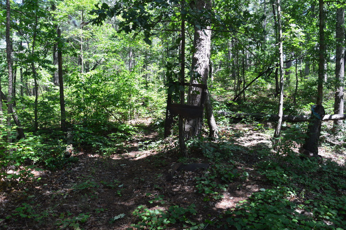
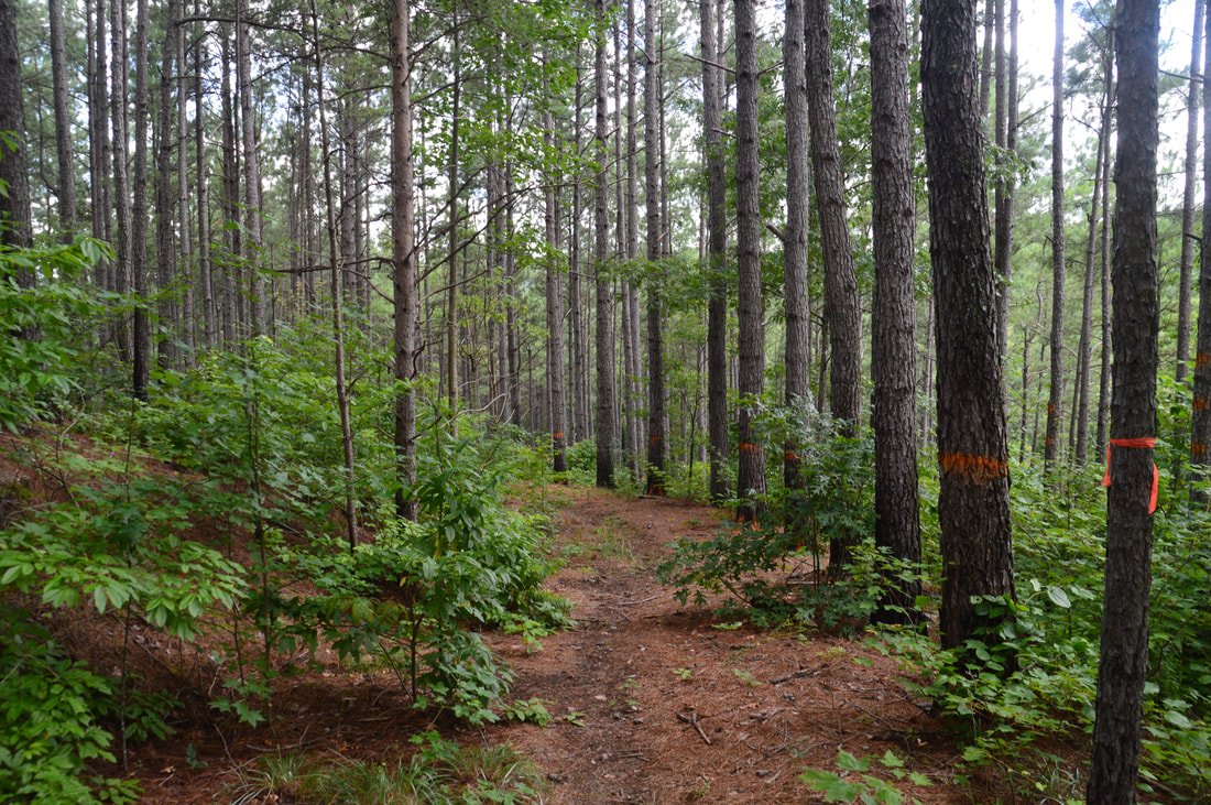
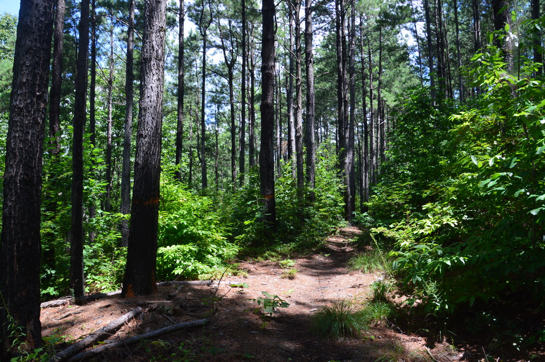
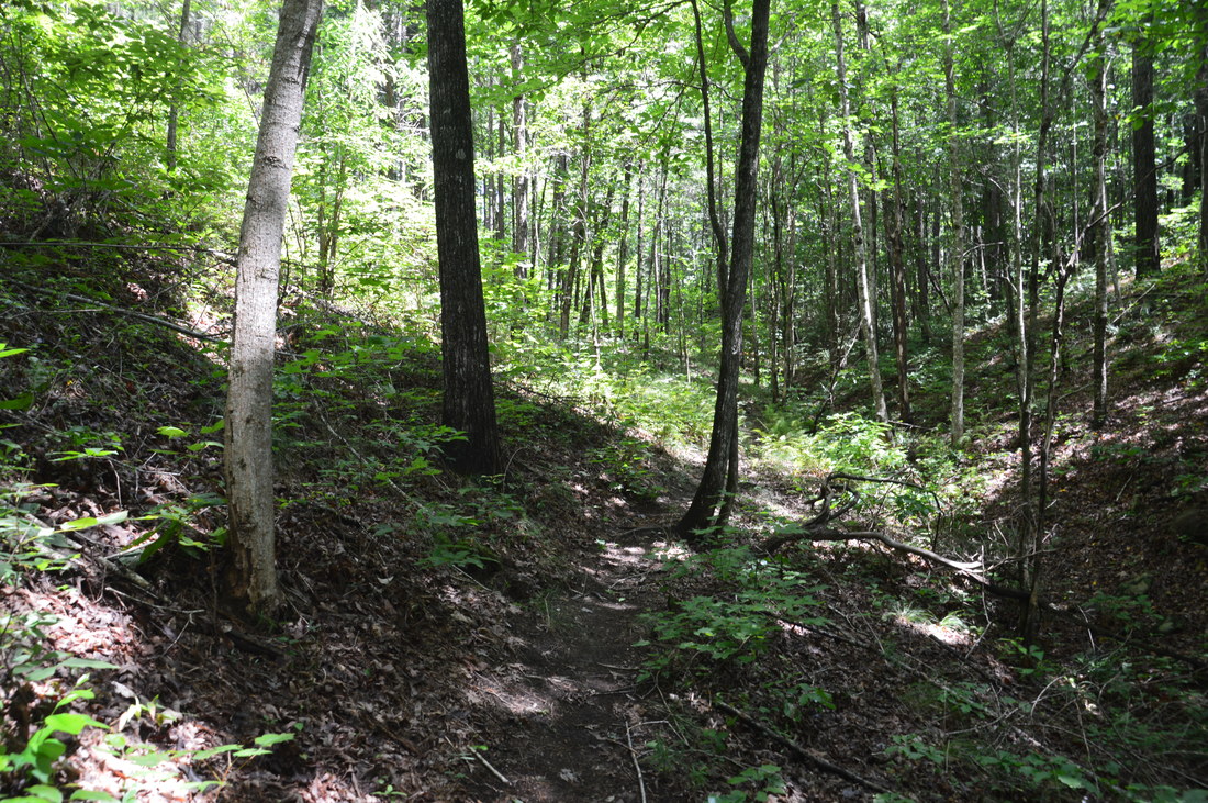
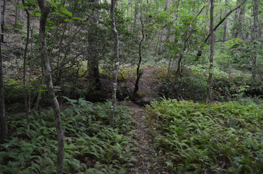
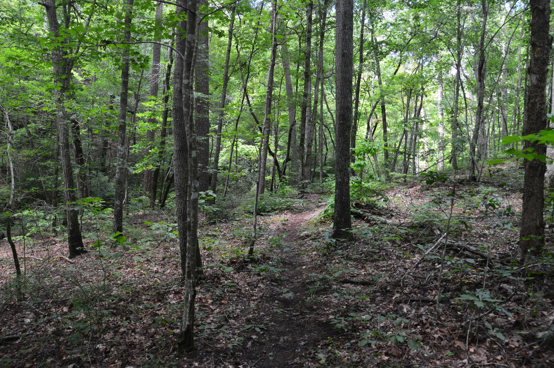
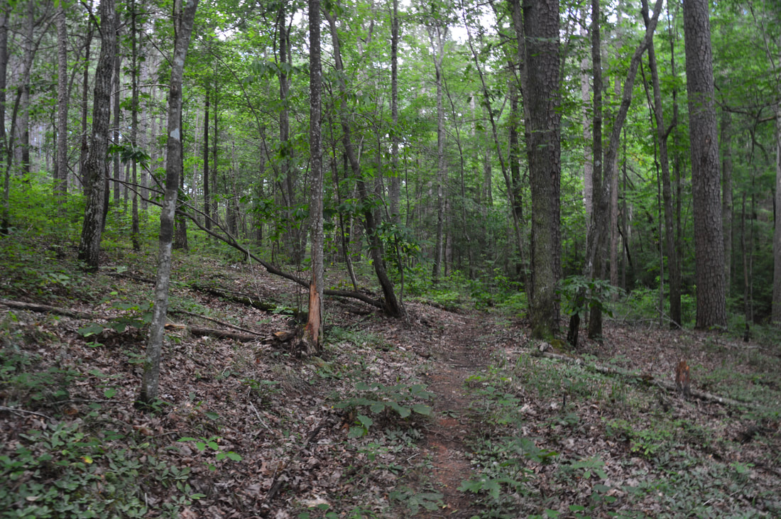
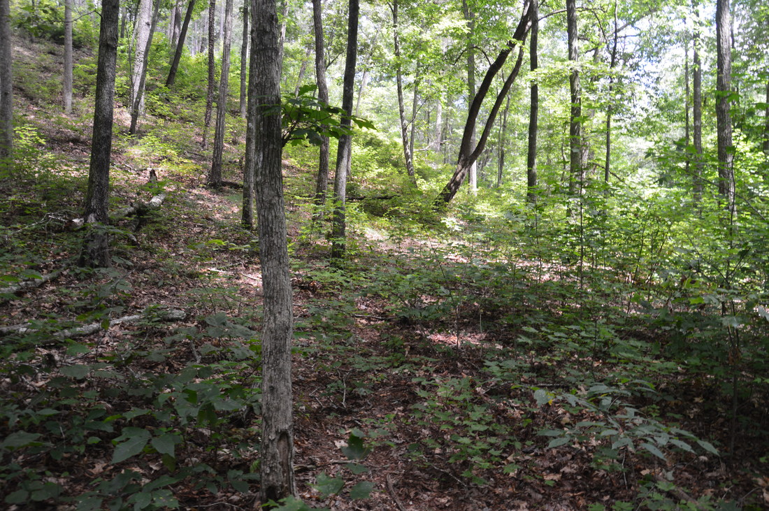
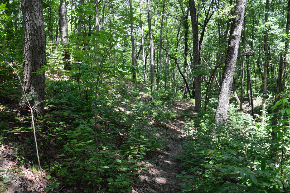
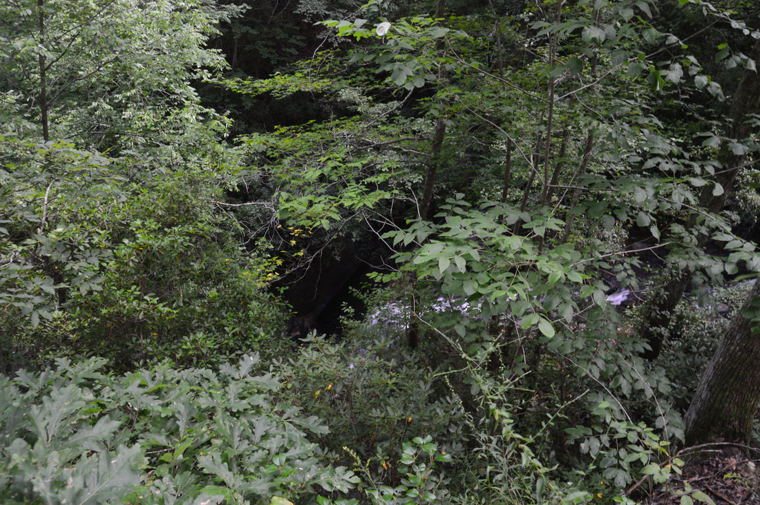
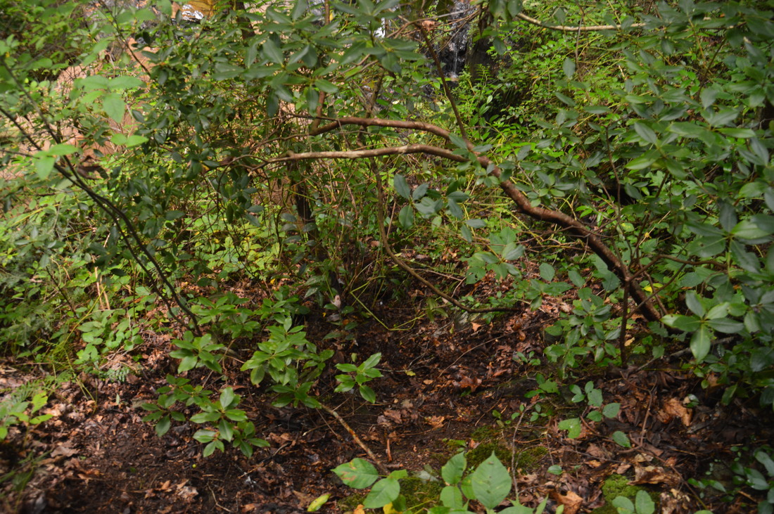
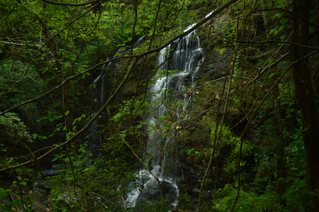
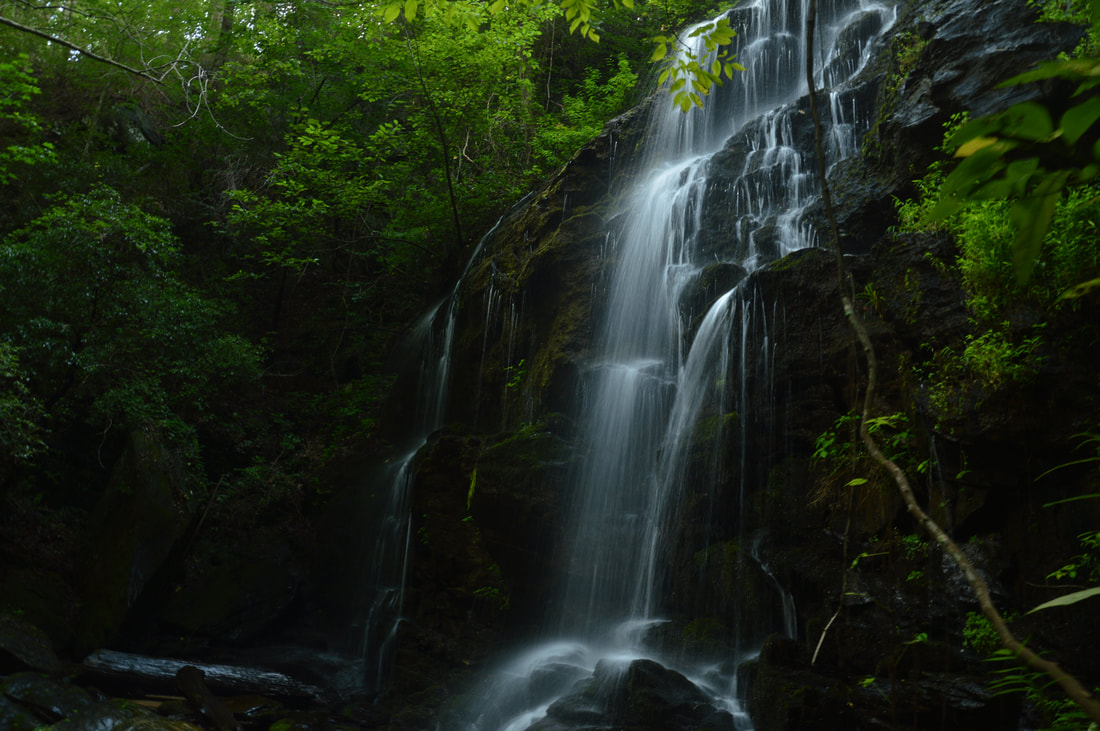
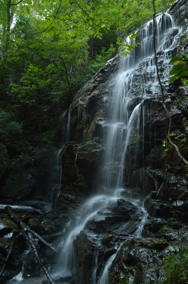
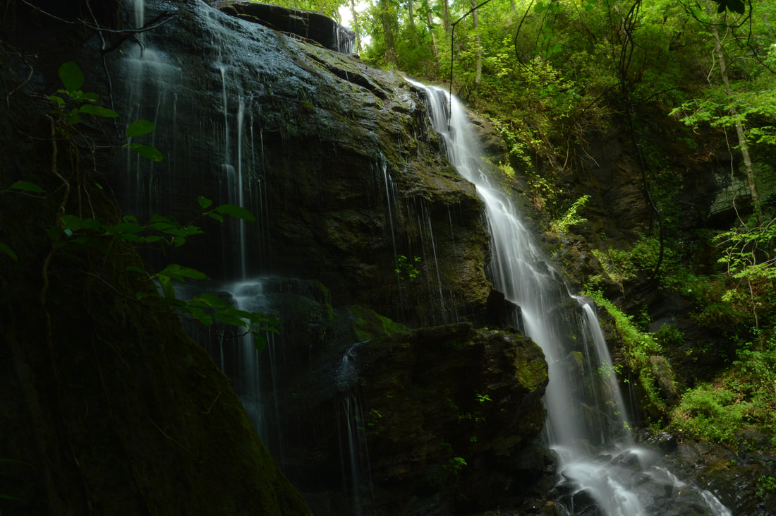
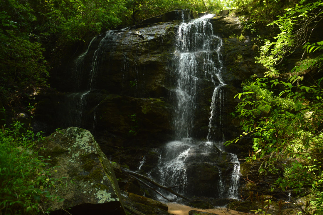
Begin the hike to Tabor Falls by walking around the gate and continuing down the portion of Sellers Road that is normally closed to vehicles, except during hunting season. The walk is nearly flat, but there are several mud holes that present minor obstacles. At about 0.25 miles, the road makes a large curve to the left as it heads up a small hill. This is the point where you need to leave the road. Look closely for a path striking off diagonally to the right (south-southeast) into a patch of pines. The first few feet of it aren't very distinct, but if you keep walking, you will soon find yourself on a path as broad and clear as any official trail. About 250 feet from the road, the trail bears right and passes through a shallow gap with some antique automobile remains. The trail then proceeds to descend gently along the west side of a ridge into the valley. The forest mostly consists of pines and appears to be part of a logging area. The trail actually joins an old roadbed and follows it into a deeper gap at 0.55 miles. This is where there you have to make an obscure right turn as the trail leaves the old road, which continues straight up the hill. The trail quickly leaves the pine forest and at 0.65 miles comes alongside a small stream - a tributary of the creek with Tabor Falls. Pay attention here: in about 50 feet, there is a junction. The trail that you have been following continues straight upstream, while another trail turns very sharply left. This new trail is the one you must take to reach Tabor Falls. The trail crosses the small stream - an easy rock hop at normal water levels - and then passes through an area with several sawed logs and one blowdown. After this, there is another easy crossing of the creek before the trail arrives at the main stream. 

At 0.85 miles, the main trail curves to the right and  approaches a crossing of the main stream (the one with Tabor Falls). However, this trail actually heads in a completely different direction toward Georgia Mountain Orchard Road. To reach Tabor Falls, turn left just before the creek crossing. You may or may not see a faint path here, but regardless, simply hike along the same side of the creek downstream through open woods and you will shortly merge with a much more distinct trail that approaches the top of Tabor Falls at 0.95 miles.  Stay away from the dangerous area at the top of the cliff and follow the trail as it bends around the cliff. In 250 feet, you will be past the cliff. Around this spot, watch out for an area to the right that seems to show signs of foot traffic leaving the trail. Since the main trail does not provide access to the base of Tabor Falls and simply continues downstream instead, you must turn right - off the trail - and make a short but steep scramble to the base of the falls, which is visible through the trees and can be heard easily. The scramble is generally open, but there are a few patches of poison ivy and some briars, so you must pay attention. At one point not far from the base, it will be best to bear right and finish the descent close to the base of the cliff to avoid a small rock outcrop. At the base of Tabor Falls at 1.0 miles, you will have to cross the creek for the best view of the falls, and while this was possible to do with dry feet today, it could be a shallow wade in wetter conditions. 

The huge cliff that forms Tabor Falls is part of what makes this such a gorgeous waterfall. The 50-foot cliff runs away from the creek for a bit on both sides as well. The stream splits into two separate channels of flow as it begins its fall down the cliff. The two channels are of equal volume and form small free-falling sections along the way down. There is a small shallow pool at the bottom. During drought, it is not worth going to Tabor Falls as it will not be nearly as spectacular due to the stream's small size, but in wet or even regular conditions, Tabor Falls is a beauty. One of the best angles for photographing the waterfall is on the north side of the stream just below a huge boulder that adds beauty to the setting. From Tabor Falls, simply retrace your steps back to the gate and parking area, concluding the hike at 2.0 miles. By the way, if you have any information about where the trails in this mysterious unofficial trail system around Tabor Falls lead - and if there are any other sights worth seeing - please let me know! 

Mileage

0.0 - Sellers Road Gate 
0.25 - Begin Tabor Falls Trail 
0.55 - Gap, Turn Right 
​0.65 - Junction, Turn Acutely Left (cross the creek) 
0.85 - Left Turn (off the main trail) above Tabor Falls 
0.95 - Top of Tabor Falls 
1.0 - Tabor Falls 
2.0 - Sellers Road Gate 

Variations

None

Bonus Stops

There are several hiking possibilities in the area. You can try hiking some of the trails around Lake Russell, Nancytown Lake, and Chenocetah Mountain. Another possibility is hiking to Currahee Mountain or the nearby Frady Branch Trails. 

Pictures

Videos

10 Comments
Butch link
12/25/2017 01:16:16 pm

Thanks for posting this. It is a beautiful waterfall. I found your directions very accurate. I did go off trail once but I was tracking on GPS so was able to get back quickly. Thanks also for the gpx file, it was a great help.

Reply
Jennifer link
4/3/2019 03:48:35 pm

Thank you so much for the great directions to this lovely spot. With the rainy winter we had it was especially spectacular.

Reply
Butch link
4/3/2019 04:10:29 pm

Jennifer, are you aware that there are quite a few more waterfalls in the same area?

Reply
Tammi
8/23/2019 12:33:17 pm

I found your website a while back, but this was the first chance I’ve had to hike any of the trails you’ve reported on. This was a very nice little hike with a delightful waterfall at the end. Now I need to get back out there and follow the trails I was on to see where they come out. I work near there, but have mostly explored Currahee Mountain and the Frady Branch trail system. I’ll definitely be trying more of the trails on your website!

Reply
Kim G
3/7/2021 03:32:39 pm

Awesome directions. We referred to them several times when things became a little confusing. You might want to mention to people not to be fooled by the orange blazes painted on the trees. We were mindlessly following them when we got off track. I think they are for hunters maybe? Thankfully we backtracked and decided we had better follow your directions...and we did without trouble. Well, except for me planting my foot directly into the stream and having a bit of a soggy hike. LOL. If it's wet and muddy, people will need an AWD to get even to the gate. Weather had been very dry when we went, and still there were a few iffy places. We would have had to abandon our attempt if it had been mushy at all.

Reply
Michelle Trujillo Stansell
3/22/2021 06:43:09 pm

You said to let you know of any trails in this area! I posted this in the All Trails app under Dead Man Branch Trail which is right beside Toccoa Falls. It’s a definite must see- this one has a cave!! But you’ve got to know where to go. From the parking lot of Toccoa Falls, you will find the worn trailhead on the right hand side and behind the brown building off to itself. You must cross the creek on your left at the first sandy beach that you come to- pretty easy if you can balance on logs. You will get to a point that is treacherous, rocky, uphill, and is so narrow that it looks like a tributary or water runoff instead of a hiking path BUT YOU ARE ON THE RIGHT PATH. This will go downhill into a swamp that you have to jump and hack through BUT IT CONTINUES ON. When you get to the dirt road/FS road, turn left, then right into the next dirt road/old FS road that is so overgrown it just looks like a trail. Down this trail you’ll find the rocks piled up on the right hand side. Take a right to go down this trail. This is where you’ll find the campfire that leads to the top of the falls. Plus (down this trail), to your left is another trail that leads to the descending trail to get to the bottom of the falls. I made a trailhead out of propping up some dead branches and horizontally sticking other dead branches in between trees. Try not to get snagged by briars as you scoot your way down this trail to the bottom of the falls. Once you are at the bottom of the falls, you will see inviting pools of water to wade in and you can climb up the rocks to get to the caves. Be very careful the rocks are slippery with moss. It is a gorgeous view once you are sitting within the caves. I just researched it some more and this is called Contentment Falls.

Reply
Harry Farrell
3/22/2021 06:52:53 pm

Hi Michelle,

There is an easier way to Cintentment Falls if you are interested.

Reply
Michelle
3/22/2021 06:59:59 pm

Is it from Bend N Hickory Rd?

Harry Farrell
3/22/2021 07:40:10 pm

You can get there from there. It's on Locust Stake Road.
If you go to Mark's waterfall website itll show you where it is. gawaterfalls.com

Reply
shane caudell
4/10/2022 11:52:00 pm

Beware on the trail at the turn around, someone died last week from falling off the trail to the creek.

https://accesswdun.com/article/2022/4/1093218/man-falls-to-his-death-at-tabor-falls

Reply


Leave a Reply.

    About Me

    Mark Oleg Ozboyd
    I'm an avid outdoor explorer and a hobbyist landscape photographer. I'm 21 years old and have been hiking since 2011. Originally based out of Atlanta, Georgia, I started out by occasionally hiking short trails throughout well-known Georgia State Parks. During 2012 and 2013, I began to expand my trips into adjacent states, as well as into the wilder National Forest areas rather than just State Parks. Throughout the years that followed, as I slowly ran out of popular hiking trails in my area, I began to search for and hike in more seldom-visited areas. Today, you can find me out in the woods every weekend, whether it's on an official trail or bushwhacking through cross-country terrain without any paths. I now attend Washington & Lee University and am exploring Virginia and West Virginia. My other hobbies include chess, science, old music, and meteorology. I have 3 years of amateur weather forecasting experience, having studied a lot of meteorology basics over the years. I am also a student at European School of Music where I learned that music and nature have a lot in common. Listening to good music inspires me to capture nature's beauty on the camera in different aspects that also make me recall many beautiful music pieces that I've heard.​


    Dear readers: I have invested a tremendous amount of time and effort in this website and the Georgia Waterfalls Database the past five years. All of the work that has gone in keeping these websites updated with my latest trip reports has almost been like a full-time job. This has not allowed me to pick up a paid job to save up money for college, and therefore, I I've had to take out loans. If you find the information on this website interesting, helpful, or time-saving, you can say "thanks" and help me out by clicking the button above and making a contribution. I will be very grateful for any amount of support you give, as all of it will apply toward my college tuition. Thank you! 

    Enter your email address to subscribe for trail reports:

    Delivered by FeedBurner


    Picture
    Coming in 2022-2023?

    Other Hiking Websites

    DWHike's Adventures
    Florida's Natural Wonders
    Florida Trailblazer
    Meanderthals
    Mountain Images
    by Bernie Boyer

    North Carolina Waterfalls with
    ​Kevin Adams
    Take-a-Hike!
    Tennessee Landforms
    Waterfall Page
    Waterfall Adventurer
    Zach's Mild Adventures

    Miles Hiked

    Year 1: 540.0 Miles
    Year 2: 552.3 Miles
    ​Year 3: 518.4 Miles
    Year 4: 482.4 Miles
    Year 5: 259.9 Miles

    Archives

    March 2021
    February 2021
    January 2021
    November 2019
    October 2019
    September 2019
    August 2019
    July 2019
    June 2019
    February 2019
    January 2019
    December 2018
    November 2018
    October 2018
    August 2018
    July 2018
    June 2018
    May 2018
    April 2018
    March 2018
    February 2018
    January 2018
    December 2017
    November 2017
    October 2017
    September 2017
    August 2017
    July 2017
    June 2017
    May 2017
    April 2017
    March 2017
    February 2017
    January 2017
    December 2016
    November 2016
    October 2016
    September 2016
    August 2016
    June 2016
    May 2016
    April 2016
    March 2016
    January 2016
    December 2015
    November 2015
    October 2015
    September 2015
    August 2015
    July 2015
    June 2015
    May 2015
    April 2015
    March 2015
    February 2015
    January 2015
    December 2014
    November 2014
    October 2014
    September 2014
    August 2014
    July 2014
    June 2014
    May 2014
    April 2014
    March 2014
    February 2014

    Categories

    All
    Adel
    Adirondack Park
    Alabama
    Alfred A. Ring Park
    Allegheny Trail
    Amicalola Falls State Park
    Anniston Area
    Apalachicola Bluffs And Ravines Preserve
    Apalachicola National Forest
    Apalachicola/Port St. Joe Area
    Apopka
    Appalachian Trail
    Appling
    Art Loeb Trail
    Aska Trail System
    Bakersville
    Balm-Boyette Scrub Preserve
    Balsam Lake Recreation Area
    Bankhead National Forest
    Bartow County Parks
    Bartram Trail
    Basinger
    Beersheba Springs
    Benton
    Benton Mackaye Trail
    Berry College Trail System
    Best Hike
    Big South Fork National Recreation Area
    Black Bear Wilderness
    Black Rock Mountain State Park
    Blairsville
    Blakely
    Blood Mountain Wilderness
    Blowing Rock
    Blue Ridge
    Blue Ridge Parkway
    Boone
    Bradenton
    Bradenton Beach
    Brasstown Bald
    Brasstown Wilderness
    Brevard
    Bryson City
    Buchanan
    Bucks Pocket State Park
    Bulow Creek State Park
    Bulow Plantation Ruins State Park
    Caesars Head State Park
    Caladesi Island State Park
    Calhoun
    Camel's Hump State Park
    Cashiers
    Caspersen Beach Park
    Catfish Creek State Park
    Caves
    CC Putnam State Forest
    Cedar Point Environmental Park
    Chatsworth
    Chattahoochee National Forest
    Chattanooga
    Chattanooga Valley
    Chattooga National Wild And Scenic River
    Cheaha Wilderness
    Cherohala Skyway
    Cherokee
    Cherokee National Forest
    Chiefland Area
    Chillhowee Recreation Area
    Chipley
    Chunky Gal Trail
    Circle B Bar Reserve
    Citico Creek Wilderness
    Citrus Wildlife Management Area
    Clarkesville
    Clayton
    Cleevland
    Cleveland
    Cloudland Canyon State Park
    Cohutta Wilderness
    Collier-Seminole State Park
    Cordele
    Cornelia
    Covington
    Crestview Area
    Crew-land-and-water-trust
    Cullowhee
    Cumberland Trail
    Dahlonega
    Dalton
    Dawson Forest Wildlife Management Area
    Dawsonville
    Dayton
    De Soto National Memorial
    DeSoto State Park
    Dillard
    Double Springs
    Ducktown
    Duncan Ridge Trail
    Dunlap
    Eagle's Rest Park
    Eastpoint
    Econfina Creek Wildife Management Area
    Eglin Air Force Base
    Elizabethton
    Elkins
    Elk Knob Game Lands
    Elk Park
    Ellicott Rock Wilderness
    Ellijay
    Emerson Point Preserve
    Englewood Area
    Enota Retreat
    Erwin
    Falling Waters State Park
    Fayetteville
    Fires Creek Recreation Area
    Fire Tower
    Flint River
    Florence Area
    Florida
    Florida Caverns State Park
    Florida Trail
    Foothills Trail
    Fort Mountain State Park
    Fort Myers Area
    Fort Payne
    Fort Payne Area
    Fort Yargo State Park
    Franklin
    Franklin Delano Roosevelt State Park
    Franklin-Marion State Forest
    Frozen Head State Park
    Gainesville
    Gainesville Area
    Gatlinburg
    George Washington National Forest
    Georgia
    Georgia Veterans Memorial State Park
    Glasgow
    Gorges State Park
    Grandfather Mountain State Park
    Great Smoky Mountains National Park
    Greeneville
    Green River Game Lands
    Gruetli-Laager
    Grundy Forest State Natural Area
    GTM Reserve
    Guana River Wildlife Management Area
    Hayesville
    Helen
    Hiawassee
    High Falls State Park
    Highlands
    Highlands Scenic Highway
    Hillsborough River State Park
    Hinson Conservation & Recreation Area
    Historic Sites
    Honeymoon Island State Park
    Hot Springs
    Huntington
    Inverness Area
    Jackson
    Jasper
    Jefferson National Forest
    Joan M. Durante Park
    Jonathan Dickinson State Park
    Jones Gap State Park
    Joyce Kilmer Slickrock Wilderness
    Joyce Kilmer - Slickrock Wilderness
    Juniper Prairie Wilderness
    Kelly Park
    Keown Falls Recreation Area
    Kolomoki Mounds State Park
    LaFayette
    Lake City Area
    Lake George Wild Forest
    Lake June-in-Winter State Park
    Lakeland Area
    Lake Placid
    Lake Russell Wildlife Management Area
    Lake Wales Ridge State Forest
    Laurel Fork North Wilderness
    Leffis Key Preserve
    Leon Sinks Geological Area
    Lexington
    Lineville
    Linville
    Linville Gorge Wilderness
    Lithia Springs
    Little Frog Wilderness
    Little Manatee River State Park
    Little River Canyon National Preserve
    Longboat Key
    Long Trail
    Lookout Mountain
    Lookout Mountain Battlefield
    Lovingston
    Lula Lake Land Trust
    Lumpkin
    Maggie Valley
    Manatee Springs State Park
    Marianna Area
    Mark Trail Wilderness
    Marlinton
    Mccaysville
    McMinville
    Mentone
    Middlesex
    Mistletoe State Park
    Monongahela National Forest
    Montreat
    Mountain Bridge Wilderness Area
    Mountain City
    Mountains To Sea Trail
    Mountains-to-Sea Trail
    Mount Rogers National Recreation Area
    Myakka River State Park
    Myron B. Hodge City Park
    Nantahala National Forest
    Naples
    Naples Area
    Natural Bridge State Park
    Neal Preserve
    New Castle
    Newport
    New River Gorge National Park
    New York
    North Carolina
    Ocala Area
    Ocala National Forest
    Ocean-to-Lake Trail
    Oconee State Park
    Oconee Station Historic Site
    Okaloacoochee Slough State Forest
    Oldsmar
    Oneida
    Orlando Area
    Ormond Beach
    Oscar Scherer State Park
    Oxford
    Palatka
    Palmetto Trail
    Panama City Area
    Panthertown Valley
    Parrish
    Paynes Creek Historic State Park
    Peaks Of Otter Recreation Area
    Pigeon Crockford Mountain Wildlife Management Area
    Pigeon-Crockford Mountain Wildlife Management Area
    Pigeon-Crockford Wildlife Management Area
    Pine Mountain
    Pinhoti Trail
    Pinnacle Park
    Pisgah Civitan Park
    Pisgah National Forest
    Pittman Center
    Pond Mountain Wilderness
    Ponds/Lakes
    Prentice Cooper State Forest
    Providence Canyon State Park
    Pumpkintown
    Quick Point Nature Preserve
    Raven Cliffs Wilderness
    Reed Bingham State Park
    Reliance
    Rice Creek Conservation Area
    Riverview Pointe Preserve
    Robbinsville
    Robinson Preserve
    Rock Creek Gorge Scenic Area
    Rock Island State Park
    Rome
    Rosman
    Sale Creek
    Salem
    Salt Springs
    Saluda
    Santa Rosa Beach
    Sarasota
    Sarasota Area
    Savage Gulf State Natural Area
    Scenic Views
    Scottsboro Area
    Sebring Area
    Sewanee
    Sheltowee Trace Trail
    Shining Rock Wilderness
    Signal Mountain
    Sipsey Wilderness
    Sky Valley
    Smithgall Woods State Park
    Snowbird Backcountry Area
    Soddy Daisy
    Soddy-Daisy
    Sopchoppy
    South Carolina
    South Cumberland State Park
    Southeastern Cave Conservancy
    Southern Nantahala Wilderness
    Sparta
    Sprewell Bluff Park
    Spring City
    Spring Hill
    Springs
    Spruce Pine
    Standing Indian Backcountry Area
    St. Augustine
    St. George Island State Park
    St. Joseph Bay State Buffer Preserve
    St. Marks Area
    St. Marks National Wildlife Refuge
    Stone Mountain
    Stone Mountain Park
    Suches
    Sumatra
    Sumter National Forest
    Suwannee River
    Swallow Creek Wildlife Management Area
    Sweetwater Creek State Park
    Sylva
    Talladega National Forest
    Tallahassee Area
    Tallulah Falls
    Tallulah Gorge State Park
    Tampa Bay Area
    Tate City
    Tate's Hell State Forest
    Tea Creek Wildlife Management Area
    Tellico Plains
    Tennessee
    Thomaston
    Toccoa
    Topsail Hill State Park
    Torreya State Park
    Townsend
    Tracy City
    Tray Mountain Wilderness
    Trenton
    Triple Creek Preserve
    Troutdale
    Unaka Mountain Wilderness
    Upper Tampa Bay County Park
    Venice
    Vermont
    Virgin Falls State Natural Area
    Virginia
    Virginia Outdoors Foundation
    Vogel State Park
    Wakulla Springs State Park
    Waleska
    Walhalla
    Wartburg
    Water Features
    Waynesville
    Weedon Island Preserve
    Weeki Wachee Preserve
    Wekiwa Springs State Park
    West Palm Beach Area
    West Virginia
    Whitehall
    White Springs
    Winder
    Withlacoochee State Forest
    Young Harris

    RSS Feed

TRAIL REPORTS

Hikes in Alabama
​Hikes in Florida
Hikes in Georgia
Hikes in North Carolina
Hikes in South Carolina
Hikes in Tennessee
Hikes in Virginia

Hiking Resources

Alabama Resources
​
Florida Resources
Georgia Resources
North Carolina Resources
​South Carolina Resources
​
Tennessee Resources

Other

Contact
Map of Hikes
Alphabetical List of Hikes
Southeast Nature Society
© COPYRIGHT 2014-2018
​ALL RIGHTS RESERVED.
Important: I disclaim any responsibility for any damage or personal injury that may occur as a result of the activities and information found on this website. All outdoor activities, especially off-trail hiking, are done at your own risk. Never hike or head into that area that may be above your fitness or experience level.
  • Home
  • Trail Reports
    • Best Hikes
    • Hikes with Scenic Views
    • Hikes with Water Features
    • Alabama
    • Georgia
    • Florida
    • North Carolina
    • South Carolina
    • Tennessee
    • Vermont
    • Virginia
  • Map
  • Hike List
  • Testimonials
  • Resources
  • Contact Us
  • Southeast Nature Society
    • Our Team
  • Georgia Waterfalls Database