
The Lake Russell trail system is often overlooked by hikers, who are interested in the "true" mountain hiking just a short drive to the north of Cornelia. The Lake Russell Recreation Area does not sit in the actual mountains, but these foothills provide quality hiking nonetheless. Several hiking trails can be found around Lake Russell and Nancytown Lake. On this hike, you will first see a couple of waterfalls on Nancytown Creek, before hiking along the shores of Nancytown Lake and then Russell Lake. The route becomes more difficult as the hike follows a seldom-used trail to the top of Chenocetah Mountain, where an old fire tower stands. Before your return to Nancytown Lake along a different trail, make sure to stop by the two clearings on Chenocetah Mountain that provide some views of Lake Russell and the distant Blue Ridge Mountains. This hike occurred on Saturday, May 7th, 2016. My plan was to hike several of the trails in the Lake Russell trail system. First, I would hike the Sourwood Trail. Then, I would take the Nancytown Lake Trail along the eastern shore of the lake, before connecting to the Lake Russell Loop and hiking the eastern and southern sides of the loop. From there, I would walk a short section of Lake Russell Road before taking the Campground Trail to the top of Chenocetah Mountain. I would return to Nancytown Lake using the Rhododendron Trail.
Summary
R/T Length of Trail: 11.8 Miles
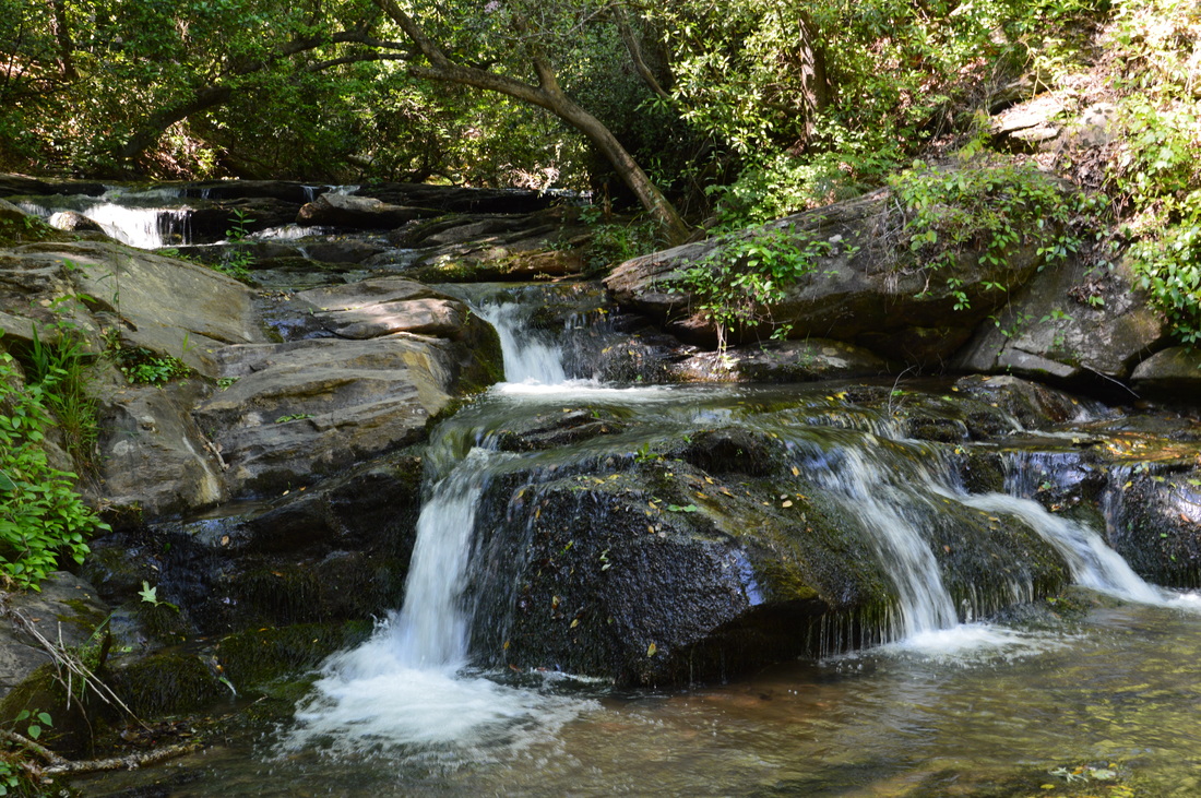
Duration of Hike: 6:50 Type of Hike: Double Loop Difficulty Rating: 5 out of 10 Total Elevation Gain: 1932 Feet Pros: None Cons: Many blowdowns on Campground Trail Points of Interest: Nancytown Falls - 3 stars; Lower Falls on Nancytown Creek - 1 star; Nancytown Lake Dam; Lake Russell Dam; Chenocetah Mountain Tower and Views - 2 stars Trail Blaze Color(s): Sourwood Trail - Lime Green; Nancytown Lake Trail - Lime Green; Lake Russell Trail - Lime Green; Campground Trail - Lime Green and Blue; Rhododendron Trail - Lime Green Best Season(s) to Hike: Summer Fees: None Beginning Point: Nancytown Lake Directions: From Cornelia, GA: Follow Dicks Hill Parkway (GA State Route 13) East for 1.9 miles. Then, turn right onto Lake Russell Road. In 2 miles, just before you reach Lake Russell, turn left onto the side road to Nancytown Lake. Continue for 0.15 miles until you reach Nancytown Lake. Here, the main road keeps right, while a paved but gated road bears left. Park here, but do not block the gate. MapDetails
There are many ways to make a day hike at Lake Russell. The disorganized trail system consists of six trails: Sourwood Trail, Nancytown Lake Trail, Lake Russell Trail, Ladyslipper Trail, Campground Trail, and Rhododendron Trail. On this day, I hiked all of these trails, except the Ladyslipper Trail. While I cannot say that the trails are conveniently connected to each other, it is still possible to combine all of them with several short roadwalks. Due to the number of road crossings, there are many points where one could begin this hike. I began the hike at the traditional Sourwood Trail parking area, which is at the southwestern corner of Nancytown Lake.
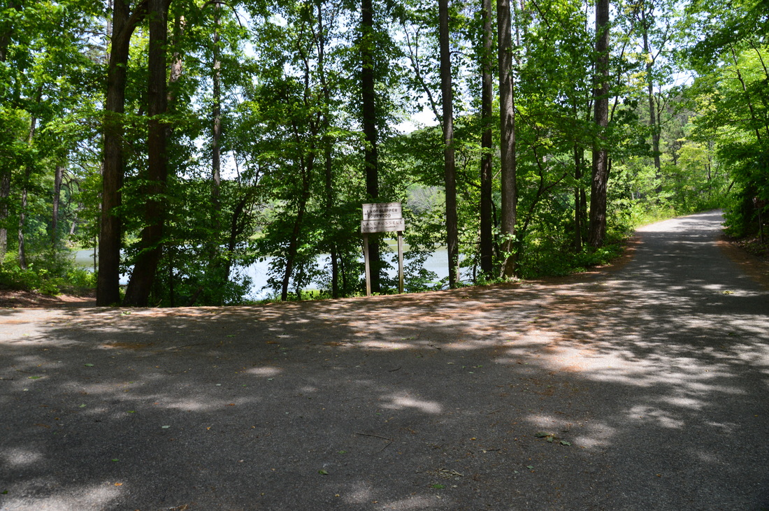
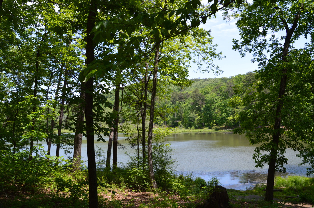
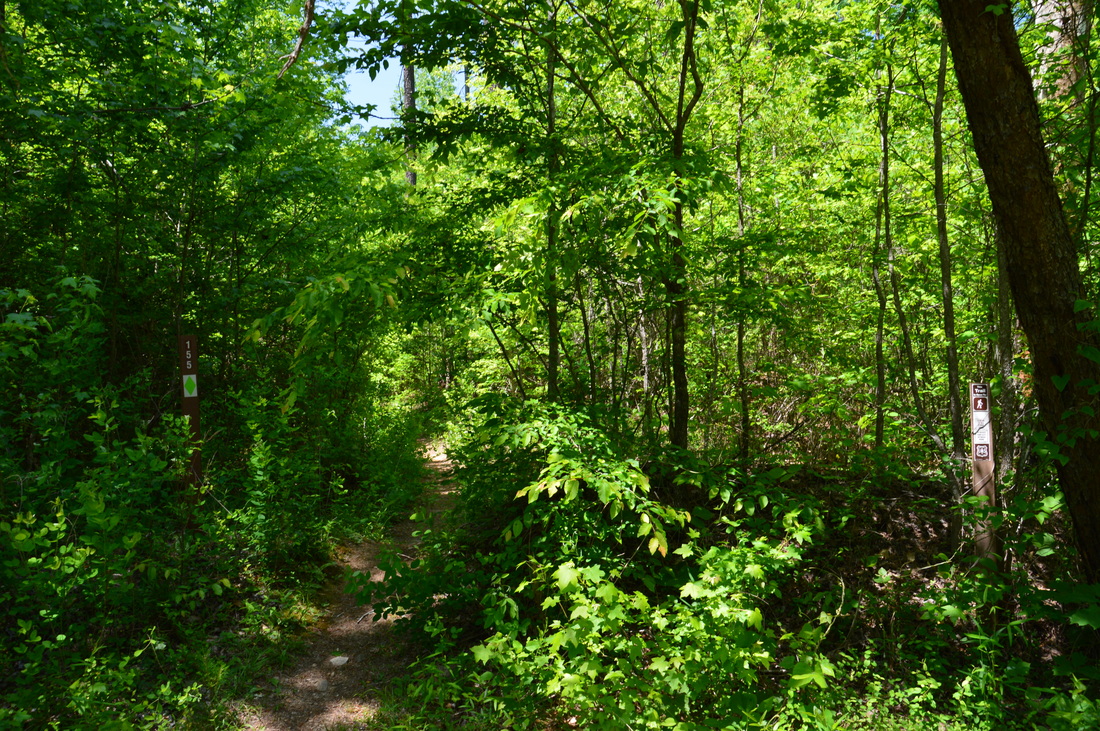
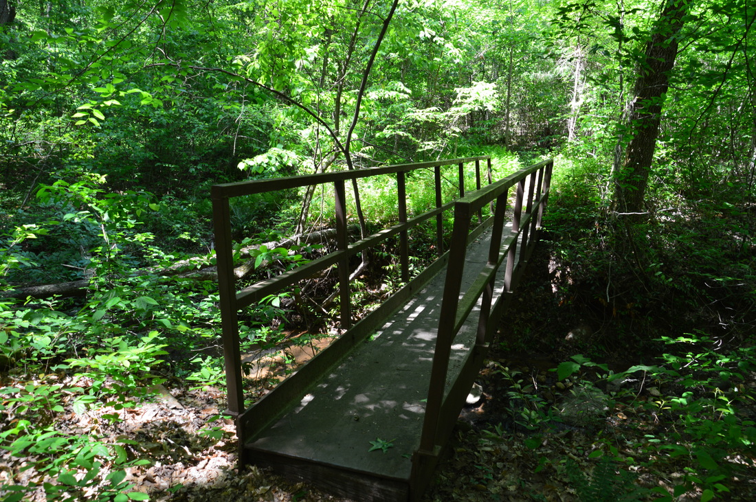
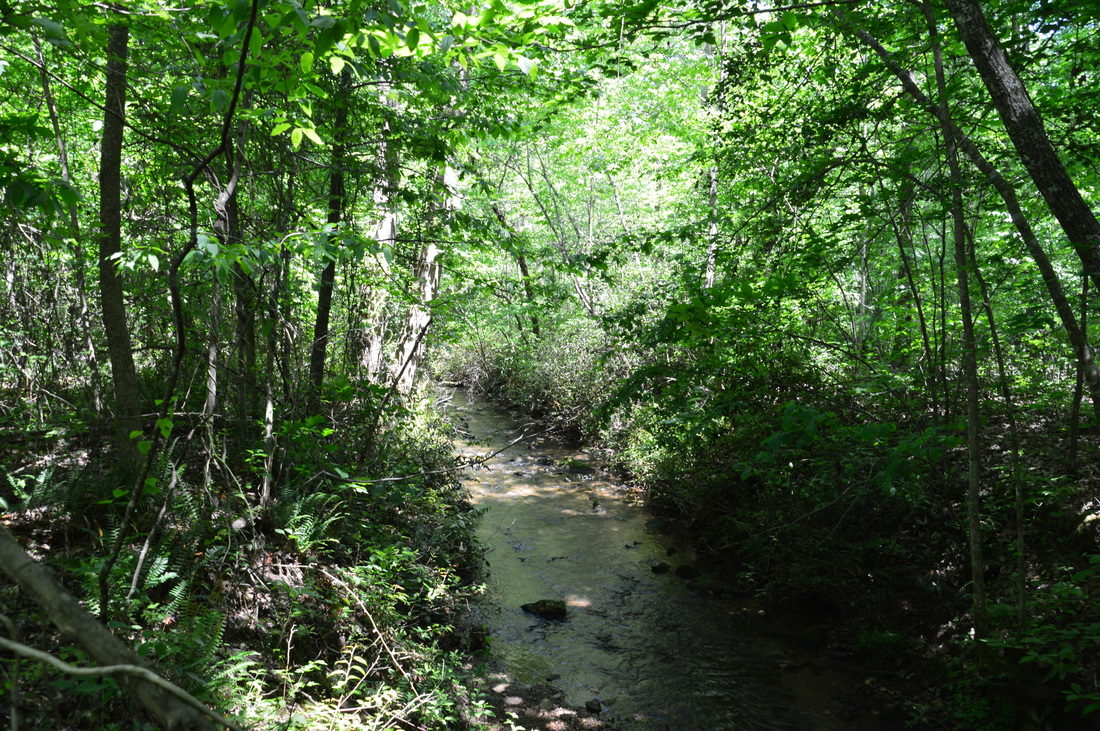
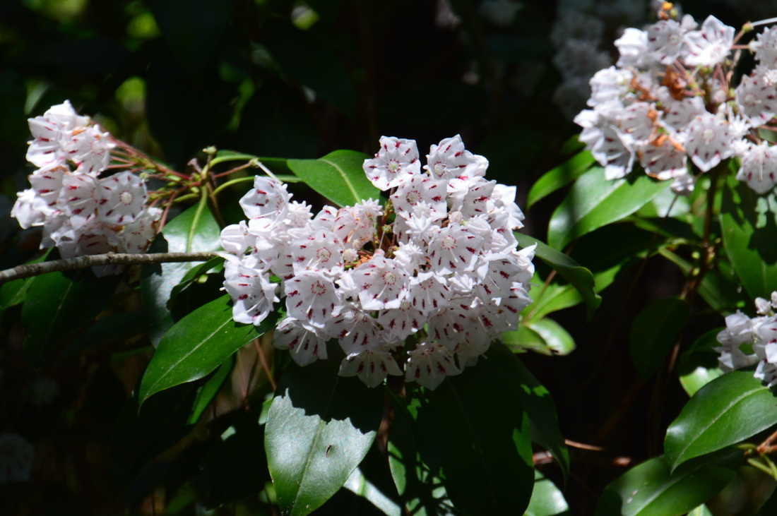
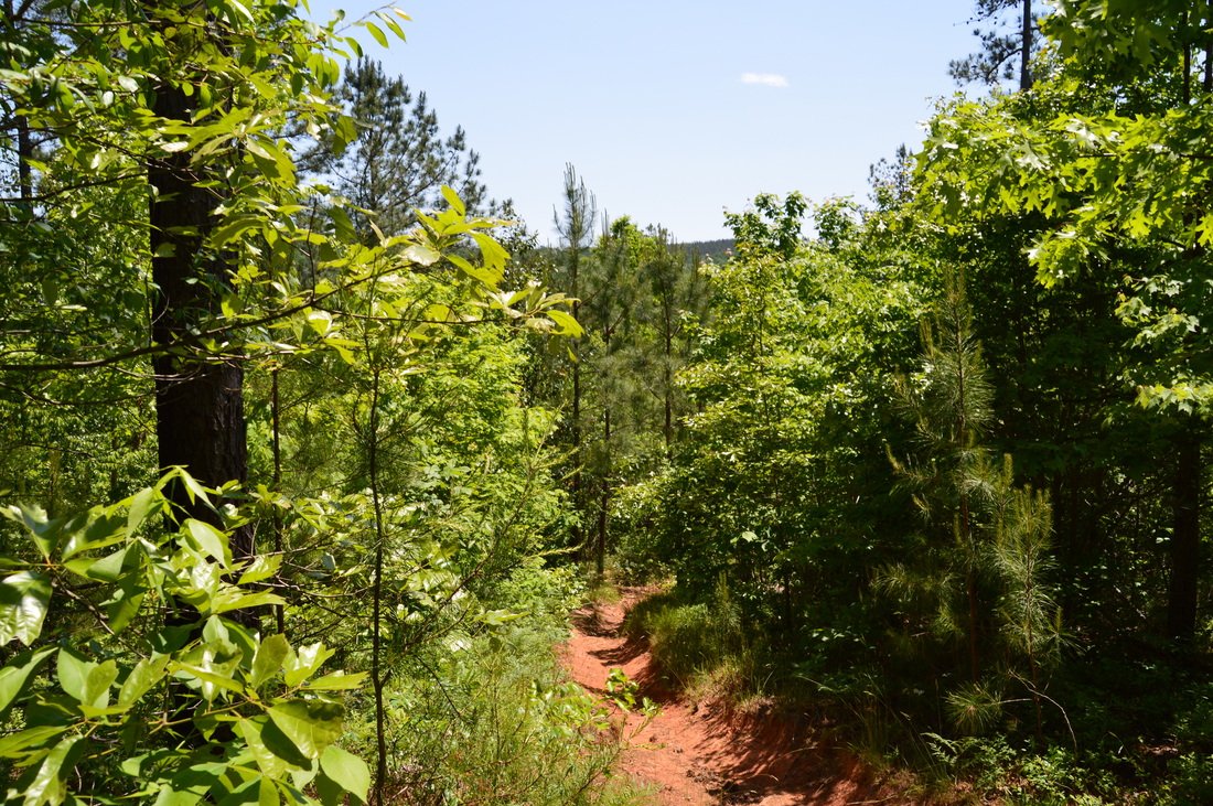
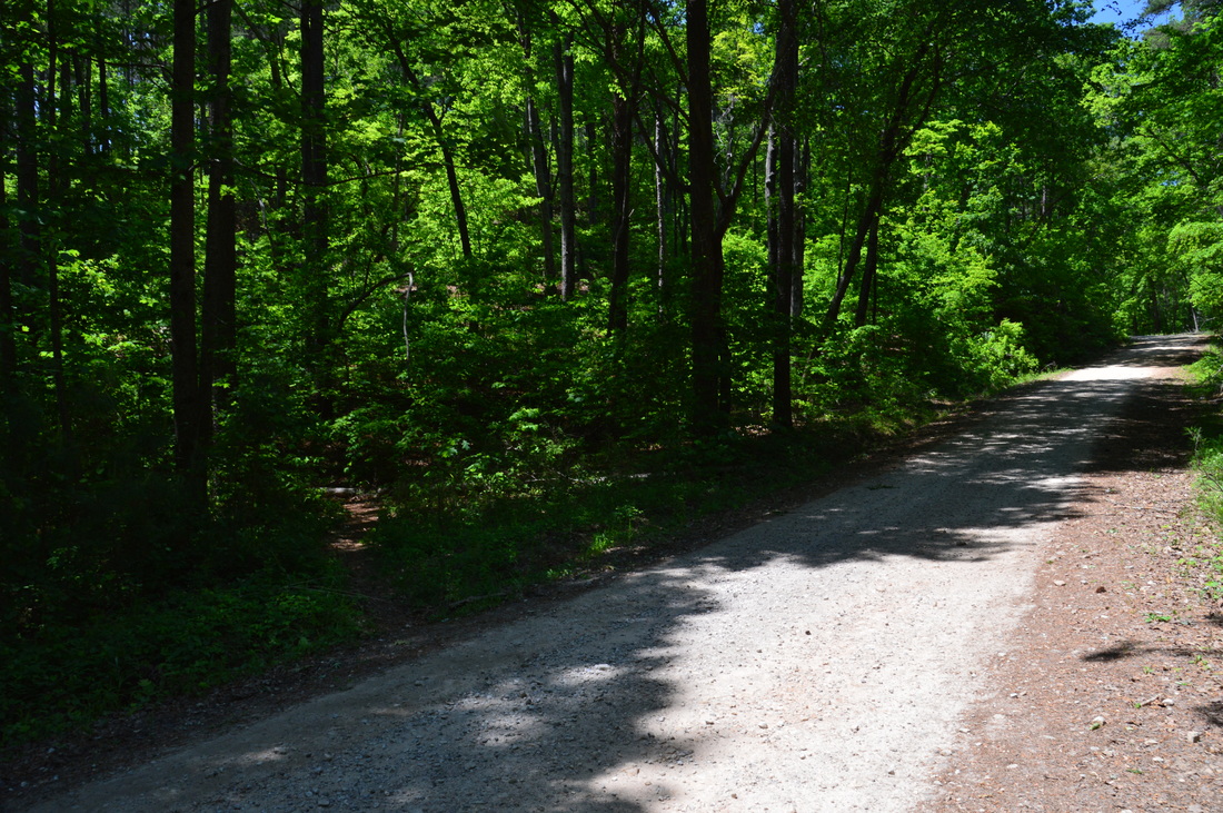
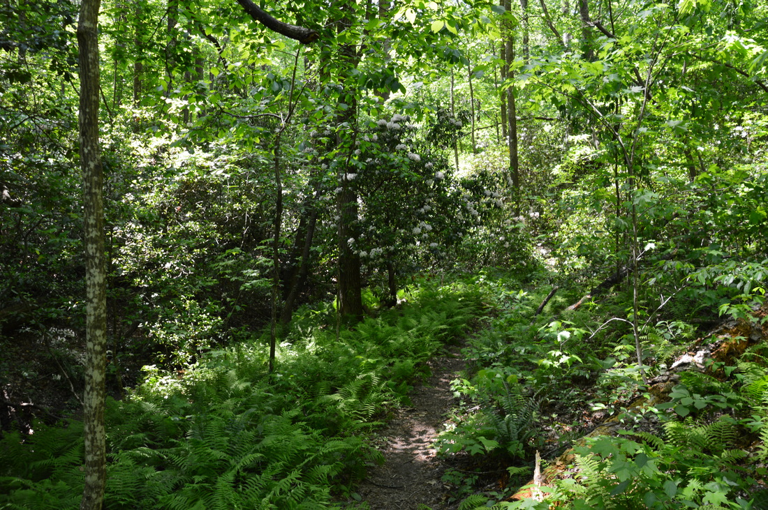
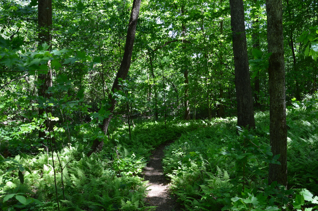
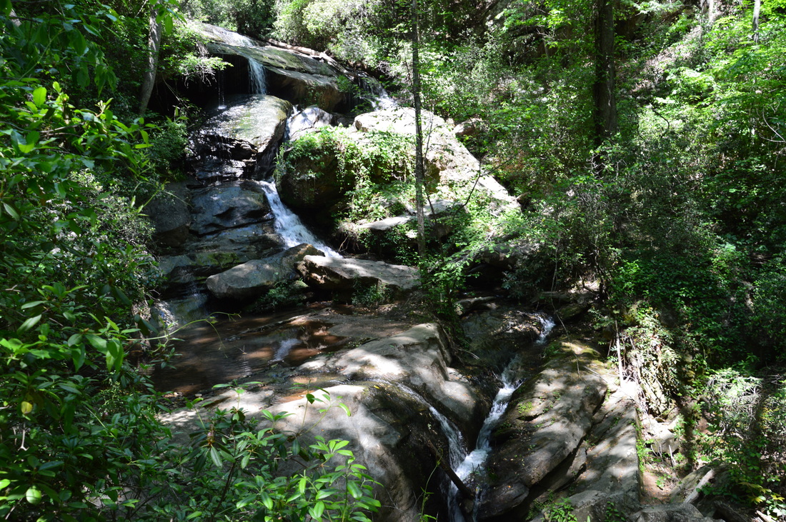
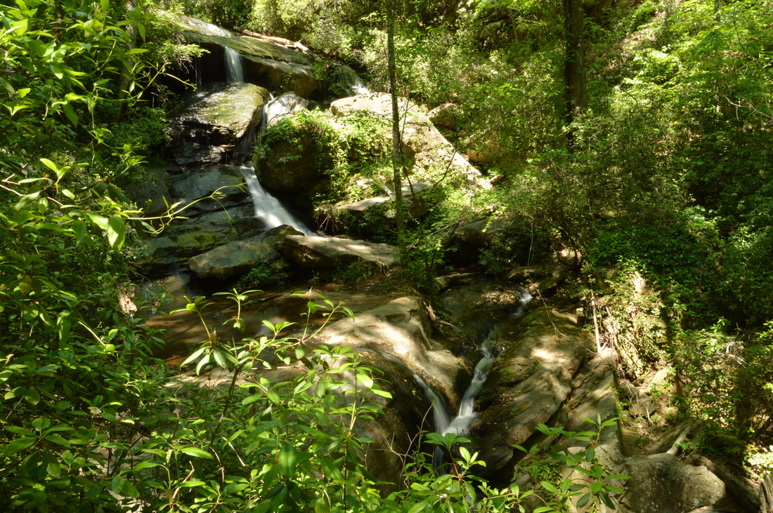
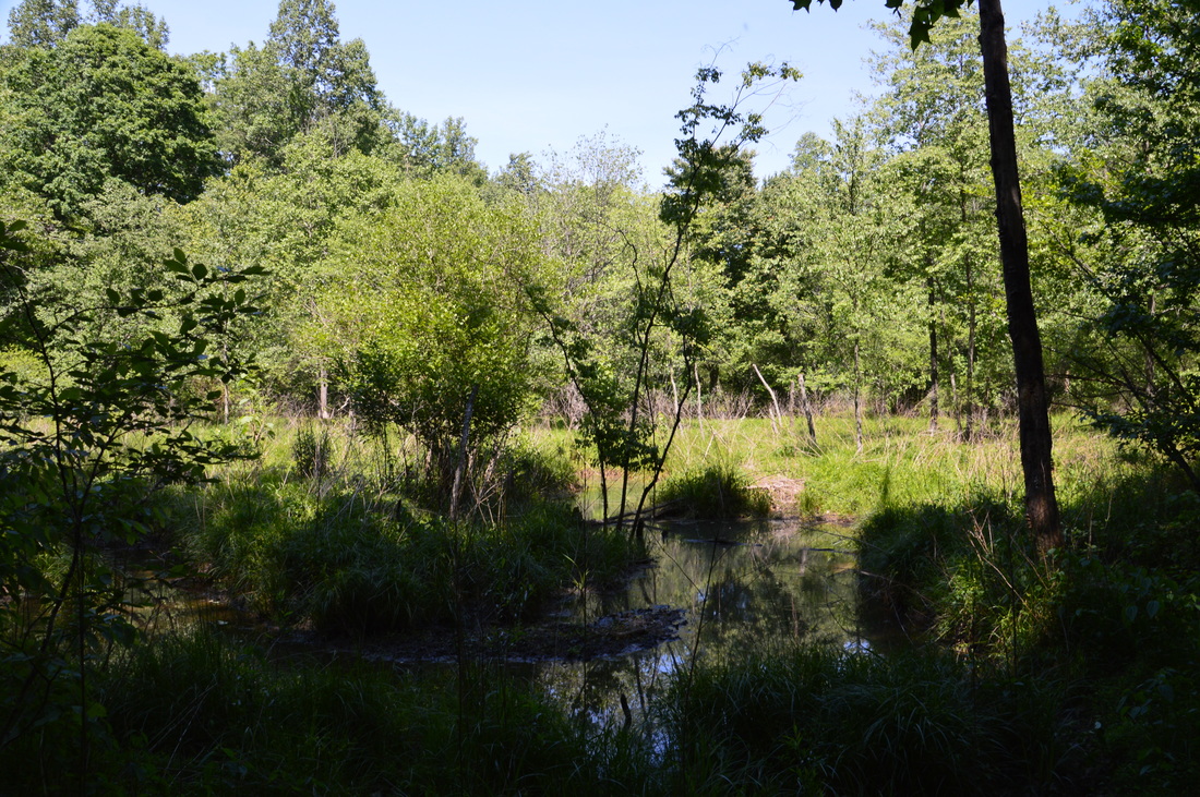
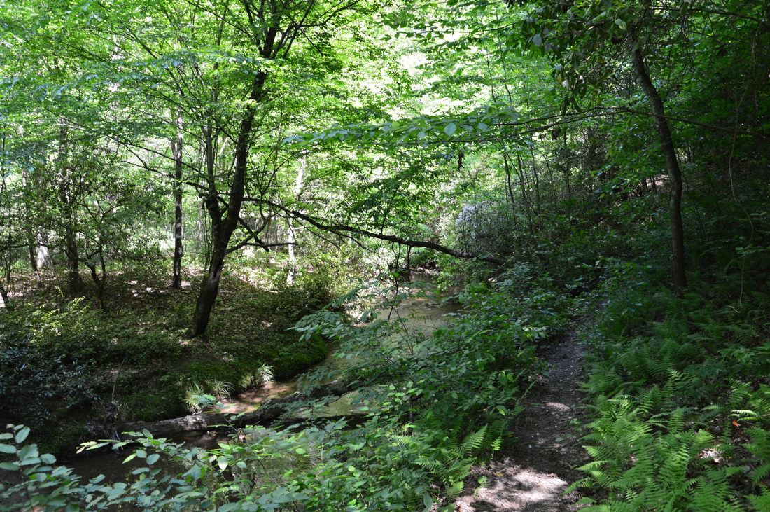
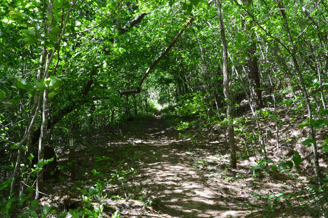
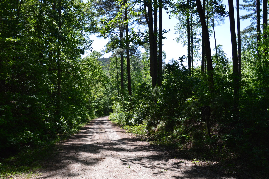
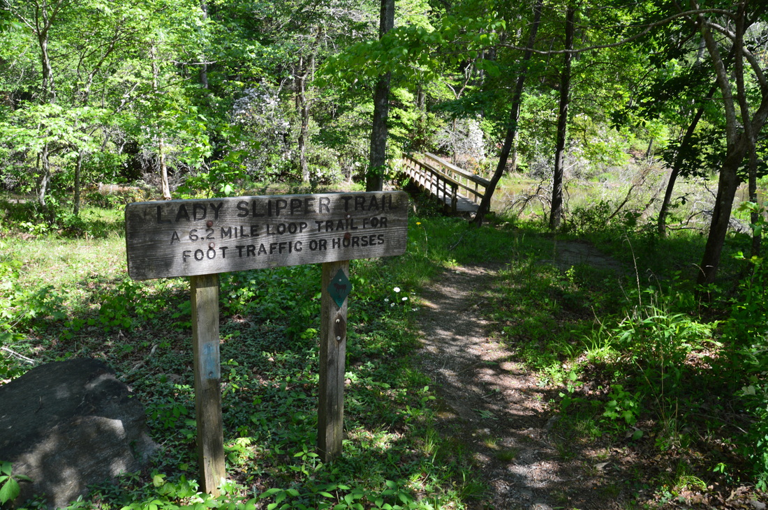
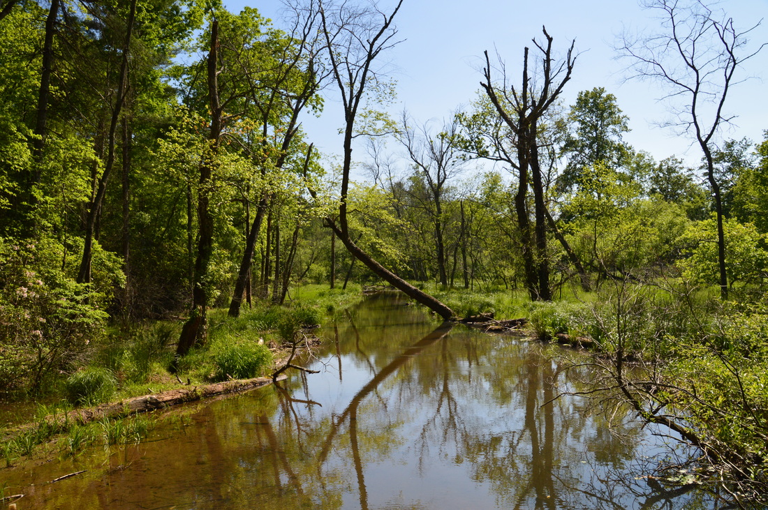
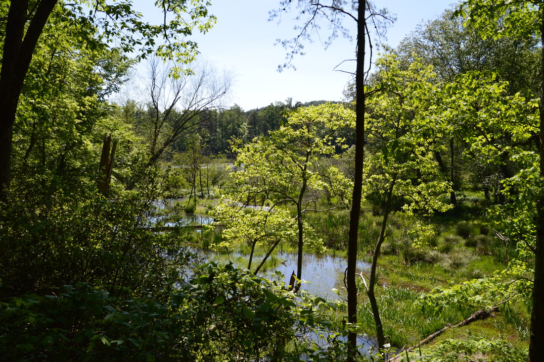
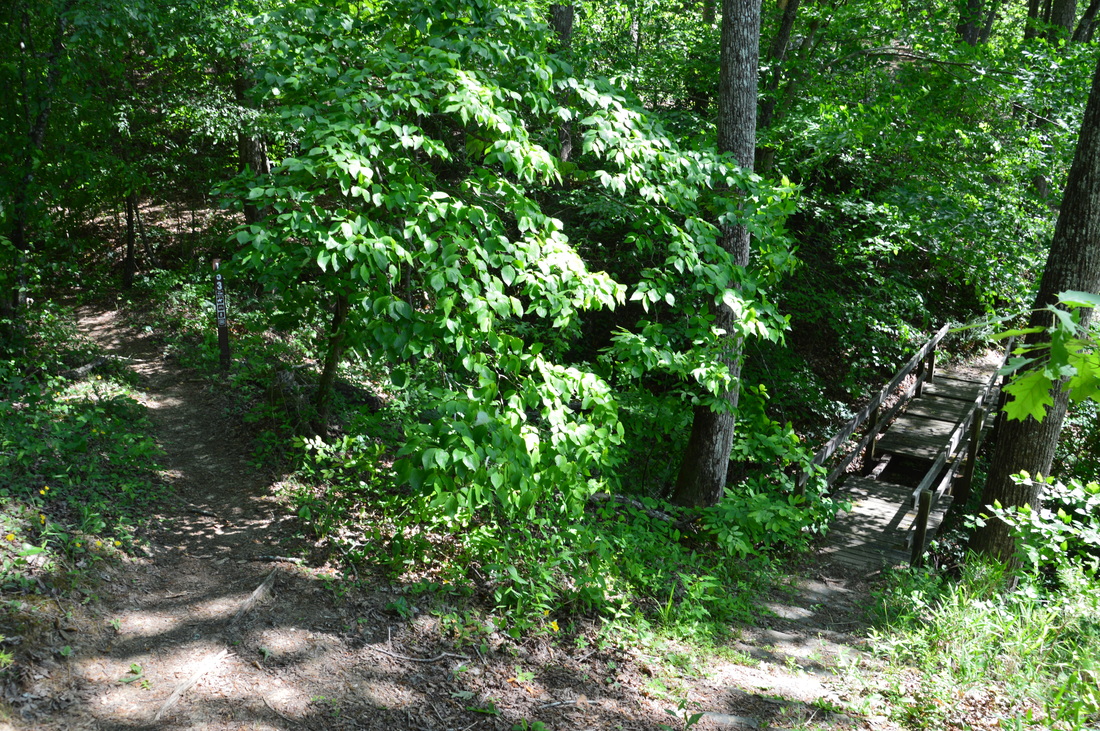
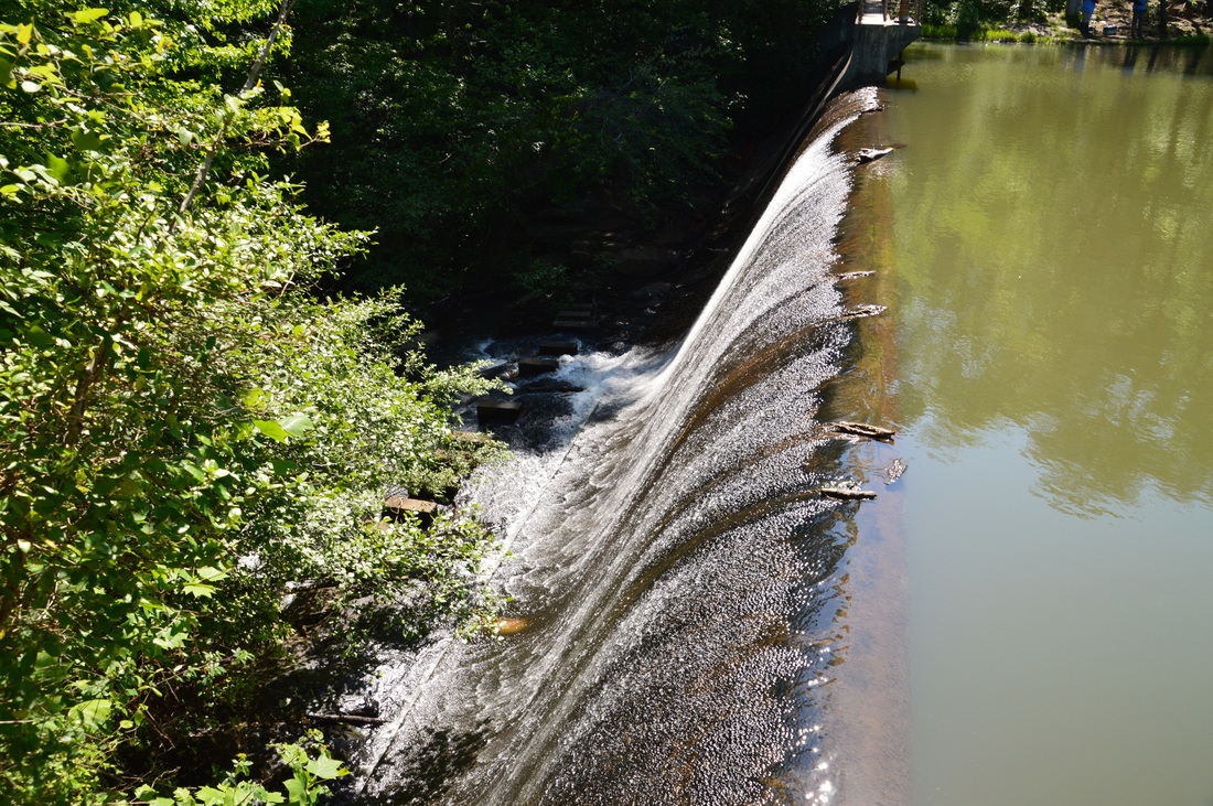
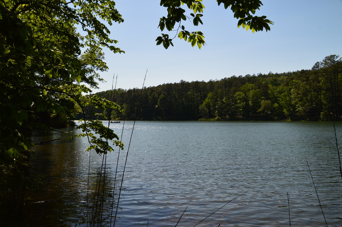
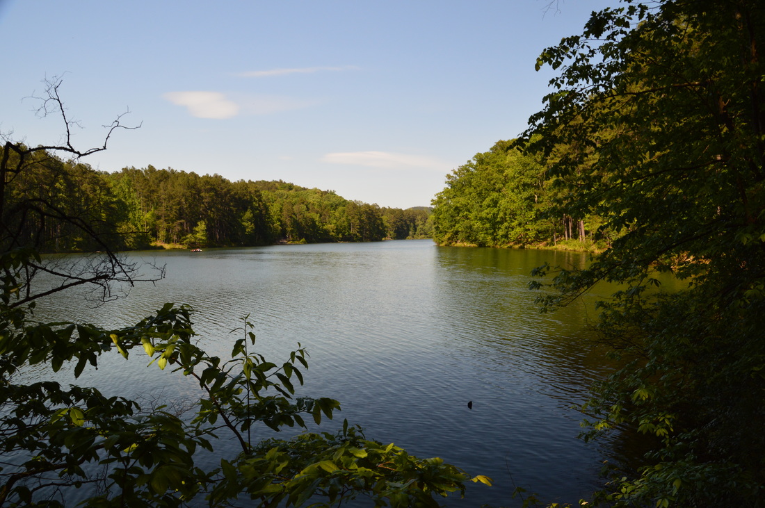
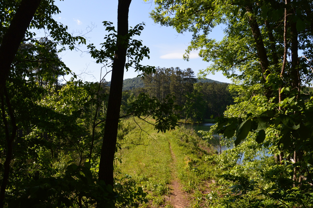
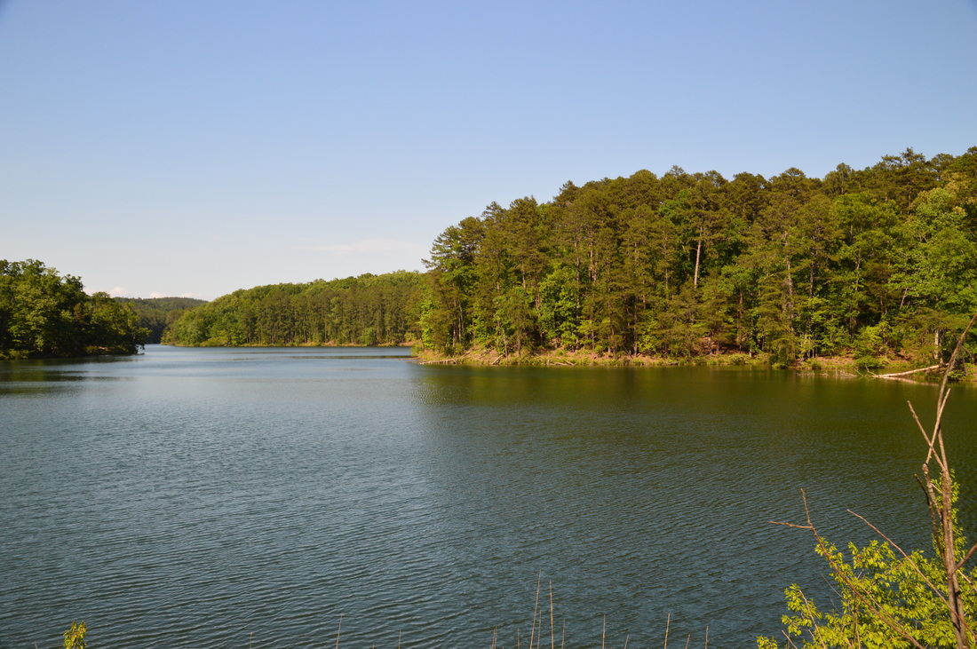
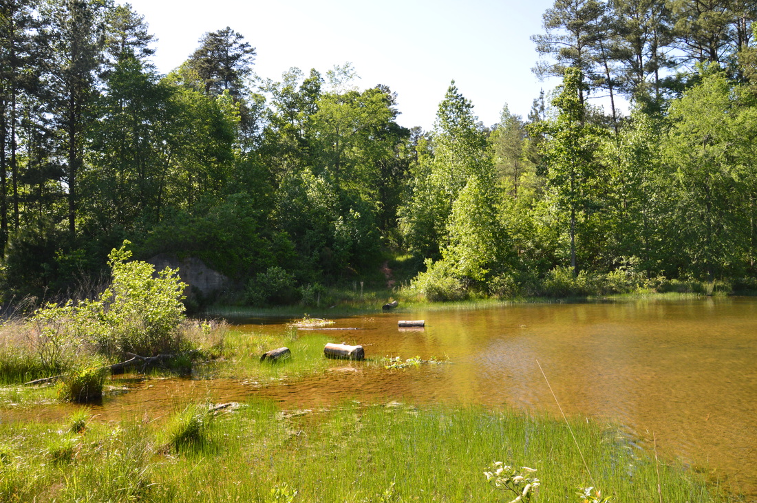
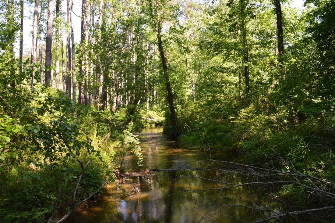
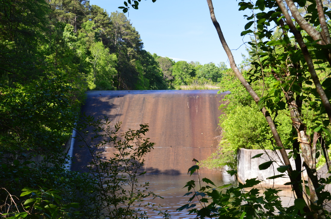
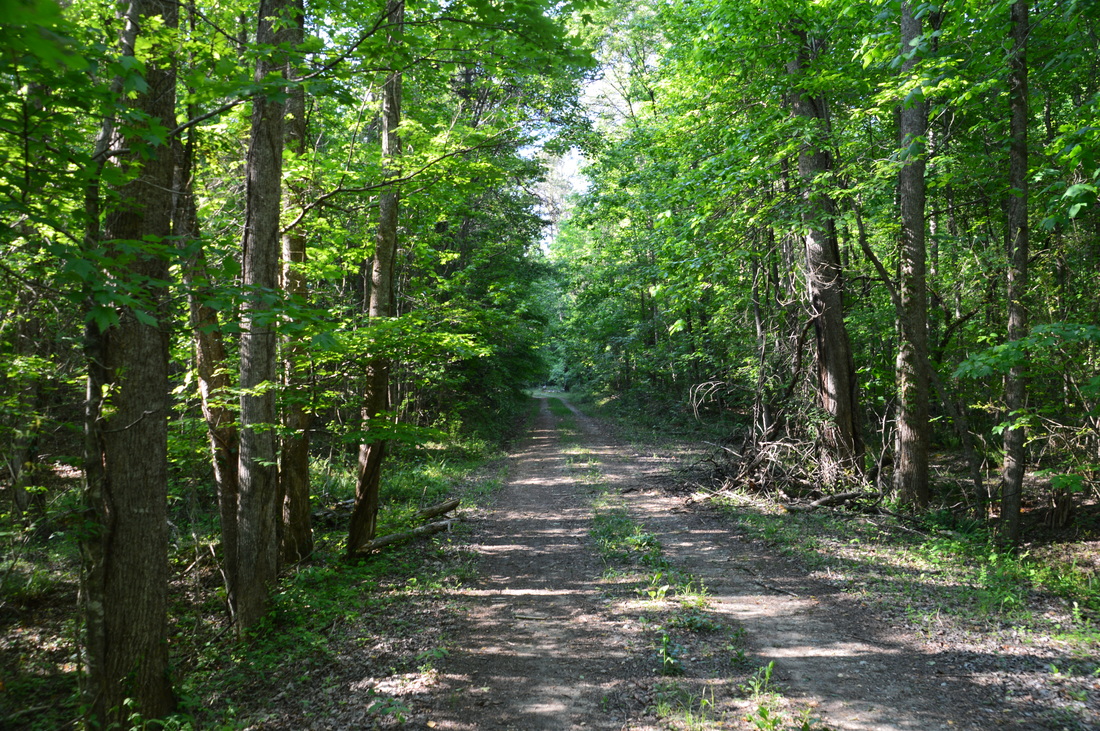
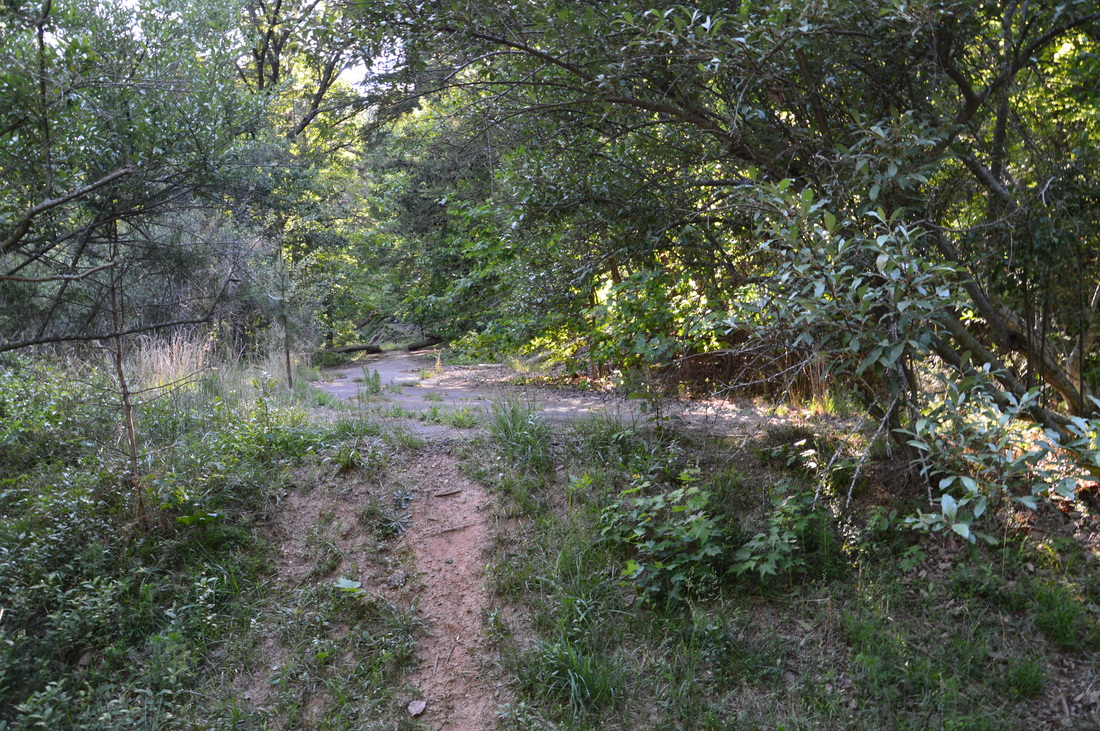
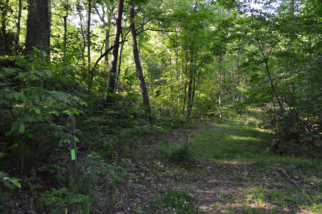
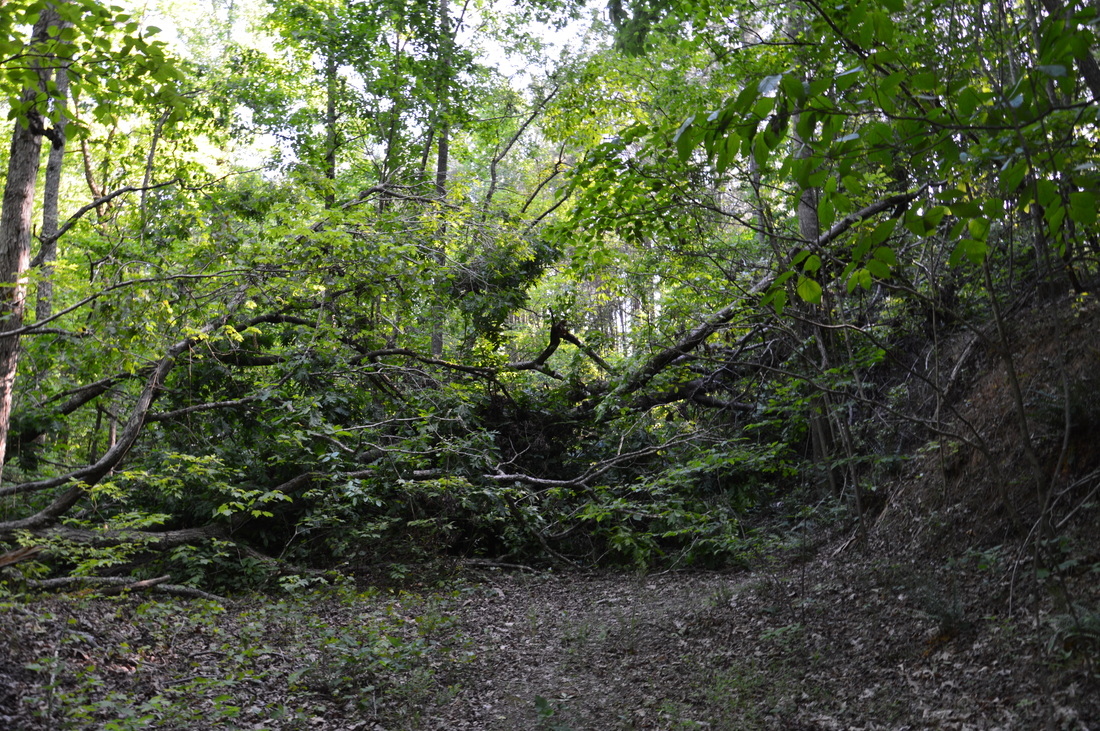
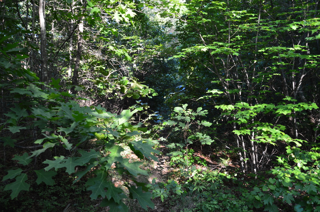
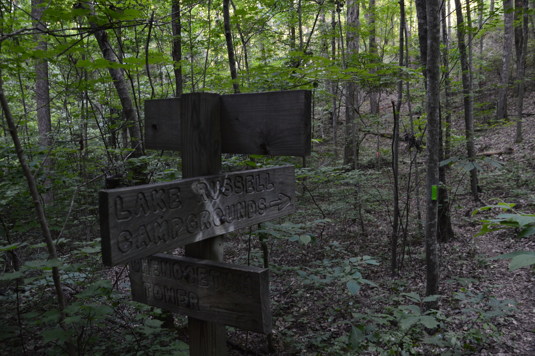
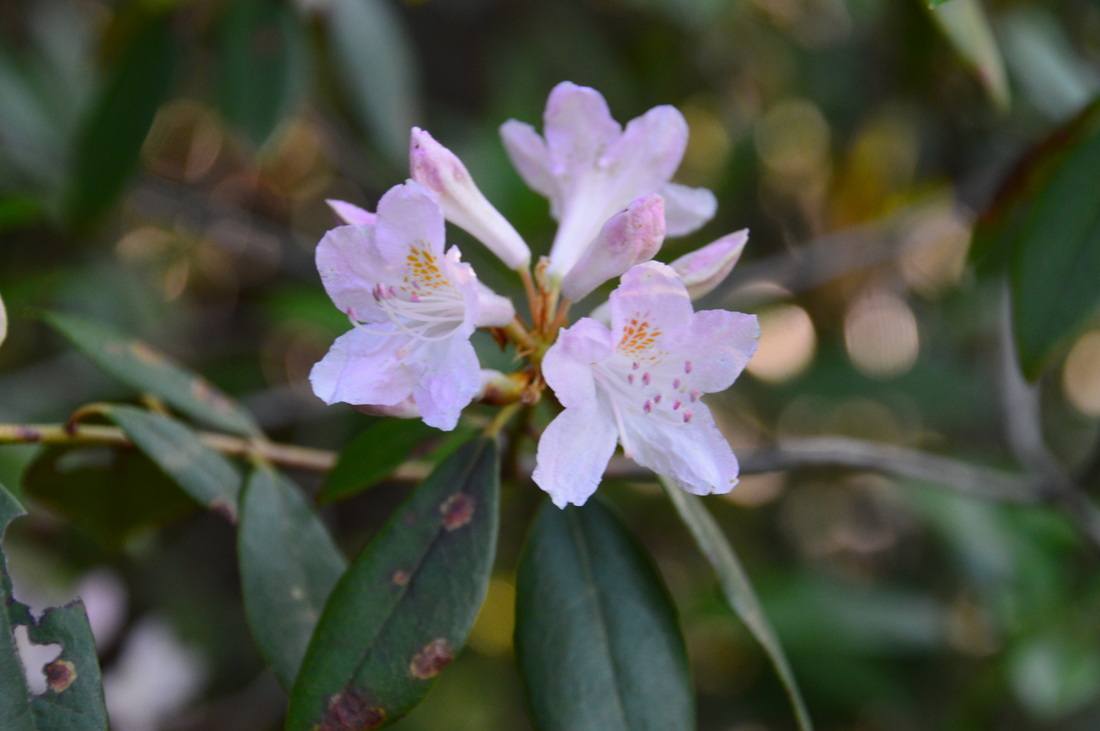
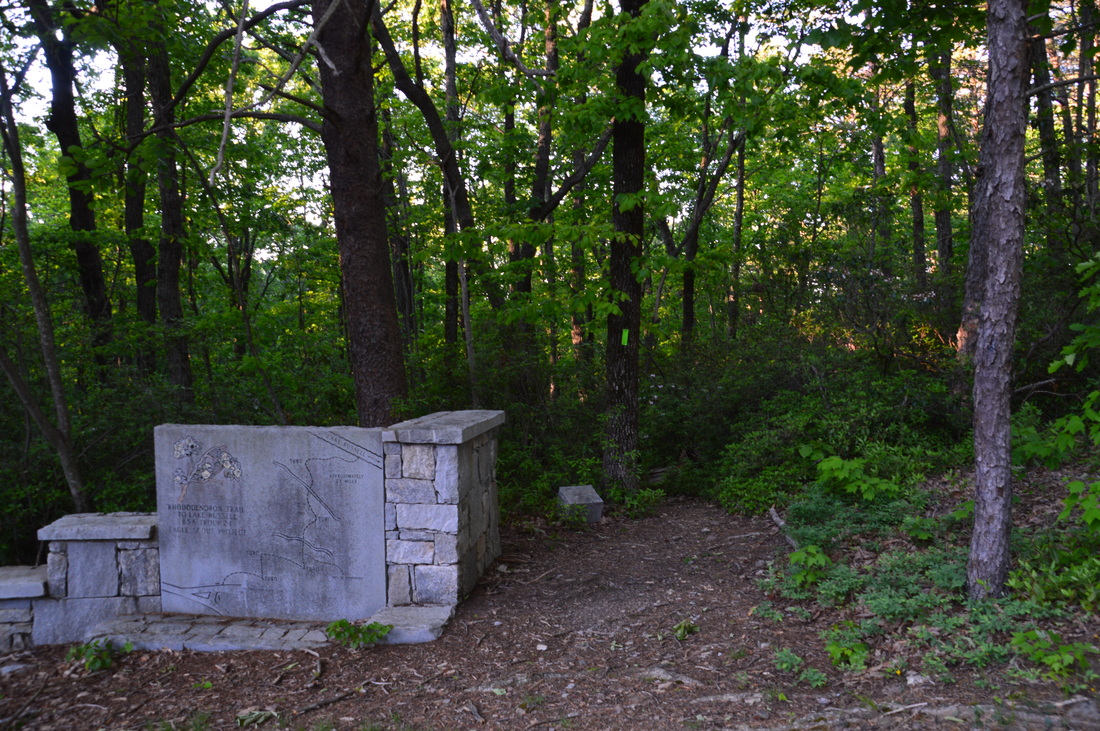
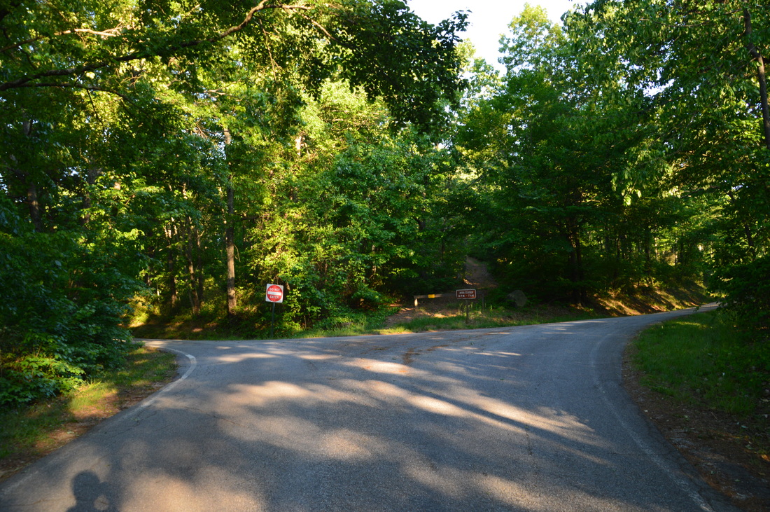
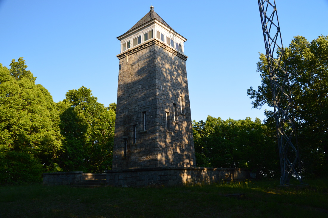
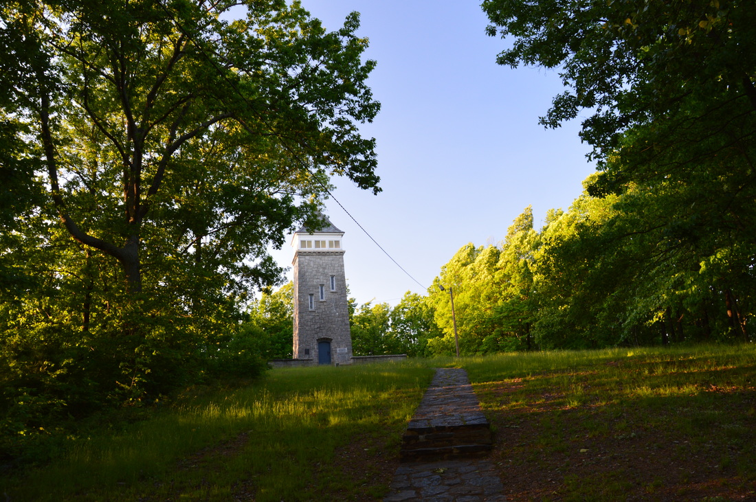
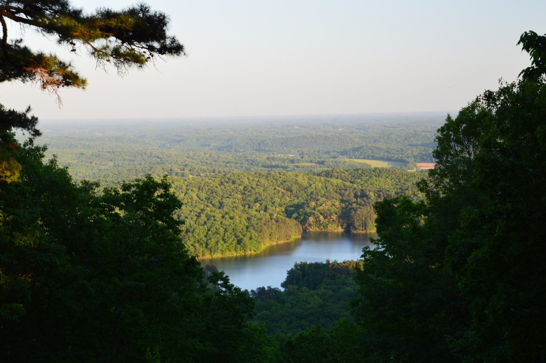
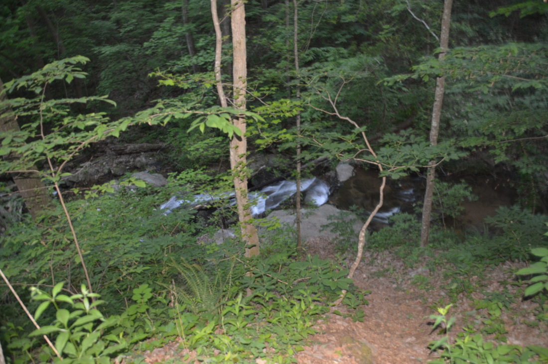
The hike begins on the gated but paved road that heads away northward from your car. Walk around the gate and follow this level road above the western shore of Nancytown Lake. The pavement may make the start of the hike a bit boring, but the hike will soon take off onto dirt trail. At 0.3 miles, there is a closed parking area at Nancytown Lake to the right. The Nancytown Lake Trail and Ladyslipper Trail begin to the right, To access the Sourwood Trail, continue straight on the still-paved road. It is unclear to me why this area was closed to vehicles, At 0.4 miles, the road curves right, crosses a bridge over a stream, and becomes gravel past another gate. The Sourwood Trail begins on the left side of this curve. It is marked by a trail wand with the number 155 and a yellow diamond. Turn left onto the Sourwood Trail and begin following a narrow trail through a lush bottomland with a small creek to your right. At 0.5 miles, the Sourwood Trail crosses the creek on a metal footbridge. After this, the trail makes a gradual 180-degree turn as it ascends onto a pine-topped hill. As the trail ascends along and follows a low ridge, you may notice some red clay around the trail. This is a giveaway of the fact that the hike is in the foothills, not in the mountains,where red clay isn't seen. At 1.25 miles, the Sourwood Trail reaches its high point and crosses Nancytown Road, a dirt road that can be accessed from GA 13. After this, the trail begins descending into the Nancytown Creek valley. The trail crosses two small streams on footbridges at 1.5 miles and 1.65 miles. At 1.8 miles, reach a junction. Here, a marked spur trail to the left leads to Nancytown Falls. The trail travels through a field of ferns near Nancytown Creek, before reaching the official viewpoint of the falls at 1.9 miles. The falls is on the low-flow side and is best seen after a lot of rain. The falls is made of several drops, first down a ledge and then cascading through a rock jumble. However, the view isn't all that great. A short goat path continues straight to a better view of the falls, where you can see the upper and middle drop in detail. Also, from the official viewpoint, you can descend to the creek and rock hop up the stream to the base of the falls. From Nancytown Falls, return down the side trail and continue following the Sourwood Trail southward along Nancytown Creek. At 2.1 miles, a marshy area to the left is actually the remains of an old beaver pond. For a while, the trail - flanked by loads of mountain laurel - stays in view of the creek and its cascades. At 2.65 miles, a metal bridge (similar to the one in the beginning of the hike) takes the trail across the creek. I've never seen these types of footbridges elsewhere, although I can imagine that they are sturdier than the typical wooden footbridges. After this, the trail begins descending down an old roadbed. You will hear the sound of rushing water to the right, hidden behind lush foliage - this is Lower Falls, although it is actually a 10-foot set of cascades. At 2.85 miles, the Sourwood Trail ends at Red Root Road. Turn right onto the dirt road to return to Nancytown Lake. As soon as you cross Nancytown Creek on the wide road bridge, turn right past a camping area to a view of Lower Falls. After viewing these photogenic cascades, walk along Red Root Road westward to reach the rest of the trail system. This dirt road receives little traffic, although there isn't much to see on the roadwalk itself. At 3.2 miles, Nancytown Road leaves to the right, but this hike continues straight. At 3.35 miles, reach the gate at the beginning of the Sourwood Trail - you have completed the Sourwood Loop. From here, continue walking along the now-paved road, until you reach the closed parking area at the north end of Nancytown Lake. Turn left here, walk across a bridge over an unnamed creek with some cascades below, walk through the parking area, and reach a trailhead. This is the beginning of the short Nancytown Lake Trail, but it is also the trailhead for the much longer Ladyslipper Trail. The trail begins with a sign about the Ladyslipper Trail and a footbridge across Nancytown Creek. The creek is marshy here, as the lake lies just downstream. As the trail gains some elevation, there are views of the marshes at the north end of Nancytown Lake. At 3.65 miles, the Lady Slipper Trail leaves to the left. I did not hike the Lady Slipper Trail on this day, as it is a whole separate loop trail that travels up Red Root Mountain and along several small tributaries of the Middle Fork of the Broad River. The loop trail is 6.2 miles long, in case you're interested in hiking it. My hike continued straight along the Nancytown Lake Trail, which afforded great views of this small reservoir. At 3.8 miles, the trail reaches the Nancytown Lake Dam. This unique dam is slanted and has a large amount of water flowing over it, making it more picturesque than one would expect. Just past the dam, there is an intersection with the Lake Russell Trail, which continues straight and to the right. The Nancytown Lake Trail also turns right and crosses Nancytown Creek on a footbridge. This footbridge provides a good front view of the dam. However, you do not have to continue on the Nancytown Lake Trail, since it leads back to the parking area. Instead, after viewing the dam from the footbridge, continue along the Lake Russell Trail southward along Nancytown Creek. Below the dam, the creek, at first, is fast and has plenty of cascades, but as the trail approaches Lake Russell, the creek slows down and becomes marshy once again. At 4.1 miles, the trail reaches Lake Russell. Over the next couple of miles, the trail travels along the shores of Lake Russell, providing many great views of the reservoir. The trail mostly follows the shore of the lake closely, but it does wind in and out of hollows that carry small streams to the lake. During summertime heat, this could be a pleasant section of trail, due to a constant breeze blowing across the lake. At 5.1 miles, the trail begins following a particularly long finger of the lake. At 5.3 miles, the trail rounds the finger, and after that, it leaves the lake temporarily and traverses some hills at the lake's southwest end. At 5.85 miles, the trail reaches the Lake Russell Dam. The trail follows this long, grassy dam with a commanding view of the lake. As the trail approaches the spillway at the end of the dam, things get a bit confusing. A very obvious path continues straight to the top of the spillway. On the other side of the lake's end here, you can see a forest road that can once can assume is the trail. Depending on the water level, it possible to wade through here to the other side of the spillway, creating a sort of shortcut. However, for those who wish to keep their feet dry, there is a trail that circumnavigates the spillway, but the trail was a bit overgrown and did not appear to receive much use. This trail leaves to the left just before the spillway. The trail descends down the dam and to Nancytown Creek, bridging it at 6.05 miles. After this, the trail follows Nancytown Creek upstream to the spillway. The spillway is similar to the one at Nancytown Lake, although the water flow is lower, so the scene isn't as picturesque. At 6.2 miles, the trail ascends to and reaches the forest road that you saw earlier. To the right is the ford above the spillway and the unofficial shortcut. To continue on the hike, turn left onto the forest road. According to maps, this is FS 59.1, but it is closed to vehicular traffic. The road that the trail follows begins ascending away from Lake Russell. At 6.35 miles, a promontory to the right seems to have a sort of junkyard with construction materials. I don't know how this is allowed in the national forest... As the trail leaves the lake, the ascent steepens. After passing a gate, the Lake Russell Trail reaches the Lake Russell Road at 7 miles. The Lake Russell Trail continues across the road, into the Lake Russell Recreation Area, and follows the north side of the lake back to Nancytown Lake. For a shorter hike, one can continue on this trail back to the parking. However, my plan was to summit Chenocetah Mountain, which required accessing a couple of other trails. Thus, I turned left onto Lake Russell Road for a brief roadwalk. As soon as you begin walking down the road, note a bizarre sight to the left: the crumbling remains of an old paved road, its start blocked off. Apparently, this is Old Lake Russell Road. It originally started on Chenocetah Mountain, but my guess is that it was closed due to private residential development around the mountain. At 7.5 miles, the Campground Trail leaves the road to the left. It is easy to miss the trailhead, as it is not marked by any signs. However, if you look closely, you will see a lime green blaze on a wooden post. Turn left onto the Campground Trail. The Campground Trail is by far the least-maintained trail out of all trails on this hike. The trail begins ascending shortly at a blue arrow with the word "Trail". There is an excessive amount of large blowdowns during the first part of the trail, making the hiking very slow. In fact, I have a hard time recalling another trail which has around a dozen of large blowdowns in under half of a mile. At 7.9 miles, the ascent steepens, and at 8..15 miles, the trail crosses a ridge that extends from Chenocetah Mountain. After this, the trail descends briefly to a small stream. After this, the ascent resumes in piney woods. Occasional blue blazes mark the trail. The trail becomes pretty overgrown at 8.5 miles. The faint path was becoming hard to follow, but luckily, the terminus of it was not far away. At 8.7 miles, the Campground Trail ended at a signed intersection with the Rhododendron Trail, which is by far the more popular route to Chenocetah Mountain. A right turn on the Rhododendron Trail is the direct route back to Nancytown Lake. However, first I had to see Chenocetah Mountain, so I took a side trip to it by turning left onto the Rhododendron Trail. The trail continues a rather steep ascent flanked by thick rhododendron growth. I have heard that during mid to late June, there is a spectacular rhododendron bloom display here - one of the best in Georgia. At 9.15 miles, the Rhododendron Trail ends at Chenocetah Drive. Turn left onto the paved road for the final walk to the summit of the mountain. At 9.25 miles, the road splits into a one-way loop around the summit of the mountain. A gated service road continues straight ahead, between the two sides of the paved road. For the shortest way up, continue onto the service road. At 9.35 miles, reach the summit of Chenocetah Mountain. The Chenocetah Mountain Tower stands ahead of you. This historic granite tower was built by the Works Progress Administration in 1936 for National Forest Service use. Today, the tower is on the National Register of Historic Places. In fact, it is the only stone fire tower in Georgia. The tower is closed to the public throughout most of the year; however, it is open to visitors on just one day, the day of the Big Red Apple Festival. On this day, the city of Cornelia offers hayrides to the tower during the day. While there is no view from the summit of Chenocetah Mountain, there are a couple of small views on the sides of the mountain. From the tower, continue straight on a stone pathway to Chenocetah Road. Once you reach the road, you will see a small cut in the trees to the left (it looked artificial to me). This opening provides a vista of Lake Russell in the valley below and the rolling hills beyond. From the opening in the trees, turn left onto Chenocetah Road and begin descending down the mountain. At 9.55 miles, another opening in the trees to the right offers a limited view of the distant Blue Ridge Mountains. At 9.7 miles, return to the beginning of the Rhododendron Trail. Note the trail diagram carved into stone to the left of the trailhead. Begin descending along the trail back into the Nancytown Creek valley. At 10.15 miles, return to the Campground Trail intersection. This time, my plan was to continue straight along the Rhododendron Trail. Rest assured - the maintenance of the Rhododendron Trail is by far better than of the Campground Trail. At 10.2 miles, the trail crosses, via a wooden footbridge, a small stream. The trail crosses a slightly larger stream at 10.4 miles, where some rhododendron was already blooming. After this, the trail begins to descend more earnestly along the east side of the growing, unnamed stream. As you lose elevation, you'll hear and see numerous cascades in the creek to the right. Around 11 miles, the trail begins flattening out and leaves the stream, before reaching Lake Russell Road at 11.4 miles. This is the eastern terminus of the Rhododendron Trail. A short roadwalk is necessary to return to the Nancytown Lake parking. Turn right onto Lake Russell Road and walk down it for a quarter-mile. At 11.65 miles, turn left onto the side road to Nancytown Lake. Continue for another 0.15 miles. You will return to your car at Nancytown Lake at 11.8 miles, concluding the hike. Mileage
0.0 - Sourwood Trail Parking
0.4 - Sourwood Trail begins to left 1.25 - Nancytown Road 1.9 - Nancytown Falls 2.85 - Red Root Road and Lower Falls 3.35 - End of Sourwood Loop 3.8 - Nancytown Lake Dam 4.1 - Lake Russell; lake views begin 5.85 - Lake Russell Dam 7.0 - Lake Russell Road, beginning of roadwalk to Campground Trail 7.5 - Campground Trail begins to left 8.7 - End of Campground Trail, left turn onto Rhododendron Trail 9.15 - End of Rhododendron Trail, left turn onto Chenocetah Drive 9.35 - Chenocetah Mountain 9.7 - Return to Rhododendron Trail 11.4 - Lake Russell Road, turn right onto road to return to the parking area 11.8 - Sourwood Trail Parking Variations
Just the Sourwood Loop - 3.75 Miles
Just Sourwood Trail and Lake Russell Trail - 8.4 Miles Add the Ladyslipper Trail to the hike - 18.0 Miles Bonus Stops
A nearby hiking trail, the Broad River Trail, explores the Broad River valley and at least a portion of it can be hiked following this hike.
PicturesVideos
2 Comments
John Staudt
8/30/2017 01:18:38 pm
Excellent review! I have hiked all these trails many times with my trusty dog Missy when I lived in Cornelia, Ga. Thanks.
Tracy Robar
2/2/2020 10:39:29 am
The HCHS cross country team I helped coach was blessed to be able to run these traills daily in season. Fond memories. Leave a Reply. |
About MeMark Oleg Ozboyd Dear readers: I have invested a tremendous amount of time and effort in this website and the Georgia Waterfalls Database the past five years. All of the work that has gone in keeping these websites updated with my latest trip reports has almost been like a full-time job. This has not allowed me to pick up a paid job to save up money for college, and therefore, I I've had to take out loans. If you find the information on this website interesting, helpful, or time-saving, you can say "thanks" and help me out by clicking the button above and making a contribution. I will be very grateful for any amount of support you give, as all of it will apply toward my college tuition. Thank you!

Coming in 2022-2023?
Other Hiking WebsitesMiles HikedYear 1: 540.0 Miles
Year 2: 552.3 Miles Year 3: 518.4 Miles Year 4: 482.4 Miles Year 5: 259.9 Miles Archives
March 2021
Categories
All
|


 RSS Feed