HIKING THE APPALACHIANS AND BEYOND
  • Home
  • Trail Reports
    • Best Hikes
    • Hikes with Scenic Views
    • Hikes with Water Features
    • Alabama
    • Georgia
    • Florida
    • North Carolina
    • South Carolina
    • Tennessee
    • Vermont
    • Virginia
  • Map
  • Hike List
  • Testimonials
  • Resources
  • Contact Us
  • Southeast Nature Society
    • Our Team
  • Georgia Waterfalls Database

Chattahoochee National Forest: Pinnacle Knob via Courthouse Gap Trail, Clayton, Georgia

6/1/2017

4 Comments

 
Picture
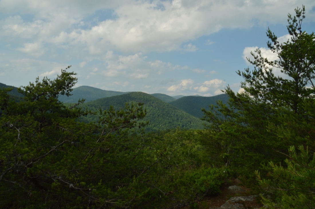
A rocky peak that towers over the Stekoa Creek valley and Clayton, Pinnacle Knob provides a 270-degree vista that is one of Northeast Georgia's best. The view from the top includes an attractive foreground of valleys and mountains with a beautiful background of fading lines of ridges. Two different hikes provide access to Pinnacle Knob: a longer hike from Warwoman Road and a shorter hike from Pinnacle Drive near US 441. While the longer route has the added benefit of passing two pretty waterfalls, the shorter route via the Courthouse Gap Trail is convenient for folks who are looking for a great payoff without a full-day hike. Furthermore, the side trail from the Bartram Trail was to the top of Pinnacle Knob was recently rerouted and lengthened to allow easier access to Pinnacle Knob's clifftop views. This hike occurred on Saturday, May 27th, 2017. My plan was to hike out and back to Pinnacle Knob via the Courthouse Gap Trail, Bartram Trail, and Pinnacle Knob Trail, starting at Courthouse Gap Road. 

Summary

R/T Length of Trail: 3.6 Miles 
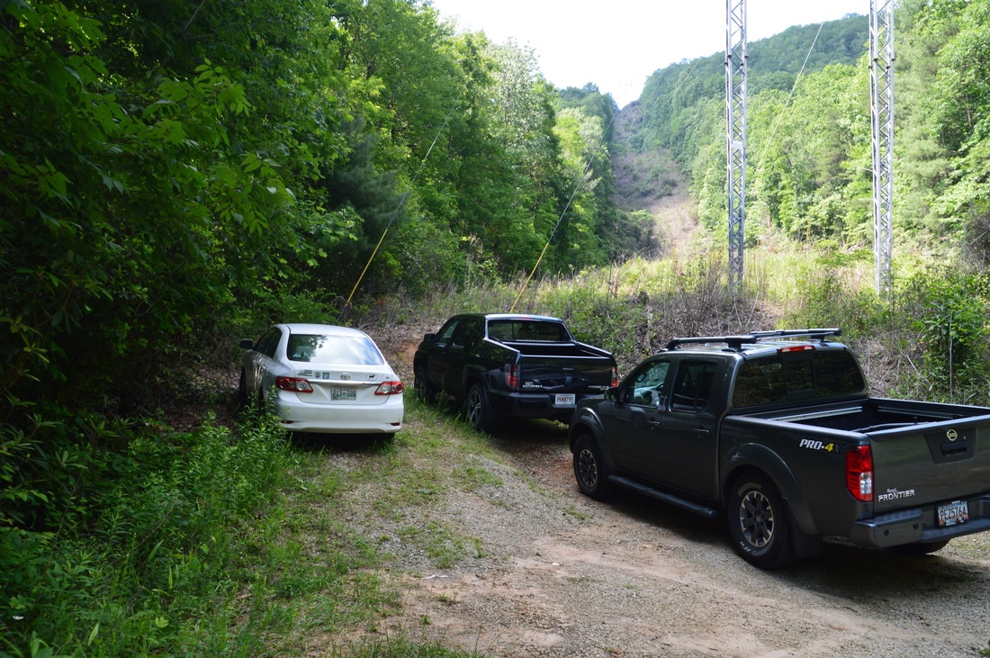
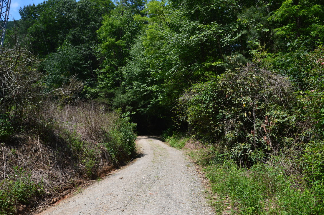
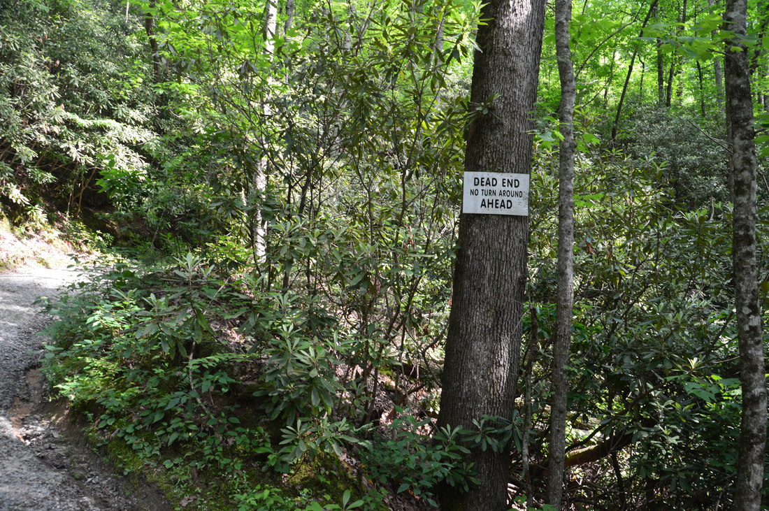
Duration of Hike: 2:30 
Type of Hike: Out and Back 
Difficulty Rating: 4 out of 10 
Total Elevation Gain: 1022 Feet 
Pros: Very well-graded ascent to Pinnacle Knob 
Cons: Rather limited parking space around the Courthouse Gap Trailhead
Points of Interest: Pinnacle Knob Vista - 8 stars 
Trail Blaze Colors: Courthouse Gap Trail - Lime Green; Bartram Trail - Lime Green; Pinnacle Knob Trail - Lime Green 
Best Seasons to Hike: Summer 
Fees: None 
Beginning Point: Courthouse Gap Road below the actual trailhead
Directions from Clayton, GA: From the intersection of Rickman Drive, Savannah Street, and US Route 23/441 in Clayton, follow US Route 23/441 North for 0.8 miles. Then, turn right onto Pinnacle Drive and continue for 1.2 miles, before turning left onto unpaved Courthouse Gap Road. After 0.2 miles of driving on Courthouse Gap Road, you will reach a powerline cut. At the powerline cut, there is a small parking area on the left with space for two cars. 0.1 miles farther up Courthouse Gap Road, there is another small parking area on the left with space for around three cars, just as a "dead end" sign is nailed to a tree near the road. The Courthouse Gap trail begins on the left side of the road about 250 feet after the second parking area, but there is no parking space at all at the actual trailhead. 

Map

Picture
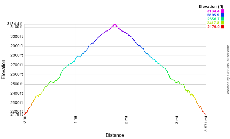
Click here to download a track of this hike. 

Details

My first visit to Pinnacle Knob was in July 2014, using the route from Warwoman Dell. At the time, I was blown away by the scenic view from the top of Pinnacle Knob. In the nearly three years that have passed, I have visited dozens of other vistas ​​all across the Southeast, and I was sure that the view from Pinnacle Knob wouldn't seem as good anymore. While now it didn't seem as incredible as it once did to me, I was still correct that the view from Pinnacle Knob is among the best in northeast Georgia. I was also glad to see that an important change had occurred in regards to the Pinnacle Knob Trail. The trail used to be extremely steep, climbing 500 feet straight up Pinnacle Knob in a half-mile, but by my latest visit, the trail had been rerouted with ample switchbacks, doubling the length of the ascent (but keeping the elevation gain about the same) and making it significantly easier. Having done both the Courthouse Gap and Warwoman Dell approaches to Pinnacle Knob, I think that I like the Warwoman Dell approach slightly better, but the Courthouse Gap approach is good for folks who don't have time for a long hike. 

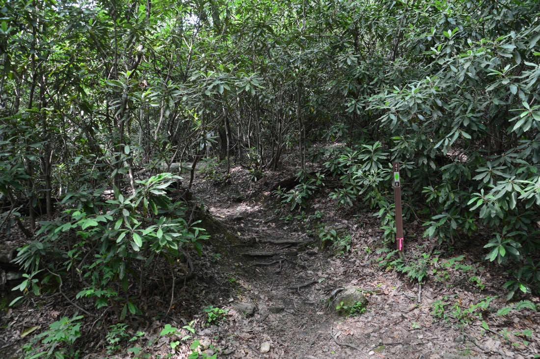
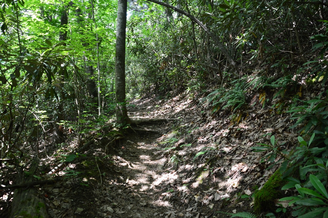
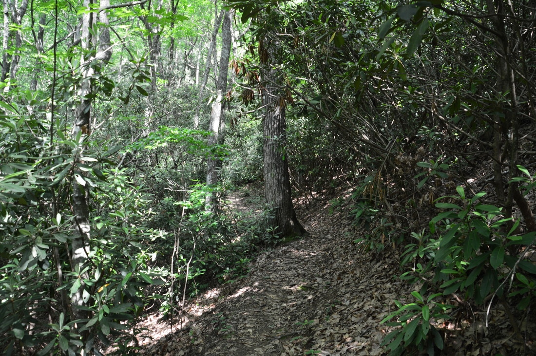
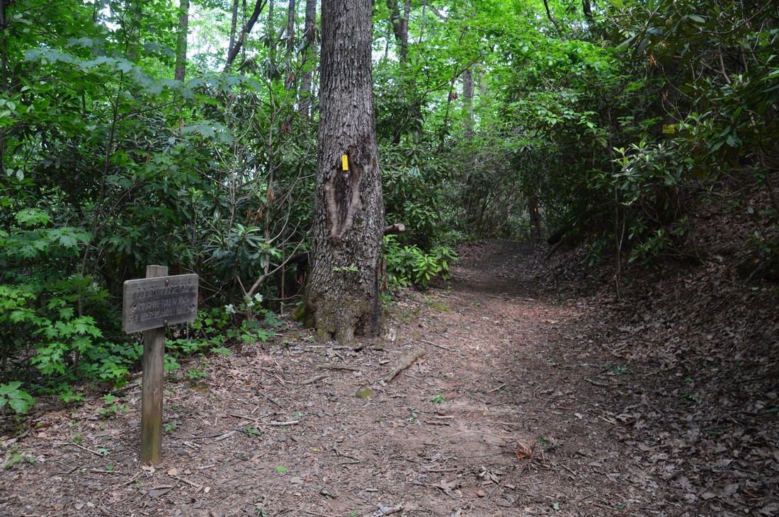
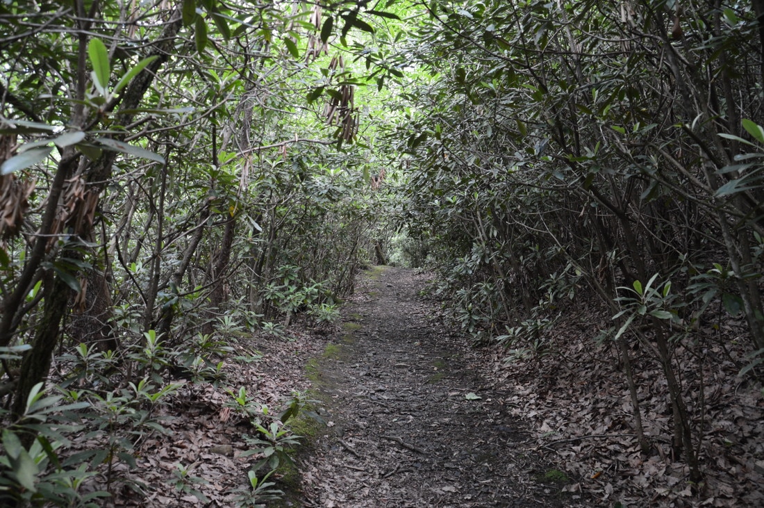
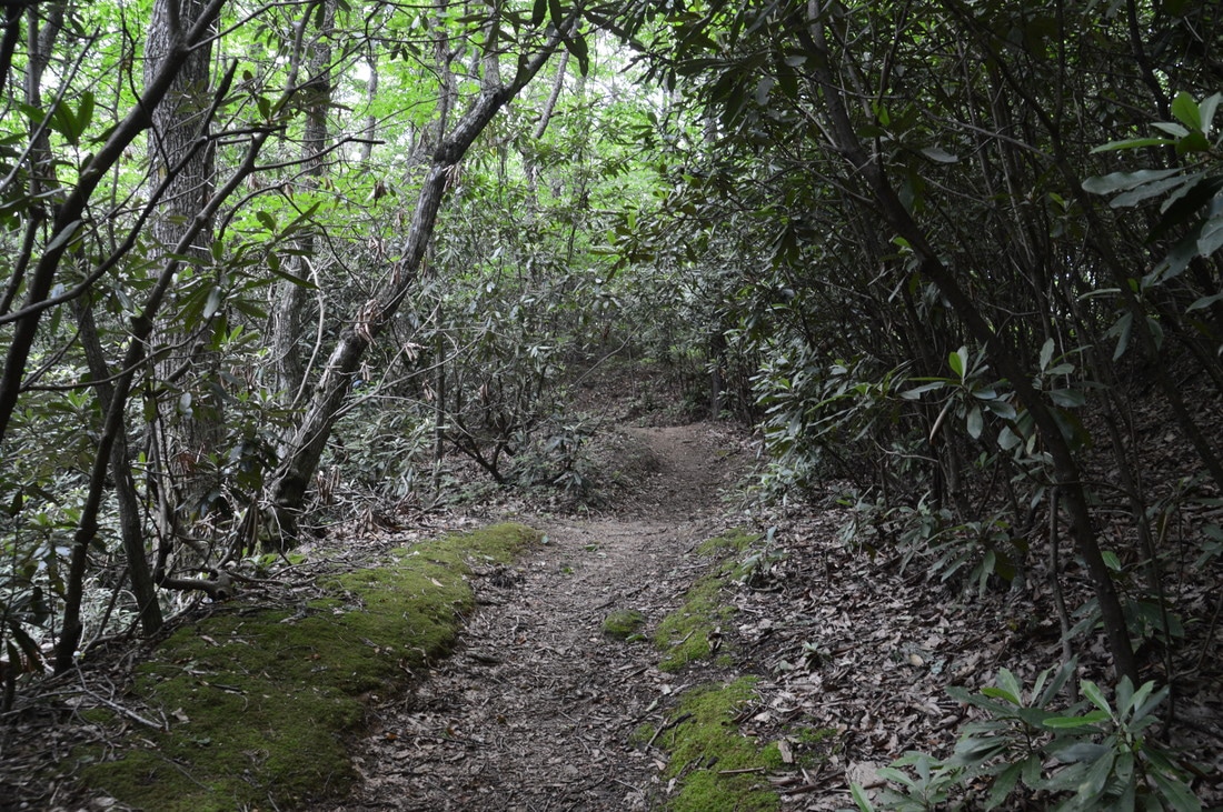
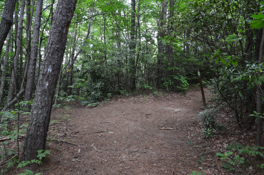
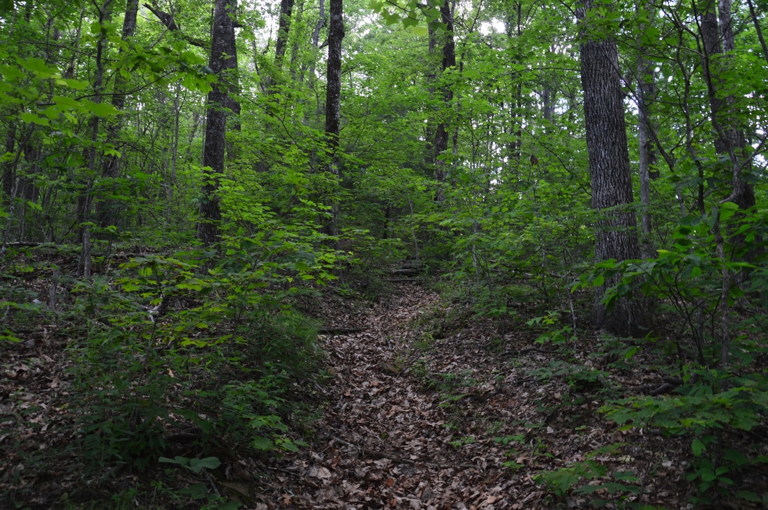
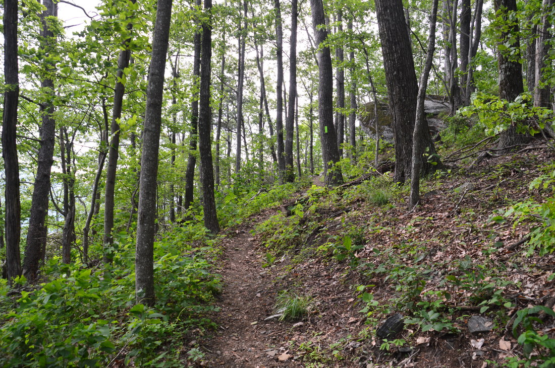
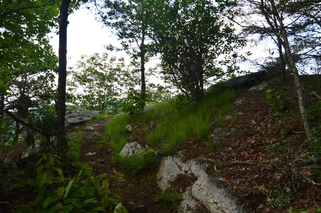
This trail report describes the hike to Pinnacle Knob from the lower parking area on Courthouse Gap Road (at the powerline cut). Start walking up the gravel Courthouse Gap Road. After 0.15 miles (about 250 feet past the dead end sign), the signed Courthouse Gap Trail (#47) will be on the left. As you turn on the trail, you will begin ascending moderately using switchbacks toward Courthouse Gap. After two pairs of switchbacks, the grade eases up as the trail contours along the slopes well above a tributary of Norton Creek. After a stretch of easy uphill, the Courthouse Gap Trail reaches a signed junction with the Bartram Trail in Courthouse Gap at 0.5 miles. To the left, the Bartram Trail leaves toward Hogback Mountain, Rock Mountain, and eventually Rabun Bald. You must turn right onto the Bartram Trail for the hike to Pinnacle Knob. The Bartram Trail enters a brief stretch of moderate ascent, curving through rhododendron tunnels before reaching a junction with the Pinnacle Knob Trail on a small hill at 0.8 miles. Here, the Bartram Trail continues straight toward Martin Creek Falls, Becky Branch Falls, and Warwoman Dell. Bear right onto the green-blazed Pinnacle Knob Trail to continue the hike to Pinnacle Knob. 
Picture
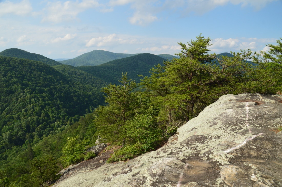
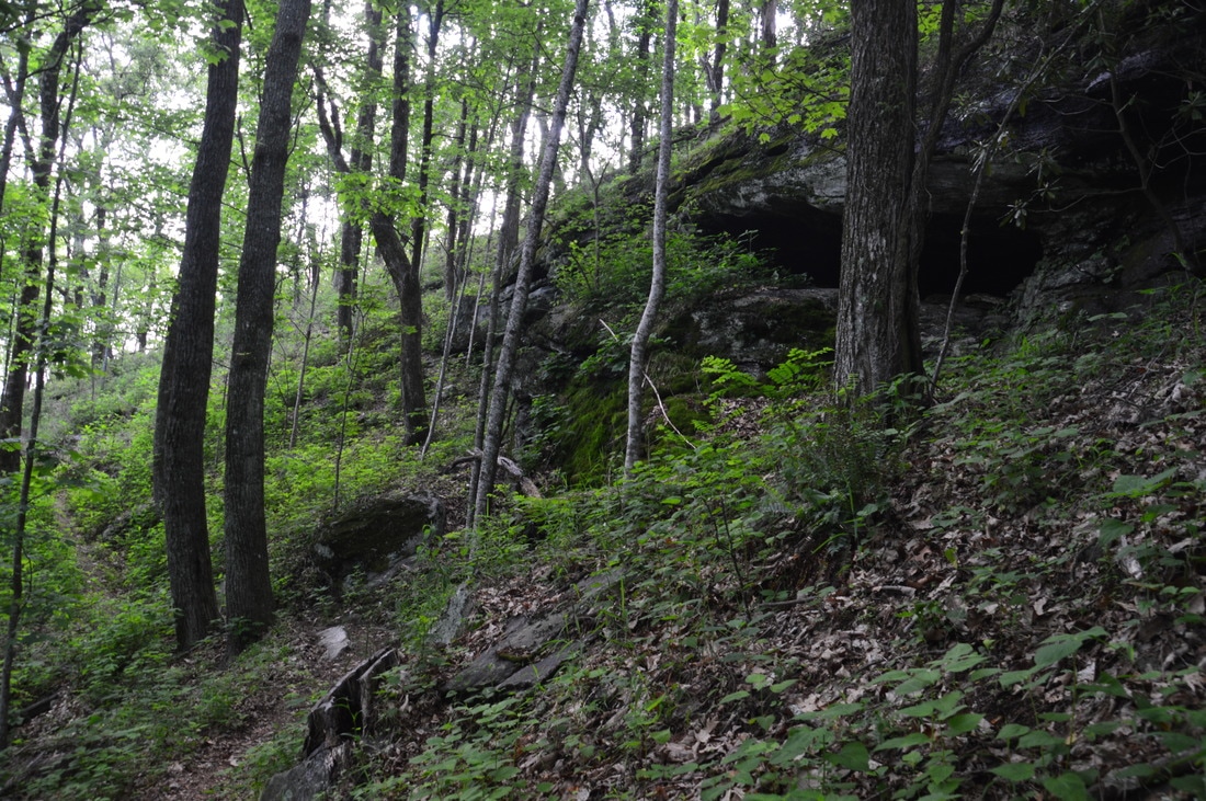
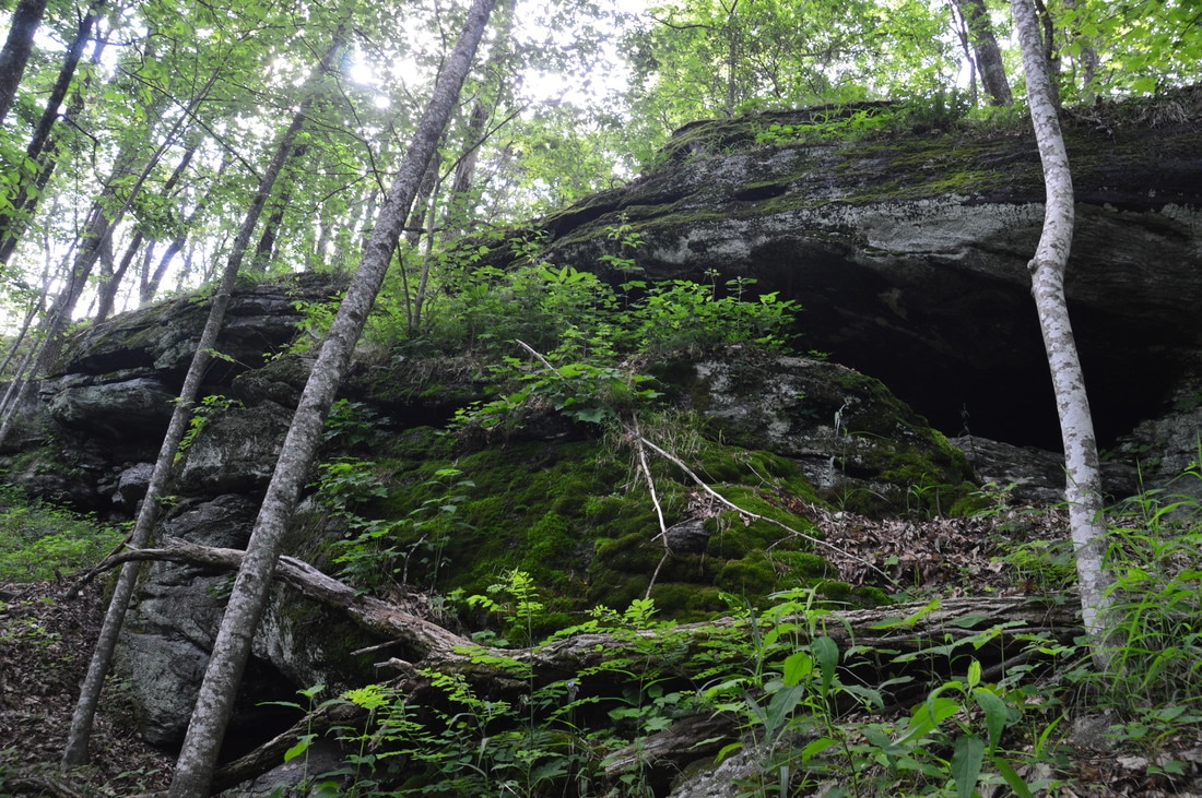
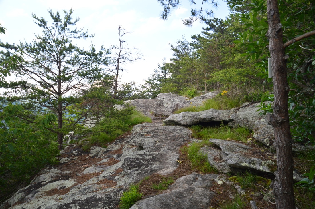
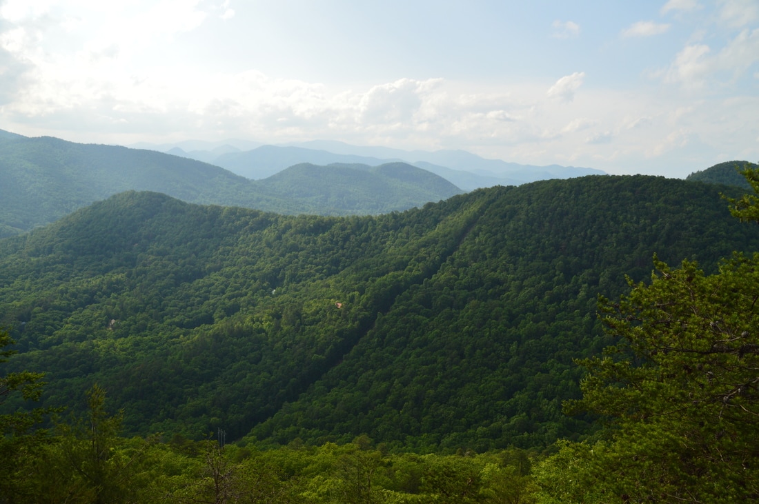
Near the summit of Pinnacle Knob, the Pinnacle Knob Trail passes a line of impressive rock outcrops and cliffs.
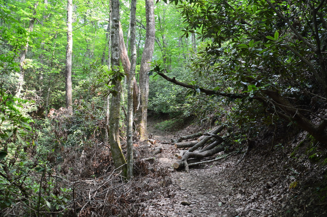
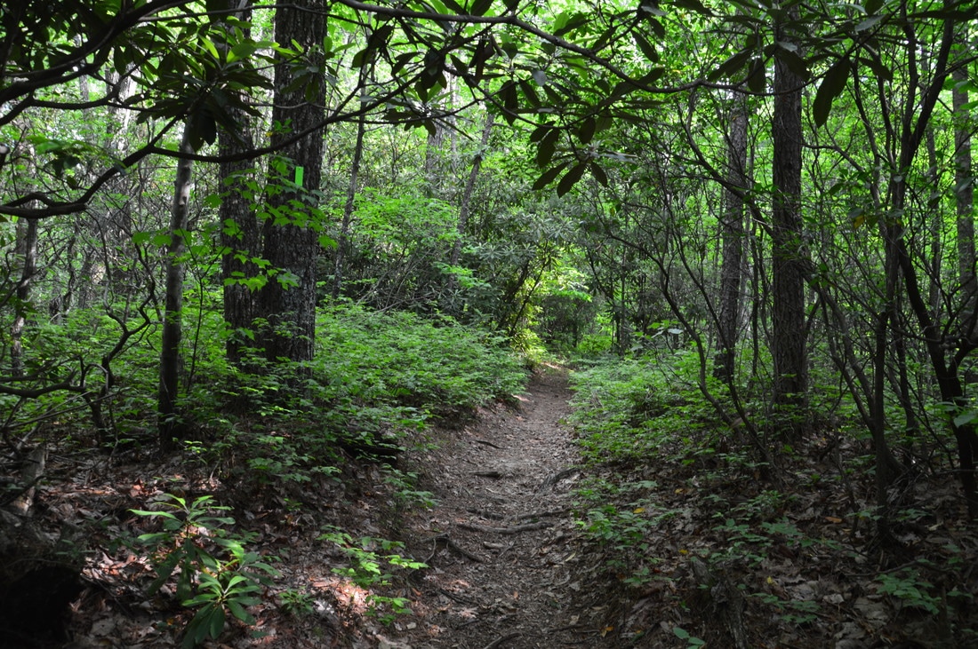
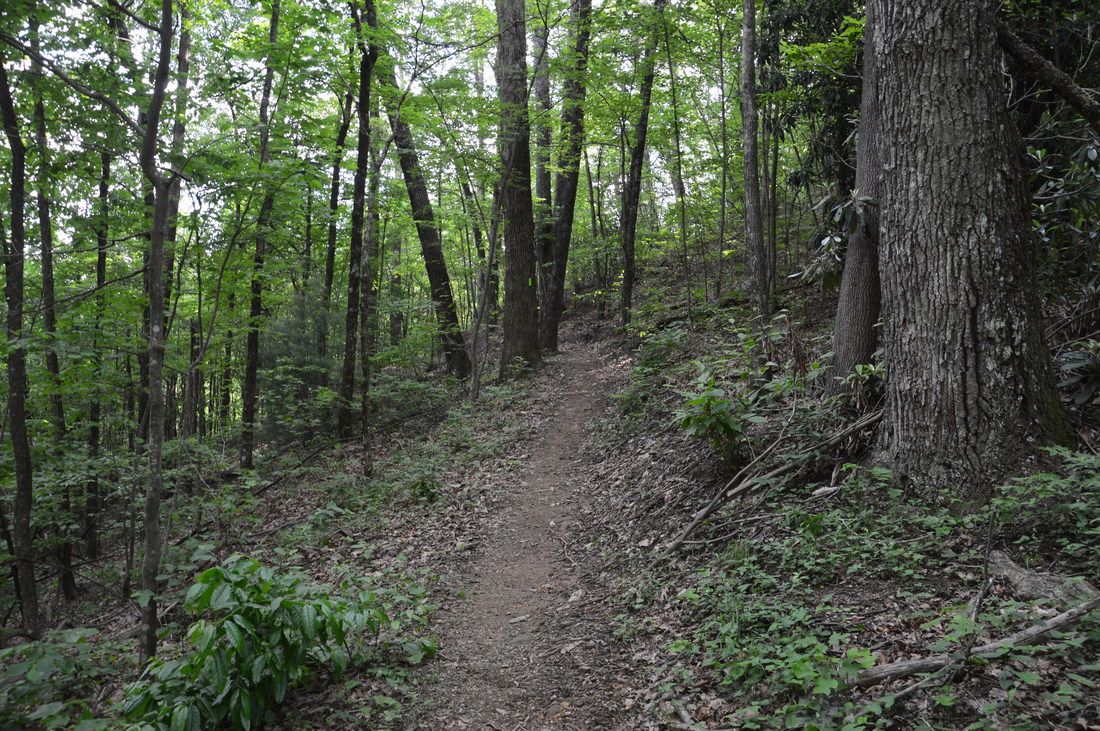
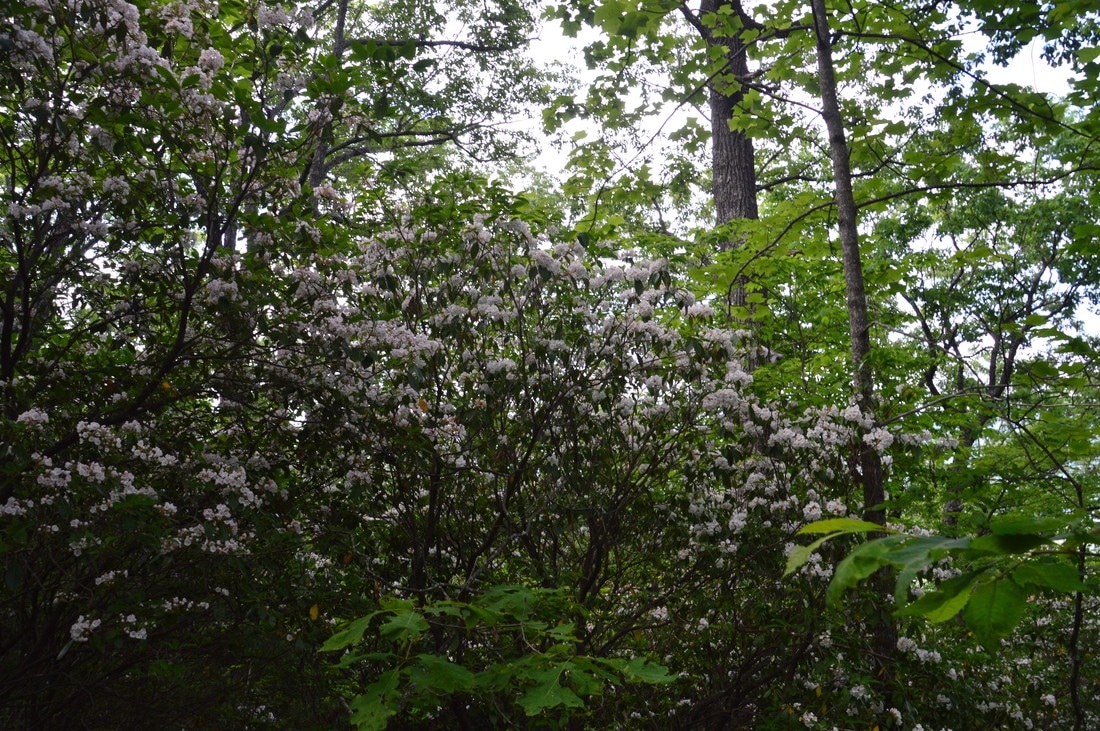
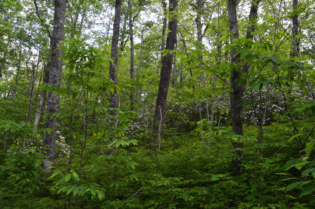
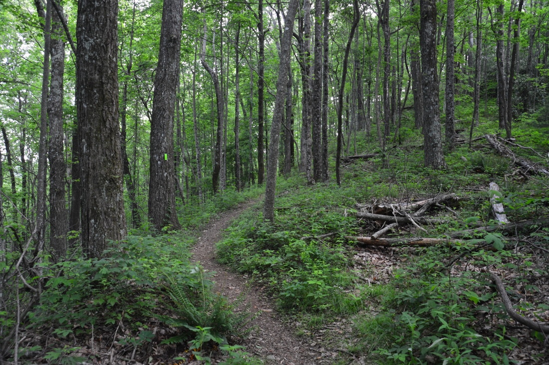
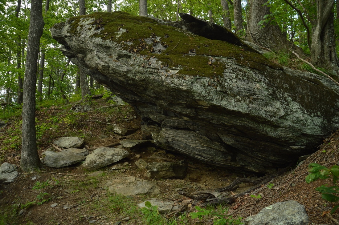
The Pinnacle Knob Trail begins a gentle ascent up a small ridge, which serves as an approach to the steep slopes that surround the knob itself. At 0.9 miles, bear right on the new trail as the blocked-off old trail continues straight.. The new trail makes a switchback and then passes near a gap at the foot of Pinnacle Knob's steep crown at 1.05 miles. Here, you can see the old Pinnacle Knob Trail crossing the new trail from left to right and beginning the extremely steep ascent up Pinnacle Knob. The new trail continues straight, gradually ascending and contouring along the slopes of the knob. At 1.25 miles, the trail makes the first of two long switchbacks. In the springtime, the following stretch of trail is flanked by rows of blooming mountain laurel bushes and is very pretty. The second long switchback is at 1.5 miles, after which the trail passes through a shallow gap near a false summit. As the trail slowly makes the final climb to the summit, it passes a beautiful line of rock outcrops and overhanging cliffs to the right at 1.65 miles. Then, the trail makes a final pair of switchbacks, after which there is a neat overhanging boulder on the right. Finally, at 1.75 miles, the Pinnacle Knob Trail ends at a long flat rock slab positioned at the top of tall cliffs near the summit of Pinnacle Knob. 

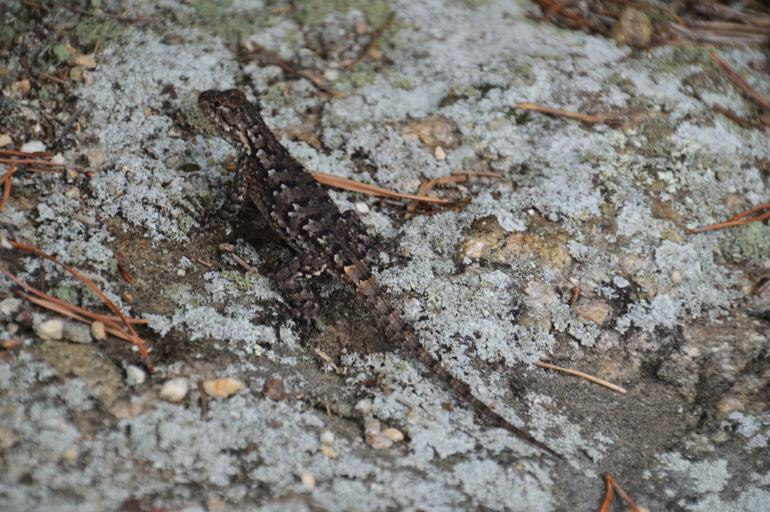
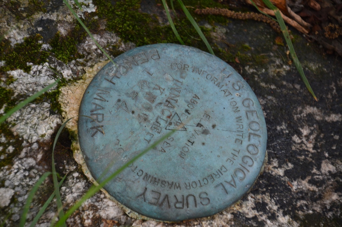
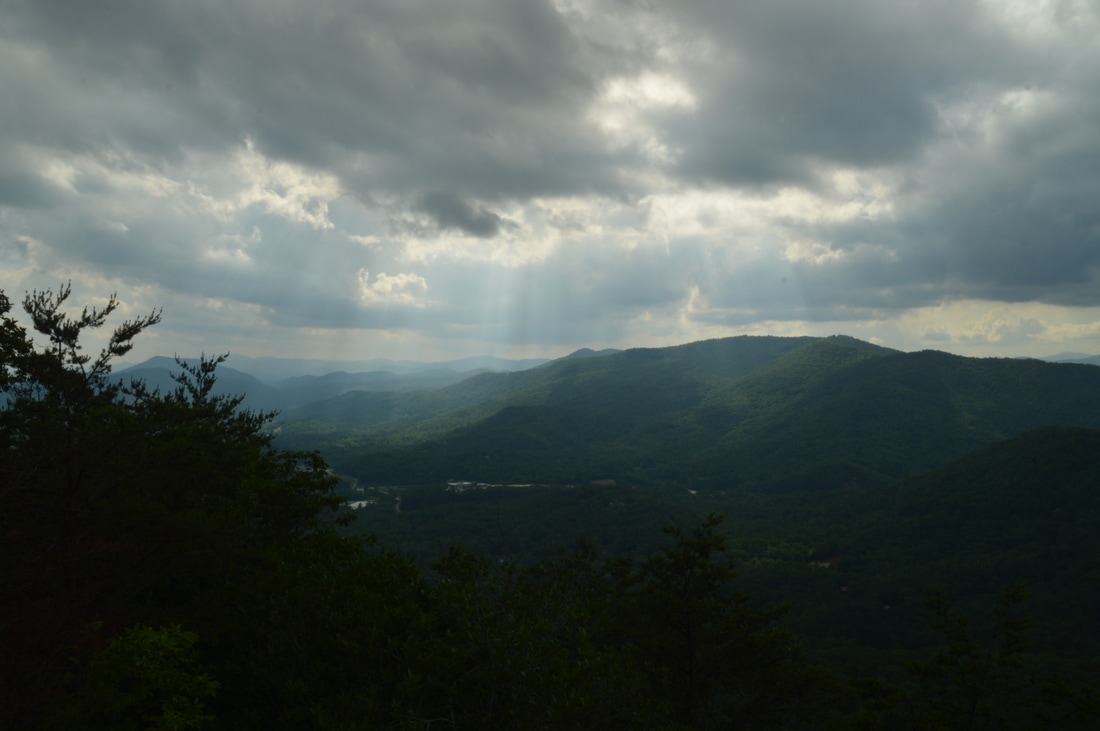
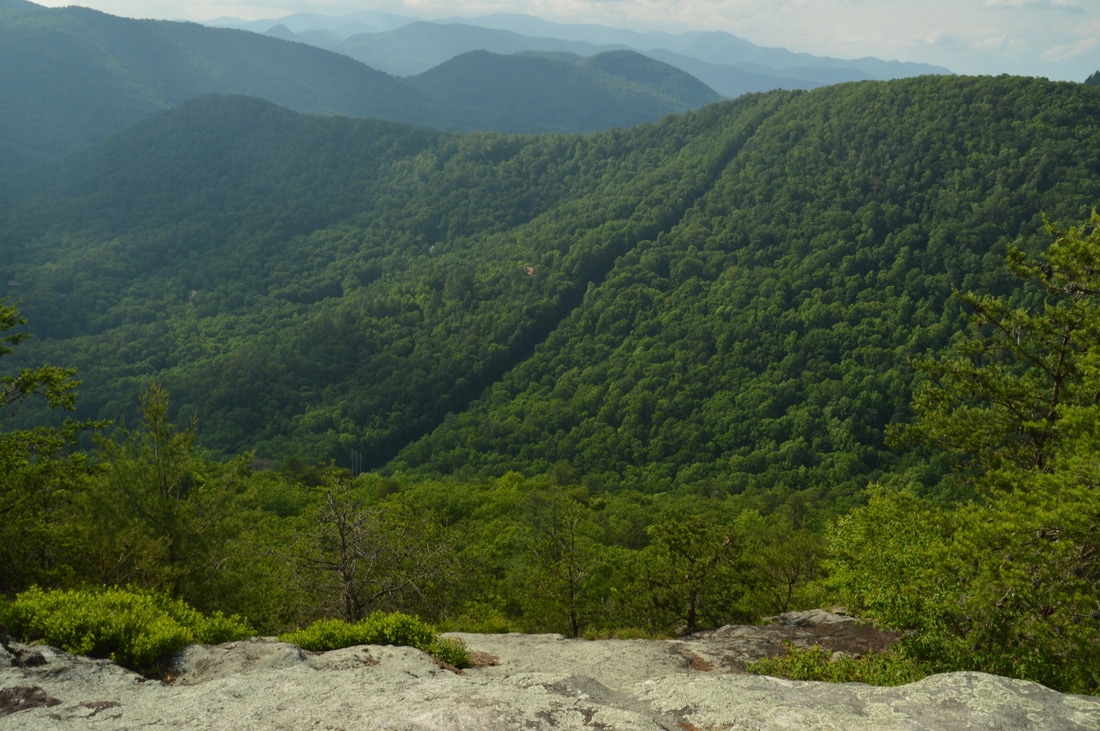
The cliffs of Pinnacle Knob provide a breathtaking 270-degree view to the north, west, and south. The north-northeast end of the view from Pinnacle Knob includes some of  Rabun County's highest terrain: Rock Mountain and Rabun Bald. Rabun Bald is the tallest peak well in the distance to the northeast. Directly in front of the cliffs, to the north-northwest, is Hogback Mountain with its powerline cut, and farther, a series of tall ridges lines the horizon.  The Stekoa Creek valley lies just below Pinnacle Knob to the west, and Black Rock Mountain towers on the other side. The valley stretches on southwestward to distant hills. Altogether, the panoramic nature of the view in combination with a great balance of an attractive foreground and background makes this a truly great overlook that does not present any special difficulty to reach. In addition, Pinnacle Knob is not a popular destination, so you'll never encounter crowds (if any people at all!). Before you leave Pinnacle Knob, make sure to follow the path away from the cliffs and to the top of the knob itself to bag the peak. At the summit (elevation 3141 feet), which you'll reach at 1.8 miles, there is a campsite and USGS survey marker. 

From the summit of Pinnacle Knob, simply retrace your steps back to the trailhead, returning to the car and concluding the hike at 3.6 miles. Keep in mind that if you park at the upper parking area, the hike will only be 3.4 miles long. 
Picture
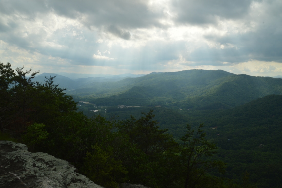
The cliffs of Pinnacle Knob afford an attractive 270-degree panoramic view.

Mileage

0.0 - Courthouse Gap Road Lower Parking
0.5 - Courthouse Gap 
0.8 - Pinnacle Knob Trail Junction
1.75 - Pinnacle Knob Vista 
1.8 - Summit of Pinnacle Knob 
3.6 - Courthouse Gap Road Lower Parking 

Variations

None

Bonus Stops

Consider checking out one of the waterfalls along Darnell Creek Road or hiking the Darnell Creek Trail to Ramey Creek Falls after the Pinnacle Knob hike. 

Pictures

Videos

4 Comments
Sue
6/4/2018 10:11:51 am

How is the drive getting to the trailhead on Pinnicle Dr and Courthouse Gap road? I don't have a 4 wheel drive vehicle - just a prius. Is it doable?

Reply
Cole
3/29/2019 07:58:24 am

I have a Jeep, but it’s one of those “in name only” Jeeps - 4 cylinder and not 4 wheel drive. I had no problem with the drive up Courthouse road as long as I didn’t stop on the gravel. My wheels would spin if I did. However, I was unable to complete the hike as someone who lives along that road has a large dog that kept standing in front of my car (it’s possible that I may have missed the parking area and been driving where I wasn’t supposed to.)

Reply
Stuart
4/6/2019 11:16:44 pm

Today the lower parking area (under the power lines) was roped off with no trespassing and no parking signs. I was able to get to the upper parking area with my Prius - gravel road is steep but in good condition.Great hike today, although I went L on the Bartram trail from the junction to Hogback Mountain instead of going up Pinnacle

Bill Lee
10/27/2021 03:29:29 pm

I re-visited Pinnacle Knob this past Sunday (October 24, 2021) and found a clearly marked parking area which will fit 3 vehicles if parked carefully. 4-wheel drive was not required, and signage about where parking is prohibited was prominently in view. As it was a pretty Sunday in October, I encountered 3 parties of 2 people each during my trek. This was my first experience with the new switchback approach and - while it lengthens the walk - it is quite preferable to the old slog straight up the gully to the top.
THANK YOU MARK for this wonderful website and all the helpful information!

Reply


Leave a Reply.

    About Me

    Mark Oleg Ozboyd
    I'm an avid outdoor explorer and a hobbyist landscape photographer. I'm 21 years old and have been hiking since 2011. Originally based out of Atlanta, Georgia, I started out by occasionally hiking short trails throughout well-known Georgia State Parks. During 2012 and 2013, I began to expand my trips into adjacent states, as well as into the wilder National Forest areas rather than just State Parks. Throughout the years that followed, as I slowly ran out of popular hiking trails in my area, I began to search for and hike in more seldom-visited areas. Today, you can find me out in the woods every weekend, whether it's on an official trail or bushwhacking through cross-country terrain without any paths. I now attend Washington & Lee University and am exploring Virginia and West Virginia. My other hobbies include chess, science, old music, and meteorology. I have 3 years of amateur weather forecasting experience, having studied a lot of meteorology basics over the years. I am also a student at European School of Music where I learned that music and nature have a lot in common. Listening to good music inspires me to capture nature's beauty on the camera in different aspects that also make me recall many beautiful music pieces that I've heard.​


    Dear readers: I have invested a tremendous amount of time and effort in this website and the Georgia Waterfalls Database the past five years. All of the work that has gone in keeping these websites updated with my latest trip reports has almost been like a full-time job. This has not allowed me to pick up a paid job to save up money for college, and therefore, I I've had to take out loans. If you find the information on this website interesting, helpful, or time-saving, you can say "thanks" and help me out by clicking the button above and making a contribution. I will be very grateful for any amount of support you give, as all of it will apply toward my college tuition. Thank you! 

    Enter your email address to subscribe for trail reports:

    Delivered by FeedBurner


    Picture
    Coming in 2022-2023?

    Other Hiking Websites

    DWHike's Adventures
    Florida's Natural Wonders
    Florida Trailblazer
    Meanderthals
    Mountain Images
    by Bernie Boyer

    North Carolina Waterfalls with
    ​Kevin Adams
    Take-a-Hike!
    Tennessee Landforms
    Waterfall Page
    Waterfall Adventurer
    Zach's Mild Adventures

    Miles Hiked

    Year 1: 540.0 Miles
    Year 2: 552.3 Miles
    ​Year 3: 518.4 Miles
    Year 4: 482.4 Miles
    Year 5: 259.9 Miles

    Archives

    March 2021
    February 2021
    January 2021
    November 2019
    October 2019
    September 2019
    August 2019
    July 2019
    June 2019
    February 2019
    January 2019
    December 2018
    November 2018
    October 2018
    August 2018
    July 2018
    June 2018
    May 2018
    April 2018
    March 2018
    February 2018
    January 2018
    December 2017
    November 2017
    October 2017
    September 2017
    August 2017
    July 2017
    June 2017
    May 2017
    April 2017
    March 2017
    February 2017
    January 2017
    December 2016
    November 2016
    October 2016
    September 2016
    August 2016
    June 2016
    May 2016
    April 2016
    March 2016
    January 2016
    December 2015
    November 2015
    October 2015
    September 2015
    August 2015
    July 2015
    June 2015
    May 2015
    April 2015
    March 2015
    February 2015
    January 2015
    December 2014
    November 2014
    October 2014
    September 2014
    August 2014
    July 2014
    June 2014
    May 2014
    April 2014
    March 2014
    February 2014

    Categories

    All
    Adel
    Adirondack Park
    Alabama
    Alfred A. Ring Park
    Allegheny Trail
    Amicalola Falls State Park
    Anniston Area
    Apalachicola Bluffs And Ravines Preserve
    Apalachicola National Forest
    Apalachicola/Port St. Joe Area
    Apopka
    Appalachian Trail
    Appling
    Art Loeb Trail
    Aska Trail System
    Bakersville
    Balm-Boyette Scrub Preserve
    Balsam Lake Recreation Area
    Bankhead National Forest
    Bartow County Parks
    Bartram Trail
    Basinger
    Beersheba Springs
    Benton
    Benton Mackaye Trail
    Berry College Trail System
    Best Hike
    Big South Fork National Recreation Area
    Black Bear Wilderness
    Black Rock Mountain State Park
    Blairsville
    Blakely
    Blood Mountain Wilderness
    Blowing Rock
    Blue Ridge
    Blue Ridge Parkway
    Boone
    Bradenton
    Bradenton Beach
    Brasstown Bald
    Brasstown Wilderness
    Brevard
    Bryson City
    Buchanan
    Bucks Pocket State Park
    Bulow Creek State Park
    Bulow Plantation Ruins State Park
    Caesars Head State Park
    Caladesi Island State Park
    Calhoun
    Camel's Hump State Park
    Cashiers
    Caspersen Beach Park
    Catfish Creek State Park
    Caves
    CC Putnam State Forest
    Cedar Point Environmental Park
    Chatsworth
    Chattahoochee National Forest
    Chattanooga
    Chattanooga Valley
    Chattooga National Wild And Scenic River
    Cheaha Wilderness
    Cherohala Skyway
    Cherokee
    Cherokee National Forest
    Chiefland Area
    Chillhowee Recreation Area
    Chipley
    Chunky Gal Trail
    Circle B Bar Reserve
    Citico Creek Wilderness
    Citrus Wildlife Management Area
    Clarkesville
    Clayton
    Cleevland
    Cleveland
    Cloudland Canyon State Park
    Cohutta Wilderness
    Collier-Seminole State Park
    Cordele
    Cornelia
    Covington
    Crestview Area
    Crew-land-and-water-trust
    Cullowhee
    Cumberland Trail
    Dahlonega
    Dalton
    Dawson Forest Wildlife Management Area
    Dawsonville
    Dayton
    De Soto National Memorial
    DeSoto State Park
    Dillard
    Double Springs
    Ducktown
    Duncan Ridge Trail
    Dunlap
    Eagle's Rest Park
    Eastpoint
    Econfina Creek Wildife Management Area
    Eglin Air Force Base
    Elizabethton
    Elkins
    Elk Knob Game Lands
    Elk Park
    Ellicott Rock Wilderness
    Ellijay
    Emerson Point Preserve
    Englewood Area
    Enota Retreat
    Erwin
    Falling Waters State Park
    Fayetteville
    Fires Creek Recreation Area
    Fire Tower
    Flint River
    Florence Area
    Florida
    Florida Caverns State Park
    Florida Trail
    Foothills Trail
    Fort Mountain State Park
    Fort Myers Area
    Fort Payne
    Fort Payne Area
    Fort Yargo State Park
    Franklin
    Franklin Delano Roosevelt State Park
    Franklin-Marion State Forest
    Frozen Head State Park
    Gainesville
    Gainesville Area
    Gatlinburg
    George Washington National Forest
    Georgia
    Georgia Veterans Memorial State Park
    Glasgow
    Gorges State Park
    Grandfather Mountain State Park
    Great Smoky Mountains National Park
    Greeneville
    Green River Game Lands
    Gruetli-Laager
    Grundy Forest State Natural Area
    GTM Reserve
    Guana River Wildlife Management Area
    Hayesville
    Helen
    Hiawassee
    High Falls State Park
    Highlands
    Highlands Scenic Highway
    Hillsborough River State Park
    Hinson Conservation & Recreation Area
    Historic Sites
    Honeymoon Island State Park
    Hot Springs
    Huntington
    Inverness Area
    Jackson
    Jasper
    Jefferson National Forest
    Joan M. Durante Park
    Jonathan Dickinson State Park
    Jones Gap State Park
    Joyce Kilmer Slickrock Wilderness
    Joyce Kilmer - Slickrock Wilderness
    Juniper Prairie Wilderness
    Kelly Park
    Keown Falls Recreation Area
    Kolomoki Mounds State Park
    LaFayette
    Lake City Area
    Lake George Wild Forest
    Lake June-in-Winter State Park
    Lakeland Area
    Lake Placid
    Lake Russell Wildlife Management Area
    Lake Wales Ridge State Forest
    Laurel Fork North Wilderness
    Leffis Key Preserve
    Leon Sinks Geological Area
    Lexington
    Lineville
    Linville
    Linville Gorge Wilderness
    Lithia Springs
    Little Frog Wilderness
    Little Manatee River State Park
    Little River Canyon National Preserve
    Longboat Key
    Long Trail
    Lookout Mountain
    Lookout Mountain Battlefield
    Lovingston
    Lula Lake Land Trust
    Lumpkin
    Maggie Valley
    Manatee Springs State Park
    Marianna Area
    Mark Trail Wilderness
    Marlinton
    Mccaysville
    McMinville
    Mentone
    Middlesex
    Mistletoe State Park
    Monongahela National Forest
    Montreat
    Mountain Bridge Wilderness Area
    Mountain City
    Mountains To Sea Trail
    Mountains-to-Sea Trail
    Mount Rogers National Recreation Area
    Myakka River State Park
    Myron B. Hodge City Park
    Nantahala National Forest
    Naples
    Naples Area
    Natural Bridge State Park
    Neal Preserve
    New Castle
    Newport
    New River Gorge National Park
    New York
    North Carolina
    Ocala Area
    Ocala National Forest
    Ocean-to-Lake Trail
    Oconee State Park
    Oconee Station Historic Site
    Okaloacoochee Slough State Forest
    Oldsmar
    Oneida
    Orlando Area
    Ormond Beach
    Oscar Scherer State Park
    Oxford
    Palatka
    Palmetto Trail
    Panama City Area
    Panthertown Valley
    Parrish
    Paynes Creek Historic State Park
    Peaks Of Otter Recreation Area
    Pigeon Crockford Mountain Wildlife Management Area
    Pigeon-Crockford Mountain Wildlife Management Area
    Pigeon-Crockford Wildlife Management Area
    Pine Mountain
    Pinhoti Trail
    Pinnacle Park
    Pisgah Civitan Park
    Pisgah National Forest
    Pittman Center
    Pond Mountain Wilderness
    Ponds/Lakes
    Prentice Cooper State Forest
    Providence Canyon State Park
    Pumpkintown
    Quick Point Nature Preserve
    Raven Cliffs Wilderness
    Reed Bingham State Park
    Reliance
    Rice Creek Conservation Area
    Riverview Pointe Preserve
    Robbinsville
    Robinson Preserve
    Rock Creek Gorge Scenic Area
    Rock Island State Park
    Rome
    Rosman
    Sale Creek
    Salem
    Salt Springs
    Saluda
    Santa Rosa Beach
    Sarasota
    Sarasota Area
    Savage Gulf State Natural Area
    Scenic Views
    Scottsboro Area
    Sebring Area
    Sewanee
    Sheltowee Trace Trail
    Shining Rock Wilderness
    Signal Mountain
    Sipsey Wilderness
    Sky Valley
    Smithgall Woods State Park
    Snowbird Backcountry Area
    Soddy Daisy
    Soddy-Daisy
    Sopchoppy
    South Carolina
    South Cumberland State Park
    Southeastern Cave Conservancy
    Southern Nantahala Wilderness
    Sparta
    Sprewell Bluff Park
    Spring City
    Spring Hill
    Springs
    Spruce Pine
    Standing Indian Backcountry Area
    St. Augustine
    St. George Island State Park
    St. Joseph Bay State Buffer Preserve
    St. Marks Area
    St. Marks National Wildlife Refuge
    Stone Mountain
    Stone Mountain Park
    Suches
    Sumatra
    Sumter National Forest
    Suwannee River
    Swallow Creek Wildlife Management Area
    Sweetwater Creek State Park
    Sylva
    Talladega National Forest
    Tallahassee Area
    Tallulah Falls
    Tallulah Gorge State Park
    Tampa Bay Area
    Tate City
    Tate's Hell State Forest
    Tea Creek Wildlife Management Area
    Tellico Plains
    Tennessee
    Thomaston
    Toccoa
    Topsail Hill State Park
    Torreya State Park
    Townsend
    Tracy City
    Tray Mountain Wilderness
    Trenton
    Triple Creek Preserve
    Troutdale
    Unaka Mountain Wilderness
    Upper Tampa Bay County Park
    Venice
    Vermont
    Virgin Falls State Natural Area
    Virginia
    Virginia Outdoors Foundation
    Vogel State Park
    Wakulla Springs State Park
    Waleska
    Walhalla
    Wartburg
    Water Features
    Waynesville
    Weedon Island Preserve
    Weeki Wachee Preserve
    Wekiwa Springs State Park
    West Palm Beach Area
    West Virginia
    Whitehall
    White Springs
    Winder
    Withlacoochee State Forest
    Young Harris

    RSS Feed

TRAIL REPORTS

Hikes in Alabama
​Hikes in Florida
Hikes in Georgia
Hikes in North Carolina
Hikes in South Carolina
Hikes in Tennessee
Hikes in Virginia

Hiking Resources

Alabama Resources
​
Florida Resources
Georgia Resources
North Carolina Resources
​South Carolina Resources
​
Tennessee Resources

Other

Contact
Map of Hikes
Alphabetical List of Hikes
Southeast Nature Society
© COPYRIGHT 2014-2018
​ALL RIGHTS RESERVED.
Important: I disclaim any responsibility for any damage or personal injury that may occur as a result of the activities and information found on this website. All outdoor activities, especially off-trail hiking, are done at your own risk. Never hike or head into that area that may be above your fitness or experience level.
  • Home
  • Trail Reports
    • Best Hikes
    • Hikes with Scenic Views
    • Hikes with Water Features
    • Alabama
    • Georgia
    • Florida
    • North Carolina
    • South Carolina
    • Tennessee
    • Vermont
    • Virginia
  • Map
  • Hike List
  • Testimonials
  • Resources
  • Contact Us
  • Southeast Nature Society
    • Our Team
  • Georgia Waterfalls Database