HIKING THE APPALACHIANS AND BEYOND
  • Home
  • Trail Reports
    • Best Hikes
    • Hikes with Scenic Views
    • Hikes with Water Features
    • Alabama
    • Georgia
    • Florida
    • North Carolina
    • South Carolina
    • Tennessee
    • Vermont
    • Virginia
  • Map
  • Hike List
  • Testimonials
  • Resources
  • Contact Us
  • Southeast Nature Society
    • Our Team
  • Georgia Waterfalls Database

Chattooga Wild and Scenic River: Long Creek Falls and Homer's Falls, Westminster, South Carolina

7/5/2018

0 Comments

 
Picture
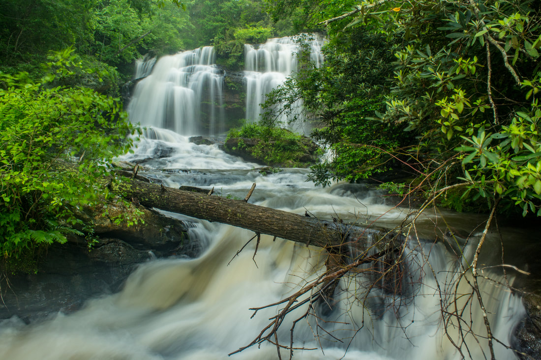
Nearly every tributary of the Wild and Scenic Chattooga River has waterfalls of some sort. 40-foot Long Creek Falls is a particularly spectacular drop only 100 feet above the Chattooga River. Long Creek Falls is accessed by a lesser-known yet easy unofficial trail from Turkey Ridge Road (FS 755), about 1.7 miles long. The great swimming hole and large flat rocks around Long Creek Falls make it an excellent summertime destination. The Long Creek Falls Trail additionally passes a steep side path to a seldom-visited cascading waterfall on Pinckney Branch called Homer's Falls. Flowing only in wet weather, Homer's Falls flows 20 feet through an incredibly lush and mossy rock grotto before emptying into the Chattooga River. Hikers who go to Long Creek Falls even have the option of making a side trip to the top of Raven Rock Cliff, a 100-foot cliff that towers over the Chattooga River and features great gorge views. This hike occurred on Saturday, May 19th, 2018. My plan was to hike out and back to Long Creek Falls from the end of FS 755, making the side trip to Homer's Falls along the way. 

Summary

R/T Length of Trail: 3.5 Miles
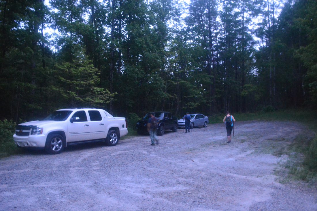
Duration of Hike: 1:30 plus 1 hour of stopping and photography 
Type of Hike: Out and Back
Difficulty Rating: 4 out of 10
Total Elevation Gain: 927 Feet
Pros: Easy access to a lesser-known waterfall
Cons: Homer's Falls side trip is extremely steep and is only worthwhile after a good rain
Points of Interest: Long Creek Falls - 8 stars; Homer's Falls - 3 stars
Trail Blaze Colors: None, not an official trail 
Best Seasons to Hike: Summer
Fees: None
Beginning Point: End of Turkey Ridge Road (FS 755) 
Directions from Westminster, SC: From the intersection of US 76 and US 123 near downtown Westminster, follow US 76 West for 12.9 miles. Then, turn left on Damascus Church Road. Turn right in 0.9 miles to stay on Damascus Church Road. In another 1.9 miles, turn right onto Turkey Ridge Road (FS 755). Follow FS 755 for 2.9 miles to its terminus at a large turnaround. FS 755I - a road only for high clearance 4WD vehicles - leaves the right side of the turnaround. If your vehicle fits the criteria, you can drive a little closer to Long Creek Falls, but I recommend starting the Long Creek Falls hike here. 

Map

Picture
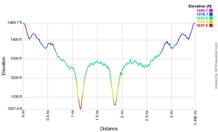
Click the link below to download a .GPX file with a track of this hike.
long_creek_falls_and_homers_falls.gpx
File Size: 166 kb
File Type: gpx
Download File

Details

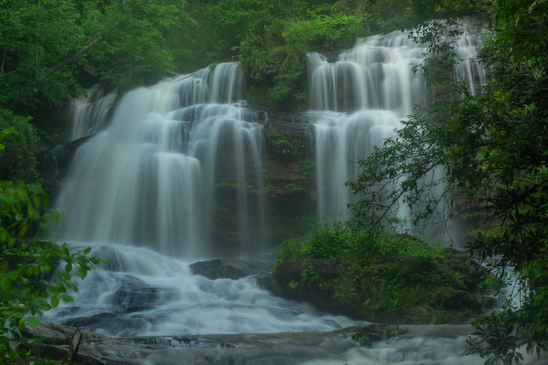
Long Creek Falls was the final hike of my day in South Carolina. As with the other waterfalls I visited on this day (Yellow Branch Falls and Lee Falls), Long Creek Falls is best-seen in periods of above average flow. However, while it didn't rain a lot during my earlier hikes, it looked like the Long Creek watershed received a deluge at the same time. Long Creek was completely swollen, and as a result, there was actually too much water at Long Creek Falls. The waterfall was hard to see and lost some of its scenic qualities. It was still a beautiful sight though, and the easy-to-moderate hike to Long Creek Falls is highly recommended for all. 

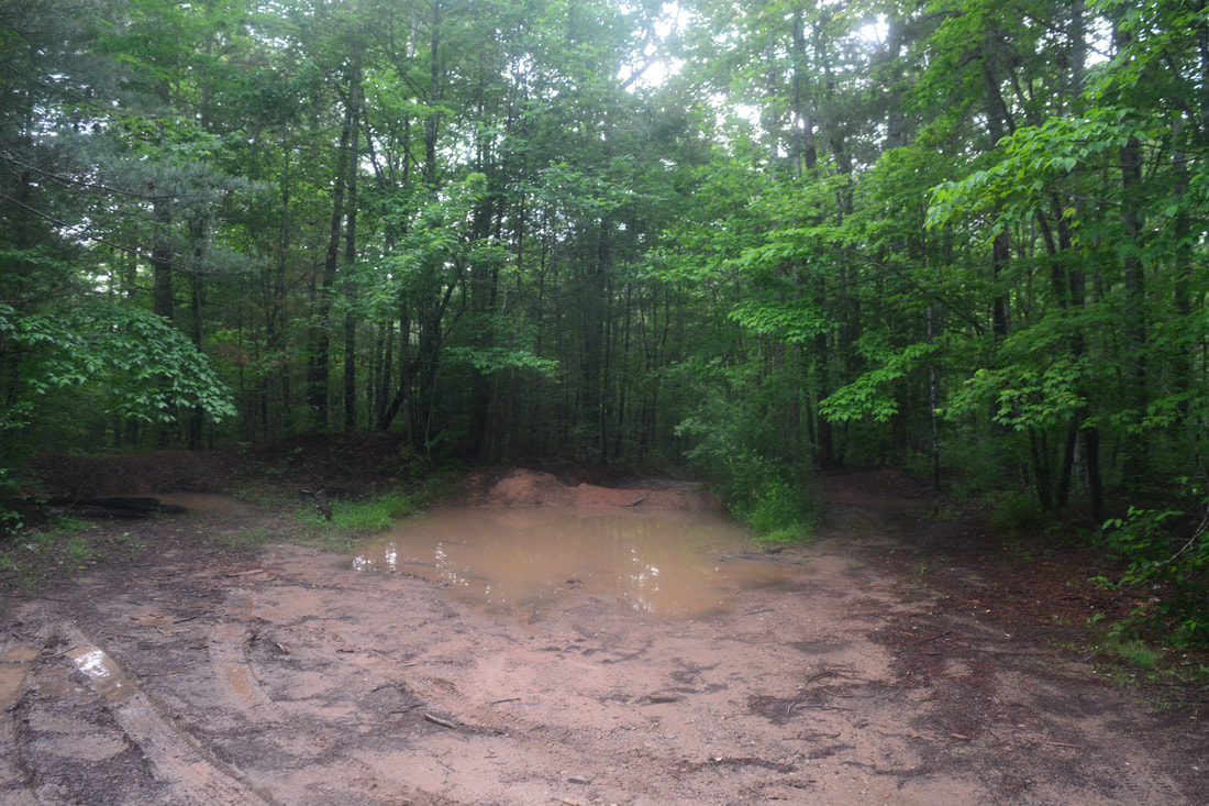
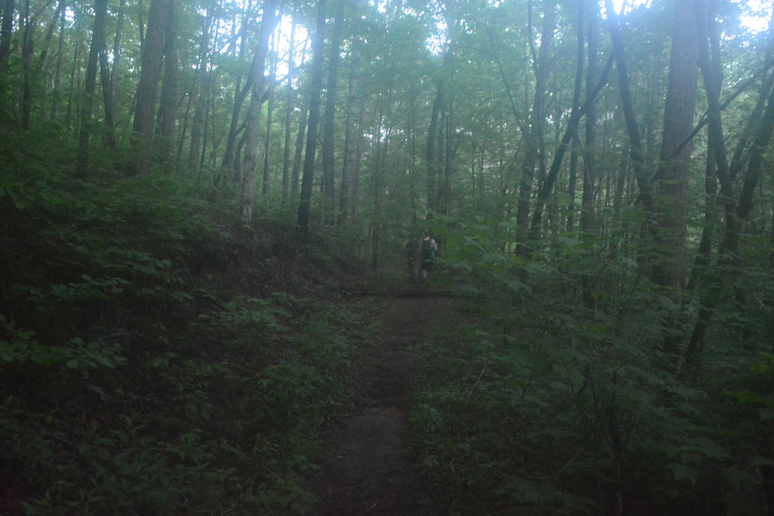
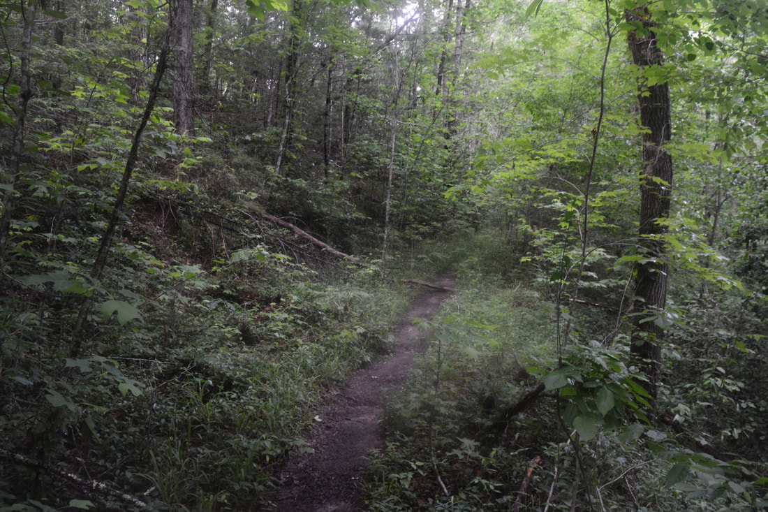
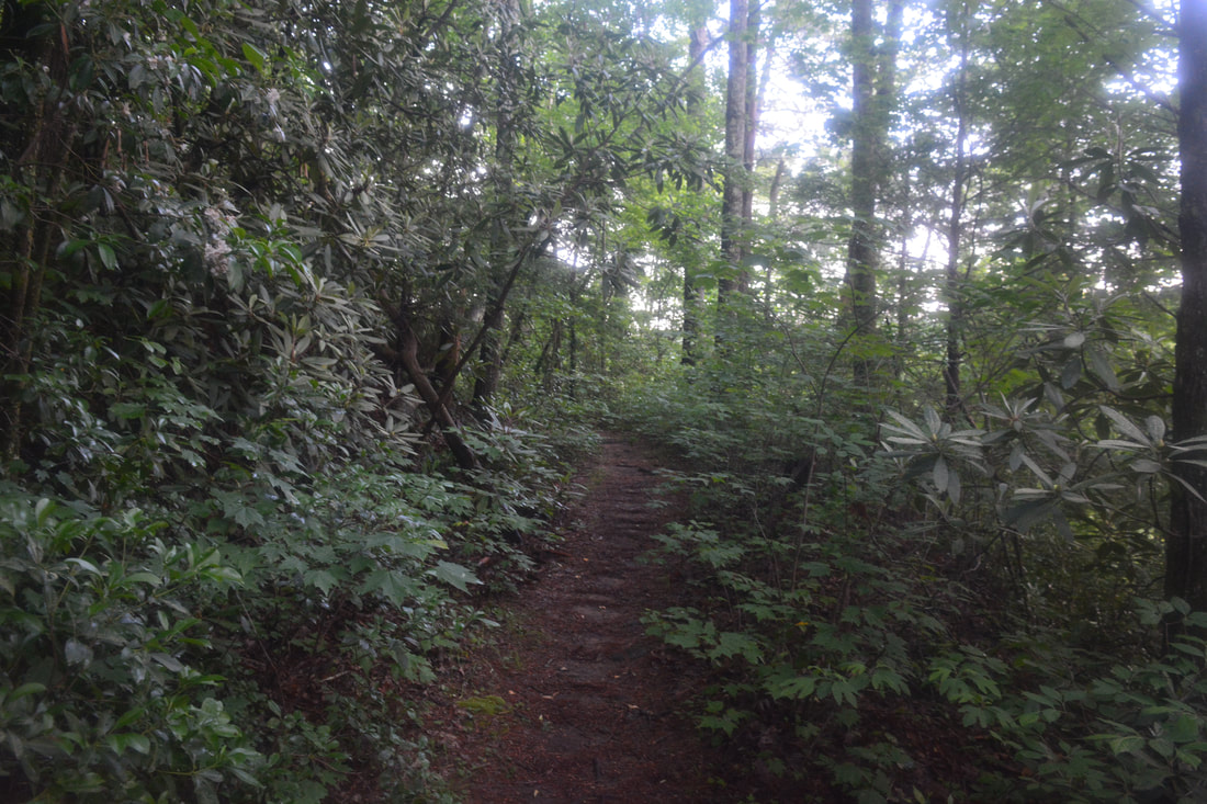
​The Long Creek Falls hike begins along FS 755I at the "Primitive Road" sign. At 0.15 miles, FS 755B - another jeep road - leaves left. Turning left onto FS 755B and continuing along the trail past the road's end will bring you to the top of Raven Rock Cliff in 0.4 miles. This 100-foot cliff has expansive views of the Chattooga River Gorge. I had every intention of including the Raven Rock Cliff view on this hike - however, I started the hike an hour later than originally planned, and I didn't have any extra time remaining after seeing Long Creek Falls and Homer's Falls. I had already seen Raven Rock Cliff from the base when I hiked the Raven Rock Trail on the Georgia side of the Chattooga River, so visiting the top of it wasn't an absolute necessity for me. 

To see Long Creek Falls, stay on FS 755I. After more downhill, reach a turnaround at the end of the road at 0.6 miles. From here on, the Long Creek Falls Trail turns into a pleasant single-track path that bears right from the turnaround. The trail reaches a junction at 1.0 miles that may be marked by a rock arrow and cairn. The main trail to Long Creek Falls bears right, while the steep, obscure side path to Homer's Falls bears left. If you decide to include Homer's Falls on this hike, you should know that 1) the scramble path to Homer's Falls is much more difficult than anything along the Long Creek Falls Trail, and 2) Homer's Falls is worth seeing only in wet weather. 
Picture
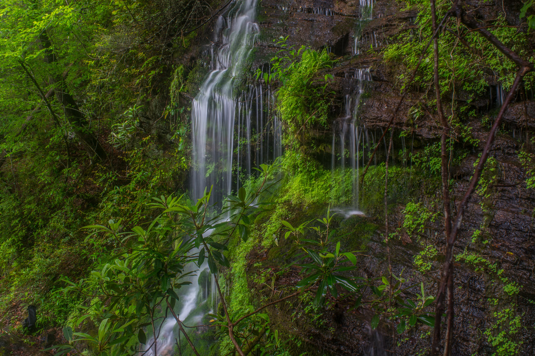
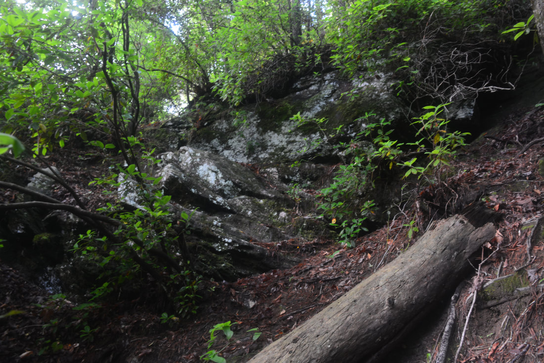
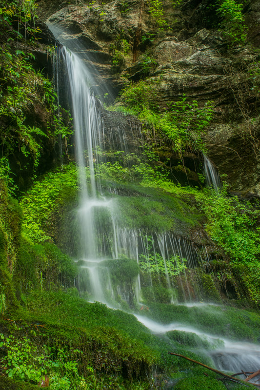
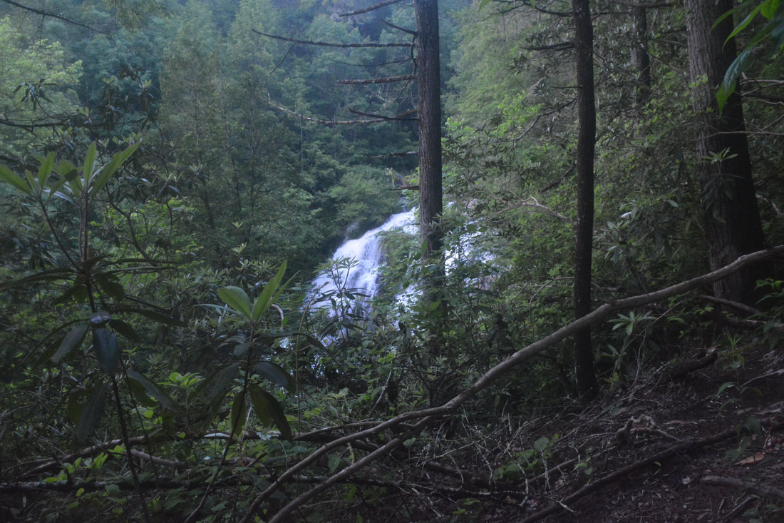
Cascading through over mossy rock outcrops, Homer's Falls is an intricate bonus waterfall near the trail to Long Creek Falls.
The 0.15-mile side path to Homer's Falls descends 200 feet very steeply, passing over several outcrops where you'll scramble down using both your hands as well as your feet. With the Chattooga River now in sight, reach Homer's Falls at 1.15 miles (ignore side paths heading down to the river). The cascading drop of Homer's Falls is only around 20 feet, but it's still quite neat if it's flowing. A breathtaking unique feature of Homer's Falls is all the delicate, lush moss growing in the permanently-moist area around the falls. In addition, note the impressive cliff towering above Homer's Falls. 

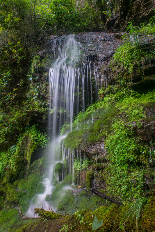
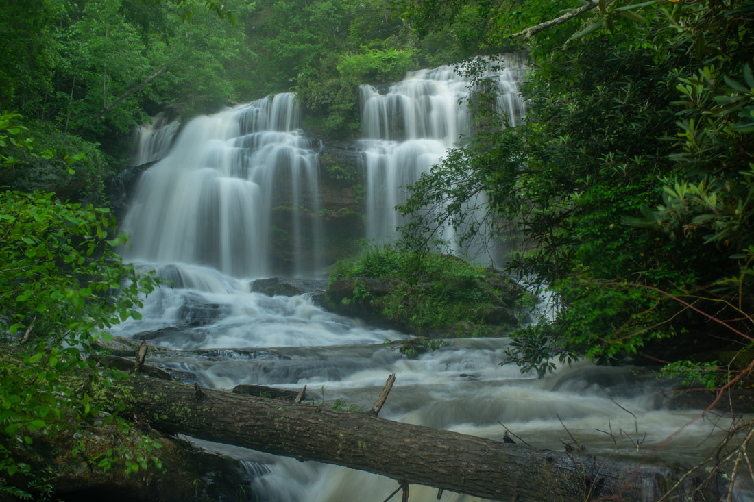
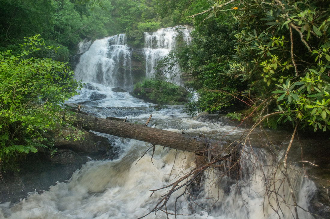
Scramble back up the Long Creek Falls Trail at 1.3 miles. Keep following the pleasant single-track pathway as it contours along the slopes a couple hundred feet above the Chattooga River. At 1.5 miles, a side path on the left descends to the Chattooga - stay on the main trail. At 1.75 miles, the easy pathway along the old logging road comes to an end, as it's entirely overgrown straight ahead. The trail to Long Creek Falls turns left down a steep path, dropping down 150 feet to the Chattooga River. Reach the trail's terminus at the confluence of Long Creek and Chattooga River at 1.9 miles. Long Creek Falls is off to the right. 

Long Creek Falls is a twin free-falling falls about 40 feet. Long Creek is close to the size of a small river on its own, so Long Creek Falls exhibits a lot of power - especially in high water, when both the left and right side of the sheer cliff are full of water. Lush green plants grow on the cliff and behind the waterfall. Normally, you can just wade up Long Creek from the confluence to the falls, and you can sunbathe on the large, flat rocks around the base of Long Creek Falls. Long Creek Falls can be seen from the Chattooga River, but it's obviously best-seen up close. On this day, however, the water was so incredibly high that wading was out of the question. I had to make a tough scramble to a tiny rock outcrop closer to the falls to photograph it, and even there, the view wasn't optimal. I look forward to revisiting Long Creek Falls in lower water. I also plan to visit Middle Long Creek Falls and Upper Long Creek Falls in the future. Both are impressive waterfalls, although they're not accessed from the same trail as Long Creek Falls. 

The Long Creek/Chattooga River confluence is a gorgeous spot on its own. There's something peaceful about watching the waters of a major river rush by you. On this day, the river was quite swollen and powerful, which actually added to the beauty of the setting. From Long Creek Falls, simply retrace your steps along the trail to the FS 755 parking area. You'll return to your car at 3.5 miles, concluding the hike.
Picture
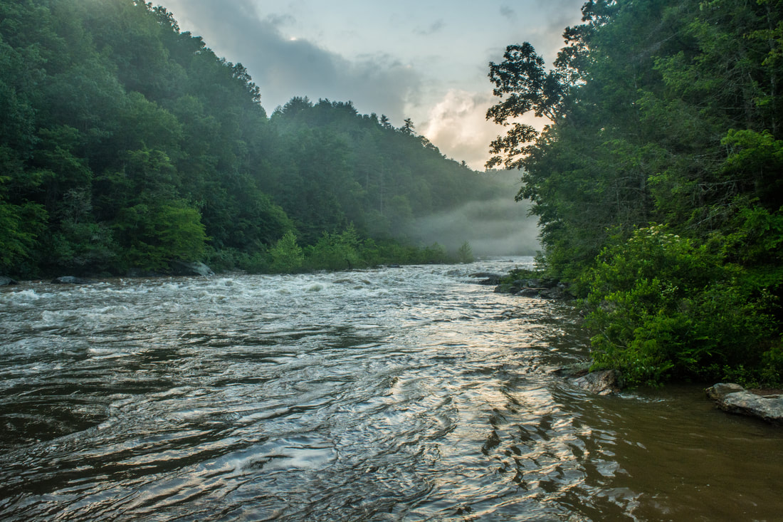
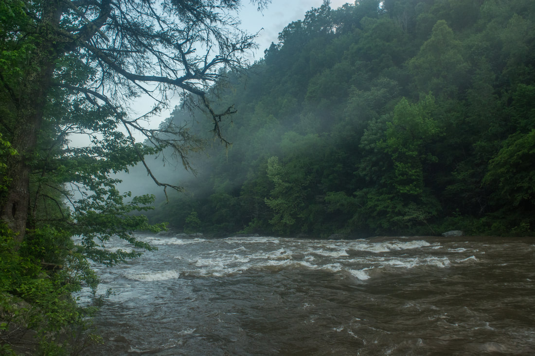
The swollen waters of the mighty Chattooga River - and the mist rising off of them - added great beauty to the setting of Long Creek Falls.

Mileage

0.0 - FS 755
0.15 - FS 755B
0.6 - End of FS 755I
1.0 - Homer's Falls Side Trail
1.15 - Homer's Falls
1.9 - Long Creek Falls
3.5 - FS 755

Variations

Hike out and back to just Long Creek Falls - 3.2 Miles

Bonus Stops

Turkey Ridge Road (FS 755) features another waterfall trailhead: the Opposum Creek Falls Trail. About 5 miles roundtrip, the Opposum Creek Falls hike features a spectacular pair of waterfalls that could easily be seen the same day as Long Creek Falls. 

Pictures & Videos

0 Comments


Leave a Reply.

    About Me

    Mark Oleg Ozboyd
    I'm an avid outdoor explorer and a hobbyist landscape photographer. I'm 21 years old and have been hiking since 2011. Originally based out of Atlanta, Georgia, I started out by occasionally hiking short trails throughout well-known Georgia State Parks. During 2012 and 2013, I began to expand my trips into adjacent states, as well as into the wilder National Forest areas rather than just State Parks. Throughout the years that followed, as I slowly ran out of popular hiking trails in my area, I began to search for and hike in more seldom-visited areas. Today, you can find me out in the woods every weekend, whether it's on an official trail or bushwhacking through cross-country terrain without any paths. I now attend Washington & Lee University and am exploring Virginia and West Virginia. My other hobbies include chess, science, old music, and meteorology. I have 3 years of amateur weather forecasting experience, having studied a lot of meteorology basics over the years. I am also a student at European School of Music where I learned that music and nature have a lot in common. Listening to good music inspires me to capture nature's beauty on the camera in different aspects that also make me recall many beautiful music pieces that I've heard.​


    Dear readers: I have invested a tremendous amount of time and effort in this website and the Georgia Waterfalls Database the past five years. All of the work that has gone in keeping these websites updated with my latest trip reports has almost been like a full-time job. This has not allowed me to pick up a paid job to save up money for college, and therefore, I I've had to take out loans. If you find the information on this website interesting, helpful, or time-saving, you can say "thanks" and help me out by clicking the button above and making a contribution. I will be very grateful for any amount of support you give, as all of it will apply toward my college tuition. Thank you! 

    Enter your email address to subscribe for trail reports:

    Delivered by FeedBurner


    Picture
    Coming in 2022-2023?

    Other Hiking Websites

    DWHike's Adventures
    Florida's Natural Wonders
    Florida Trailblazer
    Meanderthals
    Mountain Images
    by Bernie Boyer

    North Carolina Waterfalls with
    ​Kevin Adams
    Take-a-Hike!
    Tennessee Landforms
    Waterfall Page
    Waterfall Adventurer
    Zach's Mild Adventures

    Miles Hiked

    Year 1: 540.0 Miles
    Year 2: 552.3 Miles
    ​Year 3: 518.4 Miles
    Year 4: 482.4 Miles
    Year 5: 259.9 Miles

    Archives

    March 2021
    February 2021
    January 2021
    November 2019
    October 2019
    September 2019
    August 2019
    July 2019
    June 2019
    February 2019
    January 2019
    December 2018
    November 2018
    October 2018
    August 2018
    July 2018
    June 2018
    May 2018
    April 2018
    March 2018
    February 2018
    January 2018
    December 2017
    November 2017
    October 2017
    September 2017
    August 2017
    July 2017
    June 2017
    May 2017
    April 2017
    March 2017
    February 2017
    January 2017
    December 2016
    November 2016
    October 2016
    September 2016
    August 2016
    June 2016
    May 2016
    April 2016
    March 2016
    January 2016
    December 2015
    November 2015
    October 2015
    September 2015
    August 2015
    July 2015
    June 2015
    May 2015
    April 2015
    March 2015
    February 2015
    January 2015
    December 2014
    November 2014
    October 2014
    September 2014
    August 2014
    July 2014
    June 2014
    May 2014
    April 2014
    March 2014
    February 2014

    Categories

    All
    Adel
    Adirondack Park
    Alabama
    Alfred A. Ring Park
    Allegheny Trail
    Amicalola Falls State Park
    Anniston Area
    Apalachicola Bluffs And Ravines Preserve
    Apalachicola National Forest
    Apalachicola/Port St. Joe Area
    Apopka
    Appalachian Trail
    Appling
    Art Loeb Trail
    Aska Trail System
    Bakersville
    Balm-Boyette Scrub Preserve
    Balsam Lake Recreation Area
    Bankhead National Forest
    Bartow County Parks
    Bartram Trail
    Basinger
    Beersheba Springs
    Benton
    Benton Mackaye Trail
    Berry College Trail System
    Best Hike
    Big South Fork National Recreation Area
    Black Bear Wilderness
    Black Rock Mountain State Park
    Blairsville
    Blakely
    Blood Mountain Wilderness
    Blowing Rock
    Blue Ridge
    Blue Ridge Parkway
    Boone
    Bradenton
    Bradenton Beach
    Brasstown Bald
    Brasstown Wilderness
    Brevard
    Bryson City
    Buchanan
    Bucks Pocket State Park
    Bulow Creek State Park
    Bulow Plantation Ruins State Park
    Caesars Head State Park
    Caladesi Island State Park
    Calhoun
    Camel's Hump State Park
    Cashiers
    Caspersen Beach Park
    Catfish Creek State Park
    Caves
    CC Putnam State Forest
    Cedar Point Environmental Park
    Chatsworth
    Chattahoochee National Forest
    Chattanooga
    Chattanooga Valley
    Chattooga National Wild And Scenic River
    Cheaha Wilderness
    Cherohala Skyway
    Cherokee
    Cherokee National Forest
    Chiefland Area
    Chillhowee Recreation Area
    Chipley
    Chunky Gal Trail
    Circle B Bar Reserve
    Citico Creek Wilderness
    Citrus Wildlife Management Area
    Clarkesville
    Clayton
    Cleevland
    Cleveland
    Cloudland Canyon State Park
    Cohutta Wilderness
    Collier-Seminole State Park
    Cordele
    Cornelia
    Covington
    Crestview Area
    Crew-land-and-water-trust
    Cullowhee
    Cumberland Trail
    Dahlonega
    Dalton
    Dawson Forest Wildlife Management Area
    Dawsonville
    Dayton
    De Soto National Memorial
    DeSoto State Park
    Dillard
    Double Springs
    Ducktown
    Duncan Ridge Trail
    Dunlap
    Eagle's Rest Park
    Eastpoint
    Econfina Creek Wildife Management Area
    Eglin Air Force Base
    Elizabethton
    Elkins
    Elk Knob Game Lands
    Elk Park
    Ellicott Rock Wilderness
    Ellijay
    Emerson Point Preserve
    Englewood Area
    Enota Retreat
    Erwin
    Falling Waters State Park
    Fayetteville
    Fires Creek Recreation Area
    Fire Tower
    Flint River
    Florence Area
    Florida
    Florida Caverns State Park
    Florida Trail
    Foothills Trail
    Fort Mountain State Park
    Fort Myers Area
    Fort Payne
    Fort Payne Area
    Fort Yargo State Park
    Franklin
    Franklin Delano Roosevelt State Park
    Franklin-Marion State Forest
    Frozen Head State Park
    Gainesville
    Gainesville Area
    Gatlinburg
    George Washington National Forest
    Georgia
    Georgia Veterans Memorial State Park
    Glasgow
    Gorges State Park
    Grandfather Mountain State Park
    Great Smoky Mountains National Park
    Greeneville
    Green River Game Lands
    Gruetli-Laager
    Grundy Forest State Natural Area
    GTM Reserve
    Guana River Wildlife Management Area
    Hayesville
    Helen
    Hiawassee
    High Falls State Park
    Highlands
    Highlands Scenic Highway
    Hillsborough River State Park
    Hinson Conservation & Recreation Area
    Historic Sites
    Honeymoon Island State Park
    Hot Springs
    Huntington
    Inverness Area
    Jackson
    Jasper
    Jefferson National Forest
    Joan M. Durante Park
    Jonathan Dickinson State Park
    Jones Gap State Park
    Joyce Kilmer Slickrock Wilderness
    Joyce Kilmer - Slickrock Wilderness
    Juniper Prairie Wilderness
    Kelly Park
    Keown Falls Recreation Area
    Kolomoki Mounds State Park
    LaFayette
    Lake City Area
    Lake George Wild Forest
    Lake June-in-Winter State Park
    Lakeland Area
    Lake Placid
    Lake Russell Wildlife Management Area
    Lake Wales Ridge State Forest
    Laurel Fork North Wilderness
    Leffis Key Preserve
    Leon Sinks Geological Area
    Lexington
    Lineville
    Linville
    Linville Gorge Wilderness
    Lithia Springs
    Little Frog Wilderness
    Little Manatee River State Park
    Little River Canyon National Preserve
    Longboat Key
    Long Trail
    Lookout Mountain
    Lookout Mountain Battlefield
    Lovingston
    Lula Lake Land Trust
    Lumpkin
    Maggie Valley
    Manatee Springs State Park
    Marianna Area
    Mark Trail Wilderness
    Marlinton
    Mccaysville
    McMinville
    Mentone
    Middlesex
    Mistletoe State Park
    Monongahela National Forest
    Montreat
    Mountain Bridge Wilderness Area
    Mountain City
    Mountains To Sea Trail
    Mountains-to-Sea Trail
    Mount Rogers National Recreation Area
    Myakka River State Park
    Myron B. Hodge City Park
    Nantahala National Forest
    Naples
    Naples Area
    Natural Bridge State Park
    Neal Preserve
    New Castle
    Newport
    New River Gorge National Park
    New York
    North Carolina
    Ocala Area
    Ocala National Forest
    Ocean-to-Lake Trail
    Oconee State Park
    Oconee Station Historic Site
    Okaloacoochee Slough State Forest
    Oldsmar
    Oneida
    Orlando Area
    Ormond Beach
    Oscar Scherer State Park
    Oxford
    Palatka
    Palmetto Trail
    Panama City Area
    Panthertown Valley
    Parrish
    Paynes Creek Historic State Park
    Peaks Of Otter Recreation Area
    Pigeon Crockford Mountain Wildlife Management Area
    Pigeon-Crockford Mountain Wildlife Management Area
    Pigeon-Crockford Wildlife Management Area
    Pine Mountain
    Pinhoti Trail
    Pinnacle Park
    Pisgah Civitan Park
    Pisgah National Forest
    Pittman Center
    Pond Mountain Wilderness
    Ponds/Lakes
    Prentice Cooper State Forest
    Providence Canyon State Park
    Pumpkintown
    Quick Point Nature Preserve
    Raven Cliffs Wilderness
    Reed Bingham State Park
    Reliance
    Rice Creek Conservation Area
    Riverview Pointe Preserve
    Robbinsville
    Robinson Preserve
    Rock Creek Gorge Scenic Area
    Rock Island State Park
    Rome
    Rosman
    Sale Creek
    Salem
    Salt Springs
    Saluda
    Santa Rosa Beach
    Sarasota
    Sarasota Area
    Savage Gulf State Natural Area
    Scenic Views
    Scottsboro Area
    Sebring Area
    Sewanee
    Sheltowee Trace Trail
    Shining Rock Wilderness
    Signal Mountain
    Sipsey Wilderness
    Sky Valley
    Smithgall Woods State Park
    Snowbird Backcountry Area
    Soddy Daisy
    Soddy-Daisy
    Sopchoppy
    South Carolina
    South Cumberland State Park
    Southeastern Cave Conservancy
    Southern Nantahala Wilderness
    Sparta
    Sprewell Bluff Park
    Spring City
    Spring Hill
    Springs
    Spruce Pine
    Standing Indian Backcountry Area
    St. Augustine
    St. George Island State Park
    St. Joseph Bay State Buffer Preserve
    St. Marks Area
    St. Marks National Wildlife Refuge
    Stone Mountain
    Stone Mountain Park
    Suches
    Sumatra
    Sumter National Forest
    Suwannee River
    Swallow Creek Wildlife Management Area
    Sweetwater Creek State Park
    Sylva
    Talladega National Forest
    Tallahassee Area
    Tallulah Falls
    Tallulah Gorge State Park
    Tampa Bay Area
    Tate City
    Tate's Hell State Forest
    Tea Creek Wildlife Management Area
    Tellico Plains
    Tennessee
    Thomaston
    Toccoa
    Topsail Hill State Park
    Torreya State Park
    Townsend
    Tracy City
    Tray Mountain Wilderness
    Trenton
    Triple Creek Preserve
    Troutdale
    Unaka Mountain Wilderness
    Upper Tampa Bay County Park
    Venice
    Vermont
    Virgin Falls State Natural Area
    Virginia
    Virginia Outdoors Foundation
    Vogel State Park
    Wakulla Springs State Park
    Waleska
    Walhalla
    Wartburg
    Water Features
    Waynesville
    Weedon Island Preserve
    Weeki Wachee Preserve
    Wekiwa Springs State Park
    West Palm Beach Area
    West Virginia
    Whitehall
    White Springs
    Winder
    Withlacoochee State Forest
    Young Harris

    RSS Feed

TRAIL REPORTS

Hikes in Alabama
​Hikes in Florida
Hikes in Georgia
Hikes in North Carolina
Hikes in South Carolina
Hikes in Tennessee
Hikes in Virginia

Hiking Resources

Alabama Resources
​
Florida Resources
Georgia Resources
North Carolina Resources
​South Carolina Resources
​
Tennessee Resources

Other

Contact
Map of Hikes
Alphabetical List of Hikes
Southeast Nature Society
© COPYRIGHT 2014-2018
​ALL RIGHTS RESERVED.
Important: I disclaim any responsibility for any damage or personal injury that may occur as a result of the activities and information found on this website. All outdoor activities, especially off-trail hiking, are done at your own risk. Never hike or head into that area that may be above your fitness or experience level.
  • Home
  • Trail Reports
    • Best Hikes
    • Hikes with Scenic Views
    • Hikes with Water Features
    • Alabama
    • Georgia
    • Florida
    • North Carolina
    • South Carolina
    • Tennessee
    • Vermont
    • Virginia
  • Map
  • Hike List
  • Testimonials
  • Resources
  • Contact Us
  • Southeast Nature Society
    • Our Team
  • Georgia Waterfalls Database