Nestled between the Little Tennessee River and the Cherohala Skyway, the 16,226-acre Citico Creek Wilderness features some of East Tennessee's most remote hiking trails. The primary focus points of the wilderness are its two major waterways: the North and South Forks of Citico Creek. Seldom-traveled trails follow both streams, crisscrossing them many times along the way, and providing numerous views of the creeks' many scenic cascades and pristine banks. Even better, a short scramble off the North Fork Trail is the spectacular Old Goat Falls, crashing 40 feet through a cleft amidst ferny cliffs. This hike, an ambitious loop along both forks of Citico Creek all the way to their headwaters, is among the best creek hikes in Cherokee National Forest. This hike occurred on Saturday, September 1st, 2018. My plan was to initially follow the South Fork Trail from Citico Creek Road to the North Fork Trail junction. There, I would pick up the North Fork Trail and climb it to Cherry Log Gap, scrambling down to Old Goat Falls along the way. I would then follow the Benton MacKaye Trail from Cherry Log Gap to Cold Spring Gap, from where I would take the South Fork Trail back to Citico Creek Road.
Summary
R/T Length of Trail: 17.6 Miles
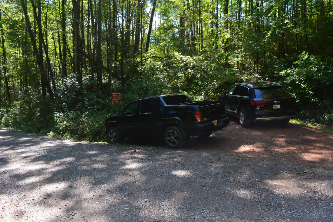
Duration of Hike: 8:30 plus 2 hours of stopping and photography Type of Hike: Lasso Total Elevation Gain: 3966 Feet Pros: Miles of beautiful streamside scenery Cons: Portions of the South Fork Trail stay well above the creek without much views Points of Interest: Old Goat Falls - 8 stars; Upper Falls on North Fork Citico Creek - 3 stars; Small Waterfall on South Fork Citico Creek - 3 stars; Numerous scenic creek views, especially in the North Fork Citico Creek headwaters area Trail Blaze Colors: None - trails in the Citico Creek Wilderness are not blazed. You may see axe marks designated to point out the trail in places though. Best Seasons to Hike: Spring; Summer Fees: None Beginning Point: Citico Creek Road Directions from Tellico Plains, TN: From the intersection of TN 68 and TN 165 (Cherohala Skyway), follow TN 165 East (Cherohala Skyway East) for 14.9 miles. Then, turn left onto Indian Boundary Road. After following Indian Boundary Road for 1.2 miles, stay right on Citico Creek Road (FS 35-1). If you reach Indian Boundary Campground, you've gone too far. The turn is marked by a sign for Citico Creek. From the turn, follow the road for 2.3 miles until you see a pullout on the right at a gated old road. This is the trailhead. You can see the Citico Creek bridge just down the road - if you have crossed the bridge, you have driven too far. FS 35-1 is unpaved but suitable for all passenger vehicles - it used to be extremely muddy but has since been improved. The parking pullout is very small and only has space for around three vehicles. Map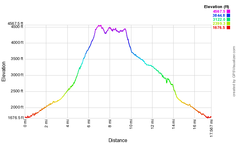
Click the link below to download a .GPX file with a track of this hike.
Details
My first visit to the Citico Creek Wilderness was in March 2015, when I hiked the North Fork Trail out and back to the Coldspring Branch Trail junction. I was amazed by the pristine beauty of the North Fork Citico Creek headwaters region - one of the most beautiful Southern Appalachian creek valleys I had ever seen. However, at the time, I did not have a ton of experience in remote wilderness hiking, so I felt that the trails were hard to navigate, and in fact, I failed to complete the planned loop that day. Furthermore, I later learned that I missed Old Goat Falls, one of the region's most breathtaking waterfalls! Now, four years later, I was excited to return, see Old Goat Falls, and complete the North/South Fork Loop. To my pleasant surprise, I found the trails quite easy to follow this time - likely due to the navigational skills I had inherited from lots of off-trail hiking in this 3.5-year span. Without further ado, let's move on to the details of this outstanding wilderness hike.
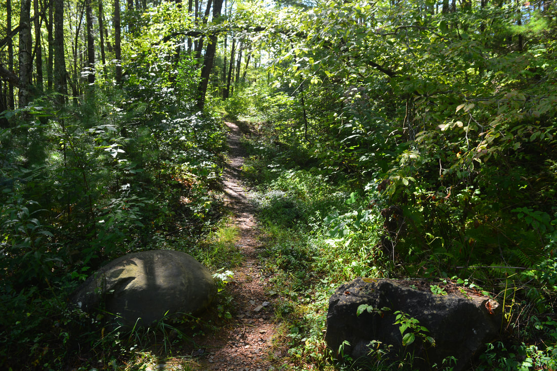
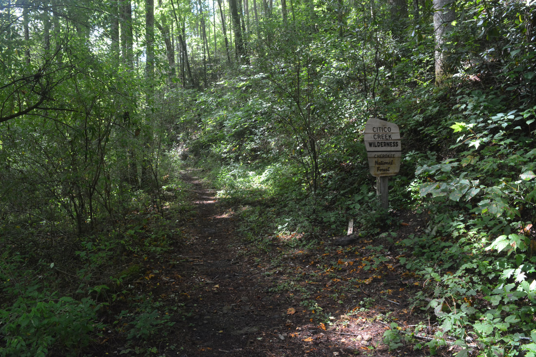
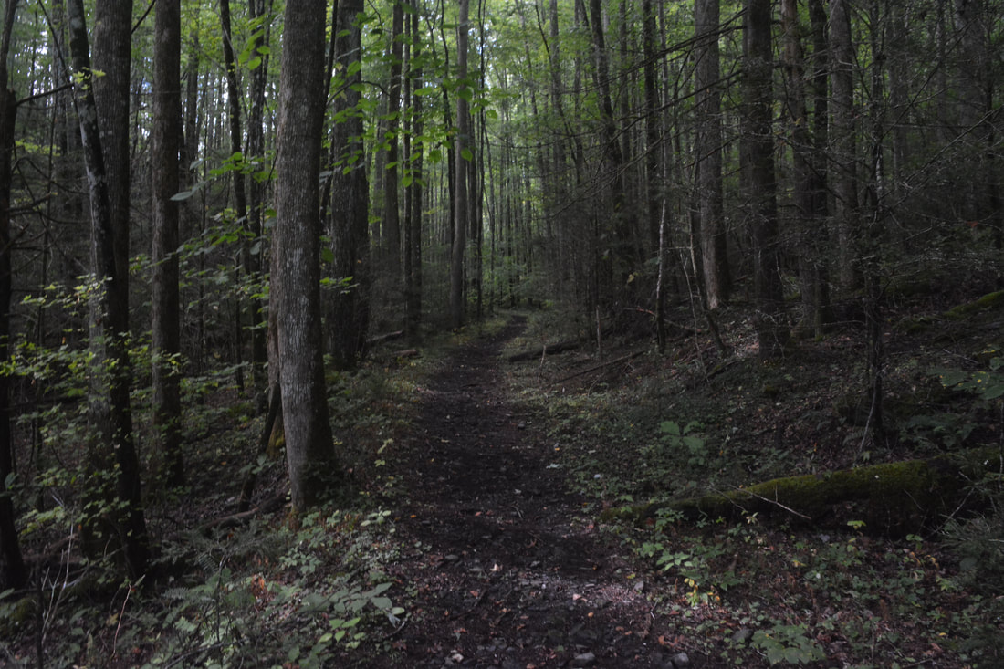
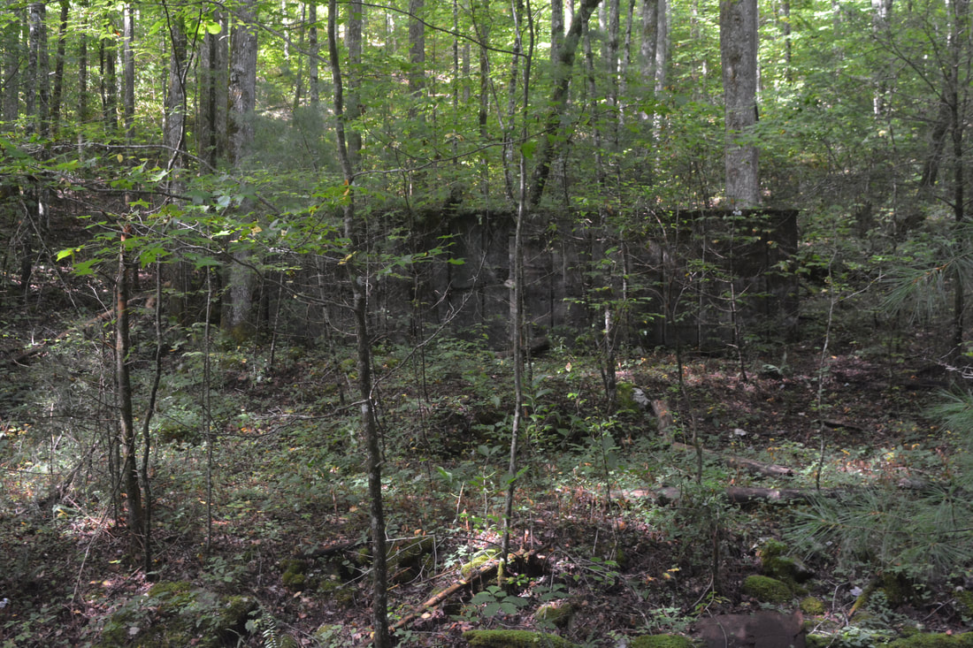
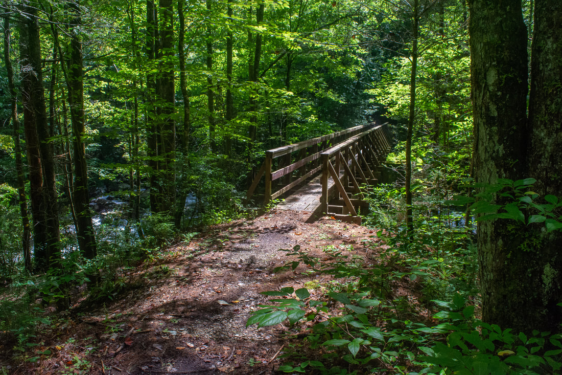
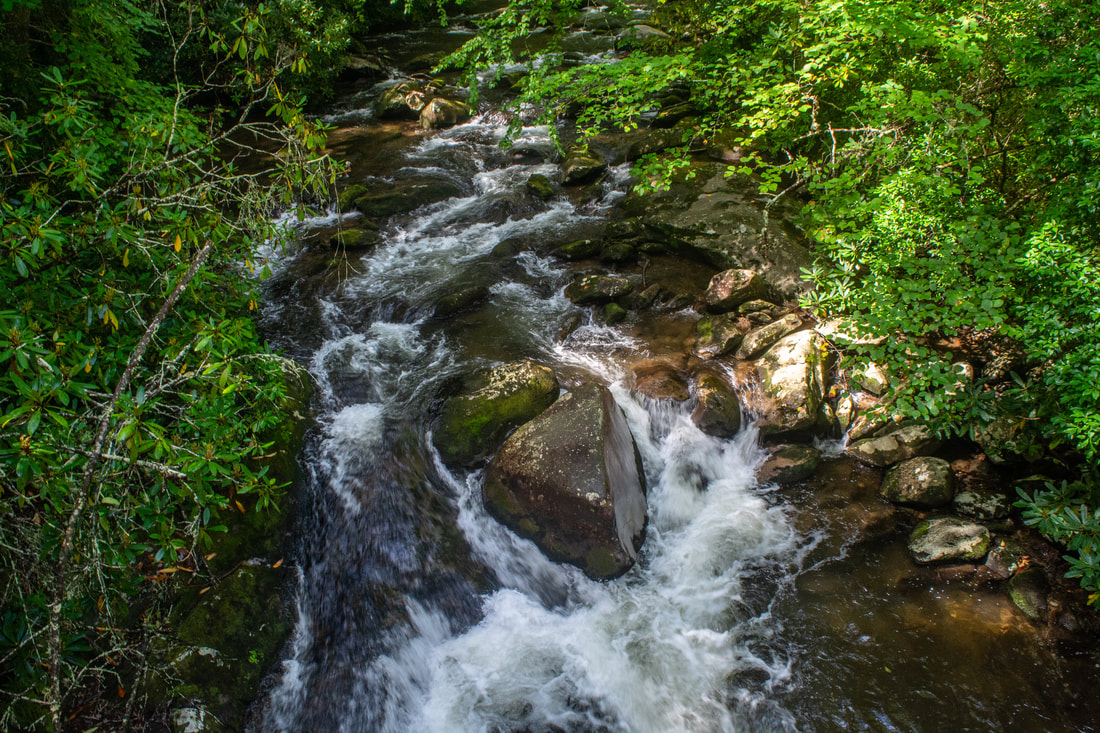
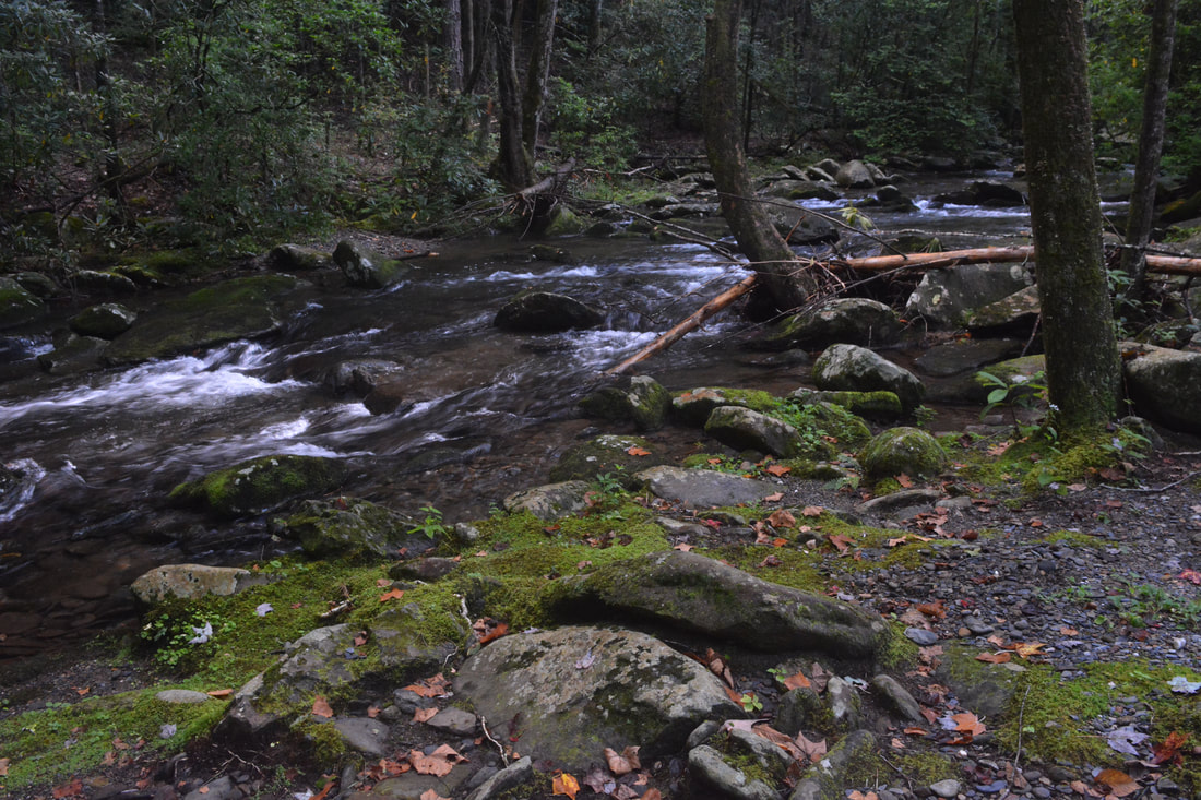
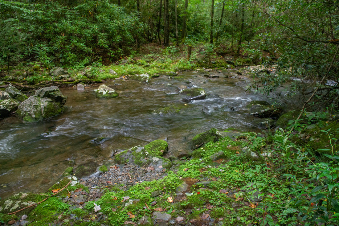
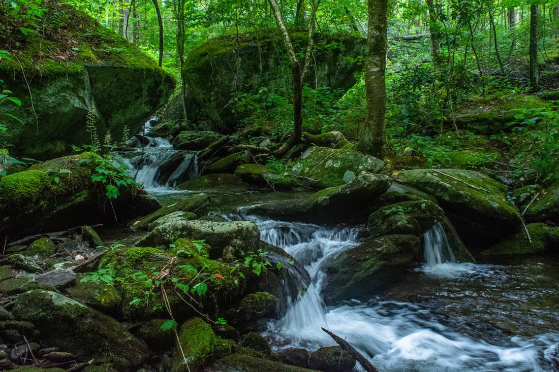
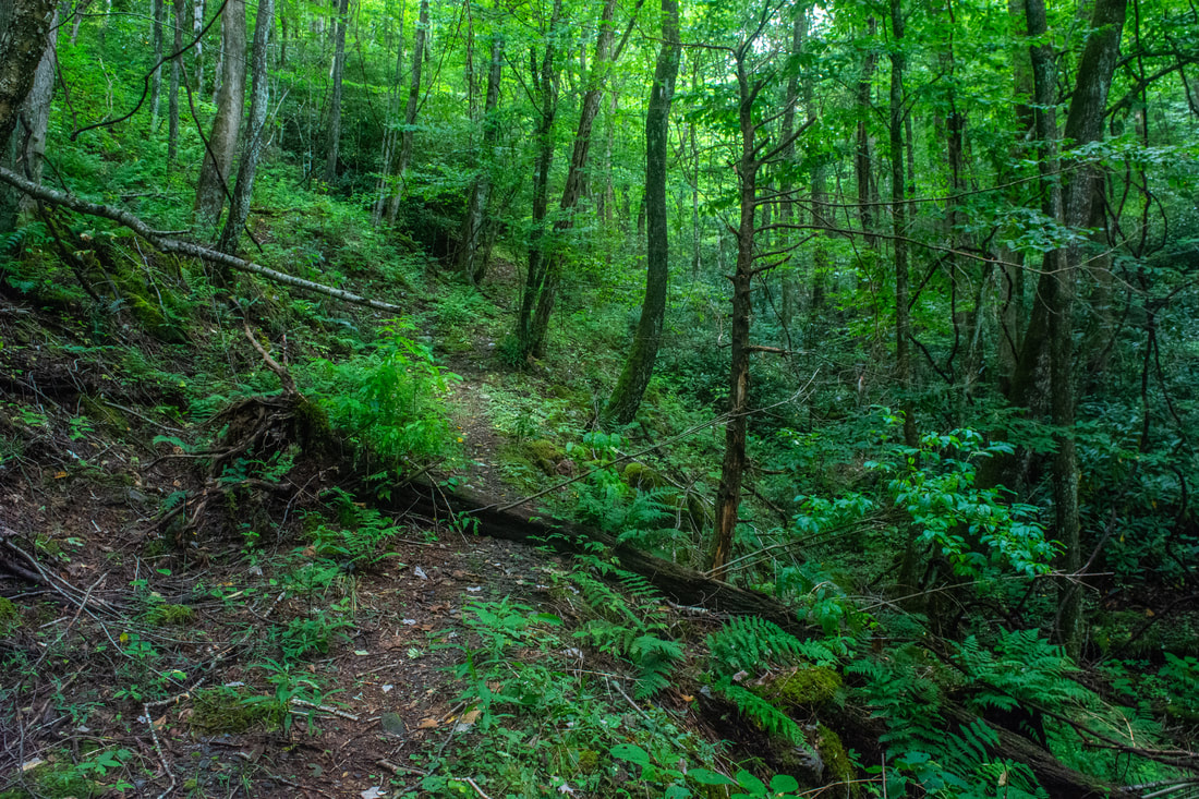
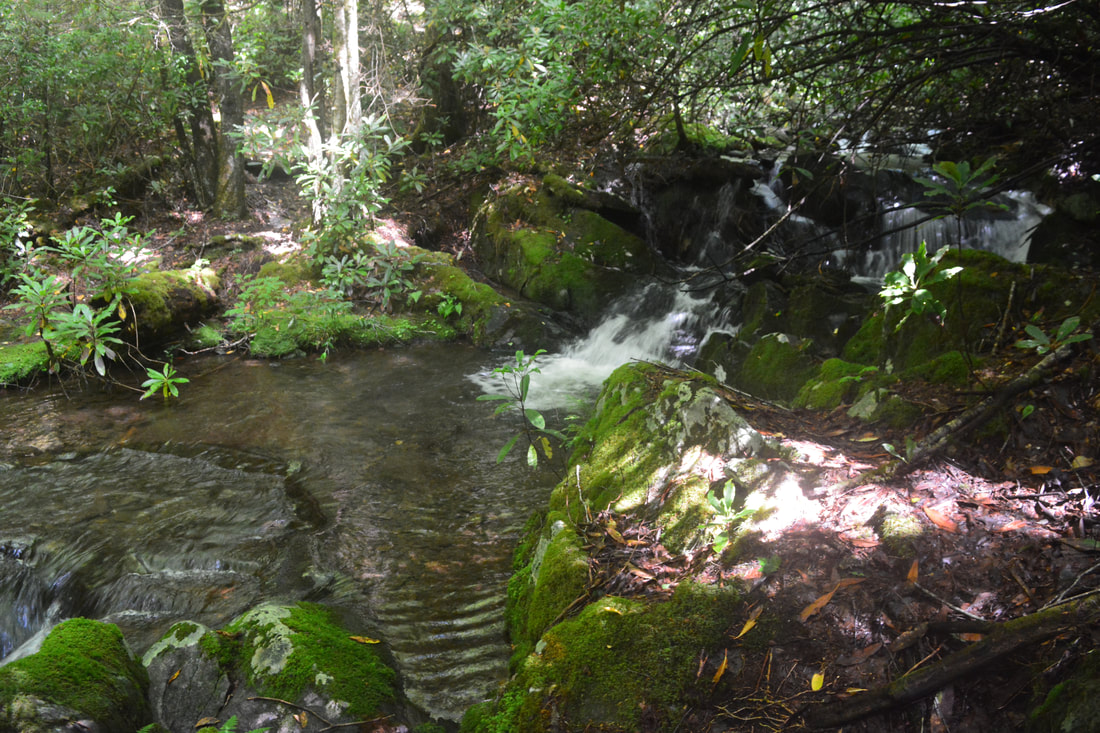
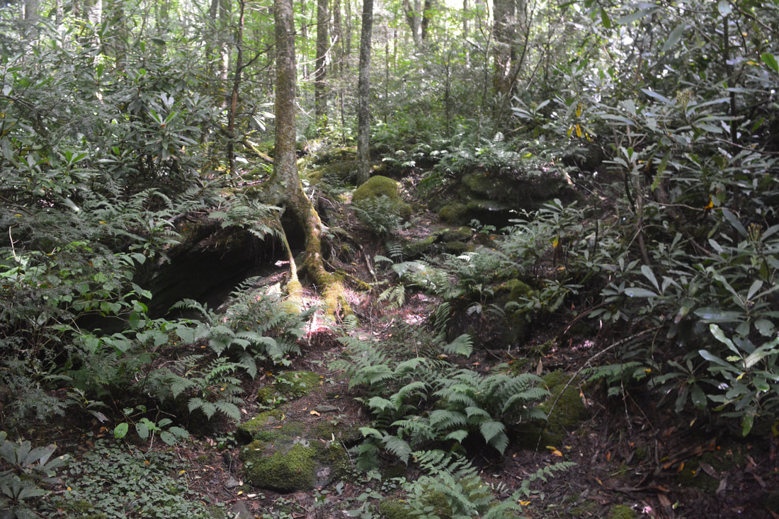
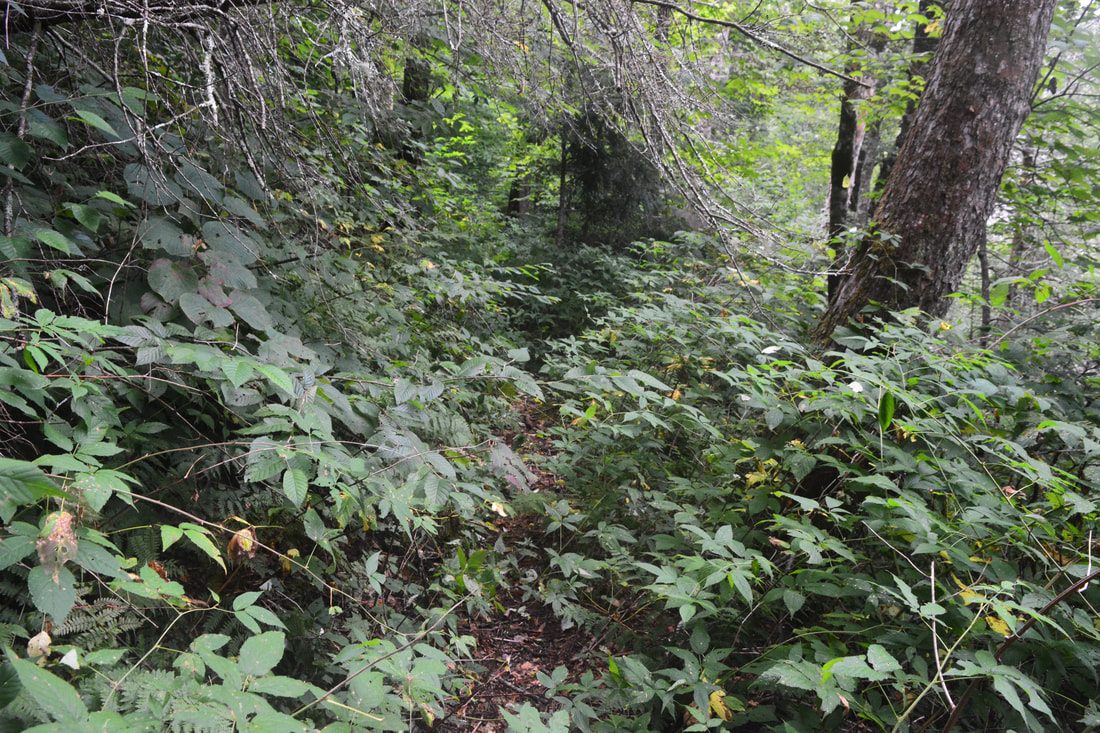
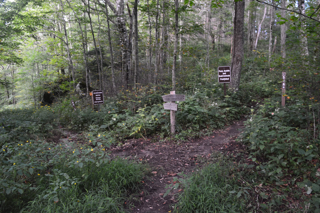
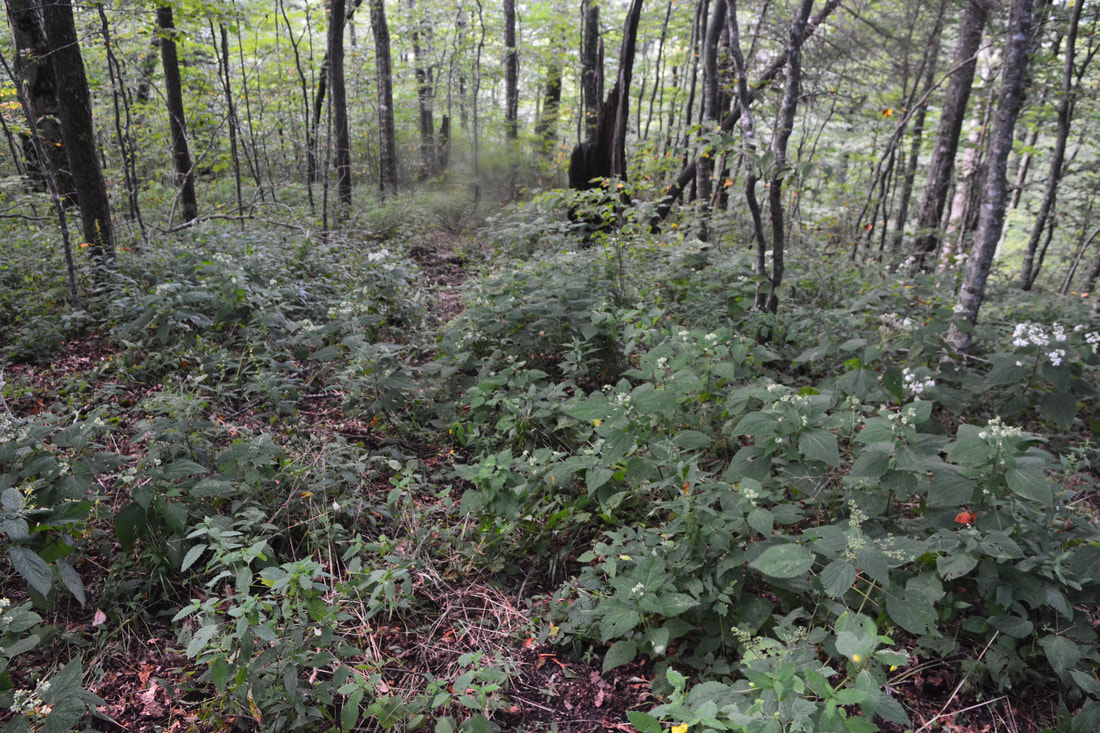
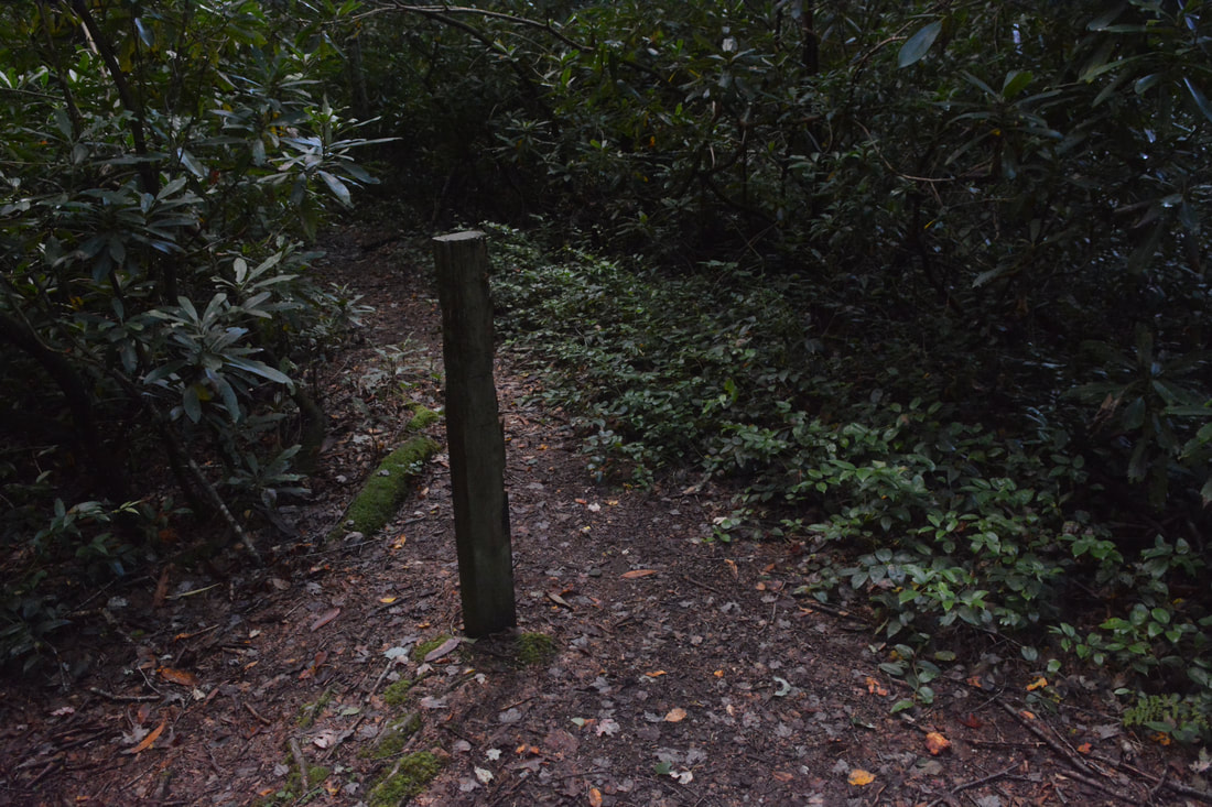
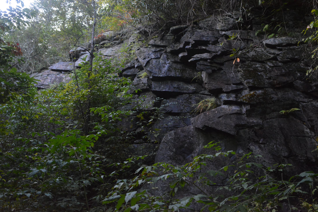
The hike begins along the South Fork Citico Creek Trail (#105) just above the Citico Creek Road upper bridge. The trail starts out as an inconspicuous, overgrown path between two small boulders - who could imagine that this modest path is the gateway to such beauty? Initially, Citico Creek is out of sight. The trail gently descends to a small creek crossing at 0.25 miles, after which the trail suddenly pops out on a precipitous bluff about 40 feet above Citico Creek. Join an old logging road and enter the Citico Creek Wilderness, which may or may not be signed, at 0.6 miles. To the left, the noisy run of Citico Creek is quite broad below the confluence of the North and South Forks. At 0.8 miles, the trail tops a small rise a little away from the creek. Look closely and you'll spot the ruins of a concrete blockhouse on the right. Just ahead is one of the hike's most important trail junctions: the Y-split of the North Fork (#98) and South Fork Trails. On my first visit, the split was marked by a "<--- #98" sign, but the sign was absent on my latest visit. Still, if you're paying attention (particularly if you just noticed the blockhouse), you won't miss this. To hike the loop clockwise like I did, stay left on the North Fork Citico Creek Trail. At 0.9 miles, the North Fork Trail reaches a magnificent wooden bridge over South Fork Citico Creek - the only bridged creek crossing in this wilderness area. The bridge is located immediately above the confluence of the two forks and provides fine views. Right away, the North Fork Trail begins following North Fork Citico Creek very closely, with excellent views around every corner. Pass the remains of a small dam at 0.95 miles. At 1.3 miles, the trail arrives at the first of 18 wet crossings of North Fork Citico Creek. I like to split this trail into two distinct parts: below and above Old Goat Falls. The section below Old Goat Falls has seven large fords that are always guaranteed wet, usually knee-deep, but possibly up to waist-deep in places. All but one of these fords can be bypassed by goat paths and easy bushwhacks, useful on a cold winter day. The section above Old Goat Falls has eleven smaller fords in quick succession. While there is definitely no sensible way to bypass any of these, they are only ankle-deep at best. During drier periods, you could quite possibly rock hop many of them, but at that point, you will probably be pretty wet anyway. 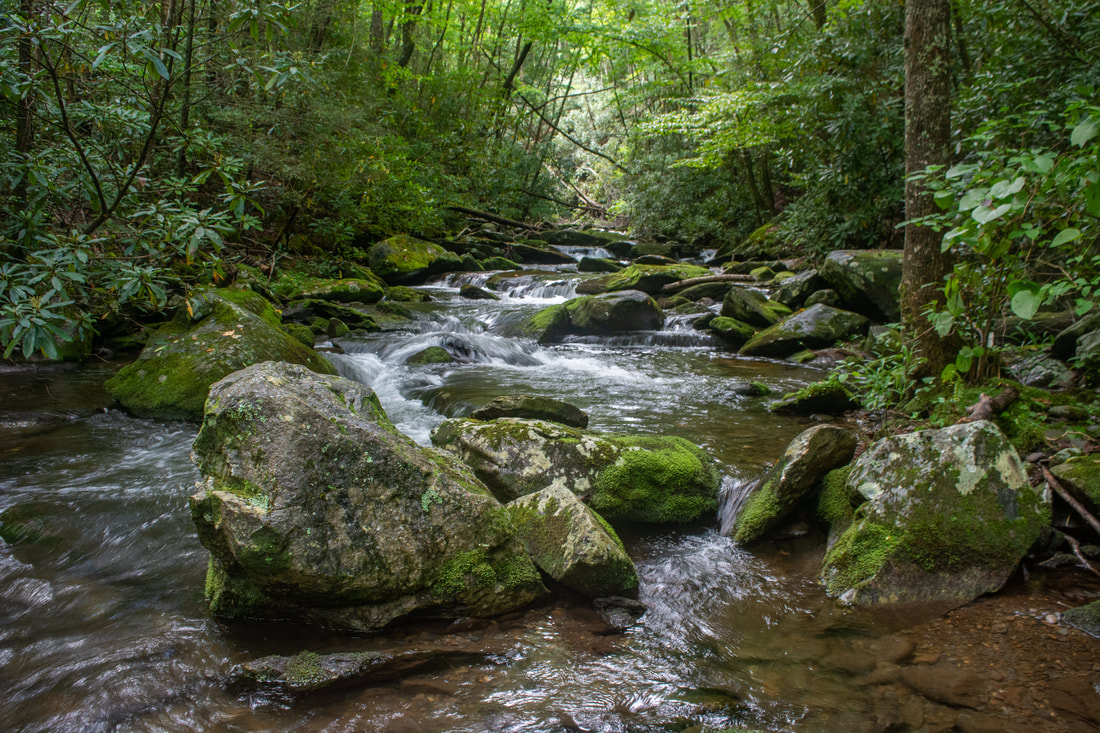
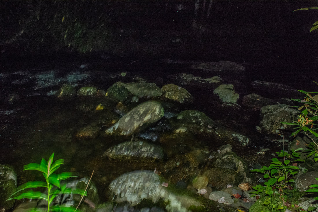
The many crossings of North Fork Citico Creek often treat you to pristine scenes like this one.
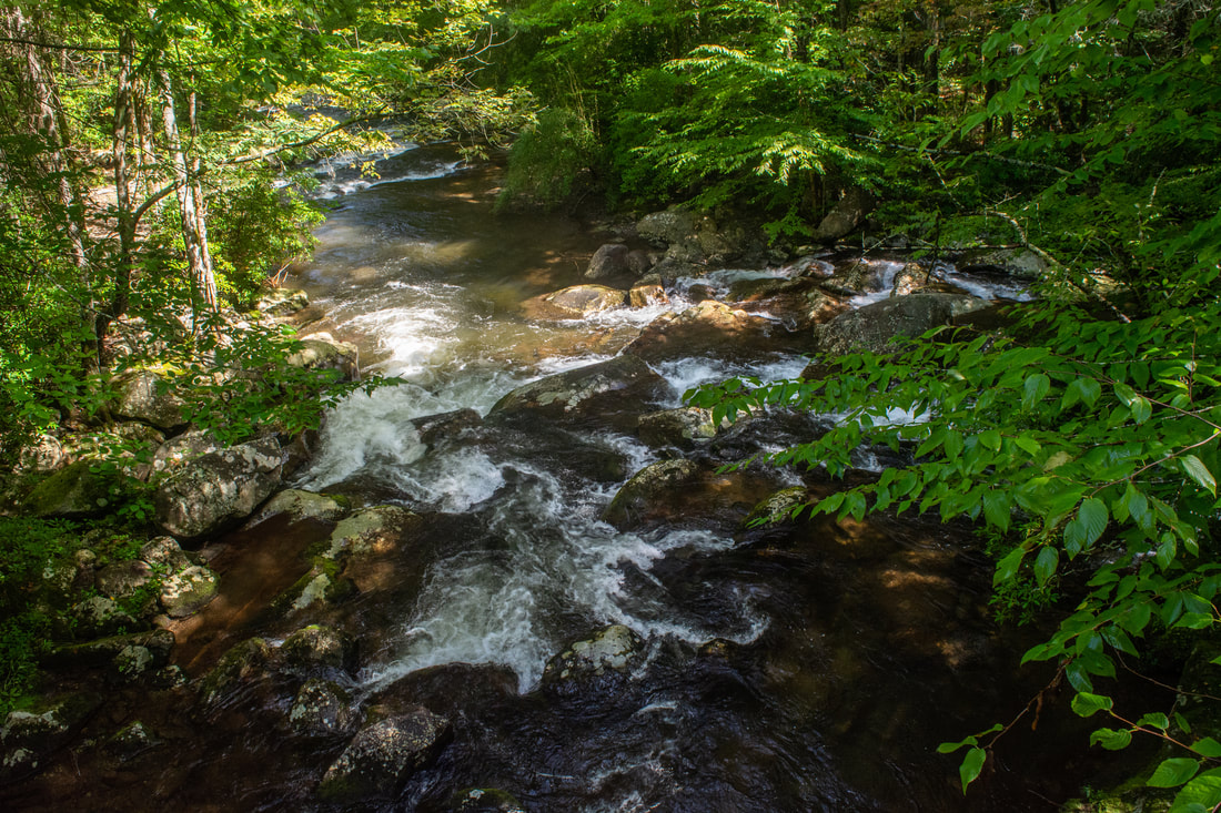
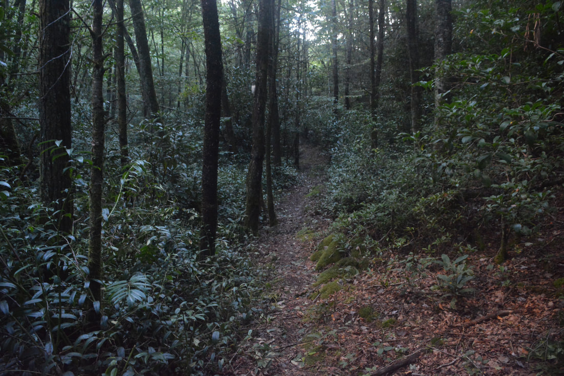
After a beautiful creekside campsite, the trail makes its second ford of North Fork at 1.4 miles. This is usually the broadest and deepest crossing. As the trail continues to parallel the boulder-strewn course of the strikingly clear creek, you might note that you are actually following the route of an old logging road at times. Ford #3 is at 2.3 miles. A well-defined goat path continues ahead and bypasses Fords #3 and #4 - it is somewhat more rugged than the official trail on the other side though. Ford #4 is at 2.5 miles. After crossing a sizeable tributary, arrive at Fords #5 & #6 at 2.7 miles. These fords are part of the trail despite being less than 20 feet apart, because an overgrown bluff on the south side of the creek blocks passage. It's possible to bushwhack over the bluff but the double ford will take much less time. The trail enters a long level stretch with occasional blowdowns. Pass a decent campsite on the right at 3.3 miles and reach Ford #7 at 3.5 miles, the final major crossing. The North Fork Trail stays nearly level as it travels along the very edge of the creek until 4.0 miles, where it abruptly turns left and shoots up a steep slope, away from the creek. This spot signals the start of a more consistent moderate ascent into the upper reaches of the North Fork Citico Creek valley.
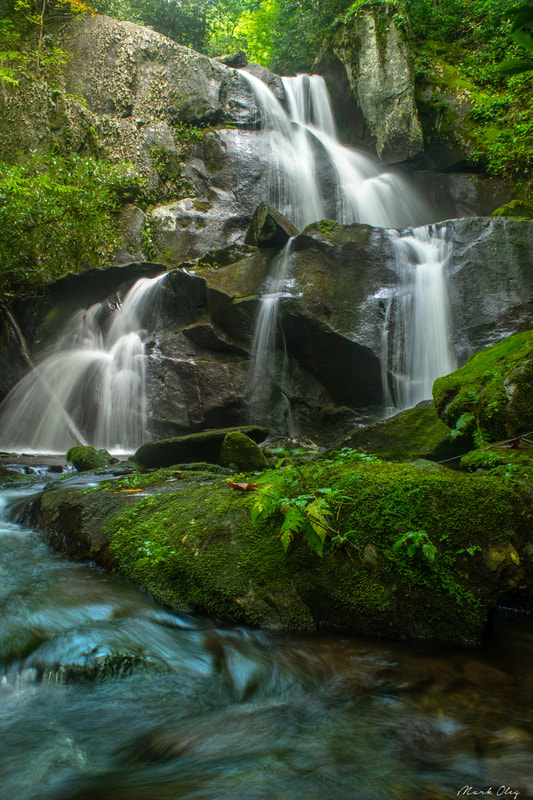
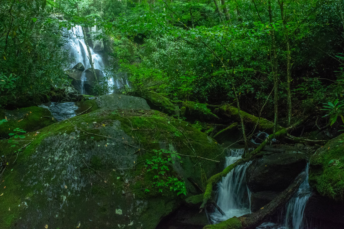
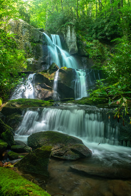
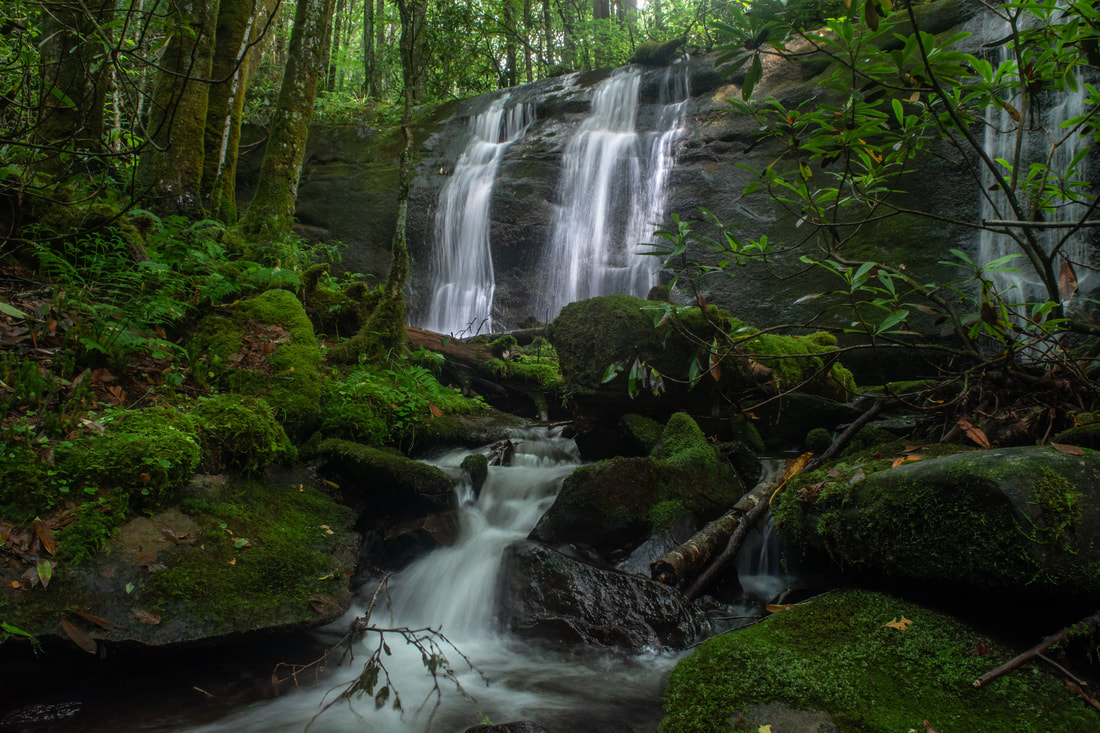
As the trail makes a pair of switchbacks, it once again becomes evident that it's following a long-abandoned, barely-discernible logging road. Even though the trail is now higher above the creek, there are still good views of the creek below. At 4.7 miles, the trail reaches a large tributary flowing down from Rockstack Mountain. This is one of my favorite spots on the hike. The creek cascades between two giant boulders and joins North Fork Citico Creek at a miniature island splitting the creek into several intricate, cascading channels. After crossing the tributary, which might be a wet crossing in itself, the ascent steepens. At 5.15 miles, the trail passes between a bluff and a large boulder. 150 feet ahead, the very faint scramble path to Old Goat Falls leaves right. You should be able to hear the waterfall, and if the leaves are down, you might see part of it too. The off-trail diversion to Old Goat Falls requires some scrambling skills but is well worth it. The faint path quickly morphs into a steep bushwhack through rhododendron, but fortunately, it is short, as you reach the creek in just 200 feet. You can glimpse the falls, but getting there first involves scrambling up a series of rock outcrops alongside the creek. Arrive at the base of Old Goat Falls at 5.2 miles. What a stunning waterfall this is! North Fork Citico Creek rushes through a cleft in a jagged, mossy cliff and then flows over a second sheer tier. The total height of the falls is about 40 feet. Most of the surrounding rocks are covered in lush green moss and ferns, and a dense screen of rhododendron lines both banks. Standing in this remote wilderness setting, it is hard to imagine that an official trail passes mere feet away from the waterfall's brink! 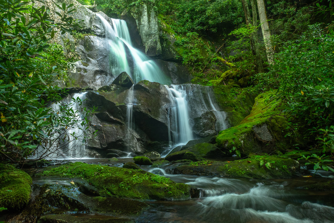
40-foot Old Goat Falls sits in a lush, remote setting, surrounded by mossy rocks and dense screens of rhododendron.
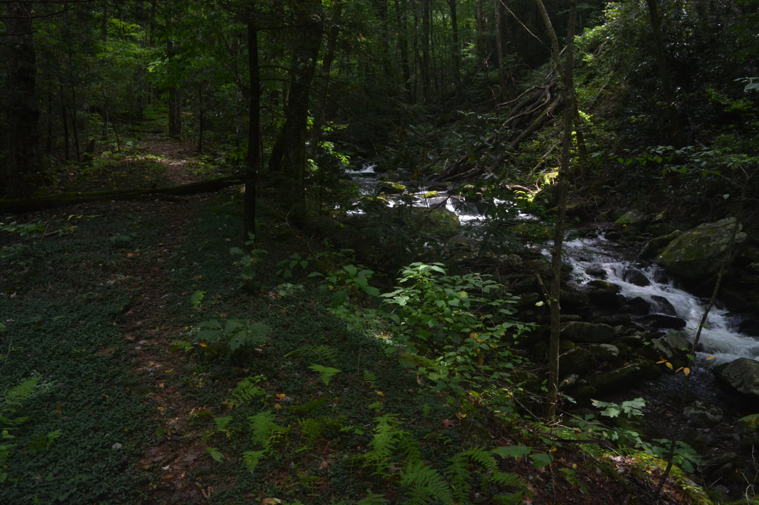
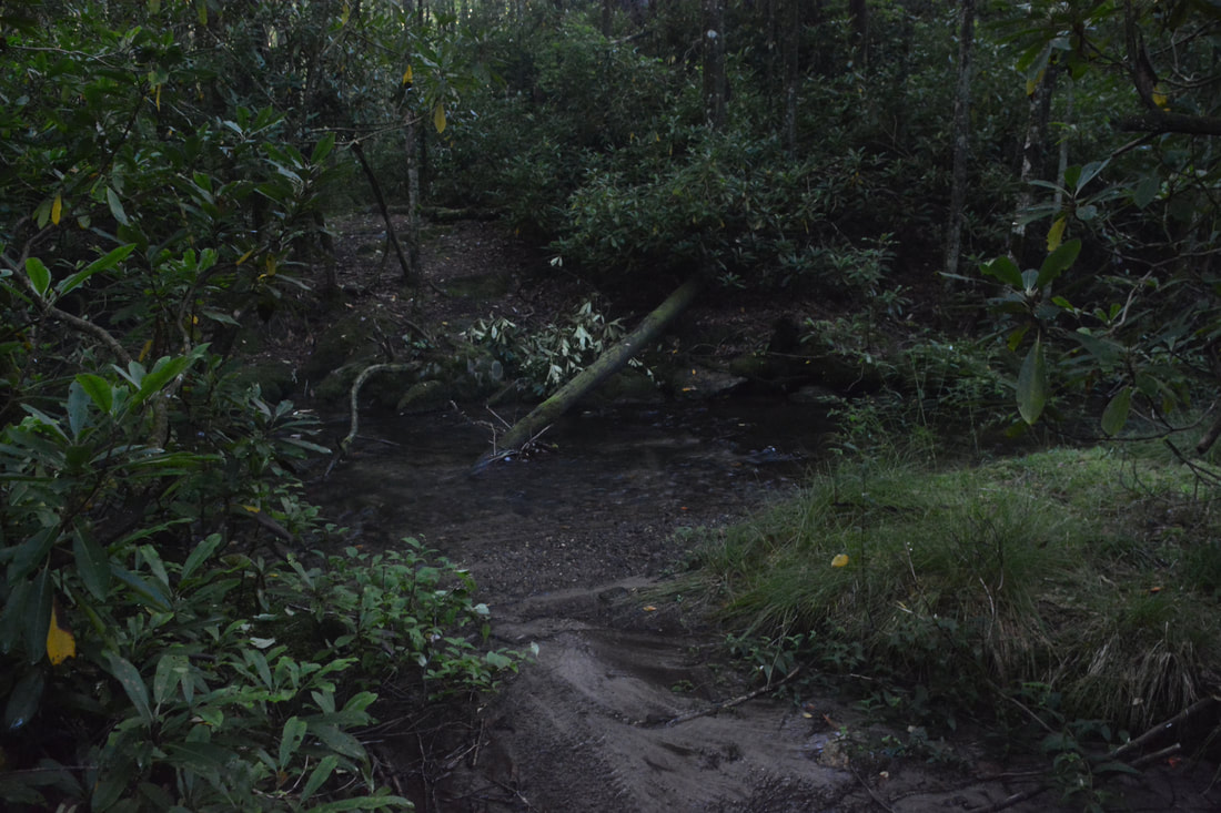
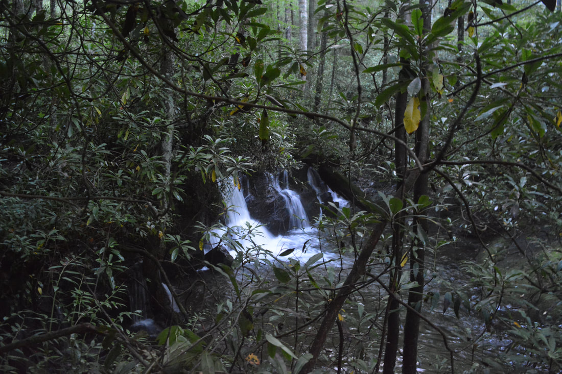
Back on the main trail, you'll make a steep climb past Old Goat Falls. At the top, reach a confusing split in paths. The correct trail is the path that takes a hard right, dropping down to the creek and fording it just above the waterfall. This is Ford #8 and the first of eleven fords in the next 0.7 miles. As mentioned earlier, these are alleasy crossings, generally not deeper than ankle-deep. At 5.9 miles, a little after Ford #16, a short side path leads left to the creek. Just upstream is the 20-foot upper falls on North Fork Citico Creek. The waterfall, a sheer drop with three separate ribbons of water, can be pretty nice with good flow. The main trail makes Ford #17 right at the brink of this waterfall. Finally, at 6.1 miles, shortly after Ford #18 (the final ford), you will arrive at the Cold Spring Gap Trail junction. The Cold Spring Gap Trail (#149) is a decent shortcut that eliminates nearly 600 feet of elevation gain. If you're short on time, you could easily take this shortcut. I like the Benton MacKaye Trail better though, because it is a tight single-track trail, while the Cold Spring Gap Trail follows a broad old road.
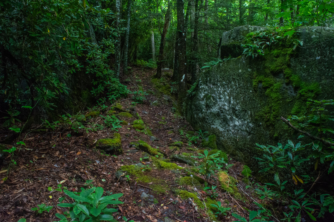
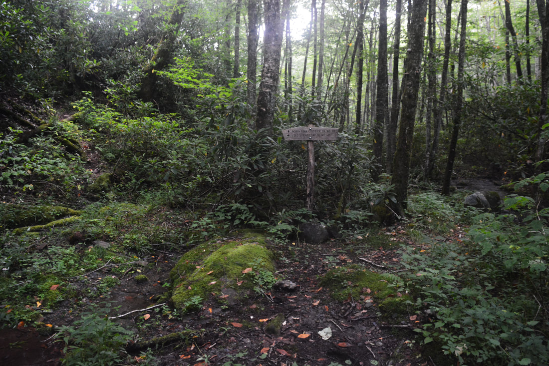
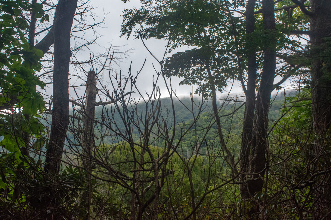
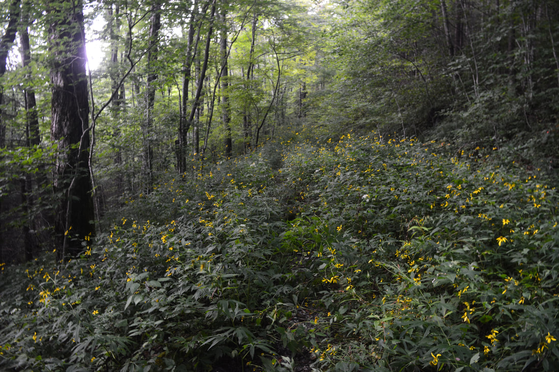
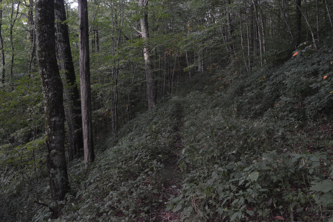
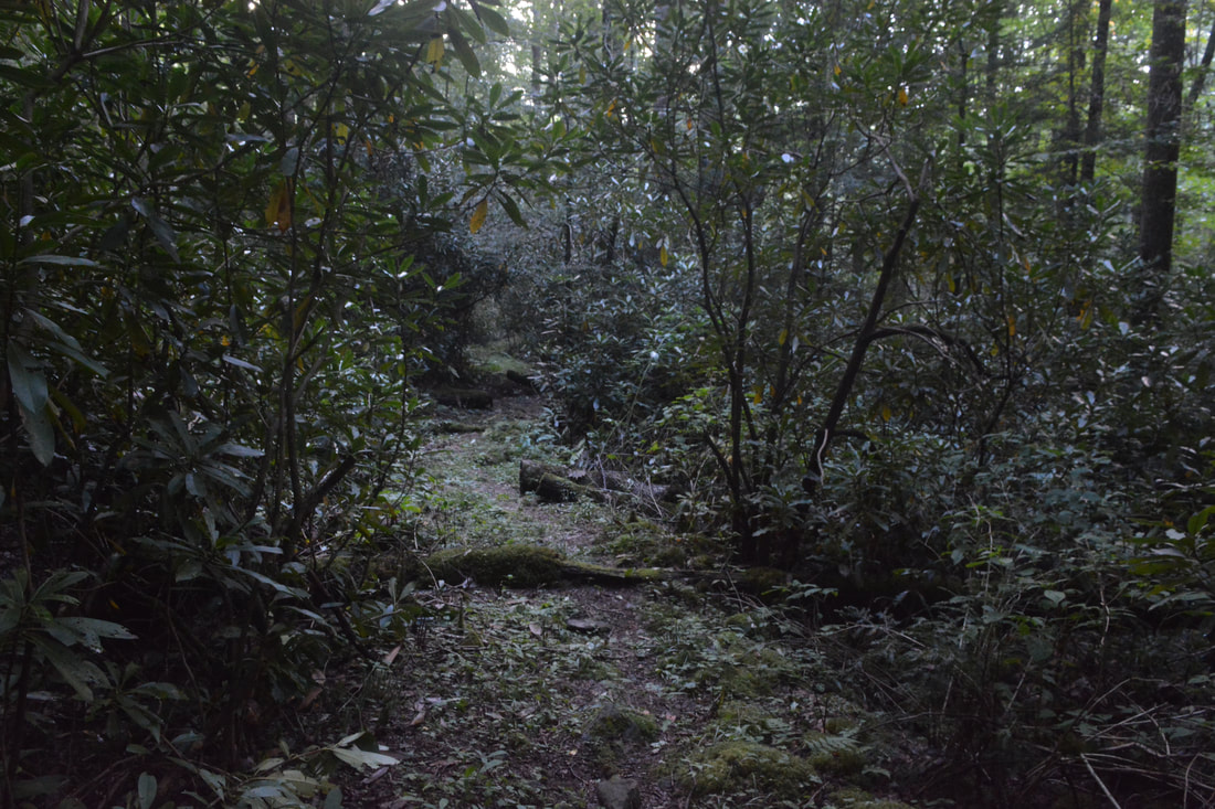
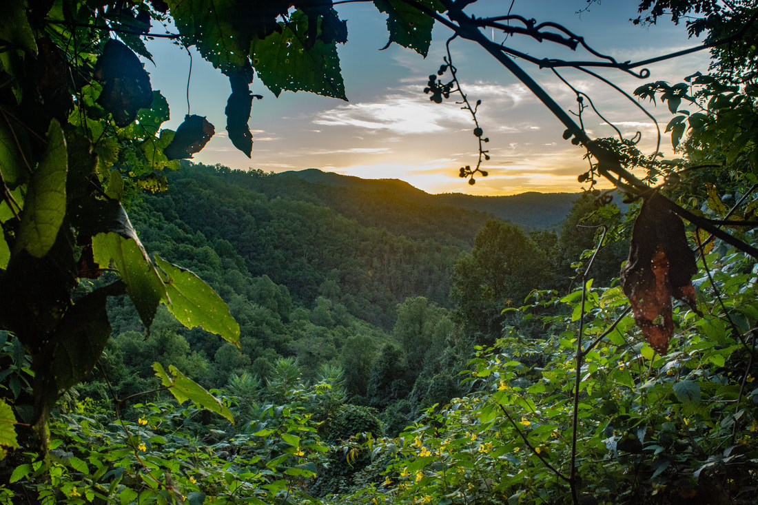
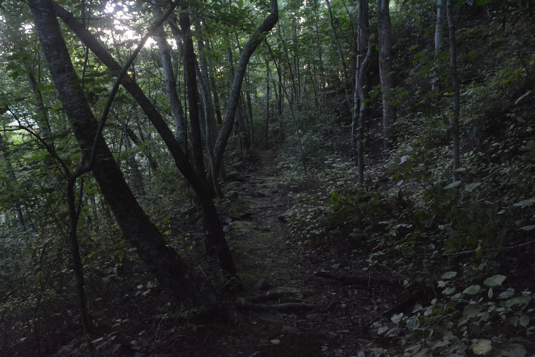
Assuming you choose to stay straight on the North Fork Trail, you'll find that the trail begins a very steep ascent to Cherry Log Gap. There is one more crossing of North Fork Citico Creek, but at this point, the creek is so tiny that it's a guaranteed rock hop. The trail then climbs 400 feet up a hollow in just 0.4 miles. At 6.7 miles, reach the terminus of the North Fork Trail as it finally reaches the Benton MacKaye Trail (#2) in conjunction with the Fodderstack Trail (#95) at Cherry Log Gap, christened such after a grove of cherry trees planted here decades ago. This hike turns right onto the Benton MacKaye Trail to loop to the South Fork of Citico Creek. The ridge you are now walking along is the state line between Tennessee and North Carolina. After climbing a little through a rhododendron tunnel, the trail levels out at a seasonal view of Bob Stratton Bald just to the southeast. Just ahead, at 7.0 miles, the Fodderstack Trail and Benton MacKaye Trail leave each other at a Y-split. The Fodderstack Trail bears left toward Bob Stratton Bald. Stay right on the Benton MacKaye Trail toward Cold Spring Gap. For the next 1.25 miles, the narrow trail meanders along slopes on the south side of the North Fork drainage, generally level or descending. When I did this hike in September, the trail was abnormally overgrown with summer vegetation in places. Reach a junction with the Cold Spring Gap Trail at 8.25 miles. Just to the right is the start of the Brush Mountain, a poorly-maintained trail that leads several miles to the South Fork Trail. The Brush Mountain can make for a great shortcut, but be advised that the trail has heavy deadfall and is nearly non-existent in places. To continue the primary loop, turn left on the Cold Spring Gap Trail, which the Benton MacKaye Trail follows in conjunction along the wide forest road. Wide in winter, that is - it's an overgrown mess outside of the slim pathway in summer. After a slow ascent back to the ridge, reach a major trail junction in Cold Spring Gap, a broad grassy opening, at 9.5 miles. The Bob Bald Trail (#54A) leaves acutely left, accessing Bob Stratton Bald like the Fodderstack Trail. Straight ahead is Forest Road 217H, a popular access into the wilderness from Beech Gap on the Cherohala Skyway, 1.9 miles away. And on the right is the trail we need to get back to Citico Creek Road, the South Fork Citico Creek Trail (#105). 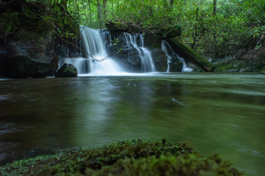
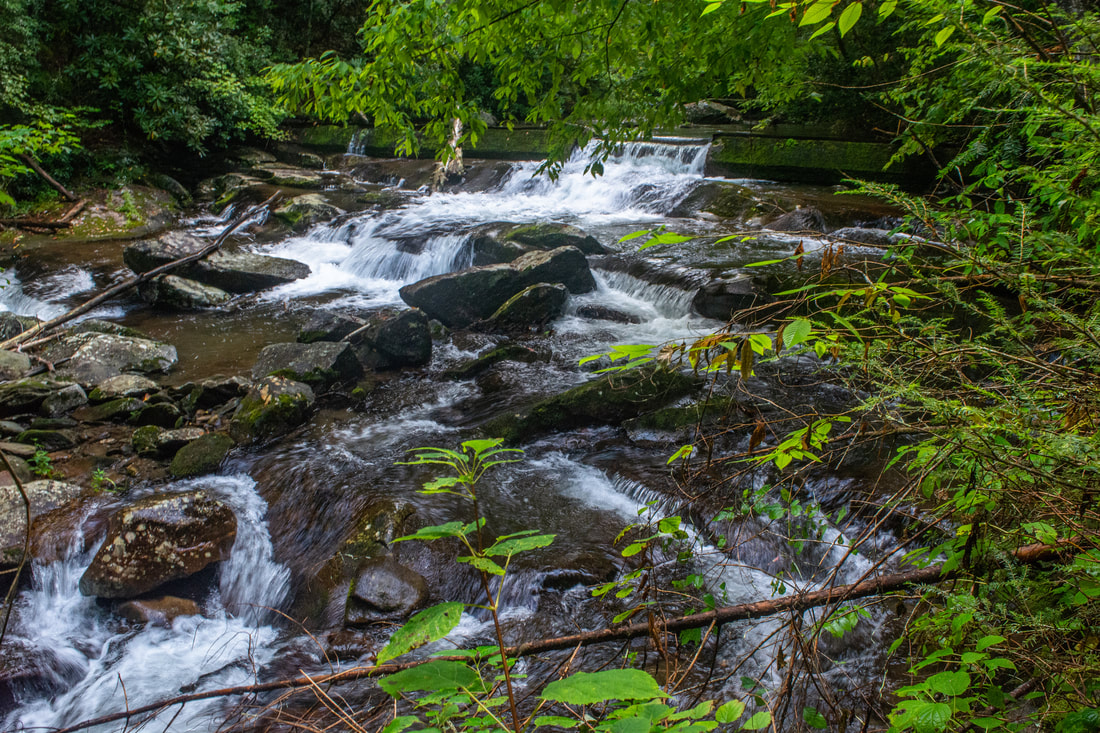
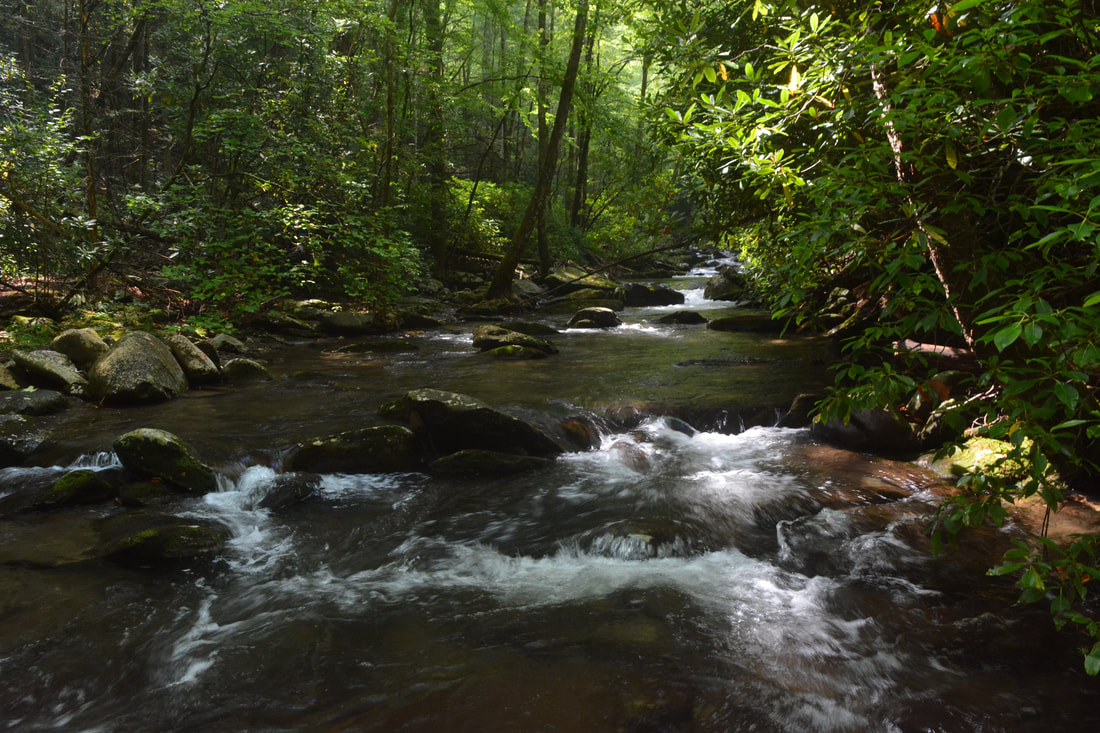
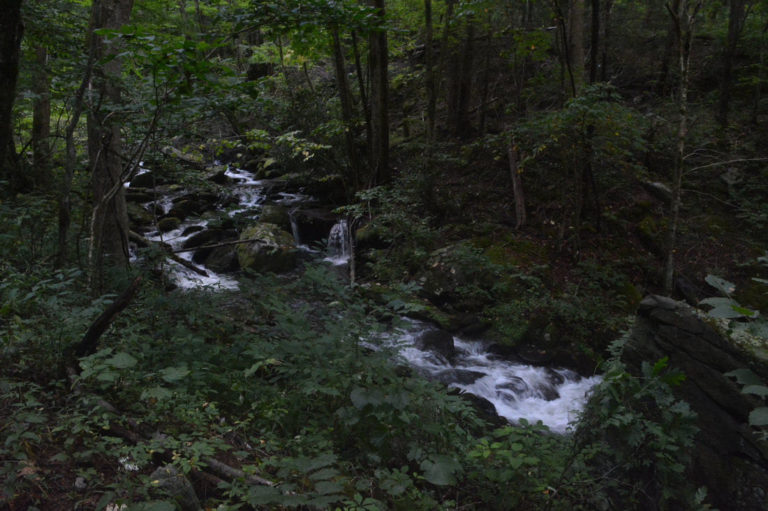
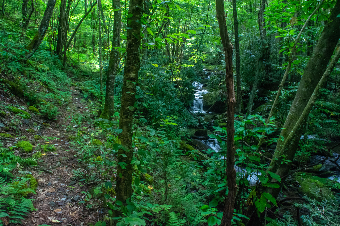
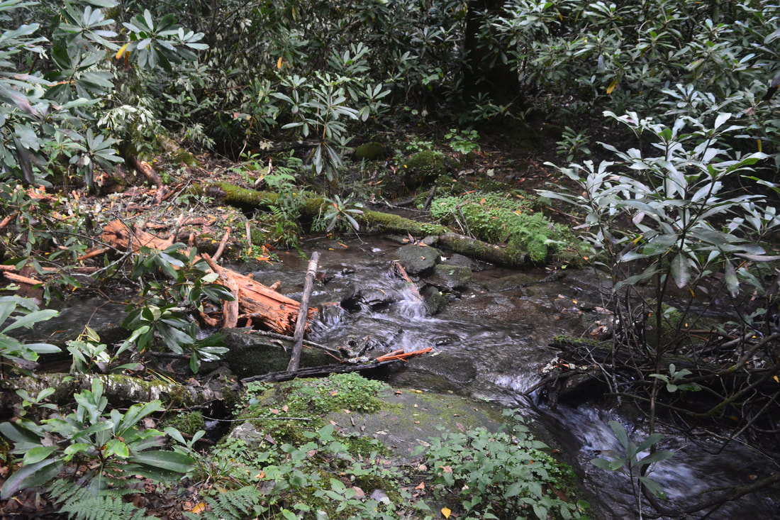
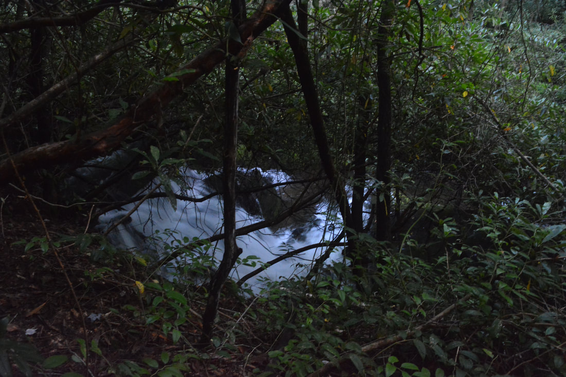
There aren't any significant waterfalls on South Fork Citico Creek, but there are scenic cascades like this one just below the Jeffrey Hell Trail junction.
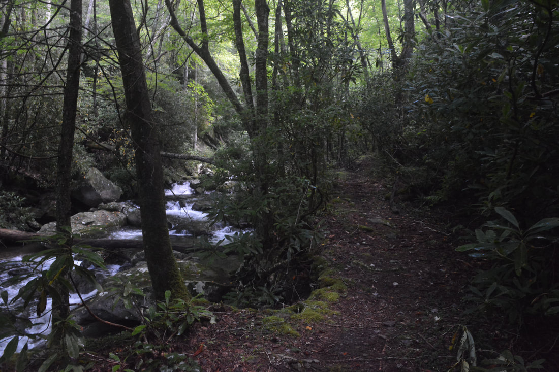
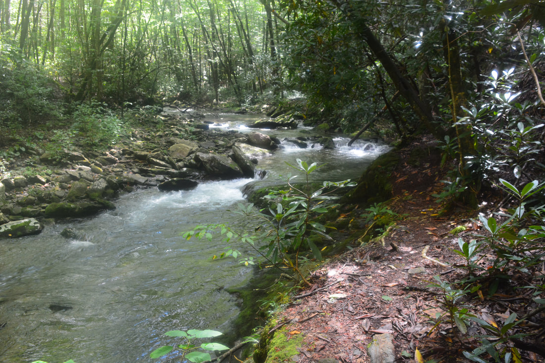
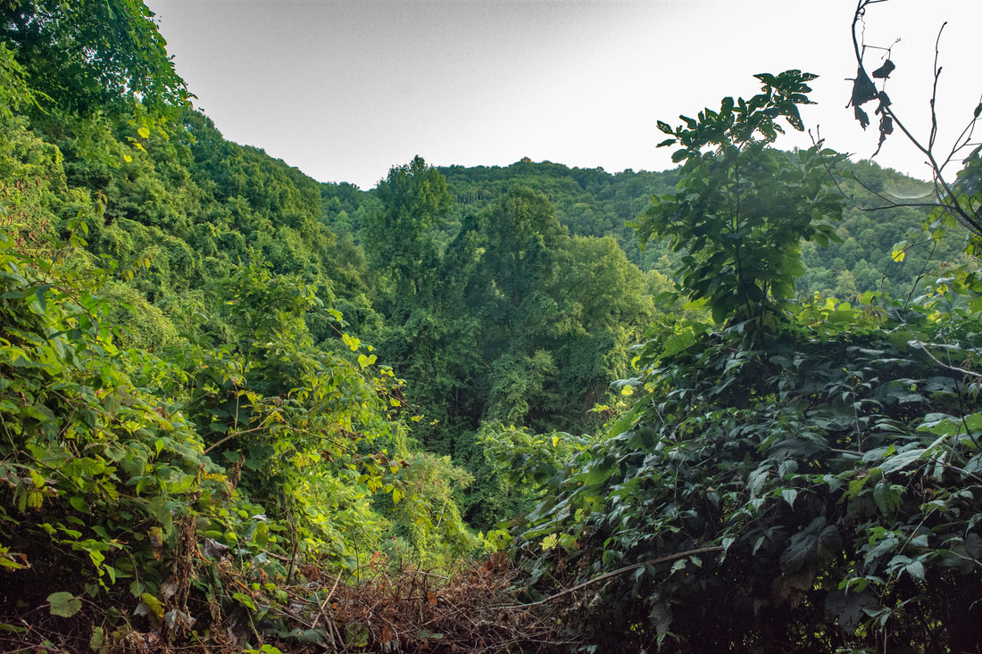
The South Fork Trail begins with an extremely steep, knee-burning descent for 0.6 miles, the trail losing 700 feet in elevation in the meantime. Level out alongside South Fork Citico Creek at 10.1 miles; the trail becomes much tamer from here on as it starts following an old logging road downstream through rhododendron tunnels. At 11.0 miles, reach the first of just two fords on the South Fork Trail - this one is still in the creek's upper reaches, only around ankle-deep. A very gradual descent continues with occasional views of the creek's tranquil cascades. Reach a junction with the Jeffrey Hell Trail (#196) at 11.75 miles. The Jeffrey Hell Trail leaves acutely left, fords South Fork Citico Creek, and climbs 2.0 miles to the Fall Branch Falls Trail and West Rattlesnake Rock Trailhead on the Cherohala Skyway. Stay right on the South Fork Trail. At 12.0 miles, the trail passes a small, scenic, triple-flow waterfall, about 8 feet high. At 12.6 miles, South Fork Citico Creek suddenly starts dropping into a deep gorge. There are several powerful cascades and small waterfalls here, but they're tough to see from the trail and obscured by vegetation. Meanwhile, the trail sticks to the level logging grade, which rises high above creek level. Between 13.1 and 13.8 miles, the trail passes through patches severely overgrown with blackberry and even kudzu, possibly the location of a former fire. An opening in the midst of the kudzu provides a view into the serene depths of the South Fork Citico Creek Gorge. My only wish is to be down in that gorge, for I can only imagine how wild and scenic it is - possibly rivaling parts of the North Fork valley. I presume that the terrain was too rugged to lead the trail that way - it was much easier to route the trail along the route of least resistance, the old logging road.
Begin descending very steeply, without any switchbacks, back into the South Fork Citico Creek Gorge at 14.0 miles. When the trail dumps you out in a flat beside the creek at 14.35 miles, you'll discover that South Fork Citico Creek is a whole different animal here - a swift, powerful creek rushing between large boulders at the floor of a narrow gorge, and a complete turnaround from the meek stream it was by the Jeffrey Hell Trail junction. The trail follows South Fork pretty closely along an old logging road for the rest of the loop. Pass a particularly scenic, rocky bend at 14.6 miles. At 15.1 miles, the Grassy Branch Trail leaves left, climbing 3.3 miles along Eagle Branch and Grassy Branch to the Cherohala Skyway. 200 feet ahead on the South Fork Trail is the trail's only other ford of South Fork Citico Creek. This is one of the hike's larger fords, rocky and up to knee-deep. Between 15.4 and 15.7 miles, the trail briefly leaves the roadbed and makes a short, steep scramble above the creek. As the trail rejoins the old logging road, it resumes paralleling South Fork closely with many superb views of the broad waterway's noisy cascades. At 16.4 miles, the Brush Mountain Trail enters from the right. It's the type of spot you won't even notice with a blink of an eye, but the location is only useful to know if you plan to hike a loop with the Brush Mountain Trail at a future date. The lower half of the Brush Mountain Trail follows Ike Camp Branch; not far from its confluence with South Fork is a scenic 12-foot cleft waterfall. Meanwhile, the South Fork Trail continues its gentle descent right to the end of the loop at the North Fork Trail junction at 16.8 miles. It's a simple matter of retracing your earlier steps from here, although you'll discover that the last part is an unpleasant climb out of the gorge back to the trailhead. Arrive at the parking area at 17.6 miles, concluding the hike. 
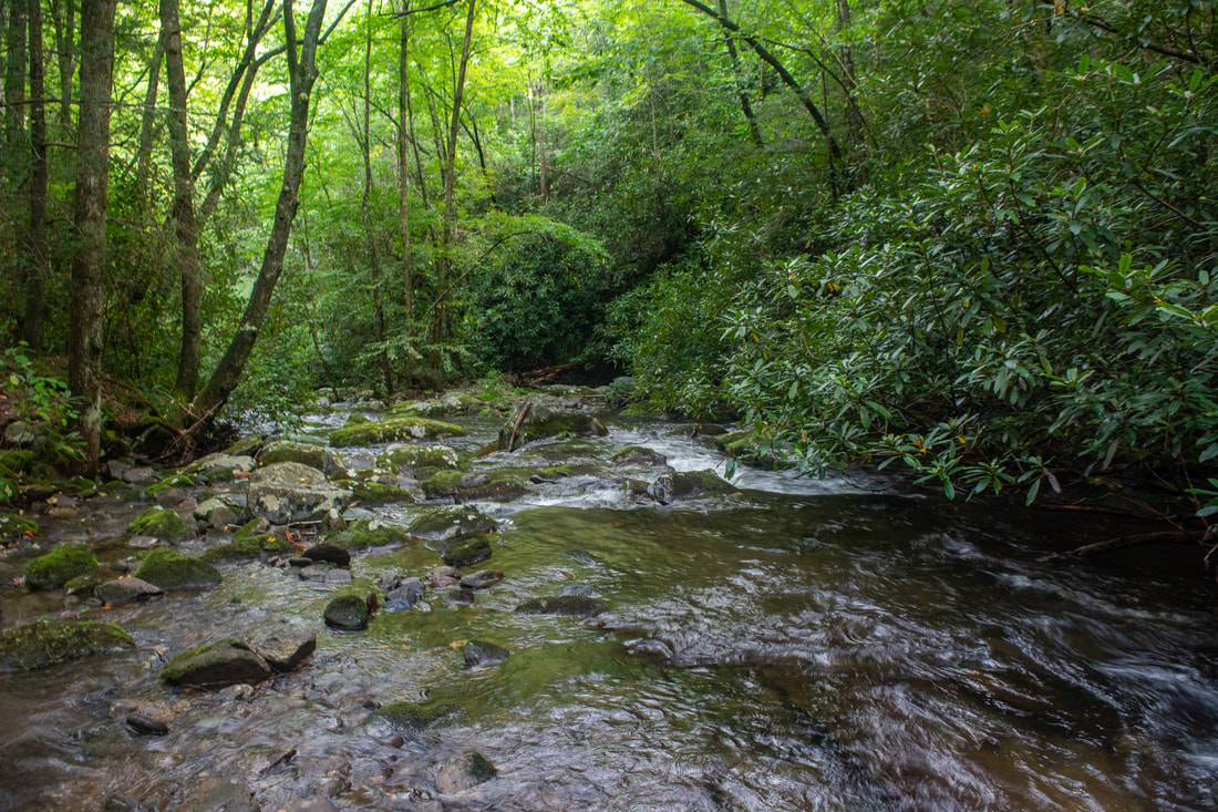
A window along the South Fork Trail into the wild depths of the South Fork Citico Creek Gorge.
The Citico Creek Wilderness features some of the finest quintessential, unspoiled Southern Appalachian streamside scenery in all of Cherokee National Forest. Both the North Fork Trail and South Fork Trail take you along miles and miles of pristine wilderness creeks. The headwaters area of North Fork Citico Creek is especially beautiful, where dozens of cascading streams, large and small, all come together in the trail's midst. The breathtaking Old Goat Falls crashing through a cleft in a mossy cliff, surrounded by nothing but the lushest green, is the icing on top of the cake. I have decided to rate this a "Best Hike", as I believe you'll be hard-pressed to find a more spectacular wilderness creek hike in this corner of East Tennessee.
Mileage
0.0 - Citico Creek Trailhead
0.8 - North Fork Trail/South Fork Trail Split (Begin Loop) 5.2 - Old Goat Falls 5.9 - Upper Falls on North Fork Citico Creek 6.1 - Cold Spring Gap Trail Junction (Lower) 6.7 - Cherry Log Gap (Benton MacKaye Trail Junction) 7.0 - Fodderstack Trail Split 8.25 - Cold Spring Gap Trail Junction (Upper) 9.5 - Cold Spring Gap (South Fork Trail Junction) 11.75 - Jeffrey Hell Trail Junction 12.0 - Small Waterfall on South Fork Citico Creek 15.1 - Grassy Branch Trail Junction 16.4 - Brush Mountain Trail Junction 16.8 - North Fork Trail/South Fork Trail Split (End Loop) 17.6 - Citico Creek Trailhead Variations
Hike out and back along the South Fork Trail to the first steep scramble - 3.8 Miles
Hike out and back along the North Fork Trail to Old Goat Falls - 10.4 Miles Hike the North Fork/Cold Spring Gap/Brush Mountain Loop - 13.4 Miles Bonus Stops
There's another significant waterfall in the same area,Falls Branch Falls, accessed by a moderate 2.7-mile hike from the Cherohala Skyway. It would make for a great end to a day or weekend in the Citico Creek Wilderness.
Pictures & Videos
3 Comments
Wow, thank you so much. I had been desperately searching for info on this loop and also looking for hidden waterfalls! I live in the Yellow Creek mountains, so trying to explore all the nearby trails. 6/11/2020 09:44:32 pm
Great report, like you I've always hiked right by it, at least 4 times but am going back with your information and see it for sure. Thanks.
Richard Watson
9/28/2020 09:31:58 pm
Hiked this loop counter-clockwise 3 weeks ago with Bob Bald added on. I stayed out for 4 days and just meandered, explored, camped, and fished. Lots of overgrowth in spots. Theres spots where Im glad I know the area. That ascent on South Fork going that direction is no joke. But still just a great place, especially when you get to take your time. It looks like SAWS has been out there in places. Leave a Reply. |
About MeMark Oleg Ozboyd Dear readers: I have invested a tremendous amount of time and effort in this website and the Georgia Waterfalls Database the past five years. All of the work that has gone in keeping these websites updated with my latest trip reports has almost been like a full-time job. This has not allowed me to pick up a paid job to save up money for college, and therefore, I I've had to take out loans. If you find the information on this website interesting, helpful, or time-saving, you can say "thanks" and help me out by clicking the button above and making a contribution. I will be very grateful for any amount of support you give, as all of it will apply toward my college tuition. Thank you!

Coming in 2022-2023?
Other Hiking WebsitesMiles HikedYear 1: 540.0 Miles
Year 2: 552.3 Miles Year 3: 518.4 Miles Year 4: 482.4 Miles Year 5: 259.9 Miles Archives
March 2021
Categories
All
|
||


 RSS Feed