Chattahoochee National Forest: Canada Creek Falls, Ontario Falls, and Alberta Falls, Suches, Georgia2/28/2017 
Folks who reside in the north Georgia Mountains are familiar with Woody Lake, a picturesque pond next to Route 60 in the community of Suches. What many of the locals are not familiar with, however, is that the stream that drains Woody Lake drops over four notable waterfalls and through a scenic gorge on its way to the Toccoa River. Three of the waterfalls can be accessed from a trailhead at the end of East Canada Creek Road, at a place where shrinking fields and old silos illustrate that a farm once prospered here. While no official trail leads to any of the waterfalls, getting to them presents only a minor navigational challenge along a series of forest roads and narrow paths worn by fellow hikers. This hike occurred on Saturday, January 21st, 2017. My plan was first to hike from the end of East Canada Creek Road downstream along Canada Creek to Ontario Falls and Canada Creek Falls. Then, I would retrace my steps and follow the creek upstream to Alberta Falls. I would save the hike to Yukon Falls for another day.
Summary
R/T Length of Trail: 4.1 Miles
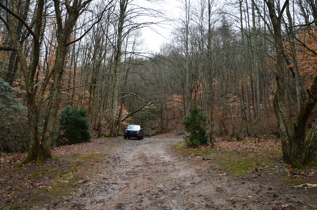
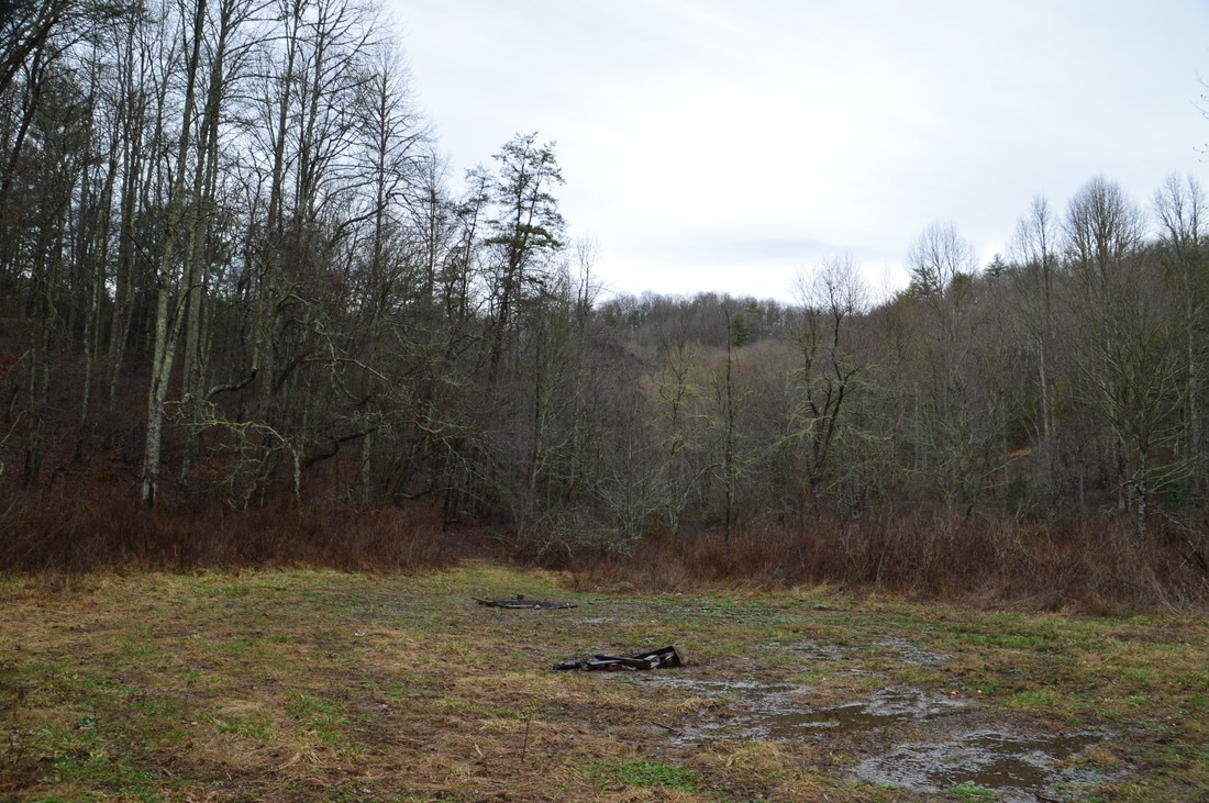
Duration of Hike: 4:00 (Allow plenty of time for navigating the unmarked and unmaintained routes to the waterfalls and for photographing the waterfalls) Type of Hike: Double Out and Back Difficulty Rating: 3 out of 10 Total Elevation Gain: 649 Feet Pros: The trail is packed with water features for such a short distance Cons: The area around the trailhead is rather "messy" Points of Interest: Canada Creek Falls - 10 stars; Ontario Falls - 6 stars; Alberta Falls - 8 stars Trail Blaze Colors: None, as none of the hike is on official or maintained trails Best Seasons to Hike: Winter; Spring Fees: None Beginning Point: Campsite and turnaround at the end of East Canada Creek Road Directions from Suches, GA: From Highway 60 in Suches, follow Cooper Gap Road south for 1.6 miles. Then, bear right onto Canada Creek Road. This road shortly turns to gravel, but it is in good condition up to the gate, with only a few potholes. I have to note that all maps seem to show that Canada Creek Road is a thru-road. This is not true, as the road is now gated near Canada Creek. For this reason, I will refer to the part of the road from Cooper Gap Road as "East Canada Creek Road". From Cooper Gap Road, follow this road for 2.1 miles to the gate at the end of the road. To the left of the gate, there is a large turnaround with a campsite. Park here to access the first, second, and third falls on Canada Creek. Map
Click here for more information and to download this trail map to view in Garmin Basecamp.
Details
The North Georgia Mountains have a lot of little-visited or even undocumented waterfalls that are not on or close to maintained trails. In recent months, I have steadily been discovering more and more such waterfalls. To start off this post, I would like to give a shoutout to Bernie Boyer, a "waterfaller extraordinaire" who has acquainted me with the waterfalls on Canada Creek, as well as many other unknown waterfalls in north Georgia. Take a look at his website here, which has information on getting to some of the waterfalls that he has discovered. I hope that y'all will find that website as useful as I did.
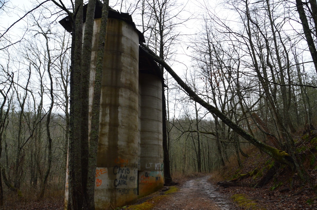
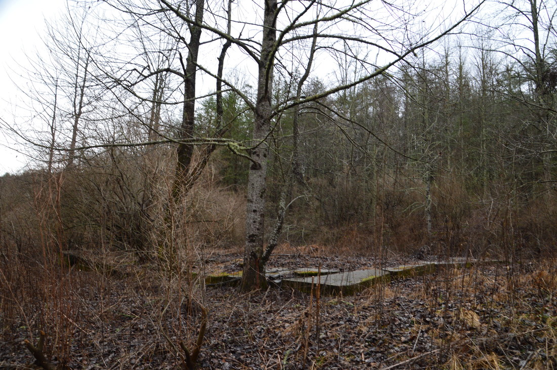
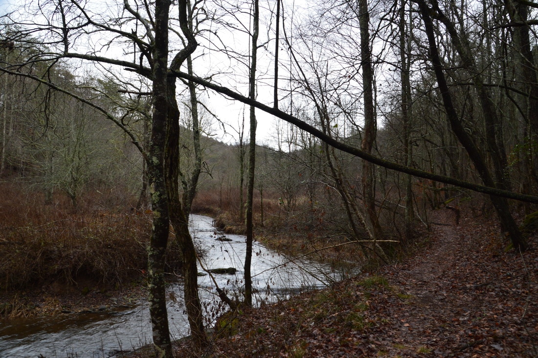
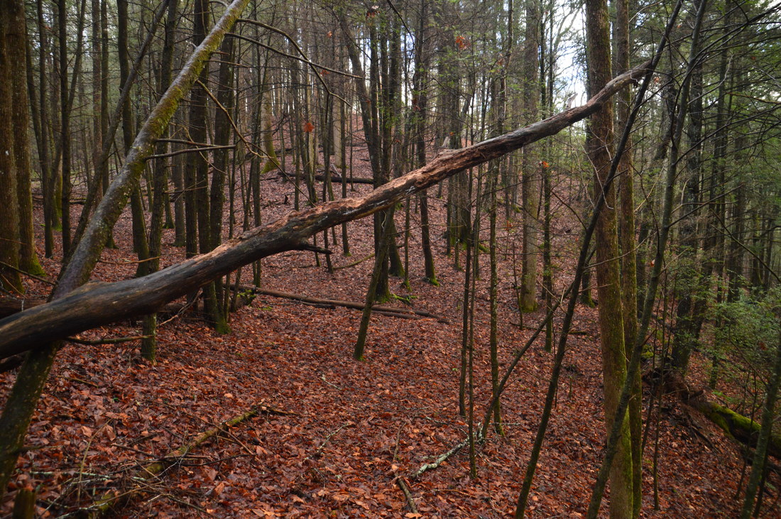
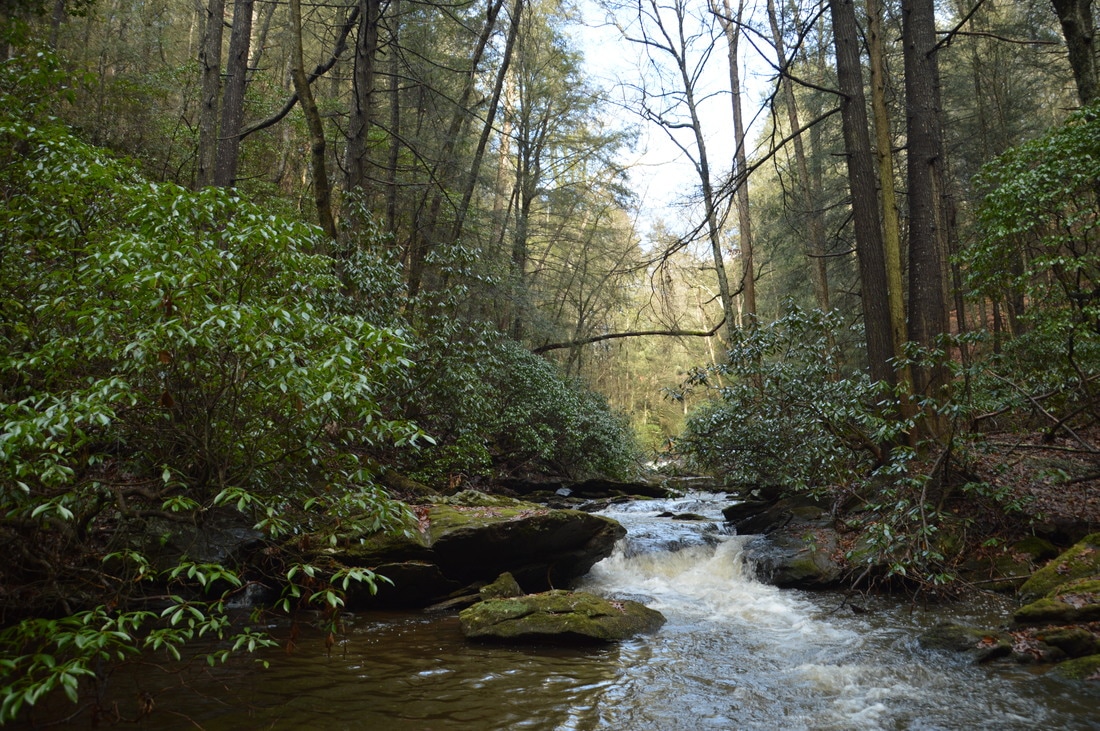
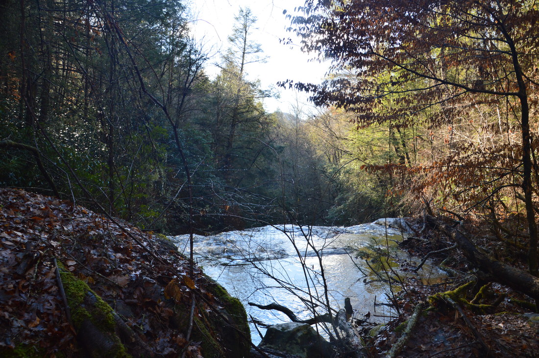
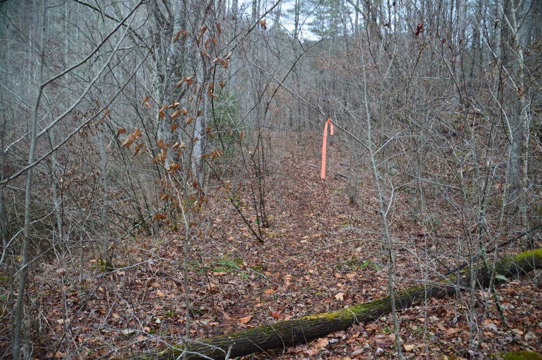
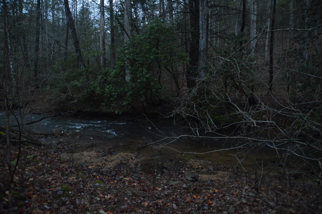
Moving on to the hike: technically, the trailhead for the Alberta Falls on Canada Creek is separate from the trailhead for the Canada Creek Falls and Ontario Falls. However, the two parking areas are only about 300 feet apart, so I consider this to be one hike, as you do not have to drive between the two trailheads. Fairly recently, Canada Creek Road used to be open all the way across Canada Creek, but that section of the road is in much worse shape than the rest of the road, which is why I assume it was gated. I could not find any information about the closure online. Regardless, I suggest visiting Ontario and Canada Creek Falls first, as the hike to them is slightly more difficult. Begin the hike by walking around the gate and down the continuation of East Canada Creek Road. You will pass two silos that are remains of a former farm. Shortly afterwards, there will be a field to the right and then the concrete remains of a foundation to the left. At 0.25 miles, the road turns right and fords Canada Creek. Do not go there; instead, continue straight into a small grassy clearing with a campfire ring. You should see a wide path leaving the far end of the clearing. Take this path, which soon narrows and begins following Canada Creek, which is tranquil in this area. The path becomes somewhat faint and a bit overgrown, but you shouldn't have trouble following it. At 0.45 miles, the path makes a gradual curve to the left as the creek bends. Then, at 0.6 miles, the path rises slightly and reaches an old logging road. This point is marked by the waypoint "Logging Road Jct" on the map above. Turn right onto this logging road, which descends back to the creek. You might spot some flagging tape several times along this stretch. At 0.65 miles, there is an intersection. The more obvious wide logging road bears left and uphill. A faint path continues straight, closer to the creek. Take this path. The path crosses a rivulet and becomes nearly non-existent on the other side. However, despite the lack of a distinct path in this section, the woods are open so it is very easy to follow the east side of the creek here. The path of least resistance is along the slope just east of the creek, about 20 feet above creek level. Occasionally, it seemed like there was a semblance of a beaten track. At 0.85 miles, there is a series of slides and cascades to the right as the creek begins to resemble a mountain stream and as the gorge gets steeper. Shortly after this, pick out a faint path that angles down the slope and down to creek level. Once you're at creek level, ford Canada Creek at 0.9 miles, where the creek makes a bend to the right and where the slope ahead looks steeper. A wet-weather stream comes in from the left here. The ford is knee to mid thigh-deep, but the current normally isn't fast, and there are few slippery rocks. A scenic cascade lies just above the fording point. 
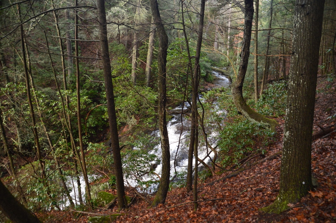
On the way to the Big Falls on Canada Creek, hikers must make the pictured thigh-deep ford of Canada Creek.
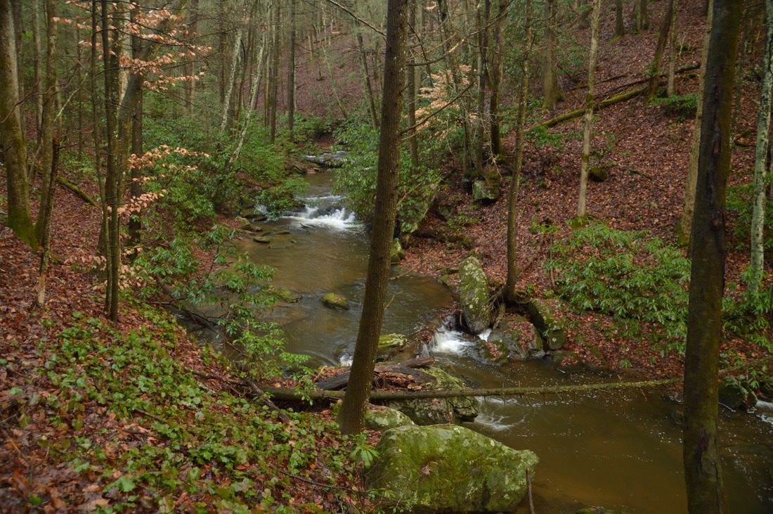
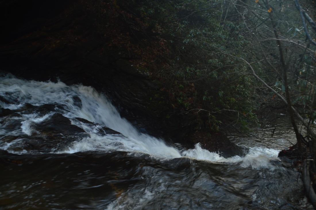
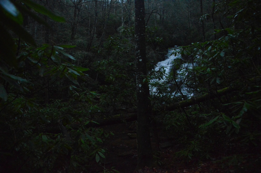
Now on the other (north) side of Canada Creek, or on "River Right" as kayakers say, you should be able to make out a path that stays just above the creek. Follow this path downstream along the creek. You should remain at about the same level above the creek until Ontario Falls. Around 1.0 miles, you should be able to see the top of Ontario Falls, as well as hear the falls well. The trail becomes steeper as it hugs the slope on the right side of Ontario Falls. About 250 feet farther, at 1.05 miles, a steep goat path breaks off to the left and descends to the base of Ontario Falls. Previously known as Falls #2 on Canada Creek, Ontario Falls is only about 15 feet high, but despite the lack of height, the waterfall is stunning! This photogenic waterfall spills over a ledge, with an impressive cliff leading away from the falls on River Right. Moss-covered boulders add to the scene on River Left. Furthermore, Canada Creek is a fairly large stream, and the creek is squeezed into a narrow passage between the cliff and boulders at the Ontario Falls, so the waterfall is powerful. There are several shoals just downstream from the falls that can be good to photograph with the Ontario Falls in the background. Ontario Falls is located at the coordinates N34° 41' 06.2" W84° 03' 44.2".
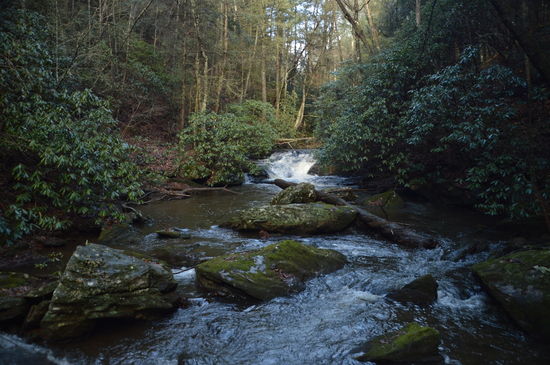
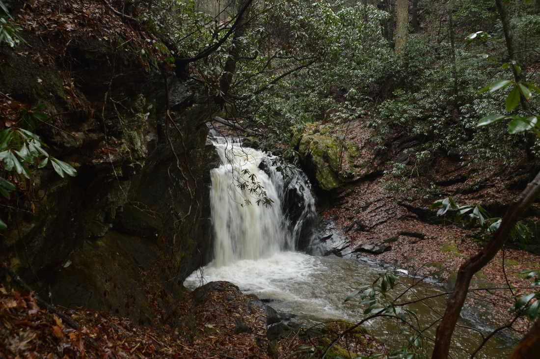
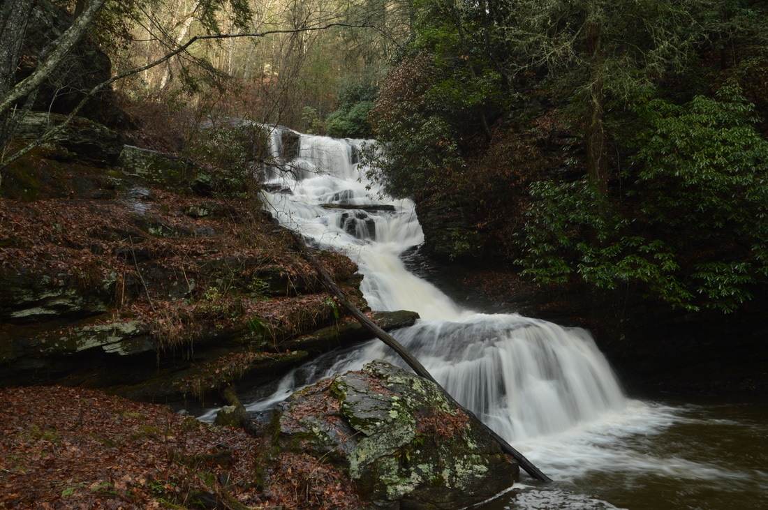
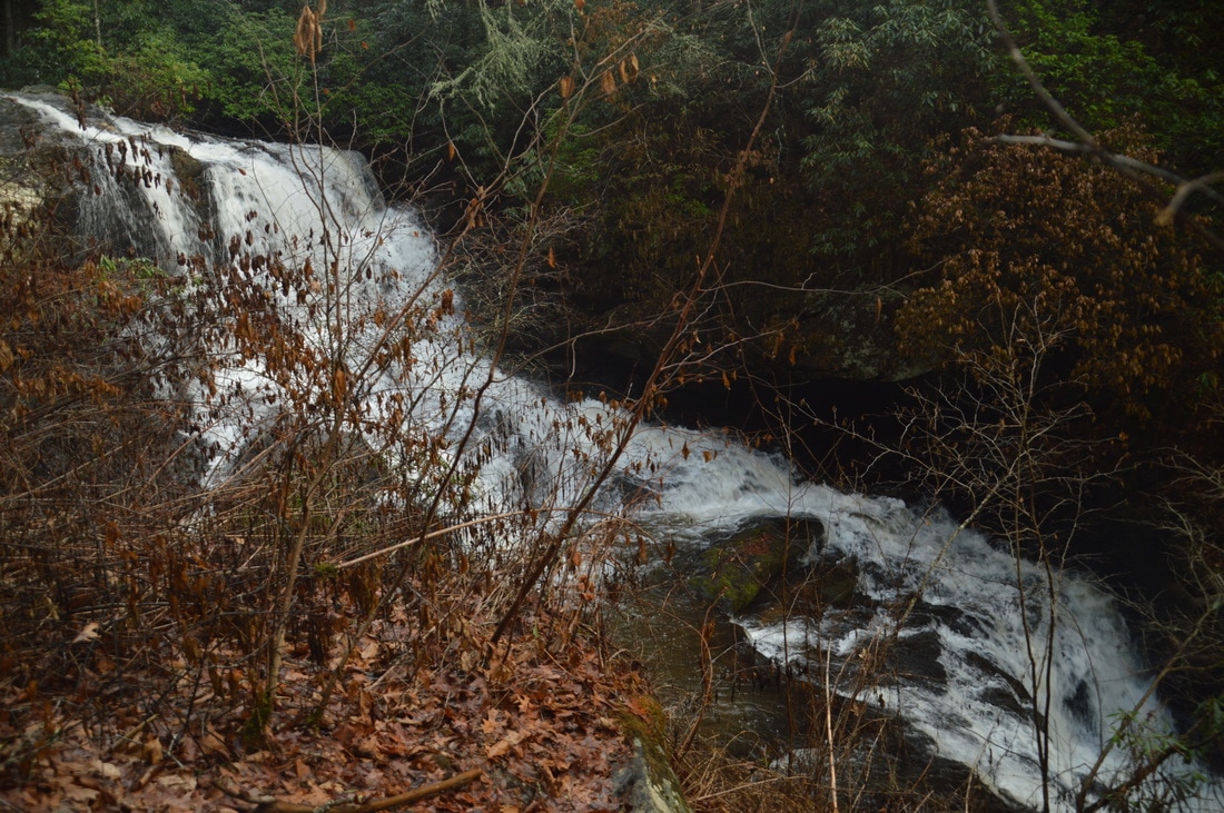
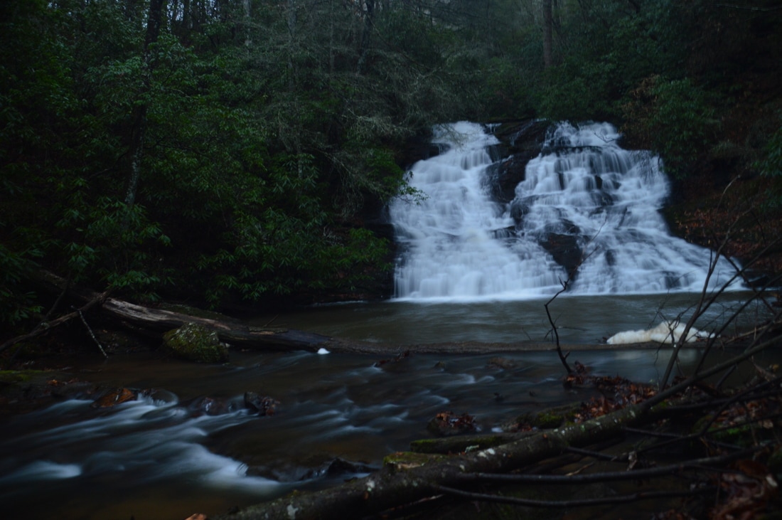
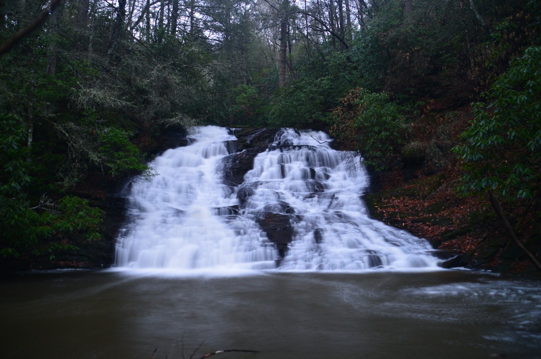
From Ontario Falls, the path appears to receive more use as it gets closer to Canada Creek Falls. At 1.1 miles, the path approaches the top precipice of Canada Creek Falls. Follow the path on the right side of the falls. About halfway down, the path splits. Both paths lead to the base, but the path that descends left is easier (the straight path takes a difficult scramble down a series of small ledges). Take the path on the left, which descends down a rock slab and to the midpoint of Canada Creek Falls. Also known as Gooch Mill Falls and Big Falls (Falls #1), Canada Creek Falls is spectacular! It is about 50 feet high with two nearly vertical tiers. At high water, the waterfall is overpowering. I personally think that the view from the middle of the falls is actually even better than from the base, as the upper tier (which is the cover photo for this post) is more photogenic and plus you can see the precipice of the lower tier. There is one note that I would like to make regarding Canada Creek Falls. There is private property beginning at the base of the falls and stretching down into the valley beyond; in fact, a private road leads from a house to the base of the falls. Nevertheless, to the best of my knowledge, you can view and photograph the waterfall from public land. The property boundary is right at the base of the falls, and a private property sign attached to a tree at the end of the road marks the boundary. Interestingly, the sign faces Forest Service land, but in reality, the private property really is starting from the turnaround at the end of the road and down. To reach the base of Canada Creek Falls, continue following the path that is closest to the falls on its right side. There is evidence of a lot of trail use here. The path descends down some slabs and a small ledge, but there is nothing tough on the descent. At 1.15 miles, reach the base of Canada Creek Falls Falls at the turnaround of the private road from the house on private property. Make sure to stay in front of the marked private property boundary. Unfortunately, the turnaround at the end of the private road is slightly distracting. Nevertheless, the falls is still very picturesque as the creek becomes quite narrow, spilling over two cliffs, and then fanning out and becoming more tranquil below the falls. Big Falls is located at the coordinates N34° 41' 07.1" W84° 03' 47.3". 
Canada Creek Falls is an impressive double-tier 50-foot waterfall. It is the best-known waterfall on the creek.
From the base of the Canada Creek Falls, retrace your steps back along the same route to the trailhead. You should return to your car at 2.3 miles. If you're up to more exploring, then there is another beautiful waterfall on Canada Creek waiting for you. Read on to learn how to get to Alberta Falls (the mileage assumes that you have already hiked to lower two falls). To reach Alberta Falls, hike up East Canada Creek Road from your car (heading up the road in the direction that you drove in from). In about 250 feet, at 2.35 miles, you should reach a bend in the road and a very big pullout with space for parking. If you wish, you can drive to this spot, but I didn't think it was worth driving to this parking area to avoid a walk of only 0.1 miles roundtrip. Two non-gated forest roads leave the pullout. The obvious forest road is straight ahead, heading north. On my way in, I took this road and encountered a confusing trail-less area of lowlands near the creek at the end of the road. Even though the mileage is about the same, this is not the best route. Instead, take the obscure forest road that leaves at the far east end of the pullout. You might not notice it immediately, but if you go all the way to the far east end of the pullout, you'll see the forest road, as it is wide and appears to be well-used.
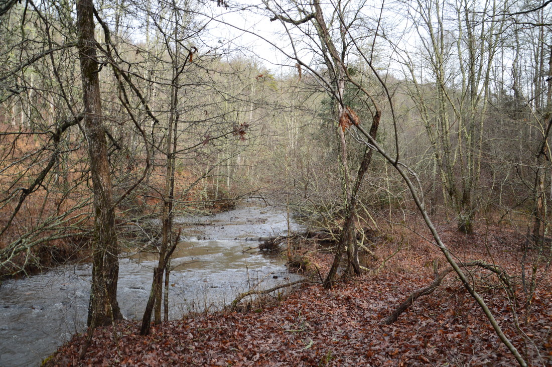
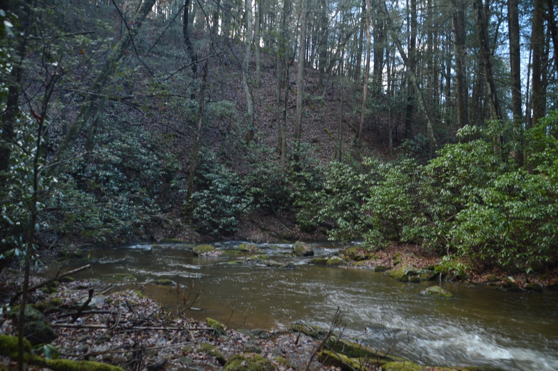
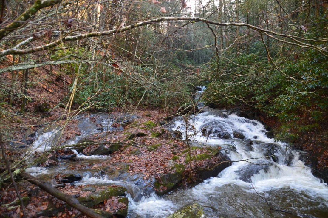
The forest road is easy to follow. Walk along it for about 0.35 miles. You should reach the end of the road at a small turnaround at 2.7 miles, 0.35 miles from East Canada Creek Road. I have marked this point on the map above with the waypoint "Logging Road End". The forest road that you have been following has stayed far from Canada Creek, but here, you should be close to Canada Creek again. At the turnaround, pick up a well-traveled path that heads upstream along the creek. Shortly, the path briefly climbs up and away from the creek over a small rise before dropping back to the creek in a rhododendron thicket, where there is a deep-looking pool in the creek to the left. Despite the jungle, the path remains fairly obvious until about 2.9 miles, where the trail appears to suddenly end at a large blowdown and a dense rhododendron thicket. It took me a moment to figure it out, but you have to descend down the steep and muddy bank of Canada Creek to the left and ford the creek here. The ford is about knee-deep but fairly easy. The hardest part is going down and then back up the creek banks. I have marked the ford with the waypoint "Ford1". On the other side of the creek, pick up a faint path that continues to follow the creek upstream. Shortly afterwards, the faint path ties into a more distinct path that comes in acutely from the left. I do not know where that path comes from, although I suspect that it is from West Canada Creek Road. At 3.0 miles, the wide path reaches another ford of Canada Creek. It is pretty similar to the previous one. I marked this spot with the waypoint "Ford2". You can also ford a bit farther just above the confluence with Wildhog Creek. If you ford at the spot I marked, bear left right after the ford and then ford Wildhog Creek, which might be a rock hop, depending on water level. Do not follow the old logging road that follows the west side of Wildhog Creek. This logging road leads to private property. After this, hike east for a short distance through an open bottomland with no distinct path. At about 3.1 miles, a path comes in from the right and continues straight. To the right, the path leads to some picturesque shoals on Wildhog Creek. Passing a campsite with a tiny "homemade" table in a flat to the left near the creek, follow the path straight and upstream along Canada Creek. The gorge narrows and the obvious path, which stays very close to the creek, passes several rushing cascades. At 3.2 miles, the path reaches and ends at Alberta Falls, previously known as Falls #3 on Canada Creek. 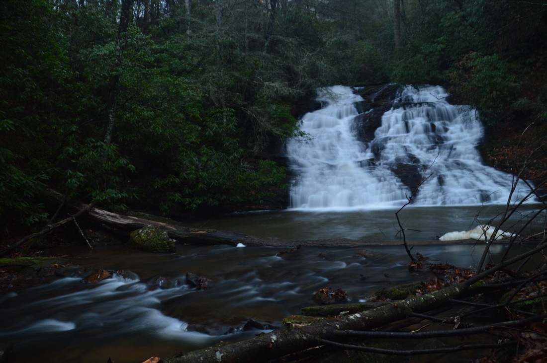
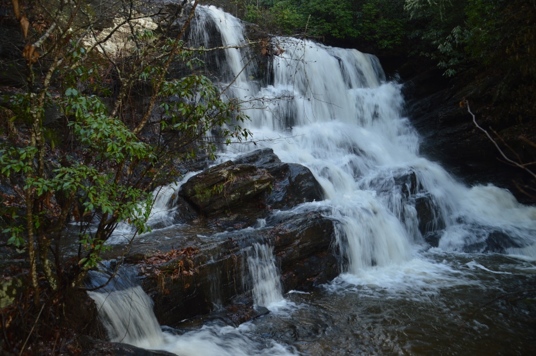
Alberta Falls on Canada Creek is one of several such beauties on this undervalued and little-known creek.
Alberta Falls is a beauty about 40 feet high. This single-drop waterfall cascades down a wide stairstep rock face into a deep pool. The creek then flows over some shoals that add character to the gorgeous scene, before it disappears out of sight. The path ends just before the waterfall. To get the best view, scramble down to a low area where deep water collects when the creek is high (on this day, the water was calf-deep). Walk through the low area and to the creek itself. The best view is from here. It is possible to wade closer up to the falls as well. Alberta Falls is located at the coordinates N34° 41' 23.5" W84° 02' 34.9".
There is a fourth waterfall on Canada Creek as well, Yukon Falls. However, it is difficult to reach it from the same trailhead, because there is no path between Alberta Falls and Yukon Falls. I did a bit of recon to make sure. I forded the creek at the log in front of the pool at the Alberta Falls, where the water was waist-deep, and then looked for any path on the north side of the creek, to the left of the falls (River Right). There is no path of any kind, and the terrain next to the falls looks very steep. Thus, in my opinion, the best route to Yukon Falls is along old logging roads from a trailhead on Cooper Gap Road near Wildhog Creek and near Cynthia Knob. I have not yet done this hike, but I will in the future; stay tuned. *UPDATE*: An easy hiking trail has been uncovered between Alberta Falls and Yukon Falls. Click here or here for more info. From Alberta Falls, simply retrace your steps back to the trailhead. Make sure to not continue on the obvious path (the one that probably leads to West Canada Creek Road) between Fords 1 and 2 and instead bear left onto the faint path closer to the creek. You should return to the trailhead and your car at 4.1 miles, concluding the hike. Mileage
0.0 - End of East Canada Creek Road
0.9 - Ford of Canada Creek 1.05 - Ontario Falls 1.15 - Canada Creek Falls 2.3 - End of East Canada Creek Road 2.9 - Ford of Canada Creek 3.0 - Ford of Canada Creek & Wildhog Creek Confluence 3.2 - Alberta Falls 4.1 - End of East Canada Creek Road Variations
Hike just to Canada Creek Falls, passing Ontario Falls, from the end of East Canada Creek Road - 2.3 Miles
Hike just to Alberta Falls from the pullout on East Canada Creek Road just before the road's end - 1.7 Miles Bonus Stops
Yukon Falls on Canada Creek is a good hike to add on to this hike. The hike is also about 4 miles roundtrip to the falls, mostly along old logging roads, except the last portion, where you have to follow a faint path.
PicturesVideos
5 Comments
Lydia Godsey
3/3/2017 06:28:19 pm
I grew up in the last two houses on Canada Creek Road. They belonged to my great-grandparents and uncle. These falls were our swimming holes. The falls were known as Kate's falls after an old timers wife. Glad you enjoyed them but not sure the locals will like their secret area becoming too popular. I am now living in Houston and this made me homesick. I have pictures of these falls on my phone to remind me of home. They closed off that road at least 25 years ago. The old wooden bridge on the other side of the mountain needed to many repairs. Nice time to go is when the Mountain Laurel blooms all around the falls.
Mark Oleg
3/3/2017 06:49:04 pm
Thanks for the info. I still have to see the Fourth Falls on Canada Creek, which I plan on accessing from a different point.
Mitchell Gentry
7/16/2020 12:12:29 pm
I would love to explore this area, any info or pictures would be appreciated. If your looking for a hiking partner let me know. I’ve been exploring upper Hemlock falls if your interested.
Mitchell Gentry
7/16/2020 12:08:36 pm
I would love to explore this area, any helpful info would be appreciated. Pictures too!
C Reidy
8/18/2020 11:09:21 pm
Just for clarification. I followed Canada Creek Rd. E past the few houses and paved section and drove quite a ways on the gravel road. It seemed to have just been resurfaced and I had to go 5 to 10 mph on the gravel. The creek was running below on my left side. Then there was a small parking area, car parts discarded, and a hairpin-type curve going down and over the creek. The road had deep ruts so I parked and walked. No waterfalls but really nice rapids there and a picnic table. I looked further down the road and it looked very narrow and rutted so I turned back. Looking now at the map, I guess you are driving quite a bit further down Canada Creek Rd. but not Canada Creek Rd W. That must be where it is gated. Leave a Reply. |
About MeMark Oleg Ozboyd Dear readers: I have invested a tremendous amount of time and effort in this website and the Georgia Waterfalls Database the past five years. All of the work that has gone in keeping these websites updated with my latest trip reports has almost been like a full-time job. This has not allowed me to pick up a paid job to save up money for college, and therefore, I I've had to take out loans. If you find the information on this website interesting, helpful, or time-saving, you can say "thanks" and help me out by clicking the button above and making a contribution. I will be very grateful for any amount of support you give, as all of it will apply toward my college tuition. Thank you!

Coming in 2022-2023?
Other Hiking WebsitesMiles HikedYear 1: 540.0 Miles
Year 2: 552.3 Miles Year 3: 518.4 Miles Year 4: 482.4 Miles Year 5: 259.9 Miles Archives
March 2021
Categories
All
|


 RSS Feed