
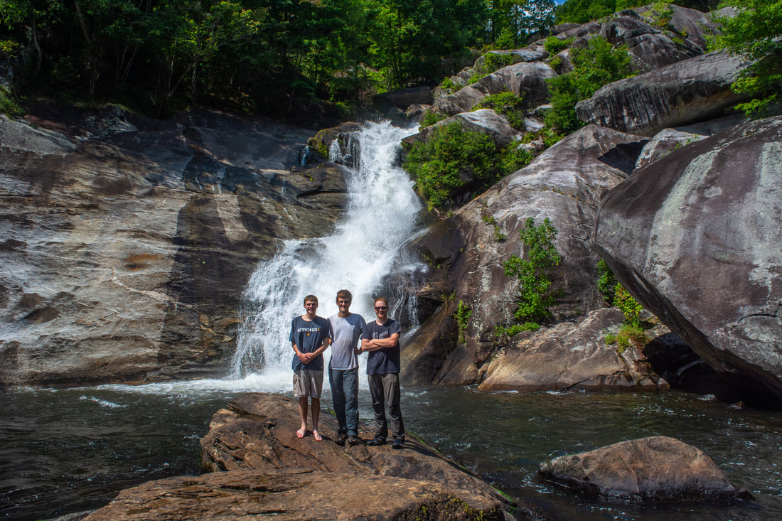
There's the touristy side of the Horsepasture River. There's the monster Rainbow Falls and its sidekicks, Stairway Falls, Turtleback Falls, and Drift Falls, all some of Gorges State Park's most popular and highly-regarded destinations. And then there's Windy Falls... the Horsepasture's truly wild side, tackled only by the most hardcore waterfallers and rock climbers. The Horsepasture's other waterfalls pale in comparison in the mighty shadow of Windy Falls, which crashes over 200 vertical feet through a conglomerate of boulders the sizes of two-story houses and slanted cliffs the sizes of small football fields. Those who reach this monster waterfall's base will be rewarded with a first-rate view of raw, breathtaking power, dwarfed by the even more majestic rocky surroundings. Yet reaching the base is an adventure not to be taken lightly, involving two rock scrambles with ropes and a squeeze through a keyhole perfect for getting stuck if you're larger than the average person. Gorges State Park neither sanctions nor recommends the trip to Windy Falls, and neither do I. Only people with substantial experience in cross-country rock scrambling with ropes must attempt to reach the base; those who don't could get injured or even fall to their deaths. Proceed at your own risk. This hike occurred on Saturday, September 8th, 2018. My plan was to hike out and back to the base of Windy Falls using a steep, unofficial trail from Chestnut Mountain Road concluding in a series of technical and potentially dangerous rock scrambles.
Summary
R/T Length of Trail: 3.6 Miles
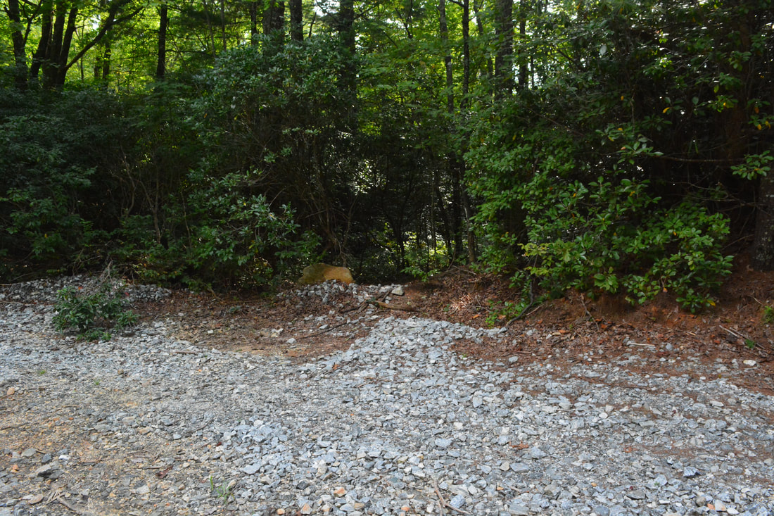
Duration of Hike: 6:30, but the majority of this was scrambling, route-finding, rope-rigging, and photography around Windy Falls Type of Hike: Out and Back Total Elevation Gain: 1320 Feet Pros: Extraordinary waterfalls Cons: Very technical, dangerous climb to the base; not sanctioned by Gorges State Park Points of Interest: Windy Falls - 10+ stars Trail Blaze Colors: None, not an official trail Best Seasons to Hike: Summer; Fall Fees: None Beginning Point: Grassy Ridge Parking Area (Rainbow Falls Trailhead) Directions from Rosman, NC: From the intersection of US 64 and US 178 near Rosman, follow US 64 West for 9.8 miles. Then, turn left onto NC 281. Continue another 0.9 miles to Gorges State Park's main entrance on the left. Enter the park through this entrance and follow Grassy Ridge road straight for 1.7 miles to the parking area. Map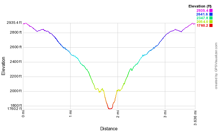
Click the link below to download a .GPX file with a track of this hike.
Details
Prior to this trip, I had only been to Gorges State Park once, visiting the popular upper waterfalls of the Horsepasture River in over a foot of snow in January 2016. Yet the reality is that Gorges is home to nearly two dozen waterfalls - most of which are well off the beaten path. Perhaps the mightiest and toughest of all is Windy Falls, a monster waterfall in whose shadow the popular Rainbow Falls pales in comparison. My sincere thanks go out to Windy Falls veteran Jack Buchanan for telling me precise instructions on tackling the base of Windy Falls. Without Jack's help, I simply wouldn't be writing this report for y'all today. Before commencing the hike description for Windy Falls, I must reiterate however that this waterfall is not to be attempted under any circumstances by all but the most seasoned explorers capable of difficult rock scrambling.
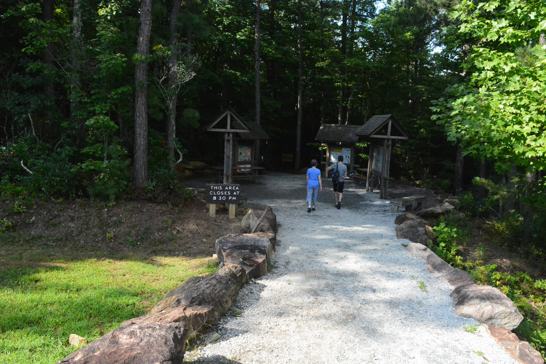
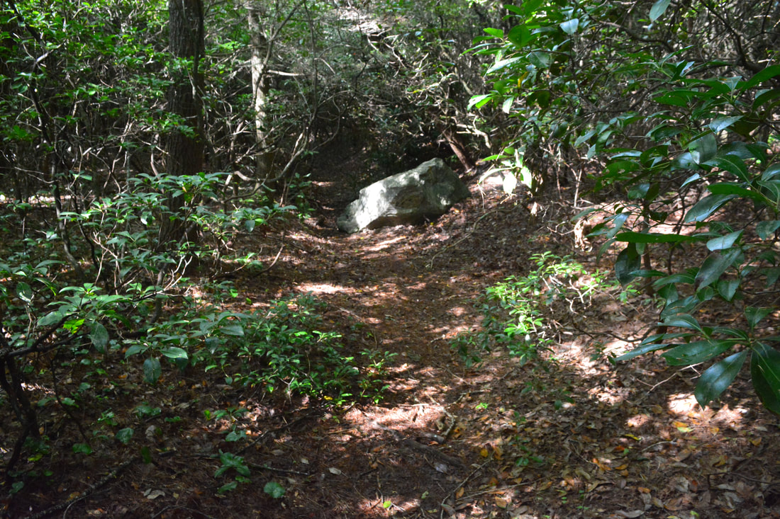
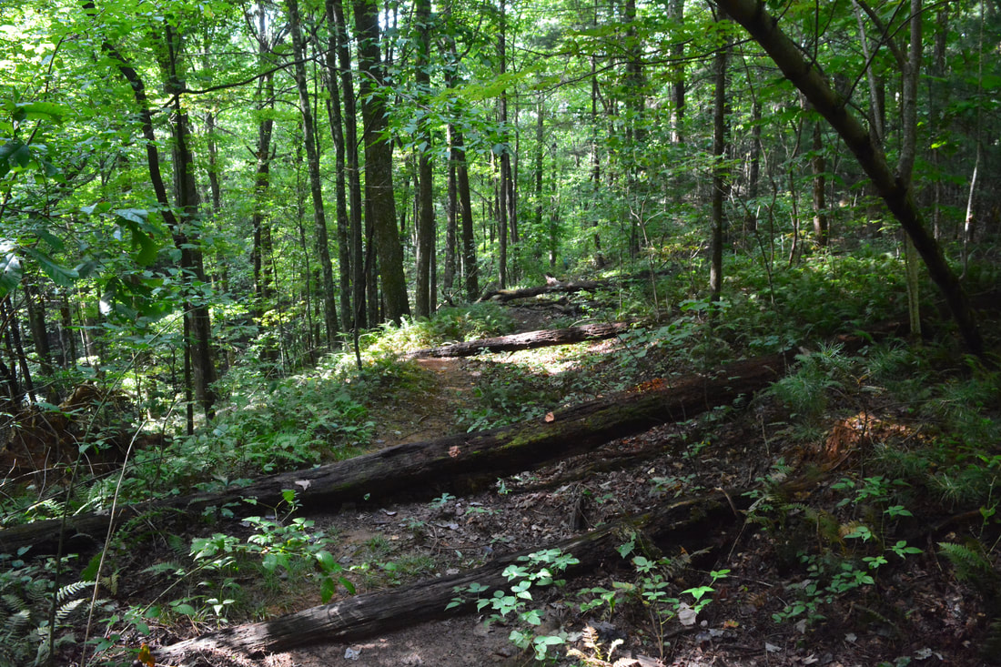
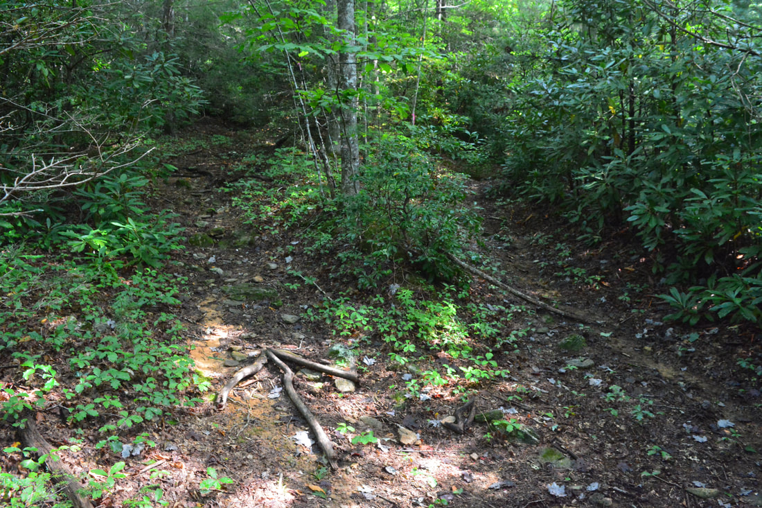
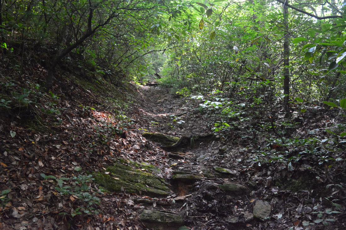
Ironically, the Windy Falls hike begins along the popular Rainbow Falls Trail at the Grassy Ridge parking area. Follow the trail past the kiosks on a gentle downhill for 0.3 miles to a T-junction. Here, the Rainbow Falls Trail turns right - a turn the vast majority of folks make. But you, seasoned explorer, belong to the minority who are headed to Windy Falls, and thus, must turn left onto the Raymond Fisher Trail. This little-used trail leads a half-mile to a set of campsites by Raymond Fisher Pond. In 0.2 miles (a half-mile from the hike start), however, the trail crosses a dirt road called Chestnut Mountain Road. To access Windy Falls, turn right onto the road and follow it one-tenth of a mile downhill to a broad spot with a gravel pile. At the start of a gravel pile, at 0.6 miles, look for the beginning of an obscure path on the right, the unofficial Windy Falls Trail. The trail dives into a rhododendron tunnel - a few dozen feet ahead is a sizable boulder smack middle in the path that confirms you're on the right track. The Windy Falls Trail begins an 800-foot descent to the Horsepasture River. The descent is generally easy to moderate, but quite steep toward its end. At 0.8 miles, merge with another trail approaching acutely from the left. This fork could be a bit disorienting on the return trip - remember to stay left when you come back. At the time of my hike, an arrow of branches on the ground indicated the right way. A few feet farther, the trail passes through a gap with an access to Sidepocket Falls, a small waterfall on the Horsepasture River roughly halfway between Windy Falls and Stairway Falls. Although there is supposedly a phantom path to Sidepocket Falls, I did not see any signs of one. Meanwhile, the descent on the main trail steadily steepens, becoming quite precipitous and eroded as the roar of the Horsepasture nears. Finally, at 1.5 miles, the trail dumps into a flat campsite alongside the river. Straight ahead is a 15-foot cascade informally referred to as Campsite Falls. The coordinates for this spot are N35.07571° W82.95919°. A path on the right follows bluffs near the river for a bit before dead-ending at a nice swimming hole. The main trail turns left; Windy Falls is downstream, right around the corner. 
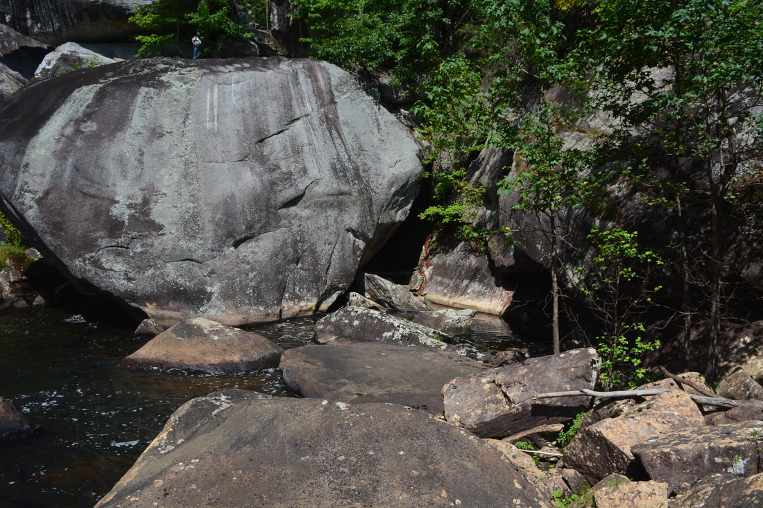
A boulder the size of a two-story house known as The Balcony provides a commanding view of Windy Falls and the Horsepasture River gorge.
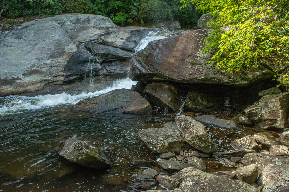
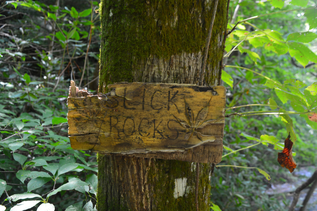
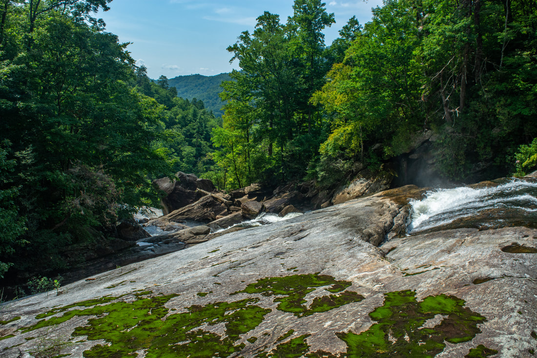
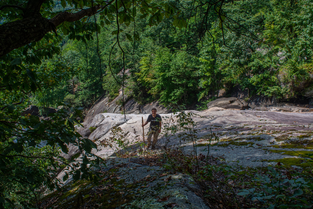
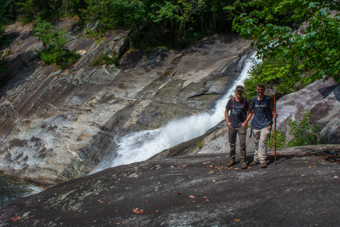
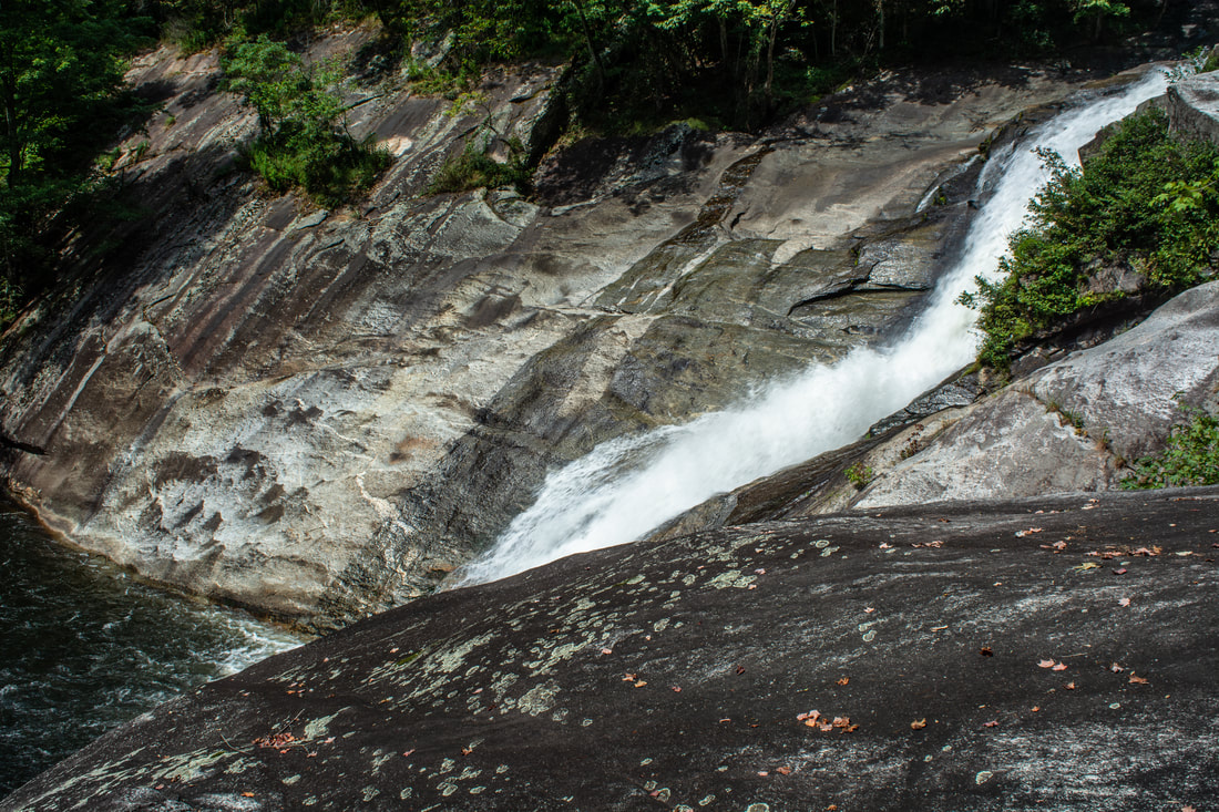
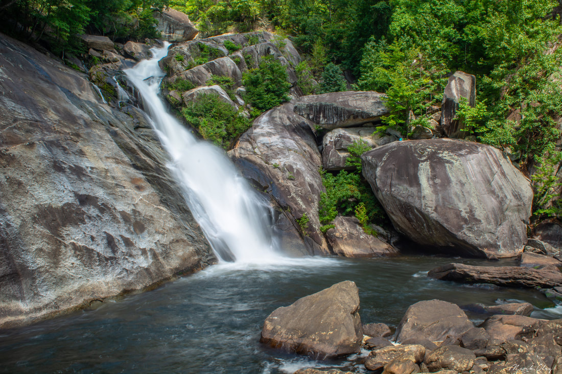
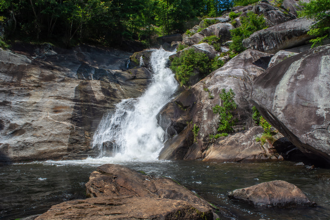
200 feet below the campsite flat, reach a junction. This is important - the main trail to Windy Falls turns left, uphill! You may continue 100 feet on the path straight ahead, which shortly dead-ends on a broad rock slab at the very top of the collective run of drops that comprise Windy Falls. A small wooden sign reads "Slick Rock". Don't even think of scrambling downriver, as this is extremely dangerous terrain and is absolutely not the way to go. Instead, take the uphill path. In about 70 feet, the path reaches the base of a forested cliff. Turn right and follow the bluff line. The path is rugged and slim, but since you're headed to Windy Falls, this should be a piece of cake for you. The trail soon passes a slanted boulder hiding a yellow jacket nest at the time of my visit, and then begins dropping steeply. Despite being surrounded by immensely rugged cliffs, the path remains quite easy to follow. About 0.1 mile from the last junction, at 1.75 miles, the trail pops out onto a vast, sloping rock face alongside the crashing upper section of Windy Falls, coordinates N35.07445° W82.95819°. This section of Windy Falls is also known as Bear Rock Falls, honoring the humongous boulder on the far side of the waterfall. While I stopped to admire the scene, I spotted a squirrel that had just scrambled up to the top of the "Bear Rock". It appeared like a tiny speck in relation to the boulder's size! This slanted rock face by Bear Rock Falls is very enticing to explore, since it keeps sloping down to the top of Windy Falls proper. Do not under any circumstances try to scramble down this life-threatening rock. It is steeper than it looks, and you won't realize you're in peril until it's too late and there's no way back. Please bear in mind that this is the last point to turn around before the hazardous, technical rock scrambles to the base of Windy Falls. You will have already seen breathtaking views of impressive cataracts up to this point - you must not proceed any further without the necessary experience!
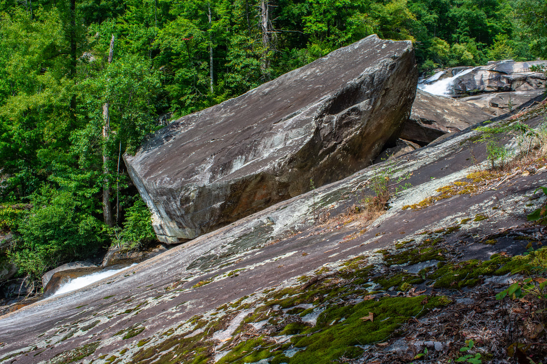
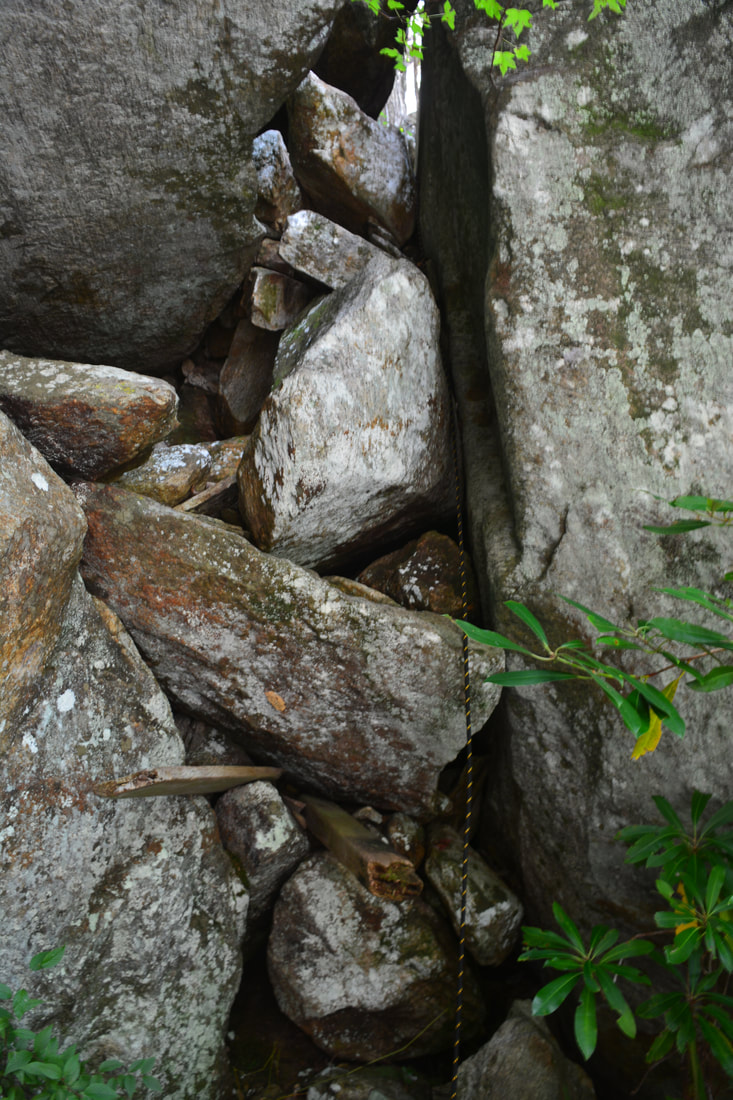
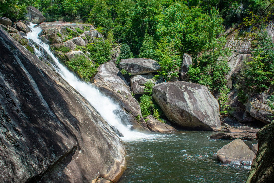
Once you have gathered up your experience, ropes, and guts, look for a narrow but well-worn path dropping into a steep cleft to the left of the slanted rock face, by its start. This is the path to the base of Windy Falls. It soon makes a short, vertical drop to get beneath the rock face, and then turns left. Next comes an eroded switchback with another tricky vertical drop. Then, 100 feet past the Bear Rock Falls view, you will arrive at the precipice of a spot known as the "Thin Ledge". This is the first of two rock climbs on this adventure that I strongly recommend ropes for. The Thin Ledge is a double-tier sheer rock about 30 feet high, and our path drops straight down the ledge. The first couple feet are along a ledge hardly a foot wide, hence the nickname "Thin Ledge". The lower ledge is also perpetually slick due to running water from a seep, so use of a rope becomes even more important here. And, before you ask, nope - there is no way to get around this spot. This is the only reasonable pass through the towering cliffs that guard Windy Falls. Past the base of the Thin Ledge, the trail bears right and drops through a rock garden. In 100 feet, the path reaches a group of enormous boulders. Straight ahead is a large, flat, and most importantly, relatively safe rock outcrop known as The Balcony, coordinates N35.07382° W82.95827°. The Balcony features a stunning view that is one of the hike's biggest highlights apart from the waterfall itself. The Balcony is actually the top of a two-story-house-sized boulder, providing a sweeping panoramic view of Windy Falls on the right, the base pool right below, the brink of Terrifying Falls straight ahead, and a majestic, jagged peak on Narrow Rock Ridge in the distance. In between is the remarkably lush green Horsepasture River gorge. Now, the million-dollar question is: how do you get to the pool right in front of you? It's so close that you can nearly reach it in an arm's throw - yet inhospitable cliffs encircle this natural amphitheater. There is only one way to reach the base without rappelling. Known as the Keyhole scramble, it is definitely the most difficult and technical part of the scramble. 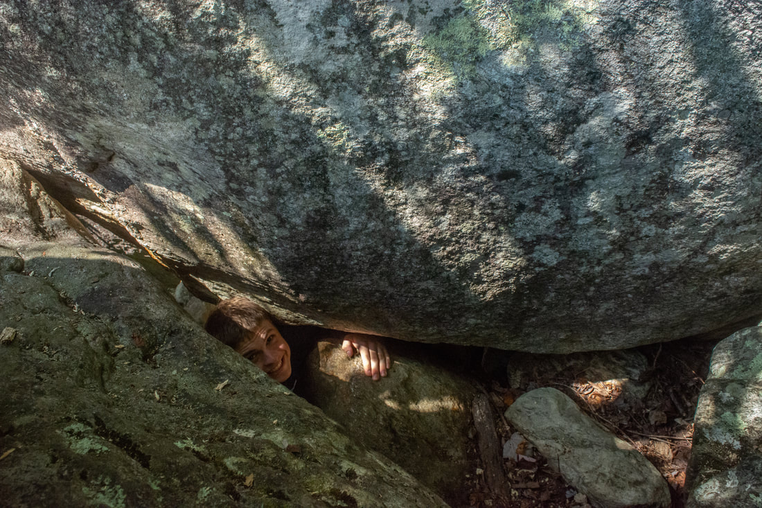
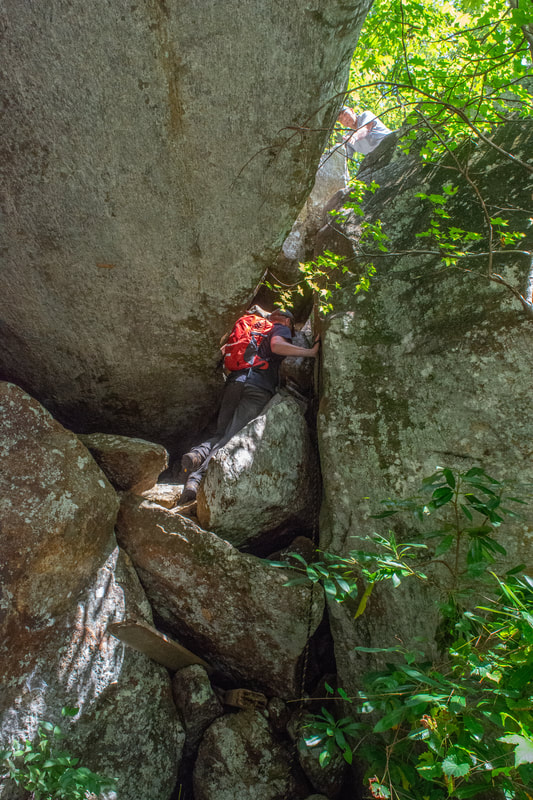
One of my partners for this hike, Brett, wriggles out of the keyhole on our way out of the gorge.
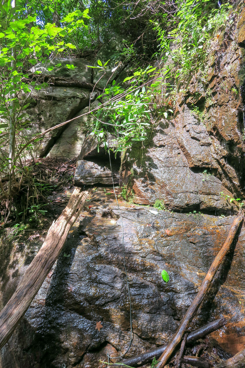
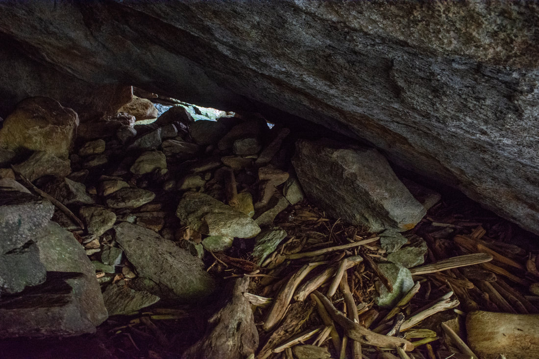
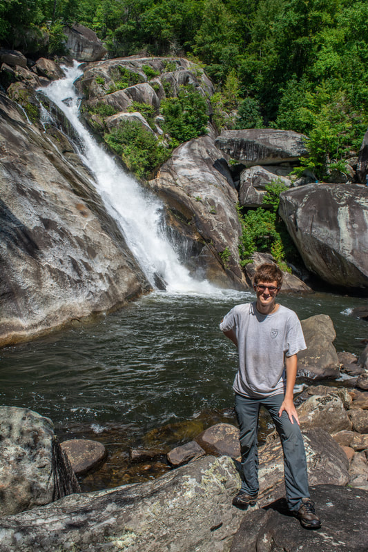
.The Keyhole is a tiny cave-like opening between two boulders. It is located at the entrance to the Balcony, on its right-hand side. The opening appears just large enough for the average person to fit through. In reality, getting stuck here is a possibility not to be dismissed. Do not venture into the keyhole alone; if you get stuck, help won't come for a long time. Fortunately, the passage is quite short - only a few feet long. But wait, there's more! On the other side of the keyhole, the only route is down a vertical, boulder-filled cleft. If you've gotten this far, you shouldn't have any trouble, but I strongly recommend a rope. You will need to rig 50 to 75 feet of rope above the keyhole and pass it through. Most of the descent through the cleft has decent handholds, but at the end is a sheer 12-foot drop. People have wedged a couple wooden boards into the rocks to help with the final drop, but who knows how long they will be there. Once you reach the end of the cleft, you're almost at the waterfall's base - walk down the gently sloping rock to the edge of the turbulent pool of Windy Falls. From a first glance, you might think jumping into the pool is the only route, but that's false. Instead, look for a cave to the left, directly underneath the Balcony boulder. The route to Windy Falls passes through this interesting cave, full of wood debris and rocks. I have no doubt that when the Horsepasture floods, this cave is swept clean! The passage is about 75 feet long. You're almost there! On the other side, wade knee-deep through a corner of the pool (this is easy), and finally, scramble atop the rocks directly in front of Windy Falls. You've traveled 1.8 miles. The coordinates for the base of Windy Falls are N35.07355° W82.95828°.
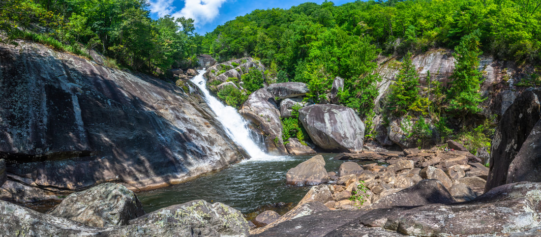
What an indescribable sight of water's wicked power this is! Only the lower section of Windy Falls is visible here, but it is still close to 100 feet high, crashing with mighty force. During normal to above average flow, all of these rocks in front of the falls will be soaked by spray. Surrounding the waterfall are rows of incredible cliffs - it is a wonder that it is possible to get through these cliffs without full-fledged rock climbing. The amazing rock amphitheater around Windy Falls makes the waterfall twice more awesome. I will firmly state that I have not seen this kind of combination of waterfall power and majestic rocks at any other location in North Carolina. If the water level at its normal late summer levels, you may try to cross to the river's far side for even better views of the falls. The crossing is waist-deep and the current is swift, but anyone who has made it this far down will handle the crossing easily. A conglomerate of boulders on the far side provides stunning views of the rock amphitheater in which Windy Falls sits. To me, it is nothing short of amazing that such a place exists in the well-forested Southern Appalachians. Just downstream from the base of Windy Falls is the brink of Terrifying Falls, a nice cascading waterfall. About 0.2 miles downstream is an impressive 40-foot waterfall known as Rooster Tail Falls at the coordinates N35.07064° W82.95852°. To get there, you would need to scramble down the west side (River Right) of the Horsepasture River. It is supposed to be pretty tough rock scrambling and wading the whole way, but I think that anyone who has managed to reach the base of Windy Falls will have no problem further down. I did not have time to go all the way down there, but I plan to return, so stay tuned! Those who have four-wheel drive may access Rooster Tail Falls (and even Windy Falls) from the Chestnut Mountain Road bridge a mile further downstream. However, it will be a pretty tough, long river-walk the whole way. 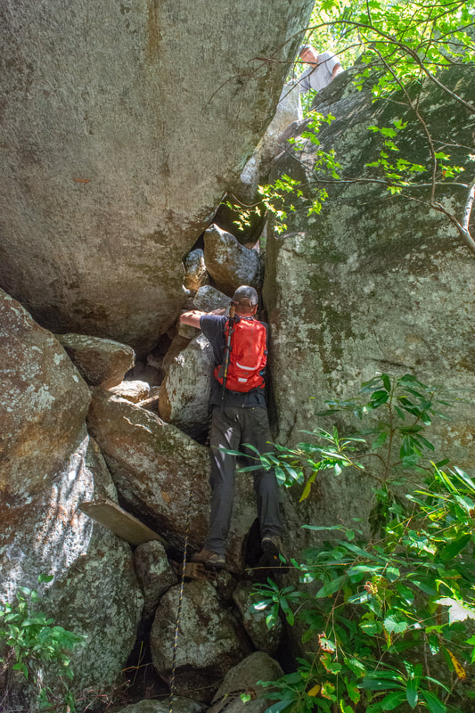
One of my hiking partners, Dan, climbs back out of the Windy Falls base area and to the keyhole.
Once you've finished soaking in the powerful beauty of Windy Falls, and perhaps taken a swim if the water isn't too high, simply retrace your steps the same way to the parking area. I found all of the rock scrambles harder on the way back, especially the twist through the keyhole. I'll repeat it again, it's pretty easy to get stuck here! Once you're back on official trails, you have the option of adding on the Horsepasture tourist waterfalls to this hike: Stairway Falls, Rainbow Falls, Turtleback Falls, and Drift Falls, 4.8 miles roundtrip, if you've never seen them before. Otherwise, you'll conclude the hike at 3.6 miles.
Variations
Hike to Rainbow Falls the same day as Windy Falls - 8.4 Miles
Pictures & Videos
Please see Dan Weemhoff's exceptionally detailed photo album for more photos and documentation of our hike!
1 Comment
Zhili Alex Zhan
5/31/2020 06:04:28 pm
Hi, Mark, Leave a Reply. |
About MeMark Oleg Ozboyd Dear readers: I have invested a tremendous amount of time and effort in this website and the Georgia Waterfalls Database the past five years. All of the work that has gone in keeping these websites updated with my latest trip reports has almost been like a full-time job. This has not allowed me to pick up a paid job to save up money for college, and therefore, I I've had to take out loans. If you find the information on this website interesting, helpful, or time-saving, you can say "thanks" and help me out by clicking the button above and making a contribution. I will be very grateful for any amount of support you give, as all of it will apply toward my college tuition. Thank you!

Coming in 2022-2023?
Other Hiking WebsitesMiles HikedYear 1: 540.0 Miles
Year 2: 552.3 Miles Year 3: 518.4 Miles Year 4: 482.4 Miles Year 5: 259.9 Miles Archives
March 2021
Categories
All
|
||


 RSS Feed