HIKING THE APPALACHIANS AND BEYOND
  • Home
  • Trail Reports
    • Best Hikes
    • Hikes with Scenic Views
    • Hikes with Water Features
    • Alabama
    • Georgia
    • Florida
    • North Carolina
    • South Carolina
    • Tennessee
    • Vermont
    • Virginia
  • Map
  • Hike List
  • Testimonials
  • Resources
  • Contact Us
  • Southeast Nature Society
    • Our Team
  • Georgia Waterfalls Database

Gorges State Park: Rainbow Falls Trail, Rosman, North Carolina

3/28/2016

1 Comment

 
Picture
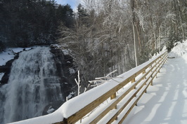
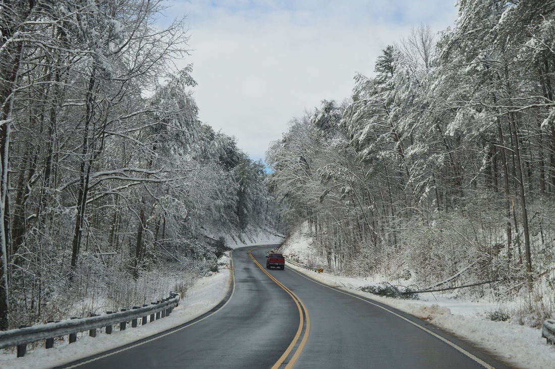
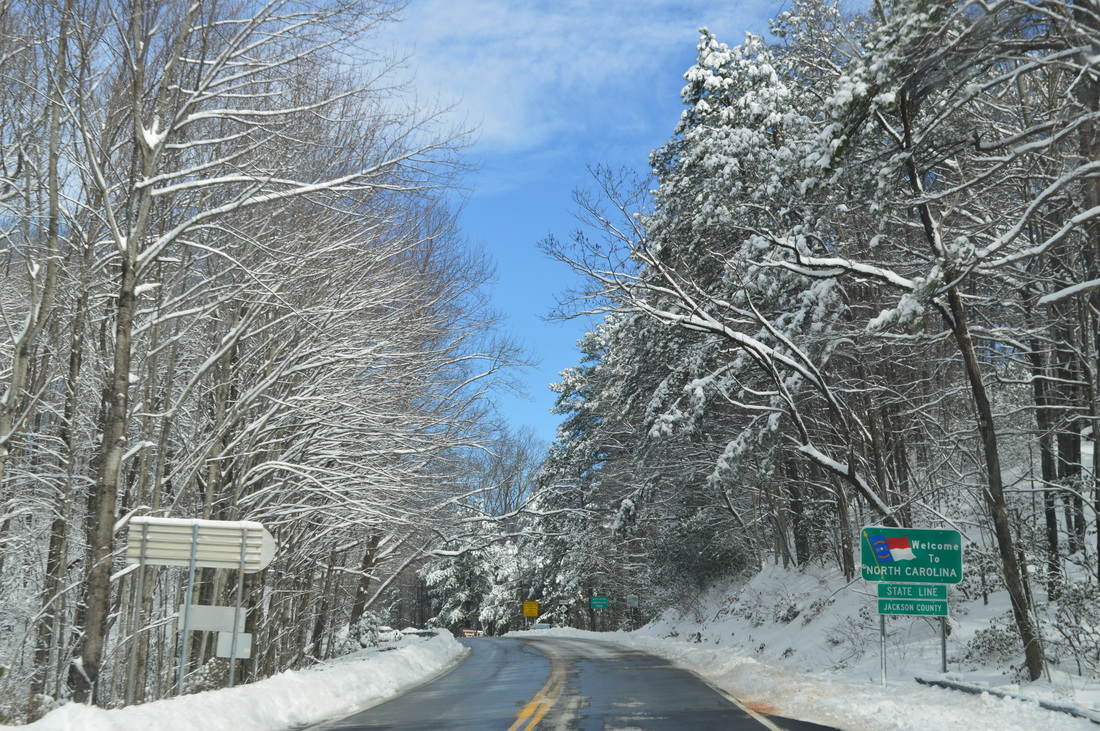
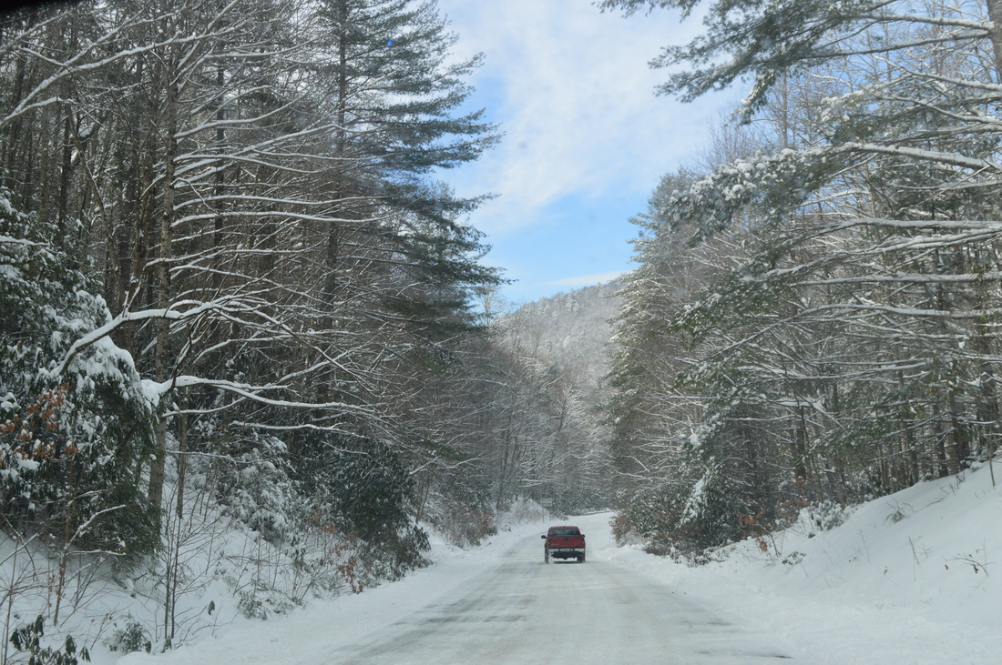
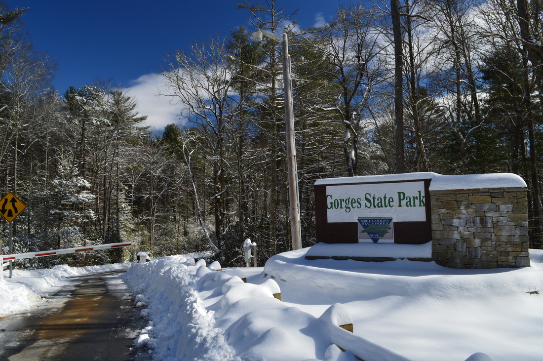
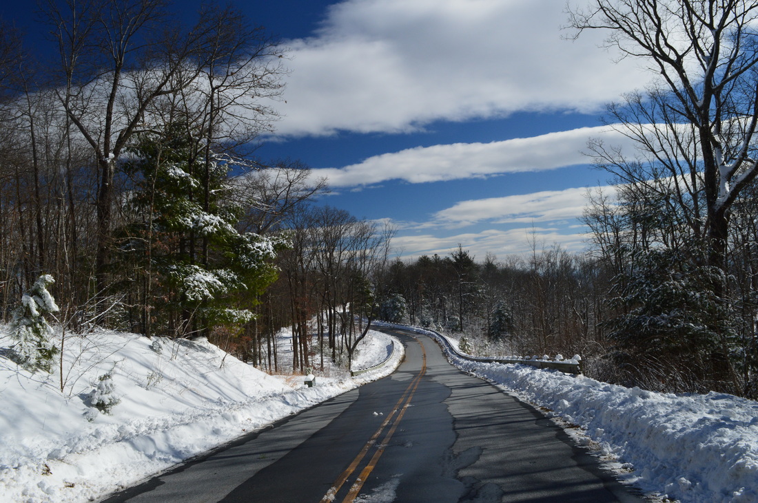
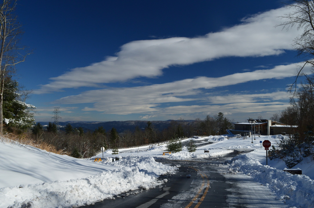
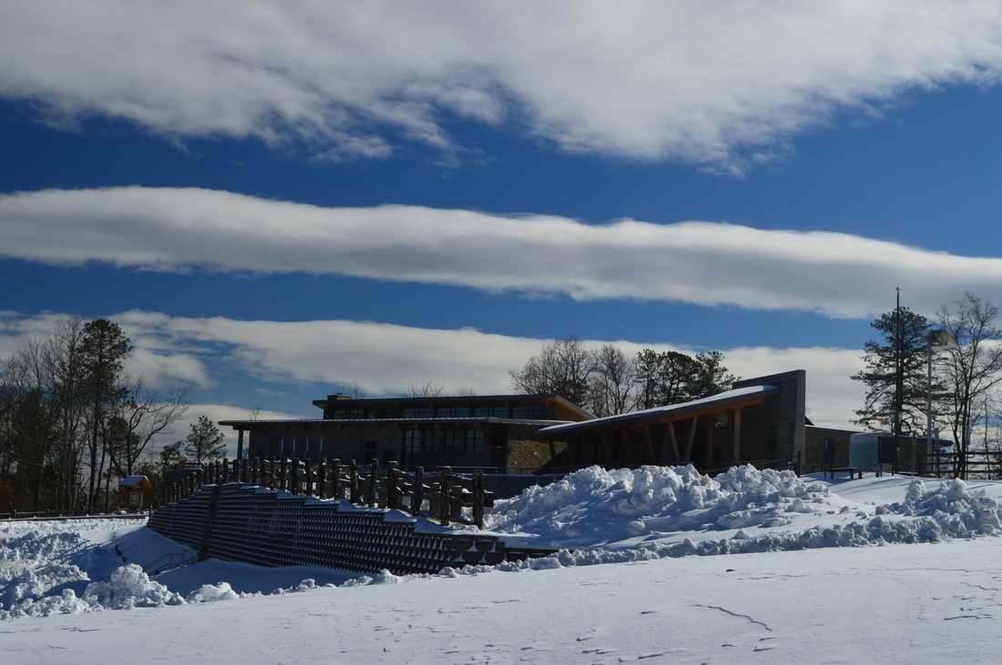
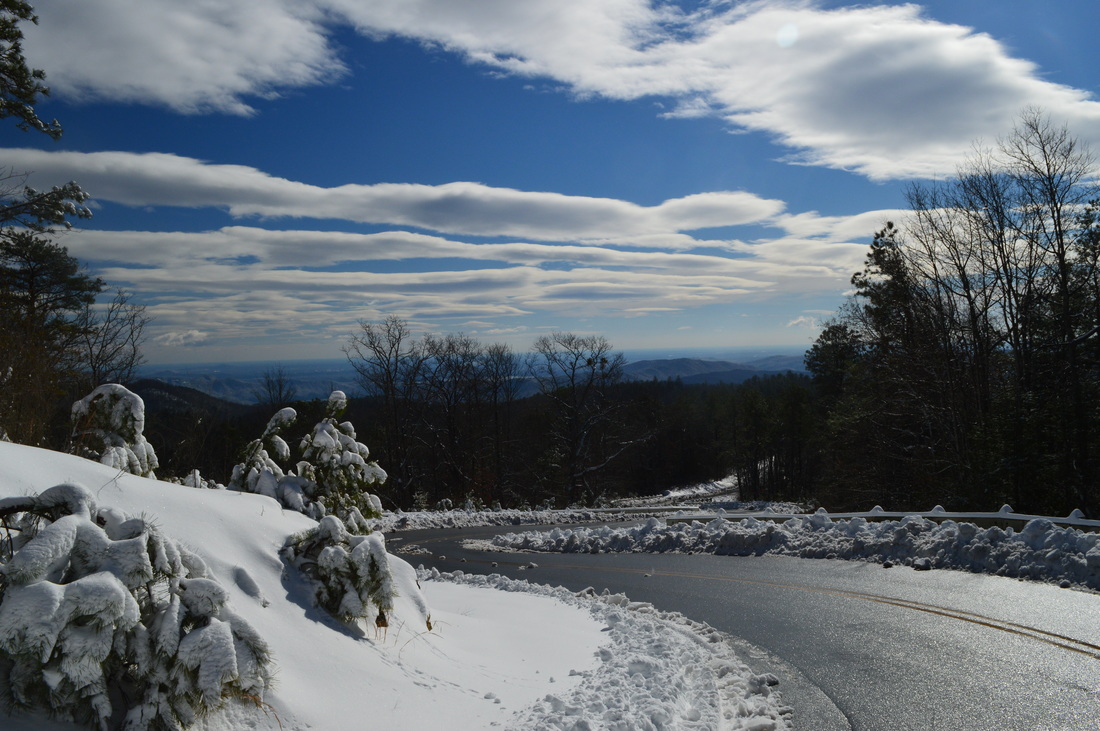
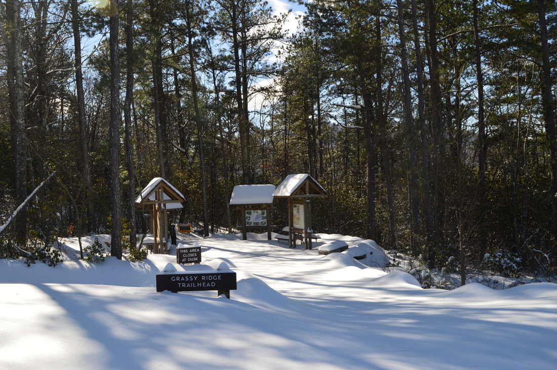
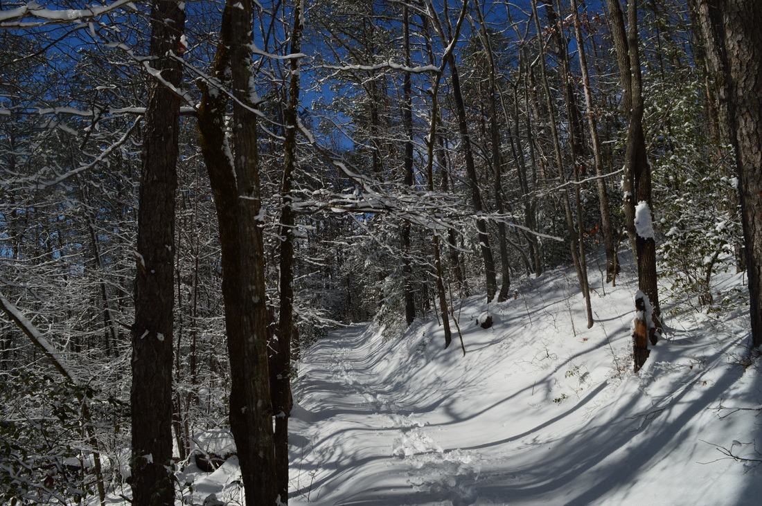
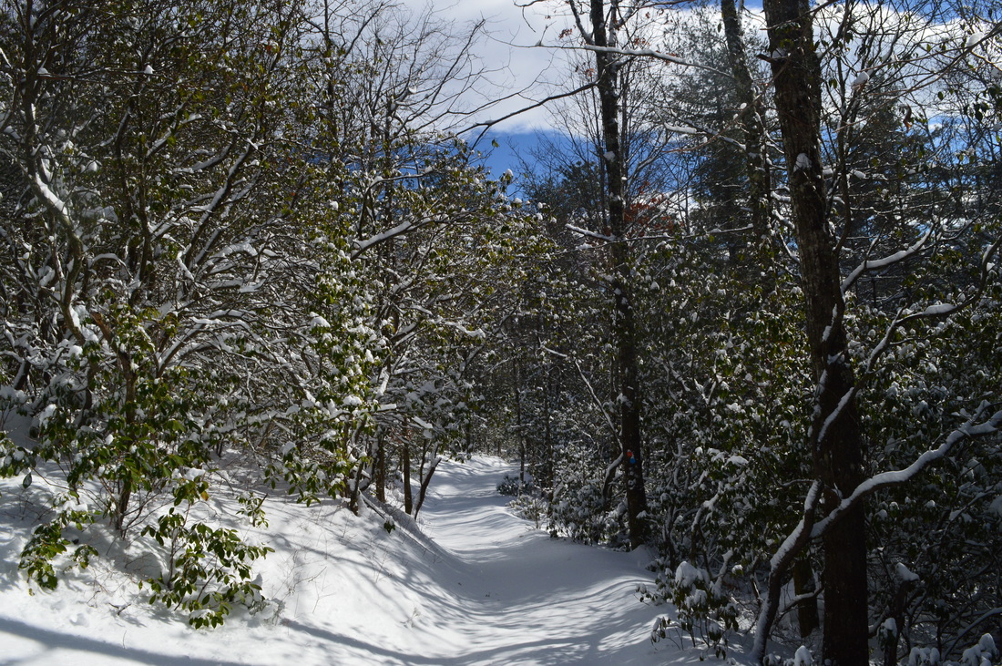
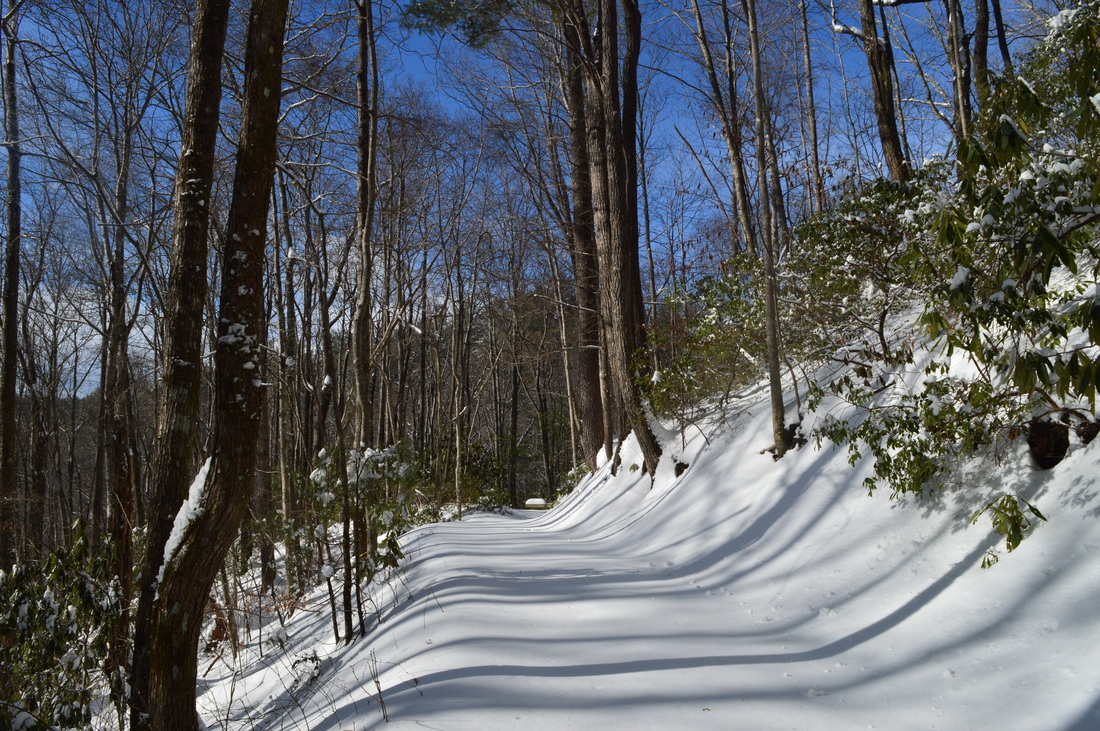
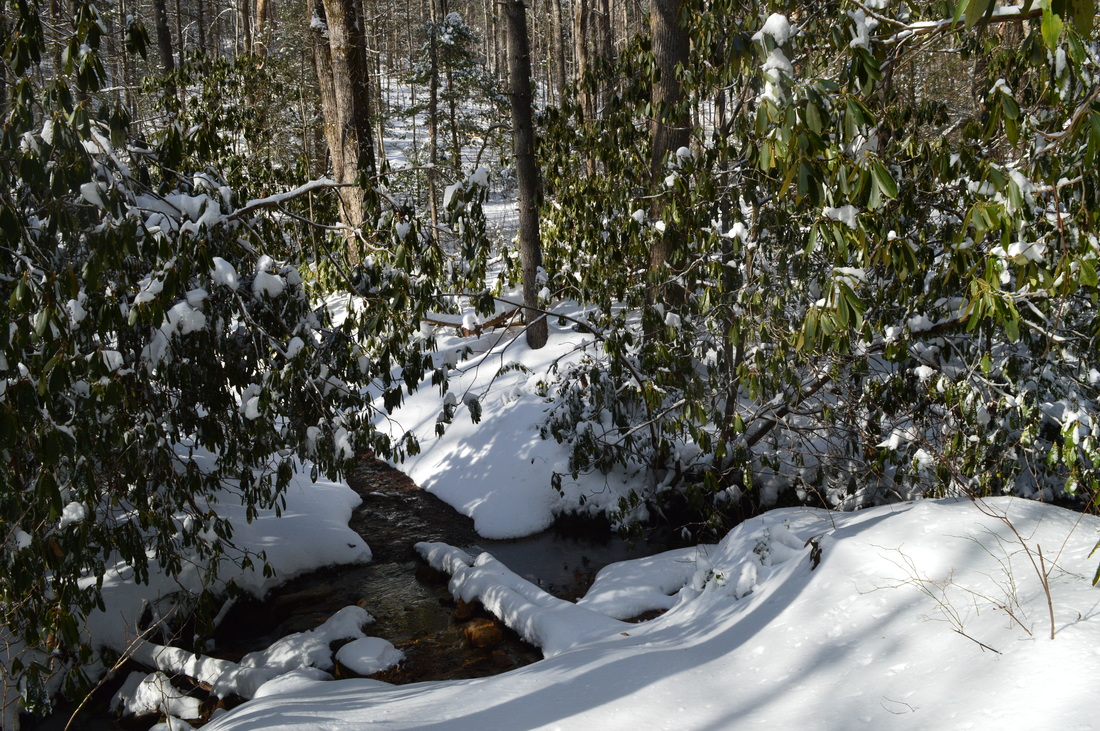
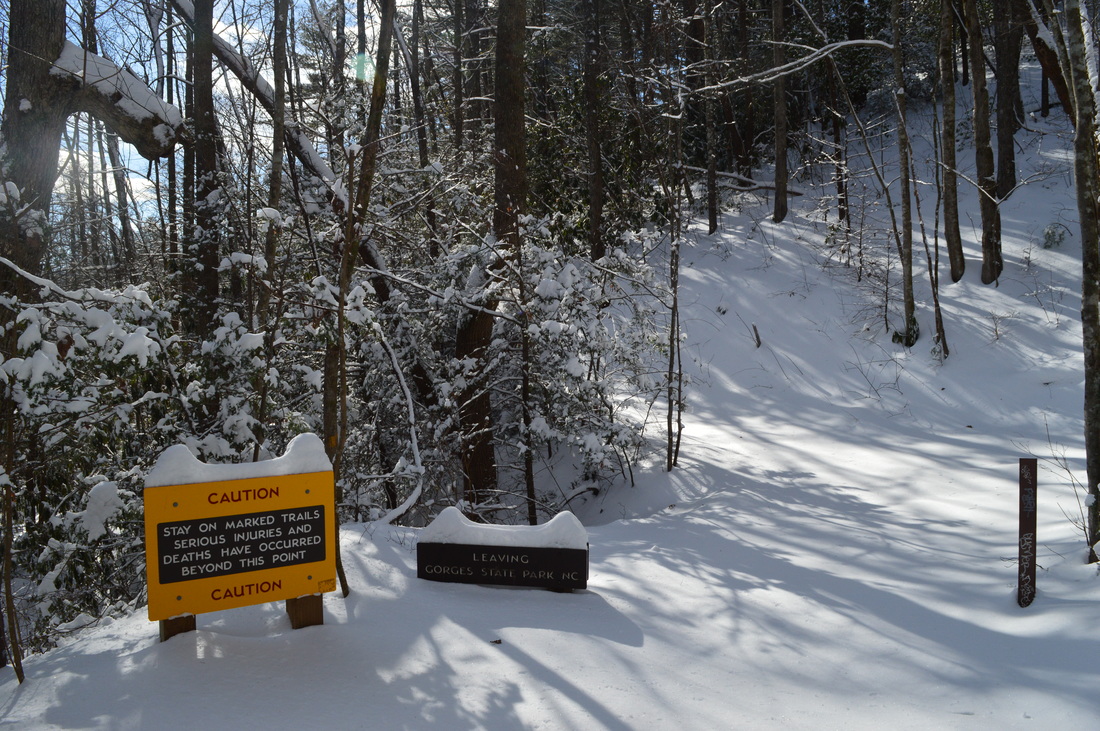
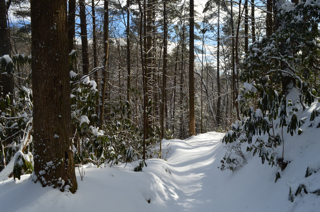
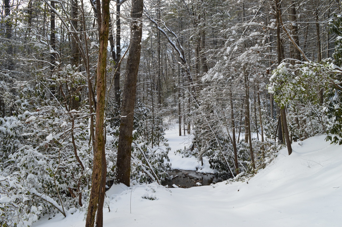
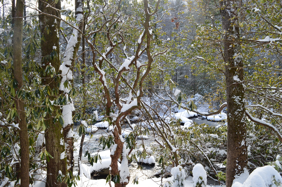
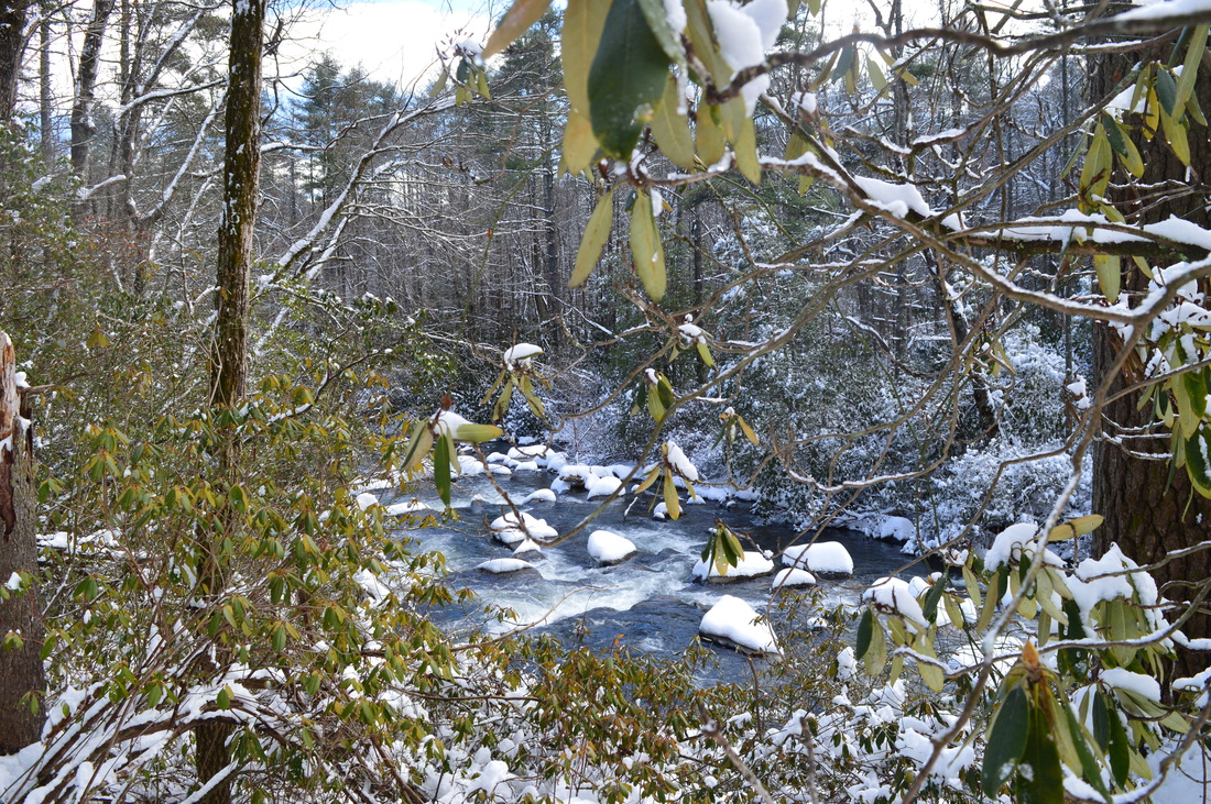
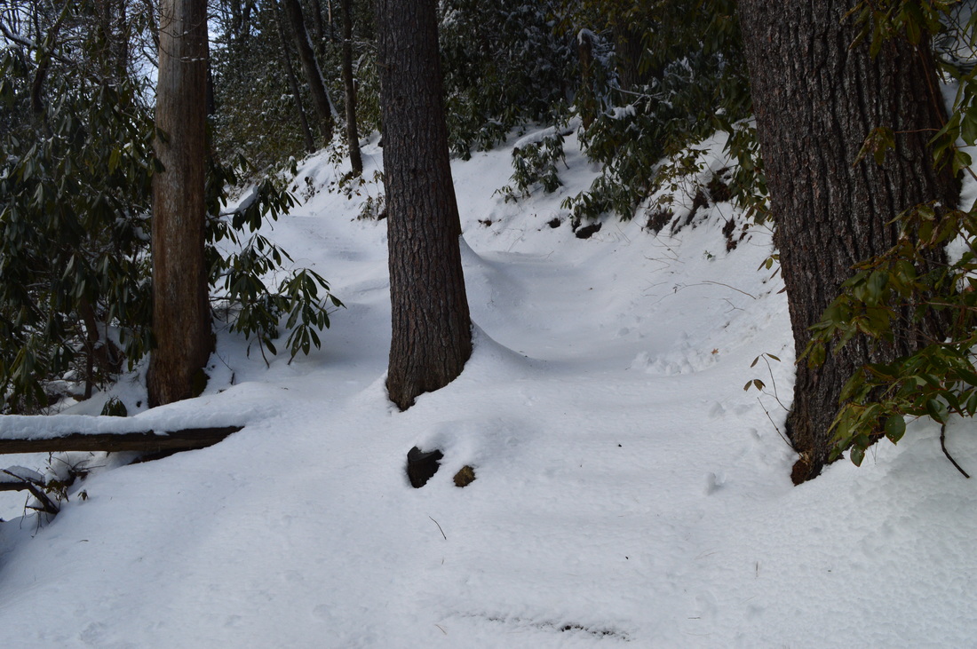
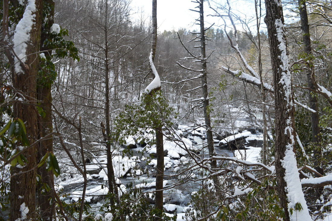
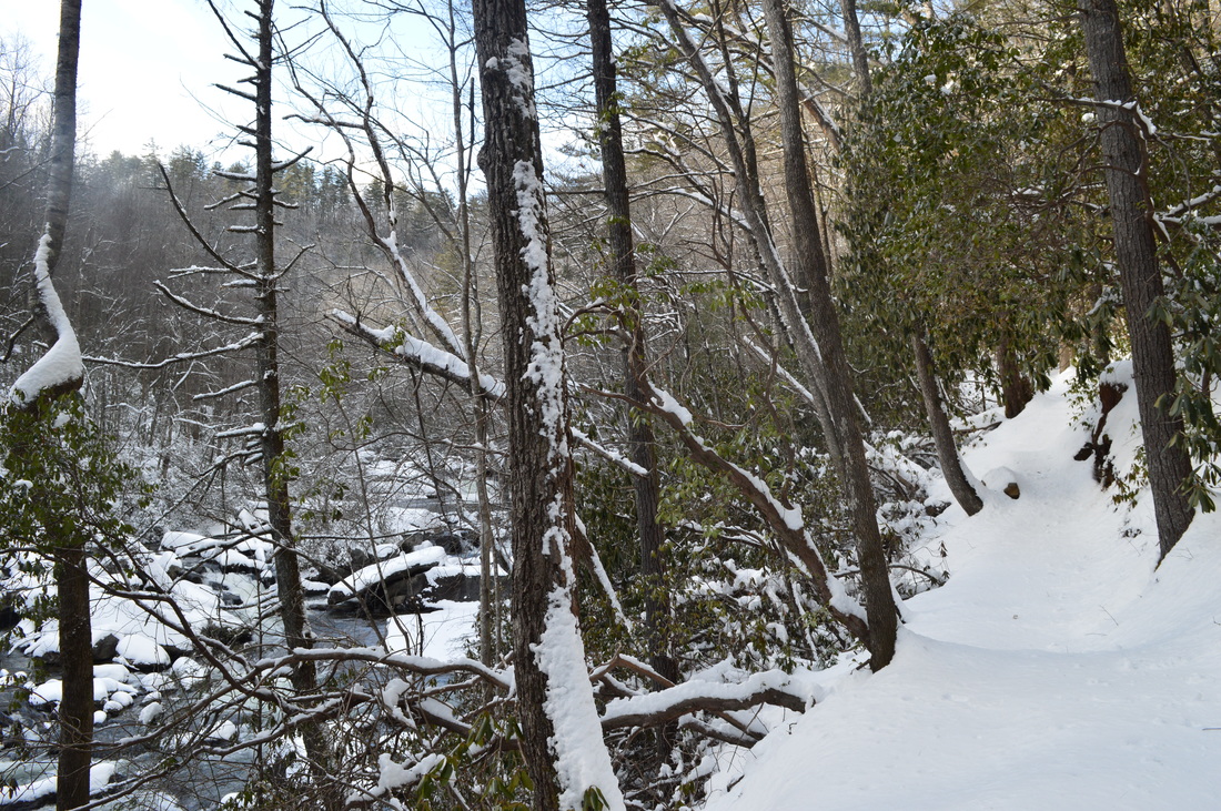
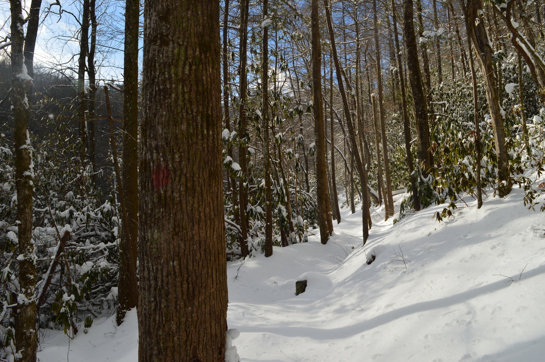
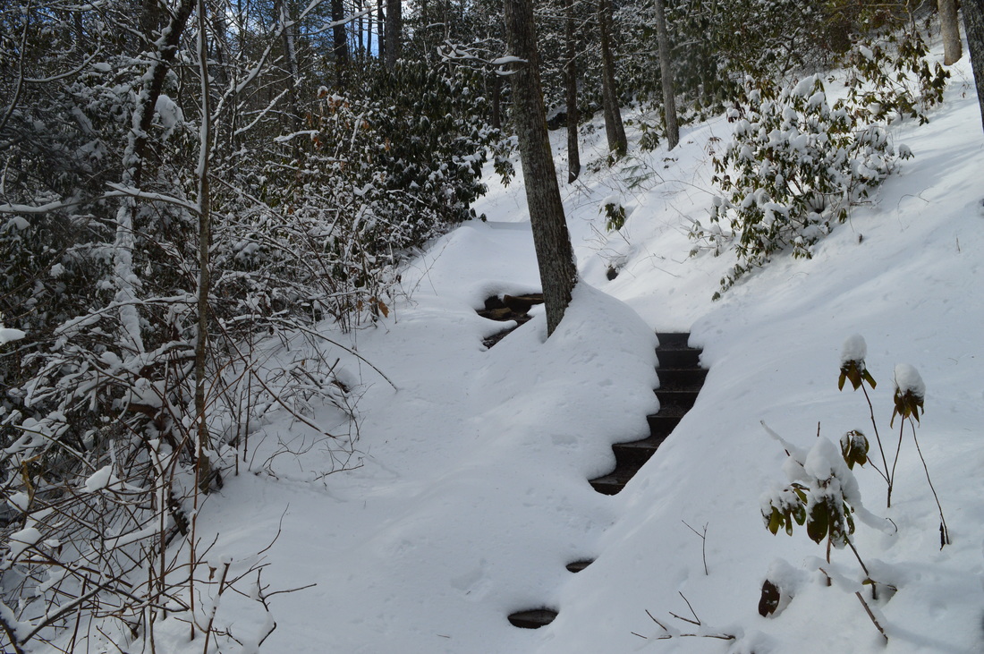
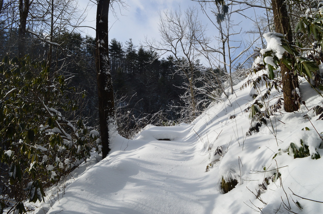
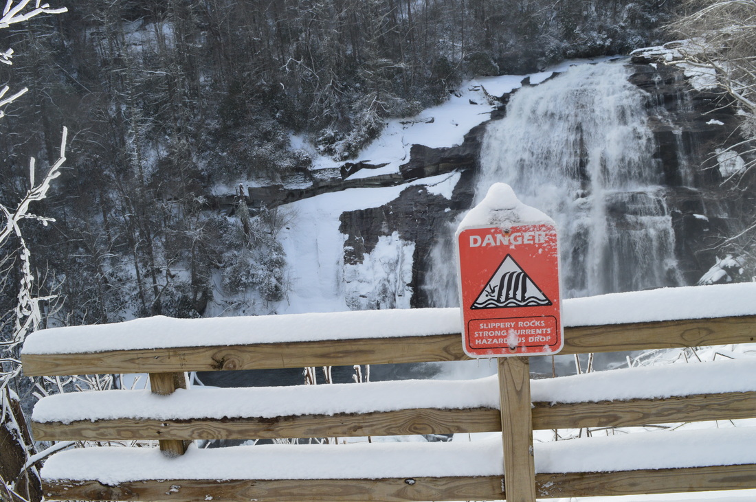
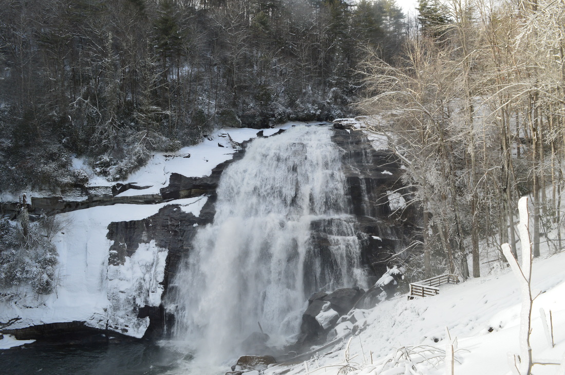
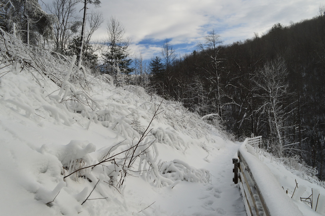
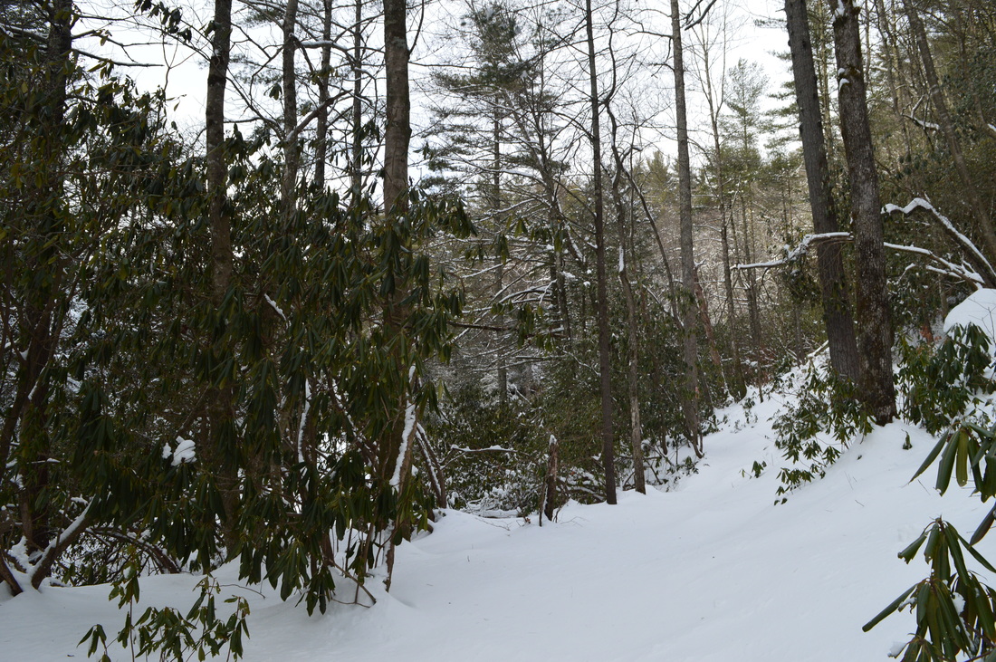
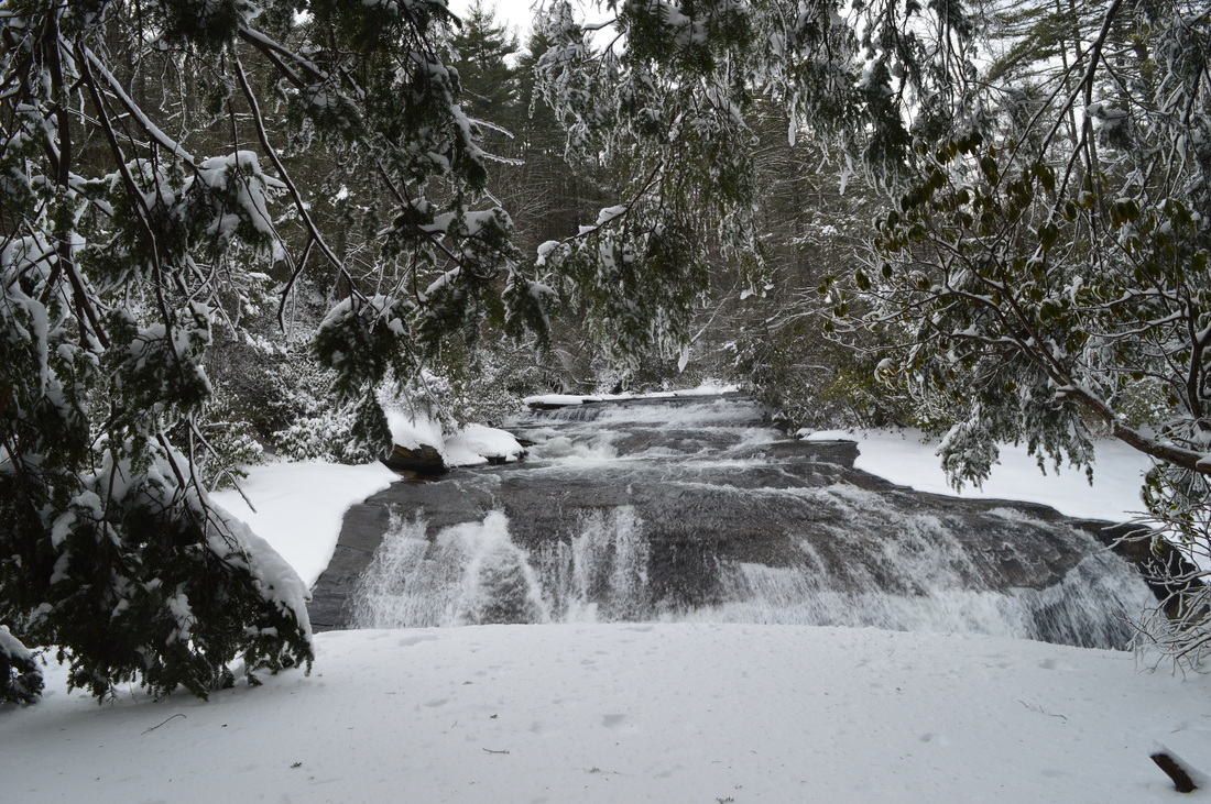
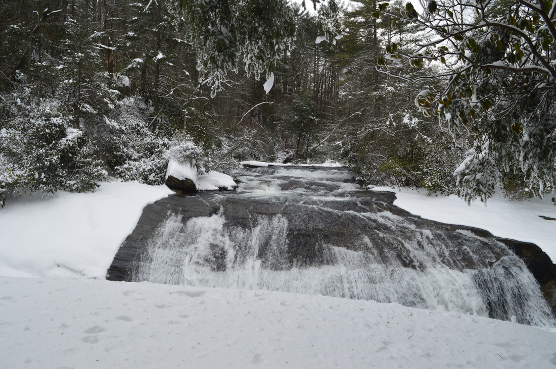
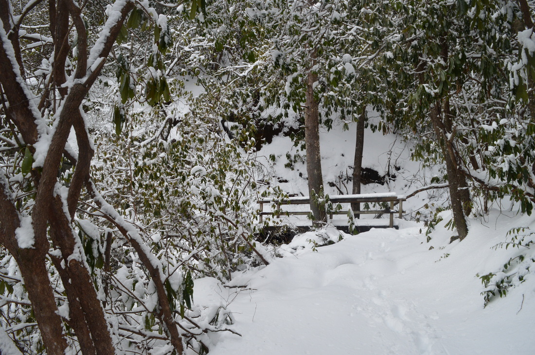
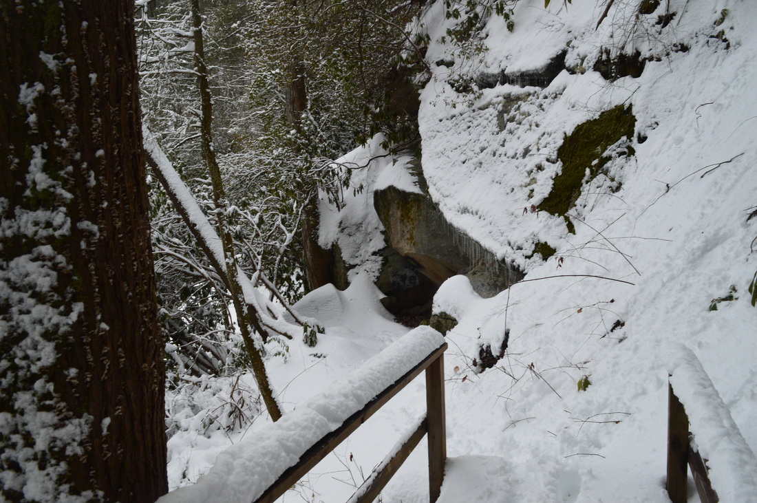
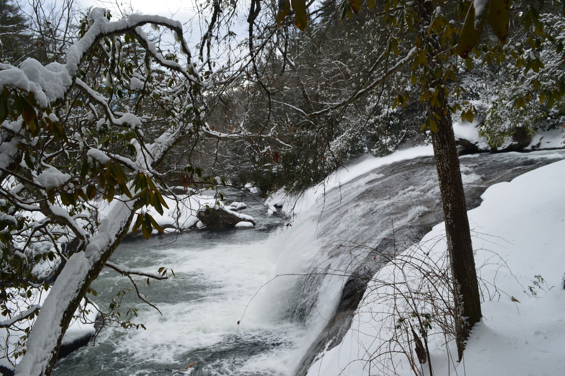
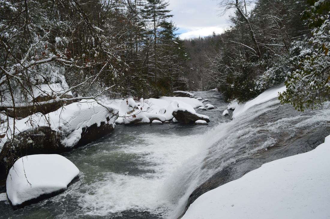
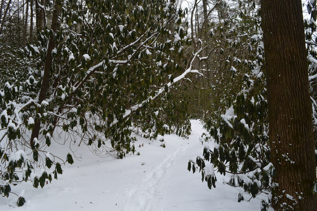
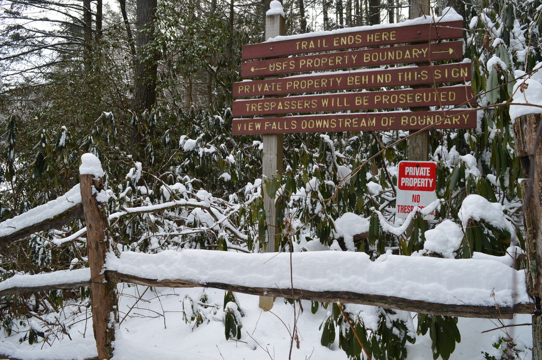
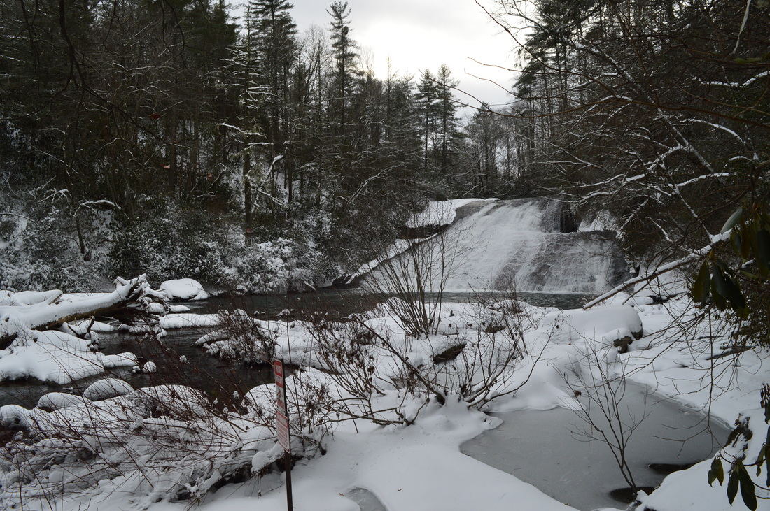
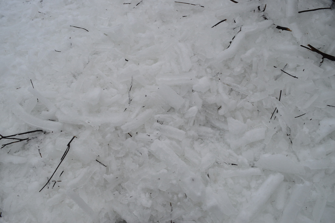
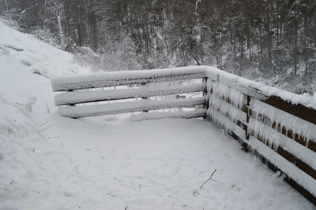
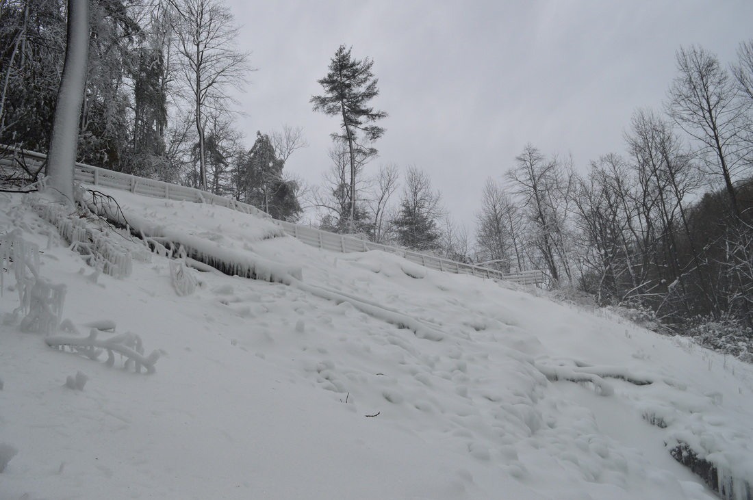
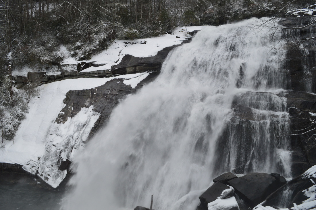
Gorges State Park is North Carolina's newest and westernmost state park, located in the area where Georgia, South Carolina, and North Carolina meet. The crown jewel of this still-developing park is the Rainbow Falls Trail, a normally easy hike that leads you to four spectacular waterfalls in the Horsepasture River gorge. On a day with 14-18 inches of fresh snow on the ground, however, the hike may not be so easy. This hike occurred on Saturday, January 23rd, 2016. My plan was to hike the Rainbow Falls Trail in the park out and back, visiting Stairstep Falls, Rainbow Falls, Turtleback Falls, and Drift Falls. I also planned to visit Raymond Fisher Pond and perhaps try some of the other short trails in the park. However, my plans were altered due to a heavy snowstorm that hit the region on the day before. All of western North Carolina got upwards of a half-foot of snow, with some areas (such as Gorges State Park) receiving as much as 18 inches. This caused Gorges State Park to be closed, and when I did this hike, I hiked the entrance road which added several miles more to my hike. Additionally, I was the first person to hike the Rainbow Falls Trail after snow, and with there being no previous footprints, it was a very slow and difficult hike. Thus, I was only able to hike the Rainbow Falls Trail to Rainbow Falls, Turtleback Falls, and Drift Falls.

Summary

R/T Length of Trail: 8 Miles (4.4 Miles from Grassy Ridge Trailhead when the park is open)
Duration of Hike: 5:30 (Expect this to take a lot less in normal conditions and when the park is open)
Type of Hike: Out and Back
Difficulty Rating: 3 out of 10
Total Elevation Gain: 1890 Feet (This will be lower if you start from Grassy Ridge Trailhead) 
Pros: Beautiful river and water features in Horsepasture River Gorge; easy access to at least three waterfalls
Cons: You cannot get very close to Drift Falls, because the falls is on private property
Points of Interest: Rainbow Falls - 10+ stars; Turtleback Falls - 5 stars; Drift Falls - 8 stars; Turtleback Falls - N/A; Raymond Fisher Pond
Trail Blaze Color(s): Rainbow Falls Trail - Orange; Raymond Fisher Trail - Blue
Best Season(s) to Hike: Spring 
Fees: None
Beginning Point: Grassy Ridge Trailhead (I started at the entrance to Gorges State Park, because the park was closed due to snow.)
Directions: From Rosman, NC: Follow US Route 64 West for 10 miles. Then, turn left onto NC State Route 281, and continue for 0.9 miles. Then, turn left and enter Gorges State Park. Follow the entrance road for 1.7 miles, past the visitor center, to the Grassy Ridge Trailhead. The parking area will be on the right. 

Map

A map and some other information regarding this hike can be viewed here.

Details

Every winter, I try to do some sort of snow hike. However, most often these snow hikes feature only light to moderate snow. On this particular snow hike, following what is widely known as the "Blizzard of 2016" across the eastern US, I happened to encounter the deepest snow I've ever seen on a hike. I estimated that there was at least 14" of snow on the ground around Grassy Ridge, with some areas probably approaching 18" deep. In the gorge, snow totals were slightly lower, but a few inches didn't make a big difference. We were the first people to hike the trail, as the park had been closed during the snowstorm and remained closed. Thus, with no footprints to follow on this normally popular and easy trail, it quickly turned into a very exhausting trek. I struggled quite a bit on the uphill out of the gorge in deep snow! Furthermore, due to the park being closed, I hiked several miles more than one would normally hike to complete this trail. 

While I started at Gorges State Park Entrance, the description will begin at Grassy Ridge Trailhead, because there's nothing of importance to note about the entrance road. It was 1.8 miles one way, and there were some good vistas along the way. From the Grassy Ridge Trailhead, you're following two trails: Rainbow Falls Trail and Raymond Fisher Trail. The wide trail descends gently into the gorge. There are some winter views. At 0.3 miles, reach a junction. Here, the Raymond Fisher Trail turns left. You can follow the Raymond Fisher Trail for 0.35 miles to Raymond Fisher Pond. However, the hike turns right to continue on the Rainbow Falls Trail. The descent continues. It is never steep, however. At 0.75 miles,cross a small stream. At 0.9 miles, exit Gorges State Park and enter Nantahala National Forest. At 1.05 miles, reach an important location. Here, the trail turns right, and a trail wand marks the right turn. An unmarked and slightly overgrown trail continues steeply down behind the trail wand. This steep spur trail leads to Stairstep Falls. I did not do this spur trail, because the prospect of scrambling through snow-topped rhododendron didn't seem too inviting. Nevertheless, I recommend that you do the spur trail to see this bonus waterfall. The spur trail is only about a quarter-mile roundtrip. After this, continue on the main trail. At 1.2 miles, the descent finally culminates as the trail crosses a small stream and enters an area of campsites. The Horsepasture River roars to the left, although it may not be visible yet. 

From here, the trail begins ascending along the Horsepasture River upstream. The trail stays above the river, but there are many great views of the gorge, the river, and its rapids. The ascent is generally not steep or difficult (unless you're hiking on deep snow like me). At 1.4 miles, the trail ascends to an opening right in front of Rainbow Falls. This spectacular waterfall, both powerful and tall, may be perhaps one of the most beautiful waterfalls I've seen in all time, comparable to Upper and Lower Whitewater Falls. The trail passes straight through the opening with a continuous view of Rainbow Falls. On this day, the waterfall's powerful spray had turned the hillside in front of it into a frozen mess, with ice crystals scattered all over the trail. At the far end of the opening, a short spur trail leads to a lower observation area that is even closer to the falls. I planned to see that observation area on the way back, however, because the deep snow was slowing me down so much that I was beginning to worry that I would not make it to Drift Falls in time to get back to the trailhead before dark. 

​While Rainbow Falls is by far the most impressive waterfall on this hike, the others are quite picturesque as well. Following Rainbow Falls, the trail ascends up the slope above the waterfall. Then, it levels out as it approaches river level. A side trail leads to the river near the top of Rainbow Falls. At 1.9 miles, a side trail bears left and leads to a point just downstream from Turtleback Falls. Turtleback Falls is visible here, although this is not the best vantage point. Continuing slightly farther on the trail, reach another side trail at 1.95 miles. This side trail leads to a front view of Turtleback Falls. This is not a tall waterfall, but rather a series of cascades ending with a slide at a 90-degree turn in the river. After this spur trail to Turtleback Falls, the trail crosses a footbridge over a small tributary and then passes next to a small rockhouse. After the rockhouse, you will ascend a series of steps next to Turtleback Falls. Here, there is a good side view of Turtleback Falls, as well as the 90-degree turn in the river. Also, you can see the start of the dropoff at Rainbow Falls. 

After Turtleback Falls, the trail continues close to the Horsepasture River, but there is not much more ascent. At 2.05 miles, cross another small tributary. Then, you will enter a rhododendron thicket. You will also pass a fenced-off area to the right of the trail, which is likely the start of the old route to the waterfalls on the Horsepasture River. This route, which leads from NC State Route 281, is now closed due to the private property that is encountered.

​At 2.2 miles, reach the end of the trail at a fence and a large sign hat indicates you have reached the national forest boundary. I have heard that the private property beyond the fence is strictly enforced. To see Drift Falls, proceed to the left along the fence down a narrow path that leads shortly to the Horsepasture River. Drift Falls is visible just upstream. This is a great view of this large slide waterfall. Unfortunately, you're not allowed to get closer to Drift Falls, as the falls itself is on private property. 

From Drift Falls, retrace your steps back to the trailhead. Make sure to do the short spur trail to the lower observation area at Rainbow Falls. The side tail is only 0.2 miles roundtrip and is well worth the close-up view. You will reach the Grassy Ridge Trailhead at 6.6 miles. 

I believe that this is another Best Hike. The waterfalls and beauty of the Horsepasture River Gorge are simply outstanding. 
Best Hike!

Variations

Out and back to Rainbow Falls - 3 Miles
Do the hike plus side trip to Raymond Fisher Pond - 7.3 Miles

Bonus Stops

Check out the other short trails in Gorges State Park, including trails that lead to Upper Bearwallow Falls and Bearwallow Valley Overlook.

Pictures

Part 1: Pictures of roads leading to Gorges State Park, and pictures from walk on the Gorges State Park entrance road (1.8 miles). 
Part 2: Pictures from the Rainbow Falls Trail hike. 

Videos

1 Comment
Ryan link
10/31/2016 06:31:47 am

What an awesome adventure and great pictures! Being the first person to the falls after a snowstorm was an experience not too many people get to experience.

We did a video of our trip to rainbow falls, it was in the Summer: https://www.hdcarolina.com/episode/rainbow-falls-north-carolina

Reply


Leave a Reply.

    About Me

    Mark Oleg Ozboyd
    I'm an avid outdoor explorer and a hobbyist landscape photographer. I'm 21 years old and have been hiking since 2011. Originally based out of Atlanta, Georgia, I started out by occasionally hiking short trails throughout well-known Georgia State Parks. During 2012 and 2013, I began to expand my trips into adjacent states, as well as into the wilder National Forest areas rather than just State Parks. Throughout the years that followed, as I slowly ran out of popular hiking trails in my area, I began to search for and hike in more seldom-visited areas. Today, you can find me out in the woods every weekend, whether it's on an official trail or bushwhacking through cross-country terrain without any paths. I now attend Washington & Lee University and am exploring Virginia and West Virginia. My other hobbies include chess, science, old music, and meteorology. I have 3 years of amateur weather forecasting experience, having studied a lot of meteorology basics over the years. I am also a student at European School of Music where I learned that music and nature have a lot in common. Listening to good music inspires me to capture nature's beauty on the camera in different aspects that also make me recall many beautiful music pieces that I've heard.​


    Dear readers: I have invested a tremendous amount of time and effort in this website and the Georgia Waterfalls Database the past five years. All of the work that has gone in keeping these websites updated with my latest trip reports has almost been like a full-time job. This has not allowed me to pick up a paid job to save up money for college, and therefore, I I've had to take out loans. If you find the information on this website interesting, helpful, or time-saving, you can say "thanks" and help me out by clicking the button above and making a contribution. I will be very grateful for any amount of support you give, as all of it will apply toward my college tuition. Thank you! 

    Enter your email address to subscribe for trail reports:

    Delivered by FeedBurner


    Picture
    Coming in 2022-2023?

    Other Hiking Websites

    DWHike's Adventures
    Florida's Natural Wonders
    Florida Trailblazer
    Meanderthals
    Mountain Images
    by Bernie Boyer

    North Carolina Waterfalls with
    ​Kevin Adams
    Take-a-Hike!
    Tennessee Landforms
    Waterfall Page
    Waterfall Adventurer
    Zach's Mild Adventures

    Miles Hiked

    Year 1: 540.0 Miles
    Year 2: 552.3 Miles
    ​Year 3: 518.4 Miles
    Year 4: 482.4 Miles
    Year 5: 259.9 Miles

    Archives

    March 2021
    February 2021
    January 2021
    November 2019
    October 2019
    September 2019
    August 2019
    July 2019
    June 2019
    February 2019
    January 2019
    December 2018
    November 2018
    October 2018
    August 2018
    July 2018
    June 2018
    May 2018
    April 2018
    March 2018
    February 2018
    January 2018
    December 2017
    November 2017
    October 2017
    September 2017
    August 2017
    July 2017
    June 2017
    May 2017
    April 2017
    March 2017
    February 2017
    January 2017
    December 2016
    November 2016
    October 2016
    September 2016
    August 2016
    June 2016
    May 2016
    April 2016
    March 2016
    January 2016
    December 2015
    November 2015
    October 2015
    September 2015
    August 2015
    July 2015
    June 2015
    May 2015
    April 2015
    March 2015
    February 2015
    January 2015
    December 2014
    November 2014
    October 2014
    September 2014
    August 2014
    July 2014
    June 2014
    May 2014
    April 2014
    March 2014
    February 2014

    Categories

    All
    Adel
    Adirondack Park
    Alabama
    Alfred A. Ring Park
    Allegheny Trail
    Amicalola Falls State Park
    Anniston Area
    Apalachicola Bluffs And Ravines Preserve
    Apalachicola National Forest
    Apalachicola/Port St. Joe Area
    Apopka
    Appalachian Trail
    Appling
    Art Loeb Trail
    Aska Trail System
    Bakersville
    Balm-Boyette Scrub Preserve
    Balsam Lake Recreation Area
    Bankhead National Forest
    Bartow County Parks
    Bartram Trail
    Basinger
    Beersheba Springs
    Benton
    Benton Mackaye Trail
    Berry College Trail System
    Best Hike
    Big South Fork National Recreation Area
    Black Bear Wilderness
    Black Rock Mountain State Park
    Blairsville
    Blakely
    Blood Mountain Wilderness
    Blowing Rock
    Blue Ridge
    Blue Ridge Parkway
    Boone
    Bradenton
    Bradenton Beach
    Brasstown Bald
    Brasstown Wilderness
    Brevard
    Bryson City
    Buchanan
    Bucks Pocket State Park
    Bulow Creek State Park
    Bulow Plantation Ruins State Park
    Caesars Head State Park
    Caladesi Island State Park
    Calhoun
    Camel's Hump State Park
    Cashiers
    Caspersen Beach Park
    Catfish Creek State Park
    Caves
    CC Putnam State Forest
    Cedar Point Environmental Park
    Chatsworth
    Chattahoochee National Forest
    Chattanooga
    Chattanooga Valley
    Chattooga National Wild And Scenic River
    Cheaha Wilderness
    Cherohala Skyway
    Cherokee
    Cherokee National Forest
    Chiefland Area
    Chillhowee Recreation Area
    Chipley
    Chunky Gal Trail
    Circle B Bar Reserve
    Citico Creek Wilderness
    Citrus Wildlife Management Area
    Clarkesville
    Clayton
    Cleevland
    Cleveland
    Cloudland Canyon State Park
    Cohutta Wilderness
    Collier-Seminole State Park
    Cordele
    Cornelia
    Covington
    Crestview Area
    Crew-land-and-water-trust
    Cullowhee
    Cumberland Trail
    Dahlonega
    Dalton
    Dawson Forest Wildlife Management Area
    Dawsonville
    Dayton
    De Soto National Memorial
    DeSoto State Park
    Dillard
    Double Springs
    Ducktown
    Duncan Ridge Trail
    Dunlap
    Eagle's Rest Park
    Eastpoint
    Econfina Creek Wildife Management Area
    Eglin Air Force Base
    Elizabethton
    Elkins
    Elk Knob Game Lands
    Elk Park
    Ellicott Rock Wilderness
    Ellijay
    Emerson Point Preserve
    Englewood Area
    Enota Retreat
    Erwin
    Falling Waters State Park
    Fayetteville
    Fires Creek Recreation Area
    Fire Tower
    Flint River
    Florence Area
    Florida
    Florida Caverns State Park
    Florida Trail
    Foothills Trail
    Fort Mountain State Park
    Fort Myers Area
    Fort Payne
    Fort Payne Area
    Fort Yargo State Park
    Franklin
    Franklin Delano Roosevelt State Park
    Franklin-Marion State Forest
    Frozen Head State Park
    Gainesville
    Gainesville Area
    Gatlinburg
    George Washington National Forest
    Georgia
    Georgia Veterans Memorial State Park
    Glasgow
    Gorges State Park
    Grandfather Mountain State Park
    Great Smoky Mountains National Park
    Greeneville
    Green River Game Lands
    Gruetli-Laager
    Grundy Forest State Natural Area
    GTM Reserve
    Guana River Wildlife Management Area
    Hayesville
    Helen
    Hiawassee
    High Falls State Park
    Highlands
    Highlands Scenic Highway
    Hillsborough River State Park
    Hinson Conservation & Recreation Area
    Historic Sites
    Honeymoon Island State Park
    Hot Springs
    Huntington
    Inverness Area
    Jackson
    Jasper
    Jefferson National Forest
    Joan M. Durante Park
    Jonathan Dickinson State Park
    Jones Gap State Park
    Joyce Kilmer Slickrock Wilderness
    Joyce Kilmer - Slickrock Wilderness
    Juniper Prairie Wilderness
    Kelly Park
    Keown Falls Recreation Area
    Kolomoki Mounds State Park
    LaFayette
    Lake City Area
    Lake George Wild Forest
    Lake June-in-Winter State Park
    Lakeland Area
    Lake Placid
    Lake Russell Wildlife Management Area
    Lake Wales Ridge State Forest
    Laurel Fork North Wilderness
    Leffis Key Preserve
    Leon Sinks Geological Area
    Lexington
    Lineville
    Linville
    Linville Gorge Wilderness
    Lithia Springs
    Little Frog Wilderness
    Little Manatee River State Park
    Little River Canyon National Preserve
    Longboat Key
    Long Trail
    Lookout Mountain
    Lookout Mountain Battlefield
    Lovingston
    Lula Lake Land Trust
    Lumpkin
    Maggie Valley
    Manatee Springs State Park
    Marianna Area
    Mark Trail Wilderness
    Marlinton
    Mccaysville
    McMinville
    Mentone
    Middlesex
    Mistletoe State Park
    Monongahela National Forest
    Montreat
    Mountain Bridge Wilderness Area
    Mountain City
    Mountains To Sea Trail
    Mountains-to-Sea Trail
    Mount Rogers National Recreation Area
    Myakka River State Park
    Myron B. Hodge City Park
    Nantahala National Forest
    Naples
    Naples Area
    Natural Bridge State Park
    Neal Preserve
    New Castle
    Newport
    New River Gorge National Park
    New York
    North Carolina
    Ocala Area
    Ocala National Forest
    Ocean-to-Lake Trail
    Oconee State Park
    Oconee Station Historic Site
    Okaloacoochee Slough State Forest
    Oldsmar
    Oneida
    Orlando Area
    Ormond Beach
    Oscar Scherer State Park
    Oxford
    Palatka
    Palmetto Trail
    Panama City Area
    Panthertown Valley
    Parrish
    Paynes Creek Historic State Park
    Peaks Of Otter Recreation Area
    Pigeon Crockford Mountain Wildlife Management Area
    Pigeon-Crockford Mountain Wildlife Management Area
    Pigeon-Crockford Wildlife Management Area
    Pine Mountain
    Pinhoti Trail
    Pinnacle Park
    Pisgah Civitan Park
    Pisgah National Forest
    Pittman Center
    Pond Mountain Wilderness
    Ponds/Lakes
    Prentice Cooper State Forest
    Providence Canyon State Park
    Pumpkintown
    Quick Point Nature Preserve
    Raven Cliffs Wilderness
    Reed Bingham State Park
    Reliance
    Rice Creek Conservation Area
    Riverview Pointe Preserve
    Robbinsville
    Robinson Preserve
    Rock Creek Gorge Scenic Area
    Rock Island State Park
    Rome
    Rosman
    Sale Creek
    Salem
    Salt Springs
    Saluda
    Santa Rosa Beach
    Sarasota
    Sarasota Area
    Savage Gulf State Natural Area
    Scenic Views
    Scottsboro Area
    Sebring Area
    Sewanee
    Sheltowee Trace Trail
    Shining Rock Wilderness
    Signal Mountain
    Sipsey Wilderness
    Sky Valley
    Smithgall Woods State Park
    Snowbird Backcountry Area
    Soddy Daisy
    Soddy-Daisy
    Sopchoppy
    South Carolina
    South Cumberland State Park
    Southeastern Cave Conservancy
    Southern Nantahala Wilderness
    Sparta
    Sprewell Bluff Park
    Spring City
    Spring Hill
    Springs
    Spruce Pine
    Standing Indian Backcountry Area
    St. Augustine
    St. George Island State Park
    St. Joseph Bay State Buffer Preserve
    St. Marks Area
    St. Marks National Wildlife Refuge
    Stone Mountain
    Stone Mountain Park
    Suches
    Sumatra
    Sumter National Forest
    Suwannee River
    Swallow Creek Wildlife Management Area
    Sweetwater Creek State Park
    Sylva
    Talladega National Forest
    Tallahassee Area
    Tallulah Falls
    Tallulah Gorge State Park
    Tampa Bay Area
    Tate City
    Tate's Hell State Forest
    Tea Creek Wildlife Management Area
    Tellico Plains
    Tennessee
    Thomaston
    Toccoa
    Topsail Hill State Park
    Torreya State Park
    Townsend
    Tracy City
    Tray Mountain Wilderness
    Trenton
    Triple Creek Preserve
    Troutdale
    Unaka Mountain Wilderness
    Upper Tampa Bay County Park
    Venice
    Vermont
    Virgin Falls State Natural Area
    Virginia
    Virginia Outdoors Foundation
    Vogel State Park
    Wakulla Springs State Park
    Waleska
    Walhalla
    Wartburg
    Water Features
    Waynesville
    Weedon Island Preserve
    Weeki Wachee Preserve
    Wekiwa Springs State Park
    West Palm Beach Area
    West Virginia
    Whitehall
    White Springs
    Winder
    Withlacoochee State Forest
    Young Harris

    RSS Feed

TRAIL REPORTS

Hikes in Alabama
​Hikes in Florida
Hikes in Georgia
Hikes in North Carolina
Hikes in South Carolina
Hikes in Tennessee
Hikes in Virginia

Hiking Resources

Alabama Resources
​
Florida Resources
Georgia Resources
North Carolina Resources
​South Carolina Resources
​
Tennessee Resources

Other

Contact
Map of Hikes
Alphabetical List of Hikes
Southeast Nature Society
© COPYRIGHT 2014-2018
​ALL RIGHTS RESERVED.
Important: I disclaim any responsibility for any damage or personal injury that may occur as a result of the activities and information found on this website. All outdoor activities, especially off-trail hiking, are done at your own risk. Never hike or head into that area that may be above your fitness or experience level.
  • Home
  • Trail Reports
    • Best Hikes
    • Hikes with Scenic Views
    • Hikes with Water Features
    • Alabama
    • Georgia
    • Florida
    • North Carolina
    • South Carolina
    • Tennessee
    • Vermont
    • Virginia
  • Map
  • Hike List
  • Testimonials
  • Resources
  • Contact Us
  • Southeast Nature Society
    • Our Team
  • Georgia Waterfalls Database