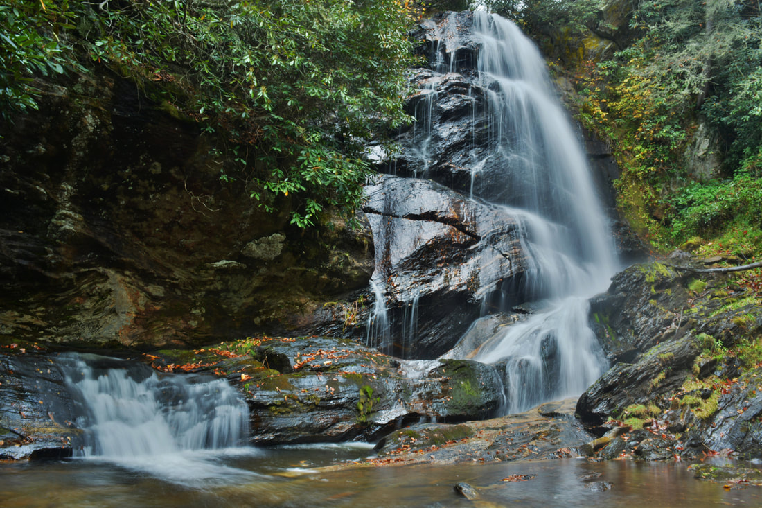
The Little Canada area of Southwest North Carolina is home to a vast array of majestic waterfalls, and Sols Creek is one of the area's signature creeks. Few North Carolina waterfalls are as jaw-dropping as Sols Creek Falls near the creek's lower end, but unfortunately, that falls is on private property. In contrast, Upper Sols Creek Falls is on National Forest land and is nearly as impressive as its taller brother. Tumbling 65 feet down a huge cliff, Upper Sols Creek Falls is a spectacular waterfall and falls into a fairly easy-to-reach category. The unofficial trail to the falls has a few creek crossings but is mostly in good shape and can be walked by hikers of nearly all levels. In fact, the most difficult part of the hike may be finding the obscure trailhead and pullout parking. This hike occurred on Saturday, October 14th, 2017. My plan was to hike out and back to Upper Sols Creek Falls from NC Route 281.
Summary
R/T Length of Trail: 0.8 Miles
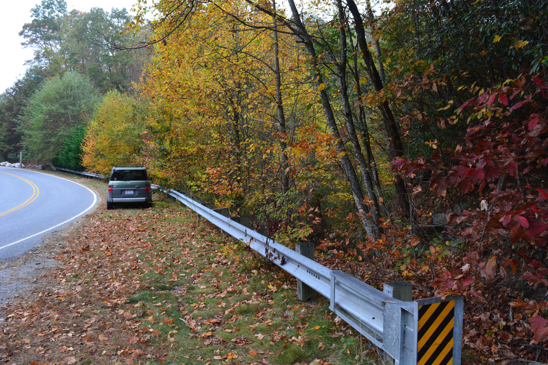
Duration of Hike: 1:30 with 45 minutes for stopping and photography Type of Hike: Out and Back Difficulty Rating: 3 out of 10 Total Elevation Gain: 169 Feet Pros: Little-visited waterfall that isn't hard to reach Cons: Difficult to find the trailhead Points of Interest: Upper Sols Creek Falls - 9 stars Trail Blaze Colors: None, not an official trail Best Seasons to Hike: Spring; Fall Fees: None Beginning Point: NC 281 Crossing of Sols Creek Directions from Cullowhee, NC: From the intersection of NC 107 and NC 281 southeast of Cullowhee, follow NC 281 South for 8.7 miles to an obscure culvert across Sols Creek. Park on the left side of the road between the guardrail and the road just past the creek without blocking any private drives. Map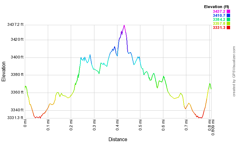
Click the link below to download a .GPX file with a track of this hike.
Details
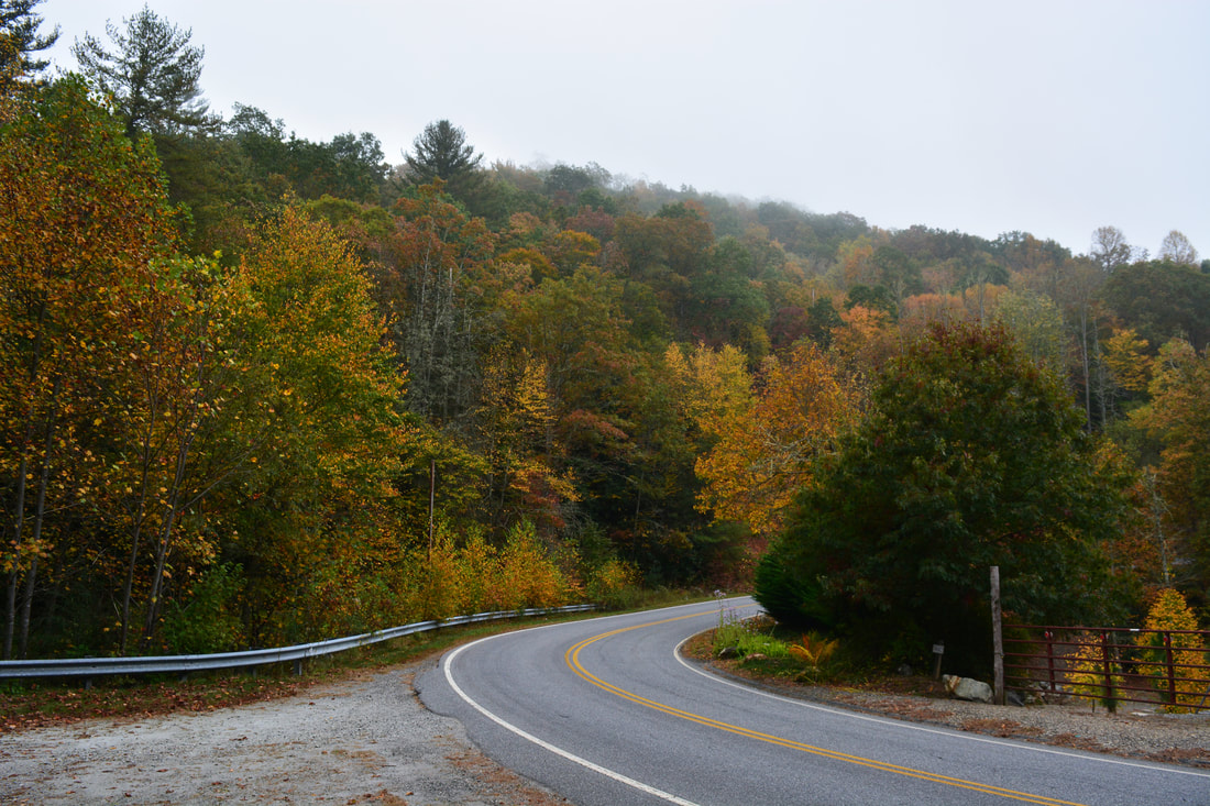
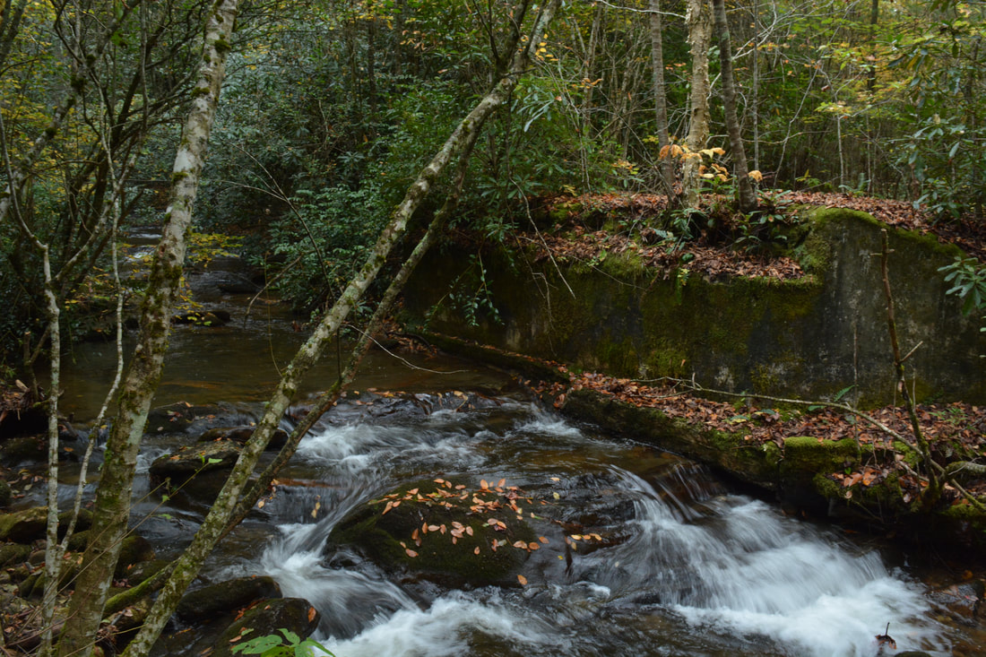
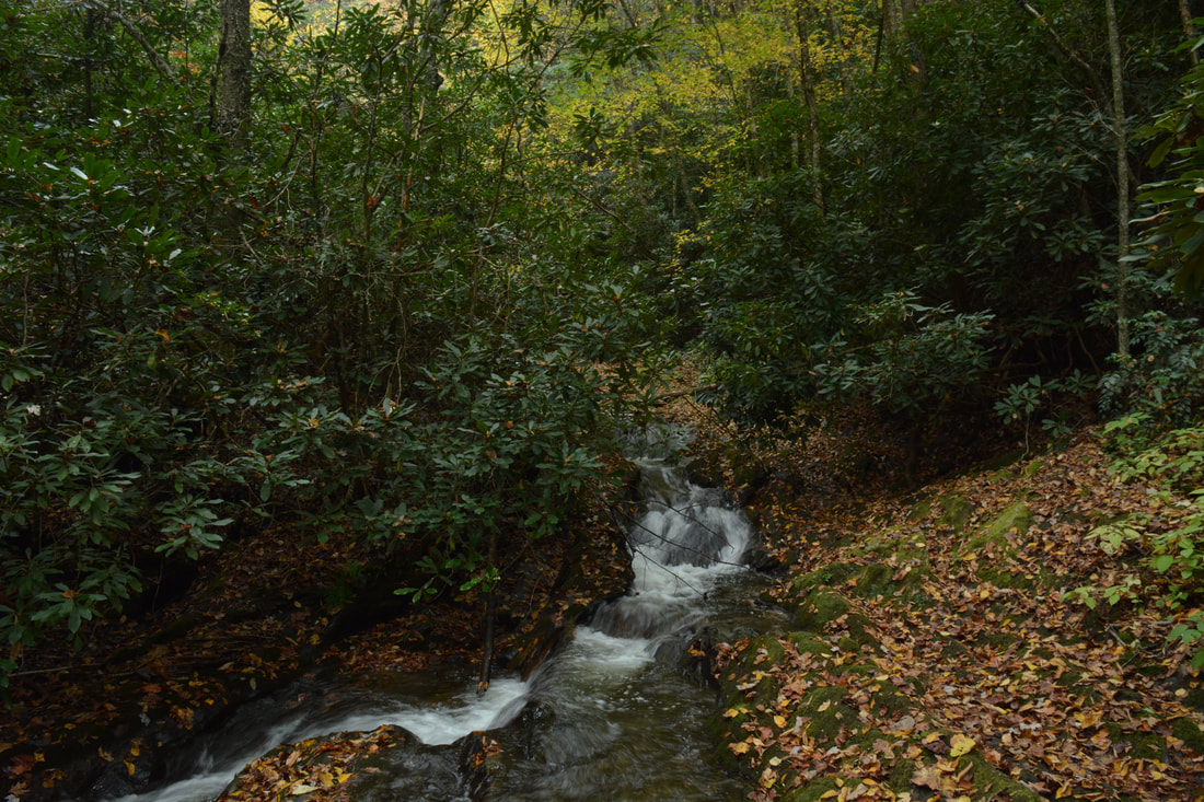
In the middle of October 2017, I decided to spend a day hiking in Southwest North Carolina to watch the fall colors. In particular, my goal was to photograph waterfalls with fall colors. As I researched little-known waterfalls that would be great for fall color photography, Upper Sols Creek Falls turned up. Being a stunning rarely-visited waterfall that isn't too hard to reach, it seemed like a perfect choice considering that the forest around the falls and along the creek had lots of hardwoods. While I must admit fall colors weren't quite yet peak at Sols Creek, it was still a nice short hike culminating with a breathtaking waterfall that I highly recommend for others to visit. The hike begins on the east (River Left) side of Sols Creek and on the north side of North Carolina 281. It is important to start on the east side as the west side is initially private property. Hop over the guardrail and follow a faint path down the bank toward the creek. The path quickly comes alongside Sols Creek and reaches the first crossing of the creek about 350 feet from the start of the hike. This crossing and all other crossings of the creek along this hike are easy. There are some old mossy bridge foundations at the crossing, a sign that this is actually the old route of NC 281. On the other side of the creek, scramble up the bank and reach a more distinct path coming in from private property.
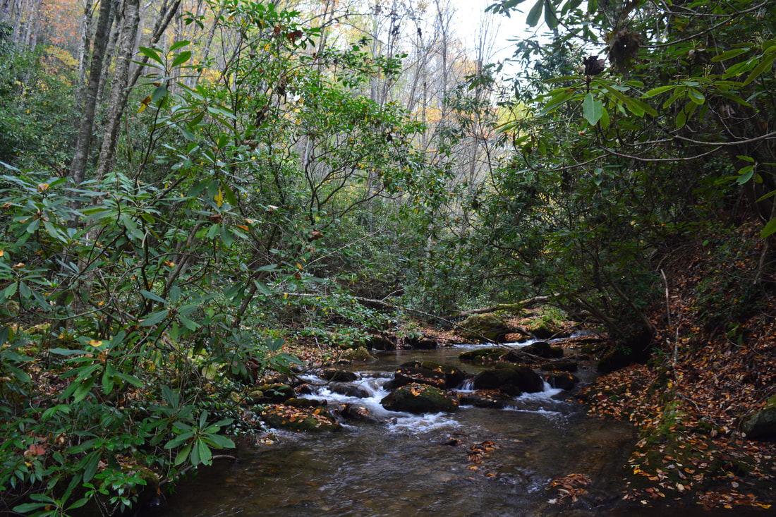
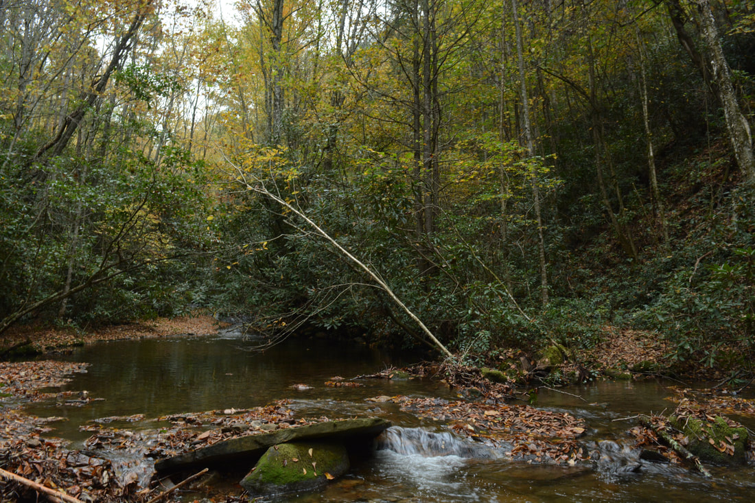
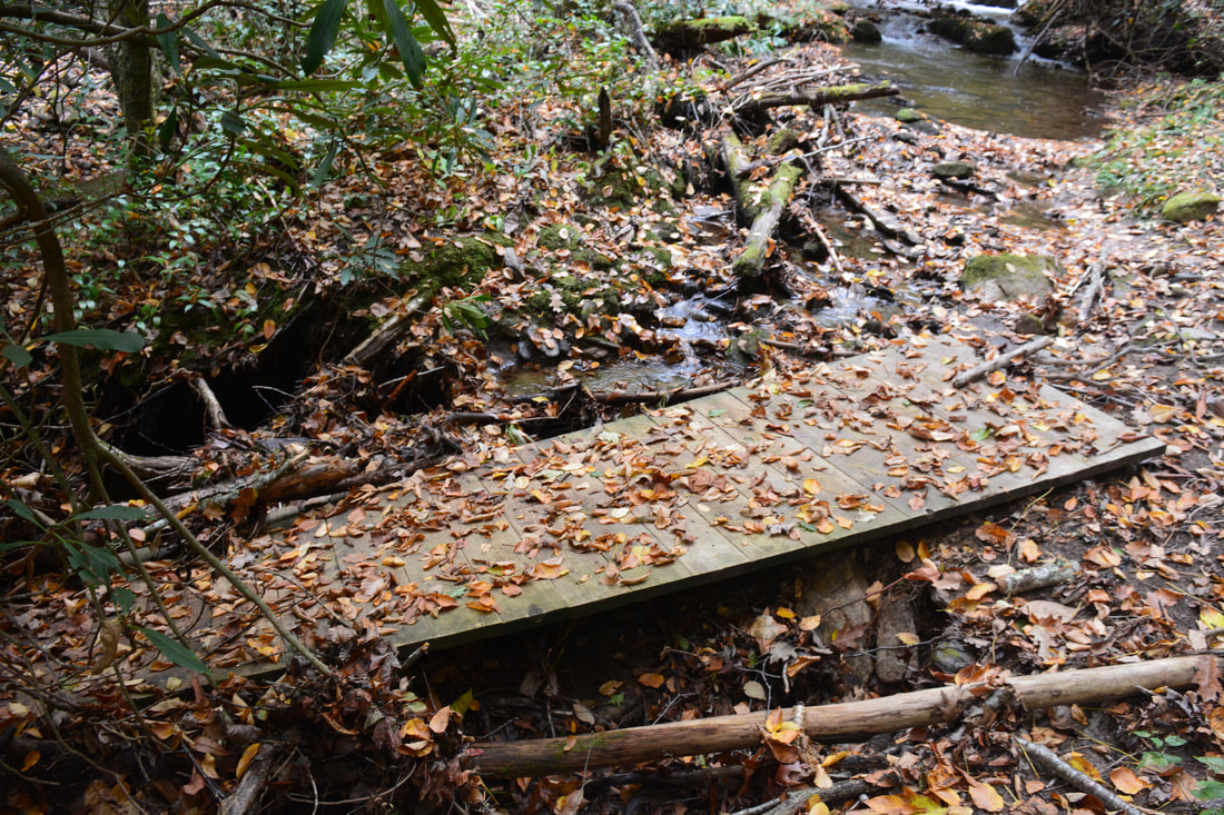
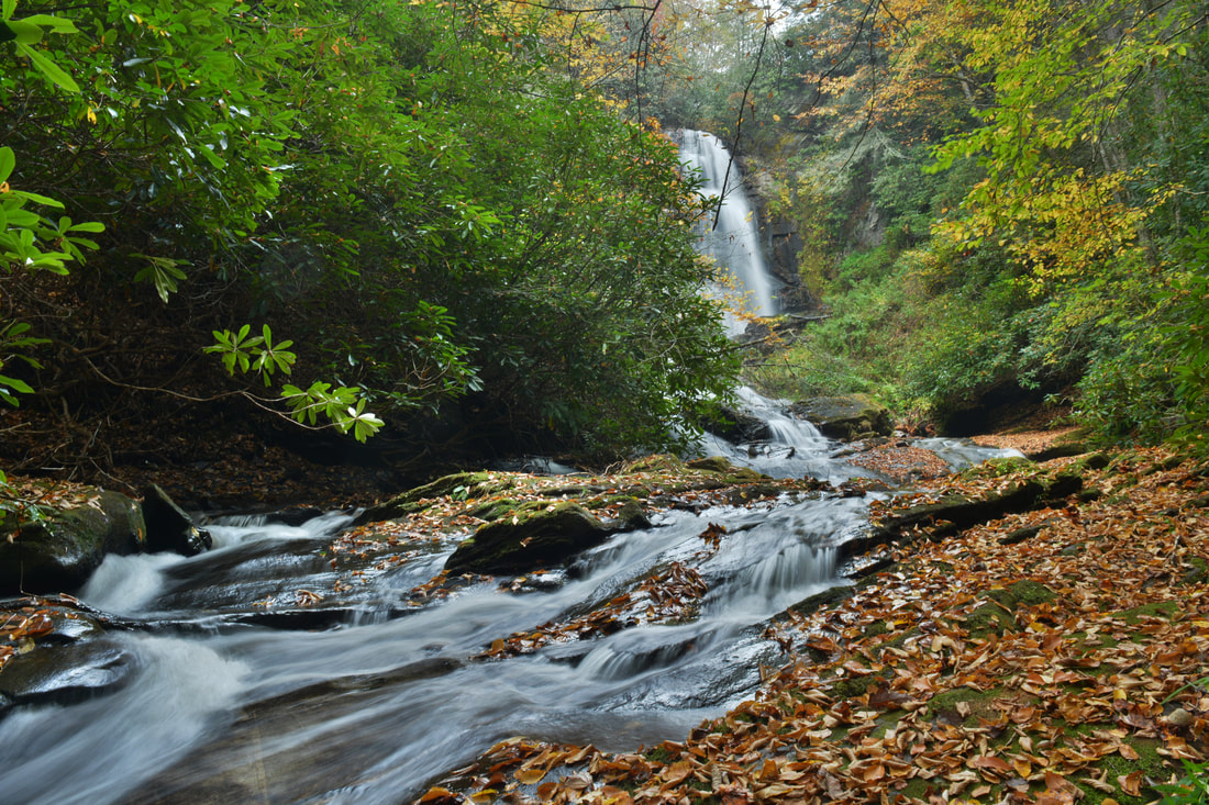
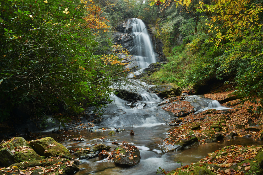
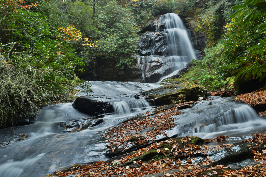
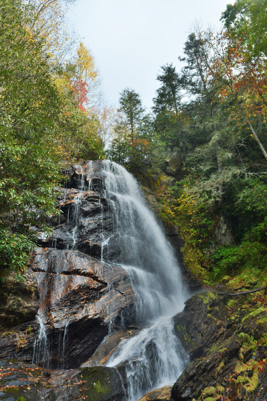
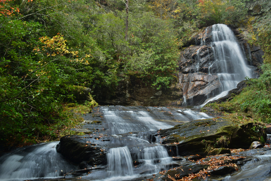
To reach the falls, turn right onto the path and then stay left into a patch of pines in 150 feet. About 250 feet after the first crossing, the trail once crosses Sols Creek for a second time. Back on the River Left side, the path remains fairly distinct and it is clear that it's well-used. At about 0.2 miles from NC 281, the trail appears to reach a dead-end at Sols Creek. Here, the trail actually joins the creek itself for about 150 feet and then exits onto the same (River Left) side of the creek. The short creek-walk is very easy but you will most likely get your feet wet if you haven't already. After this, the trail becomes a little fainter, but that's not crucial - just keep following the east side of Sols Creek upstream along the route of least resistance. You may notice the wooden remains of what looks like a footbridge at one point. At about 0.35 miles, there's a set of small but scenic cascades on Sols Creek - especially beautiful during fall color season. The path ends here but the falls is just around the corner and may already be audible. Scramble along the same side of the creek upstream, round the bend, and arrive at the base of Upper Sols Creek Falls at 0.4 miles. Falling about 65 feet down a sheer cliff, Upper Sols Creek Falls is quite a sight. During high flow, many different trickles of water slide down the cliff in addition to the main plunge. The main viewing area is actually at the base of a 15-foot sliding cascade below the main falls, and if this cascade is included into the height of the falls, then the total height is 80 feet! It is possible to scramble up to the base of the main drop of the falls but i do not recommend it for most. If you insist, it is best to climb up the same side of the creek to the mid-point of the slide, cautiously cross the creek there, and then finish the climb up the other side. There is a very neat grotto on the west (River Right) side of Upper Sols Creek Falls formed by the tall cliffs. From Upper Sols Creek Falls, simply retrace your steps along the same route, returning to the NC 281 parking at 0.8 miles. Mileage
0.0 - NC 281
0.35 - Scenic Cascades 0.4 - Upper Sols Creek Falls 0.8 - NC 281 Variations
None
Bonus Stops
There's a number of spectacular waterfalls in the Little Canada area that can be added on to Upper Sols Creek Falls. One good choice is Wolf Creek Falls, also known as Paradise Falls, just down the road on NC 281. If you are interested in exploring more of Sols Creek, consider checking out the small but scenic Roy Taylor Falls much further upstream on Sols Creek.
Pictures and Videos
0 Comments
Leave a Reply. |
About MeMark Oleg Ozboyd Dear readers: I have invested a tremendous amount of time and effort in this website and the Georgia Waterfalls Database the past five years. All of the work that has gone in keeping these websites updated with my latest trip reports has almost been like a full-time job. This has not allowed me to pick up a paid job to save up money for college, and therefore, I I've had to take out loans. If you find the information on this website interesting, helpful, or time-saving, you can say "thanks" and help me out by clicking the button above and making a contribution. I will be very grateful for any amount of support you give, as all of it will apply toward my college tuition. Thank you!

Coming in 2022-2023?
Other Hiking WebsitesMiles HikedYear 1: 540.0 Miles
Year 2: 552.3 Miles Year 3: 518.4 Miles Year 4: 482.4 Miles Year 5: 259.9 Miles Archives
March 2021
Categories
All
|
||


 RSS Feed