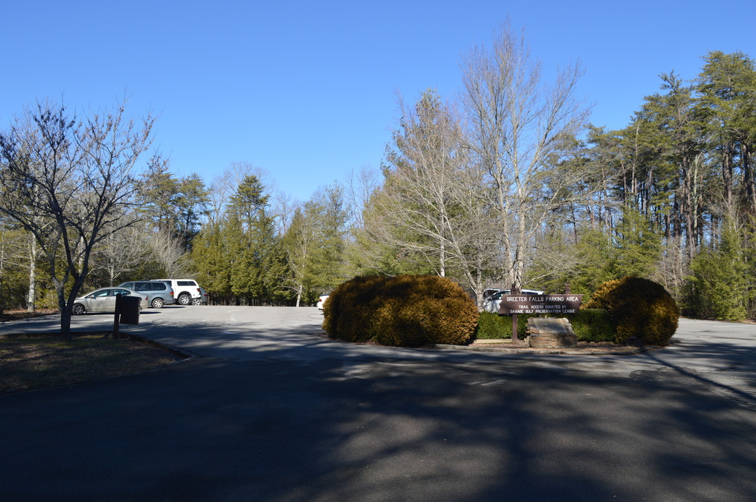
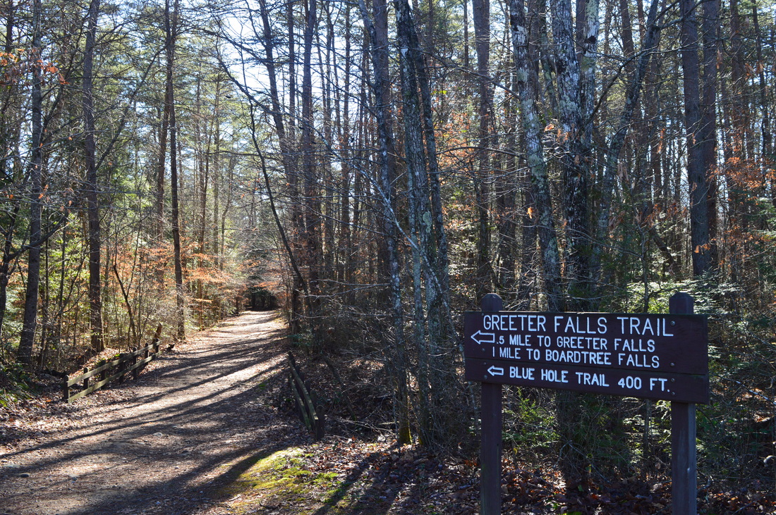
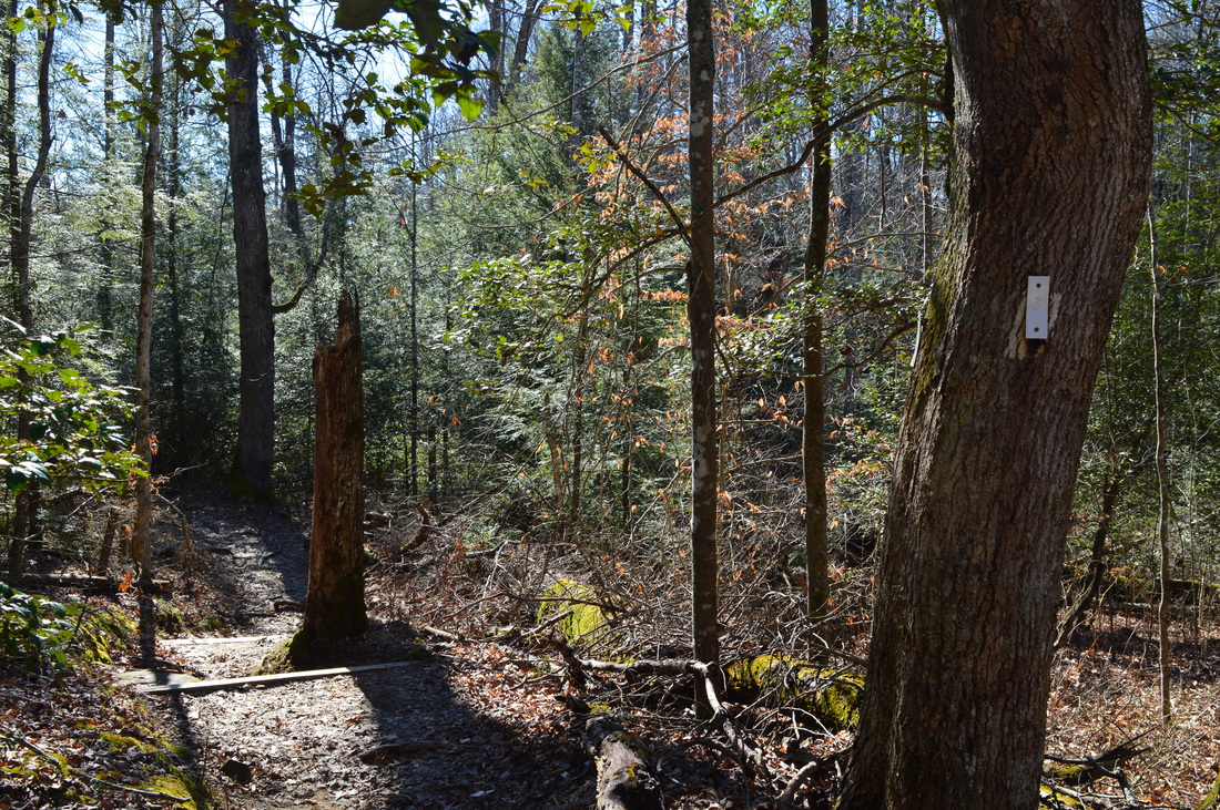
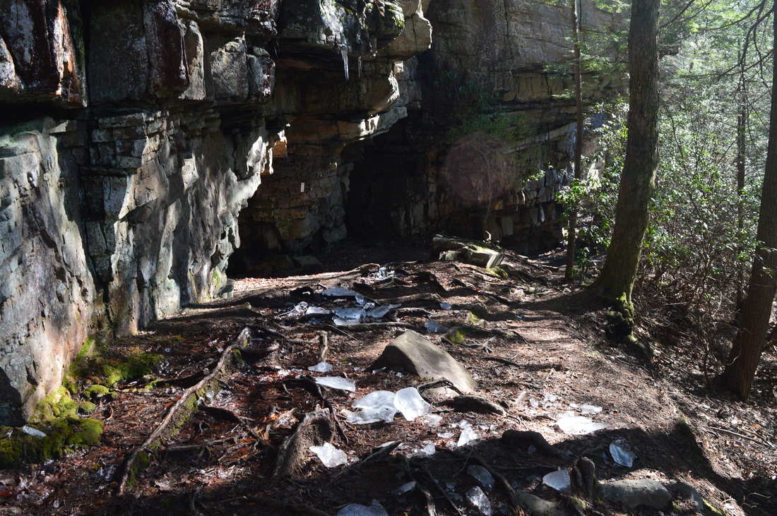
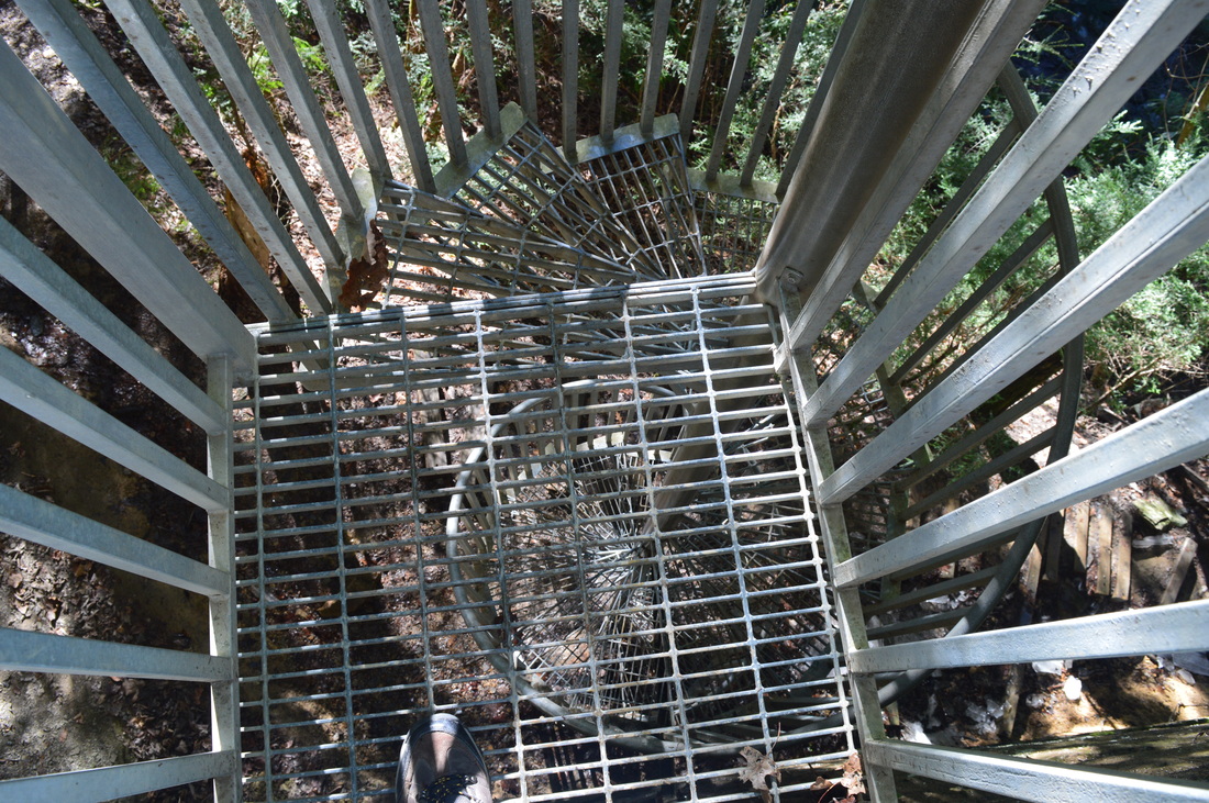
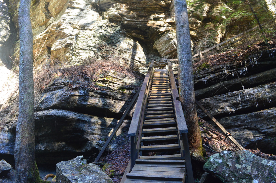
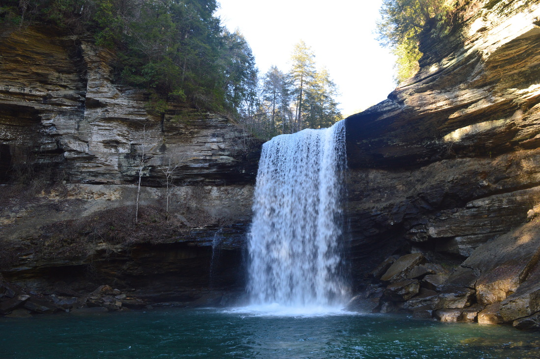
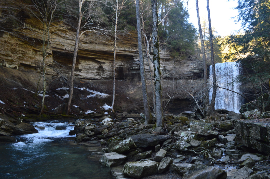
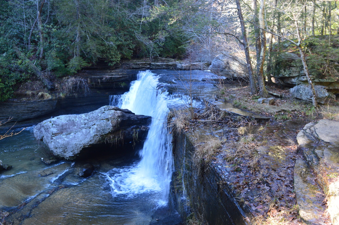
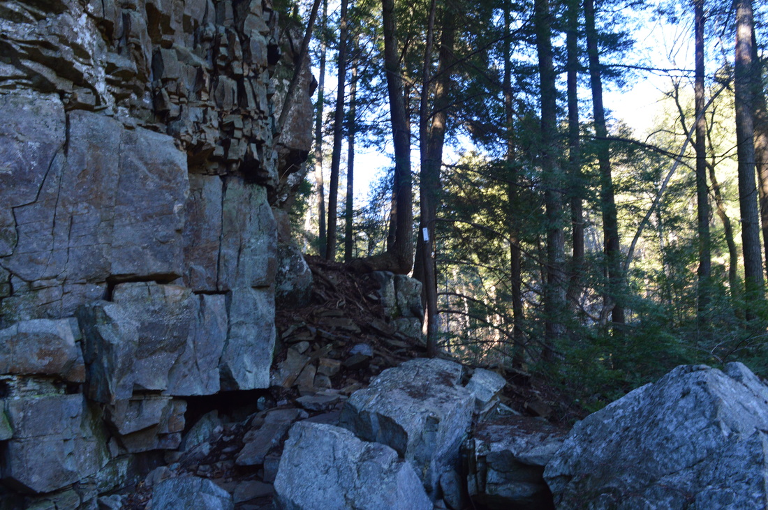
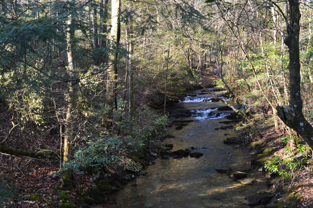
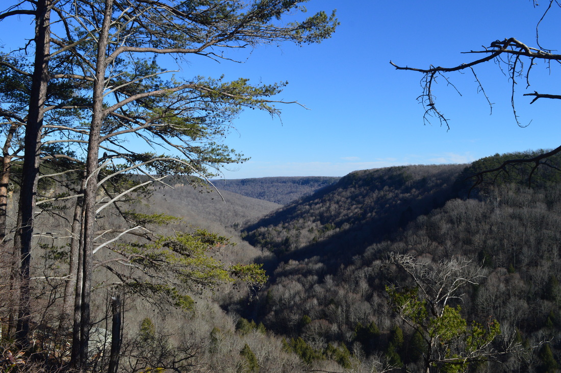
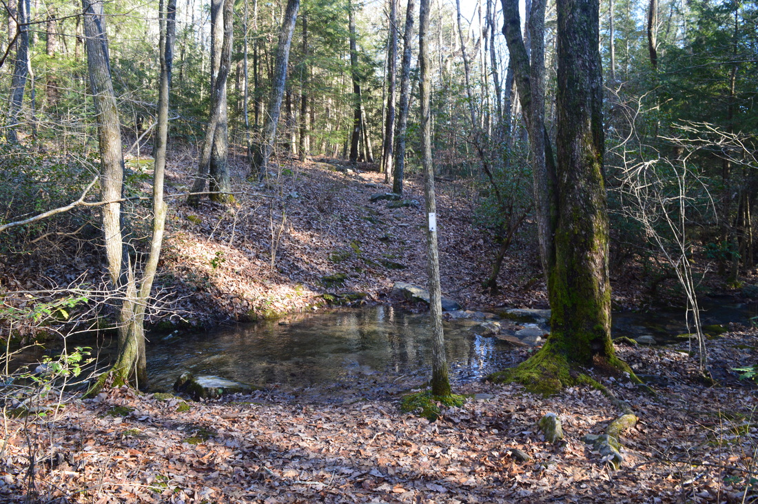
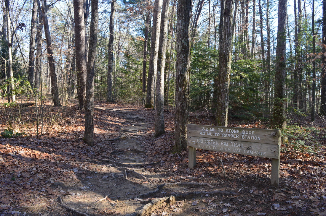
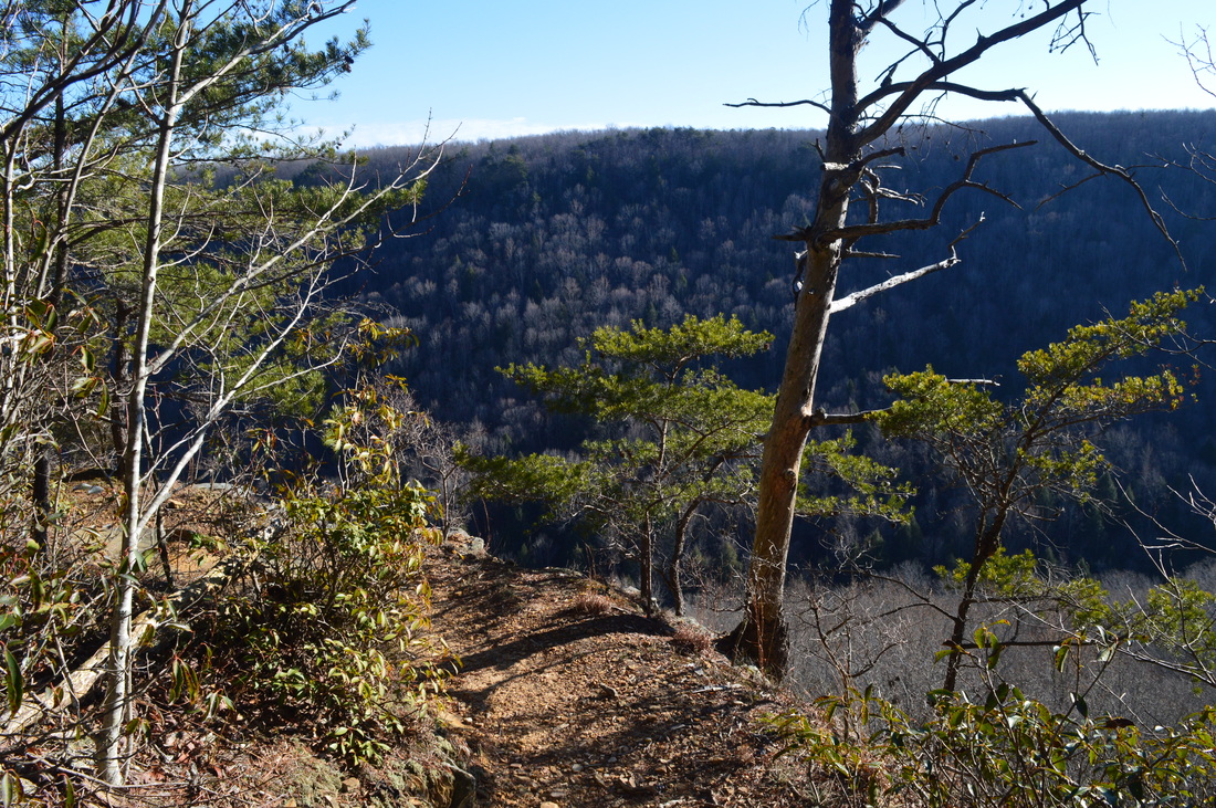
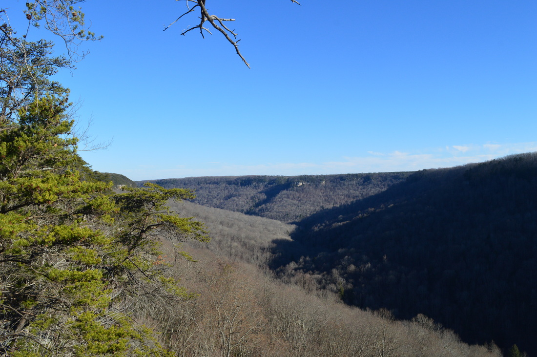
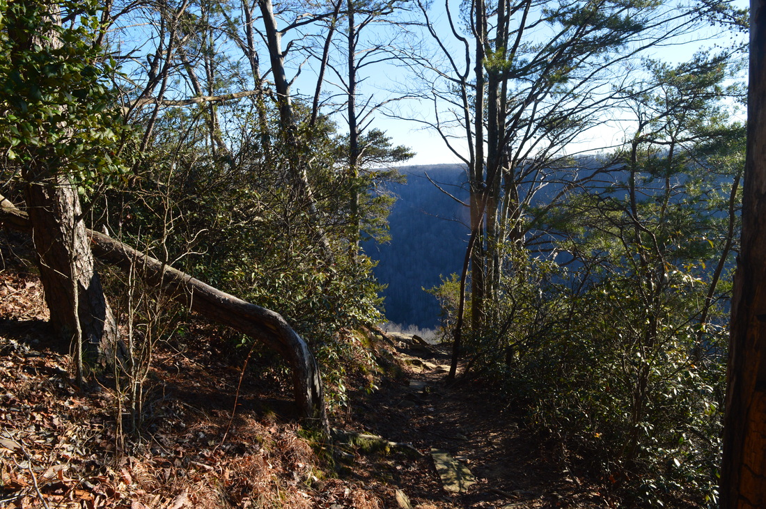
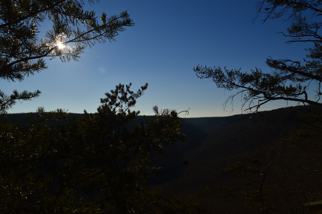
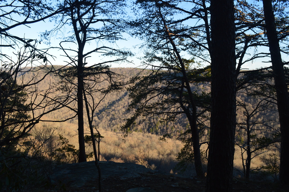
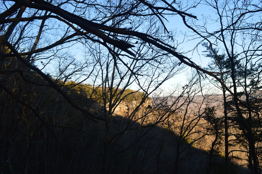
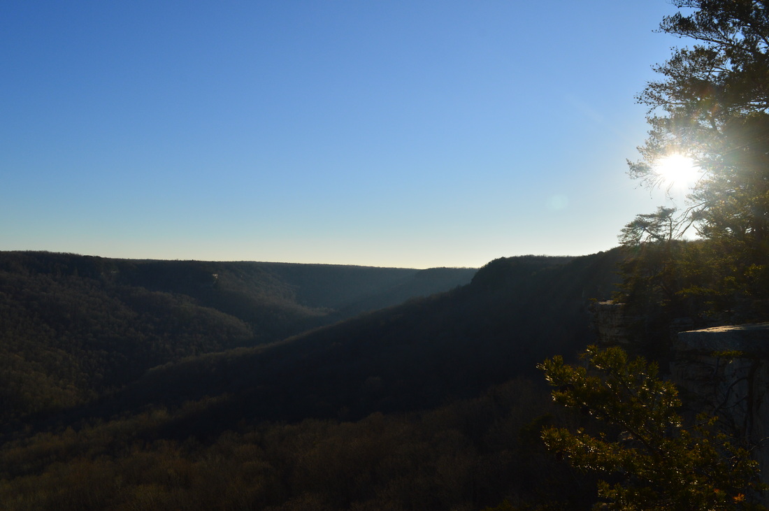
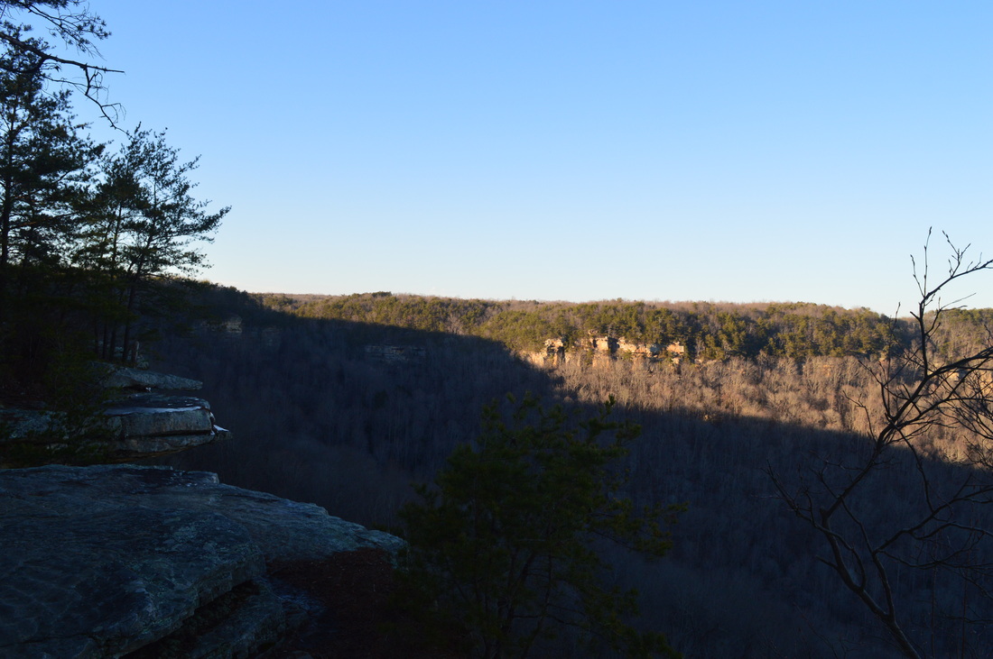
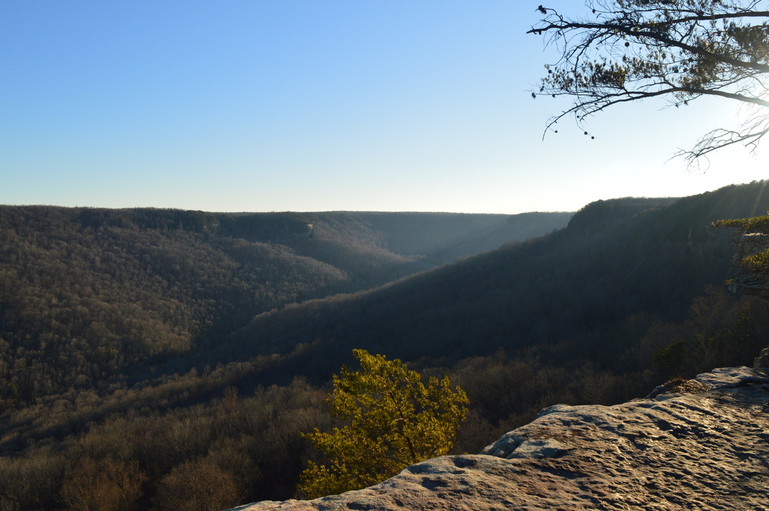
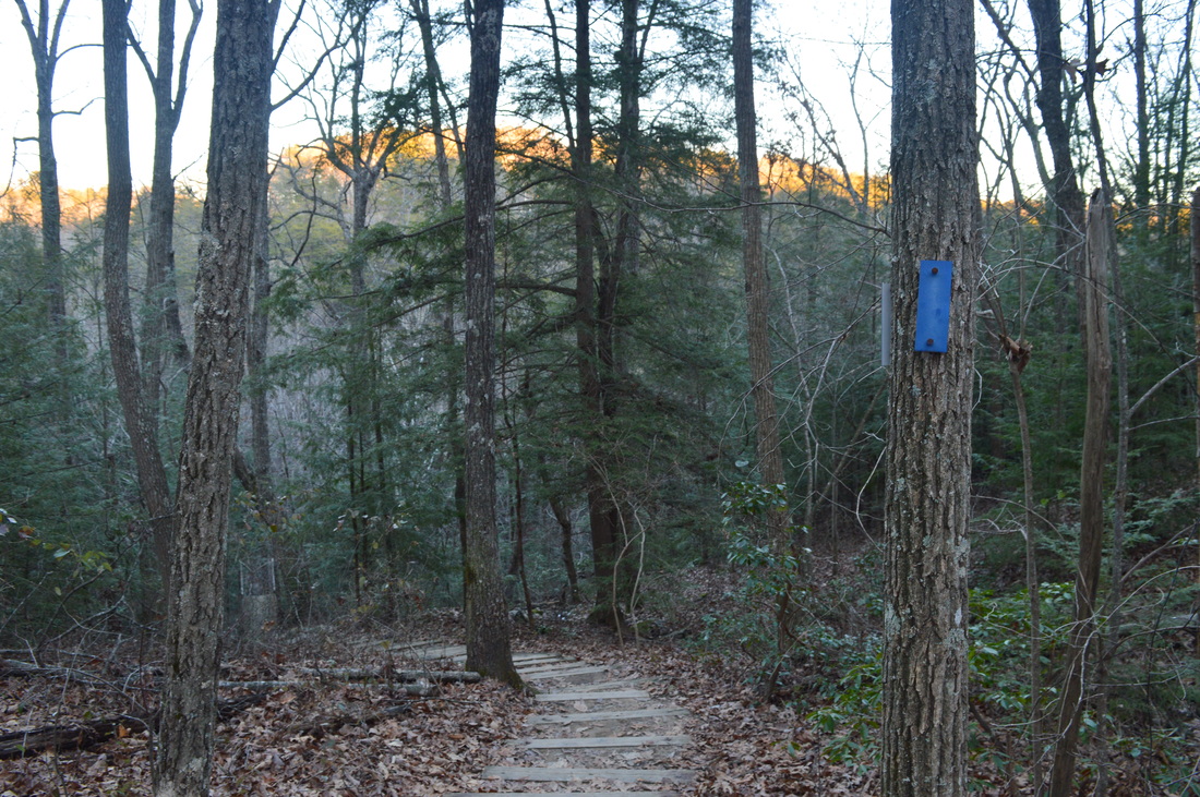
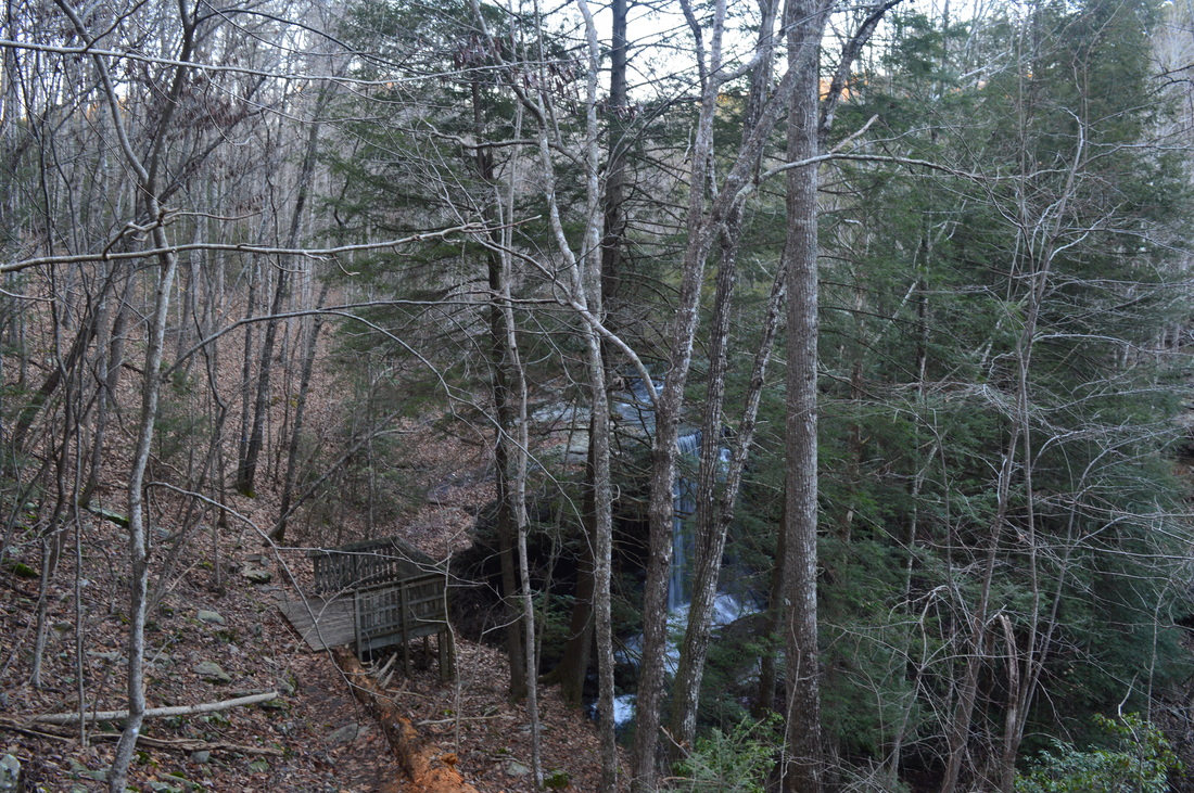
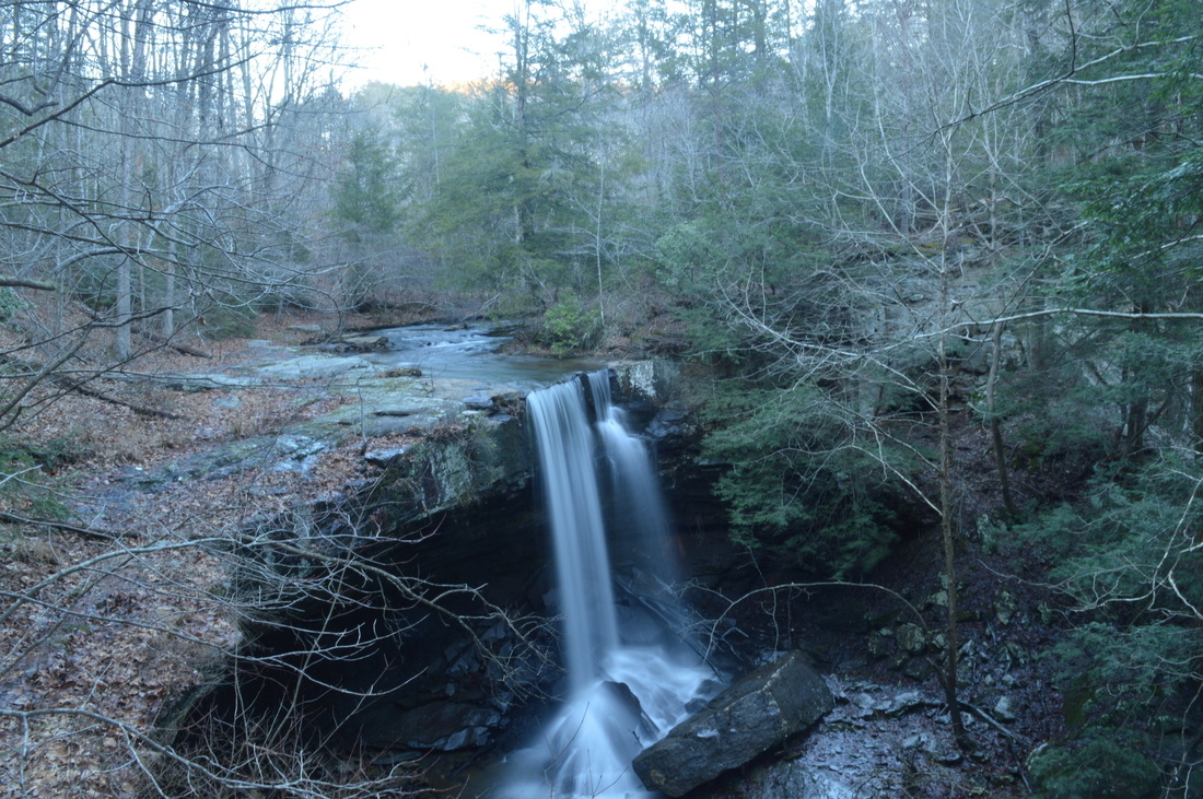
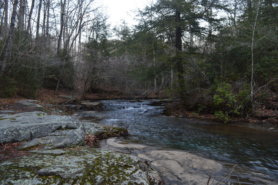
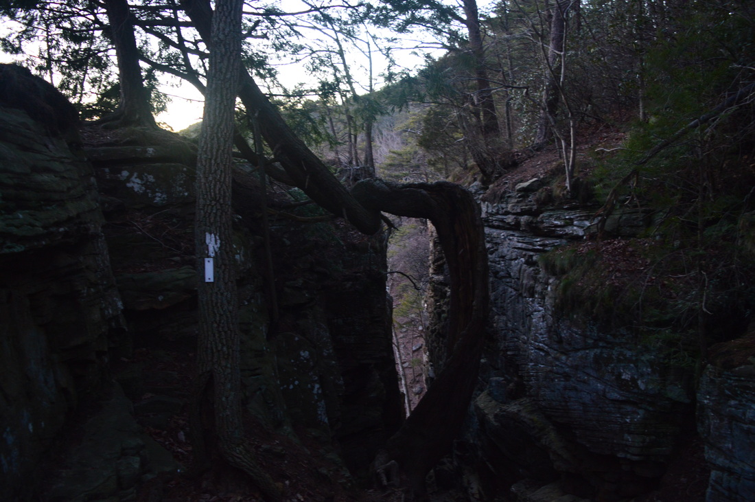
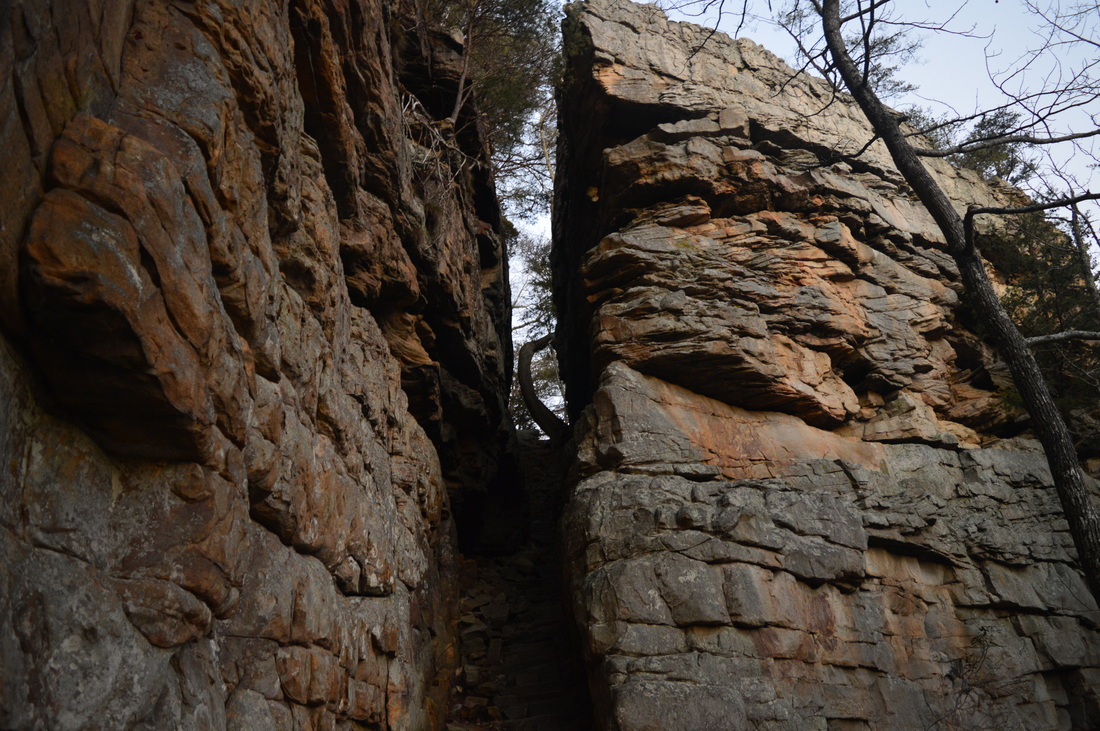
 South Cumberland State Park is one of the most beautiful and diverse areas in Tennessee. The park is not your regular state park. Spread over several counties and in many different land tracts, the state park protects some of the most scenic streams and waterfalls on the Cumberland Plateau. The Savage Gulf State Natural Area, one of the largest sections of South Cumberland State Park, houses nearly a dozen of these waterfalls, and on this hike, you'll get a chance to see five. In addition to the waterfalls, panoramic views abound at the Stone Door Overlook - get to see into the heart of Savage Gulf and hike through a narrow crack in the plateau rim known as the Stone Door. This hike occurred on Saturday, January 17, 2015. My plan was to start my hike at the Greeter Falls Trailhead, and hike the Greeter Falls Loop past Greeter Falls, Upper Greeter Falls, and Boardtree Falls, before taking the Greeter Trail. Following the Greeter Trail, I would take the Big Creek Rim Trail to the panoramic views at the Stone Door. From there, I would take the Stone Door Trail to Laurel Falls and return the same way to the Stone Door. From here, I would take the Big Creek Gulf Trail with a side trip to Ranger Creek Falls, before returning to the Greeter Trail junction and retrace my steps to the trailhead. R/T Length of Trail: 12.6 Miles Duration of Hike: 8:15 Type of Hike: Figure 8 Loop Difficulty Rating: 7 out of 10 Pros: Many beautiful waterfalls; panoramic views from Stone Door area; unique rock formation at the Stone Door; very easy trail along Big Creek Rim Cons: Very rugged trail in Big Creek Gulf; confusing access to Ranger Creek Falls Scenic Views: Views from Big Creek Rim Trail - 5-6 stars; Stone Door Overlook - 8 stars; Laurel Gulf Overlook - 7 stars Water Features: Greeter Falls - 7 stars; Upper Greeter Falls - 7 stars; Boardtree Falls - 5 stars; Laurel Falls - 8 stars; Ranger Creek Falls - N/A (See description) Trail Blaze Color(s): All main trails are blazed white; all side trails are blazed blue Best Season(s) to Hike: Spring Beginning Point: Greeter Falls Parking Area and Trailhead Directions: From Beersheba Springs, TN: Follow TN State Route 56 South until Greeter Falls Road, within the city limits of Beersheba Springs. Turn left onto Greeter Falls Road and follow it for 0.5 miles. Then, turn left to keep following it and arrive at the parking area in 0.5 miles. There's quite a few natural attractions in Savage Gulf, but most people just visit one at a time. However, I sketched out three loops, ranging from 12 to 16 miles, that could let me visit all of the attractions in the area. The one described here is the shortest but perhaps the most interesting one of the three. I definitely intend to do the others at some point. The loop described here covers the majority of Big Creek Gulf, the western section of the Savage Gulf Natural area. The other two loops cover Savage Gulf itself, the southern section, and Collins Gulf, the eastern section. Together, the three creeks that flow through the canyons form the Collins River that gradually becomes bigger and bigger before entering the Caney Fork River at Rock Island State Park. You can read more about the waterfalls and trails at Rock Island State Park here. Out of the destinations on this hike, Greeter Falls is definitely the most popular one, even if it's not the most scenic. While you can access the whole trail system from Greeter Falls Trailhead, most of the cars you will see there likely are associated with people who are hiking just to Greeter Falls. Greeter Falls Loop is the only trail that leaves the trailhead, though, so that's where this hike starts. The trail starts on an old roadbed behind the gate, and descends to a junction with Blue Hole Trail at 0.1 miles on right. This trail leads for half a mile to the Blue Hole, a good swimming hole. Meanwhile ,the main trail keeps left and at 0.2 miles, keeps right as a short spur trail leads straight to the Greeter Homestead. At 0.3 miles, the small Greeter Falls Loop begins. Keep right toward where the sign points for Greeter Falls - you'll come in from what goes straight on the very end of your hike. As you turn right, the trail leaves the old roadbed and immediately takes on a rocky manner. Descend down and along some bluffs before reaching a junction with the spur trail to Greeter Falls and Upper Greeter Falls at 0.4 miles. Immediately, as you turn right onto the spur trail, it forks again - the left fork leads to Greeter Falls and the right one leads to Upper Greeter Falls. I checked out Greeter Falls first. When you turn left, he trail shortly reaches an unusual spiral staircase that leads you down the bluff, followed by some more wooden steps that descend right down to Greeter Falls at 0.5 miles. It is a single-drop waterfall but the rock wall it drops over is impressive, and the waterfall itself is too, especially during high water levels. This waterfall reminds me of Cherokee Falls and Hemlock Falls in Cloudland Canyon, although they are both larger than this one. Return back up to the spur trail to Upper Greeter Falls and take it at 0.6 miles. Reach Upper Greeter Falls shortly. While this waterfall doesn't have much a drop, it is pretty as it s a wide drop over a small, natural dam-like rock wall. After Upper Greeter Falls, return to Greeter Falls Loop at 0.7 miles. Turn right onto the Greeter Falls Loop and keep following it. It gets rockier as the trail follows the bluffs above and traverses boulder fields. Lower Boardtree Falls can be heard somewhere far below but I am not aware of any easy ways of reaching it, so it's not mentioned in this hike's description. At 1 mile, reach Boardtree Falls. There is no sign marking it, but there is a well-used side trail leading right, down to the creek. There's no "excellent" view of Boardtree Falls, unless you want to wade into the middle of the creek, but it is good enough. The waterfall is a slide type of waterfall. Right after Boardtree Falls, reach the junction with Greeter Trail. The Greeter Falls Loop turns left here up a steep, rock staircase. However, for the purpose of this hike, take the Greeter Trail. You'll eventually be back at this place and then you'll take the staircase. The Greeter Trail right away crosses Boardtree Creek on a suspension bridge. It is rather small and to be on the safe side I would recommend only one person at a time to be on the bridge. Starting from the suspension bridge, the next half-dozen miles of trail will be relatively easy, staying on top of the rim without any major downhill or uphill sections. The Greeter Trail follows the rim of the uppermost section of Big Creek Gulf, providing winter views into the gulf. At 1.8 miles, arrive at Big Bluff Overlook. The Greeter Trail turns left here, while the overlook is on the right. This is a small rock outcropping that sticks out affording views up and down Big Creek Gulf. The views are decent, although nothing very interesting. After the overlook, the Greeter Trail descends slightly to reach Alum Creek. This should be normally a dry crossing. Even with water levels being up on this day, it was still dry although the rock hop was slightly tricky. After the crossing, the Greeter Trail ends at Alum Gap at 2 miles. Alum Gap is a pretty major trail junction. Three trails leave the gap and the surrounding area, and it's also home to a very popular camping area, Alum Gap Camp Area. Where the Greeter Trail ends, the Big Creek Rim Trail turns left and the Big Creek Gulf Trail turns right. This is the start of the larger loop section of the hike. Turn left onto the Big Creek Rim Trail. I decided to hike it first to see the main overlooks first, although it might be a better idea to hike the rugged Big Creek Gulf Trail first. It's up to you, but this description will follow the way I did the hike. Right after turning onto Big Creek Rim Trail, reach the junction with Laurel Trail and a spur trail leading to Alum Gap Camp Area. An outhouse is located at the junction. The Laurel Trail and Big Creek Rim Trail both lead to about the same place - Stone Door Ranger Station - but the Big Creek Rim Trail is absolutely more scenic. The Laurel Trail is slightly shorter, so it acts like a shortcut, skipping the main significant features. I kept hiking straight on the Big Creek Rim Trail. Over the next 3.2 miles (the Big Creek Rim Trail's length), there are many small creek crossings, but all are not worthy of any attention. On the map, I marked what was one of the largest ones, although I am confident that it is very rarely causes a problem, just like the other ones. At 2.5 miles, the trail reaches Big Creek Overlook, providing a nice view into Big Creek Gulf. The next couple overlooks on the trail will be similar to this one. I like how at all of the overlooks, the trail follows the very edge of the rim for a little bit. The next overlook, Pine Rock Overlook, comes at 2.7 miles. I liked it slightly more than Big Creek Overlook. At 3.6 miles, reach Sinks Overlook. Here, you can see a section of Big Creek Gulf where there is a large sinkhole into which Big Creek often goes underground. After a long stretch of woodland walking with winter views into Big Creek Gulf, the trail reaches Split Rock Overlook at 4.9 miles. This overlook has a view of the Stone Door, At 5.2 miles, reach the end of Big Creek Rim Trail at the Stone Door. The Stone Door is another major trail junction. Where the Big Creek Rim Trail ends, the Stone Door Trail goes left and reaches Stone Door Ranger Station in 0.9 miles. Meanwhile, the Big Creek Gulf Trail turns right, heads through the Stone Door, and traverses Big Creek Gulf before eventually reaching Alum Gap again in 4 miles. Also, a short spur trail continues straight to an outstanding panorama from Stone Door Overlook. First, I took this short spur trail. The views from Stone Door Overlook are definitely the best on the entire hike. There is a three-way panorama here, and I could see the entire Big Creek Gulf, the smaller Laurel Gulf, and the vast proximity of Savage Gulf fading into the horizon. You can probably see the mouths of Savage Gulf and Collins Gulf from this vantage point. Once you have enjoyed the views here, retrace your steps back to the main junction I just mentioned. You will need to take the Big Creek Gulf to get back to Alum Gap (by following this description), but first, take the Stone Door Trail, which leads not just to Stone Door Ranger Station, but also to Laurel Falls. The Stone Door Trail winds through mostly flat areas. There will be a couple footbridges, including one over a relatively bigger stream at 5.6 miles. At 5.9 miles, reach Laurel Gulf Overlook. This is another very nice overlook providing views into Laurel Gulf and the rest of Savage Gulf State Natural Area, although it does not have any views into Big Creek Gulf. The rest of the Stone Door Trail is paved until it ends at Stone Door Ranger Station at 6.1 miles. Right at the trailhead, look for a sign for Laurel Falls Loop. Laurel Falls Loop is a short 0.3-mile loop that passes through the uppermost section of Laurel Gulf and visits Laurel Falls. The Laurel Falls Loop steeply descends down a wooden staircase to reach the observation platform for Laurel Falls at 6.2 miles. While this waterfall is best during wet weather, it is my favorite waterfall out of all on this hike (except Ranger Creek Falls, which I didn't get to see - I'll explain later). Laurel Falls is a high, single drop waterfall ending in a small rock jumble in Laurel Creek. Following Laurel Falls, the trail parallels Laurel Creek, and then a short spur trail continues straight to the site of an old mill on Laurel Creek. Meanwhile, the Laurel Falls Loop continues left, back up some steps, reaching the Stone Door Ranger Station again at 6.4 miles. From here, retrace your steps on Stone Door Trail back to the trail junction at the Stone Door at 7.3 miles. From the trail junction, take the Big Creek Gulf Trail, and shortly reach and descend through the Stone Door. This is a long, narrow crack in the bluffs at the rim. It can look scary when looking down into it from above, but it isn't as bad as it seems. Following the Stone Door, an extremely rocky descent continues. Pay attention carefully to the white blazes! It is easy to get lost in the boulder fields if not paying attention to the blazes. The descent continues for quite a while until a junction with the Connector Trail at 8.2 miles, which marks the end of the steepest descent. The Big Creek Gulf Trail turns right, while the Connector Trail turns left. The Connector Trail goes in the direction of Savage Gulf and Collins Gulf, and hence the name, connects Big Creek Gulf, Savage Gulf, and Collins Gulf together. The Big Creek Gulf Trail goes on and off an old roadbed much of the time here, but wherever it doesn't, it's still extremely rocky. There are also constant steep small ups and downs. At 9.3 miles, the spur trail to Ranger Creek Falls leads left. This one is quite confusing. While it's blazed blue, the blazes don't stay long. It shortly reaches a dry streambed. Here, turn right onto it and you'll eventually see a blue blaze. Then, the trail reaches a ford of Big Creek. This ford is normally dry, but it wasn't on this day. However, on the other side, I didn't find a single blaze or trail. There was a boulder field, but it was unclear if the trail went there. I'll try to gather information and eventually try finding it again. Just for your information, the spur trail is supposed to be 0.4 miles one way. From the Ranger Creek Falls Spur Trail, the trail continues following Big Creek, closer or farther from it. At 9.9 miles, a short spur trail leads left to The Sinks, the place where Big Creek usually falls into the ground. During high water levels, though, it continues flowing down the streambed. At 10.8 miles, the trail begins a very steep ascent up to Alum Gap. First, it is up steps and then up a steep, old roadbed. This climb can wear you out after hiking nearly 11 miles! At 11.3 miles, reach Alum Gap. From Alum Gap, turn left onto Greeter Trail and retrace your steps back to the suspension bridge over Boardtree Creek, reaching the Greeter Falls Loop again at 12.3 miles. Ascend up the staircase I mentioned in the beginning of this post. After the staircase, join the old roadbed and shortly reach the end of the loop. Retrace your steps back up the trail to the trailhead and Greeter Falls Parking Area, reaching it at 12.6 miles.
3 Comments
3/13/2016 03:27:10 am
I checked out Greeter Falls first. 5/15/2023 06:01:51 pm
It is a single-drop waterfall but the rock wall it drops over is impressive, and the waterfall itself is too, especially during high water levels. Thank you for the beautiful post! Leave a Reply. |
About MeMark Oleg Ozboyd Dear readers: I have invested a tremendous amount of time and effort in this website and the Georgia Waterfalls Database the past five years. All of the work that has gone in keeping these websites updated with my latest trip reports has almost been like a full-time job. This has not allowed me to pick up a paid job to save up money for college, and therefore, I I've had to take out loans. If you find the information on this website interesting, helpful, or time-saving, you can say "thanks" and help me out by clicking the button above and making a contribution. I will be very grateful for any amount of support you give, as all of it will apply toward my college tuition. Thank you!

Coming in 2022-2023?
Other Hiking WebsitesMiles HikedYear 1: 540.0 Miles
Year 2: 552.3 Miles Year 3: 518.4 Miles Year 4: 482.4 Miles Year 5: 259.9 Miles Archives
March 2021
Categories
All
|


 RSS Feed