
Nestled in the Bald Mountains of Northeast Tennessee, the West Fork Dry Creek valley features some of the area's most beautiful streamside scenery. A well-known hiking trail, the Margarette Falls Trail, climbs along West Fork Dry Creek close to a mile past numerous scenic cascades to the 60-foot fan-shaped drop of Margarette Falls. Above Margarette Falls is a very unique waterfall called Bailey Falls. Accessed exclusively by an off-trail creek-walk, Bailey Falls consists of separate 30-foot upper and 20-foot lower sections in a gorgeous slot canyon. For experienced waterfallers, Bailey Falls is a must-see - no other waterfall quite like it is known in Tennessee. This hike occurred on Friday, April 27th, 2018. My plan was to hike the Margarette Falls Trail out and back to Margarette Falls. I would continue following a goat path past Margarette Falls and then walk the creek to Lower & Upper Bailey Falls. This hike was the second of six hikes that I did during a four-day trip to the mountains of northeast Tennessee and northwest North Carolina.
Summary
R/T Length of Trail: 3.0 Miles
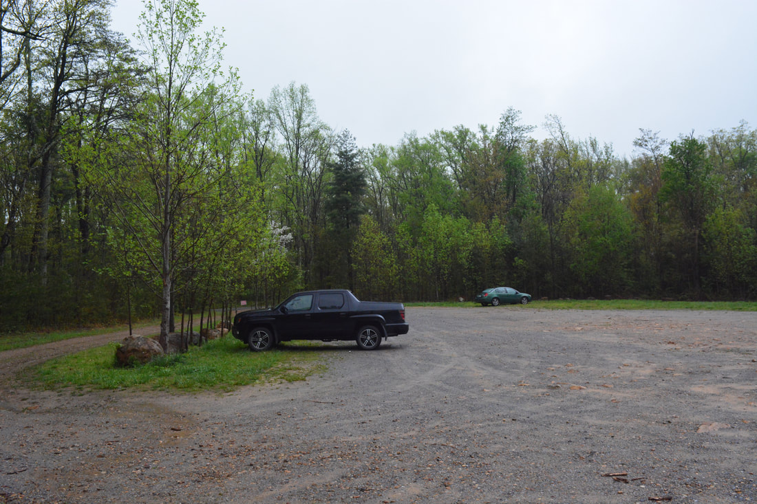
Duration of Hike: 2:00 plus 2.5 hours of stopping and photographing Type of Hike: Out and Back Difficulty Rating: 4 out of 10 for Margarette Falls; 10 out of 10 for Bailey Falls Total Elevation Gain: 942 Feet Pros: Very scenic, moderate trail to Margarette Falls; remote setting at Bailey Falls Cons: None Points of Interest: Margarette Falls - 8 stars; Lower Bailey Falls - 7 stars; Upper Bailey Falls - 9 stars Trail Blaze Colors: Margarette Falls Trail - Blue Best Seasons to Hike: Spring; Summer Fees: None Beginning Point: Margarette Falls Parking off Shelton Mission Road Directions from Greeneville, TN: From the intersection of Main Street and TN 350 in downtown Greeneville, follow TN 350 South. TN 350 ends at a four-way intersection with TN 351 in 5.7 miles; continue straight onto Greystone Road. In 3.8 miles, turn right on Shelton Mission Road. Follow Shelton Mission Road for 1.4 miles to the gravel Margarette Falls parking area on the right. Map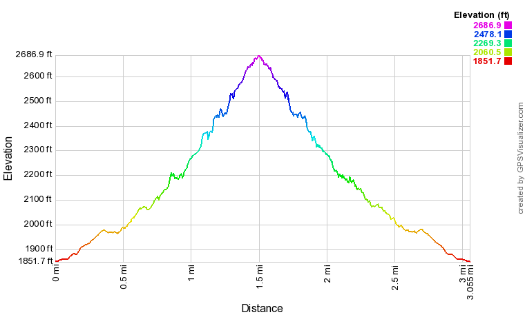
Click the link below to download a .GPX file with a track of this hike.
Details
Bailey Falls had been on my list for years due to its uniqueness. In fact, it was one of the top reasons I chose to take an April trip to this region. The previous evening featured several hours of moderate rain, raising the water levels by quite a bit. Margarette Falls had more water than I'd seen in any pictures. However, it didn't stop me from hiking to Bailey Falls, and it was thrilling to finally get to see such an interesting waterfall.
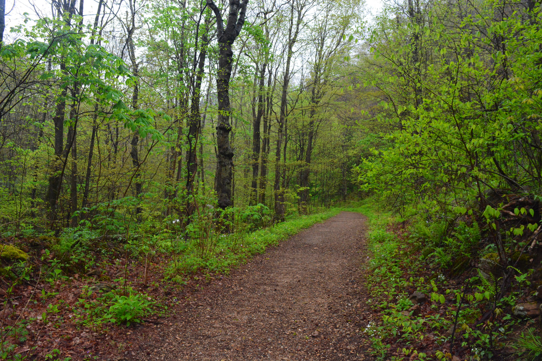
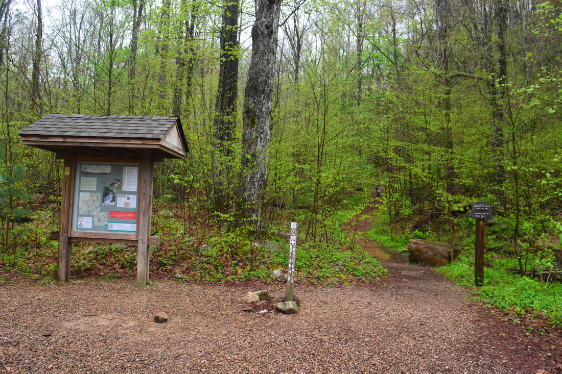
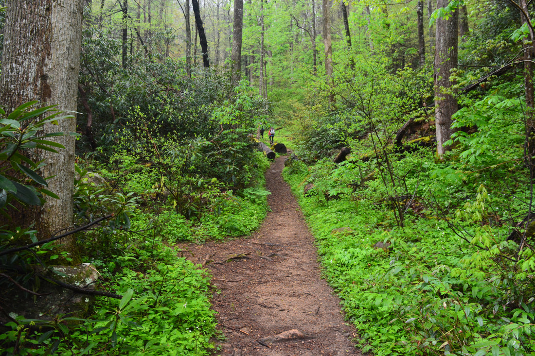
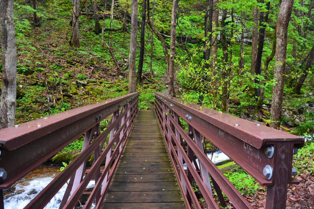
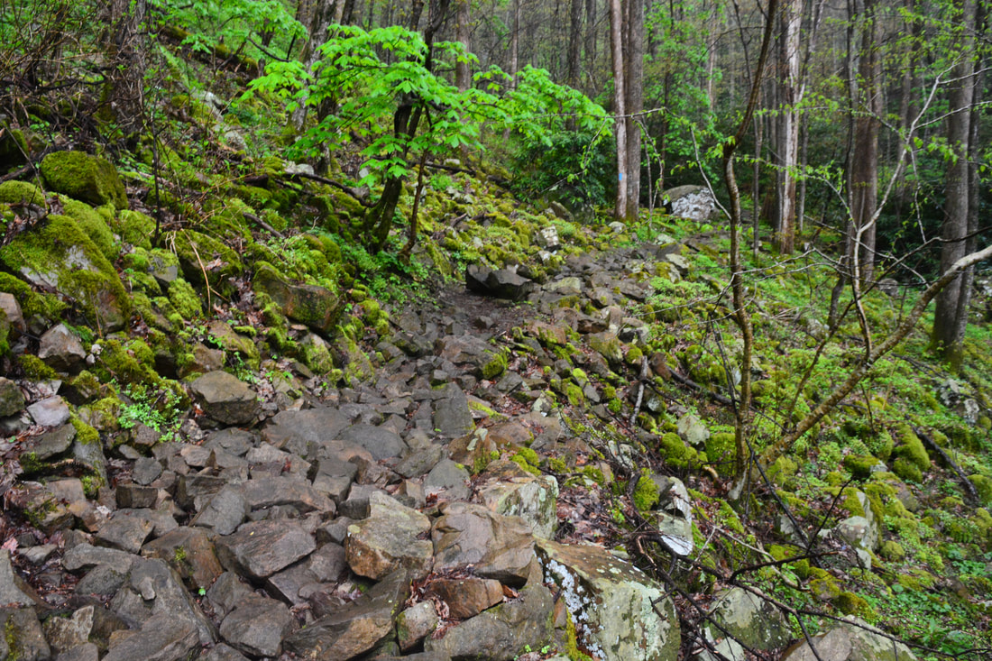
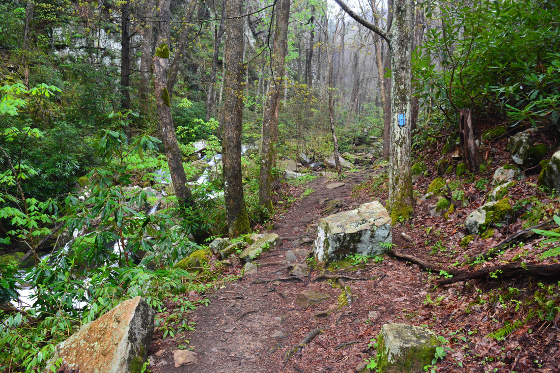
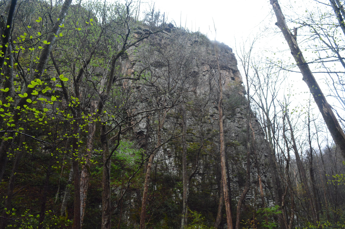
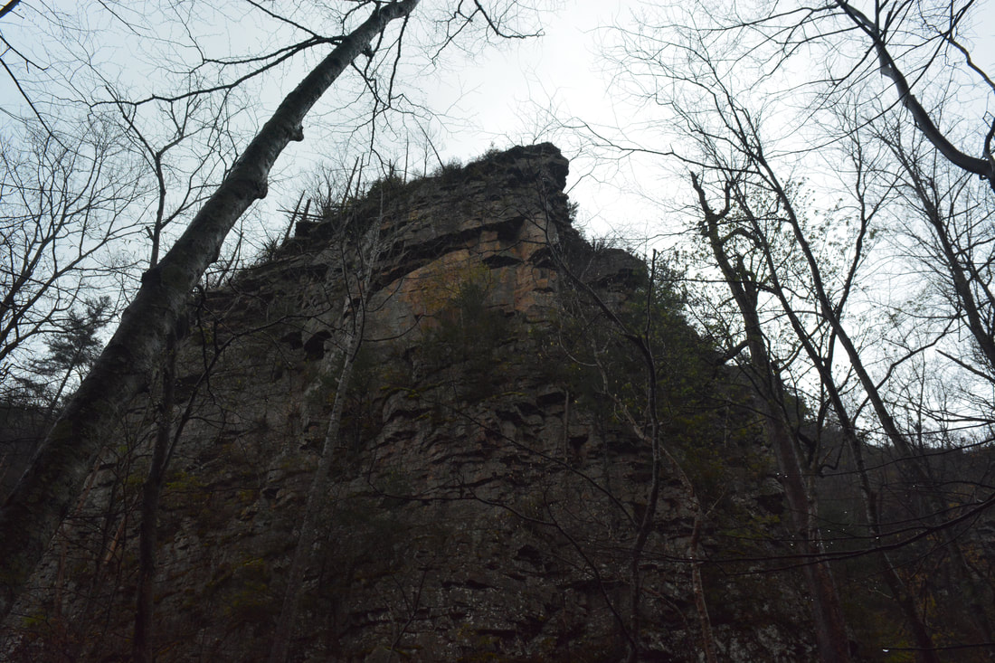
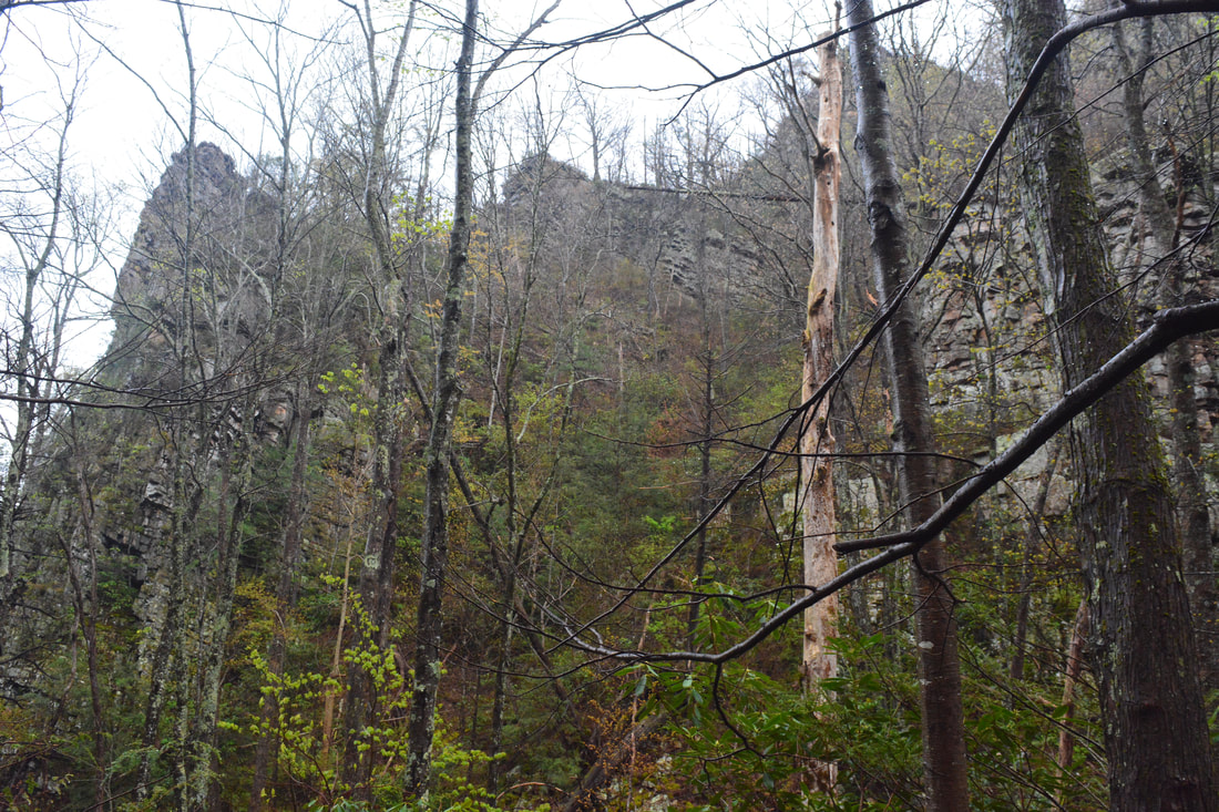
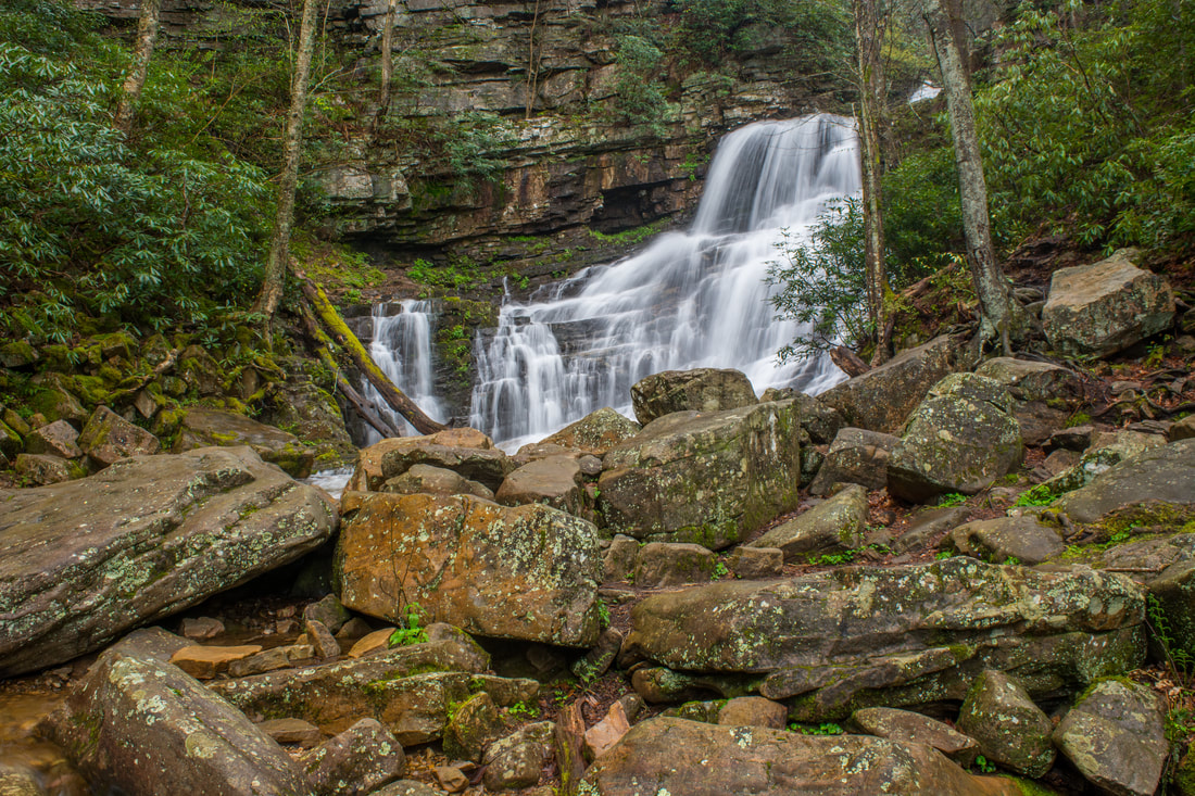
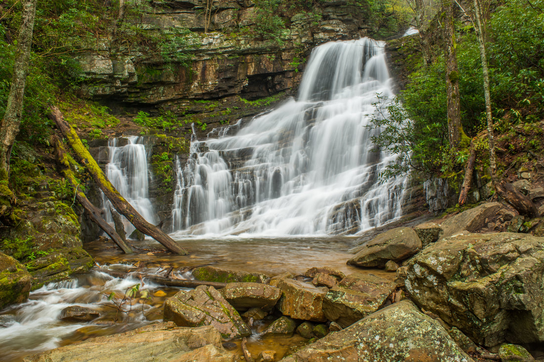
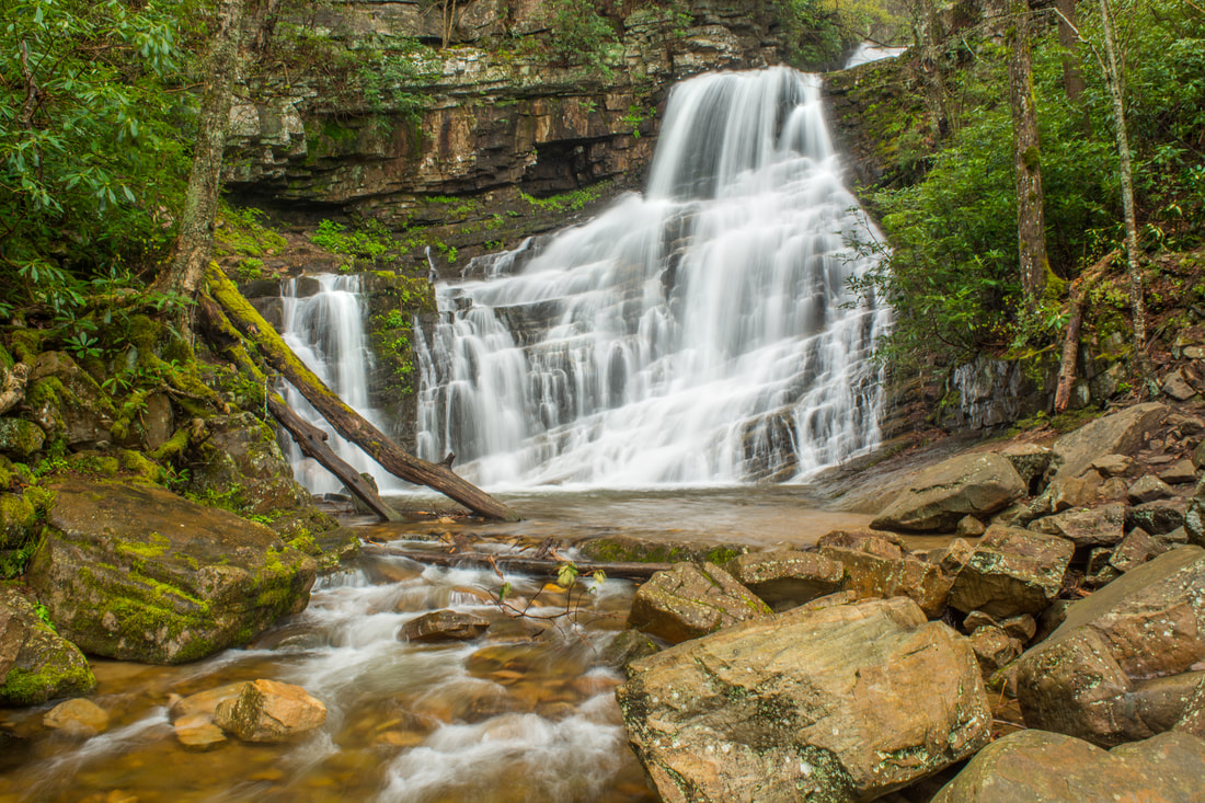
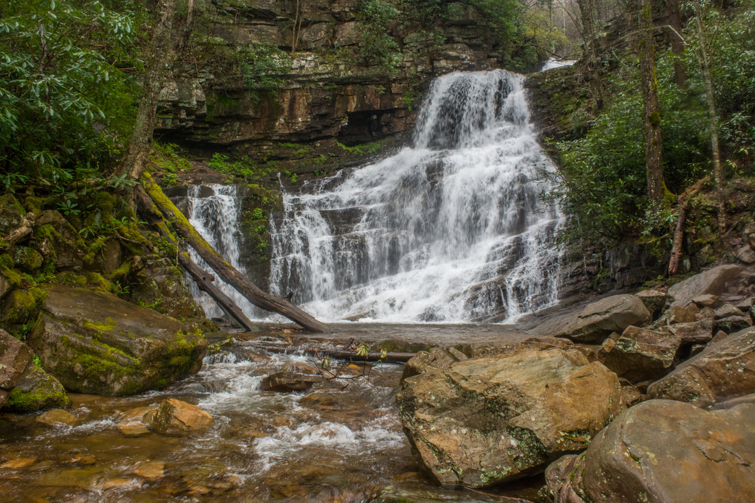
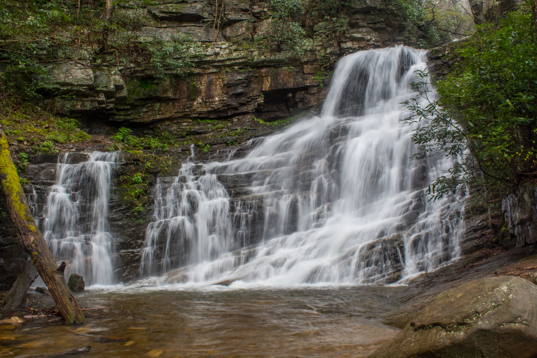
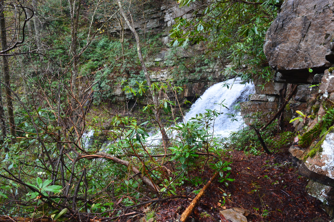
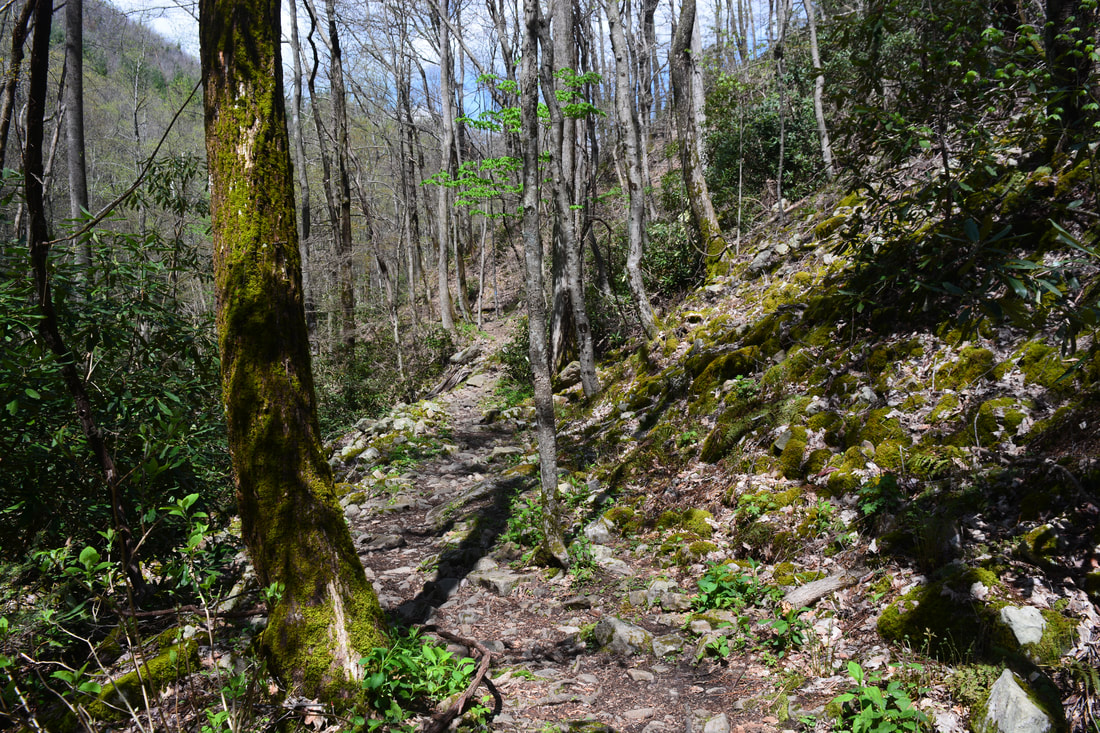
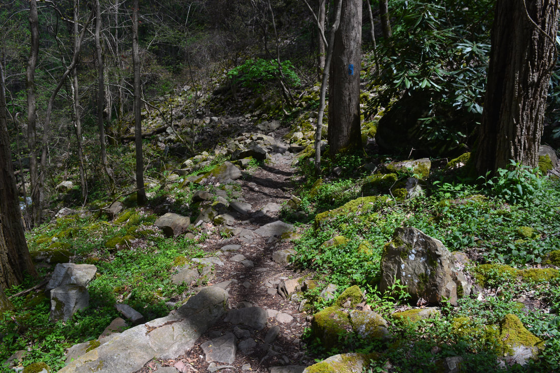
The hike begins behind the gate by the large "Trailhead" sign along a closed gravel road. The first 0.5 miles of the trail follow this old road, which is nearly level. After a half-mile of easy walking, reach a turnaround at the road's end by a new trailhead kiosk. The Phillips Hollow Trail leaves left, fording Dry Creek just below the scenic confluence of the West Fork and East Fork. Just below the crossing are the foundations of an old road bridge. The little-used Phillips Hollow Trail then climbs several miles through Phillips Hollow to the Appalachian Trail. This hike stays right on the Margarette Falls Trail. In another 100 feet, Bullen Hollow Trail bears right at a Y-split - stay left on Margarette Falls Trail (Bullen Hollow Trail eventually leads to Viking Mountain Road near Jones Meadow). This is where the trail begins closely following the extremely scenic West Fork Dry Creek. At 0.85 miles, the trail crosses a wooden footbridge across the creek just below a scenic chute among mossy rocks. The trail then passes through a rough boulder field and begins ascending more steeply. Just after passing a pancake-shaped cascade popular with photographers, the trail reaches an ankle-deep ford of West Fork Dry Creek at 1.1 miles. This is the only wet crossing before Margarette Falls. At 1.2 miles, the trail passes a massive cliff on the other side called Cathedral Rock. When you see Cathedral Rock, you'll know you're almost at the falls. Reach the end of the official trail at Margarette Falls at 1.3 miles. A combination of beauty and ease of access makes Margarette Falls a popular one in good weather. This 60-foot drop starts out with a short free-fall that fans out beautifully along a stairstep rock face. A pile of boulders below the pool provides ample viewing space. 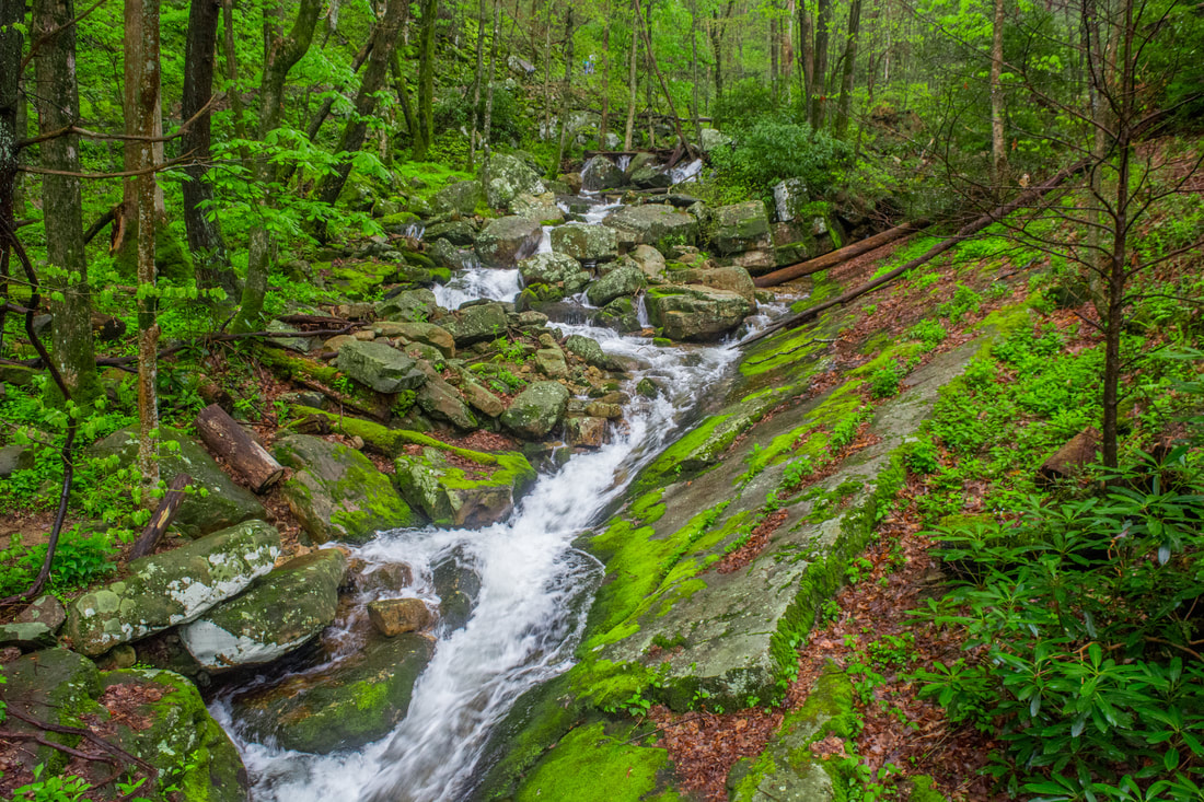
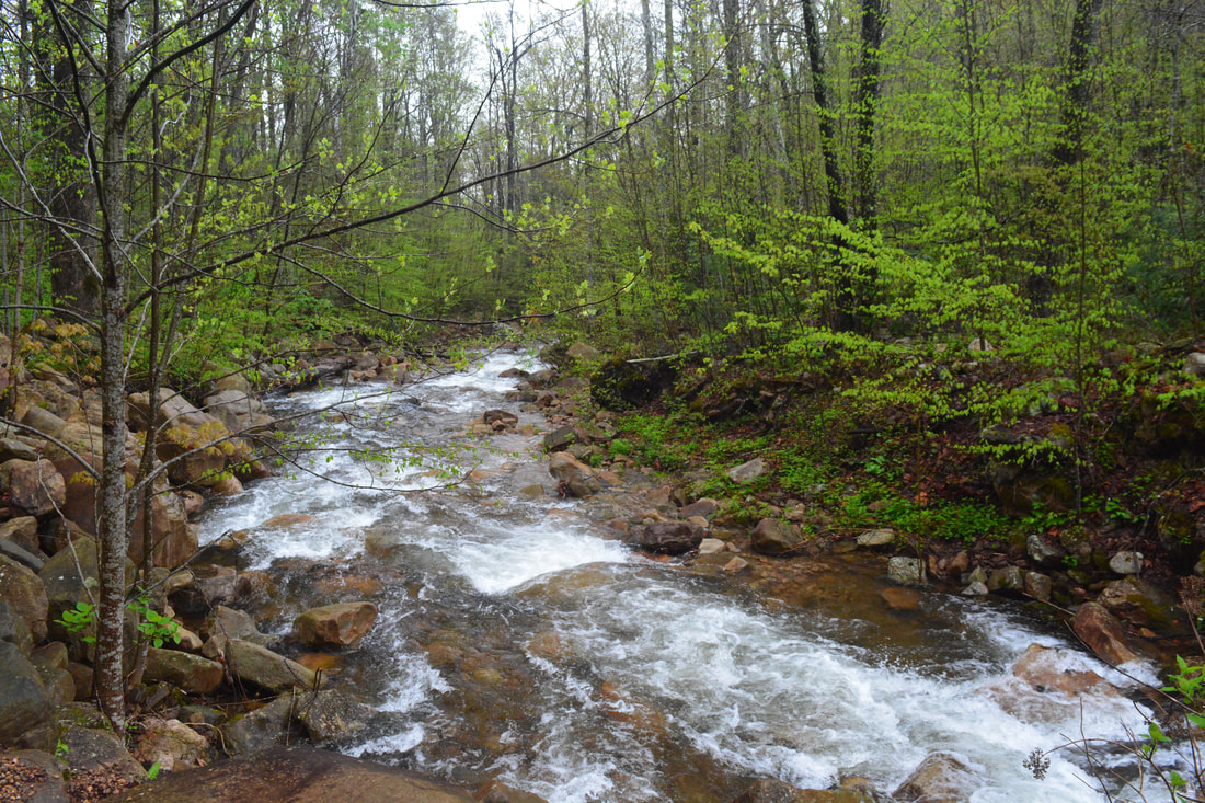
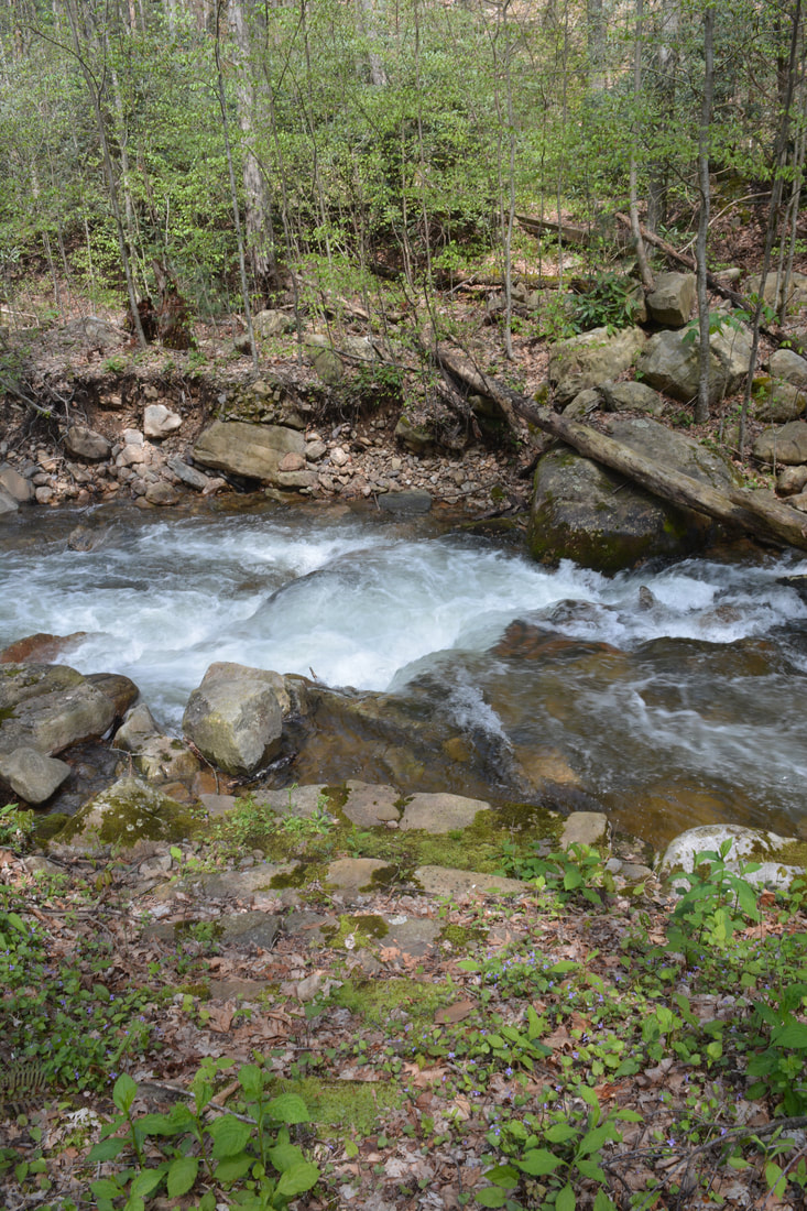
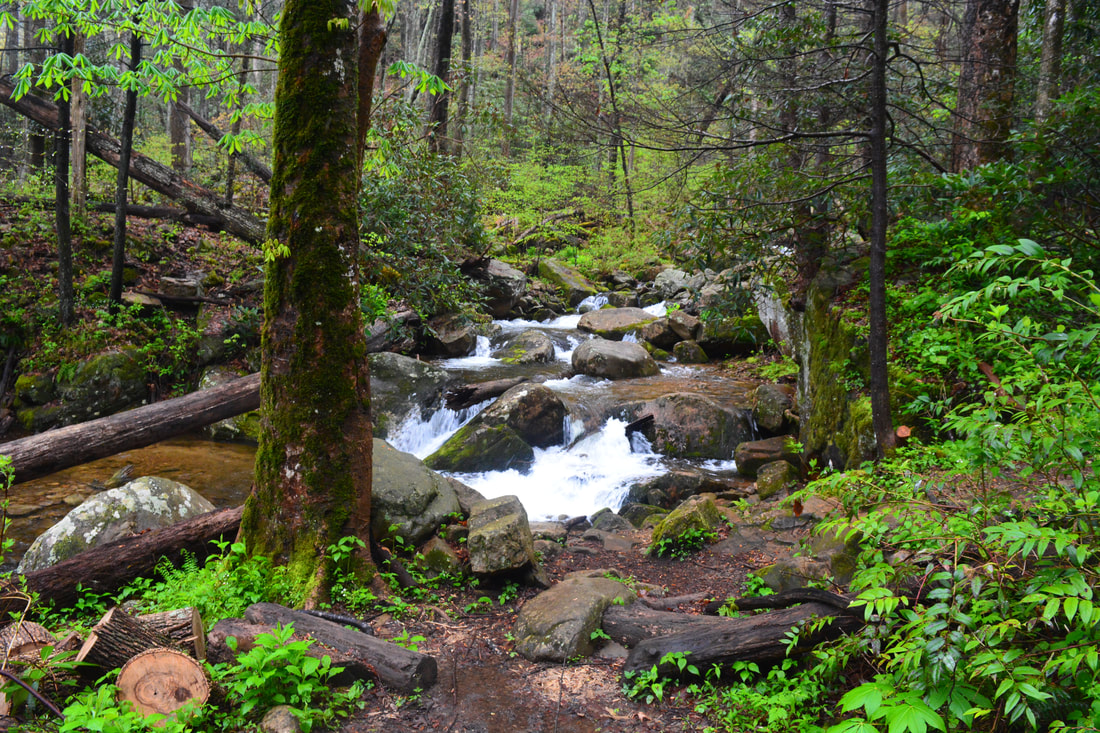
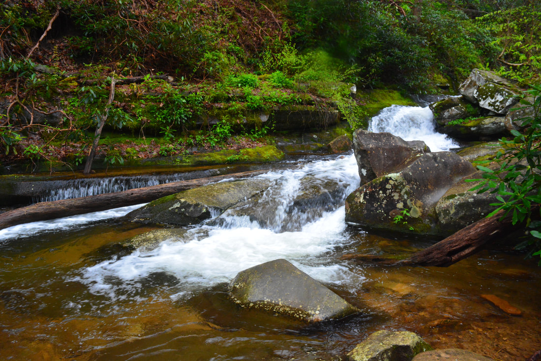
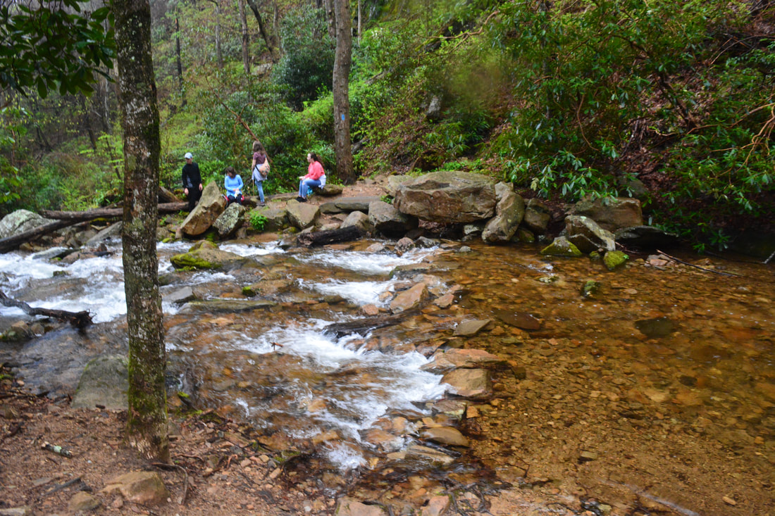
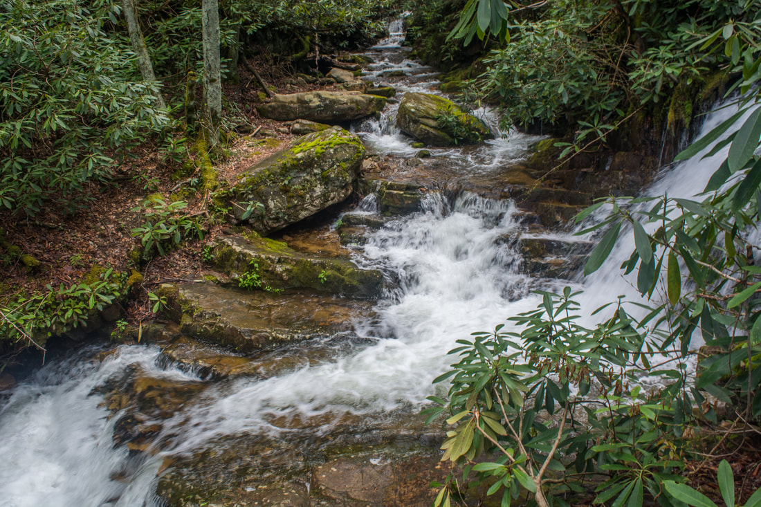
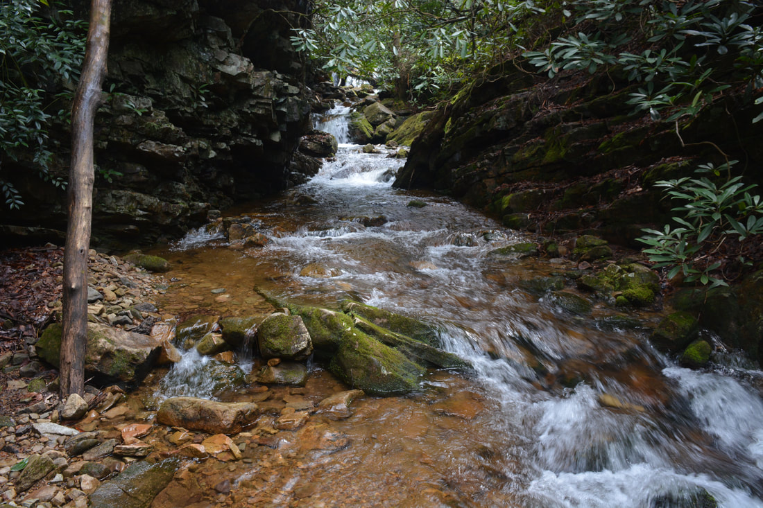
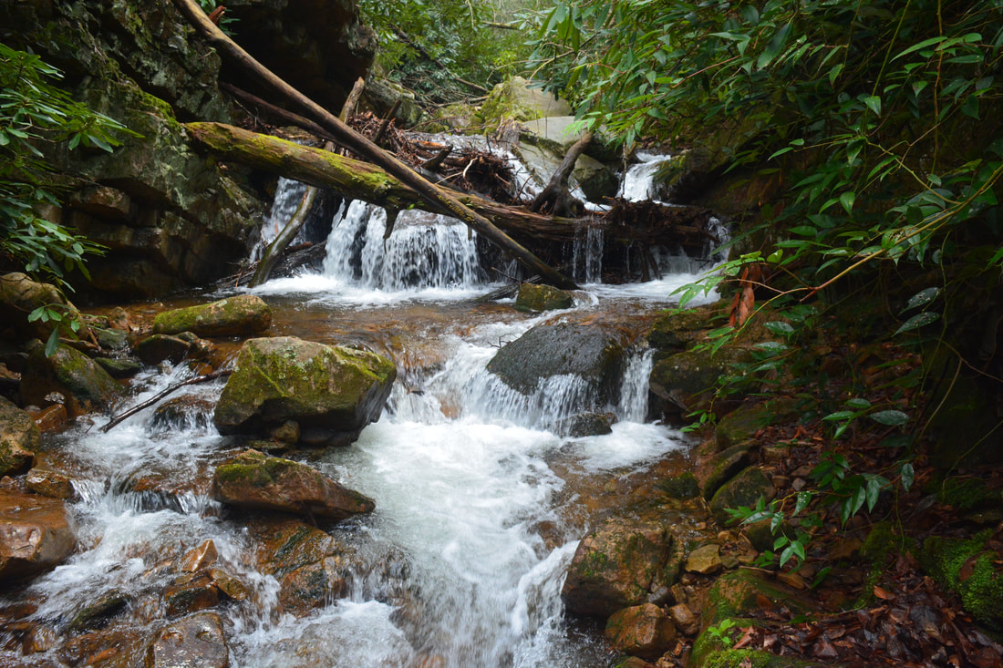
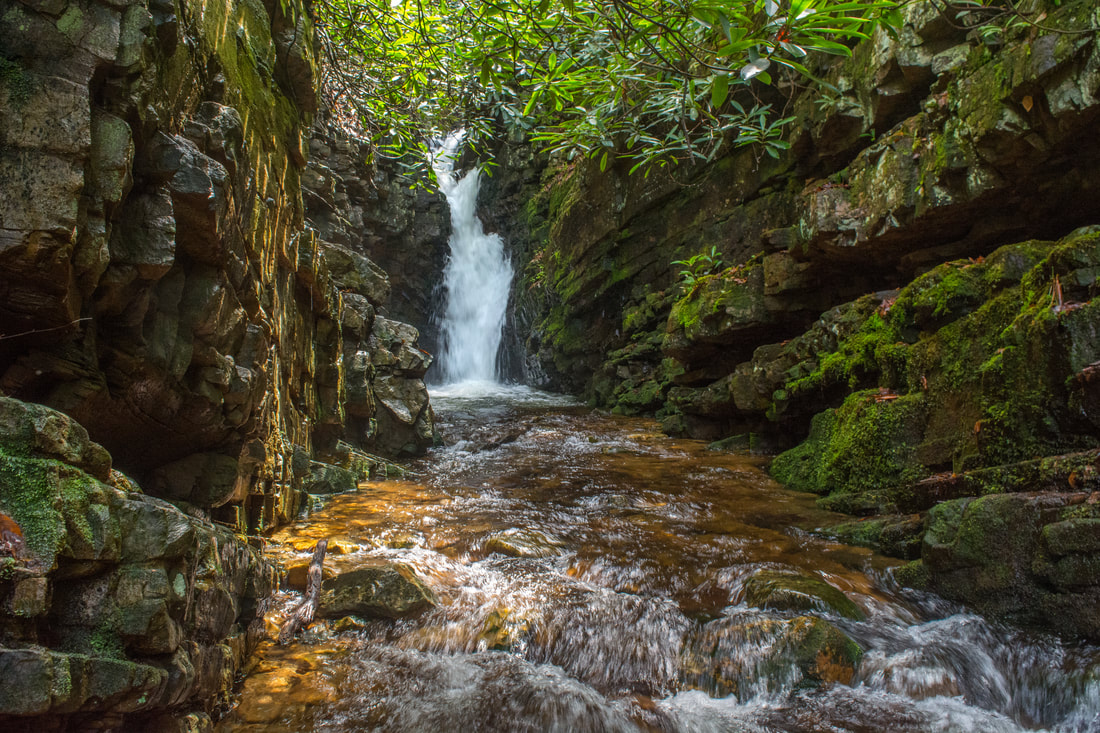
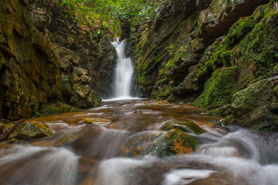
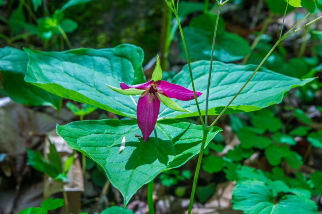
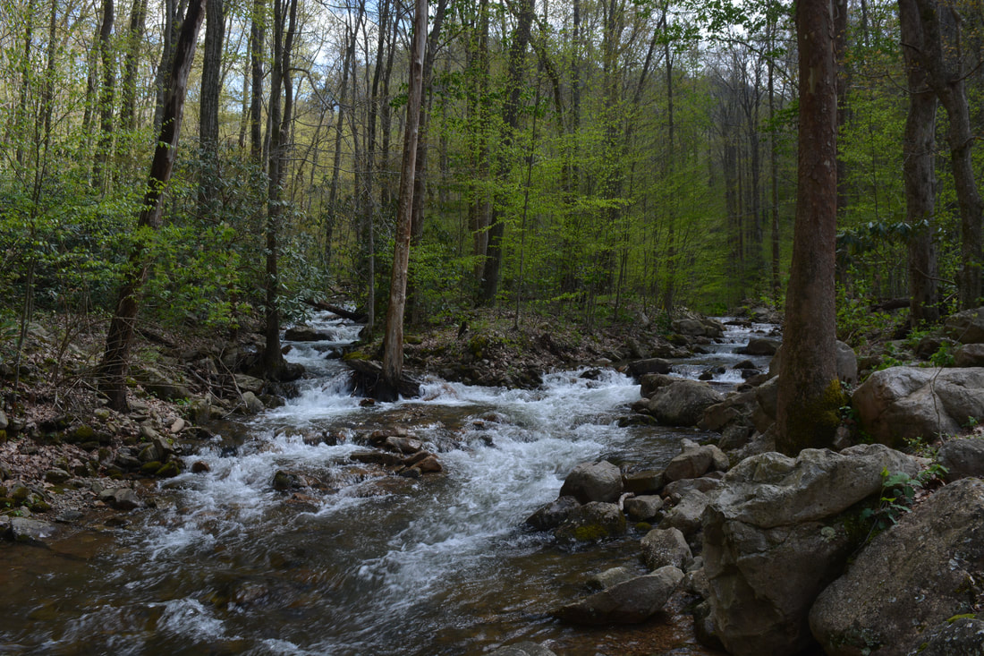
The course of West Fork Dry Creek is stunningly beautiful in spring.
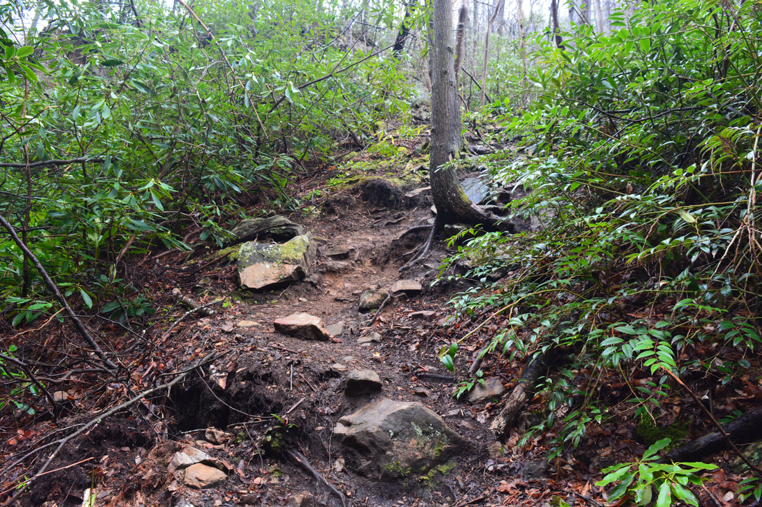
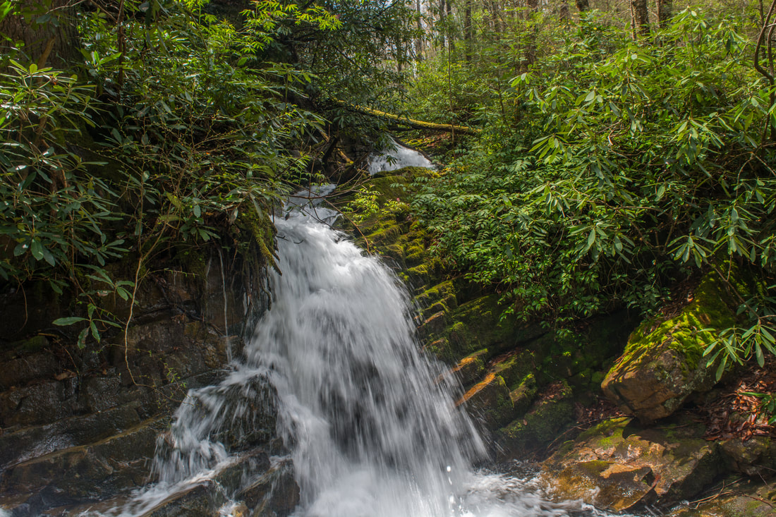
The hike out and back to just Margarette Falls is a moderate 2.6 miles roundtrip and a great choice for novice hikers or folks just looking for a few hours of exercise and time in nature. However, there's a lot more to see for experienced hikers. While the official trail ends at Margarette Falls, a steep and well-defined pathway climbs up alongside Margarette Falls on the same side of the creek. This is the way to Bailey Falls. Near the top of the climb, you need to turn left and scramble up a 10-foot rock outcrop. Experienced scramblers shouldn't have issues due to several good handholds. The path continues 100 feet before reaching a creek crossing. At normal flow, the crossing should be easy, but be extremely careful, as the top of Margarette Falls just downstream. On the other side, you'll find a secluded campsite. The path crosses the creek again before ending at the confluence of an unnamed tributary from Bullen Hollow on the River Left side (from the west) at 1.4 miles. The pretty 10-foot cascade at the confluence is sometimes referred to as Glen Falls.
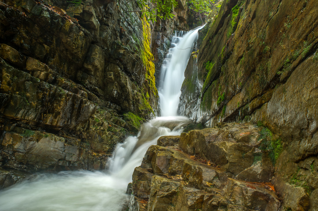
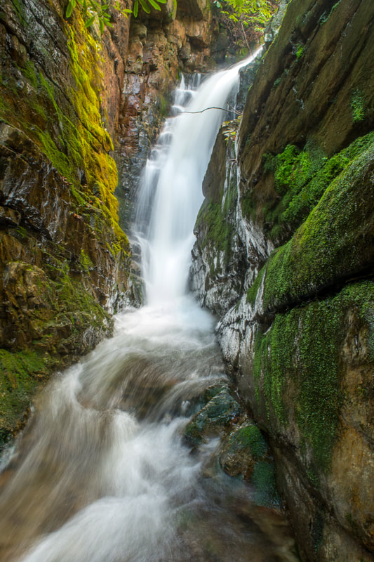
The rest of the way to Bailey Falls from the confluence is exclusively in the creek. Be sure to stay on the left-hand branch of the creek at the confluence (River Right branch). Most of the creek-walk is fairly easy in normal flow, but there is one tricky spot where you'll need to scramble up a pile of deadfall and a slick sloping rock. You'll pass a couple of jagged bluffs before the falls. Reach Lower Bailey Falls at 1.5 miles. Lower Bailey Falls is a unique chute-style drop between narrow, jagged rock walls. The bluffs along both sides of the creek form an unusual slot canyon setting. Small stones are scattered throughout the stream just below the falls. Lower Bailey Falls is situated in a grotto that remains dusky even on a sunny afternoon. Lower Bailey Falls is very photogenic and interesting, but in my opinion, the upper falls right around the corner is even more stunning. To get there, look for a steep scramble path on the River Right (east) side of the creek just below the falls. It climbs up a series of rock outcrops above the lower falls, meanders for 100 feet, and comes out on a sloping rock at the top of the lower falls. Proceed extremely carefully down the rock and into the creek just above the lower falls. This is not a place for any foolish decisions - a fall down Lower Bailey Falls could be fatal! Once you safely maneuver your way into the water, you'll have a clear view of Upper Bailey Falls (although the best view is on a narrow rock shelf on the other side of a waist-deep pool). 30-foot Upper Bailey Falls is a sheer drop in a spectacular slot canyon. West Fork Dry Creek shoots out from an invisible passage above the canyon and makes a right-angle turn as it drops into the canyon. Tall vertical cliffs surround the falls, helping to create one of the most breathtaking and distinctive scenes in Northeast Tennessee. 
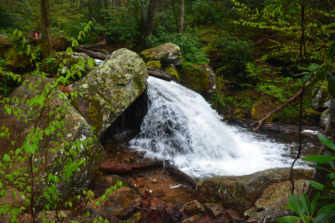
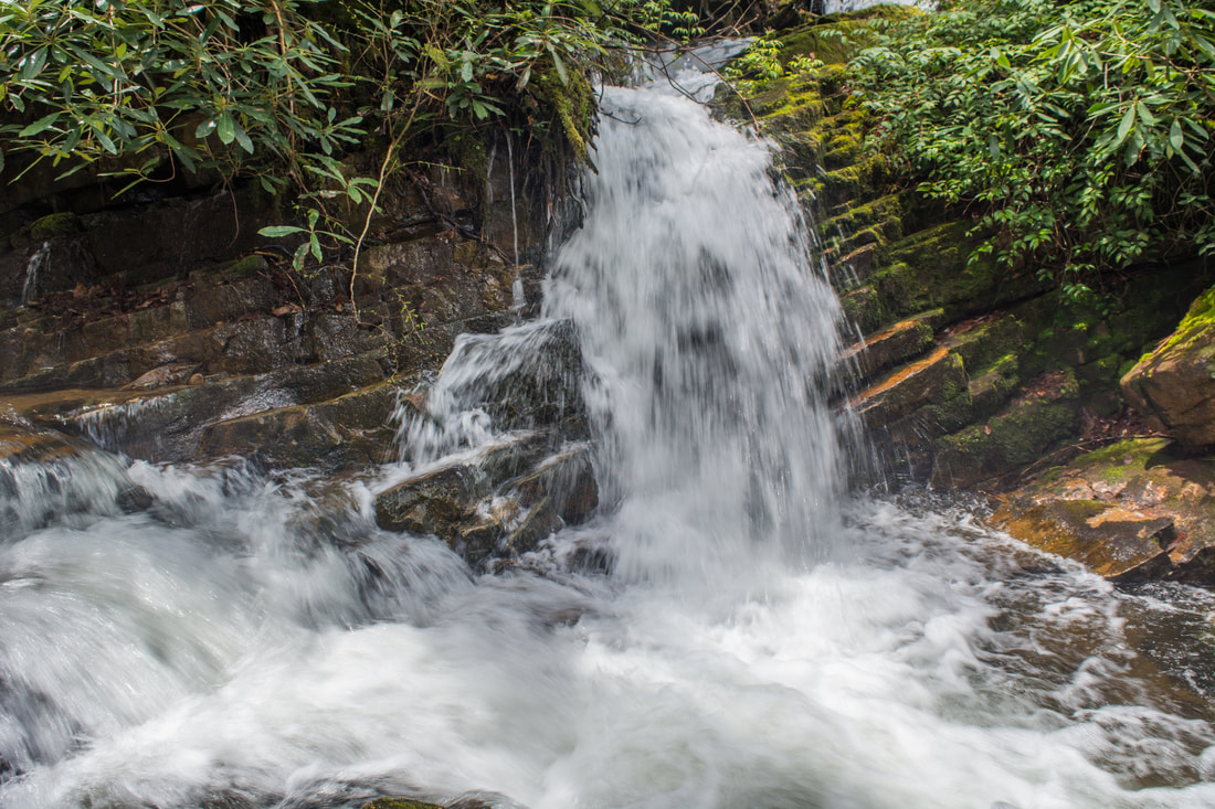
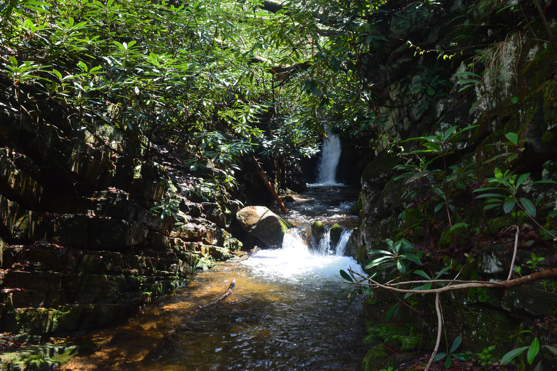
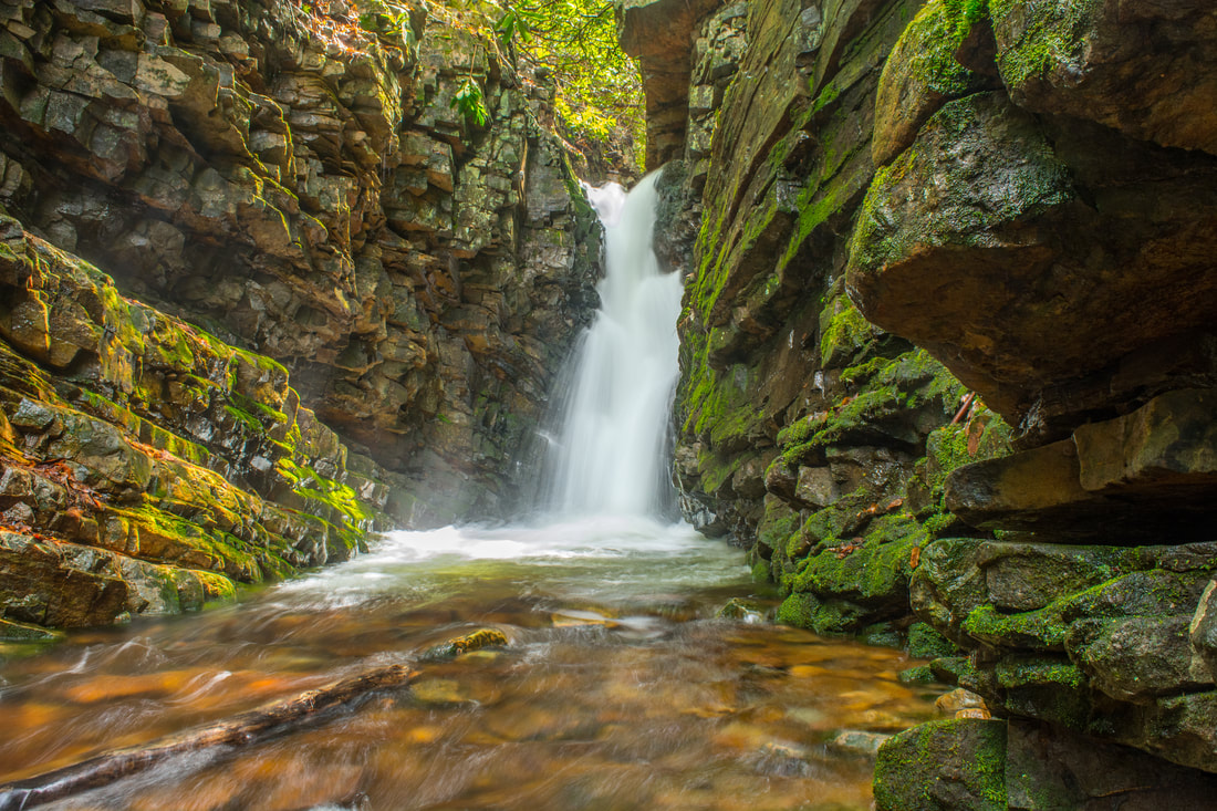
Lower Bailey Falls is a unique 20-foot waterfall in a shadowy grotto formed by jagged cliffs.
Simply retrace your steps back to the parking area from Upper Bailey Falls. After you finish the creek-walk and descend to Margarette Falls, the rest of the return trip will be a piece of cake. You'll conclude the hike at 3.0 miles.
Mileage
0.0 - Margarette Falls Trailhead
0.5 - Phillips Hollow Trail and Bullen Hollow Trail Split 0.85 - West Fork Dry Creek Footbridge 1.1 - West Fork Dry Creek Ford 1.2 - Cathedral Rock 1.3 - Margarette Falls 1.5 - Bailey Falls Variations
Hike just out and back to Margarette Falls - 2.6 Miles
Bonus Stops
the Margarette/Bailey Falls hike is only a half-day hike, at best. If you're wanting to fill up the day with another hike, consider driving up Viking Mountain Road to Jones Meadow and hiking the Appalachian Trail out and back to the spectacular views from Blackstack Cliff and Firescald Knob.
Pictures & Videos
0 Comments
Leave a Reply. |
About MeMark Oleg Ozboyd Dear readers: I have invested a tremendous amount of time and effort in this website and the Georgia Waterfalls Database the past five years. All of the work that has gone in keeping these websites updated with my latest trip reports has almost been like a full-time job. This has not allowed me to pick up a paid job to save up money for college, and therefore, I I've had to take out loans. If you find the information on this website interesting, helpful, or time-saving, you can say "thanks" and help me out by clicking the button above and making a contribution. I will be very grateful for any amount of support you give, as all of it will apply toward my college tuition. Thank you!

Coming in 2022-2023?
Other Hiking WebsitesMiles HikedYear 1: 540.0 Miles
Year 2: 552.3 Miles Year 3: 518.4 Miles Year 4: 482.4 Miles Year 5: 259.9 Miles Archives
March 2021
Categories
All
|
||


 RSS Feed