HIKING THE APPALACHIANS AND BEYOND
  • Home
  • Trail Reports
    • Best Hikes
    • Hikes with Scenic Views
    • Hikes with Water Features
    • Alabama
    • Georgia
    • Florida
    • North Carolina
    • South Carolina
    • Tennessee
    • Vermont
    • Virginia
  • Map
  • Hike List
  • Testimonials
  • Resources
  • Contact Us
  • Southeast Nature Society
    • Our Team
  • Georgia Waterfalls Database

Chattahoochee National Forest: Yonah Mountain Trail, Cleveland, Georgia

9/19/2017

1 Comment

 
Picture
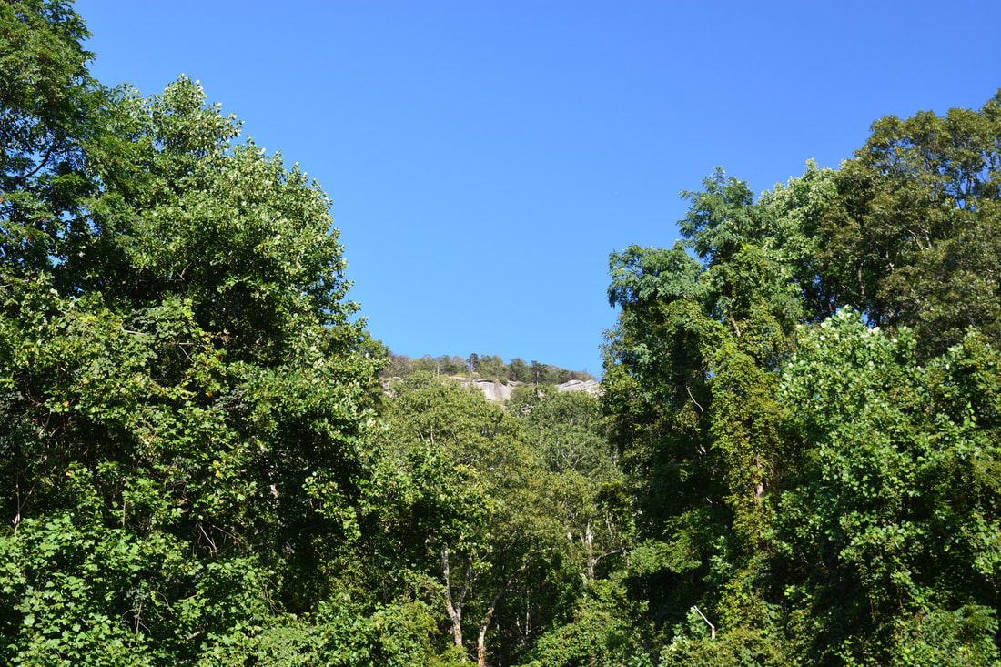
Few mountains in Georgia are landmarks as prominent as Yonah Mountain. Situated between the towns of Helen and Cleveland, Yonah Mountain's shape and spectacular sheer cliffs can be recognized from nearly every direction. In recent years, the trail to the top of Yonah Mountain has also become one of the most popular hikes in Georgia and for good reason: the incredible panoramic views atop Yonah's cliffs are easily among Georgia's most breathtaking. Even though the trail involves a fairly steep ascent, it does not stop up to hundreds of people from visiting the cliffs on good weekends. Unfortunately, the crowds can be a drawback of this hike, but the views are so spectacular that it's still worth it, and if you hike very early in the morning or late in the day, you might encounter relatively few people. This hike occurred on Monday, September 4th, 2017. My plan was to hike the Yonah Mountain Trail out and back to the top of Yonah Mountain, where I would make a small loop visiting all four main vistas. On my way back, I would make a slight detour to see an enormous boulder known simply as "The Boulder". 

Summary

R/T Length of Trail: 4.2 Miles 
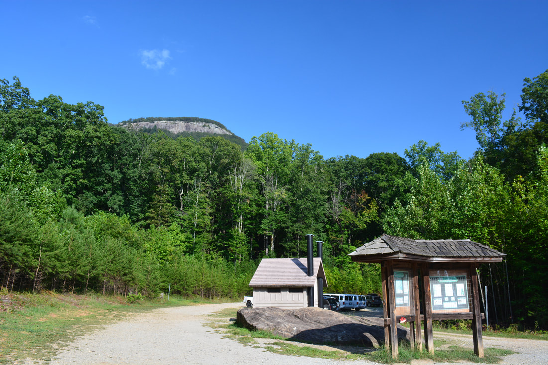
Duration of Hike: 3:50 (includes about 1 hour and 20 minutes of breaks) 
Type of Hike: Out and Back 
Difficulty Rating: 5 out of 10 
Total Elevation Gain: 1613 Feet
Pros: Spectacular views 
Cons: Parts of the trail follow forest roads and service roads 
Points of Interest: Yonah Mountain Views - 10 stars collectively; The Boulder below Yonah Mountain 
Trail Blaze Colors: Yonah Mountain Trail - Lime Green 
Best Seasons to Hike: Fall; Winter 
Fees: None 
Beginning Point: Yonah Mountain Parking off Chambers Road 
Directions from Cleveland, GA: From the intersection of Main Street (US 129) and Helen Highway (GA 75) near downtown Cleveland, follow Helen Highway/GA 75 North for 2.1 miles. Then, turn right onto Tom Bell Road. In another 0.9 miles, turn right onto Chambers Road. Continue on Chambers Road for 0.7 miles to the Yonah Mountain Trailhead sign. Turn right onto the dirt trailhead road and follow it to its end at a large parking area where the hike begins with a view of the Yonah Mountain cliffs. Even though the parking are is pretty big, it still fills up quickly and cars often have to park along the entrance road. 

Map

Picture
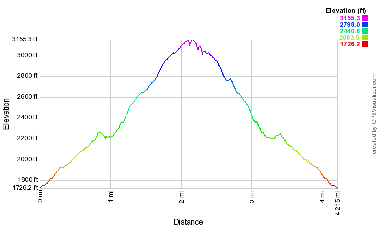
Click the link below to download a .GPX file with a track of this hike. 
yonah_mountain_trail.gpx
File Size: 176 kb
File Type: gpx
Download File

Details

My first visit to Yonah Mountain was over four years ago. At the time, I was blown away by the breathtaking cliff-top views, and the trail was also not as well-known as it is today. As Labor Day 2017 rolled around, I decided that it was time for a re-visit of Yonah Mountain. I was shocked to find the parking area overflowing when I arrived at the trailhead at about 5 PM. Fortunately, due to the late timing of my hike (just in time for sunset), I met most of the people on my way up and had the views and nighttime descent mostly to myself. ​

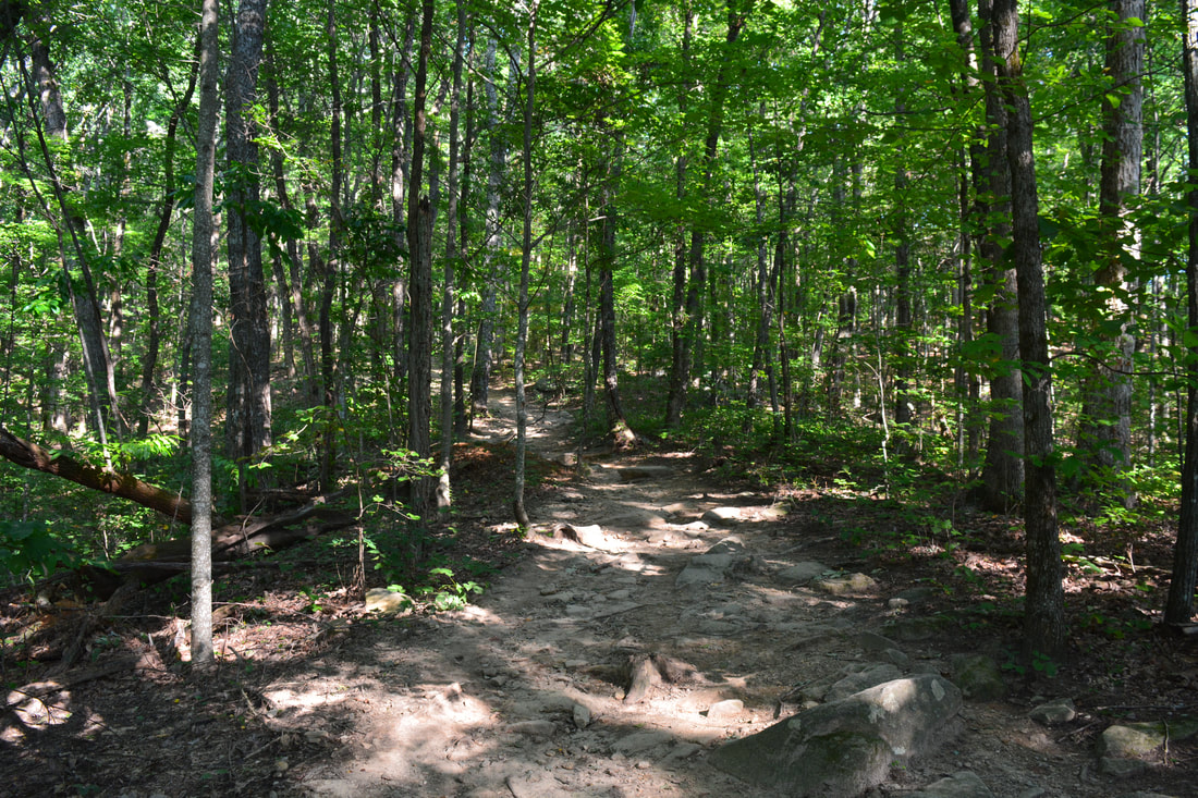
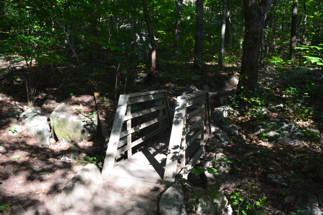
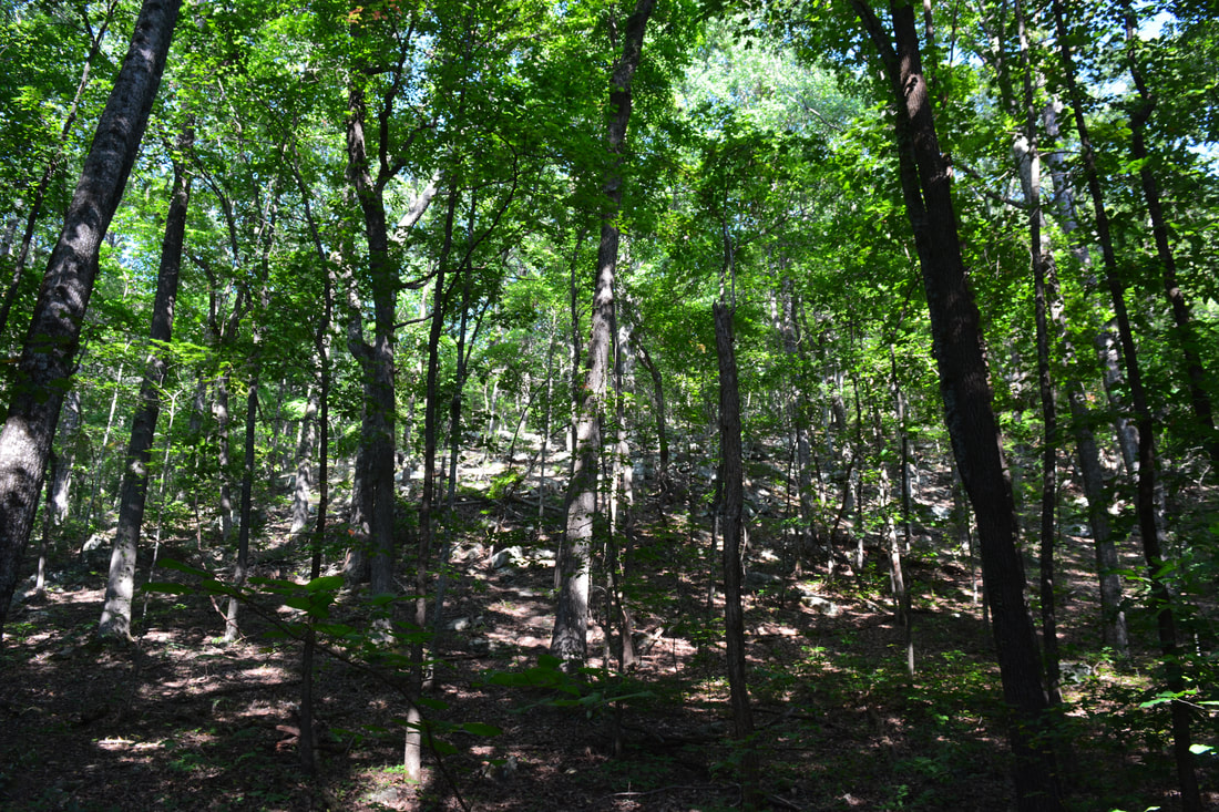
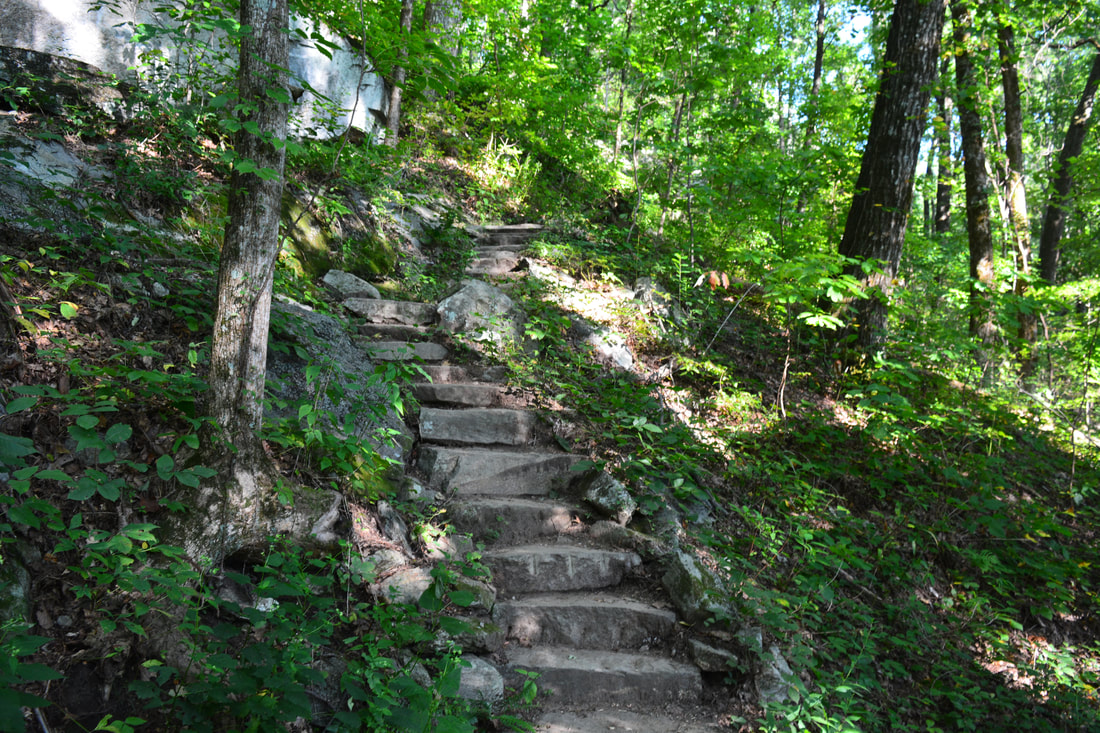
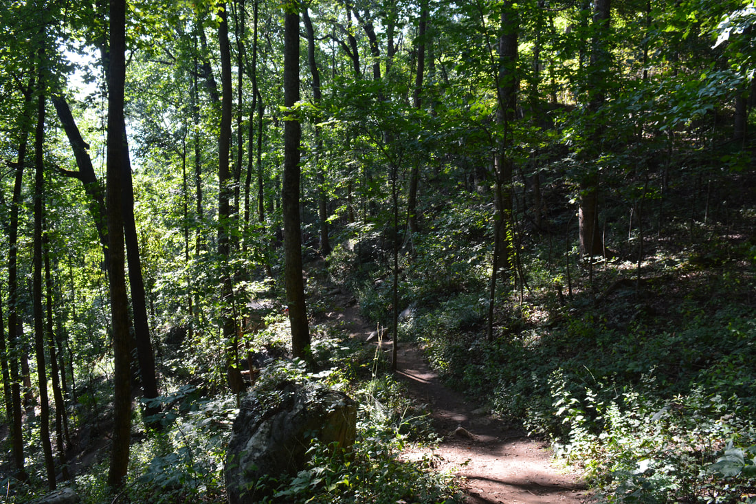
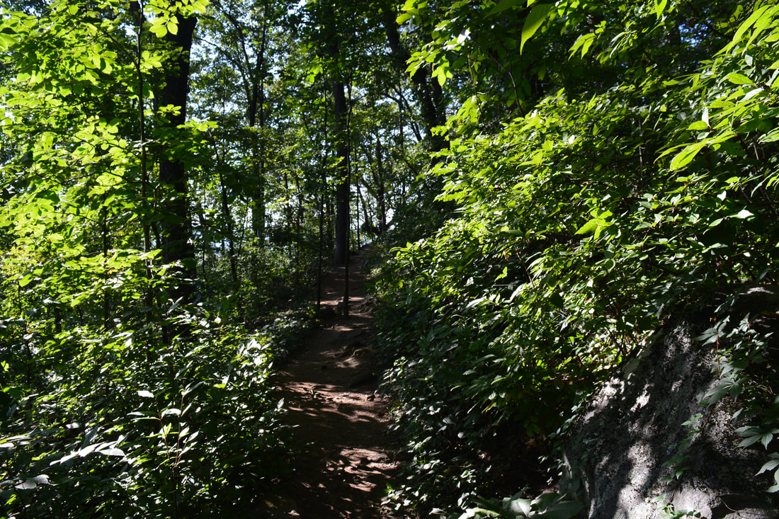
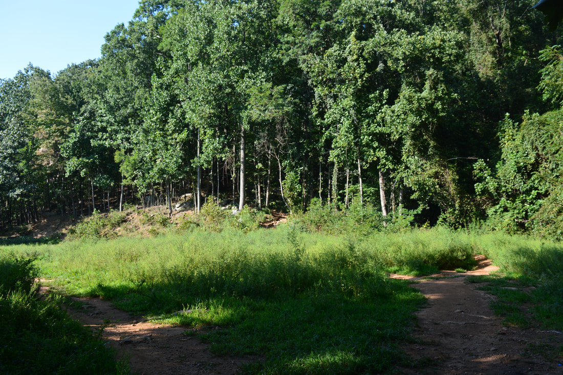
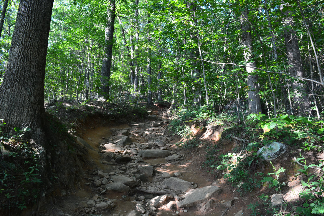
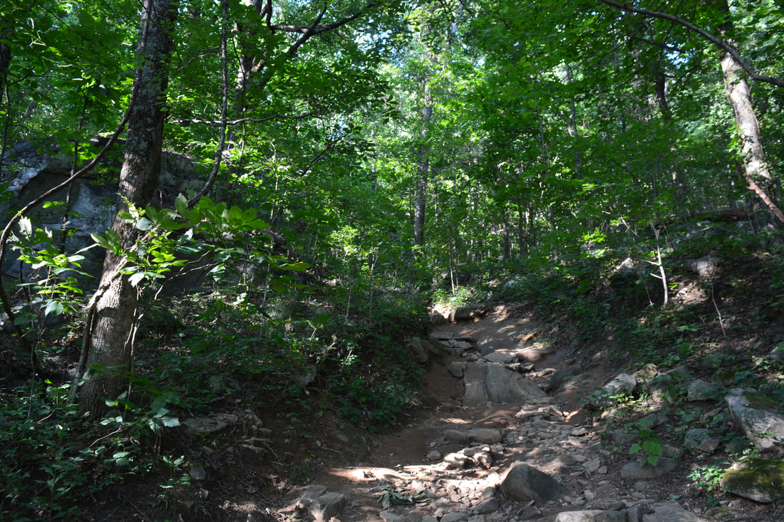
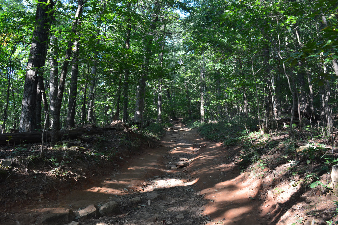
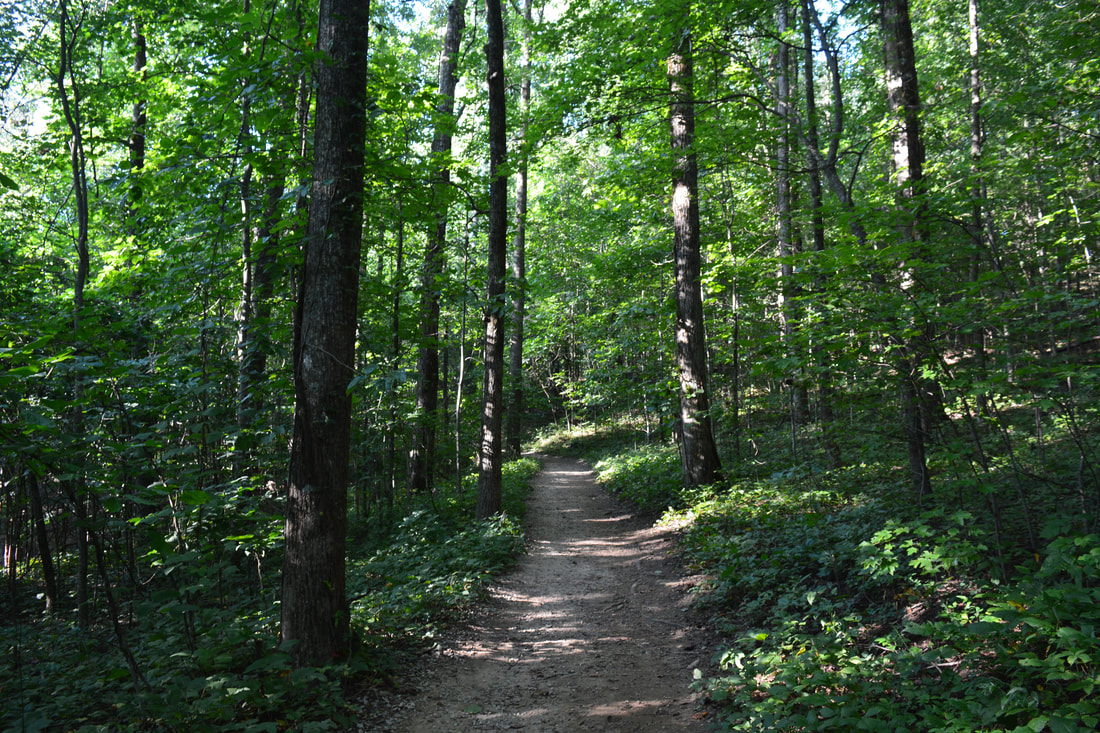
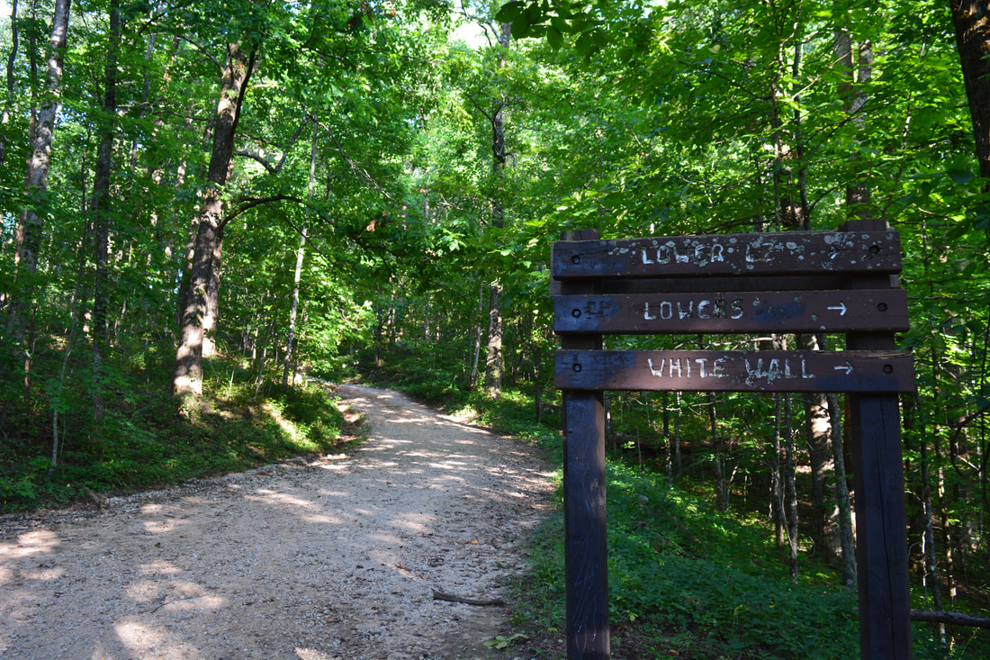
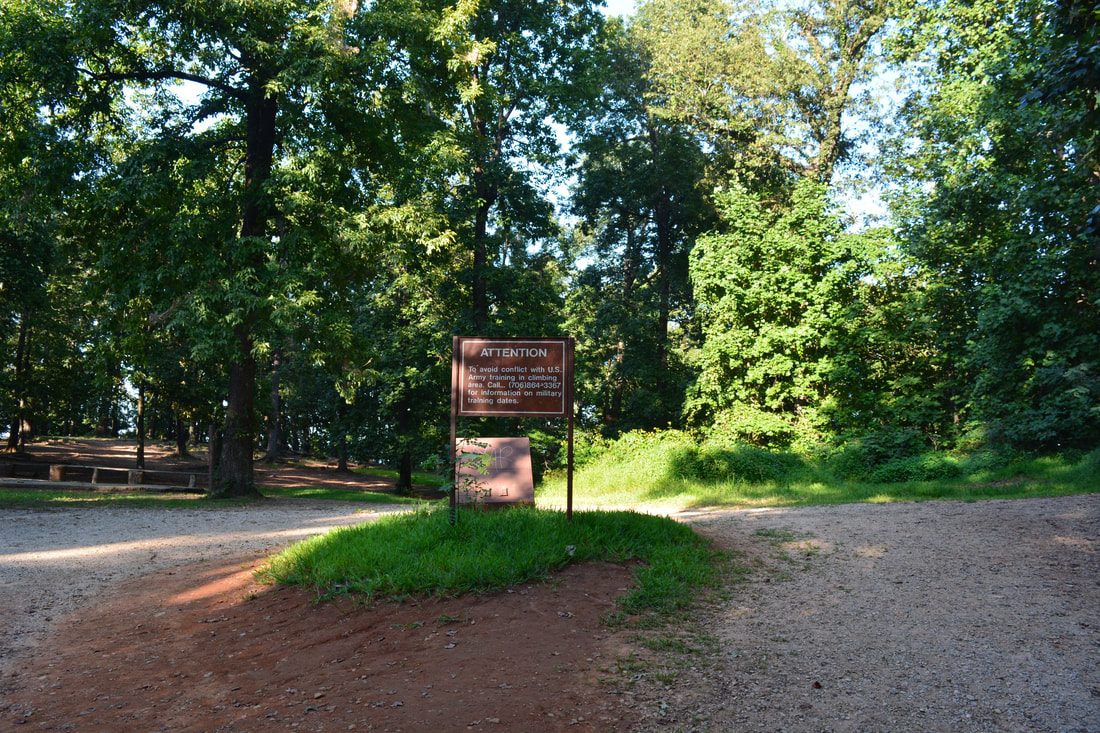
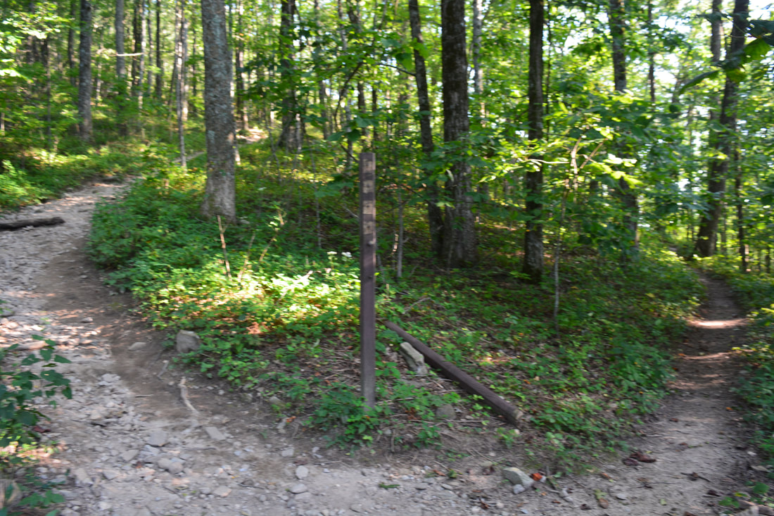
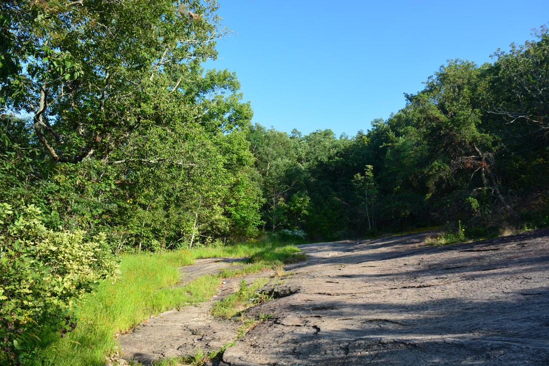
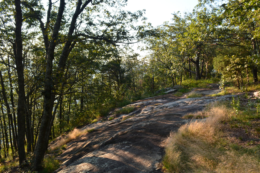
The Yonah Mountain hike begins on the broad trail leaving the left side of the parking area near the kiosk. Before beginning the hike, take a minute to look up toward the massive signature cliffs of Yonah Mountain. The green-blazed trail starts out with a gradual ascent that gradually steepens. Around 0.3 miles, the trail crosses a footbridge across a gully in a boulder field. The trail then briefly levels out with views of boulder fields up the steep slope to the left. As the ascent steepens again, there are several sets of rock steps along the obvious trail around 0.7 miles. Make sure to stay on the main trail and avoid any shortcuts. A particularly large switchback occurs at 0.8 miles, followed by a very brief downhill - the only one on the way up Yonah Mountain. The trail soon becomes considerably rockier, making a short boulder scramble through a notch at 1.0 miles. After traversing another boulder field with some winter views, the trail reaches an overgrown grassy clearing at 1.2 miles. A small rock outcrop provides views into the valley to the west, but these views are only a small taste of what's to come. The grassy clearing also has a view of the Yonah Mountain cliffs high above, showing how much farther you have to ascend. You have ascended about 600 feet so far, and there is still over 800 feet of elevation gain coming up - along with the steepest part of the trail. 

The trail turns right at the clearing and begins ascending very steeply along a severely eroded and rutted old road. User-created trails have sprung up along sides of the road to bypass the eroded areas. Farther up, the road becomes slightly less eroded but remains nearly as steep. Just before it levels out, a distinct path heads right at 1.4 miles. That path is an alternate trail that leads past The Boulder, which I would check out on my way back. Meanwhile, the trail along the old road levels out a bit and reaches a gravel service road at 1.55 miles. Turn right onto the service road and shortly reach a large clearing where there is a US Army Training Area at 1.6 miles. Turn right here onto the forest road that leads to the summit. Shortly afterwards, the forest road bears left while a distinct trail continues straight. Both the road and the trail lead to the summit, but I used the shorter and steeper trail. A few feet after leaving the forest road, the main trail continues straight while another trail bears right and leads to The Boulder. You will use this trail on the way back. A sign used to mark this junction, but at the time of my hike, it was missing. Meanwhile, the main trail intercepts one switchback of the forest road and then ends at another switchback in the road at 1.8 miles. Continue following the ascending road from here on as it curves left. At 1.85 miles, the road crosses a broad rock slab. Some of Yonah Mountain's vistas lie just to the right, but I suggest saving them for later and continuing straight to the summit along the road for now. 
Picture
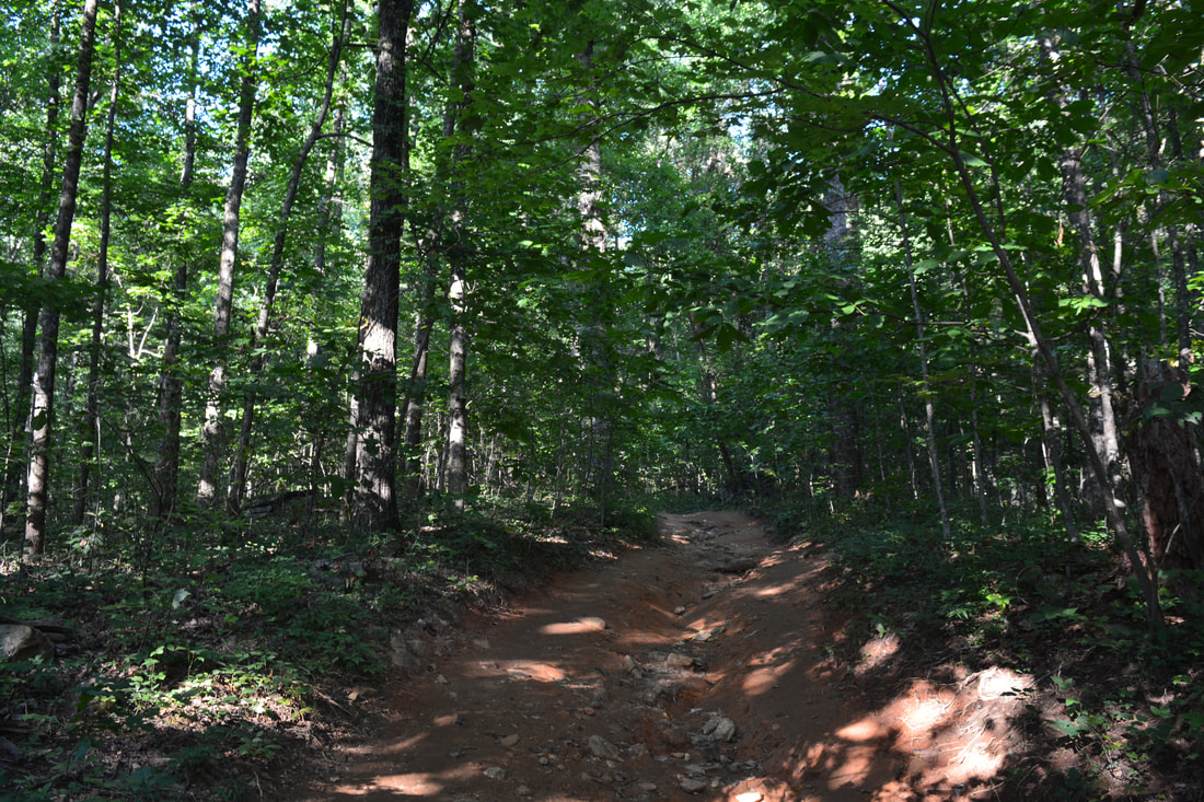
Part of the Yonah Mountain Trail follows a steep and eroded old road.
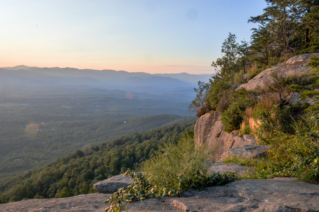
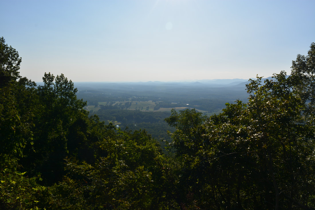
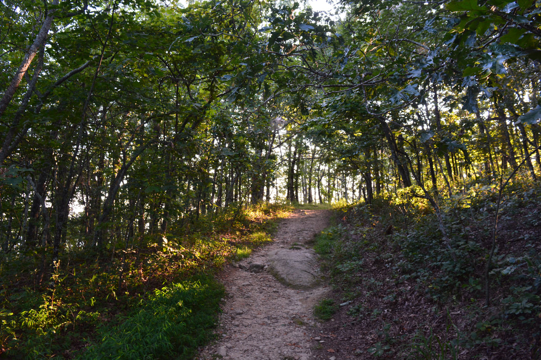
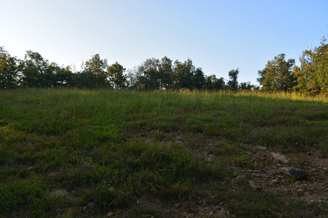
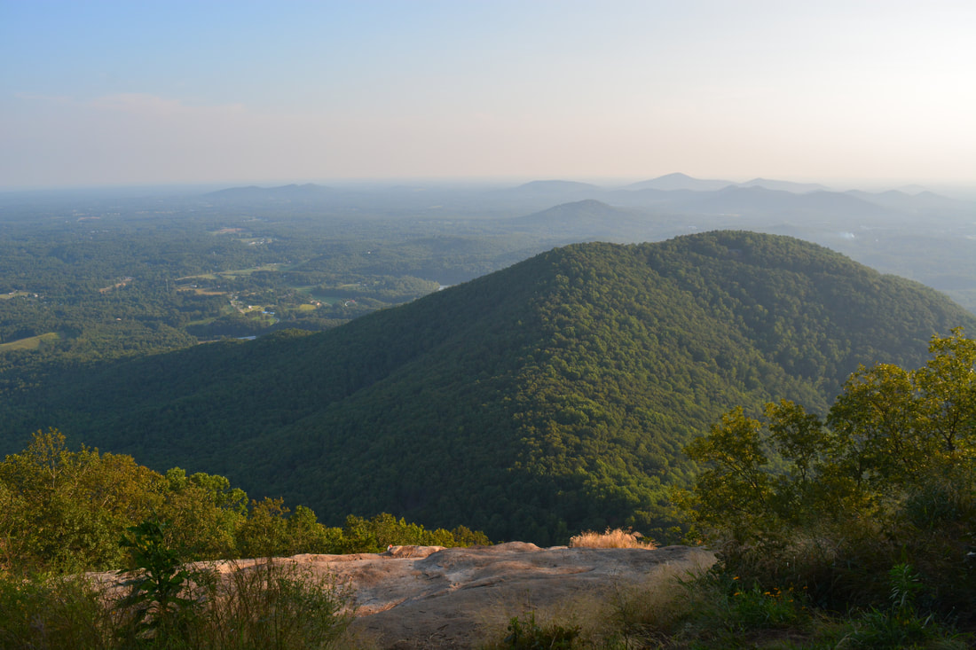
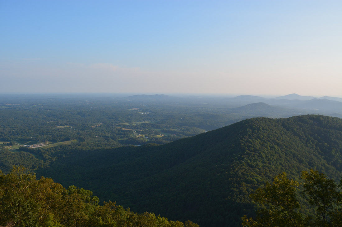
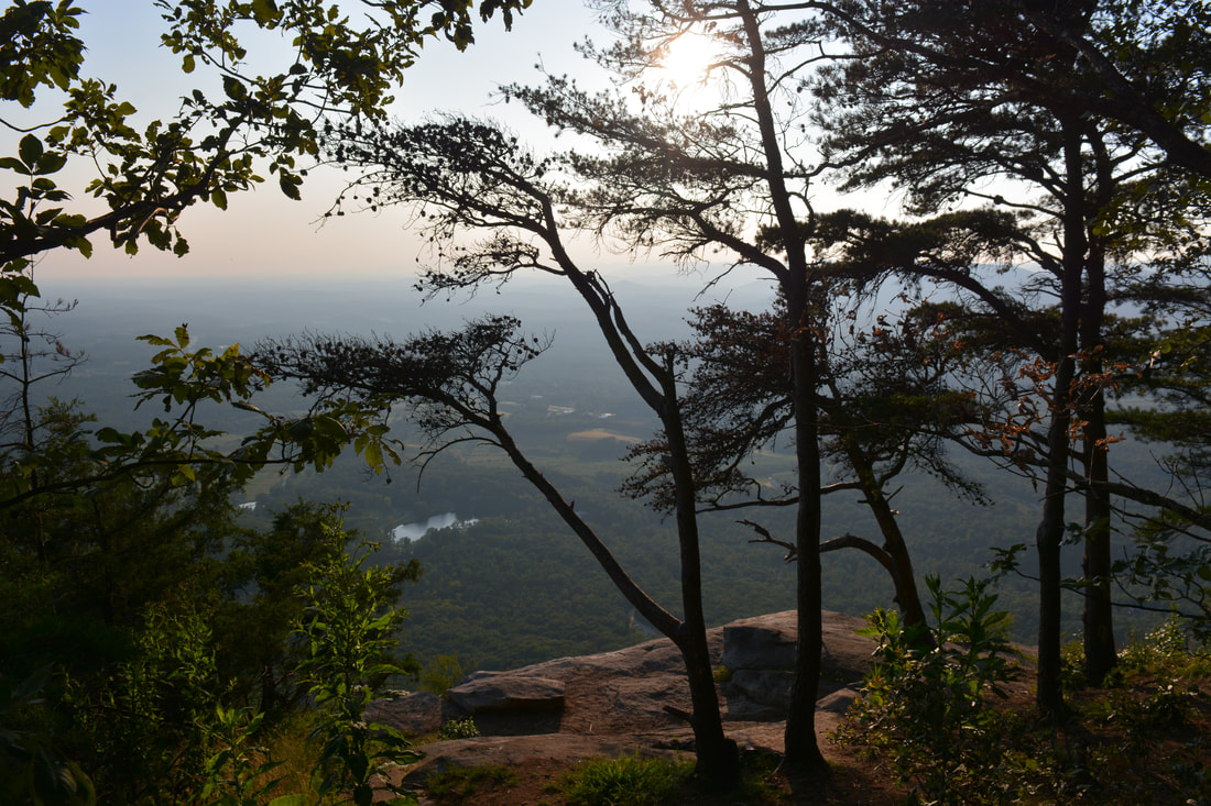
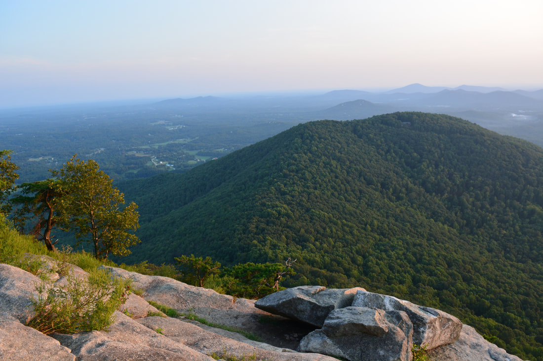
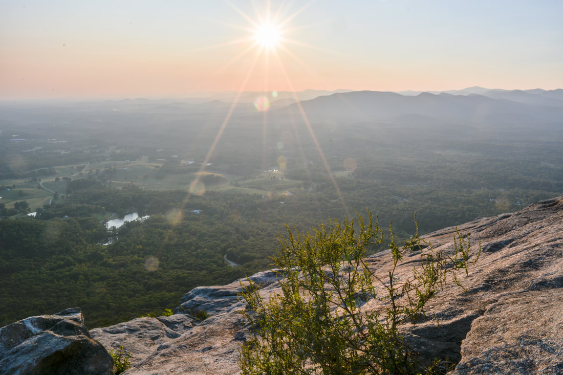
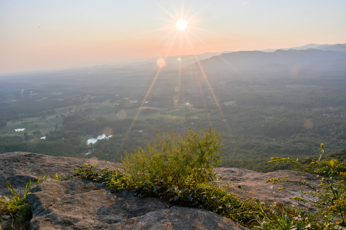
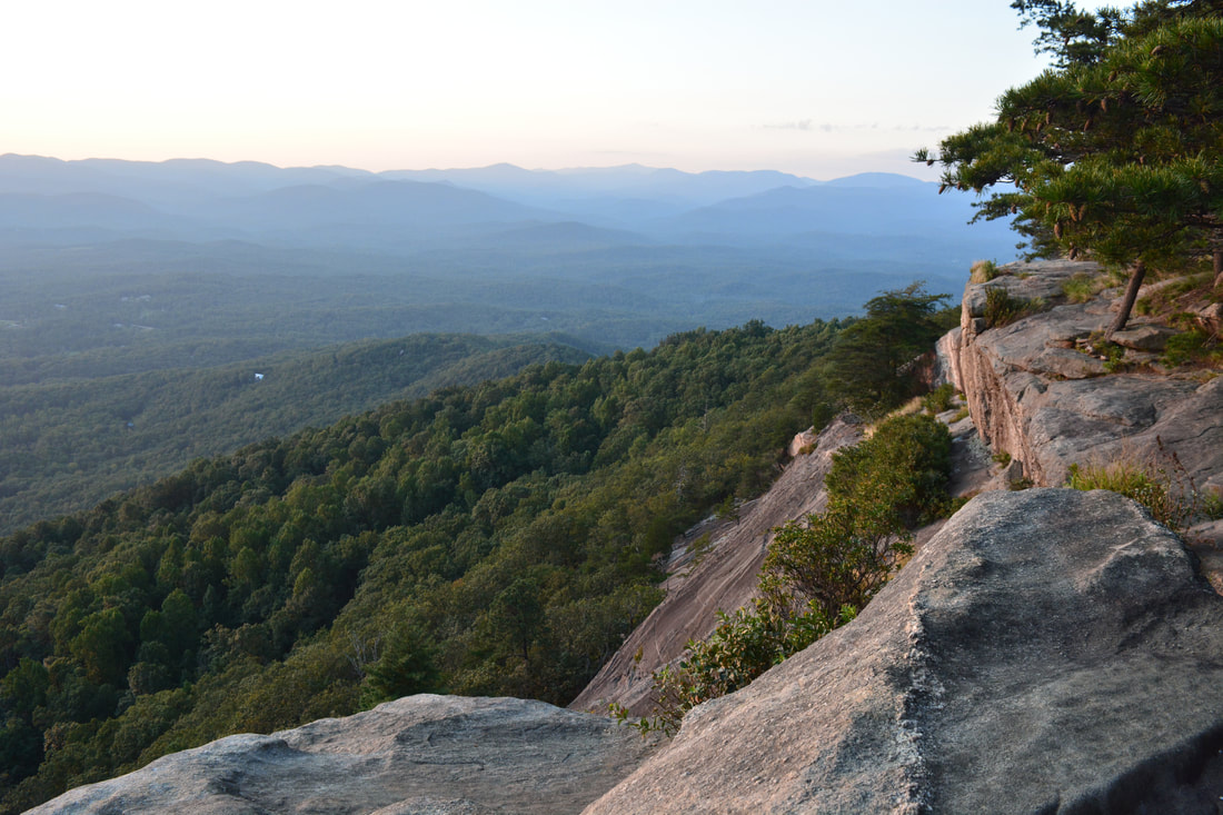
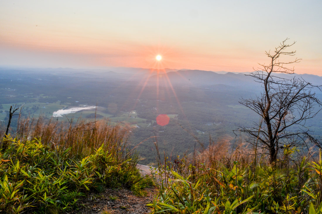
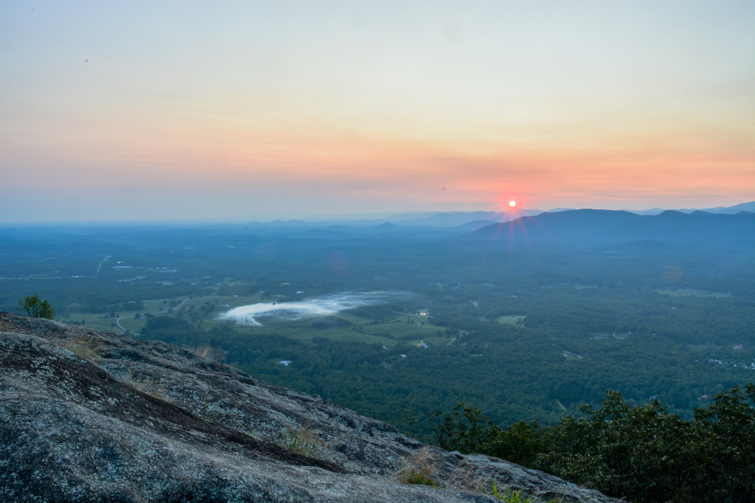
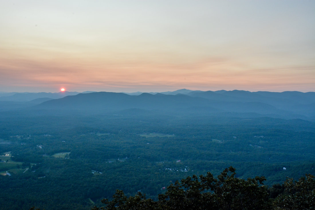
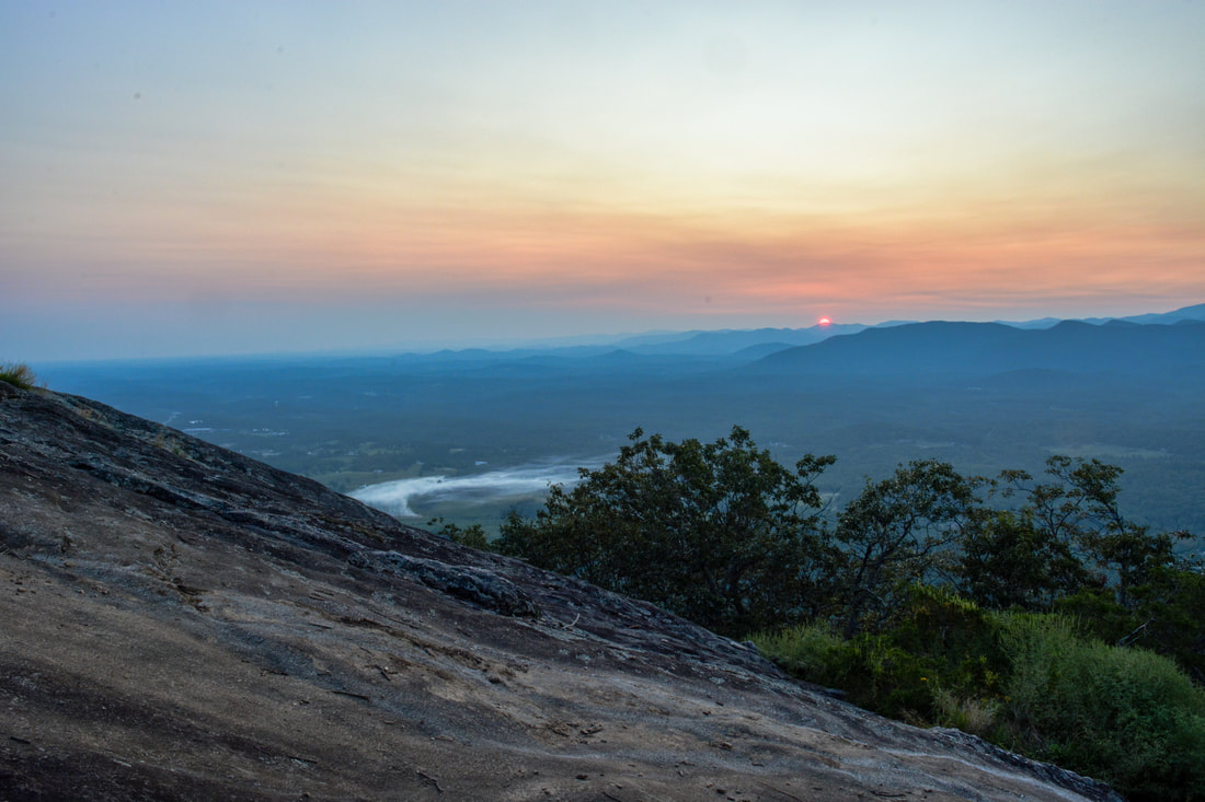
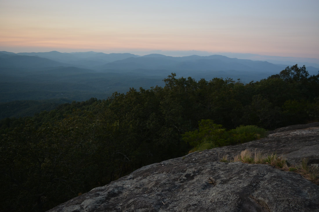
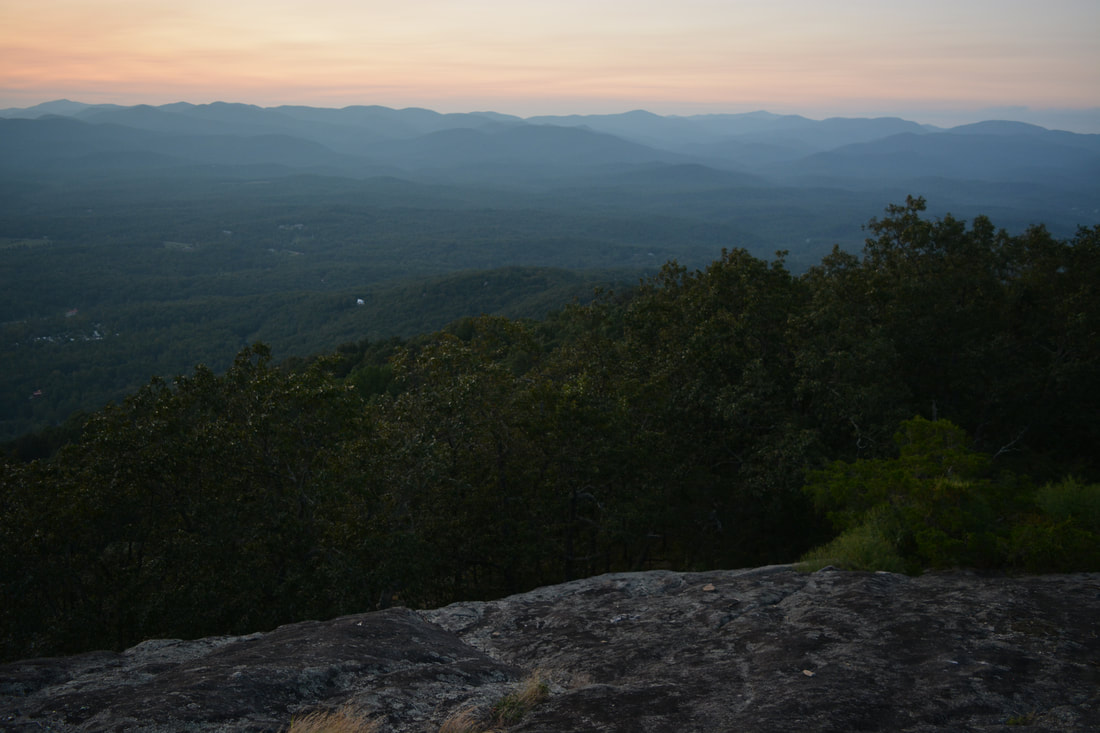
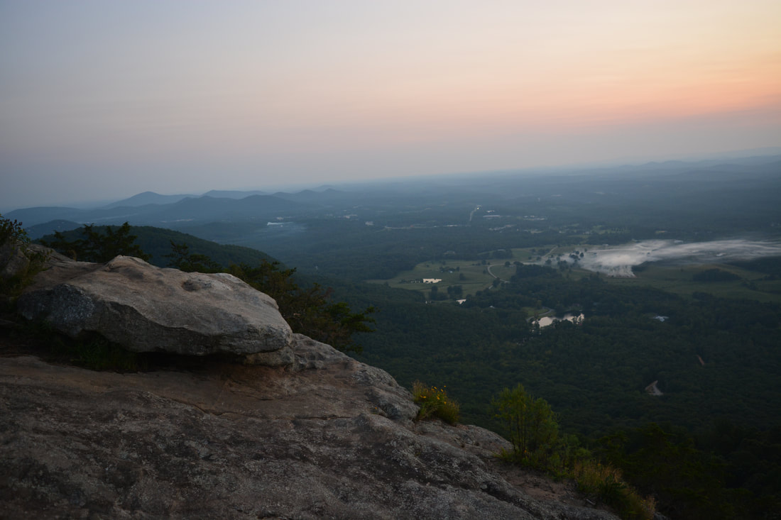
The road continues a moderate climb as it curves around the Yonah Mountain summit before finally entering the grassy clearing at the summit at 2.1 miles. Shortly after the trail enters the summit clearing, a broad path leaves to the left. Take this path, which passes a nice campsite and quickly reaches the first vista on Yonah Mountain at 2.15 miles. The view faces southward from a broad rock slab. Pink Mountain, nearly 500 feet lower than Yonah Mountain, is directly ahead with the nearly flat Georgia Piedmont stretching to the horizon. From this vista, backtrack a short distance, but before the summit clearing, turn left on a path that parallels the clearing and then starts descending the west side of the summit in the direction of the other vistas. When the path reaches a small rock slab, you should be able to see an open rock outcrop a short distance below. Follow the steep but obvious path down to the rock outcrop, reaching it at 2.25 miles. Facing westward, this is the second and arguably the best vista on Yonah Mountain. The 180-degree panorama is breathtaking, with many different mountains and ridges in the view. The valley with Chambers Lake directly below is fully visible. Look closely and you'll be able to spot the Yonah Mountain parking far below. Looking northward, you can also see the continuation of the Yonah Mountain cliffs, where you're headed next. 

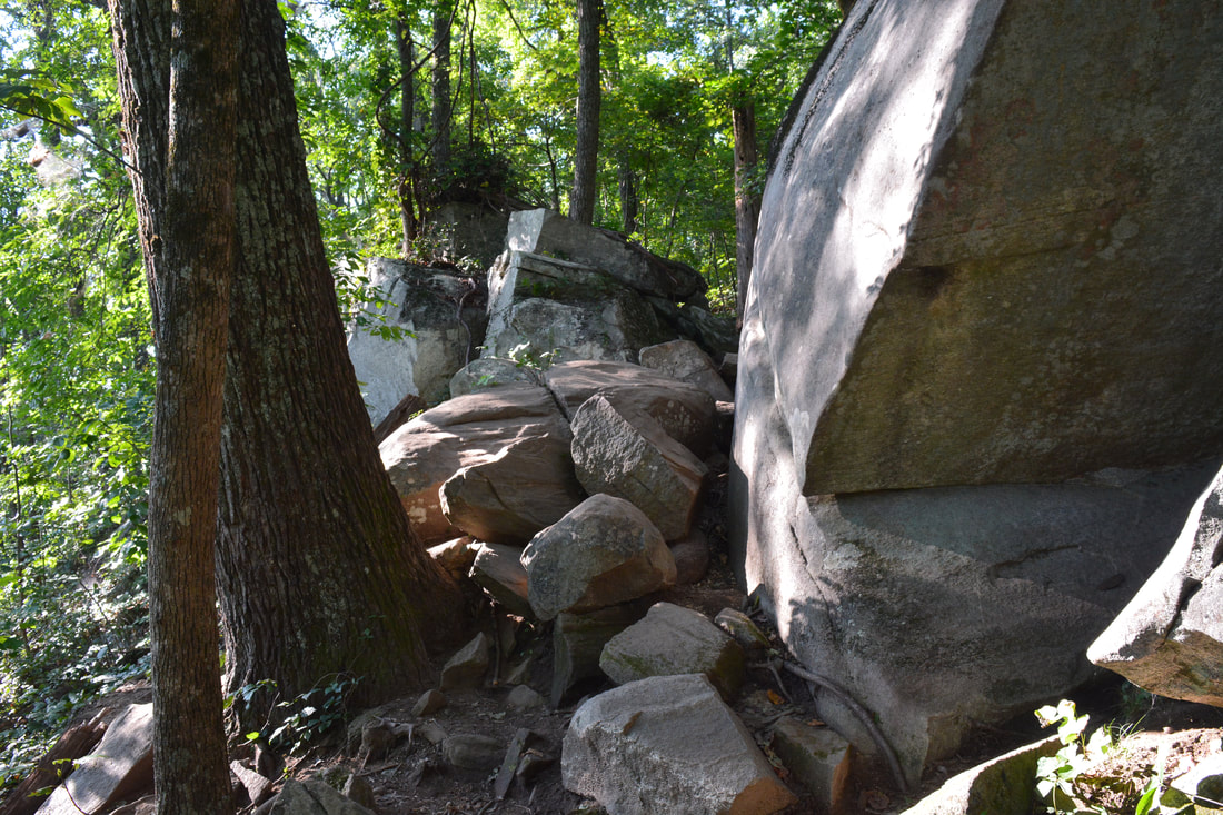
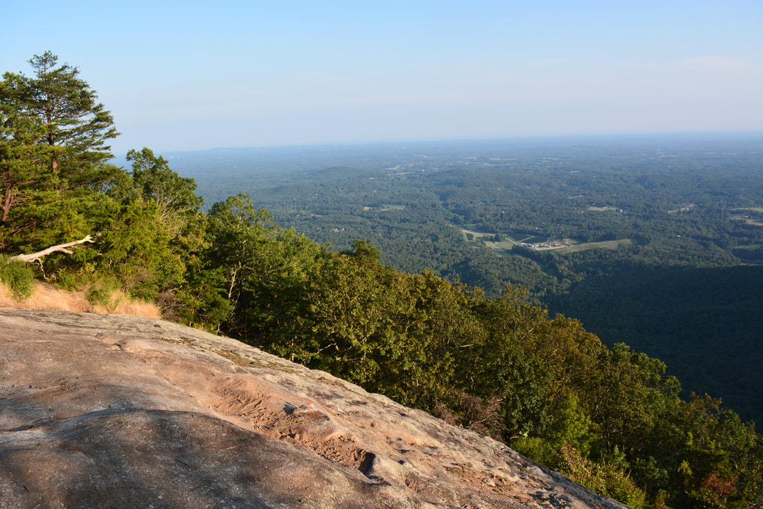
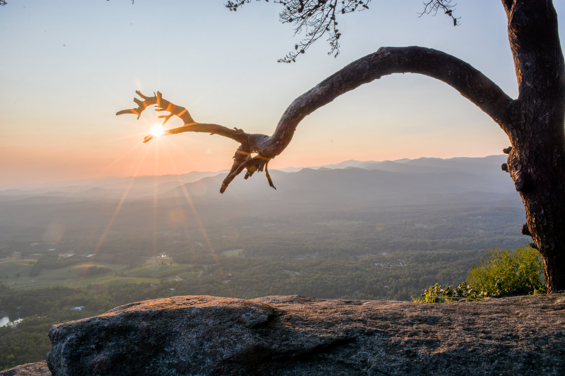
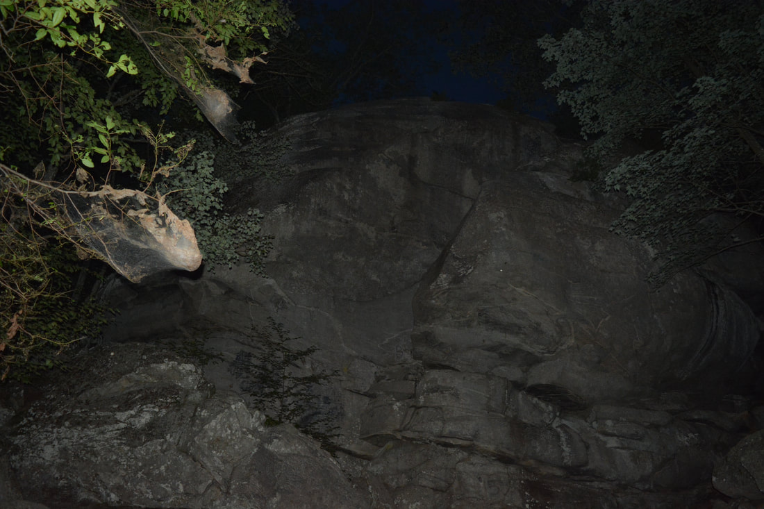
From the second vista, backtrack a few feet and continue following the path that has now turned northward and shortly reaches the edge of the cliff line at 2.3 miles. This is the third main vista. While it is pretty similar to the second vista (and perhaps a bit more limited), it provides better views of the cliffs. The path has nearly continuous views for the next 0.1 mile, with short side trails leading out to more rock outcrops. At 2.4 miles, the path reaches the fourth and final vista at the broad rock slabs on the northwest side of Yonah Mountain. The west view from here is slightly poorer, but on the other hand, the north view is better than at any other vista. As a result, the four vistas on Yonah Mountain cover every direction except east/northeast. And none of these views are just small openings in the trees - all four are panoramic views from cliffs hundreds of feet high! When hiking to the Yonah Mountain vistas, always remember to stay away from the cliff edges, as you're likely to die if you fall. 

From the fourth vista, continue straight ahead, shortly rejoining the old road. Turn left here and retrace your steps back to the junction with the trail to The Boulder just above the US Army Training Area at 2.65 miles. Turn left onto this alternate trail and follow it downhill into the boulder fields. After a short rock scramble, the trail reaches The Boulder at 2.75 miles. The Boulder is in fact an enormous boulder on the west side of Yonah Mountain. It is quite a sight from the base, as is the whole surrounding boulder field. At The Boulder, the trail turns right and briefly becomes extremely steep as it scrambles down through the rocks. After the graded eases, the trail ends at the broad old road that the Yonah Mountain Trail follows at 2.8 miles. Turn left onto the road - for the rest of the hike, simply retrace your steps from earlier this day. The descent along the steep and eroded part of the old road is pretty difficult and slippery. You will return to the trailhead at 4.2 miles, concluding the hike. 
Picture
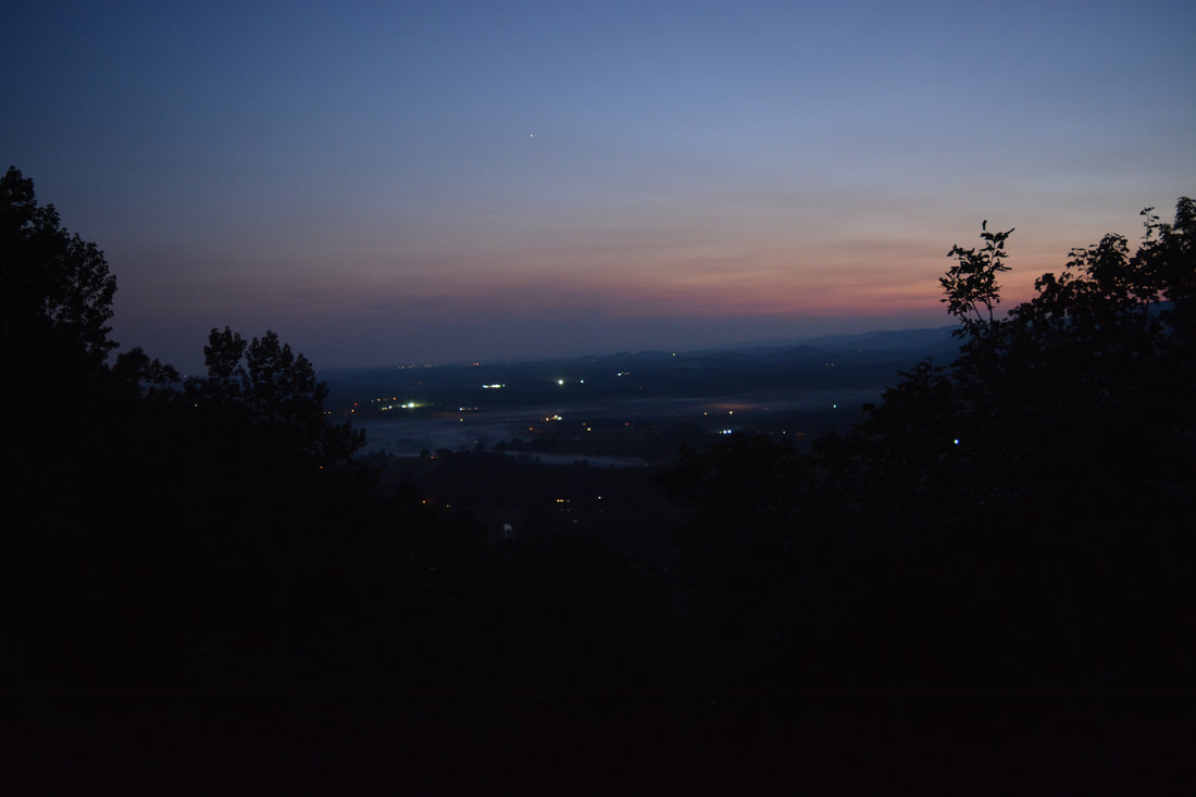
The cliffs of Yonah Mountain are a superb sunset-viewing location.
I decided to rate this a "Best Hike" simply due to how spectacular the views are. It was a tough call due to how crowded the trail is, but it seems to me that the views manage to overweigh the crowds. I highly recommend for anyone from North Georgia to hike the Yonah Mountain Trail one day (preferably at a time when crowds are likely to be minimized). The views are easily among the best anywhere in the state. 
Best Hike!

Mileage

0.0 - Yonah Mountain Trailhead
1.2 - Grassy Clearing 
1.6 - US Army Training Area
2.1 - Yonah Mountain Summit 
2.15 - First Vista on Yonah Mountain 
2.25 - Second Vista on Yonah Mountain 
2.3 - Thrid Vista on Yonah Mountain 
2.4 - Fourth Vista on Yonah Mountain 
2.75 - The Boulder 
4.2 - Yonah Mountain Trailhead

Variations

There are no sensible variations for this hike, as its sole purpose is to reach the cliffs at the top of Yonah Mountain. You can shorten the hike slightly by hiking only to the Fourth Vista (which would be the first one coming the other way of the small summit loop), but I do not suggest it as the other views are at least as good and require very little additional effort. 

Bonus Stops

Consider heading north into Helen for some waterfalls after Yonah Mountain. A good choice would be the short and easy hike to Horsetrough Falls and Upper Chattahoochee River Falls. 

Pictures

Videos

1 Comment
Jeremy Mosteller
9/8/2020 01:14:40 pm

That is only 5 out of 10 on the difficulty range? Brother, that is at least a 7 or 8.

I saw very fit people challenged with it.

If that is a 5, then Olympic and elite people could only handle an 8 or 9 difficulty range on your scale, my friend.

Reply


Leave a Reply.

    About Me

    Mark Oleg Ozboyd
    I'm an avid outdoor explorer and a hobbyist landscape photographer. I'm 21 years old and have been hiking since 2011. Originally based out of Atlanta, Georgia, I started out by occasionally hiking short trails throughout well-known Georgia State Parks. During 2012 and 2013, I began to expand my trips into adjacent states, as well as into the wilder National Forest areas rather than just State Parks. Throughout the years that followed, as I slowly ran out of popular hiking trails in my area, I began to search for and hike in more seldom-visited areas. Today, you can find me out in the woods every weekend, whether it's on an official trail or bushwhacking through cross-country terrain without any paths. I now attend Washington & Lee University and am exploring Virginia and West Virginia. My other hobbies include chess, science, old music, and meteorology. I have 3 years of amateur weather forecasting experience, having studied a lot of meteorology basics over the years. I am also a student at European School of Music where I learned that music and nature have a lot in common. Listening to good music inspires me to capture nature's beauty on the camera in different aspects that also make me recall many beautiful music pieces that I've heard.​


    Dear readers: I have invested a tremendous amount of time and effort in this website and the Georgia Waterfalls Database the past five years. All of the work that has gone in keeping these websites updated with my latest trip reports has almost been like a full-time job. This has not allowed me to pick up a paid job to save up money for college, and therefore, I I've had to take out loans. If you find the information on this website interesting, helpful, or time-saving, you can say "thanks" and help me out by clicking the button above and making a contribution. I will be very grateful for any amount of support you give, as all of it will apply toward my college tuition. Thank you! 

    Enter your email address to subscribe for trail reports:

    Delivered by FeedBurner


    Picture
    Coming in 2022-2023?

    Other Hiking Websites

    DWHike's Adventures
    Florida's Natural Wonders
    Florida Trailblazer
    Meanderthals
    Mountain Images
    by Bernie Boyer

    North Carolina Waterfalls with
    ​Kevin Adams
    Take-a-Hike!
    Tennessee Landforms
    Waterfall Page
    Waterfall Adventurer
    Zach's Mild Adventures

    Miles Hiked

    Year 1: 540.0 Miles
    Year 2: 552.3 Miles
    ​Year 3: 518.4 Miles
    Year 4: 482.4 Miles
    Year 5: 259.9 Miles

    Archives

    March 2021
    February 2021
    January 2021
    November 2019
    October 2019
    September 2019
    August 2019
    July 2019
    June 2019
    February 2019
    January 2019
    December 2018
    November 2018
    October 2018
    August 2018
    July 2018
    June 2018
    May 2018
    April 2018
    March 2018
    February 2018
    January 2018
    December 2017
    November 2017
    October 2017
    September 2017
    August 2017
    July 2017
    June 2017
    May 2017
    April 2017
    March 2017
    February 2017
    January 2017
    December 2016
    November 2016
    October 2016
    September 2016
    August 2016
    June 2016
    May 2016
    April 2016
    March 2016
    January 2016
    December 2015
    November 2015
    October 2015
    September 2015
    August 2015
    July 2015
    June 2015
    May 2015
    April 2015
    March 2015
    February 2015
    January 2015
    December 2014
    November 2014
    October 2014
    September 2014
    August 2014
    July 2014
    June 2014
    May 2014
    April 2014
    March 2014
    February 2014

    Categories

    All
    Adel
    Adirondack Park
    Alabama
    Alfred A. Ring Park
    Allegheny Trail
    Amicalola Falls State Park
    Anniston Area
    Apalachicola Bluffs And Ravines Preserve
    Apalachicola National Forest
    Apalachicola/Port St. Joe Area
    Apopka
    Appalachian Trail
    Appling
    Art Loeb Trail
    Aska Trail System
    Bakersville
    Balm-Boyette Scrub Preserve
    Balsam Lake Recreation Area
    Bankhead National Forest
    Bartow County Parks
    Bartram Trail
    Basinger
    Beersheba Springs
    Benton
    Benton Mackaye Trail
    Berry College Trail System
    Best Hike
    Big South Fork National Recreation Area
    Black Bear Wilderness
    Black Rock Mountain State Park
    Blairsville
    Blakely
    Blood Mountain Wilderness
    Blowing Rock
    Blue Ridge
    Blue Ridge Parkway
    Boone
    Bradenton
    Bradenton Beach
    Brasstown Bald
    Brasstown Wilderness
    Brevard
    Bryson City
    Buchanan
    Bucks Pocket State Park
    Bulow Creek State Park
    Bulow Plantation Ruins State Park
    Caesars Head State Park
    Caladesi Island State Park
    Calhoun
    Camel's Hump State Park
    Cashiers
    Caspersen Beach Park
    Catfish Creek State Park
    Caves
    CC Putnam State Forest
    Cedar Point Environmental Park
    Chatsworth
    Chattahoochee National Forest
    Chattanooga
    Chattanooga Valley
    Chattooga National Wild And Scenic River
    Cheaha Wilderness
    Cherohala Skyway
    Cherokee
    Cherokee National Forest
    Chiefland Area
    Chillhowee Recreation Area
    Chipley
    Chunky Gal Trail
    Circle B Bar Reserve
    Citico Creek Wilderness
    Citrus Wildlife Management Area
    Clarkesville
    Clayton
    Cleevland
    Cleveland
    Cloudland Canyon State Park
    Cohutta Wilderness
    Collier-Seminole State Park
    Cordele
    Cornelia
    Covington
    Crestview Area
    Crew-land-and-water-trust
    Cullowhee
    Cumberland Trail
    Dahlonega
    Dalton
    Dawson Forest Wildlife Management Area
    Dawsonville
    Dayton
    De Soto National Memorial
    DeSoto State Park
    Dillard
    Double Springs
    Ducktown
    Duncan Ridge Trail
    Dunlap
    Eagle's Rest Park
    Eastpoint
    Econfina Creek Wildife Management Area
    Eglin Air Force Base
    Elizabethton
    Elkins
    Elk Knob Game Lands
    Elk Park
    Ellicott Rock Wilderness
    Ellijay
    Emerson Point Preserve
    Englewood Area
    Enota Retreat
    Erwin
    Falling Waters State Park
    Fayetteville
    Fires Creek Recreation Area
    Fire Tower
    Flint River
    Florence Area
    Florida
    Florida Caverns State Park
    Florida Trail
    Foothills Trail
    Fort Mountain State Park
    Fort Myers Area
    Fort Payne
    Fort Payne Area
    Fort Yargo State Park
    Franklin
    Franklin Delano Roosevelt State Park
    Franklin-Marion State Forest
    Frozen Head State Park
    Gainesville
    Gainesville Area
    Gatlinburg
    George Washington National Forest
    Georgia
    Georgia Veterans Memorial State Park
    Glasgow
    Gorges State Park
    Grandfather Mountain State Park
    Great Smoky Mountains National Park
    Greeneville
    Green River Game Lands
    Gruetli-Laager
    Grundy Forest State Natural Area
    GTM Reserve
    Guana River Wildlife Management Area
    Hayesville
    Helen
    Hiawassee
    High Falls State Park
    Highlands
    Highlands Scenic Highway
    Hillsborough River State Park
    Hinson Conservation & Recreation Area
    Historic Sites
    Honeymoon Island State Park
    Hot Springs
    Huntington
    Inverness Area
    Jackson
    Jasper
    Jefferson National Forest
    Joan M. Durante Park
    Jonathan Dickinson State Park
    Jones Gap State Park
    Joyce Kilmer Slickrock Wilderness
    Joyce Kilmer - Slickrock Wilderness
    Juniper Prairie Wilderness
    Kelly Park
    Keown Falls Recreation Area
    Kolomoki Mounds State Park
    LaFayette
    Lake City Area
    Lake George Wild Forest
    Lake June-in-Winter State Park
    Lakeland Area
    Lake Placid
    Lake Russell Wildlife Management Area
    Lake Wales Ridge State Forest
    Laurel Fork North Wilderness
    Leffis Key Preserve
    Leon Sinks Geological Area
    Lexington
    Lineville
    Linville
    Linville Gorge Wilderness
    Lithia Springs
    Little Frog Wilderness
    Little Manatee River State Park
    Little River Canyon National Preserve
    Longboat Key
    Long Trail
    Lookout Mountain
    Lookout Mountain Battlefield
    Lovingston
    Lula Lake Land Trust
    Lumpkin
    Maggie Valley
    Manatee Springs State Park
    Marianna Area
    Mark Trail Wilderness
    Marlinton
    Mccaysville
    McMinville
    Mentone
    Middlesex
    Mistletoe State Park
    Monongahela National Forest
    Montreat
    Mountain Bridge Wilderness Area
    Mountain City
    Mountains To Sea Trail
    Mountains-to-Sea Trail
    Mount Rogers National Recreation Area
    Myakka River State Park
    Myron B. Hodge City Park
    Nantahala National Forest
    Naples
    Naples Area
    Natural Bridge State Park
    Neal Preserve
    New Castle
    Newport
    New River Gorge National Park
    New York
    North Carolina
    Ocala Area
    Ocala National Forest
    Ocean-to-Lake Trail
    Oconee State Park
    Oconee Station Historic Site
    Okaloacoochee Slough State Forest
    Oldsmar
    Oneida
    Orlando Area
    Ormond Beach
    Oscar Scherer State Park
    Oxford
    Palatka
    Palmetto Trail
    Panama City Area
    Panthertown Valley
    Parrish
    Paynes Creek Historic State Park
    Peaks Of Otter Recreation Area
    Pigeon Crockford Mountain Wildlife Management Area
    Pigeon-Crockford Mountain Wildlife Management Area
    Pigeon-Crockford Wildlife Management Area
    Pine Mountain
    Pinhoti Trail
    Pinnacle Park
    Pisgah Civitan Park
    Pisgah National Forest
    Pittman Center
    Pond Mountain Wilderness
    Ponds/Lakes
    Prentice Cooper State Forest
    Providence Canyon State Park
    Pumpkintown
    Quick Point Nature Preserve
    Raven Cliffs Wilderness
    Reed Bingham State Park
    Reliance
    Rice Creek Conservation Area
    Riverview Pointe Preserve
    Robbinsville
    Robinson Preserve
    Rock Creek Gorge Scenic Area
    Rock Island State Park
    Rome
    Rosman
    Sale Creek
    Salem
    Salt Springs
    Saluda
    Santa Rosa Beach
    Sarasota
    Sarasota Area
    Savage Gulf State Natural Area
    Scenic Views
    Scottsboro Area
    Sebring Area
    Sewanee
    Sheltowee Trace Trail
    Shining Rock Wilderness
    Signal Mountain
    Sipsey Wilderness
    Sky Valley
    Smithgall Woods State Park
    Snowbird Backcountry Area
    Soddy Daisy
    Soddy-Daisy
    Sopchoppy
    South Carolina
    South Cumberland State Park
    Southeastern Cave Conservancy
    Southern Nantahala Wilderness
    Sparta
    Sprewell Bluff Park
    Spring City
    Spring Hill
    Springs
    Spruce Pine
    Standing Indian Backcountry Area
    St. Augustine
    St. George Island State Park
    St. Joseph Bay State Buffer Preserve
    St. Marks Area
    St. Marks National Wildlife Refuge
    Stone Mountain
    Stone Mountain Park
    Suches
    Sumatra
    Sumter National Forest
    Suwannee River
    Swallow Creek Wildlife Management Area
    Sweetwater Creek State Park
    Sylva
    Talladega National Forest
    Tallahassee Area
    Tallulah Falls
    Tallulah Gorge State Park
    Tampa Bay Area
    Tate City
    Tate's Hell State Forest
    Tea Creek Wildlife Management Area
    Tellico Plains
    Tennessee
    Thomaston
    Toccoa
    Topsail Hill State Park
    Torreya State Park
    Townsend
    Tracy City
    Tray Mountain Wilderness
    Trenton
    Triple Creek Preserve
    Troutdale
    Unaka Mountain Wilderness
    Upper Tampa Bay County Park
    Venice
    Vermont
    Virgin Falls State Natural Area
    Virginia
    Virginia Outdoors Foundation
    Vogel State Park
    Wakulla Springs State Park
    Waleska
    Walhalla
    Wartburg
    Water Features
    Waynesville
    Weedon Island Preserve
    Weeki Wachee Preserve
    Wekiwa Springs State Park
    West Palm Beach Area
    West Virginia
    Whitehall
    White Springs
    Winder
    Withlacoochee State Forest
    Young Harris

    RSS Feed

TRAIL REPORTS

Hikes in Alabama
​Hikes in Florida
Hikes in Georgia
Hikes in North Carolina
Hikes in South Carolina
Hikes in Tennessee
Hikes in Virginia

Hiking Resources

Alabama Resources
​
Florida Resources
Georgia Resources
North Carolina Resources
​South Carolina Resources
​
Tennessee Resources

Other

Contact
Map of Hikes
Alphabetical List of Hikes
Southeast Nature Society
© COPYRIGHT 2014-2018
​ALL RIGHTS RESERVED.
Important: I disclaim any responsibility for any damage or personal injury that may occur as a result of the activities and information found on this website. All outdoor activities, especially off-trail hiking, are done at your own risk. Never hike or head into that area that may be above your fitness or experience level.
  • Home
  • Trail Reports
    • Best Hikes
    • Hikes with Scenic Views
    • Hikes with Water Features
    • Alabama
    • Georgia
    • Florida
    • North Carolina
    • South Carolina
    • Tennessee
    • Vermont
    • Virginia
  • Map
  • Hike List
  • Testimonials
  • Resources
  • Contact Us
  • Southeast Nature Society
    • Our Team
  • Georgia Waterfalls Database