Southwest North Carolina's Wolf Creek sure is a potent stream with the six major waterfalls it is home to. The tallest and best-known waterfall on the creek is Wolf Creek Falls aka Paradise Falls below Wolf Creek Lake. But higher up on Wolf Creek is a set of four breathtaking pristine waterfalls clustered close together near Balsam Lake. The series of falls culminates with Lauren Falls, a spectacular near free-fall with a deep pool surrounded by beautiful water-sculpted rock outcrops. The hike to these waterfalls, especially Patricia Falls and Lauren Falls, is quite difficult as it involves a lot of off-trail scrambling, but less experienced hikers have the choice to hike just to the first waterfall, Balsam Falls, which is considerably easier to reach with only minimal scrambling. Along the way, visitors will be treated to many gorgeous views of Balsam Lake along the Mallonee Trail. This hike occurred on Saturday, October 14th, 2017. My plan was to hike to the Mallonee Trail along Balsam Lake from Balsam Lake Recreation Area to Balsam Lake Dam, from where I would follow faint paths to Balsam Falls, Lower Balsam Falls, Patricia Falls, and Lauren Falls. I would return the same way.
Summary
R/T Length of Trail: 1.7 Miles
Duration of Hike: 2:00 plus lots of stopping Type of Hike: Out and Back Difficulty Rating: 8 out of 10 (difficult off-trail scrambling) Total Elevation Gain: 348 Feet Pros: Most folks can get to the first waterfall, Balsam Falls, without too much trouble Cons: Getting to Lower Balsam Falls, Patricia Falls, and Lauren Falls involves steep off-trail scrambling on faint paths and some bushwhacking Points of Interest: Balsam Falls - 4 stars; Lower Balsam Falls - 6 stars; Patricia Falls - 9 stars; Lauren Falls - 10 stars; Balsam Lake Trail Blaze Colors: Mallonee Trail - None; None for the unofficial paths to the waterfalls Best Seasons to Hike: Spring Fees: None Beginning Point: Balsam Lake Recreation Area Directions from Rosman, NC: From the intersection of NC 215 and US 64 near Rosman, follow NC 215 North for 13.8 miles. Then, turn left onto Charleys Creek Road and follow it for 5.3 miles. The Balsam Lake Recreation Area will be on the left. Map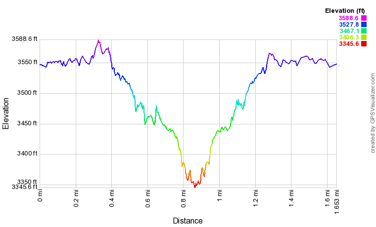
Click the link below to download a .GPX file with a track of this hike.
Details
For many years after he discovered the four waterfalls on Wolf Creek near Balsam Lake, Kevin Adams (the author of North Carolina Waterfalls) kept them secret to preserve their pristine nature. He finally published the directions to them earlier in 2017. Us waterfallers cannot thank him enough for describing how to get to the very beautiful waterfalls on the creek, especially Lauren Falls - one of the best waterfalls I've seen all year. With that said, the hike to Lauren Falls is definitely not for everyone. Good navigational skills and experience in off-trail hiking and scrambling are necessary.
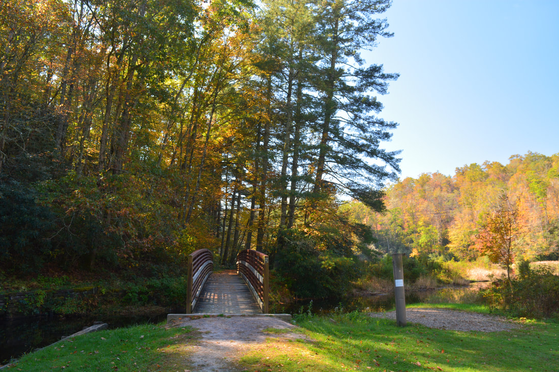
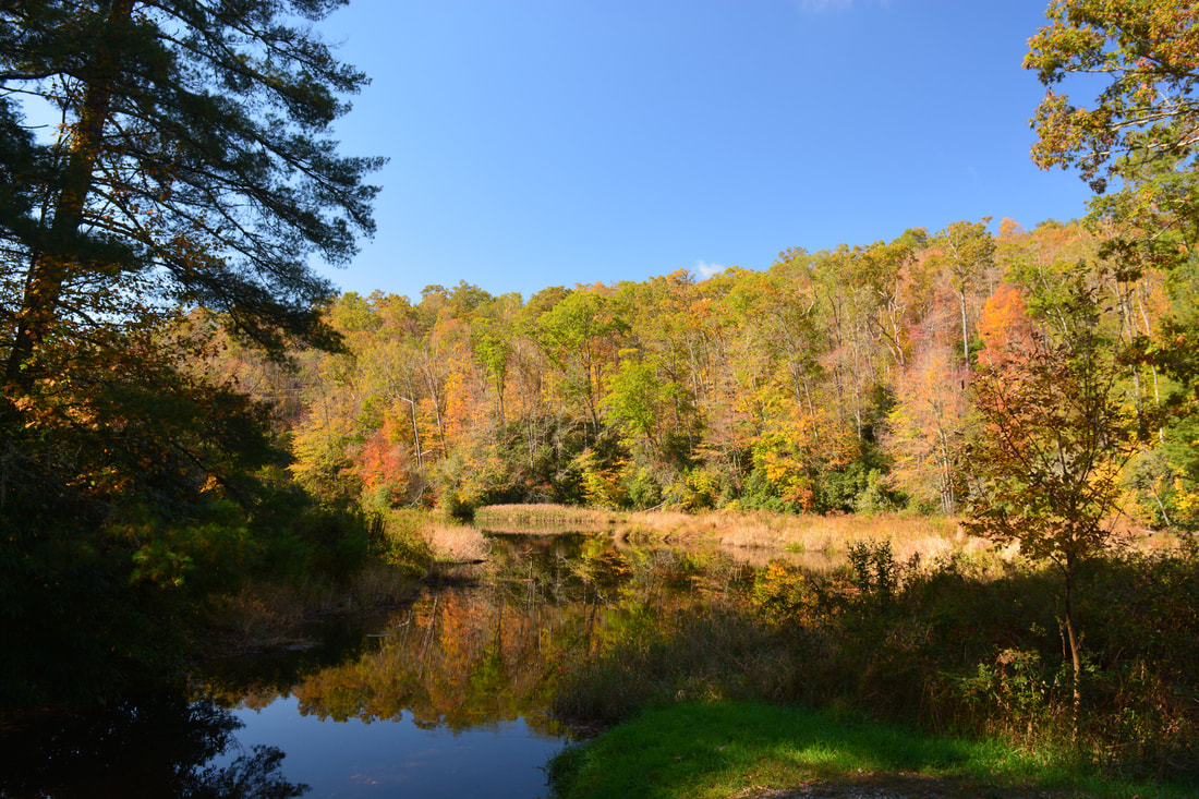
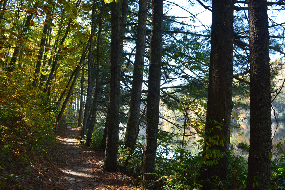
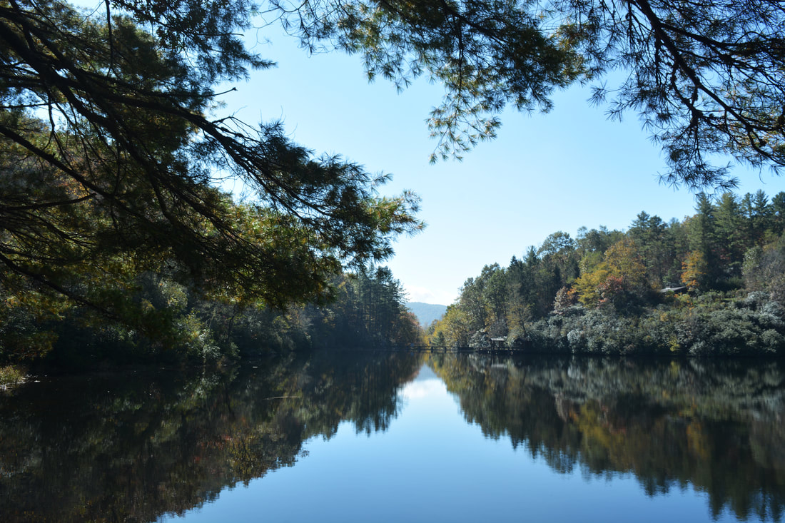
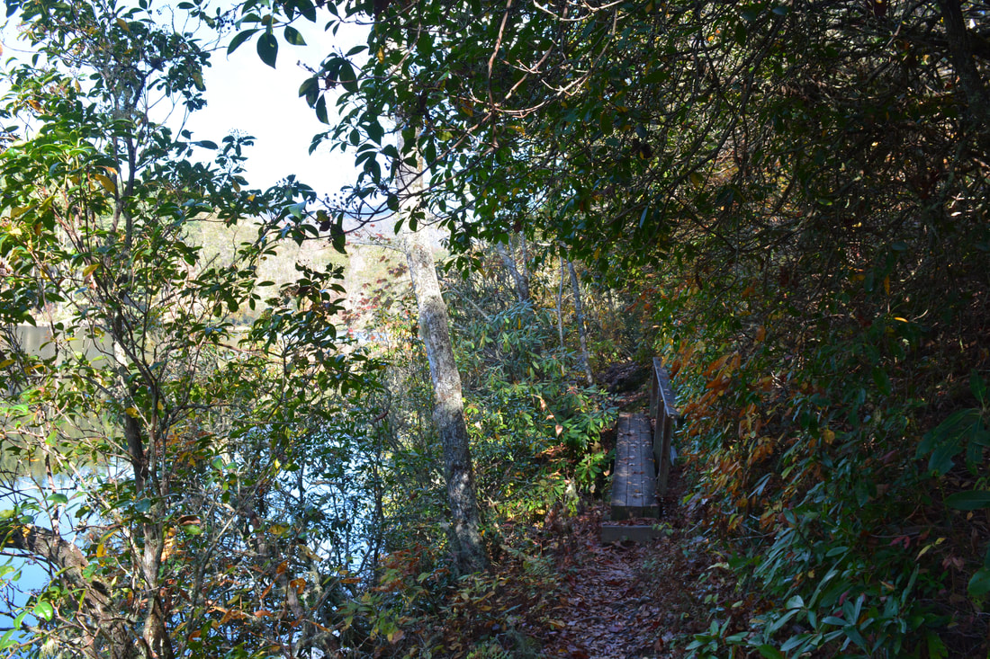
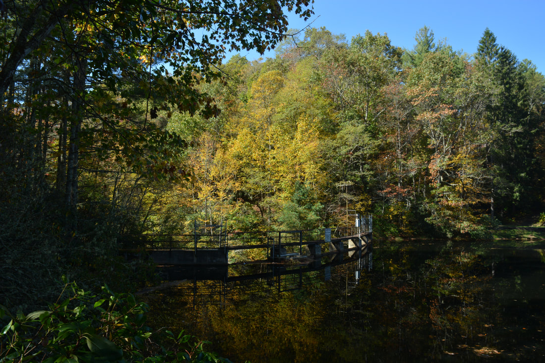
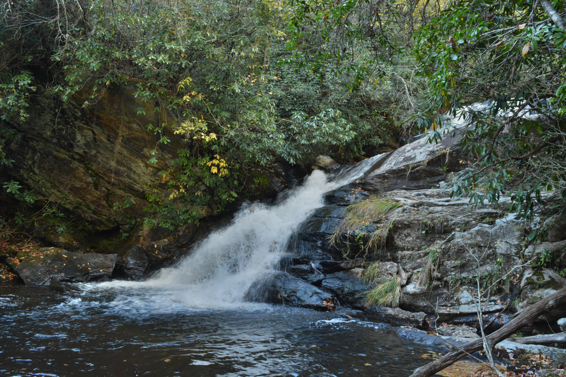
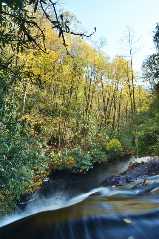
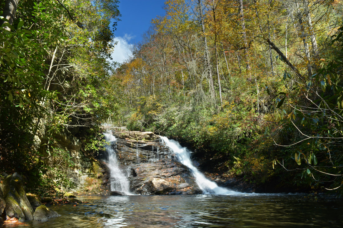
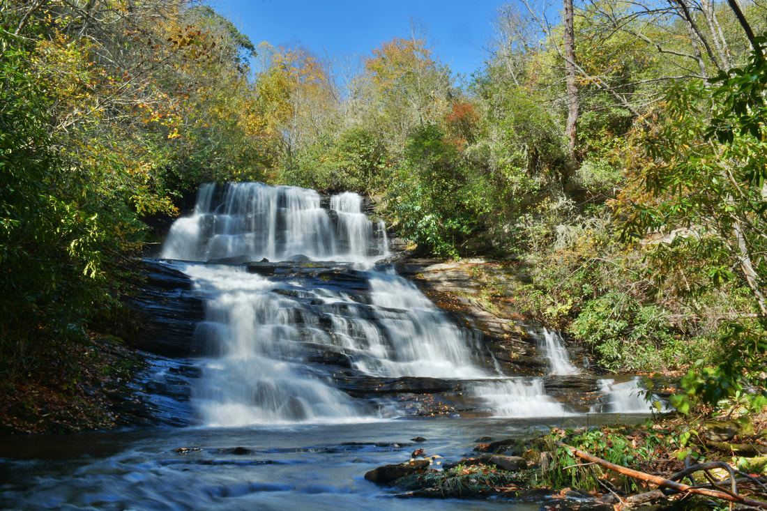
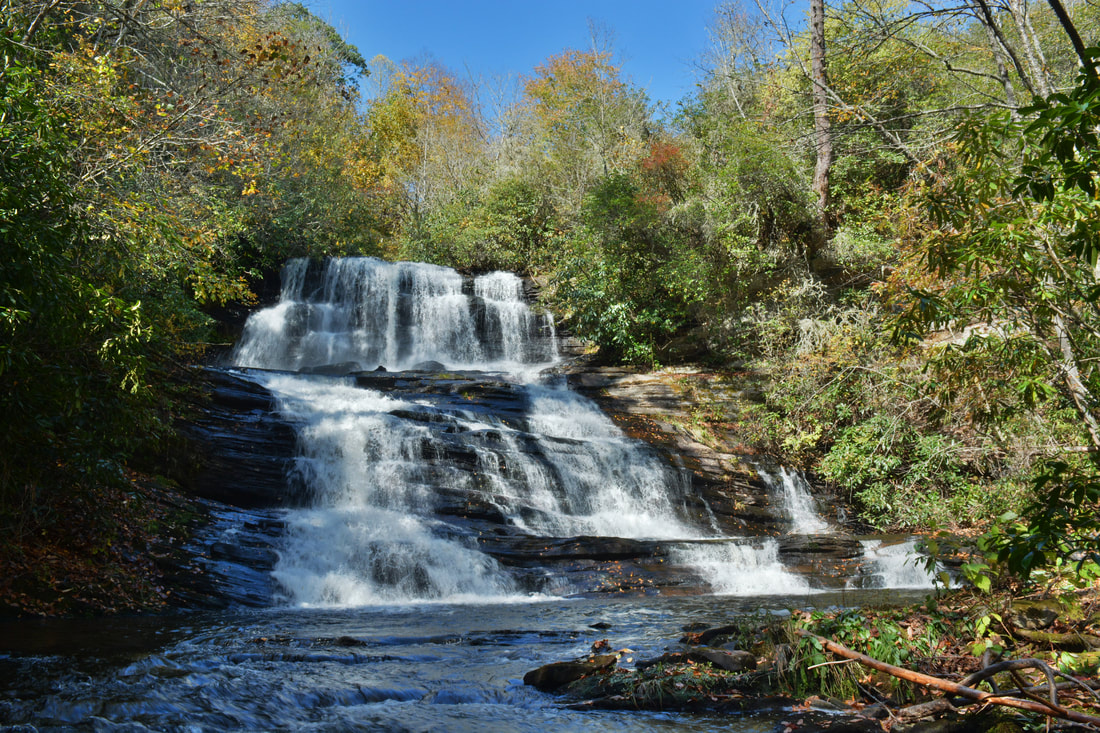
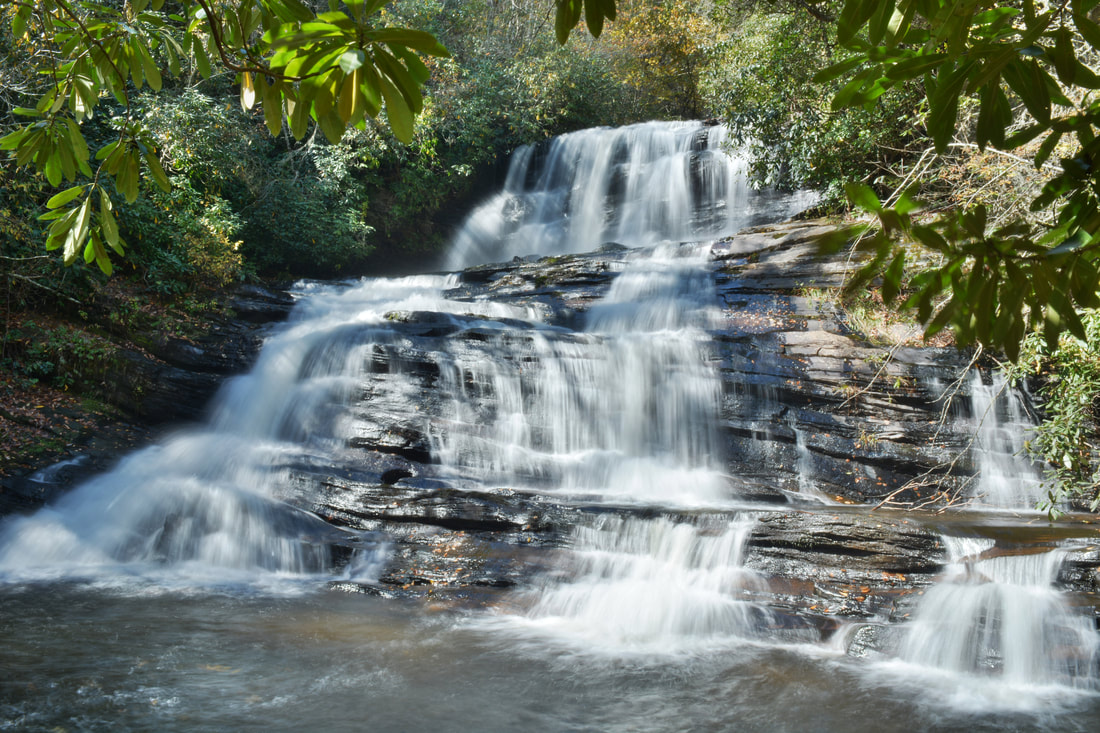
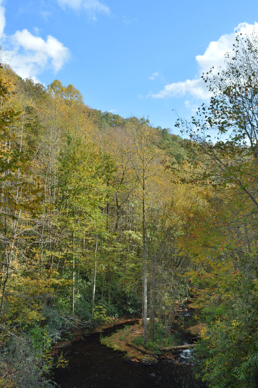
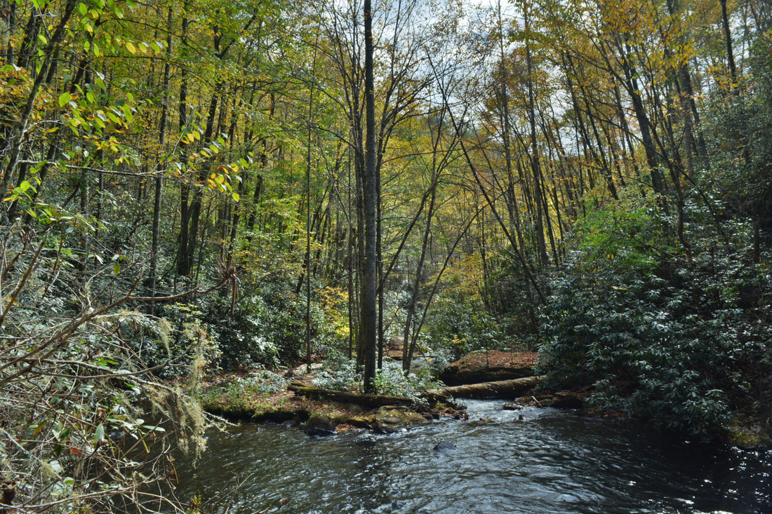
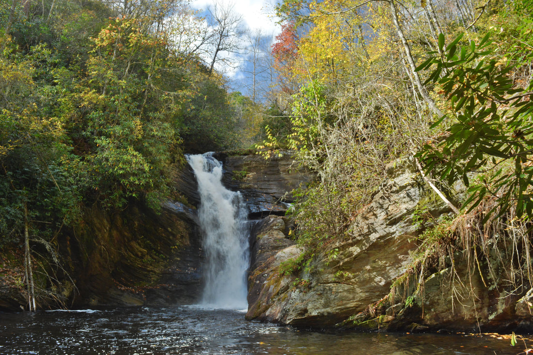
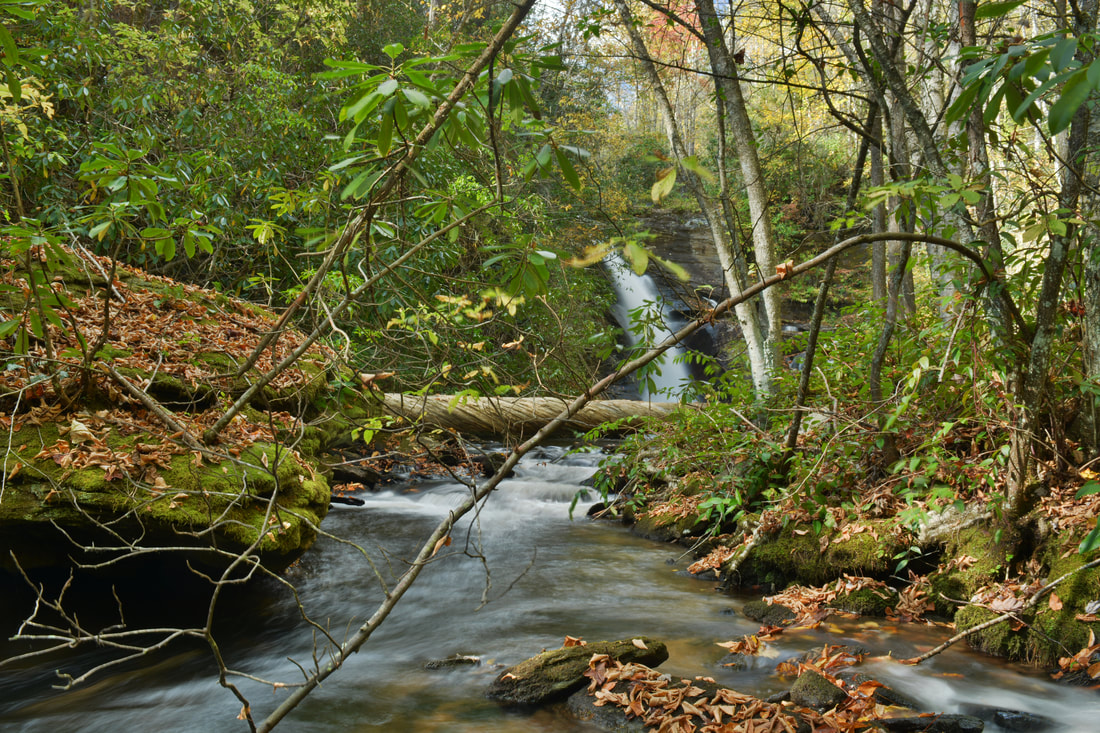
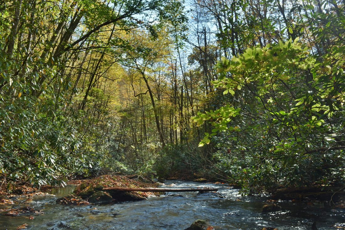
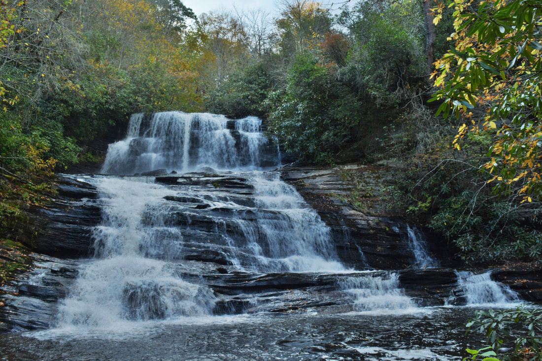
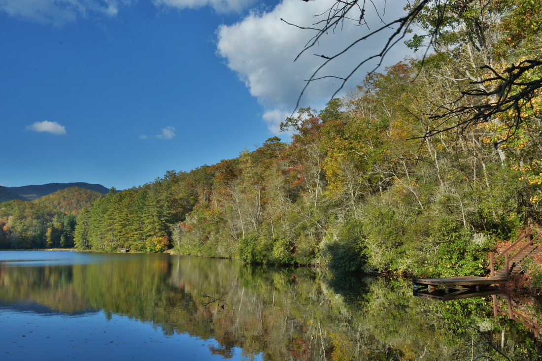
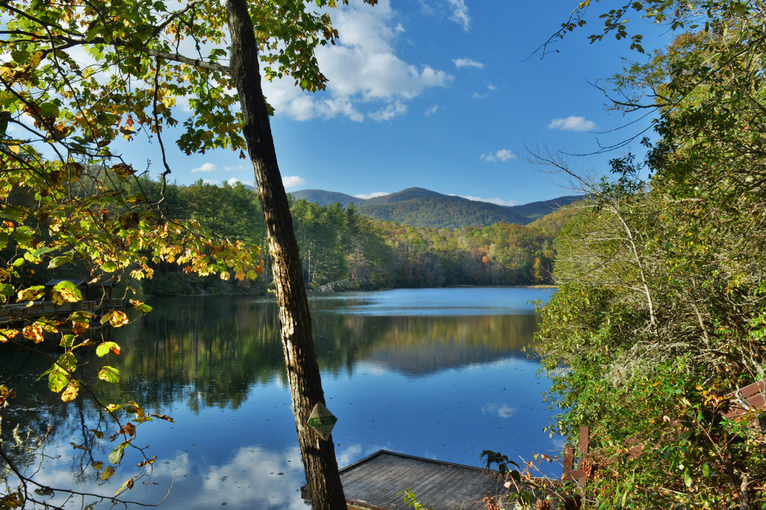
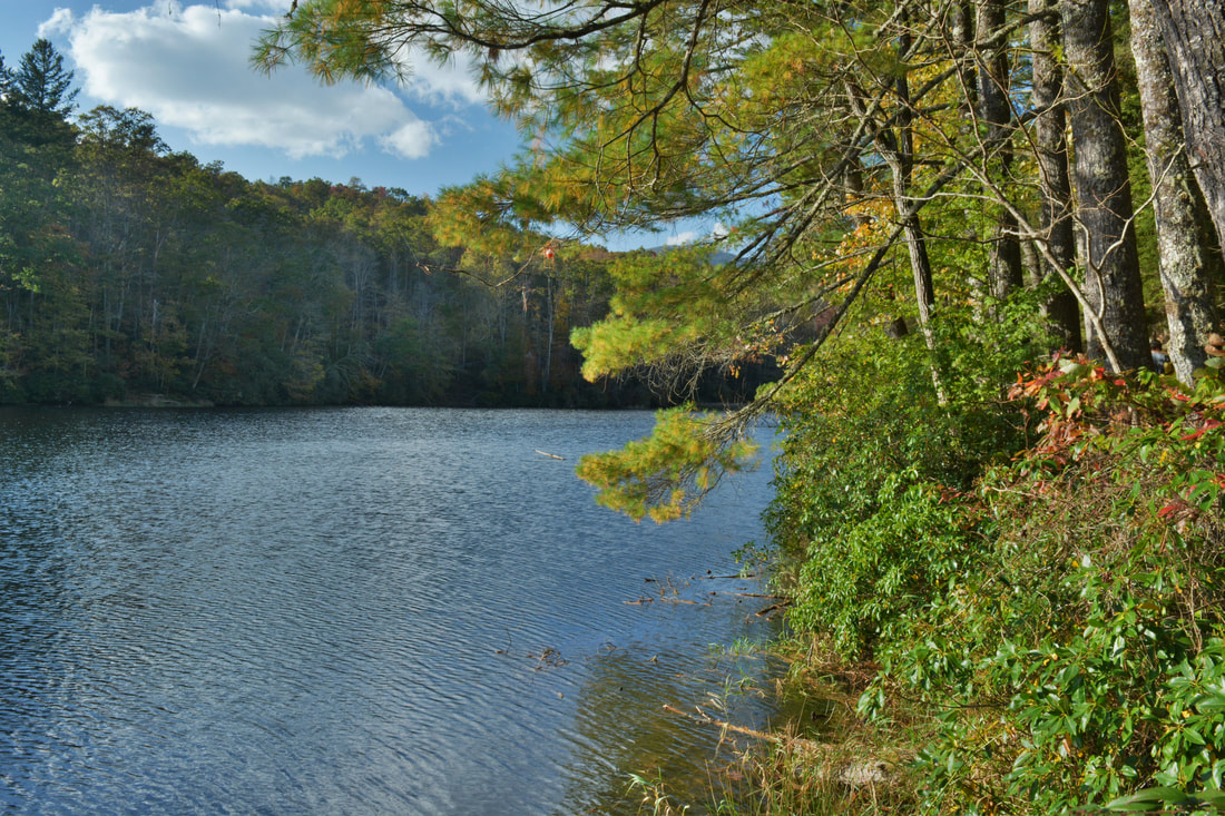
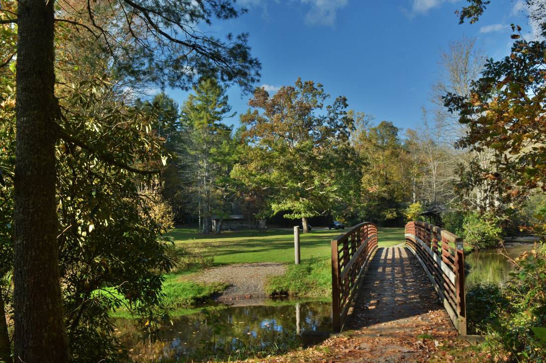
The hike starts out quite tame along the Mallonee Trail. From the Balsam Lake Recreation Area parking area, cross the footbridge across Wolf Creek at the head of Balsam Lake and begin following the Mallonee Trail along the east side of the lake. The Mallonee Trail is named in honor of Tom Mallonee, who helped the US Forest Service to acquire the Roy Taylor Forest - a 39,000-acre tract of higher-elevation Nantahala National Forest with many beautiful waterfalls. The Mallonee Trail is also very scenic as far as lakeside trails go, mainly because Balsam Lake is one of the more beautiful man-made lakes I've seen. As you follow the obvious trail, there will be several observation decks with peaceful views of the lake. Eventually, the trail grows narrower as it approaches the dam. Just before the dam, one final observation deck on the right provides a spectacular view of the lake framed by the Rich Mountain Ridge in the background. The Mallonee Trail ends at Balsam Lake Dam after 0.4 miles. The public is not allowed to cross the dam. On the other side of the dam and lake is the Balsam Lodge, but that is private property so you must make sure to stay away from the lodge and its access road too - only guests are allowed on its property. The rest of the hike is on unofficial paths. At the dam, turn left onto a narrow path that follows the east (River Left) side of Wolf Creek. If you pay attention, you should be able to follow the path downstream without any issues. At 0.55 miles, the Wolf Creek path makes a steep scramble to the base of Balsam Falls shortly after passing the top. The scramble isn't too hard but it is on pretty slippery rocks so be careful. From the end of the path at the Balsam Falls pool, the view of the falls isn't that great. You have to cross the pool to get a better view of the falls, but the creek crossing is necessary to continue to the other waterfalls anyway. The issue with the creek crossing though is that the brink of Lower Balsam Falls lies only a few feet downstream. It is important to stay away from the brink of the 20-foot falls as that is a dangerous spot and pick just the right spot to cross that isn't too deep. You'll probably encounter some slippery rock slabs underwater. On the other side of the creek, there is a great view of 20-foot Balsam Falls. The double-tier falls consists of a pair of steep cascades with a small bluff on the River Right side. This waterfall is a nice introduction to the series of waterfalls on Wolf Creek, but it is definitely the least scenic of the four. Most people can make it this far, but the rest of the hike is a lot more difficult. 
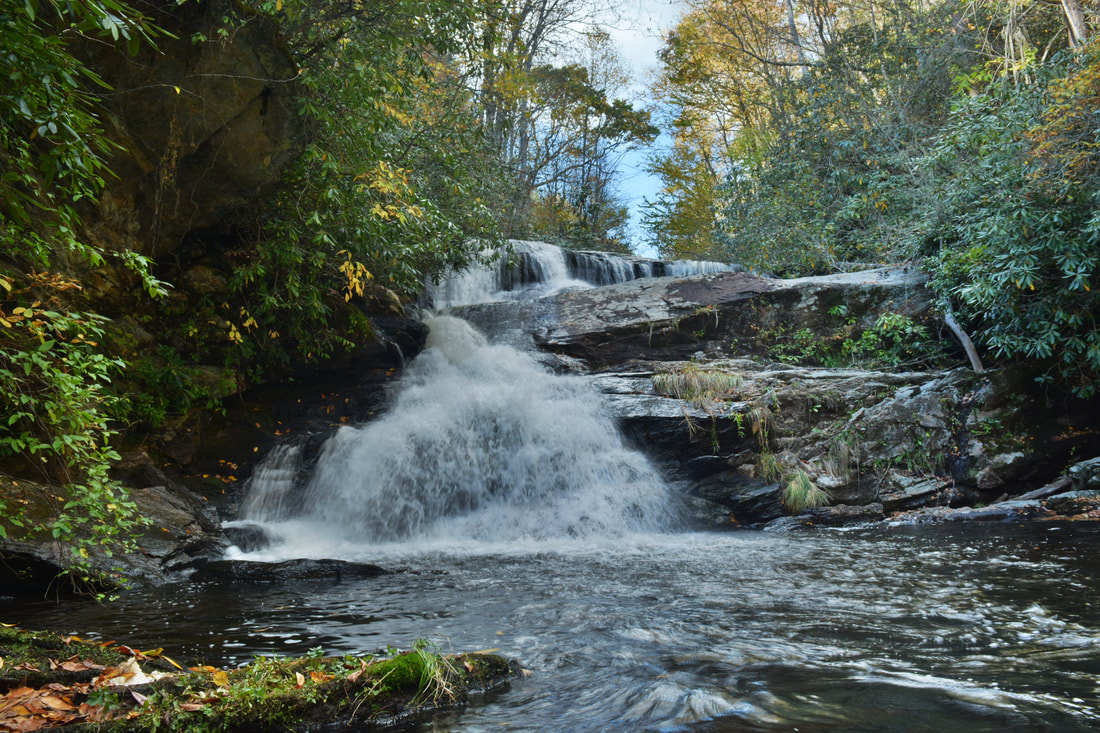
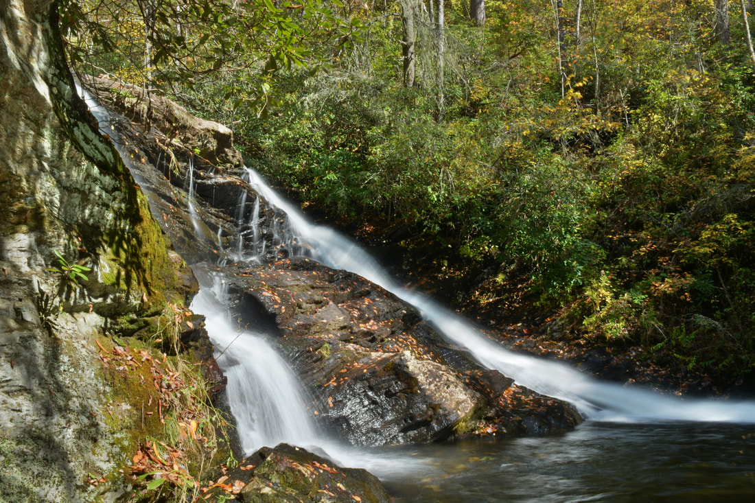
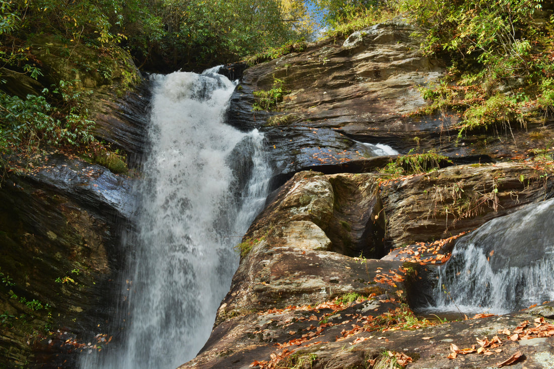
Lower Balsam Falls is the second of four waterfalls on Wolf Creek just below Balsam Lake. It is a small but scenic split-flow waterfall.
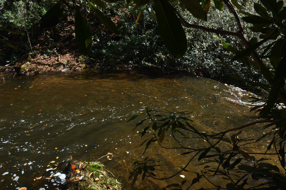
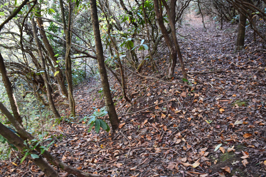
From Balsam Falls, after you cross the pool, look for a faint scramble path that climbs up the steep slope on the west (River Right) side of Wolf Creek very close to the base of the falls. This is the way to the other waterfalls. After the first few yards, the path levels out, bears left, and comes out onto another path which is in the middle of a sharp switchback at this point. This spot is slightly confusing - stay left and downhill on this new path (the path that bears right along the old roadbed leads to Balsam Lodge). In a few feet, there is another junction. The increasingly faint path to Patricia Falls and Lauren Falls continues straight while an extremely steep side path turns left to Lower Balsam Falls. Take the side path down the slope and reach Lower Balsam Falls in about 150 feet at 0.6 miles. The last few feet involve a short and relatively easy rock scramble. Lower Balsam Falls is about the same height as its upper counterpart but it is considerably more scenic. Lower Balsam Falls drops 20 feet in split flow down a sheer ledge. The two similar ribbons of flow on opposite sides of creek are unique and interesting. A neat rock wall stretches away from the falls on the River Right side.
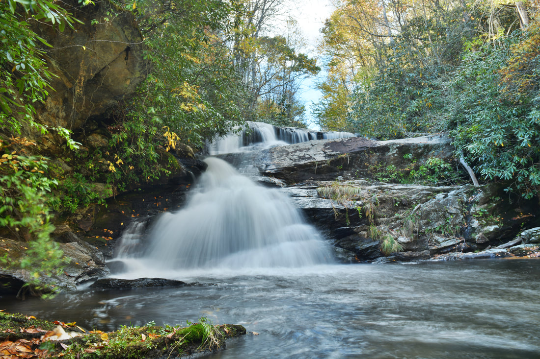
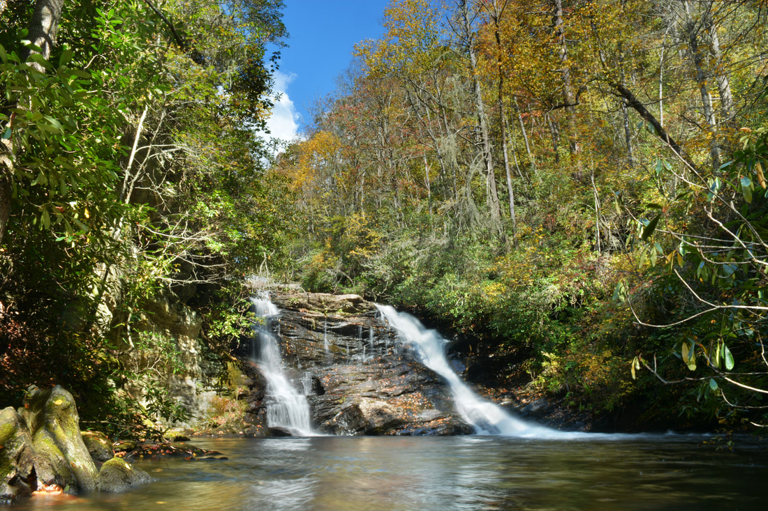
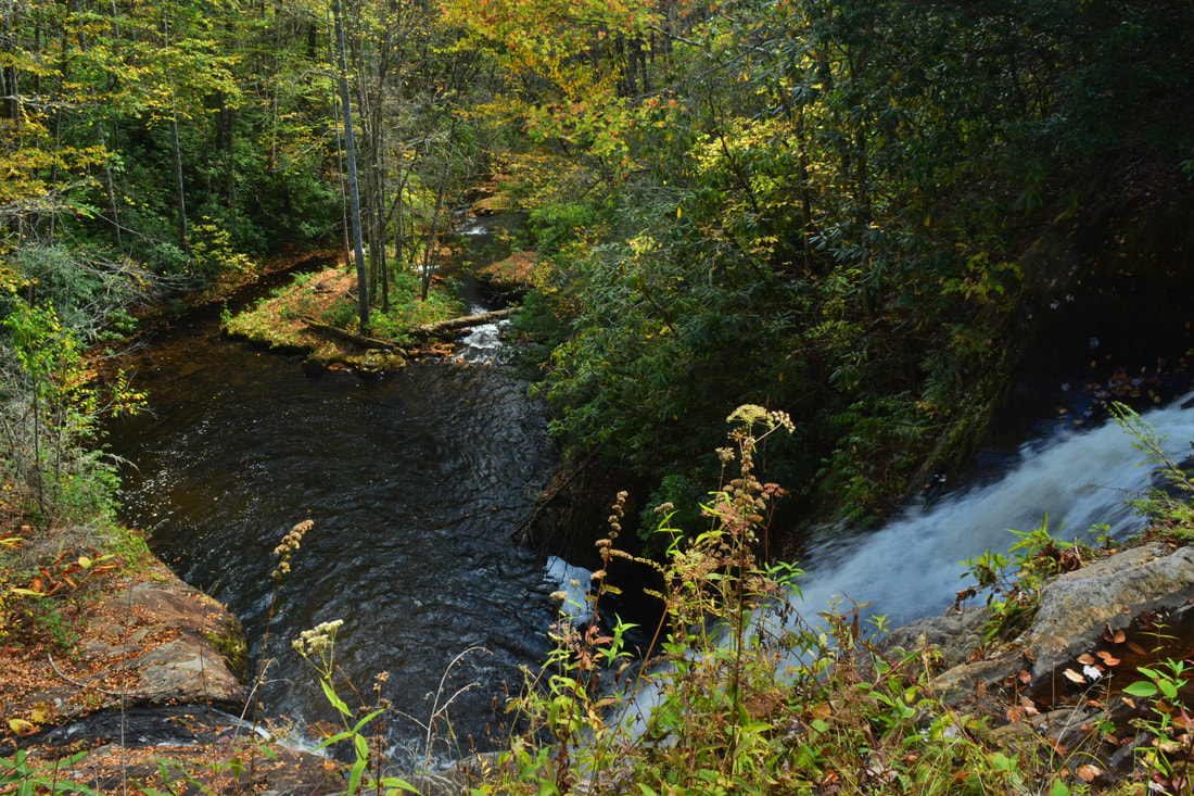
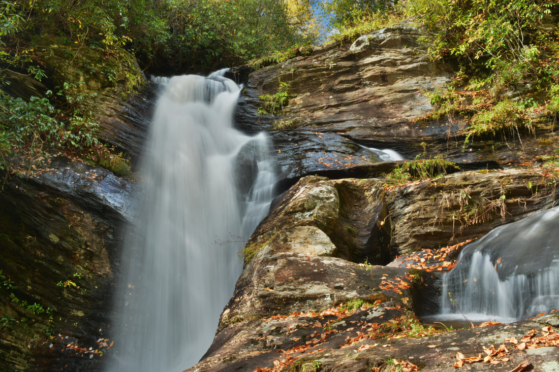
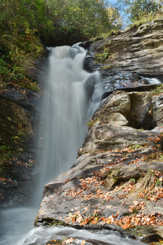
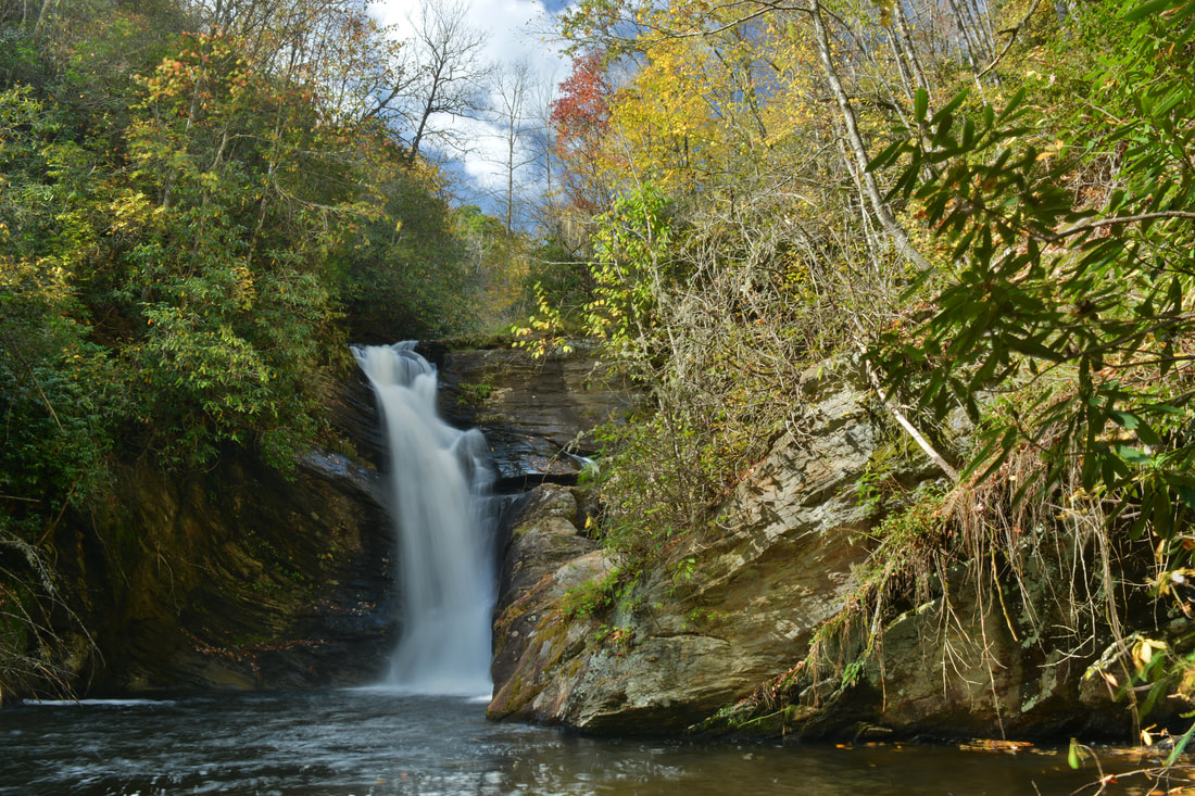
Return to the main path from Lower Balsam Falls and continue following the path in the downstream direction. You'll have to stay left toward creek-level at one point. About 350 feet from the Lower Balsam Falls side path, the main path reaches Wolf Creek and becomes even fainter with several blowdowns as it parallels the creek. In another 300 feet, just past 0.75 miles, you will reach a tiny tributary that flows into Wolf Creek from the west. You'll want to cross Wolf Creek right at/around the tributary as the brink of Patricia Falls is right around the corner and the path to the base descends the east (River Left) side. Once across the creek, it may be difficult to locate the path at first but just stay on the route of least resistance. At one point, a faint path branches left and heads up the ridge - this is the bypass route for the extremely steep and potentially dangerous rock scramble at Patricia Falls. 150 feet after the creek crossing, the path reaches the rock scramble near the top of Patricia Falls. In my opinion, this is the most difficult spot on the hike. You have to find the easiest way down the rock face. This is doable, but you have to be experienced in steep scrambling and remain extremely careful in order to safely make it down. I recommend bringing a rope if you're unsure about making it down. The path continues from the base of the rock around the edge of the Patricia Falls pool and reaches the base of Patricia Falls at 0.8 miles. Patricia Falls is a gorgeous and powerful waterfall. About 35 feet high, Patricia Falls has a lovely structure. It begins with a broad free-fall section followed by a photogenic stairstep set of steep cascades that culminates in a deep pool. If you stand in the creek near the base of Patricia Falls, you can also see the brink of Lauren Falls just downstream. The setting of Patricia Falls is pristine and practically undisturbed. I hope it stays this way! So far, the hike has been entirely on paths of some sort. The final leg of the hike to Lauren Falls has little to no path. From Patricia Falls, follow the route of least resistance through a few fallen trees downstream along the River Left side of Wolf Creek for 100 feet to the top of Lauren Falls. There, a path on the right leads to the top of Lauren Falls. The view is great but I don't suggest going there as the perch is extremely dangerous as one slip will send you tumbling down a vertical 40-foot waterfall. To reach the base of Lauren Falls, turn left, go through a thick cluster of branches and minor deadfall, and pick up a faint track that briefly contours along the slope above the Lauren Falls cliff. 
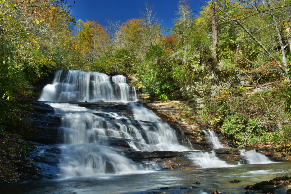
The third waterfall on Wolf Creek just below Balsam Lake, Patricia Falls is a gorgeous double-tier falls consisting of a free-fall and a stairstep cascade.
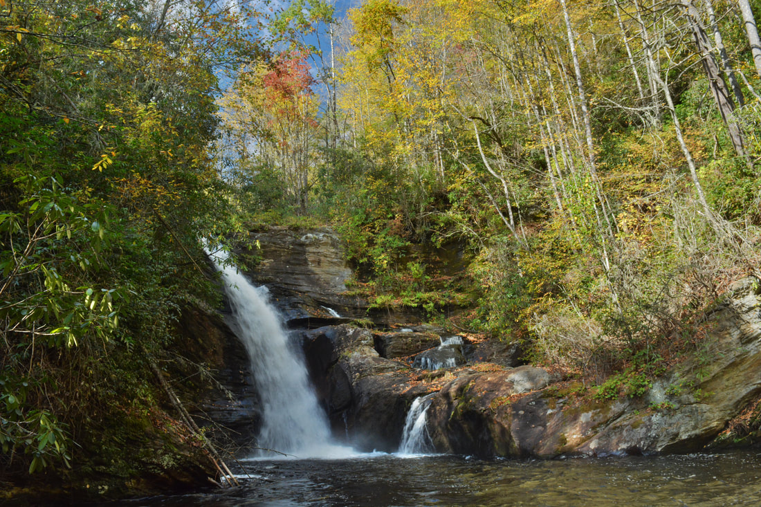
Another 100 feet past the top of Lauren Falls, the faint path turns right and makes a very steep scramble toward the base of Lauren Falls. It is a little easier than the Patricia Falls scramble but not by much. The problem is that the path ends at a large ledge about 3/4 of the way to the base of Lauren Falls. I really like the view of Lauren Falls from here as well, especially since it provides a close-up of the interesting potholes in the rock on River Left, but the view from the true base is definitely better. The point you want to get to is the beautiful island in the middle of Wolf Creek that you can see just downstream from the ledge. Getting to the island from the ledge requires a bushwhack, and even though I used two different ways going in and out, I am still not sure I used the best route, but I imagine the options are all about the same. Anyway, at the ledge, turn left, cross some deadfall, and hop down a large rock outcrop. If you've made it this far, you won't have any issues here, but getting back up the rock would be tricky so I suggest bushwhacking higher up the slope on the way back (skipping the ledge near the base). Past the rock outcrop, you are on your own to find the best route to the true base - the buswhack is kindof messy but short. Just don't climb too far above the creek and remember that the island is your destination. You should reach the island at the base of Lauren Falls around 0.9 miles. Even though you will have hiked less than a mile to this point, it will feel like a lot more - especially time-wise!
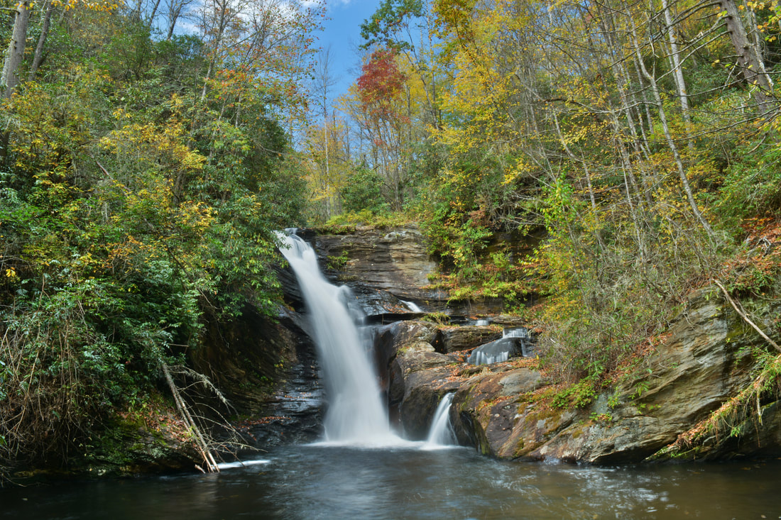
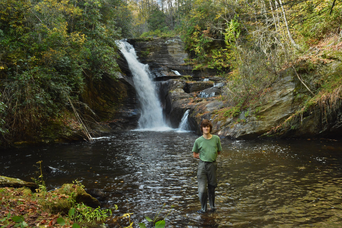
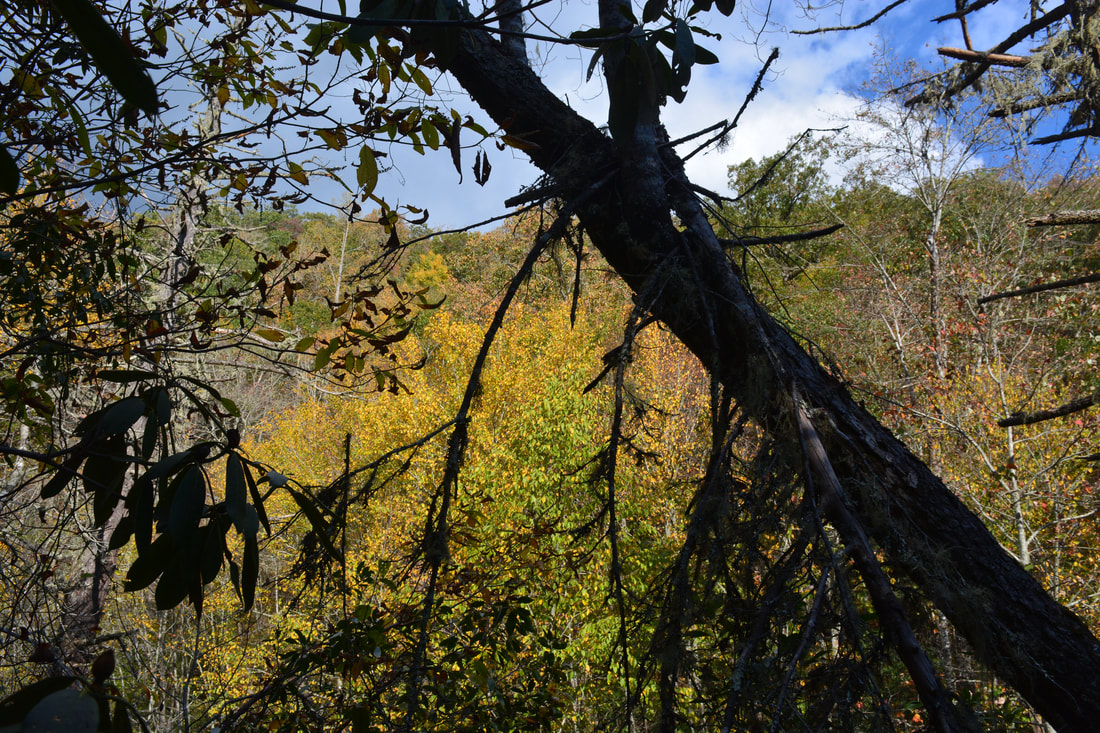
Lauren Falls is an absolutely breathtaking waterfall! Wolf Creek crashes about 40 feet off the cliff in a near free-fall into a spectacular deep pool. The rock outcrops around Lauren Falls are very interesting. Of special note is the hollow-shaped rock that was carved out by water on the River Left side of the falls. The setting at Lauren Falls is about as pristine and remote as it can get, and the small wild island only adds to the beauty. It will definitely feel like all the effort to get to this spot was worth it. Below Lauren Falls, Wolf Creek levels out and remains relatively calm before spilling into Wolf Creek Lake several miles farther. It is interesting to observe that the huge Wolf Creek Falls (also known as Paradise Falls) is located much further downstream on the same Wolf Creek below Wolf Creek Lake not far from where it enters the Tuckasegee River. From Lauren Falls, retrace your steps all the way back to the Balsam Lake Recreation Area. Remember, it's a long and difficult way back out of the gorge! I highly recommend stopping at some of the views of Balsam Lake again on the way back for a few more moments of relaxation. You'll return to the parking area in the recreation area at 1.7 miles, concluding the hike. 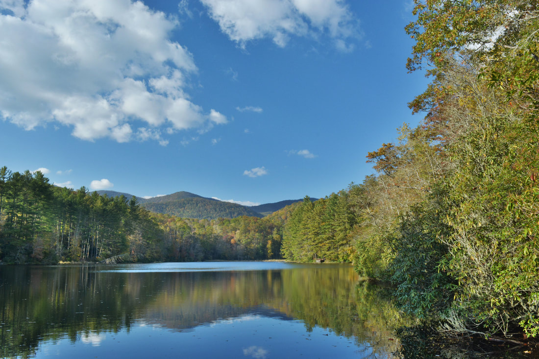
The Mallonee Trail affords several views of the small man-made Balsam Lake framed by mountains.
Mileage
0.0 - Balsam Lake Recreation Area
0.4 - Balsam Lake Dam 0.55 - Balsam Falls 0.6 - Lower Balsam Falls 0.8 - Patricia Falls 0.9 - Lauren Falls 1.7 - Balsam Lake Recreation Area Variations
Hike out and back to the end of Mallonee Trail for just a relaxing walk along Balsam Lake - 0.8 Miles
Hike out and back to Balsam Falls - 1.1 Miles Hike out and back to Patricia Falls (not recommended if you've managed to make it this far) - 1.5 Miles Bonus Stops
There are many other waterfalls in this area. A good pair to check out is Dill Falls and Upper Dill Falls on Tanasee Creek.
Pictures & Videos
0 Comments
Leave a Reply. |
About MeMark Oleg Ozboyd Dear readers: I have invested a tremendous amount of time and effort in this website and the Georgia Waterfalls Database the past five years. All of the work that has gone in keeping these websites updated with my latest trip reports has almost been like a full-time job. This has not allowed me to pick up a paid job to save up money for college, and therefore, I I've had to take out loans. If you find the information on this website interesting, helpful, or time-saving, you can say "thanks" and help me out by clicking the button above and making a contribution. I will be very grateful for any amount of support you give, as all of it will apply toward my college tuition. Thank you!

Coming in 2022-2023?
Other Hiking WebsitesMiles HikedYear 1: 540.0 Miles
Year 2: 552.3 Miles Year 3: 518.4 Miles Year 4: 482.4 Miles Year 5: 259.9 Miles Archives
March 2021
Categories
All
|
||


 RSS Feed