The definition of the term slot canyon is "a narrow canyon formed by the wear of water rushing through rock". These unique canyons are fairly common in the Desert Southwest sector (such as in Utah or Arizona) of the United States. What if I told you that there is a slot canyon, or several, in southwest North Carolina? Are you baffled yet? It is actually the truth, as there are a few isolated and very rare slot canyons on some of the mountain rivers and creeks in southwest North Carolina and adjacent portions of extreme northeast Georgia. At the Upper Chattooga River Slot Canyon, the mighty river gets squeezed into an unusually deep and very picturesque alleyway that is no more than a few feet wide. Two small but photogenic waterfalls act as bonuses to this already excellent hike. There might still be more slot canyons out there in the Blue Ridge Mountains, waiting for their turns to be discovered and introduced to the public. This hike occurred on Saturday, February 25th, 2017. My plan was to hike the Chattooga River Trail out and back from Bullpen Bridge to a goat path that would take me to the Chattooga River, from where I'd walk upstream to Whoa Nellie! Sieve and the Upper Chattooga River Slot Canyon. After the hike, I would make the scramble to Potholes Falls at Bullpen Bridge.
Summary
R/T Length of Trail: 2.3 Miles
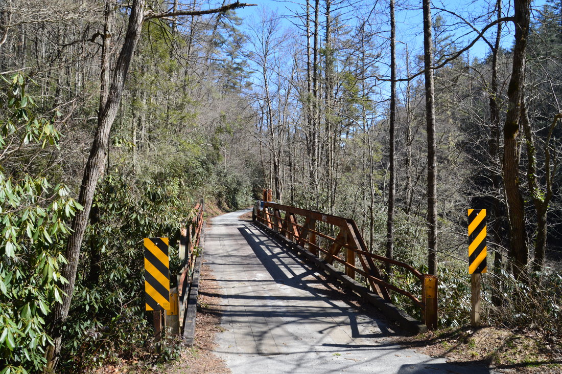
Duration of Hike: 3:00 (Allow ample time for reaching and exploring the slot canyon) Type of Hike: Out and Back Difficulty Rating: 6 out of 10 (difficult rock scrambling and a period of river-walk are required to reach the canyon) Total Elevation Gain: 397 Feet Pros: The Chattooga River Trail is maintained very well and provides many scenic views of the river Cons: Parking is rather limited at Bullpen Bridge; The last portion of the hike lacks a trail and is much more difficult than the trail Points of Interest: Chattooga River Slot Canyon; Whoa Nellie! Sluice - 4 stars; Potholes Falls - 6 stars Trail Blaze Colors: Chattooga River Trail - None Best Seasons to Hike: Summer; Fall Fees: None Beginning Point: Bullpen Bridge Directions from Highlands, NC: From the intersection of Main Street and 4th Street in downtown Highlands, follow Main Street East (which turns into Horse Cove Road) for 4.6 miles. Then, at the Y-split where Whiteside Cove Road bears left, bear right onto Bull Pen Road toward Bullpen Bridge. This road has an unpaved section, but it is in excellent shape, and the road becomes paved again closer to the bridge. Continue on it for 3.1 mile to Bullpen Bridge. The parking area for the hike is on the left just before the bridge. The parking area only has space for two or maybe three cars, and parking near the bridge is not allowed outside of the designated parking area, so if it is full, back up the hill away from the no parking signs and park next to the road farther up. Map
Click here for more information and to download this trail map to view in Garmin Basecamp.
Details
Until fairly recently, I had no idea that slot canyons exist in the southeastern US. I was shocked when I learned about the discovery of a slot canyon on the Upper Whitewater River near Cashiers, and since then, it has even become published in a Kevin Adams' hiking guidebook "North Carolina Waterfalls". Then, I began to hear rumors about a slot canyon on the Upper Chattooga River, and those rumors were confirmed when a group of adventurers found the canyon and posted their pictures of it on Facebook. After seeing the pictures, I made it a goal to locate and hike to the slot canyon, and on this day, I finally got around to doing the hike.
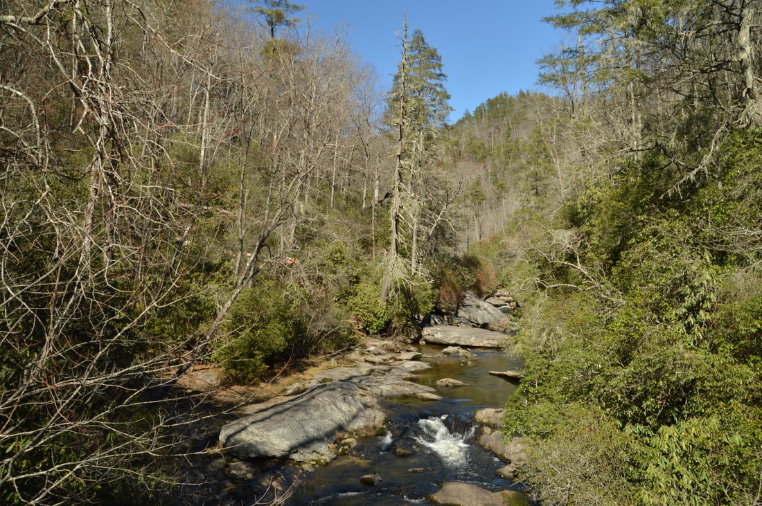
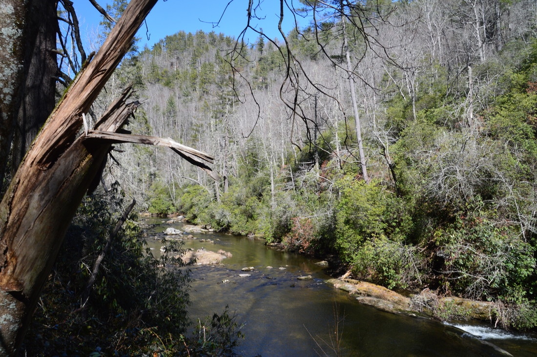
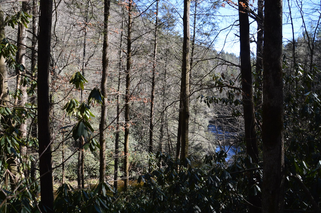
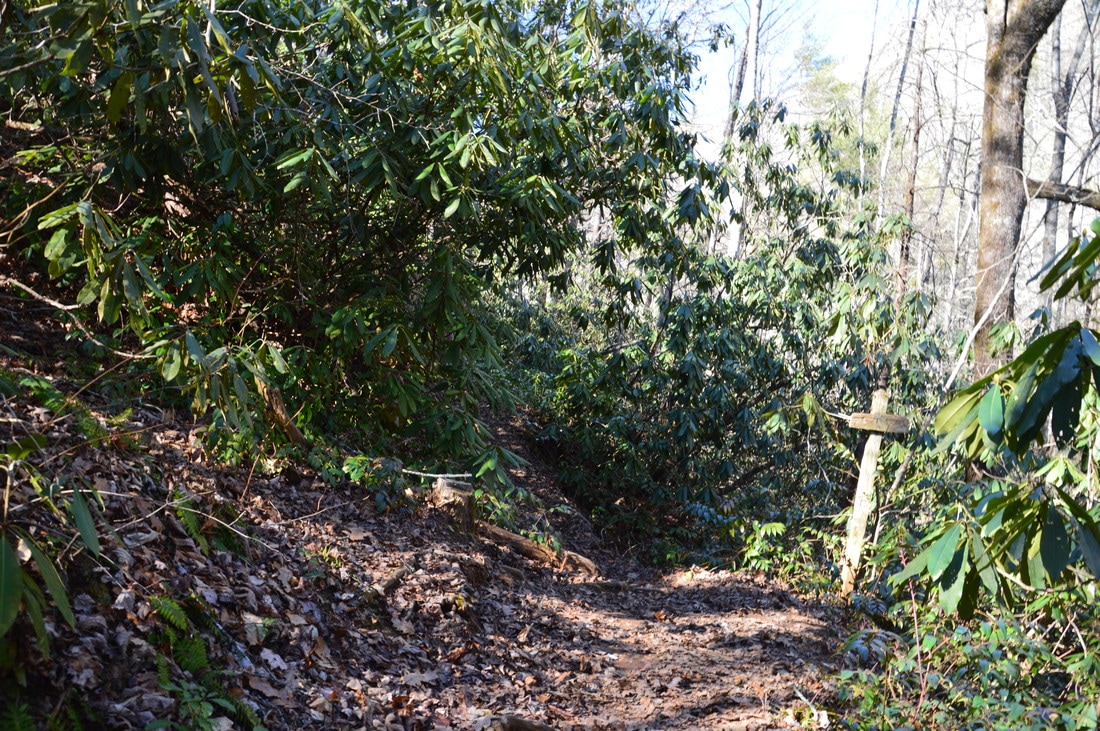
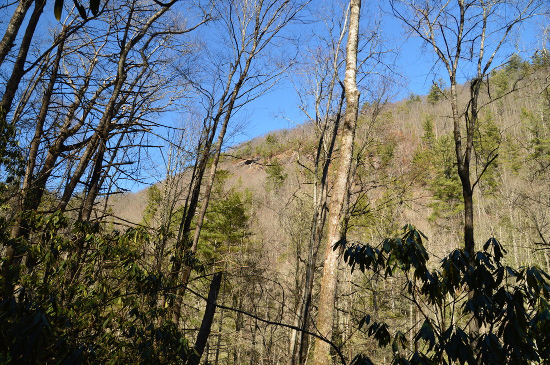
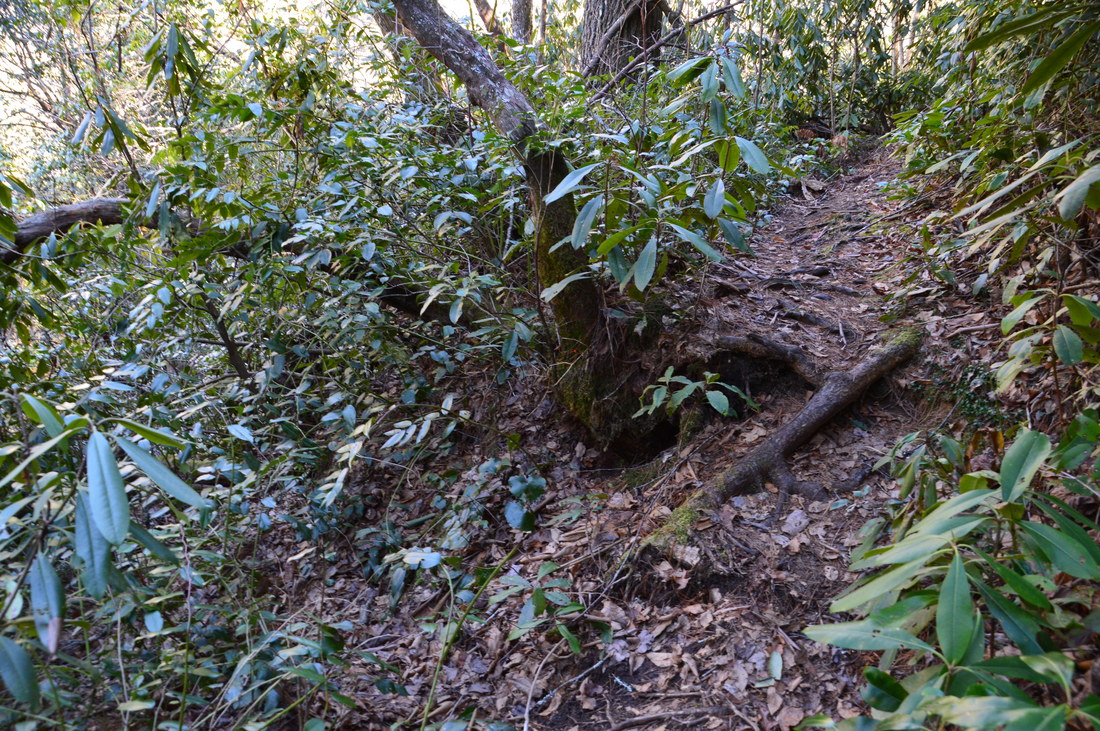
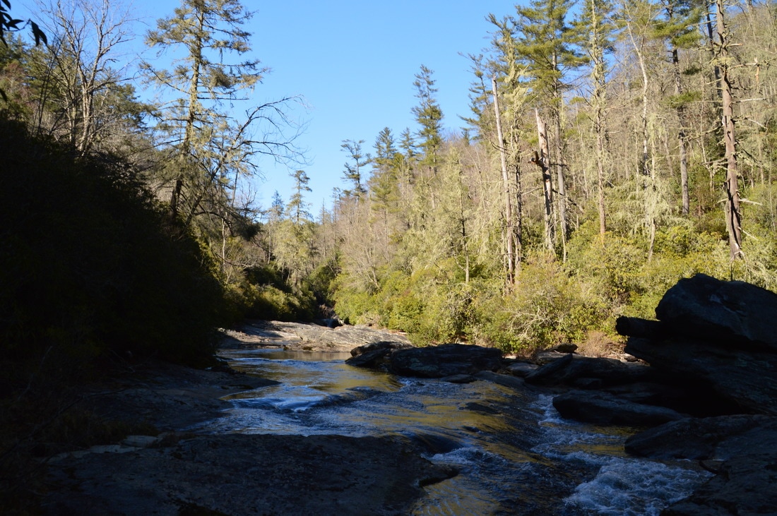
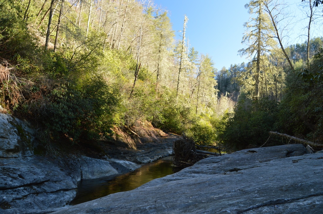
There are several trailheads for the Upper Chattooga River Slot Canyon. The Chattooga River Trail has two trailheads: at Bullpen Bridge and Whiteside Cove Road. Additionally, the County Line Trail from Whiteside Cove Road provides an easy route to the river and is frequently used by kayakers. However, the route from Bullpen Bridge is the shortest and it is also very pretty with many views of the river. The small but photogenic Potholes Falls is located right at Bullpen Bridge. I suggest visiting Potholes Falls after the main hike. The access to this waterfall is discussed farther down this post. From the back of the small parking area at Bullpen Bridge, pick up the Chattooga River Trail at the trailhead kiosk (make sure to pick up the flat trail and not the downhill trail that leads to Potholes Falls). Passing a large rock outcrop to the left, the trail quickly reaches a large fallen hemlock that is tricky to get across and then begins following the Chattooga River with many views of this pristine mountain river. Because the banks of the Chattooga River gorge are rather steep, the trail spends more time contouring in and out of ravines on the slopes just above the river rather than directly following the river. However, there are nearly continuous views of the river through the trees, and it is always within hearing distance. Sadly, dead hemlocks both litter the gorge and stand out as pale ghosts, illustrating the infinite effects of the hemlock woolly adelgid. 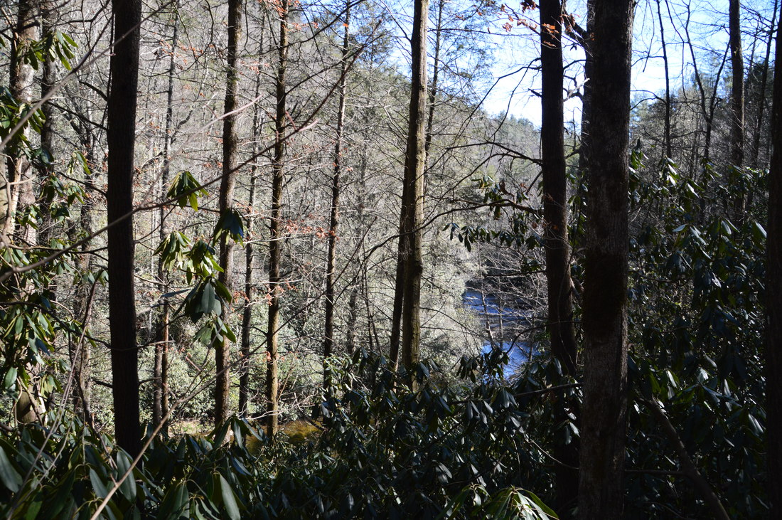
The pale ghosts of dead hemlocks litter the Upper Chattooga River gorge.
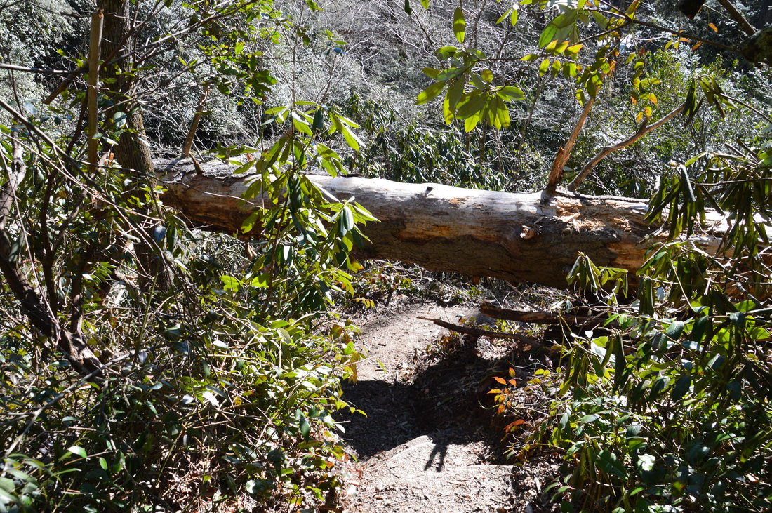
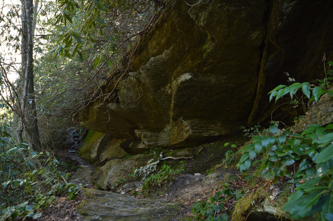
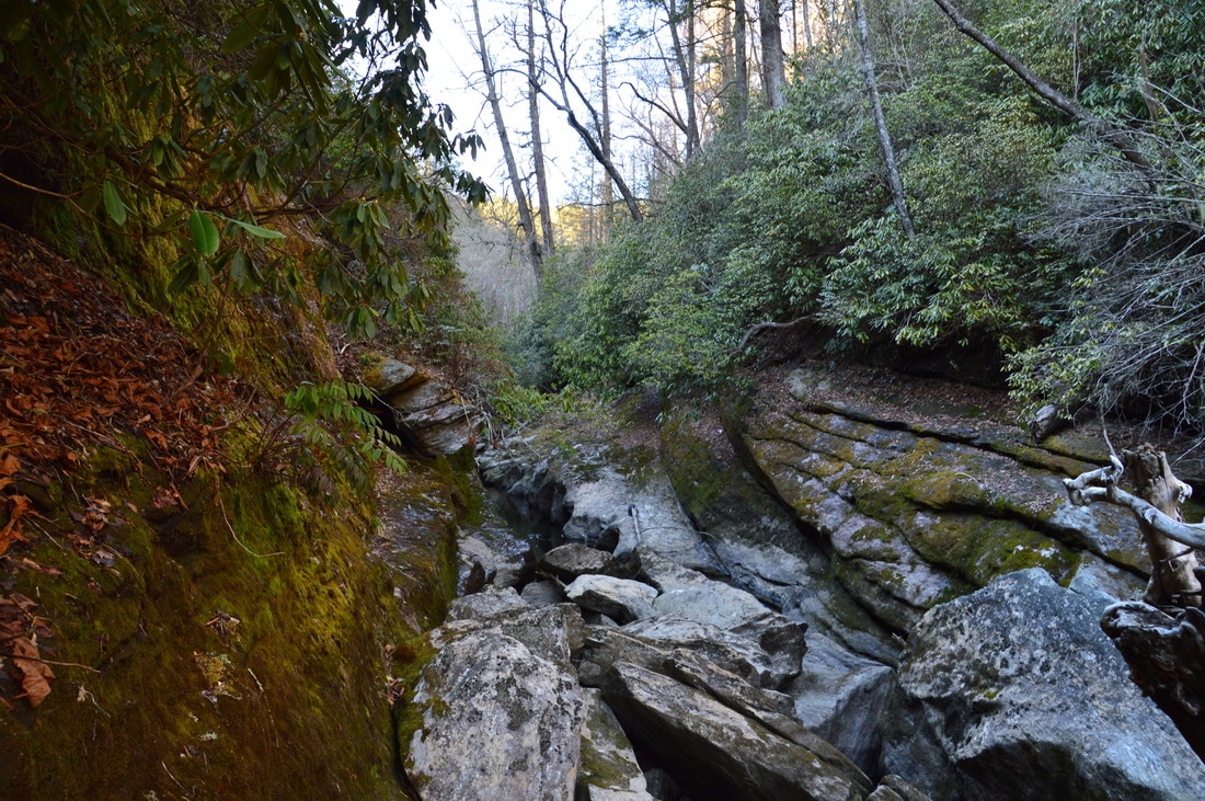
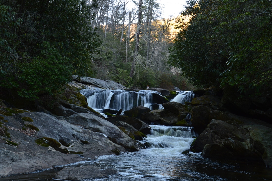
At 0.6 miles, after a cliff to the left, the trail reaches the signed junction with the Chattooga Loop Trail. This trail leaves acutely to the left to another trailhead on Bullpen Road. The trail appeared to be used a lot less than the main Chattooga River Trail. After the junction, the trail becomes a lot more rugged, soon passing over a pair of rock staircases below a huge rock overhang. At 0.85 miles, the trail makes a tricky scramble across an open rock slab just above the river, with a fallen tree at the far end of the rock slab. There is an open view of a picturesque bend in the river here. A little bit farther, you’ll have to hop across another large fallen tree.
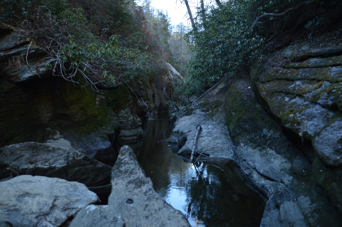
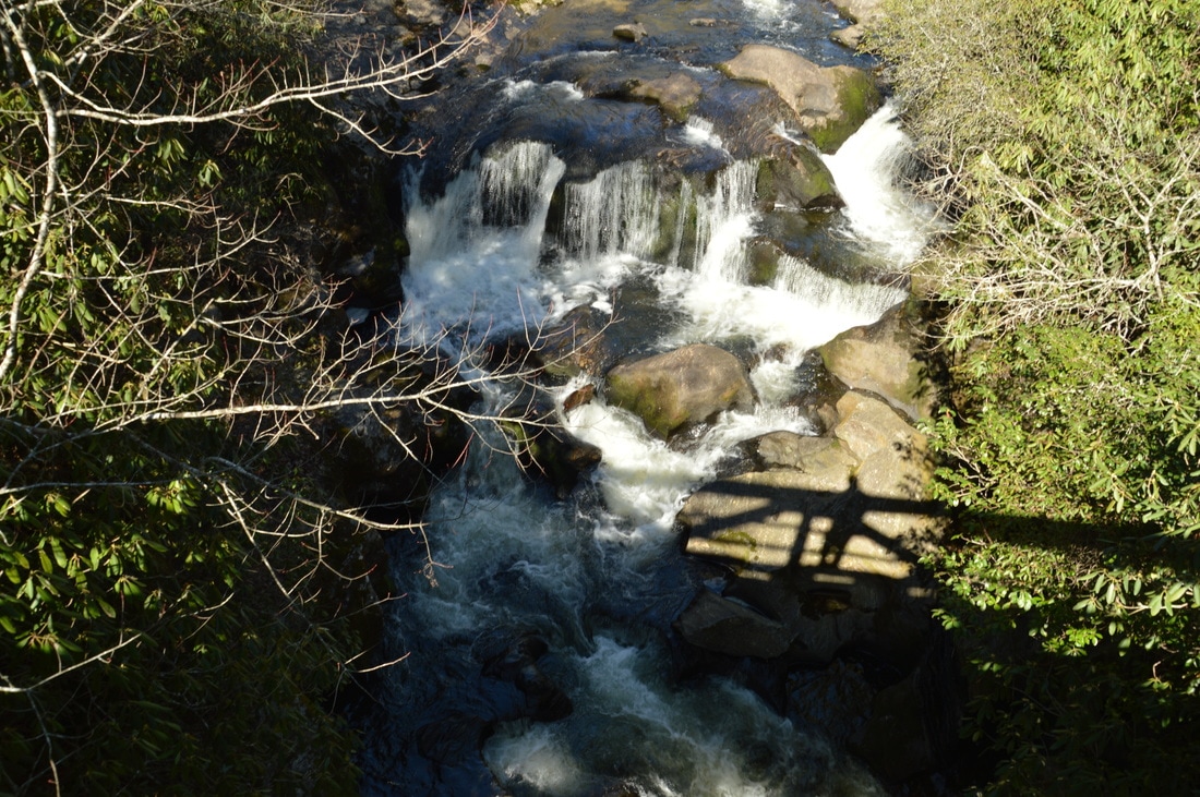
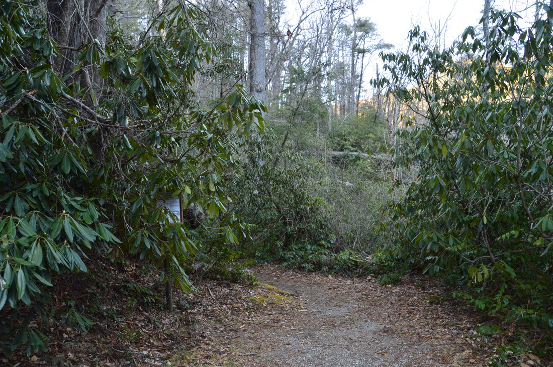
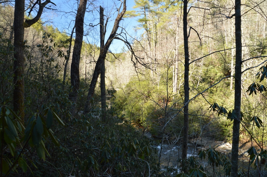
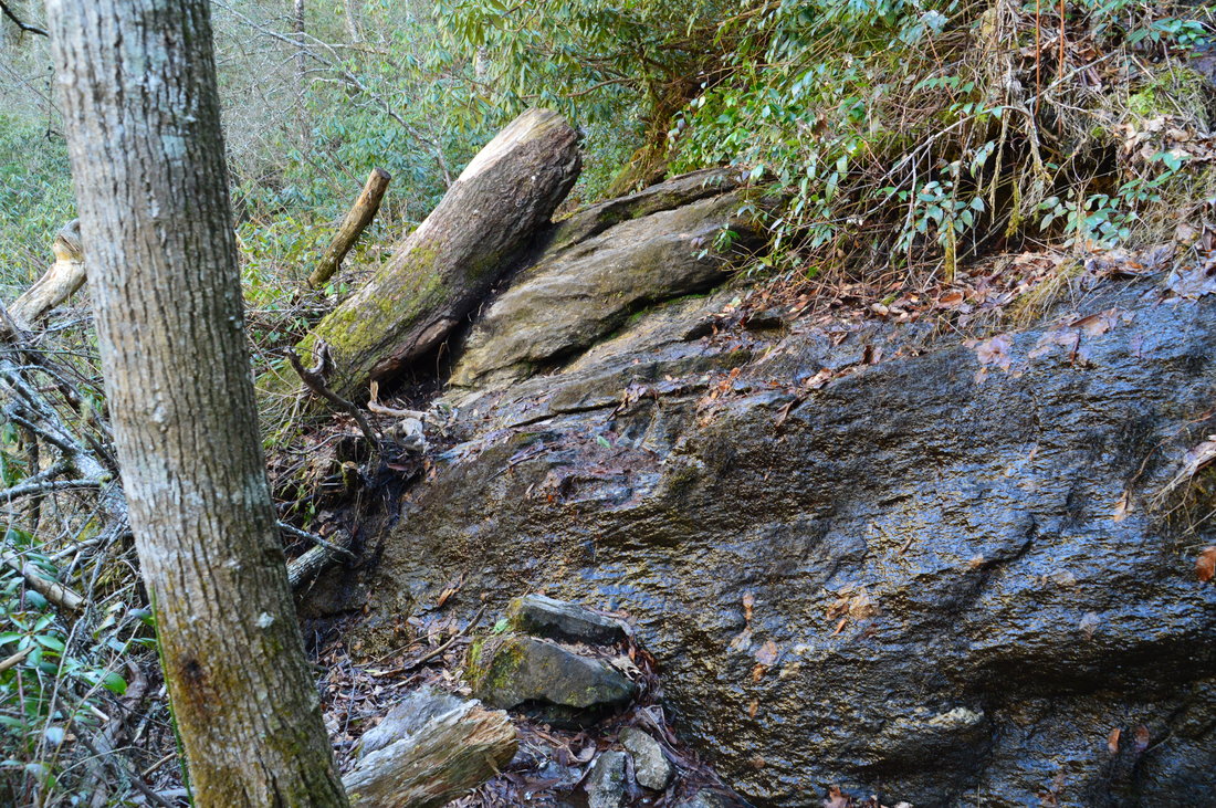
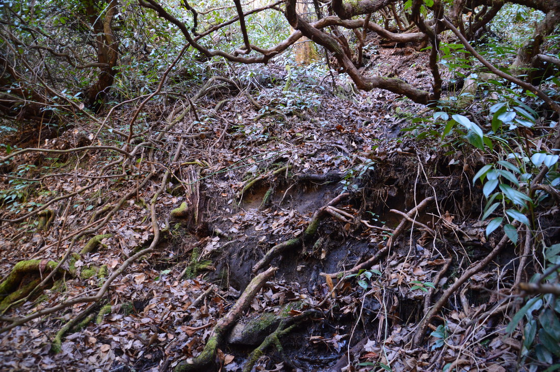
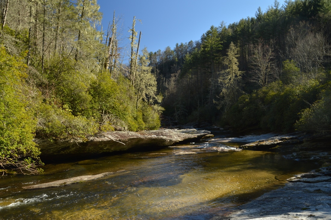
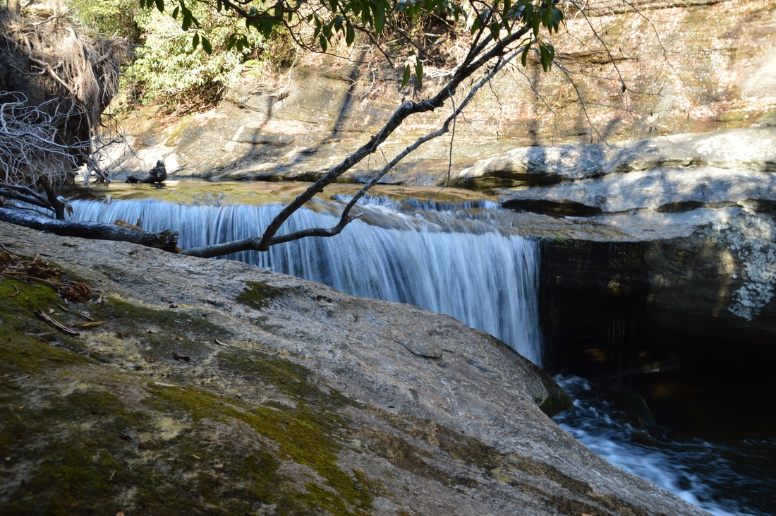
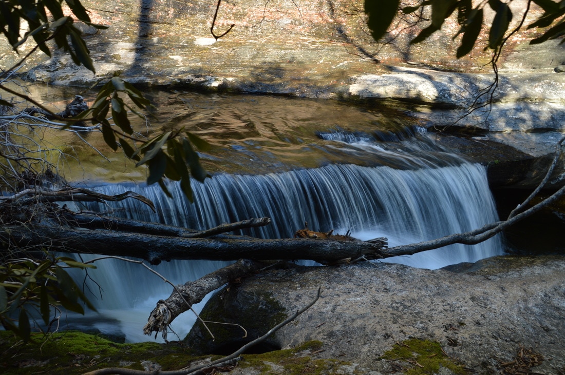
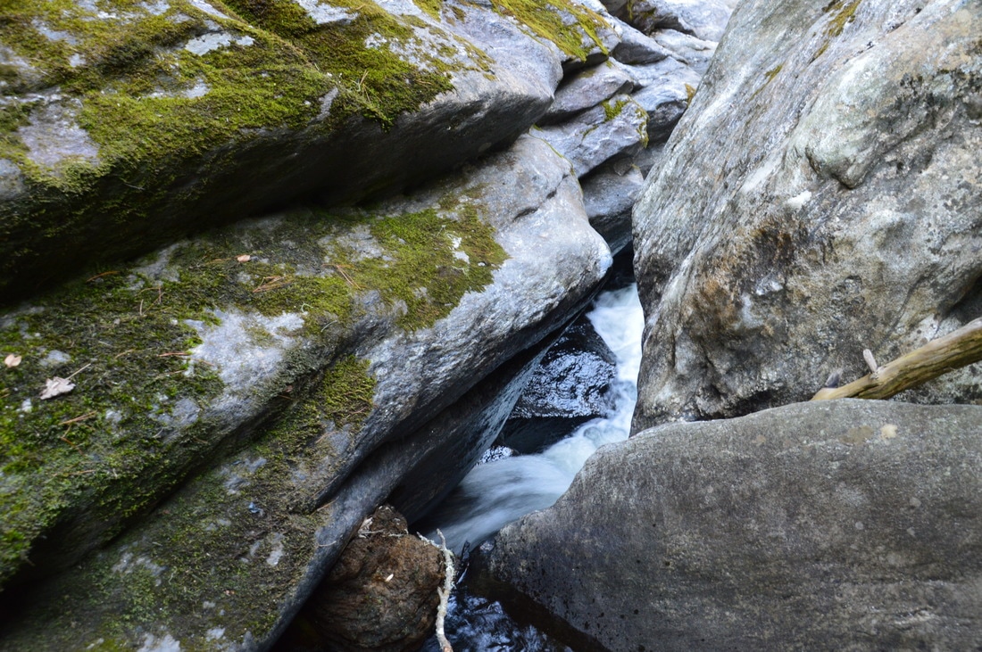
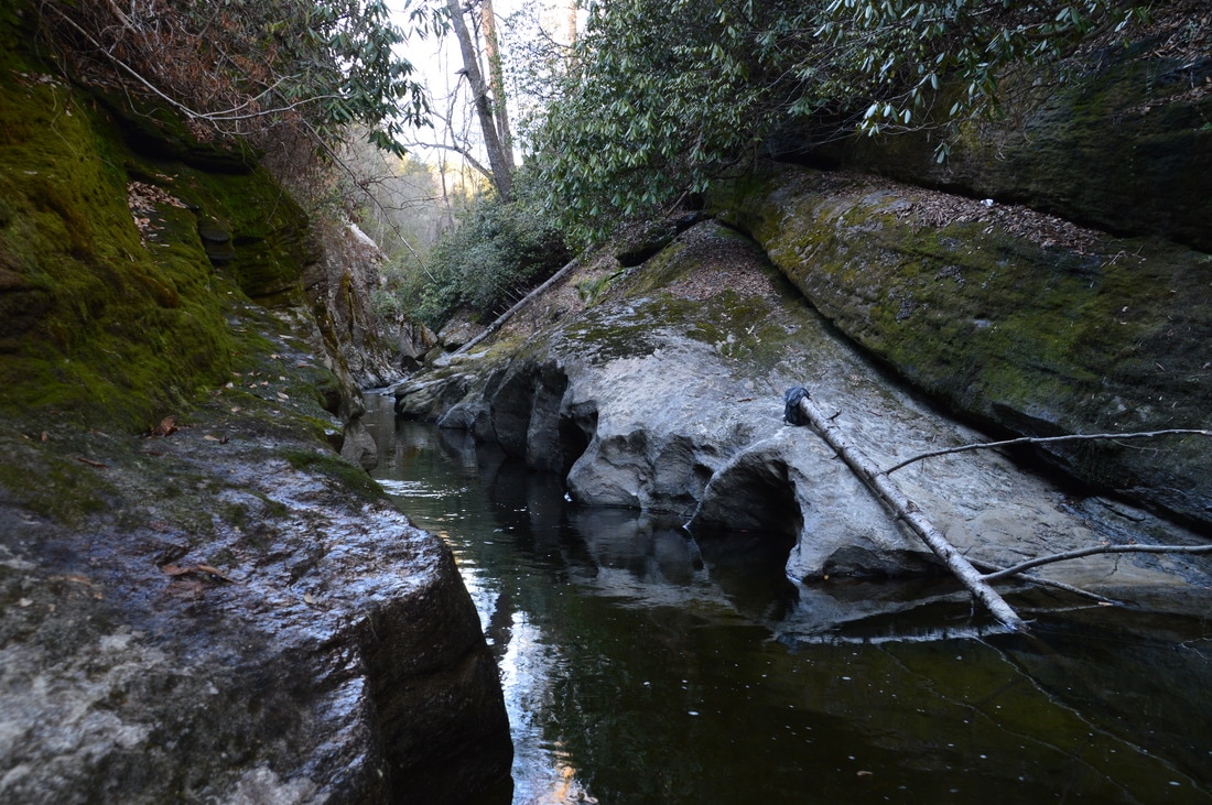
You will reach the point where it is best to leave the trail to access the slot canyon at 0.95 miles. It is not obvious, but a steep and overgrown path leaves to the right down in the direction of the river at this point. You must take this goat path, as after this, the trail rises slightly above the river to bypass the extremely rugged slot canyon area. The coordinates of the place where you have to turn off the trail and onto the steep goat path are N35° 01' 33.0" W83° 07' 48.3". The path makes a short but very steep descent to the river – fortunately, numerous trees provide helpful handholds. At 1.0 miles, the path ends at the Chattooga River. From here to the canyon, the distance is relatively short but there is no path to speak of. The easiest route is along and/or straight in the river, which is why this hike is best to do during summer’s and fall’s warm weather and low water levels. Additionally, the slot canyon’s beautiful features are unveiled the best at low water. For the most part, it is possible to stay dry by walking along the rocks on the left side (kayakers say River Right), but there is one location where either a narrow rock scramble or a deep wade is required. In high water, the wade is not an option. At 1.05 miles, the relatively easy part of the river-walk ends at a small but picturesque waterfall that is known as "Whoa Nellie! Sieve" in the kayaking community. Kayakers' names are typically not the official names of waterfalls or rapids, but in this case, there is no other name that I know of. The coordinates of the end of Whoa Nellie! Sieve are N35° 01' 37.3" W83° 07' 49.2". The river spills over a 6-foot ledge and into a small pool, with a long rock slab on River Right and a picturesque rock overhang on River Left. The main portion of the sieve itself is further upstream, at the beginning of the slot canyon, but it is not yet visible from this point. From here, the only way to progress further is to hike up the gently sloping rock slab on River Right (left side facing upstream) and across a number of downed trees. At 1.1 miles (about 250 feet past the small waterfall), reach a large rock slab next to a deep pool. From here, depending on water level, it is possible to walk out into the shallower portions of the pool and view the upper part of Whoa Nellie! Sieve. Technically, this is the beginning of the slot canyon as marked on my map. At low water, this is an incredibly scenic spot, as the river becomes only a foot wide as it flows through a narrow chute and into the pool. To the right (on River Left), a towering cliff adds grandeur to the scene, and on River Right, there is a low but long rock shelter. 
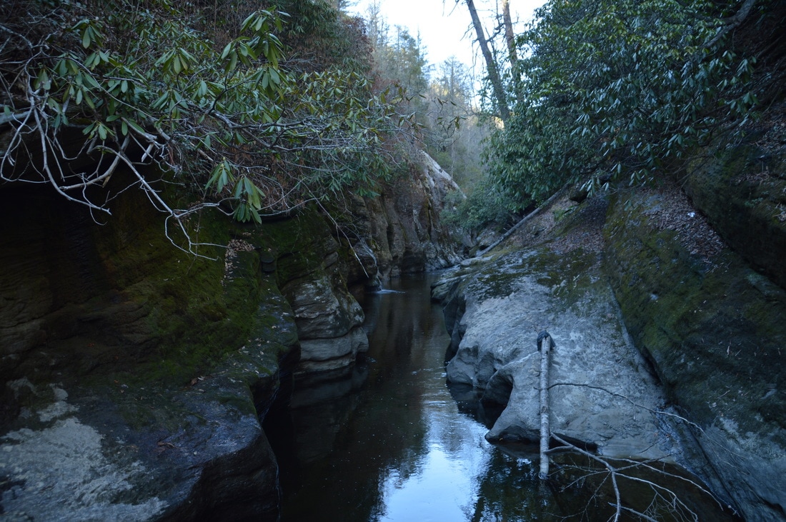
The upper portion of Whoa Nellie! Sieve signals the beginning of the Upper Chattooga River Slot Canyon, a place where the Chattooga River squeezes into a narrow chute only a foot wide.
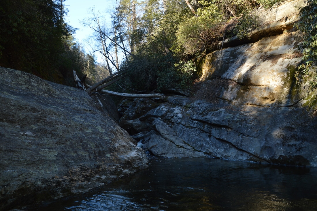
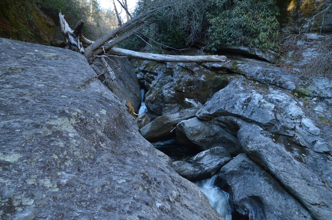
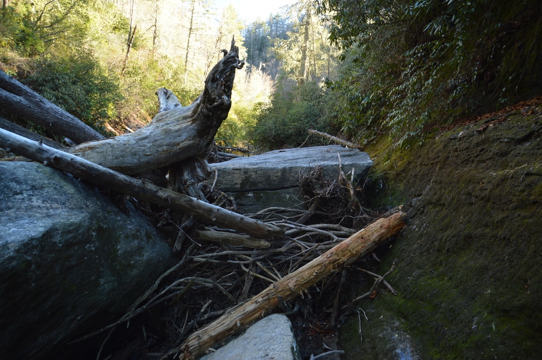
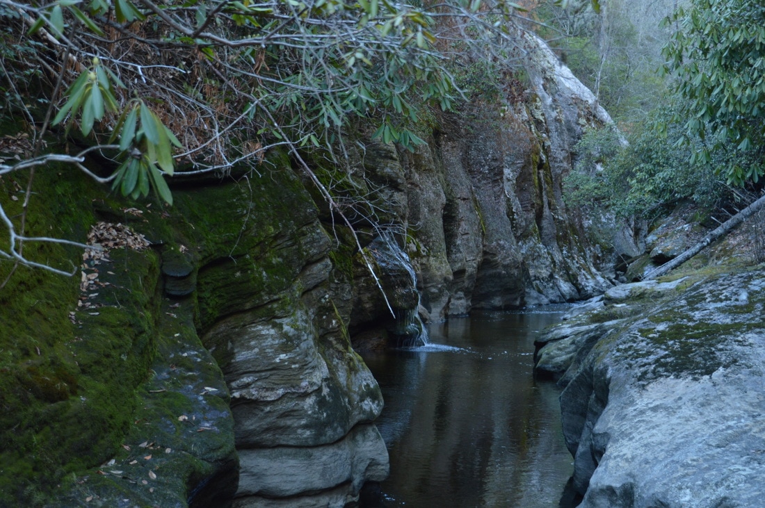
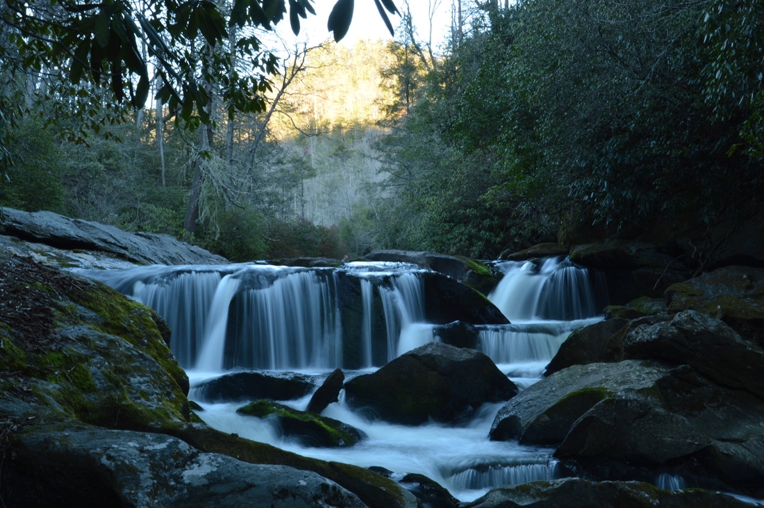
The most difficult portion of the hike is after the pool at the sieve. For any further progress, a difficult scramble up the ledge that forms the rock shelter is needed. Those who are skilled in rock scrambling and overall navigating in rough terrain should have no trouble to step onto a small log below a slight gap in the ledge. Grabbing on to a chunk of driftwood on the ledge above, and pushing off your legs that should be placed against the ledge on the other side of the gap, you should be able to get onto the huge boulder above. A picture of this place is included in the gallery at the bottom of this page. Once on top of the boulder, walk across it to its far end. There, the entrance to the Upper Chattooga River Slot Canyon comes in view. Sheer 40-foot cliffs line the narrow, tranquil, and extremely deep river, as it flows through a sort of alleyway. Wow! What a scene! For a closer view, descending the other side of the boulder down a huge log jam is required. Despite the somewhat fragile-looking construction of the log jam, it held out well when I was here, although I can imagine that the day will come when a flood of the magnitude that brought these logs here could also wipe them out. Once across the log jam, a short scramble across a series of boulders leads to the edge of the canyon at 1.15 miles. The coordinates of this location are N35° 01' 39.7" W83° 07' 50.4".
No further progress is possible after this spot, without swimming across the slot canyon and continuing along the broad rock slab on River Left. Depending on season and water level, such a feat may be possible, but on this cold February day, I was not up to getting wet above knee level, and furthermore, I was very content with what I had seen. As you observe the slot canyon and its beautiful cliffs, note the wet-weather tributary left that spills down the cliffs a short distance upstream on the left side (River Right). As I stood at the edge of the canyon, I realized that kayakers need a significantly higher amount of water in the river to safely float through the canyon. Whoa Nellie! Sieve is definitely passable only at very high water, although I suppose that it isn't difficult to portage. From the slot canyon, simply retrace your steps back to Bullpen Bridge, and make sure to take your time. Assuming that you didn't explore the canyon further than I did, you will return to the trailhead at 2.3 miles. 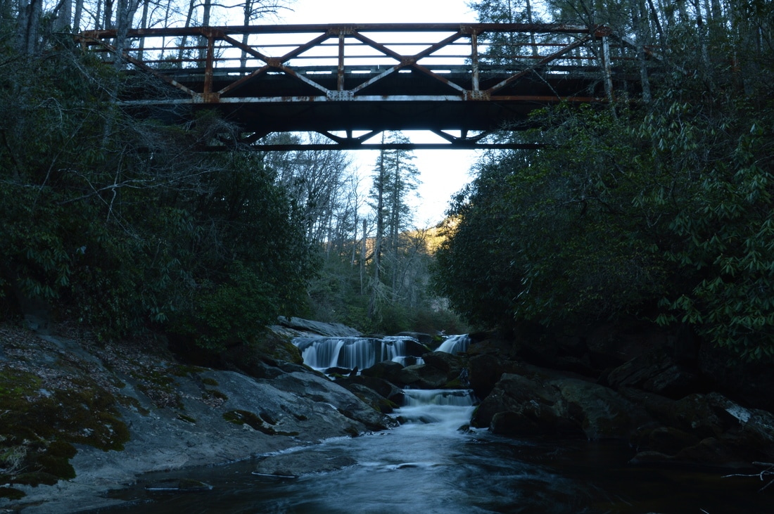
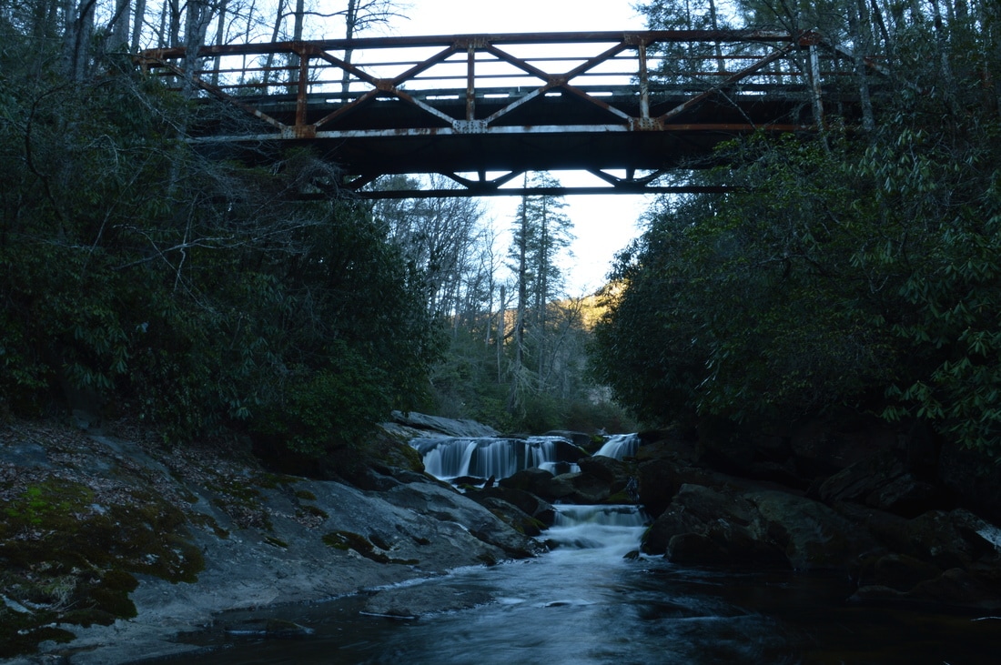
Located nearly directly below Bullpen Bridge, Potholes Falls is very photogenic for having a height of only 10 feet.
Potholes Falls
The short hike to Potholes Falls is well worth the time before or after the main hike. There are routes to both the top and base of Potholes Falls. To reach the top, follow the obvious trail that heads downhill from the Bullpen Bridge parking area. It descends over some steps and comes out at the top of the falls in a hundred feet. From here, there is a great view across the small waterfall and down to the Bullpen Bridge, which is a very photogenic iron bridge high above the river. The best view of the falls is from the base, however. To reach the base, cross Bullpen Bridge and pick up the steep goat path that heads right and down to the river. Some minor rock scrambling is necessary to reach the river. Once at the river, a short period of rock hopping or wading - depending on the water level - upstream along the river brings you to Potholes Falls. The best view of it is from River Right (left side looking upstream). At Potholes Falls, the Chattooga River cascades over a series of ledges and into a tight mini-gorge with potholes. From a bit farther downstream, it is possible to take a picture of both the waterfall and the bridge in the frame. There are many options for creative photography at Potholes Falls. Mileage
0.0 - Bullpen Bridge
0.6 - Chattooga Loop Trail Junction 0.95 - Goat Path to Chattooga River 1.0 - Chattooga River 1.05 - Whoa Nellie! Sieve (Ledge) 1.1 - Whoa Nellie! Sieve (Upper Chute) 1.15 - Upper Chattooga River Slot Canyon 2.3 - Bullpen Bridge Variations
None
Bonus Stops
There are many other hiking options in the area. Here are a few.
PicturesVideos
2 Comments
Matt
4/20/2019 07:53:56 am
That is awesome. I've been camping the chattooga for 20 years and never heard of this. I will be exploring this as soon as possible. Thank you!
Ashley
3/7/2022 09:55:44 am
I went here this weekend by accident after going to Cane Creek Falls. The scramble way we went down to the river went past a very cool deep crevice cave that had to be hopped over to get down to the water. Today I was on whitewater sites trying to find a name of the beautiful waterfall and canyon…couldn’t tell if it was Whoa Nelly and Crease Boof or something else. I am tickled to find your listing and pics of this magical spot as well! Leave a Reply. |
About MeMark Oleg Ozboyd Dear readers: I have invested a tremendous amount of time and effort in this website and the Georgia Waterfalls Database the past five years. All of the work that has gone in keeping these websites updated with my latest trip reports has almost been like a full-time job. This has not allowed me to pick up a paid job to save up money for college, and therefore, I I've had to take out loans. If you find the information on this website interesting, helpful, or time-saving, you can say "thanks" and help me out by clicking the button above and making a contribution. I will be very grateful for any amount of support you give, as all of it will apply toward my college tuition. Thank you!

Coming in 2022-2023?
Other Hiking WebsitesMiles HikedYear 1: 540.0 Miles
Year 2: 552.3 Miles Year 3: 518.4 Miles Year 4: 482.4 Miles Year 5: 259.9 Miles Archives
March 2021
Categories
All
|


 RSS Feed