
The coastal Florida Panhandle is well-known for its outstanding beaches. You have probably at least heard names such as Fort Walton Beach, Destin, and Panama City Beach. What most people don't know though is that not all of the beaches between Pensacola and Panama City are developed. A number of state parks, such as Topsail Hill State Park and St. Andrews State Park, are placed along the coast here to protect the fragile ecosystems that are found near the ocean. This part of Florida's coastline is home to fifteen coastal dune lakes - a very rare ecosystem that is found only in four other places: Oregon, Australia, Madagascar, and New Zealand. These lakes are one of the reasons that there is so much conserved land along the shoreline in Walton County. Out of the variety of state parks here, Topsail Hill State Park is the king of them all. This large park has several hiking trails that visit two dune lakes, a remote beach, and a landscape spotted with dunes of all shapes and sizes. This hike occurred on Tuesday, April 19, 2016. My plan was first to follow the paved Beach Tram Path to the Campbell Lake Bike Path, This is where I would take the south side of the Turpentine Trail past a view of Lake Campbell and then to the Deer Track Trail. I would follow the Deer Track Trail's south side to the Morris Lake Trail. After making a side trip to the beach, I would hike the Morris Lake Trail's loop counter-clockwise. Then, I would hike the Old Growth Trail, before hiking the Deer Track Trail's north side. I would finish the hike by following the north side of the Turpentine Trail.
Summary
R/T Length of Trail: 10.3 Miles
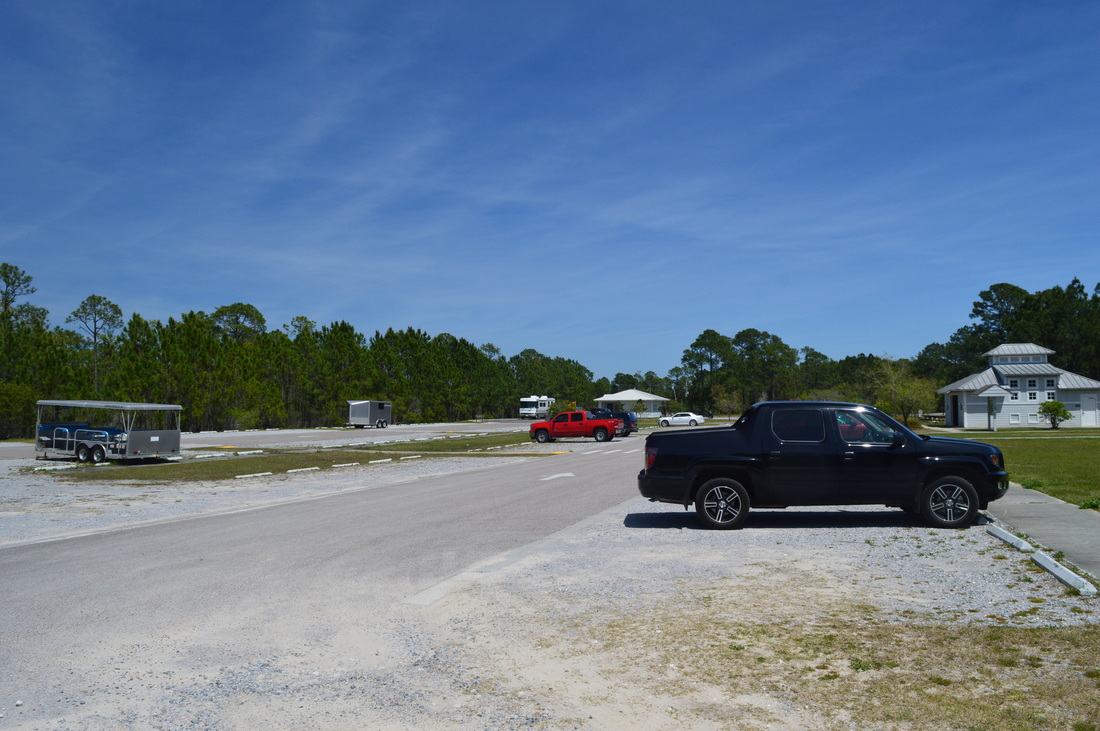
Duration of Hike: 4:40 Type of Hike: Several Loops Difficulty Rating: 3 out of 10 Total Elevation Gain: Minimal Pros: Beautiful, remote coastline that is very rare to find in Florida Cons: Much of the hike is on double-track trail; The southern side of Deer Track Trail can very confusing due to a lack of signage or blazes Points of Interest: Campbell Lake; Morris Lake; Remote beach and coastline Trail Blaze Color(s): Campbell Lake Bike Path - Yellow; Turpentine Trail - Green; Deer Track Trail - Orange; Morris Lake Trail - Blue; Old Growth Trail - Red Best Season(s) to Hike: Summer (but it does get hot) Fees: There is a $6 entrance fee per vehicle with 2 to 8 people. The entrance is $4 for vehicles with only one person. There is also a $2 fee for pedestrians and bicyclists. Beginning Point: Topsail Hill State Park Trailhead Directions: Topsail Hill State Park is located in the unincorporated community of Santa Rosa Beach. From US Route 98, take County Highway 30A southeastward and follow it for 0.3 miles. Then, turn right at a sign at the entrance to Topsail Hill State Park. Once you enter the park, pass the ranger station, pay your fee, and park anywhere in the huge parking area just ahead. Other than the Clubhouse Trail, no trails start right here, but the Beach Tram Path is closed to non-authorized traffic, so you will have to walk down the paved road to get to the main trail system. Map
Click here for more information and to download this trail map to view in Garmin Basecamp.
Details
Topsail Hill State Park has gained some fame among the hiking communities in Florida. The park's trail system has become known to be one of the best hikes in the state. On a week-long trip to the Florida Panhandle, I was presented with an opportunity for a hike in the Panama City area, so I was anxious to find out what all the fuss was about at Topsail Hill. After completing the hike, I can certainly say that this was one of the most scenic hikes I have done in Florida. The coastal lakes, the remote beach, and the trail through the sand dunes all turned out to be very picturesque. The hike did have one downside: most of the trails were doubletrack, and this took away the feeling that you could expect to feel on a true wilderness hiking trail. Also, you may have noticed that I increased the difficulty of this trail by a notch, compared to many other hiking trails in Florida. The reason for the slightly higher difficulty rating is that the Morris Lake Trail encounters quite a few areas of sand that is rather deep. The hike through the sand lasts for around two miles. Two miles of hiking through sand like this can turn out to be strenuous for those who are not accustomed to it - thus, I decided that this hike is slightly more difficult than many other hikes in Florida that I completed, as the landscape isn't totally just normal flat terrain.
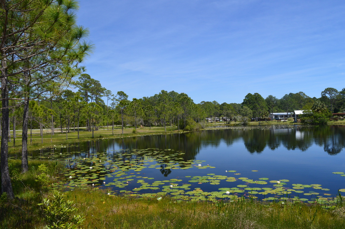
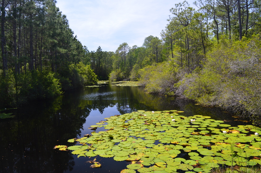
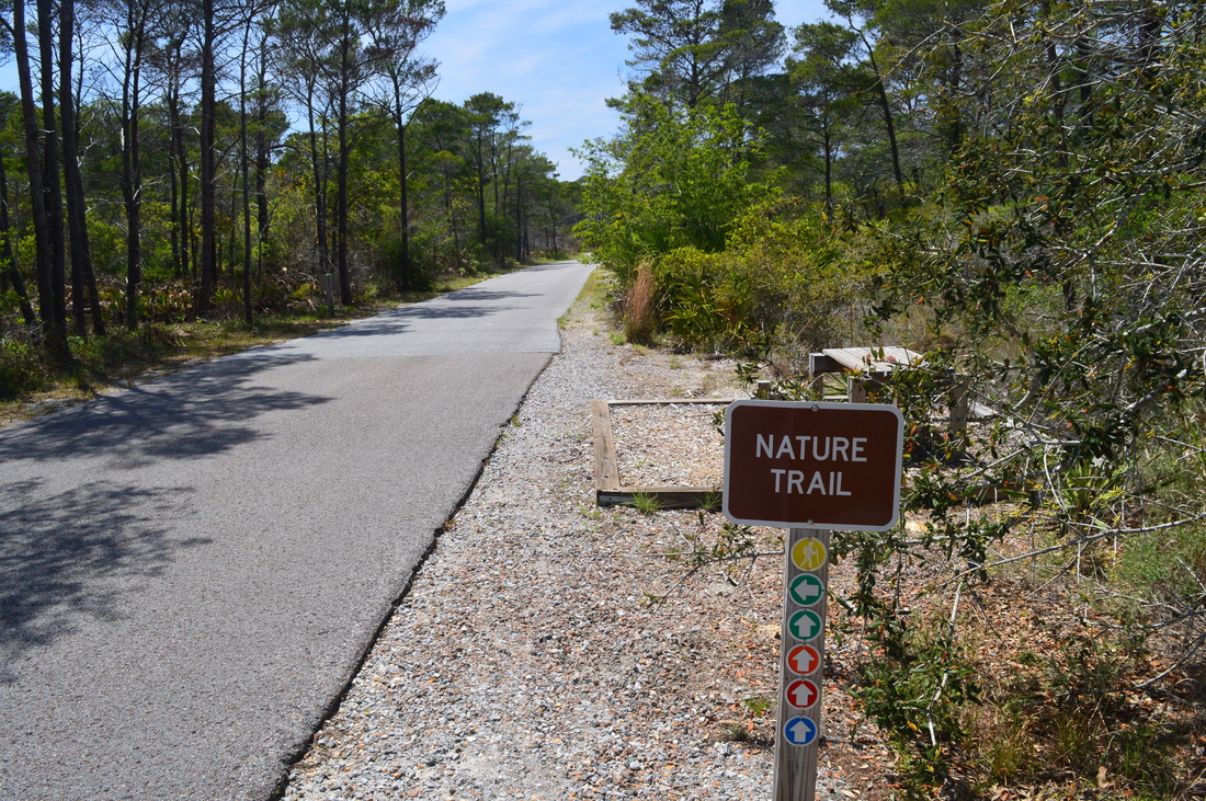
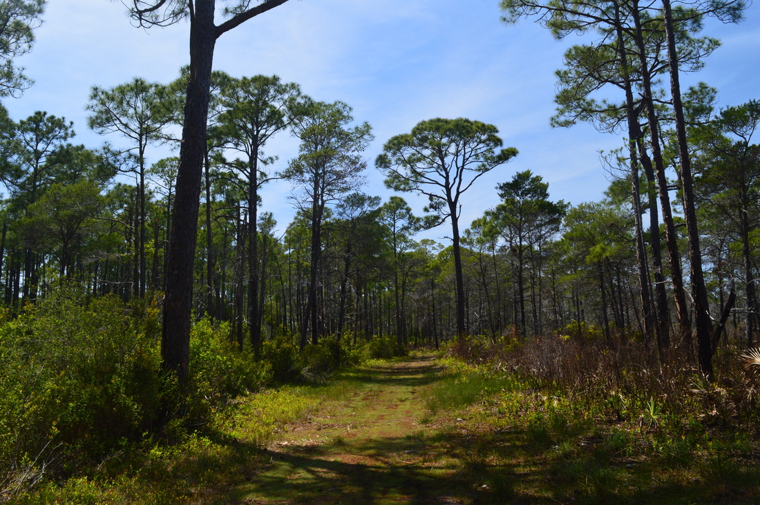
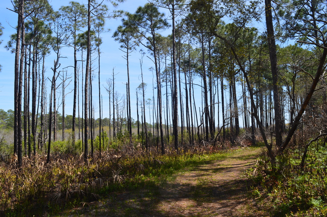
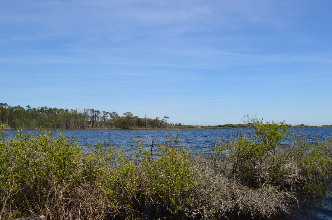
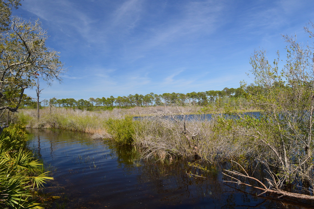
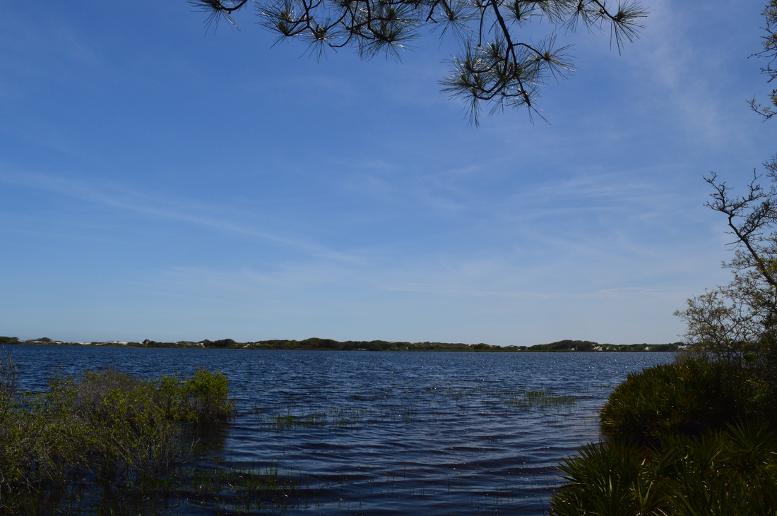
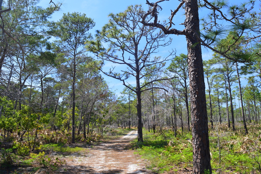
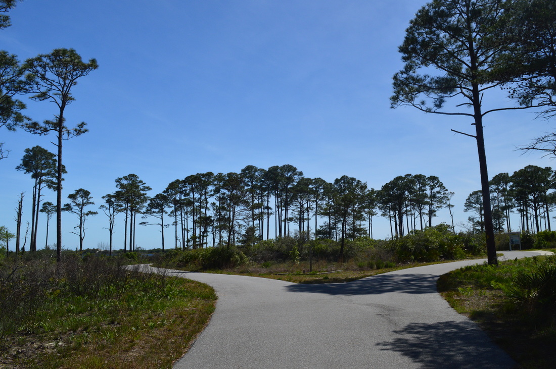
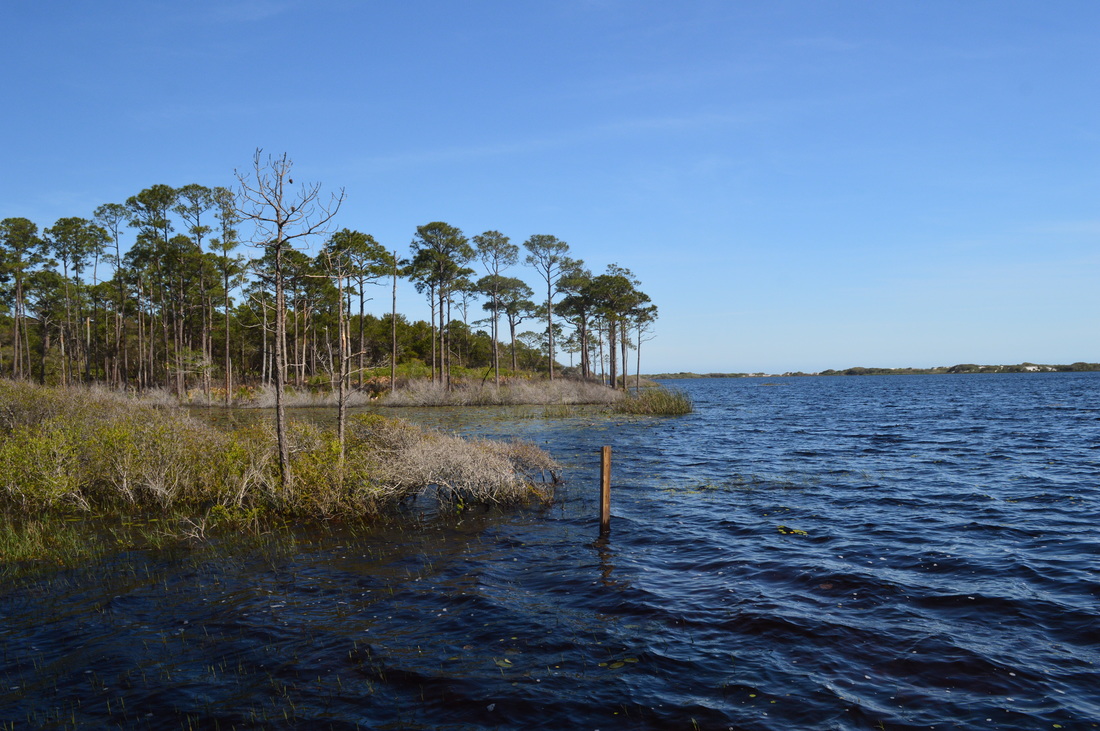
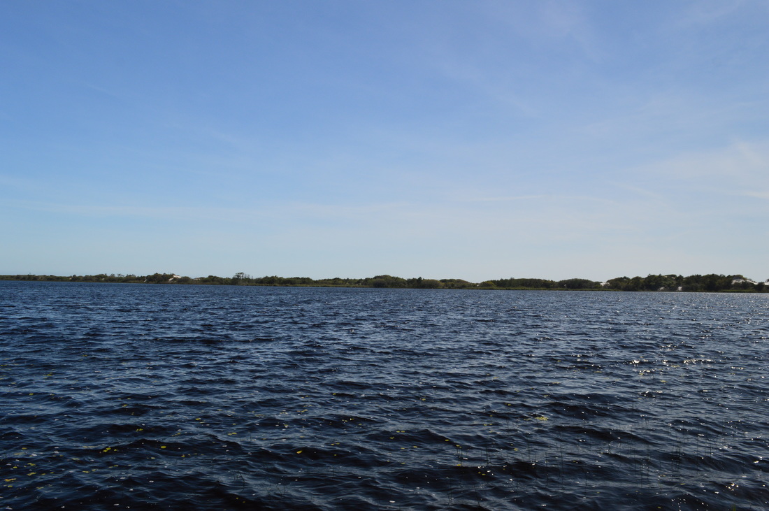
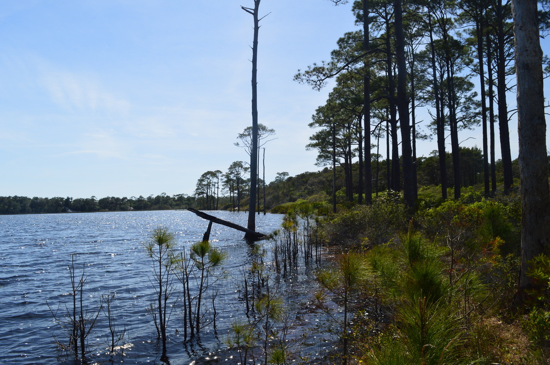
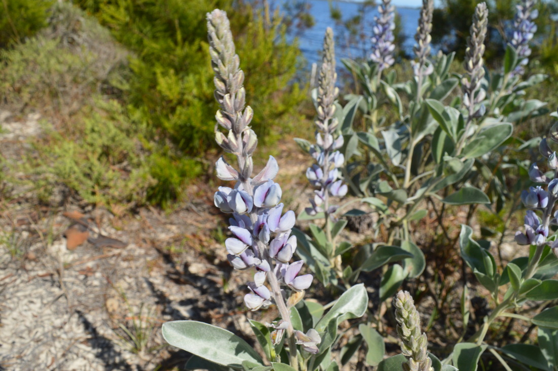
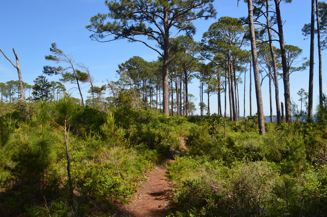
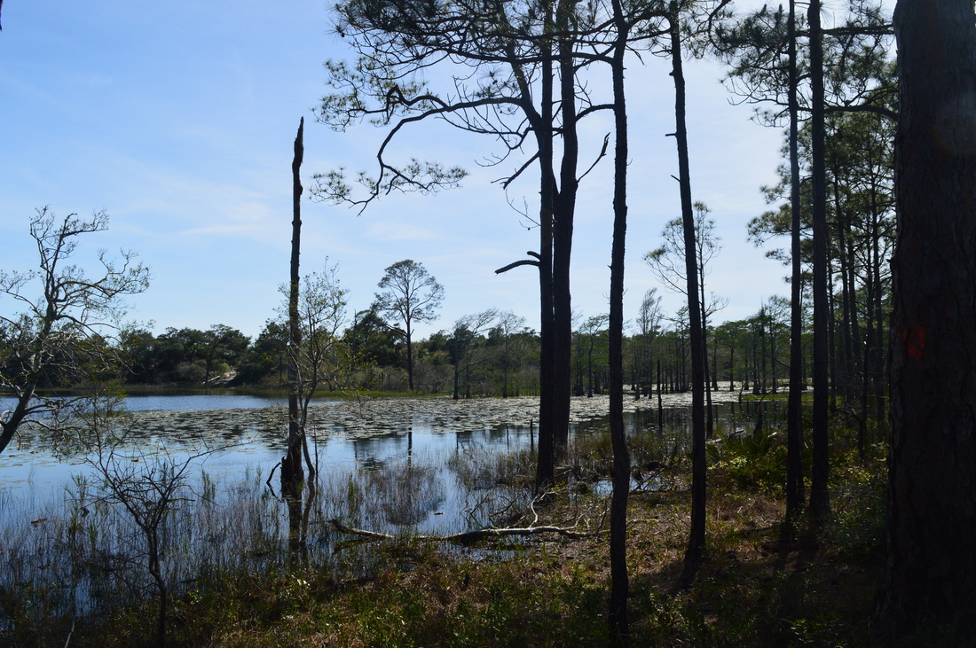
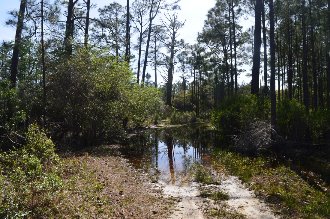
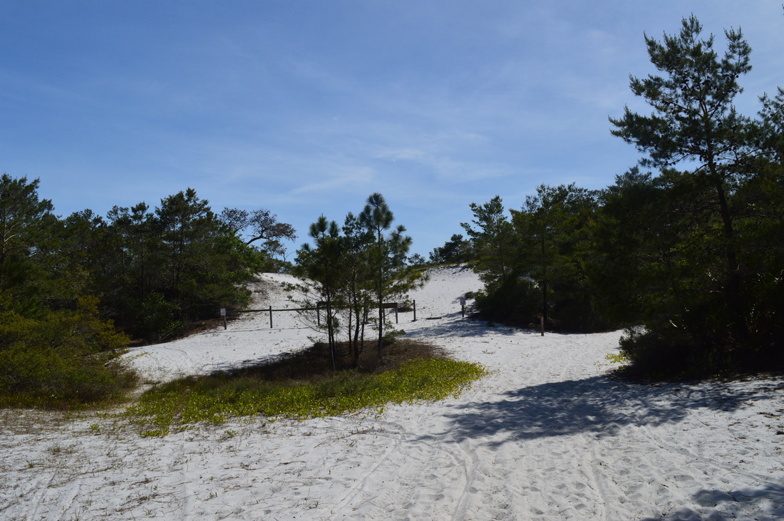
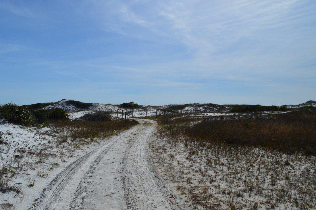
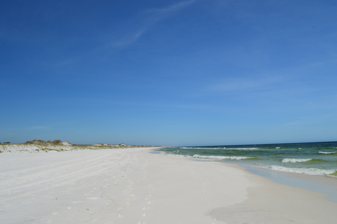
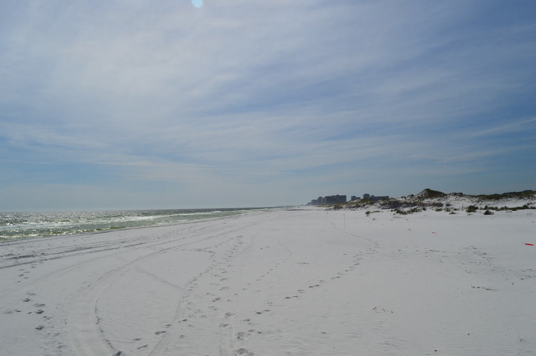
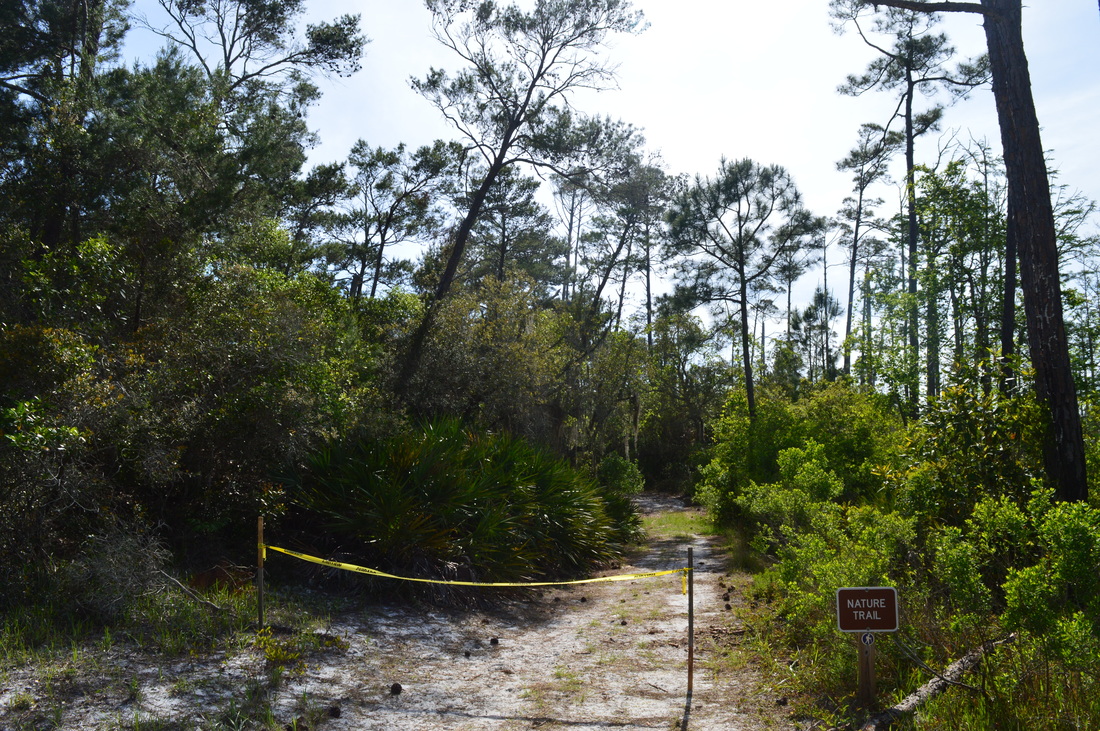
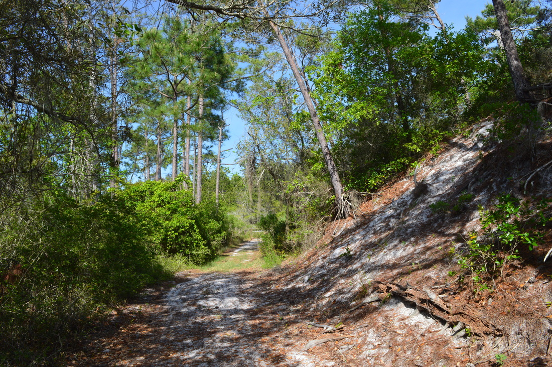
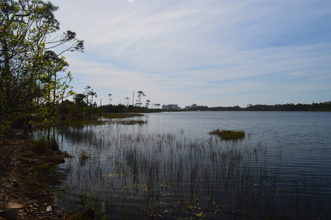
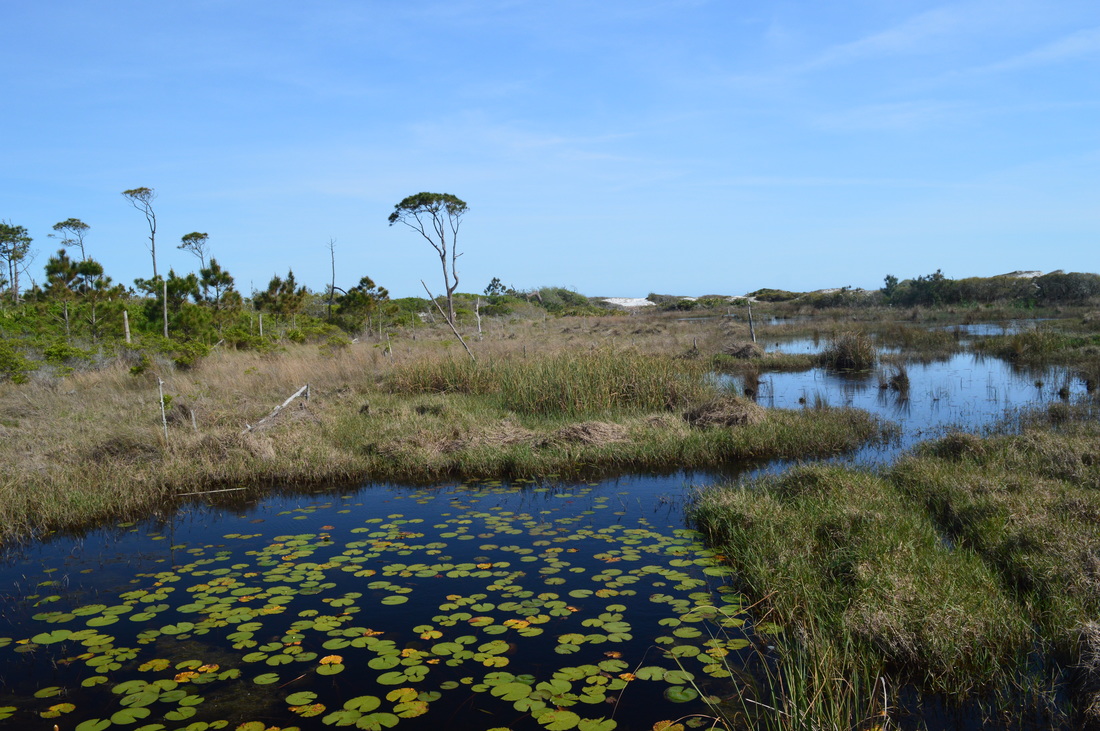
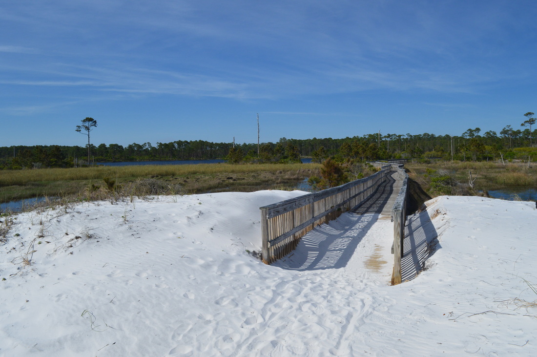
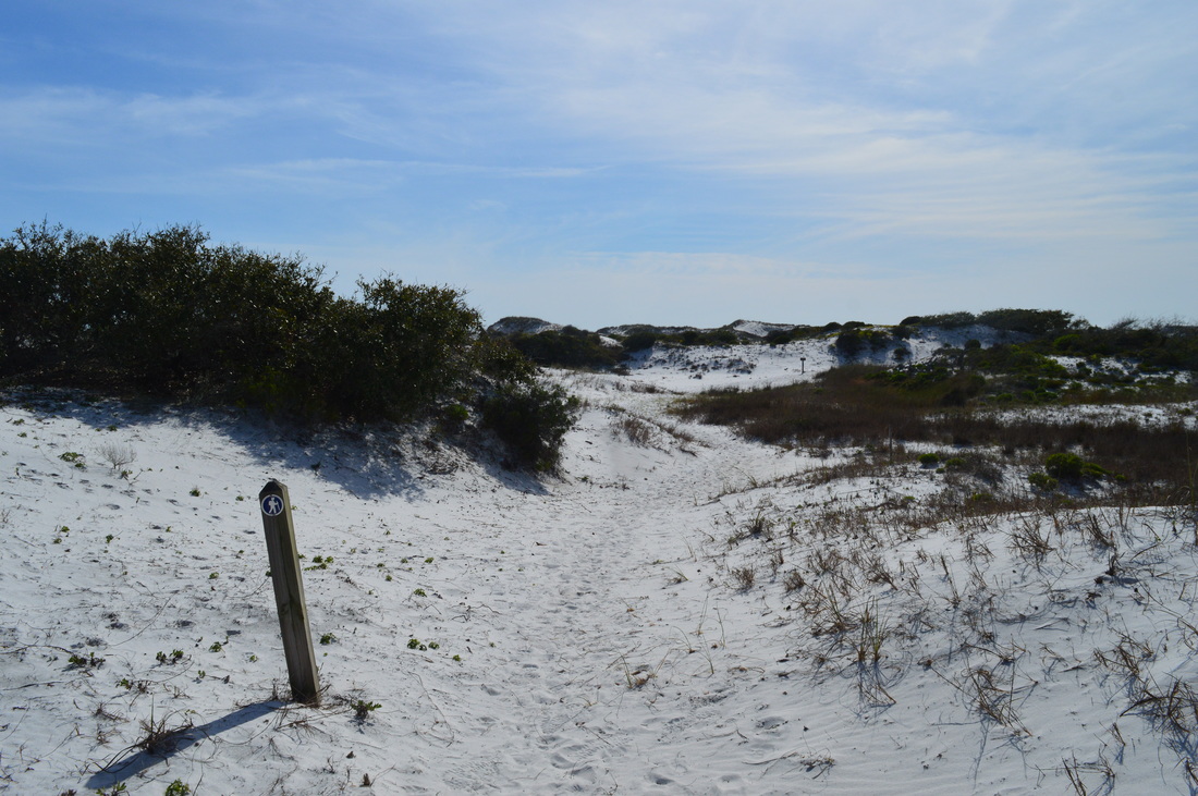
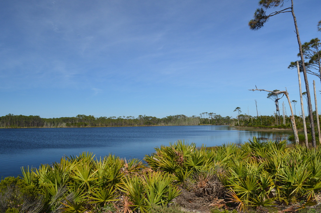
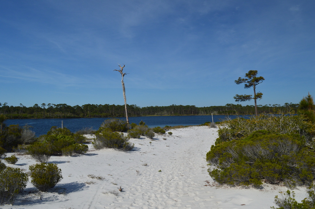
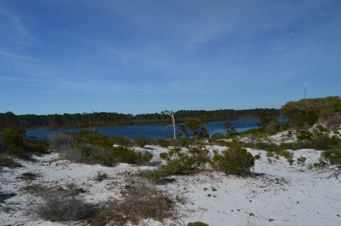
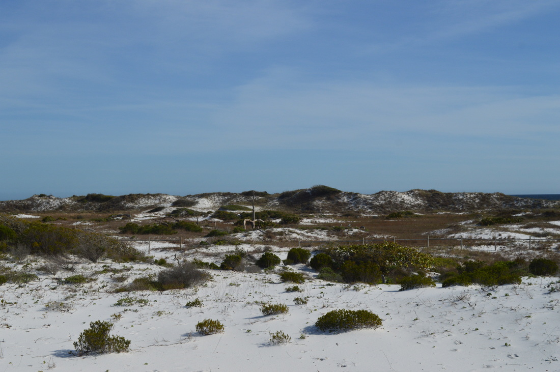
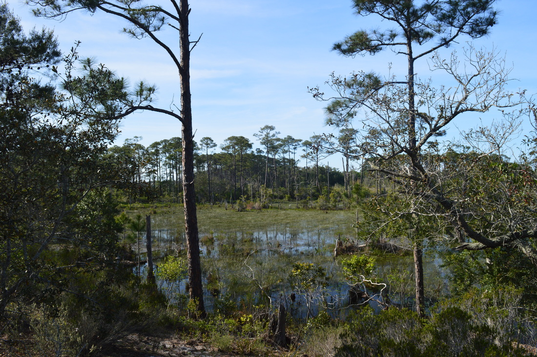
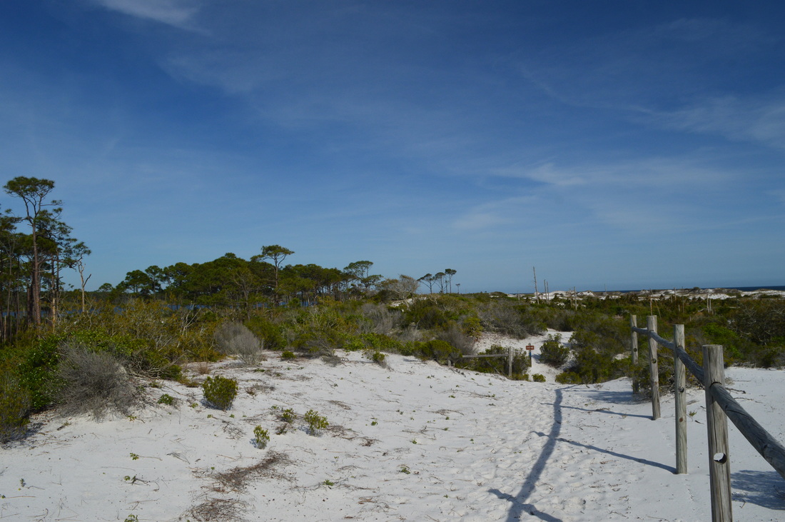
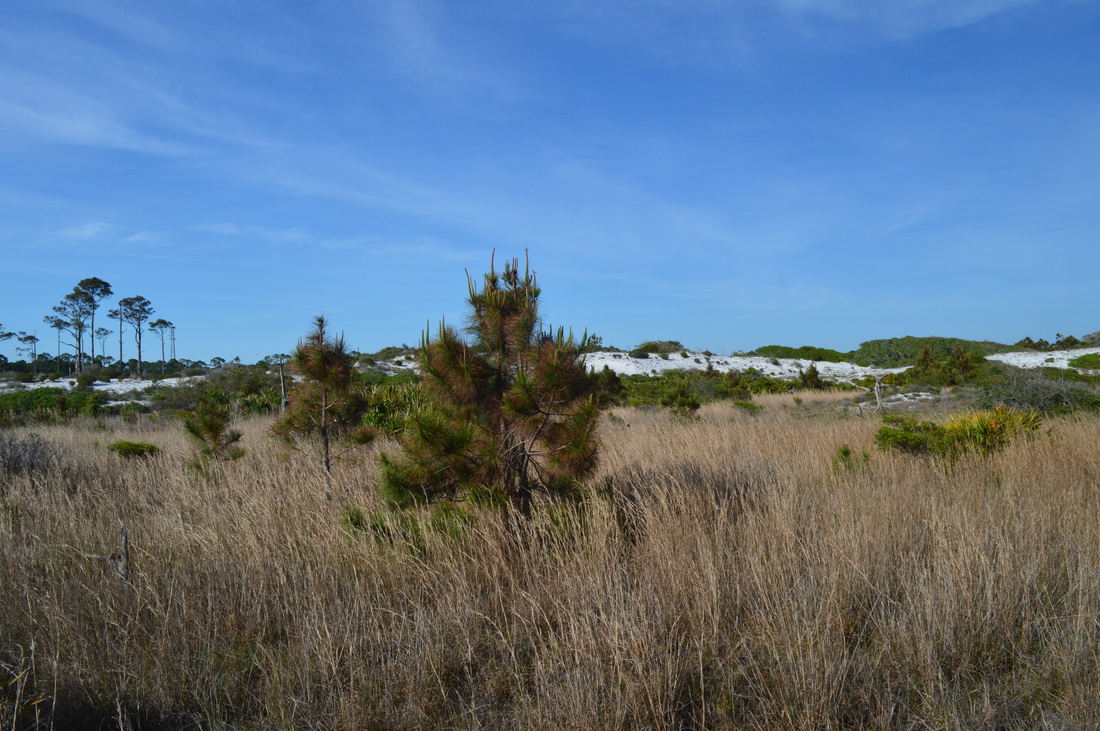
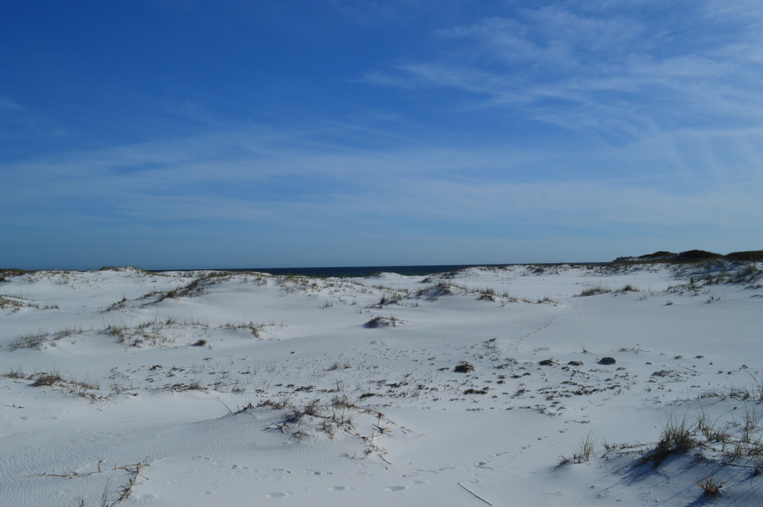
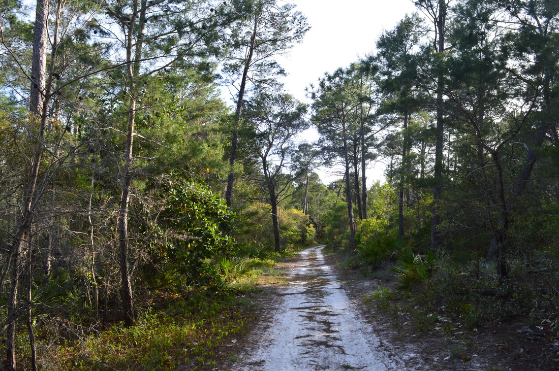
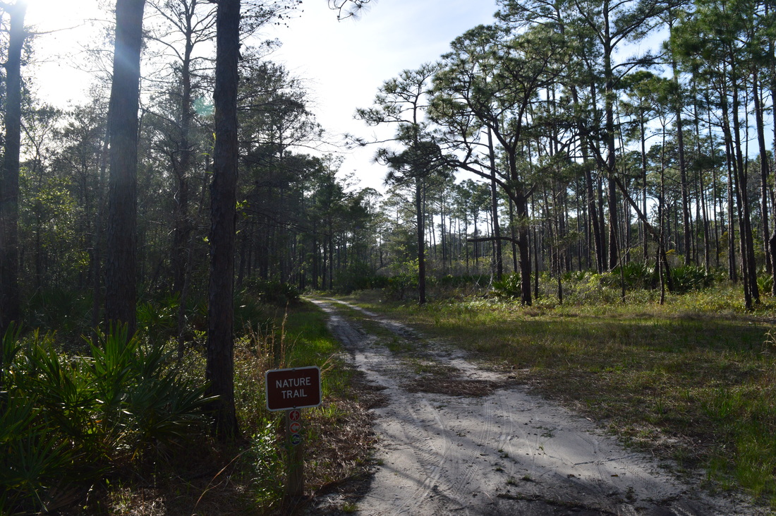
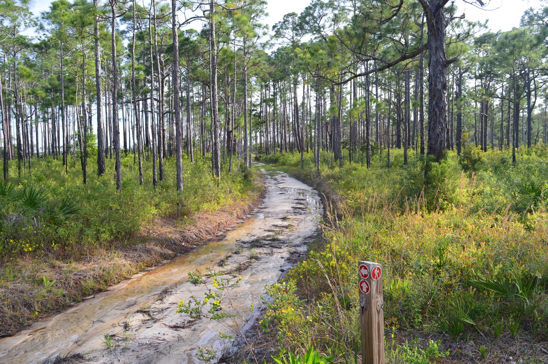
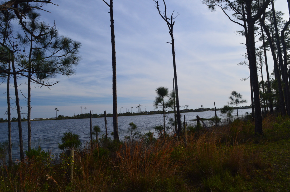
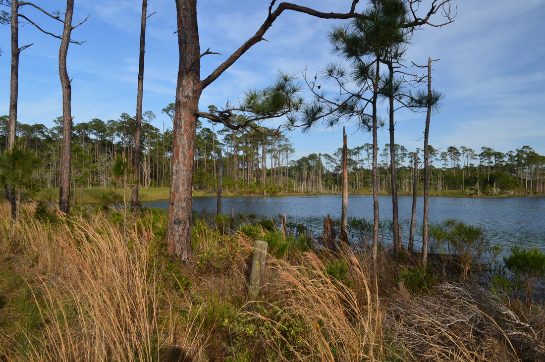
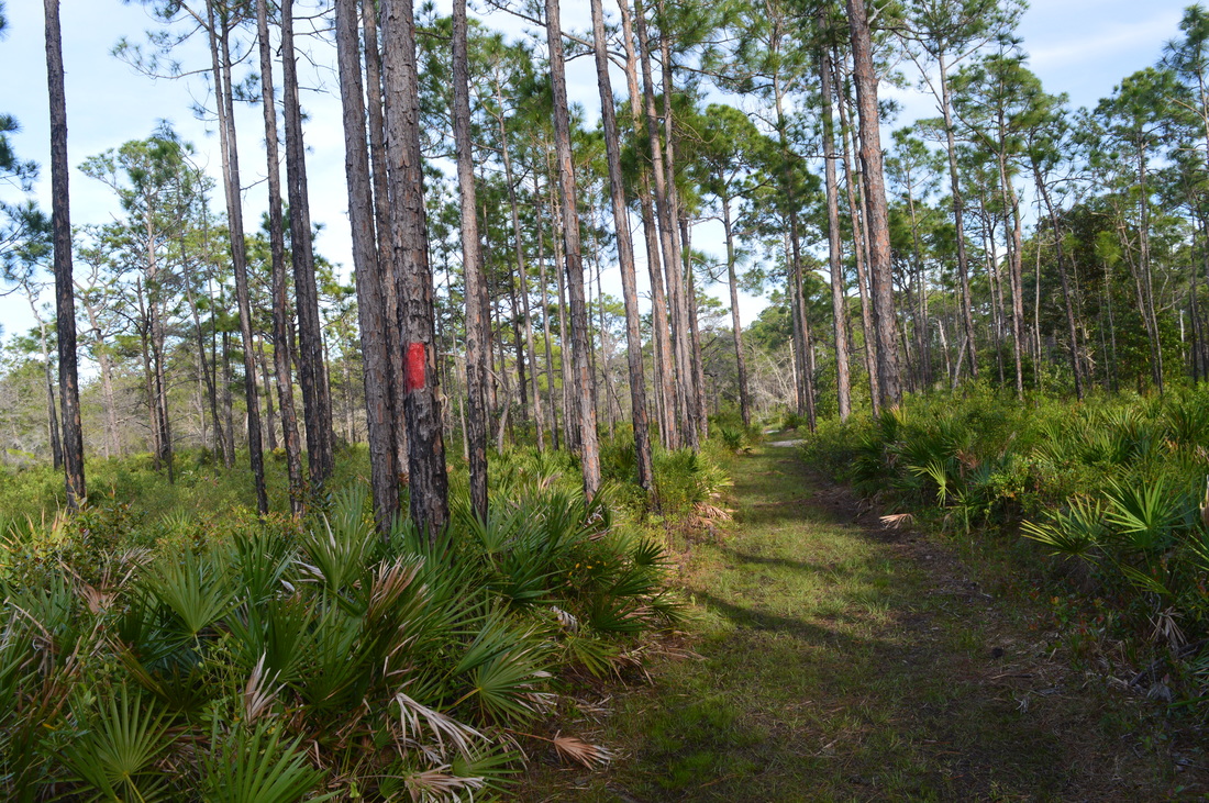
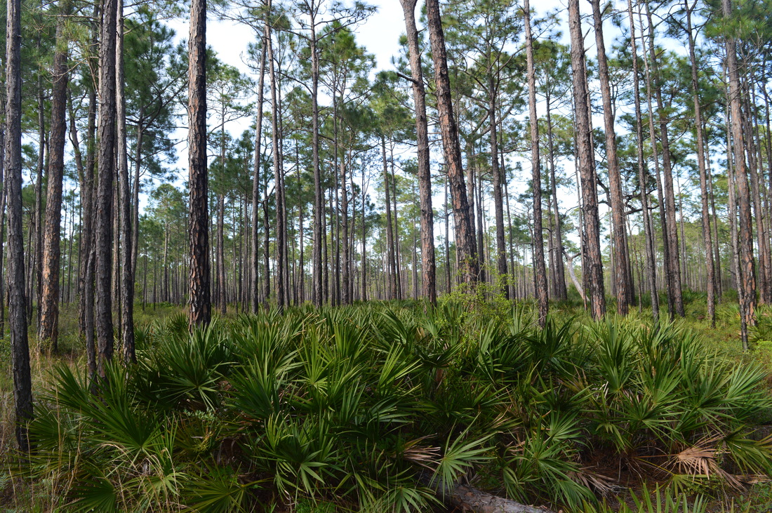
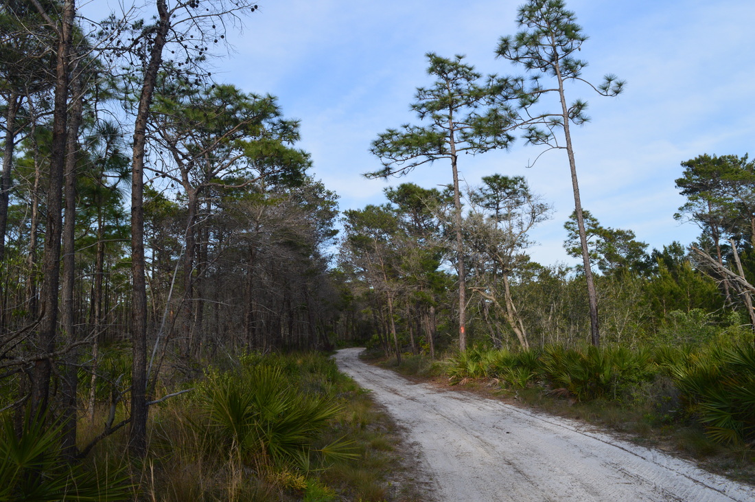
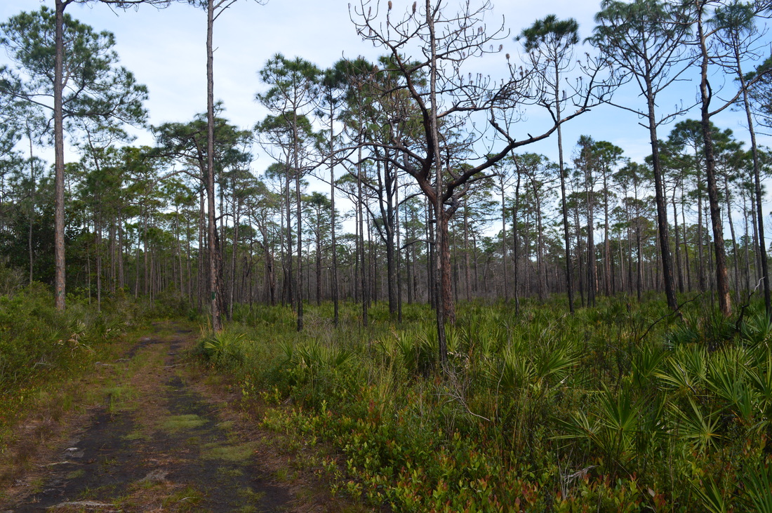
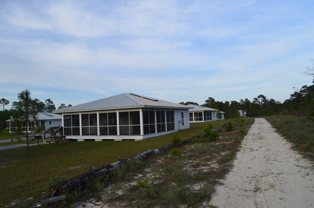
Begin the hike at the start of the Beach Tram Path. The Beach Tram Path is a one mile long paved route that leads from the trailhead directly to the beach. While the path can be hiked or biked, it is used by the tram that runs every two hours starting at 9 AM. There are three tram stations on the tram path - the first one is at the parking area. The tram path is used not only for beach access though. The only way to reach the main trail system is to follow the tram path until it reaches the Campbell Lake Bike Path, where you can choose a trail to hike. Thus, to get to the trails, begin walking down the paved path southward from the parking area. You will pass between two ponds to the left and right near the beginning of the tram path. Then, the tram path passes through part of the Gregory E. Moore RV Resort. At 0.25 miles, reach Tram Station #2 where the tram path crosses one of the resort's roads. It seems like the RV Resort is not just a campground - it also has cabins, although some of them didn't seem to be in too good of a shape. Leaving the resort, continue on the paved tram path. After the paved path makes a gradual turn, reach a junction with the Campbell Lake Bike Path at 0.5 miles. The tram path turns left here and continues on to Tram Station #3 and the Beach Access. If you continue to follow the Tram Path, you will also pass the No Name Lake Trail, a short side trail that leads to a small dune pond. To access the primary trail system, though, continue straight onto the Campbell Lake Bike Path. This bike path is also paved, but you will not stay on it for long. You will notice a number of blazed arrows on a wooden post. Each color represents a different trail. At 0.6 miles, just before the Campbell Lake Bike Path bears right, the green-blazed Turpentine Trail leaves to the left. Turn left onto this double-track trail and enter a shady pine forest. There is another junction shortly after the turn. A spur section of the Turpentine Trail continues straight to the tram path, but the main trail turns acutely right onto what looks like a service road. After you turn right, you will notice some muddy areas on the trail that appear to have been caused by service vehicles. Also, the farther you hike on this trail, the more you will notice that the ground gets soft underfoot pretty often - and this means that this area can be slightly under water during the wet season. At about 0.9 miles, pass a marshy area to the left. According to my topographic map, it seems like this marsh is part of the overflow area of Campbell Lake. At 1.25 miles, the Turpentine Trail reaches a spur trail to the left. This spur trail leads to a scenic and remote view of Campbell Lake. It is well worth the visit. After you turn left, you will realize that the spur trail is double-track as well. At 1.4 miles, wetlands become visible to the left. These wetlands are part of Campbell Lake. Before long, the wetlands begin to encroach on the trail. As the blue lake becomes seen ahead, the trail continues to get narrower until you're following a tiny strip of shoulder along the water (although I'm sure that the water level here can be higher or lower depending on the season). Eventually, the trail went totally underwater, but I still had not reached a good view of the lake, so I wasn't sure what to do. After some brief reflection, I decided to head off the trail and to the right to bypass the water. There is a faint path in places here, and it is not long at all, so you should have no trouble following it. At 1.55 miles, reach the shore of Campbell Lake. This is one of the two large dune lakes that are encountered on this hike. Freshwater dune lakes such as this connect occasionally with the saltwater Gulf of Mexico. When the lake overflows, it can pour some of the water into the Gulf. This is known as an outfall, and this interesting mechanism controls potential flooding. Also, when this happens, some salt water and various organisms can flow from the Gulf into the lake. Some of the dune lakes can be completely freshwater lakes, while others can be mostly saltwater - every lake is different. As you stand at the shore of Campbell Lake, notice the wall of sand dunes rising up on the opposite shore of the lake. The Gulf of Mexico hides just behind those dunes. The lake and the ocean are only about a tenth of a mile part apart at the point where the strip of dunes is narrowest. Although you'll see more of Campbell Lake throughout this hike, personally I liked this view the best, because you are likely to be all by yourself here. From this view of the lake, retrace your steps to the main trail. Turn left onto the Turpentine Trail, and continue following it until you reach the Campbell Lake Bike Path again at 1.95 miles. To continue to the rest of this hike's trails, turn left onto the paved path. Slightly farther, the second part (north half) of the Turpentine Trail turns off to the right onto another wide path. For now, continue straight on the bike path, and keep the north half of the Tuurpentine Trail for later. At 2.2 miles, at a point where the bike path bears left, the north side of the Deer Track Trail continues straight onto a sandy road. This is where you'll come out from much later in the hike. My plan was to hike the south side of the Deer Track Trail first, so I continued on the paved bike path. At 2.4 miles, reach a paved circle at the end of the Campbell Lake Bike Path. There is a picnic shelter here, and Campbell Lake lies straight ahead. This is a very popular location, because a lot of people bike the paved path to this point and then fish here or have a picnic here. once you hit the next trail, you should leave most of the people behind. At the far end of this cul-de-sac, a sign says "Nature Trail". This is the Deer Track Trail. Follow the path down to the shoreline of Campbell Lake. Across the lake, you can see a row of white sand dunes. The tallest dune is known as Topsail Hill - the park's namesake. To the left is a kayak launch. The trail turns to the right. This is where things get a little bit "interesting". This section of the Deer Track Trail goes through a maze of single-track fisherman paths that are not signed and poorly blazed. I will try my best to describe the route from this point. After you turned right near the kayak launch, you should follow a narrow path within sight of Campbell Lake until you reach what seemingly is an intersection. A faint path appears to bear right, but this path becomes nothing very fast. Turn left on a path that seems to receive a lot of traffic, with the lake still in view. At around 2.65 miles, this clear path suddenly peters out. It took me a bit of walking around to find what I missed. Immediately before the path peters out, another (very faint) path leaves to the left. Take this path and quickly reach the shoreline of the lake. Turn right, and briefly follow a muddy path along the shoreline, before turning right again and heading away from the lake. At approximately 2.75 miles, reach another T-intersection (if it can be considered as one). A very overgrown possible path comes in from the right, and a clearer trail appears to be to the left. Turn left, and enter a denser forest. I remember that in the dense forest I made yet another left turn in this maze, before reaching the shore of the lake once again, in a sandy area. Turn right and scramble up an eroded sandy bank. Suddenly, the trail widens and becomes double-track again, and another pathway comes in from the right. Congratulations! You have gotten out of the maze. To this day, it is unclear to me if I followed the exact route of the Deer Track Trail - I suspect that fishermen are the main people who use the south side of the Deer Track Trail, resulting in unclear and random paths, while the main route of the trail is becoming overgrown in some places. Regardless, from this point, continue straight on the wide trail. At 2.9 miles, the Deer Track Trail intersects a shortcut. The shortcut leads right and connects to the north side of the Deer Track Trail. You can use the shortcut to return back to the trailhead a lot faster, but if you have hiked this far, I highly recommend to hike the Morris Lake Trail, as it is the crown jewel of the park's trail system. Thus, I turned left to continue following the Deer Track Trail. Just farther, at 2.95 miles, reach a "marsh ford", where the wetland to the left seems to dump water onto the trail. At first, I thought there was no way to avoid getting my feet wet here, but then, I noticed a bypass to the left that could possibly my feet dry. Take this side path to a place where two unstable logs are placed across the narrowest point of this outflow stream. With the aid of trekking poles, you should be able to cross these logs, unless they are submerged as well. On the other side of the crossing, the double-track trail curves around this far end of Campbell Lake and then reaches the boundary of the dune area. A signed fence ahead warns you to not climb the dunes. You must absolutely not get off the marked trail. This is a very fragile environment that must be preserved. At the fence line, bear right on a sandy trail and cross a few miniature hills that seem to be grown-over dunes. The going gets a lot slower due to the sand underfoot. At 3.2 miles, the Deer Track Trail reaches a wide service road. This road used to be the entrance road for a second entrance to Topsail Hill State Park. The road provided quick access to the beach, as well as a much shorter hike to Morris Lake. The reason that the road was closed to motor traffic was to preserve the fragile dune environment and to revert any damage that had been done up to that point. Today, foot traffic is welcome on this service road. While the Deer Track Trail turns right onto the service road, I highly recommend turning left onto the road to the beach access, as the beach here is very photogenic and worth seeing. Once you have turned left, you will pass a picnic shelter. The road heads out into the open dune-dotted landscape. Once again, do not leave the road. As the road finally winds up the front row of dunes, the waves of the ocean become louder and louder. And then, at 3.45 miles, there it is: the sparkling ocean, the waves hitting the shoreline, the huge snow-white beach, and the egrets flying back and forth through the air. I have been to many public beaches, and I have stayed at beachfront dwellings, but I have to admit that this was one of the most beautiful beaches I have ever seen. The sand on most beaches that I have been is usually not this white, and rarely have I seen a beach this wide. Also, you are likely to be alone or nearly alone here, and it is not easy to locate a beach with such a lack of people on it. Even though some condominium towers can be seen as they rise to the east in the towns of Miramar Beach and Destin, they should not affect the remoteness of the beach that you're at. Look to the left - you'll see nothing but a strip of white all the way to the horizon. From the beach, retrace your steps to the Deer Track Trail. Like I mentioned earlier, the Deer Track Trail turns to follow the service road north for a brief time, so stay on the road. At 3.85 miles, the Deer Track Trail arrives at an intersection with the Morris Lake Trail. The service road continues straight, but the Deer Track Trail turns right and the Morris Lake Trail turns left at a "Nature Trail" sign. Like I said earlier, do not miss the Morris Lake Trail, as it is very beautiful. For some reason the entrance to Morris Lake Trail had a caution tape strung across it, although there was a space wide enough for a hiker to pass. My guess is that it was the tape was strung across the entrance to possibly discourage bike use. In any case, I didn't find any reason why the trail would be closed to hiking use, and there were plenty of footprints, so continue onto it. You will follow the base of a tall dune to your left. At 4 miles, the trail reaches the first of many views of Morris Lake. This is another dune lake, similar to Campbell Lake. It is hard to say which one is prettier, although you will see more of Morris Lake as a good portion of the Morris Lake Trail stays close to the lake. At 4.05 miles, the trail veers to the left and away from the lake. This is where it crosses a long wooden footbridge across a marsh that lies between the lake and the dunes. As I approached the end of the footbridge, I found its far end to be buried in sand from the shifting dunes. At the end of the footbridge, look back. There is an interesting contrast of lake, marsh, and snow-like sand here. Beyond the footbridge, the trail delves into the dune country. The trail is fairly slow, due to the deep sand underfoot, but you shouldn't be in a hurry - there are lots of interesting sights to see around yourself. Just remember to not stray off the trail. The views of Morris Lake are nearly continuous as you reach the tart of the loop section of the Morris Lake Trail at 4.5 miles. Keep right to hike the loop counter-clockwise, although there is no big difference if you hike the loop clockwise. The trail is lined by a fence in many areas - it is also marked by arrows and posts with blue hiking symbols, so there is no danger of losing the trail here. As you near the shoreline of the lake again in a rosemary scrub habitat, the trail suddenly dips into an area of cord grass, although not for long. The trail picks up a sort of rollercoaster attitude due to the constant ups and downs across the dunes. At around 4.5 miles, the trail will follow a "dune ridge" that provides an excellent panorama of most of Morris Lake. The dune ridge continues away from the lake. As the trail approaches the western boundary of Topsail Hill State Park, a wetland lies to the right where I spotted a heron. At 5.2 miles, the trail gradually turns back eastward, away from the developments in Miramar Beach. Shortly after the turn, on top of one of the dunes, you will reach a point Morris Lake and the Gulf of Mexico are both visible. A vast expanse of sand lies in between the two. You may notice that this section of the trail seems to be less-traveled than the north side of the loop. Passing through a small marshy depression between two rows of dunes, the trail reaches the end of this fantastic loop at 5.75 miles. Continue straight on the part of the Morris Lake Trail that you hiked earlier, and retrace your steps along it to the end of the Morris Lake Trail and the service road junction at 6.4 miles. From here, you have an option. You can hike back the way you came using the south side of the Deer Track Trail, or you can follow the north side of the Deer Track Trail for some new scenery and take the Old Growth Trail side trip if you have time to spare. I chose to cover some new terrain on the north side, since the distance was about the same. Thus, continue straight onto the Deer Track Trail. The double-track trail is flanked by palmetto and is under the shade of tall pine trees. At 6.7 miles, the Deer Track Trail turns right, while the red-blazed Old Growth Trail turns left. I was beginning to run a bit short on time before the park's closing time, but I still decided to take the Old Growth Trail side trip, although I didn't hike the full trail. The Old Growth Trail leads to some vistas of Morris Lake from its north shore. Turn left onto the Old Growth Trail. Once again, you're following what looks like a service road. At 6.9 miles, recross the old entrance road, and then bear left onto another old road at 7 miles in the middle of the pine forest. You can hear and see traffic moving on US 98 to the right. At 7.1 miles, a loop section of the Old Growth Trail leaves to the left to some views of Morris Lake. I decided to follow the loop section. Turn left onto the trail and reach the north shore of Morris Lake at 7.25 miles. Across the lake, you can see where you were earlier on the Morris Lake Nature Trail. You can also see a wall of dunes across the lake, similar to what you saw at Campbell Lake. Turn right, and reach an intersection of forest roads. To the right a forest road leads to the main forest road that the Old Growth Trail was following. To the left a short side trail leads to another view of Morris Lake. If you turn left, you'll see another road going right which is apparently a slightly longer version of this loop. I wasn't sure if there was anything worth seeing there, and being short on time, I didn't take it. After seeing the second view of Morris Lake, head back north along the main forest road and the trail. At 7.5 miles, you return to the forest road that you followed earlier before you turned off onto the "loop". If you turn left here, according to the map you will end up at another view of Morris Lake from near a finger of it. I decided that I did not have enough time to take that side trail, so I turned right onto the Old Growth Trail to return back to the Deer Track Trail. At 8 miles, you will return to the Deer Track Trail. Continue straight onto it. The forest road becomes graveled at some point, for reasons unclear to me. At 8.15 miles, the trail reaches a shortcut that was seen much earlier on the hike. Bear left to continue following the Deer Track Trail. Slightly farther, a service road leaves left toward US 98. The forest road that the trail follows becomes increasingly sandy, before the trail ends at the Campbell Lake Bike Path at 8.5 miles. Continue straight onto the paved path. At 8.75 miles, you will arrive at the Turpentine Trail junction. You have one last option here. You can continue straight on the paved path, or you can turn left onto the Turpentine Trail and follow the trail's north side. Although the trail is slightly longer than the paved bike path, I preferred it, because it is mostly a primitive old road. Turn left onto the Turpentine Trail and begin heading north toward US 98 through more pine forest. At 8.95 miles, the trail turns acutely right at a T-intersection, while a service road heads left to US 98. You can see a gas station and some other business on US 98. The slash pine forest is vast and becomes more isolated as the din of US 98 traffic gradually quietens. At 9.6 miles, a connector to the right leads to the bike path. Then, at 9.7 miles, the trail reaches an area of newer cabins, and it seems like they are part of the Gregory E. Moore RV Resort. As I was gradually rounding a corner at the cabin clearing, I somehow missed a point where the Turpentine Trail continued forward to its end at the bike path. Instead, I followed a path that paralleled the boundary of the resort. This is not an official trail - it is just a trail that is used by those people who spend some time in the resort. At 10 miles, this pathway ends at the tram path near Tram Station #2. Turn left onto the tram path, and follow this final paved section of the hike to the trailhead. You will arrive at the trailhead at 10.3 miles, concluding a fantastic hike across the rare ecosystems of Topsail Hill State Park. I believe that this hike is a "Best Hike". The combination of beautiful lakes, rare habitats, remote beach, and photogenic hiking trails confirms that this is one of the most beautiful hikes in Florida (out of the few that I have done, at least). Remember, if you don't have time to hike the whole trail system, you must at least get to and hike the Morris Lake Trail, as well as see the beach. Mileage
0.0 - Topsail Hill Trailhead
0.5 - Continue onto Campbell Lake Bike Path 0.6 - Turn left onto Turpentine Trail 1.55 - Campbell Lake View 1.95 - Turn left onto Campbell Lake Bike Path 2.4 - Campbell Lake; start of Deer Track Trail 3.2 - Junction with old entrance road; turn left to access the beach 3.45 - Topsail Hill State Park Beach 3.85 - Turn left onto Morris Lake Trail 4.0 - First view of Morris Lake 4.5 - Begin loop section of Morris Lake Trail 5.75 - Finish loop section of Morris Lake Trail 6.4 - Continue onto Deer Track Trail 6.7 - Turn left onto Old Growth Trail 7.25 - View of Morris Lake from north shore 7.35 - Another view of Morris Lake 8.0 - Return to Deer Track Trail 8.5 - Return to Campbell Lake Bike Path 8.75 - Turn left onto Turpentine Trail 10.0 - Turn left onto Beach Tram Path 10.3 - Topsail Hill Trailhead Variations
For a short hike, hike to the Campbell Lake vista on the Turpentine Trail and back - 3.1 Miles
Skip the Old Growth Trail - 9.0 Miles Bonus Stops
For a bonus on this hike, follow the Tram Path southward from the Lake CampbellBike Path junction to the No Name Lake Trail junction. Take the No Name Lake Trail to a view of a small unnamed dune lake.
PicturesVideos
1 Comment
Justin Baldwin
8/1/2021 07:59:14 am
Thanks for the great turn by turn directions. I was able to leave from our tent site early in the morning and head to Morris Lake via the Deer Track trail. The views did not disappoint. Reading your blog the night before allowed me to see some of the more scenic spots as I didn’t have much time to hike that morning. Leave a Reply. |
About MeMark Oleg Ozboyd Dear readers: I have invested a tremendous amount of time and effort in this website and the Georgia Waterfalls Database the past five years. All of the work that has gone in keeping these websites updated with my latest trip reports has almost been like a full-time job. This has not allowed me to pick up a paid job to save up money for college, and therefore, I I've had to take out loans. If you find the information on this website interesting, helpful, or time-saving, you can say "thanks" and help me out by clicking the button above and making a contribution. I will be very grateful for any amount of support you give, as all of it will apply toward my college tuition. Thank you!

Coming in 2022-2023?
Other Hiking WebsitesMiles HikedYear 1: 540.0 Miles
Year 2: 552.3 Miles Year 3: 518.4 Miles Year 4: 482.4 Miles Year 5: 259.9 Miles Archives
March 2021
Categories
All
|


 RSS Feed