
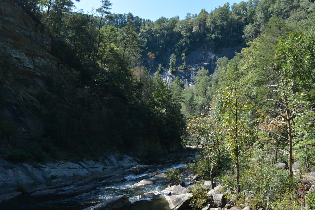
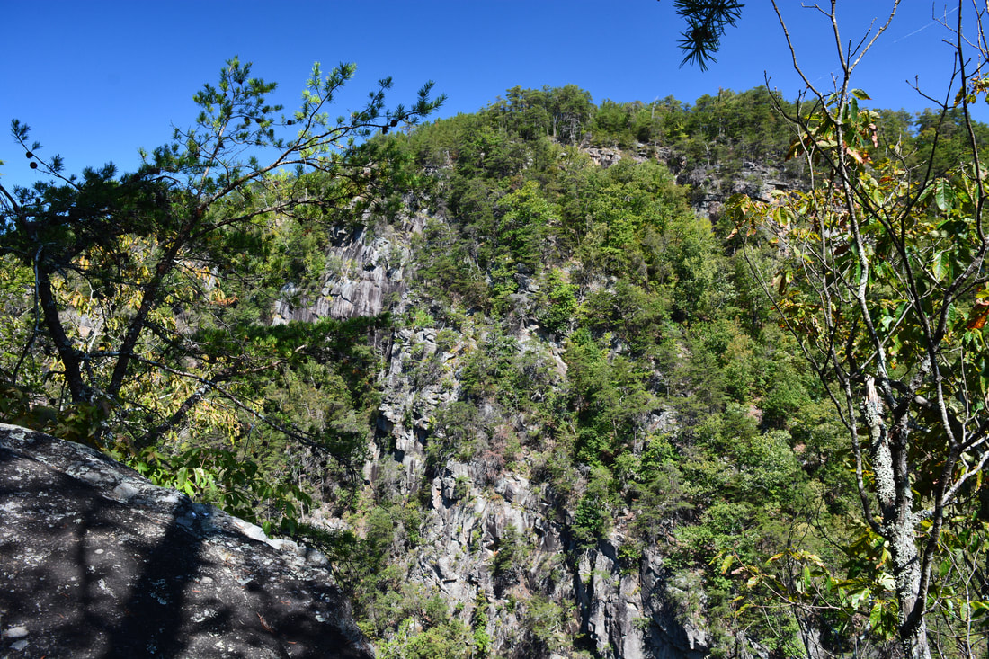
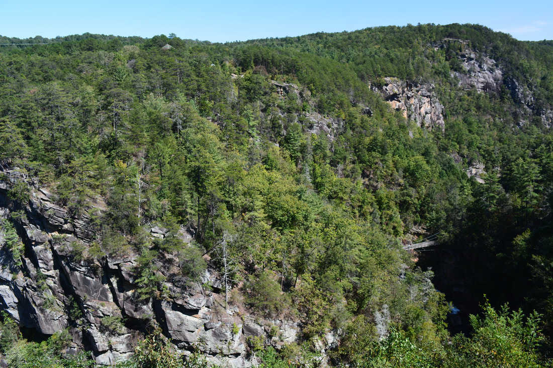
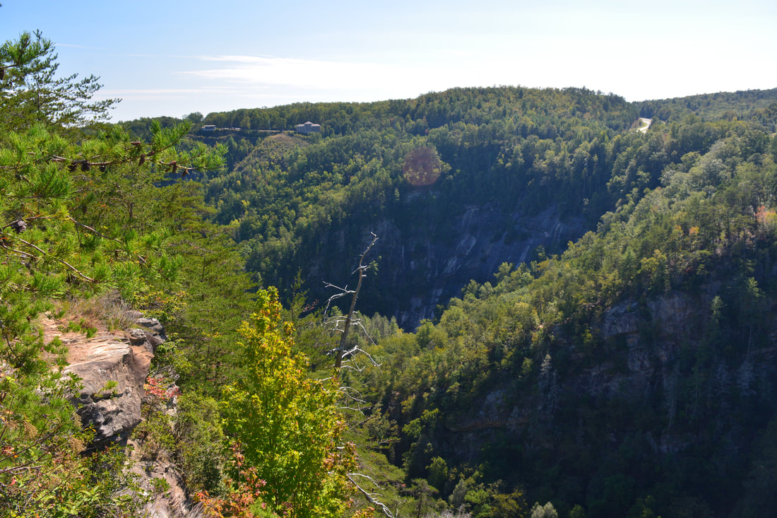
Tallulah Gorge is an anomaly in Georgia. The cliff-lined gorge through which the Tallulah River flows is nearly 1000 feet deep in places, and there's no other gorge of this magnitude anywhere else in the state. Tallulah Gorge State Park encompasses all of the gorge below Tallulah Falls Dam and has a number of hiking trails that provide access into the gorge. While some trails follow the rims with breathtaking views of the gorge, a different trail descends hundreds of steps to Hurricane Falls deep in the gorge. From there, one can follow a rugged and rocky footpath known as the Gorge Floor Trail along the river and past two other waterfalls, but a Gorge Floor Permit is necessary for this - and only 100 are issued per day. The extremely steep climb back out along the Sliding Rock Trail is an exciting rock scramble with more views of the cliffs. Lastly, before concluding the hike, you'll have the chance to stop by Inspiration Point - a sweeping panorama that is arguably the best view of Tallulah Gorge. This hike occurred on Saturday, September 30th, 2017. My plan was to hike the Gorge Floor Loop clockwise, later making a side trip to Inspiration Point.
Summary
R/T Length of Trail: 3.2 Miles
Duration of Hike: 5:45 (includes over two hours of photography and stopping Type of Hike: Loop with Side Trip Difficulty Rating: 6 out of 10 Total Elevation Gain: About 1000 Feet Pros: Unique gorge scenery Cons: Tallulah Gorge is extremely crowded; it is difficult to obtain the Gorge Floor permit on good summer weekends Points of Interest: L'Eau d'Or Falls (Rim View) - 8 stars; Hurricane Falls - 10 stars; Oceana Falls - 4 stars; Bridal Veil Falls - 2 stars; Inspiration Point Views and other Tallulah Gorge Views - 10 stars cumulatively; North and South Wallenda Towers Trail Blaze Colors: None, none needed Best Seasons to Hike: Fall Fees: There is a $5 per car entry fee to Tallulah Gorge State Park. Gorge Floor Permits are free. Beginning Point: Jane Hurt Yarn Interpretive Center in Tallulah Gorge State Park Directions from Clayton, GA: Follow US 23/441 South for 10.8 miles from the intersection of Savannah Street/Rickman Drive with US 23/441 in downtown Clayton. Then, turn left onto Jane Hurt Yarn Road. In 0.4 miles, stay right and enter Tallulah Gorge State Park. Continue for another 0.4 miles to the parking area by the interpretive center. Map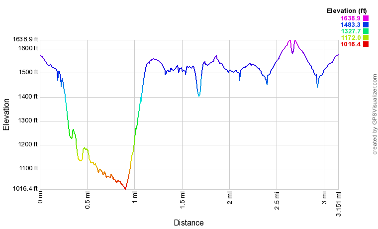
Note: The profile above isn't fully accurate in a few spots as it has some spikes due to the trail's proximity to the sheer gorge walls.
Click the link below to download a .GPX file with a track of this hike.
Details
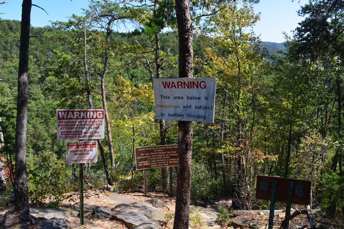
Tallulah Gorge is a one-of-a-kind gorge in Georgia. No other gorge in the state is so deep and cliff-lined or has such a mighty river flowing through it. There are few similar gorges elsewhere in the Southeast as well. Linville Gorge is one of the top comparisons. Even though Linville Gorge is much larger, wilder, and more impressive than Tallulah Gorge, the Linville River actually doesn't have as many major waterfalls in the gorge as the Tallulah River does. While a number of touristy trails follow the rims of Tallulah Gorge and descend into it, it is tricky to hike down the Tallulah Gorge Floor itself. Access to the rugged Gorge Floor Trail is based on a permit system, and only 100 permits are given out per day. On good summer weekends, when hoards of people hike the Gorge Floor to swim at Bridal Veil Falls (Sliding Rock), you have to be at the park entrance when the park opens at 8 AM if you want a shot at getting the permit (and I speak from my own experience). Getting the permit is somewhat easier in the colder months, although the two river fords would be frigid then and may not feel pleasant to some hikers. And remember, no entry to the Gorge Floor Trail (to the area between Hurricane Falls and Bridal Veil Falls and the top of the Sliding Rock Trail) is allowed without a Gorge Floor Permit - those who hike the trail illegally will be fined.
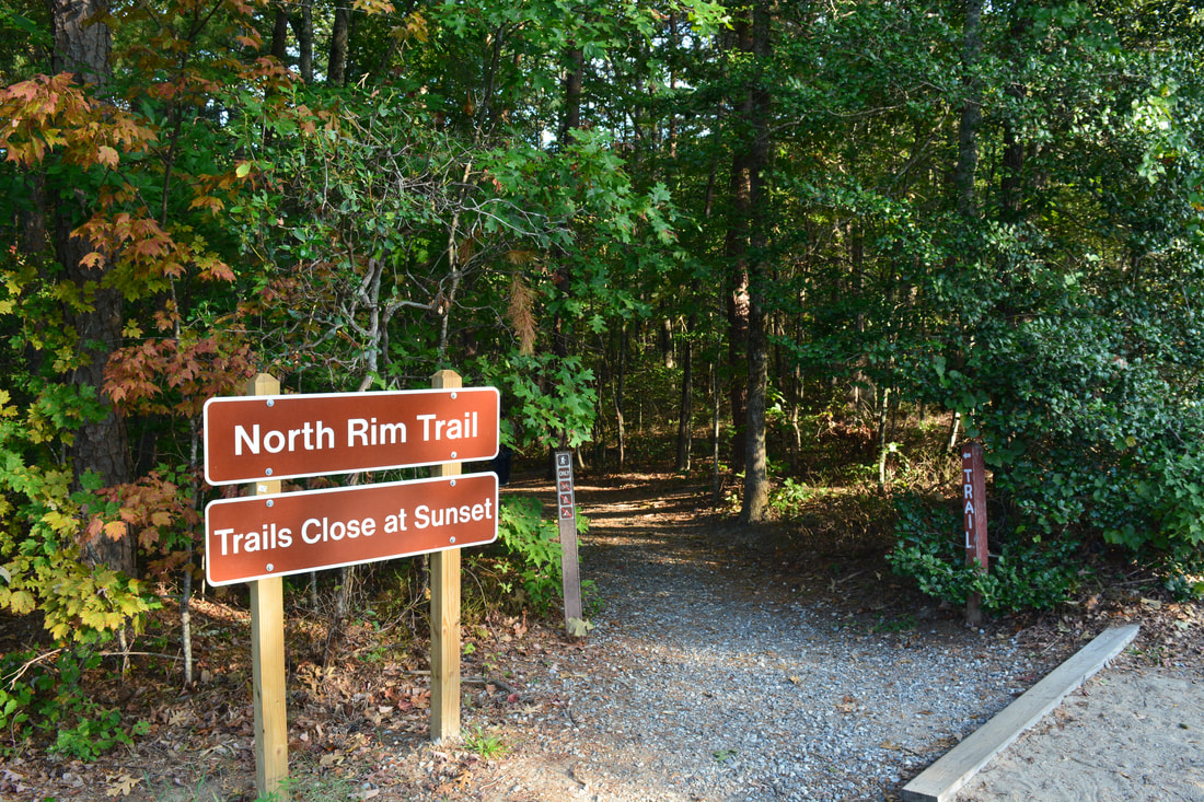
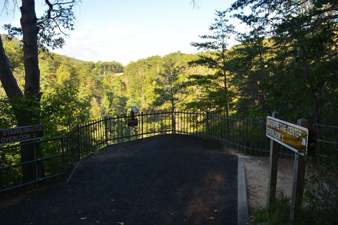
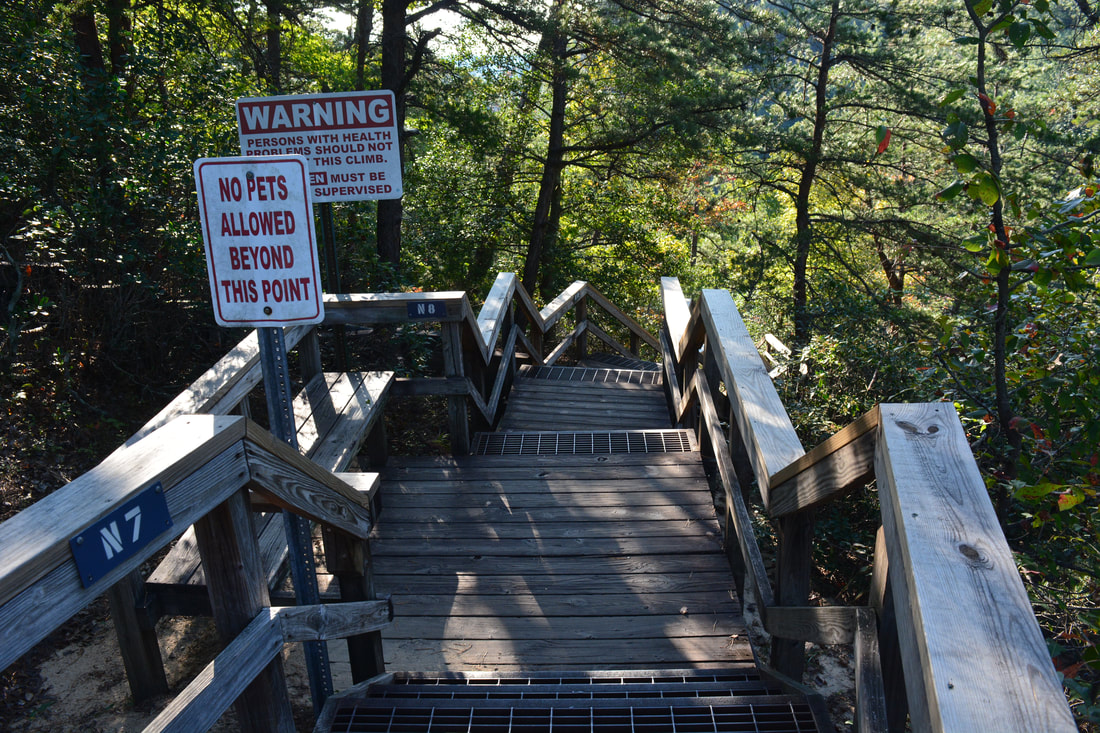
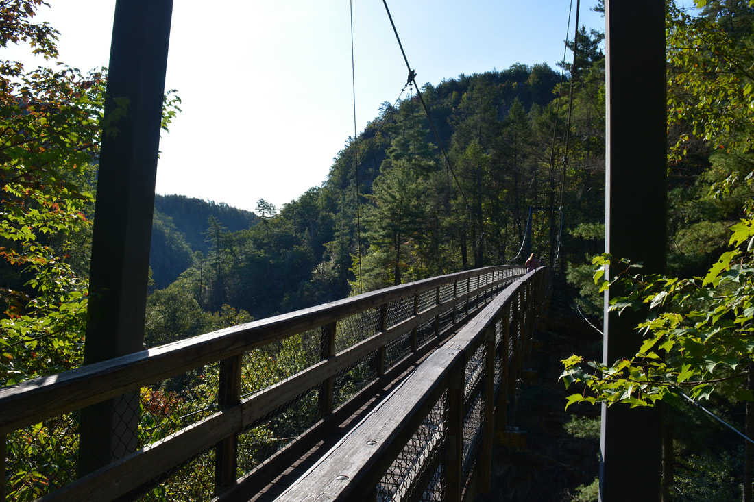
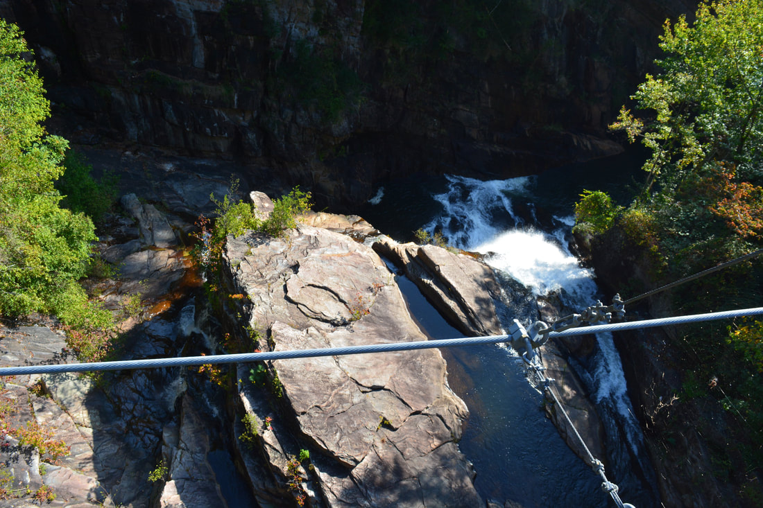
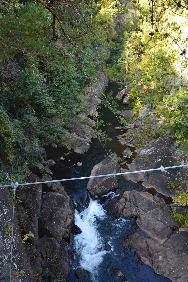
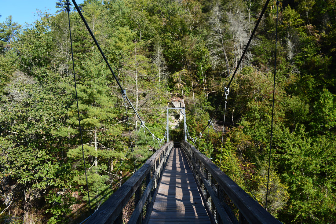
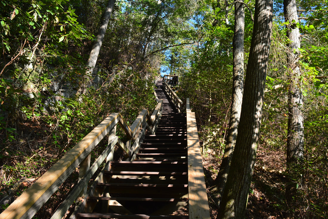
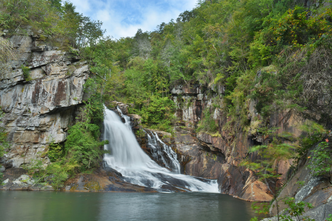
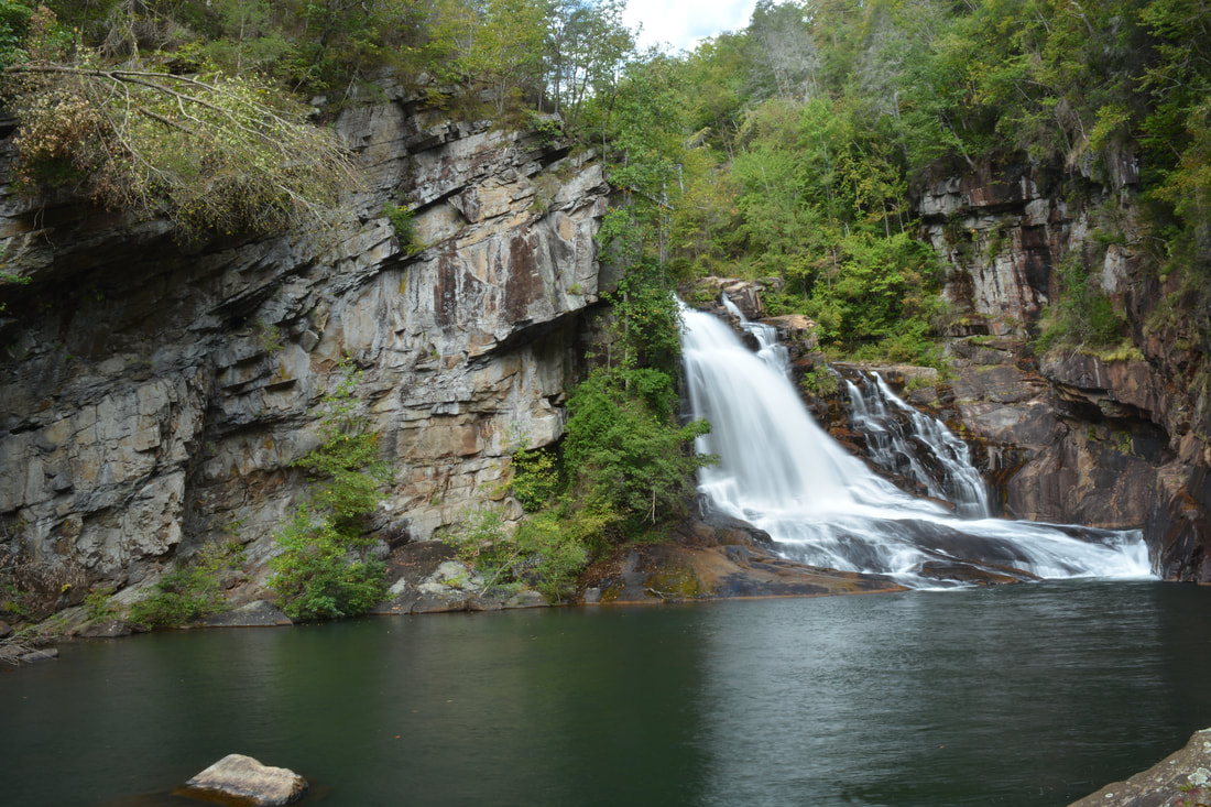
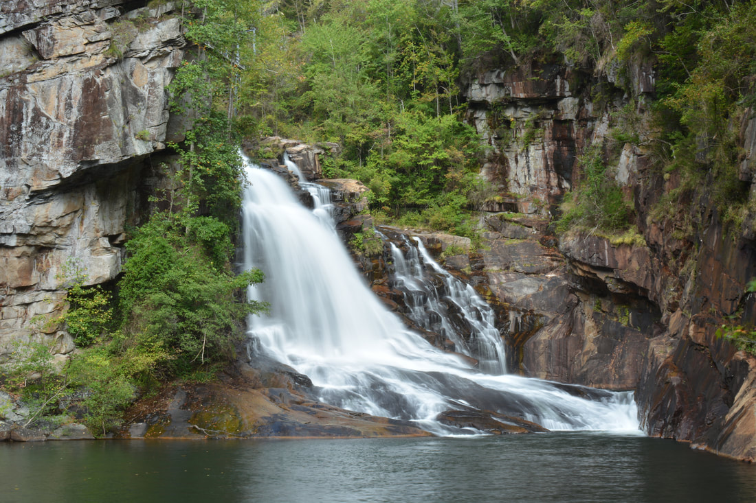
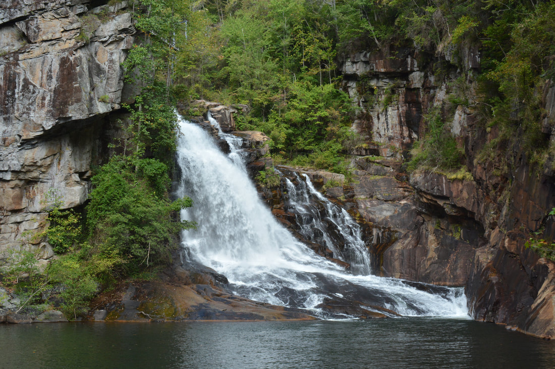
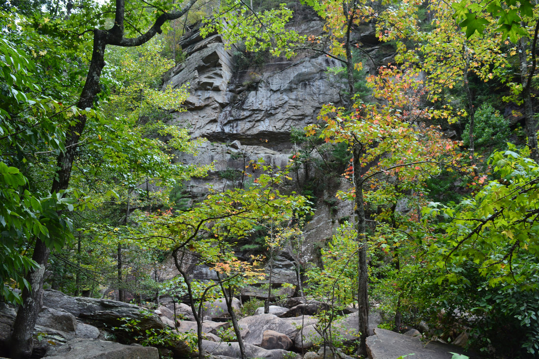
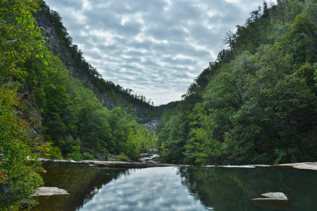
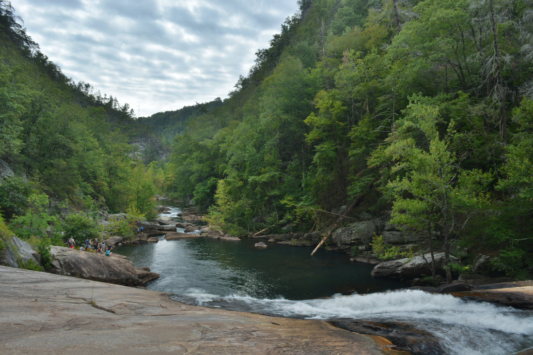
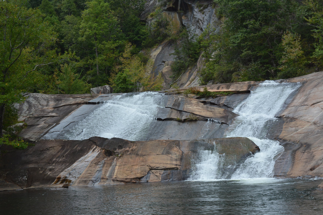
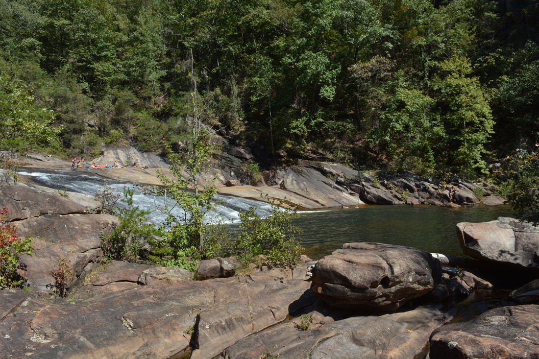
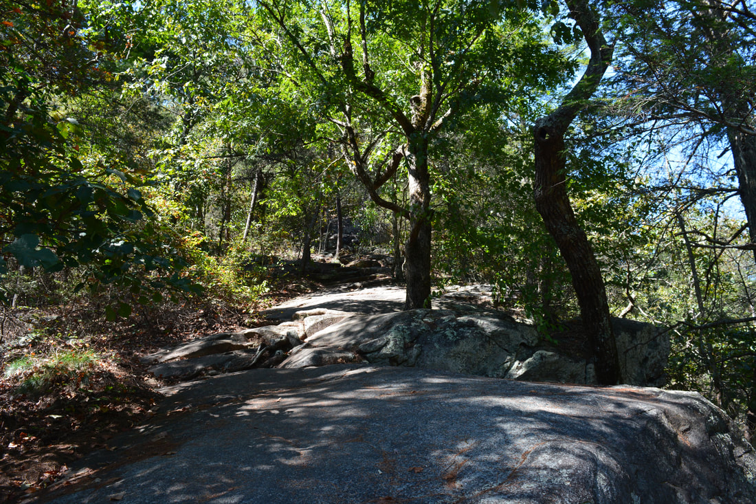
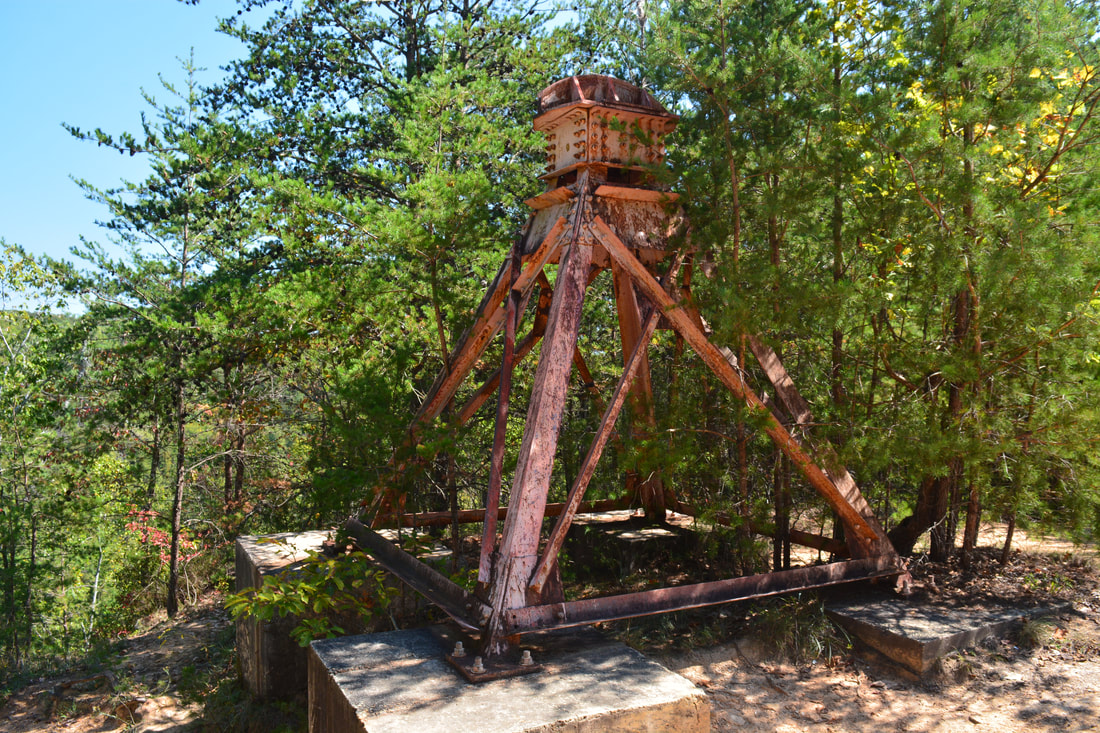
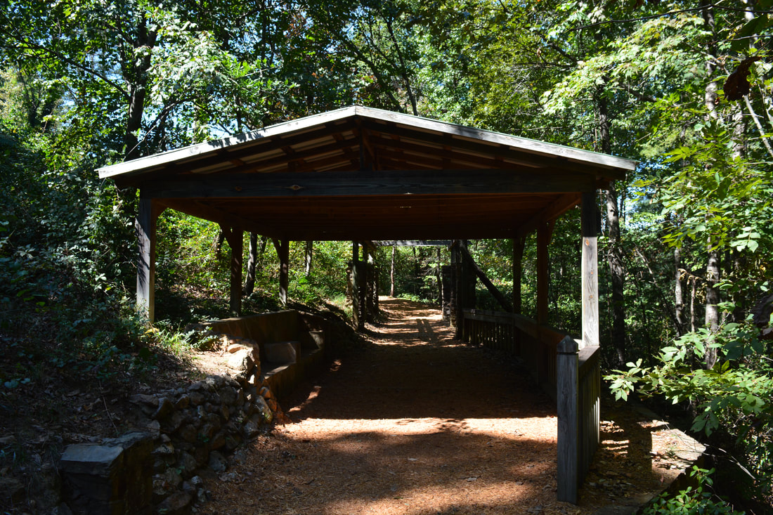
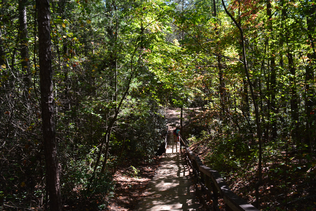
Begin the hike by heading down the Interpretive Center Trail, signed as North Rim Trail, that leaves to the right from the parking just before the Interpretive Center. A gradual descent brings you to a junction with the North Rim Trail at 0.1 miles. Turn right onto the North Rim Trail and shortly reach Overlook 3 at the edge of Tallulah Gorge at 0.2 miles. This overlook has a view of L'Eau d'Or Falls (slightly obscured by trees) and the huge Hawthorne Pool immediately below the falls. The most interesting part of the view is the water compressor plant ruins, related to Tallulah Falls Dam, at the top of the falls. You can also see the US 441 bridge at Tallulah Falls Dam in the distance. At Overlook 3, turn left onto the Hurricane Falls Trail, beginning the loop. You will reach Overlook 2 in about 150 feet. Overlook 2 has a completely open view of L'Eau d'Or Falls. L'Eau d'Or Falls is a beautiful triple set of sliding cascades with a total height of about 40 feet. Tall cliffs line the right side of the waterfall. There is no way to access the base of this waterfall. The Hurricane Falls Staircase begins right after Overlook 2. Between this point and the suspension bridge, the trail descends down 347 steps into the gorge. At 0.35 miles, reach the suspension bridge at the top of Hurricane Falls. There is a grand view of the Tallulah River in both directions from here. Some people could find the suspension bridge unnerving as it sways with every step! On the other side of the bridge, there is a junction with the side staircase to the base of Hurricane Falls and the Gorge Floor Access. Turn left onto the Hurricane Falls side trail (the steps straight ahead climb back out of the gorge to the South Rim). After 221 more steps, the trail reaches the base of Hurricane Falls at 0.4 miles. A wooden observation deck provides a view of Hurricane Falls and the cliff-lined pool below it. However, due to the right angle turn at the falls, only the lower part of Hurricane Falls is visible from this side of the river. A much better view of the falls is on the other side of the river (where you can get only with a Gorge Floor Permit). If you don't have a permit, you'd have to backtrack from this point. But if you do have one, push open the gate and descend the steps to the edge of the river. The first of two fords of the Tallulah River is at this point. It is best to cross via the large boulders to the left. While the crossing at that particular spot isn't very deep, the boulders are extremely slick and polished - thus, care needs to be taken during the crossing. Make sure you have dry bags for electronics as it can be easy to slip and fall into much deeper water here. On the other side of the river is a spectacular view of Hurricane Falls. At Hurricane Falls, the Tallulah River crashes 90 feet with a thundering roar into a blue-green cliff-lined pool. You can see part of the suspension bridge hovering well above the falls. Hurricane Falls is definitely the most beautiful waterfall in Tallulah Gorge. It is also one of the best waterfalls in Georgia, although the crowds can unfortunately be quite distracting, especially when compared to some more remote locations. 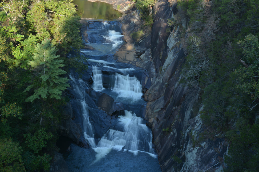
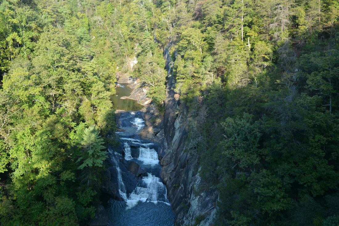
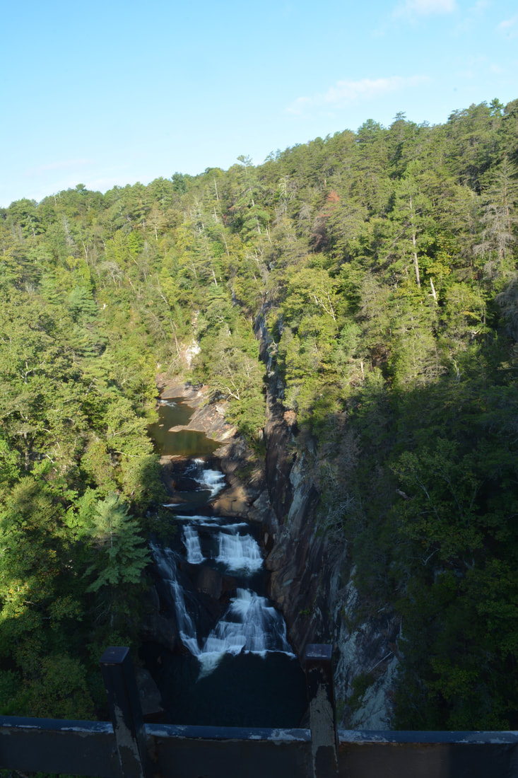
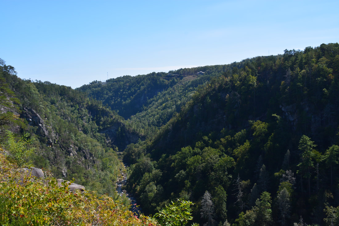
A triple set of sliding cascades, L'Eau d'Or Falls is the uppermost waterfall in Tallulah Gorge and can only be viewed from the gorge rim.
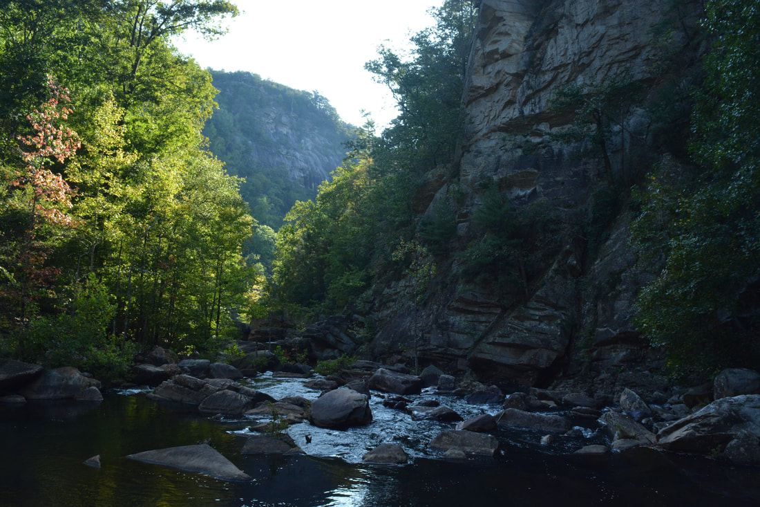
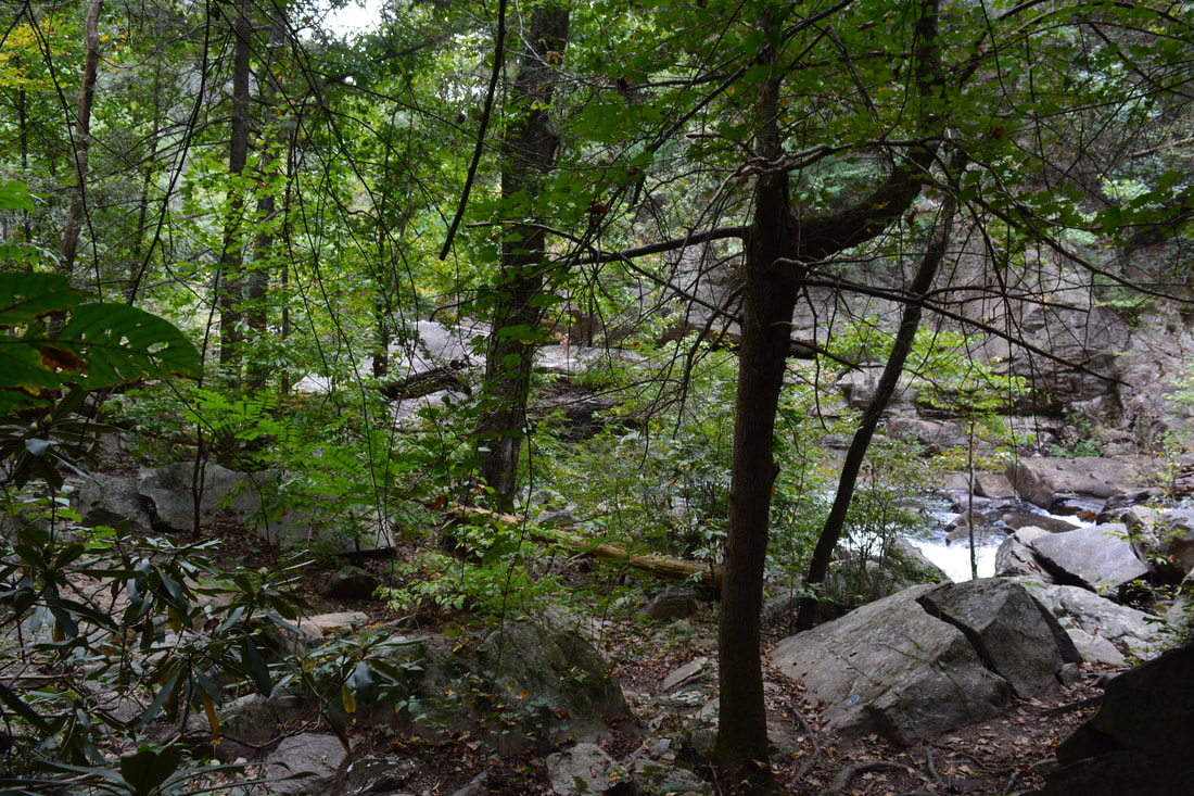
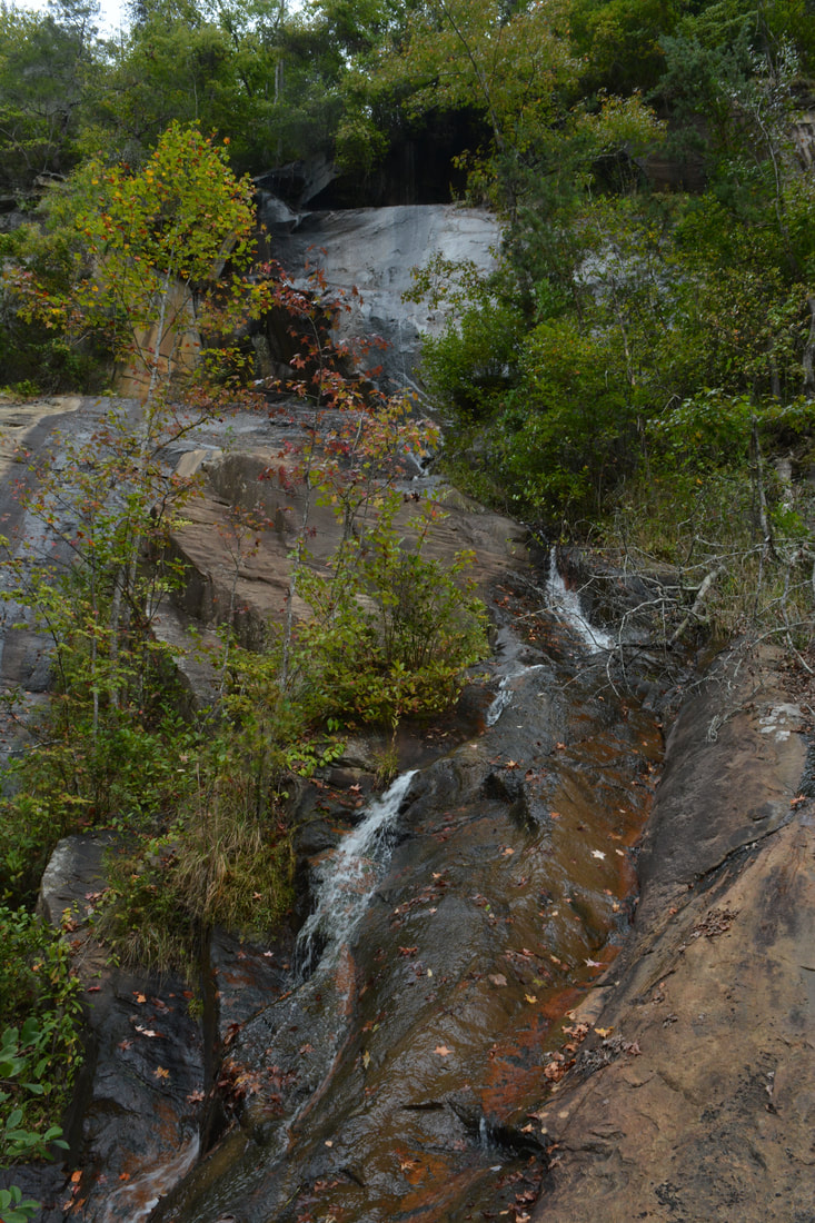
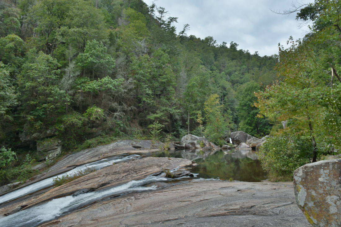
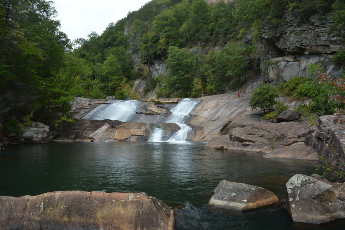
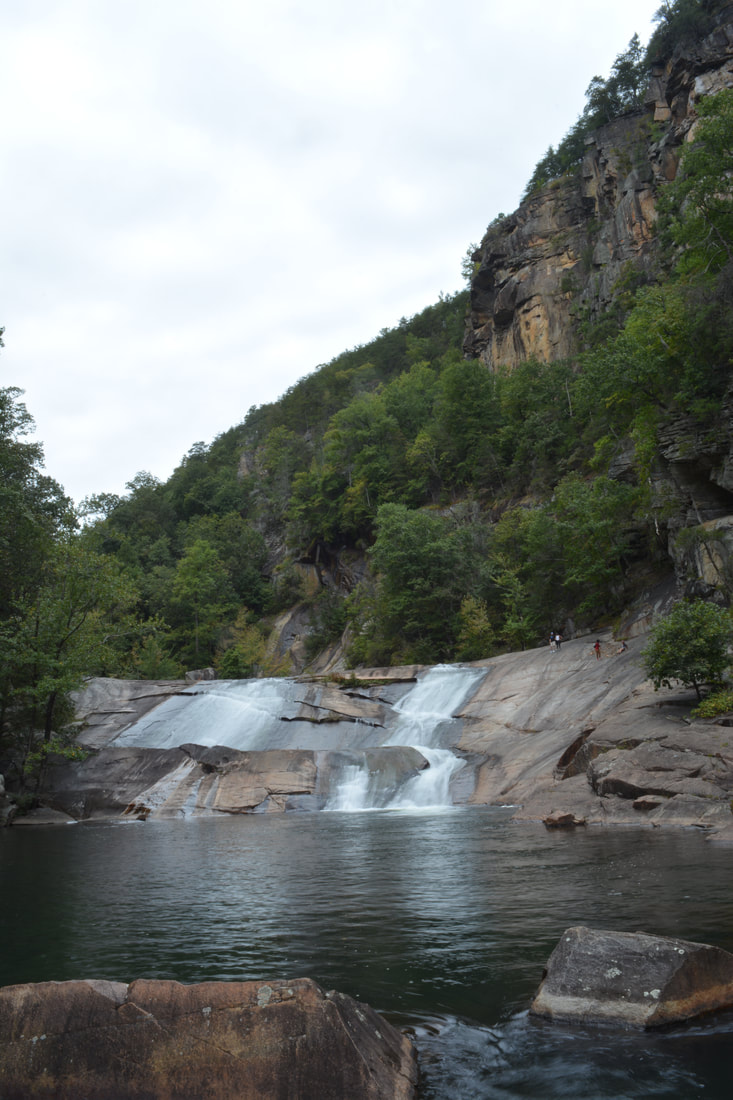
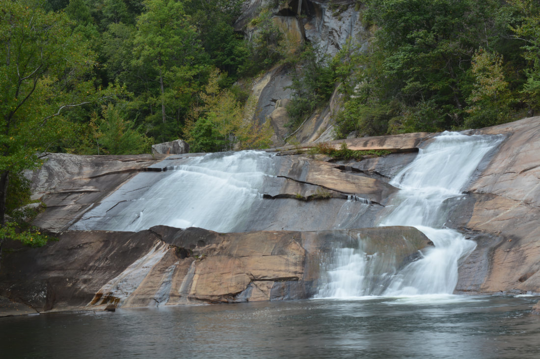
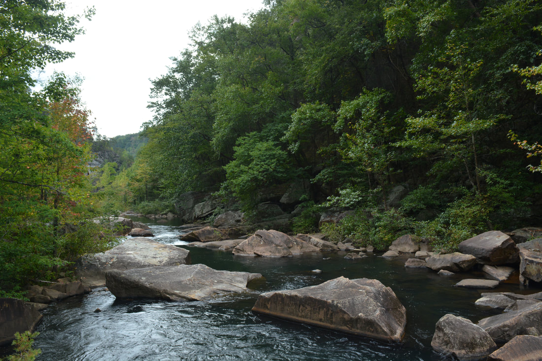
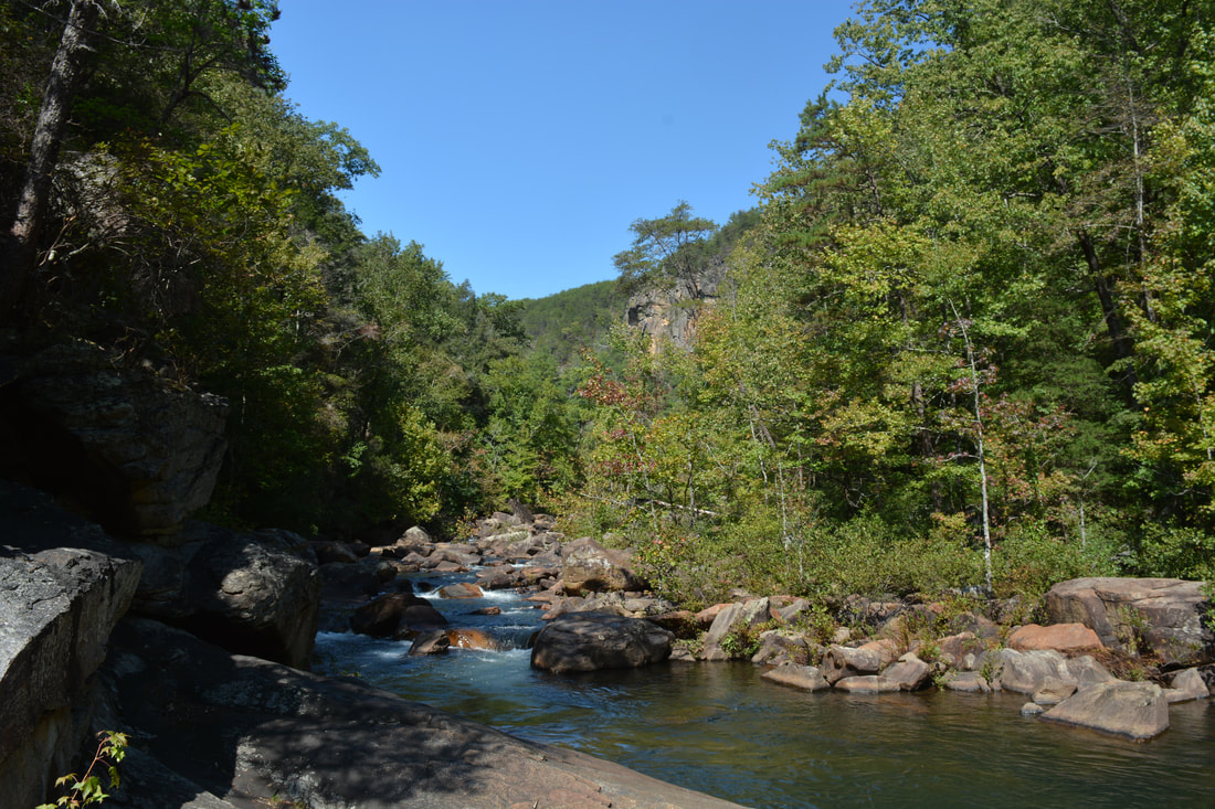
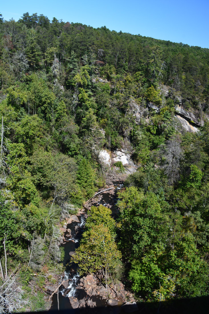
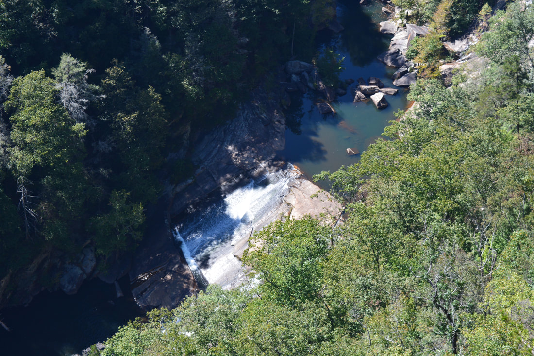
Once you're across the river at Hurricane Falls, begin hiking downstream along the north side of the river (River Left Side). While at times there is a real path, most of the Gorge Floor Trail is one long boulder scramble. Just below Hurricane Falls, you will see a tall cliff across the river. At 0.55 miles, arrive at a long slightly sloping rock face just before the brink of Oceana Falls. Fortunately, the rock face is not slippery and pretty easy to traverse. At this rock face, a small unnamed stream tumbles down the side of the gorge to the left and joins the Tallulah River. The waterfall that the stream forms on the gorge cliffs is known as Caledonia Cascade and is the second-highest waterfall in Georgia, but normally, it is a very low-flow waterfall. You'll reach the brink of Oceana Falls at 0.6 miles. The only way to the base is a walk down an angled rock slab that stretches away from the waterfall. While the rock slab isn't slippery, you'll still have to be careful, as a slip will send you sliding down into the pool at the base of Oceana Falls. It is best to hug the bluff on the far left when making the descent. At the end of the rock slab, there is a nice side view of Oceana Falls - a long slide about 40 feet high. Continuing a bit farther across an assortment of boulders and rock outcrops, there will be a frontal view of Oceana Falls, including the pool and the tall cliffs in the background.
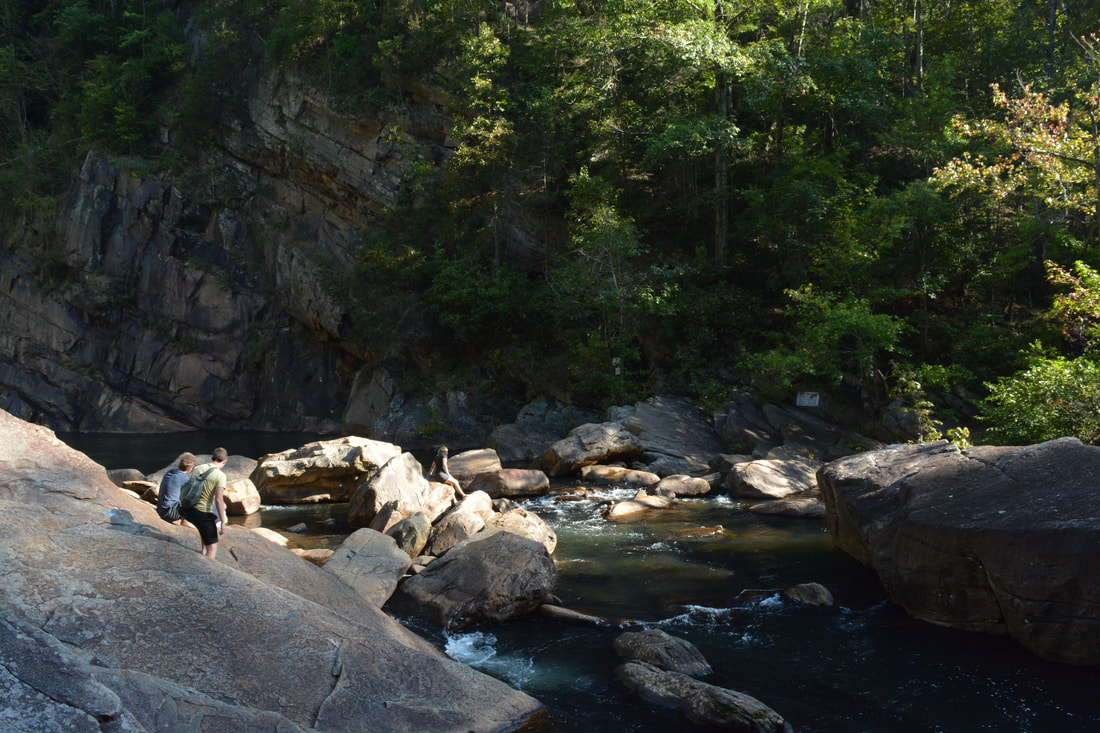
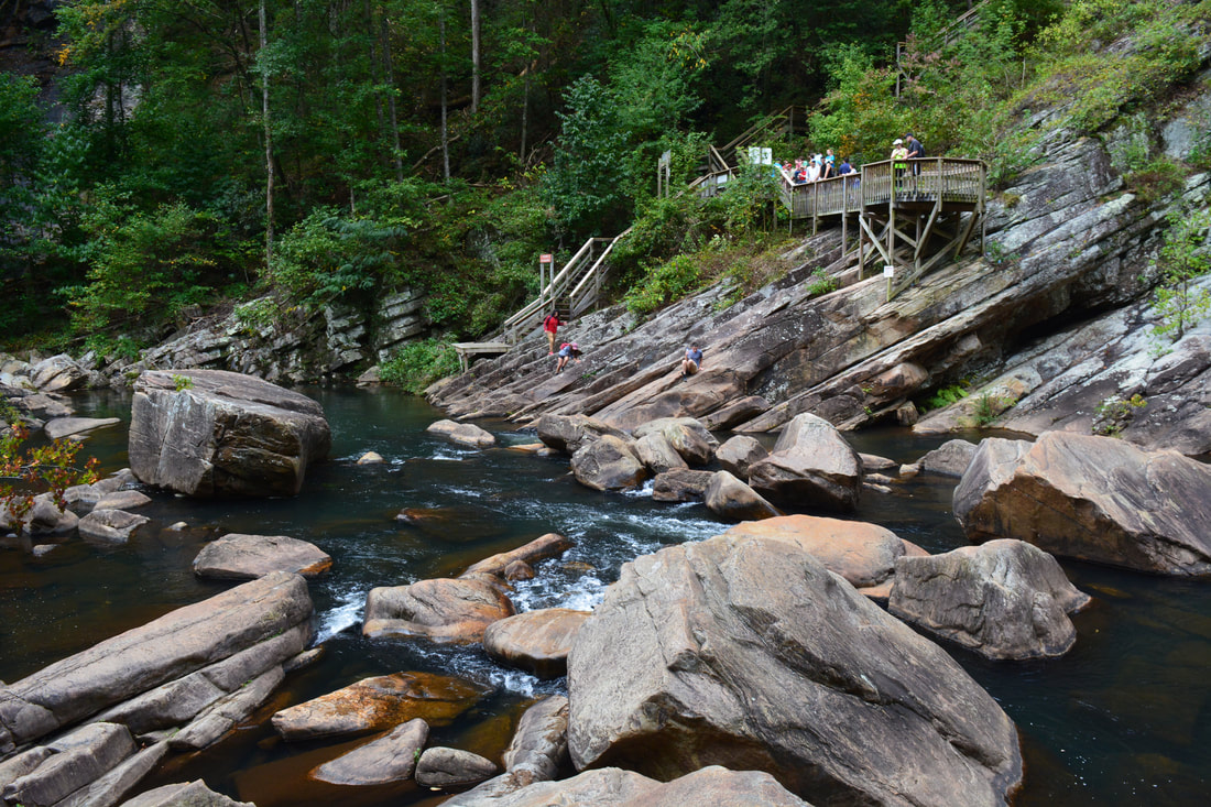
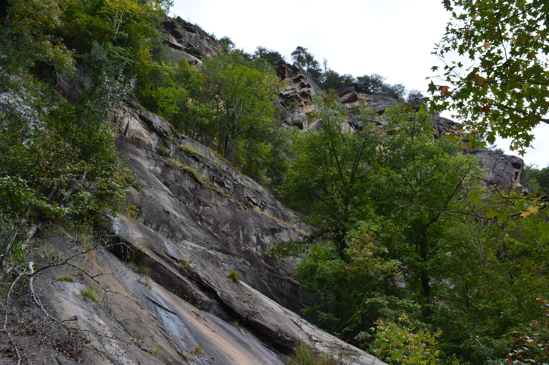
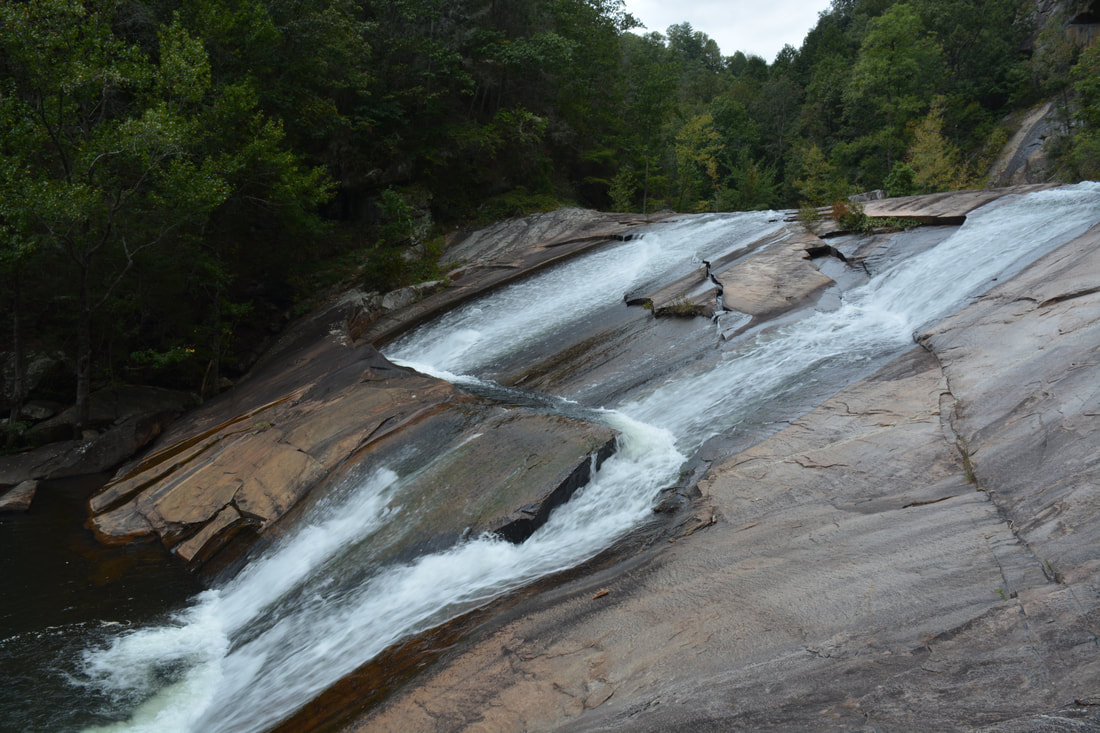
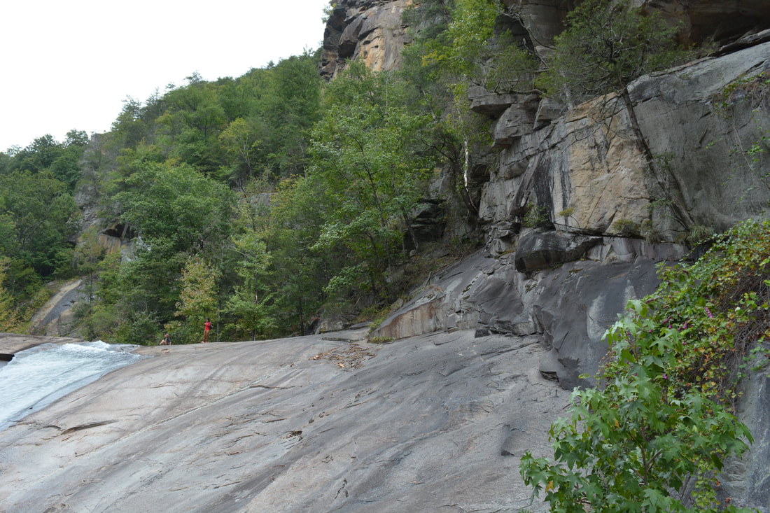
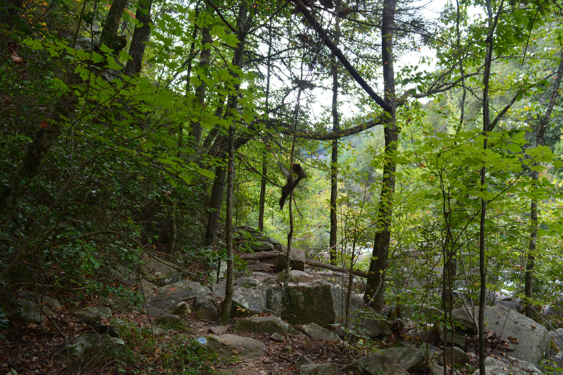
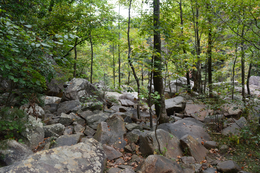
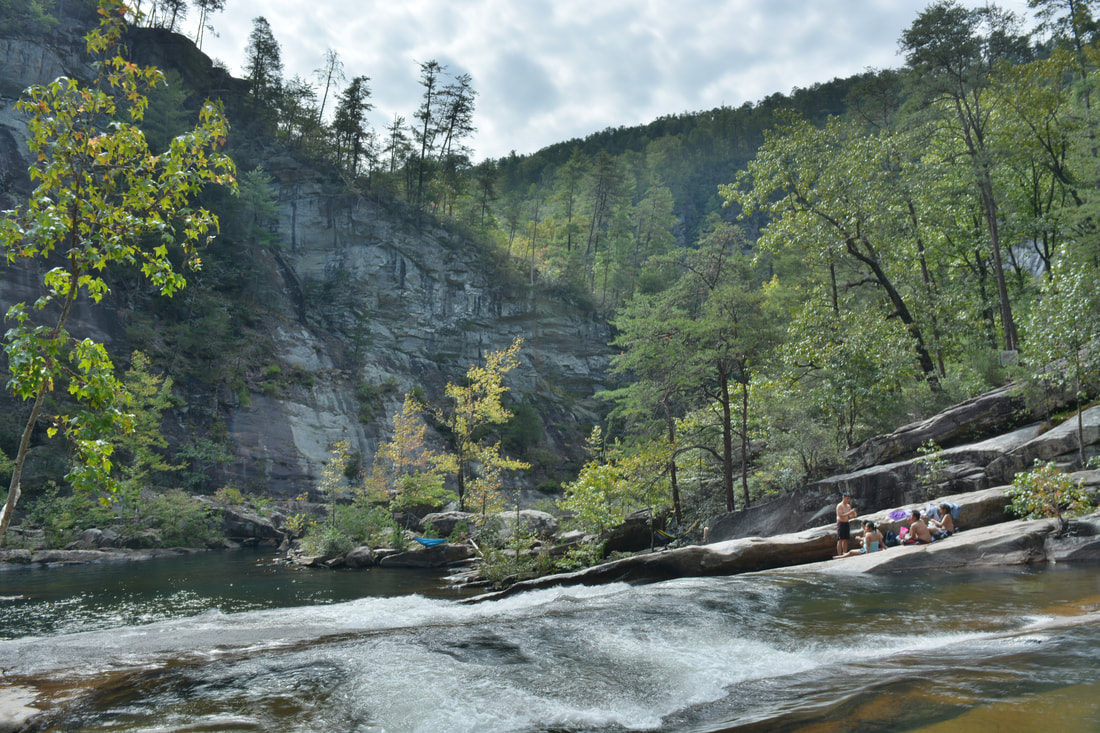
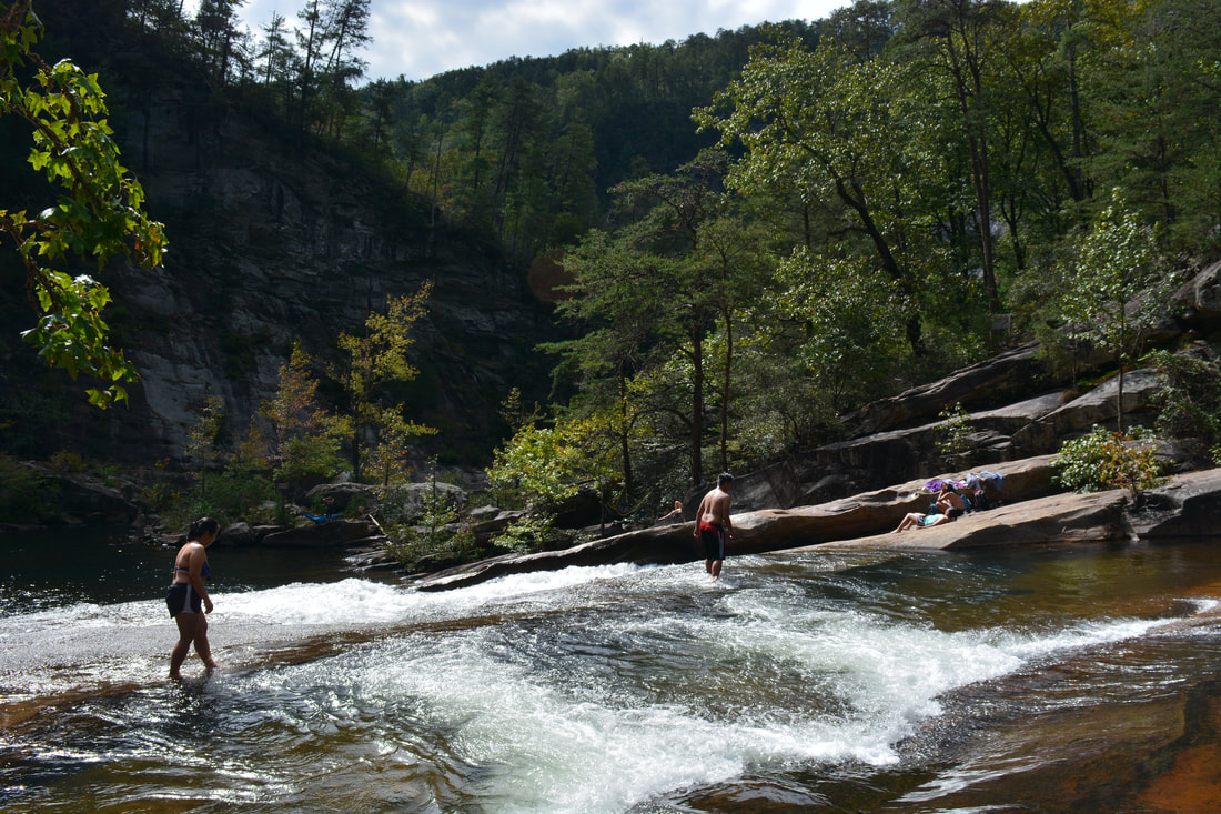
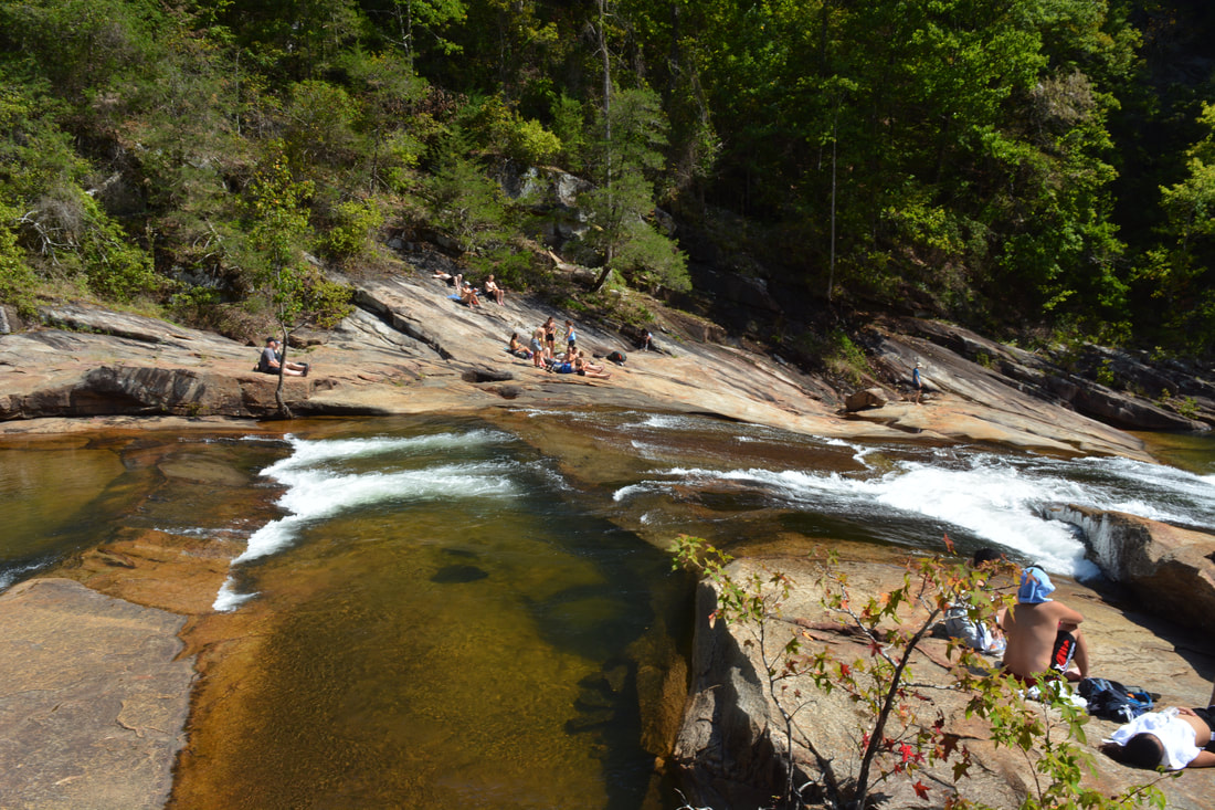
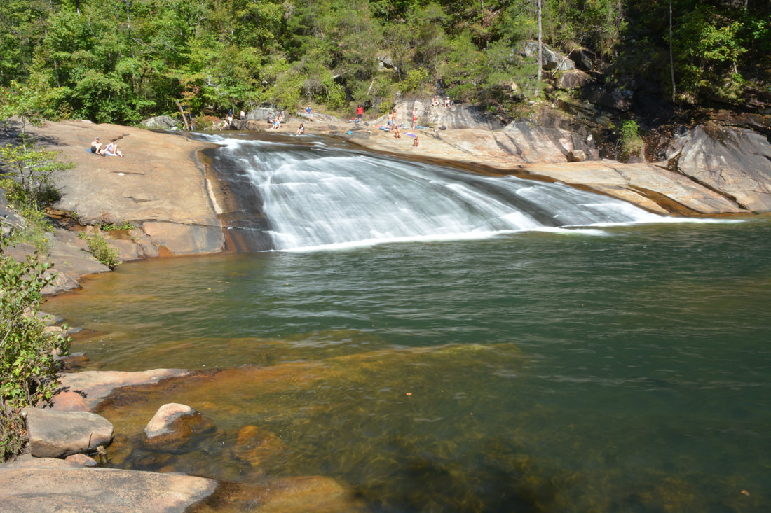
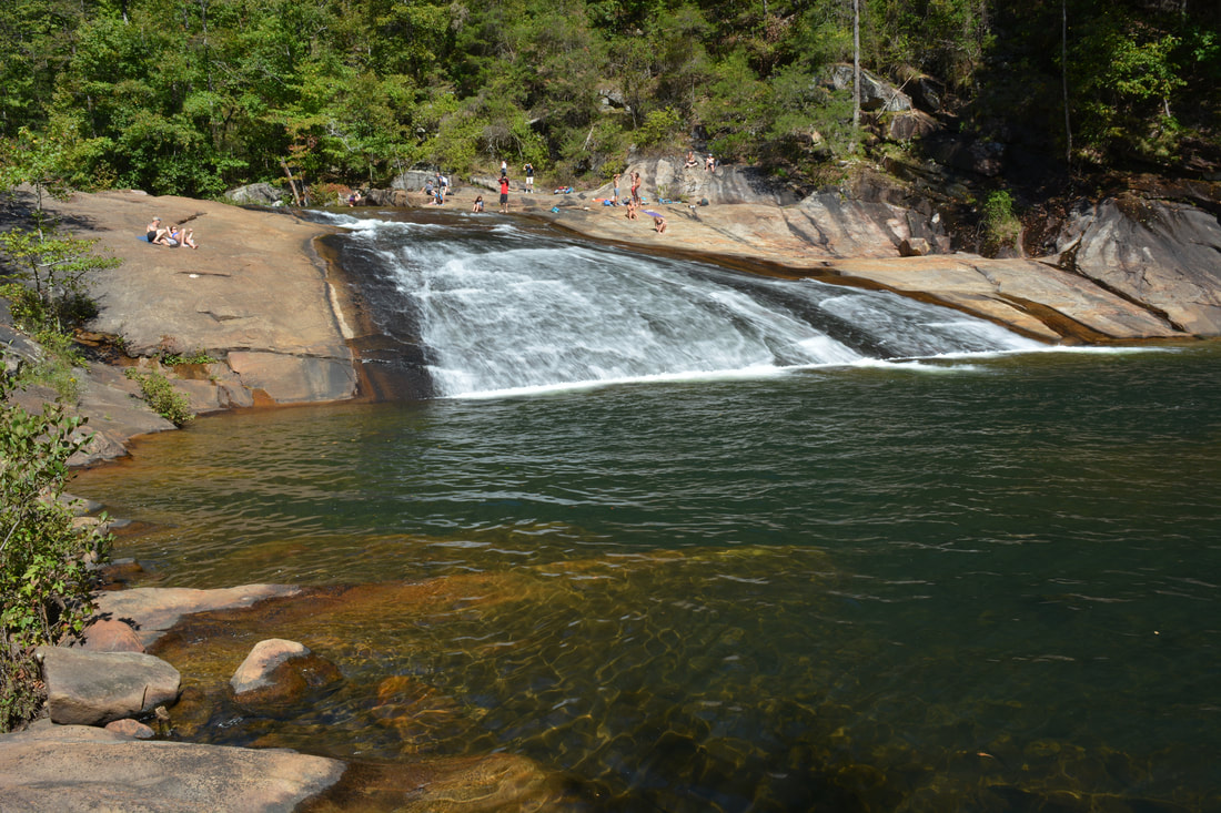
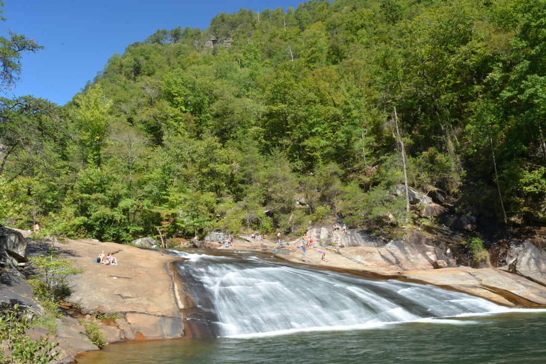
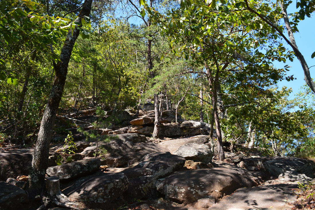
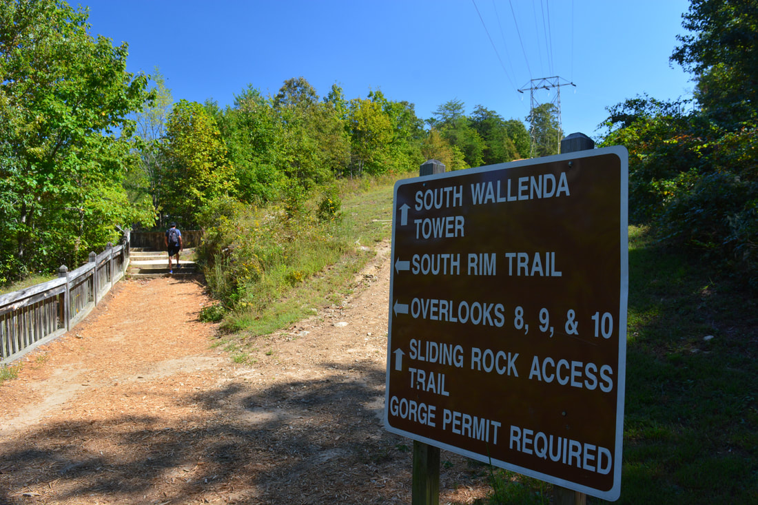
The Gorge Floor Trail continues in the form of easy to moderate boulder scrambles, and sometimes, it'll take a minute to figure out the best route. Generally though, below Oceana Falls there are a few more stretches of actual path. At 0.85 miles, the Gorge Floor Trail arrives at its terminus at the top of Bridal Veil Falls. This is where a second river ford is located, allowing you to connect to the Sliding Rock Trail on the other side. The best location to cross is right at the brink of Bridal Veil Falls. While normally I strongly discourage crossing rivers at the tops of waterfalls, in this case, it's okay, because the crossing is shallow, the rocks have surprisingly good traction (although you have to walk in small steps just in case), and most importantly, Bridal Veil Falls is a small waterfall with a deep pool at the bottom, so it's unlikely that you'll be hurt if you manage to slip. It's called Sliding Rock for a reason! On the other side, a sign marks the Sliding Rock Trail that provides an exit route out of the gorge, but first, take the scramble path on the left that leads to the base of Bridal Veil Falls. The falls isn't overly attractive as it's a long gradual slide about 20 feet high, but it's a nice bonus to the hike. The large deep pool at the base makes Bridal Veil Falls very attractive to swimmers who slide down the waterfall and then cool off in the pool. Perhaps the most scenic feature of Bridal Veil Falls is the huge 250-foot sheer cliff that is on the east side of the river just below the falls. Looking downstream, you can also see a high wet-weather waterfall cascading down the cliffs in the distance. Hiking any further down the gorge from Bridal Veil Falls is prohibited though. Begin heading up the Sliding Rock Trail from Bridal Veil Falls. This trail ascends about 540 feet in just a quarter-mile! The Sliding Rock Trail is also extremely rocky and more of a rock scramble than a trail, as on your way up, you'll navigate your way over many boulders and rock outcrops. There are a few good views of the cliffs on the north side of the gorge along the ascent. At 1.1 miles, the trail passes an abundance of warning signs and slowly levels out as it enters a small area of private property. Please stay on the trail here. At 1.15 miles, the trail reaches the top of the ascent at the South Wallenda Tower. In 1970, tightrope walker Karl Wallenda walked across Tallulah Gorge from rim to rim, starting at the north rim. The South Wallenda Tower was the endpoint of his walk, and you'll see the North Wallenda Tower (the starting point) later in the hike. 
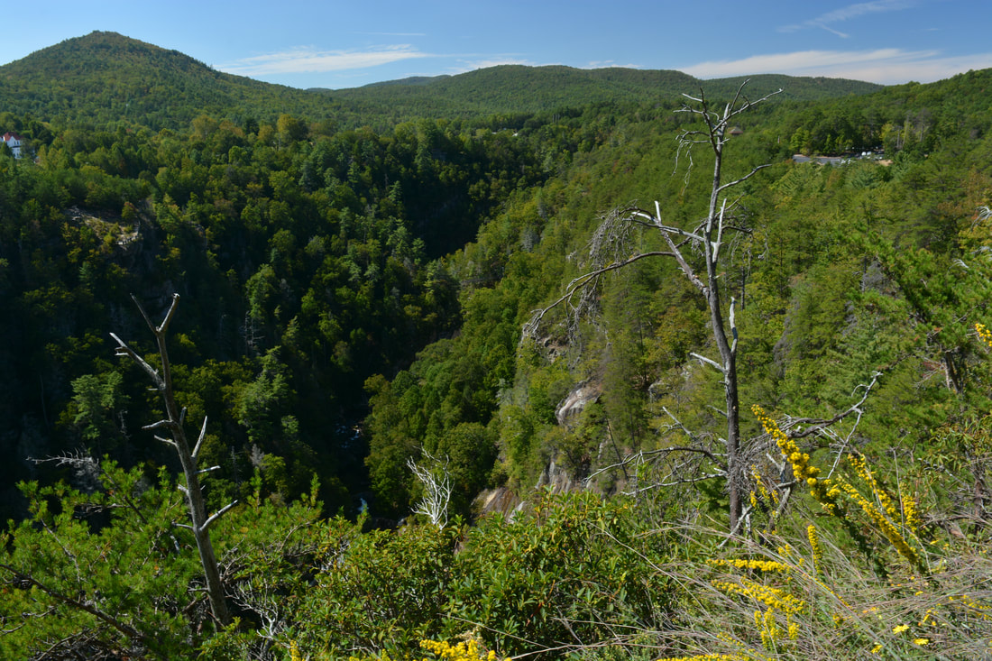
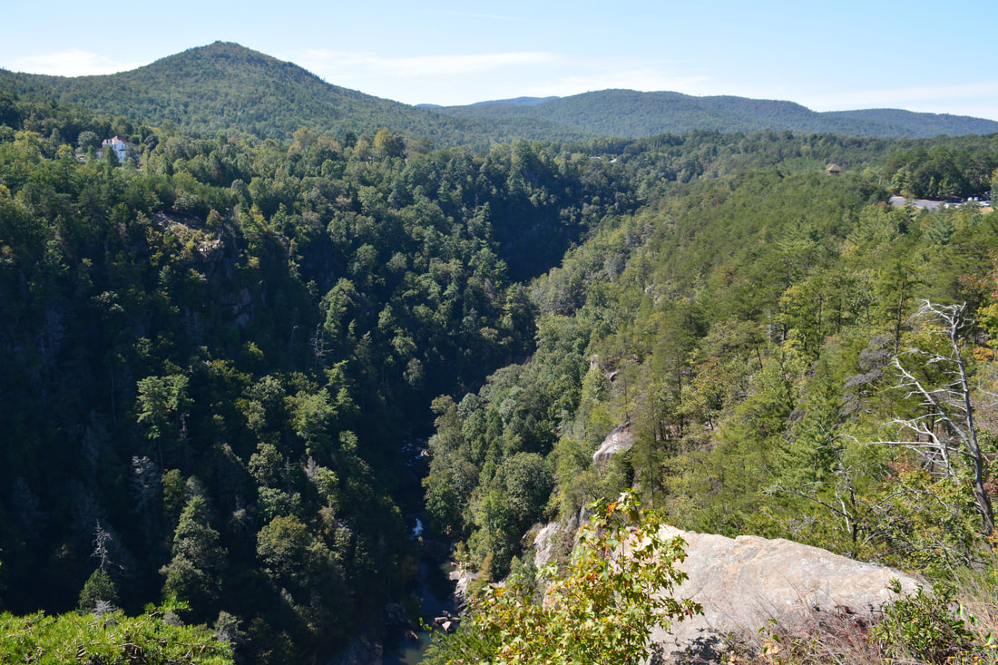
The spectacular panorama of Tallulah Gorge and its surroundings from Inspiration Point
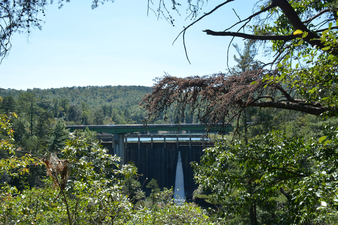
At South Wallenda Tower, stay left and follow the signs for the trail. After walking down a powerline cut, you will reach the end of the Sliding Rock Trail at the South Rim Trail Junction at 1.35 miles. To the right, the South Rim Trail leads to Overlooks 8, 9, and 10. While I skipped those overlooks today as I had seen them previously, they are worthwhile. Bear left onto the South Rim Trail to stay on the main loop. At 1.4 miles, the Hurricane Falls Trail comes out from the right. Stay on the South Rim Trail, which passes Overlook 7 at 1.45 miles. Overlook 7 provides the only clear view of Tempesta Falls, an 85-foot sliding waterfall in the gorge between L'Eau d'Or Falls and Hurricane Falls. Unfortunately, the view is getting quite overgrown, so out of the five waterfalls in the gorge, this one is the hardest to see. As with L'Eau d'Or Falls, there is no way to access the base of Tempesta Falls. The trail then reaches Overlook 6 at 1.55 miles, which has a panoramic view of the gorge with the suspension bridge far below. The South Rim Trail ends at US 441 at 1.6 miles. To continue the loop, walk the sidewalk across the Tallulah River bridge on US 441. The bridge is right at Tallulah Falls Dam - the head of Tallulah Gorge - with Tallulah Falls Lake on the other side of the bridge. Once across the bridge, take the staircase on the right down to the North Rim Trail, which starts out paved but turns to dirt. As you follow the North Rim Trail, you'll pass Overlook 5 with a limited downstream view of the gorge at 1.85 miles. Overlook 4 at 1.9 miles has a good tree-framed view of Tallulah Falls Dam. The spout of water coming from the dam, along with the lake in the background behind the bridge, makes it a pretty scenic one.
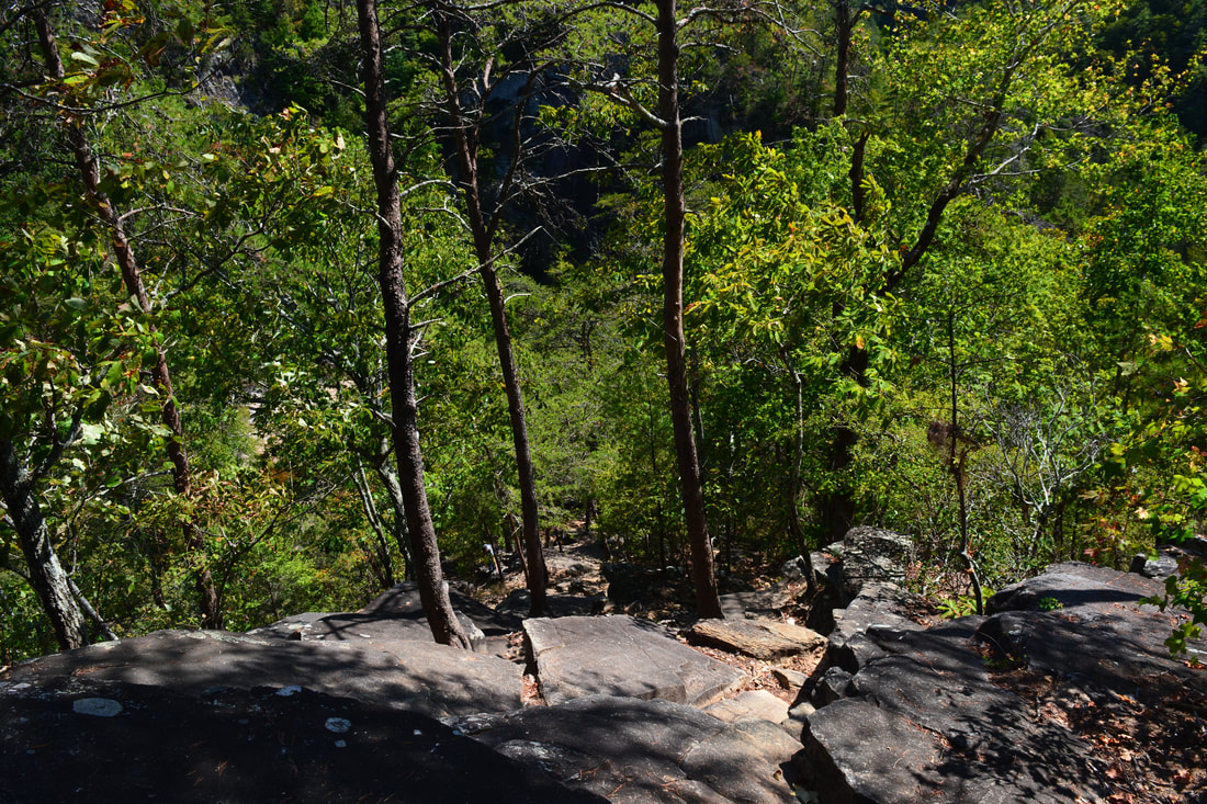
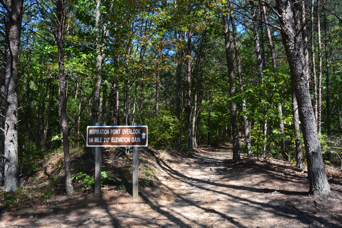
The North Rim Trail reaches the Hurricane Falls Trail Junction and Overlook 3 once again at 2.1 miles, concluding the loop. Stay straight on the trail toward the interpretive center. However, before wrapping up the hike, I highly recommend continuing on the North Rim Trail to Inspiration Point. The trail passes Overlook 1A at 2.25 miles, with the access trail to the parking area leaving left. Then, the trail descends to a footbridge across the small stream that forms Caledonia Cascade. At 2.4 miles, the North Rim Trail ends at Overlook 1, another very nice view of Tallulah Gorge. North Wallenda Tower lies on the ground by the overlook. Bend around the tower and continue on the signed Inspiration Point Trail. A moderate ascent commences as the trail rises to some of the tallest cliffs along the gorge. At 2.65 miles, the trail comes to a short side trail on the right to Inspiration Point (the trail also continues straight ahead and connects to the High Bluff Trail and Stoneplace Trail, but a different permit is needed to hike there). The cliff-top view at Inspiration Point hundreds of feet above the Tallulah River is about as good as it gets! The spectacular panorama encompasses much of Tallulah Gorge, with Oceana Falls visible far below and the cliffs of Bridal Veil Falls in the distance to the left. Straight ahead is the ridge that you climbed on the Sliding Rock Trail. You can also see some of the surrounding mountains, including Hickory Nut Mountain to the west. Retrace your steps to the interpretive center from Inspiration Point and take the final access trail to the parking area, concluding the hike at 3.2 miles. Mileage
0.0 - Jane Hurt Yarn Interpretive Center
0.2 - Overlook 3 0.25 - Overlook 2 (L'Eau d'Or Falls) 0.35 - Tallulah River Suspension Bridge 0.4 - Hurricane Falls 0.55 - Caledonia Cascade 0.65 - Oceana Falls 0.9 - Bridal Veil Falls 1.15 - South Wallenda Tower 1.45 - Overlook 7 (Tempesta Falls) 1.55 - Overlook 6 1.6 - Tallulah Falls Dam/US 441 1.85 - Overlook 5 1.9 - Overlook 4 (Tallulah Falls Dam View) 2.1 - Overlook 3 2.25 - Overlook 1A 2.4 - Overlook 1/North Wallenda Tower 2.65 - Inspiration Point 3.2 - Jane Hurt Yarn Interpretive Center Variations
Hike just the Gorge Floor Loop without Inspiration Point - 2.4 Miles
Hike just out and back to Inspiration Point from the Interpretive Center - 1.1 Miles Hike the North/South Rim Loop to Hurricane Falls and Inspiration Point without the Gorge Floor Trail and Sliding Rock Trail - 2.35 Miles Bonus Stops
A number of scenic waterfalls lie in the Tallulah Falls/Clayton/Cornelia area. A few that you may consider visiting are Minnehaha Falls, Panther Falls and Angel Falls, Mill Shoals and Big Shoals on Stekoa Creek, and Tabor Falls.
Pictures & Videos
1 Comment
11/26/2023 03:27:02 pm
Dear Mark, Leave a Reply. |
About MeMark Oleg Ozboyd Dear readers: I have invested a tremendous amount of time and effort in this website and the Georgia Waterfalls Database the past five years. All of the work that has gone in keeping these websites updated with my latest trip reports has almost been like a full-time job. This has not allowed me to pick up a paid job to save up money for college, and therefore, I I've had to take out loans. If you find the information on this website interesting, helpful, or time-saving, you can say "thanks" and help me out by clicking the button above and making a contribution. I will be very grateful for any amount of support you give, as all of it will apply toward my college tuition. Thank you!

Coming in 2022-2023?
Other Hiking WebsitesMiles HikedYear 1: 540.0 Miles
Year 2: 552.3 Miles Year 3: 518.4 Miles Year 4: 482.4 Miles Year 5: 259.9 Miles Archives
March 2021
Categories
All
|
||


 RSS Feed