HIKING THE APPALACHIANS AND BEYOND
  • Home
  • Trail Reports
    • Best Hikes
    • Hikes with Scenic Views
    • Hikes with Water Features
    • Alabama
    • Georgia
    • Florida
    • North Carolina
    • South Carolina
    • Tennessee
    • Vermont
    • Virginia
  • Map
  • Hike List
  • Testimonials
  • Resources
  • Contact Us
  • Southeast Nature Society
    • Our Team
  • Georgia Waterfalls Database

Sweetwater Creek State Park: Red Trail and White Trail, Lithia Springs, Georgia

11/4/2015

0 Comments

 
Picture
Are you looking for a remote, scenic hike in the busy Atlanta metro area? The trail system at Sweetwater Creek State Park may be right for you. The park's constantly expanding trail system lies on both the west and east sides of beautiful Sweetwater Creek. You can explore the historic mill ruins and the numerous rapids on Sweetwater Creek, visit the historic farming area on Jack's Hill, or traverse the dry ridges on the east side of Sweetwater Creek. This hike was a partial redo of a previous hike of mine at Sweetwater Creek State Park. This hike occurred on August 29th, 2015. My plan was to hike the Red Trail to its southern terminus and then follow the White Trail over Jack's Hill and back to the trailhead. ​

​Summary

R/T Length of Trail: 4.4 Miles
Duration of Hike: 1:50
Type of Hike: Loop​
Difficulty Rating: 2 out of 10
Pros: Well-marked and easy-to-follow trails
​
Cons: None
Points of Interest: Sweetwater Creek Falls/Rapids - variable rating (2 stars for normal water levels, significantly higher rating ​for above average water levels); Historic Mill Ruins
Trail Blaze Color(s): Red Trail - Red; White Trail - White​
​Best Season(s) to Hike: Winter; Spring
Beginning Point: Sweetwater Creek State Park Visitor Center​
Directions: From Lithia Springs, GA: Follow Sweetwater Road south for 2.2 miles. Then, continue straight as the road name changes to Mount Vernon Road. Continue for another 1.5 miles. The main entrance to Sweetwater Creek State Park will be on the left. Turn left and continue straight to the end of the road at a large parking area by the visitor center.

​Map

Sweetwater Creek State Park has one of the most scenic hiking trail systems in Metro Atlanta, and by far one of the most remote. The park has many trails, including several new ones. The Yellow Trail crosses Sweetwater Creek from west to east on a bridge and forms a loop on the east side of the creek along dry ridges that have good winter views. The new Orange Trail is an extension of the Yellow Trail's loop - I haven't hiked it as it was recently created, and on the day I did the hike described on this page, I didn't have time to do the whole trail system like the first time I hiked in the park. The Red Trail is the only really popular trail in the park - it is an out and back trail that extends from the visitor center along the west side of Sweetwater Creek, past the historic mill ruins to the most powerfoul rapids on Sweetwater Creek, also known as "The Falls" (although it's not really a waterfall). The White Trail is a mostly remote loop that travels the perimeter of the majority of the western side of the par, visiting the historic Jack's Hill farming area and Jack's Lake. The Green Trail is a new connector trail that connects Jack's Hill to the historic mill ruins. The Brown Trail is another new long and probably remote trail (that I haven't hiked) that runs from Jack's Hill south along Sweetwater Creek to a dead end at private property. On this hike, I only did the Red Trail and the White Trail, but if the opportunity will be present, I may return and do some of the new trails soon. 

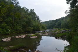
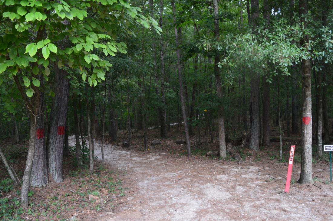
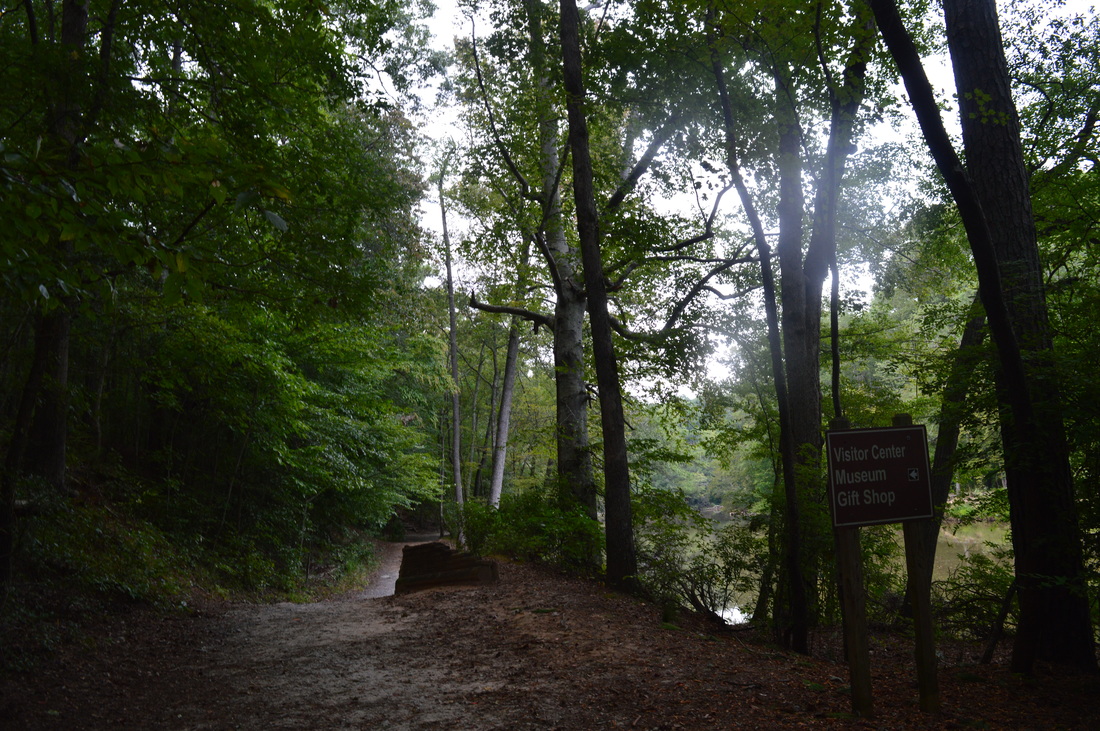
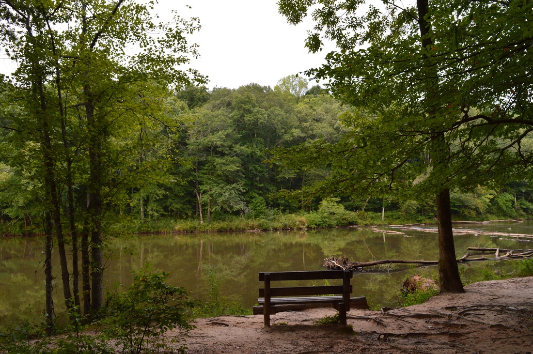
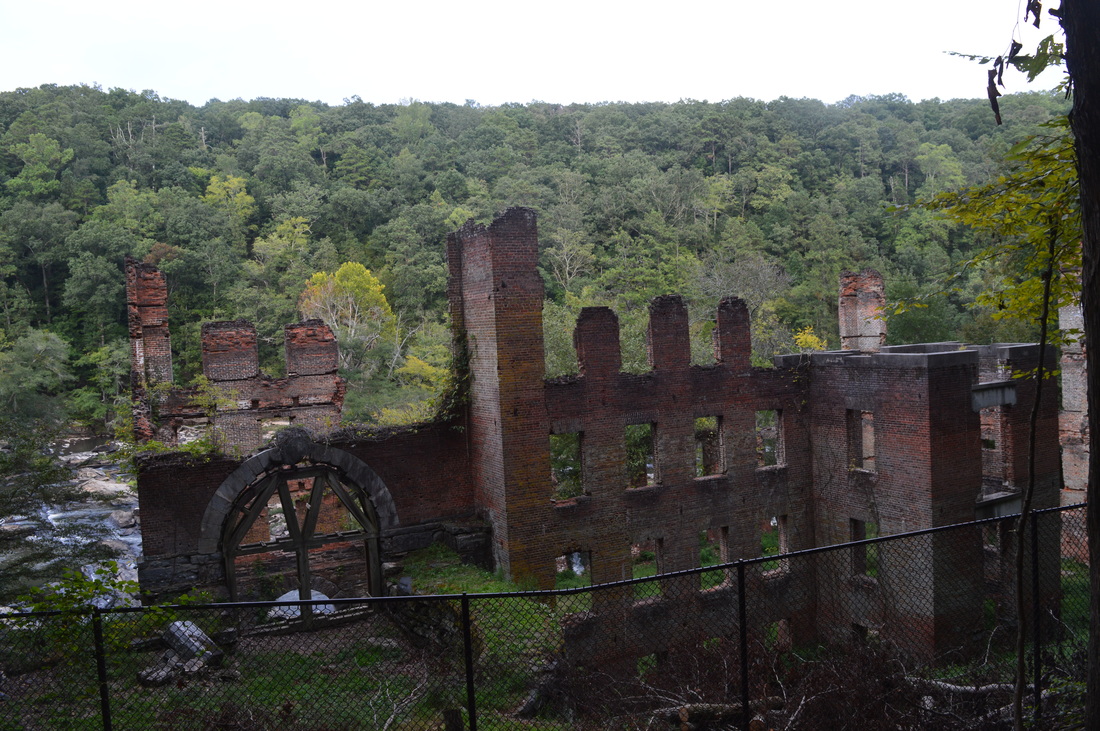
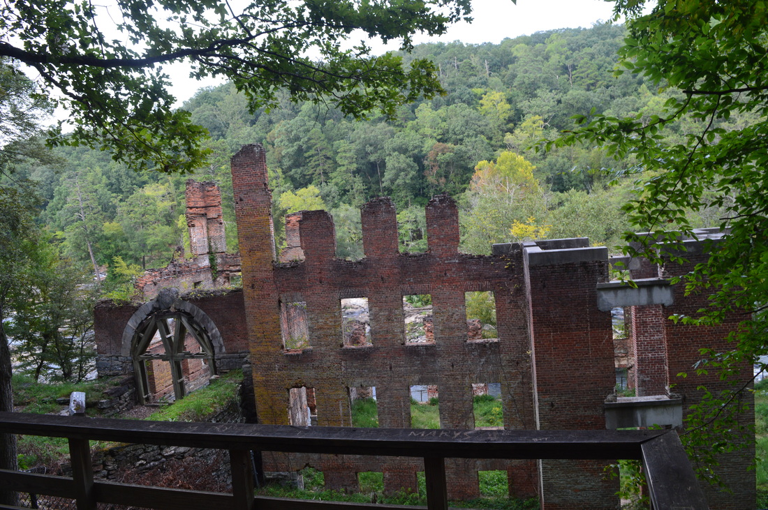
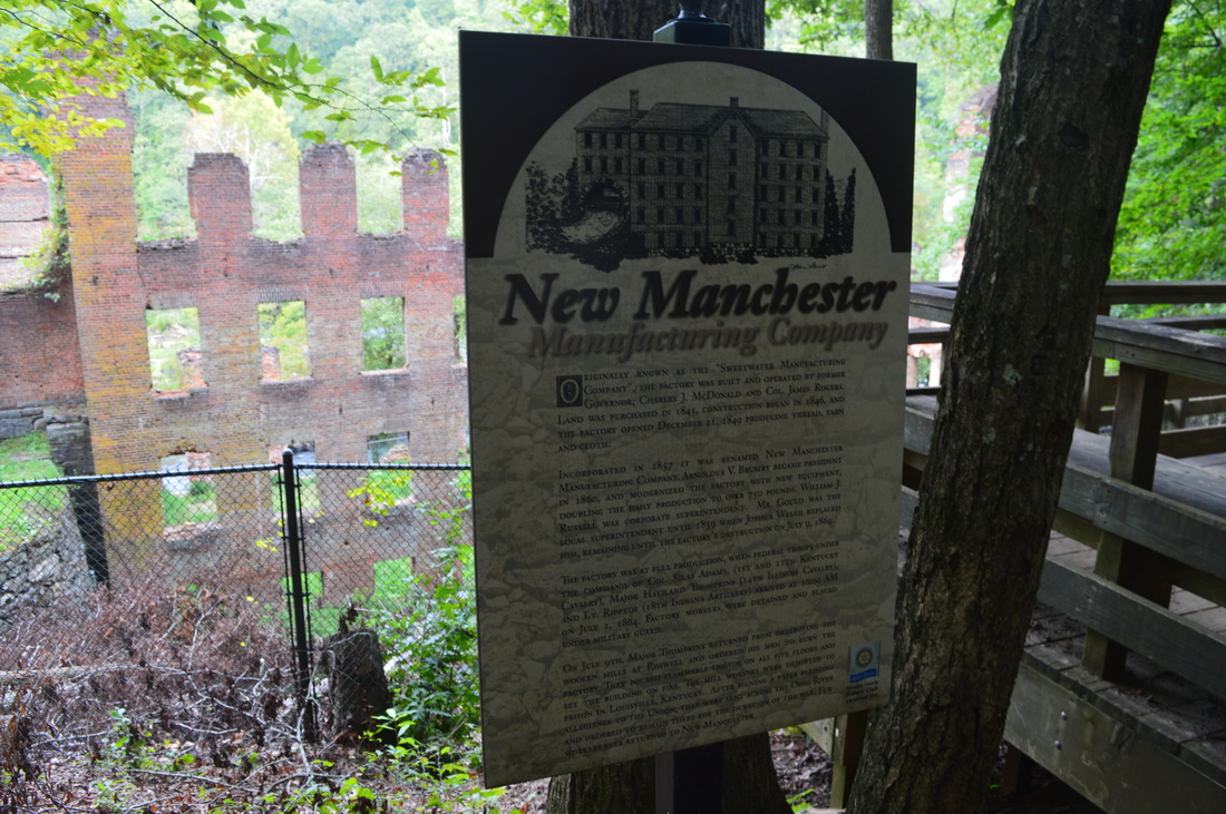
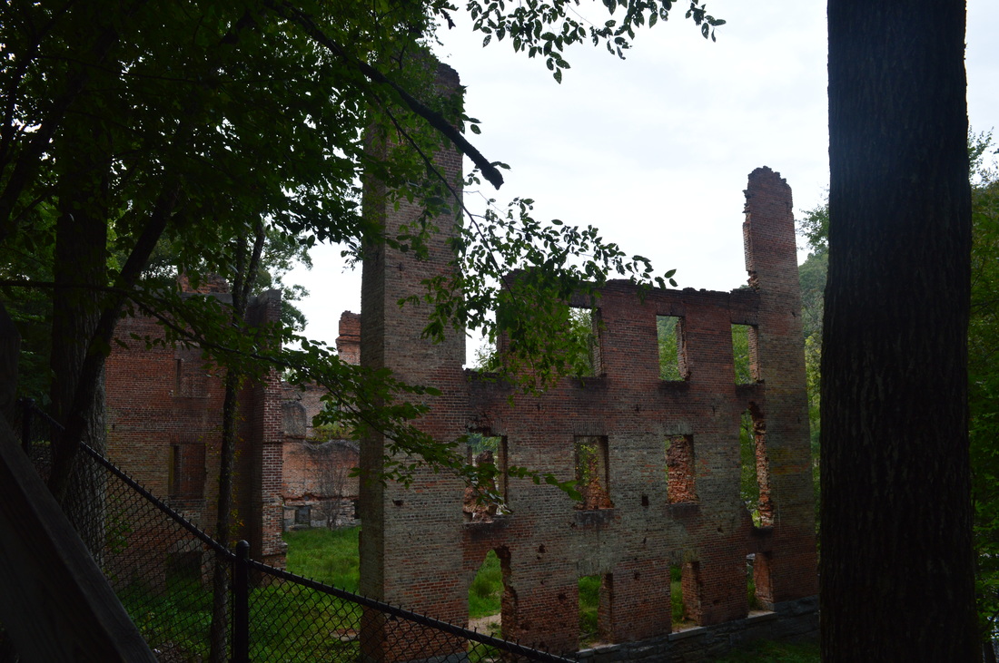
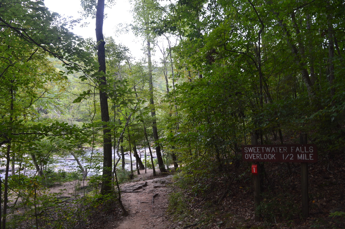
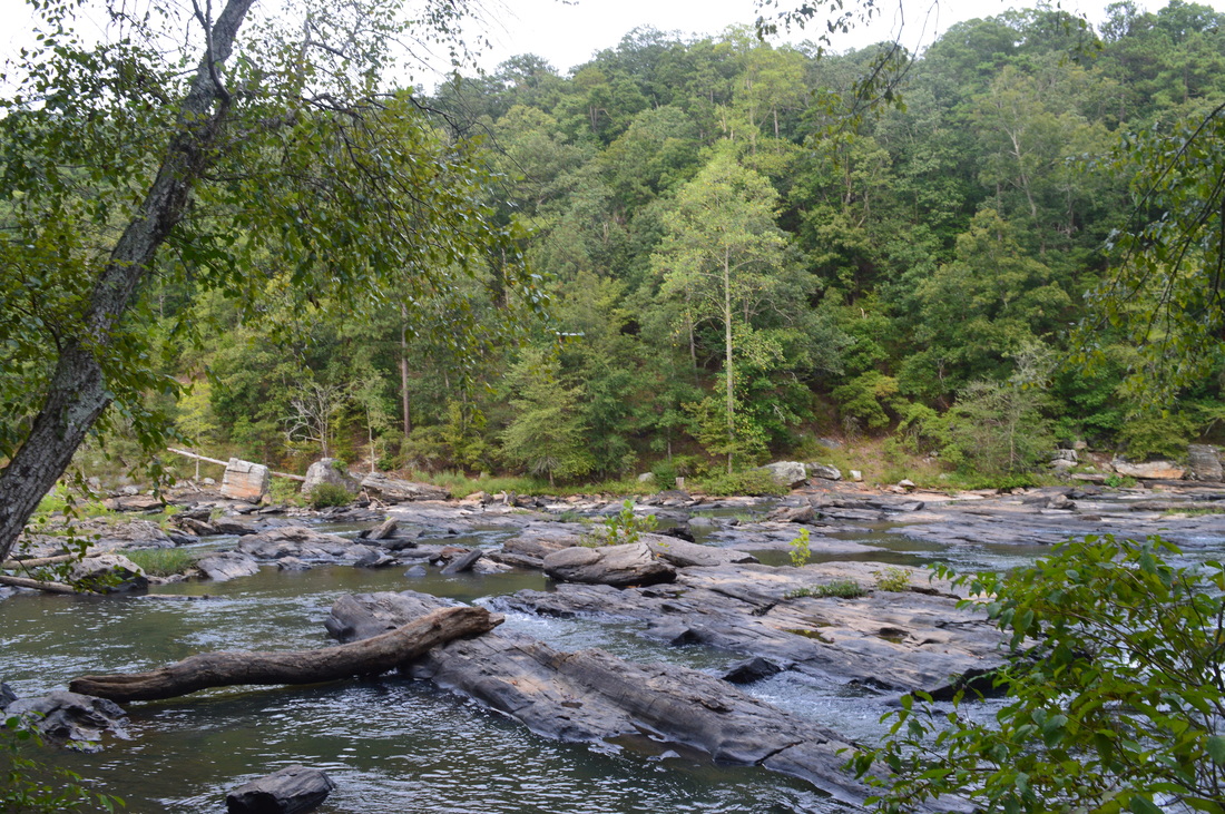
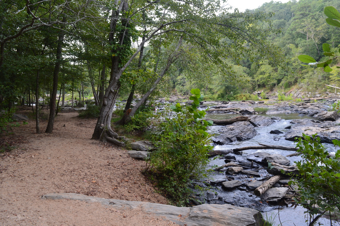
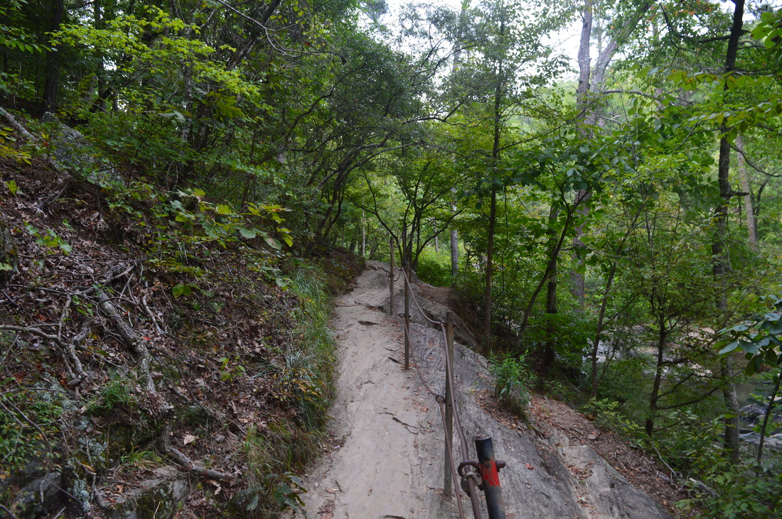
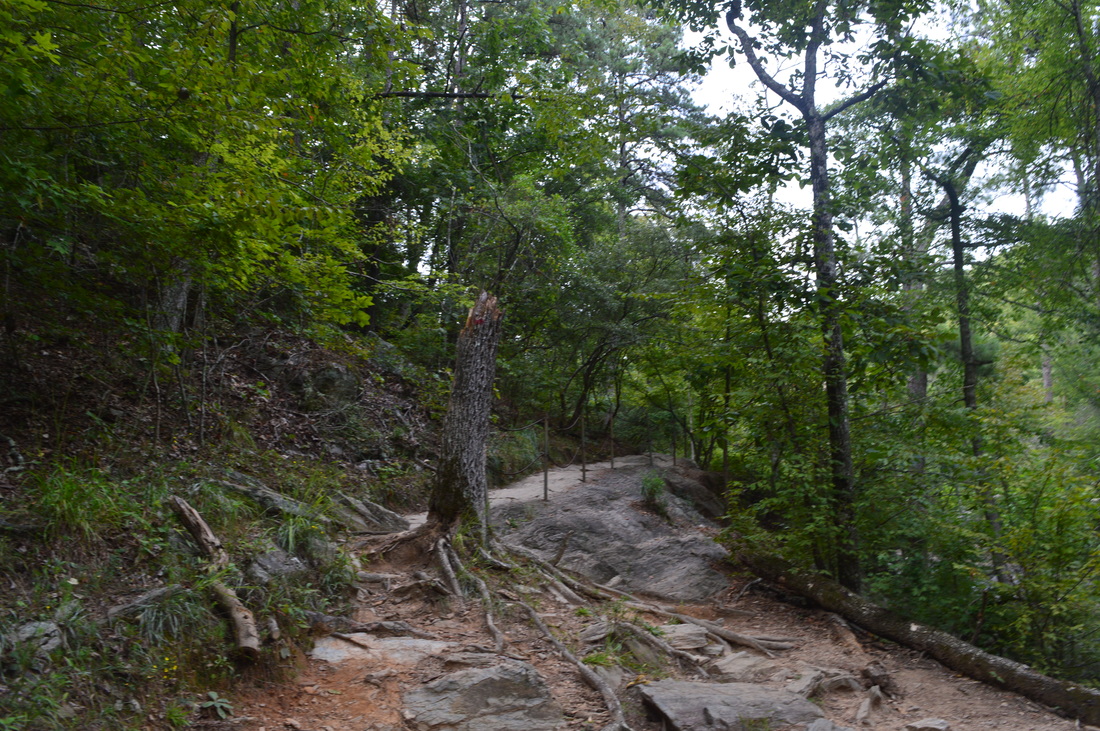
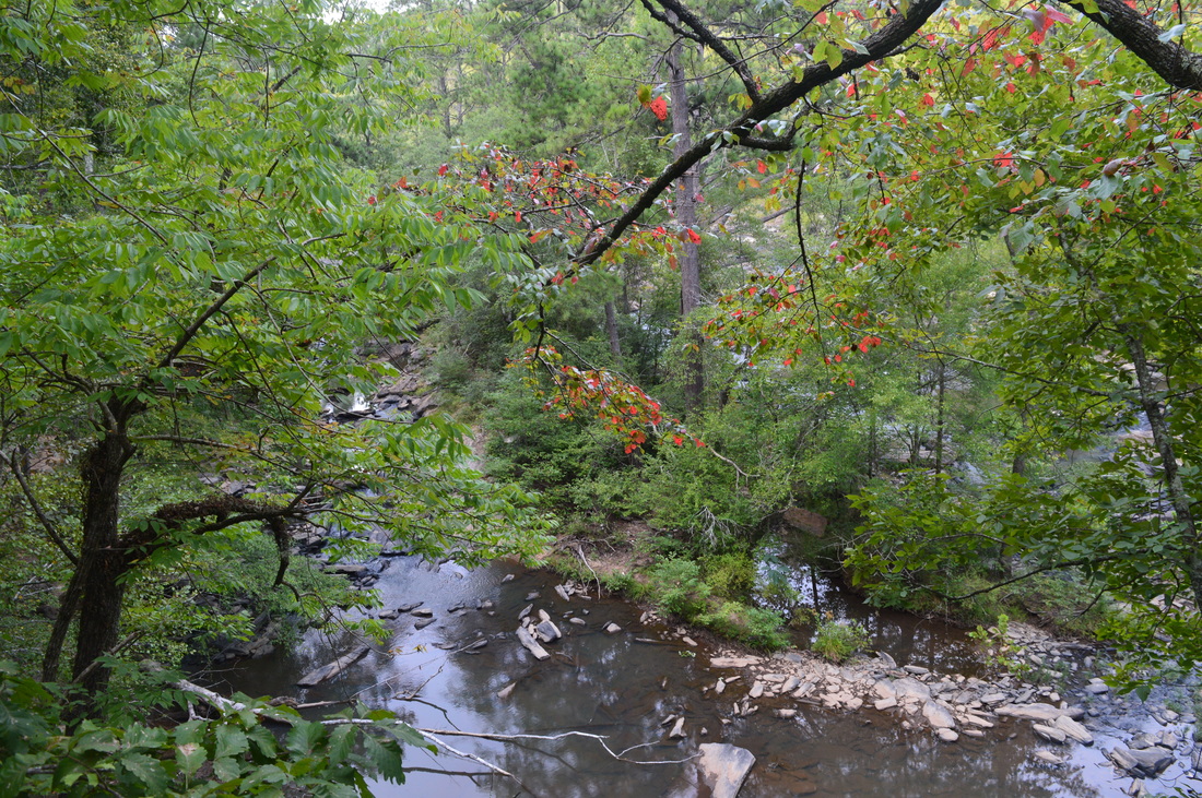
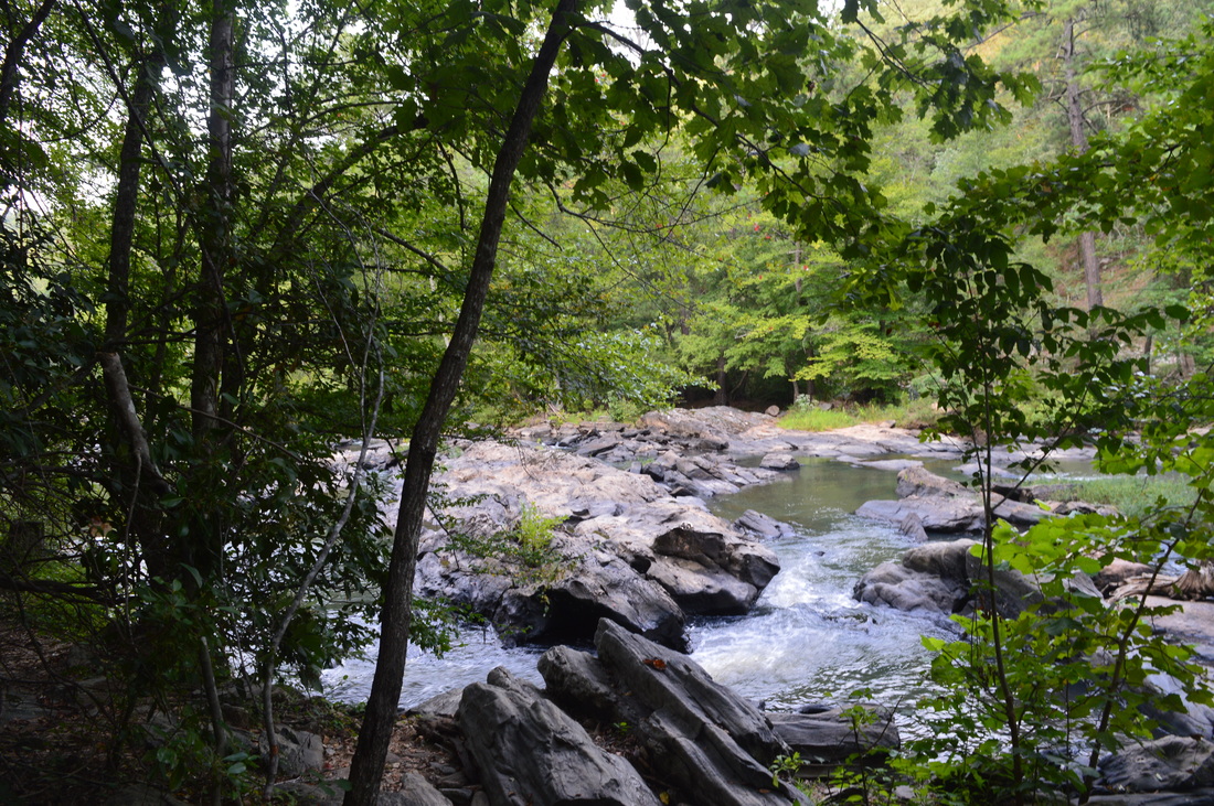
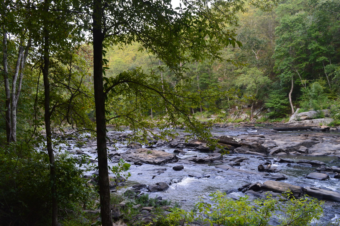
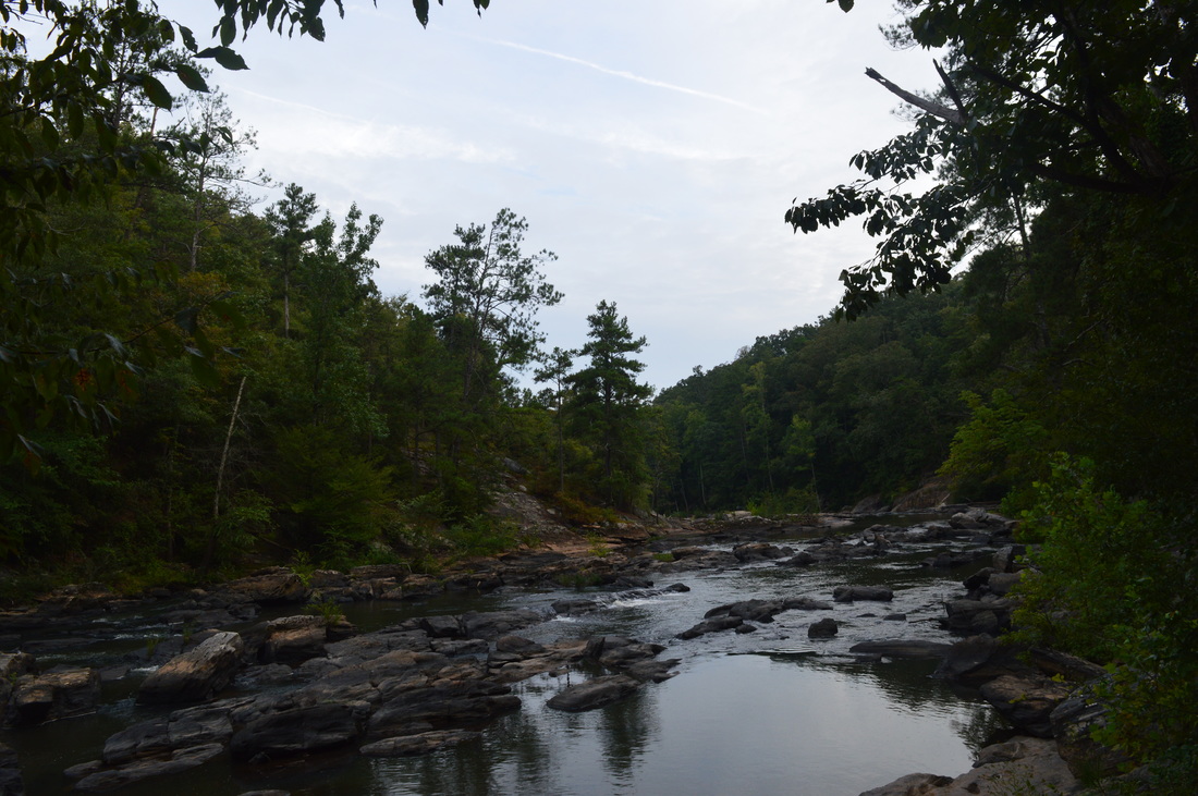
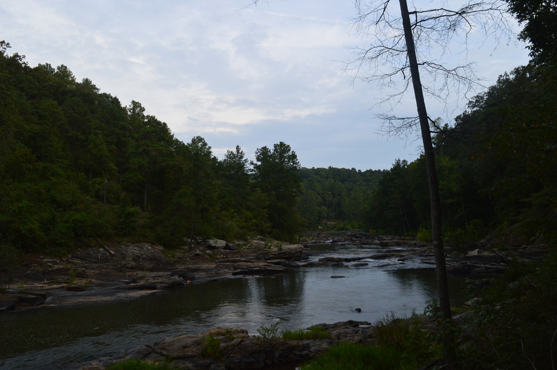
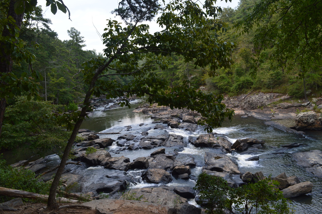
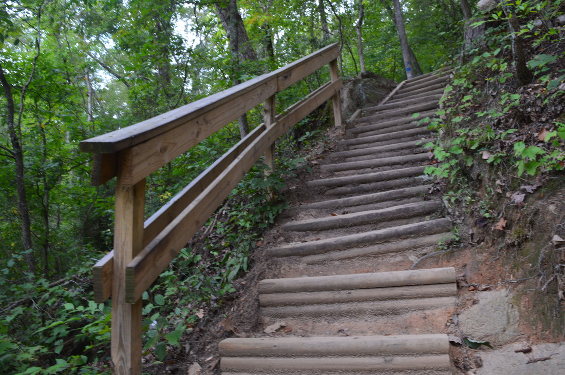
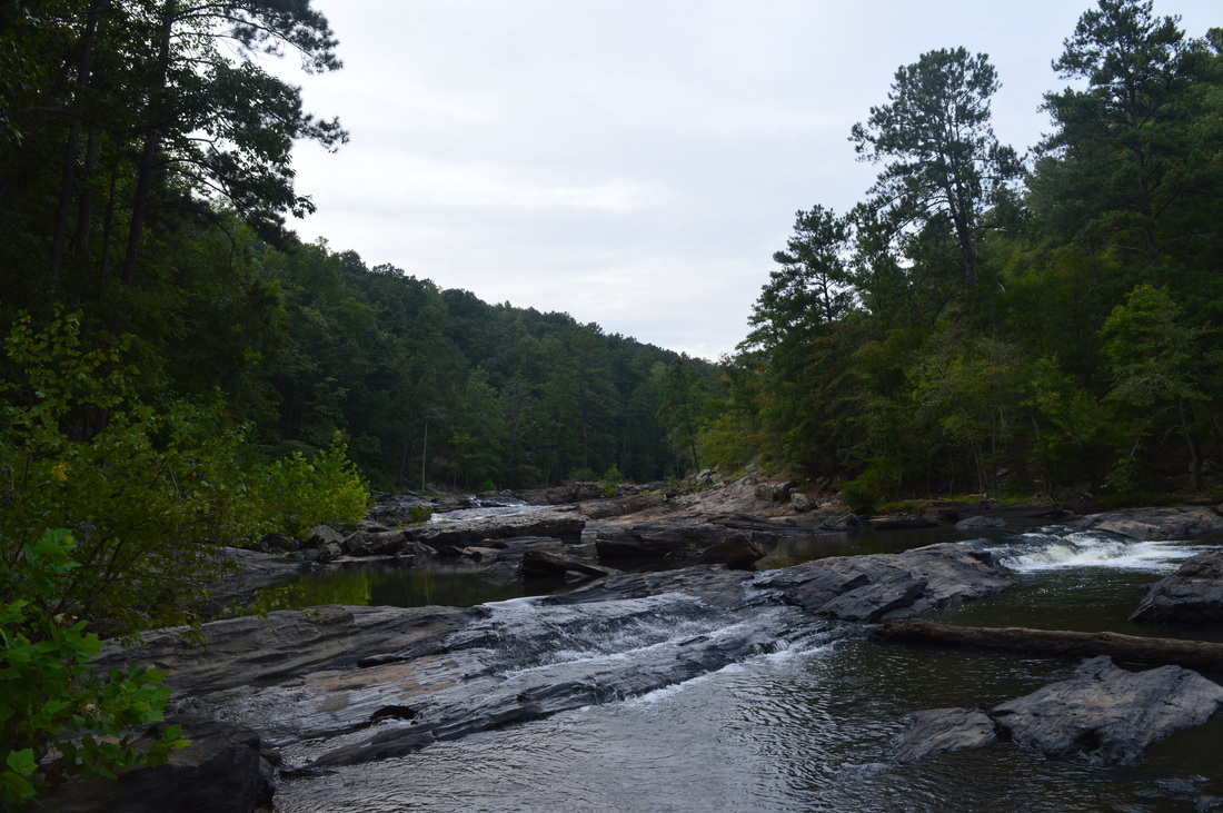
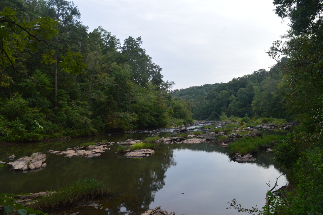
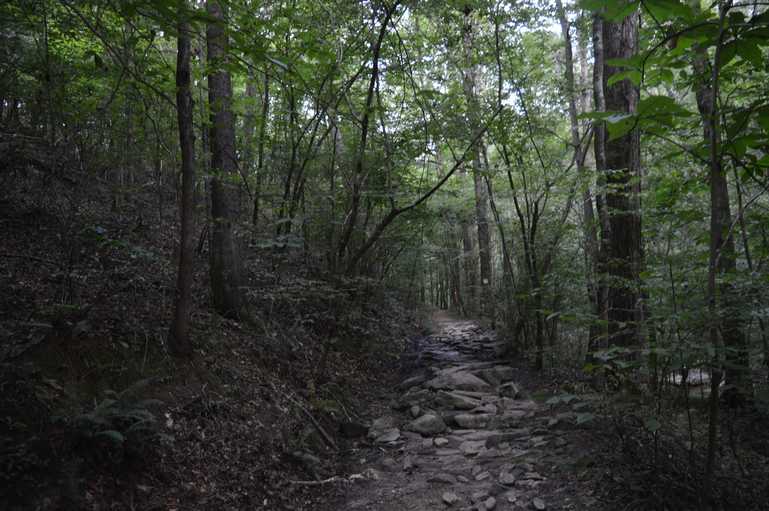
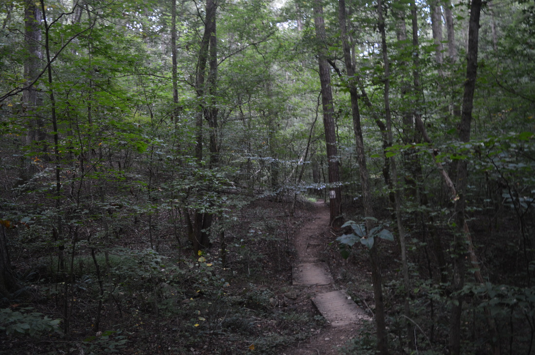
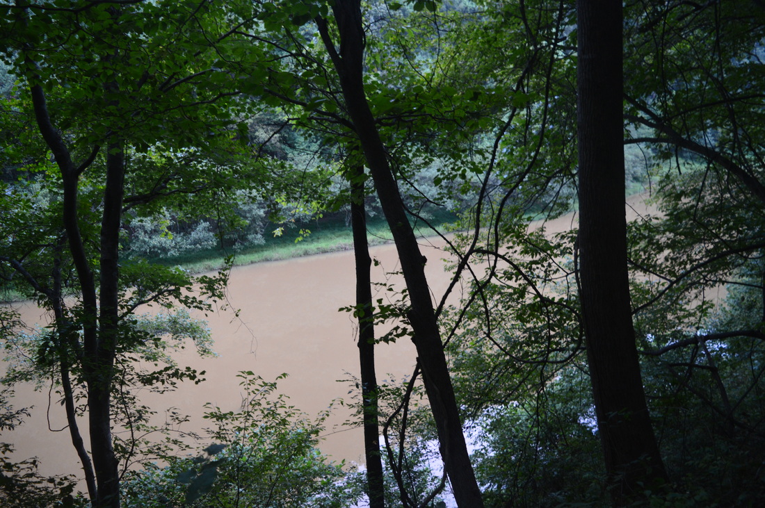
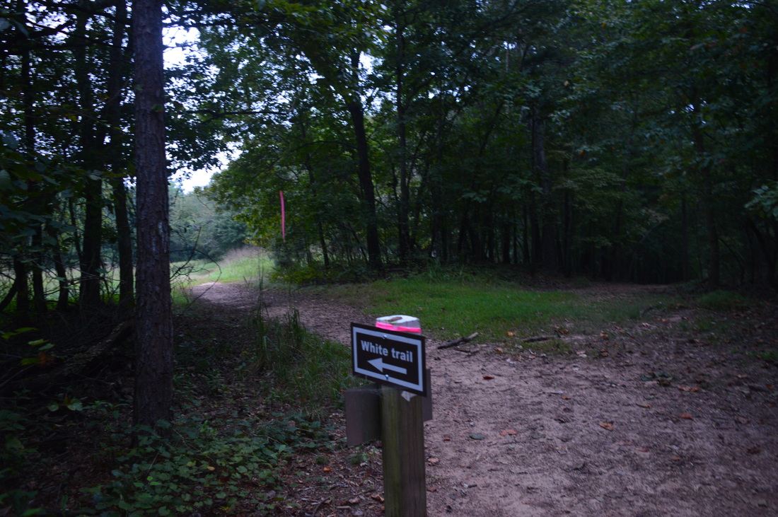
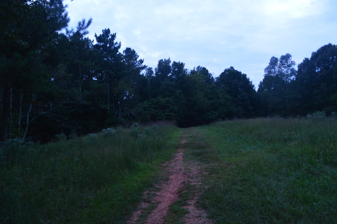
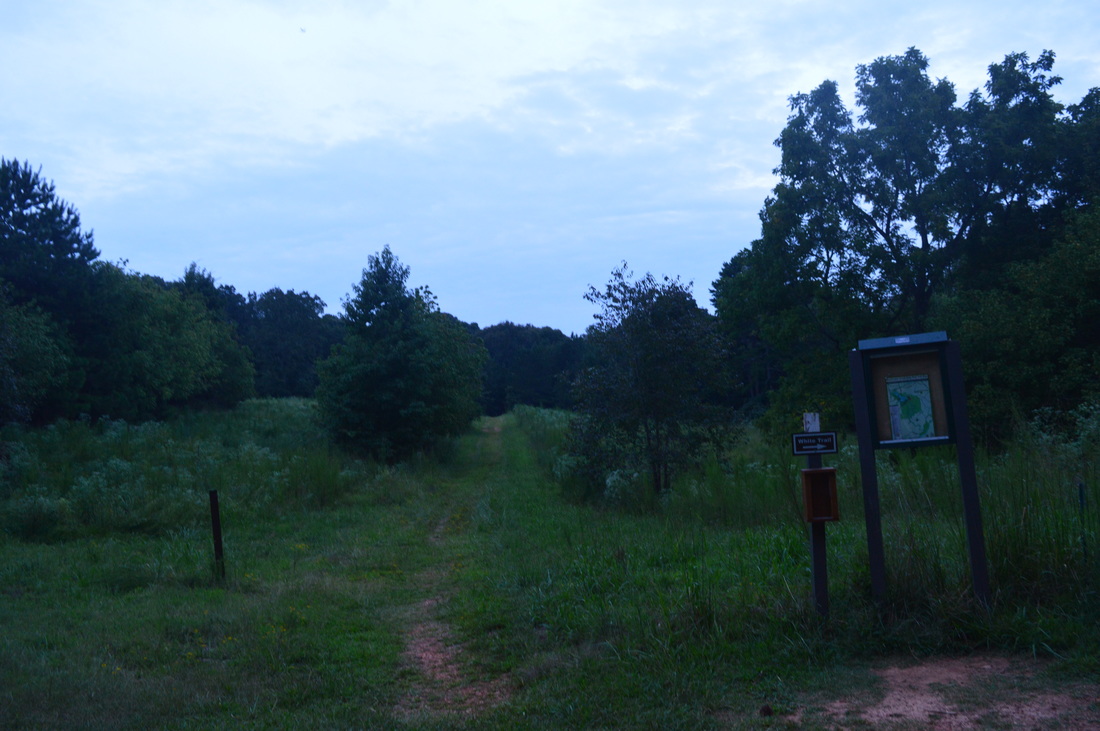
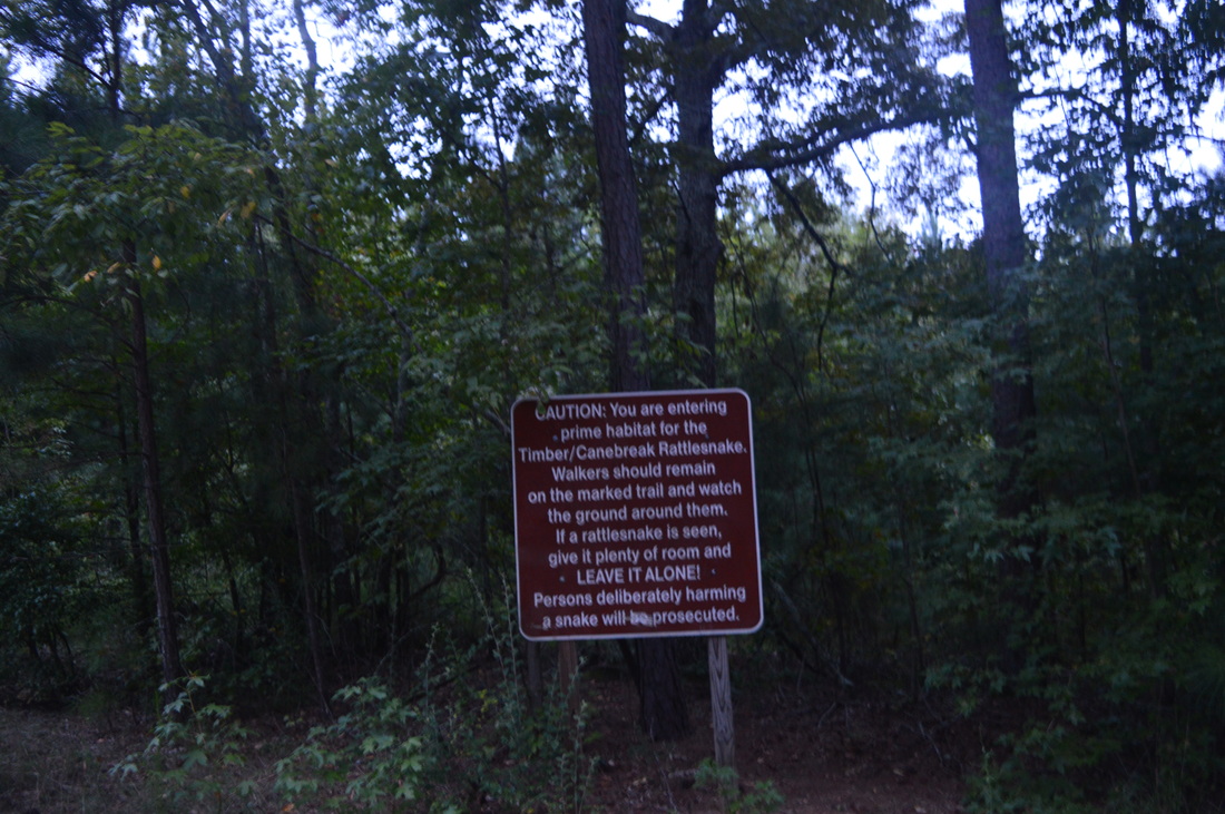
All of the park trails start at the visitor center. Walk down the paved path from the parking area. The Red Trail starts shortly on the left. Follow the Red Trail and its red blazes downhill to Sweetwater Creek. At 0.2 miles, reach Sweetwater Creek. An extension of the Red Trail that leads to the Yellow Trail goes left. The main Red Trail turns right along Sweetwater Creek. Turn right. The trail closely parallels Sweetwater Creek that is quite calm here. At 0.4 miles, a spur trail leads left to a small island in Sweetwater Creek. The rapids begin here, and there is a good view from the spur trail. But if you go here after significant rainfall - the sight will be 10 times more breathtaking. Following the spur trail, the White Trail briefly merges with the Red Trail from the right (if you take the White Trail to the right you will reach the Green Trail to Jack's Hill shortly). At 0.5 miles, reach the historic mill ruins, visible from the trail to the left. There is an observation deck with a view of the ruins as well as some information about them. The ruins are of the New Manchester Manufacturing Company, also known as the Sweetwater Manufacturing Company. The company was a five-story mill and a factory that produced cotton, yarn, and fabric. At the factory's peak, it produced 700 pounds of cotton per day. But in 1864, during the Civil War, the Union Army stormed the factory, arrested all employees, and ordered to shut it down. It was then burned - flammable substances were poured onto all 5 floors. Nowadways, all that remains from the mill are ruins of the walls. 

From the mill ruins, continue straight and then shortly turn left down a staircase to continue following the Red Trail. The White Trail leaves the Red trail here and continues farther above the creek. The Red Trail descends to the far end of the ruins and to creek level. Here, turn right onto a wide trail right along Sweetwater Creek. The next half-mile is quite rough as the slow trail constantly maneuvers between and over the numerous rocks and rock formations scattered along the creek. This part of the creek is full of rapids. There will be one long staircase that will take you above the creek just before "The Falls". At the top of the staircase is an observation deck with a view of Sweetwater Creek. Soon after that, at 1 mile, the trail reaches a rock outcrop with a view of "The Falls", a large area of turbulent rapids at a bend in Sweetwater Creek. On my first visit to this location nearly two years ago, the rapids at this location were one big froth of whitewater; on the second visit, just regular rapids. Shortly after the rock outcrop, climb up to the terminus of the Red Trail and the junction with the White Trail. If you turn right onto the White Trail, it will quickly take you back to the visitor center. However, to hike the full loop, turn left onto the White Trail. The White Trail descends back to Sweetwater Creek and continues to follow it for some time, but here, the trail is faster and the creek is calmer. There are some good long-distance views here down the creek, such as the one in the header photo for this post. At 1.7 miles, the trail reaches Jacks Branch, a tributary of Sweetwater Creek. Here, the White Trail turns right and leaves Sweetwater Creek. The rest of the hike is away from Sweetwater Creek.

The White Trail begins a gentle uphill along Jacks Branch. At 1.8 miles, reach a trail intersection. The new Brown Trail crosses the White Trail from right to left across a footbridge over Jacks Branch. Keep in mind that the Brown Trail to the left is a dead end; to the right, the trail is a shorter but steeper alternative for the White Trail to Jack's Hill. Continue on the White Trail. The trail continues to ascend gradually along Jacks Branch before scrambling onto a small dam at the eastern end of Jacks Lake at 2.3 miles. The small lake is more like a marsh, however. The trail turns right here and continues uphill at a slightly higher incline along an old road that at first parallels Jacks Lake, and then, veers away from Jacks Branch. After the trail leaves the Jacks Branch area, there is one final moderately steep uphill pitch and then you reach the top of Jacks Hill. At the top of Jacks Hill at 2.8 miles, there is a potentially confusing intersection with an assortment of old roads leading in various directions. The road to the right seems to dead-end somewhere shortly (according to my topographic map) at the site of one of the old structures that were located here (Jacks Hill was once a farming area). The road that continues straight ahead seems to lead to the Brown Trail. The White Trail turns left onto a different old road that leads into a field. At 3 miles, reach another confusing intersection (although on my more recent visit, both intersections had signs). The Brown Trail starts here and turns right. An old road with an unclear ending continues straight. The White Trail turns left. Then, the White Trail descends to a gap and then ascends to a small rise. At the top of the rise, an old road on the right is the start of the Green Trail that leads back to Sweetwater Creek. 

Continue straight on the White Trail past various old roads going left and right. At 3.3 miles, there is a fork in the road, with a road veering both left and right. The White Trail takes the left side. The right side is a dead-end road to what apparently is a staff residence. At the intersection, there is a sign about the trail entering a prime habitat for rattlesnakes. At another fork in the roads at 3.6 miles, keep right - straight ahead is an access to Mount Vernon Road. The trail continues to follow a mostly flat roadbed before reaching a paved park road at 4 miles. Cross the road and continue on a en easy downhill path. Recross the road at 4.3 miles and reach the visitor center at 4.4 miles. Follow the paved path straight ahead past the visitor center and shortly reach the parking area. 

Variations

Hike just the Red Trail out and back - 2 Miles
Hike the full trail system (Red Trail, White Trail, Brown Trail, Yellow Trail, and Orange Trail) - Exact mileage is unknown; I estimate that such a hike would be 12-14 miles long

Bonus Stops

Check out the George H. Sparks Reservoir on the north side of Sweetwater Creek State Park

Pictures

0 Comments


Leave a Reply.

    About Me

    Mark Oleg Ozboyd
    I'm an avid outdoor explorer and a hobbyist landscape photographer. I'm 21 years old and have been hiking since 2011. Originally based out of Atlanta, Georgia, I started out by occasionally hiking short trails throughout well-known Georgia State Parks. During 2012 and 2013, I began to expand my trips into adjacent states, as well as into the wilder National Forest areas rather than just State Parks. Throughout the years that followed, as I slowly ran out of popular hiking trails in my area, I began to search for and hike in more seldom-visited areas. Today, you can find me out in the woods every weekend, whether it's on an official trail or bushwhacking through cross-country terrain without any paths. I now attend Washington & Lee University and am exploring Virginia and West Virginia. My other hobbies include chess, science, old music, and meteorology. I have 3 years of amateur weather forecasting experience, having studied a lot of meteorology basics over the years. I am also a student at European School of Music where I learned that music and nature have a lot in common. Listening to good music inspires me to capture nature's beauty on the camera in different aspects that also make me recall many beautiful music pieces that I've heard.​


    Dear readers: I have invested a tremendous amount of time and effort in this website and the Georgia Waterfalls Database the past five years. All of the work that has gone in keeping these websites updated with my latest trip reports has almost been like a full-time job. This has not allowed me to pick up a paid job to save up money for college, and therefore, I I've had to take out loans. If you find the information on this website interesting, helpful, or time-saving, you can say "thanks" and help me out by clicking the button above and making a contribution. I will be very grateful for any amount of support you give, as all of it will apply toward my college tuition. Thank you! 

    Enter your email address to subscribe for trail reports:

    Delivered by FeedBurner


    Picture
    Coming in 2022-2023?

    Other Hiking Websites

    DWHike's Adventures
    Florida's Natural Wonders
    Florida Trailblazer
    Meanderthals
    Mountain Images
    by Bernie Boyer

    North Carolina Waterfalls with
    ​Kevin Adams
    Take-a-Hike!
    Tennessee Landforms
    Waterfall Page
    Waterfall Adventurer
    Zach's Mild Adventures

    Miles Hiked

    Year 1: 540.0 Miles
    Year 2: 552.3 Miles
    ​Year 3: 518.4 Miles
    Year 4: 482.4 Miles
    Year 5: 259.9 Miles

    Archives

    March 2021
    February 2021
    January 2021
    November 2019
    October 2019
    September 2019
    August 2019
    July 2019
    June 2019
    February 2019
    January 2019
    December 2018
    November 2018
    October 2018
    August 2018
    July 2018
    June 2018
    May 2018
    April 2018
    March 2018
    February 2018
    January 2018
    December 2017
    November 2017
    October 2017
    September 2017
    August 2017
    July 2017
    June 2017
    May 2017
    April 2017
    March 2017
    February 2017
    January 2017
    December 2016
    November 2016
    October 2016
    September 2016
    August 2016
    June 2016
    May 2016
    April 2016
    March 2016
    January 2016
    December 2015
    November 2015
    October 2015
    September 2015
    August 2015
    July 2015
    June 2015
    May 2015
    April 2015
    March 2015
    February 2015
    January 2015
    December 2014
    November 2014
    October 2014
    September 2014
    August 2014
    July 2014
    June 2014
    May 2014
    April 2014
    March 2014
    February 2014

    Categories

    All
    Adel
    Adirondack Park
    Alabama
    Alfred A. Ring Park
    Allegheny Trail
    Amicalola Falls State Park
    Anniston Area
    Apalachicola Bluffs And Ravines Preserve
    Apalachicola National Forest
    Apalachicola/Port St. Joe Area
    Apopka
    Appalachian Trail
    Appling
    Art Loeb Trail
    Aska Trail System
    Bakersville
    Balm-Boyette Scrub Preserve
    Balsam Lake Recreation Area
    Bankhead National Forest
    Bartow County Parks
    Bartram Trail
    Basinger
    Beersheba Springs
    Benton
    Benton Mackaye Trail
    Berry College Trail System
    Best Hike
    Big South Fork National Recreation Area
    Black Bear Wilderness
    Black Rock Mountain State Park
    Blairsville
    Blakely
    Blood Mountain Wilderness
    Blowing Rock
    Blue Ridge
    Blue Ridge Parkway
    Boone
    Bradenton
    Bradenton Beach
    Brasstown Bald
    Brasstown Wilderness
    Brevard
    Bryson City
    Buchanan
    Bucks Pocket State Park
    Bulow Creek State Park
    Bulow Plantation Ruins State Park
    Caesars Head State Park
    Caladesi Island State Park
    Calhoun
    Camel's Hump State Park
    Cashiers
    Caspersen Beach Park
    Catfish Creek State Park
    Caves
    CC Putnam State Forest
    Cedar Point Environmental Park
    Chatsworth
    Chattahoochee National Forest
    Chattanooga
    Chattanooga Valley
    Chattooga National Wild And Scenic River
    Cheaha Wilderness
    Cherohala Skyway
    Cherokee
    Cherokee National Forest
    Chiefland Area
    Chillhowee Recreation Area
    Chipley
    Chunky Gal Trail
    Circle B Bar Reserve
    Citico Creek Wilderness
    Citrus Wildlife Management Area
    Clarkesville
    Clayton
    Cleevland
    Cleveland
    Cloudland Canyon State Park
    Cohutta Wilderness
    Collier-Seminole State Park
    Cordele
    Cornelia
    Covington
    Crestview Area
    Crew-land-and-water-trust
    Cullowhee
    Cumberland Trail
    Dahlonega
    Dalton
    Dawson Forest Wildlife Management Area
    Dawsonville
    Dayton
    De Soto National Memorial
    DeSoto State Park
    Dillard
    Double Springs
    Ducktown
    Duncan Ridge Trail
    Dunlap
    Eagle's Rest Park
    Eastpoint
    Econfina Creek Wildife Management Area
    Eglin Air Force Base
    Elizabethton
    Elkins
    Elk Knob Game Lands
    Elk Park
    Ellicott Rock Wilderness
    Ellijay
    Emerson Point Preserve
    Englewood Area
    Enota Retreat
    Erwin
    Falling Waters State Park
    Fayetteville
    Fires Creek Recreation Area
    Fire Tower
    Flint River
    Florence Area
    Florida
    Florida Caverns State Park
    Florida Trail
    Foothills Trail
    Fort Mountain State Park
    Fort Myers Area
    Fort Payne
    Fort Payne Area
    Fort Yargo State Park
    Franklin
    Franklin Delano Roosevelt State Park
    Franklin-Marion State Forest
    Frozen Head State Park
    Gainesville
    Gainesville Area
    Gatlinburg
    George Washington National Forest
    Georgia
    Georgia Veterans Memorial State Park
    Glasgow
    Gorges State Park
    Grandfather Mountain State Park
    Great Smoky Mountains National Park
    Greeneville
    Green River Game Lands
    Gruetli-Laager
    Grundy Forest State Natural Area
    GTM Reserve
    Guana River Wildlife Management Area
    Hayesville
    Helen
    Hiawassee
    High Falls State Park
    Highlands
    Highlands Scenic Highway
    Hillsborough River State Park
    Hinson Conservation & Recreation Area
    Historic Sites
    Honeymoon Island State Park
    Hot Springs
    Huntington
    Inverness Area
    Jackson
    Jasper
    Jefferson National Forest
    Joan M. Durante Park
    Jonathan Dickinson State Park
    Jones Gap State Park
    Joyce Kilmer Slickrock Wilderness
    Joyce Kilmer - Slickrock Wilderness
    Juniper Prairie Wilderness
    Kelly Park
    Keown Falls Recreation Area
    Kolomoki Mounds State Park
    LaFayette
    Lake City Area
    Lake George Wild Forest
    Lake June-in-Winter State Park
    Lakeland Area
    Lake Placid
    Lake Russell Wildlife Management Area
    Lake Wales Ridge State Forest
    Laurel Fork North Wilderness
    Leffis Key Preserve
    Leon Sinks Geological Area
    Lexington
    Lineville
    Linville
    Linville Gorge Wilderness
    Lithia Springs
    Little Frog Wilderness
    Little Manatee River State Park
    Little River Canyon National Preserve
    Longboat Key
    Long Trail
    Lookout Mountain
    Lookout Mountain Battlefield
    Lovingston
    Lula Lake Land Trust
    Lumpkin
    Maggie Valley
    Manatee Springs State Park
    Marianna Area
    Mark Trail Wilderness
    Marlinton
    Mccaysville
    McMinville
    Mentone
    Middlesex
    Mistletoe State Park
    Monongahela National Forest
    Montreat
    Mountain Bridge Wilderness Area
    Mountain City
    Mountains To Sea Trail
    Mountains-to-Sea Trail
    Mount Rogers National Recreation Area
    Myakka River State Park
    Myron B. Hodge City Park
    Nantahala National Forest
    Naples
    Naples Area
    Natural Bridge State Park
    Neal Preserve
    New Castle
    Newport
    New River Gorge National Park
    New York
    North Carolina
    Ocala Area
    Ocala National Forest
    Ocean-to-Lake Trail
    Oconee State Park
    Oconee Station Historic Site
    Okaloacoochee Slough State Forest
    Oldsmar
    Oneida
    Orlando Area
    Ormond Beach
    Oscar Scherer State Park
    Oxford
    Palatka
    Palmetto Trail
    Panama City Area
    Panthertown Valley
    Parrish
    Paynes Creek Historic State Park
    Peaks Of Otter Recreation Area
    Pigeon Crockford Mountain Wildlife Management Area
    Pigeon-Crockford Mountain Wildlife Management Area
    Pigeon-Crockford Wildlife Management Area
    Pine Mountain
    Pinhoti Trail
    Pinnacle Park
    Pisgah Civitan Park
    Pisgah National Forest
    Pittman Center
    Pond Mountain Wilderness
    Ponds/Lakes
    Prentice Cooper State Forest
    Providence Canyon State Park
    Pumpkintown
    Quick Point Nature Preserve
    Raven Cliffs Wilderness
    Reed Bingham State Park
    Reliance
    Rice Creek Conservation Area
    Riverview Pointe Preserve
    Robbinsville
    Robinson Preserve
    Rock Creek Gorge Scenic Area
    Rock Island State Park
    Rome
    Rosman
    Sale Creek
    Salem
    Salt Springs
    Saluda
    Santa Rosa Beach
    Sarasota
    Sarasota Area
    Savage Gulf State Natural Area
    Scenic Views
    Scottsboro Area
    Sebring Area
    Sewanee
    Sheltowee Trace Trail
    Shining Rock Wilderness
    Signal Mountain
    Sipsey Wilderness
    Sky Valley
    Smithgall Woods State Park
    Snowbird Backcountry Area
    Soddy Daisy
    Soddy-Daisy
    Sopchoppy
    South Carolina
    South Cumberland State Park
    Southeastern Cave Conservancy
    Southern Nantahala Wilderness
    Sparta
    Sprewell Bluff Park
    Spring City
    Spring Hill
    Springs
    Spruce Pine
    Standing Indian Backcountry Area
    St. Augustine
    St. George Island State Park
    St. Joseph Bay State Buffer Preserve
    St. Marks Area
    St. Marks National Wildlife Refuge
    Stone Mountain
    Stone Mountain Park
    Suches
    Sumatra
    Sumter National Forest
    Suwannee River
    Swallow Creek Wildlife Management Area
    Sweetwater Creek State Park
    Sylva
    Talladega National Forest
    Tallahassee Area
    Tallulah Falls
    Tallulah Gorge State Park
    Tampa Bay Area
    Tate City
    Tate's Hell State Forest
    Tea Creek Wildlife Management Area
    Tellico Plains
    Tennessee
    Thomaston
    Toccoa
    Topsail Hill State Park
    Torreya State Park
    Townsend
    Tracy City
    Tray Mountain Wilderness
    Trenton
    Triple Creek Preserve
    Troutdale
    Unaka Mountain Wilderness
    Upper Tampa Bay County Park
    Venice
    Vermont
    Virgin Falls State Natural Area
    Virginia
    Virginia Outdoors Foundation
    Vogel State Park
    Wakulla Springs State Park
    Waleska
    Walhalla
    Wartburg
    Water Features
    Waynesville
    Weedon Island Preserve
    Weeki Wachee Preserve
    Wekiwa Springs State Park
    West Palm Beach Area
    West Virginia
    Whitehall
    White Springs
    Winder
    Withlacoochee State Forest
    Young Harris

    RSS Feed

TRAIL REPORTS

Hikes in Alabama
​Hikes in Florida
Hikes in Georgia
Hikes in North Carolina
Hikes in South Carolina
Hikes in Tennessee
Hikes in Virginia

Hiking Resources

Alabama Resources
​
Florida Resources
Georgia Resources
North Carolina Resources
​South Carolina Resources
​
Tennessee Resources

Other

Contact
Map of Hikes
Alphabetical List of Hikes
Southeast Nature Society
© COPYRIGHT 2014-2018
​ALL RIGHTS RESERVED.
Important: I disclaim any responsibility for any damage or personal injury that may occur as a result of the activities and information found on this website. All outdoor activities, especially off-trail hiking, are done at your own risk. Never hike or head into that area that may be above your fitness or experience level.
  • Home
  • Trail Reports
    • Best Hikes
    • Hikes with Scenic Views
    • Hikes with Water Features
    • Alabama
    • Georgia
    • Florida
    • North Carolina
    • South Carolina
    • Tennessee
    • Vermont
    • Virginia
  • Map
  • Hike List
  • Testimonials
  • Resources
  • Contact Us
  • Southeast Nature Society
    • Our Team
  • Georgia Waterfalls Database