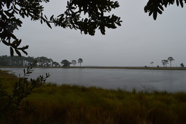
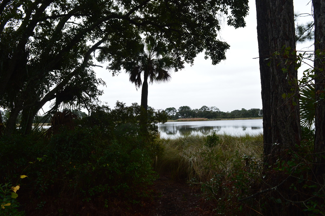
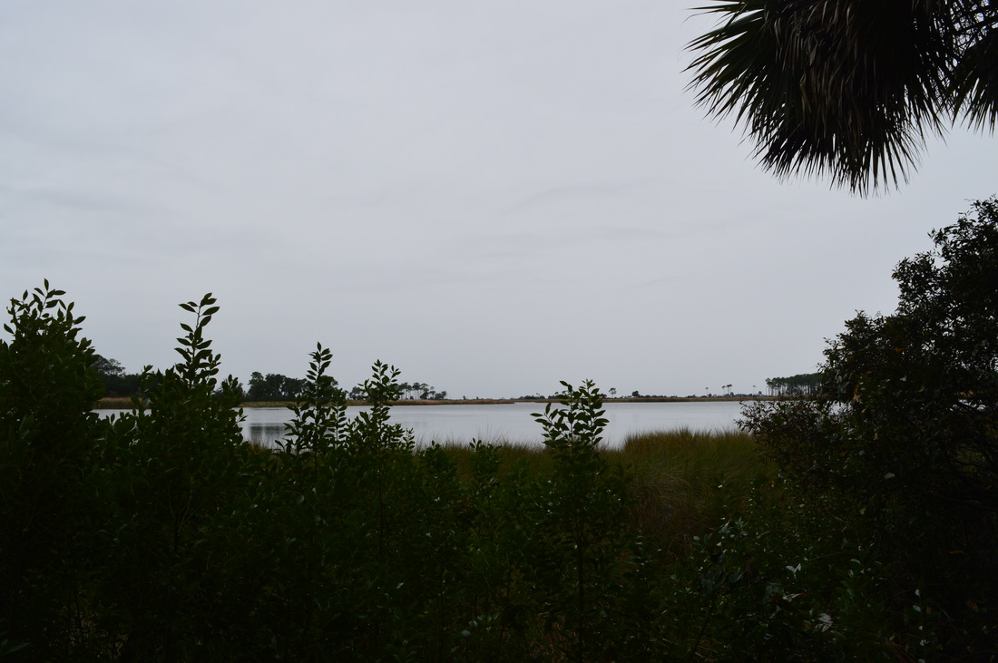
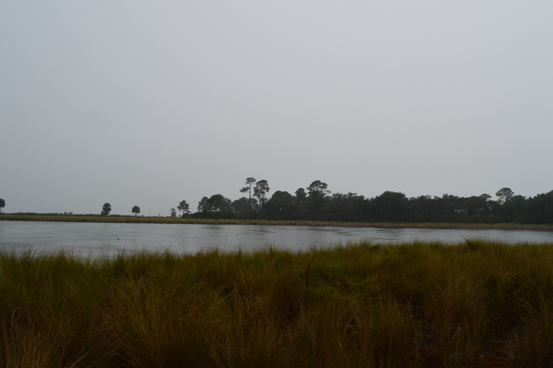
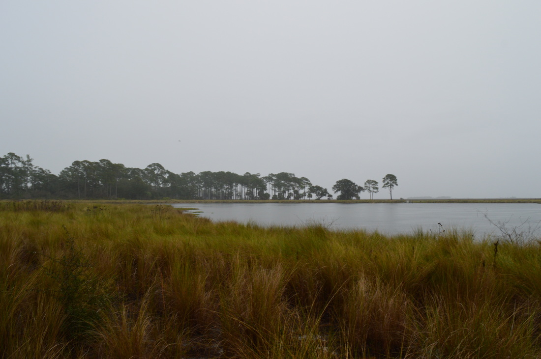
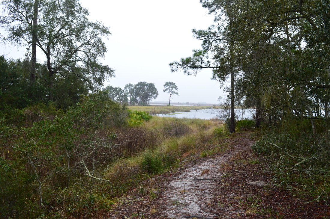
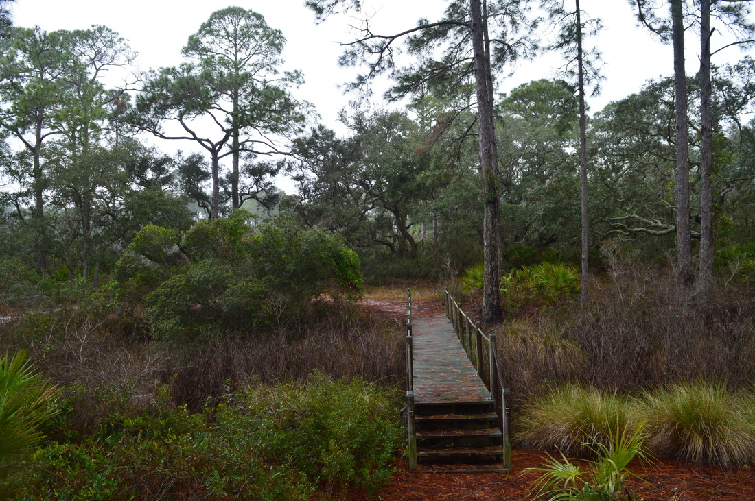
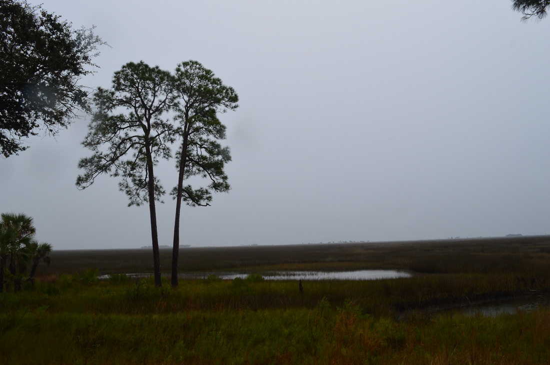
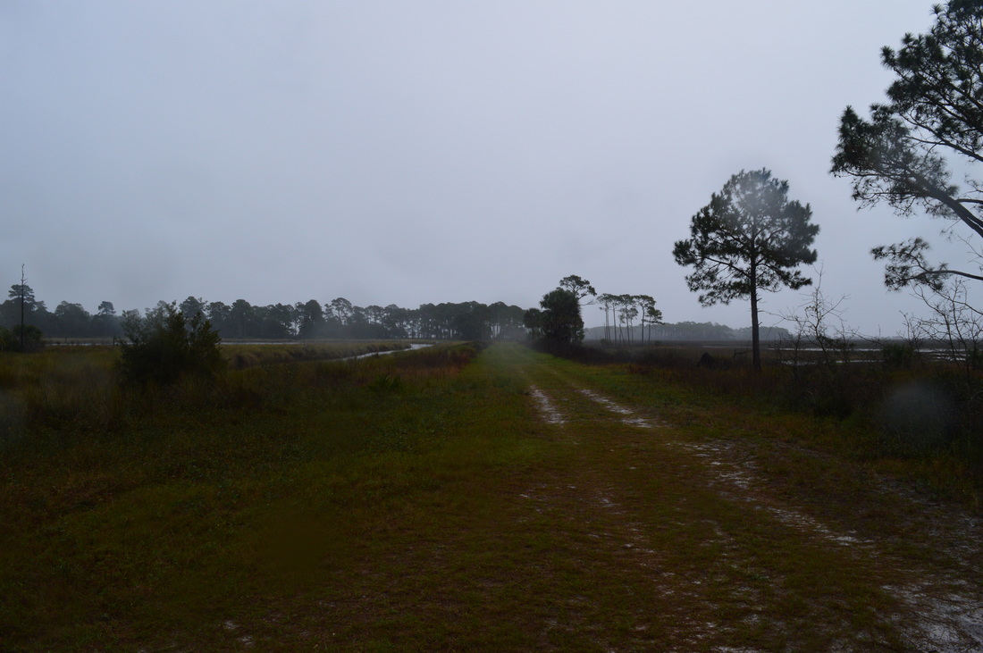
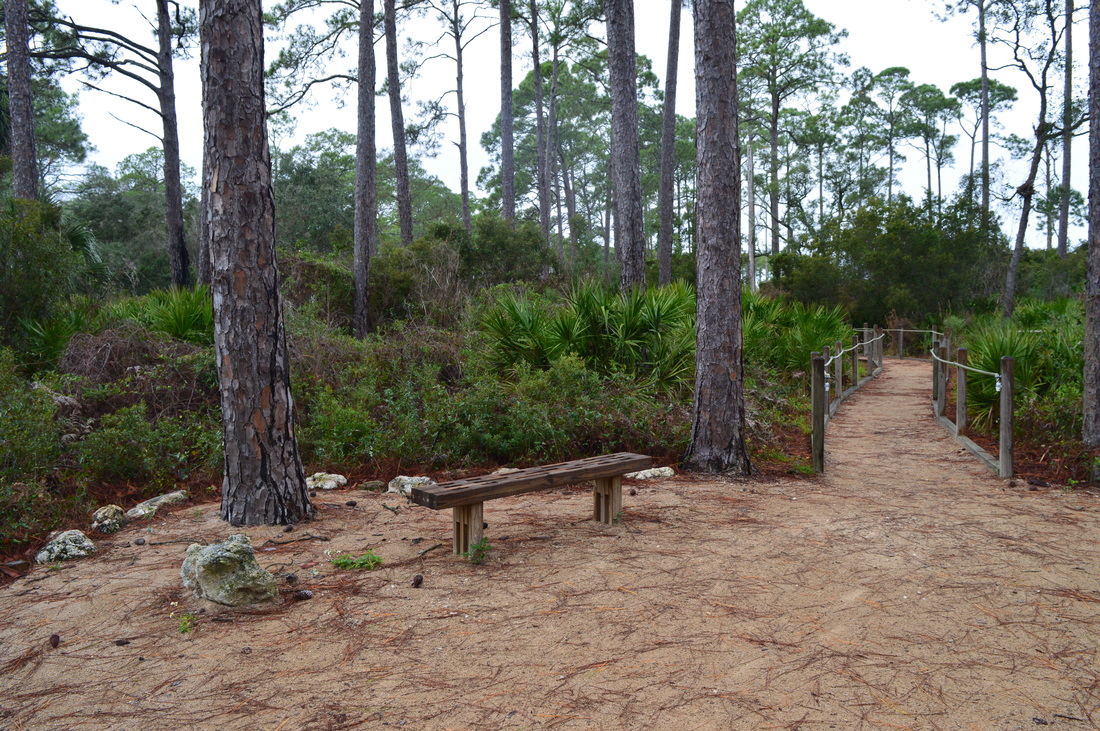
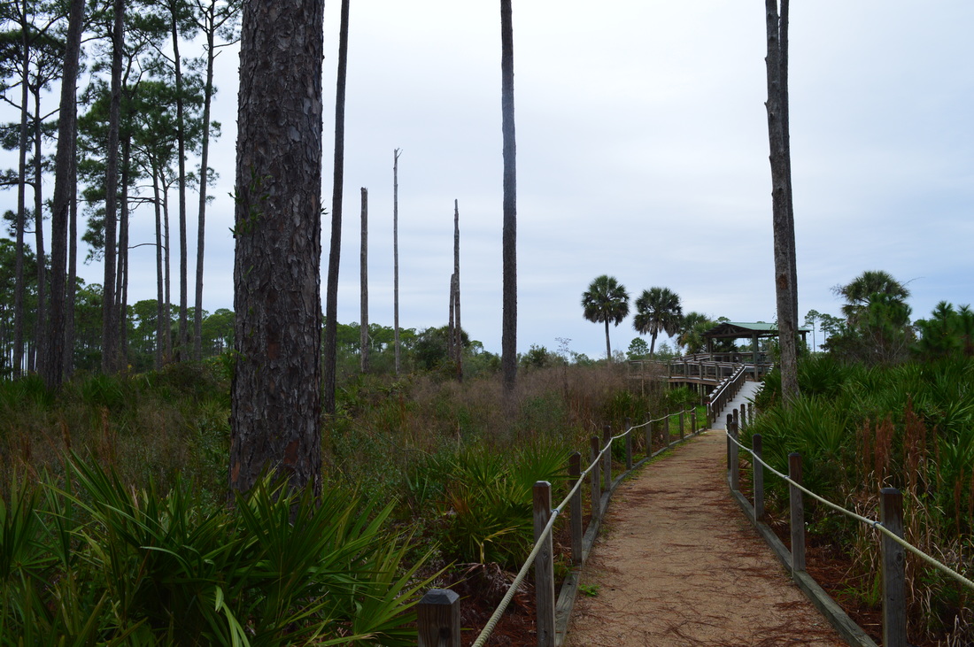
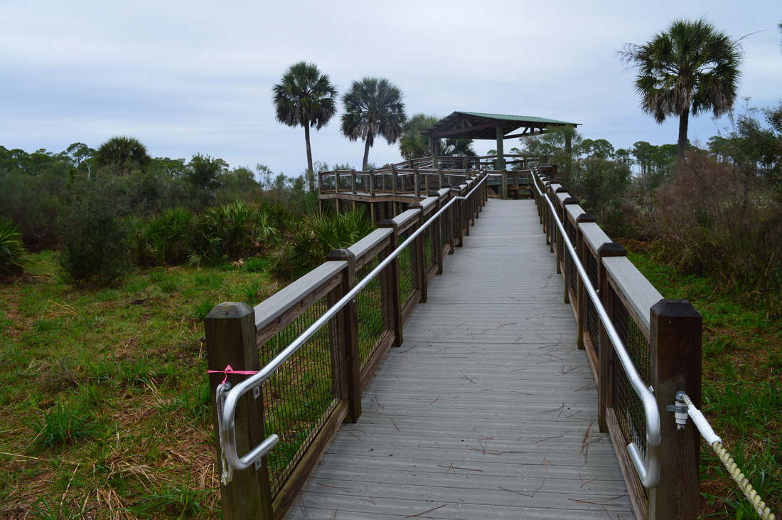
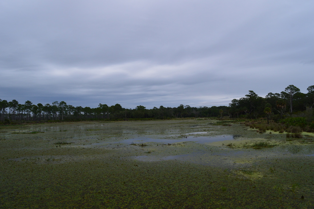
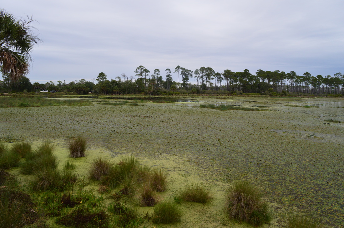
 Tower Pond and Headquarters Pond are two small ponds in the southern section of the St. Marks Unit of St. Marks NWR. Two nature trails visit these ponds. On the Tower Pond Nature Trail, you will visit an old fire tower before circling Tower Pond via a number of paths and forest roads. You will also see some salt marshes. Along the way, don't miss the photo blind for great birding opportunities. On the shorter Headquarters Pond Trail, which leaves the same trailhead, you will take a quick walk to an observation platform overlooking Headquarters Pond, a small body of water full of lily pads. If you're lucky, you might even spot an alligator. This hike occurred on Friday, January 1st, 2016. My plan was to hike five nature trails at St. Marks National Wildlife Refuge on this day, as well as one of the primitive trails. These two trails were my second stop of the day, after the Plum Orchard Nature Trail. I planned to hike the Tower Pond Trail clockwise, and then, I would hike the Headquarters Pond Trail out and back. Tower Pond Nature TrailSummaryR/T Length of Trail: 1.3 Miles Duration of Hike: 0:40 Type of Hike: Loop Difficulty Rating: 1 out of 10 Total Elevation Gain: Minimal Pros: Very nice views of Tower Pond and salt marshes; photo blind is convenient for wildlife photography Cons: None Points of Interest: Old fire tower; photo blind; views of Tower Pond Trail Blaze Color(s): None Best Season(s) to Hike: Year-round Fees: As of 1/1/16, the fees for entry to the St. Marks Unit of the St. Marks NWR are $5 per car or motorcycle, and $1 per bicycle or pedestrian. There is also an annual pass that costs $25. Please note that entry to all other units of the St. Marks Unit (Panacea, Wakulla, and Aucilla Units) is free. Beginning Point: Tower Pond/Headquarters Pond Trailhead Directions: From Newport, FL: Take Lighthouse Road (County Road 59) southward from US Route 98 just east of the bridge over the St. Marks River. Please note that Lighthouse Road is a dead-end road that only serves the St. Marks Unit of St. Marks NWR. 3.3 miles from US 98, you will reach a fee booth upon entry into the St. Marks NWR. If there is no attendant here, continue straight. In another 0.3 miles, reach a fee station to the right of the road. Pay here. From the fee station, continue for another 5.3 miles on Lighthouse Road. Then, turn left into the parking area for Tower Pond Nature Trail and Headquarters Pond Nature Trail. MapA map and some other information regarding this hike can be viewed here. DetailsTwo nature trails leave the parking area: Tower Pond Nature Trail and Headquarters Pond Nature Trail. Tower Pond Nature Trail is the one on the right side of the parking. I must say that this trail was considerably more interesting than the first one, although if you visit here, I suggest you do them all. The trail heads down a well-defined corridor. At 0.05 miles, reach a pond... but not Tower Pond. This is Picnic Pond. Turn left here and parallel Picnic Pond to continue hiking on the trail. At 0.15 miles, reach the start of the loop. Turn left here to hike the loop clockwise. The trail ascends up a small hill - and it is here where a fire tower stands. The fire tower is off limits to the public, and it is surrounded by a fence. Continue straight across the clearing, ignoring the paths heading in different directions. The path drops down into flatwoods near Tower Pond, and the trail stays wide and easy to follow. At 0.35 miles, reach a spur trail marked "Photo Blind". This was the first time ever that I've seen such a term. Curious, I turned right onto the spur trail. At 0.4 miles, the short spur trail ended at your first view of Tower Pond. Here, a weird structure stands at the shore. This is a "photo blind", a small booth where you can set up your tripod and wait for the perfect moment to take a picture - perhaps, some wildlife photography, as this is a good birding spot. On this day, it proved to be quite useful - but for a different reason. As soon as I started to hike the Tower Pond Trail, it started to rain, and while the rain wasn't very heavy, it was very annoying. There was a constant strong cold wind present together with light but consistent wind-blown rain. In this weather, taking pictures was nothing but easy, and this shelter gave me an opportunity to take good-quality pictures of Tower Pond, without raindrops blown onto my lens. From the photo blind, return to the main trail and continue following the loop. Signs mark most major junctions with old roads. At 0.5 miles, keep right onto an old road and shortly afterwards, keep right again onto a trail off the road. You will see some views of Tower Pond through the trees. At 0.7 miles, the trail descends into a ravine and causes a marshy stream via footbridge. This stream seems to connect Mounds Pool and Tower Pool. Climb over another hill, and turn right onto a forest road at 0.75 miles. This is my favorite section of the hike. The trail now follows a levee with Tower Pond to your right and and an endless expanse of salt marshes to your left. To your right across Tower Pond, you will spot the fire tower you visited at the beginning. Cross the levee, and at the end of Tower Pond at 1 mile, turn right onto another forest road. Cross a culverted stream, and reach the end of the loop at 1.2 miles. From here, you can retrace your steps to the trailhead, or turn left at the old fire tower, and follow the forest road to the trailhead. You will come out at the restrooms at the parking area, for a total of 1.3 miles. VariationsHike out and back to the Photo Blind - 0.8 Miles Bonus StopsThere is a number of other nature trails, as well as two primitive trails, located on Lighthouse Road. These are all good to add on to the day you hike this trail. PicturesHeadquarters Pond Nature TrailSummaryR/T Length of Trail: 0.2 Miles Duration of Hike: 0:10 Type of Hike: Out and Back Difficulty Rating: 1 out of 10 Total Elevation Gain: Minimal Pros: None Cons: None Points of Interest: Observation platform at Headquarters Pond Trail Blaze Color(s): None Best Season(s) to Hike: Year-round Fees: As of 1/1/16, the fees for entry to the St. Marks Unit of the St. Marks NWR are $5 per car or motorcycle, and $1 per bicycle or pedestrian. There is also an annual pass that costs $25. Please note that entry to all other units of the St. Marks Unit (Panacea, Wakulla, and Aucilla Units) is free. Beginning Point: Tower Pond/Headquarters Pond Trailhead Directions: From Newport, FL: Take Lighthouse Road (County Road 59) southward from US Route 98 just east of the bridge over the St. Marks River. Please note that Lighthouse Road is a dead-end road that only serves the St. Marks Unit of St. Marks NWR. 3.3 miles from US 98, you will reach a fee booth upon entry into the St. Marks NWR. If there is no attendant here, continue straight. In another 0.3 miles, reach a fee station to the right of the road. Pay here. From the fee station, continue for another 5.3 miles on Lighthouse Road. Then, turn left into the parking area for Tower Pond Nature Trail and Headquarters Pond Nature Trail. MapA map and some other information regarding this hike can be viewed here. DetailsWhile this short 0.2 mile trail is barely worth describing, it starts at the same trailhead as the Tower Pond Nature Trail, and it is worth the extra 10 minutes. This is the newest trail in the park. The trail starts on the left side of the parking area. Follow the wide path, passing several interpretive markers. At 0.1 miles from the parking area, the trail ends at a large, sheltered observation deck at Headquarters Pond. From the deck, you can see most of the large pond. I have heard that there is a good chance to see some alligators here, although I didn't see any. This is also a good birding spot. From the observation deck, retrace your steps to the parking area and continue your tour of the St.. Marks Unit of St. Marks National Wildlife Refuge. VariationsNone Bonus StopsThere is a number of other nature trails, as well as two primitive trails, located on Lighthouse Road. These are all good to add on to the day you hike this trail. Pictures
0 Comments
Leave a Reply. |
About MeMark Oleg Ozboyd Dear readers: I have invested a tremendous amount of time and effort in this website and the Georgia Waterfalls Database the past five years. All of the work that has gone in keeping these websites updated with my latest trip reports has almost been like a full-time job. This has not allowed me to pick up a paid job to save up money for college, and therefore, I I've had to take out loans. If you find the information on this website interesting, helpful, or time-saving, you can say "thanks" and help me out by clicking the button above and making a contribution. I will be very grateful for any amount of support you give, as all of it will apply toward my college tuition. Thank you!

Coming in 2022-2023?
Other Hiking WebsitesMiles HikedYear 1: 540.0 Miles
Year 2: 552.3 Miles Year 3: 518.4 Miles Year 4: 482.4 Miles Year 5: 259.9 Miles Archives
March 2021
Categories
All
|


 RSS Feed