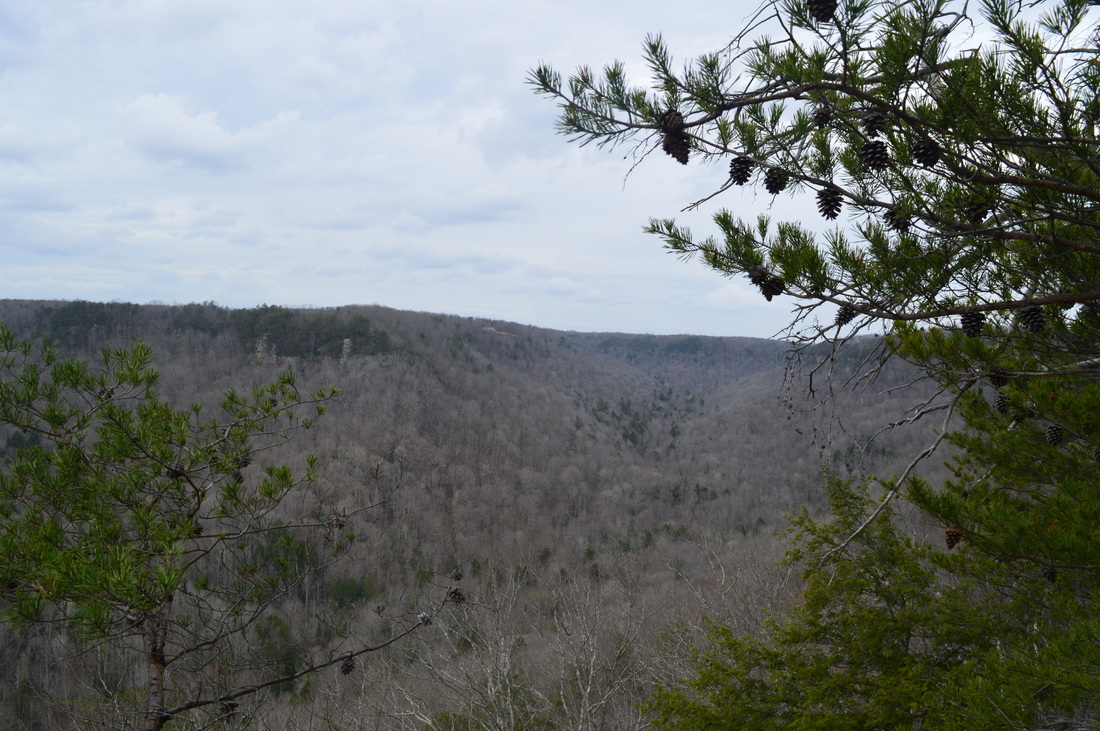
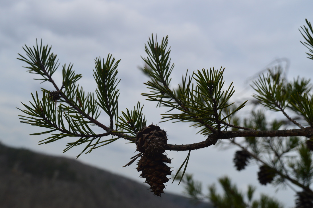
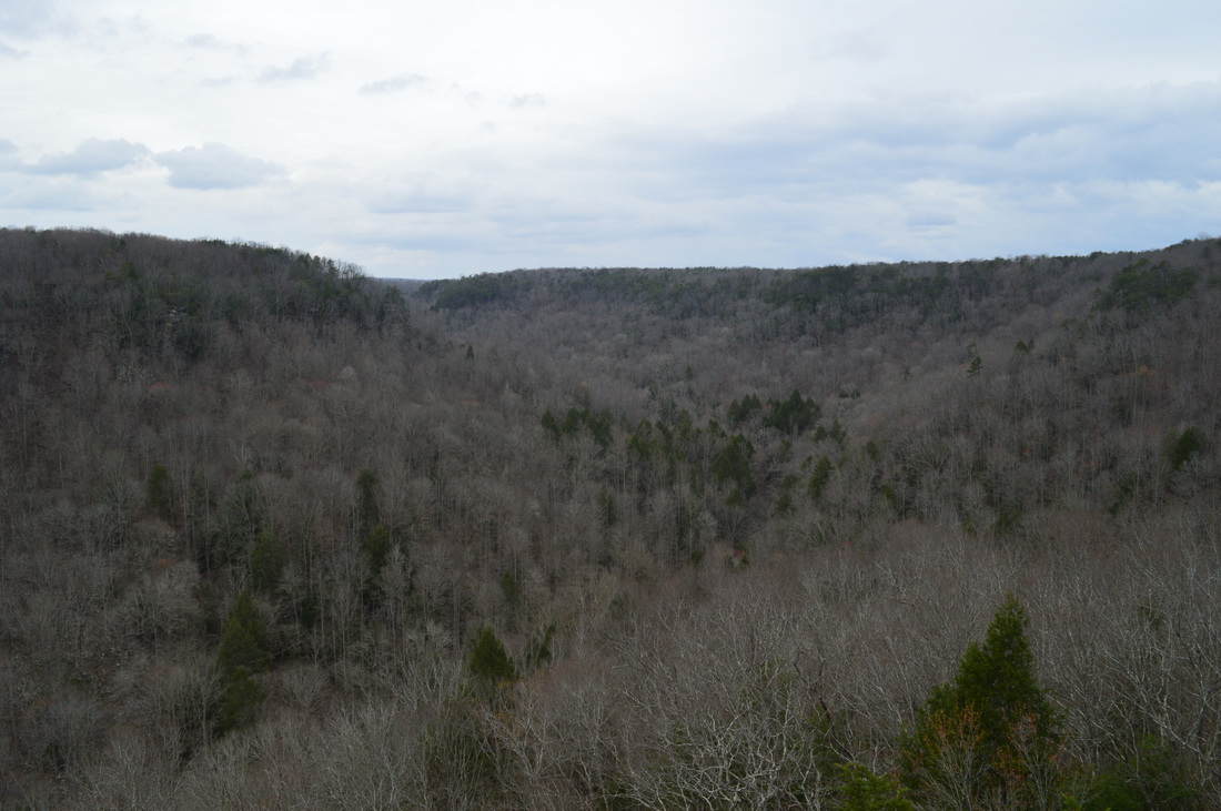
South Cumberland State Park is a state park with several tracts scattered throughout the south Cumberland Plateau in Grundy County, Franklin County, and Marion County. Two of these tracts - Grundy Forest State Natural Area and Foster Falls TVA Small Wild Area - serve as the starting and ending point for a dozen-mile long trail that is known as the Fiery Gizzard Trail. The Fiery Gizzard Trail has gained the reputation of being one of the most difficult trails in Tennessee, as it traverses several rocky gorges with rugged terrain. Backpacker Magazine has ranked the Fiery Gizzard Trail in its top 25 hiking trails throughout the US due to the beauty of the gorges encountered on this trail. On this hike, you're going to follow a route that will take you past several waterfalls on Little Fiery Gizzard Creek and Fiery Gizzard Creek before embarking on a very rugged scramble through the gorge. Then, you will ascend out of the gorge to a couple of panoramic vistas of the Fiery Gizzard gorge, before returning to the Grundy Forest Day Loop and seeing more waterfalls on Big Fiery Gizzard Creek. This hike occurred on Saturday, March 12th, 2016. My plan was to first hike the eastern section of Grundy Forest Day Loop. Then, I planned to take the Fiery Gizzard Trail south through the Fiery Gizzard Creek gorge to Raven Point. After visiting Raven Point, I would take the Dog Hole Trail back to the Fiery Gizzard Trail near Grundy Forest Day Loop. I would finish the hike by taking the western half of the Grundy Forest Day Loop.
Summary
R/T Length of Trail: 10.9 Miles
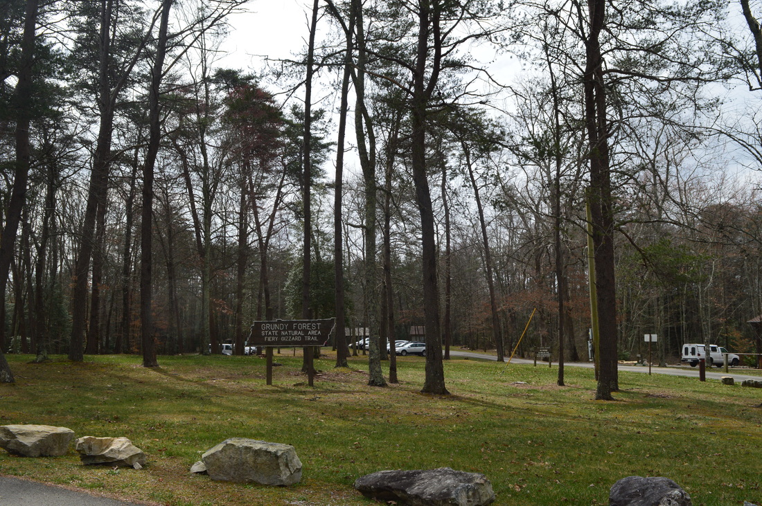
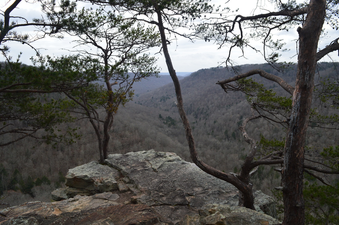
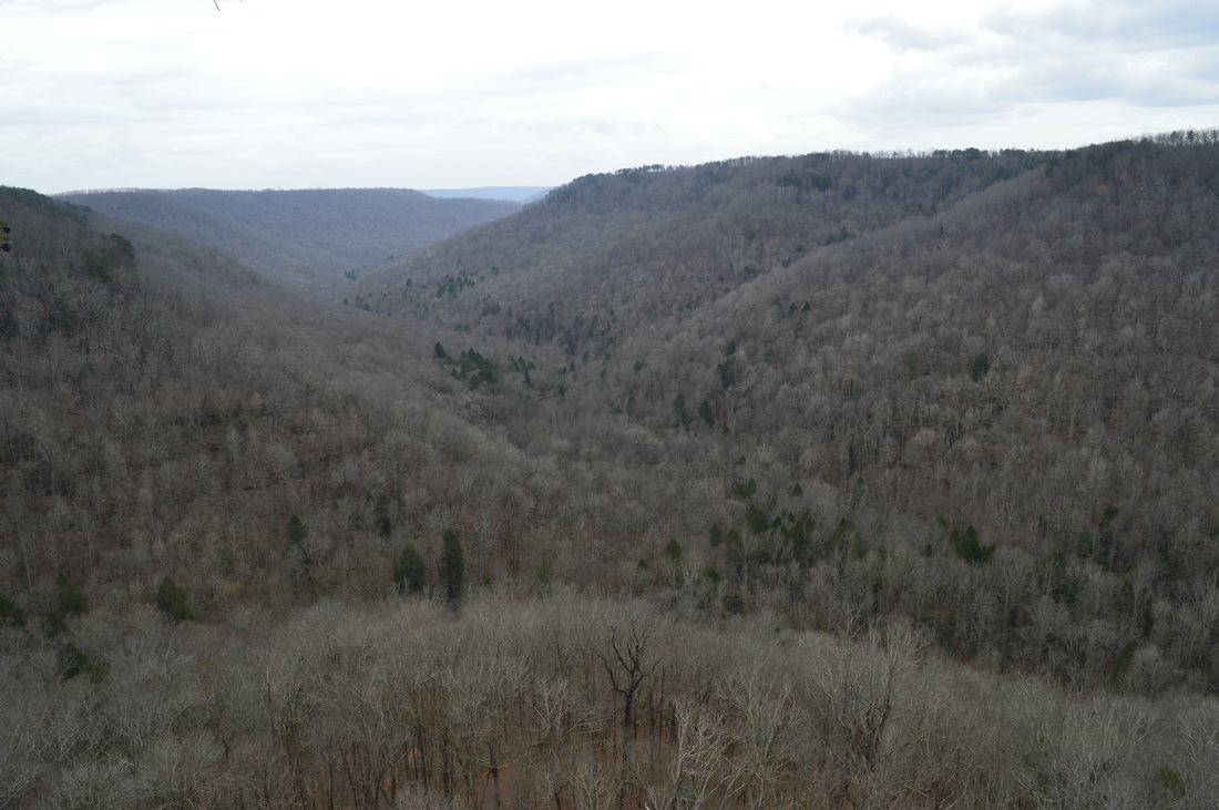
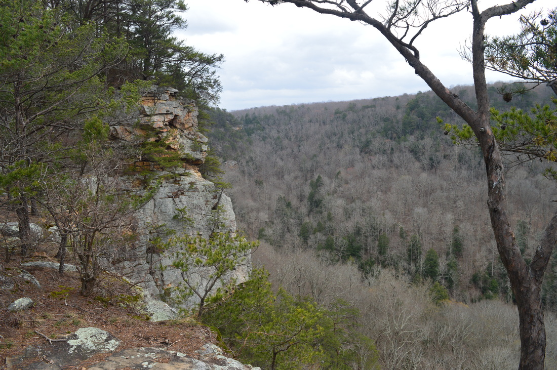
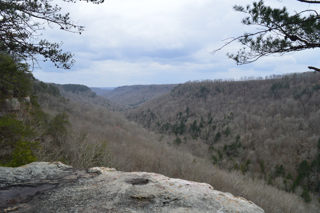
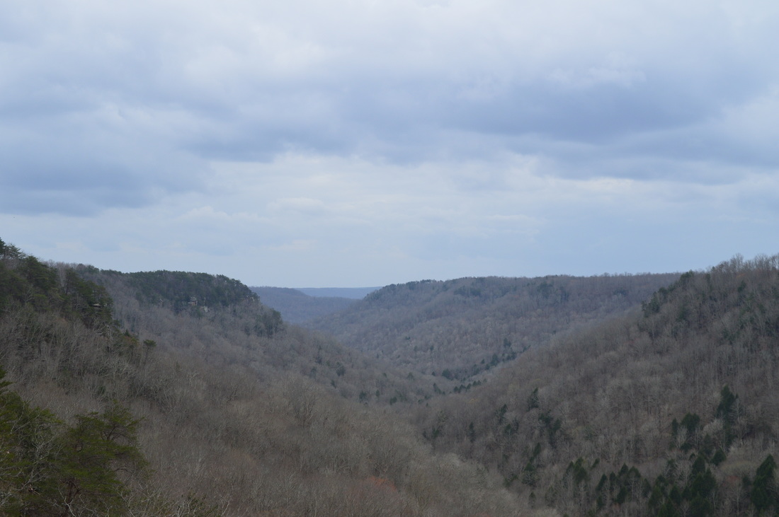
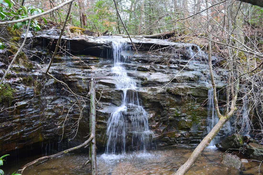
Duration of Hike: 7:20 Type of Hike: Double Loop Difficulty Rating: 7 out of 10 Total Elevation Gain: 1850 Feet Pros: There is generally good maintenance on this rugged hike Cons: The trail in the Fiery Gizzard gorge is extremely rocky, rugged, and slow Points of Interest: Blue Hole Falls - 1 star; Black Canyon and Falls - 8 stars; Chimney Rocks; Sycamore Falls - 4 stars; Fruit Bowl; Unnamed waterfall on tributary of Fiery Gizzard Creek - 3 stars; Natural arch; Raven Point Vista - 6 stars; Flat Rock Overlook - 1 star; Werner Point Overlook - 8 stars; Yellow Pine Cascade - 2 stars; Dog Hole Mine; Hanes Hole Falls - 3 stars Trail Blaze Color(s): Fiery Gizzard Trail - White; Grundy Forest Day Loop - White; Sycamore Falls Side Trail - Blue; Raven Point Side Trail - Blue; Dog Hole Trail - White; Werner Point Overlook Side Trail - Blue; Yellow Pine Cascade Side Trail - Blue Best Season(s) to Hike: Spring Fees: None Beginning Point: Grundy Forest Trailhead Directions: This hike is located in the city limits of Tracy City, TN. From the intersection of Main Street, 9th Street, and Railroad Avenue in Tracy City, follow Railroad Avenue southwest for 0.4 miles. Then, turn left onto 2nd Street. Continue on 2nd Street for 0.2 miles, and then turn right onto Fairground Street. In another 0.2 miles, bear left onto Fiery Gizzard Road. Reach the overflow parking, to the right of the road, in 0.1 miles. This is where I parked, as the main parking area was full. You will reach the main Grundy Forest parking area just past the overflow parking. Map
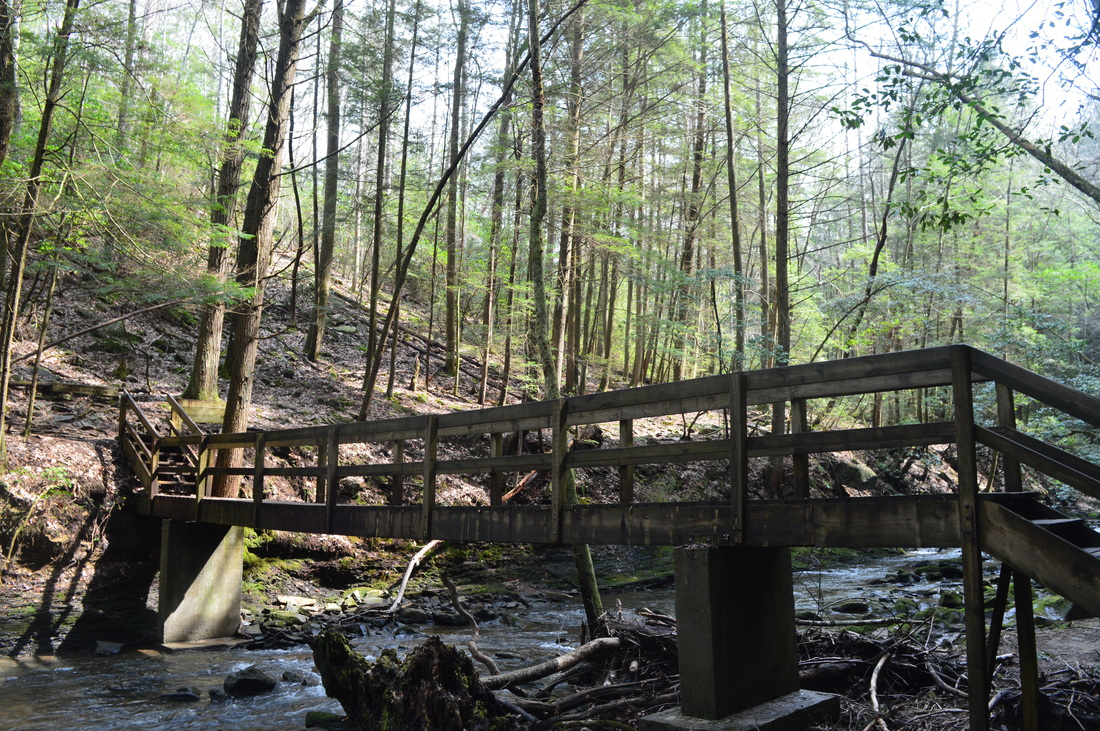
Note: The map above is my GPS track of this hike. The track bounced around a lot in the gorge, and for this reason, on the map, there is some inaccuracy, and there seem to be several crossings of Big Fiery Gizzard Creek, Little Fiery Gizzard Creek, and Fiery Gizzard Creek. There is only one crossing of any of those creeks n the entire hike - it is a footbridge across Little Fiery Gizzard Creek at the beginning of the Fiery Gizzard Trail. There are no other creek crossings on this hike, regardless of what the GPS track shows.
Click here for more information and to download this trail map to view in Garmin Basecamp. Details
I had always known that Fiery Gizzard Trail has a reputation of being a very difficult trail. However, where did all of the difficulty come from? There did not seem to be any extended ascents on the trail, according to the map. After completing this hike, the true reason became obvious: the rockiness of the Fiery Gizzard Trail makes it a very slow and tiring hike, and even by the time you're out of the gorge, you will be very tired from the rugged trail in the gorge.
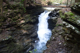
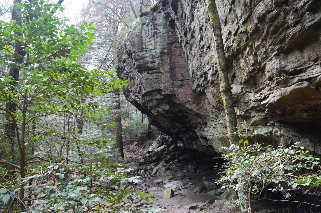
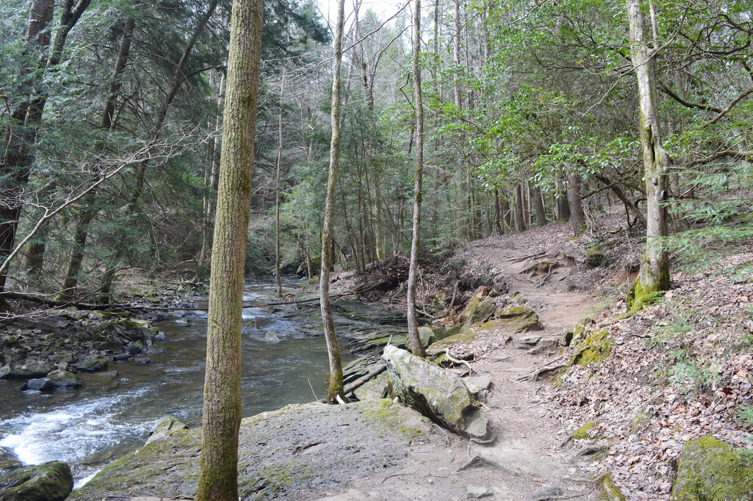
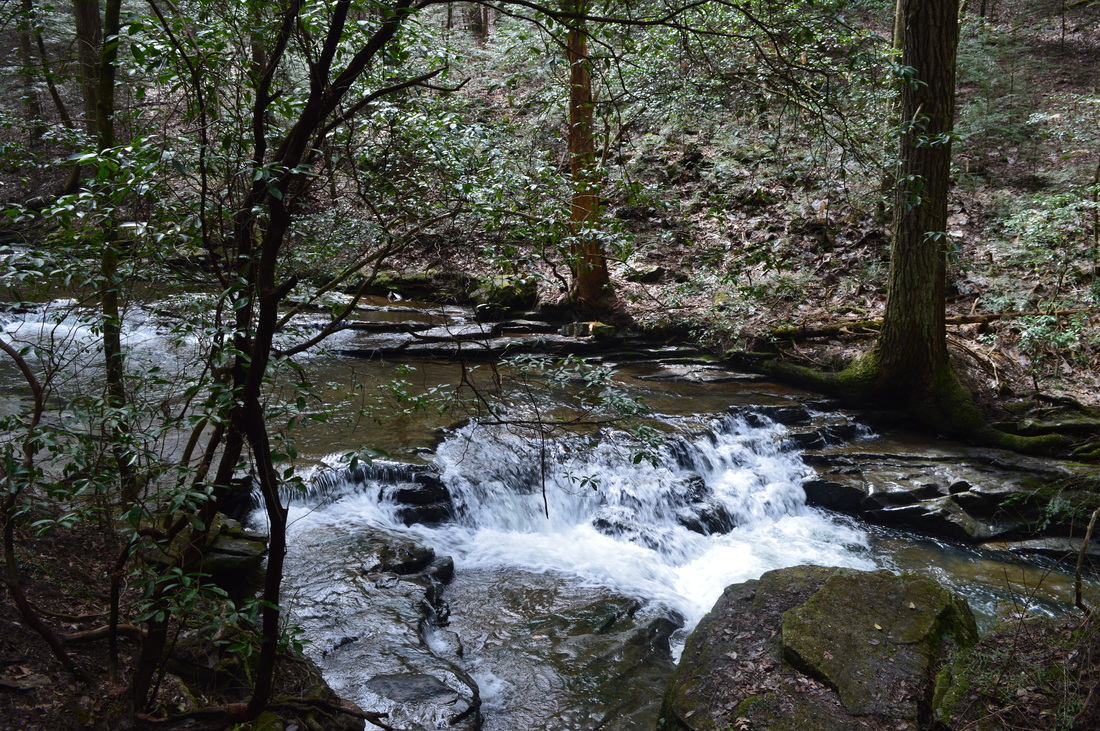
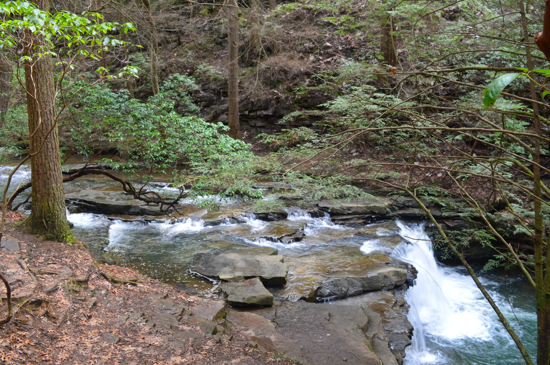
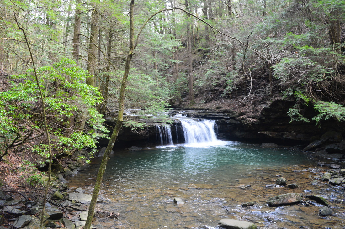
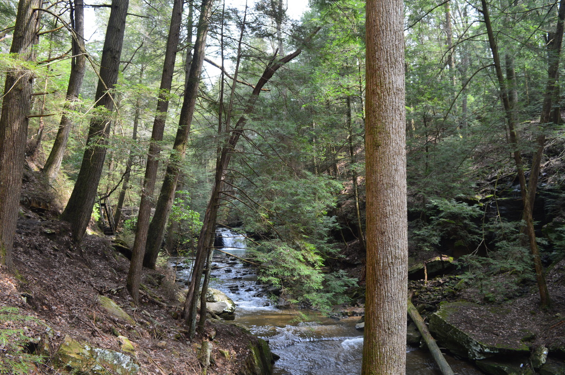
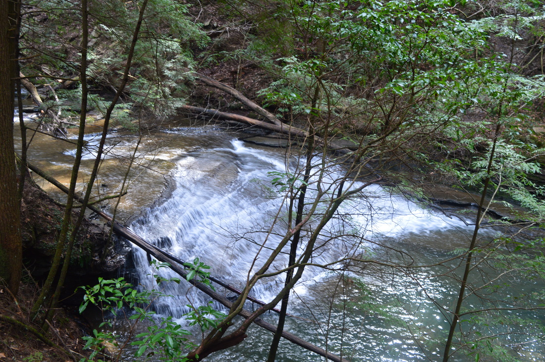
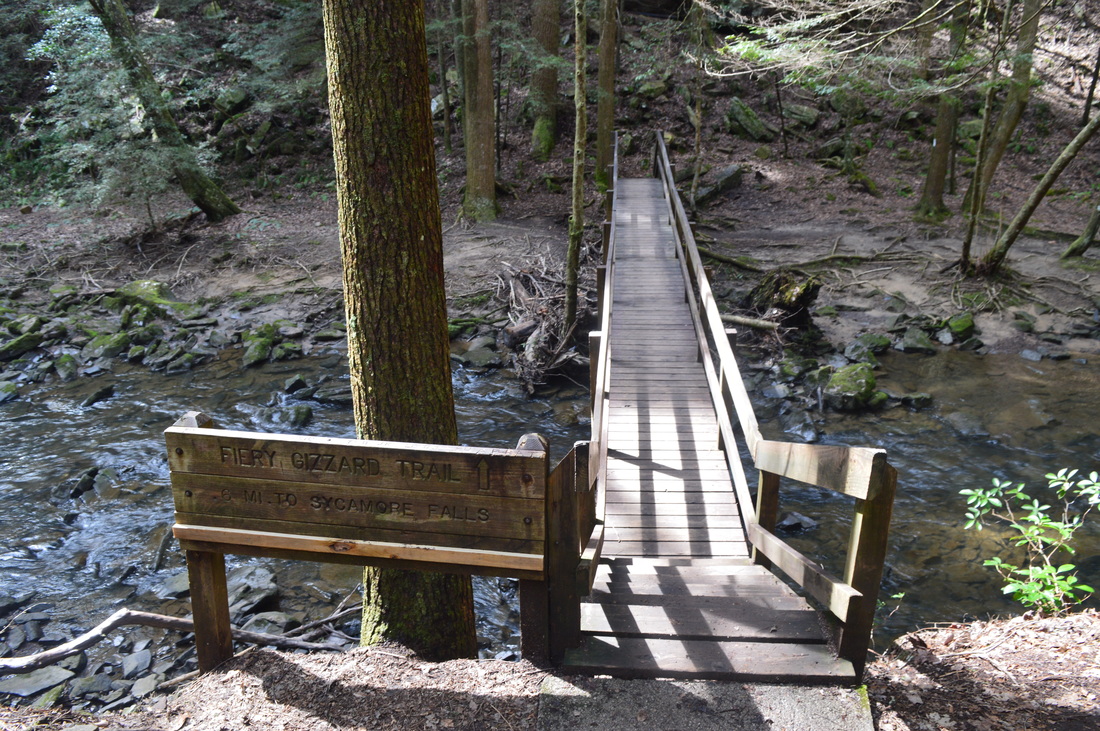
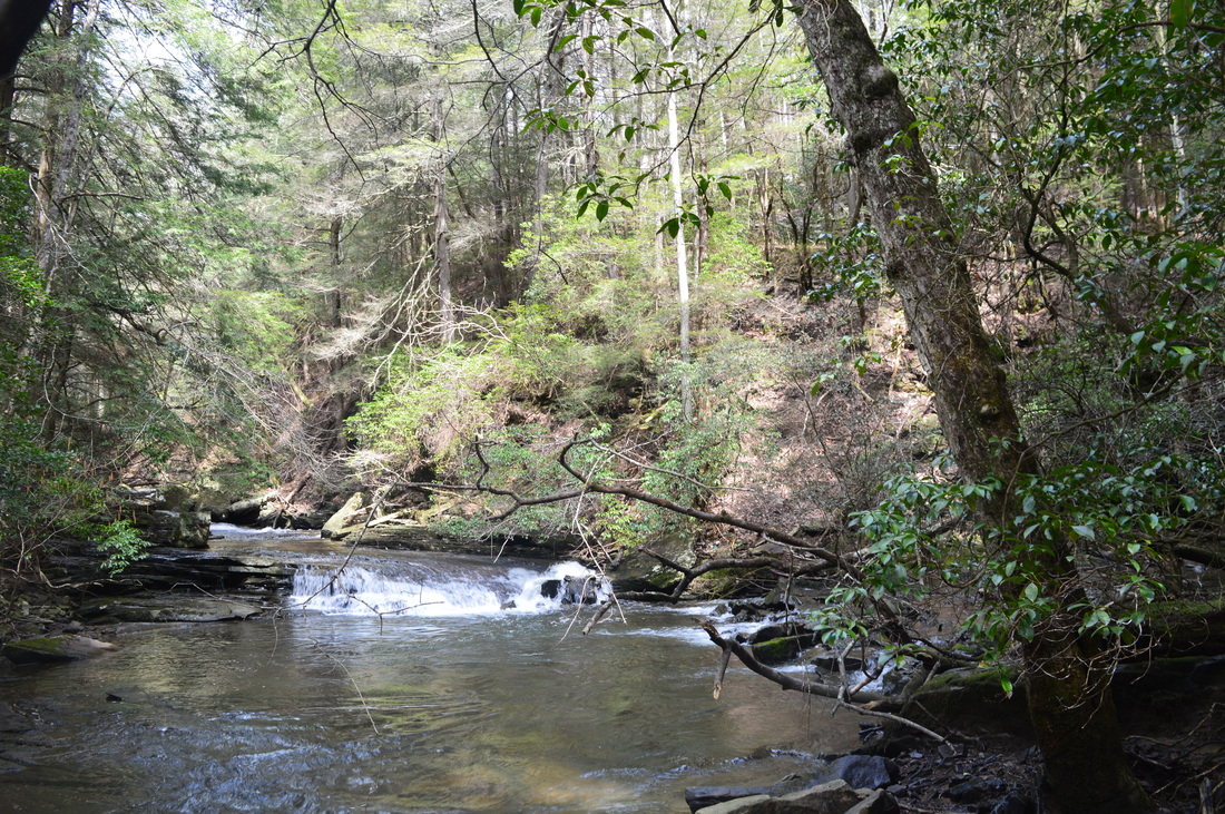
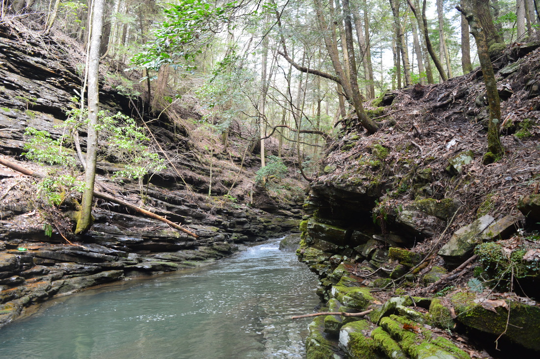
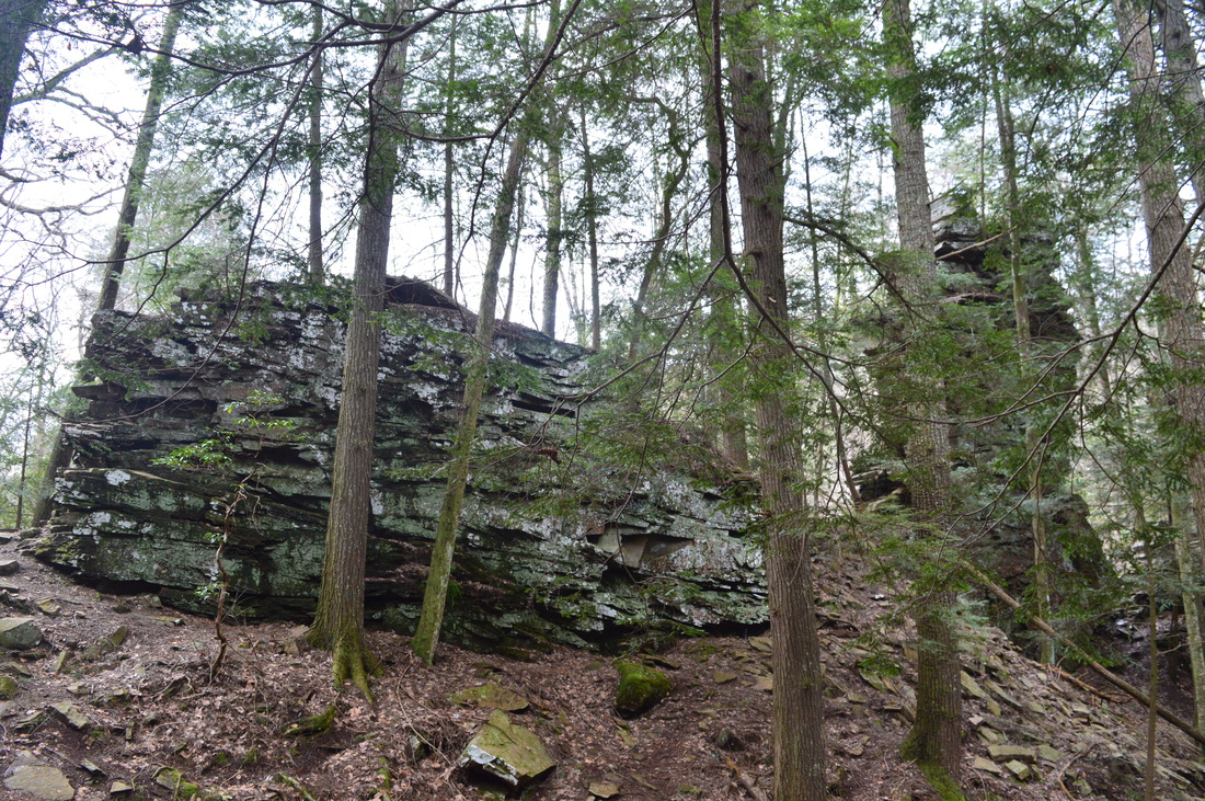
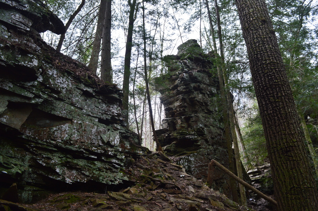
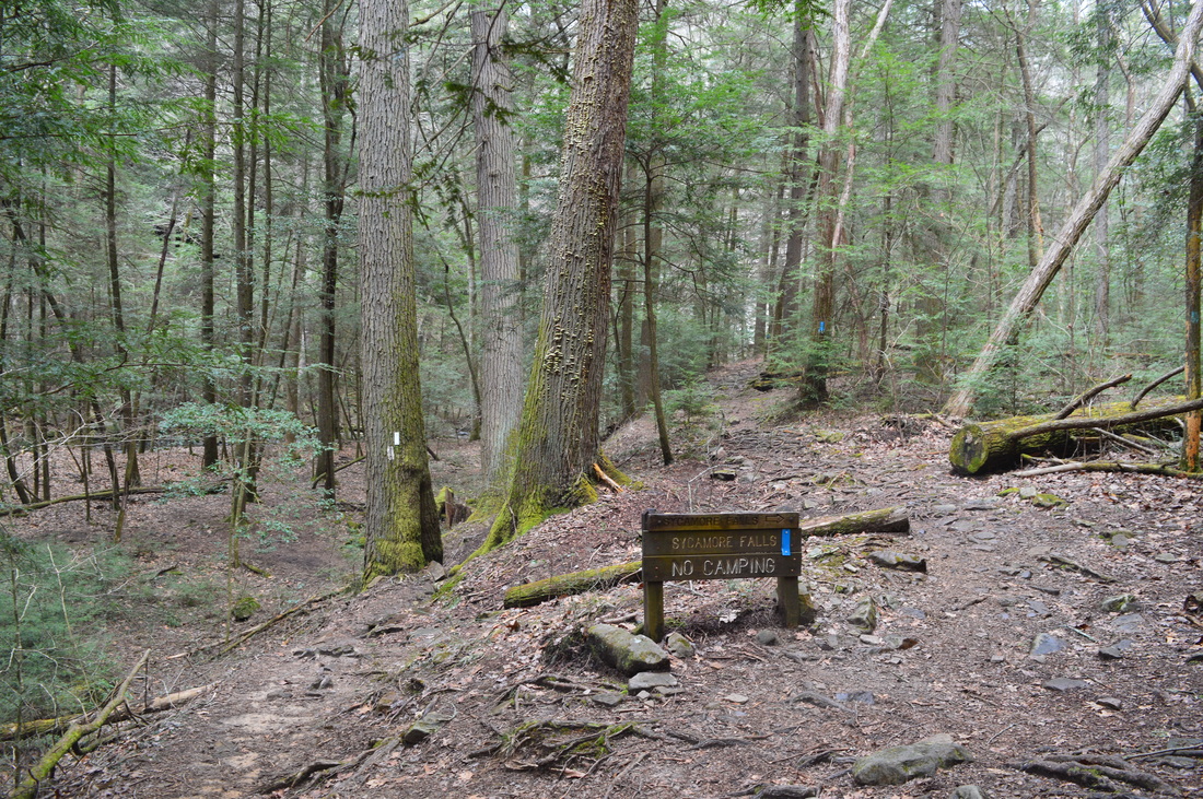
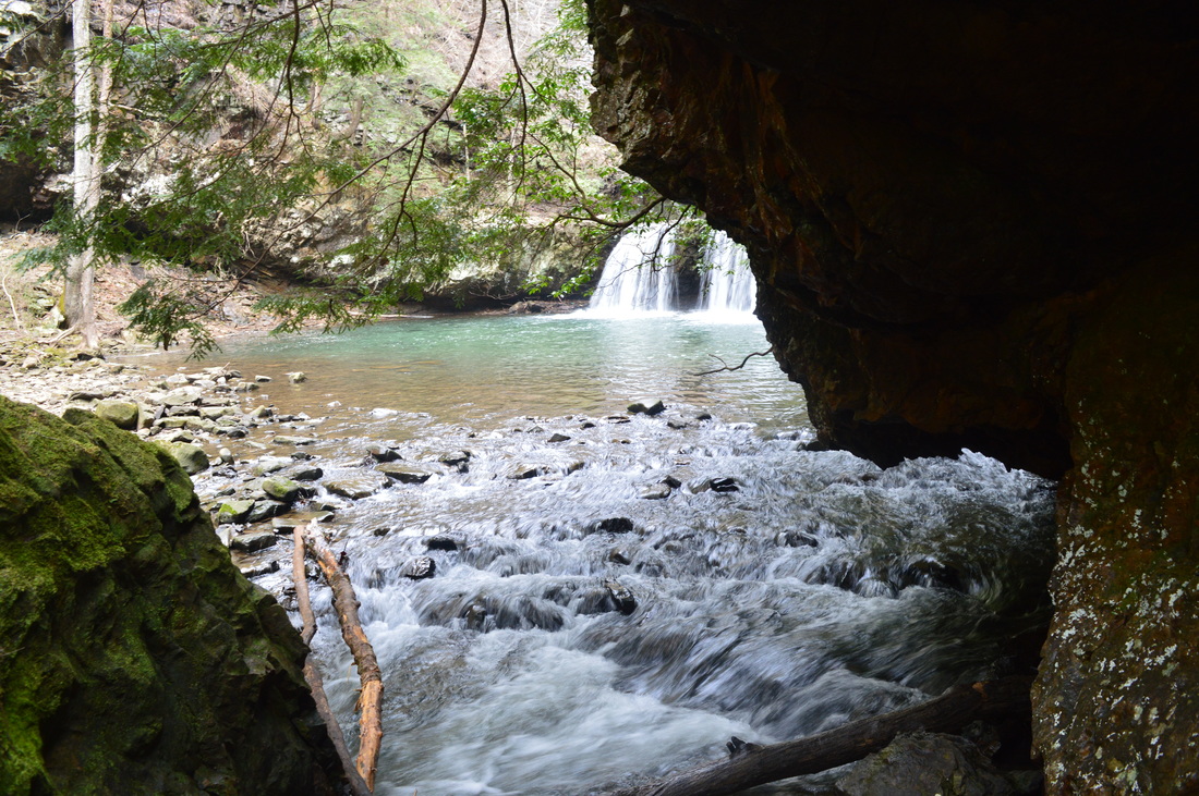
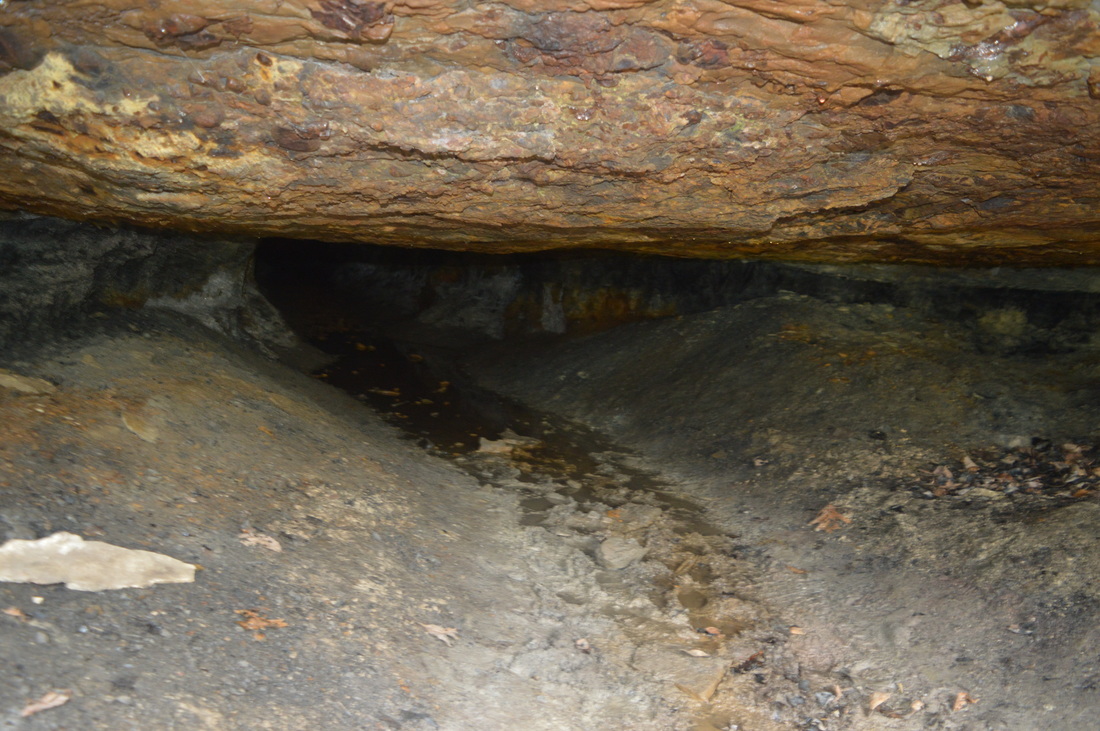
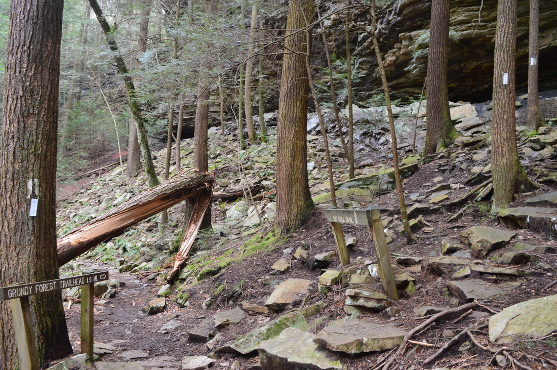
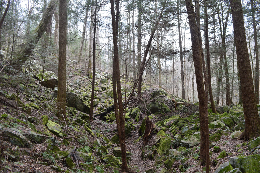
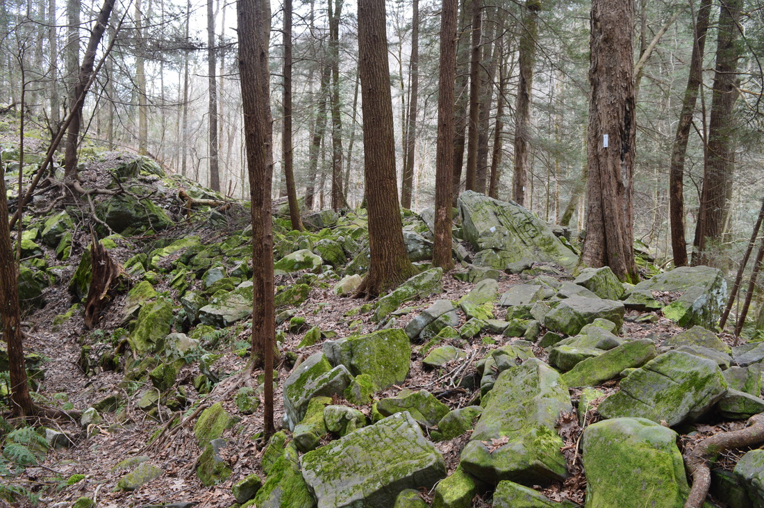
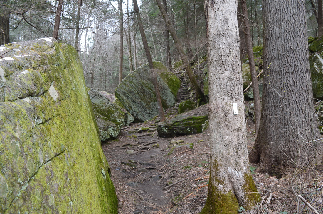
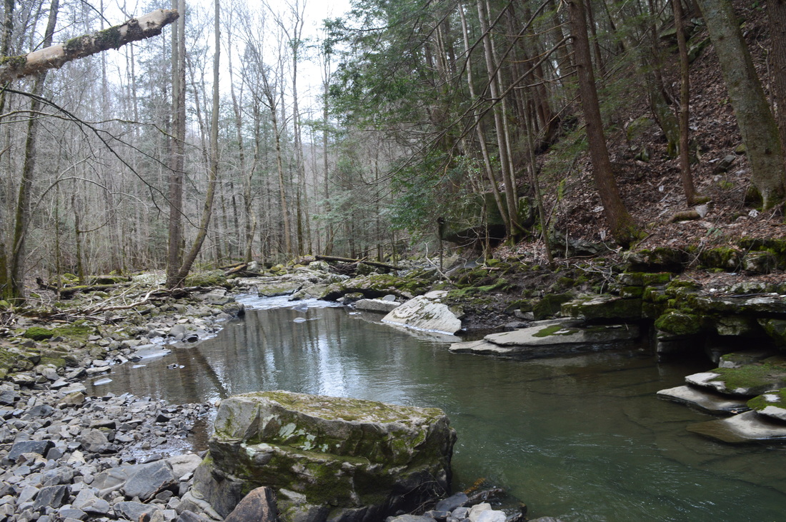
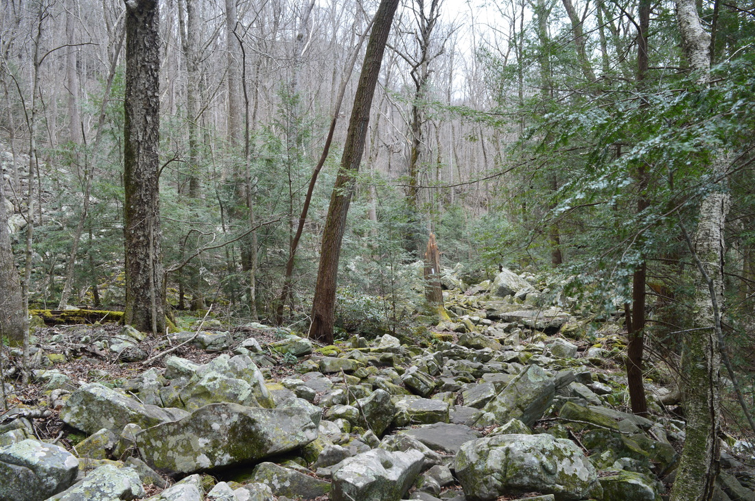
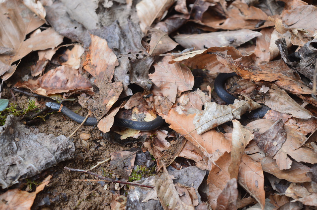
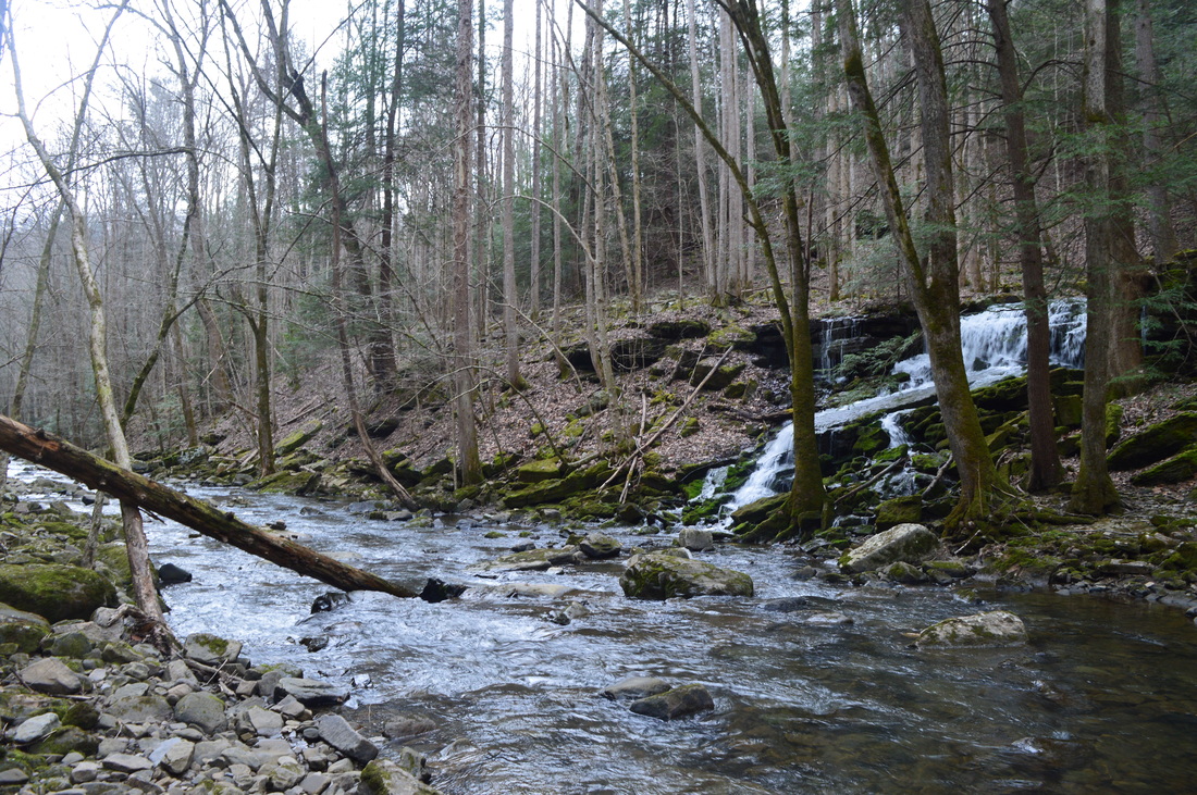
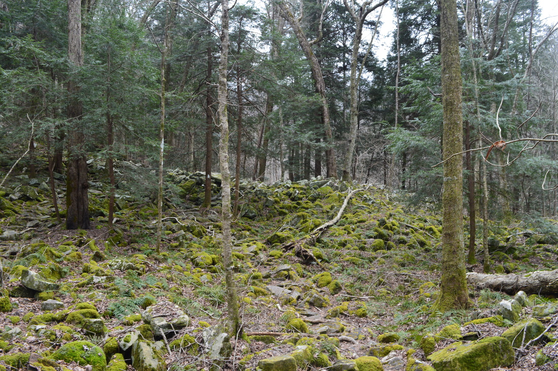
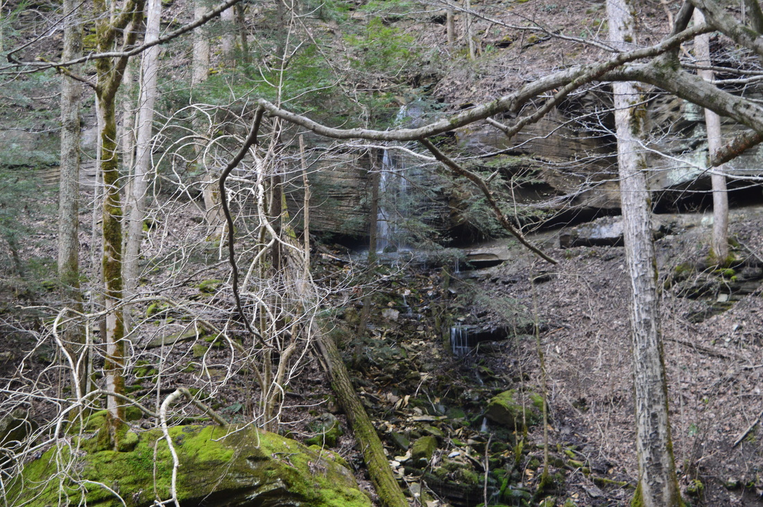
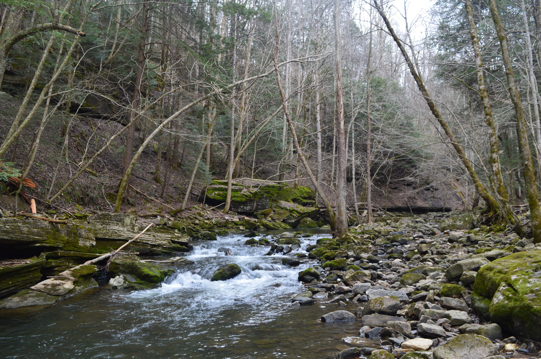
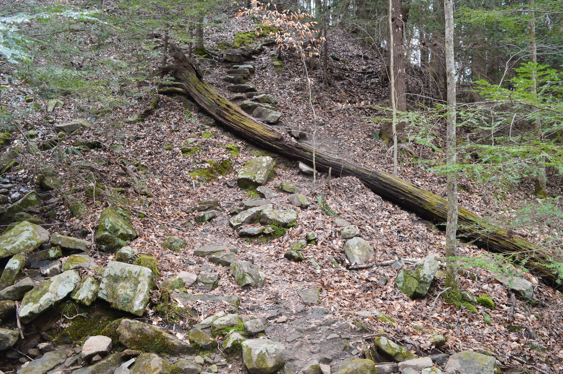
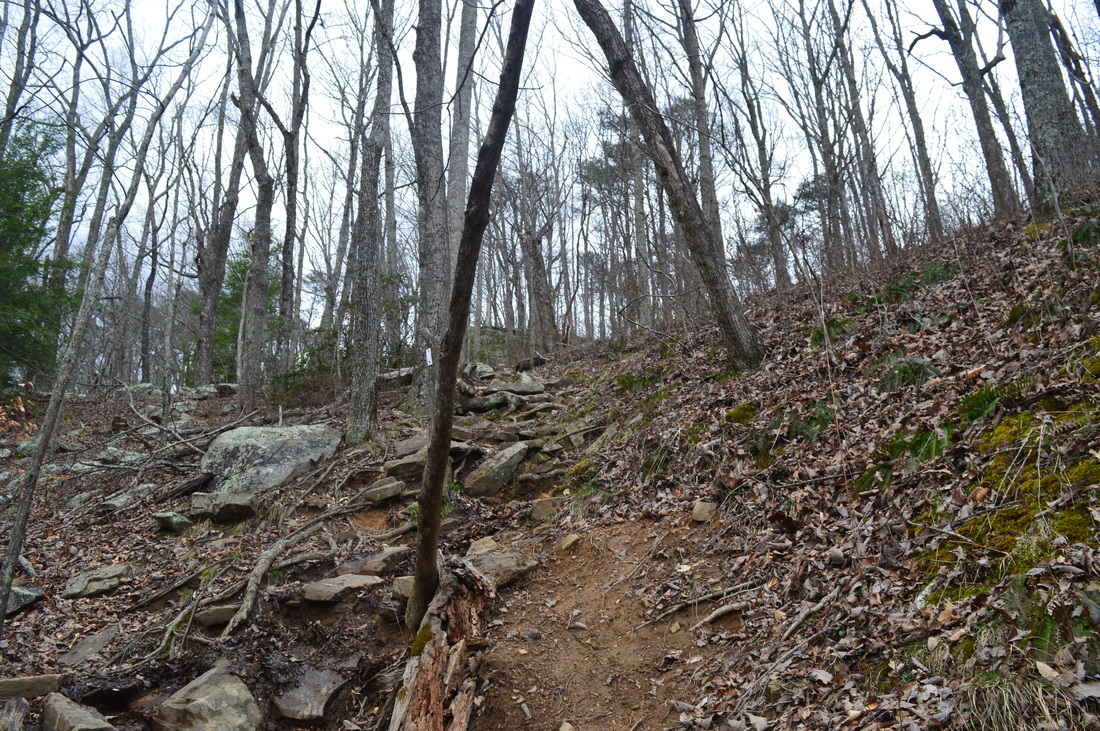
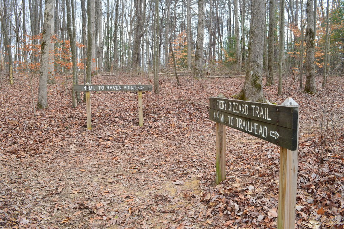
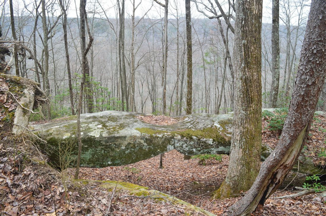
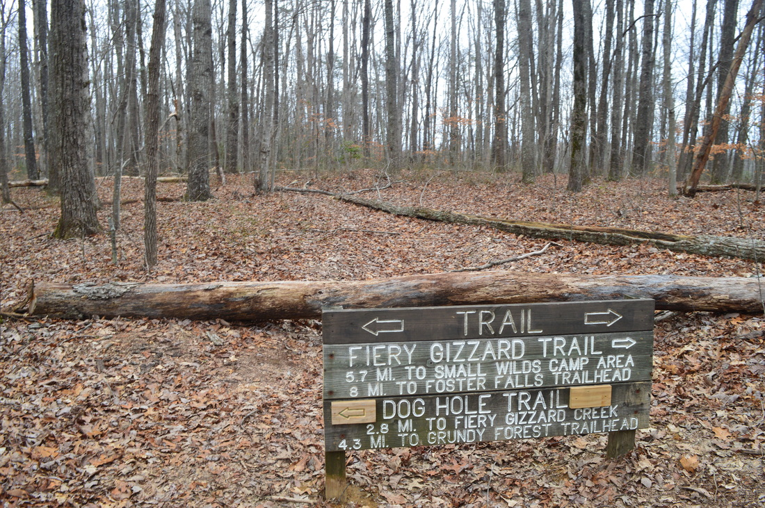
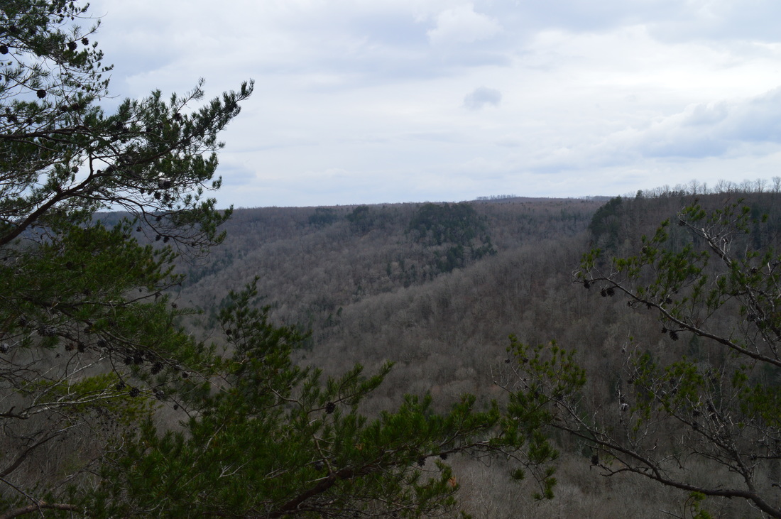
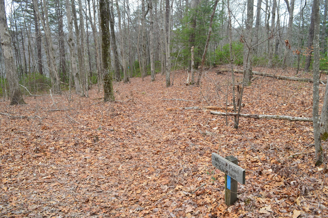
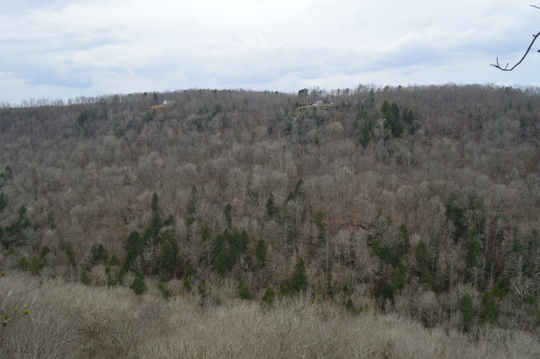
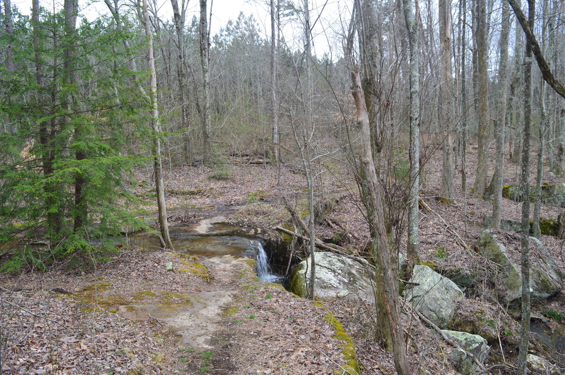
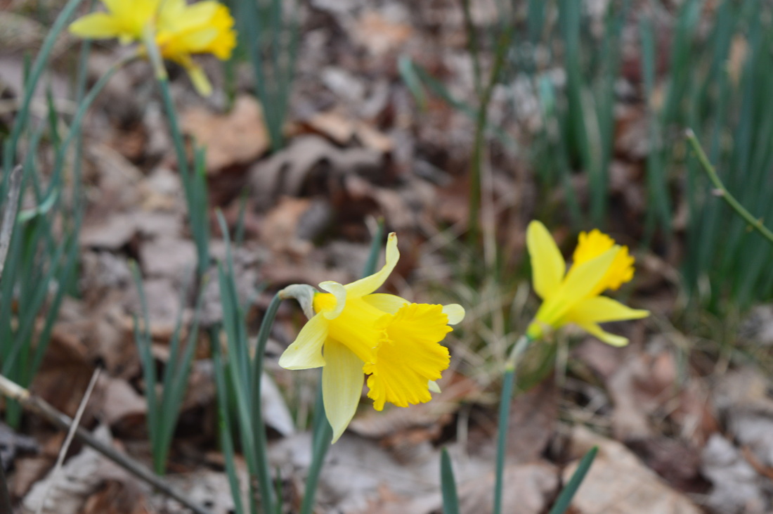
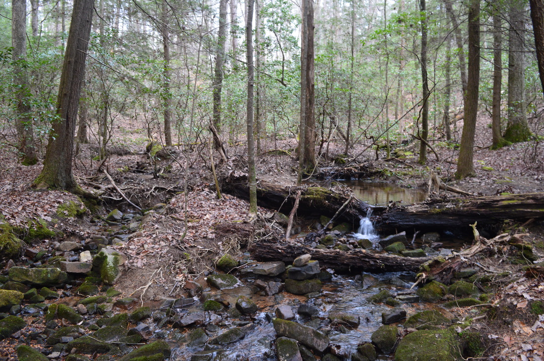
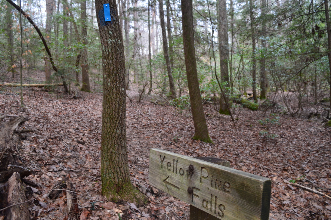
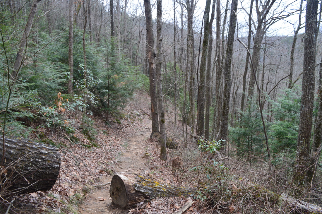
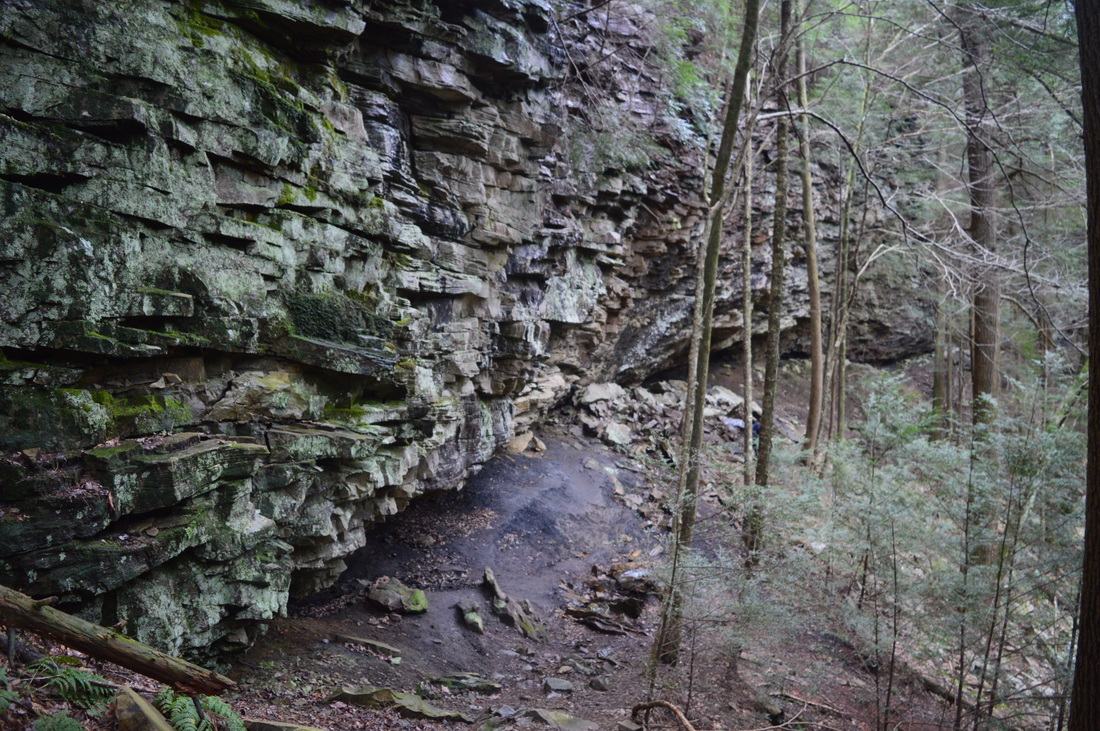
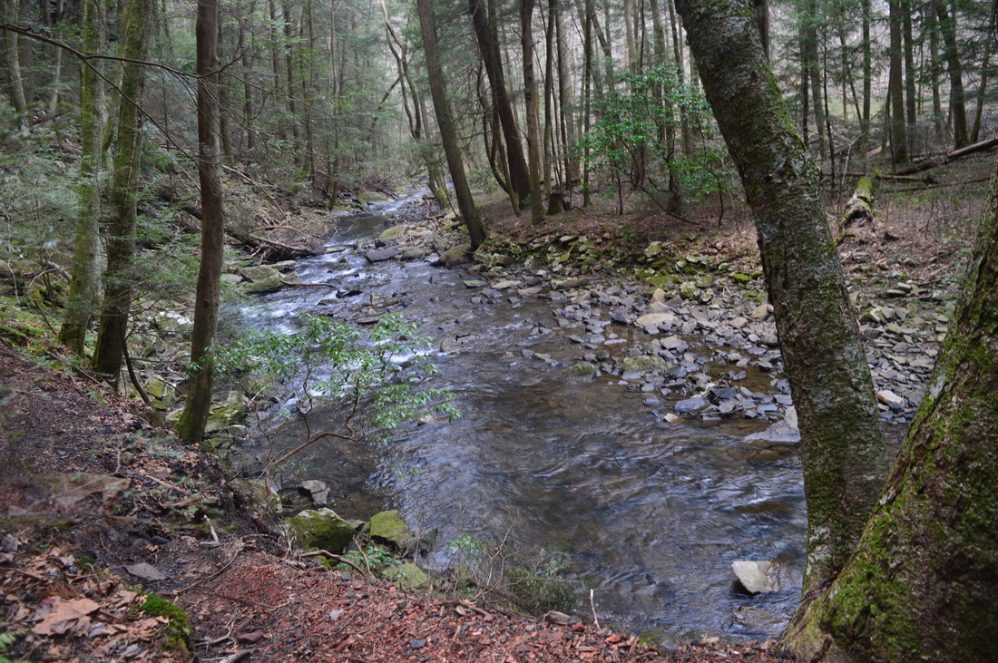
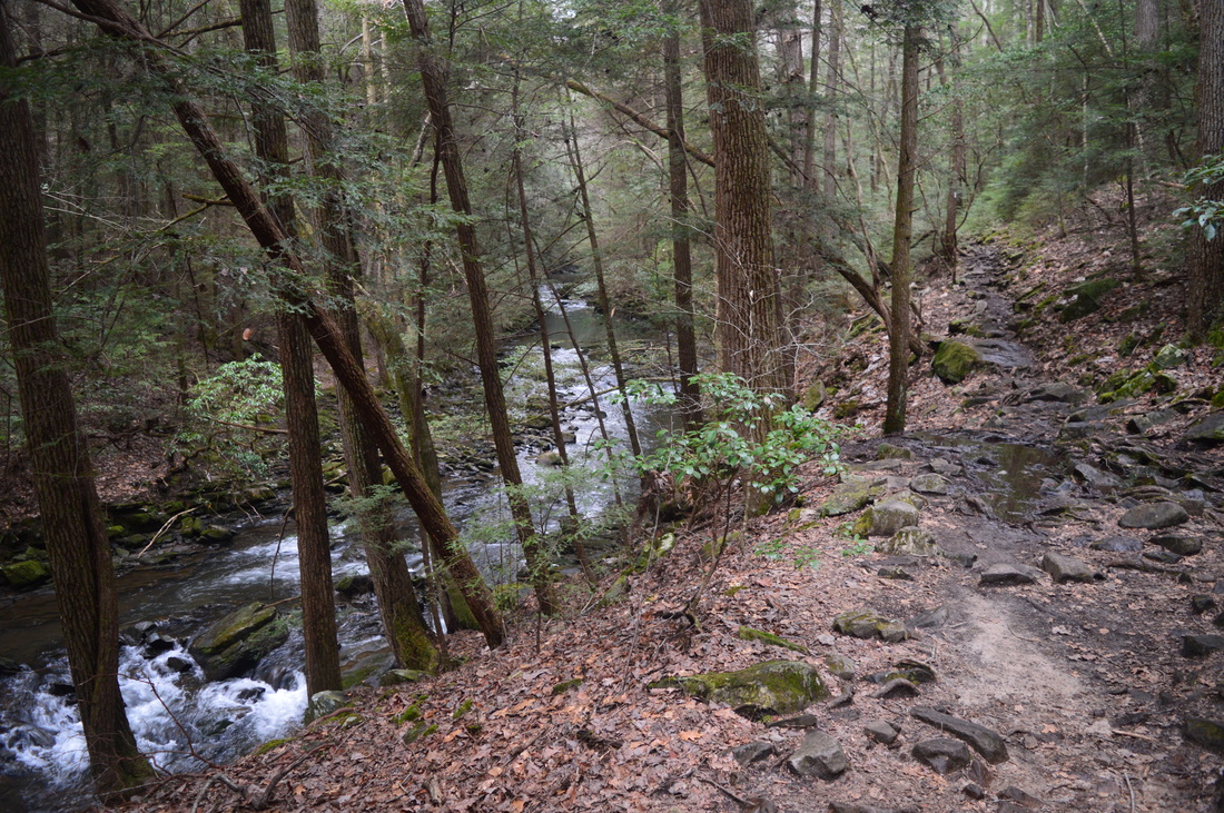
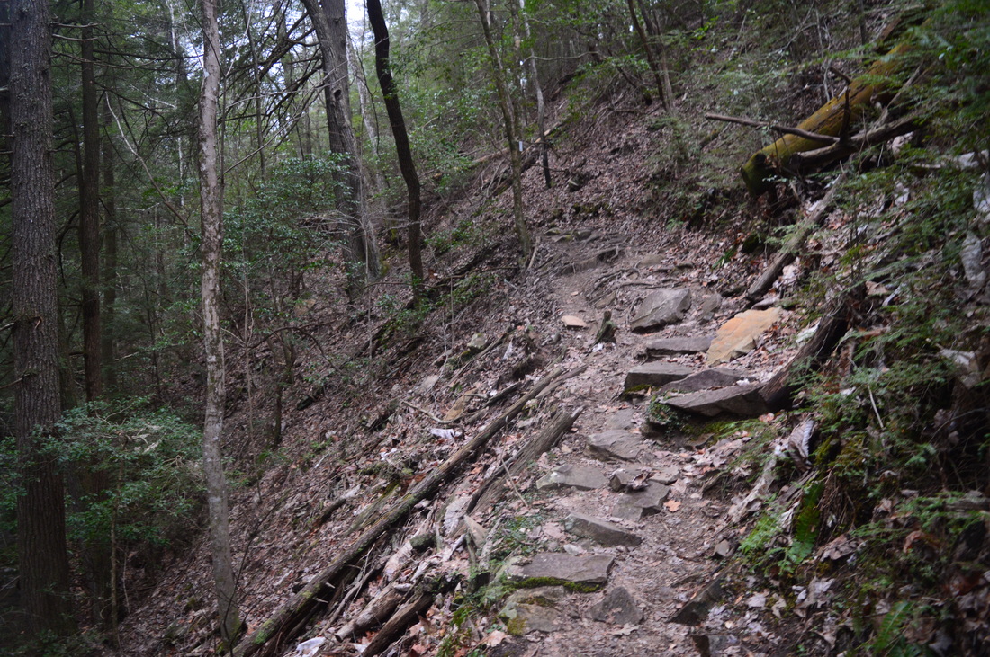
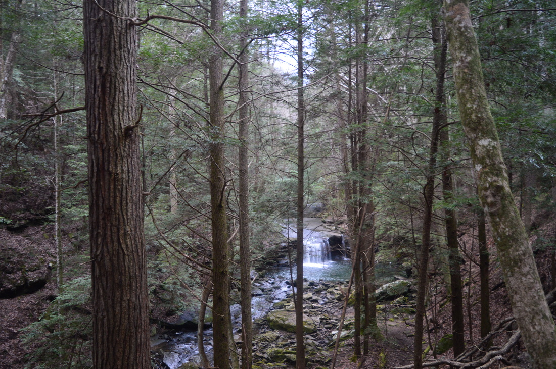
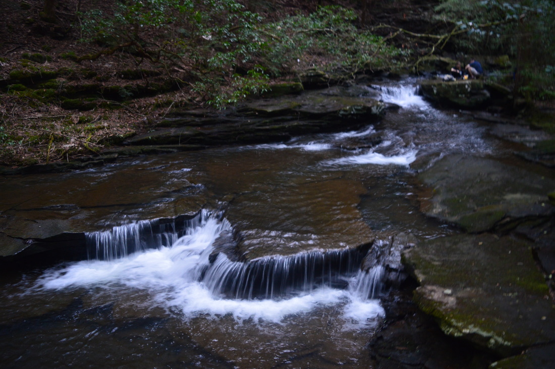
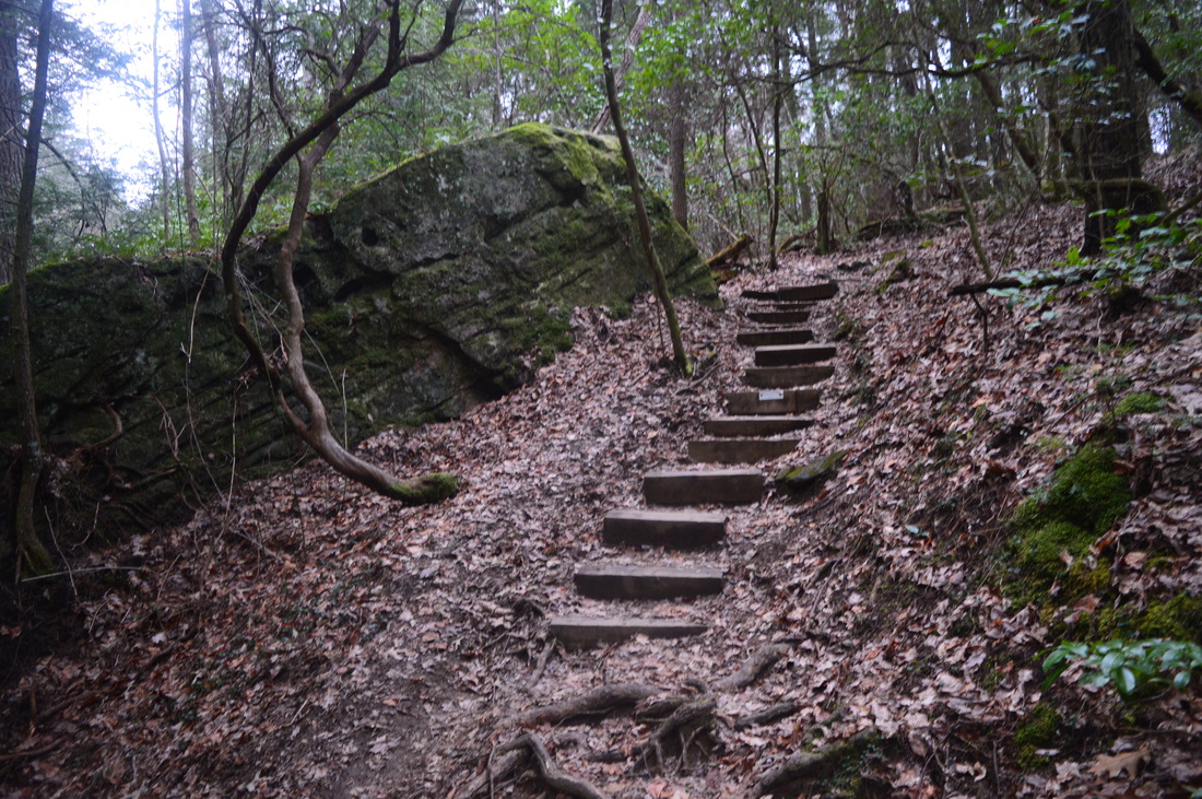
From the overflow parking area, walk down the road and across the main parking area to the signed trailhead next to the kiosk, reaching it at 0.1 miles. Please note that you would save 0.2 miles roundtrip by parking in the main parking area (if it not full). The mileages that you see in this trail report are counted from the overflow parking. From the trailhead, follow the Grundy Forest Day Loop downhill. You will follow the day loop for some time, before you reach the actual beginning of the Fiery Gizzard Trail. A short descent on the trail brings you to the top of a cliff at the edge of the Little Fiery Gizzard Creek gorge. This part of the gorge is at its upper end, and thus, it is not a very deep gorge yet. Thus, it doesn't take long to descend into the gorge. Curve to the left and descend down a stone stairway to reach the bottom of the gorge near Little Fiery Gizzard Creek. At 0.2 miles, reach a large rockhouse under the cliff that you were just on. you will closely parallel Little Fiery Gizzard Creek that flows to your left. There are some pretty cascades in the creek. You will cross a footbridge across a small tributary of the creek and then reach Blue Hole Falls at 0.6 miles. The trail is slightly above the creek here, providing a good side-top view of the small falls. Cross a footbridge across School Branch, descend down a wooden staircase, and reach a front view of Blue Hole Falls. This small waterfall is not very impressive - it is only 9 feet high. There is a large plunge pool in front of the small drop. The plunge pool's depth is supposed to be 7 feet. From Blue Hole Falls, continue on a rocky trail near the creek. You will see a pretty waterslide in the creek shortly afterwards. At 0.8 miles, rate, the Grundy Forest Day Loop continues straight ahead, while the Fiery Gizzard Trail begins to the left. Turn left, and cross Little Fiery Gizzard Creek on a wooden footbridge that is positioned on sturdy concrete pilings. On the other side of the creek, turn right and continue to follow the creek downstream. At 0.9 miles, reach the confluence of Big Fiery Gizzard Creek and Little Fiery Gizzard Creek. Take a path to the right that leads to the scenic confluence. Cascades are visible on both creeks, and to the left, the now larger creek, Fiery Gizzard Creek, prepares for its big drop into Black Canyon. Return to the main trail, and continue just a little farther to another path to your right. Take this path to a view of Black Canyon. Black Canyon is a very picturesque location on Fiery Gizzard Creek. The creek forms a waterfall as it drops down into the slot canyon amidst a white froth of water. Below the waterfall, the creek passes through a narrow canyon that is lined by steep cliffs. This is definitely a place to linger and take some pictures. I suggest following the slim path downstream along the edge of the canyon for some more views of the canyon. The path is more scenic than the main trail, and the path rejoins the main trail near the end of Black Canyon. Shortly after this, with Fiery Gizzard Creek to your right, you will enter the first of many boulder fields on this hike. This relatively small boulder field is only an appetizer for what is to come. As the trail raises above the creek, you can see many cascades in the creek below. At 1.3 miles, cross a small stream and reach Chimney Rocks. The "Chimney Rocks" are several rock pillars to the right and left of the trail, or in other words, "chimneys" of rocks. You can walk up close to the two chimney rocks to the right of the trail. After the Chimney Rocks, descend to a junction with the Sycamore Falls spur trail at 1.4 miles. Bear right onto the blue-blazed spur trail. At 1.45 miles, reach Sycamore Falls at the end of the side trail. This small waterfall is located at a bend in the creek. Straight ahead, a wet=weather waterfall spills into the main creek down from a cliff. For a better view of Sycamore Falls, retrace your steps a little bit, and watch out for a steep path that is now to your right (it would have been to the left on the way in). Take the steep path down to a fork - take a right at the fork, and then, reach a rock overhang with 12-foot Sycamore Falls straight ahead. Together with the falls, the cascades where the creek flows under the overhang makes this as a photogenic location. Without the cascades, Sycamore Falls would not be much different from Blue Hole Falls. There is a great swimming hole below the falls as well. From Sycamore Falls, retrace your steps back to the main trail. Turn acutely right onto the main trail at 1.5 miles. It is likely that you have left most casual hikers behind at Sycamore Falls, although the trail still receives some traffic to Raven Point. At 1.6 miles, pass through a gas pipeline clearing and enter increasingly rocky terrain along Fiery Gizzard Creek. At 1.7 miles, the Dog Hole Trail begins to the left. This is where you start the larger loop on this hike. You will continue straight on the Fiery Gizzard Trail, but you will return from the Dog Hole Trail. Shortly after the junction, enter a huge and very slow boulder field. The trail here is non-existent, and if not for the blazes, it would probably be next to impossible to find the trail. You will notice a pattern that is constantly repeated as long as the trail stays in the gorge - there is a sort of "shelf" above the creek that is full of boulders and is nearly impassable. The trail constantly hops on and off this shelf, and whenever it is in the endless boulder field, expect your going to be very slow. At 2.3 miles, reach a particularly picturesque spot. The trail passes through heaps of moss-covered rocks before descending down a stone staircase past huge boulders. This place is known as the Fruit Bowl. Following the Fruit Bowl, the trail briefly cruises along Fiery Gizzard Creek before ascending back into the boulder fields. You will cross a couple of tributaries of Fiery Gizzard Creek, but both are small. At 3.05 miles, there is something to not be missed. The trail curves left and ascends, but a faint path continues straight along the creek to the sound of rushing water. You will soon see a waterfall on a tributary on the right side of the creek. This unnamed waterfall is nice, with adequate water flow. It is not mentioned anywhere that I know of. After this, return to the main trail and continue rambling through the boulder fields. Every time that the trail descends off the boulder field, you think that you have left it for good, only to see the trail scrambling back up into the gray mass. While you work your way ever so slowly through each boulder field, you may notice some cascades in the creek to your right. At 4.1 miles, the trail finally begins the ascent out of the gorge. Pass through one more boulder field, and then rise above the shelf with the boulders. At first, the ascent seems gradual and easy, but this is deceiving. At 4.6 miles, the trail makes a sudden turn and begins a very steep ascent, aiming for the rim of the gorge. The steep section is not long, but it is enough to drain any of your energy that is still remaining after the boulder fields earlier. At 4.7 miles, begin to level up. Pass a side trail to a natural arch to your right - I chose to view the natural arch from a different side trail a bit later. At 4.8 miles, reach a junction. Here, the Fiery Gizzard Trail turns left, while a spur trail to Raven Point heads right. Do not skip this spur trail no matter how tired you are - turn right. Just after your right turn, a slim path leaves the trail to the right. This path leads 0.1 miles to the natural arch - an interesting rock formation. Check out the arch and then continue on the trail to Raven Point. As you approach Raven Point, the ridge that you're on begins to narrow, and the wind begins to pick up. At 5.3 miles, descend briefly and reach Raven Point. Raven Point, positioned high above the confluence of the Fiery Gizzard Creek gorge and McAlloyd Branch/Anderson Creek gorge. From Raven Point, you get a spectacular view of Fiery Gizzard Creek gorge downstream. There are also limited views of the Anderson Creek gorge and the Fiery Gizzard Creek gorge upstream. While Raven Point is a great vista, one of the vistas on the Dog Hole Trail along this hike - Werner Point Overlook - is even more beautiful than Raven Point. From Raven Point, retrace your steps along the Raven Point Trail. Return to the Fiery Gizzard Trail at 5.6 miles. Continue straight this time, and reach another junction at 5.7 miles. Here, the Dog Hole Trail leaves to the left to continue the loop. Straight ahead, a path that is no longer used leads to the Raven Point Campsite that once existed here. The campsite, as well as a section of the Fiery Gizzard Trail near it, was closed due to private property issues. Because of this, a new section of the Fiery Gizzard Trail is under development through the Anderson Creek gorge. This section is expected to be opened to the public by December 2016. The new section of trail will feature an 80-foot waterfall: Anderson Creek Falls. From the intersection that you are currently at, the Fiery Gizzard Trail does go right, but it is not yet finished, and there will not be a link between the two halves of the trail until December 2016. Thus, turn left onto the Dog Hole Trail. With a sigh of relief, I finally began this long stretch of flat, easy trail. Much of the Dog Hole Trail follows the rim of the gorge with occasional rolling hills., although the elevation changes are minimal. At 6 to 6.1 miles, pass several rock outcrops to the left that are known as the Flat Rock Overlooks. These rock outcrops provide limited views of the gorge. They are best seen when the leaves are down, and even then, the view is barely worth to be mentioned. At 6.4 miles, cross a small unnamed creek. At 6.6 miles, reach a spur trail to your left to Werner Point Overlook. Werner Point Overlook is a fantastic view of the Fiery Gizzard Creek gorge in both directions. You must absolutely not skip this spur trail. Follow the blue-blazed trail to reach the overlook at 6.7 miles. Here, a rock outcrop past a small blowdown provides an excellent view far down the gorge. Continue just a little bit farther to a different rock outcrop with another great view of the gorge upstream - the best view of the gorge upstream on this hike. After seeing Werner Point Overlook - the last vista on this hike - return to the main trail at 6.8 miles, and turn left. Cross a small stream at 7.1 miles, and pass the site of the old Sam Werner Farm to the right. On this day, some daffodils were blooming at the old farm site. After this, continue to follow the rim of the gorge to another stream at 7.6 miles. This is where the spur trail to Yellow Pine Cascade leaves to the right. Take the short 0.05-mile spur trail upstream to Yellow Pine Cascade, a low flow waterfall falling off a rock ledge. Even though it is not very tall and needs more water, the cascade is worth the side trip. Return to the main trail, and continue on an easy trail along the rim. At 8.5 miles, cross the same gas pipeline clearing that you saw in the first part of the hike. After this, make a sharp left turn and begin descending back into the gorge. After recrossing the gas pipeline clearing, the trail becomes increasingly rocky. Pass along the base of a sandstone bluff to the left and reach the Dog Hole Mine, an old coal mine entrance. After this, descend steeply amidst rocks to the end of the Dog Hole Trail at the Fiery Gizzard Trail at 8.8 miles - this marks the end of the larger loop of the two loops on this hike. To continue following my route, turn right onto the Fiery Gizzard Trail, and follow the route that you used when you hiked in. You will pass the side trail to Sycamore Falls, as well as Chimney Rocks and Black Canyon, before returning to the Grundy Forest Day Loop at 9.5 miles. This is where you will start the second loop on this hike. Turn left to continue the Grundy Forest Day Loop clockwise. The trail rises above Little Fiery Gizzard Creek and passes the confluence of Little and Big Fiery Gizzard Creek. After this, you will find yourself following Big Fiery Gizzard Creek. At 9.8 miles, reach Hanes Hole Falls and the pool below it. There is a good view of this small falls from the trail. To reach the base of the falls, you can take a steep side trail to the left, but I was content with the view from the trail, as I was running out of time to finish the hike before darkness. The trail closely parallels the creek, and you will see some nice cascades in the creek, until the trail ascends a stone staircase out of the now-small gorge. At the top of the staircase, make another curve to the right and level out. The rest of the hike is mostly flat. At 10.2 miles, a spur trail to the left leads to a campsite and some CCC ruins. Continue on the main trail. Cross School Branch on a footbridge at 10.5 miles. There is supposed to be a 20-foot wet weather waterfall downstream, but with darkness swiftly approaching, I did not check it out. Continue through mostly flat terrain, before reaching the Grundy Forest Trailhead at 10.8 miles. This is the end of the hike, although if you're parked at the overflow parking, you'll walk along the road for a tenth of a mile to conclude the hike at 10.9 miles. Mileage
0.0 - Overflow parking
0.1 - Grundy Forest Trailhead 0.2 - Cave Spring Rockhouse 0.6 - Blue Hole Falls 0.8 - Turn left onto Fiery Gizzard Trail 0.9 - Black Canyon 1.3 - Chimney Rocks 1.45 - Sycamore Falls 1.7 - Pass Dog Hole Trail to left 2.3 - Fruit Bowl 3.05 - Unnamed waterfall on tributary 4.8 - Turn right onto Raven Point Trail; then pass side trail to natural arch 5.3 - Raven Point 5.7 - Turn left onto Dog Hole Trail 6.0+ - Flat Rock Overlooks 6.6 - Turn left onto spur trail to Werner Point Overlook 6.7 - Werner Point Overlook 7.1 - Site of Sam Werner Farm 7.65 - Yellow Pine Cascade 8.8 - Dog Hole Mine; turn right onto Fiery Gizzard Trail 9.5 - Turn left onto Grundy Forest Day Loop 9.8 - Hanes Hole Falls 10.5 - School Branch 10.8 - Grundy Forest Trailhead 10.9 - Overflow parking Variations
Hike just the Grundy Forest Day Loop - 2.2 Miles
Hike the Grundy Forest Day Loop and the Fiery Gizzard Trail to Sycamore Falls - 3.5 Miles Hike the entire big loop but return the way you came along the Grundy Forest Day Loop - 10.3 Miles Bonus Stops
The nearby Lone Rock Loop at the Grundy Lakes State Park sounds like it should be worth a visit. It passes many coke ovens that remain from Lone Rock Mine.
PicturesVideos
4 Comments
5/24/2016 11:08:11 am
An excellent trip report!
Rob Wagner
10/7/2016 11:28:21 am
Were you able to complete all this in a day? I want to do that. I keep seeing that you have to camp? thanks for the clarity.
Mark Oleg
10/7/2016 06:36:21 pm
Yes, I completed this in a day. You do not have to camp, but there's some camping spots if you wish to split this into an overnight hike.
Melisse
2/11/2023 12:40:06 pm
Hi, do you know if there is shuttle service for the trail? I am not finding much of help online. Leave a Reply. |
About MeMark Oleg Ozboyd Dear readers: I have invested a tremendous amount of time and effort in this website and the Georgia Waterfalls Database the past five years. All of the work that has gone in keeping these websites updated with my latest trip reports has almost been like a full-time job. This has not allowed me to pick up a paid job to save up money for college, and therefore, I I've had to take out loans. If you find the information on this website interesting, helpful, or time-saving, you can say "thanks" and help me out by clicking the button above and making a contribution. I will be very grateful for any amount of support you give, as all of it will apply toward my college tuition. Thank you!

Coming in 2022-2023?
Other Hiking WebsitesMiles HikedYear 1: 540.0 Miles
Year 2: 552.3 Miles Year 3: 518.4 Miles Year 4: 482.4 Miles Year 5: 259.9 Miles Archives
March 2021
Categories
All
|


 RSS Feed